I'm not much into amusement parks because I don't care much for most of the rides...did I mention I get motion sickness? So
Marine World in Vallejo was always my favorite. It is an amusement park but it has more of an emphasis on showing animals than other theme parks. Growing up, I remember being in awe of the tropical birds that would ride small bicycles across tightropes.
The last time I was at Marine World (~five years ago), it was called
Six Flags Marine World. Six Flags acquired the park and to my disappointment, they put in more rollercoasters. Now (2008), it is called
Six Flags Discovery Kingdom. With the Marine World name now gone, would it be the park I once loved?
That morning I read in the Wall Street Journal that Six Flags was having declining profits due to fewer patrons. They were boosting in advertising, like Toyota and Geico, while trying to make the place more family-friendly. This meant enforcing a dress code that would prevent women from wearing bikini tops in the park. Few patrons was good for me but the ban of bikini tops was not good...in my humble opinion.
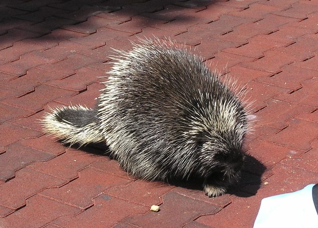
The park was about 50 minutes from home. It was easy to get to but fairly expensive: $40 per person plus $12 for parking. Upon entering the park, we saw a porcupine. This was a good sign.
We grabbed a park map and brochure then spent the next few hours watching animal shows.
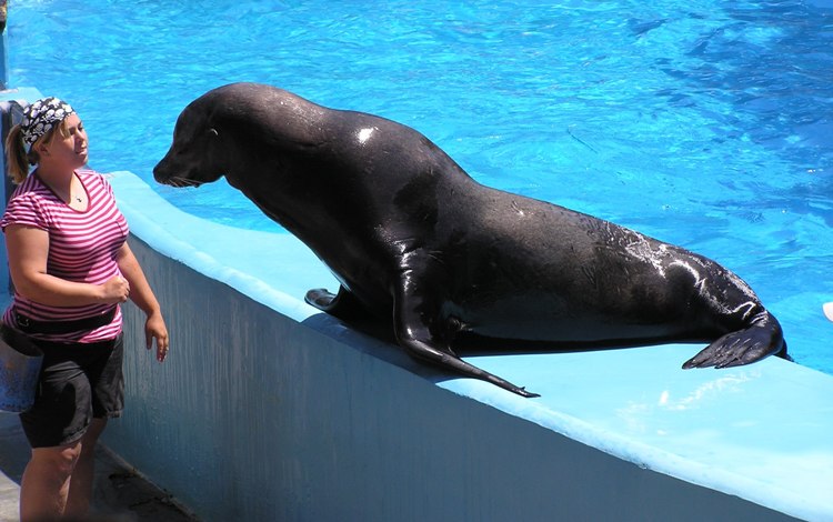
Our first stop was the sea lion show. Their playful nature reminds me at times of sea otters.
Next, we saw a killer whale show. There was a dolphin which did tricks too but I think he was mainly there so folks would know just how big the killer whale was.
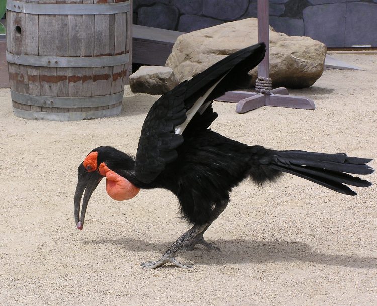
Then we caught a bird show. I think I liked this the best. I especially liked seeing a large black bird with red markings run around on stage frantically then attack a rubber snake.
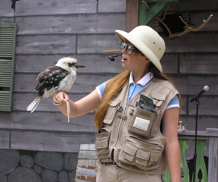
I also enjoyed hearing the kookaburra laugh. They crack me up. I remember singing the
kookaburra song in elementary school but nobody knew what a kookaburra was and nobody bothered to ask. I don't know how old I was when I learned it was a bird.
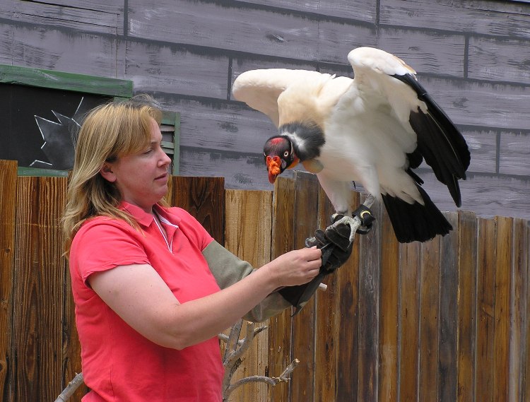
There was a South American vulture with very colorful head markings.
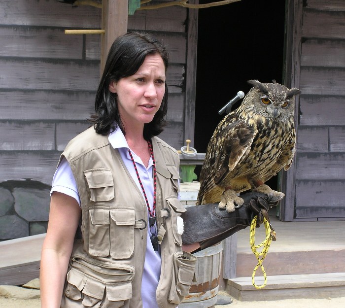
A European great horned owl made an appearance. It was bigger than the American great horned owl.
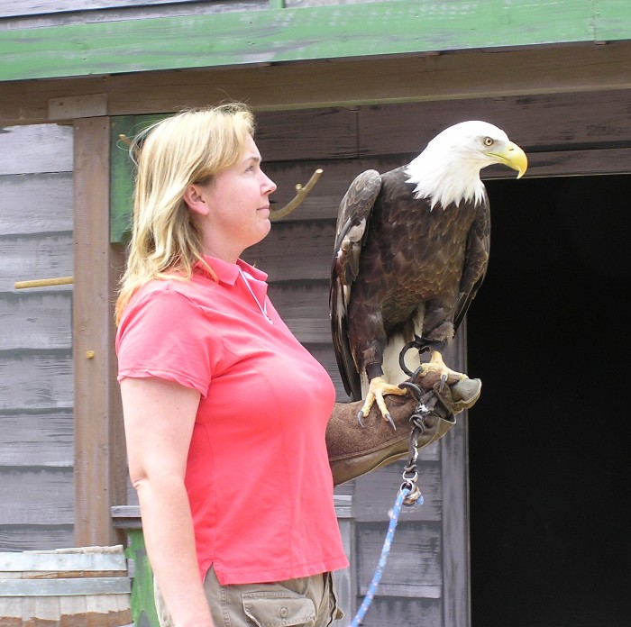
Last was the bald eagle.
Norma and I caught the tiger show where we saw a Siberian tiger and a white Bengal tiger. The Bengal was quite fond of the water.
1 / 2

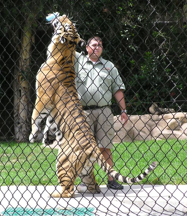
Siberian.
2 / 2
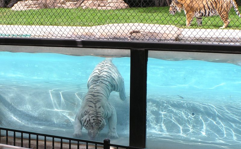
Bengal.
❮
❯
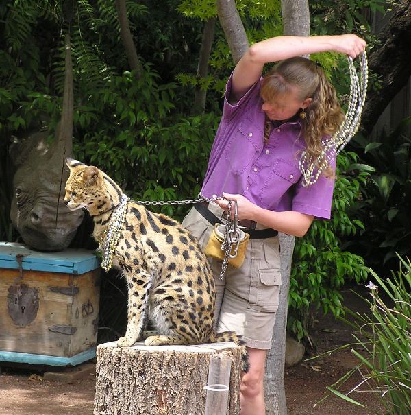
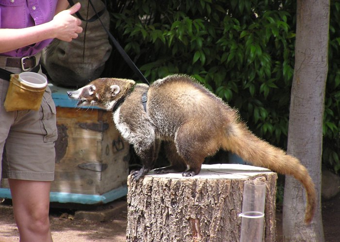
Next was a show with an assortment of small critters. We saw a serval all pimped-out with necklaces.
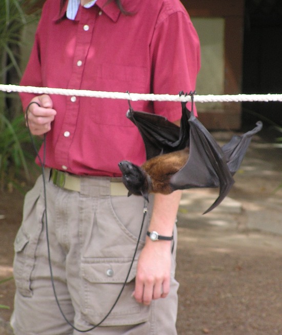
A fruit bat walked upside down under a tightrope.
There were a couple of animals I had never seen whose names I don't remember. A little girl was brought on stage to pet one of them but when she saw it, she quickly ran off stage. Hilarious!
There was an anteater...but not a giant anteater. He demonstrated how he uses his long tongue by eating ants from a test tube.
Norma got to pet an opossum.
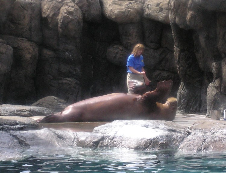
We saw a walrus show. Though obviously intelligent, he wasn't was as agile as the smaller sea lion. Still, it was impressive how he got his massive body on a plastic iceberg.
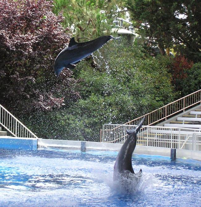
The dolphin show is always impressive because these graceful mammals are so powerful. I never cease to be amazed at how far they can jump out of the water.
One pair of dolphin were even able to propel a trainer several feet into the air!
After seeing the animal shows, Norma and I rode one of the water rides. I always like them. Water is both a lubricant and a friction reducer so water rides can't get as wild as the rollercoasters.
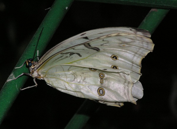
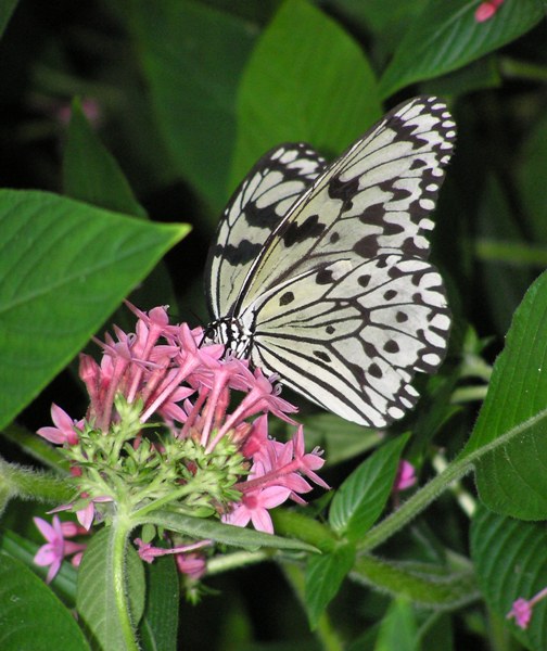
We walked through a very impressive butterfly room and saw all types of colorful butterflies. Some were mating.
1 / 4
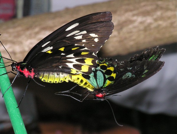
Mating.
2 / 4
Shiny white.
3 / 4
On flower.
4 / 4
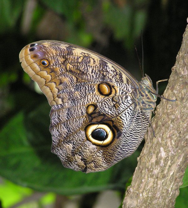
Eye wing.
❮
❯
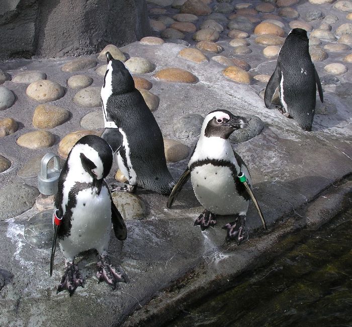
In another space, we saw some African penguins.
We ended with one of the more tame (but not kiddie) rollercoasters. I can't say I enjoyed it but it didn't make me feel sick either. Norma had her sunglasses at the start of the ride but not at the end. We guess the park personnel must find all sorts of personal items under these rides.
After leaving the park (which I still love), we drove back to Sacramento and I showed Norma my old church and the location where my grandparents' farm used to be.
We ate a really good dinner at
Korea House.
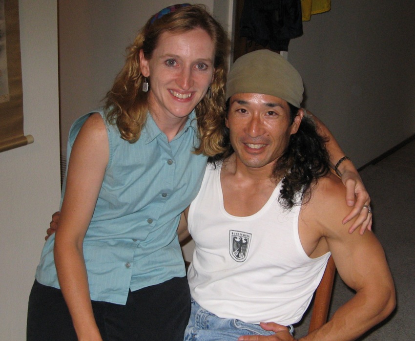
Lastly, we had a long visit with my original martial art instructor, Arnie. One can't help but like Arnie.


