|
This page describes a kayak weekend I spent in Queen Anne's County, Maryland. |

|
This page describes a kayak weekend I spent in Queen Anne's County, Maryland. |
|
My last kayak trip was on April 26, 2009. On that day, I paddled the upper portion of the Chester River. Today, I planned to paddle what I consider the middle portion.
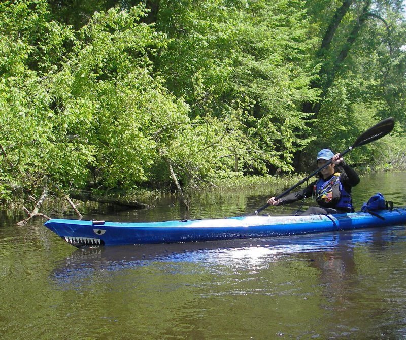
I loaded up my camping gear, bicycle, Futura S1-A, and my Cobra Expedition. Then I drove to Anglers Sports Center where I purchased an annual Queen Anne's County launch permit for $25. I don't think I've had that permit for about three years and hence, I've done very little paddling in Queen Anne's County. I hoped to make up for some of that this weekend. My next stop was Southeast Creek. Here, I dropped off my S1-A and personal floatation device (PFD) then locked them up to a pole. Then, I drove to Centreville Public Landing where I unloaded my bicycle. I packed everything I'd need for kayaking in my drybag backpack and bicycle saddle bag, donned my helmet and blaze orange vest, then biked 10.2 miles to my boat. This roughly equates to biking from Centreville to the outskirts of Church Hill. It was an easy ride that wasn't too terribly scenic except for the last mile. I saw a very small dead turtle on the side of the road. Its shell was only one inch long. I figured I might be seeing lots of dead animals after all the rain. 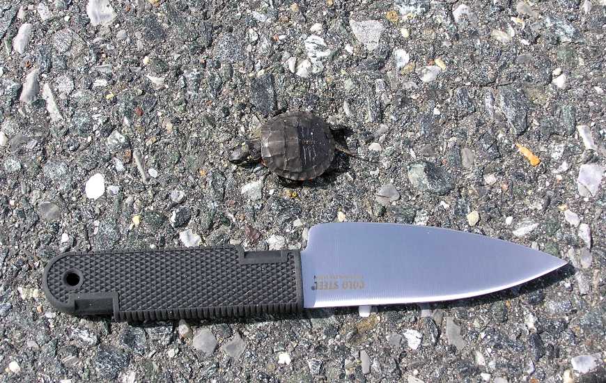
At Southeast Creek, I unlocked my boat then locked up my bike. I set sail at 1100. The water was extremely high. 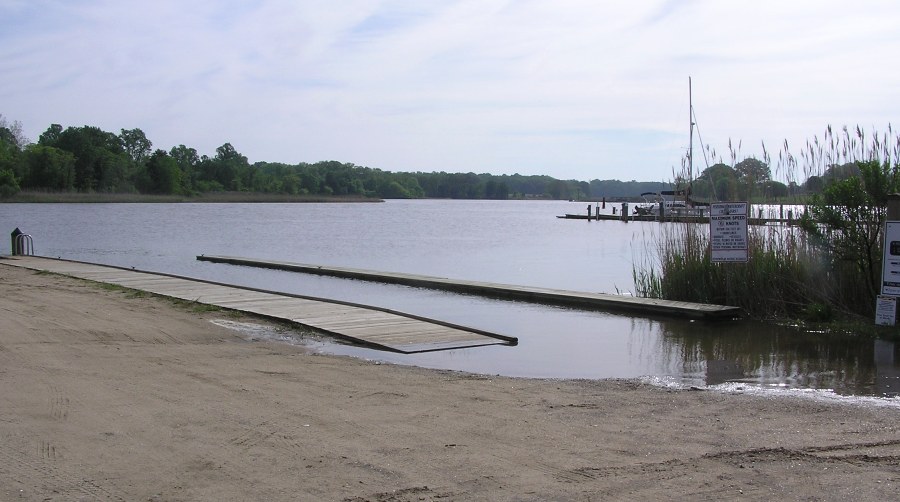
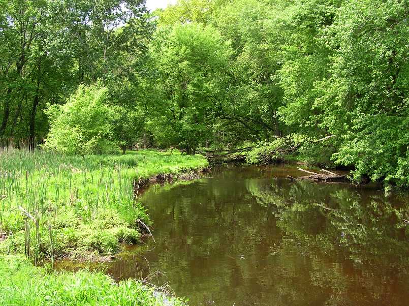
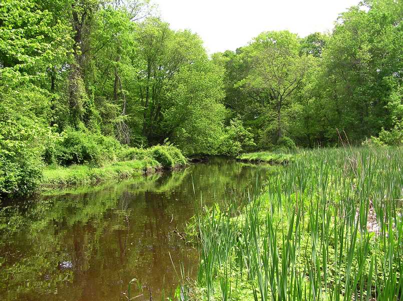
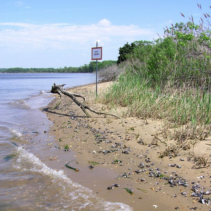
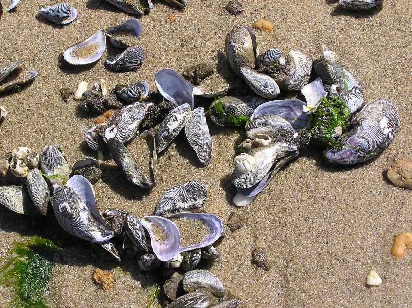
I paddled upstream towards Church Hill. I made it about three miles east of the launch site. I believe I reached the property at the end of Water Way Drive in Church Hill before I turned around. I had to do one portage to make it this far though I probably would have had to make more if the water were lower. Based on the maps I studied, I don't think I would have made it more than a fifth of a mile further had I opted to do more portages. But I'm glad I made the portage I did since on a scale of one to ten, the last half mile I paddled was a perfect ten. Very lush, green, and wooded. The water appeared to be fresh and full of tannic acid. It reminded me of my May 19-21, 2006 trip to the Pocomoke River. I would loved to have explored the nearby Browns Branch and Island Creek which are both not more than 1.4 miles from the Southeast Creek launch site. But instead I decided to leave that for another trip. I paddled downstream on Southeast Creek. I saw both a mature and an immature bald eagle. I also spotted numerous turtles, a muskrat, and the usual osprey and great blue heron. I began paddling down the Chester River. I planned my downstream trip to take advantage of the ebb tide which I was sure would be strong due to the rain over the last few days. Unfortunately, the strong southwest wind negated my tidal plans. I estimate I fought a 13 mph wind which generally kept my moving average between 4 and 5.5 mph. Near Camp Pecometh I saw a 24-inch long northern water snake about 600 feet from the shore. There was a light rain and dark skies. It was actually a bit cold for awhile but that just gave me more incentive to paddle harder. I encountered quite a few one-foot waves and some two footers. It was at times a bit challenging when passing powerboat traffic which created beam waves. I took a short lunch break and several breaks to stretch my back. It was feeling more sore than usual. The river widened significantly. Near Conquest Beach, it was 1.5 miles wide! About 0.6 miles downstream of Conquest Beach, I saw an oyster sanctuary. There were numerous empty shells on the beach which I presume were from oysters but I could be wrong. A few years ago, I volunteered with the Chesapeake Bay Foundation to help reintroduce oysters to the bay. We shoveled oyster shells into buckets then dumped them into an area with the hope that oyster larvae would attach to the dumped shells and form new colonies. I assume the shells washed up were put there for that purpose. Unfortunately, on dry land they served no purpose. I rounded Spaniard Point at 1450. That was low tide. Soon, I began heading up the Corsica River with a little help from the flood tide. I saw a windsurfer. He was obviously quite experienced. I estimate he was moving at nine mph! Further upstream on the Corsica, I saw a second windsurfer. As the Corsica River narrowed, the effects of the wind died down which was bad because for about a mile or two prior, I actually had it to my back. I landed at the Centreville Public Landing at 1600, having completed a tough 21 mile trip. Just seven hours after I started, the water level was a foot lower. Some of this was due to the tide but I suspect it was mainly because so much water was moving out into the Chesapeake Bay. I drove back to Southeast Creek to pick up my bicycle.  |
|
While my paddling was done for the day, my time in Queen Anne's County was not. I would be spending the rest of the day and the following morning with a group from the Chesapeake Paddlers Association (CPA), led by Ralph H., a veteran trip leader, both on the water and on land.
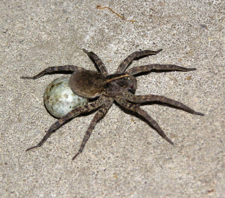
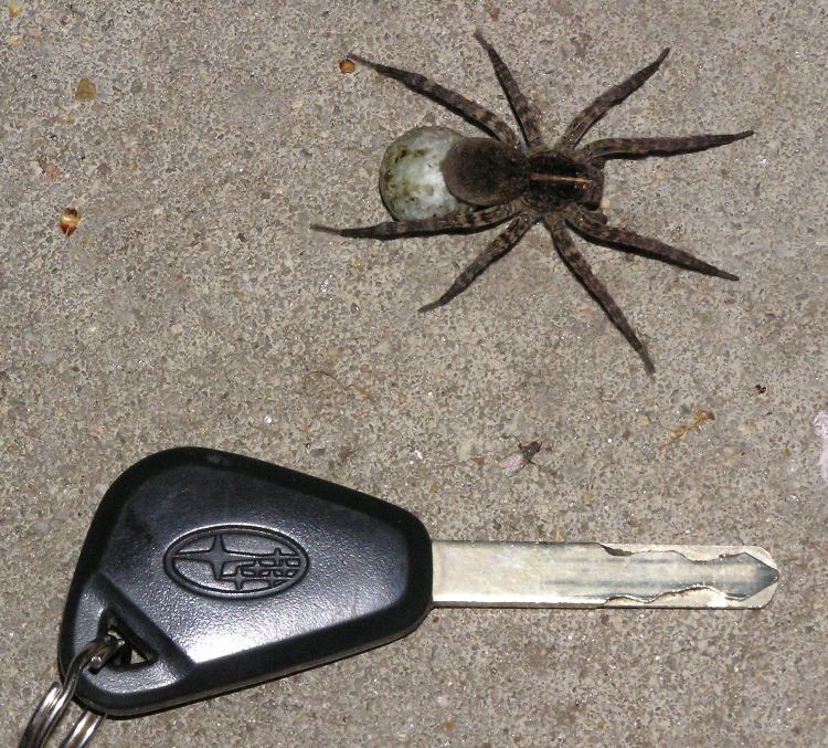
Ralph's group spent the day paddling the lower Tuckahoe Creek, which I did last year. Since food is probably my lowest priority when it comes to outdoor adventures, I only packed a few snacks and a couple of meals ready-to-eat (MREs) as backup. On the drive up, I spotted a Subway restaurant in Centreville so I made sure to stop in on my way to the campsite. I bought a foot-long cheesesteak sub, a foot-long cold cut sub, two cookies, and two bags of chips. It would be enough food to last me until I went home. I drove to Tuckahoe State Park and joined Ralph's group at non-electric campsites T-1 and T-2. I met Lucy M., Lee D., Jim A., and Rob G. In addition to Ralph, Jim was the only one I knew from previous trips. I set up my tent, washed up, then voraciously devoured my cheesesteak sub. The mosquitos around the campsites were terrible. It was warm and humid. With all the rain we received, they had plenty of fertile breeding ground. I applied my remaining bug spray then used some insect repellent impregnated wipes. Not wanting to just sit around and get bit, I decided to go walking. I invited my campmates to join me but they opted to stay behind. I walked south to the Lore of the Land Nature Trail. Not terribly interesting but there were more toads hopping around than I could count (i.e. over 21). I then walked south to the group campfire area. At the water's edge, I saw a two mph current and a beautiful wooded creek that was as nice as the headwaters of Southeast Creek I saw earlier that same day. But I didn't stick around to take in the scenery since I was actually encountering more mosquitos than at the campsite. I explored more of the trail and actually got a bit lost. It wasn't a big area but the trail branches off frequently and meanders. After about 1.5 miles of walking, I returned to the campsite. I reported my findings to Ralph then he showed me a much nicer launch site just a short distance from our campsite, Tuckahoe Campground Area Launch Site. We got our campfire started. I built it but didn't do a very good job. I tend to build my kindling teepees too big and the flame from the firestarter doesn't ignite things so easily. Bigger isn't always better. A cool breeze blew through followed by rain. But it didn't put out the fire since it was now stoking. This was just what we needed to keep the mosquitos away. A fellow kayaker from a nearby site (and New Jersey) came by to share our fire and tell sea stories. He was nicknamed "Mr. Happy" because of his positive disposition. A neighboring camper came by seeking burn medicine. Nurse Lucy was able to oblige. Unfortunately, she wouldn't be joining us for tomorrow's paddle so this was the last I would see of her. I know an awful lot of people having babies this spring (some planned, some not). Add to this list a 2.1 inch long wolf spider carrying an egg sack. Can you see her eyes in the pics below? She has eight. By 2130, I was in bed. I got in some good paddling and was hoping for more of the same tomorrow. |
|
You might be wondering why I packed two boats yesterday when I was traveling solo for the weekend. It is because I wanted the ~22 pound S1-A surfski for my 21 mile trip on mostly big water while my Cobra Expedition would suit me better on the narrow upstream portions of Tuckahoe Creek with a group. At 18 feet long, it is hardly a narrow creek boat but it is shorter than my Futura C4 surfski and considerably more durable than my carbon fiber/fiberglass S1-A. Maybe someday I'll invest in a short boat specifically for narrow creeks but until then, my Cobra Expedition will have to do.
After nine hours of good sleep, I ate half of my Subway cold cut sandwich, packed up my gear, donned my wetsuit, and took more photos of bugs. Below is a 1.5 inch long patent-leather beetle, also known as a Jerusalem beetle. 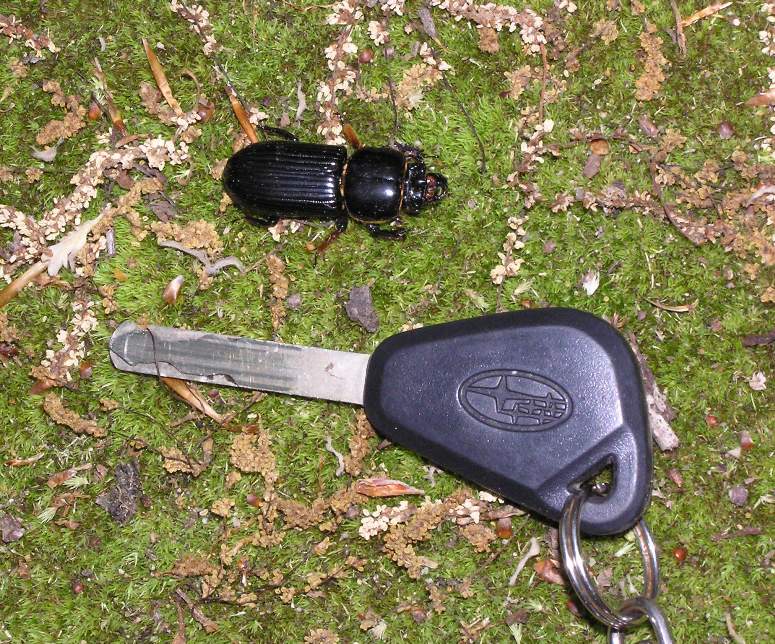
Here is a dragonfly that found my kayak tie-down to be a good perch. 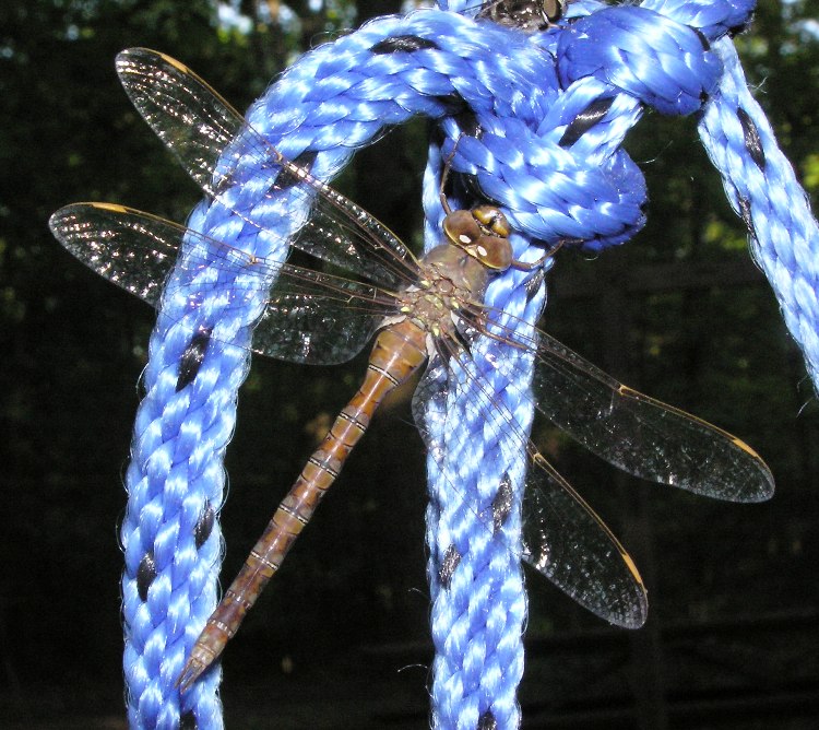
It was considerably cooler than yesterday which helped keep the bugs away. It was still windy but that was irrelevant since we would be on very sheltered water. Sunscreen wasn't even needed. We drove about 2.5 miles to the Tuckahoe Lake Launch Site, arriving at 0915. I didn't know how far upstream we would get but I knew our chances of getting far were significantly better with all the rain we received over the last several days. Tuckahoe Lake is really more of a big pond. How does one differentiate between a big pond and a small lake? I know not. Regardless, it is extremely scenic. 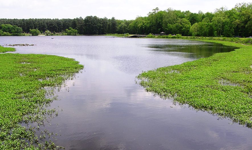
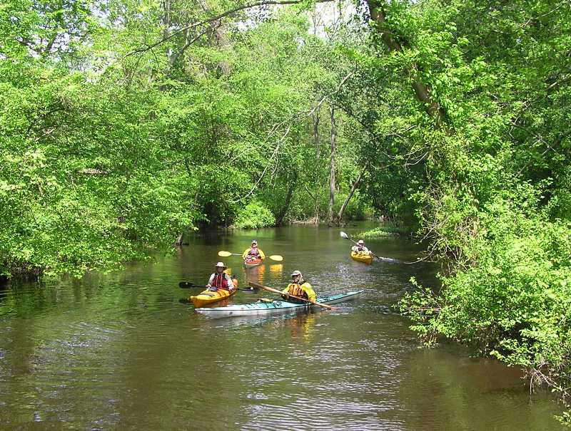
There were some fishermen out but otherwise, we had the small lake to ourselves. On the left side of the photo below, you can see a fisherman in an inflatable device out on the water as Ralph readies his gear. 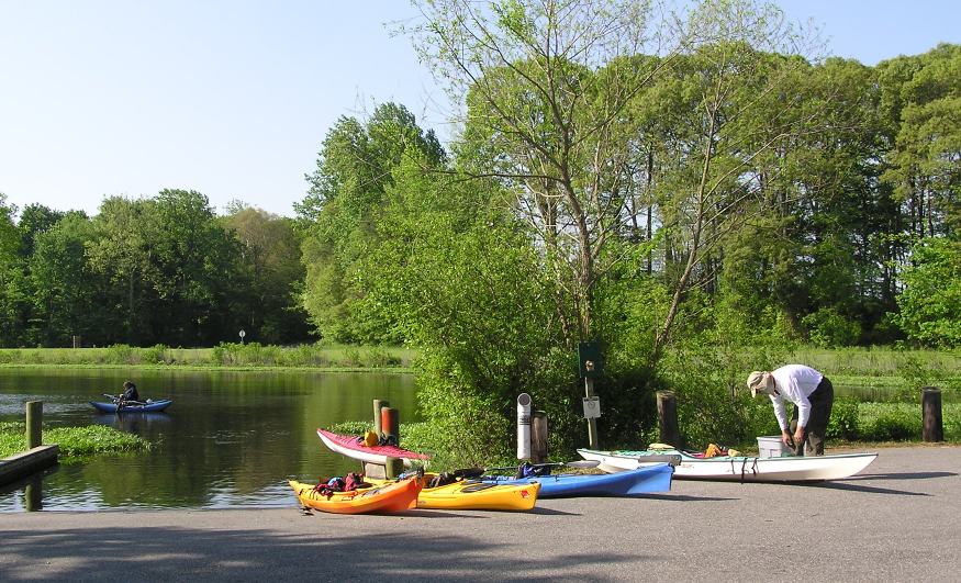
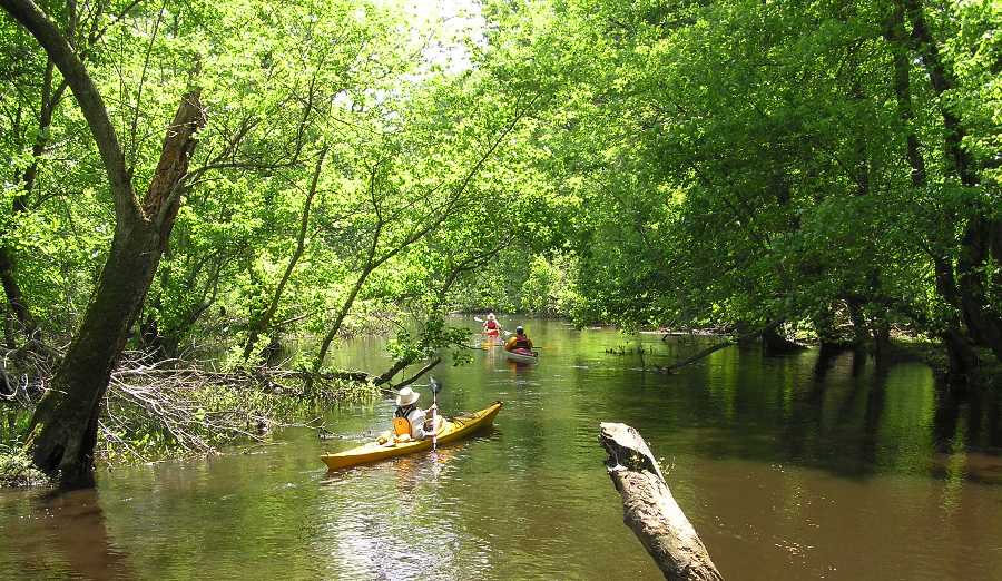
I traded places with the fisherman and caught a view of Rob making final preparations before launching. 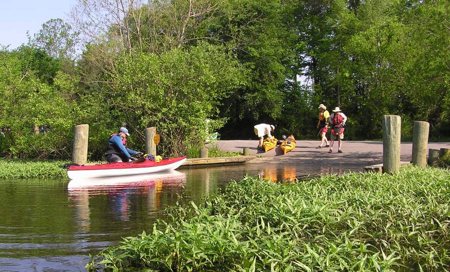
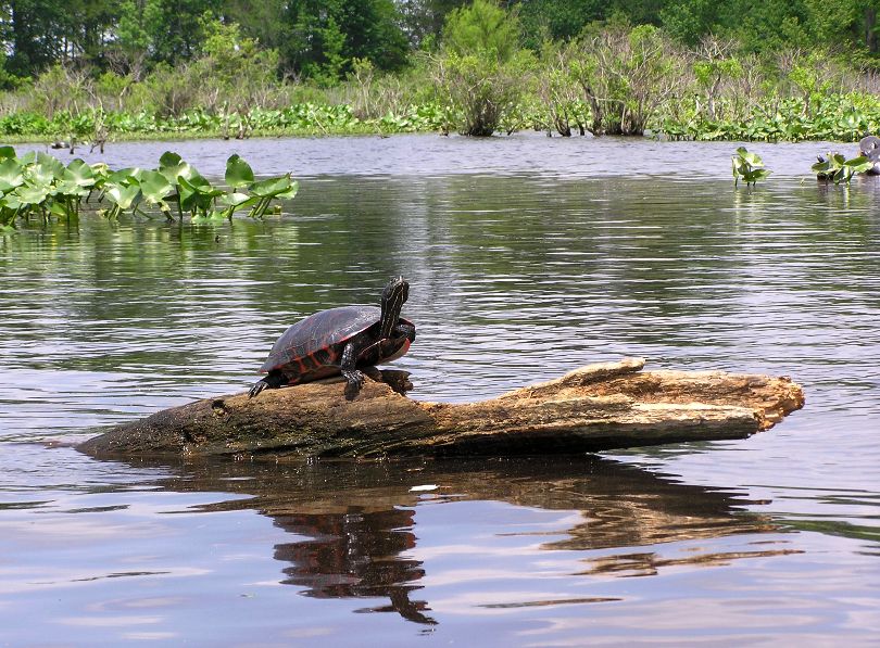
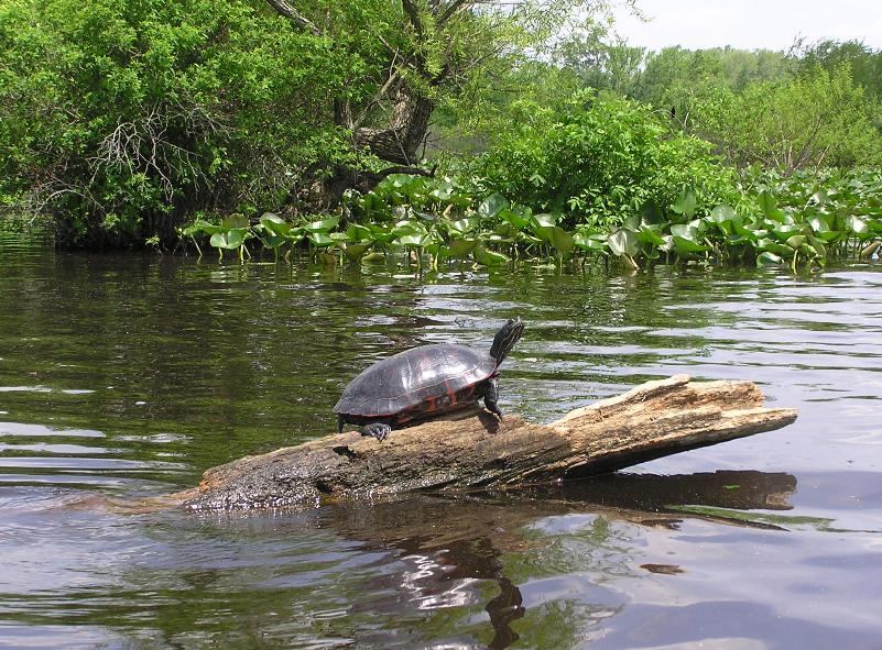
Paddling east, we saw numerous turtles. They reminded me of the turtles at Corker's Creek, a tributary off the Pocomoke River, because they were so not-camera-shy. I also saw a northern water snake, about 18 inches long. We paddled up the Tuckahoe Creek on a part I've never kayaked. 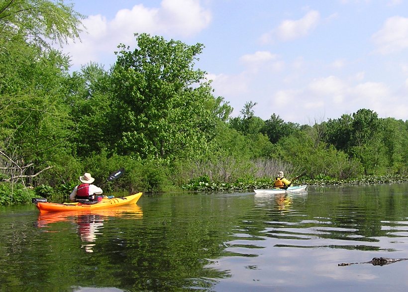
The furthest upstream I'd been on this creek in the past was on July 4, 2006, when Norma and I launched from the Tuckahoe Water Trail Launch Site. In terms of scenery, that water trail is a ten. If today's trip was anything close, I would be happy. Generally, when I paddle on the eastern shore to explore a scenic area, I launch from a main part of a river then paddle for a mile or two to get to a creek. Then I paddle up the creek for two or three miles. Most of the scenery is grasslands. The creek narrows and one side is typically wooded. Then in the last mile or two, the creek gets very narrow and both sides are tree-lined. It is this last mile that is the most scenic. I think it might have something to do with the salinity dropping in the water. But our day trip was full of tree-lined narrow creek scenery after only a half mile of paddling! We stopped at the Tuckahoe Campground Area Launch Site for a break and group photo. I believe this was about 2.25 miles from the west end of the lake. 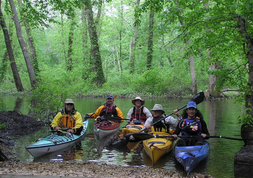
I found a snake skin during our rest. 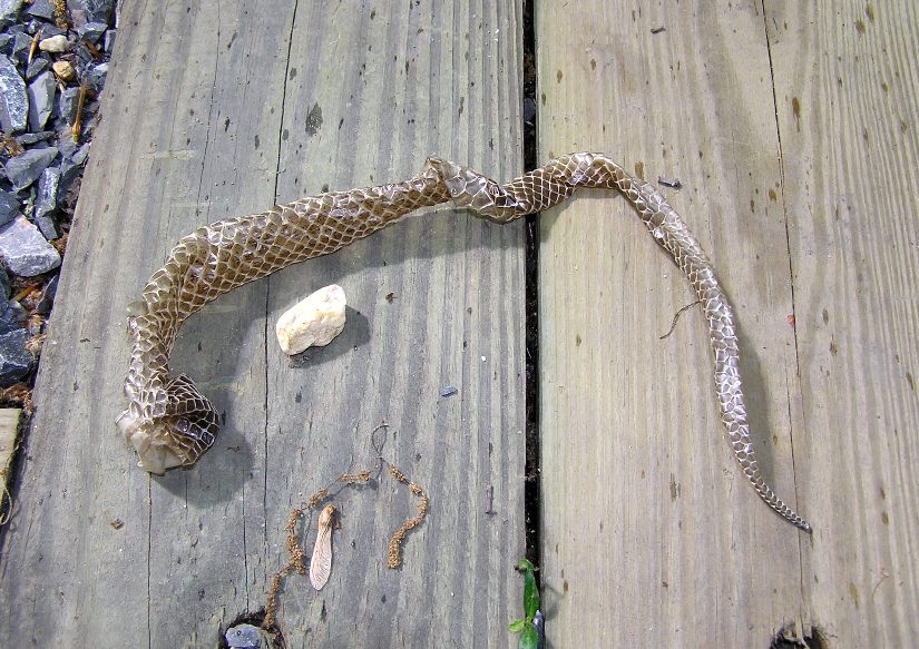
The water was cool, clean, and brown with tannic acid. We saw very little litter. There were numerous wood duck boxes and signs displaying cryptic addresses. Perhaps they were marker for a water trail? I think they were so the wood ducks could receive mail. Several parts of the creek were a bit circuitous. There were multiple options for getting upstream. The trick was to find the one with the least resistance. As long as we felt a current, we knew we were heading the right way...though not necessarily the best. There were several fallen trees but it was obvious that people came by and cleared a path. There were also many low branches that we had to paddle under, some hosting poison ivy. See our fearless leader below. 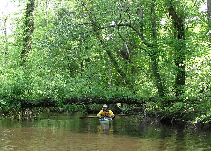
Surprisingly, no portages were required though there were several times I used my Fiskars loppers to cut low hanging branches. Though small, they worked amazingly well. I even managed to cut through a 1.25 inch diameter branch though it required three cuts to do so. According to my maps, Tuckahoe Creek splits about a half mile upstream of the Tuckahoe Campground Area Launch Site. On the east side is Mason Branch while on the west side is German Branch. It looks like the latter widens out and remains wide. It leads to German Branch Bridge on Ruthsburg Road (route 304) after 1.25 miles from the split and later to Hope Road (route 305), 4.25 miles after the split. Unfortunately, my global positioning system (GPS) says we took Mason Branch, which is shown to be very narrow...so narrow that we would not have been able to turn around easily had we continued. Hence, we began heading back after 3.2 miles. We only made it about a quarter mile up Mason Branch. There was one section of the creek where it appeared to split but by taking the west branch, we would have had to portage. Short portages are easy for my sit-on-top but tougher for the cockpit boats so we did not pursue this. I suspect if we did, the creek might have opened up considerably and given us access to German Branch. I'm sure I'll be back, checking things out from German Branch Bridge by vehicle first. Paddling back downstream was just as nice as paddling upstream. While we saw nobody as we paddled upstream, we now saw numerous canoeists and kayakers. Most of the kayakers were in recreational boats which were probably better suited for this environment than long sea kayaks. At the lake, there were even more turtles than earlier. I don't think I've ever seen so many turtles in my life in such a small area. It seemed every protruding log had at least one turtle perched on it. We finished the day with a 6.5 mile paddle. I have to say it was without a doubt one of the most scenic kayak trips I've ever done! |
|
Enjoying a good kayak trip is all about planning. Not just the route, but the weather and the tide too. My Saturday trip could have been nicer if both the tide and the wind were on my side but I only planned for one variable. Sunday's trip was excellent because we took advantage of the rain over the last several days. It is unlikely the water on the upper Tuckahoe will be so high anytime soon...and probably not when things are so green. If it is, the place will probably be more buggy. Things worked out just peachy on Sunday.
I love it when a plan comes together and we have Ralph to thank for it. |