|
This page is about a trip that Norma and I did to the Brandywine Valley area of Delaware in 2012. |

|
This page is about a trip that Norma and I did to the Brandywine Valley area of Delaware in 2012. |
|
Back on October 28-30, 2011, Norma and I spent some time in the Brandywine Valley area just northwest of Wilmington, Delaware. The weather was unusually bad so we spent most of our time indoors. But we vowed to return to explore the natural beauty of the area at a later date.
That date was set for April 14-15, 2012.  |
|
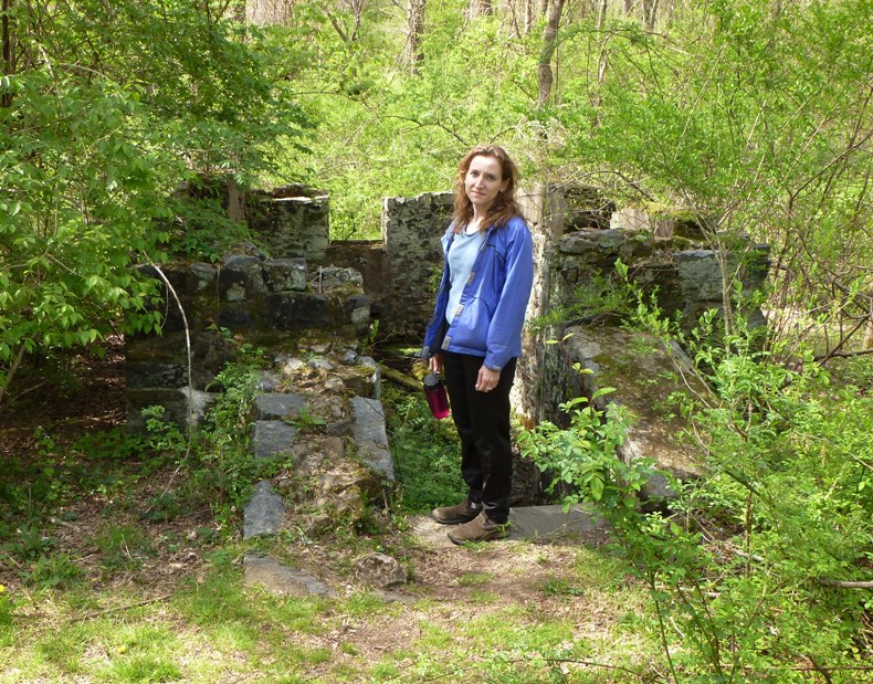
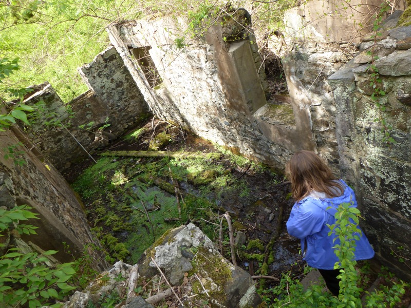
Norma and I were up bright and early. We loaded my Ocean Kayak Cabo, our bicycles, and hiking gear. Then we drove to the Nature Center and Park Office at Brandywine Creek State Park. We walked on the Indian Springs and Hidden Pond trails to Brandywine Creek. We passed numerous stone walls and ruins, along with a spring house which was used to keep things cool prior to the era of refrigeration.
Walking south (downstream) along the west side of the river, we passed by the Freshwater Marsh Nature Preserve. Below is an upstream view of the river near the nature preserve. 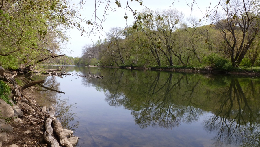
Near another stone structure, I saw a black snake. It stuck its head out of the rocks then went back in once it saw me so I didn't get to see much but I'm guessing it was about 2.5 feet long. We walked near Adams Dam just north of Rockland Road. 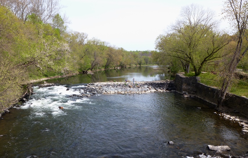
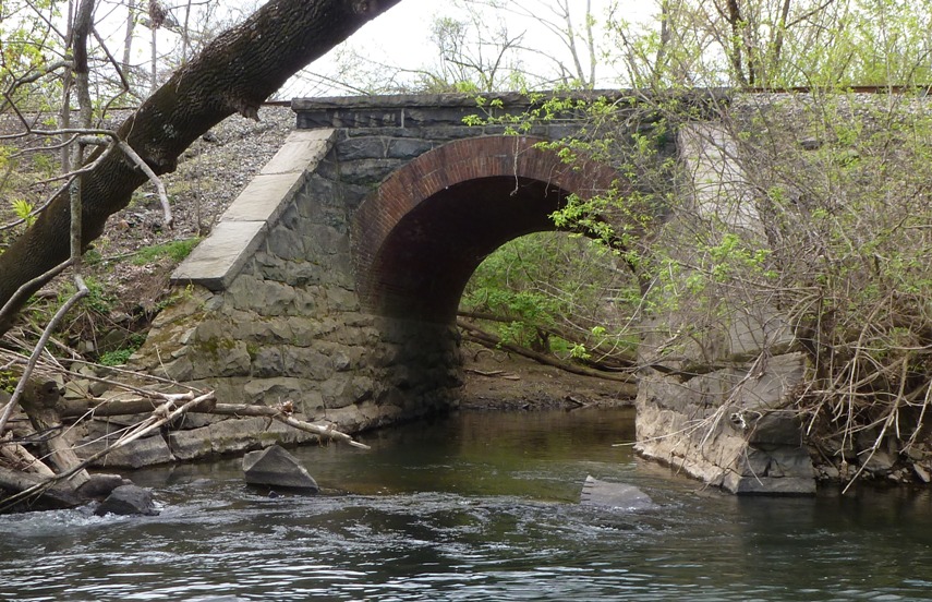
Then we crossed the Pennington Bridge via the same road. Here is a downstream view of the Brandywine. 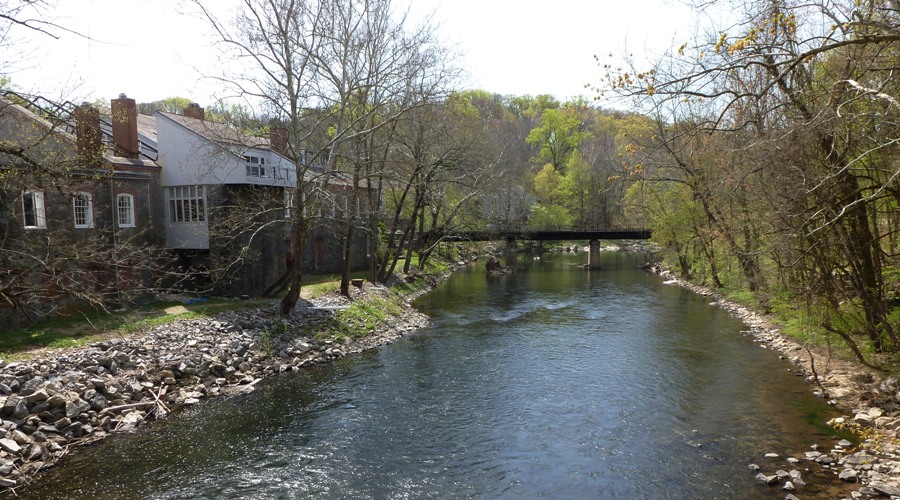
On the east side of the water, we walked north (upstream), passing more stone ruins. In one area, I saw what I think might have been part of a canal. 
The two of us headed north, first on the Northern Delaware Greenway trail, then on some dirt paths that ran between it and the river. Lots of folks were out hiking, walking their dogs, or running. It is obvious the state of Delaware put a lot of money into making this such a nice place so it was good to see it being used so much. There were a few people fishing in the creek too, which looked to be quite clean. The narrow dirt path was well worn with well defined greenery along either side. Within this greenery, lots of little flowers emerged. 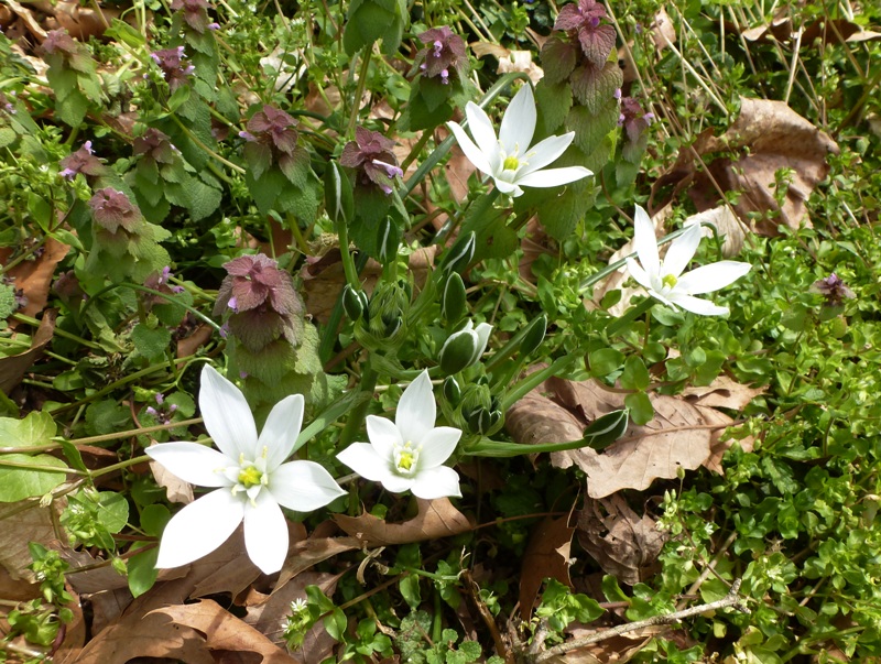
There would be big sections of just one type of flower; then after a short distance, the species would change. We also saw some interesting plants such as jack-in-the-pulpit. 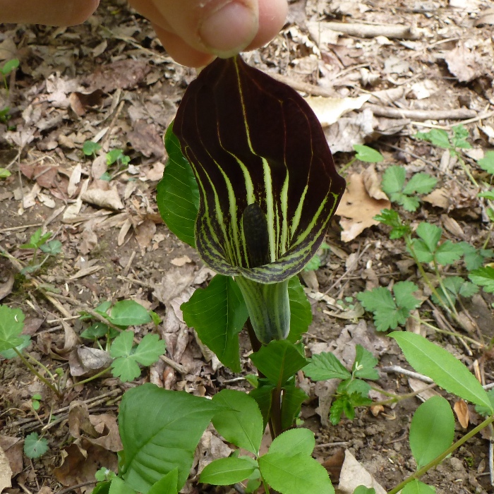
One plant, in particular, was very strange because it had extensions along the stem that seemed to alternate. It looked rather artsy. 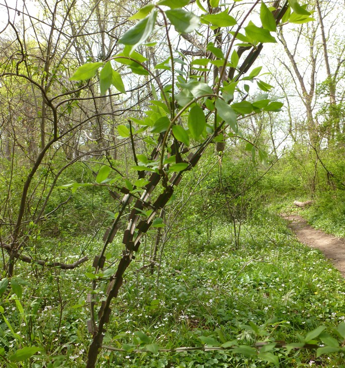
Our trail briefly merged with Rocky Run. At Thompsons Bridge, we crossed over the river then continued our walk on the west side, heading south. Looking southeast from the bridge, one can see stairs that lead down to the canoe launch. 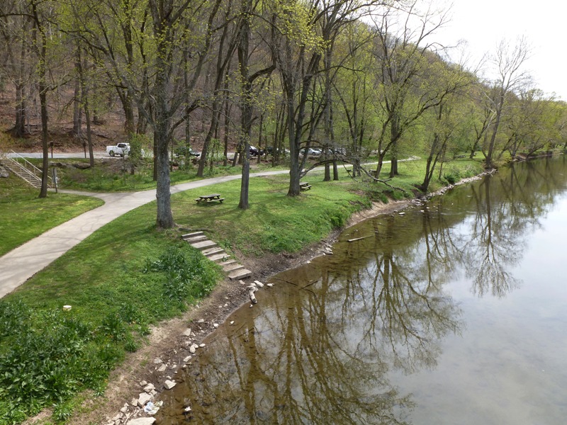
Norma and I walked through the dried up Hidden Pond. Despite it being so early in the spring, the water was very low. We haven't had much rain and almost no snow during the winter. It was a mostly sunny 73 degrees with moderate wind...a great spring day to be outside! The bugs also enjoyed being out, though fortunately, the mosquitos were not yet a big problem. 
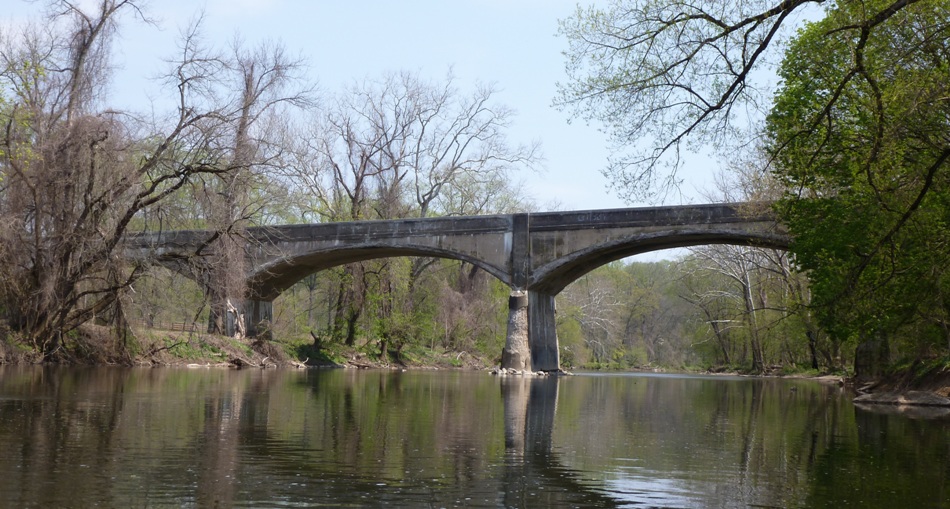
Norma and I walked through the Tulip Tree Woods Nature Preserve but we didn't even know it until I looked at the map the next day. After our 5.3-mile walk, we ate sandwiches in a little garden pond area behind the nature center. We spent a little time driving around, checking out the river for kayaking tomorrow. Below is a view of the East Branch of the Brandywine from Shaws Bridge, a very nice launch site. 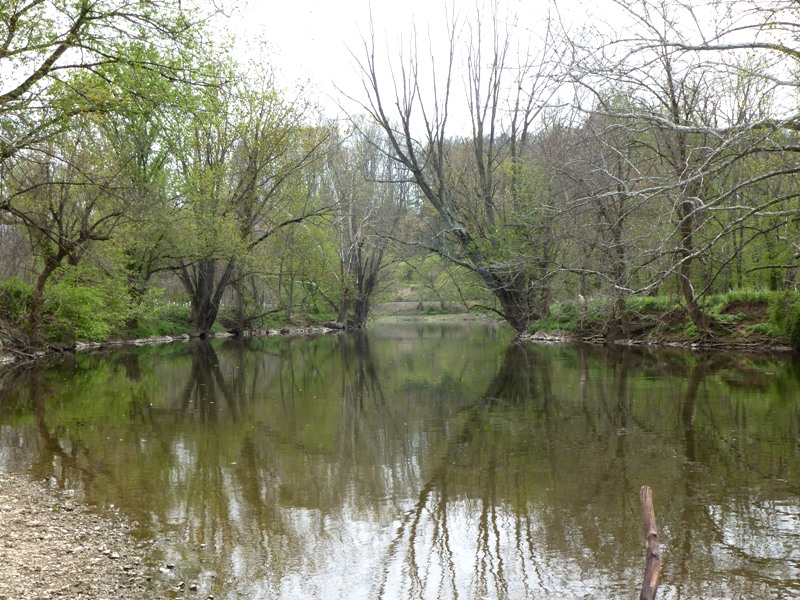
|
|
I really like the Brandywine area. There are lots of old stone houses with beautifully landscaped yards, museums, history, and trails. But what the area lacks are campgrounds. I found absolutely none nearby, neither in Delaware nor Pennsylvania. So I booked our stay at the Days Inn Wilmington which is only 1.5 miles from Thompsons Bridge and four miles from the Nature Center and Park Office of the state park. As of April 2012, I got a room for two for $69.12 after tax. Don't let them bill you for using the safe unless you actually plan on using it. The room was fine. The table was wobbly and the fan in the bathroom didn't work but everything else was o.k. and it was clean. The front desk staff is friendly and you can check your e-mail at their lobby guest computer. But the best thing about this place is the breakfast. They have eggs, rice, and waffles along with the usual fruit, cereal, bagels, juice, coffee, and muffins. I like getting a little protein in the morning so this was a real bonus in my book.
Norma wanted to walk across the street to check out Leon's Garden World so we did that. Then we ate dinner at India Grille. On a scale of one to ten, I give it a six. I don't like spicy food so I asked for my dish to be mild but it could have used a little more flavor. So I suppose I should have ordered it "lightly spicy." Regardless, their servings were generous. The place is just a stone's throw from the motel. |
|
It rained during the night.
We were up by 0615. After packing up and eating a big breakfast at the motel, we were on the road by 0745. I wanted to get out early since we planned to do kayaking with a bicycle shuttle and our bike route didn't have a shoulder. So I wanted to do the biking before traffic picked up. I drove us to Shaws Bridge where we locked up our boat. Then we drove to Thompsons Bridge. We unloaded the bikes and rode to Shaws Bridge. This easy route took us past many scenic views of the river and past numerous old historic stone houses. This is an area we wouldn't mind retiring to. We rode through historic Chadds Ford, near where I think we ate lunch on October 29, 2011. Arriving at our destination, we unlocked the boat and locked up the bikes. There were quite a few other boaters out...two kayakers and two canoeists launching from the same place as us. But the kayakers went upstream and the canoes took off after us so we were pretty much alone. |
|
The air temperature was comfortable but the water was quite cold so it was defintely wetsuit weather although we were the only boaters wearing wetsuits.
Paddling downstream, we came to our first dam just upstream of Lenape around mile one. 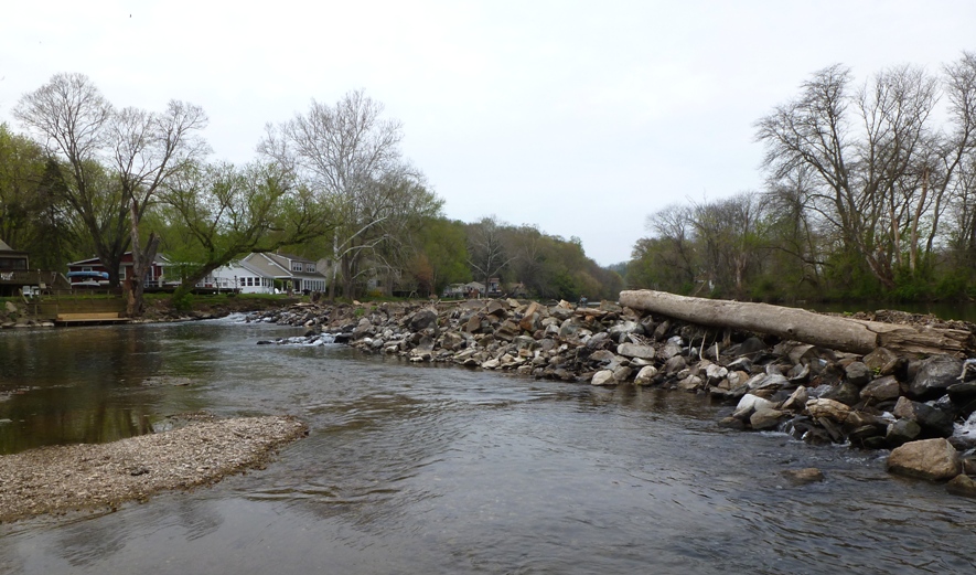
The creek veered to the left, so rather than go down the dam, we decided to explore what lay ahead on the left. There were numerous small waterfront homes, then an area where one can rent paddleboats. But the creek ended so we turned around and portaged over the dam. By then the canoes caught up with us so I helped them with the portage before venturing onward. The waterfront homes were pretty simple. No mansions like in Annapolis. The second dam, around mile 4.2, was similar to the first. 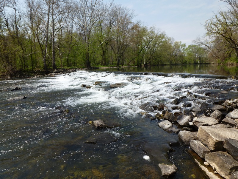
For both dams, we portaged on the left. 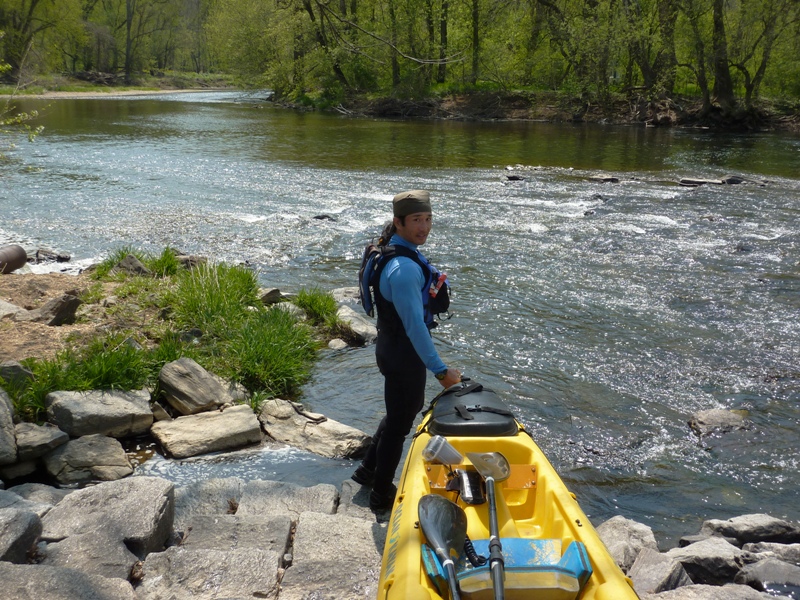
What do you see in the above photo behind me? Yes, it is a two-foot long northern water snake sunning itself on some rocks. It was in the way of our portage but he didn't mind moving. 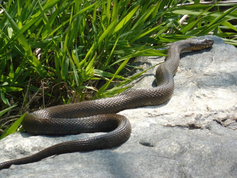
A good many turtles were seen but only during the first half of the trip. Not sure what became of them after. If anything, it seems like we would have spotted more as the day warmed up. 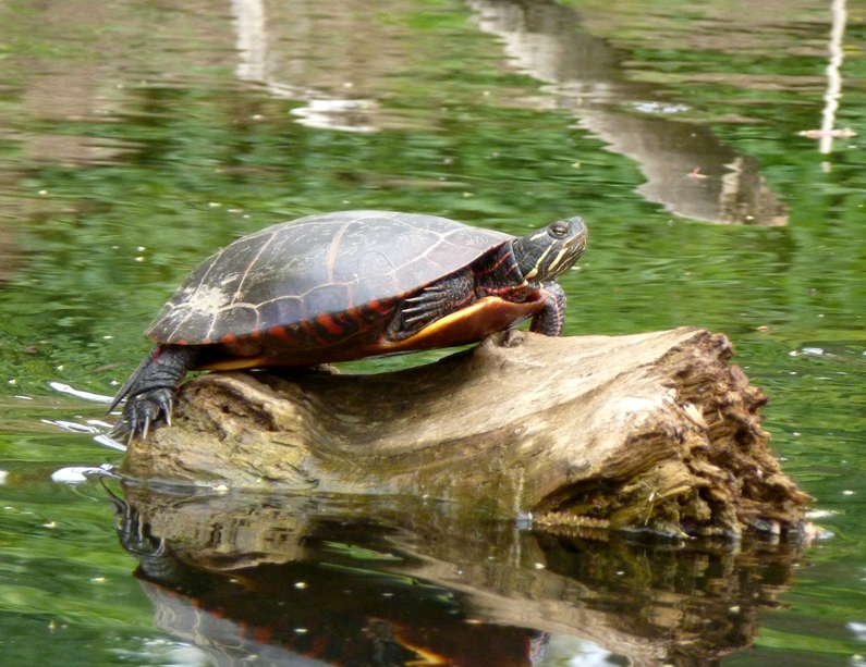
Most of the morning was slightly overcast, but in the afternoon, the sun started coming out and it was actually a little hot in the sun with the wetsuits, but in the shade, it was comfortable. The predicted high temperature was 79 degrees. 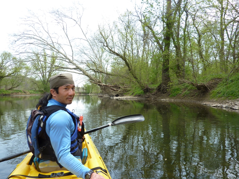
I saw a few other kayakers out and about. There were quite a few bridges that we either passed by or paddled under. We paddled past the Brandywine Museum of Art which we visited on October 29, 2012. Some people were fishing from the shore. Can you see anyone fishing in this photo? 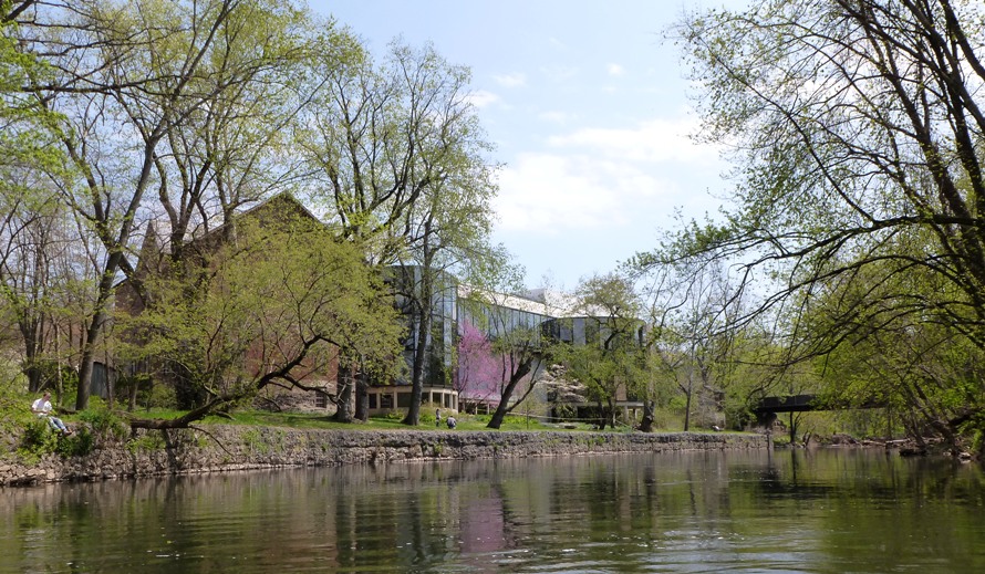
I think being so far from salt or brackish water influenced the birdlife we saw. There was only one heron and one egret. No osprey or bald eagles were seen. We paddled under the Smith Covered Bridge, built in 1839. 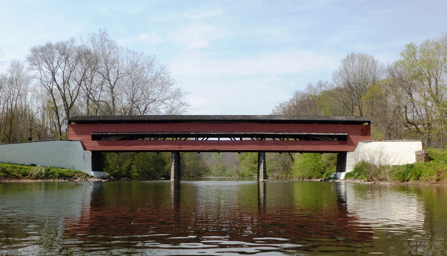
A nice stone house stood nearby. I wonder if the original owner of the bridge lived in this house. 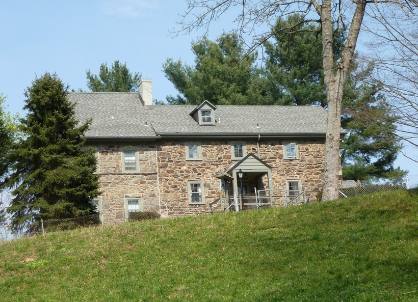
The water was very low and there were numerous times where we scraped bottom and had to get out, then drag the boat to continue. I can't imagine paddling out here in the summer except after a big rain. One thing I really like about this creek is that it stays fairly narrow for the entire route and there was never an obstacle big enough to require portaging (except the dams) or cutting with saws. Any narrower and this might not have been the case. Any wider and the trip would have lost some of its creek-like appeal. Overall, the Brandywine was moderately scenic. As Gertler mentions in his book, powerlines were frequently seen, taking away from some of the naturalness of the area. There were also nearby roads and a train track through we never saw any moving trains. Still, he only rated the scenery as fair. I would rate it as good. By about 1500, we finished kayaking 12.3 miles. We changed clothes, loaded up the boat, then drove back to Shaw's Bridge Park to retrieve the bicycles. After getting some ice cream at Jimmy John's, we were ready for our drive home. Traffic in our direction moved pretty quickly but was slow going the other way. So we lucked out. |