|
This page is about a trip to Ricketts Glen State Park which Norma and I did in 2015 so see the beautiful waterfalls I had read so much about. |

|
This page is about a trip to Ricketts Glen State Park which Norma and I did in 2015 so see the beautiful waterfalls I had read so much about. |
|
Norma and I decided to do a last minute getaway on October 17 and 18, 2015 as a belated anniversary celebration. I suggested Ricketts Glen State Park.
Ricketts Glen State Park is home to the challenging Falls Trails named "Best Hike in Pennsylvania" as part of Backpacker Magazine's 2009 Reader Choice Awards. Ricketts Glen is one of the most scenic areas in Pennsylvania. - from "tournepa.com - 2015 Fall Foliage Driving Tour Brochure" (broken link as of 2018) I had first heard about this park about five years ago from Mike J. who described three nice hikes out there on his Mid-Atlantic Hikes website (a broken link as of 2024). It had been on my "bucket list" ever since then. Norma and I have always liked waterfalls. Who doesn't like them? We have fond memories on March 12, 2011 of seeing Overall Run Falls which has the highest drop of all the waterfalls in Shenandoah National Park. Of course there is also Swallow Falls State Park which has Muddy Creek Falls, the highest free-falling waterfall in Maryland at 54 feet. There is also Cunningham Falls State Park which has Cunningham Falls, the highest cascading waterfall in Maryland at 78 feet. Autumn isn't necessarily the best time to see waterfalls in the mid-Atlantic area because water levels tend to be low. But we did have a big rain about a week or two prior so we didn't expect them to be too bad. But the best reason for an autumn hike (in my opinion) is to see the colorful leaves.  |
|
Norma and I drove out in the morning. It was a long drive. We stopped in at a restaurant that definitely had a Pennsylvania-Dutch influence. Food prices were amazingly low. On our drive, we often had a nice view of the mighty Susquehanna River.
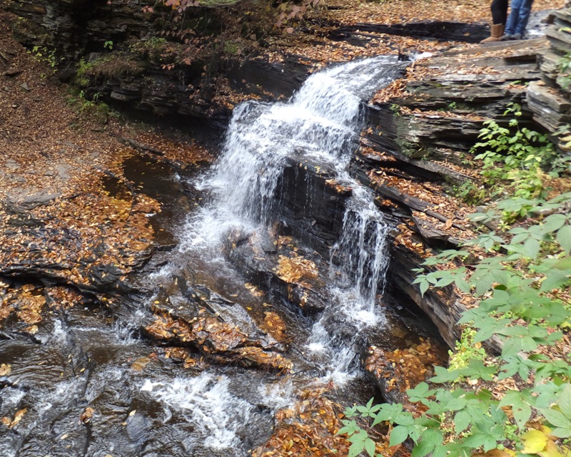
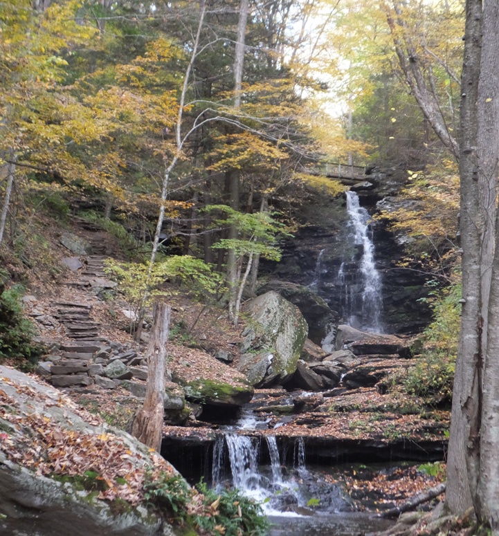
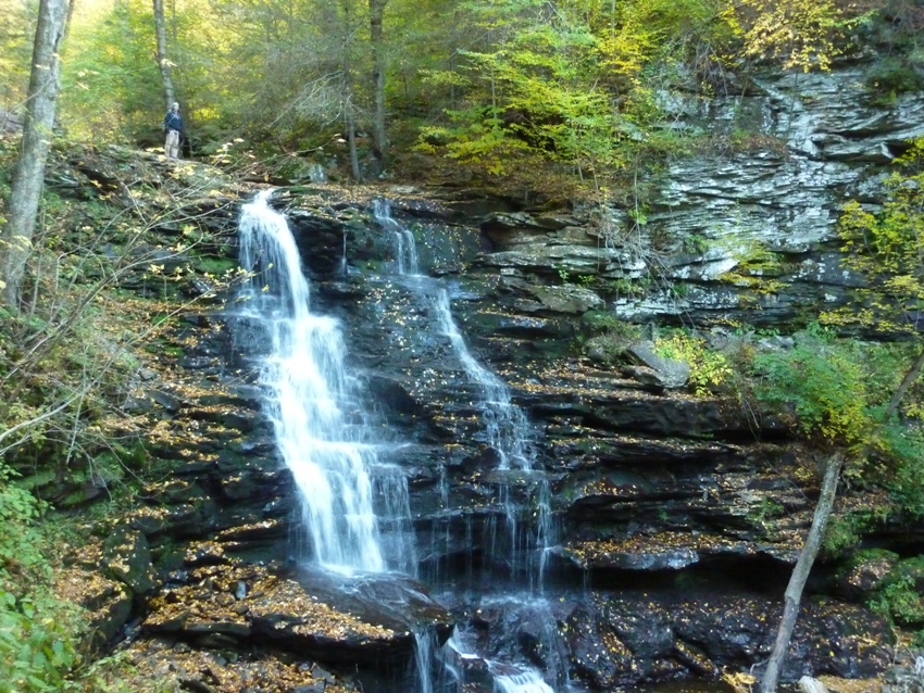
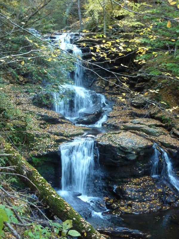
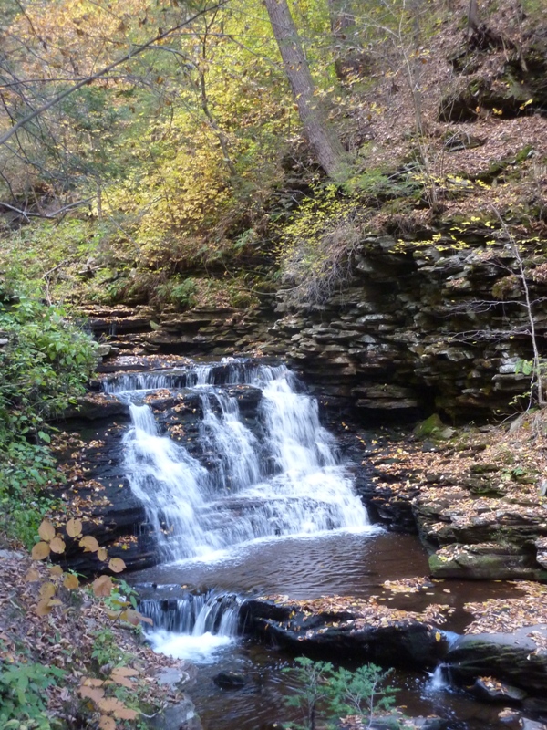
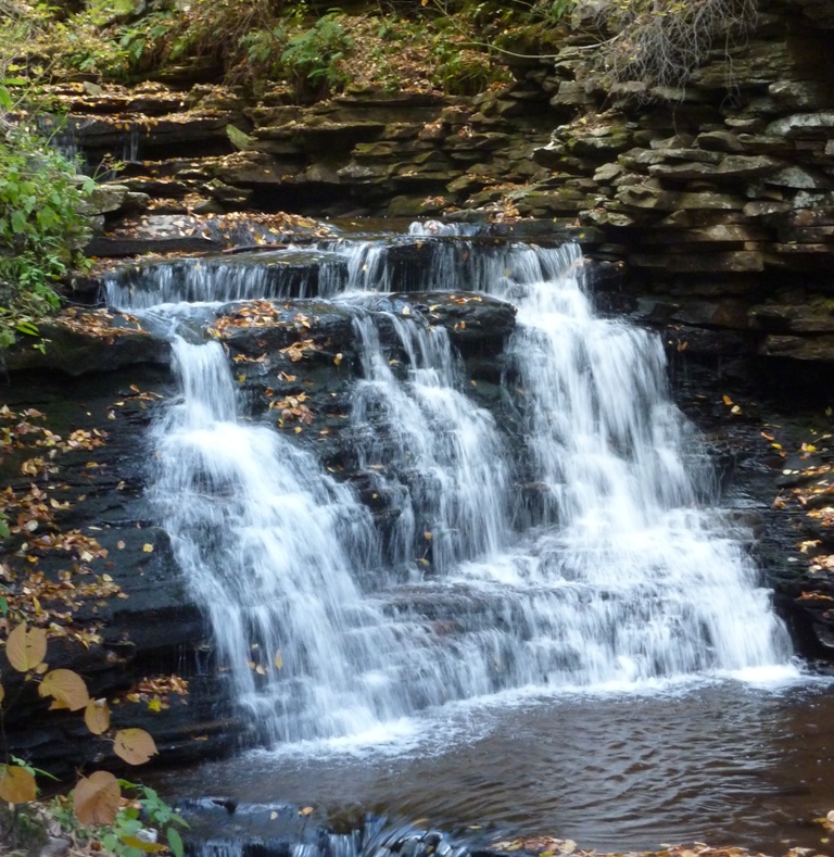
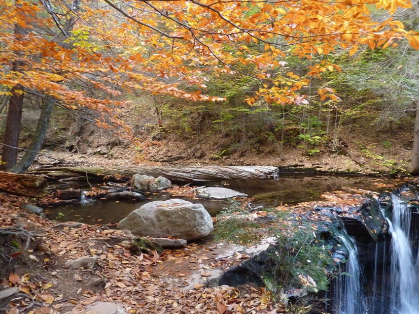
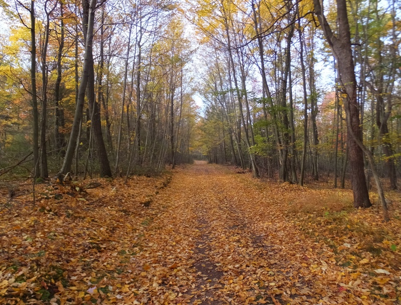
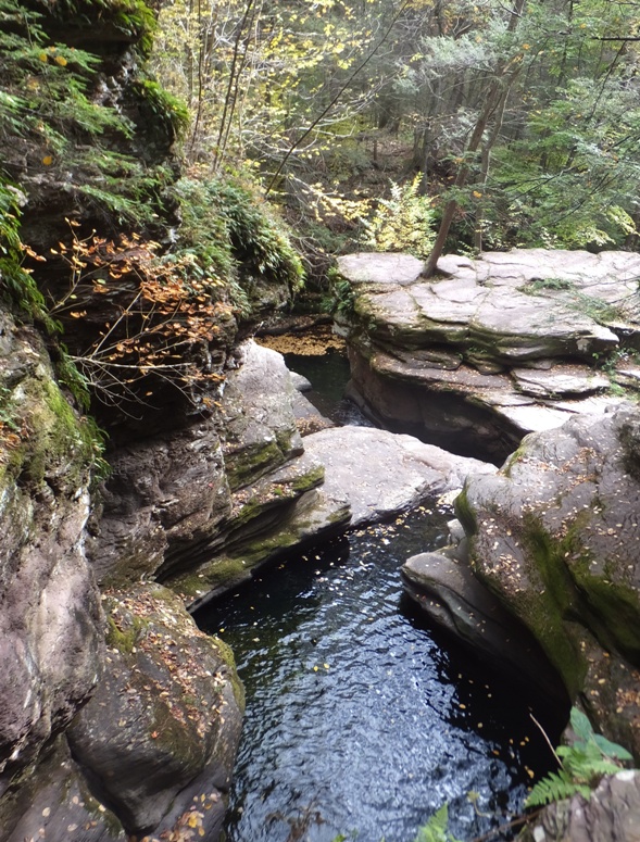
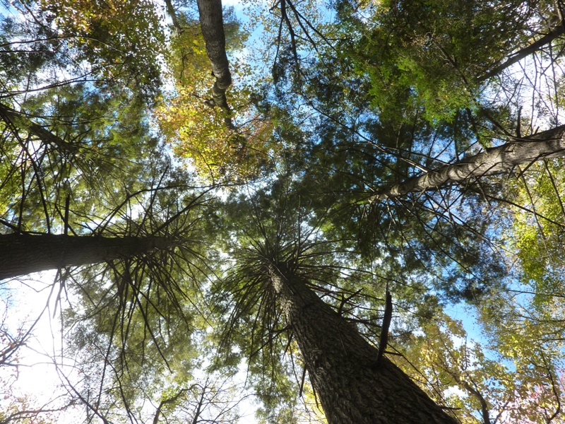
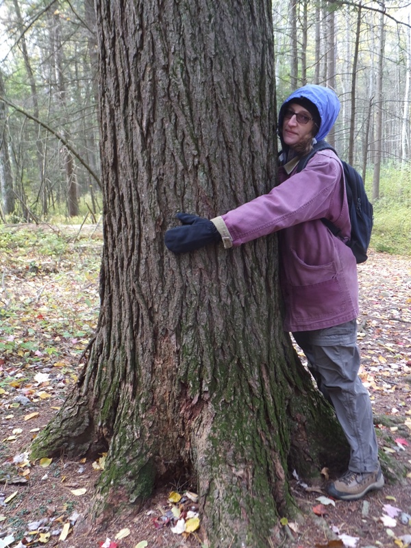
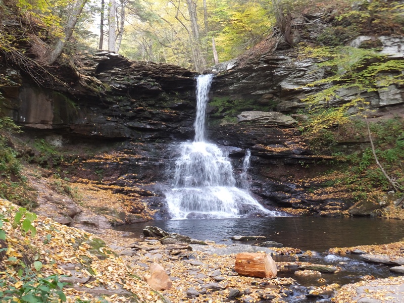
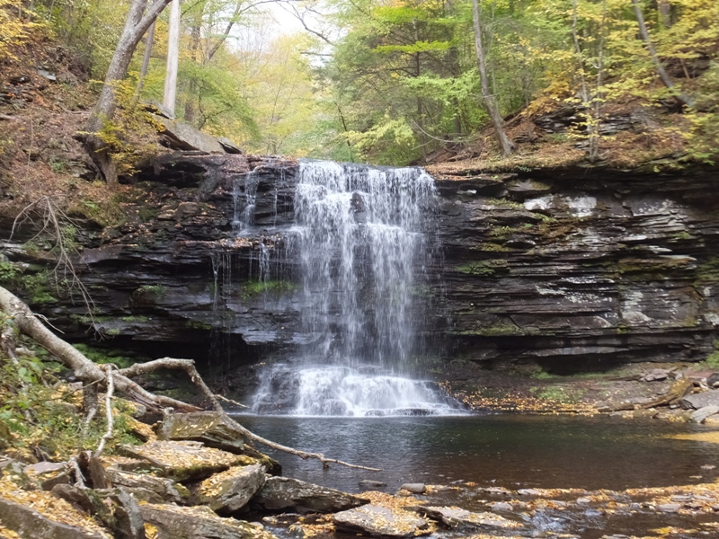
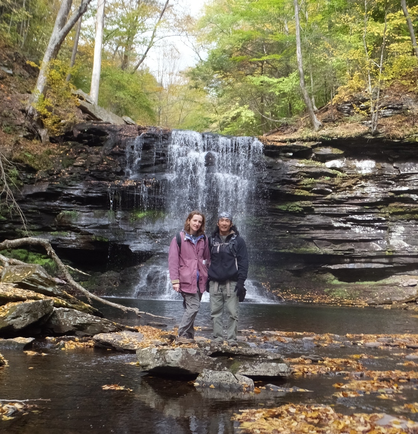
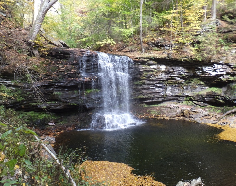
We discussed where we would want to live once we retire. Staying in Savage is not out of the question but it is expensive living where we are and over time, the already densely populated area will only get more dense. I love the Chesapeake Bay but Norma isn't too fond of the flatlands. To make a long story short, we felt that Cecil County, Maryland might be a good compromise. It isn't flat, it is near the Bay, land prices are cheaper than where we live, and it isn't much further from her family than where we already live. Norma and I drove for about three hours and 45 minutes then took another hour for lunch and to inquire about lodging in and around the town of Benton. Apparently, a lot of people were drawn to the town that weekend so many places were booked up. We finally arrived at Ricketts Glen in the mid-afternoon. Ricketts Glen is one of the most scenic areas in Pennsylvania and is comprised of 13,050 acres which it shares between Luzerne, Sullivan and Columbia counties. The Falls Trail is located in the Glens Natural Area [and is] comprised of 21 free flowing waterfalls ranging from just over 11 feet to its highest resident waterfall of 94 feet; Ganoga Falls. Falls Trail is 7.2 miles long when doing both the upper and lower sections and is rated as difficult. An easier and shorter route of 3.2 miles is available and allows you to view most of the waterfalls including Ganoga Falls. This trails runs directly alongside the waterfalls, so picture taking is plentiful and the vistas are spectacular. Well worth the effort. Good hiking shoes are strongly recommended. This area is also the meeting ground of the southern and northern hardwood types, creating an extensive variety of trees. Many of the magnificent trees in this area are over 500 years old and ring counts on fallen trees have revealed ages as high as 900 years. Diameters of almost four feet are common and many trees tower to 100 feet in height. In 1993, the Glens Natural Area became a State Park Natural Area and will be protected and maintained in a natural state. - from "tournepa.com - Backpacker Magazine Recognizes Ricketts Glen State Park" (broken link as of 2018) The park ranger that greeted us said there was no entry fee. He gave us a free map of the park. We asked about lodging and he gave us Lodging near Ricketts Glen. We figured we'd do the hike and then continue looking for lodging after. We drove to Lake Rose Trailhead Parking. This is a big lot, however, Ricketts Glen is also a very popular place so the lot fills up quickly. But we were getting a late start so it had already begun clearing out. |
|
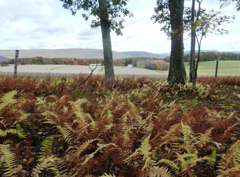
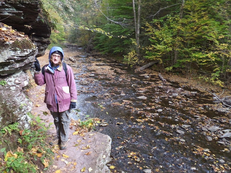
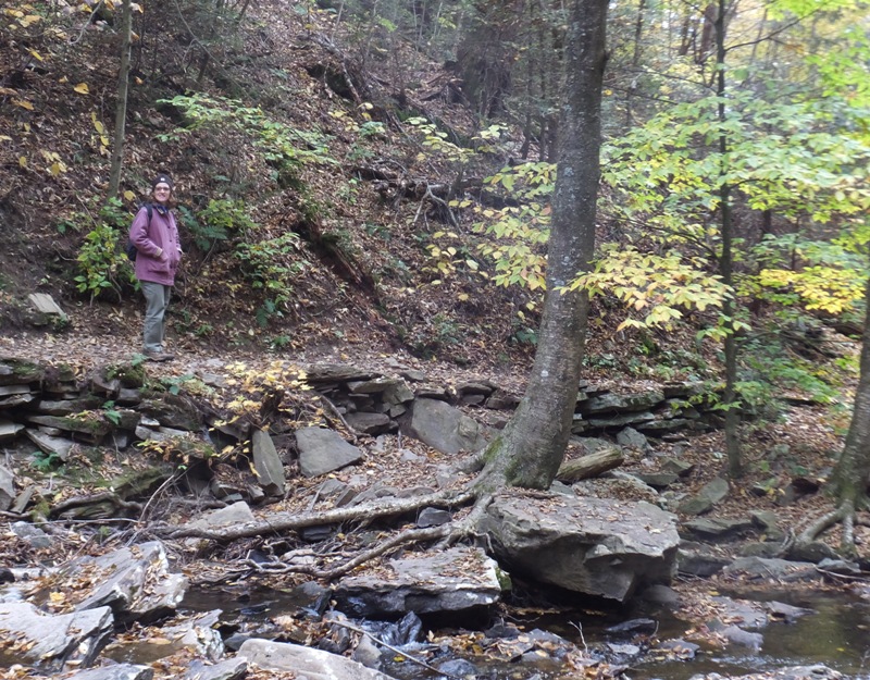
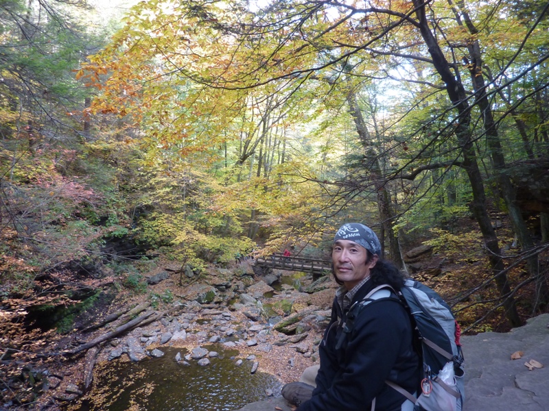
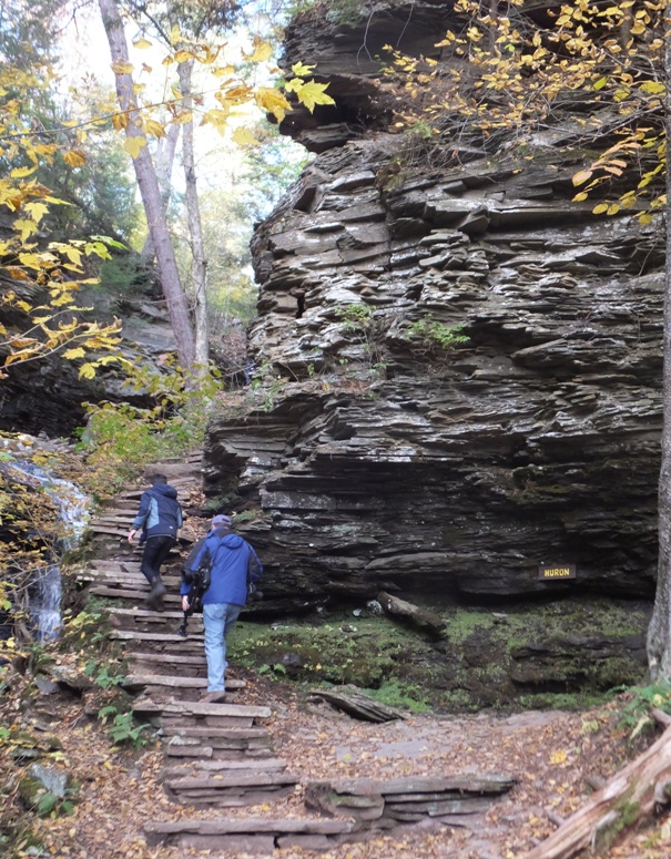
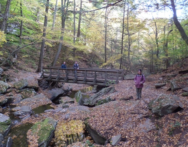
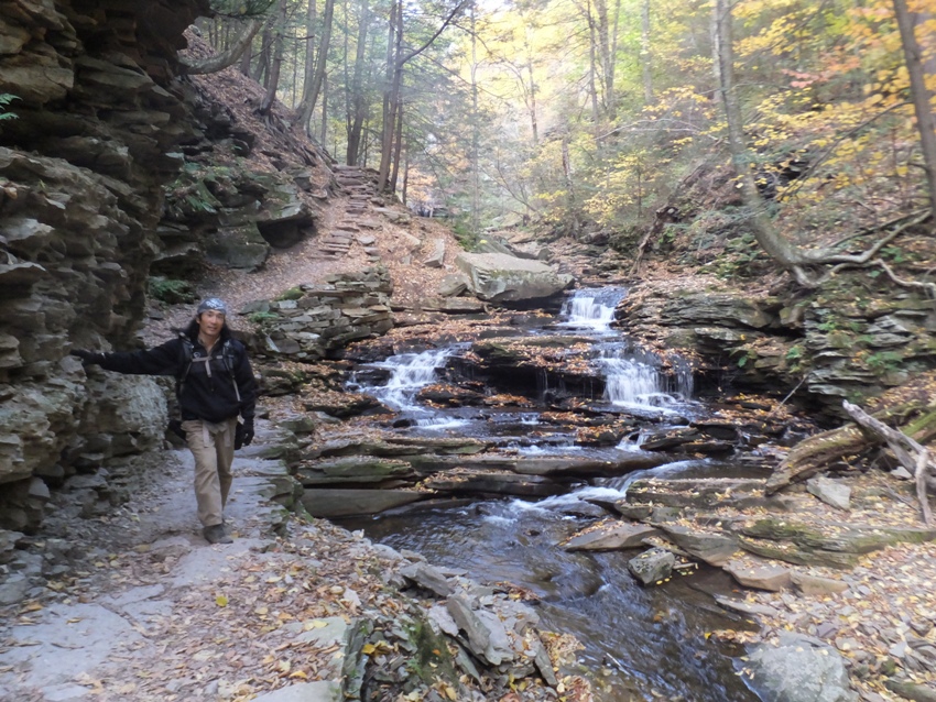
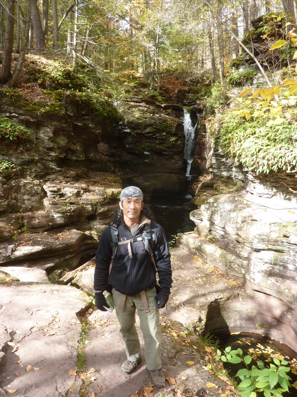
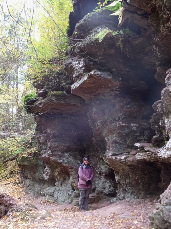
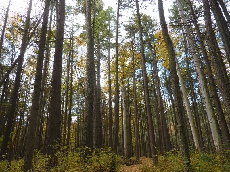
By 1500, we were walking in the Glens Natural Area.
The trails within the Glens Natural Area (which together make up the Falls Trail system) are home to 22 scenic waterfalls. - from sign in park titled "Hike Smart - Hike Safe, Ricketts Glen State Park" Norma and I wouldn't have enough time for one of Mike J.'s hikes so instead we did a shorter loop hike recommended by the ranger. We walked east on the Highland Trail and enjoyed seeing the fall colors. The temperature at Ricketts Glen is, on the average, cooler than in the Baltimore area so the leaves were looking more vibrant than in our area. 1 / 4

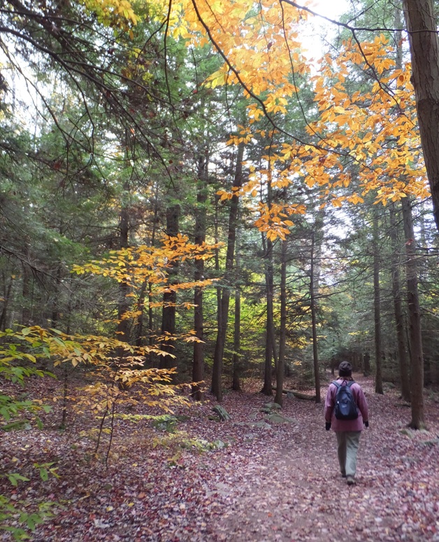
Yellow leaves contrast with evergreens.
2 / 4
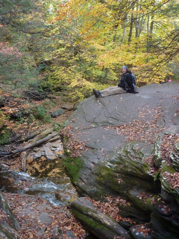
Ready for some hiking.
3 / 4
Colored leaves on the ground.
4 / 4
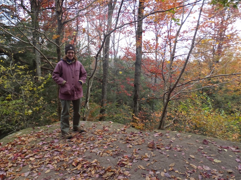
Norma at edge of steep drop off.
There were a lot of people out hiking. I expect they were wanting to see the fall colors as much as us. |
|
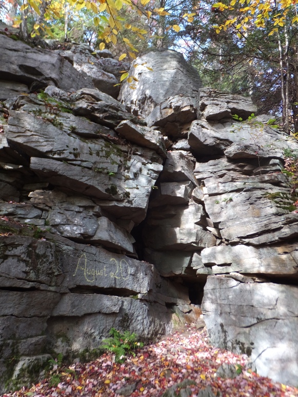
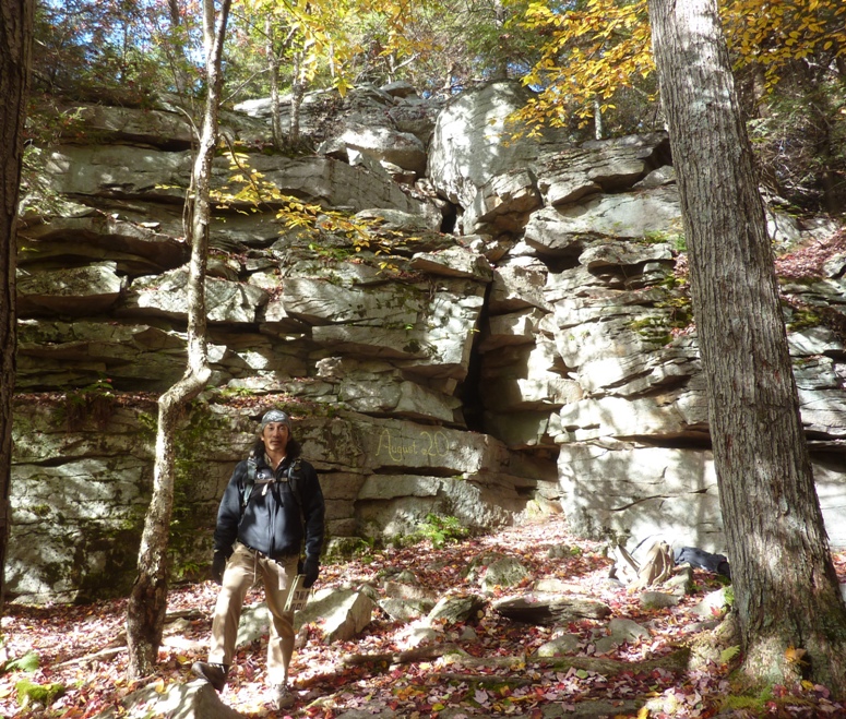
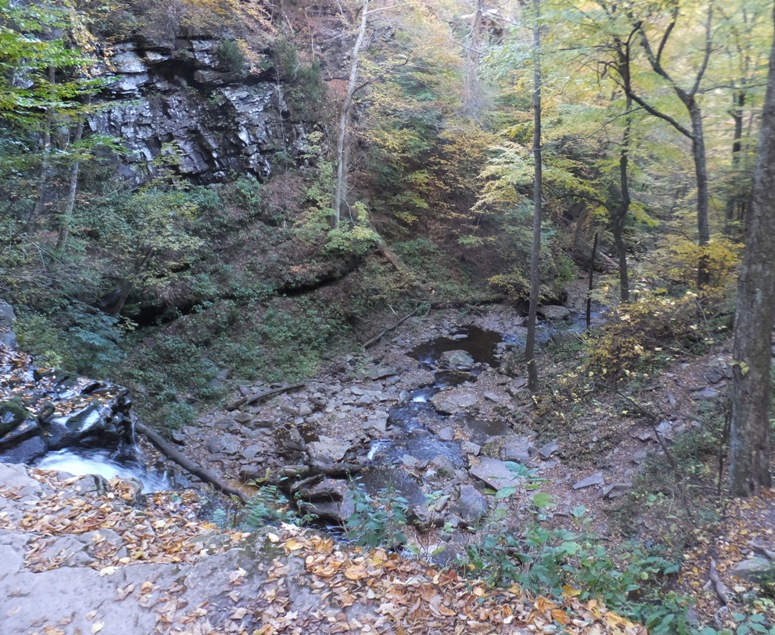
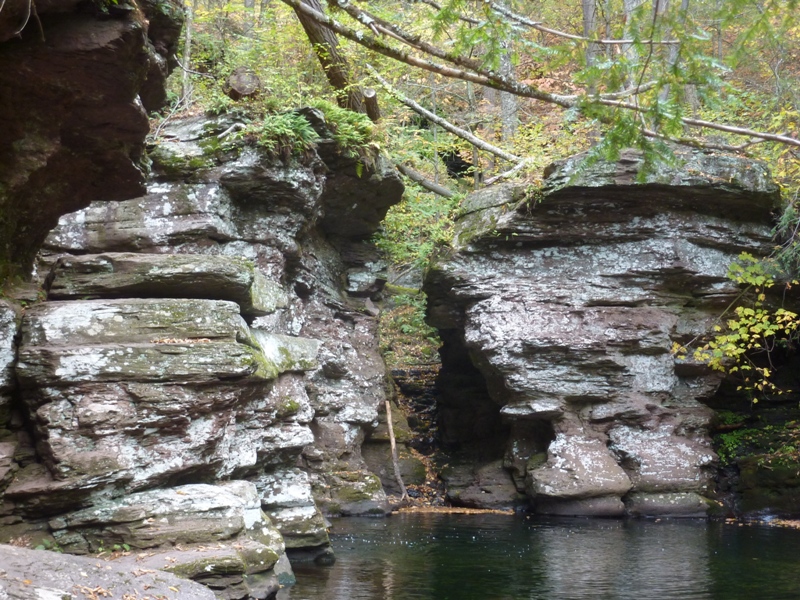
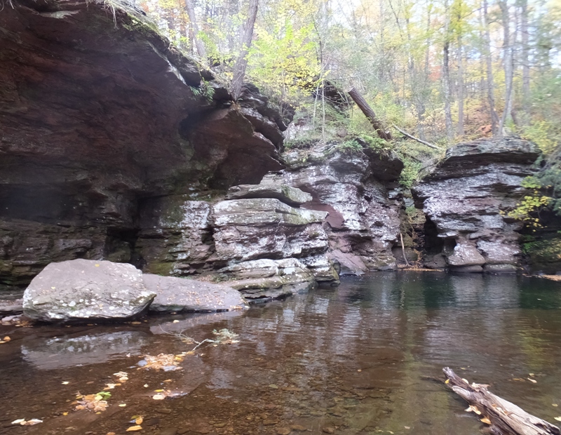
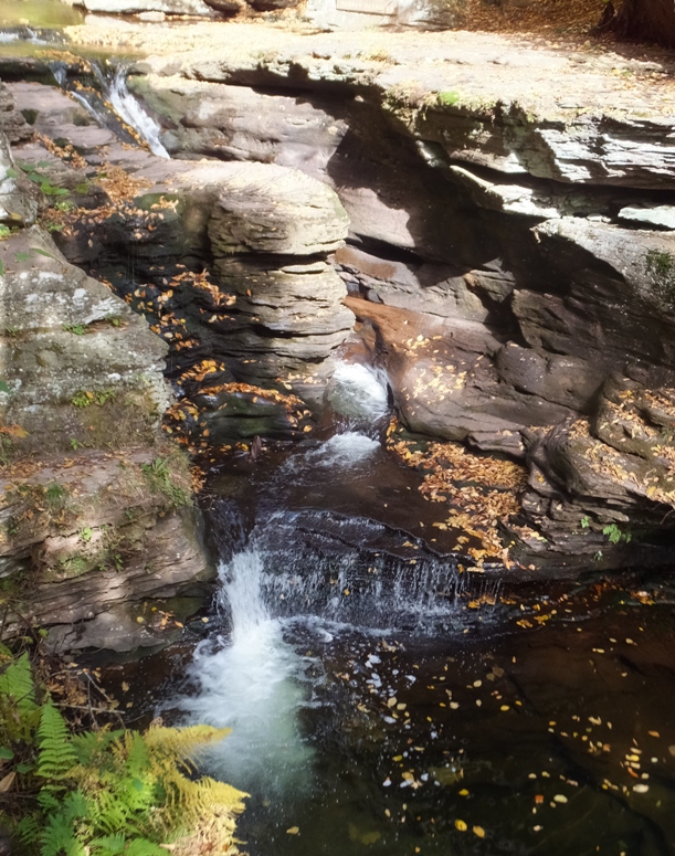
Eventually, we came to the Midway Crevasse. This is a
narrow passageway between large blocks of Pocono sandstone conglomerates that were deposited throughout this area by glacial movements. At least three times in the last one million years, continental glaciers buried this land under hundreds of feet of ice. - from "A Pennsylvania Recreational Guide for Ricketts Glen" |
|
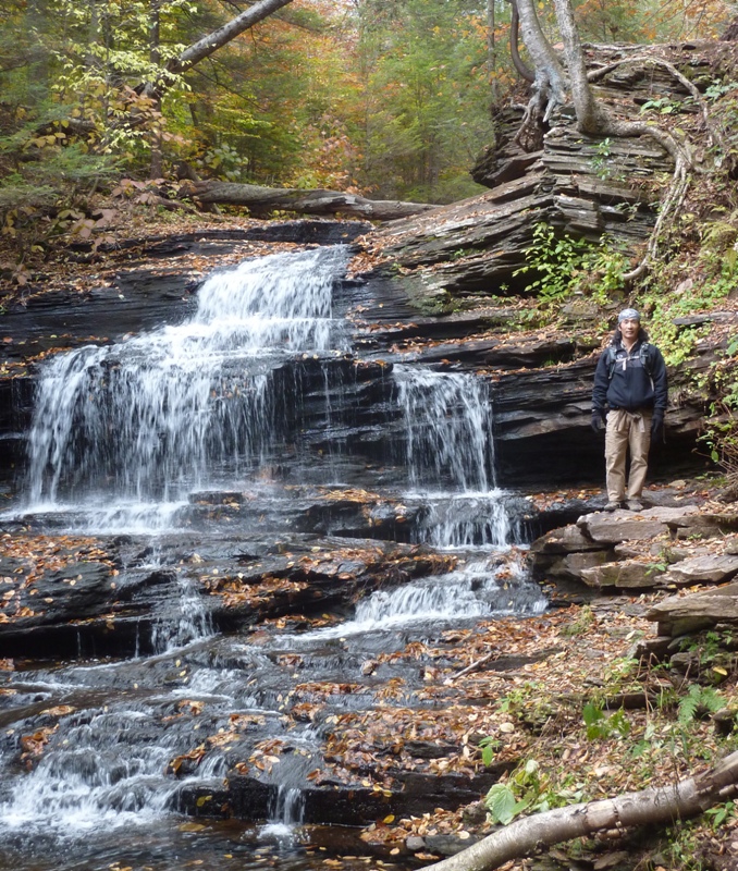
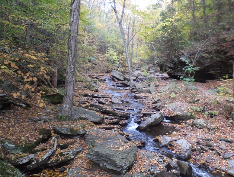
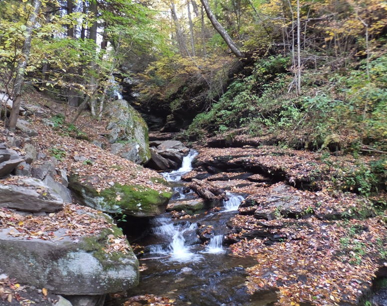
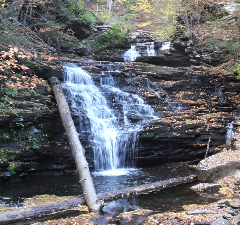
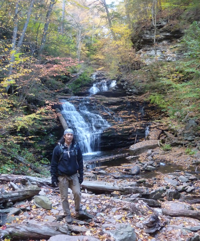
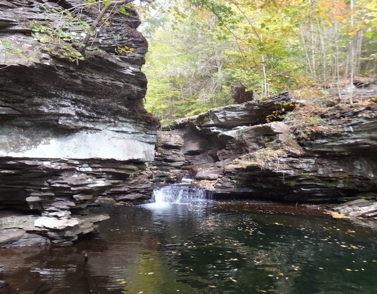
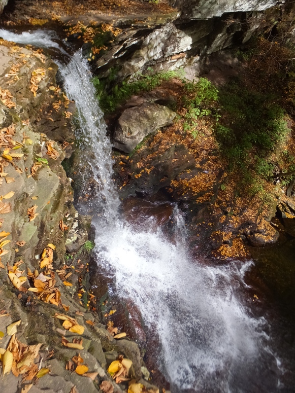
We left the Highland Trail and turned south at Kitchen Creek. This put us in Glen Leigh.
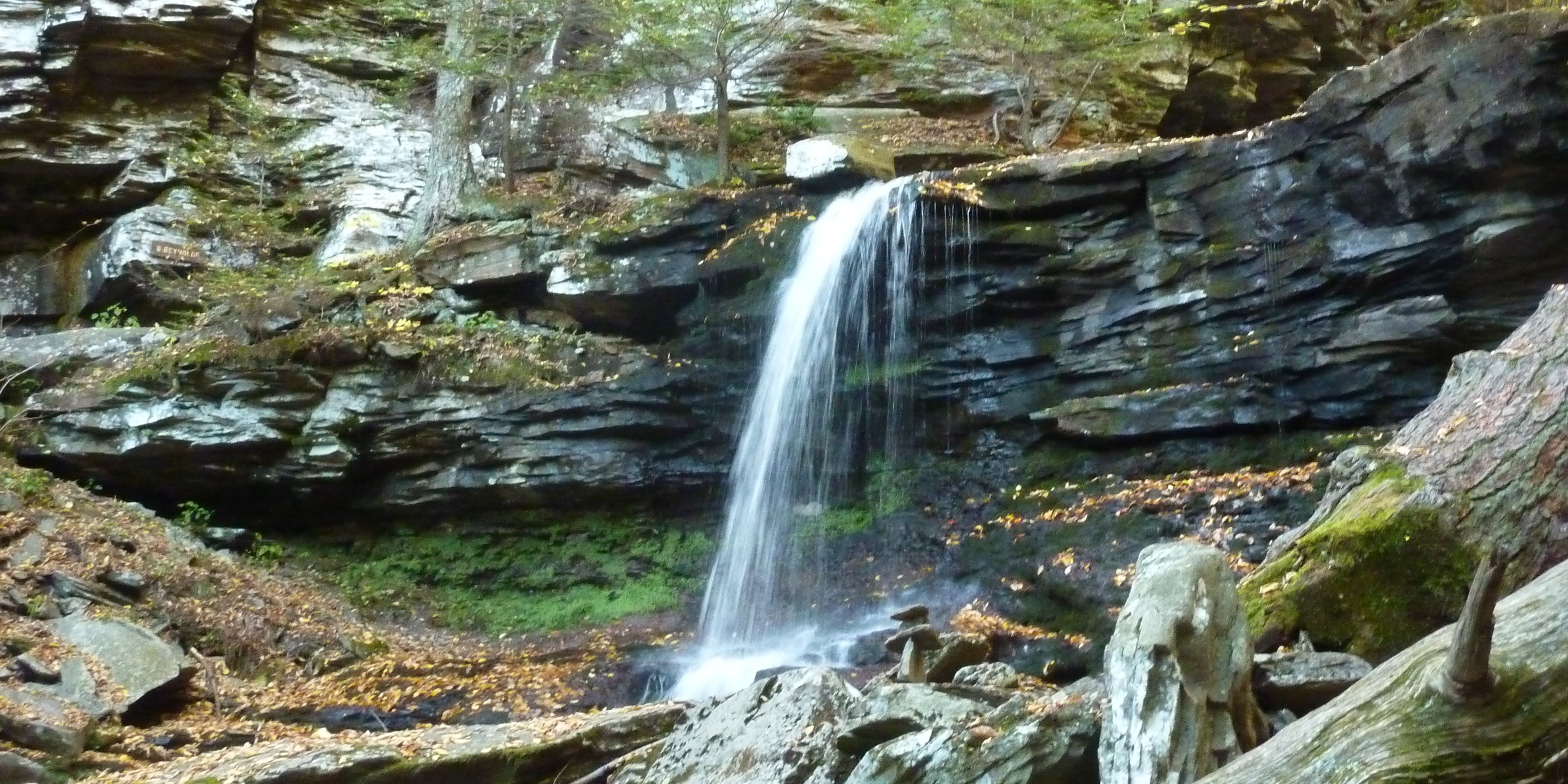
...the ruggedness of Glen Leigh requires several bridges to cross the streams, a couple of short walks through the woods, and even a stone staircase that's carved right into the rock. This makes the hike along Glen Leigh a bit more interesting than hiking the other parts of the Falls Trail. Uncovering PA - The Waterfalls of Glen Leigh (beautiful photos) Onondaga
F.L. Ricketts
Shawnee
Huron
Ozone
R.B. Ricketts
B. Reynolds
Wyandot
|
|
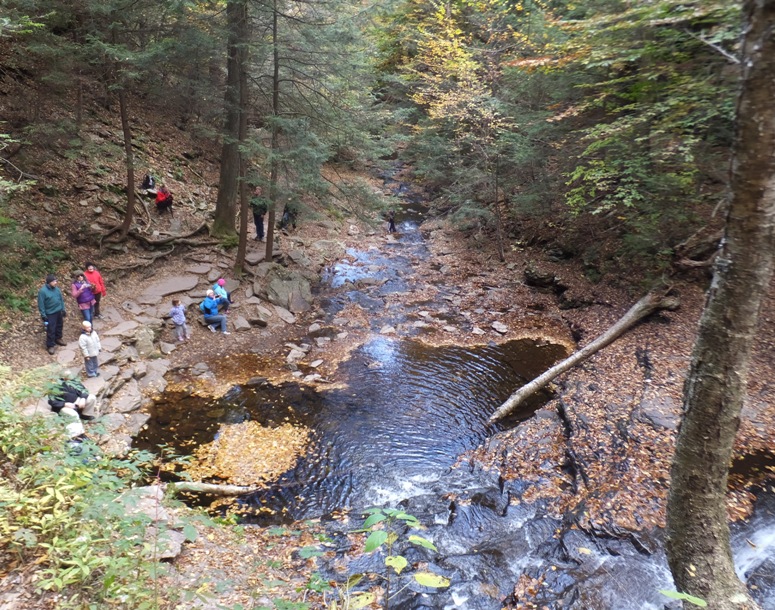
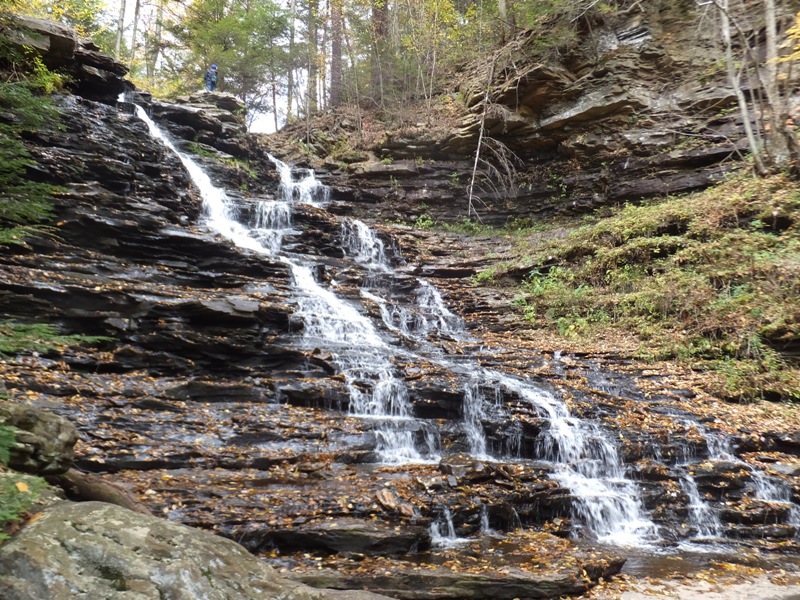
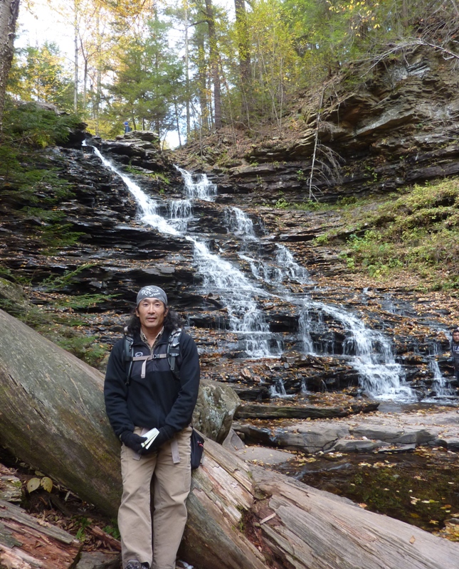
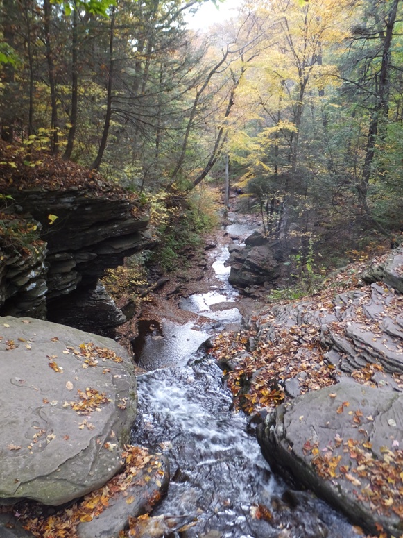
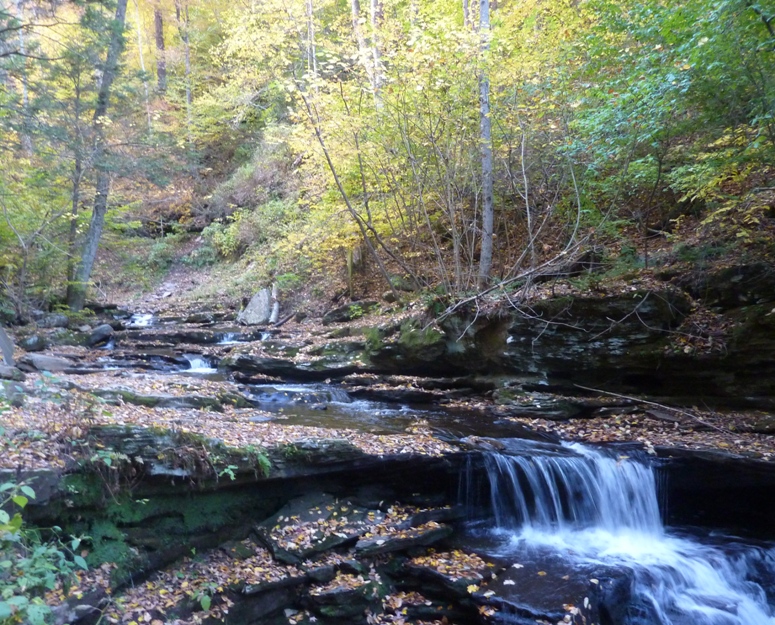
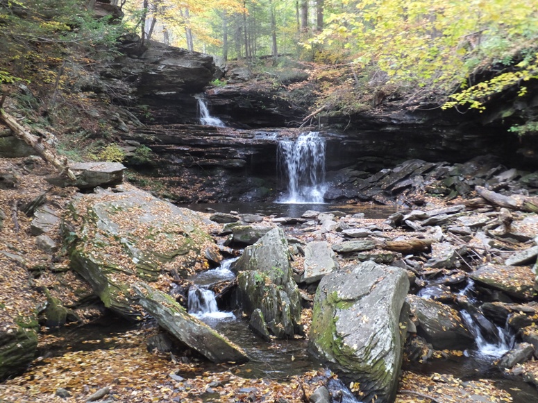
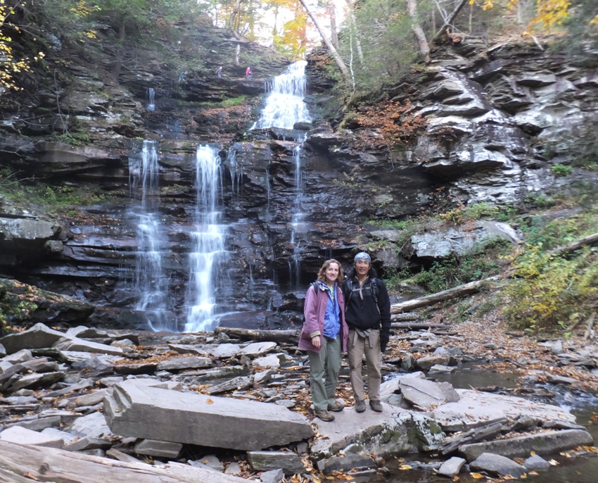
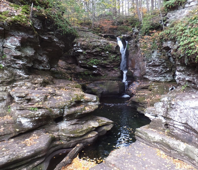
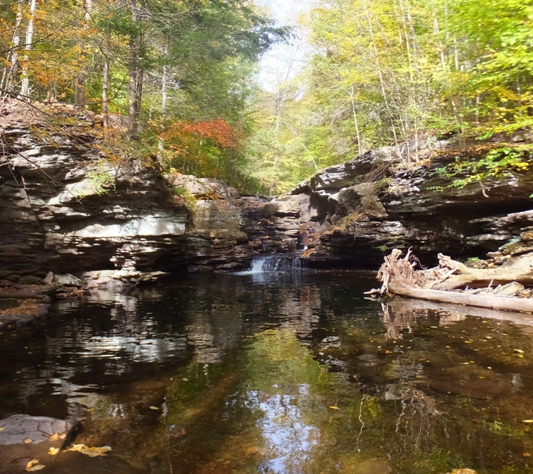
Two creeks met at a place called Waters Meet (sometimes referred to as Water Meet). Here, Norma and I started walking west on a new creek as we entered Canoga Glen.
Unlike the other areas of the park, all of the waterfalls in Ganoga Glen except for one are named after Native American tribes that once lived near Ricketts Glen State Park. The exception, Ganoga Falls, is named in a native language. When R. Bruce Ricketts was naming the waterfalls, he named Ganoga Falls after a word in the Seneca language that meant "water on the mountain." However, it now appears that Ganoga is actually a word in the Cayuga language that means "place of floating oil." - from Uncovering PA - The Waterfalls of Canoga Glen (beautiful photos) Seeing all the rugged rocks made me wonder what the area was like long ago. Approximately 15,000 years ago, glaciers moved through the area, carving gorges through the bedrock. As the glaciers melted, loose rock and soil filled old valleys, creating lakes and swamps. - from sign in park titled "The Power of Water and Ice - Waterfalls of Ricketts Glen State Park" Erie
Tuscarora
Conestoga
Mohican
Delaware
Seneca
Ganoga
Cayuga
Any sudden descent of a stream over a very steep slope or precipice in its stream bed. Characterized by the stream dropping vertically, or very nearly so. The water must drop a minimum of five feet to be considered a true waterfall. The term is collectively applied to three types: Oneida
Mohawk
|
|
After our little hike, we continued calling about lodging. Having called the bigger motels, Norma started calling the smaller places. She found a vacancy at Country Farms Bed and Breakfast. It wasn't far from the park. It was in the middle of nowhere at an old farm. We were greeted by our hosts, Ron and Alice. They were both very friendly. The house was charming and our rooms were neat and clean. The price was also reasonable. We asked about dining and were told about Strevig's Family Restaurant in Benton. So that is where we ate that night. Like everything else in the area, it was inexpensive.
That night, Norma and I played a board game called Camel Up. After a few rounds, we were pretty evenly matched. |
|
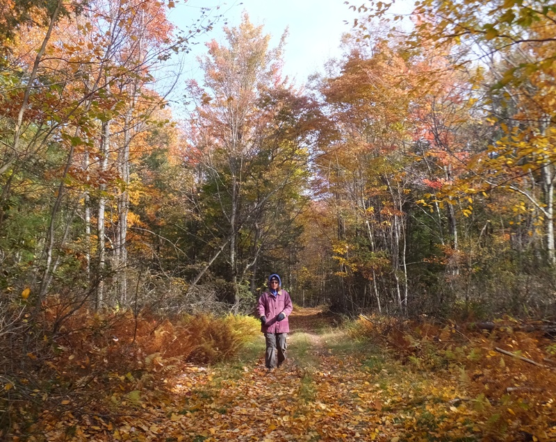
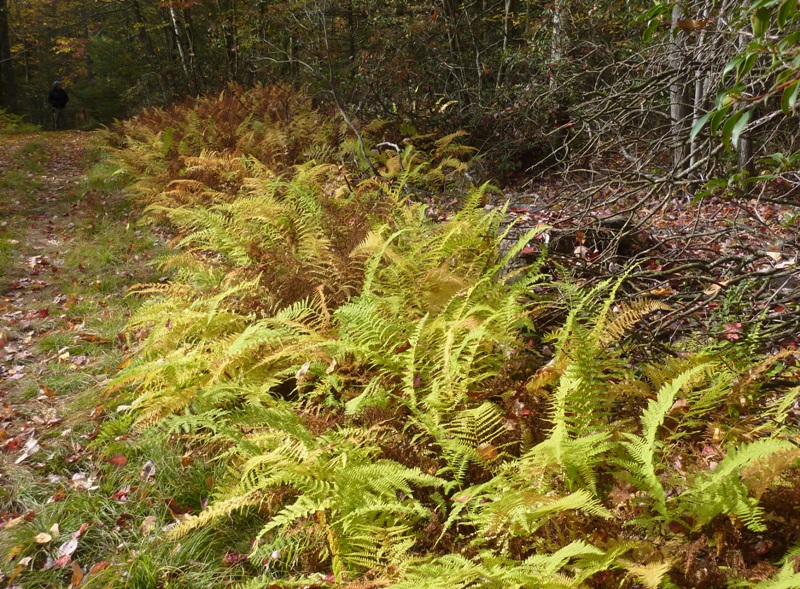
Norma and I ate a good old-fashioned country style breakfast prepared by Ron and Alice. Such a meal gave us plenty of energy for the rest of our busy day full of discovery.
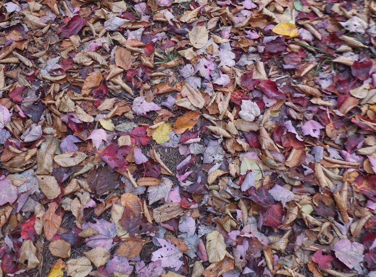
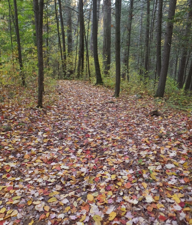
After packing up and saying farewell to our hosts, we explored some of the trails on their farm which appeared to be old logging roads. Walking down towards Little Fishing Creek, we saw plenty of pines. There were a few flakes of snow. Unlike where we live, these colder temperatures helped bring out the more dramatic fall colors. 1 / 5
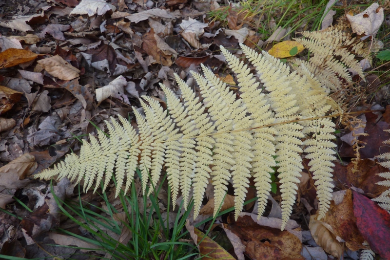
Fern.
2 / 5
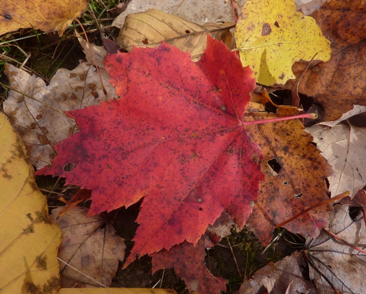
Red maple leaf.
3 / 5
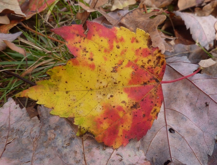
Red and yellow leaf.
4 / 5
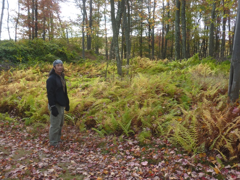
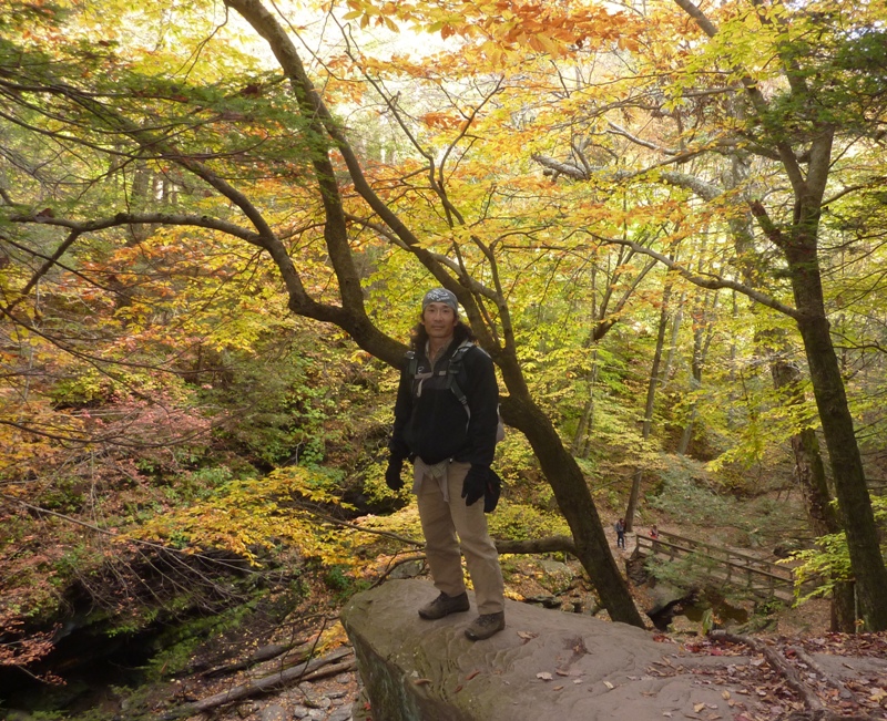
Me with ferns.
5 / 5
Browning ferns.
After exploring the trails near the farm, we headed back to Ricketts Glen State Park to see more waterfalls. |
|
Today's walk in the park started on the south side of route 118 between Tripp Road and Bethel Hill Road. We parked at and caught the Evergreen Trail which ran near Boston Run.
Adams
Old growth forest
|
|
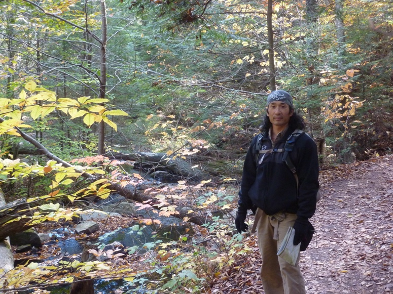
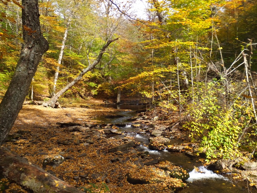
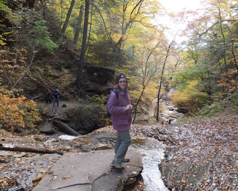
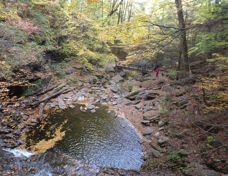
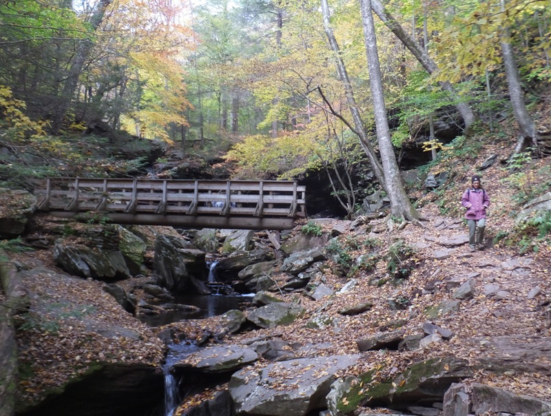
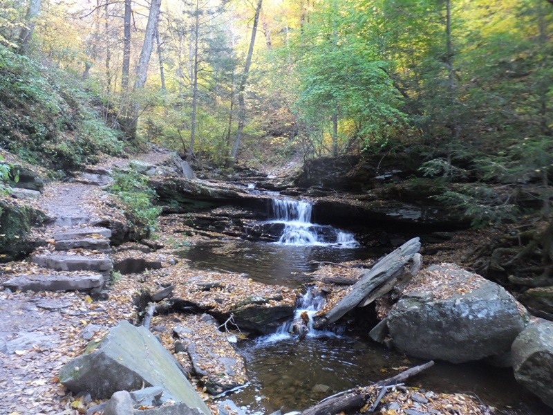
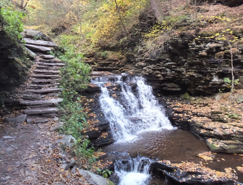
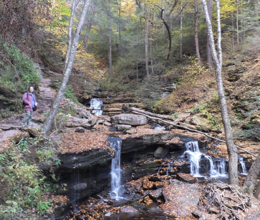
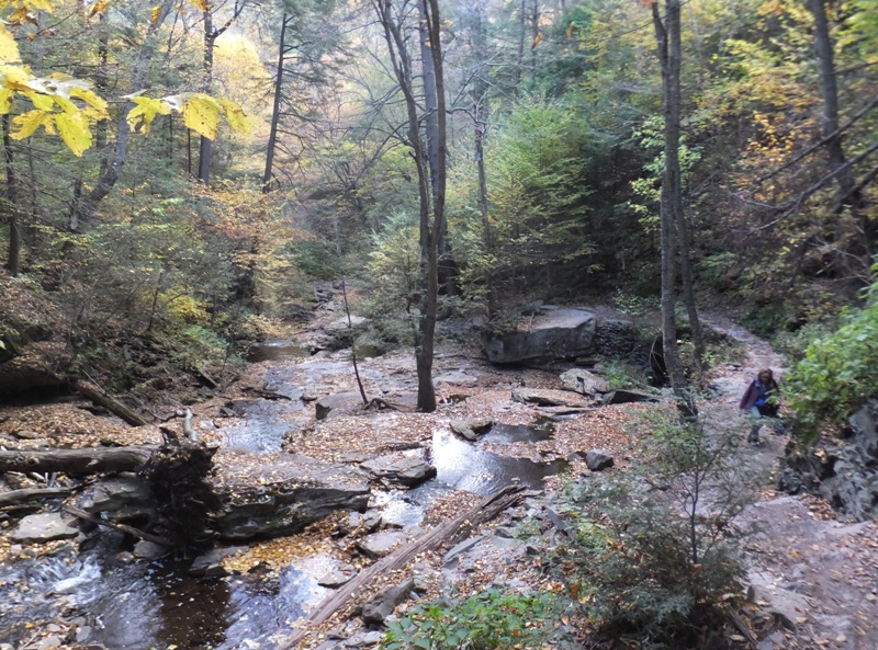
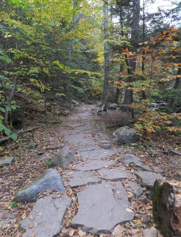
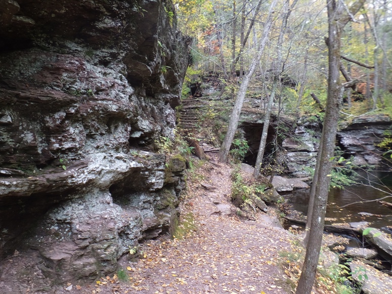
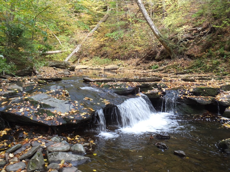
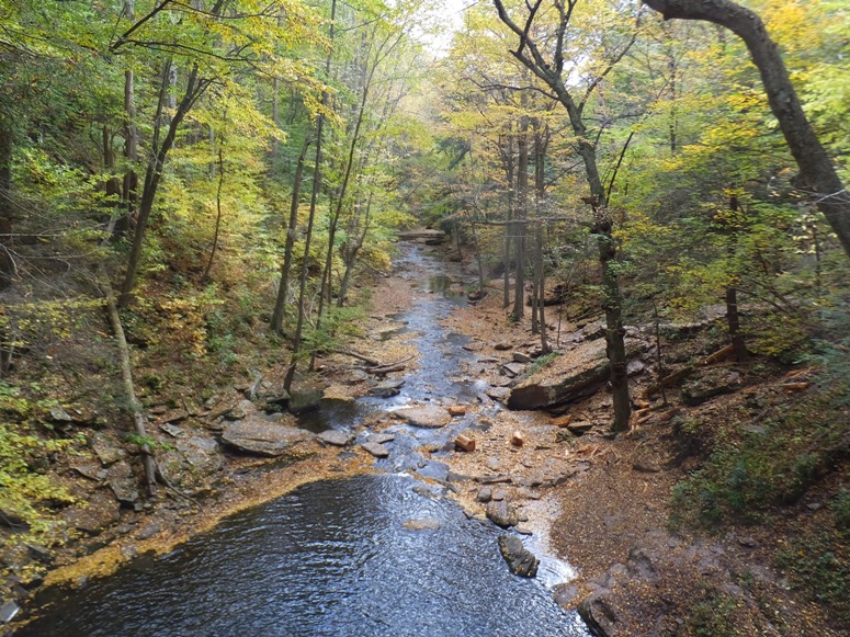
After completing our walk on the Evergreen Trail, we crossed over route 118 and then caught the Falls Trail. This is the same trail on which we walked yesterday but we didn't get this far. The plan was to walk it from this end heading north, up to near where we were yesterday. That would enable us to see the remaining named waterfalls in the park.
Norma and I followed the trail along the west side of Kitchen Creek. 1 / 5
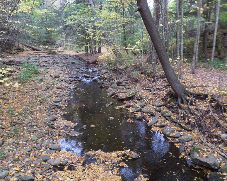
Shallow Kitchen Creek.
2 / 5
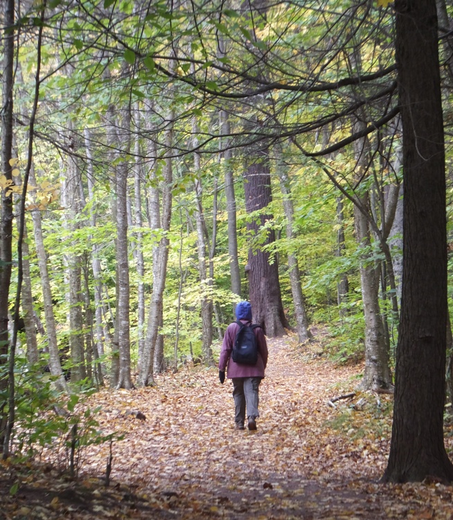
Norma on dry part of trail.
3 / 5
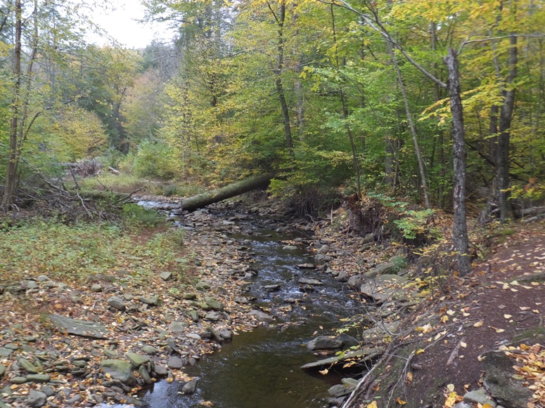
Falls Trail on right.
4 / 5
Wide part of creek.
5 / 5
Striking fall colors.
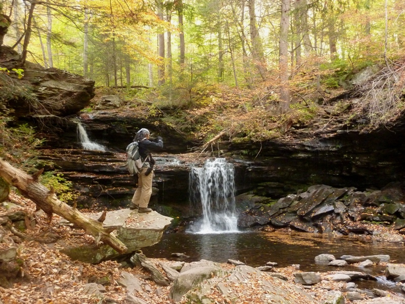
A few sections of the trail were less defined near the water. Some of these comprised the Lower Trail, an alternate route to the easier Upper Trail. We did the prior walking to the falls and the latter on the return. 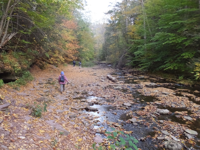
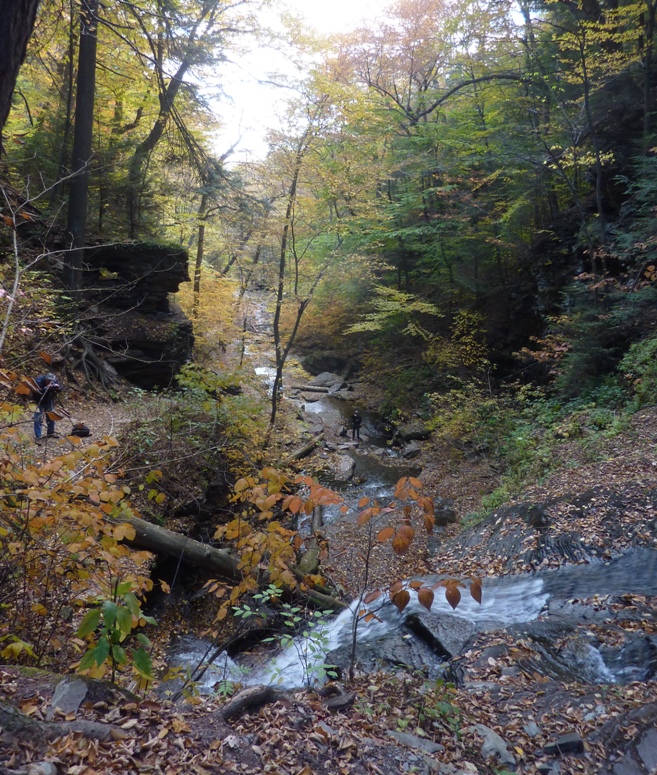
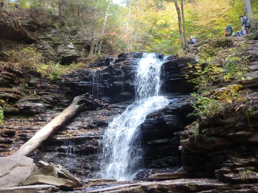
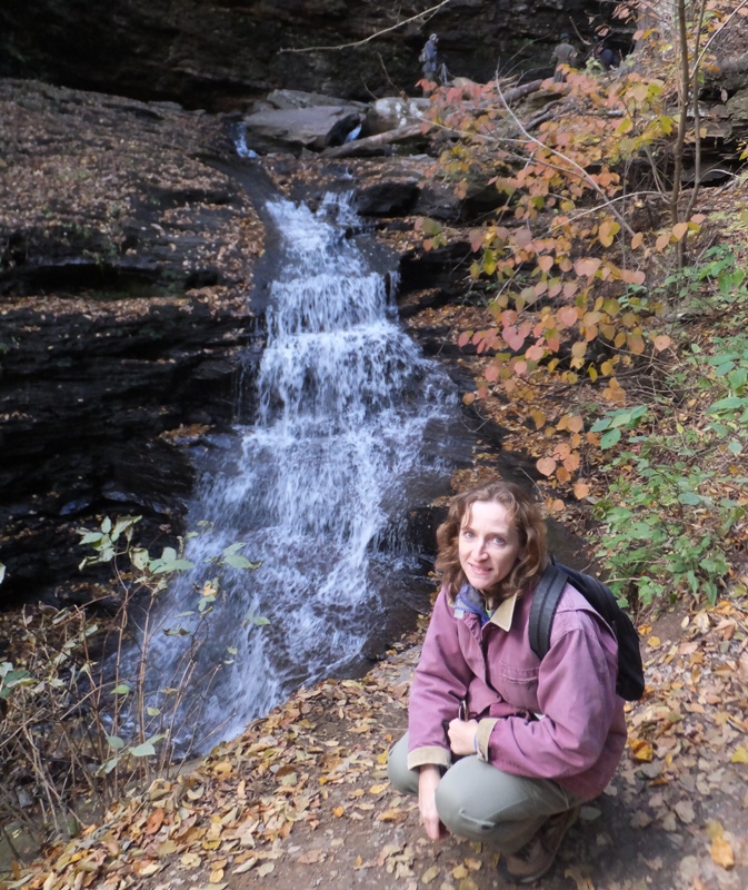
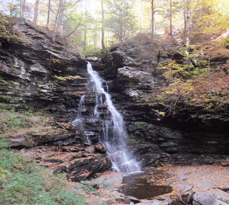
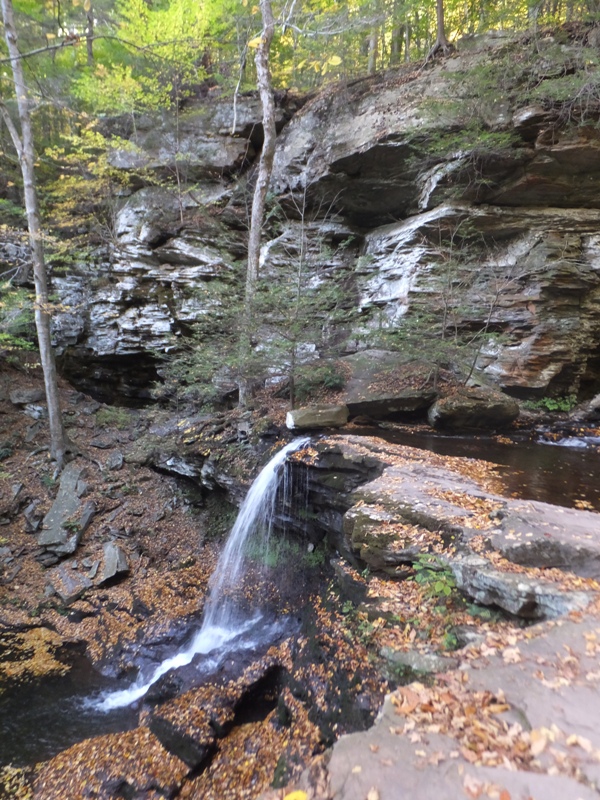
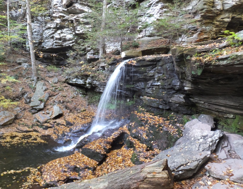
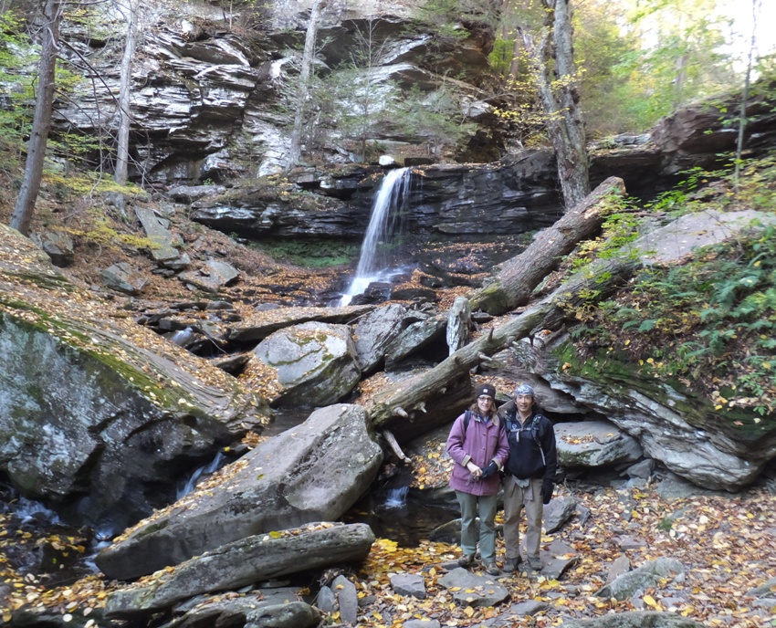
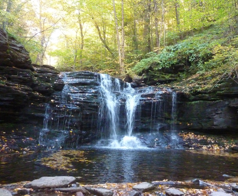
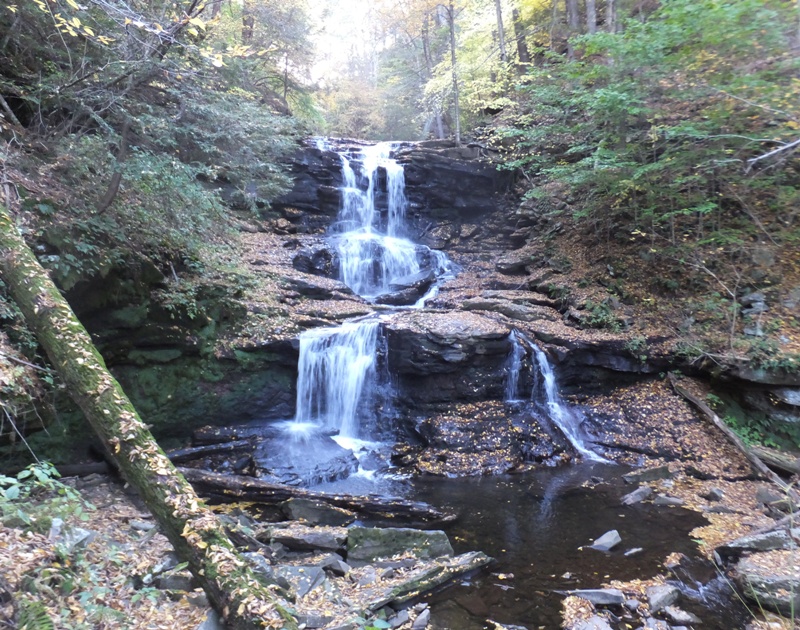
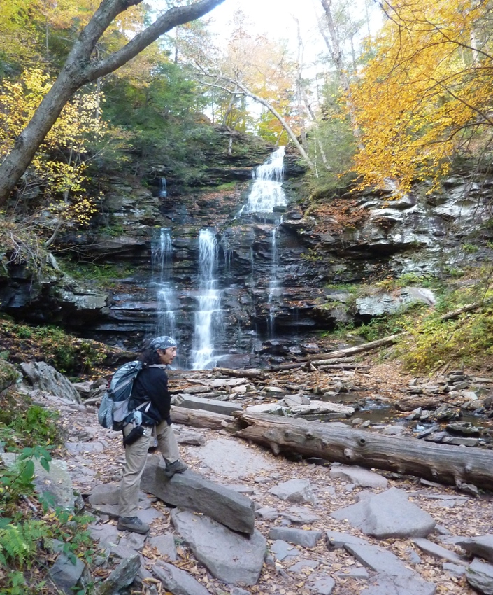
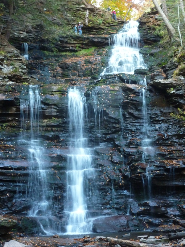
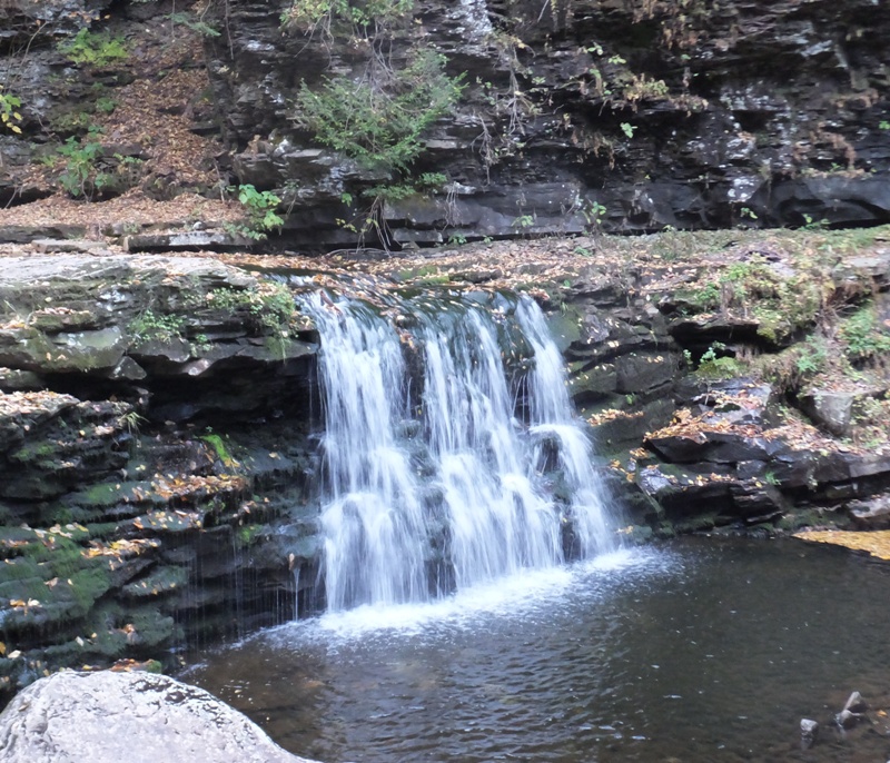
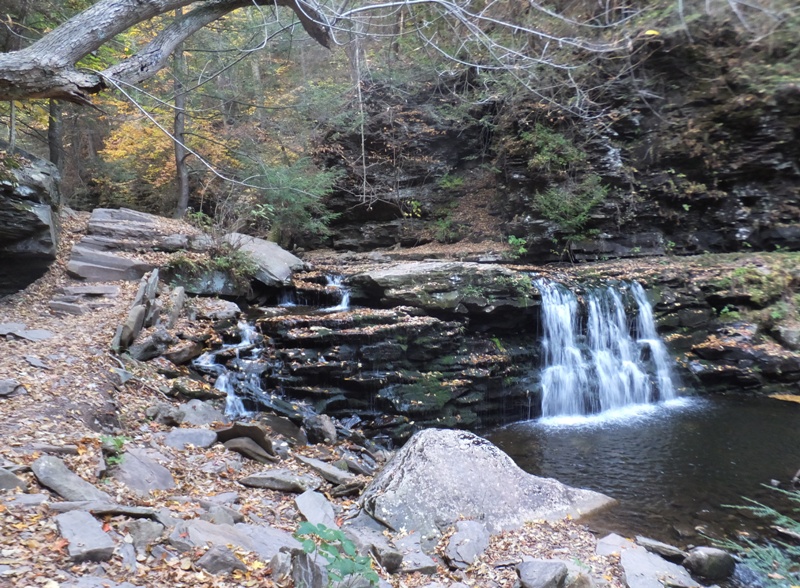
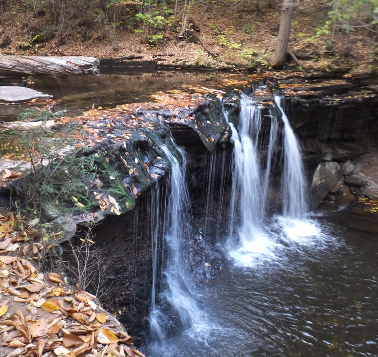
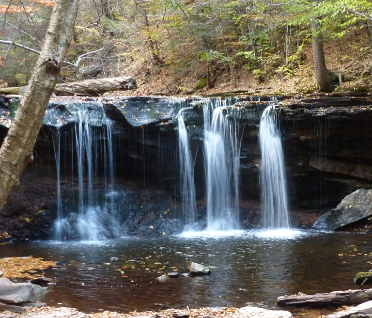
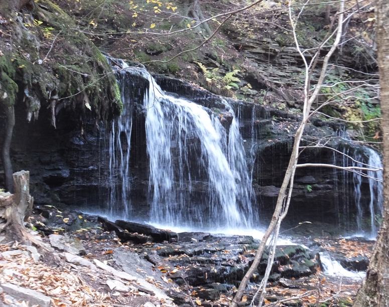
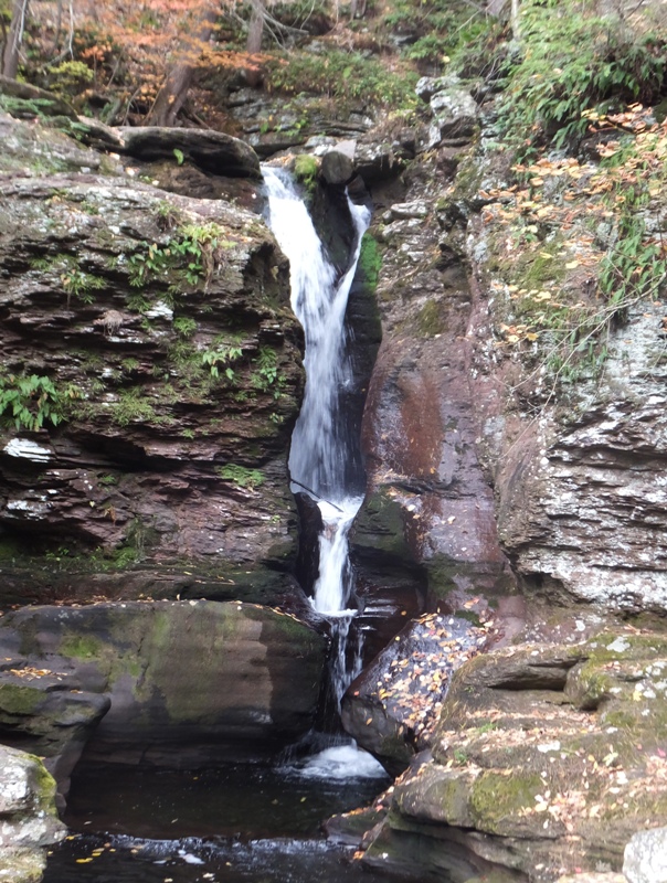
We had three named waterfalls left to see that day. To see some spectacular photos of them, check out Uncovering PA - The Falls below Waters Meet. Murray Reynolds
Sheldon Reynolds
Harrison Wright
Although each waterfall is unique, look for two main formations as you hike the trail: There wasn't much wildlife. I think we saw a deer and a heron. The most interesting thing we saw was a hickory tussock caterpillar. One might be tempted to touch their long hairs but experts say you should not. Contact with the poisonous hairs or spines of the Hickory tussock moth caterpillar can cause skin rashes or even a hypersensitivity reaction in some cases. - from Hickory tussock moth caterpillar poisoning (a broken link as of 2024) 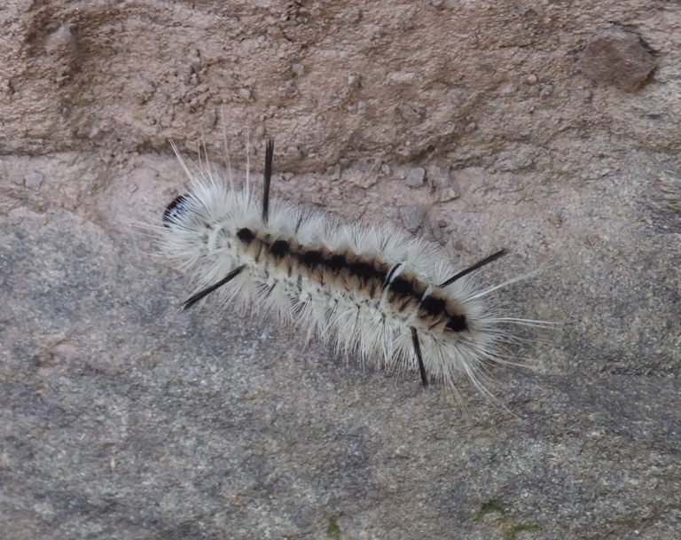
By the mid-afternoon, we completed walking 4.75 miles in the park. There was a chance of rain today but that never materialized. We were fortunate. Just a few flakes of snow. |
|
There were three unnamed waterfalls in the park on Little Cherry Run Trail that we didn't see.
I thought about other waterfalls that Norma and I hadn't yet seen. Vince recently told us about Raymondskill Falls, the highest waterfall in Pennsylvania. He also mentioned Ridley Creek State Park and sent us nice photos of both. Then I read about Crabtree Falls, the tallest waterfall in Virginia. The set of waterfalls is often credited with being 1,200 feet high, but topographic maps show the total drop to be closer to 1,000 feet. Crabtree Falls is a series of cascading waterfalls, with five major cascades, the tallest of which drops about 400 feet, and several smaller cascades, all over a total distance of approximately 2,500 feet horizontally. The cascade with a 400-foot drop also gives Crabtree Falls the title of tallest vertical drop in a waterfall east of the Mississippi River. - from Wikipedia - Crabtree Falls A couple of weeks later, I read about a beautiful place called Kilgore Falls in my Chesapeake Bay Foundation magazine. We'll have to add that to our "must see" list too although this is described not just as a waterfall but also a popular swimming hole so we might want to visit when it is warm. It is close enough to be a day trip. Maryland's second highest free-falling waterfall is located on the Falling Branch of Deer Creek in northern Harford County. Falling Branch passes through a steep gorge known as Kilgore Rocks, where the falls have developed in relatively erosion-resistant Prettyboy Schist. The Falling Branch Area of Rocks State Park is a 67-acre parcel of land which is home to Kilgore Falls. This non-developed, environmentally sensitive area has a serene hiking trail (Kilgore Falls Trail) leading back to the waterfall. - from Maryland Geological Survey - Falling Branch, Harford County Norma and I both enjoy hiking quite a bit. But seeing a waterfall on a hike is even better. It is good to know we've got plenty of options for future adventures. |


