|
This page is about an Adirondacks trip which Norma and I did in upstate New York from July 29 to August 4, 2013. |

|
This page is about an Adirondacks trip which Norma and I did in upstate New York from July 29 to August 4, 2013. |
|
Numerous people in the Chesapeake Paddlers Association have visited the Adirondacks region upstate New York state. They must really like it because some of them go back year after year. They've even named their little group...the Adirondack Loons.
Typically, I'm not much into kayaking on lakes but that's mainly because lakes in Maryland are man-made. But the Adirondack lakes are natural. Kayaking isn't the only thing that area has to offer. There are 46 High Peaks which were originally believed to comprise all of the Adirondack peaks higher than 4,000 feet. An elite group of hikers can boast that they have climbed to the top of all these mountains and have thus qualified to become members of the Adirondack 46ers. I have no intention to accomplish such a feat but knowing there is such great hiking opportunity gave me a good reason to visit. The Adirondacks is a big place. The park covers some 6.1 million acres, a land area roughly the size of Vermont and greater than the National Parks of Yellowstone, Yosemite, Grand Canyon, Glacier, and Great Smoky Mountains combined. - from Wikipedia - Adirondack Park Norma and I had talked about visiting this big place for quite awhile but the trip didn't come together until just a few days prior. To help narrow down our options, I purchased the Delorme New York Atlas. After studying the map, Norma and I figured that choosing a location near a town with some nice restaurants and things to see and do was a good start. I spoke to a few people and decided that someplace near or in Lake Placid would make for a nice base camp. I remember it being the home of a few winter Olympics. I also remember seeing a movie called Lake Placid, which I don't recommend. In 2010, U.S. News & World Report rated Lake Placid as one of the "6 Forgotten Vacation Spots" in North America. We looked for lodging. There were a couple hostels available. These are good if you're traveling alone but if you're with another person, a cheap motel isn't much more costly. But cheap motels are hard to find in Lake Placid, which is rather upscale. In the end, we went the inexpensive route and stayed at campgrounds for all but one night. Our first few nights would be in a small town called Ray Brook between Lake Placid and the town of Saranac Lake.  |
|
Norma and I got a late start. I actually went into work briefly to get some stuff done. I'm glad I did. Nothing worse than going on vacation thinking about what I should have done at work or what I need to do when I get back. I got a few important things done and then left feeling like I was at a good stopping point.
It was a nine hour drive to the Meadowbrook public campground in the town of Ray Brook. Tent sites were only $20 a night. We arrived with just enough light to get the tent set up. Then it was dinner and bedtime. |
|
We awoke to a campground that wasn't very crowded. But that was not the case a few days ago. The Adirondacks attracts a lot of fit, rugged people and there is frequently a big race taking place on the weekend in the summer. Last weekend was the Ironman Triathlon which brought hundreds of participants and their guests to Lake Placid. Hotels sold out and the campground was packed. But that was over and the hardcore athletes were gone. We were lucky this time, but next time we'll make sure our visit doesn't clash with any big races unless we plan to participate...which isn't likely.
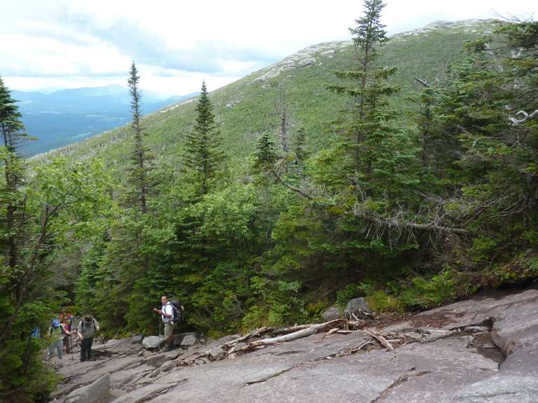
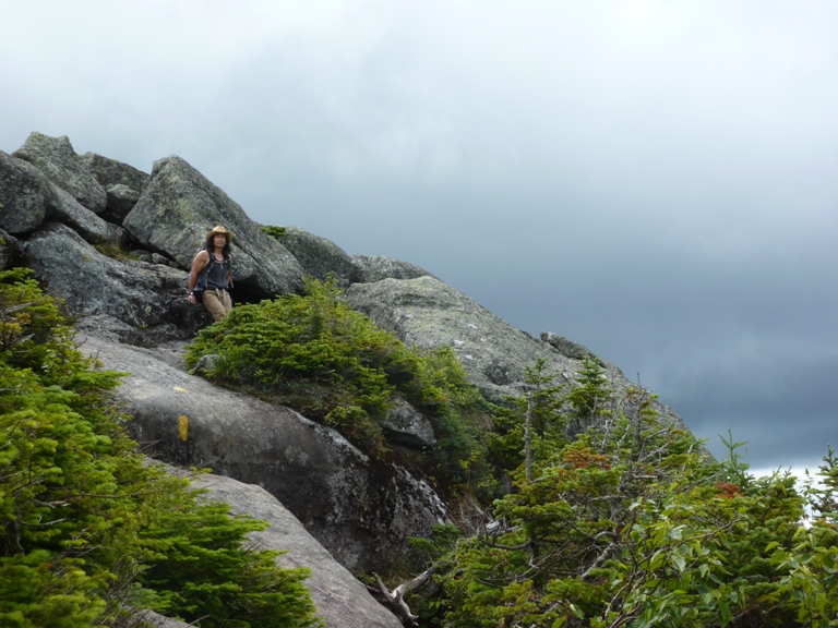
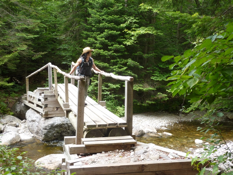
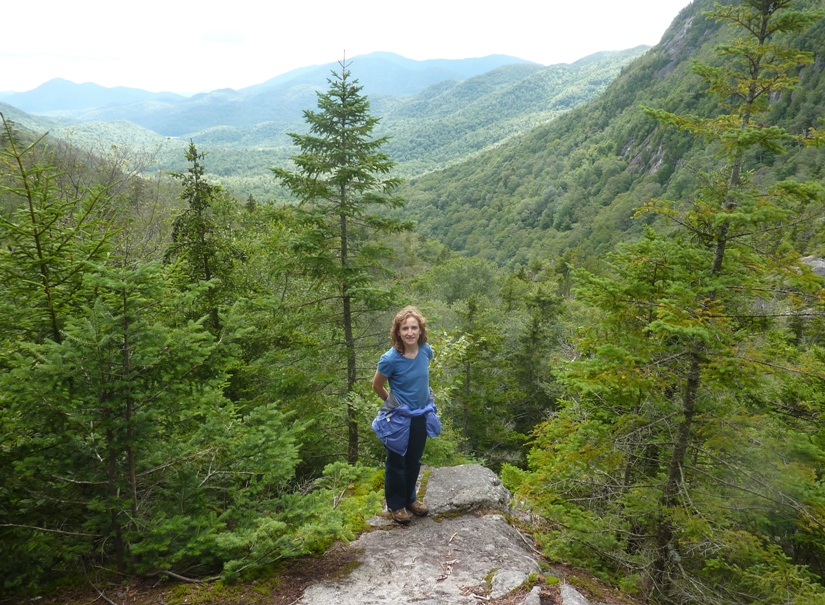
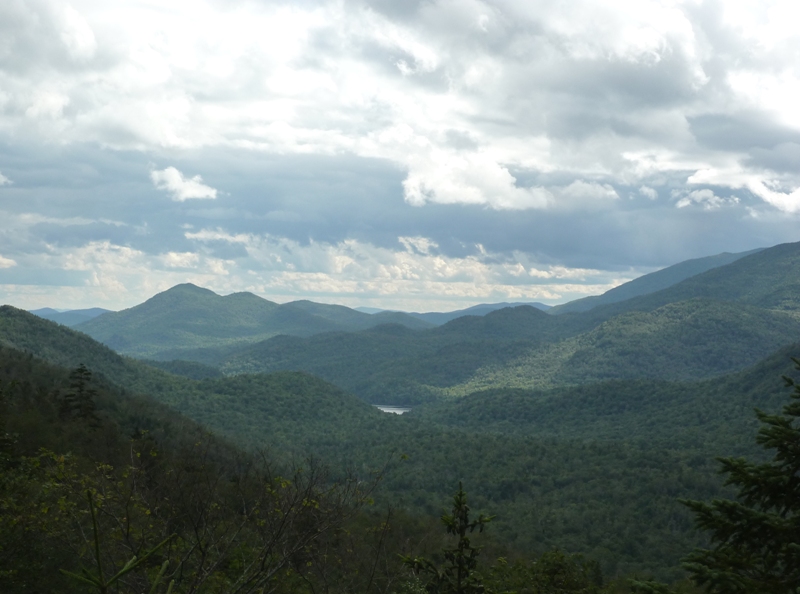
Norma and I ate breakfast at Saranac Sourdough where we also bought sandwiches for our first outdoor adventure...a hike to two of the 46 peaks. At the High Peaks Information Center at the Adirondack Loj, we bought various books including Adirondack Paddling by Phil Brown. This turned out to be a good investment. The two of us hiked uphill along MacIntyre Brook to the MacIntyre Mountains. A family with a few small children followed the same route as us for awhile. The young kids ran from one point to another but made sure to not get too far ahead of their parents. They certainly had much more energy than I did when I was their age. Eventually, our paths split and Norma and I were mostly alone (at least temporarily) in the tranquility of the woods. It was a scenic but difficult trek because of all the large boulders along the way. There was also a lot of uphill climbing up steep rocky areas. As usual, Norma and I looked for wildlife. We were pretty far from Maryland so we were hoping to see something exotic like a moose or a bobcat. Something more common to our neck of the woods like a bear or a snake would have been nice too. But we saw none of those things. Not even an eagle. A squirrel or a chipmunk was about as good as it got that day. After awhile, we entered the Arctic Alpine Plant zone. A sign warned us not to walk or sit on the plants as they are very fragile. At this point, we were above the tree line. From these higher elevations, we had some great views. The dark clouds above the neighboring mountains made for some dramatic scenery that reminded me of our May 13, 2011 hike in the German Alps. 1 / 4

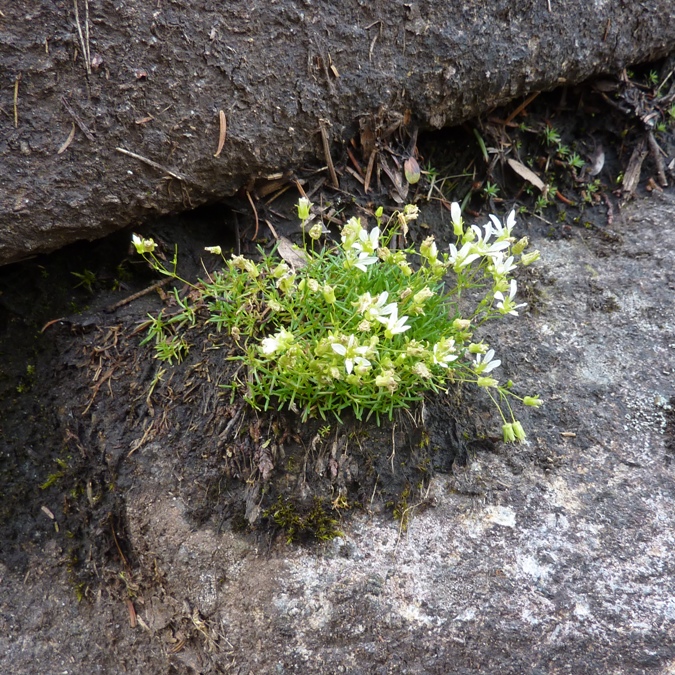
High altitude flowers.
2 / 4
Enjoying the view.
3 / 4
Norma near the top.
4 / 4
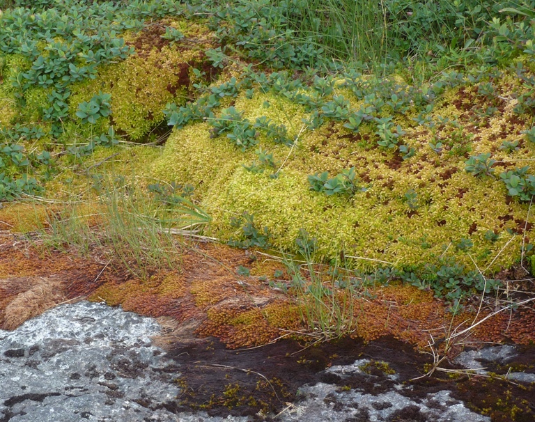
Assorted moss.
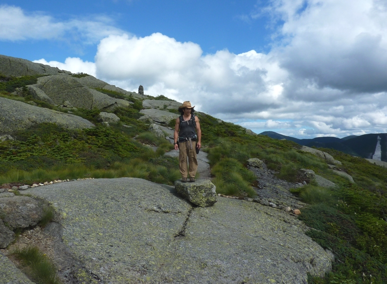
Numerous cairns marked the rocky trail. Norma did her part by bringing rocks from the lowlands to help build them up. 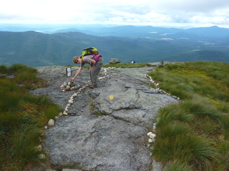
We did not contribute to any of the rocks in this cairn. 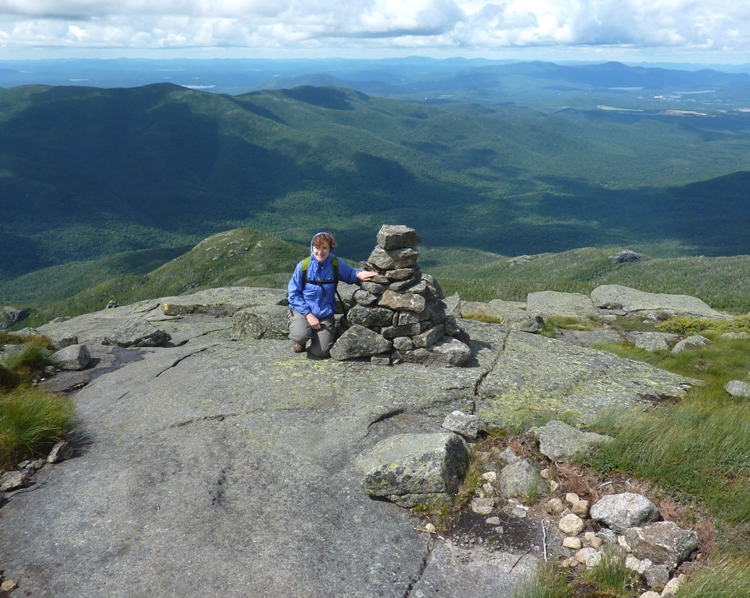
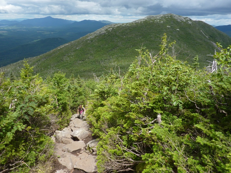
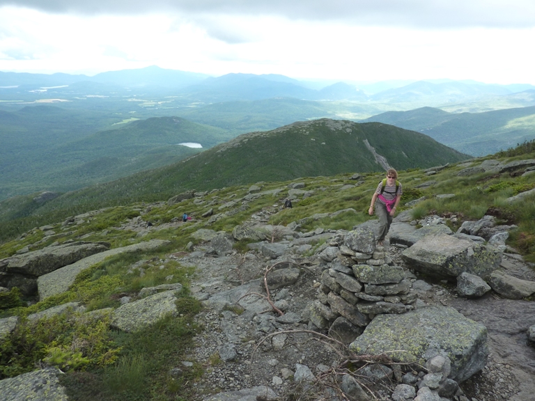
Finally, we reached our destination, Algonquin Peak, the second tallest mountain in the state of New York at 5,114 feet above sea level. 
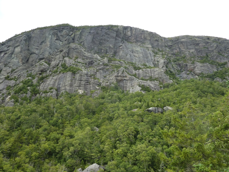
There were several people at the top, including a "summit steward" that told us about the area. Before today, I never met someone on a mountain top that was there specifically to provide information. I was most impressed. She pointed out a nearby mountain with a pale strip where a rock slide had occurred just a few years ago. 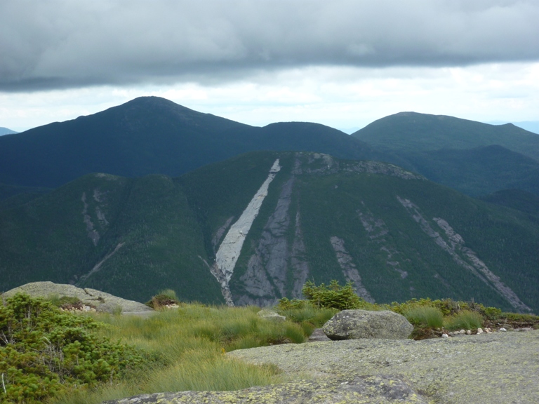
She also mentioned how the grasses in the Arctic Alpine Zone could die after being stepped on just five times. 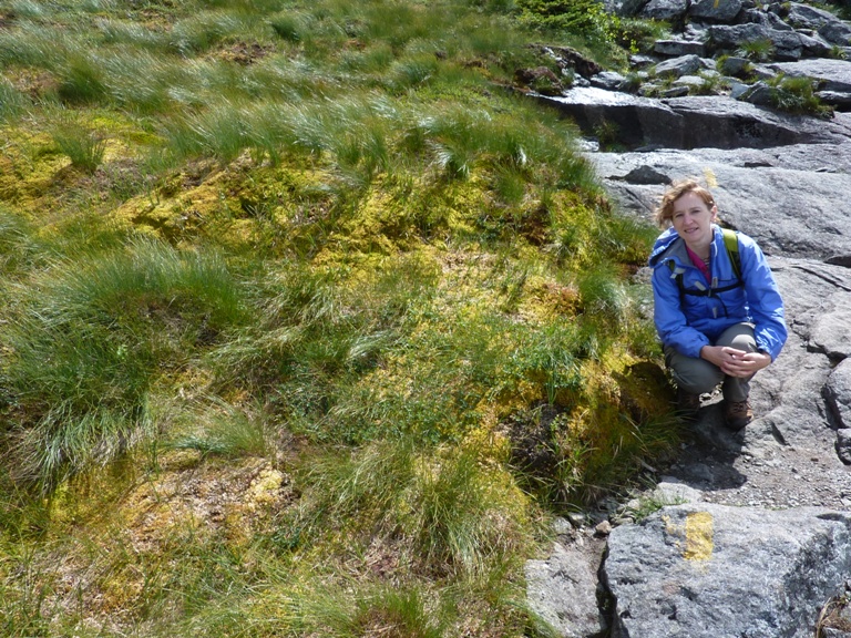
If you do this hike, be sure to bring warm clothes, despite the temperature at the trailhead. It was pretty cold and windy up there. At least it was dry. We made our way down the mountain then backtracked a bit, seeing some familiar faces along the way. 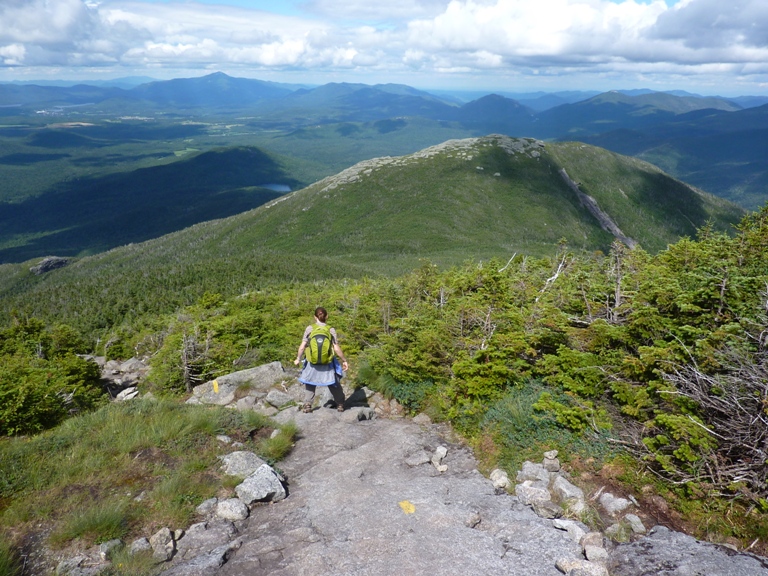
|
|
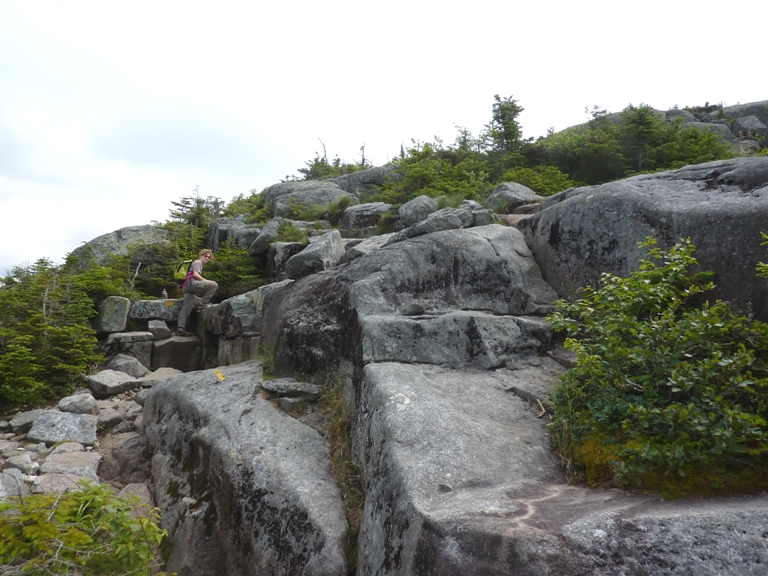
After retracing our steps for a few miles, Norma and I climbed the 4,586 foot Wright Peak.
Unlike Algonquin Peak, we saw very few people here. While not as tall as Algonquin, the view was still spectacular. We found some plane wreckage from the 1962, Air Force B47 bomber crash, but we didn't find the plaque that commemorates it. 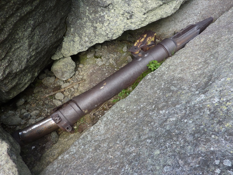
As with Algonquin, numerous cairns marked the trail. Some of them were quite large. 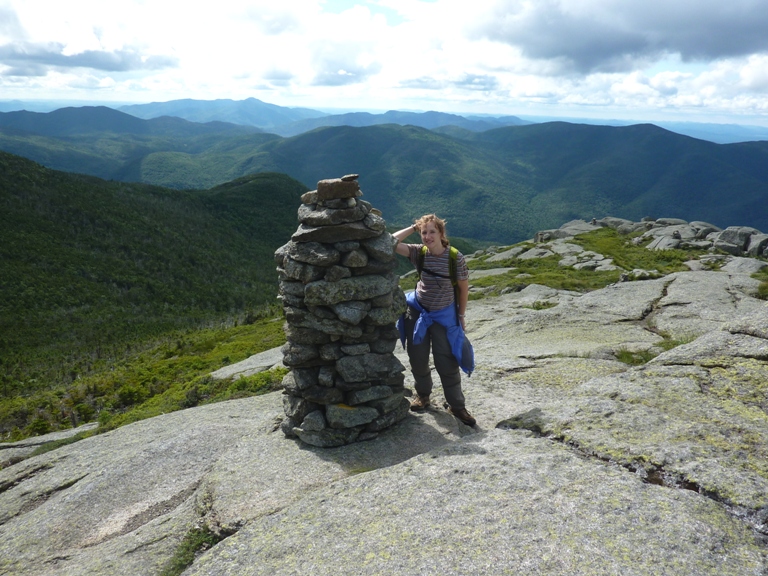
We finished our 8.5 hour, 9.1 mile hike. Our total ascent was 3,842 feet, making this possibly our second most challenging hike, after Mount Washington in New Hampshire, the highest peak in the northeastern U.S. We were both a little tired and sore. Having worked up quite the appetite, I insisted we eat pizza. So we stopped for a mediocre dinner at Johnny's Pizza in Lake Placid. |
|
After stopping for coffee and tea in the town of Saranac Lake, we commenced on our second day of adventure.
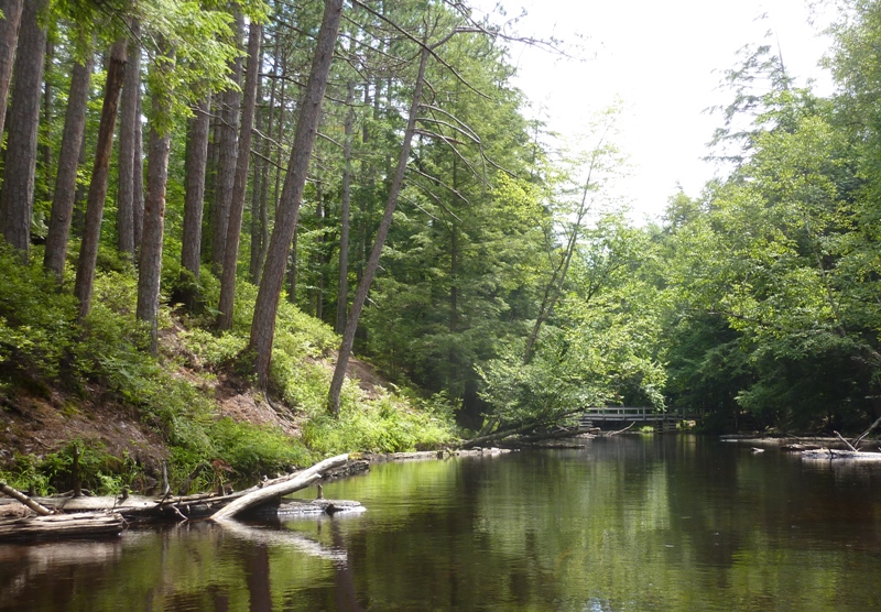
I decided we would paddle the "Round the Mountain Loop" described in our new "Adiondack Paddling" book. We launched at a public access site on the northeast end of Lower Saranac Lake. Staying on the north side, we kayaked to Fish Creek. We got up about a mile on this very scenic creek. 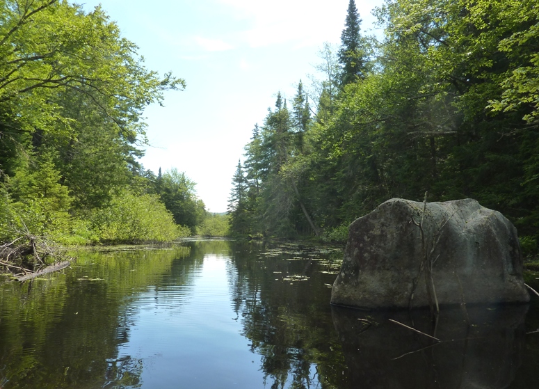
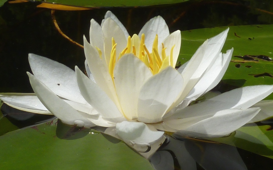
We saw a muskrat further downstream along with lots of water lilies. 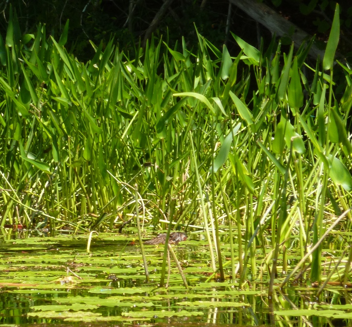
Making our way back to the lake, we paddled south then across to the east side, passing numerous islands along the way. Many were designated campsites. As we kayaked past one, I noticed a fat man wearing a small bikini-style swim suit. I figured he must have been one of the numerous French-speaking visitors from Ontario. But looking closer, I noticed he wasn't wearing anything. I pulled out my knife and was about to stick it in my eye until Norma stopped me and told me that I can't "unsee" something. As we rounded this island, I noticed his wife or girlfriend lounging in a chair. She covered up (I assume she was naked) as we approached so I didn't get to see anything but if her level of fitness was anything like his, I don't think I would have wanted to. Unlike islands in the Chesapeake Bay and its rivers, these islands were rocky and not threatened by eroding away anytime in the near future. The water was much cleaner than in the Cheseapeake. It was also cooler but nowhere near as cold as the ocean water off Maine. So we were fine without a wetsuit. We landed at Bluff Island for a lunch break. A brightly colored toad came to greet us. 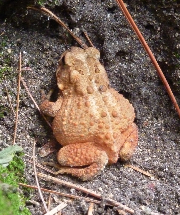
A large group of women occupied a campsite at one end of the island so we stayed more towards the middle. There were a few nice clearings and picnic tables on the island. 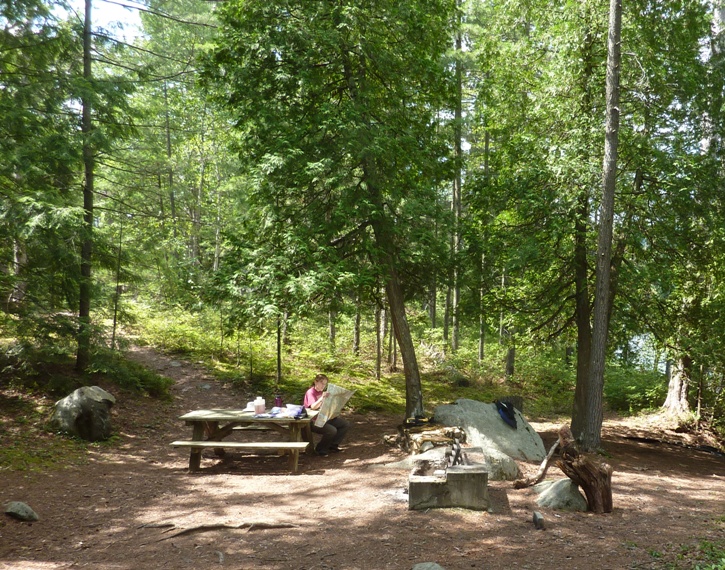
I found a rocky section that gave us a nice view of the area. 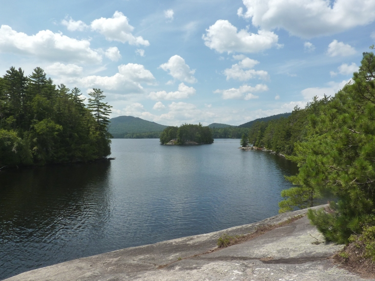
From here, we were able to see other islands and folks kayaking 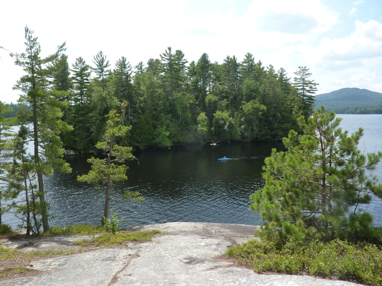
Surprisingly, we didn't have any problem with biting insects. In fact, during our whole time there, I had only minor problems with mosquitos. The air temperature was quite comfortable too. Great conditions for kayaking. 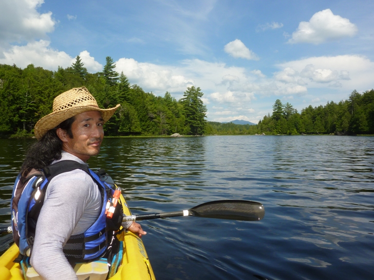
We tried to paddle around what looked like a large island (according to the GPS) and access First Pond on the Saranac River via the south side. But that didn't work since the stream that we attempted to paddle up was far too narrow and overgrown. So we paddled back towards Bluff Island to continue our trip along the route described in the book. So much for me deviating from Phil Brown's path. Along the way, we had a different view of Bluff Island. We saw a 70-foot rock cliff with lots of people at the top and someone climbing up it. I read that sometimes people will jump off the cliff into the water but we didn't see anyone doing that. 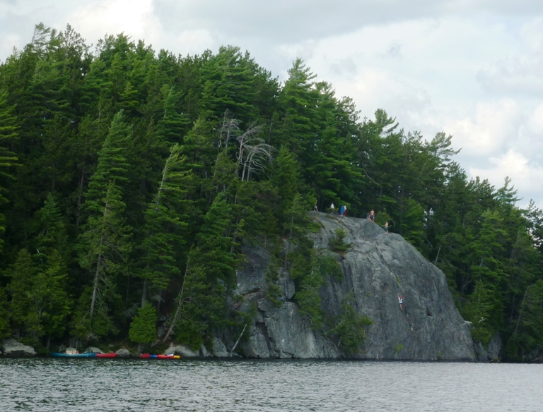
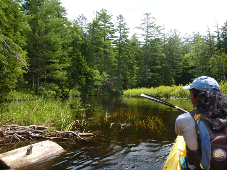
On First Pond, we saw a fit, older woman in a lightweight canoe. Some of the kevlar ones weight only about 15 pounds. She was moving along at a pretty good pace...a little faster than your average sea kayaker. From First Pond, we continued onto Second Pond. Who comes up with these unoriginal names? All these sections along the narrow part of the Saranac River were quite nice. They were also very busy with other canoeists and kayakers. I think the canoes outnumbered the kayaks. For flatwater camping in the Adirondack lake region, a canoe is probably a better choice. We got up about half a mile on the very scenic Cold Brook. Here's Norma at the turnaround point. 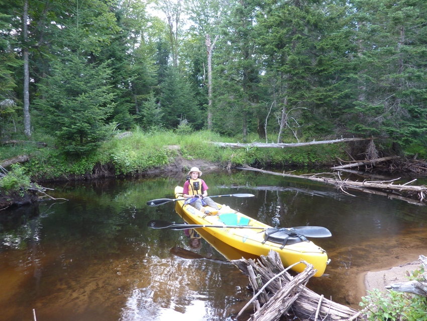
Paddling downstream, we made our way near the mouth of Cold Brook. 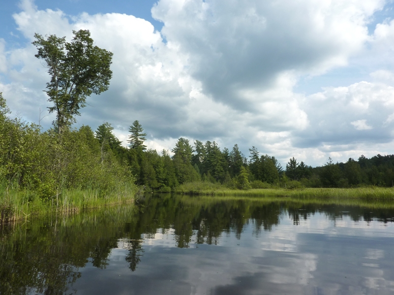
I found the skin molting of a dragonfly nymph. 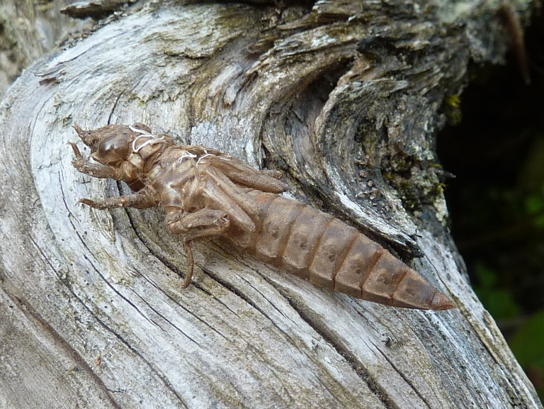
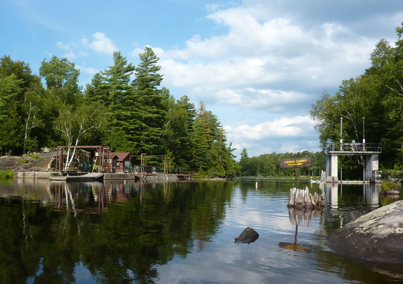
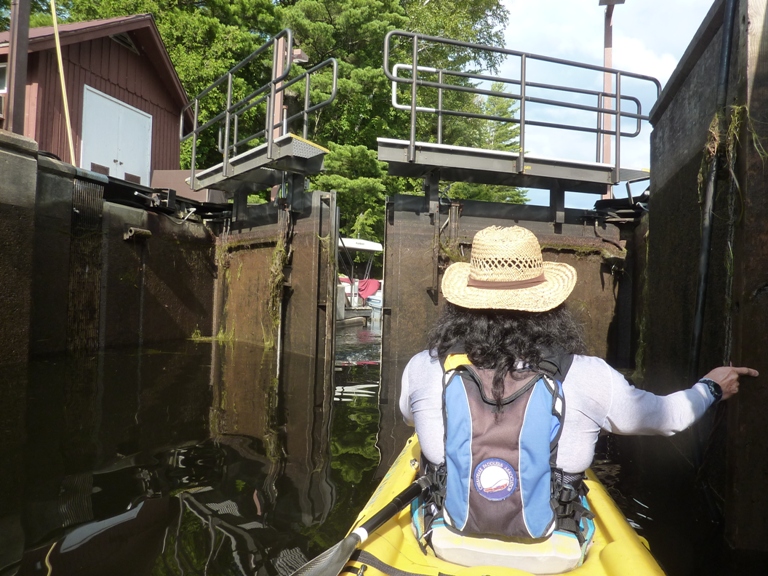
Eventually, we came to the Lower Locks. There was a trail off to the south side where we were about to portage. But then the lock master yelled in our direction, saying that he could take us through the lock. We weren't expecting this and were pretty happy to receive his offer. He took us and a small power boat through at the same time. It was quite the experience. I'm guessing the lock lowered us about five feet. Kayaking east, we got to Oseetah Lake and paddled by more islands. There were lots of water lilies. 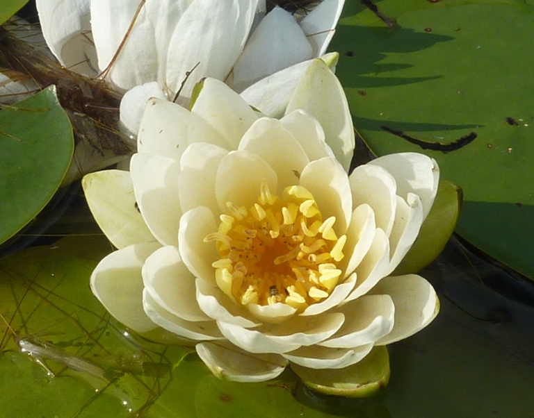
We also saw several unusual football-shaped leaves on the water. What made these leaves peculiar were the random stripes on some of them. 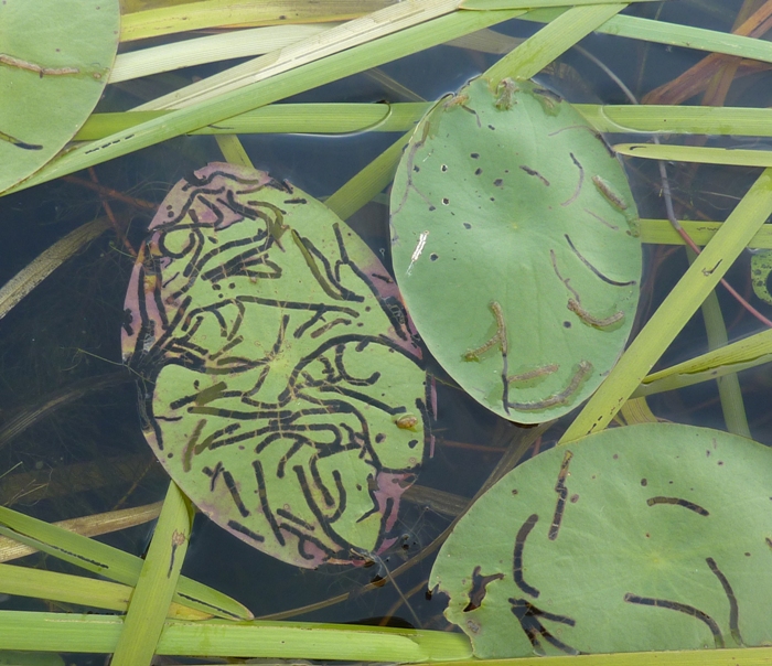
At first, we thought they were just patterns on the leaves until we picked one up and realized that they were actually holes made by something that was eating them. We never found out what was doing the damage. 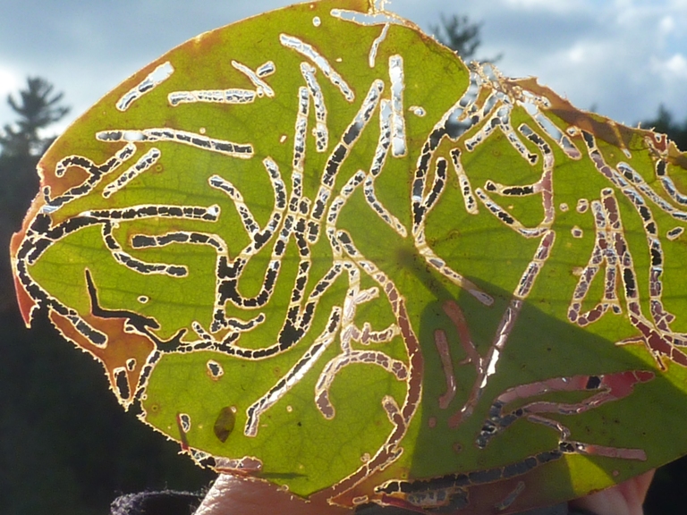
On the west side of the lake were some nice homes. Some had immaculate landscaping. 
To our north, we had some pretty nice views of the mountains and to our west was Dewey Mountain. It is this mountain that gives the name of this trip..."Round the Mountain Loop." After about eight hours, we completed our 17.6 mile trip, ending at the Saranac Lake. We locked the boat up to a sign then walked 1.6 miles back to the car. |
|
Norma and I ate dinner at the Blue Moon Cafe in Saranac Lake. We spoke to a very loud owner and sat near an almost-as-loud off-duty waitress. They were both friendly, but REALLY loud. They reminded me of a noisy co-worker of mine, also from New York. I had the Saranac bacon cheeseburger which was good.
It was getting harder to sleep at the campsite. A nearby business had a loud generator that ran on and off during the night. Norma informed the staff at the campsite but they didn't seem to care. Fortunately, I always carry earplugs when I camp. |
|
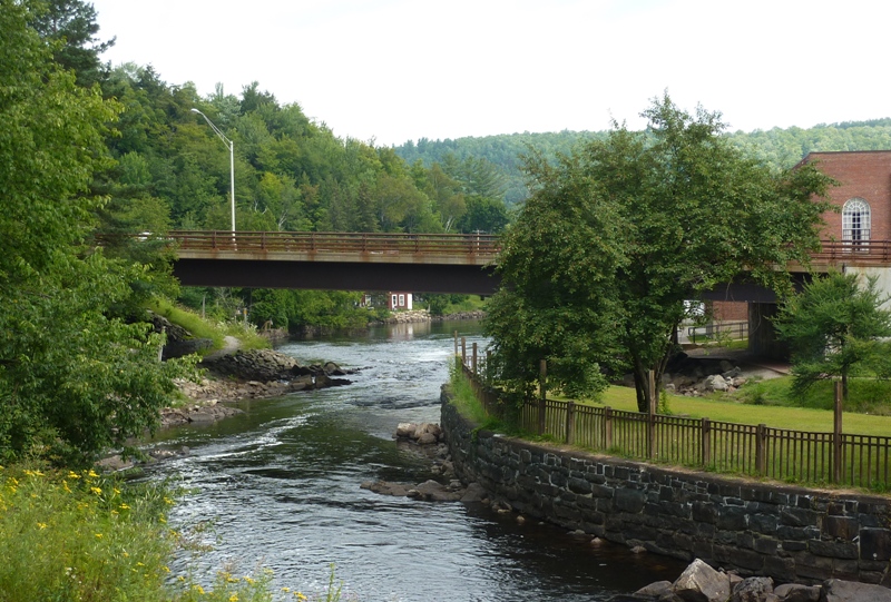
Norma and I walked on the Riverwalk Trail in the Village of Saranac Lake. This 1.5 mile trail starts near Lake Flower and then winds through the historic district as it makes its way downstream along the Saranac River.
I bought 3.75 inch trilobite fossil at Twin Crystal Rock Shop. The owner claims it was found in Morocco. An extinct marine arthropod common in Europe and North America. Most likely a bottom feeding scavenger and predator. This fossil is approximately 425 to 500 million years old. - from "Paleozoic Trilobite" information card received at store We stopped by Saint Regis Canoe Outfitters at Saranac River and spoke to the people there for quite awhile. That is definitely the place to go if you're a kayaker or canoeist looking for gear or a route. They were friendly and knowledgable. It rained off and on throughout the day. Norma and I ate a French lunch at Left Bank Cafe. Out on the balcony, we had a nice view of the river while we ate. |
|
Next, we went to John Brown's gravesite at his farm in North Elba.
The John Brown Farm and Gravesite was the home and is the final resting place of abolitionist John Brown. It is located on John Brown Road in North Elba near Lake Placid, New York, where John Brown moved in 1849 to lead freed slaves in farming. In 1855, he moved to Kansas to support his sons' efforts to keep Kansas as a free-state under the popular sovereignty laws, leaving his wife and several of his children behind. Brown returned to visit his family at Lake Placid several times. In 1859, Brown attempted to start a liberation movement among enslaved African Americans by seizing the arsenal at Harpers Ferry, West Virginia. For this, he was tried for treason against the state of Virginia and was hanged. - from Wikipedia - John Brown Farm State Historic Site 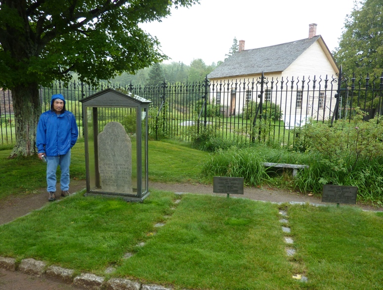
|
|
The rain let up a bit as we made our way to Lake Placid. Unlike Saranac Lake, Lake Placid was crowded, touristy, more expensive, and pristine. I sensed that many of the tourists were pretty well off too. We felt more comfortable in Saranac Lake.
I bought candy for my co-workers at Adirondack Chocolates. We ate an overpriced dinner at Pan Dolce. Leaving Lake Placid, Norma and I headed back to the campsite. It rained more during the night. |
|
Norma and I packed up a wet tent. If there is one thing I hate about car camping or backpacking, it is packing up wet gear. Maybe my next car will be big enough to tow a small pop-up camper or recreational vehicle. We talked about other ways that we could streamline our car camping, and eating out less was one suggestion. Last night's dinner for the two of us cost about as much as three night's worth of camping. A little more planning on our part (in terms of food) could save us a good bit of money.
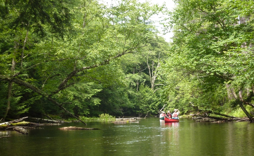
We ate breakfast at Blue Moon Cafe in Saranac Lake, the same place we ate dinner on Wednesday. Originally, we planned to paddle the "Axton to Raquette Falls" trip described in the "Adirondack Paddling" book, but with all the rain over the previous 24 hours, we figured it would be too difficult to paddle upstream. So instead we did the "Fish Creek Loop" route. This starts at a launch site near Saint Regis Canoe Outfitters at Floodwood Pond (not Saranac Lake). This canoe route requires portaging over a pretty good distance and I wasn't smart enough to bring my kayak cart. But the folks at Saint Regis were happy to rent us one for a very small fee. There were numerous people launching at the same spot as us. I always have mixed feelings about seeing a lot of other paddlers. I enjoy being the only one on the water but if it is a nice place, then I think it's a shame when there aren't others out there enjoying it too. There was plenty to explore and once we got on the water, we spread out quite a bit. We headed east on Floodwood Pond. Then we paddled downstream on the narrow and scenic Fish Creek. The big ponds aren't so interesting but the narrow tributaries or connector sections such as Fish Creek are stunning. This took us to Little Square Pond and then to Copperas Pond. At the west end of Copperas Pond, there was a foot trail. We portaged 0.65 mile to Whey Pond and ate lunch before resuming our time on the water. By now the wind had picked up, but fortunately the weather was still dry. We paddled across Whey Pond where we saw a loon...a common sight on Adirondack waters but exotic by Maryland standards. 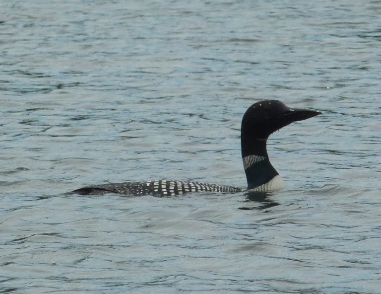
Another portage took us to Rollins Pond in Rollins Pond State Campground. We saw a woman in a canoe looking for paddles and other gear that someone in her group lost when they tipped their boat. There were a few turtles but not many. Unfortunately, we saw no snakes. We also saw a few herons but no osprey. 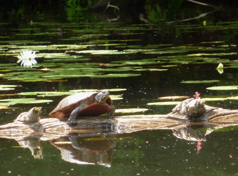
We paddled north on Rollins Pond for a good distance, exploring some of the serene sheltered sections along the way. 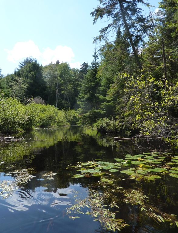
A very small and narrow creek took us back to Floodwood Pond. 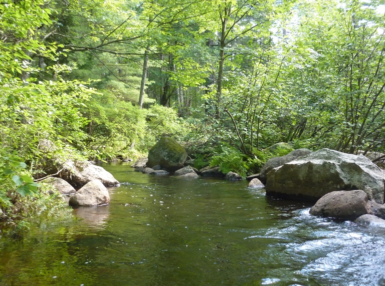
We were done after four hours, having paddled 8.5 miles. |
|
We stopped at the Axton launch site which is where we would have started had we done the "Axton to Raquette Falls" trip. A father was waiting for his son and a group of Boy Scouts that had been canoeing overnight. They did some long distance canoeing and arrived only ten minutes late. From what I could gather by talking to the man, paddling to Raquette Falls is a very scenic trip that would have been doable even after last night's rain. Hopefully, Norma and I will return during some other summer and give it a go.
We checked in at the Blue Jay Campsite at Tupper Lake. The place had very clean bathrooms and the doors are make of strips of heavy plastic so there was no loud bang when the door closed. That night, we ate dinner at the White Birch Cafe. This was my most memorable meal all week. They had excellent fish and chips...as good as Skippers (a chain restaurant in Sacramento that went out of business several years ago). |
|
Norma and I packed up the tent and then drove to the Adirondack Interpretive Center. Here we saw lots of displays about all the wildlife we never saw over the last few days. I learned that my wingspan is slightly larger than an osprey's while Norma's wingspan is slightly smaller.
We stopped at the Old MacIntyre Furnace, a huge stone structure along a small section of the Hudson River that was once used for extracting iron. It was in operation from 1854 until a flood in 1857. At one time, six tons of iron was cast daily. 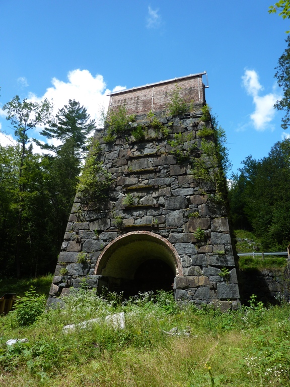
|
|
For our last full day, we decided to do another hike. Two days of hiking and two days of paddling seemed like a pretty well-balanced vacation.
We started at the Indian Pass Trail in the High Peaks Wilderness Area of Tahawus Preserve. A woman was there to greet us at the parking lot. She made sure that people signed in and if they were camping out in the woods, they had to have the right type of bear-proof food container. Apparently, the New York bears are smarter than the ones in Maryland and West Virginia since they know how to get to food tied in a tree. So instead, sturdy hard plastic containers are used for food storage. But some of the older containers aren't strong enough so now backpackers must use a new and improved container. For more information, see New York Department of Environmental Conservation: Bear Resistant Canister Regulation. We saw nobody on the trail and I think there is a reason for that. It was EXTREMELY muddy. We hopped from rock to log and back to rock to stay out of the mud. Even then, I couldn't avoid stepping in and sinking down a foot or so from time to time. "Trails.com - Indian Pass-Lake Colden Loop" (broken link as of 2018) describes it as a grueling boulder-and-mud obstacle course. But it wasn't all bad. Some parts were really nice and being the only ones out there was pretty cool. 1 / 6
Indian Pass Brook bridge.
2 / 6
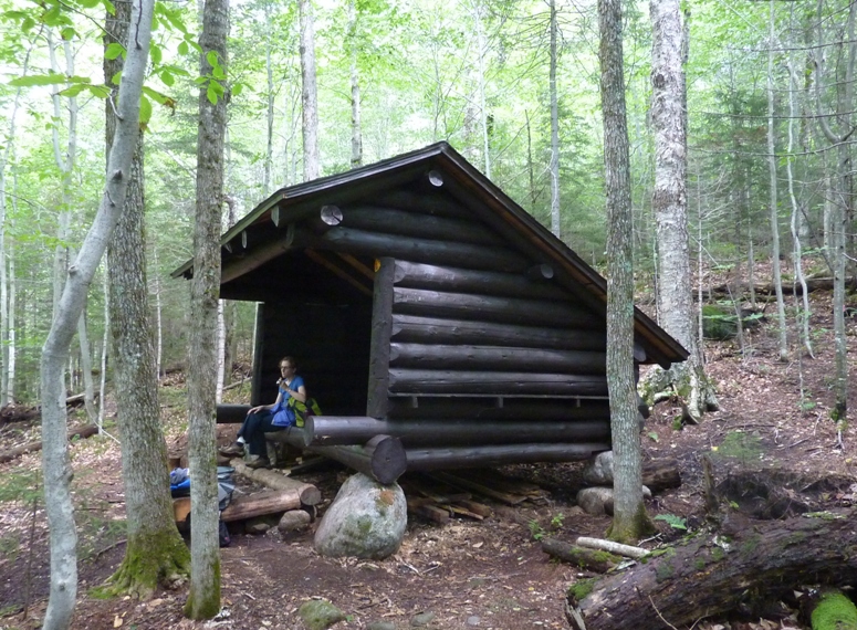
Norma at lean-to.
3 / 6
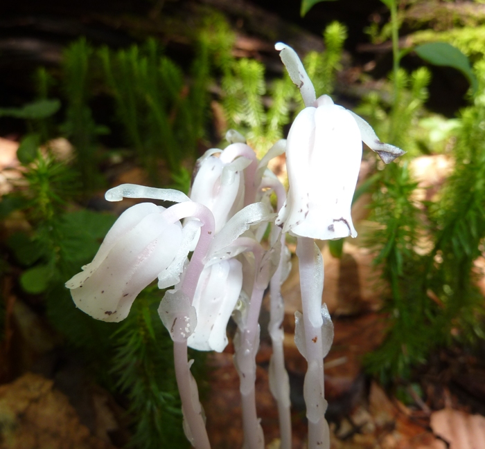
Indian pipe.
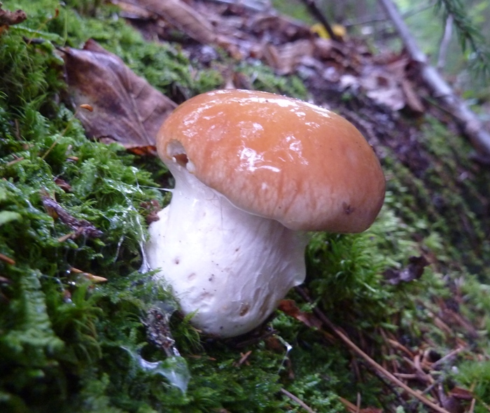
4 / 6
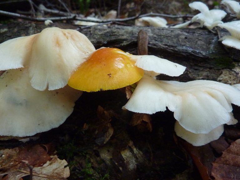
Yellow and white mushrooms.
5 / 6
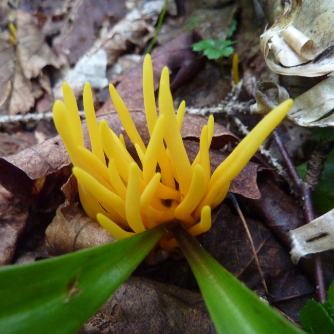
Spindle-shaped yellow coral mushroom.
6 / 6
Dr. Seuss mushroom
After a few miles, we approached our destination, Wallface Cliff. Our goal wasn't to climb it, but rather just see it. The scenery improved dramatically in the last mile before the turn-around. 
Instead of flatland mud, we were walking by huge boulders and climbing up ladders. 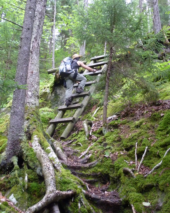
We finally arrived at a clearing where we had an excellent view of Wallface Cliff. At 1,200 feet, it is the highest precipice east of the Rockies. It forms the west wall of Indian Pass. It looked like a rock climber's dream yet we saw nobody. We did, however, hear some people yelling to each other. I couldn't tell what they were saying but it wasn't a cry for help. 1 / 4
Norma with mountains behind.
2 / 4
Wallface Cliff.
3 / 4
Possibly Henderson Lake.
4 / 4
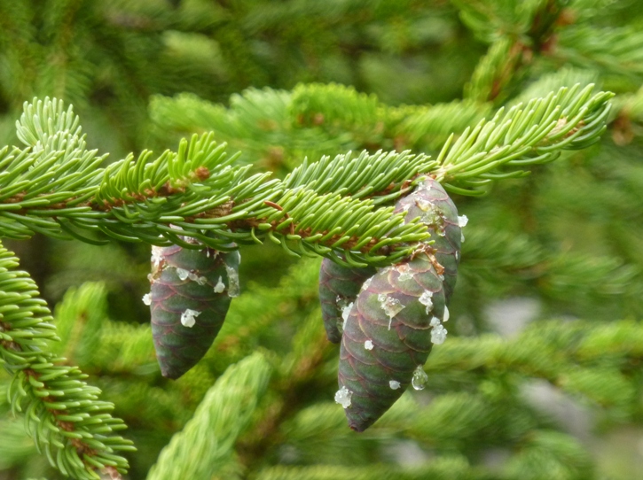
Pine cones.
After eating a late lunch, we started back. We saw more interesting stuff including a big patch of wet moss. 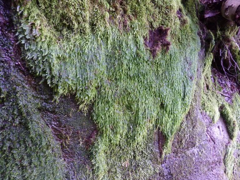
Unlike our first hike, Norma was feeling more energetic than me. I think trying to avoid all the mud was wearing me out mentally. Our total hike distance was 8.9 miles with 1,441 feet of total ascent. |
|
For our final night, we stayed at the very cheap Harbor Motel in Lake George. Our room was in very poor condition but it was better than unpacking and setting up a wet tent in the dark.
We didn't much care for the town. It hardly seemed like a place to go to get away from it all. It was more of a party town. Just a short walk from the motel was the Gaslight Bar and Grill. I had the meat platter which was almost as delicious as the fish I ate the night before. The ribs were to die for. The service was great too. |
|
Norma and I started our long drive home.
We stopped at Gander Mountain in Chambersburg, Pennsylvania where I bought a Carhartt Men's Sacramento Workflex Cap. I found it interesting that the cap had the name of my home town though I would have bought it even if it did not. It was one of the few hats I've found that fits my big head without having to make any adjustments. In Hagerstown, we stopped at Joyce's place (Norma's sister) to pick up Norma's niece for a visit. Upon arriving at home, I started getting things cleaned up. I hate having a wet tent and a smelly car so that was high on my list of priorities of things to take care of that night. |
|
I am really glad we got to spend time in the Adirondacks. It is a beautiful place with lots of stuff for outdoorsy people to do. I am certain we will return for more hiking and kayaking. We might also head out there for some cross country skiing and snowshoeing.
|