California 2023

My dad passed away on April 27, 2023 at the age of 94. Alzheimer's disease and kidney dysfunction made the last couple years of his life difficult. Mom served as his caretaker up until the last few weeks of his life. She worked hard, tending to his every need. It was now time for her to get out and enjoy life as she once had. Norma and I helped make that happen during our visit.

Above is a view of the Standard Mill which we saw on our visit to Bodie.


 Wednesday, August 30, 2023

ArrivalOpen accordion icon
After our flight landed, I was supposed to get a subcompact car from Budget, but instead, they gave me a Jeep Compass for no extra charge. I spoke to the person about where I was going and I think he figured a car that could do some mountain off-roading would be a better fit.

Norma and I unpacked and had a bite to eat. Then Mom and I worked on the shed in the back yard. She cleaned the exterior and I reinforced some parts that were falling apart and then patched holes. One of my goals for our trip was to repaint the shed. It had never been repainted and was possibly 30 years old. The bottom two feet were rotting but had recently been replaced. So that part was unpainted. The bottom part of the door was rotting a bit but it wasn't too bad. I think things last a long time in the dry Sacramento climate. Maybe that is why dogs are not allowed in so many places in California. Their poop might not break down as fast as it does in Maryland.
Close accordion icon

ArnieOpen accordion icon
I visited Arnie that night. I saw Richard N. and we spoke about Filipino stick fighting and other martial arts. It was good catching up with the old Kenpo Karate gang.
Close accordion icon


 Thursday, August 31, 2023

Jedediah Smith Memorial TrailOpen accordion icon
Norma, Mom, and I went for a walk on the Jedediah Smith Memorial Trail near Watt Avenue. I spent a lot of time here biking these paved trails when I was young. We saw some quails and what I think was a blue-belly lizard.

We took a look at the American River. It was running high for this time of year thanks to all the snow that fell during the winter. Sacramento typically has a drought but not this year.

Along the access which connects the trail to the main road, we saw various fruit trees that had been planted fairly recently.
Close accordion icon

ShedOpen accordion icon
Norma and I primed the bare parts of the exterior of the shed.
Norma using a roller on the shed

Mom is really good about saving stuff and keeping things organized so we were able to use some old primer. We also made use of a lot of painting supplies which Mom kept around. Some of it might have been as old as me.
Close accordion icon


 Friday, September 1, 2023

Mono Lake Visitor CenterOpen accordion icon
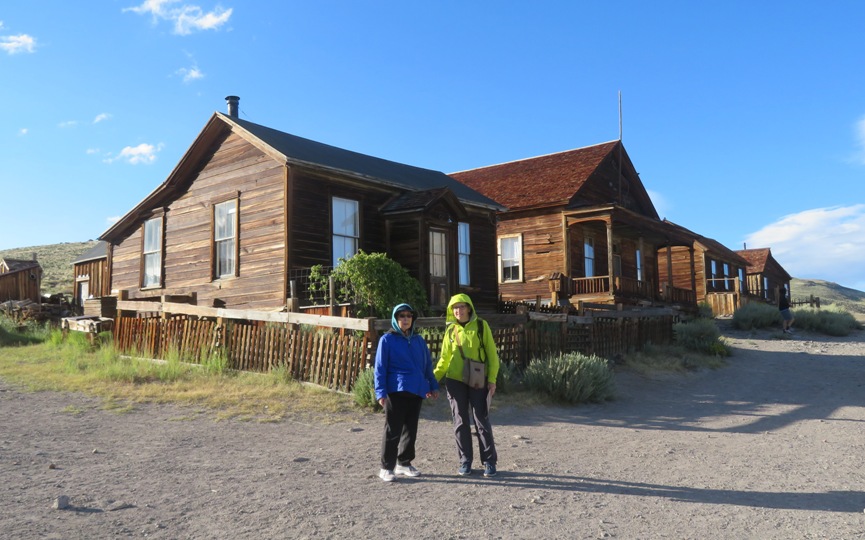
It was about a four hour drive to our destination, the Mono Lake Visitor Center. In the parking lot, I saw a car with a cool SUP sticker.
Baby on SUP sticker

We arrived shortly before they closed and with just enough time to learn about the area.

Mono Lake is fed by five streams flowing down from the Sierra Nevada.
These pure streams drew the attention of the city of Los Angeles in the 1920s. The city's Department of Water and Power (LADWP) was looking for additional sources for its water supply. Through a lengthy court battle, they condemned the water rights of Mono Basin farmers. Eventually, they bought most of the watered land surrounding Mono Lake.
In 1941, the aqueduct into the Mono Basin was completed, diverting part of the water from Rush, Lee Vining, Parker, and Walker creeks. With the flow of incoming fresh water reduced, Mono Lake began to shrink since water lost to evaporation now exceeded inflow.
In 1970, the city doubled the capacity of their aqueduct system and began taking the entire flow of the Mono Basin creeks. The lake level dropped dramatically, falling as much as forty-five vertical feet. The decline caused Mono's water to double in salinity, threatening its simple, fragile ecosystem. The diverted creeks became dry washes.

- from sign at visitor center titled "When the Creeks Stopped"

Among the concerned biologists was David Gaines. In 1978, he and friends formed the Mono Lake Committee. The Committee's goal was to find alternatives to excessive diversions in order to stabilize the lake level. When LADWP refused to negotiate a solution, the Mono Lake Committee, National Audubon Society, California Trout, and others went to court.
In an effort to win protection for Mono Lake, the Mono Lake Committee lobbied successfully for the creation of the Mono Lake Tufa State Reserve in 1981, and the Mono Basin National Forest Scenic Area in 1984.
The pivotal case is based on a doctrine called the "public trust." It requires the state to protect bodies of water for the use and benefit of the people. In 1983, the California Supreme Court ruled that the public trust doctrine required the protection of places like Mono Lake, even if this meant reconsidering past water allocations. The court said a "better balance" should be struck between the water needs of Mono Lake and Los Angeles.
On September 28, 1994, the State Water Resources Control Board released its decision regarding Mono Lake. The order will raise the lake by 17 feet to an elevation of 6392 over the next 20-30 years.

- from sign at visitor center titled "Take It to the Judge"

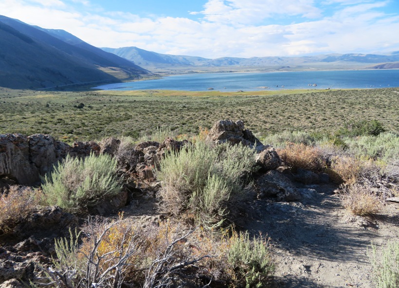
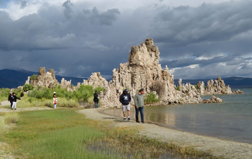
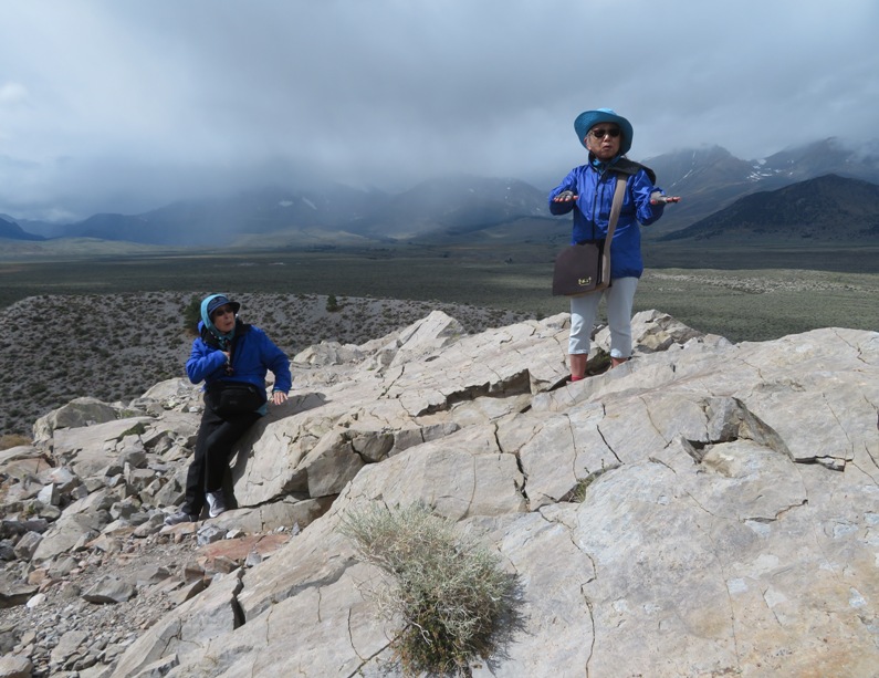
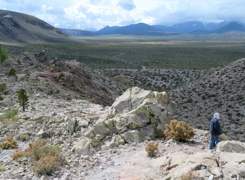
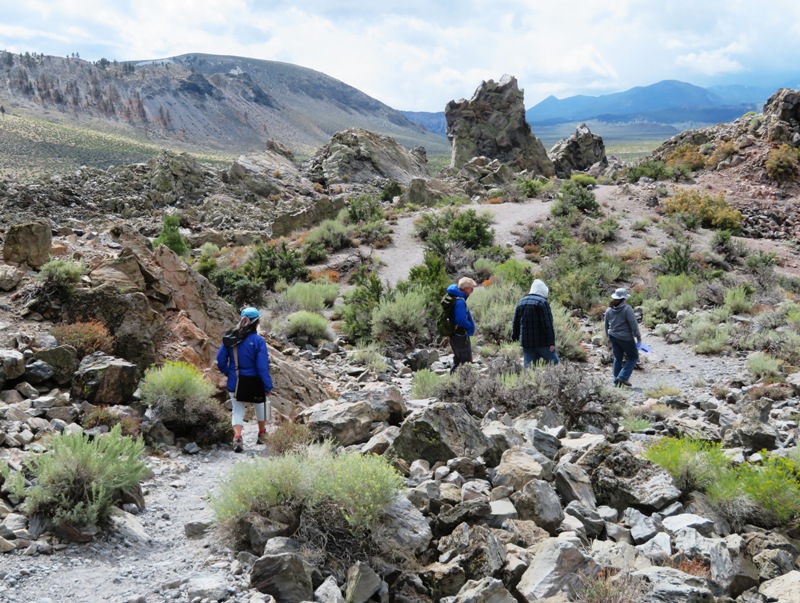
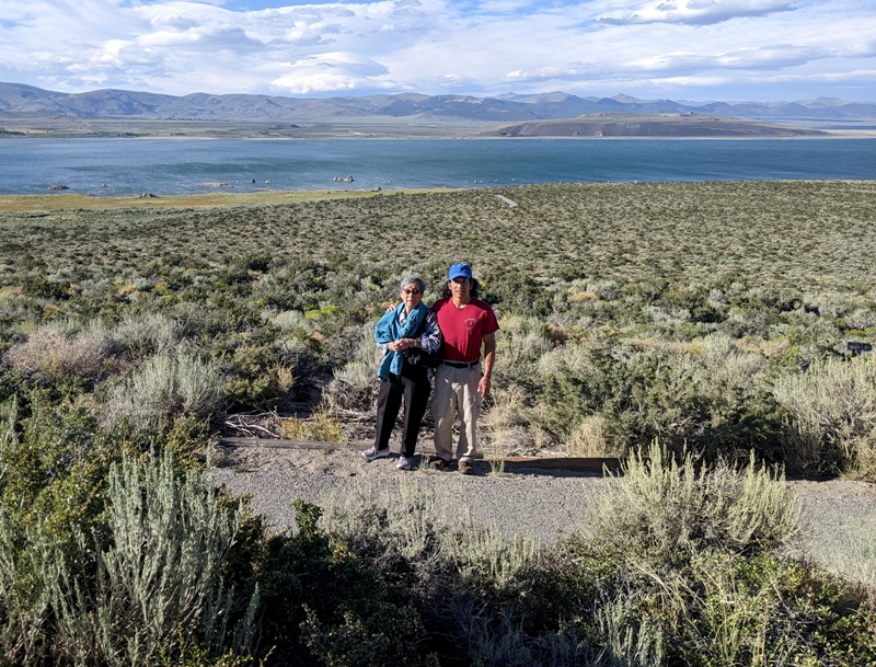
The three of us walked on the gravelly Mono Lake Trail and the David Gaines Boardwalk from the visitor center to the lake. It was a downhill path that gave us a nice view of the lake to our front.
Mono Lake in the distance

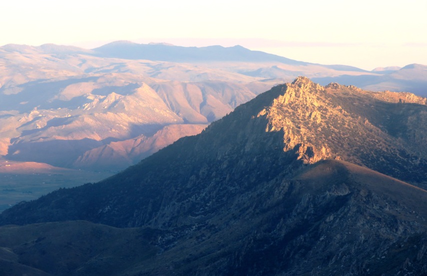
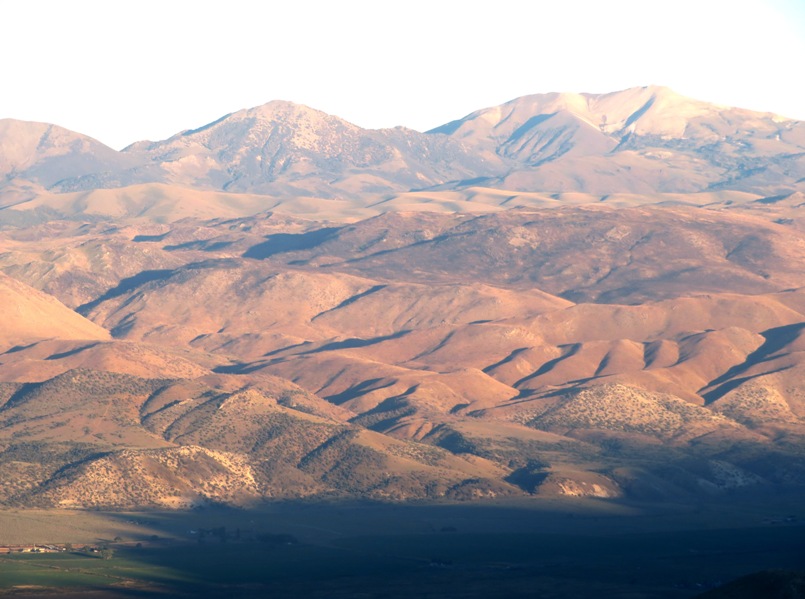
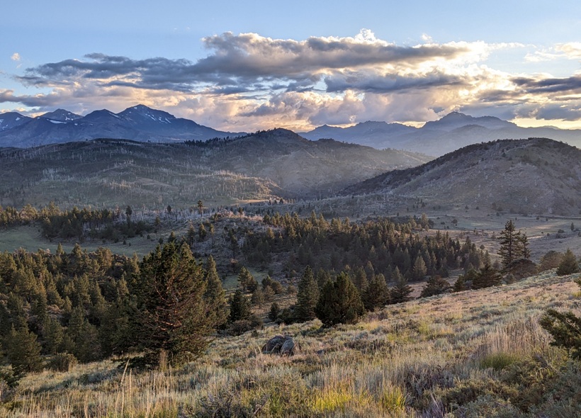
With much higher ground all around, it is no surprise there is a lake here.
Five streams, fed by the Sierra snowpack, provide most of the freshwater flowing into Mono Lake.
Water also enters the lake from underground sources as seeps and springs.
Rain and snow falling directly into the lake average about seven inches of water each year.

- from sign at visitor center titled "How Water Enters Mono Lake"

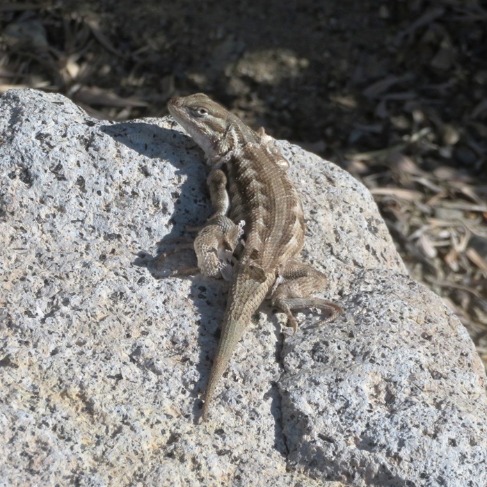
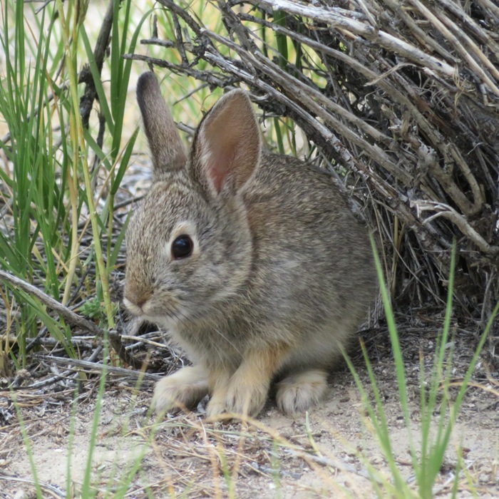
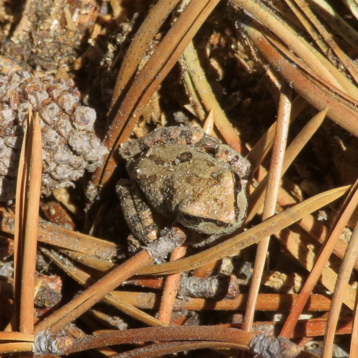
Always on the look-out for wildlife, I saw some type of Fence Lizard, perhaps a Great Basin Fence Lizard.
The Great Basin Fence Lizard can often be seen basking in the sun on rocks, fences, and buildings. While sunning themselves, fence lizards may change their color dramatically ranging from a light gray to a dark black. This is a way for them to control their body temperatures in the heat.
- from sign at visitor center titled "Reptiles and Rodents of the Mono Basin"
Some type of Fence Lizard

As the three of us walked towards the lake, I thought about previous groups of people who called this their home.
The Mono Basin has been occupied off and on for the last 9,000-10,000 years. Evidence indicates that volcanic activity has influenced population movements in and out of the region. The Kuzedika, a part of the Paite nation, are known to have been living in the Mono Basin since about 1300 A.D.
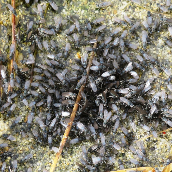
Kuzedika women collected kutsavi, or alkali fly pupae, in winnowing baskets and laid the pupae in the sun to partially dry. Kutsavi were an important food source and trade item for the Kuzedika.
Kutsavi are about the size and color of a brown rice grain and taste like bacon bits.

- from signs at visitor center

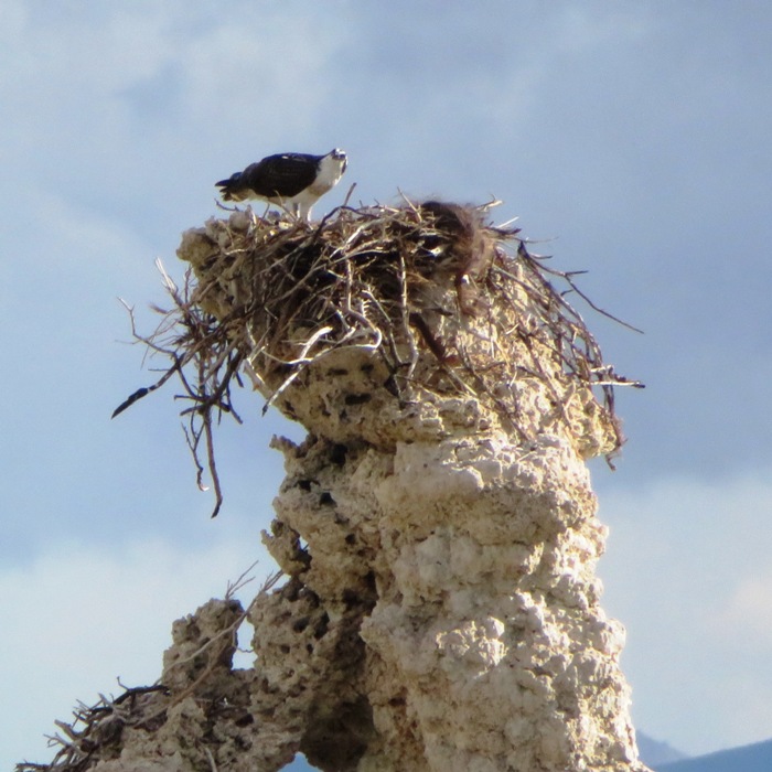
An important source of food for shorebirds, the alkali fly is a fascinating creature.
- from sign at visitor center

The sun was getting low, casting shadows on the hills and making the vegetation glow.
Norma and Mom on trail

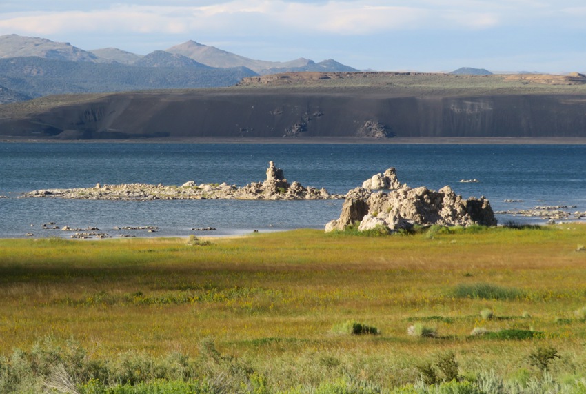
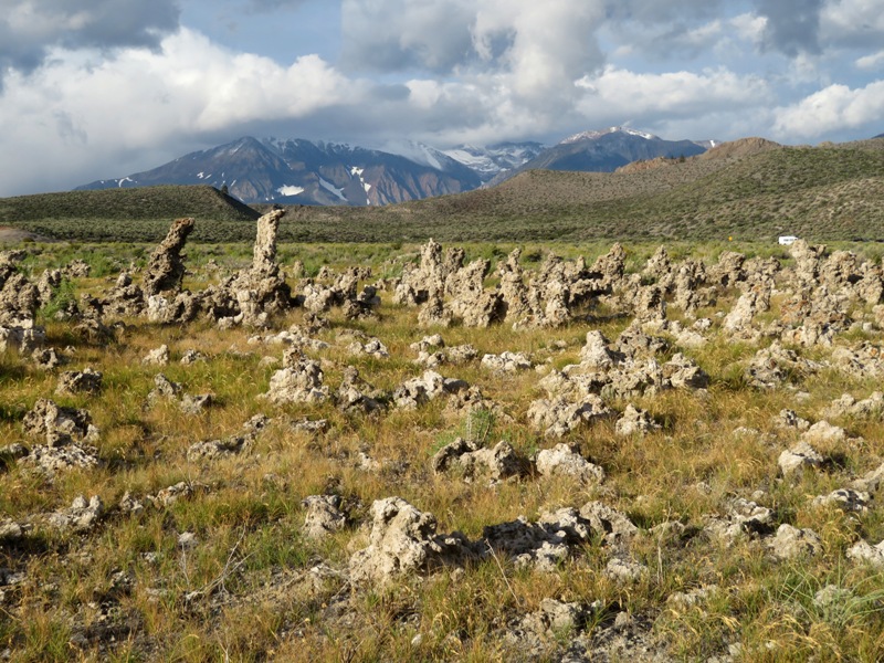
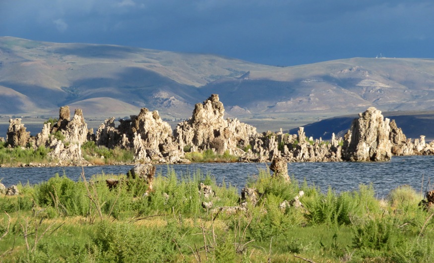
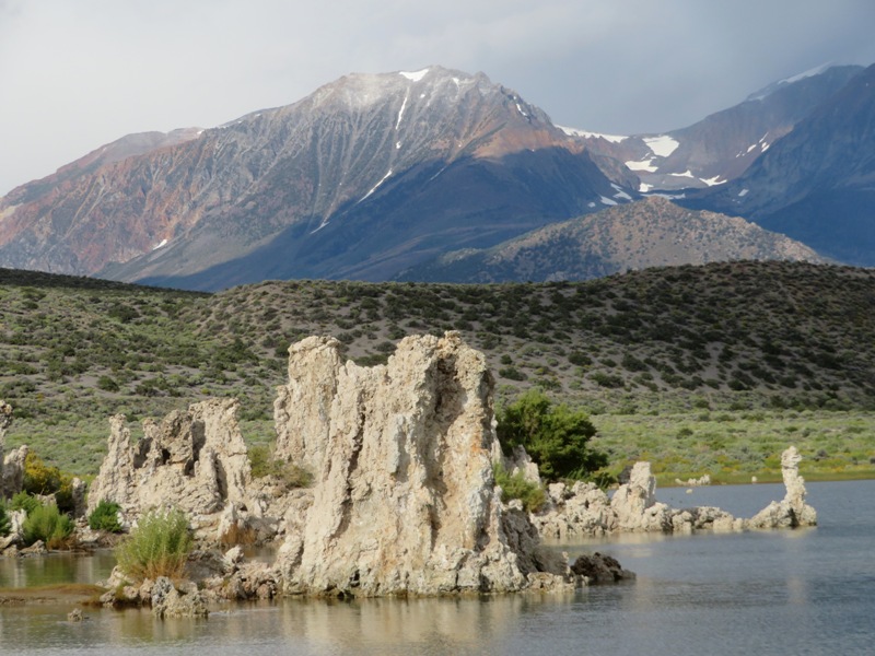
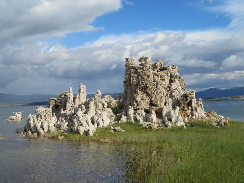
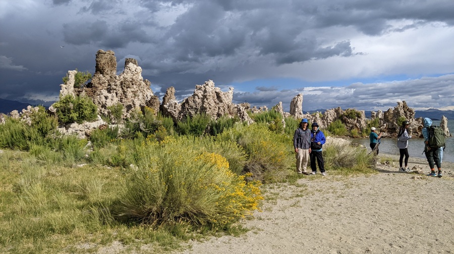
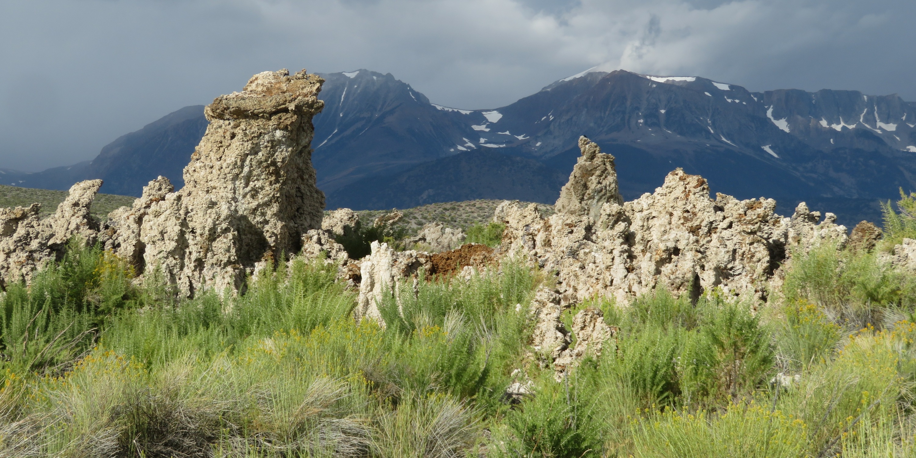
Looking out on the lake, I could see white rocky formations also reflecting the bright sun.
Tufas on Mono Lake

These structures are known as tufas and they are what make Mono Lake famous.
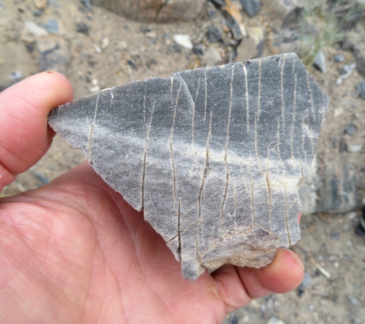
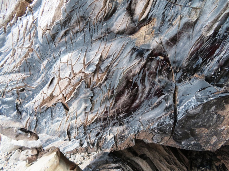
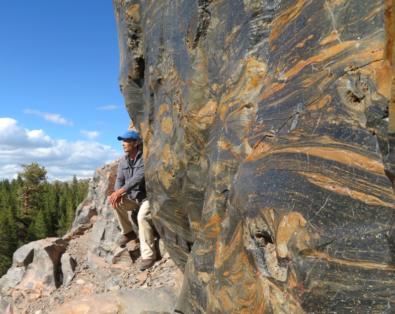
Mono Lake's "petrified springs" are spectacular examples of what nature can do with a few basic ingredients. Ask geologists what "tufa" is and they will tell you "it's calcium carbonate formed by the mixing of waters of different compositions."
Tufa gets is name from the Latin "tofus" which means porous stone.
Freshwater springs (calcium) + alkaline water (carbonates) = tufa (calcium carbonate)
Calcium-bearing freshwater springs well up through the carbonate-rich lake water causing a chemical reaction that forms solid limestone, or tufa. Over many years, a tower forms around a spring. Tufa continues to form today where freshwater and lake water meet.

- from signs at visitor center

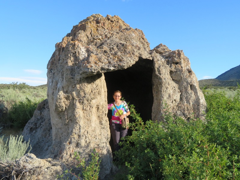
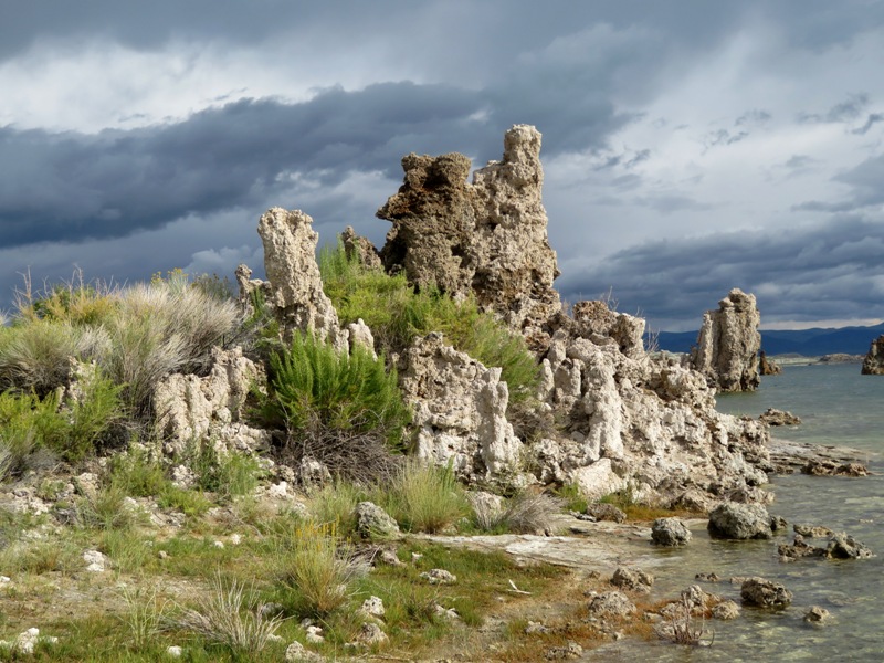
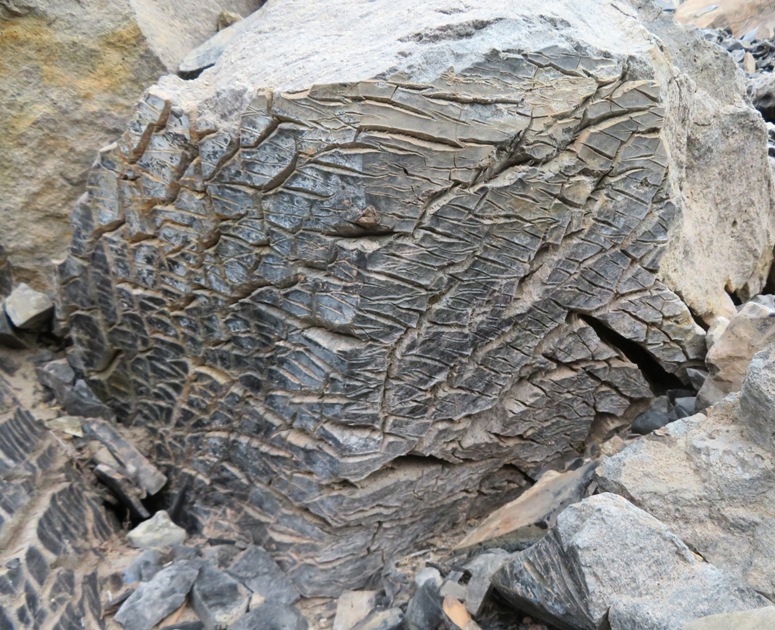
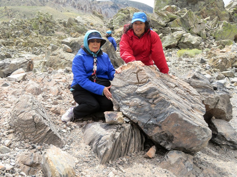
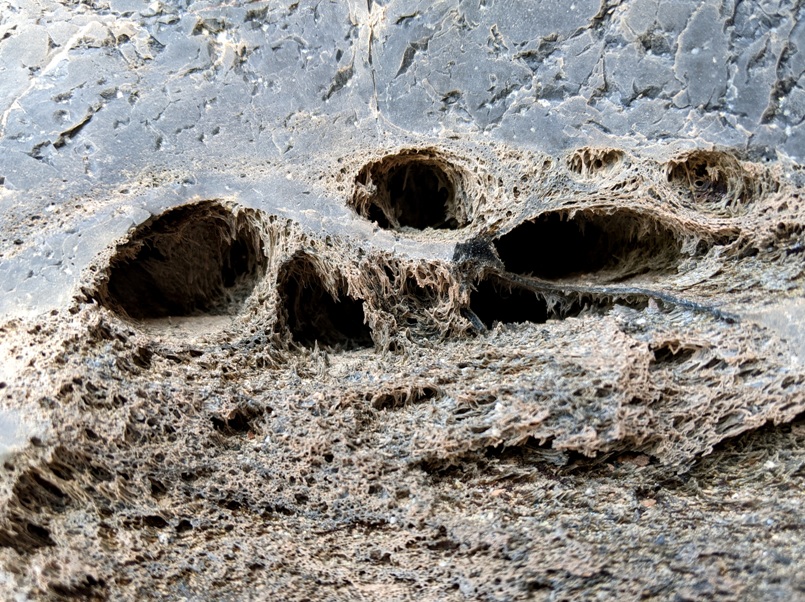
The first major tufa we saw up close was Icebox Tufa.
This tufa formed thousands of years ago under a much larger lake as the ice ages were waning. Shepherds of the Mono Basin took advantage of the natural cave-like formation using the tufa for shelter and rest.
- from sign on trail titled "Ranching the Mono Basin"
Norma at Icebox Tufa

Alkalinity isn't the only thing that makes the water in Mono Lake special.
An estimated 280 million tons of solids are dissolved within the lake, and it is 2-3 times saltier than the ocean depending on its water level fluctuation over the years.
- from Mono Lake Committee - Water Chemistry

The water in Mono Lake is inhospitable to most wildlife. But that doesn't mean it is devoid of life.
When Mark Twain dubbed Mono Lake the "Dead Sea of California," he could not have been farther from the truth.
Actually Mono Lake is one of the most productive lakes in the world. It doesn't have a great variety of species, but those that live here do so in phenomenal numbers.
During the summer months, one cubic foot of near-shore, rocky bottomed lake water contains:
  • Brine shrimp 50-400
  • Alkali flies (larva, pupae and adults) 5,000-10,000
  • Microscopic plants and animals - These are too numerous and variable to count
  • - from sign at visitor center

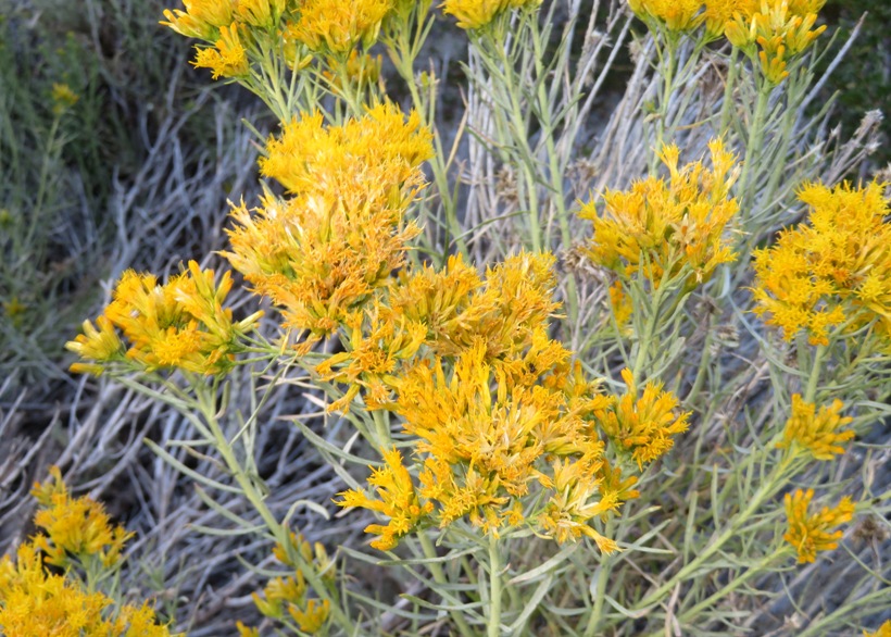
    There is also a lot of life surrounding the lake.
    The most abundant shrub at South Tufa, rabbitbrush, quickly moved in as the lake moved out. In the fall, its profuse yellow blossoms color the Basin.
    - from sign at South Tufa trailhead
    Rabbitbrush flowers

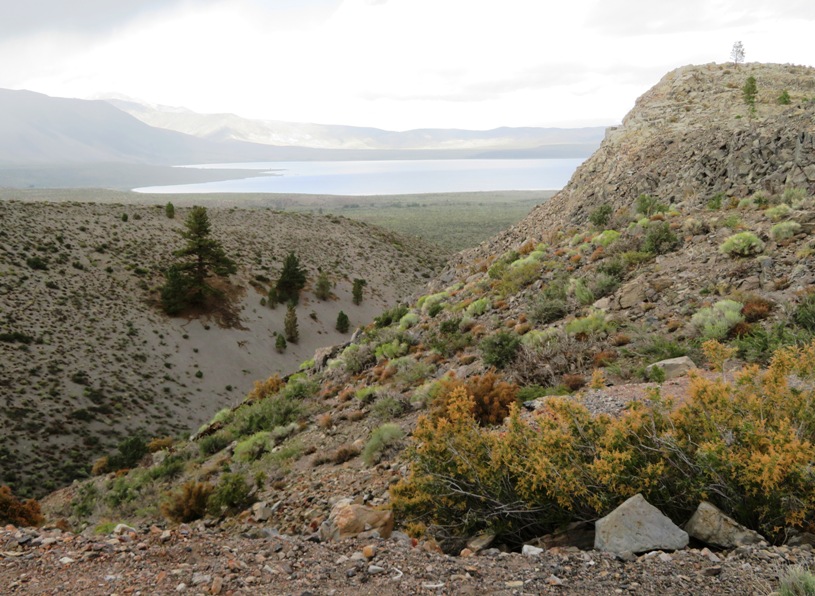
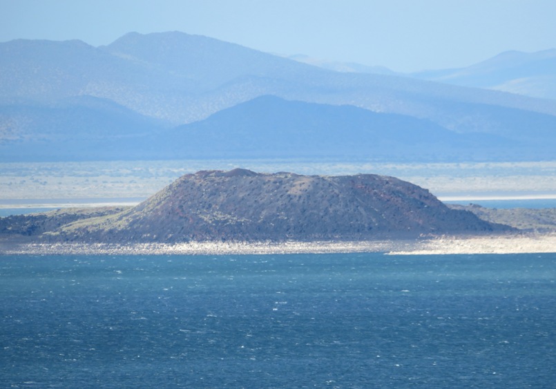
    Looking across the lake, we could see two islands.
    Paoha, the larger of the two islands, does not look volcanic because its surface is composed of lake bottom sediments. About 300 years ago, a magma rose underneath the lake and pushed these sediments above the water level. Negit, the black island, was formed by volcanic eruptions that occurred between 300 and 1,700 years ago. Negit once hosted most of the state's nesting California gulls. When the land bridge emerged in 1977, most gulls moved to nearby islets to escape predators that could reach their nests.
    - from sign outside of visitor center titled "Volcanic Islands"

    1 / 2
    Mom and me with Paoha island behind us on the right
    Paoha behind on right.
    2 / 2
    Negit Island
    Negit Island.

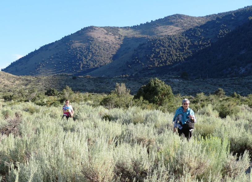
    Mom and Norma walked to the Old Marina at the west end of the boardwalk. I walked back to the car and then drove to pick them up, giving them an easy quarter-mile stroll instead of a mile of slightly uphill terrain.
    Close accordion icon

    June LakeOpen accordion icon
    We checked into the June Lake Motel and then went out for pizza at June Pie. Norma and Mom seemed to like their choice but my New Yorker was not so great.

    Back at the motel, I read about the Mono Lake area in the Summer 2023 issue of the "Mono Lake Newsletter." In the 2023 winter,
    The Mono Basin amassed a record-breaking snowpack. By late February, 67 inches of snow covered the ground in Lee Vining - a new record for total snow depth. A season 229.1 inches of snow was measured in town, which smashed the 1952 record of 170.5 inches.
    Last winter was also the coldest in decades, adding a further twist to the extreme precipitation.


    The local weather prompted me to read about something called poconip fog.
    It's a form of freezing fog - fog that forms at below-freezing temperatures. When freezing fog comes into contact with a surface (like a tree, fence, road, or power line), it deposits ice crystals in the form of frost, or rime. In the Mono Basin, where freezing fog can last for days, or sometimes even weeks, frost can accumulate into layers several inches thick.
    - from Michael Frye - Poconip Fog
    Close accordion icon


     Saturday, September 2, 2023

    ManzanarOpen accordion icon
    It rained the previous night. But the sky cleared up in the morning, leaving a beautiful rainbow in front of the mountains. A good omen.
    Rainbow in front of mountains

    Norma played various podcasts to educate us about our next destination...Manzanar. What was Manzanar? First, a little background history.
    For decades before World War II, politicians, newspapers, and labor leaders fueled anti-Asian sentiment in the western United States. Laws prevented immigrants from becoming citizens or owning land. Immigrants' children were born U.S. citizens, yet they too faced prejudice. Japan's December 7, 1941 attack on Pearl Harbor intensitifed hostilities toward people of Japanese ancestry.
    President Franklin D. Roosvelt signed Executive Order 9066 on February 19, 1942, authorizing the military to remove "any or all persons" from the West Coast. Under the direction of Lt. General John L. DeWitt, the Army applied the order to everyone of Japanese ancestry, including over 70,000 U.S. citizens. DeWitt said, "You can't tell one Jap from another...They all look the same...A Jap's a Jap."
    In spring 1942, the U.S. Army turned the abandoned town site of Manzanar, California, into a camp that would confine over 10,000 Japanese Americans and Japanese immigrants.

    - from National Park Service Manzanar brochure

    Here's Mom and me in front of the Manzanar visitor center. Before us is a rock marking the site as a National Historic Landmark. The sign reads as follows:
    Manzanar has been designated a National Historic Landmark. This site possesses national significance in commemorating the history of the United States of America. 1985
    Mom and me behind rock with national historic landmark plaque

    Manzanar was the first of ten relocation camps that would intern 110,000 people.

    We spent quite a bit of time talking to the staff and obtaining printouts of historic family records from other relocation camps. Then we toured the visitor center. It is definitely worth visiting.

    Outside, we saw a guard tower, similar to one that would have overlooked the camp.
    From 1942 to 1945, eight U.S. Army guard towers loomed over the more than 11,000 Japanese Americans held in Manzanar. For most of that time, U.S. Military Police manned the towers, a visual reminder that the unconstitutionally incarcerated people were not allowed to leave without permission.
    - from sign titled "Icon of Confinement"
    Guard tower

    We also got to walk through reconstructions of the barracks.
    Barrack

    One of the most memorable things about our visit was the wind. It blew across the desert landscape with such force, it was difficult to stand still.

    What became of the camp?
    The Manzanar camp closed on November 21, 1945, three months after the war ended. Despite having regained their freedom, some people found life equally difficult after the war. Most spent decades rebuilding their lives, but few spoke openly about their wartime experiences.
    - from National Park Service Manzanar brochure
    Close accordion icon

    Copper Top BBQOpen accordion icon
    There wasn't much around Manzanar so we figured we'd stop for food on the drive heading back north. The first few places we checked out were closed or out of business. Then we came to Copper Top BBQ. I had their tri-tip sandwich. This cut of meat originated from California.

    The cut was known in the United States as early as 1915, called "the triangle part" of the loin butt. Rondo (Ron) Brough, a butcher for the US Army during World War II working in Southern California, claimed that he created the "triangle tip" cut as a way to gain an extra portion of meat for the troops by reorienting nearby cuts and eliminating scrap. This practice caught on with Brough's Army colleagues and after the War, they began cutting and serving triangle tip throughout restaurants and butcher shops in California.
    Otto Schaefer Sr. originally named and marketed tri-tip in Oakland, California, in the 1950s.

    - from Wikipedia - Tri-tip

    It was the most delicious cut of meat I'd eaten in a long time and it was without a doubt the best meal I had during my visit to California.
    Close accordion icon

    BodieOpen accordion icon
    We arrived at Bodie State Historic Park in the afternoon. This was perhaps my favorite part of our trip. I love things from the old west and this met my expectations. The only thing that could have made it better is if they had reenactors. A simulated gunfight would have been spectacular.

    Ghost townOpen accordion icon
    Four prospectors, including W.S. Bodey, stumbled upon one of the richest Eastern Sierra gold strikes in 1859. Body froze to death in November of that year when he returned with supplies during a blizzard. He never lived to see the town named in his honor.
    From 1863 to 1877 only a handful of industrious prospectors and miners worked the Bodie mines. A collapse in the Bunker Hill Mine exposed a rich vein of gold and silver ore in 1875 and the Bodie rush and boom began. By 1879 the population of the town grew to well over 2,000 - it reached 7,000 or more inhabitants within another two years and swelled seasonally in the summertime.

    - from sign titled "Boomtown Bodie"

    The most memorable building in town was the Methodist Church.
    The structure was built in 1882 and was one of the two churches in town. There were about 65 saloons. The last standard church service was conducted in 1932, when all but a few families had left Bodie.
    - from Bodie - Methodist Church
    1 / 3
    The Methodist church
    Methodist church.
    2 / 3
    Inside the church
    Inside church.
    3 / 3
    Another outside view of the church
    Another view.

    The largest feature in town was the Standard Mill, which appears at the top of this page.
    [It] processed ore from the Standard Mine. The mine was originally named the Bunker Hill Mine when it was first registered in 1861.
    - from Bodie - The Standard Mill
    1 / 3
    Standard Mill
    Standard Mill.
    2 / 3
    Mom with steel cables probably used at the mine
    Mom with cables.
    3 / 3
    View of town with Standard Mill in the background
    Standard Mill on left.

    30 different companies mined the earth along with nine stamp mills that pulverized the ore and separated the gold.
    - from sign titled "Boomtown Bodie"

    The most prominent street was Green Street. The Methodist Church stood on the west side. Here are some views looking east.
    1 / 2
    View near Green Street and Main Street
    Green and Main.
    2 / 2
    Old buildings and phone lines
    Green Street.

    It is hard to think of folks laboring in town and then exercising to stay fit back then but there was indeed a gym.
    Here stands the Dechambeau Hotel and I.O.O.F. (Independent Order of Odd Fellows) buildings. At one time, the I.O.O.F. hall was bustling with meetings, and later became a "health club" of the times, where members would come to use the barbells and primitive workout machines. And the Dechambeau Hotel, late in the life of the town of Bodie, was also the "Bodie Cafe," one of the last businesses in town.
    - from Bodie - Dechambeau Hotel and I.O.O.F. Building
    1 / 2
    Speed bag, clubbells, and dumbbells
    Exercise equipment.
    2 / 2
    Rings and trappeze bar
    Rings and trappeze bar.

    The town had a morgue, which I believe got lots of business.
    Like many booming mining camps, Bodie soon earned a reputation for violence and lawlessness. Killings were sometimes daily events and robberies, stage holdups, and street fights were common occurrences in the camp.
    - from Legends of America - Bodie – A Ghostly Ghost Town
    A view inside the town morgue

    We saw an ore wagon with steel-lined wheels.
    Me next to ore wagon

    With all those wooden buildings, they needed a firehouse. At one time, there were four! Notice the bell on this one.
    On the night of August 10, 1941, the bronze bell from the firehouse belfry was stolen. Soon after, on September 28, 1941, it was returned to Bodie and is still on display today.
    - from Bodie Firehouse
    Firehouse with broze bell

    We got to see the Bodie schoolhouse.
    It was originally the Bon Ton Lodging House in 1879, but was later converted to the schoolhouse, after the first one was burned down.
    The first schoolhouse was burned down by a small boy who had gotten in trouble, and was sent home. He went to the backside of the school and began setting fire to the dry brush for fun. It spread to the building and burnt it to the ground.

    - from Bodie Schoolhouse
    Bodie schoolhouse

    Near Standard Mill stood the Hoover House.
    1 / 2
    Hoover house
    Hoover house.
    2 / 2
    A zoomed-out view of the Hoover house on the left
    Zoomed-out view.

    The town had a bank which caught on fire.
    ...the bank was completely destroyed, except for the brick shell of the vault, and the contents of the safe. If you visit Bodie, you can still see the beautifully decorated safe through a hole cut in the large metal door.
    - from Bodie Bank
    Brick bank vault

    Here's Mom and Norma in front of the Donnelly and Seiler homes on the corner of Cemetery Road and Prospect Street. You can learn more about the buildings in Bodie at Wikipedia - List of buildings in Bodie, California.
    Mom and Norma in front of a residential home

    We stopped at the sawmill.
    This small sawmill was probably running quite often. Bodie is above the tree line for the area, which means that all the wood in town needed to be hauled in from other areas.
    - from Bodie Sawmill
    Sawmill

    The "wild west" atmosphere of the town meant it needed a good jail. Supposedly, this one wasn't built very well and one prisoner managed to escape.
    Jail

    I was hoping to hear or read about at least one famous outlaw that passed through the town but none are noted. However,
    John Wayne visited Bodie at least once, and was photographed at the jail.
    - from Bodie Jail
    Close accordion icon

    CemeteryOpen accordion icon
    We left the main part of town and took a tour of the cemetery. The sun was getting low in the sky which gave us a lovely view of the town.
    View of town from the cemetery

    We had two tour guides. Each took on the character of deceased Bodie residents and told their stories of the town. The first told us about William S. Bodey's death.
    Bodey froze to death in a blizzard. When his body was located the following spring, he was buried where death had overtaken him, and the boom town that sprang up as a result of his discovery was named in his honor - with corrupted spelling. Some years later, in a burst of civic pride, it was decided that Bodey's bones should be removed from their lonely resting spot to a place of honor in the city cemetery; and in November, 1879 - the 20th anniversary of Bodey's death - the removal was performed with the Bodie Brass Band providing suitable music, and local luminaries making speeches. A sizable purse was raised to pay for a monument, and a sculptor was commissioned to chisel a tall shaft topped by an urn. But, before the inscription was cut, word reached Bodie of the assassination of President Garfield. By this time the fervor for honoring the camp's discoverer had begun to wane a bit - and inasmuch as Garfield had been a good Mason and the Masonic lodge was then one of the strongest organizations in the town, it came about that Bill Bodey's granite shaft was dedicated to a martyred president.
    No one, presumably, knows the exact location of Bill Bodey's grave, but so that his name might not be forgotten,...the Snowshoe Thompson Chapter of E. Clampus Vitus installed in the cemetery a large granite boulder bearing a bronze plate with the inscription: "This marker placed in memory of William S. Bodey, discoverer of the Bodie mines who lies buried on this hillside. Let him reposein peace amid these everlasting hills."

    - from "Desert Magazine / October, 1960"
    Tour guide with Bodey's marker

    Here's Norma and Mom with the second tour guide. As the sun got low, the place got pretty cold.
    Norma, Mom, and second tour guide behind gravesite

    After our tour, we drove back to the motel. It is a long drive on an isolated road into and out of Bodie. We saw several nighthawks.
    Close accordion icon
    Close accordion icon


     Sunday, September 3, 2023

    Mono LakeOpen accordion icon
    We returned to Mono Lake to spend some time looking at tufas, learn about the wildlife, and just spend some time outside in Mono County.

    Guided walkOpen accordion icon
    I signed us up for the Mono Lake canoe tour at Navy Beach but our guide determined it was too windy. So we were reimbursed the fee and instead received a free walking tour. I was very much looking forward to getting out on the water but on land, we were able to walk up to many of the tufas, while on the water, there were several places where it would have been too shallow to get as close.

    The walking tour description read
    Join a naturalist-guide for a walk among strange tufa towers, bubbling springs, birds, wildlife, brine shrimp, and the behind-the-scenes story of the most unusual lake in California. This guided, one-hour walk includes hands-on activities, and an overview of the human and natural history of Mono Lake appropriate for all age levels.

    We met at the South Tufa area.
    If you only have time for one stop, this is the best place to visit Mono Lake. A one-mile self-guided nature trail winds through spectacular tufa formations along the lakeshore.
    - from sign titled "Exploring the Mono Basin"

    Maura was our tour guide. There were about 16 in our group. The highlight of the tour were the tufas. They were glowing in the bright morning sun. Steep, snow-peaked mountains and sometimes dark skies made for some dramatic scenery.
    1 / 7
    Tufas on grass with snow-peaked mountains behind
    Tufas on grass.
    2 / 7
    Tufas on water with shadowy mountains behind
    Tufas on water.
    3 / 7
    Mountains with snow behind tufas
    Snow behind.
    4 / 7
    Tufas on the shore
    Tufas on shore.
    5 / 7
    Compare the height of the tufas with the tourists
    Height perspective.
    6 / 7
    Tufas with desert vegetation
    Desert vegetation.
    7 / 7
    Mom and I with the tufas
    Mom and I.

    Maura pointed out some common plants in this desert environment such as sagebrush. She also identified various birds.
    The lake becomes the bustling home to birds that have traveled far to raise their young or refuel for their long migrations. California Gulls, Wilson's and Red-necked Phalaropes, and Eared Grebes gobble up shrimp and flies. Some grebes eat so much that they can't lift off and must lose weight before they can become airborne!
    Eared Grebes arrive at Mono Lake in greater numbers than any other species.

    - from sign at Mono Lake Visitor Center titled "Fueling Station"

    One of the birds we saw was an osprey. This seemed a little out of place because they eat fish and there are no fish in the lake. But at other lakes, there are bald eagles which compete with the osprey. So at least here, they don't have competition with eagles for territory.
    1 / 3
    Osprey on nest
    Osprey on nest.
    2 / 3
    3 / 3
    Female yellow-headed blackbird
    Yellow-headed blackbird.

    We also saw an immature Red-necked Phalarope and an earred grebe.

    Maura showed us a picture of a shrike, which is also known as a butcherbird.
    Also known as butcherbirds, loggerhead and northern shrikes leave a culinary horror show in their wake. Both species regularly impale prey - often still alive - on spikes, thorns, or barbed wire, and leave them there for days or weeks.
    - from

    For several species of birds, Mono Lake serves as a refueling stop, or staging area, in their annual migratory flights from breeding areas to winter grounds.
    Birds stop for periods ranging from a few days to several months, feasting on brine shrimp and alkali flies, in preparation for their journeys.

    - from sign at visitor center

    Maura pointed out the alkali fly larvae in the water and invited us to taste them. Mom did. Norma and I did not. On land, the adult flies were hard to miss.
    Alkali flies

    The brine shrimp were harder to see so Maura collected a sample of water in a clear cup and caught a few to show us.
    In summer, trillions of brine shrimp ply Mono's waters. Their colorful bodies move through the water as feathery appendages help them gather food. Adapted to the unique water of Mono Lake, these shrimp would not survive elsewhere and brine shrimp from other locations could not survive here.
    - from sign at visitor center

    After the tour, the three of us walked around a little more and saw a rabbit.
    Rabbit under bush
    Close accordion icon

    Panum CraterOpen accordion icon
    Next, we drove to Panum Crater parking for a tour of the crater. Here's the description of this guided walk:
    Discover the geologic history of the Mono Basin with a walk into the middle of Panum Crater, a plug-dome volcano.

    The rocks in this part of the country are much different than what I am used to in Maryland.
    The Sierra Nevada's granitic rocks formed under a large ancestral mountain range 100 million years ago. Erosion stripped away most of the overlying rocks and exposed the granite. About 10 million years ago, the Sierra began rising anew. Broken by faults on its east side, the entire Sierra block tiled to the west, creating the gentle western slope and the steep eastern escarpment visible outside the visitor center door.
    Granitic rocks make up most of the Sierra Nevada. Molten rock (magma) forced its way into the existing metamorphic and volcanic rocks. Miles below the surface, the magma cooled slowly, forming large crystals.
    Between here and Tioga Pass, much of the bedrock consists of metamorphic rocks, the oldest rocks in the Yosemite area (about 300 million years old). Some metamorphic rocks began as sediments in an ancient sea, and others are remnants of ancient volcanic eruptions.

    - from sign at Mono Lake Visitor Center titled "Uplift," "Granitic Rock," and "Metamorphic Rock"

    For the Mono Lake area in particular, the geology is particularly interesting.
    The Mono Craters of Mono Lake form the youngest mountain range in North America!
    Rhyolitic volcanic eruptions started here about 40,000 years ago. The most recent created Panum Crater only 650 years ago. Panum's eruptions produced lava with high concentrations of silica (quartz - about 76%), making it very viscous (thick) and glassy. The lava cooled into several different rock forms:
  • Pumice, the gray bits of rock under your feet, formed by explosive eruptions of frothy, molten glass that solidified instantly, trapping air bubbles. If you inspect this pumice closely, you will see glassy walls that once surrounded air bubbles. Notice that the pumice is very light in weight. It even floats on water.
  • Obsidian, a black shiny rock you will see on your hike, is chemically identical to pumice but erupted slowly, losing trapped air. It cooled too quickly to form a crystalline structure, but formed glassy rock that has extremely sharp edges when broken. Native Americans used hunting tools with obsidian spear and arrow points. Some surgeons today use obsidian for scalpels. In time, obsidian absorbs water and becomes fine-grained rock; so geologically speaking, obsidian is never very old!
  • Look for light rocks with cracks on their surfaces. Breadcrust bombs formed as chunks of molten lava were thrown into the air. The outside surface cooled rapidly but the gases inside continued expanding, cracking the surface, creating a texture similar to the crust of a loaf of French bread.
  • Occasionally, you may see small drop-like pieces of obsidian - molten glass that solidified in tear shapes as they fell through the air. These lapilli, small fragments of lava, are called Pele's Tears.
  • The Mono Craters, including Panum, are not extinct, but merely dormant. Future eruptions are not only possible, but likely.

    - from sign titled "Panum Crater - A Perfect Example of a Rhyolitic Plug-Dome Volcano"

    We walked on the Plug Trail heading clockwise and north to a place where we had a nice view of Mono Lake to our north. Along the way, we saw some fascinating geology.
    1 / 3
    Obsidian
    Obsidian.
    2 / 3
    Small rocks with lots of fissures
    Fissures.
    3 / 3
    Breadcrust bomb boulder
    Breadcrust bomb.

    Here's Mom and me with a big rock.
    1 / 2
    Mom and I with a big rock
    Big rock.
    2 / 2
    Close up shows obsidian
    Close-up of big rock.

    The peak of the crater lies at 7038 feet above sea level. We climbed to a spot slightly lower than that to the north. Here's Mom and our tour guide.
    Mom and our tour guide

    There were plenty of lovely views from the trail.
    1 / 3
    High point on right with Mono Lake in the background
    Mono Lake behind.
    2 / 3
    Shadowy valley
    Valley of the shadow...
    3 / 3
    Visitors walking on stone-lined trail
    Stone-lined trail.

    The weather fluctuated quite a bit. Sometimes the wind was strong and other times it was calm. It rained off and on. This desert climate doesn't usually get much rain.
    As storms move inland, the Sierra crest forces them to drop rain or snow on the western slope, leaving the region east of the mountains dry. This rainshadow creates the vast Great Basin Desert, stretching from the Mono Basin to the Rocky Mountains.
    - from sign at Mono Lake Visitor Center

    After our visit to Panum Crater, we took a drive on June Lake Loop and then had lunch at the Silver Fork in Kyburz.
    Close accordion icon
    Close accordion icon

    Obsidian DomeOpen accordion icon
    The tour at Panum Crater fueled Norma's and my interest to see more obsidian. So the two of us drove out to Obsidian Dome while Mom rested up at the motel.

    Spot OneOpen accordion icon
    We stopped at Parking Spot One and did a little exploring.

    Climbing up the rocks, we saw more obsidian than we could shake a stick at. Much of it appeared layered in other rocks.
    1 / 3
    Me sitting below obsidian boulders
    Below the rocks.
    2 / 3
    Norma looking up at obsidian stones
    Norma and obsidian.
    3 / 3
    Me looking at the horizon by a cliff of swirled obsidian
    Obsidian swirls.

    I can't quite tell what the below is but they are holes in stone with a porous, web-like appearance. Definitely a result of volcanic activity.
    Web-like holes in stone
    Close accordion icon

    Spot TwoOpen accordion icon
    Next, we drove to Parking Spot Two for a totally different view.

    We didn't see obsidian here...instead, we saw what I think is granite.
    1 / 3
    Norma surrounded by granite
    Norma and granite.
    2 / 3
    Big granite boulders
    Boulder field.
    3 / 3
    Me surrounded by big rocks
    Me and rocks.

    The drive out to this place was a little rough. I'm glad we had a Jeep, though I think we would have been fine with a regular car.
    Close accordion icon
    Close accordion icon


     Monday, Labor Day, September 4, 2023

    MammothOpen accordion icon
    While back home in Maryland, folks had been experiencing hot, humid weather, in Mono County, the temperature in the early morning was in the high 30s.

    For the final day of our eastern Sierra adventure, we visited Mammoth Mountain. I had never heard of this place before but it is quite popular, especially with families. There are numerous recreational activities in this area. But with the holiday and the nice weather, that meant it was quite crowded.

    Had we arrived very early, we could have driven to our destination but since we arrived later, we had to take a shuttle bus from Mammoth Mountain to Reds Meadow. The bus was extremely crowded.

    Devils PostpileOpen accordion icon
    Our first hike was to Devils Postpile.
    The Devils Postpile formation and the Upper Middle Fork San Joaquin River valley were both formed and shaped by three very different rivers. Rivers of ice created the valley and eventually polished the basalt columns of the Postpile. A river of lava pooled, cooled, and cracked, creating the Postpile formation.
    - from sign titled "Three Rivers"
    1 / 4
    Norma, Mom, and I with Devils Postpile behind
    The three of us.
    2 / 4
    Columns of basalt rock, some bent
    Basalt columns.
    3 / 4
    A closer view of the basalt columns
    Close-up.
    4 / 4
    A closer view still
    Even closer.

    Molten lava and glacial ice shaped these unusual rock columns. Basaltic lava more than 400 feet deep filled this narrow valley nearly 100,000 years ago. As the lava cooled, cracks formed on the surface to release built-up tension. These cracks formed into hexagons, one of nature's most efficient and stable shapes. The cracks deepened as the interior cooled to form basaltic columns. During the last ice age, about 20,000 years ago, a glacier exposed this cliff of columns and polished the top surface. The postpile continues to be sculpted by weathering and earthquakes that break and change the formation.
    The Devils Postpile formation is one of the finest examples of visible basaltic columns in the world.

    - from sign titled "Shaped by Fire and Ice"
    1 / 2
    Norma sitting on the top part of basalt columns
    Norma on hexagons.
    2 / 2
    Mom and I next to the top part of basalt columns that have fallen at 45 degrees
    Mom and I.

    As we waited for the bus, I spotted a small frog. I showed it to a young boy and I think that made his day as he continued to follow it after I left.
    Small frog

    We walked a little over two miles with 253 feet of elevation gain. My 88 year old mom did quite well but she chose to sit out the next hike.
    Close accordion icon

    Rainbow FallsOpen accordion icon
    Norma and I started our hike from the Rainbow Falls Trailhead. Then we walked through the Ansel Adams Wilderness to reach our destination.
    Photographer Ansel Adams (1902-1984) contributed to the preservation of wilderness in America's ongoing conservation movement through his captivating photographic images. In 1984, this 492,875-acre wilderness was named for Ansel Adams to honor his contribution.
    - from sign titled "Rainbow Falls Trailhead - Ansel Adams Wilderness"

    Our path crossed the famous Pacific Crest Trail.

    As we approached, we could see where the river dropped off at the falls. The rocks on the right reminded me of the basalt columnar formations at Devils Postpile.
    Flowing river drops off

    Eventually, we came to Rainbow Falls.
    Thousands of years ago, unknown events caused the Middle Fork San Joaquin River to leap from its banks and onto dry land. After a mile of wandering down the valley, the river turned to reunite with its original course - a steep gully carved through volcanic rock. The river rushed over the edge and into the gully below, creating [the 101-foot-tall] Rainbow Falls.
    - from sign titled "Rainbow Falls"
    1 / 3
    Falls with rock cliff, trees, and rainbow
    Rainbow Falls.
    2 / 3
    Closer view of the falls
    Closer view.
    3 / 3
    People along the river with a pronounced rainbow
    Visitors at the bottom.

    Returning from the falls, Norma spotted some interesting plants.
    2 / 2
    I don't know what this spiky green fruit is
    Don't know this one.

    We took a slightly different route back so we could end at Reds Meadow Resort, where we met Mom. Then we took the shuttle bus back to the car.
    Close accordion icon
    Close accordion icon

    Drive backOpen accordion icon
    Heading back to Sacramento, we had some fantastic scenery on the eastern Sierra as we left the valley and then drove over the mountains.

    There were plenty of cattle in the flat, grassy terrain.
    Cows grazing

    Up in the mountains, we had some dramatic views.
    Rugged mountain with other mountains in the background

    At higher elevations, there were no trees.
    In California's Sierra Nevada Mountains, the tree line averages between 8,000 to 12,000 feet.
    - from A-Z Animals - What is the Tree Line and Why Does It Change?

    The setting sun cast a glow on mountains in the distance.
    Mountains in the distance in low light

    The sun played peek-a-boo with us. Here's one last shot as we continued northwest to Sacramento.
    Tree-covered landscape

    I did almost all the driving over the last few days but Norma drove the whole way back to Sacramento. As with the drive to Mono Lake, many of the roads were windy but for our return trip, much of it was done in low light or in the dark. There was also a long stretch where we needed a gas station but there were none. But it all worked out fine in the end.
    Close accordion icon


     Tuesday, September 5, 2023

    ShedOpen accordion icon
    On our last full day in Sacramento, I had one goal...finish painting the shed. Norma, Mom, and I all pitched in and finished the job. We were all pleased with the results.
    Me with painted shed
    Close accordion icon

    DinnerOpen accordion icon
    Later that day, cousins Cindy, Steve, and Steve's girlfriend, Kelly, came over for dinner. Kelly took the photo below so she's not in the picture.
    Group of us seated in the backyard for dinner
    Close accordion icon


     Wednesday, September 6, 2023

    Capitol Mall Farmers MarketOpen accordion icon
    After packing up, Norma and I said our farewells and then drove to the Capitol Mall Farmers Market, which was on the way to the airport. This is the Sacramento downtown area's largest Certified Farmers Market. In the background in the below snapshot is the vertical lift Tower Bridge.
    Capitol Mall Farmers Market
    Close accordion icon

    Flying homeOpen accordion icon
    Our flight home was pretty uneventful.

    I watched the first hour of "Big George Foreman" until Norma's laptop battery died. It would be nice if Southwest Airlines offered electric outlets for the passengers. I don't know if the other airlines do.

    We had two flights to get to Sacramento and two to get home. None of the flights were full and on the last flight, which was the longest, Norma and I each had a whole row of seats to ourselves so we could stretch out. I am thinking that flying mid-week, ideally Wednesday, is the best.

    We had a great trip. I'm really glad we got to see so much stuff that is so unlike what we have in Maryland. I was also thrilled that Mom could join us.
    Close accordion icon

    Tufas at Mono Lake
    Tufas at Mono Lake, September 3, 2023