|
This page is about a Team SNaCk road trip in New Mexico and Texas in 2016. |

|
This page is about a Team SNaCk road trip in New Mexico and Texas in 2016. |
|
Norma has spent quite a bit of time in the southwestern part of the country. It is a place she's been wanting to show me for quite awhile. When her good friend, Aimee, announced that she was getting married in Dallas, Texas, Norma decided the time was right to make this into a southwestern road trip.
On March 29 to April 4, 2014, Norma and I did a Texas trip which included the Dallas area. So instead of spending more time in central Texas, she felt it would be best to fly into El Paso, Texas and visit her friend Anna. From there, we would drive into and explore southern New Mexico before going to Dallas for the wedding. To make this trip all the more fun, we made it a Team SNaCk (Saki, Norma, and Carmen) event by inviting our good friend Carmen.  |
|
Norma and I packed up on the morning of Friday, April 29 and then flew out from Baltimore Washington International (BWI) Airport shortly after. We were traveling heavy, bringing car camping gear and wedding formal attire. We transferred in San Antonio and then landed in El Paso where Anna met us. After gathering our luggage, I rented a car.
Norma and I followed Anna's car into the city where we then picked up Carmen who arrived a few hours earlier. The four of us went out for dinner. Anna took us to meet Connie, her friend that she met in the local dog park. Connie had some extra space in her house so Norma, Carmen, and I slept there for the night. |
|
Norma, Carmen, and I went to the Westside Community Dog Park where we had a chance to meet Anna's four dogs. Three of them are shown below.
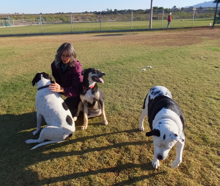
They are quite a handful. Carmen and I tossed the flying disc for them but the pit bull preferred to bite our elbows rather than the disc. 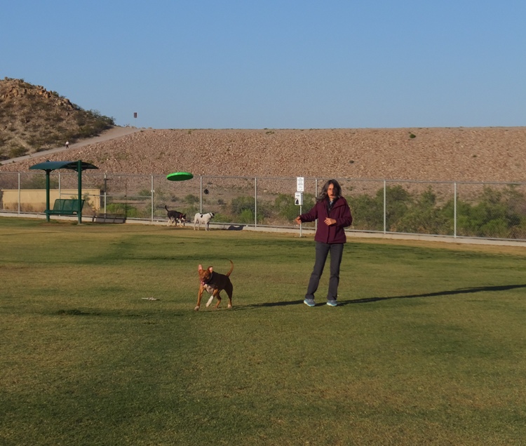
|
|
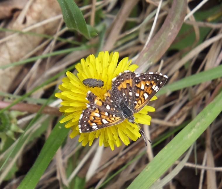
Team SNaCk crossed the border from Texas into New Mexico, stopping in Las Cruces. The three of us went to the Farmers and Craft Market of Las Cruces for food and shopping.
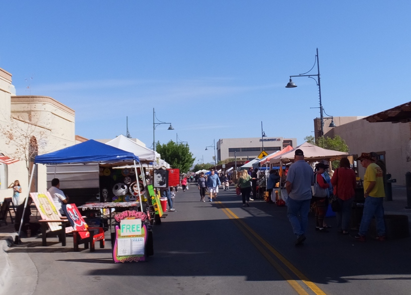
There, we purchased a dozen mini-donuts. One was bacon and maple flavored for (guess who?) me. 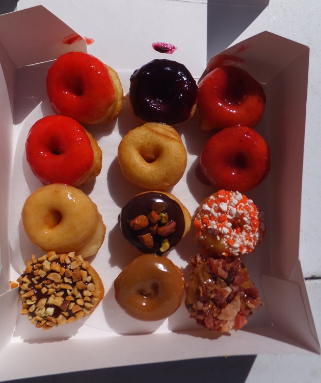
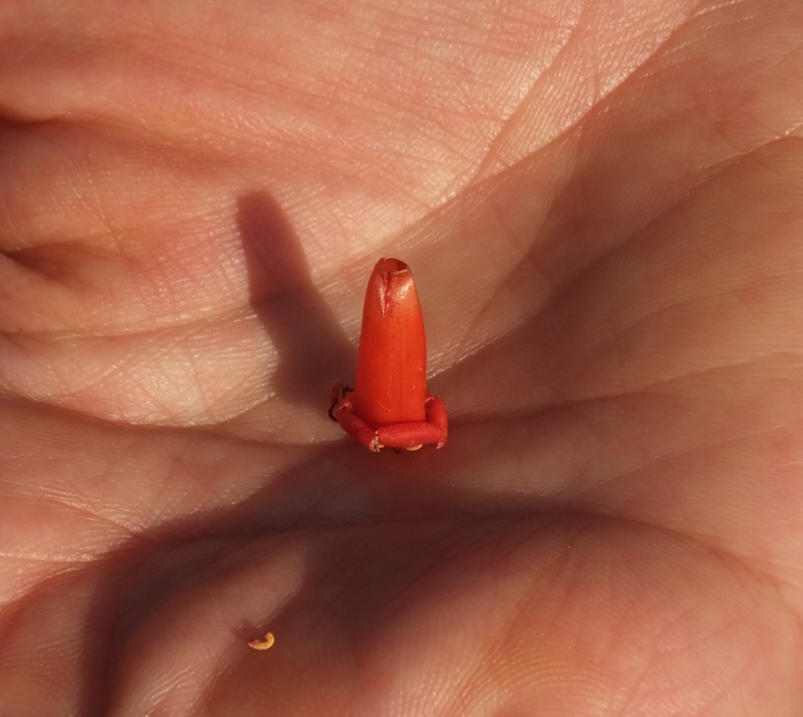
I also purchased some fossils. This included petrified wood from New Mexico or Arizona along with orthoceras. Orthoceras fossils are dated back to the Silurian Age 400+ million years ago and are the earliest recognizable animals. They are ancestors to the modern day squid. Even though they were amongst the earliest forms of life, this class of nautiloid is still considered one of the most intelligent forms of ocean life. The Orthoceras ranged in size from a few inches in length to over six feet! They could swim as well as crawl on the ocean floor. Also, by filling chambers in their shells with air, they could float through the seas, propelling themselves by squirting jets of water. As they died, their shells accumulated on the ocean floor. After being covered by sediment, they transformed into stone over the ages. Having a long, straight shell, their fossils have an iridescent, gem-like quality when polished. These Orthoceras specimens are from the Atlas Mountains in Morocco. - from handout at table I also bought my mom a Mother's Day gift...a handmade shawl. What brought us to this particular vendor was their cute dog. 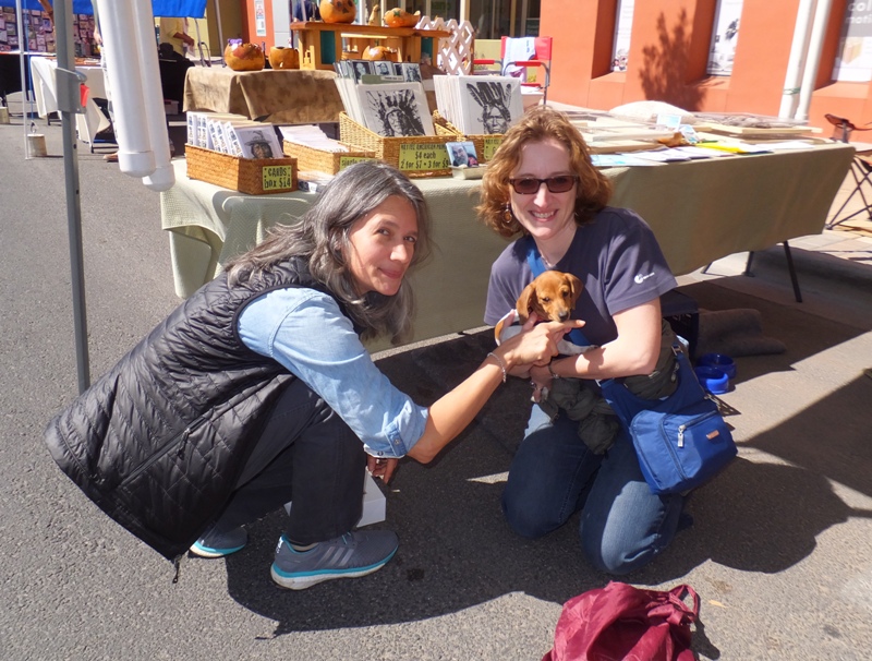
Carmen pointed out a particular symbol associated with New Mexico, the "Land of Enchantment." We learned it is called Zia. The people of the Zia Pueblo in New Mexico regard the sun as sacred. Their symbol, a circle with groups of rays pointing in four directions, is painted on ceremonial vases, used to introduce newborns to the sun, and is featured on the New Mexico state flag. Four is a sacred number of the Zia, and can be found repeated in the points radiating from the circle. - from "Jessica Whitten - The Zia Sun Symbol and the Spiral" (a broken link as of 2024) |
|
Next, we drove (actually, I drove for most of the trip) to Mesilla.
The 1848 Treaty of Guadalupe Hidalgo ended the Mexican-American War, establishing Mesilla as a Mexican holding. Cura Ramon Ortiz settled families from El Paso del Norte and pre-territorial New Mexico here. Disputes over the border just north of town continued. Soldiers raised the U.S. flag on this Plaza, November 16, 1854, marking the signing of the Gadsden Purchase, the last major territorial acquisition within the contiguous United States. - from sign in town square There was a big British car show taking place. I never knew there were so many different models of British cars. 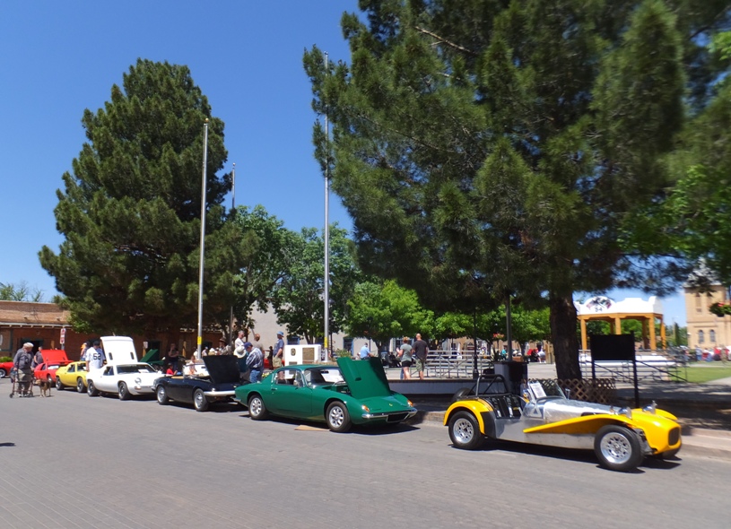
We passed by San Albino Church. 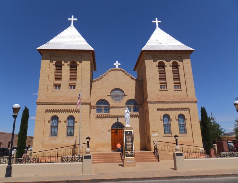
|
|
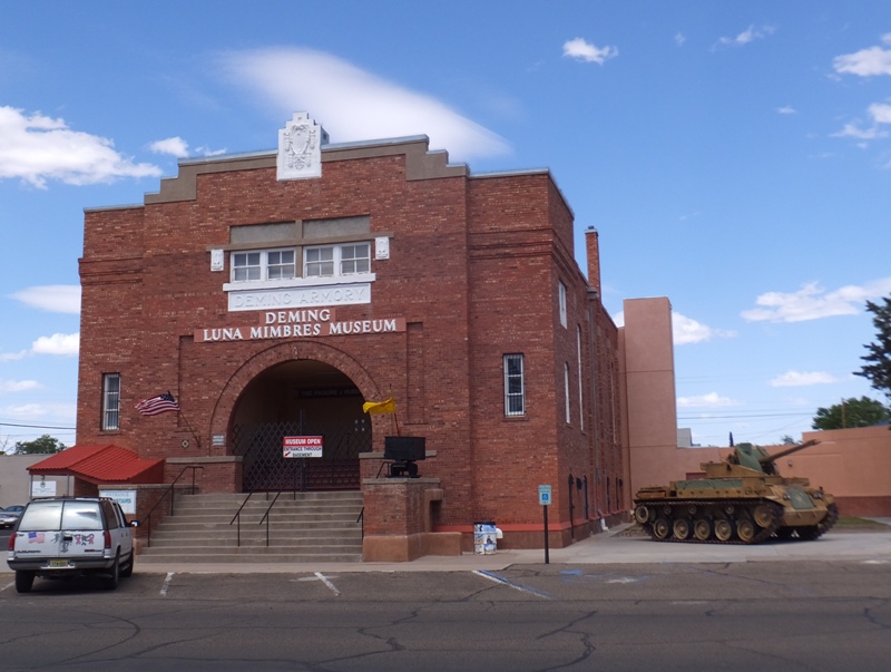
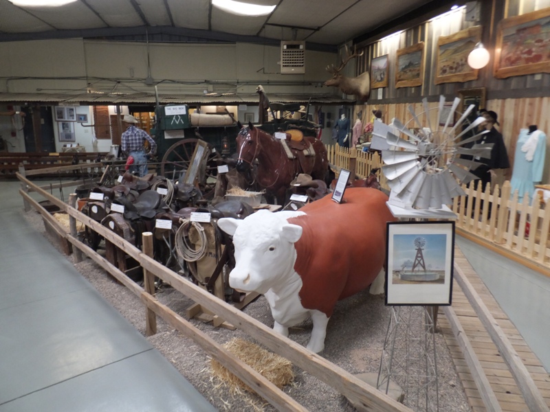
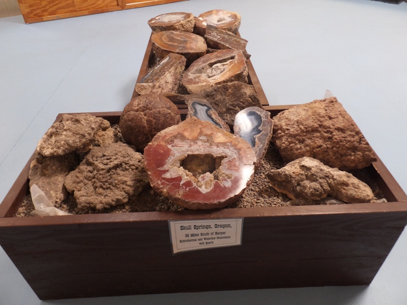
Our next stop was the Deming Luna Mimbres Museum, founded in 1881.
In one section of the museum, Carmen and I saw a 4-H jacket and learned the 4-H pledge, an organization for which Norma was a member. I Pledge My Head to Clearer Thinking My Heart to Greater Loyalty My Hands to Larger Service My Health to Better Living For My Club, My Community, My Country, and My World! - from sign in display cabinet We briefly tried to think of a Team SNaCk pledge but that didn't get far. What that town is known for is having such a large number of residents that were part of the Bataan Death March, something I learned about in the Marines. The thing I liked most about the museum were the folks that worked there. They were an elderly couple and were obviously very proud of their museum. Their enthusiasm was contagious. |
|
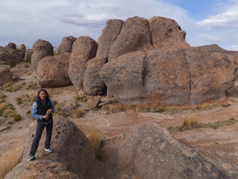
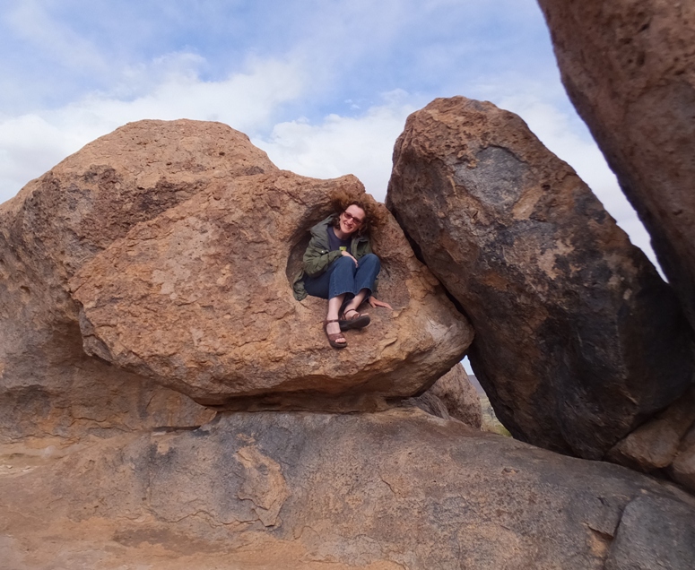
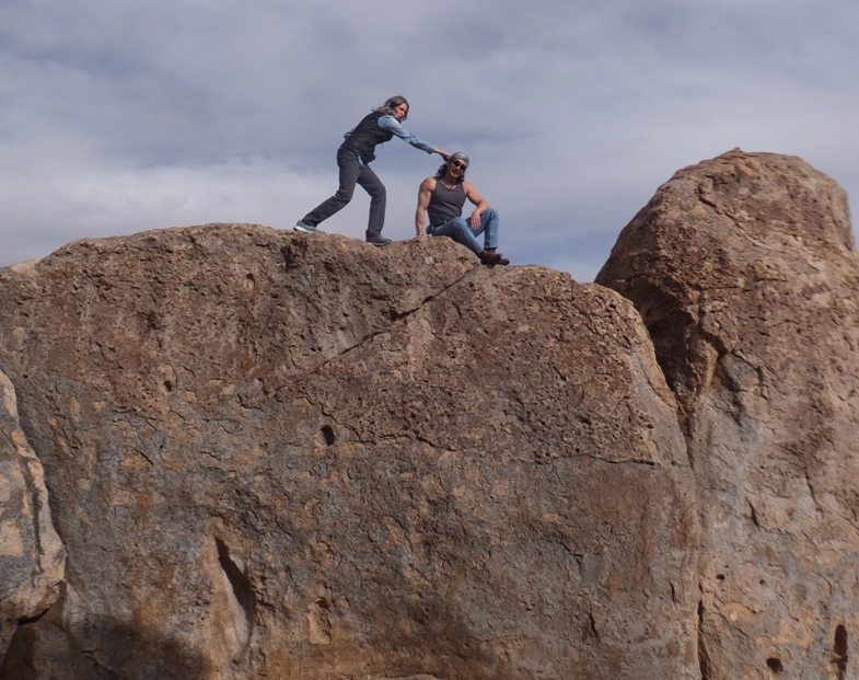
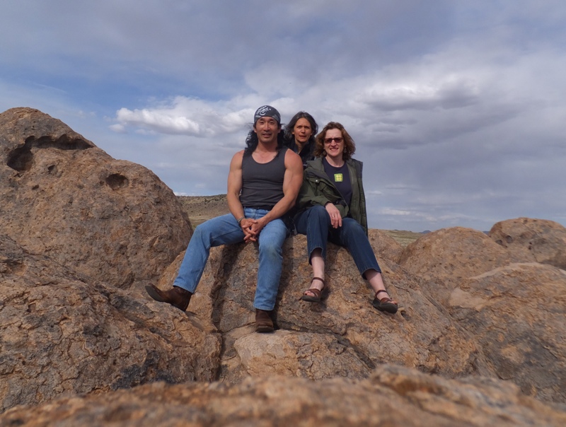
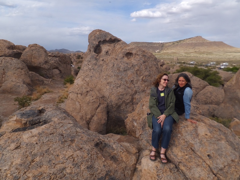
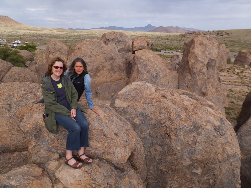
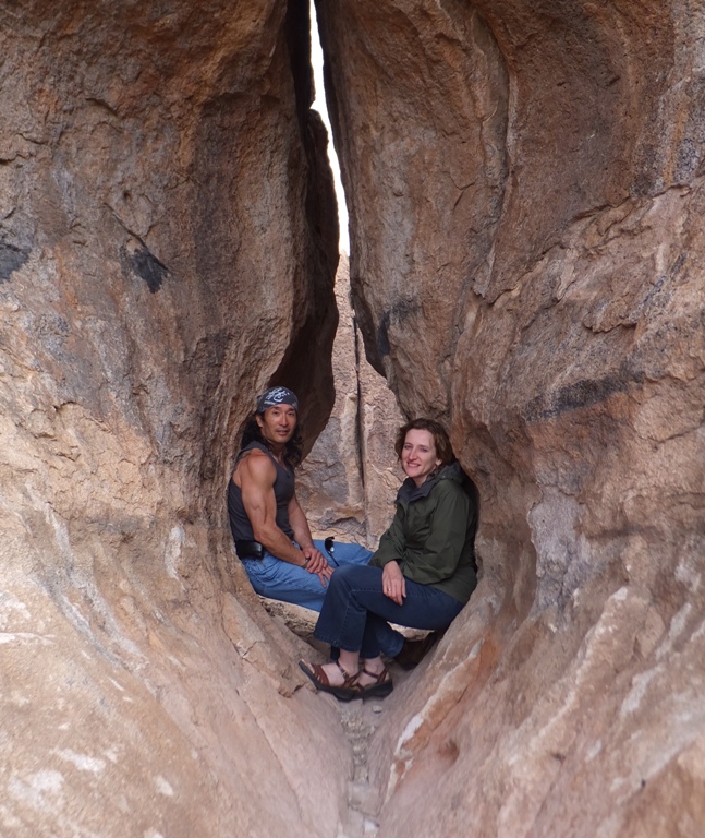
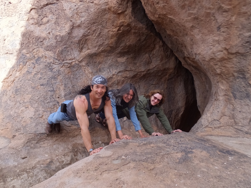
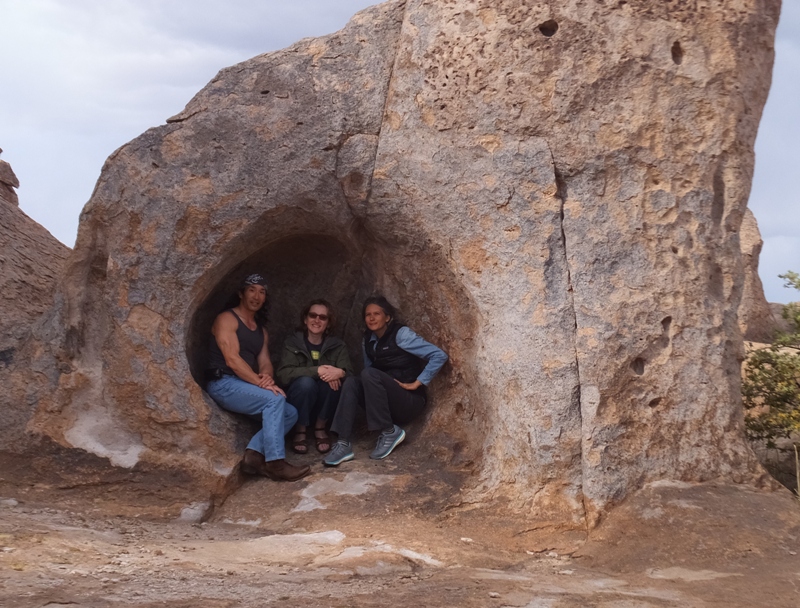
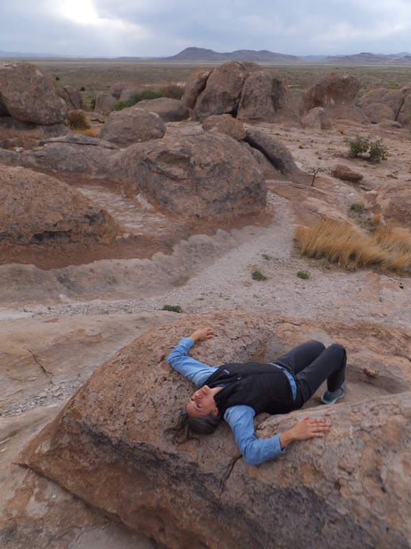
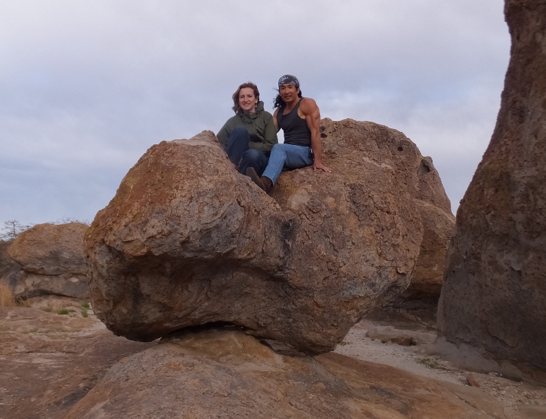
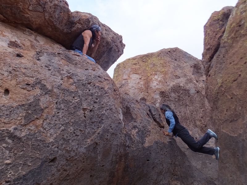
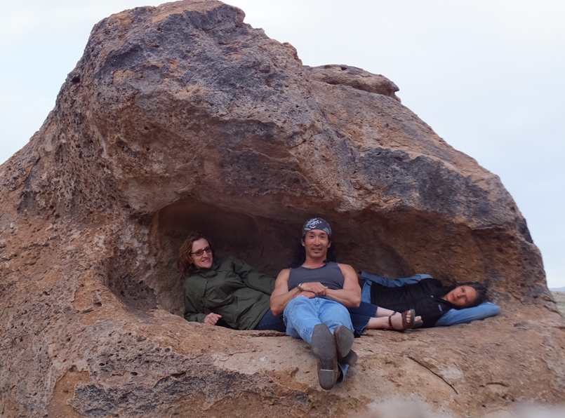
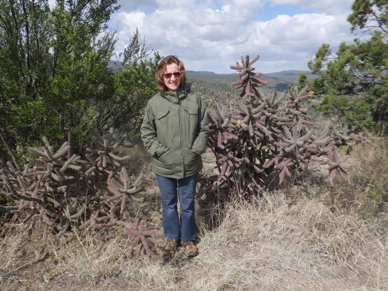
Our last adventure of the day was a stop at City of Rocks State Park. This was my favorite part of the trip. I really enjoy rock scrambling though my skills are quite mediocre. Wearing cowboy boots did not help. Carmen and I did a lot of climbing and Norma took a lot of photographs.
1 / 17

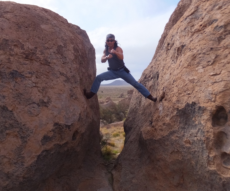
My Jet Li pose.
2 / 17
Carmen and her water bottle.
3 / 17
An avant garde chair.
4 / 17
Fight training.
5 / 17
Team photo.
6 / 17
Norma and Carmen.
7 / 17
Carmen and Norma.
8 / 17
Norma and I.
9 / 17
Assuming the position.
10 / 17
Who needs a tent?
11 / 17
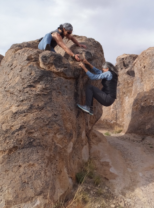
Offering Carmen a hand.
12 / 17
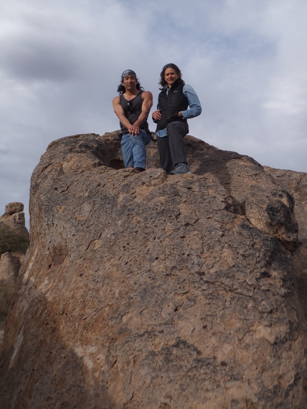
On top of the world!
13 / 17
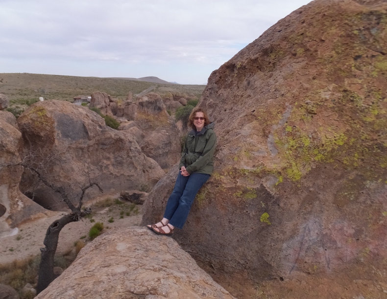
Norma and a big rock.
14 / 17
Carmen horizontal.
15 / 17
Heart-shaped rock.
16 / 17
Carmen-style of climbing.
17 / 17
Taking a rest.
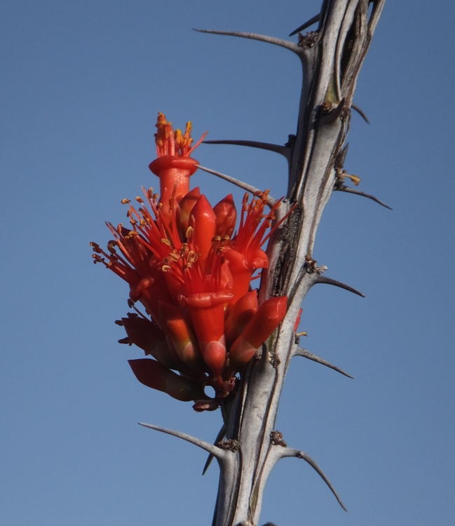
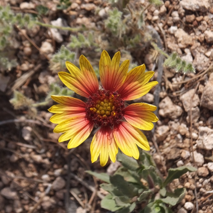
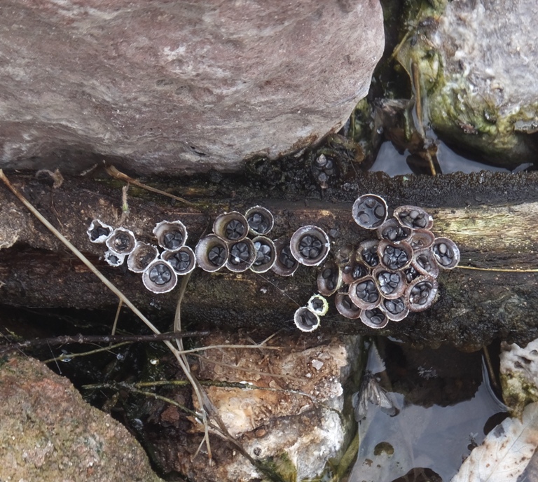
Even without the climbing, the place was great just for walking. The rocks jutted up out of the ground like scenery from a Road Runner cartoon. This was also our first taste of seeing real southwestern desert plants up close and personal. We also got to see a few flowers and several lizards. After leaving the area, Norma and I spotted a wild pig, probably a collared peccary. After our play time, we drove to Silver City for the night. We checked in at the Copper Manor Motel and ate dinner at Tre Rosat Cafe where I ate a tasty duck pizza. For the duration of our road trip, eating out once a day and staying in inexpensive motels was our modus operandi. We brought camping gear but never used it. Not because we're big spenders but rather because we were able to make the most out of our limited time by not having to set up or take down tents and deal with other gear. |
|
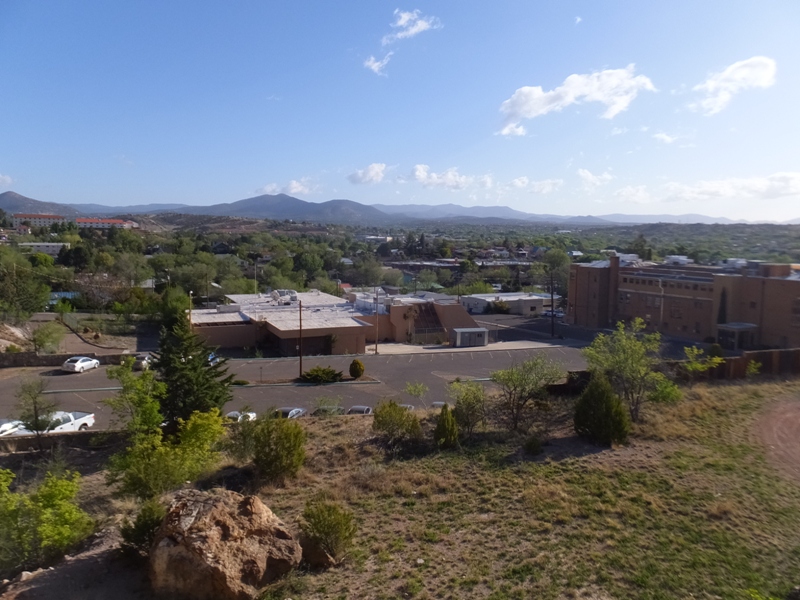
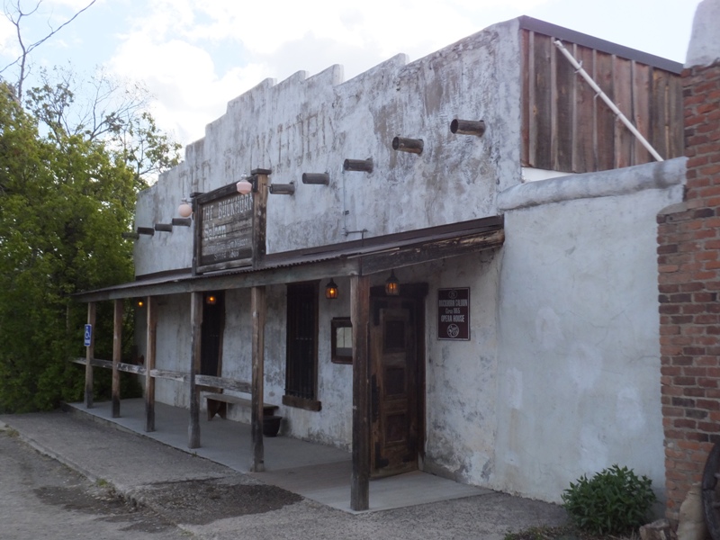
We started out our morning by driving around Silver City. There was a not-too-bad view from the high part.
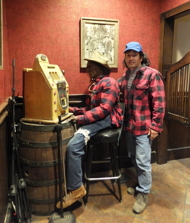
The three of us made a quick stop at the famous Buckhorn Saloon and Opera House in Pinos Altos. They weren't open for business but a guy there let us check out the place. I found a mannequin dressed like me. Across the street from the saloon was the town's historic museum, which was also closed, despite what the sign read. 
Next, we drove for a long time on some winding roads through part of the Gila National Forest on a road called the Trail of the Mountain Spirits Scenic Byway. At one stop in the forest, we spotted two acorn woodpeckers at the Arrastra Site. 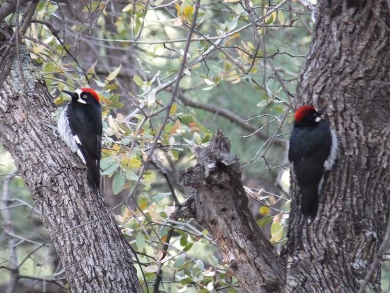
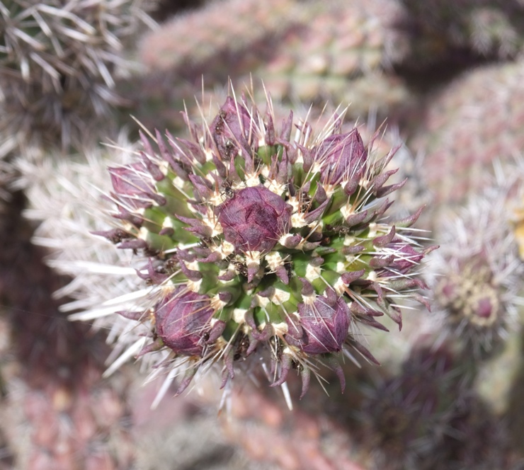
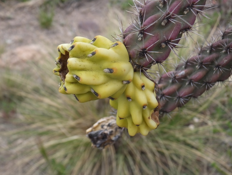
We saw lots of plants we don't see in Maryland. One was a cane colla cactus. One of our breaks was at the Clinton P. Anderson Overlook. 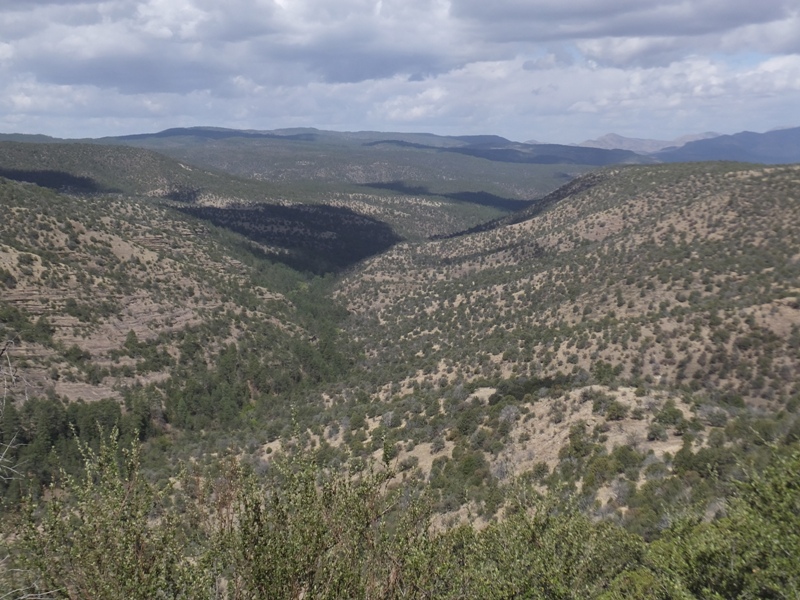
|
|
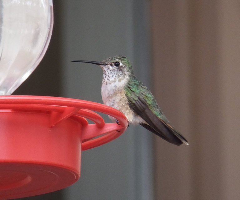
After some time, we finally arrived at the Gila National Forest. We checked out the visitor center where there were numerous hummingbirds buzzing about.
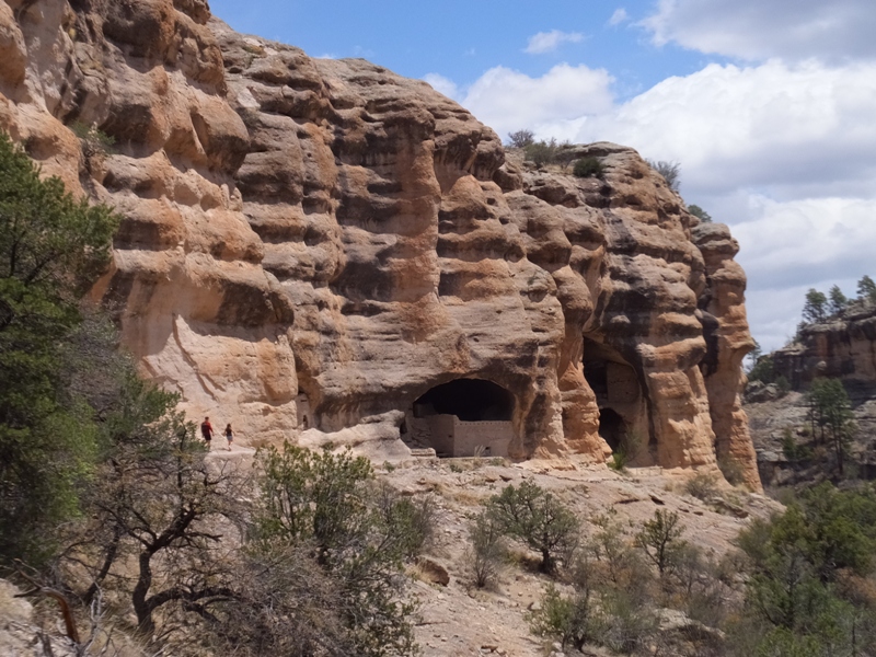
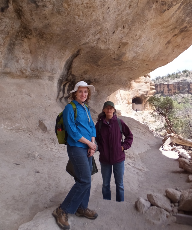
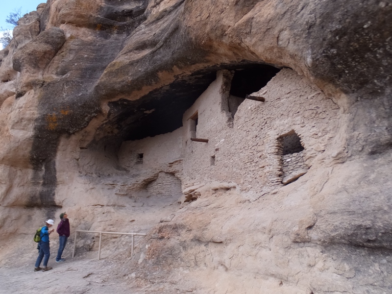
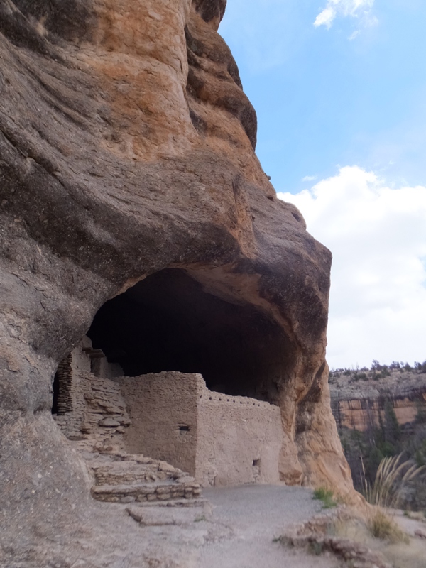
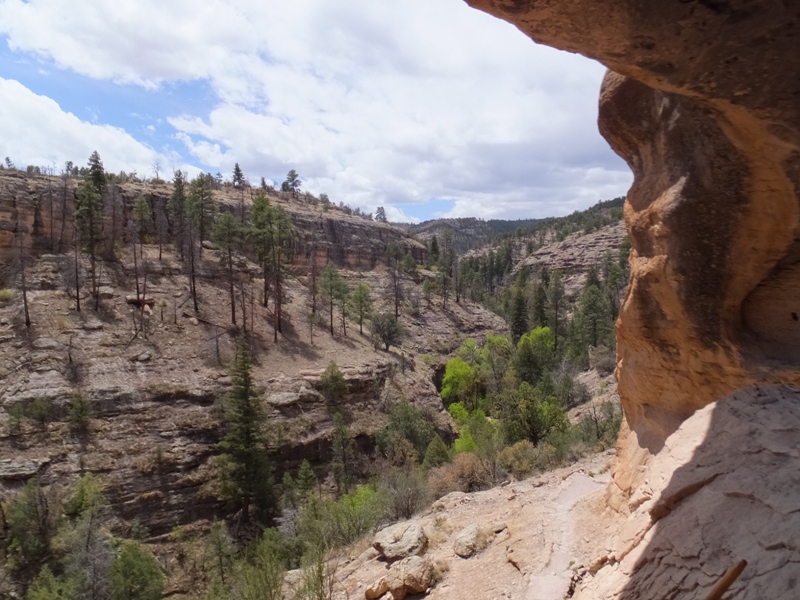
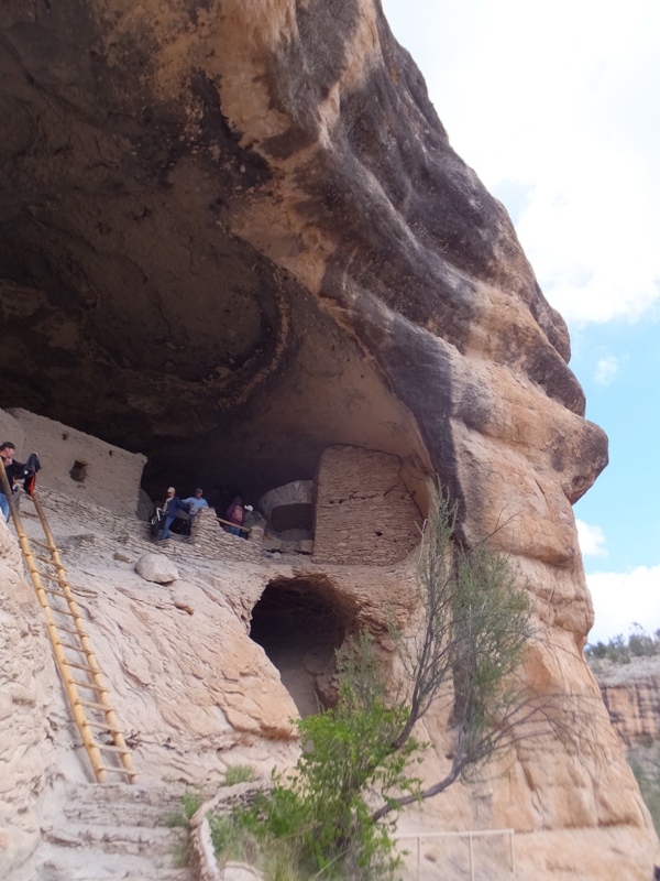
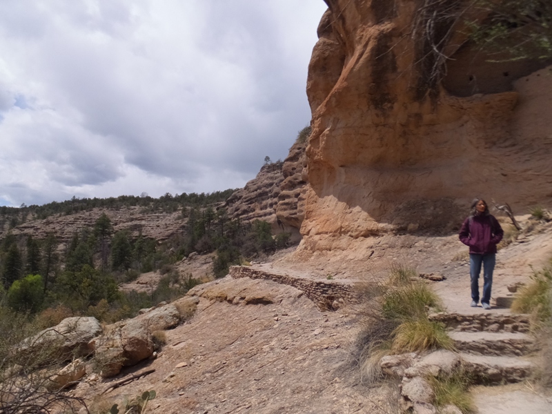
Then we drove a short distance to the Gila Cliff Dwellings. These dwellings contain about 40 rooms in a series of naturally formed caves. These rooms were built by ancient Puebloans of the Mongollon Area around 1280 CE. - from signs in visitor center The geology of the area is unique. The Mogollon Mountains in the Gila National Forest are part of the Middle-Teriary Mongollon-Datil volcanic field. This field is dominated by a number of supervolcanoes that erupted between 35 and 28 million years ago. Supervolcanoes are the largest eruptions known to occur on earth. They produced catastrophic eruptions of volcanic ash with a force estimated at 1,000 times the power of the 1980 Mount Saint Helens eruption. The Bursum and Gila Cliff Dwellings calderas are the remnants of two supervolcanoes. - from sign at trailhead Thanks to the efforts of our fine national park system, this area has been protected and preserved just so Team SNaCk could see it today. Gila Cliff Dwellings National Monument was established in 1907 by Theodore Roosevelt to protect the prehistoric material culture of the Mogollon people and others who inhabited this area. - from sign at trailhead Our hike led us over a stream and between some steep mountains. There were certain things about the scenery that reminded me of California but there were also plenty of terrain features that screamed "New Mexico!" We saw the West Fork of the Gila River. We finally arrived at the dwellings. Some were closed off. The ones we saw were most impressive. 1 / 7
Dwellings from afar.
2 / 7
Norma and Carmen.
3 / 7
Reading and looking.
4 / 7
No roof needed.
5 / 7
Always a great view.
6 / 7
No flooding worries.
7 / 7
Well-maintained trail.
There was blackness in the ceiling from smoke when the natives built their fires. 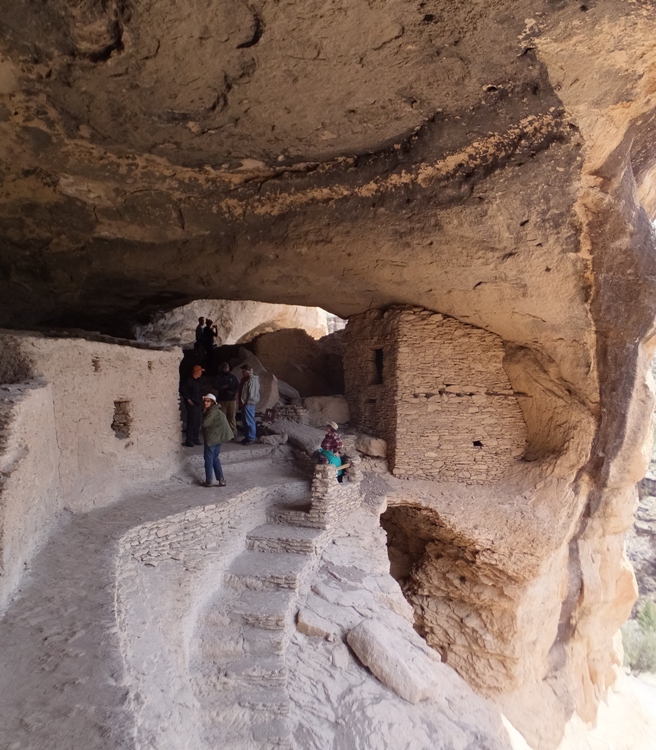
Norma holds the ladder to keep Carmen from plummeting to certain death. 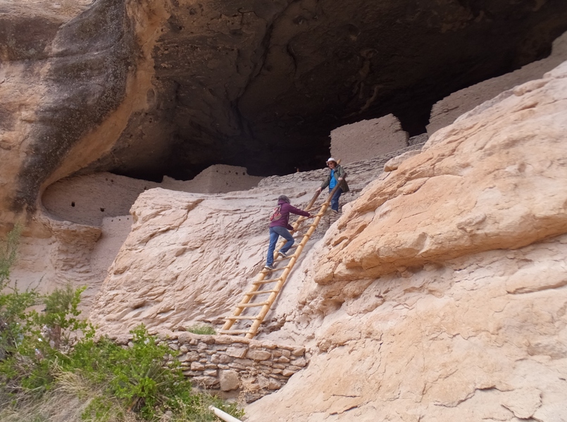
As with most of our trip, the weather was spectacular. It was very unlike Maryland where they were receiving a great deal of rain at this time. In the parking lot of the cliff dwellings, I saw a darkling beetle. 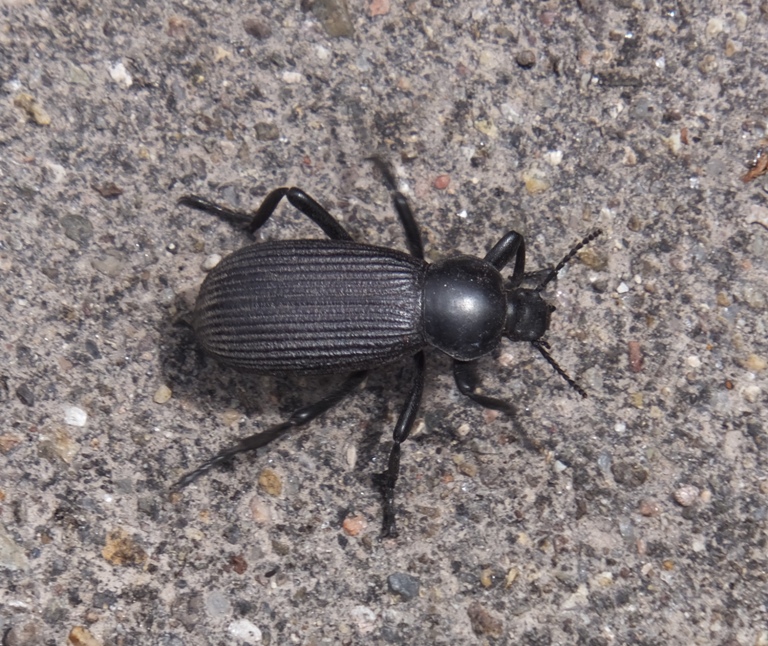
In the Gila National Forest, there was quite a bit to do in a small area so we didn't have to drive far to get to our next destination. |
|
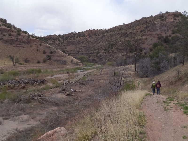
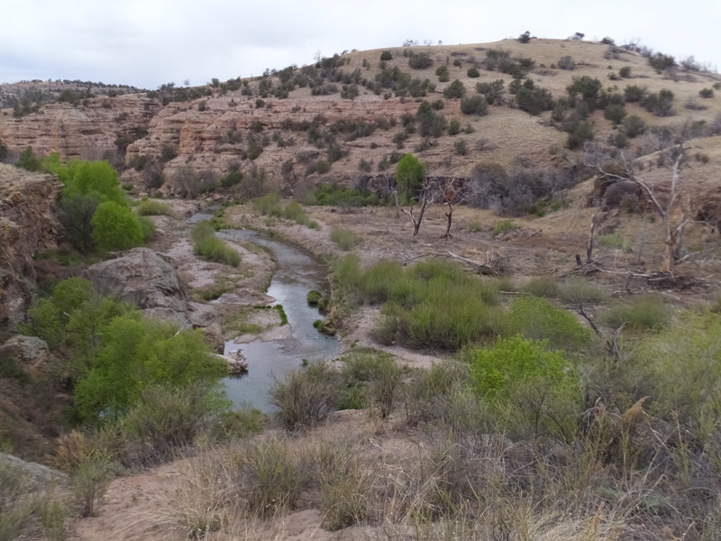
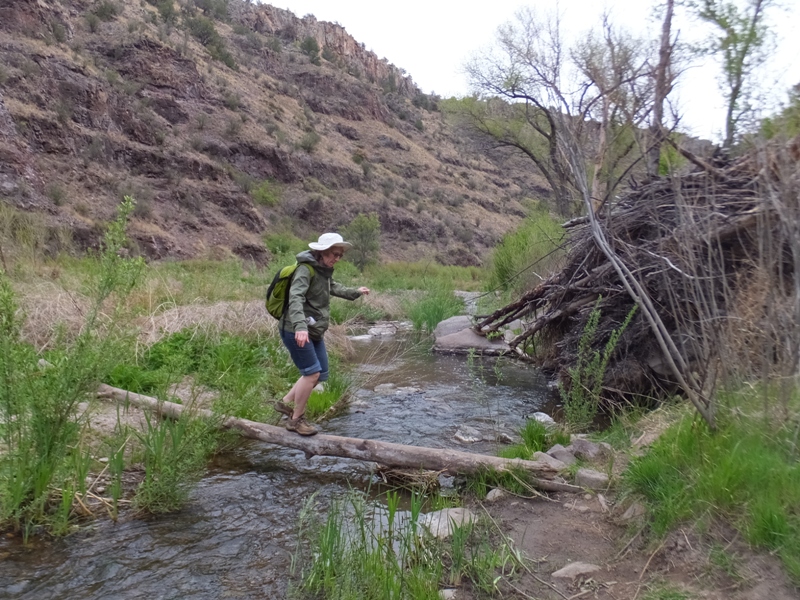
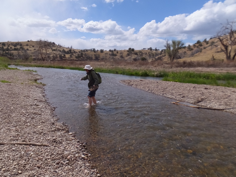
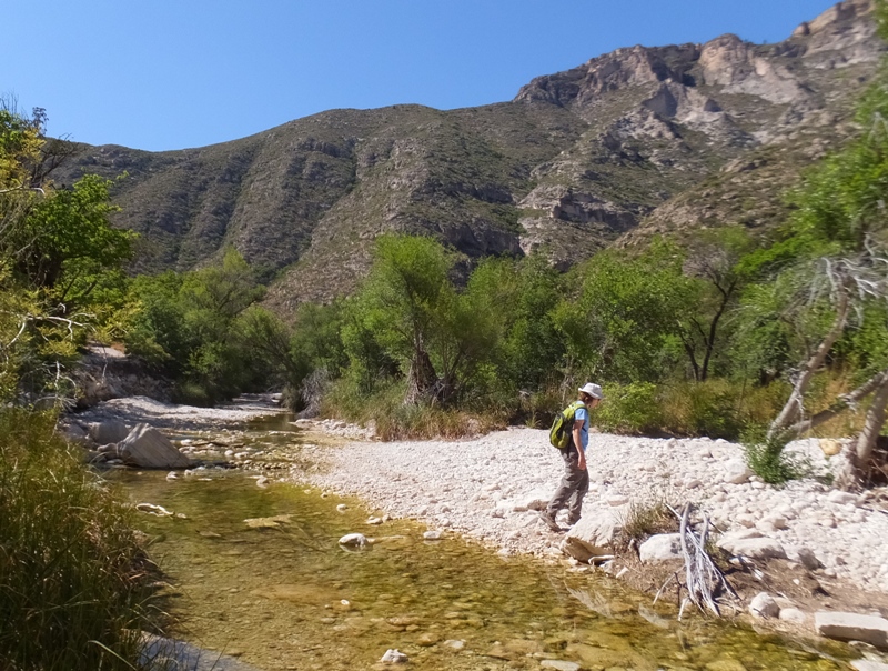
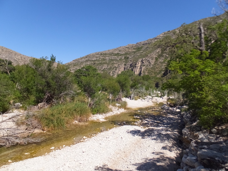
We did the Lightfeather hot springs hike which commenced near the visitor center. This took us on a trail near the Middle Fork of the Gila River.
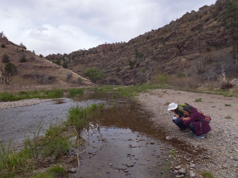
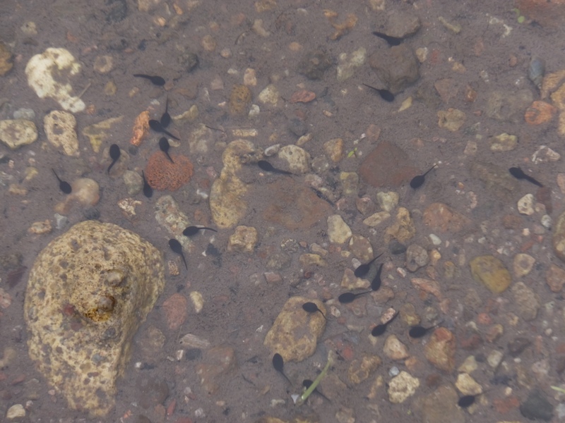
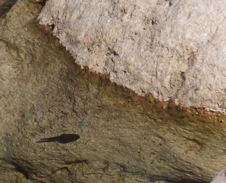
We saw several polliwogs. We had to do three stream crossings to get to our destination. 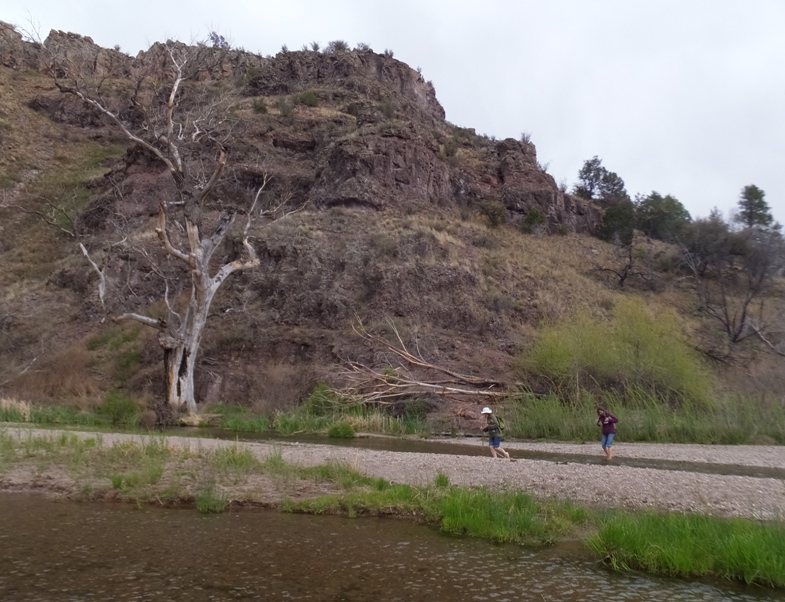
This was a fine opportunity to see some nice southwestern landscape. 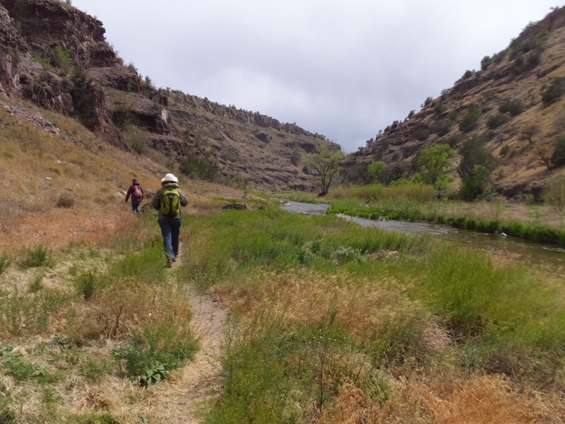
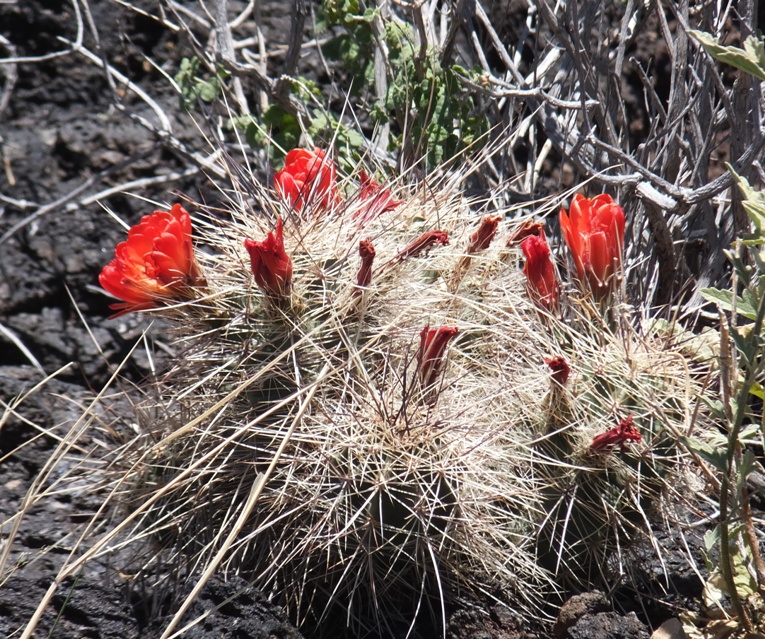
We saw some kingcup cactus flowers. 
Cairns told us where to pick up the trail after fording the river. 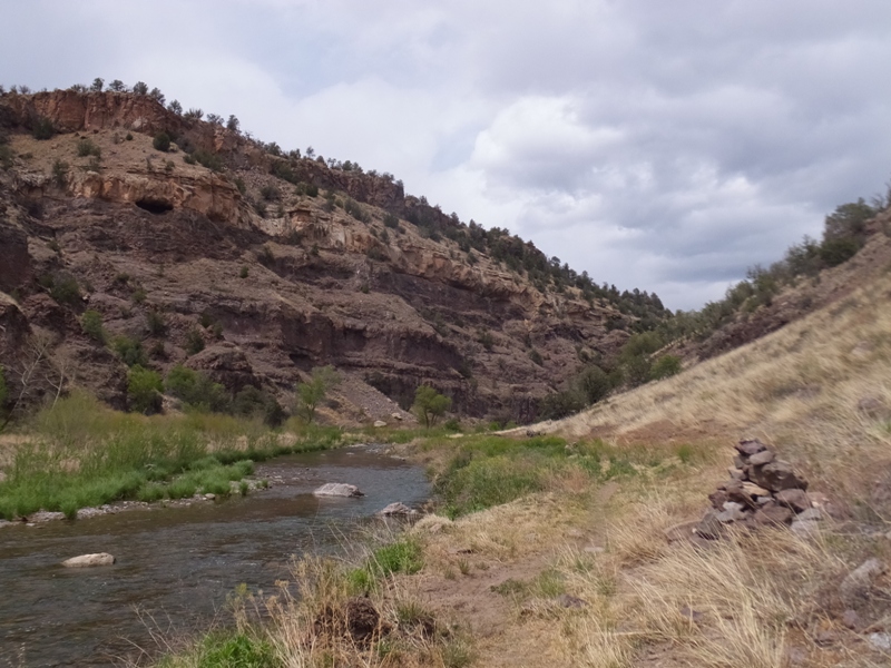
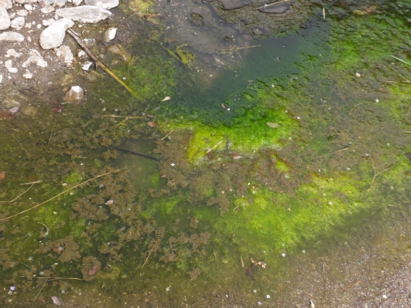
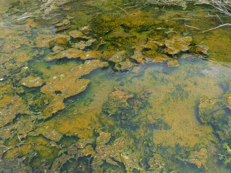
After a short distance, we reached our destination, Middlefork (sometimes referred to as Lightfeather) hot springs. The hot springs themselves are very hot (about 149 degrees Fahrenheit) and will scald you if you sample them near the source. - from "Trails.com - Middlefork (Lightfeather) Hot Springs" (broken link as of 2024) I've seen plenty of springs but this was the first hot spring I've seen in the United States. 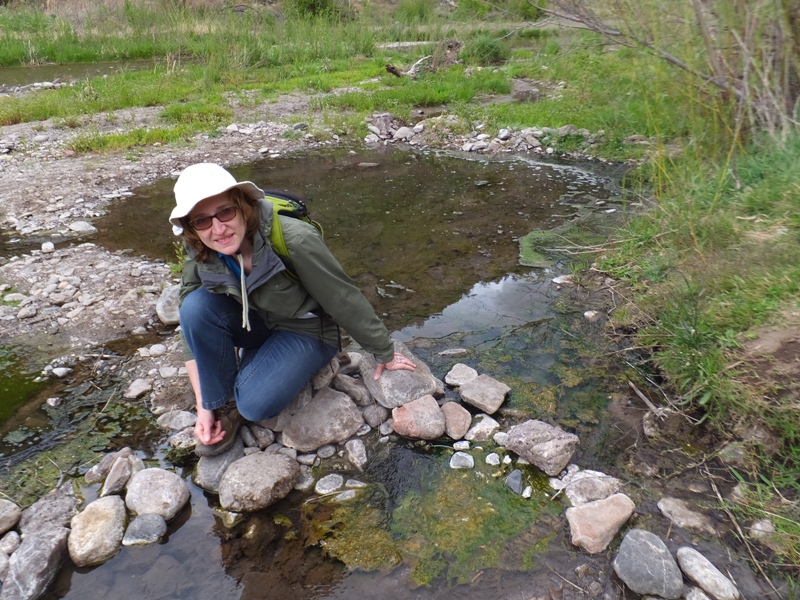
Rocks lined the area near where the hot water mixed with the cold. 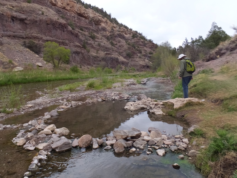
Each pool divided by the rocks got hotter as they approached the spring. 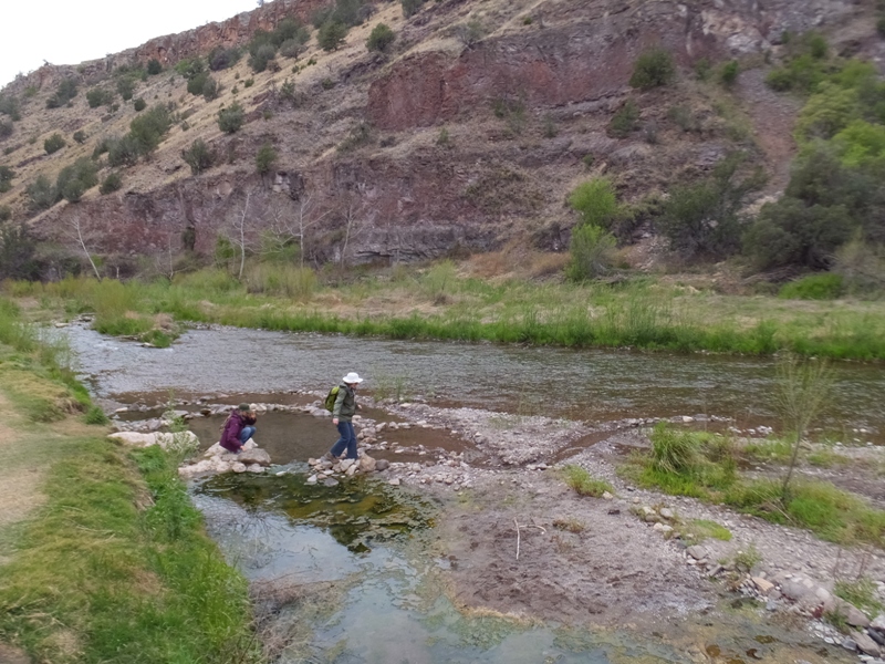
At the bottom of this photo, you can see hot water coming out of the source, just below the trail. 
A variety of algae and and some fungus grew near the hot spring. Even though this is a sanctioned Team SNaCk event, Carmen was the only one to remember to bring her team colors which she flashed. Next time, she will need to remind us to pack our uniform. 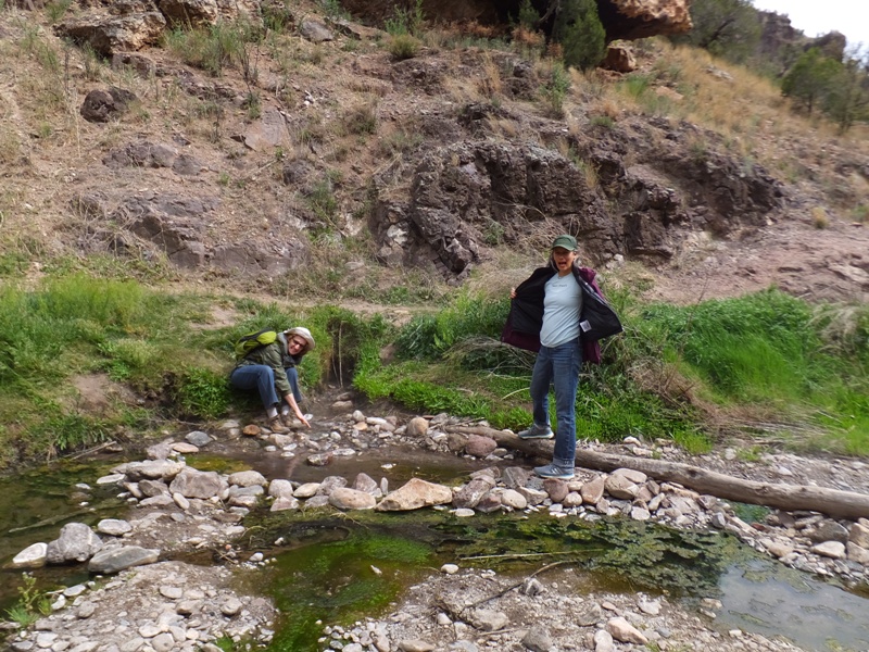
Higher up and across the stream was an inaccessible cave. 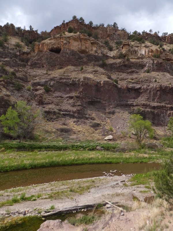
We climbed up to check out a rock overhang where it looked like the locals might go to enjoy their beer. The blackened overhang reminded me of the Gila Cliff Dwellings because they were also darkened due to smoke from the fires of the natives. 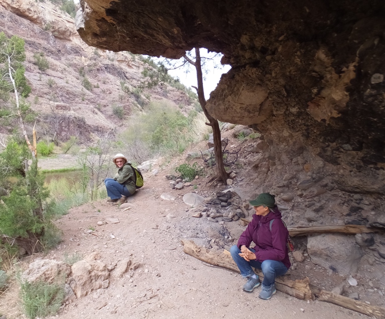
Returning back the way we came, Norma and Carmen had now mastered the art of stream crossing. |
|
Driving on, we made our way through Emory Pass,
...homelands of the eastern band of Chiricahua Apaches known as the Warm Springs or Chihenne (Red Paint People). - from sign at side of road Some of the mountainous areas we passed were home to old silver mining towns. 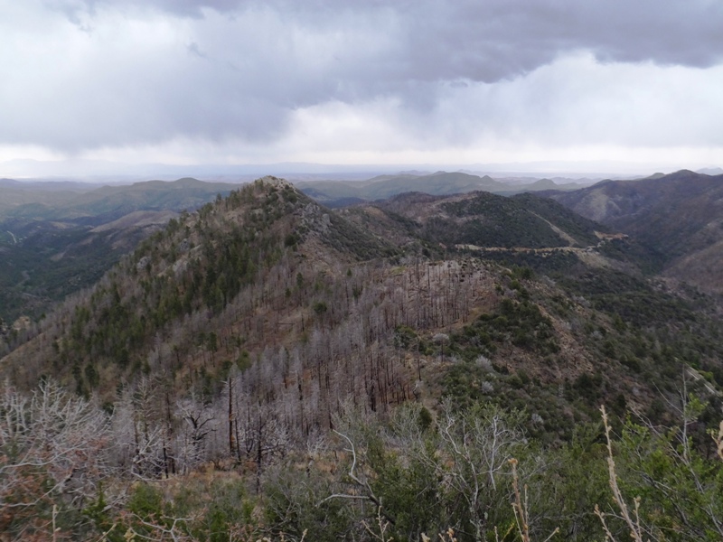
In the town of Truth or Consequences, we stopped for the night, staying at the Oasis Motel. 
The manager had a dog that looked very much like the dog my family had (Foxy) when I was a kid. The owner assumed the dog was half Pomeranian. 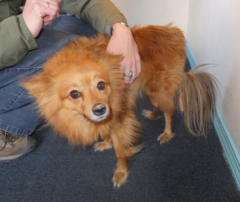
The three of us ate dinner at La Cocina. |
|
I didn't sleep much last night so I slept in while the girls explored the town. It had a quirky reputation that it didn't quite live up to.
Continuing our adventure, we drove to the Rio Grande. Being so famous, I thought it might be fun to kayak on it but after seeing it, I am glad we did not. It looked very muddy. 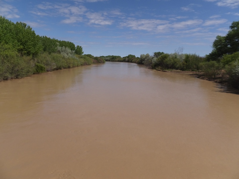
A herd of pronghorn antelope crossed the highway. 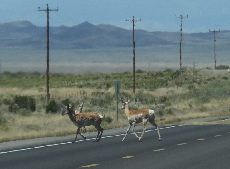
Eventually, we came to a big area filed with lava rock. 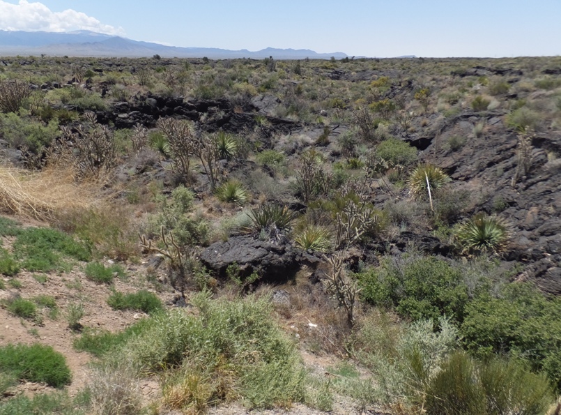
Continuing a bit further, we arrived at the Valley of Fires Recreation Area. Here, we hiked on the mostly paved Malpais Nature Trail. 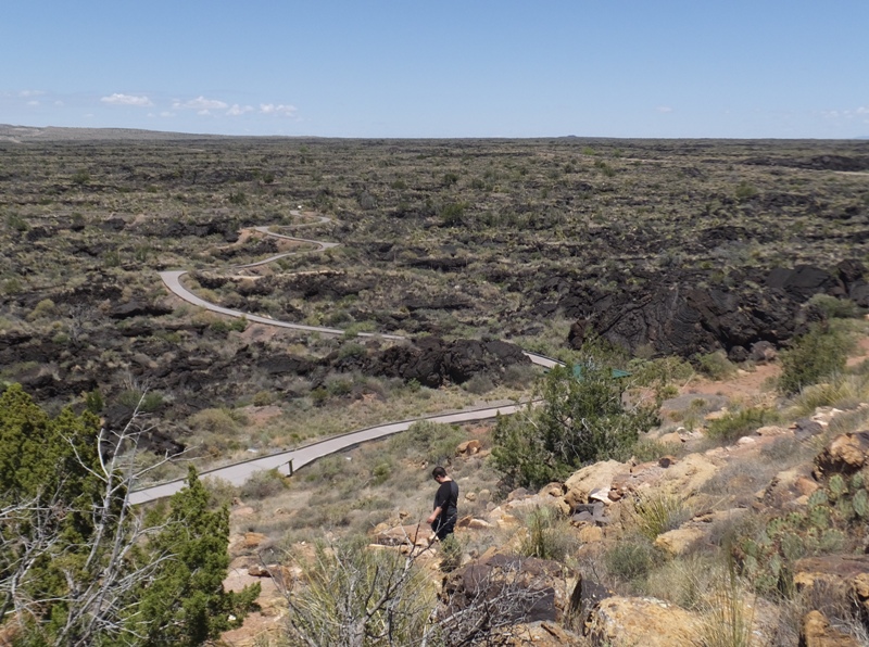
Here we had a chance to see the lava rock up close and personal. 
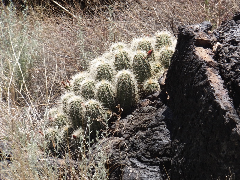
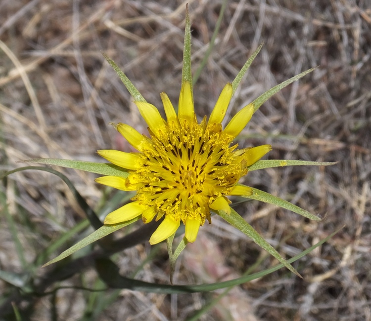
Geologists believe that the lava of the Carrizozo Malpais flowed from volcanic vents in the valley floor about 5,000 years ago. It is one of the youngest and best preserved flows in the United States. This lava flow is the second youngest in New Mexico. The McCarty's flow near Grants, which occurred almost 3,000 years ago, is the most recent in the state. A volcano was not the source of the lava flow. Instead, the lava emerged from openings, called vents, in the valley floor. As the molten lava flowed southward, it covered the original valley floor and surrounded areas of higher ground, forming islands, called kipukas. Other features of the lava flow include collapsed bubbles, pressure ridges, lava tubes, gypsum caves, and ice caves. The flow is 44 miles long, and varies in width from 2 to 5 miles. Its depth averages 45 feet. At the thickest point, it is 165 feet deep. The flow has a surface area of 127 square miles. - from sign on trail There was a significant amount of plant life living amongst the lava flow. The dark color of the lava helps by absorbing heat during the day and keeping the plants warmer at night. Lots of sunshine and 145 frost free days provide a long growing season. With an elevation of 5,000 feet and an annual rainfall of 9 to 14 inches, the lava flow has a climate similar to the Chihuahuan desert in northern Mexico. - from sign on trail Many flowers were in bloom. One of the trail signs said there were tarantulas in the area but sadly we did not see any on our trip. I was also wanting to see an armadillo at some point but we failed to see any of them either. The wide trail was wheelchair accessible. What is Carmen gesturing below? 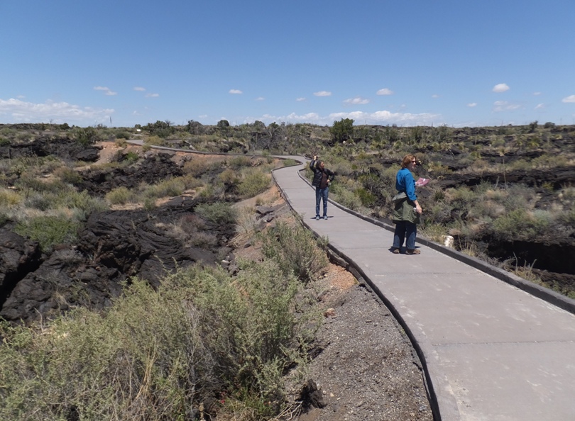
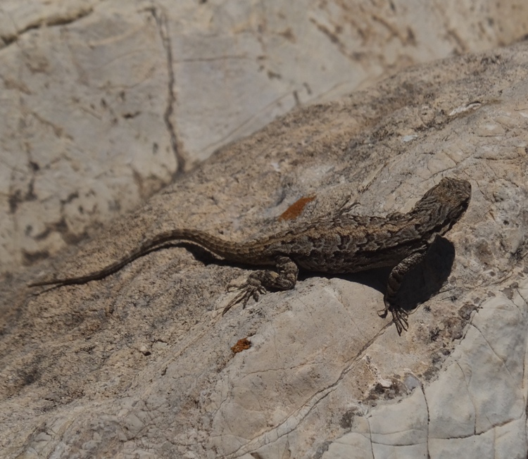
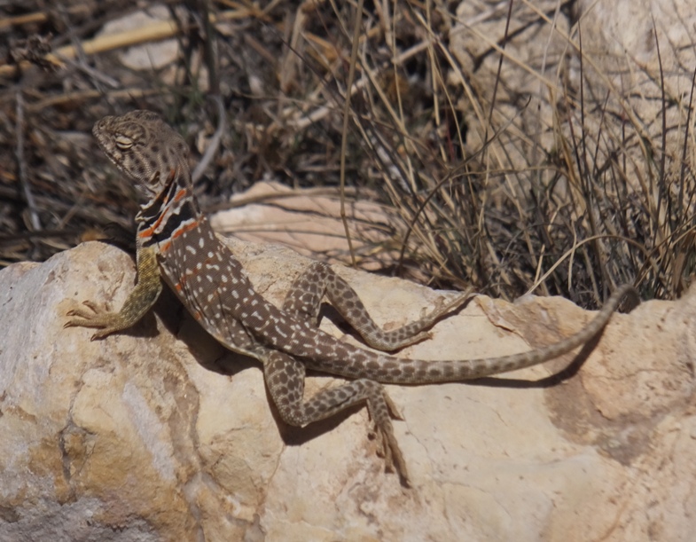
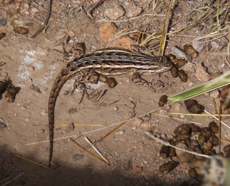
We saw numerous lizards and a variety of desert plants. 1 / 4
Some kind of cactus.
2 / 4
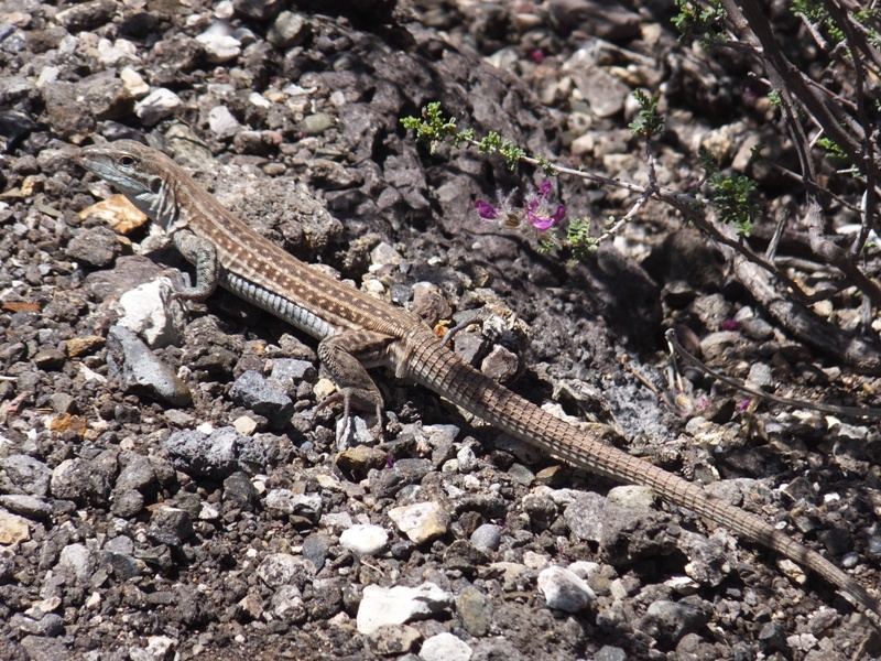
Whiptail lizard.
3 / 4
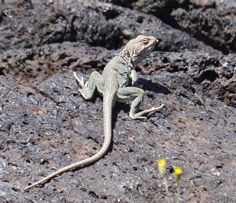
Collared lizard.
4 / 4
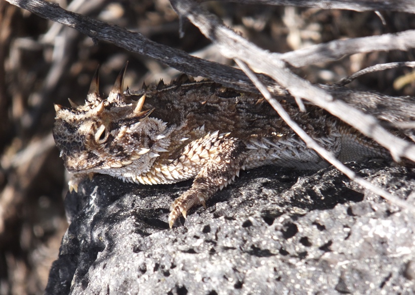
Texas horned lizard.
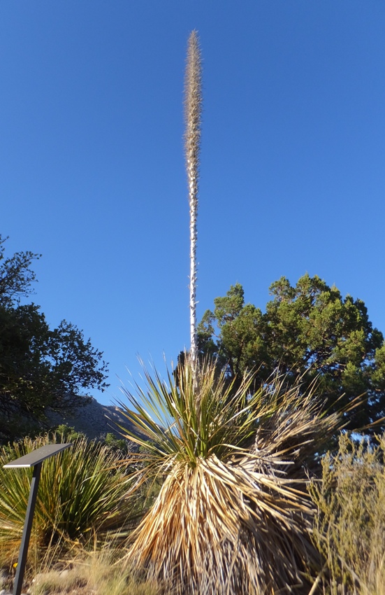
In the distance were sotol plants which look similar to yucca. It is also called a "spoonplant." 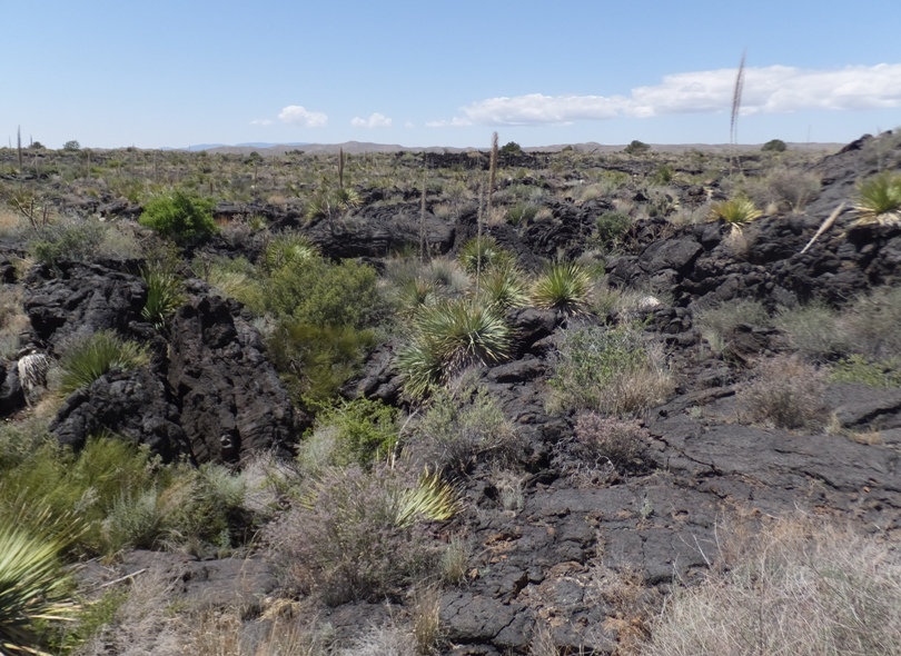
Is this a flower? I call it a troll doll plant. 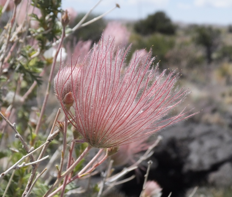
A not-so-exotic squirrel was eager to get its picture taken. 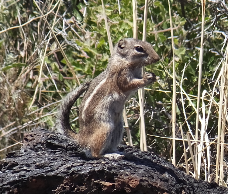
We passed by one section of lava having an unusual folded appearance. It is known by its Hawaiian name, "pahoehoe." 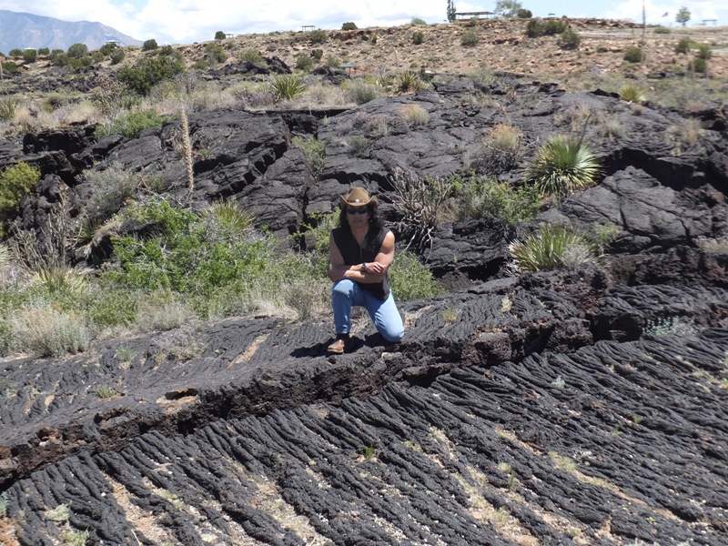
Maybe it was the blackness of all the lava but it felt pretty warm in this area. Carmen even took off her jacket which she didn't do very often on this trip. |
|
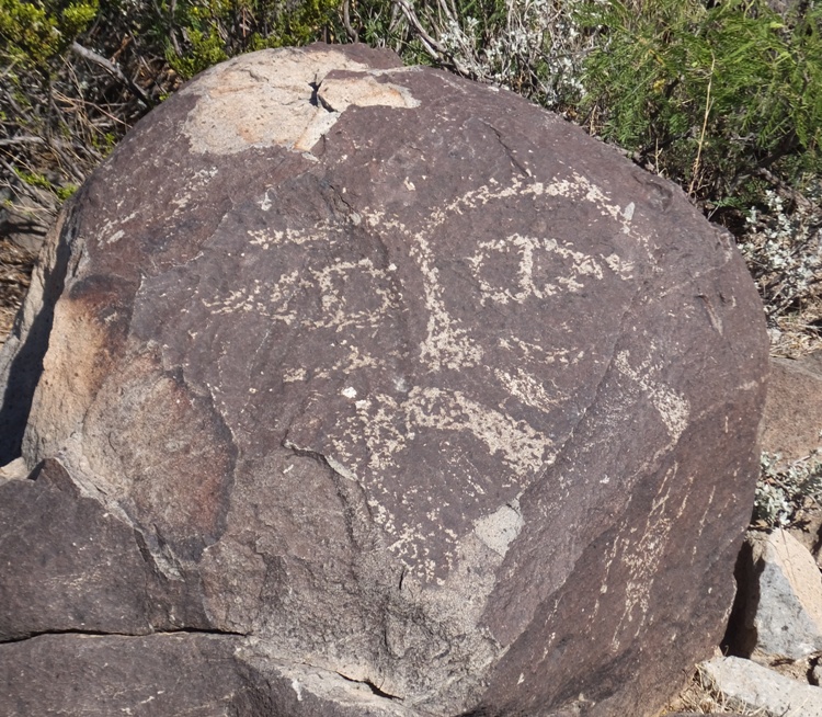
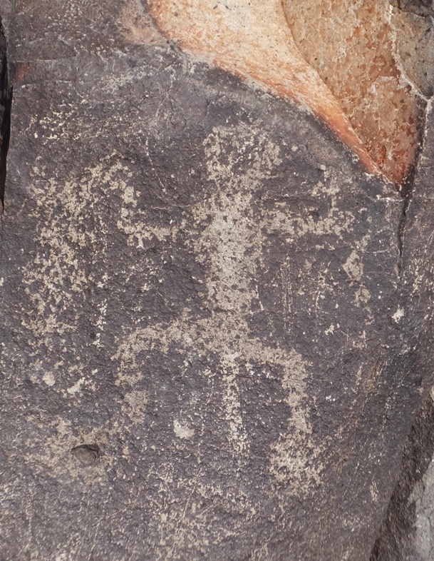
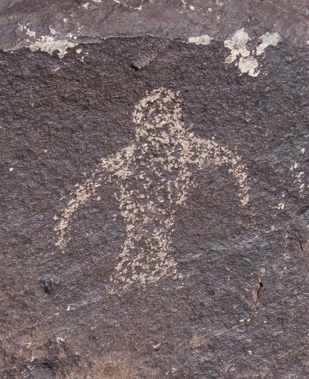
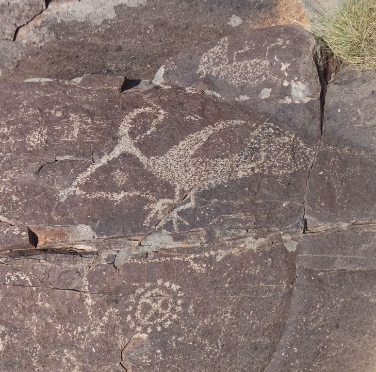
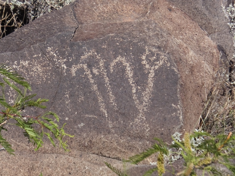
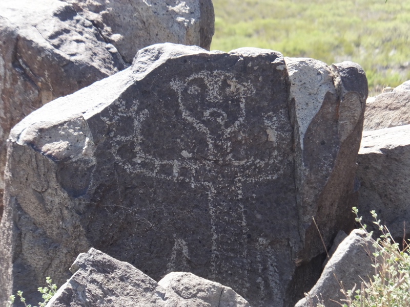
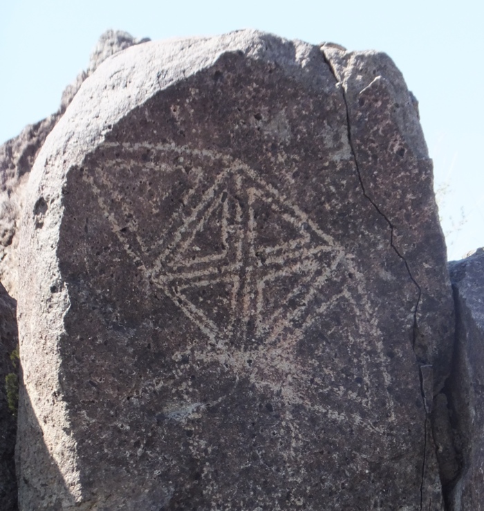
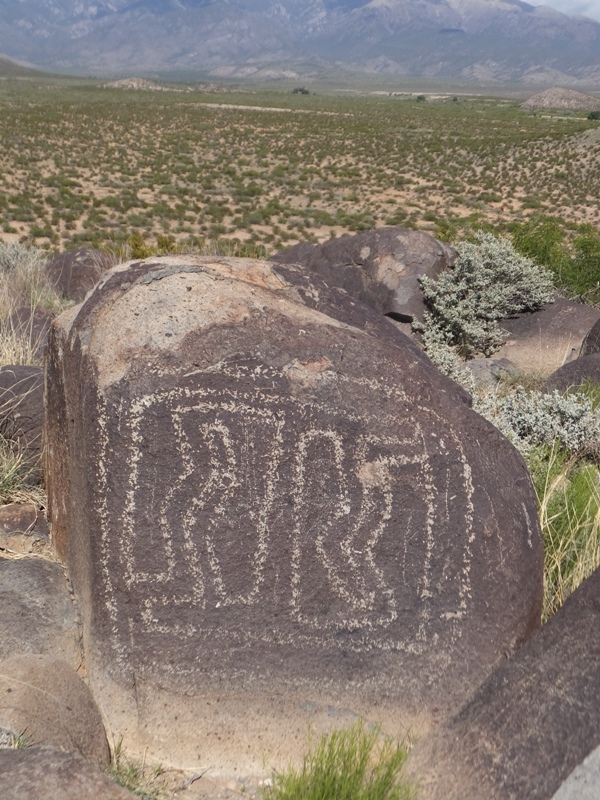
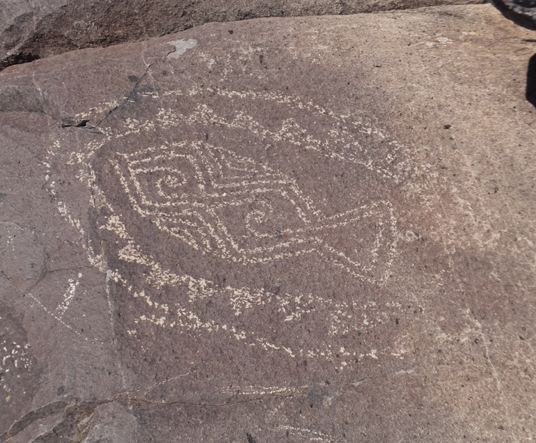
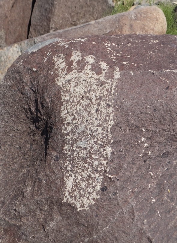
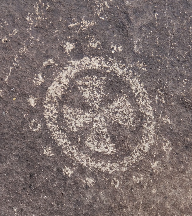
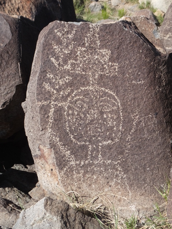
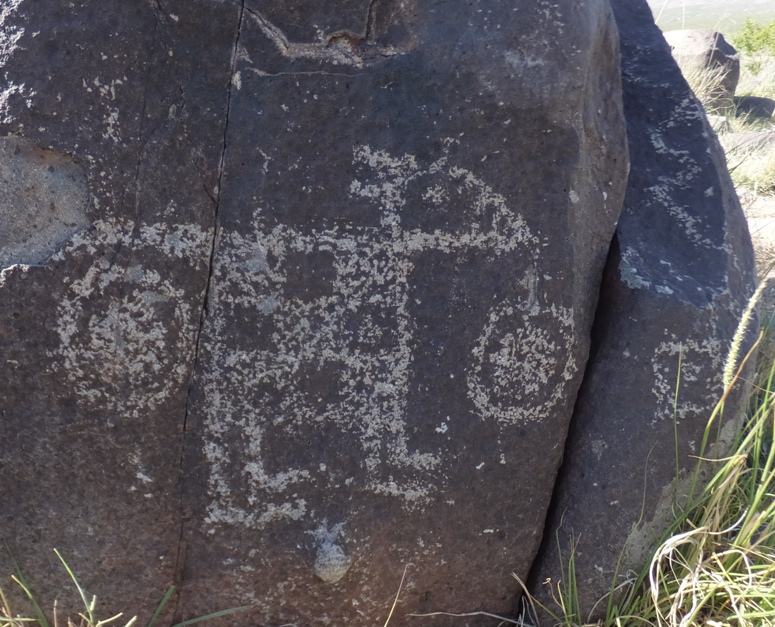
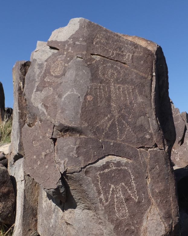
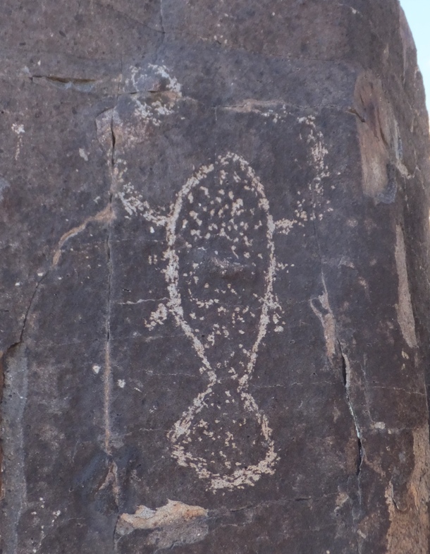
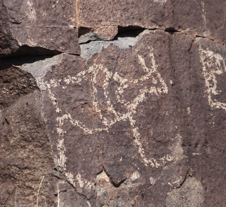
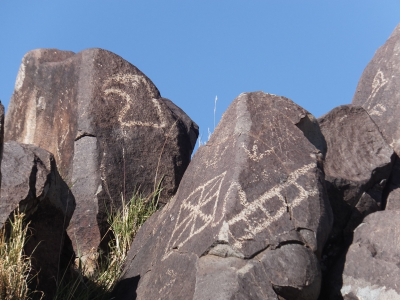
Our next stop was the Three Rivers Petroglyph Site.
Inhabitants of a nearby village made the Three Rivers petroglyphs (rock carvings) over 600 years ago. Over 20,000 petroglyphs have been identified in the area. The people were of the Jornada Mogollon prehistoric Indian culture, of which there are no known modern descendants. The petroglyphs' purpose and meaning are not entirely clear. Some depict the animals and plants the people saw around them. Many certainly had religious meaning. - from sign at parking area I am sure anthropologists can make better sense of the petroglyphs than us but we did our best to interpret what the artist was trying to depict at the time. 1 / 21
Mario Brother.
2 / 21
Roadkill.
3 / 21
Linux penguin.
4 / 21
Pterodactyl.
5 / 21
Dancing candy canes.
6 / 21

Balloon head.
7 / 21
Don't shoot!
8 / 21
Kayak.
9 / 21
M.C. Escher drawing.
10 / 21
Decorative bomb or fish.
11 / 21
No need to interpret.
12 / 21
Iron cross.
13 / 21
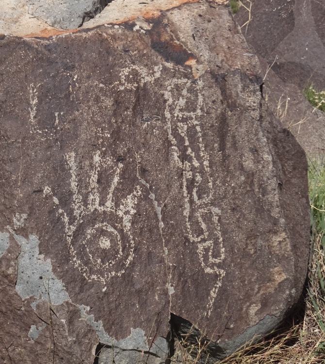
Hand and snake.
14 / 21
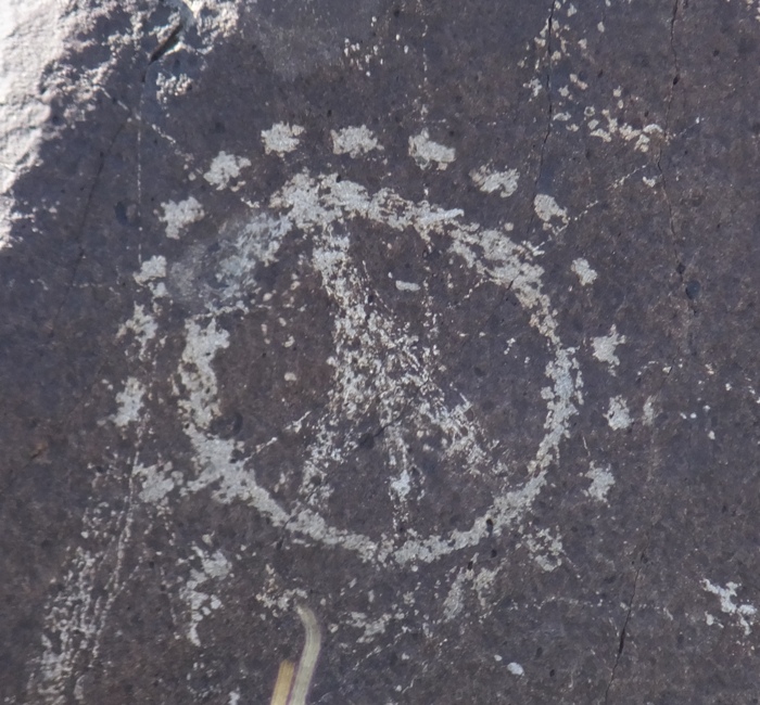
Peace bro.
15 / 21
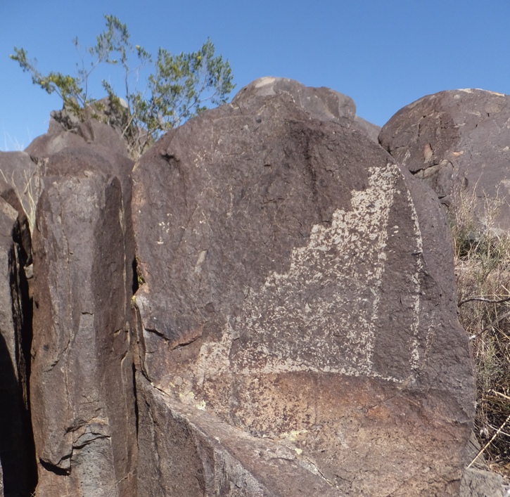
Stairway to heaven.
16 / 21
Are we not men? We are Devo.
17 / 21
Fido and Purina symbol.
18 / 21
Bundeswehr eagle.
19 / 21
Lobster.
20 / 21
Fat antelope.
21 / 21
American eagle head.
This one made me think of a shooter who had his crosshairs on the target but put bulletholes everywhere else. 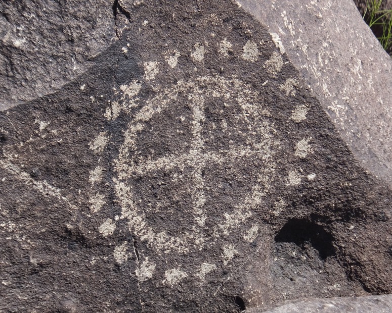
Here's Carmen with a drawing that reminds me of stairs. 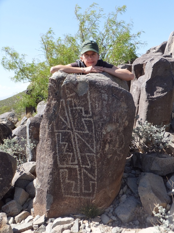
My two favorite women at the petroglyph site. 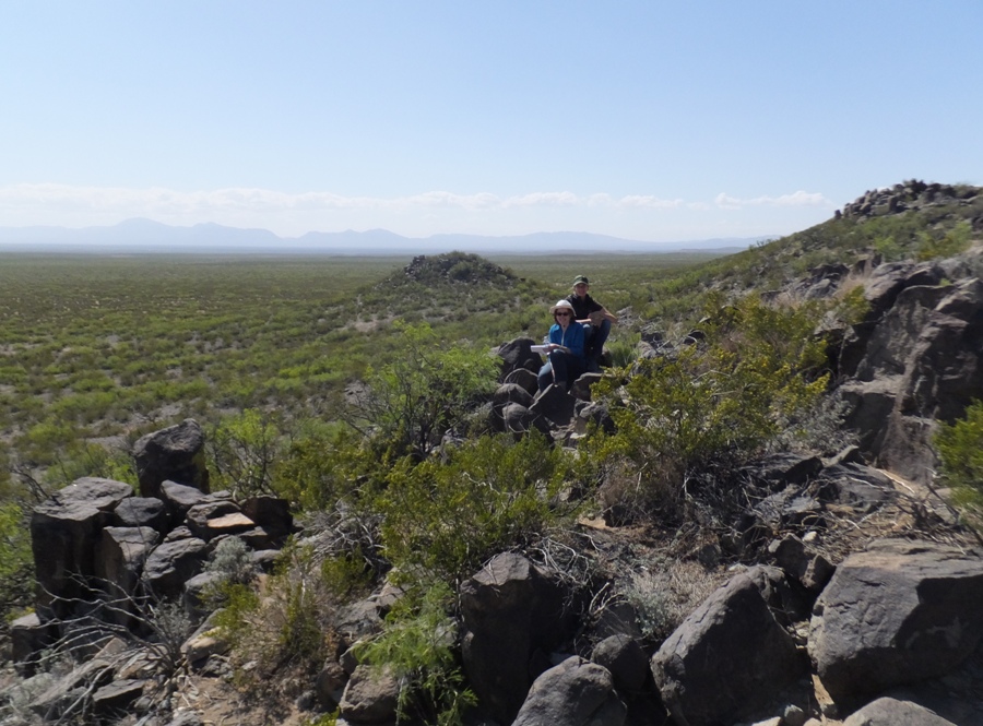
Carmen and I. 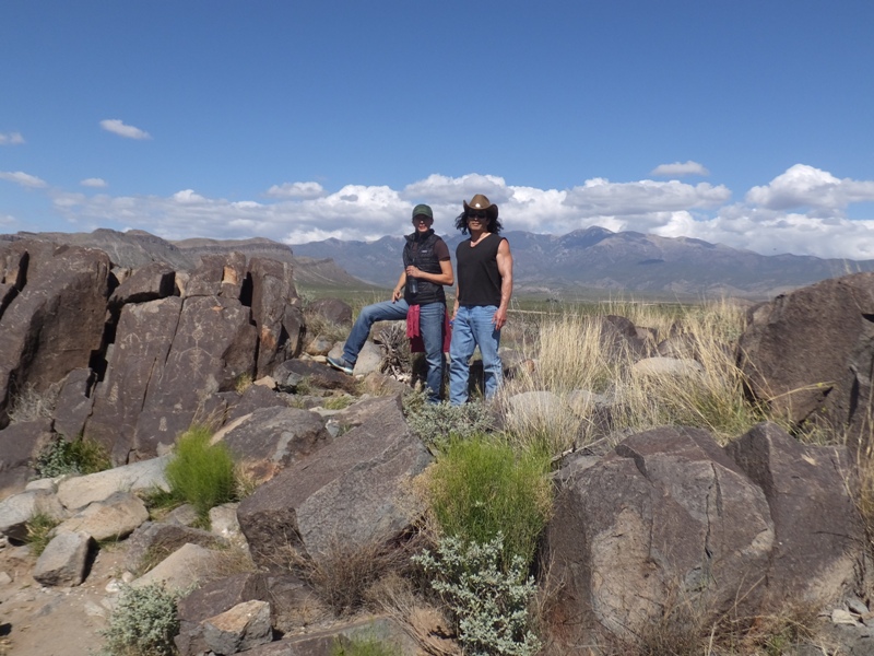
This is a popular place for Native American graffiti 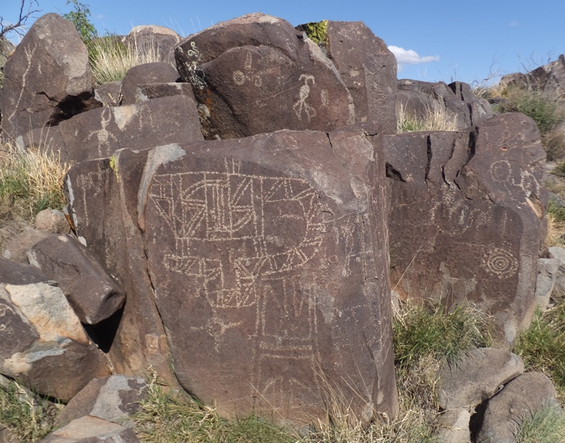
Not sure what this could be but isn't the background view nice? 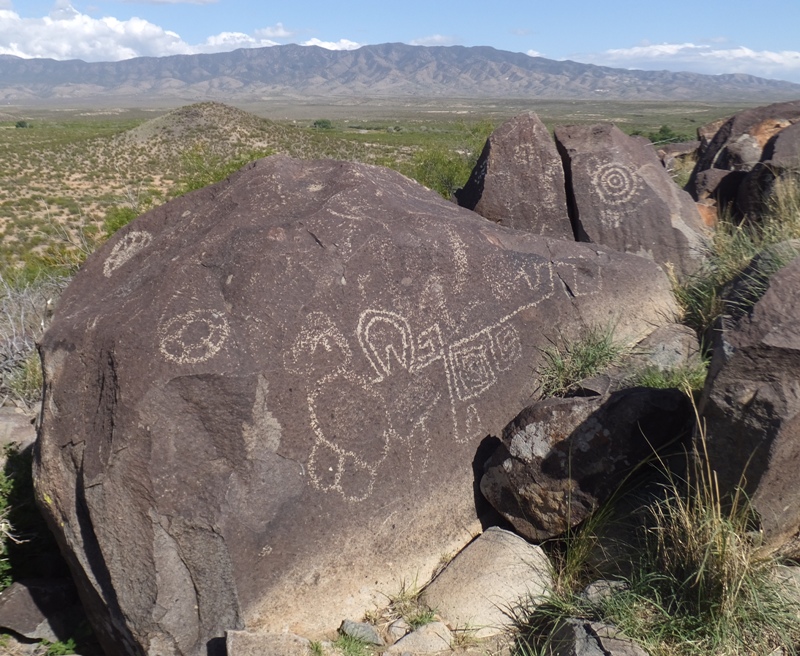
Walking over uneven terrain. 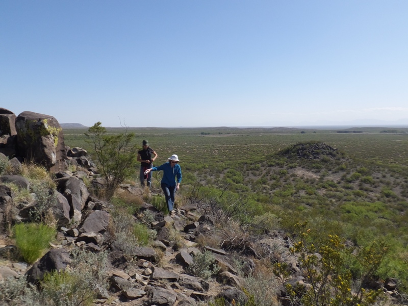
Wouldn't this make a great tribal tattoo? 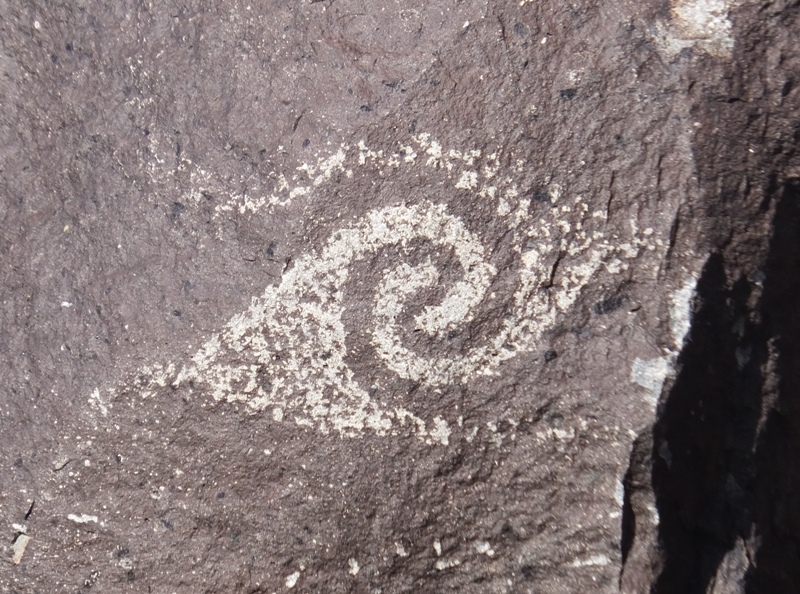
I see a hand with six fingers. Maybe the artist was smoking too much peyote. 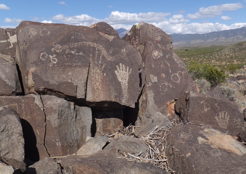
Another popular place to draw. 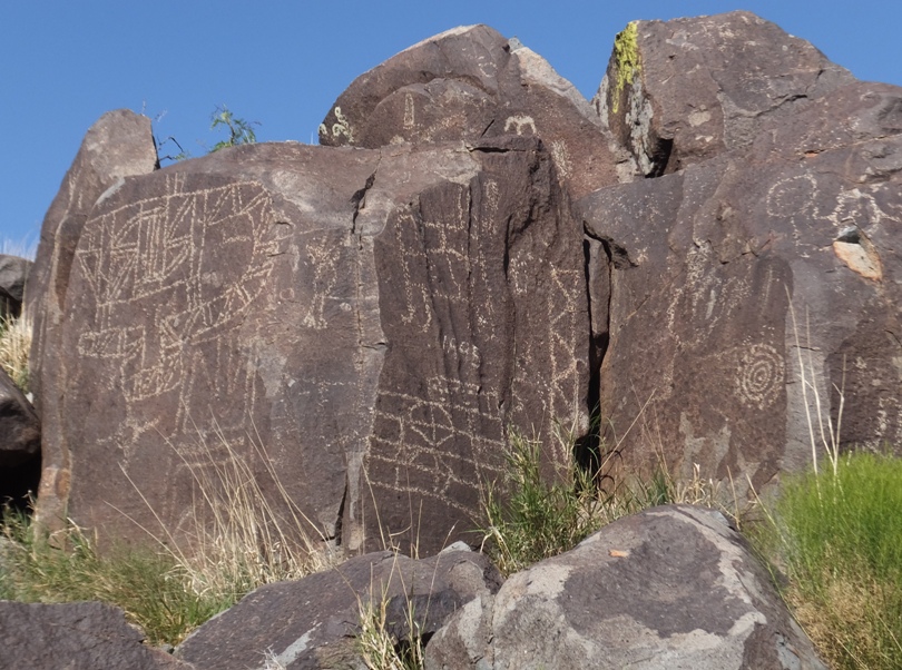
The surrounding area was flat for miles around, except for an occasional outlier here and there. Being at the petroglyph site put us on the high ground so we had a nice view of the landscape, including the Sacramento Mountains. There wasn't a whole lot of wildlife out but we did see one rabbit. 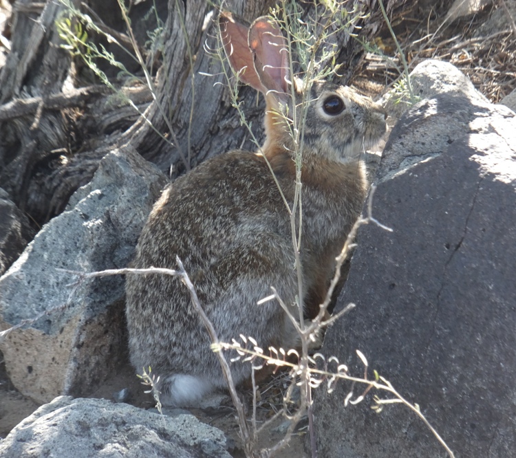
|
|
In Alamogordo, the three of us stopped in at McGinn's Pistachio Tree Ranch Country Store to purchase gifts. Carmen and I got our money's worth eating free samples of various candy coated nuts. New Mexico grows a lot of pistachios so it was a great place for tourist shopping.
We had our photo taken in front of McGinn's famous "World's largest pistachio." 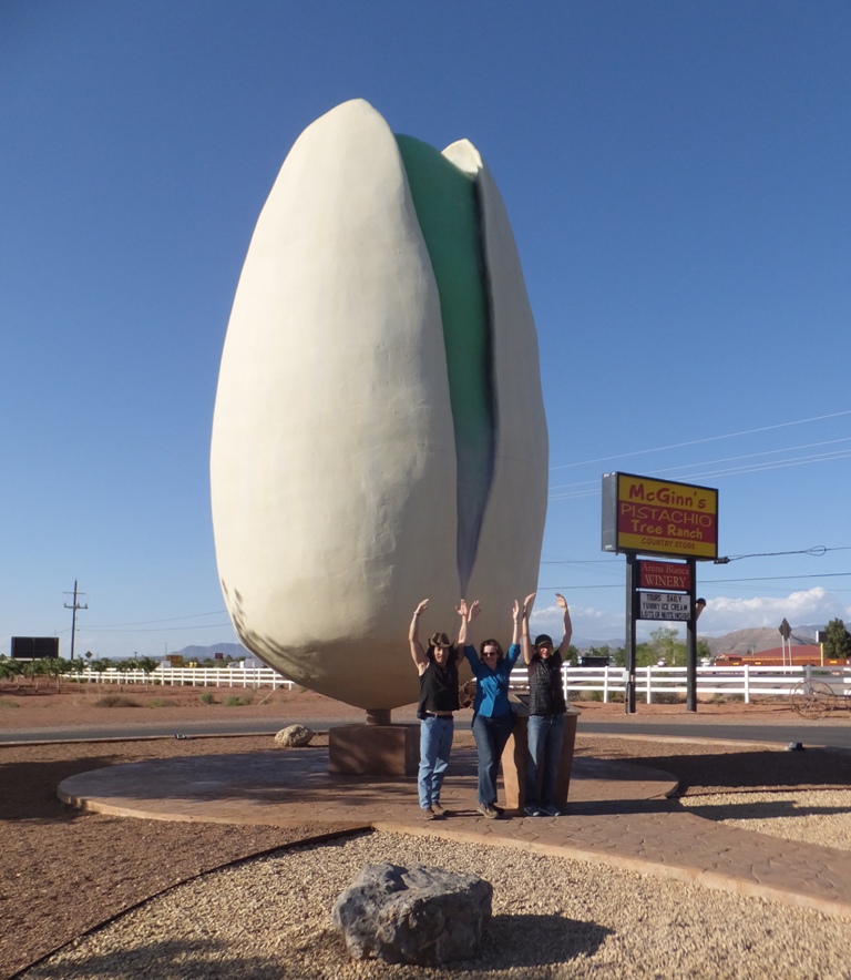
That night, we dined at Pizza Patio in Alamogordo and stayed at an inexpensive chain motel. |
|
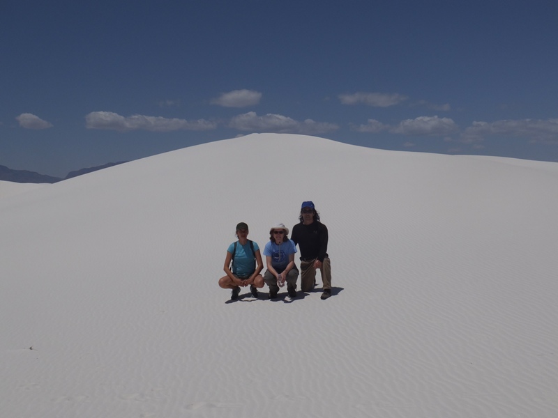
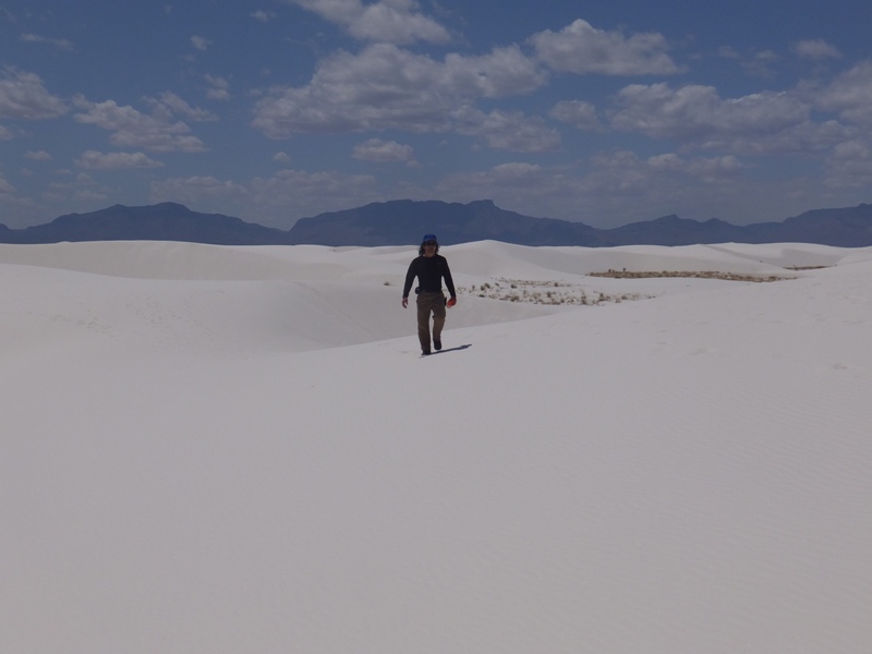
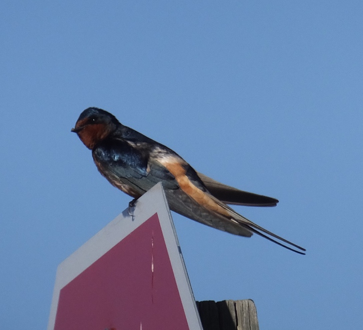
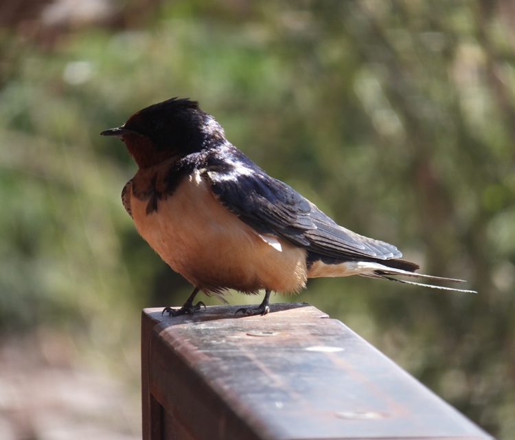
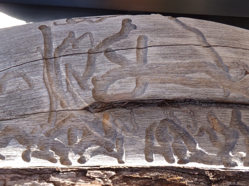
Up to now, we had done a good job with making good use of our time. We saw a lot but didn't feel too rushed. However, some things were beyond our control. This happened at White Sands National Monument. We arrived around 0800 to get in and see things while the sun was low. But due to missile testing, they said they would not open until 1000. We hung around the visitor center. A little later, they changed opening time to 1130. We really didn't have any good alternatives so we just waited. It certainly could have been worse. The visitor center was not a bad place to hang out. There were barn swallows just begging to have their picture taken. I also found some interesting worm-eaten wood lying around. They sold various desert-themed stuff like the selenite stick I purchased for a buck. The rangers ended up letting us into the park a little after 1100.
What was the park like long ago? 275 million years ago, during the Permian Period, a shallow, salty tropical sea covered this area. The sea rose and fell repeatedly over millions of years, leaving gypsum deposits behind as the water evaporated in the sun. These gypsum layers were eventually uplifted and became a part of the surrounding mountains. Crystal shards, lifted by strong spring winds, collide and shatter, again and again. They eventually become the white sand that pile up into dunes. Today, the park is home to the largest gypsum dunefield in the world. - from signs at visitor center and/or park More recently, this area serves as a missile test site. Back in 1945, The first atomic bomb was tested in July at the Trinity Site, 60 miles north of the White Sands. - from sign at visitor center Gypsum is a recurring theme at White Sands. Gypsum dunes only form under a unique set of circumstances, and there are only a few in the world. The three dunefields found in the Chihuahuan Desert are all protected. Gypsum is a $100-million-a-year industry. It is the main ingredient in drywall and plaster of Paris. Did you know this mineral is found in all kinds of food, household products, and medicines? - from signs at visitor center and/or park Gypsum was once a very important commodity...significant enough so that the illegal trade of gypsum sparked what was called the Plaster War of 1820. But that was nowhere near White Sands. Our first stop in the park was the Interdune Boardwalk. As you can see in this photo, the sun was high so it wasn't the best time to view the area. I don't recommend touching any metal on the boardwalk. Carmen did a few times and got electrocuted. Not sure what that was all about. I'm just glad she lived. 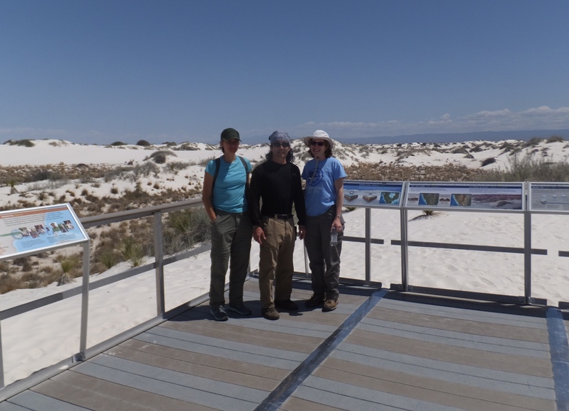
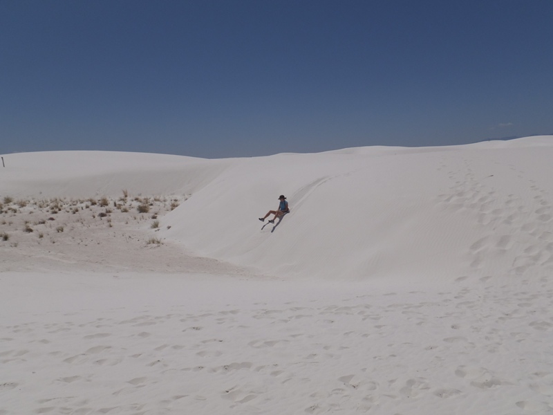
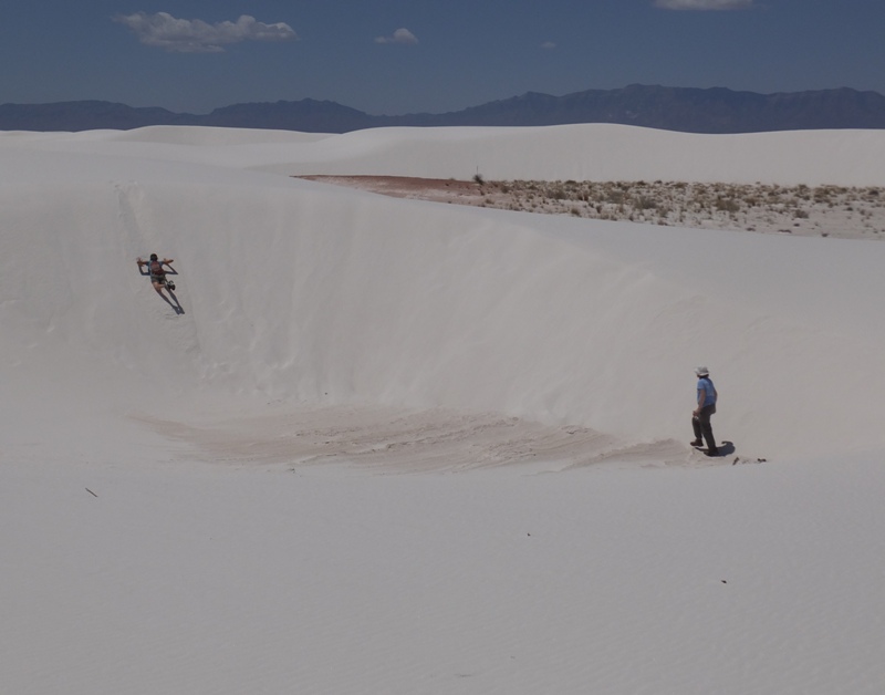
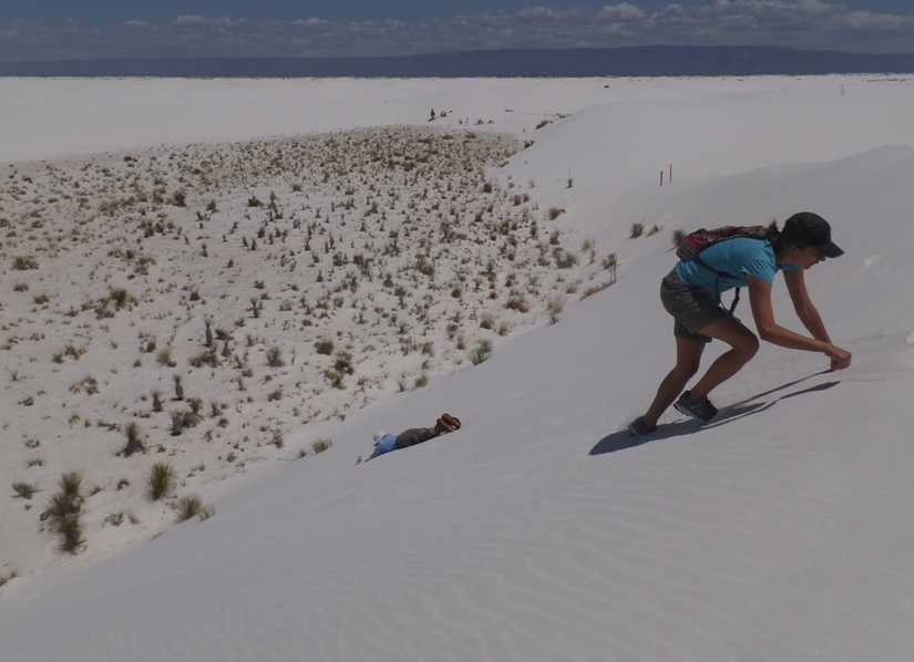
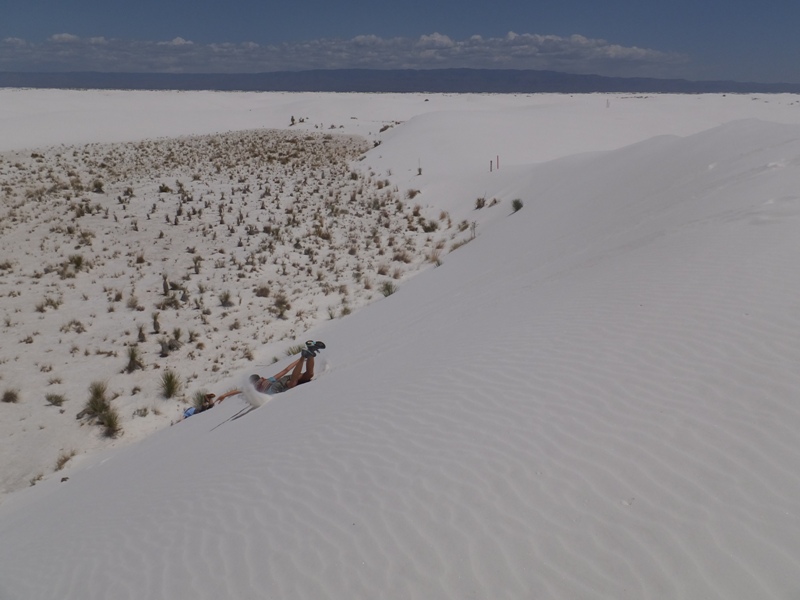
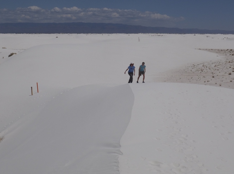
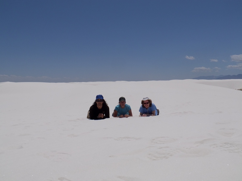
Driving a little further, we hiked on the well-marked Backcountry Camping Loop Trail. Without the trail markers, it would have been very easy to become disoriented since things ended up all looking the same after awhile. Along this trail, one can do very primitive camping (assuming no missile tests are taking place). Carmen brought a plastic tarp on which to slide down on the dunes. This didn't work very well so instead, she simply slid down on her butt. But sliding on her belly worked best. Eventually, Norma joined in. 1 / 4
Carmen sliding on her butt.
2 / 4
Carmen sliding on her belly.
3 / 4
Norma sliding, Carmen climbing.
4 / 4
Carmen sliding on her belly.
Here's a video of Norma and Carmen sliding down a dune on their bellies. Click the image to start. 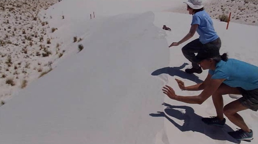
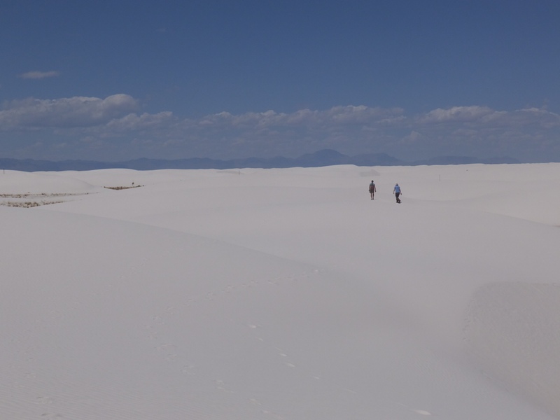
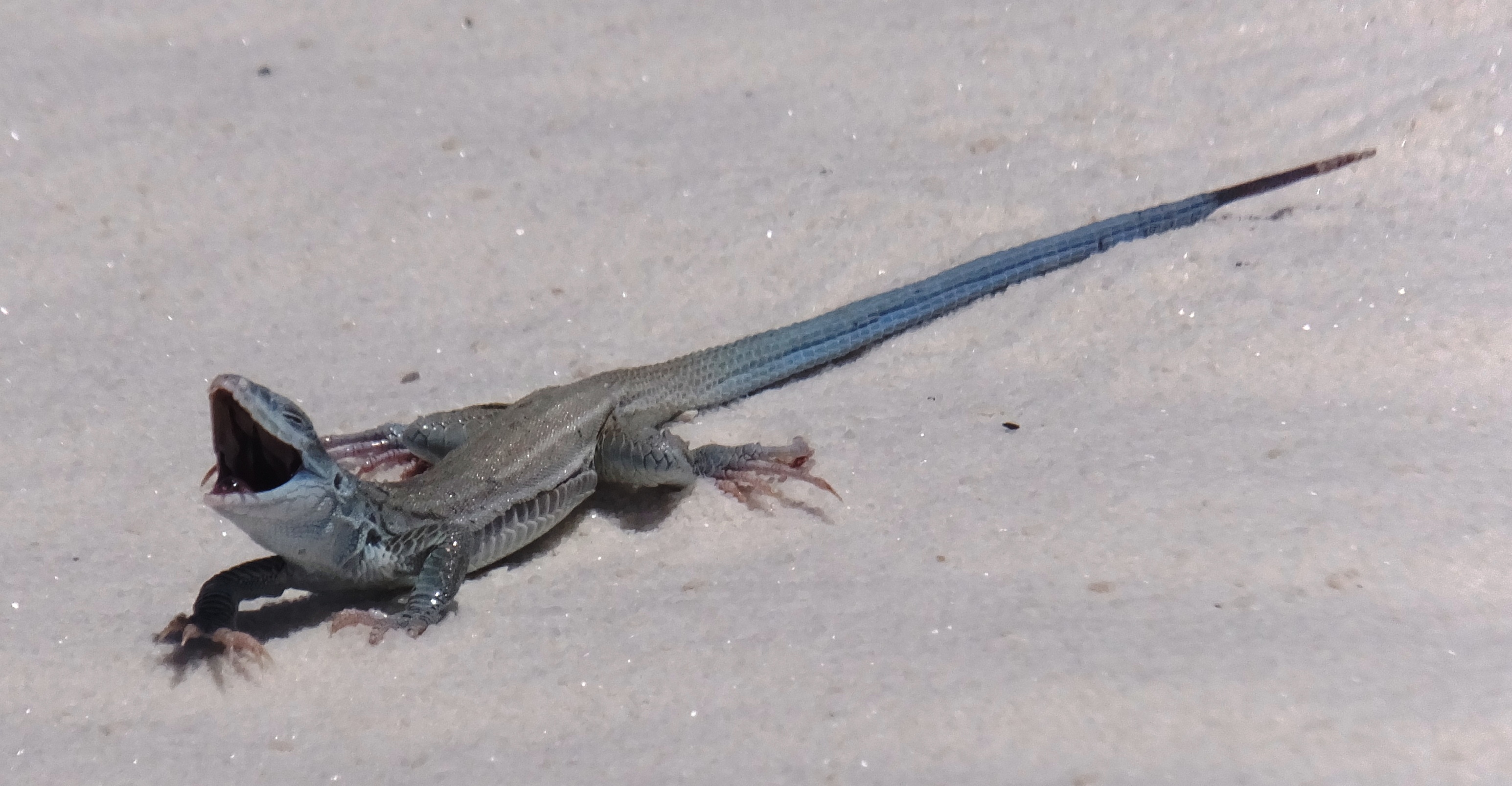
Some of the dunes were quite large. According to one sign, Some dunes are 45 feet high and may travel up to 38 feet per year. We saw a variety of interesting plants and animals. At the bottom of the page is a little white whiptail, often called "little blue-tail." This is a bleached earless lizard. 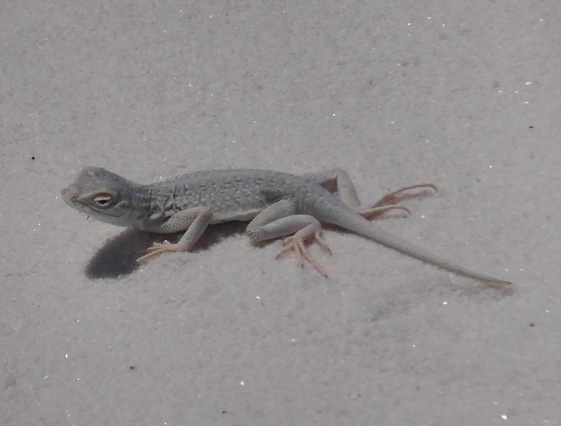
The air was warm and the sun was extremely bright, largely because so much of it reflected off the sand. But it wasn't uncomfortably hot. Still, it was comfortable to be under the cool sand. Norma testified to this after Carmen buried her. 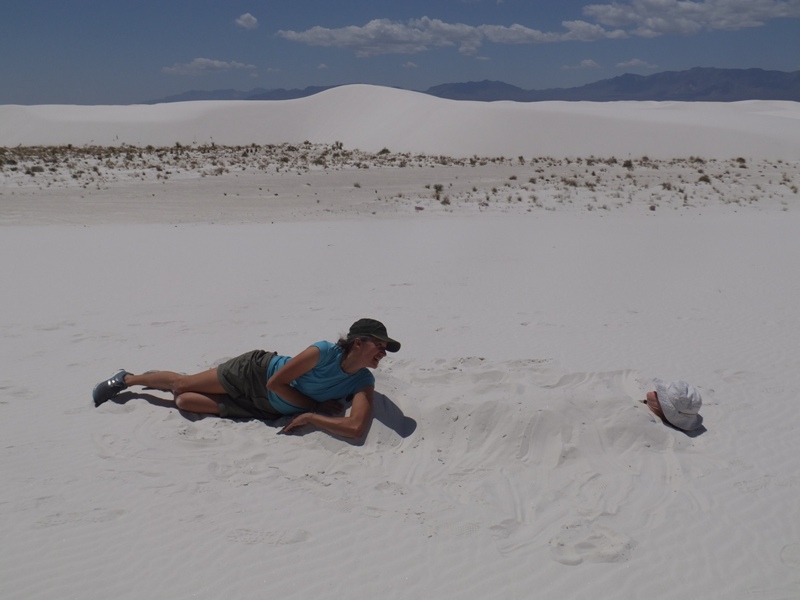
In a few places, flowers bloomed. 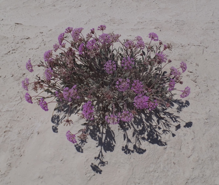
There were some things about that place which reminded me of the desert in Saudi Arabia and Kuwait although the latter was nowhere near as white, was completely flat (no dunes), and had almost no vegetation. This place was much more interesting. Still, the feelings that it brought back felt weird. 1 / 5
Very white sands.
2 / 5
Trail markers.
3 / 5
Prone.
4 / 5
Good visibility.
5 / 5
Almost back to trailhead.
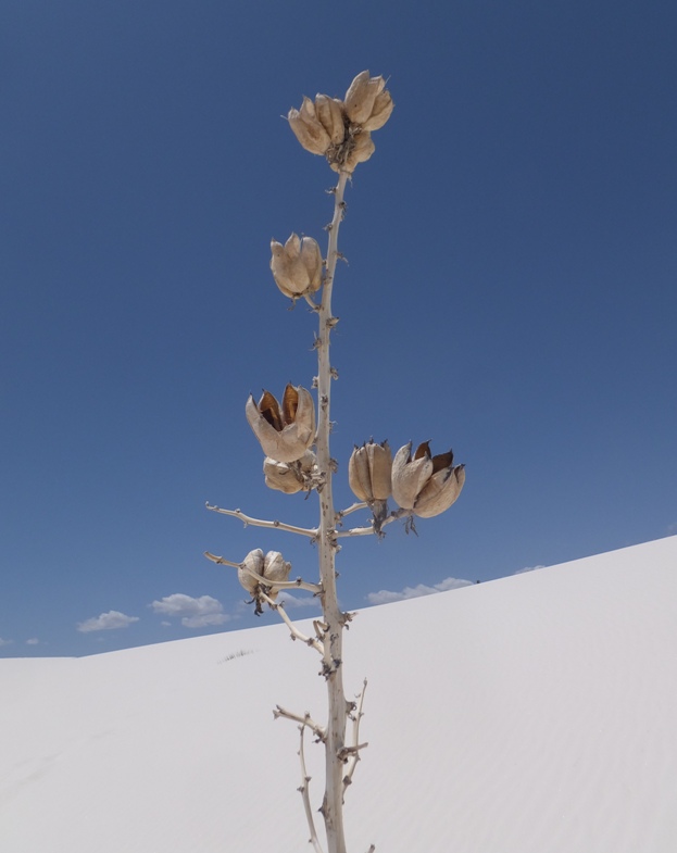
One of the plants we saw was soaptree yucca. This adapts to the shifting dunes by rapid growth. Yuccas first take root in the interdunal soil. As a dune edges up and over the yucca, it elongates its stem to keep its leaves above the sand for photosynthesis. What looks like a 4 to 6 foot tall yucca growing on top of a dune is really much taller with a long stem connecting to roots in the interdunal soil. - from sign at visitor center One organism we did not see but was present was cyanobacteria. In the interdunal areas (low areas between dunes), you will see a bumpy, raised surface covering the sand. What you are looking at is cyanobacteria - a woven mat of organisms living on the soil surface. The cyanobacteria adds nutrients to the sand, allowing plants to grow. It also holds rainwater like a sponge and slows erosion. The crust is very fragile and can be damaged if you walk on it. - from sign at visitor center For more information about cyanobacteria, see my April 12, 2015 blog. |
|
We drove through the Lincoln National Forest. Some of the views were breathtaking and the lighting was just right.
1 / 4
Steep mountains and clear skies.
2 / 4
Lots of rocks.
3 / 4
Norma and Carmen.
4 / 4
Norma and me.
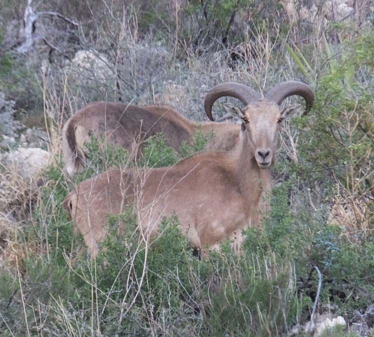
Outside the town of Hope, Norma saw a roadrunner. That was on my list of things to see in the wild on our trip so I was disappointed not to see it. It was a long drive between destinations and I asked Norma to drive the second part of this stretch so I could catch a little shut eye. So my eyes were shut when the roadrunner went "beep beep." Near White's City, we saw a large herd of barbary sheep cross the road. I reckon there were about twenty, many of which were on either side of the road when this photo was taken. 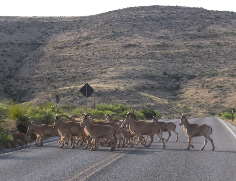
|
|
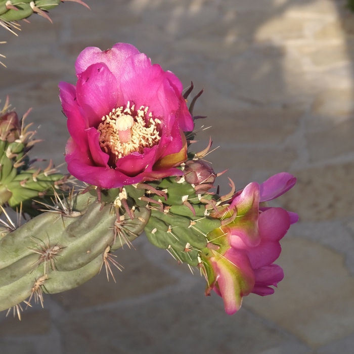
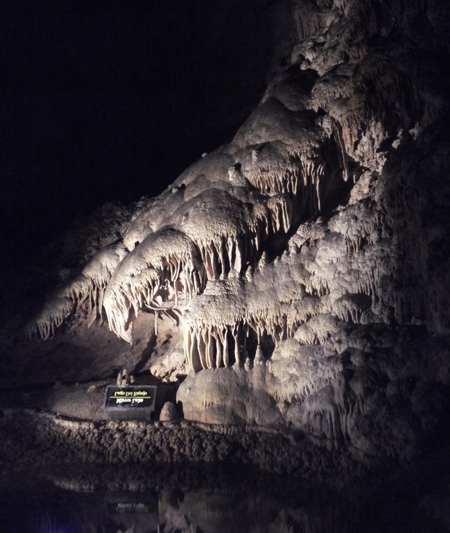
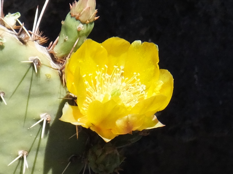
As the sun got low in the sky, we pulled into Carlsbad Caverns. The place was abundant with lots of blooming desert vegetation.
1 / 5
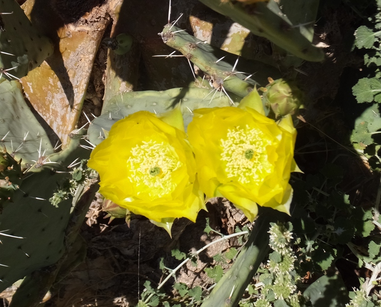
Cactus flower.
2 / 5
Something less prickly.
3 / 5
Really tall plant.
4 / 5
Like a highway road cone.
5 / 5
Another cactus flower.
We were some of the first to arrive at the cave entrance for the bat show. A park ranger was there to greet us and we spoke to him while we waited. Gradually, lots of other people showed up. He was expecting that we would see only 300 bats fly out of the cave at dusk. Cave swallows flew into the cave. They share the cave with the bats but live closer to the entrance. The ranger said they don't much like each other. ...they roost inside the natural entrance. In the fall, the swallows migrate south. - from sign near cave While we waited, I read about the history of the cave. American Indians have known about the entrance to Carlsbad Caverns for untold years, but they may not have ventured very far into the cave. There is telling evidence, however, that they inhabited this area. Yucca sandals, arrowheads, stone tools, stone flakes, and brownware pottery have been found nearby. The first Anglo settler to find the natural entrance or enter the cave is unknown. However, Jim White is widely recognized as the premier explorer. He most likely entered the cave in 1898 through the natural entrance by fashioning a ladder of sticks and wire. - from sign near cave We were instructed to turn off our phones and not use our cameras when the bats started flying out. This was to not disturb their echolocation which they use to navigate. That's why I don't have any photographic proof of this spectacular event. Gradually, the bats started coming out. Most were Mexican Freetail Bats. They flew in circles between us and the cave before flying off to find food. With them, they brought a strong stench. Instead of 300, we saw several thousand. A few days prior, there were very few because it was cold. But tonight, the weather was ideal. The bats kept coming out and keeping us entertained for maybe 20-30 minutes. For me, this was the second best part of our trip, after City of Rocks State Park. It wasn't quite as impressive as the bats in Austin, Texas but it was definitely worth seeing. That evening, we stayed at the Rodeway Inn which was very close to the caverns. It was the most expensive place we stayed during our trip...just over $100 for the three of us! But it was also the nicest. We ordered pizza and ate in our very spacious room. |
|
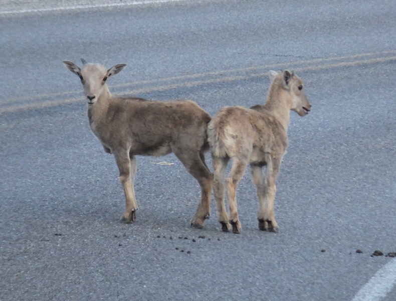
I was up before dawn. Alone, I drove back to the caverns to see the bats return to the cave. Along the way, I saw the barbary sheep again. Some of the babies were playing in the road. They seemed used to people and cars.
I arrived at the cave entrance at 0638. Yesterday, the ranger said the bats return around 0645. I waited there for a half hour but I did not see any bats. It was already pretty sunny when I arrived so I'm guessing I was too late. Or maybe we crossed over a time zone and I didn't adjust my watch. Maybe I would have seen them had I not stopped to see the sheep. The cave swallows were quite active. Noticing some of the vegetation in the area, not all the interesting plants were things in their prime. This dead branch from a cactus left an intricate skeleton. 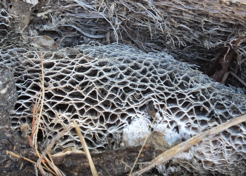
I walked on the Old Guano Road Trail where I found another cave entrance. This was a mining shaft that ...was once used to remove bat guano (droppings) from the cave below. Over 100,000 tons of guano were mined from this cave over a twenty year period. Bat guano, an excellent nitrogen fertilizer, was shipped to California to fertilize new citrus groves. Early miners initially removed guano through the large natural entrance where park visitors enter today. In 1903, this shaft and a similar one 1/8 mile east were blasted through the cave ceiling to reach the guano 160 feet below. Buckets attached to metal cables were used to lower miners and their equipment. Guano was brought up in the same buckets. Explorers and early park visitors also entered the cave by guano bucket [hopefully a clean one]. By the mid 1920's, the mining operations had come to an end in this cave. However, years later, guano was removed from other caves in this area. The "guano" bats continue to return to the caverns every summer as they have for thousands of years. - from sign near mining shaft entrance 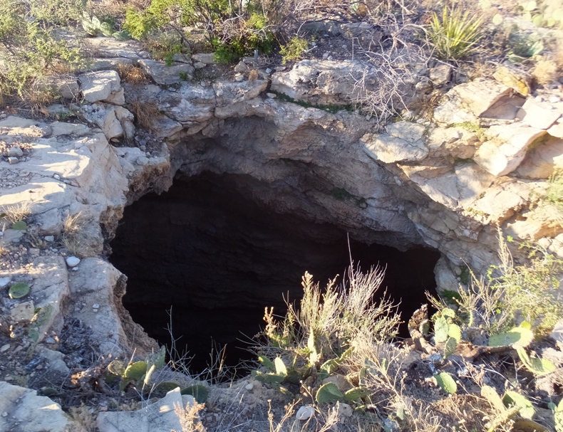
The low sun offered some good photo opportunities. 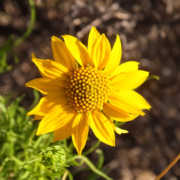
I returned to the motel where I found an interesting moth. Looks a little like a leopard moth but I'm not certain. 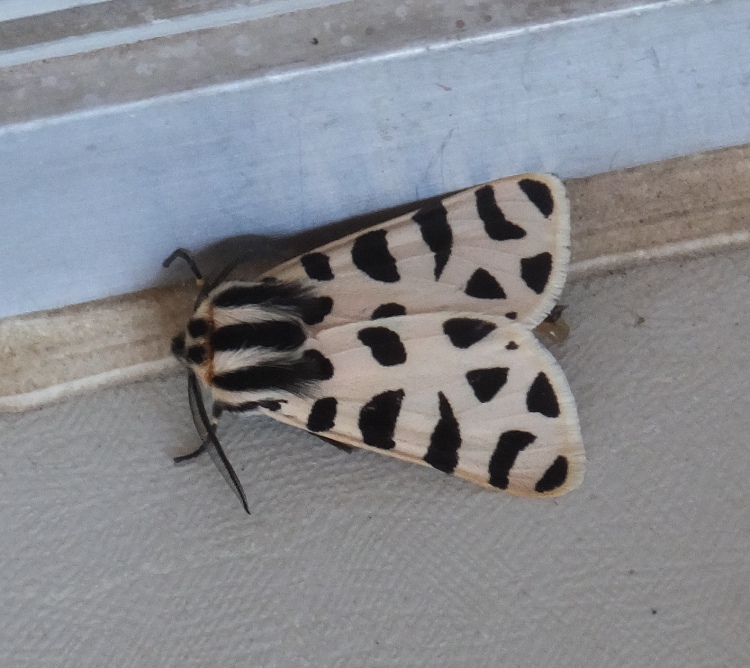
After breakfast, we packed up and all headed back to the cave. |
|
There were plenty of interesting plants and a few lizards outside the cavern.
1 / 4
Yellow cactus flower.
2 / 4
Lesser earless lizard.
3 / 4
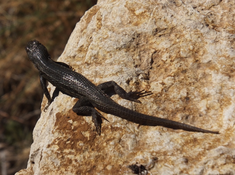
Black lizard.
4 / 4
Collared lizard.
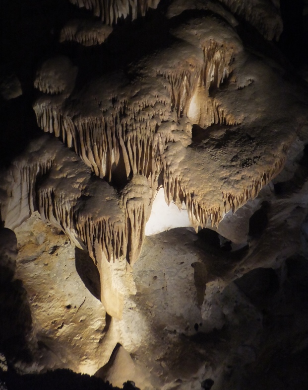
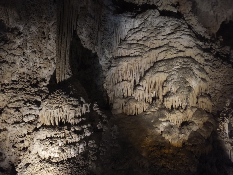
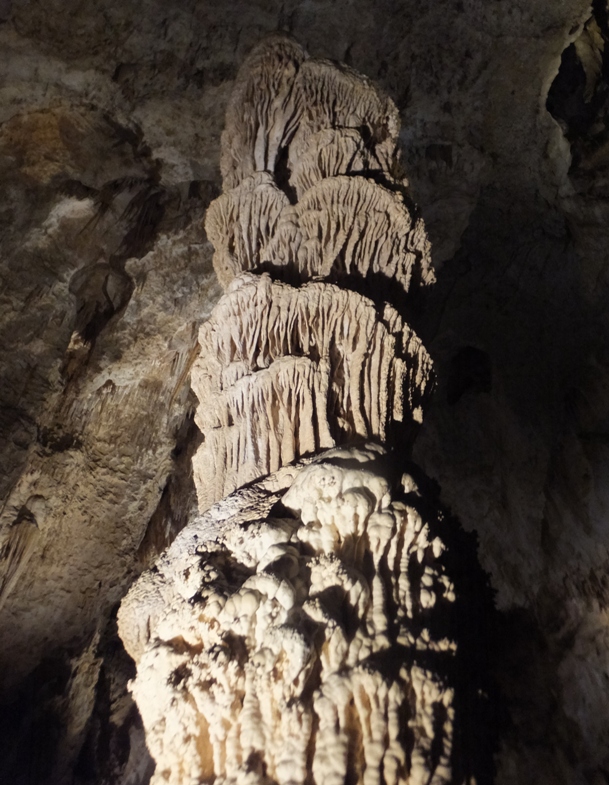
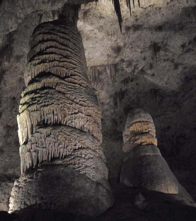
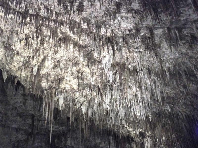
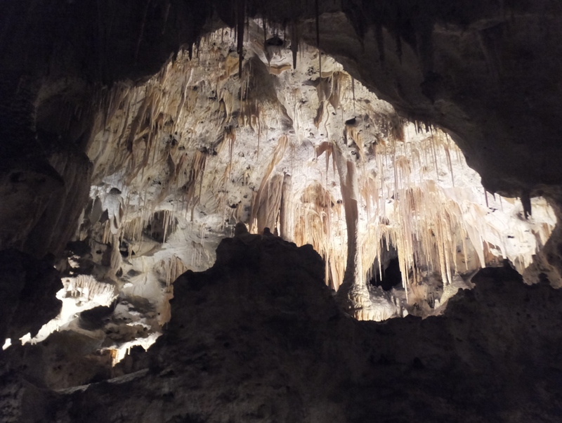
As we made our way down into the cave, I found myself being just as impressed with the unusual cave formations as the engineering that went into making the cave so accessible. This was no small feat! 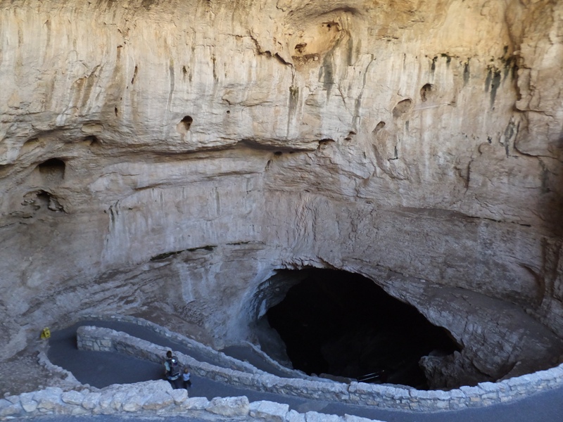
Seeing such fascinating cave features really got my imagination churning in fifth gear. I started thinking about what the various parts of the cave resembled. 1 / 6
Melting wax.
2 / 6
Cauliflower.
3 / 6
Icicles.
4 / 6
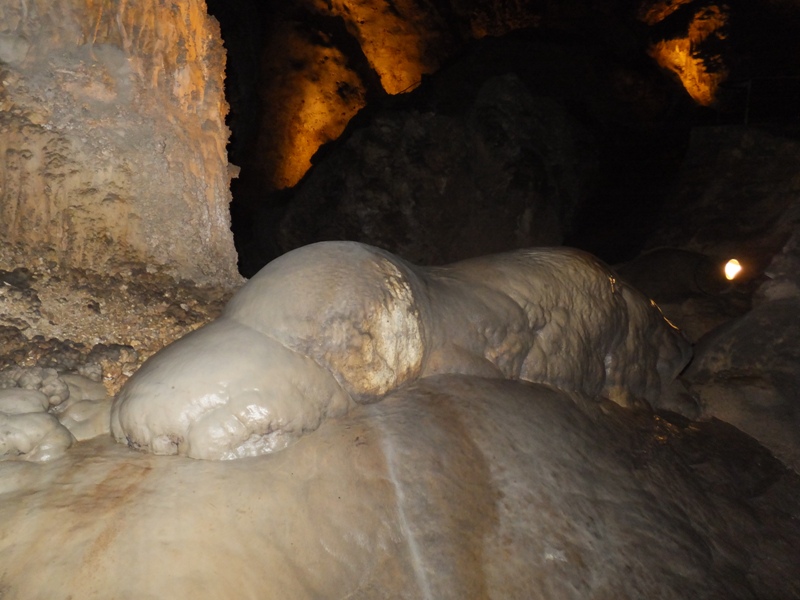
Beached seal.
5 / 6
Totem pole.
6 / 6
Water adds another dimension.
Something tells me that if a kid loses his helium balloon here, it will not last long with a ceiling like this. 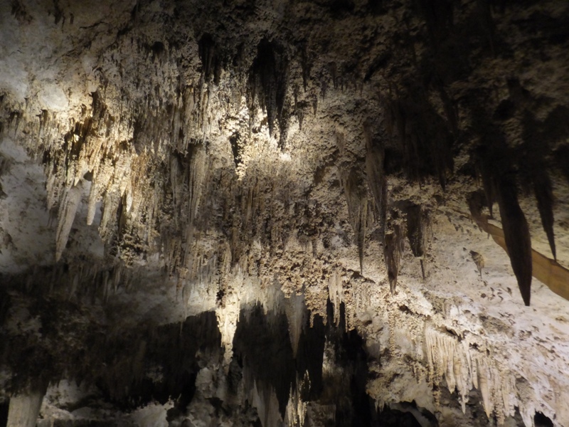
I would have liked to have explored back in here but it was off limits. 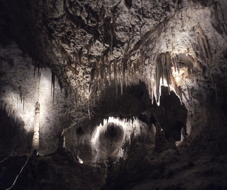
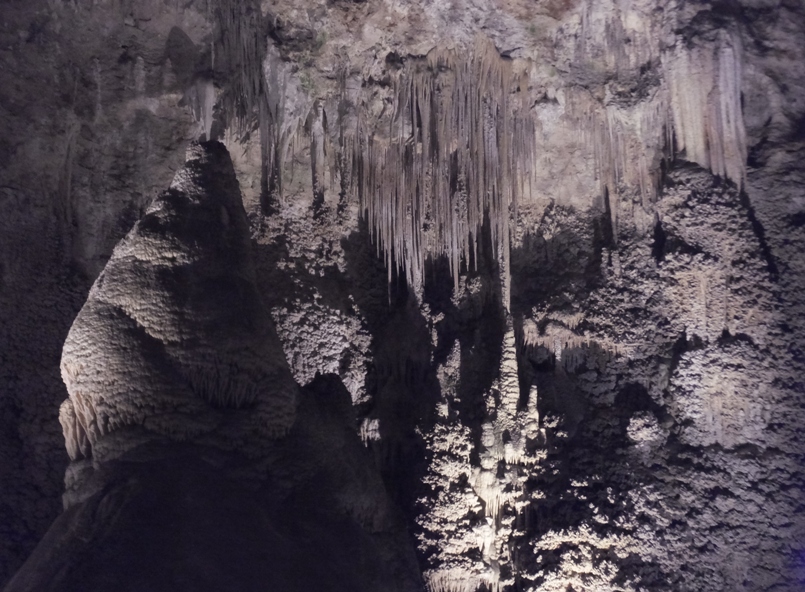
It was hard to appreciate just how big some of these rooms were. 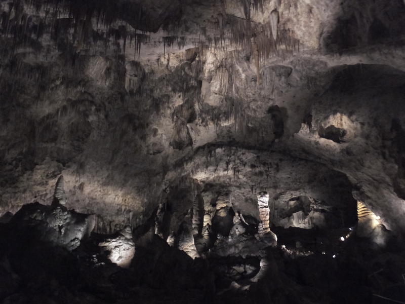
The lights used in the cavern allowed us to see natural colors. In this, I see yellow. 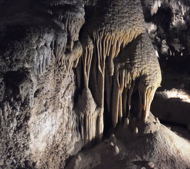
Even from a good distance away, a lot of detail could be seen in the cave features. 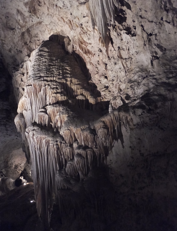
While the bottom may look like melting wax, I think the top looks like trees. 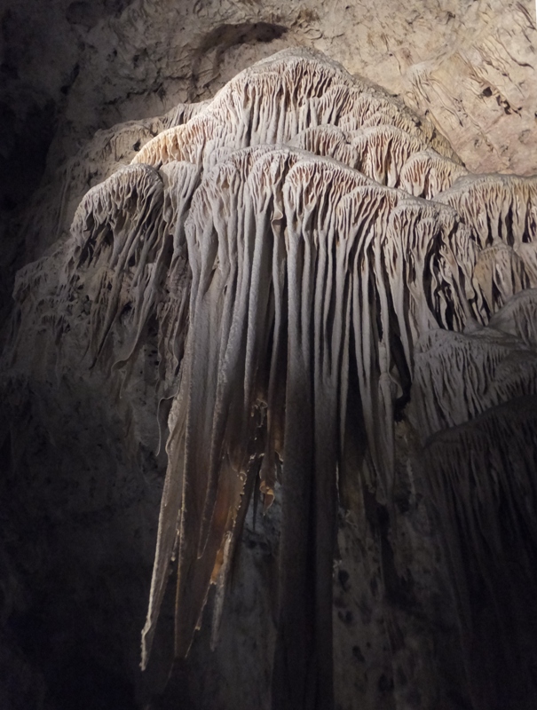
Some of these stalactites and stalagmites are almost touching. 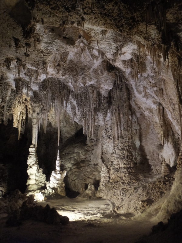
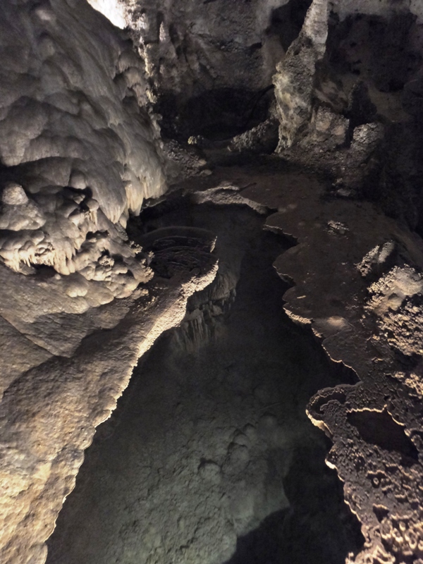
A sign in the cave described its formation over the years. There were plenty of illuminated signs in the cave to keep us informed and educated. Stalactites, stalagmites, and other cave deposits made chiefly of calcite are called "decorations" or "speleothems." Speleothems form when groundwater containing calcium bicarbonate solution seeps into the cave. When the solution becomes exposed to cave air, carbon dioxide gas is released, and calcite is deposited. "Soda straws" are thin, hollow stalactites formed by dripping water. As we descended deep into the cave, we saw more interesting formations. Below, I list the actual names of these features (not stuff I made up) and information from nearby signs. Here's other named features: 1 / 7
Lions Tail.
2 / 7
Hall of Giants.
3 / 7
Fairyland.
4 / 7
Mirror Lake.
5 / 7

The Chandelier.
6 / 7
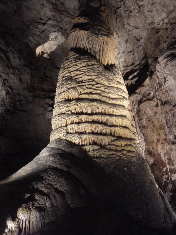
Rock of Ages.
7 / 7
Painted Grotto.
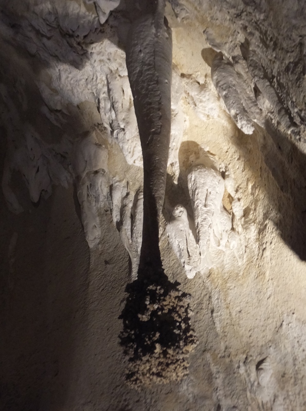
Closer to the entrance, we saw a bat at the base of the cave wall. 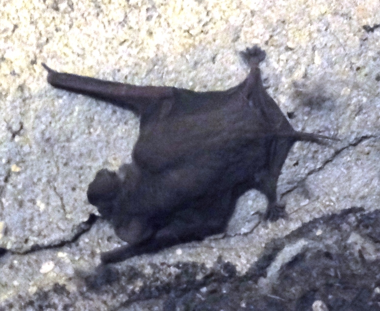
On the surface, we enjoyed the sun, did some shopping at the visitor center, and got a bite to eat before heading off to our next adventure. |
|
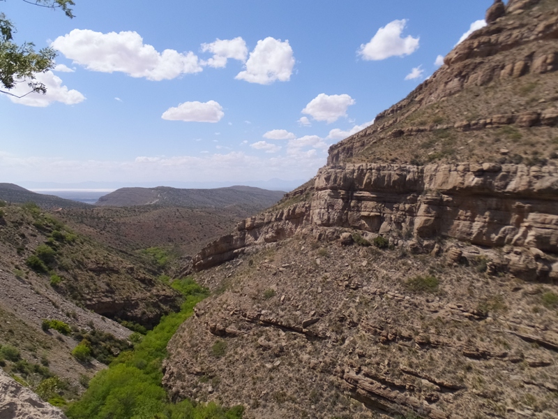
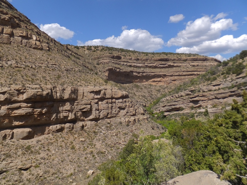
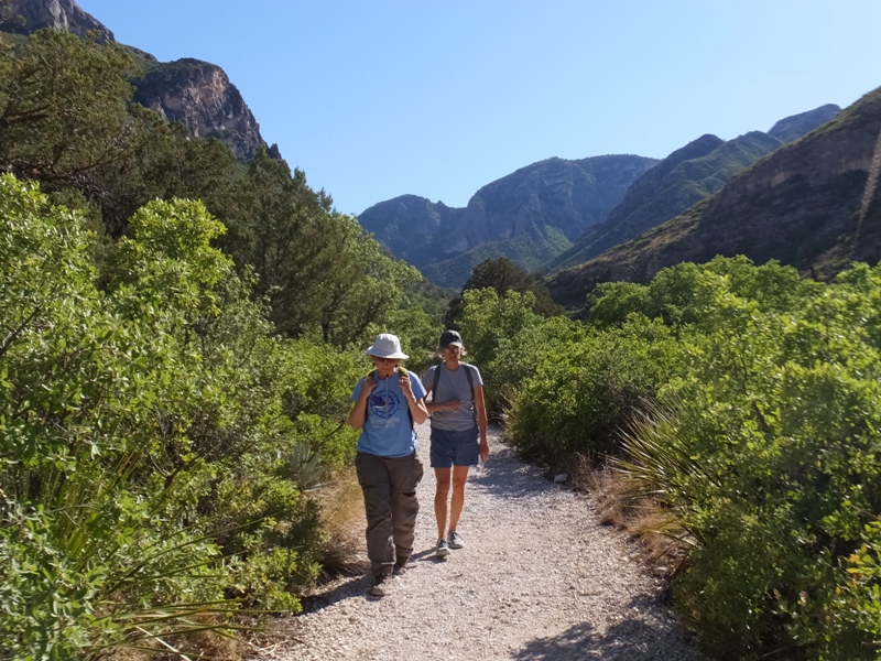
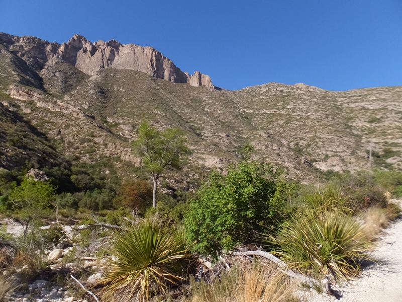
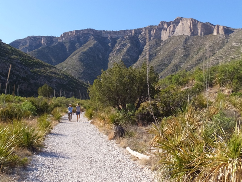
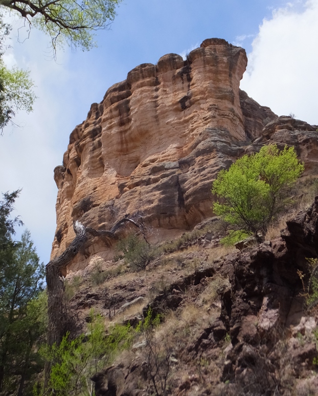
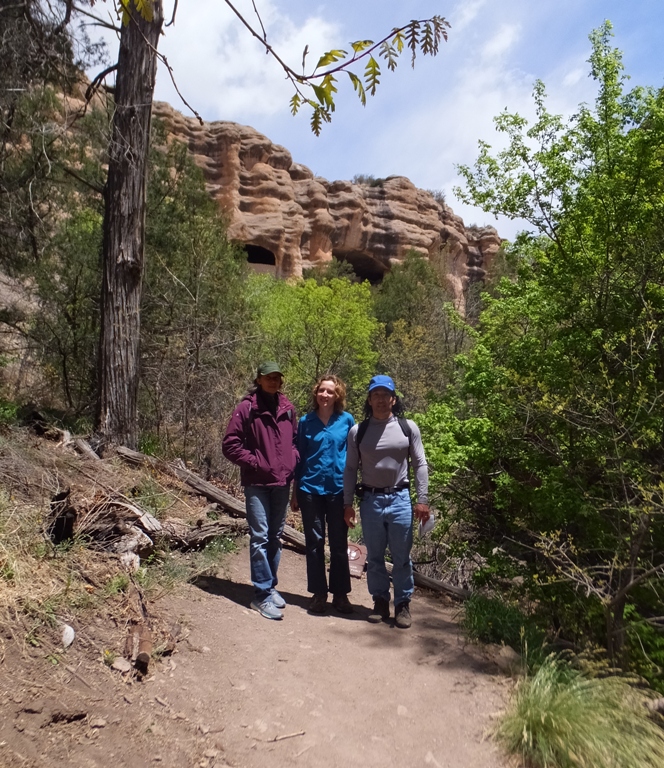
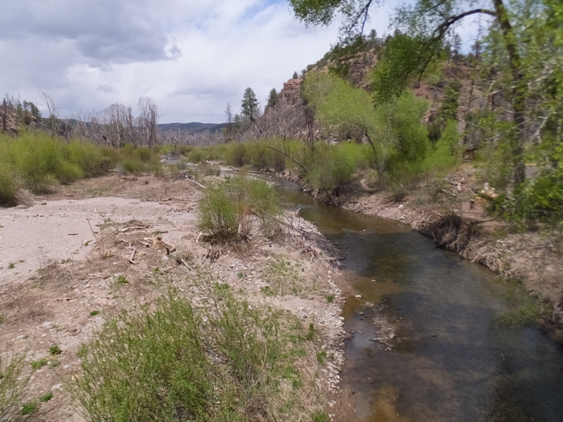
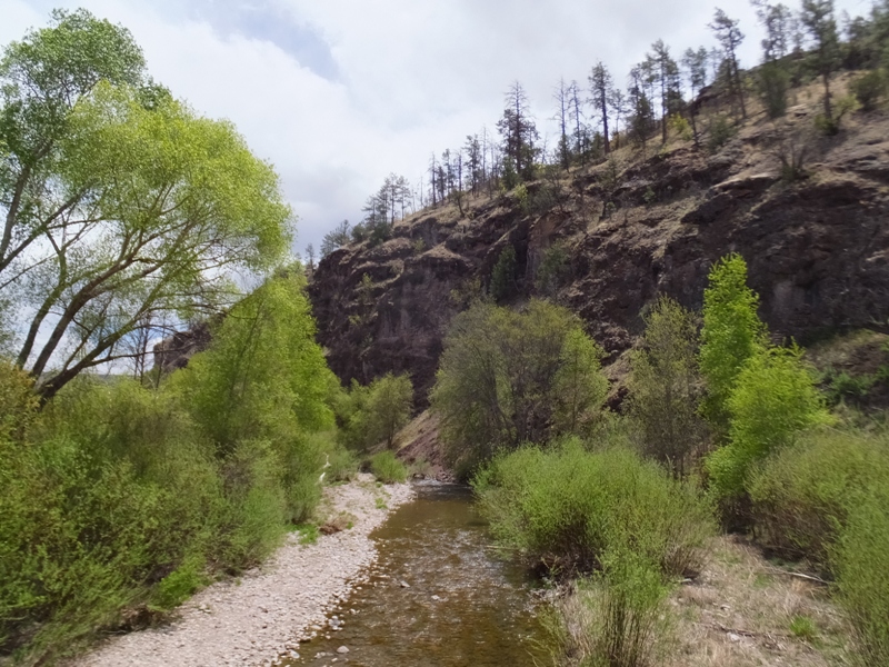
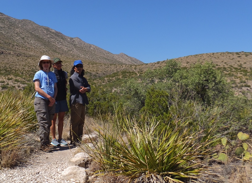
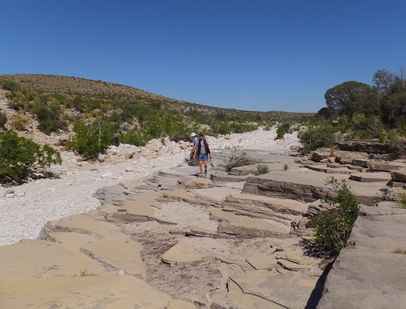
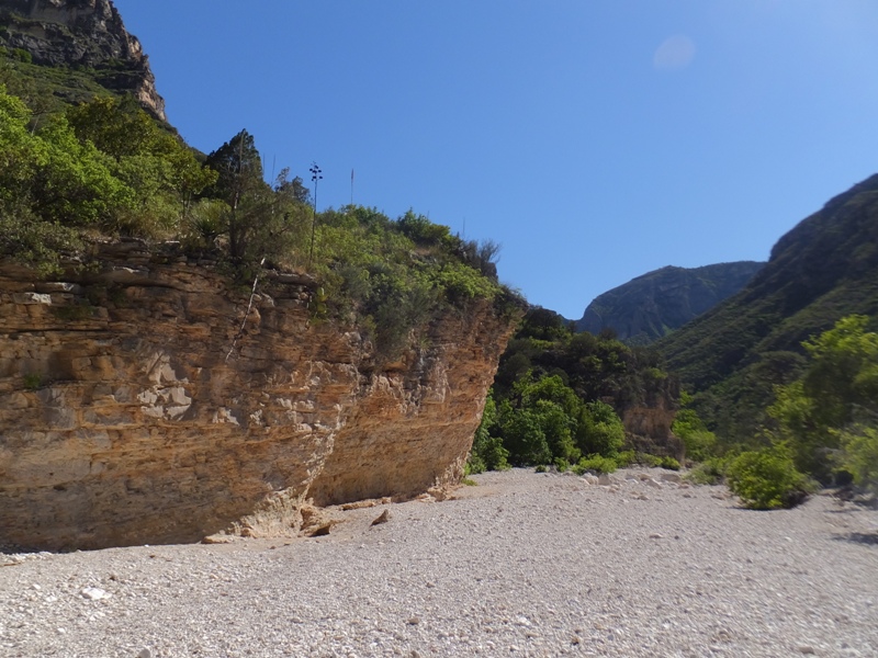
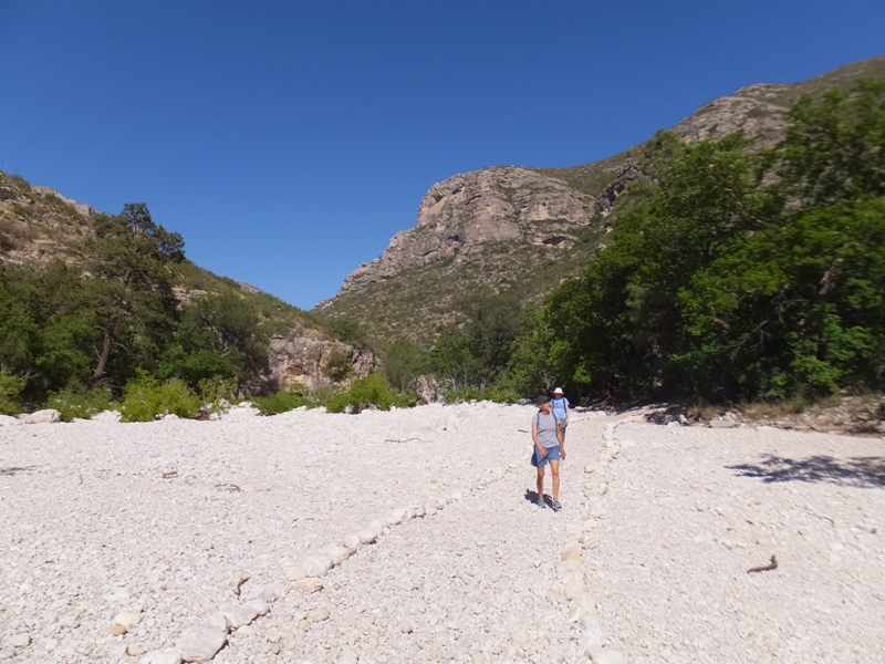
We crossed back into Texas and then made our way to Guadalupe Mountains National Park. This park
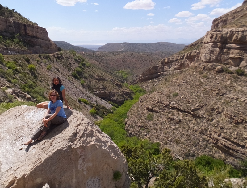
safeguards the world's finest example of a marine fossil reef - a reminder of the time hundreds of millions of years ago when the area was under water. The park also protects a gypsum dunefield [which we did not see]. - from sign at White Sands National Park It is a big area and it would have been nice to stay there longer but since our time was limited, I suggested we do a hike at McKittrick Canyon. I was intrigued about it after reading signs and watching a video about the area. "...the most beautiful spot in Texas." ...a sparkling succession of miniature lakes and waterfalls...closely bordered by lush green growth...bounded by gray walls towering under the blue desert sky. This is how geologist Wallace Pratt remembers this canyon as he first saw it in 1921. Mr. Pratt purchased the land and later donated it to the National Park Service. Sadly, McKittrick Canyon has lost some of its former beauty through natural changes. The miniature lakes and waterfalls were formed by the travertine -- deposits of calcium carbonate. This long established travertine was demolished by severe floods in 1943 and 1968. The dense green vegetation bordering the stream was carried away. Half of the stream began to flow underground. Today the travertine is slowly building up. The lush vegetation known by Wallace Pratt is slowly recovering. - from sign at park We commenced our out and back hike to McKittrick Canyon by walking through a typical southwestern desert landscape. Eventually, we walked along a dry riverbed. A gravelly trail led us into the valley. As we continued, the area became more lush. Eventually, we found the stream that Pratt had mentioned. In it were some polliwogs. There were very few people on the trail and some were very surprised to see anyone else. After awhile, we arrived at our turnaround point, the Pratt "stone cabin" as he called it. 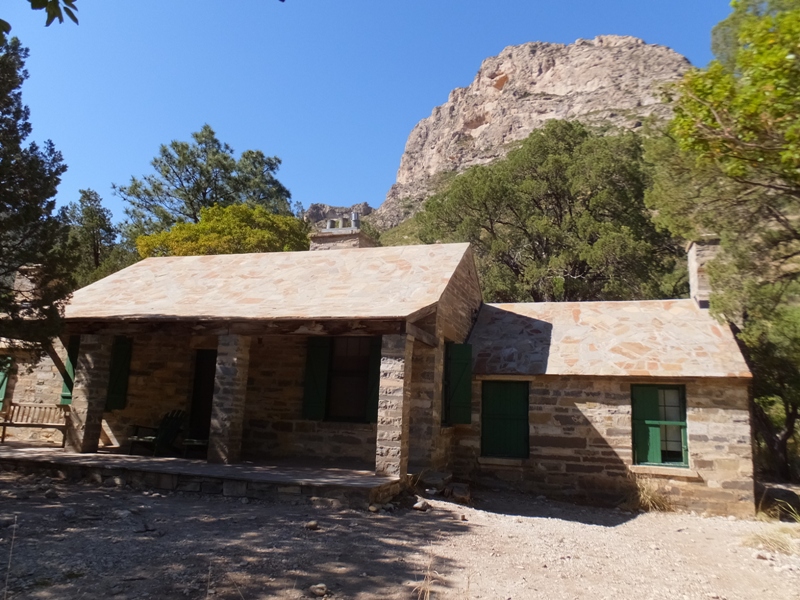
At the cabin, we stopped for a snack and admired the view from the house. 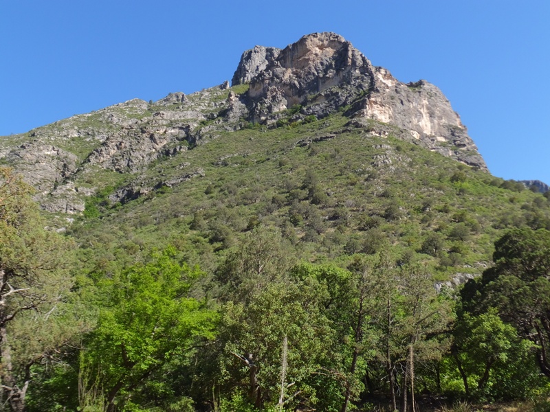
We walked back to the car. 1 / 3
Looking back at the narrow valley.
2 / 3
Rolling hills and rocky cliffs.
3 / 3
Wide enough for a vehicle.
We saw a pair of agave plants that looked like eight-foot tall asparagus. 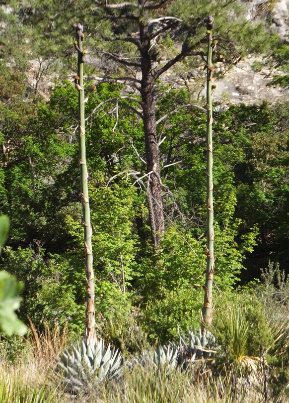
Had we instead done the hike to our north on the Permian Reef Trail, we would have been in a place where there were once colorful sea animals and plants abounded in the shallows of the Permian Sea which covered this part of Texas about 250-280 million years ago. - from sign at park |
|
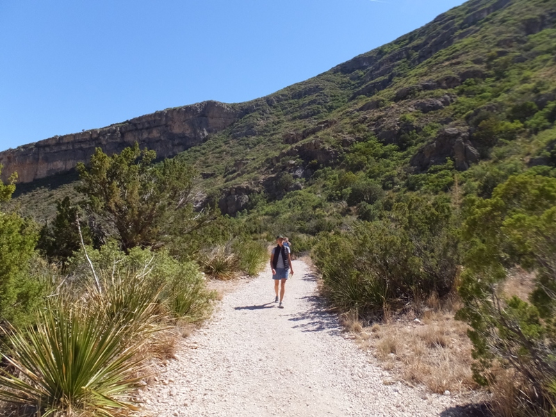
Our next stop was the Guadalupe Mountains National Park Visitor Center. It was closed for the day but we were able to walk on the informative trail nearby.
The Guadalupe Mountains trace their origin to the ancient Capitan Reef, which built up along the fringe of a shallow ocean here. The reef formed during the Permian Period 250 million years ago, before mammals and flowering plants appeared on Earth. - from sign at visitor center There were several fine specimens of native plants along the path with information signs describing them. My hometown, Sacramento, is where the Pony Express originated. Near my old neighborhood, I remember seeing signs and a logo for a neighborhood called "Butterfield." Today, I saw what appeared to be the same logo on a sign that described something called the Butterfield Overland Mail. As a forerunner of the Pony Express and the Transcontinental Railroad, the Butterfield Overland Mail was the first successful attempt to link East and West with a reliable transportation and communication system. The arduous 2,700-mile wilderness journey between Saint Louis and San Francisco was always completed within 25 days as stipulated in John Butterfield's federal mail contract. The six-year federal mail contract awarded to John Butterfield, a wealthy and popular businessman, was cut short by the onset of the Civil War in 1861, yet the Butterfield Overland Mail was heralded by some as one of the "greatest events of the age." - from sign on trail Butterfield relates to this area because Pinery Station [nearby]...has the distinction of being the only ruin of an original company-built Butterfield station standing in close proximity to a national highway. - from sign on trail We heard a strange sound that Norma later thought was a coyote howling. |
|
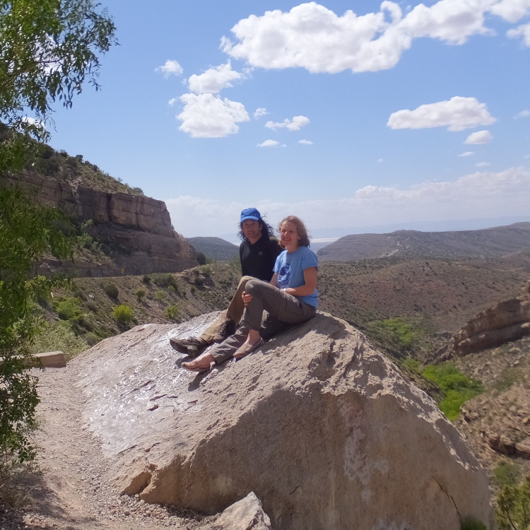
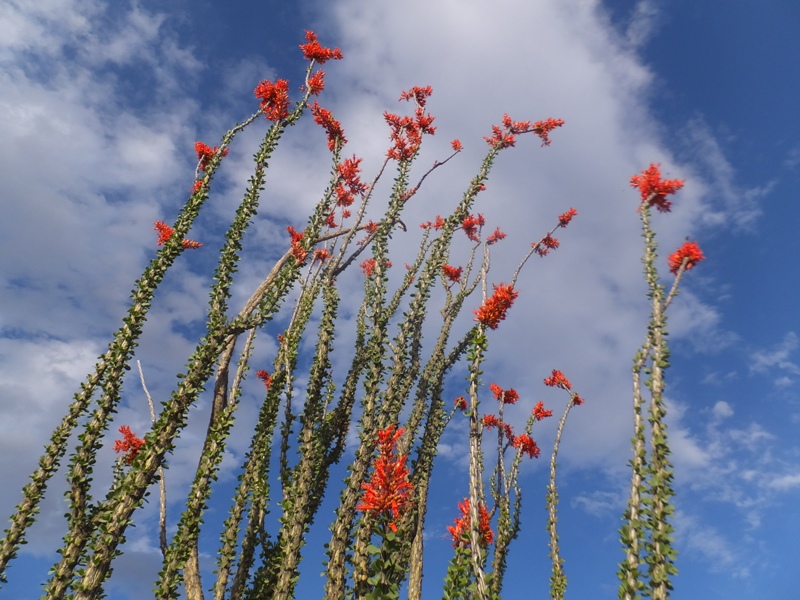
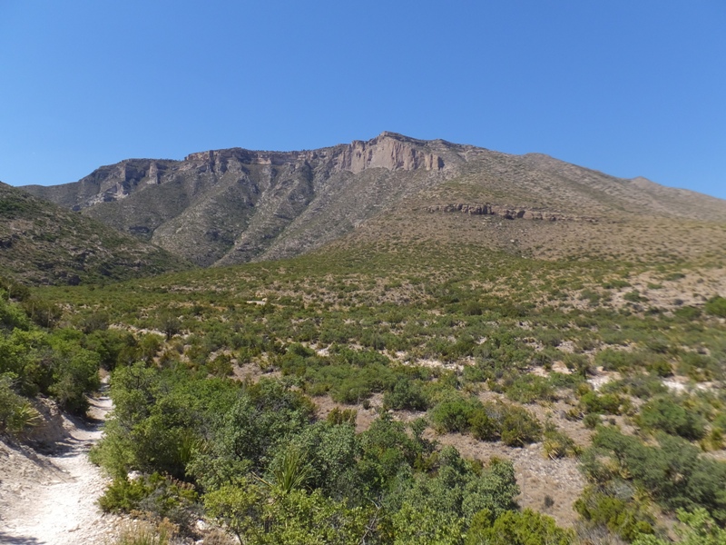
After leaving the area, we stopped near Guadalupe Peak.
Guadalupe Peak, Texas' highest mountain at 8,749 feet above sea level, dominates one of the most scenic and least-known areas of the state. It lies behind and to the right of El Capitan (8,078 feet), the sheer wall that rises more than 3,000 feet above this spot to mark the south end of the Guadalupe Range. - from sign along side of road The picture below shows El Capitan. 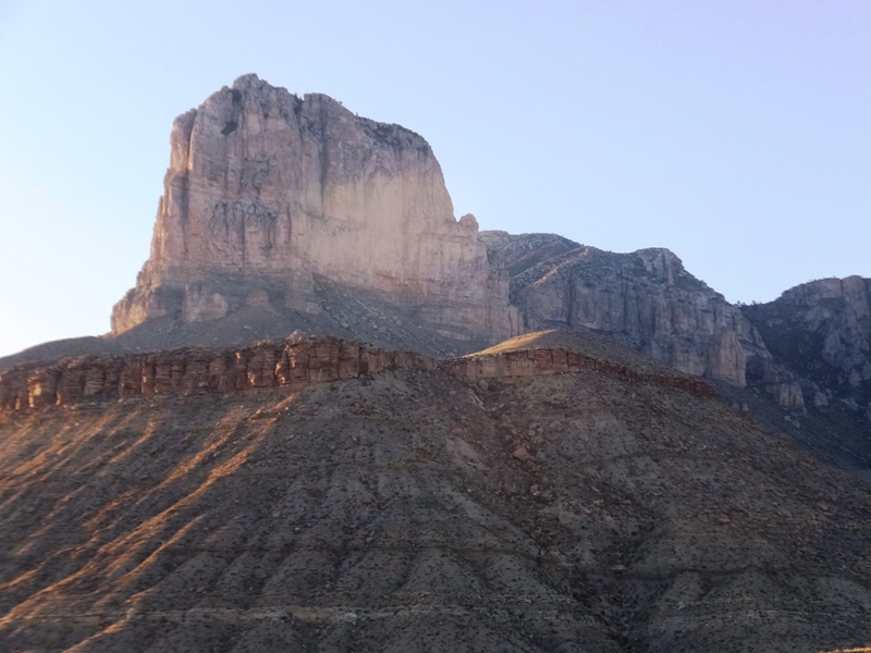
Looking away from El Capitan, we had a nice view of some rolling hills. See the photo at the top of the page. I saw a couple of coyotes off the side of the road. That evening, we stayed at Connie's house again. |
|
Norma and I drove Carmen to the bus station where she then headed to the airport. We were hoping to spend some time with her in El Paso but the morning commuter traffic was incredibly slow and ate up too much time.
After losing the 'C' in our Team SNaCk, Norma and I ventured to explore El Paso on our own. It was late morning and quite a few things were still closed but there was plenty of stuff to see like this Aztec calendar. 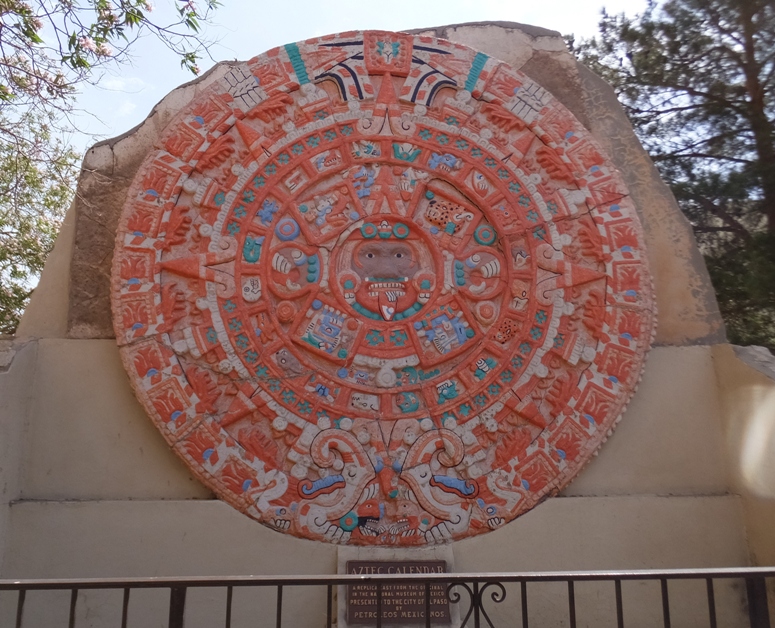
We ate lunch at El Tenedor, which was very good. The two of us passed a restaurant called Oishii that uses a circular swimming fish pattern that I thought would make an excellent tattoo. Norma and I toured the El Paso Museum of Art which I didn't much care for. Next, we saw the El Paso Museum of History which I enjoyed more. Walking around San Jacinto Plaza, we saw the famous alligator statue that Carmen had told us about earlier. 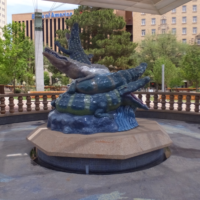
We got a snack at The Green Ingredient. I bought their anti-inflammatory drink which tasted horrible but I guess that must mean it works. |
|
At the University of Texas at El Paso, we walked through their Chihuahuan Desert Gardens.
Inside the university, they had a fulgurite on display. I did a "fun fact" at work about fulgurites. Fulgurite is scientific Latin for "lightning stone." Fulgurites are made when lightning strikes the ground. When a bolt strikes loose sand, it vaporizes a thin wormhole and melts the zone around it, creating an instant froth of natural glass. - from "Geology About - Fulgurites" (a broken link as of 2024) 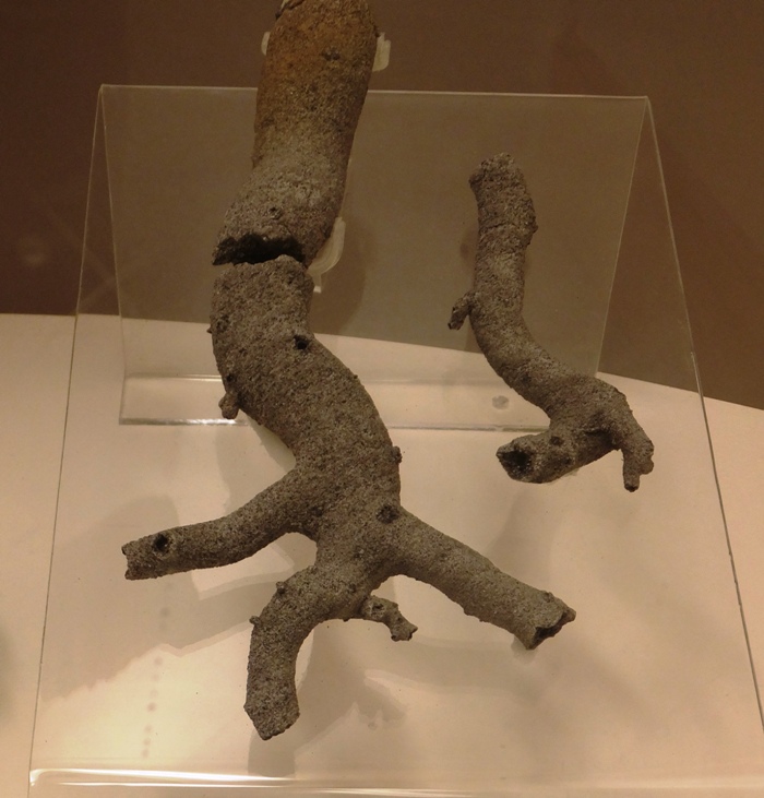
|
|
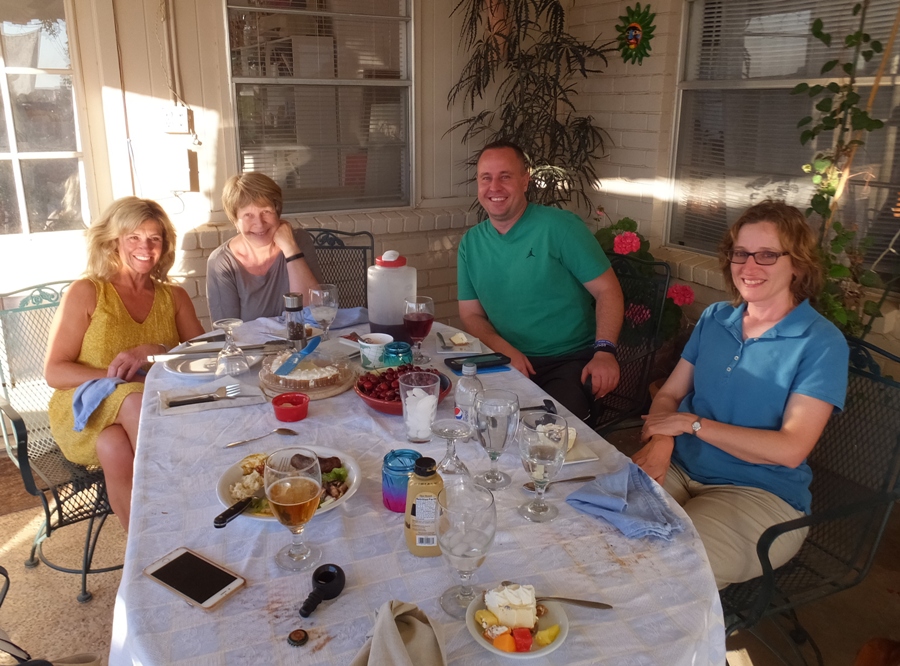
Norma and I ate dinner at Anna's house with her housemate, Daniel, and Connie. In the below snapshot, Connie is on the far left, Anna is next to her, and then Daniel and Norma. It was quite a feast that Anna really put a great deal of time into preparing.
That evening, we slept at Connie's house again. |
|
Norma and I left Connie's house bright and early and drove to the airport. We returned the rental car and then boarded a flight to Dallas.
In Dallas, we used Uber to get around. This was my first time using it. I was quite pleased with it and the phone app. We checked into an AirBnB house where we would stay for the rest of our trip. Our host was Brad. The purpose of our trip to Dallas was to attend the wedding of Aimee and Luis. Aimee is Norma's friend. That evening, Norma attended Aimee's bachelorette party. |
|
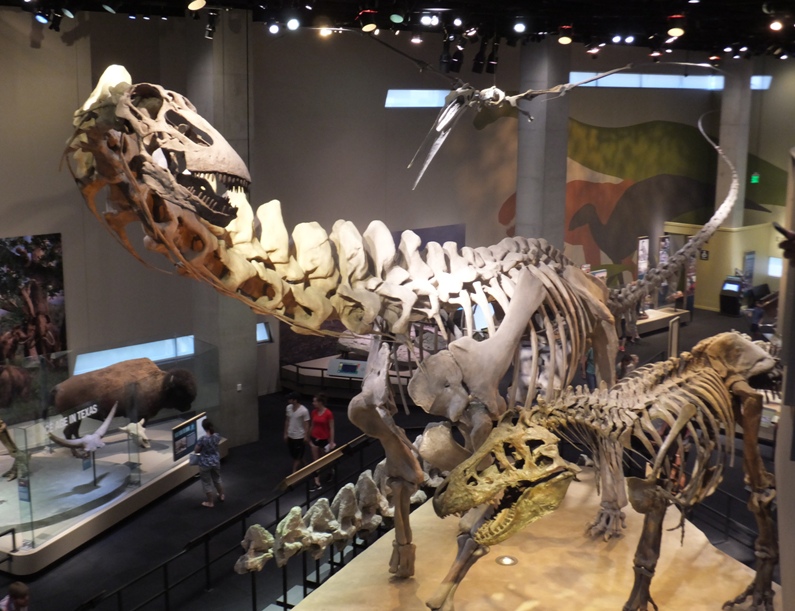
Norma spent much of the day with wedding stuff so I went and checked out the Perot Museum of Nature and Science. Gary (Norma's friend's husband), Luke (Gary's son), and Mark (Norma's other friend's husband) joined me but we all ended up going at our own pace. We watched a very inspiring 40-minute long 3D movie about space exploration and traveling to Mars that made Mark and me want to be astronauts. I saw minerals, animals, engineering displays, information signs about energy, and dinosaur fossils.
The thing I found most interesting at the museum were the sections explaining fracking and oil refinement. I had no idea so much stuff we use every day comes from oil...and I'm not just talking about plastic. Later that evening, we attended a Mexican dinner for wedding guests at hotel. Norma sat next to an in-law of Aimee's that said great things about Chestertown, Maryland, a place we have talked about retiring to. |
|
In the morning, Norma and I participated in a very nice walking tour of downtown Dallas.
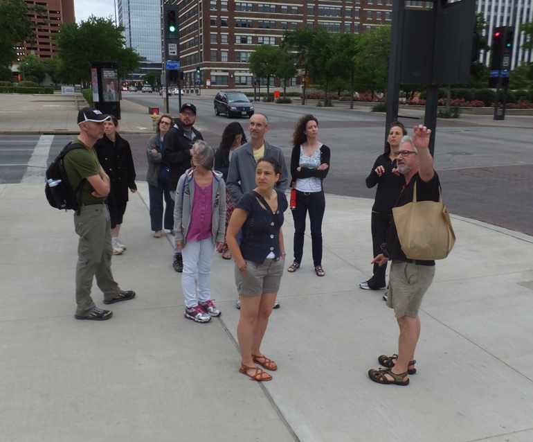
Our guide, Jim, used to work with Luis. He mentioned the generosity of Ross Perot and gave us some very detailed information about the John F. Kennedy assassination. Jim showed us a lot of stuff. We saw the pegasus, which is a symbol of both Dallas and Mobil Oil. 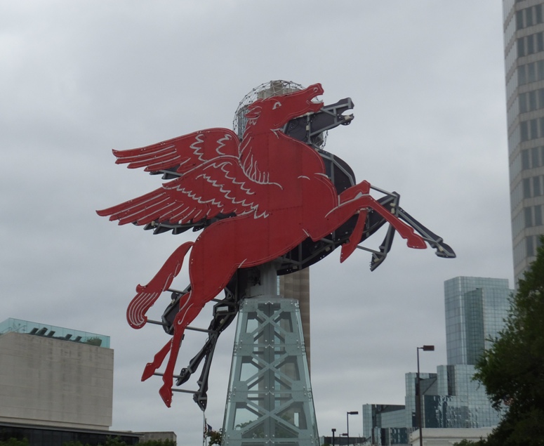
After the tour, we ate at Spaghetti Warehouse which was mediocre. |
|
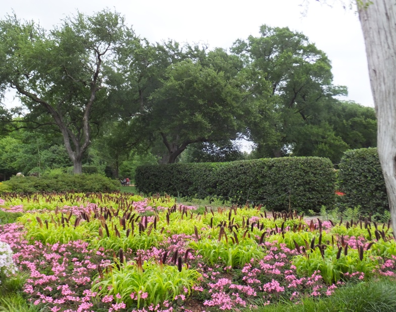
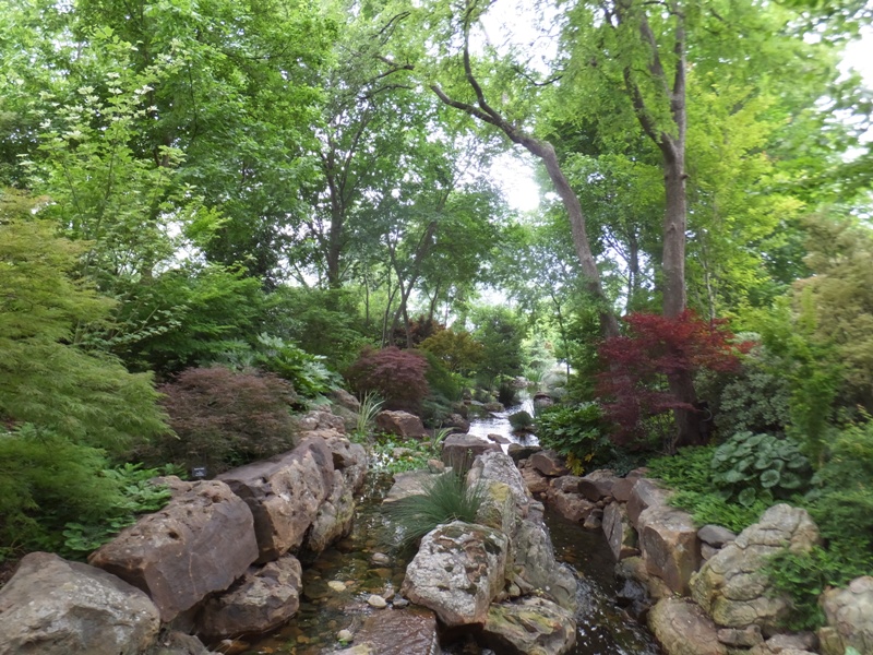
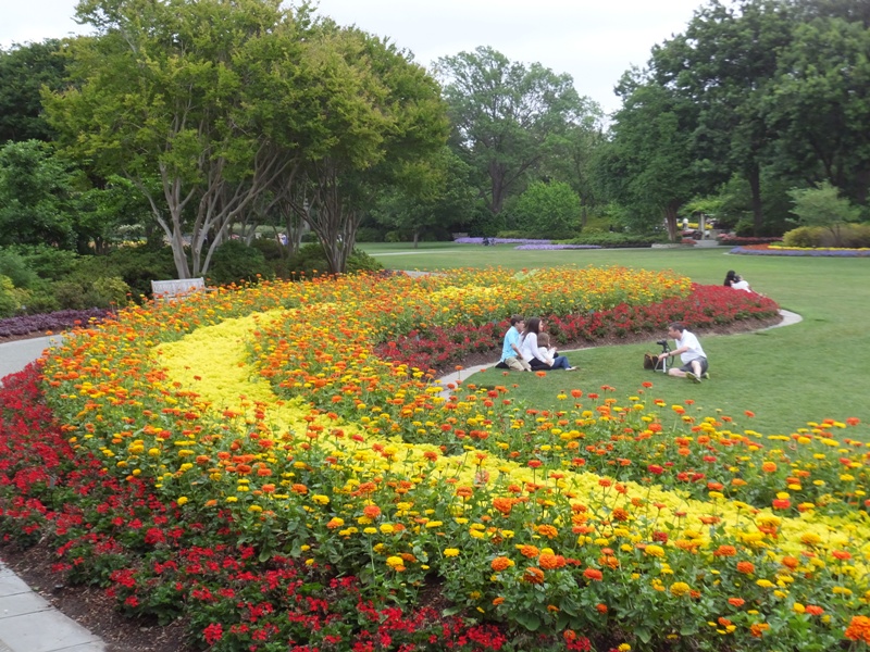
Norma left to prepare for the wedding while I went to the Dallas Arboretum. The place was extremely well-maintained. I actually didn't much care for it because it was so perfect that it seemed very artificial...short of like paddling in a reservoir. Still, the sights were lovely.
The arboretum was huge and it took me a long time to find my way out. I should have picked up a map at the entrance because the exit was not clearly marked until you were there. |
|
I caught an Uber ride back to the wedding and arrived just in the nick of time at the venue, the Filter Building.
Norma was one of the bridesmaids. 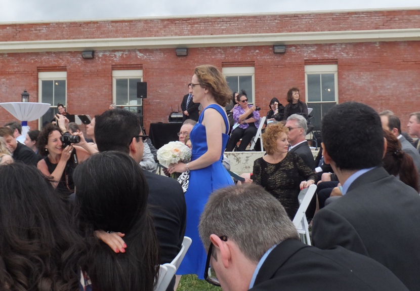
Unlike most of our other days, it was cloudy with a chance of showers. It was also very windy. There were a few American coots out on White Rock Lake. Earlier, I had looked into paddling there but the boat rental place sold out pretty fast, despite the high winds. 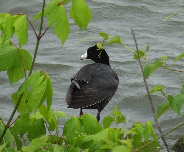
The wedding went off without any problems. I was moved at Luis' sincerity when he read his vows. I don't know him well but he seems like a very genuine person. I wish them both a lifetime of happiness together. 
|
|
Norma and I packed up and flew out of Dallas ridiculously early. We landed back at BWI then went to work.
It was cloudy and cool. Talking to my co-workers, we definitely picked a good time to be out of Maryland. It was much nicer weather in New Mexico and Texas. We had a superfantastic trip but I was glad to be home. Later, I read about a couple of places that are similar but different enough to be interesting. They are Big Bend National Park in Texas and Petrified Forest National Park in Arizona. Hopefully there will be another road trip in the southwest where we can see these. |


