|
This page is about a Washington state vacation which Norma and I did in the late summer of 2024. |

|
This page is about a Washington state vacation which Norma and I did in the late summer of 2024. |

|
The year 2024 was unlike others when it came to paddling for me. I probably did fewer day trips and none on the eastern shore of Maryland. But I did some big multi-day trips. Most were not so far away but one would be a major trip over 2,000 miles away.
After finishing my work in one office, I decided to take three weeks off. Typically, I don't like such long vacations because when I return, I have too much work to get caught up with. But since I was sort of between jobs, that wouldn't be the case. I figured a multi-day kayak camping trip was in order, but where? I considered the Channel Islands of California, a return to the fjords of Norway, and other places. I wasn't wanting to deal with logistics so I figured I'd do a guided trip with an outfitter. I read the descriptions of each trip and found them too easy. Then I found San Juan Kayak Expeditions - 5-Day The Ultimate: This trip is only for fit, adventurous people willing to accept a challenge. You must be active, muscle-toned, and ready for excitement. For those who meet these criteria awaits an adventure with cozy campfires, sea glass hunting, whale watching, sea kayak sailing and scrumptious camp cuisine. Marvelous sunset hikes and bioluminescent paddles will make this trip the highlight of your summer! I was sold. Norma was not. So I reached out to my cousin Steve and asked if he wanted to be my wingman in the tandem kayak. Without hesitation, he said yes. We both reserved our spot, purchased airline tickets, and reserved a room for the night before. But Norma wanted to join me for some land exploration of the "Evergreen State." We were both interested in doing some hikes in Olympic National Park. So I planned to stay an extra week and spend that time with her.  |

|
I flew from Baltimore Washington International (BWI) to Seattle-Tacoma Airport (Sea-Tac) on an Alaska Airlines direct flight. I was within earshot of a crying baby and without earplugs, so the trip could have been a lot better.
Sea-Tac Airport was kinda ugly, especially the baggage claim area. But I was excited to be in Washington. It was my first visit. The sky was clear and the temperature perfect. After retrieving my luggage, I caught the BellAir Charters & Airporter SeaTac Airport shuttle to the ferry terminal in Anacortes. Traffic in the Seattle area was pretty slow.  |

|
After arriving in Anacortes, I purchased a ferry ticket to Friday Harbor. The next departure was canceled so I had quite a bit of time to kill before the following one. My shuttle driver warned us about this. Apparently, there is an engineer strike so the ferries are short-staffed. On the bright side, I was told that folks around here have grown used to it and in doing so, have developed a high level of patience.
There were lots of outdoorsy people waiting for the ferry. Many had bicycles. Some looked like backpackers. But there was one couple that had an unusually large number of dry bags. I introduced myself and found out they were doing the same trip as Steve and me. Their names were Chris (husband) and Dorota (wife). They had just finished backpacking in Olympic National Park so I figured I could pick their brains about places to go and stuff to see. I walked around the ferry area. There was a nice cove with some beach, shown below. Looking across the water, I saw a harbor seal. It would be the first of many to come. Apples grew wild. No surprise there. This is what Washington is known for. Invasive and delicious Himalayan blackberries were also common...too common. It costs millions of dollars for both control and in estimated impacts. This species spreads aggressively and has severe negative impacts to native plants, wildlife and livestock. - from Washington State Noxious Weed Control Board - Himalayan Blackberry Eventually, our ferry arrived, the Samish, named after the Samish Indian Nation.  |

|
It was a nice ferry ride. The water was calmer than I expected.
I got off at Friday Harbor, a town on one of the San Juan Islands that is actually called San Juan Island. After the pedestrians disembarked, the vehicles drove off the ferry and into town. Cousin Steve came and picked me up. He rented a vehicle. We bought some groceries and then went to the Orca Inn. He had already been there the previous night and had a chance to explore the town while I was in transit. Friday Harbor is a really nice place...too nice for me. Very pristine and expensive. I felt out of place. I was later told that the folks who live there either have three homes or three jobs.  |

|
The original plan was to meet at 1000 but our guide, Noah, asked if we could instead meet at 0900 to take advantage of the tide. That worked for us all.
Steve drove all four of us to the Sea Kayak Center kiosk and then parked his car at the place he planned to stay once our trip ended. We met Noah, picked up breakfast, and then headed out to Turn County Park where we unloaded the boats, loaded up our gear, and then launched. 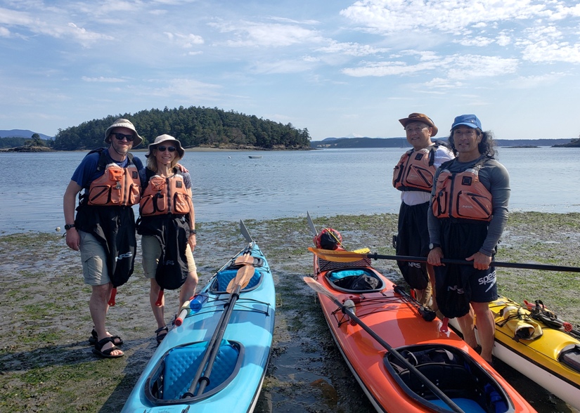
 |

|
Out on the water, we saw sea planes in flight. This is a common sight in this area.
Steve and I were in a SeaScape 2 Northwest tandem kayak, as were Chris and Dorota. This is a heavy duty fiberglass boat with lots of storage capacity. I found it comfortable and easy to handle. Loaded up, it took four of us to carry it to the water. I sat up front since I was taking pictures. That meant Steve did the steering. I liked way the bungees were configured to wrap around a cleat to hold the paddles so I could take pictures. Noah also paddled a Northwest kayak but his was a single. Noah led us north between San Juan and Shaw Island. West of Crane Island, we saw the first of what would be many harbor seals. They are pretty safe on land but in the water, killer whales are a threat. The water was cold and clear. Many things about this area reminded me of Maine.  |

|
After paddling 7.4 miles, we pulled ashore at Jones Island. We pulled the boats ashore far enough so they wouldn't float away at high tide. Tidal fluctuation in this area is ~seven feet.
Next, we set up our campsite. Many of the islands have designated sites which people can reserve. There are also pit toilets and seasonal running water. I brought my own sleeping bag/pad. Steve rented his from the outfitter. I was impressed with the quality of his sleeping bag/pad and the tent they provided us. All their gear was high quality, including the boats and paddles. The islands have hiking trails which Chris, Dorota, and I explored. Steve was content to not join us. The trails were all short but I chose to use my hiking poles to help take pressure off my right heel which was suffering from plantar fasciitis. I later found out it also had other issues. The most unusual plant I encountered on our walk was the madrone tree. In June and July, Madrones shed all of their bark. The deep red gives way to an exceptionally smooth green trunk. If you place your hand where the bark has peeled, the tree feels downright cold. Not icy cold, but cool enough to refresh an overheated hiker. This has earned the Madrone the nickname, "Refrigerator Tree." - from NatureOutside - The Refrigerator Tree Noah took care of meals and we pitched in to help anytime he needed an extra hand. People in our group had various dietary restrictions so Noah prepared food that everyone could eat. It wasn't exactly the sort of cuisine I would choose because it was so healthy, but I have to admit that I felt really good physically after these meals. Steve said the same. To satisfy my red meat craving, I brought a couple bags of beef jerky which Steve and I snacked on. 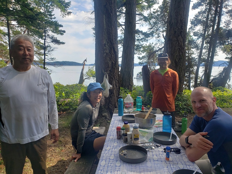
There were other kayak groups in the area. Some went out for a sunset paddle. That night, I slept exceptionally well. I don't think there was ever a night that I did not.  |

|
On our second day, we had plenty of time to explore Jones Island. Noah didn't want to leave until ~1100 so we could catch the tide. I'm really glad we had him leading us because he knows the area well. The average depth of the muddy Chesapeake Bay is 21 feet. In contrast, the rocky San Juan Channel has an
average depth is about 350 feet, but near its northern end it is more than 600 feet deep. - from University of Washington Publications in Geology - Topography So what does this mean? When water is pushed or pulled by the tide, it can travel from an extremely deep area to a relatively shallow area. This can create a tremendously strong current. Timing things wrong means we might have to work very hard, and in the end, we might fail to reach our destination. Waiting for the tide, I did more exploring on the island. On the north side, I found sea anemones. I also spotted a moon jelly. I didn't see any crabs but I did come across what I think is a red rock crab claw. The north side also had lots of yachts and sailboats. There's a lot of money in this area and I attribute all that tax revenue to the good infrastructure on the islands. It seemed all the larger islands had well-maintained trails, campsites, picnic tables, toilets, and water spigots. The island was lush with greenery, especially salal. Another plant I saw was Garry oak, a very slow growing tree. These trees can be 500 years old, and even smaller trees only 30 feet high can be 200 years old. - from Sequim Plants - Garry Oak Facts, their range and demise in the PNW Walking back to the south side, I saw what appeared to be an old water tower. I suspect it is from the days when the trees on these islands were cut for timber. Almost all the sea kayakers I know are very good at keeping on schedule and our group was no different. That's a very good thing because the tide waits for nobody.  |

|
Steve was happy to be back on the water.
We paddled north, hugging the west side of Orcas Island. Noah promised nice scenery and indeed it was. Clinging to the rocks were some purple starfish. It was cool and overcast but no rain. No rain was expected during our entire trip. We were also not expecting any strong winds. Good paddling weather.  |

|
We pulled ashore for a break on the west side of Orcas Island. I don't think this place had a name.
On the rocky beach, we saw dozens of moon jellies stranded when the tide went out. I explored the shore and tidepools.  |

|
Back on the water, we paddled to the north side of Orcas Island, stopping for lunch at Point Doughty. Noah warned us that this is the place on the islands with the worst restroom. Compared to the other sites I saw, he was correct, but it still wasn't that bad.
After eating, I set out to do some land exploration. High up on some rocks, I saw four large river otters below. Here's a view of where we landed.  |

|
Continuing north, we did an open water crossing to Sucia Island, our final stop for our second day. We got in 12.8 miles that day.
Since we started late, we also landed somewhat late. But we had plenty of time to set up our tents, have a nice meal, do a little exploring, and get cleaned up. Steve washed his feet at a spigot. Standing on one foot, he washed the other. This didn't work out so well once he lost his balance. Rather than put his clean foot down, he held onto the spigot and hopped around on his standing foot as he fell, doing a full 360 degree spin around the spigot until he landed on his butt. He was bruised but not seriously hurt. It was quite funny. Sucia Island is one of the more popular islands. I had actually signed up for a one day kayak trip at this island once Norma arrived. Before doing so, I failed to check the itinerary of our five day trip so I didn't realize I'd be seeing this island twice. After discussing things with Norma over the phone, we decided to instead do a whale watching trip with that same outfitter. This island has more than its share of hiking trails. I explored just a bit. One of them took me to a high overlook. With the San Juan Islands being so rocky and often steep, they don't have the same erosion problems as the islands in the Chesapeake. One common plant I found in the area is snowberry. The berries are not considered edible, being very bitter tasting. - from Washington Native Plant Society - An Appreciation of Snowberry (Symphoricarpos albus) Cell phone reception on the islands was not bad. Again, I attribute that partly to the number of wealthy people in the area. If you look closely at the below photo, you can see a cell phone tower in the distance. Every night, Noah would review what we paddled during the day. He also got our input for the next day's trip. He suggested we wake up at 0400 to take advantage of the tidal currents to head east. While we weren't exactly looking forward to such an early start, we knew his suggestion was the best option so we were in.  |

|
On our third day, we launched at 0500 to take advantage of the tidal current. From a distance, it is hard to appreciate the strength of these currents. In the conditions we paddled, I doubt such strong moving water would capsize an experienced kayaker, but it could definitely make things extremely difficult for one to reach their destination if they had to fight such currents.
It would be interesting to see an underwater topography map of the area to gain an appreciation of how the tidal movements get channeled between deep and shallow areas. Over 12,000 years ago the Vashon Glacier covered the entire area with 4,200 feet of ice! The forward movement of the glacier polished and scoured the land masses and carved out deep canyons, now filled with sea water. The waterways surrounding the San Juan Islands vary in depth. Drop something overboard and it could be 400-800 feet to the sea floor! - from Western Prince Whale & Wildlife Tours - The San Juan Islands We paddled around the north end of Sucia Island before heading east to Matia Island, our rest stop for the morning. 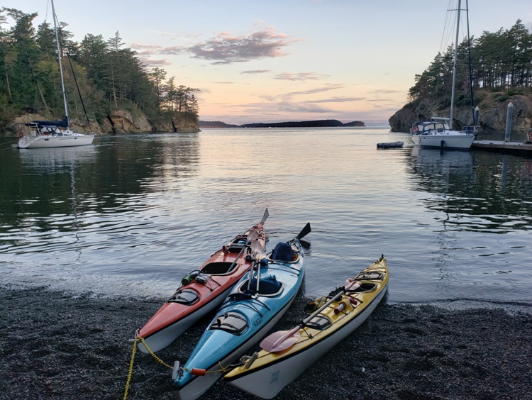
We ate breakfast which typically consisted of yogurt, fresh fruit, granola, and oatmeal. On Matia Island, we saw banana slugs. Banana slugs are the largest land slug in North America and second largest in world. They can reach ten inches and four ounces to quarter-pounders. - from Friends of Edgewood - Banana Slug According to a sign at the Olympic National Park Hoh Rain Forest Visitor Center, banana slugs: While the abundance of marine mammals in the area was quite the treat, I did not see much interesting wildlife on land. I was familiar with banana slugs but black slugs were totally new for me. These invasive creatures supposedly get up to six inches long, but I think I saw some that were larger. Matia Island had more than its share of them. After breakfast, I did some trail exploring. Most trees are not very old because loggers cut down the largest ones, mainly before 1930, but this one was sizeable. Chris and Dorota shared their photos with Steve and me while I shared mine with them. Here is one that they took. 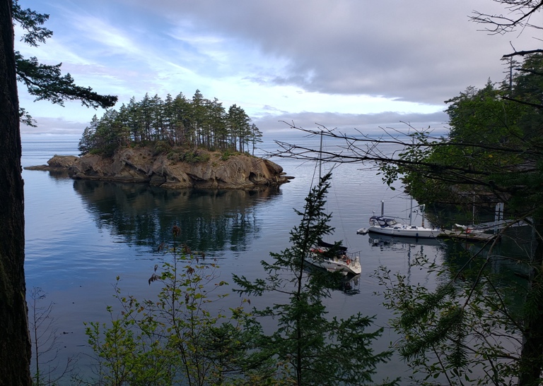
 |

|
Back on the water, we passed Puffin Island. I saw no puffins.
It was pretty overcast. When the sun was out, it was comfortable but otherwise, it was a little cold for me. I think I might have been the more extreme in terms of being cold. I am used to the Maryland summers which are hot and humid. The humidity holds the warmth. Additionally, the Chesapeake water is warm in the summer. In Washington, I found the water quite cold. We kayaked south along the west side of Clark Island before rounding the south side. Here we saw several river otters. There are also sea otters in the area but we did not see any. We kayaked north, along the east side of Clark Island and the west side of Lone Tree Island. On the latter, we saw numerous harbor seals.  |

|
We landed at Clark Island after paddling 12.3 miles. It was a bit of a climb from the shore to our campsites. I don't know if it had something to do with kids being back in school but a lot of sites were vacant so we could spread out. We did see others but never many.
Since we got such an early start, we had lots of time to look around. Below, I am exploring the tidepools at Clark Island. The snow-covered Mount Baker lies in the background. An oil tanker called the Washington passed by. In the tidepools, I saw more sea anemones. Climbing on the rocks, I noticed that some resembled Swiss Cheese. The island has various sandy and rocky beaches. I had a good view of the cell phone tower on a neighboring island. I paid attention to some of the colorful vegetation. I found another black slug.  |

|
We were up early again but nowhere as early as our previous morning.
Steve unintentionally stepped on a banana slug. Here is one that he did not. 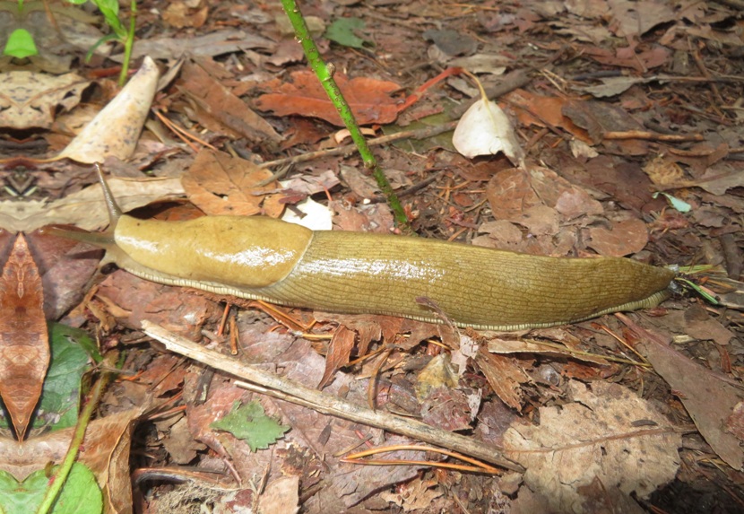
We launched around sunrise and then headed south to Doe Bay on Orcas Island. It was very foggy. I saw lots of dungeness crabs in the water. Water clarity in the San Juan Islands area was excellent so could often see what was crawling below us. We saw plenty of moon jellies. But we also saw lion's mane jellyfish. The one shown here had a 24-inch diameter bell, but they can get much larger. With tentacles up to 120 feet long, some individuals even rival in size the blue whale, the largest animal in the world. - from Oceana - Lion's Mane Jellyfish  |

|
We pulled ashore at Doe Bay. As long as we kept paddling, I was reasonably comfortable. But once ashore, I got cold. I did a lot of bodyweight squats to warm up. I was wearing a lightly insulated paddling shirt and splash jacket but that was not sufficient. If I had to do this trip again, I would bring my 3mm farmer john wetsuit or at least splash pants. The reason I left it behind is because I knew space was very limited.
Doe Bay is a private resort. Noah and some of our group went to the store to purchase ice. They had a nice restroom, cafe, and kayak outfitter.  |

|
Back on the water, we paddled south. The fog got thicker. It was disorientating because at times, I could not tell where the water ended and the sky began. I got a light headache.
Noah did a great job of keeping us on track. We paddled south along the east side of Orcas Island and then passed between Orcas and Obstruction Island. As the sun came out, I saw a fog bow. This was only the third time in my life that I'd seen one. This is a primary rainbow caused by refraction and reflection, and to a minor extent diffraction, of sunlight or moonlight in very small water droplets. It appears on a "screen" of fog or mist. The fog bow consists of a white band, usually fringed with a faint, thin red band on the outside and a faint, thin blue band on the inside. The fog bow is also sometimes known as a cloudbow, mistbow or white rainbow. - from World Meteoroogical Organization - Fog Bow Eventually, the fog lifted and we had sunny weather. Yay!  |

|
We pulled ashore for lunch at Obstruction Pass State Park.
Noah went over our options for the second half of our day and described how that would affect the day after. Then we were back on the water.  |

|
After a couple more hours of kayaking, we landed at Blind Island after paddling a day's total of 16.8 miles. This island is part of the Cascadia Marine Trail.
One of the first things I noticed was a deep, water-filled hole in a rocky area. This was a retainer around a spring. In the early 20th century, a squatter set up housekeepig, building a small house and storage sheds. He lived like a hermit, existing off his work as a fisherman and his small garden, evidence of which remains today. This man dug several holes into the rock, evidently to be used as cisterns, and built a concrete retainer around a natural spring on the island. The retainer is the only structure which remains on the island, as all buildings were removed in 1972. - from sign on Blind Island On a small island to our north, several harbor seals sunned themselves. A big apple tree bearing fruit lay behind a grove of thorny Himalayan blackberries. I found a way to get close to it from the shore but then the apples were about 20 feet above my head. To our south lay Shaw Island. I watched the ferry drop off and pick up passengers from the terminal. This island was unlike the other in that it was very small and without a lot of trees or trails. But I found plenty of things to see and investigate. I wasn't eating the stuff I normally do, which isn't bad. I tasted various new things like Tru Fru Nature's Peaches which I really enjoyed. That night, we saw bioluminescence in the water and heard owls.  |

|
It was our last day. Once again, we were up early. We packed up, ate breakfast, and were on the water ~0715.
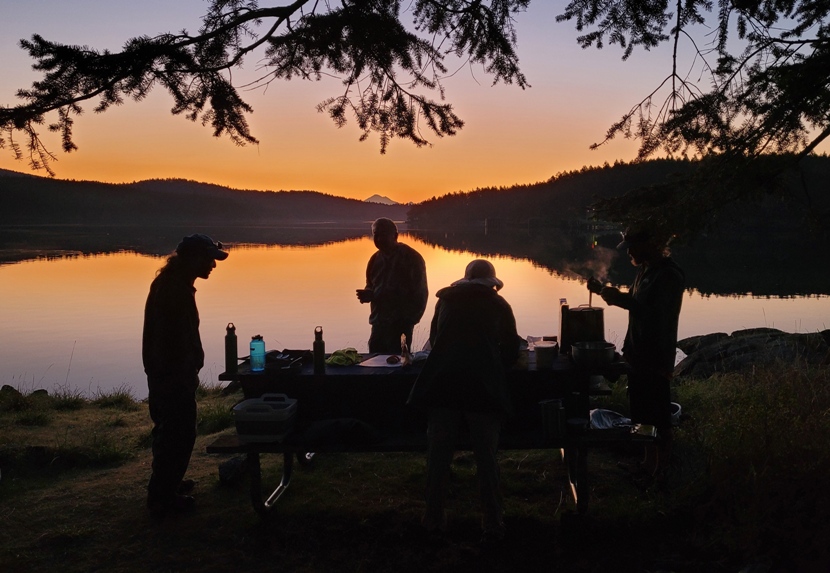
 |

|
We kayaked in view of a beautiful sunrise.
We paddled east and then south to Lopez Island. Along the way, we saw a great blue heron. We saw one bald eagle, no osprey, and no herons other than great blues. I also don't recall seeing any egrets.  |

|
We pulled ashore at Lopez Village.
Walking around the pristine little town, I saw a master gardeners demonstration garden featuring heritage apples. Apple orchards were planted by early settlers who came to Lopez Island from other parts of the United States, Canada, and Europe beginning in the 1850s. Apples were a major economic crop for the San Juan Islands, exported throughout Washington and along the coast until the early 1900s. The trees in this orchard originated as scion wood, or cuttings, taken from heritage trees found on Lopez Island historic homesteads. Lopez master gardeners grafted the scion wood onto Antonovka "standard" rootstock. - from sign titled "Lopez Island heritage apple orchard and demonstration garden" I stopped by the Lopez Historical Museum where I read about the local watermen and their boats. Shown below is the Sally J, a gillnetter, built in 1930. It was used to fish ...for salmon off the Iceberg Point Boundary Monument for more than 50 years. The Sally J was [also] used off Stuart Island in an experimental nori seaweed farming venture. - from sign at the Lopez Historical Museum This was our last stop which made me a little sad. In some ways, I didn't want it to end but I also looked forward to starting the second half of my Washington trip with Norma.  |

|
We were now in the home stretch. During our time out, the water never got rough but the current was sometimes strong. We had no rain that I recall and little wind. On our final stretch, the water was almost as smooth as glass.
We kayaked west, back to San Juan Island. Along the way, we passed Noah's sailboat.  |

|
We finished at a slightly different location than where we started.
Pulling ashore, we ate our last meal together. Washington is known for its apples and the ones that Noah brought were the finest I've ever eaten. They were cosmic crisps. Our mileage for the day was 11.1. For the entire trip, it was 60.4! After loading, transporting, and unloading stuff, Noah drove us back to Friday Harbor. We said our farewells and I then rushed to catch the next ferry back to Anacortes. It was a truly fantastic trip and I'm very glad I did it with Noah as our guide and Chris, Dorota, and Steve as my paddling companions. Here is our route. 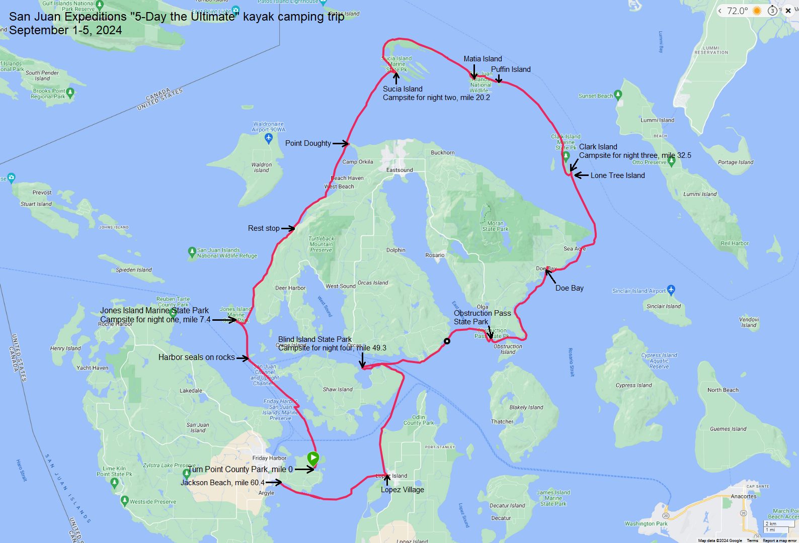
 |

|
Norma met me at the Anacortes ferry terminal. I was most happy to see her.
We drove out to our motel, the Auld Holland Inn in Oak Harbor. I chose this motel mainly because it was affordable. Unlike Friday Harbor and Anacortes, Oak Harbor wasn't a tourist destination. Rather, it is a military town. I did laundry at Midway Laundry and then we ate dinner at Island Cafe. We had an extremely animated waitress who served the best clam chowder I've ever tasted. Dining outside made me miss Daphne, who is often with us when we choose outdoor seating. Lots of termites flew around.  |

|
Norma and I had a surprisingly good continental breakfast at Auld Holland Inn. That got us fueled up for a big day that started with a visit to the south side of Deception Pass State Park. I call it the south side because it is south of Deception Pass, a waterway that many boaters find very challenging.
The water flowing through creates some of the fastest, strongest and potentially dangerous currents in Puget Sound, or for that matter, in the expansive waters of the Canadian Gulf Islands to the north. Four times per day, the massive waters of the Strait of Juan de Fuca (to the west) and those of Saratoga Passage (to the east) surge through the narrow opening of Deception Pass. All that water crushes its way through the pass, creating maximum currents that can exceed nine knots. The currents create massive whirlpools and eddies that can easily alter the course of heavy displacement vessels...Standing waves can reach eight to ten feet under maximum current. - from Passagemaker - Troubled Waters: Washington's Deception Pass We did a clockwise loop that started near Deception Pass Bridge (Route 20). 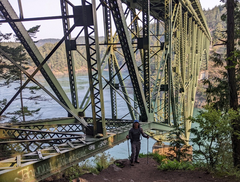
Most of the trail was wooded but there were some bare, open areas with just dry grass. 11,000 years ago the massive ice sheet that covered this area rapidly receded back to Canada. It left behind hill tops scraped to bedrock, leaving no soil for plants to grow. Over thousands of years enough soil has built up to allow the plants we see in the meadows to become established. - from trail sign titled "Please respect the balds and meadows" We saw lots of fungi. Though sometimes mistaken to be a fungi, we also saw Indian pipe. The most interesting wildlife we spotted was a spotted banana slug. Much of the trail was lined by tall, healthy-looking trees and ferns. We walked a total of 2.9 miles.  |

|
The high point of the day was a trip with Outer Island Excursions called Anacortes Whale Watching. We did indeed see whales...plus a whole lot more.
We started from Anacortes. From the pier, I saw a harbor seal swim below me. It glided effortlessly through the cold water. This was the first of a multitude of marine mammals we saw today. Sea lions

Humpback whales

Killer whales

Paddle shell

 |

|
We returned to Deception Pass State Park, visiting the north side. We did little walk at an area called Rosario.
We encountered a large wooden carving of a Native American woman holding a fish. The Maiden of Deception Pass is a Samish story pole which recalls the legend of Ko-Kwal-alwoot. She was a young girl of the Samish Nation who was transformed into a sea spirit on this spot in Deception Pass State Park. - from Fidalgo Island Crossings - Ko-Kwal-alwoot During my visit, I learned about and grew to develop an appreciation of the native peoples of the area. The lives of Samish and other Coast Salish peoples have always revolved around the sea. Everything important comes and goes with the tides, the seasons, and the weather. They studied the sea carefully so they could travel safely, eat well, and avoid disasters. Coast Salish peoples dried and stored fish, clams, and camas [a perennial herb belonging to the lily family]. They also traded food, baskets, and blankets with villages up the rivers and across the mountains to Eastern Washington. They appreciated the power and gifts of the sea as they knew that their survival depended on their knowledge and respect of it. - from trail sign titled "Ko-kwal-alwoot: The Maiden of Deception Pass" Norma and I walked a short trail on the peninsula. On the side of a tree, we found a northern alligator lizard.  |

|
Our next stop, also in Deception Pass State Park, was Bowman Bay. Here, we found the Bowman Bay Boat Launch and the Civilian Conservation Corps Interpretive Center.
On the beach, we saw a female elephant seal. Park staff were there to answer questions and keep folks away from her.  |

|
Norma and I checked out of the Auld Holland Inn and then drove to the Coupeville Ferry Dock. Actually, she did all the driving on our trip because when she rented the Chevrolet Equinox, there was an extra daily fee to add an another driver which she did not want to pay.
It is recommended to purchase ferry tickets in advance if you plan to bring your vehicle. We did not so we were on a wait list. But we had no problems getting on. I was very impressed with the whole ferry system. It was fast and efficient. On one of the islands, I saw passengers loading their cars by driving backwards onto the ferry which they did very well. That leads me to think drivers in this area are quite skilled as compared to the rest of the population. Once we were underway, we got out of our vehicle and went above deck to get a better view. We were hoping to see more whales but did not. The ferry took us through the Puget Sound, making our trip much shorter than driving around it. We landed at Port Townsend which was having their Wooden Boat Festival. Norma thought I might be interested in this but after viewing the website, I realized it really didn't feature the tall ships I like, but was more about the smaller boats. This was for the true aficionados, not the casual observers like myself. But there were a few big boats.  |

|
Our next stop was the Olympic National Park visitor center. Here, we picked up some maps and other literature to plan our first hike, Hurricane Ridge via the 1.6-mile-long Hurricane Hill Trail.
Although the highest peaks in the Olympics are just under 8,000 feet, they rise from sea level, catching the large amount of precipitation that rolls in from the Pacific Ocean. So much snow falls that over 60 glaciers are able to exist as low as 4,500 feet in elevation. The largest of the ice-covered peaks are visible from Hurricane Ridge. - from visitor information sign at the Coupeville Ferry Terminal titled "Northern Olympic Peninsula" 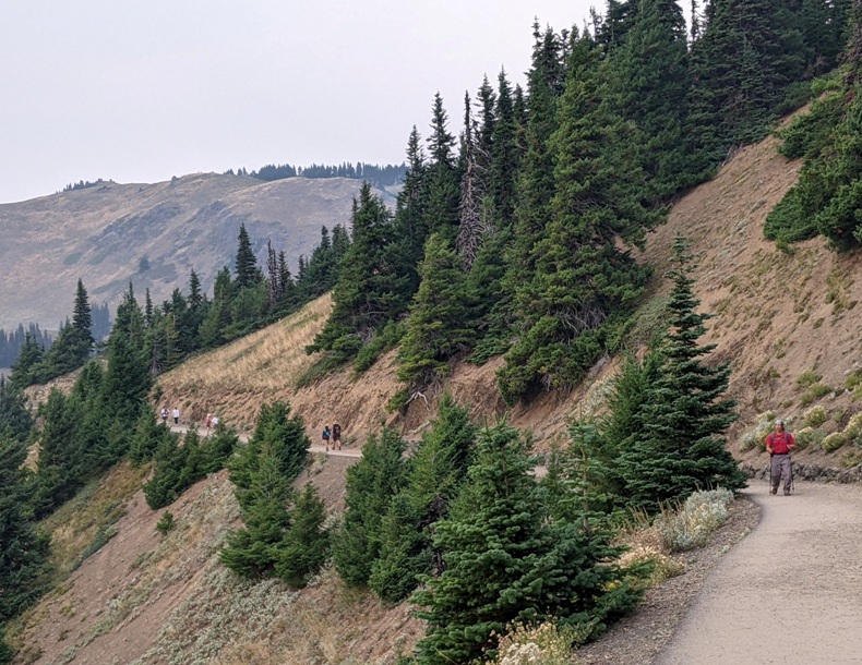
Littering the ground, there were so many shield-backed katydids it was difficult not to step on them. We came across something that most people simply would have passed by but my curiosity paid off because it was something interesting...a dendrite. Dendrites are branched, tree-like structures that are found in various natural and biological systems. In the context of mineral precipitation or crystal growth, dendrites refer to the branching patterns formed by the deposition of minerals or crystals in a non-equilibrium environment. - from AGU - Dendritic Growth Patterns in Rocks: Inverting the Driving and Triggering Mechanisms Manganese oxides are well-known to form nice dendritic patterns on the surface of rocks in veins. Dendrites are common on the surface of sedimentary rocks, especially limestone. Such dendrites are sometimes mistaken for fossils and are therefore often used as an example of a pseudofossil. Pseudofossils are natural objects that may be mistaken for fossils. - from Sandatlas - Dendritic growth in crystals We found a sheep moth caterpillar. Here's Norma on Hurricane Hill, elevation 5,757 feet above sea level. This is a lichen called witch's hair. So what is a lichen? Lichens are a complex life form that is a symbiotic partnership of two separate organisms, a fungus and an alga [singular form of "algae"]. The dominant partner is the fungus, which gives the lichen the majority of its characteristics, from its thallus shape to its fruiting bodies. The alga can be either a green alga or a blue-green alga, otherwise known as cyanobacteria. Many lichens will have both types of algae. - from U.S. Forest Service - About Lichens We came across a colorful plant that I think is Orthocarpus cuspidatus. Norma spotted a northwestern fritillary. We were fortunate to spot several marmots living in the area. This was our first time seeing them. Olympic marmots live in the isolated Olympic Mountains, and nowhere else on Earth. Look for these mottled brown rodents at their burrows or foraging for plants after a long winter hibernation. Listen for their whistle, an alert to other marmots. - from trail sign titled "Disappearing Marmots" Some marmot colonies at Hurricane Ridge and other areas of the park have disappeared. Research reveals predation by non-native coyotes is driving the decline. Hurricane Hill is one of the best remaining places to observe these rare animals in their mountain home. - from trail sign titled "Disappearing Marmots" We spotted a young deer taking a rest. It was not the least bit afraid of us. Norma and I were seeing much more wildlife than I expected. The last critter we spotted was a local chipmunk. Olympic chipmunks are one of several endemic mammals on the Olympic Peninsula and are they are found nowhere else in the world. - from National Park Service - Olympic Chipmunk Up top, there weren't a lot of trees. 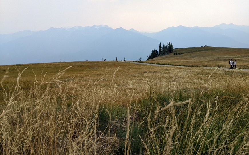
We had some nice views up on the ridgeline. While this may resemble the Blue Ridge or the Smoky Mountains, our hazy view was actually due to smoke from wildfires in Oregon. The two of us walked 3.8 miles. It was a little painful with my foot problems but having good insoles and hiking poles helped.  |

|
That afternoon, we drove west to Forks, and stayed in a mini-cabin at Manitou Lodge. There was no toilet or shower attached but there was a porta-john and an unheated shower at the tent campground. Lodging in this area is very expensive so we did what we could to cut costs, such as staying at this place. We tried to contact the management and let them know that the heater for the shower was broken but our only means to contact them was text messaging and there was no phone service in the area. When we finally got to a place with cell phone service, we let them know but they never got back to us. We never saw anyone that actually worked there.
The mini-cabin itself wasn't so bad. It was very small and cramped but clean and fairly nice-looking. It had a microwave, mini-fridge, and sink. We could have camped in tents, but with Washington's reputation for rain, we felt it would be better to not. If the town of Forks sounds familiar to you, it is because it is home to the Twilight saga...something the townspeople take great pride in.  |

|
Norma and I were greeted by two banana slugs in front of our mini-cabin. If that wasn't a good omen, then I don't know what is.
We headed out to Rialto Beach in Olympic National Park. The morning was overcast and cool. We walked north, stopping to investigate any tidepool along the way. We timed our visit with the low tide so we could see as much marine wildlife as possible. We spotted several anemones. In order to capture their prey, the anemone uses its tentacles to fire a paralysing injection of venom. Once the injection has hit its target, the anemone uses its tentacles to snatch the victim into its mouth. This method of feeding combined with its stinging tentacles means that sea anemones have few predators. Similar to corals, anemones are polyps with a tube-like body and a central mouth. Unlike corals, however, a sea anemone's mouth is surrounded by tentacles that give them a flower-like appearance. The number, length, and color of the tentacles vary from species to species. - from Lembeh Resort - Sea Anemone Facts We saw numerous starfish, generally attached to rocks vertically near the low tide waterline. That's another word like killer whale where there are a lot more folks now calling it by a different name...sea star. We saw one starfish that was only partially clinging to a rock. Some of its arms lost their grip so we could see its underside. Click on the below image to see its movement close up. Walking on the sand, we saw a yellow-spotted millipede, also called the "cyanide millipede." If you were to pick up a yellow-spotted millipede, it would likely curl into a spiral and exude hydrogen cyanide on you, accompanied by the strong scent of toasted almonds (that's the smell of cyanide). The amount secreted by an individual millipede is not enough to seriously harm a human, though it may stain the skin or burn and blister if you're sensitive (wash your hands if you handle one). This amount is lethal, however, to birds and rodents. - from Cool Green Science - The Millipede That Protects Itself with Cyanide I found some gooseneck barnacles. These are native to the west coast. I don't believe they live on the east coast. Norma found a mossy chiton. Chitons are ancient creatures, first appearing about 500 million years ago. - from Shape of Life - Chiton I saw a black katy chiton for the first time. "Sea prune" is a name used by some First Nations groups; another name for this species is "small Chinese slippers." - from "Central Coast Biodiversity" (a broken link as of 2024) Tidepools often contain a lot of life, but sometimes you have to look very closely. This goby fish is fairly well camouflaged on the bottom. Here's two large limpets and three small hermit crabs. It was easy to spend all my time looking down into the tidepools for life. But every once in a while, it was good to also look up and appreciate other wildlife, such as the brown pelicans. Rialto Beach had some dramatic giant boulders. Just be sure to watch your step. They can get slippery. During our visit, one woman fell and had to be hauled off in an ambulance. We posed for a photo at a dramatic rock formation called Hole in the Wall...a place only accessible at low tide. Here, time and the constant push of the tides have carved an opening in the basalt cliff. - from To & From Fam - Rialto Beach, Washington and Hole in the Wall Geologists believe that this part of the Olympic Peninsula formed from the cooled eruption of undersea volcanoes. When volcanoes spewed lava far offshore, that lava hardened into basalt on the ocean floor. Then, as two tectonic plates slowly collided, this basalt buckled up - forming the cliffs we admire today. - from "To & From Fam - Rialto Beach, Washington and Hole in the Wall" Here's Norma at the Tree Graveyard, a massive collection of bleached driftwood lining the shore. By the time we had finished, we walked three miles out-and-back along the beach.  |

|
We drove east to hike on the Hall of Mosses and Spruce Nature Trails in the Hoh Rain Forest of Olympic National Park. Other temperate rain forests include Queets and Quinault, neither of which we visited.
Mild winters, cool summers, and up to 12 feet of annual precipitation produce the giant conifers that dominate this rain forest, one of the most spectacular examples of temperate rain forest in the world. - from National Park Service information sheet titled "Olympic National Park - Hoh Rain Forest" A rain gauge at the visitor center indicated that the rainfall is about 18 inches less than what is predicted for this time of year. 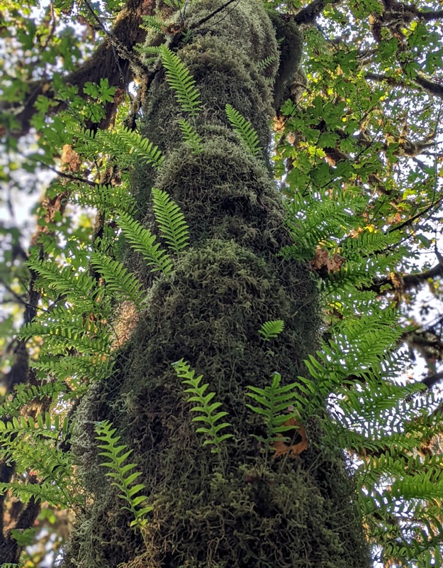
Moss seemed to grow everywhere. Here's some lanky moss (Rhytidiadelphus loreus). Can you see the flowers? The rain forest has many levels of green. Often, the lower story is elk food. - from trail sign titled "Lower Story Plants" We did not see any elk. Olympic National Park was created in 1938 to preserve the "finest example of primeval forest...and provide permanent protection for the herds of native Roosevelt elk." Thus, the Hoh Valley from the park boundary to Mount Olympus looks much like it has for 5,000 years. - from National Park Service information sheet titled "Olympic National Park - Hoh Rain Forest" 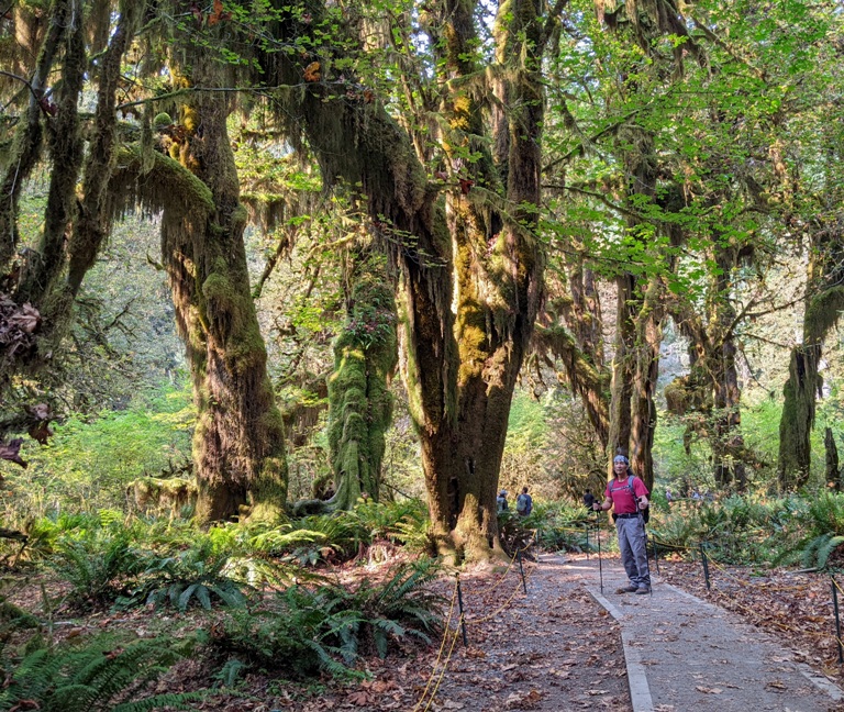
Many of the big trees are over 200 feet tall, their tops in an upper atmosphere. - from trail sign titled "The Upper Story" 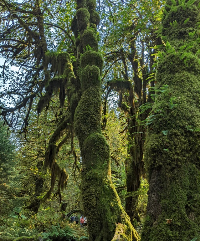
When a big tree falls, it can provide a stage for new life. Hemlock and spruce seedlings, unable to survive on the tangled forest floor, absorb minerals, moisture, and warmth from the decaying trunk. Even on this perch, competition is fierce. Only a few seedlings last. After their roots reach soil, new trees often seem to stand on stilts as the nurselog moulders away. - from trail sign titled "Nurselogs" Much like the nurselogs, this rootball from a fallen tree with the dirt it holds provides an environment for new trees to grow. 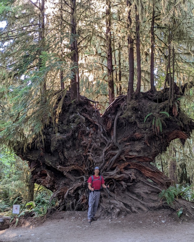
We passed by the crystal clear Taft Creek which was also full of greenery. There is almost no bare ground. Herbs, mosses, ferns, and shrubs grow so dense they leave little room for new sprouts. - from trail sign titled "Groundcover" Shown here is oxalis, common groundcover in this area. The atmosphere of the rain forest is so fertile that some plants thrive on air. Dining on moisture and nutrients from rain and wind-borne particles, clubmoss and licorice fern fasten to trunks and branches but do not harm their hosts. - from trail sign titled "Plant on Plant" Norma pushed the trees like Samson pushing on the stone pillars in Gaza. The clear waters of Taft Creek come from springs and seeps just upstream. - from trail sign titled "Spring Water" Ferns thrive in the understory while moss hangs from the trees. After walking about two miles on the trails near the Hoh Rain Forest Visitor Center, we drove on Hoh Valley Road and then pulled over to look for salmon in the Hoh River. Instead, we found unusual concrete structures along the shore. What might they be? The answer is concrete dolosse. These are wave-dissipating concrete blocks used in great numbers as a form of coastal management. - from Wikipedia - Dolos Bank stabilization along the Upper Hoh River Road consists of Engineered Log Jams (ELJs) that are composed of large logs, woody brush, riprap, and concrete Dolosse. As part of bank stabilization activities to support flood protection, this project can also potentially address another need along the river: protecting or improving areas that encourage fish habitat creation. - from U.S. Department of Transportation - Upper Hoh River Road Phase 2  |

|
Returning to our mini-cabin, we saw a Chevy Equinox that matched our exactly. It was parked at the adjacent cabin.
We also saw a very friendly cat that followed us into our cabin. I think it could tell that Norma is a cat person.  |

|
After saying farewell to our Manitou cabin, we drove out to the Soleduck Salmon Hatchery (sometimes spelled "Sol Duc"). Here, we learned about the fish of the Sol Duc Valley. Its waterway, the Sol Duc River,
serves as a key highway for coho salmon, running through the valley and ascending to the lakes and headwaters in the surrounding mountains. - from National Park Service - Olympic - Visiting the Sol Duc Valley We saw a few small live fish but nothing noteworthy.  |

|
Heading north, we made our way to Shipwreck Point, where we did a little tidepooling.
Shipwreck Point is a 3-mile stretch of beach along the Strait of Juan de Fuca, east of Neah Bay. The landscape of the Strait of Juan de Fuca was carved out by ice-age glaciers 13,000 years ago. The retreat of the glaciers created deep fjords which provide abundant food and habitat for many species of marine mammals. Shipwreck Point is a great place to spot gray whales, and occasional passing orcas. - from The Whale Trail - Shipwreck Point Unfortunately, we saw no marine mammals...or shipwrecks. There wasn't much to see in the tidepools either, though we had our fill at Rialto. But I did find a yellow shore crab.  |

|
Heading west, we visited the Makah Indian Reservation. Our first stop was the Makah Cultural & Research Center, home of the Makah Museum. We weren't permitted to take photos so I don't have anything to show.
The museum was built in 1979 to house and preserve the artifacts discovered at the Cape Alava archeological digs at Lake Ozette, 15 miles south of Neah Bay. - from a "Visitor Information" sign at the Coupeville Ferry Dock What really piqued my interest at the museum was their canoes, paddles, and love of the water. Neah Bay's Makah Days in August is the largest Indian festival on the Olympic Peninsula. Tribes from throughout the Northwest gather every year at the Makah Reservation to take part in competitive canoe races and festivities. Visitors are always welcome. - from a "Visitor Information" sign at the Coupeville Ferry Dock I asked someone at the Makah Museum about the shape of the paddles. She told me that they taper to a point for stealth. When the Makah are hunting, they don't lift the paddle completely out of the water because doing so would cause water to drip from the paddle, alerting their prey. Instead, they lift the paddle but leave the tip in the water. This creates some drag but enables a well-disciplined crew to move silently through the water. At the Makah Indian Reservation, we purchased a delicious fish meal at the Bigginz food truck. This food truck was decorated with Makah-style tribal art. After visiting the museum, I could clearly see the Makah influence in the Seattle Seahawks' logo. While there is no such bird as a seahawk, some say the team's logo resembles the mythical thunderbird of the Makah tribe on the Olympic Peninsula and other tribes along the west coast of the U.S. and British Columbia. - from The Seattle Times - National exhibit showcases art of Makah and other tribes On the right, in the photo shown below, is something resembling an inverted Makah canoe paddle on the Bigginz food truck. You can see how it tapers to a point.  |

|
Norma and I continued our exploration of the "Evergreen State" by heading to the northwestmost tip of the contiguous United States. Here, we did a short walk on the Cape Flattery Trail.
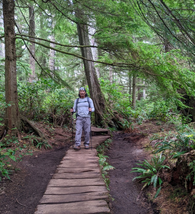
At the end of this trail, we saw the Cape Flattery Lighthouse on Tatoosh Island. It was constructed in 1857. This is the view looking south from the Cape Flattery Observation Deck. Here is the view looking northeast from Miracle Point at Cape Flattery. 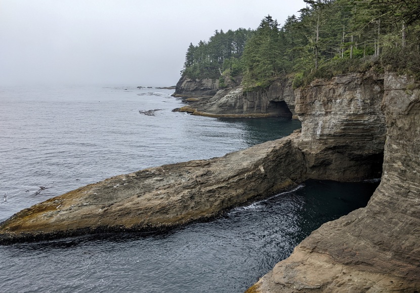
You really need to know what you're doing to paddle in the northwest waters in Washington state. The water can get very rough and the rocky shores are unforgiving. What I found most impressive is that the Makah hunted whales from their canoes. They were clearly master watermen as this trail sign depicts.  |

|
We spent the next two nights in a mini cabin at Emerald Valley Inn. It had no electricity or running water but we knew that before we booked. Nearby was a porta-john and further away was a nice shower. Unlike the Manitou, management was very responsive. The place was clean and well-maintained. The property was adjacent to Granny's Cafe, where we had a great meal just before checking in.
One thing we loved about the place were the animals. They had chickens, goats, and two emus. A friendly polydactyl orange tabby greeted us. If I had to name him, I would call him Hemmingway. Polydactyl animals remind me of the Little Twelve Toes Schoolhouse Rock cartoon. Watching this as a kid helped me later in life when I had to learn the hexadecimal number system.  |

|
We stopped briefly in a town called Joyce, which shares its name with Norma's sister. It is known for being susceptible to disruptions that might be caused by a possible catastrophic earthquake.
 |

|
Norma and I started the day at Lake Crescent.
Lake Crescent, a cold, clear, glacially-carved lake, owes its existence to ice. Its azure depths, which plummet to 624 feet, were gouged by huge ice sheets thousands of years ago. As the ice retreated, it left behind a steep valley that filled with the clear blue waters of Lake Crescent. - from "Olympic National Park - Lake Crescent Area" pamphlet  |

|
Our next stop was the Marymere Falls Trail. This trail passed through a tunnel which took us under Olympic Highway (Highway 101).
We spotted a snail-killer carabid. The narrow head is an adaptation to eating snails from the shell. - from Bug of the Month - Scaphinotus angusticollis There was no shortage of tall, healthy trees in the area. 
The Marymere Falls Trail passes through an old-growth forest which some describe as a forest that has developed over a long period of time without disturbance. 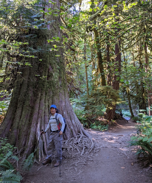
Marymere Falls is a 90-foot-high waterfall named in honor of Mary Alice Barnes, sister of Charles Barnes, a member of the Press Expedition and homesteader along the shores of Lake Crescent. - from Washington Trails Association - Marymere Falls 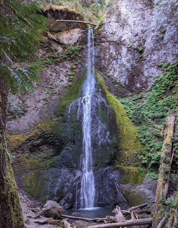
The falls could have used a little more water. Steps and viewing platforms gave us different views to appreciate it. The cool, moist, shady environment created a haven for ferns. 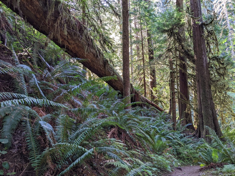
 |

|
Back at Lake Crescent, we walked on the short Moments in Time Trail.
Right away, you'll find yourself in the kind of magical fern, moss and evergreen forest that has made Olympic National Park and the Olympic Peninsula famous around the world. - from Washington Trails Association - Moments in Time Interpretive Trail 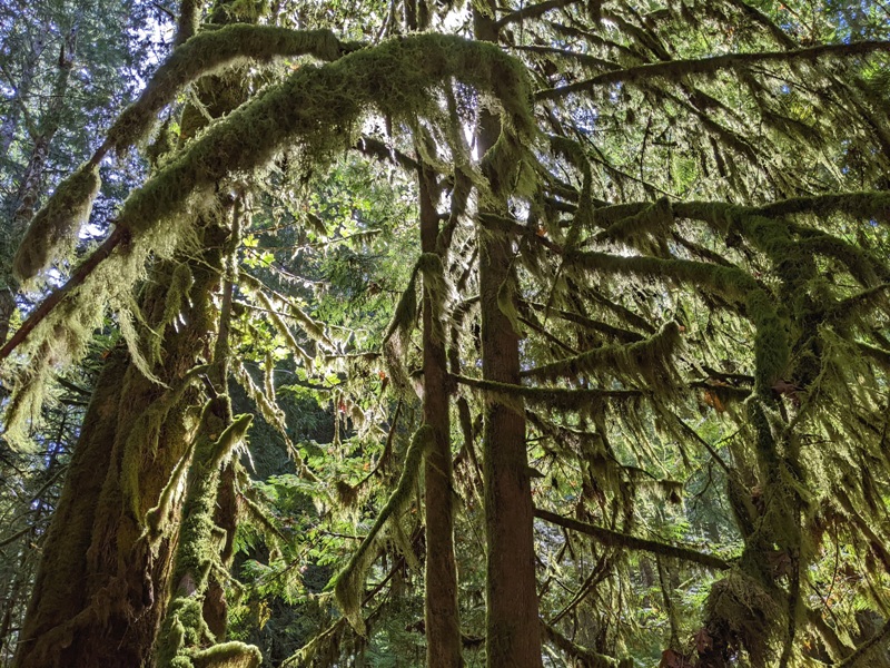
Natural forests evolved in the presence of fire. The heart of this western redcedar was consumed by fire - why is the crown still green? Live tissue still survives under the bark, transporting food down from the needles and water and nutrients up from the roots. - from sign on trail titled "Still Standing" 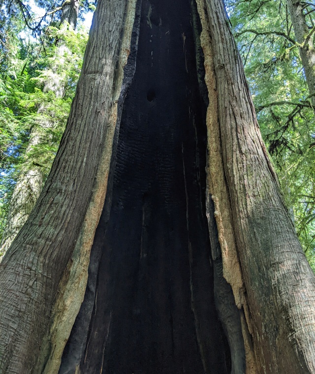
We came across this non-authentic canoe at Lake Crescent which pays homage to the native boat builders, especially in the figurehead.  |

|
Our final hike for the day was on the Sol Duc Falls Trail. Here, we saw a variety of mushrooms, including oyster mushrooms.
Notoriously delicious and easy to find, oyster mushrooms are also one of the best local picks for cooking. Easy to spot from their fan-shaped caps and pale flesh, these mushrooms grow out of wood. Check stumps deep in the woods or near water - the mossier, the better. - from Daily Hive - 7 fantastic fungi to forage in BC [British Columbia] this spring After a mere 0.8 mile, we reached our destination. Called the most beautiful falls in Olympic National Park, and situated just a few miles from Sol Duc Hot Springs Resort and Campground, Sol Duc Falls is a treasure year round. Unlike other falls on the Peninsula, you view it from above on the brink as it falls 50 feet into the slot canyon below. - from My Olympic Park - Sol Duc Falls in Olympic National Park's Sol Duc Valley Depending on water volume, Sol Duc Falls splits into as many as four channels as it cascades 48 feet into a narrow, rocky canyon. - from Washington Trails Association - Sol Duc Falls Old-growth forest, subalpine lakes, and snowy peaks populate the Sol Duc landscape, while the Sol Duc River serves as a key highway for coho salmon, running through the valley and ascending to the lakes and headwaters in the surrounding mountains. - from National Park Service - Olympic - Visiting the Sol Duc Valley Sol Duc Falls has three powerful fall branches, thundering sideway down into a green moss-covered canyon. It is easily the most beautiful waterfall in Olympic National Park. - from Live That Adventure - Sol Duc Falls, the Most Beautiful Waterfall in Olympic NP, WA 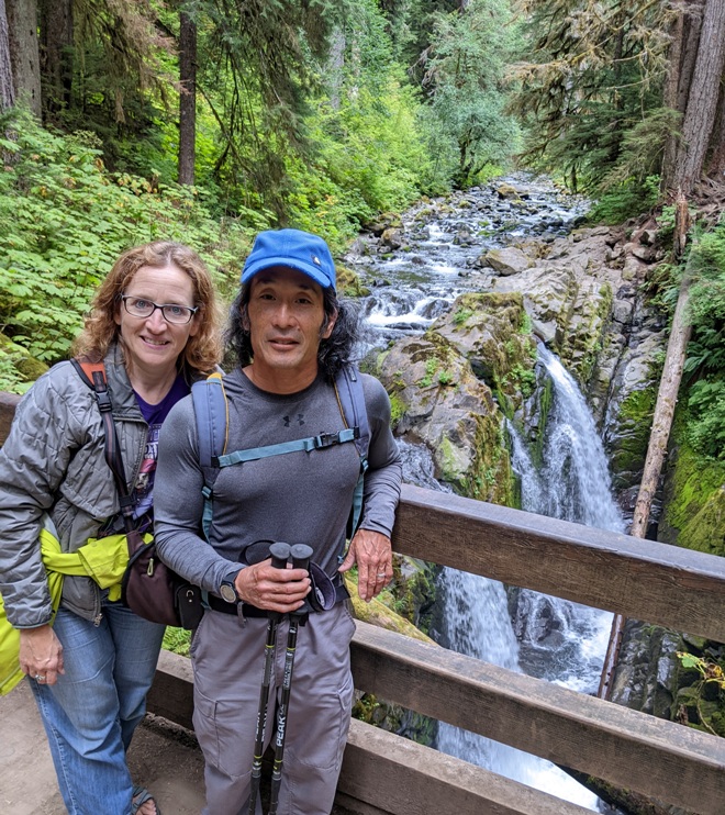
That evening, Norma and I picked up some food at the Joyce General Store and then listed to the Presidential debate before turning in for the evening.  |

|
Norma and I decided to retrace our route slightly so we could return to Auld Holland Inn. The reason is because we both left stuff there when we checked out. They weren't very cooperative in trying to return our things via mail so we figured it would be easiest to simply head back there. Not exactly the fastest way to get to our destination but at least we got our stuff back.
Our next stop was Port Townsend (shown here) where we had breakfast at the Lighthouse Cafe before catching the ferry across part of Puget Sound. Once again, it was easy to get on the ferry, even though we didn't have a reservation.  |

|
The ferry took us to the Coupeville Ferry Dock, which isn't really in Coupeville but it is close. Norma read about Coupeville so we decided to pay a visit.
Coupeville is the second oldest town in the State of Washington. - from Whidbey Camano Islands - Coupeville - In the heart of Ebey's Reserve Island County Historical Society Museum

Coupeville Historic Wharf

Shellfish platforms

 |

|
Norma and I arrived in Seattle, our final destination for our trip. This was the only place that we didn't have reservations for lodging. We hoped to find something last minute in the International District, which was somewhat inexpensive.
Nihonmachi

Hostel

Views

 |

|
Our first stop for the day was Uwajimaya Village, a place known for its variety of Asian cuisines. Shown here are dungeness crabs, the same kind I saw crawling underwater at the San Juan Islands during my five day kayak camping trip.
 |

|
Next, we went to the tea shop next to the Panama Hotel in Japantown. The area was much more welcoming this morning and there were lots of young people at the tea shop. In the window was a book containing the photos of Seattle residents who served in the 442nd Regimental Combat Team.
Panama Hotel is the same hotel in the book Hotel on the Corner of Bitter and Sweet. This book spent two years on the New York Times bestseller list and went on to win the 2010 Asian/Pacific American Award for Literature. Pictured here is a view of the hotel basement where Japanese Americans stored their valuables before leaving for the relocation camps. These are the items that were never claimed. We saw Jan Johnson, who spoke to various visiting college students. Jan Johnson is a Pacific Northwest native who has traveled extensively in Italy. She purchased the Panama Hotel in 1985. It is the oldest operating hotel from pre-war Japantown. She has welcomed thousands of visitors to the historic Panama Hotel and Tea House in Seattle's Nihonmachi (Japantown) over the past nearly four decades. ...little is known about the woman who single-handedly took over this aging hotel and transformed it into a top destination for visitors around the globe. - from The North American Post - Jan Johnson of Japantown's Panama Hotel: "Saving History Saves the Future"  |

|
We visited the Wing Luke Museum
which focuses on the culture, art and history of Asian Americans, Native Hawaiians, and Pacific Islanders. Established in 1967, the museum is a Smithsonian Institution affiliate and the only pan-Asian Pacific American community-based museum in the United States. - from Wing Luke Museum We received a fantastic guided tour by Han which I highly recommend. At the museum, we saw a rare photo of martial arts master Bruce Lee in Reserve Officers' Training Corps (ROTC) uniform. Supposedly, he tried to join the U.S. Army to serve in the Vietnam War but was rejected for medical reasons. It turns out the conference that drew so many to the Panama Hotel was taking place at the museum.  |

|
Norma and I did an underground walking tour of Seattle. This tour
details the birth of our city, 1890's architecture, and several other stories including the Klondike Gold Rush, Skid Row, and the Coast Salish Peoples that first inhabited the area. - from Beneath the Streets Our tour guide (shown here) took us through three underground passageways originally constructed in the 1890's. - from "Beneath the Streets" She told us about the origin of the term "skid row" which was associated with early Seattle. The term skid road originally referred to the path along which timber workers skidded logs. Its current sense appears to have originated in the Pacific Northwest. - from Wikipedia - Skid Row  |

|
Our Beneath the Streets tour guide mentioned the significance of how the Klondike gold rush shaped the city. This prompted Norma and me to visit the Klondike Gold Rush National Historical Park to learn more.
On July 17, 1897, the steamship Portland arrived in Seattle carrying nearly two tons of gold. Sixty-eight exhausted but wealthy miners disembarked. They told stories of rivers lined with gold and easy riches in a remote region of northwestern Canada. The event sparked the imagination of people around the world. The rush was on! Savvy city leaders seized the opportunity and advertised Seattle as THE gateway to the Klondike. Thousands of people flooded through the city spending millions of dollars. As a result, a slumbering Seattle awoke, becoming a bustling economic center. - from sign at Klondike Gold Rush National Historical Park titled "Klondike Gold Rush" With all the walking we did, my foot was feeling pretty miserable. So I went back to our room while Norma explored the town a little more on her own.  |

|
On our last day, Norma and I checked out of the hostel and set out to explore other parts of Seattle before heading to the airport for our flight home. I had a great time but I was ready to return to Savage and see Daphne.
One of the most iconic places in Seattle is Pike Place Market. Considered by many "the soul of Seattle," the Market spans nine historic acres in the center of downtown where everyday locals and tourists alike shop, visit, eat and discover. Founded in 1907, the Market is one of the oldest and largest continuously operating public markets in the United States and is brought to life by the hundreds of farmers, crafters, small businesses, and residents that call it "home." - from Pike Place Market We saw the first Starbucks which opened on March 30, 1971. In my five years as manager of 1912 Pike Staff, there was never a day without The Line. I doubt there ever will be. It winds out the door. Stretches down the street. Plows past the stop sign on the corner and just keeps on going. - from Starbucks' Stories and News - Store Tour: Inside 1912 Pike Place, Seattle, USA We passed by the world-famous Pike Place Fish Market which is known for its fish throwing. This place has been in business since 1930. The Maryland state fish is the rockfish, which is also known as the striped bass. But in Washington state, the rockfish is something totally different. In one area outside, we saw lots of grotesque artwork that looked like something I might find on a Rob Zombie album. In some ways more grotesque than the artwork but also intriguing and colorful was the Gum Wall. The Gum Wall started in the 1990s when local patrons and performers at Unexpected Productions stuck their used gum on the wall. Since those days, the wall has grown piece by piece to cover an enormous expanse of brick and continues to expand down Post Alley. - from Pike Place Market - The Gum Wall 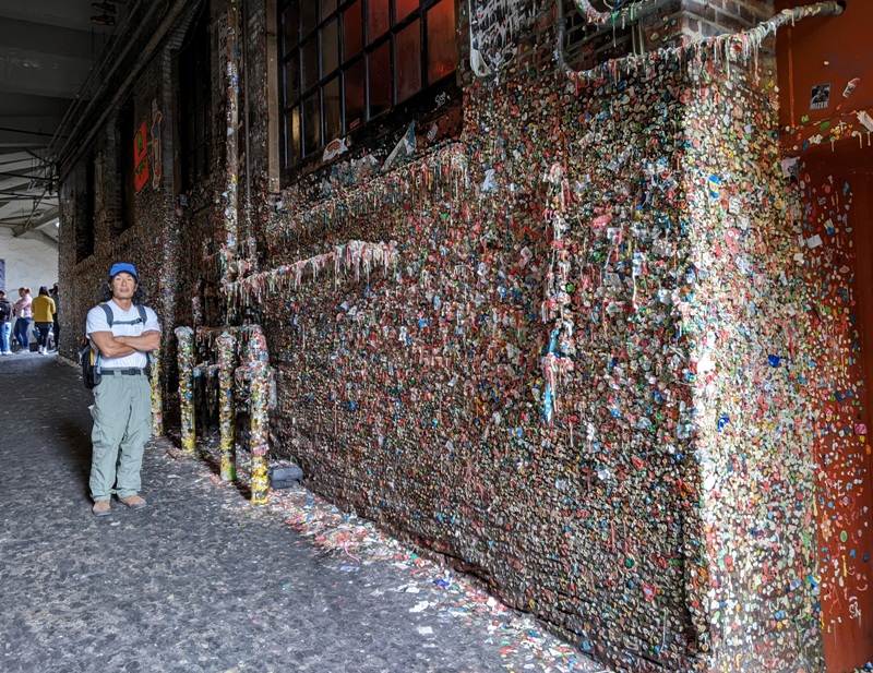
 |

|
We walked by the Seattle Great Wheel, where we had a nice view of the skyline. In the pic below, the building on the left in the front is the Seattle Aquarium.
We thought about visiting the Seattle Aquarium but we live near and have visited numerous times the National Aquarium in Baltimore. I don't think anything could top that.  |

|
We walked through Olympic Sculpture Park. Behind Norma is a piece called the Wake.
The red sculpture in the foreground is the Eagle. In the background is the Space Needle, perhaps the most recognizable structure in Seattle. No, we did not visit it.  |

|
Next, we headed out to the Portage Bay section of Seattle to see the "houseboats" which Norma read about in her travel guide. It turns out they are really just floating homes. Even the cheapest ones were very expensive.
 |

|
After eating lunch at the Agua Verde Cafe, I rented a kayak from the University of Washington Waterfront Activities Center (WAC). I explored the west side of Union Bay. While I did this, Norma walked on the Arboretum Waterfront Trail. Our paths crossed a bit.
Out on the water, I saw a beaver lodge and this painted turtle. I spotted this water lily. Notice the pollinator. Here's a great blue heron looking for a meal. This is a spatterdock flower maturing to seed pod. Here's an American coot. While Washington state has some great marine mammals and interesting life in its tidepools, I was a little disappointed with their birds. I feel Maryland is better for birding while kayaking, and Florida has Maryland beat by a lot.  |

|
We drove to the SeaTac Airport, returned the rental car, and flew home. Erin, who had been taking care of Daphne, Chester, and our chickens, picked us up at BWI and took us home. Washington was great but it was good to be back in Maryland.
 |