|
This page describes my hiking adventures in 2022. |

|
This page describes my hiking adventures in 2022. |
|
After spending the morning doing some volunteer construction work at Carroll Baldwin Hall in our town, Norma and I decided to spend part of the afternoon hiking with Daphne on the Appalachian Trail. Our destination was Black Rock and we planed to get there via the Thurston Griggs Trail. Our route is described at AllTrails - Thurston Griggs to Appalachian Trail to Black Rock.
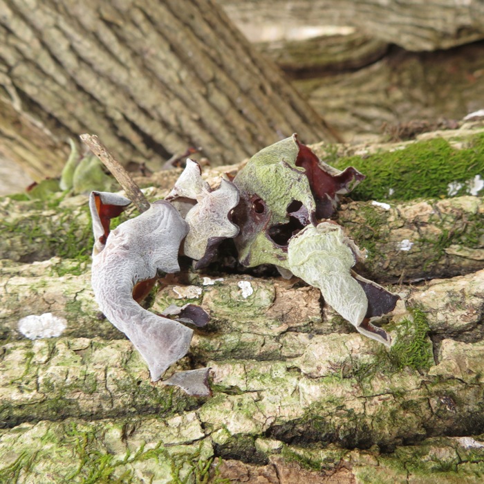
Who is Thurston Griggs? Thurston Griggs was a father, teacher, inventor and environmentalist during his lifetime. His involvement with the Appalachian Trail was almost an afterthought in his retirement. Mr. Griggs was very involved with the protection of the Appalachian Trail and other hiking trails in the Mid-Atlantic in the late 20th Century, at a time when land protection efforts were crucial. One of his more ambitious projects was the protection of the Bagtown Road access west from Pogo Campsite in the 1990s. For this, Bagtown Road was renamed in his honor on his 86th birthday. Mr. Griggs remained active in the trails community until shortly before his passing at the age of 95. - from trailhead sign The three of us hiked 0.9 mile to the Appalachian Trail (AT). This was pretty much all uphill and mostly rocky. Some sections were a little muddy but it wasn't bad. It was nice walking along Black Rock Creek. We saw very little ice. Since we got a late start (around 1330), we saw a lot of hikers coming downhill as we went uphill. There wasn't much to see but it sure was nice getting some fresh air. It was cool but comfortable by February standards, with temperatures in the mid and high 40s. The only interesting flora we saw was some genus of Calostoma fungus, which Norma found. I touched it and it released spores. 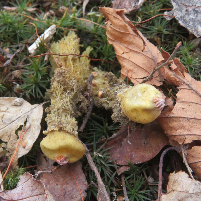
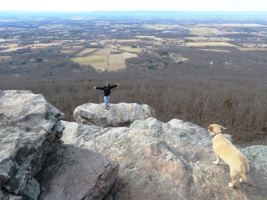
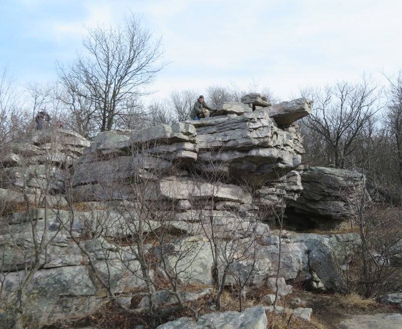
The trail description mentioned a waterfall but I saw none. Water did flow down Black Rock Creek but I would hardly call any of that a "waterfall." We did a few easy stream crossings over it. Once we reached the AT, we headed south, passing the Pogo Campsite. Near Black Rock Cliff along the Appalachian Trail in Maryland is "Pogo" Campsite. A question often asked by hikers is how did Pogo Campsite get its name? The sign at the campsite states that it is a memorial to Walter Rheinheimer, Jr. (1957-1974), who was nicknamed "Pogo" by his mother soon after his birth. Pogo and his parents were active in the Mountain Club of Maryland and the Potomac Appalachian Trail Club. A young Pogo became the "mascot" of the MCM. He began hiking with his father at an early age and at 9, with Walter Sr., hiked more than 100 miles on the Appalachian Trail. This was the first of two several-week hikes. By age 16, Pogo had walked more than half of the AT. In the summer of 1974, Pogo and a friend began a bicycle journey from the Atlantic Coast in quest of the Pacific Coast. On their first day, the cyclists were side-swiped by a truck. Both were injured and his companion required several months hospitalization for a spinal injury. A friend, perhaps attempting to rekindle Pogo's enthusiastic enjoyment of nature, suggested a Potomac River canoe trip. Not yet fully recovered from his cycling injuries, Pogo accepted the invitation. He was not a swimmer nor an experienced paddler. In the rushing water, Pogo was separated from his canoe and swept downstream to his death. The Mountain Club of Maryland wished to memorialize Pogo and sought to purchase appropriate land. PATC President Ruth Blackburn suggested the old Black Rock Hotel site be designated "Pogo Campsite" in honor of the young adventurer. The site was owned by the State of Maryland and had a suitable water supply. As a primitive campsite, the spring and the pit-privy are the only amenities at Pogo Campsite. We can only speculate what Pogo may have accomplished had he survived. He surely would have enjoyed the campsite and the spirited adventurers passing through. - from trailhead sign For more information about Pogo, read BlueRidge Country - Kinship Remembered: Hiking With My Brother. After about 0.9 mile on the AT, we came to Black Rock. It was very windy here and we had an unobstructed view to the east. The place looked a lot like Annapolis Rock, which was a little to our south. The scenery was excellent. In the distance, we could clearly make out highway 70. Too bad we didn't have more sun. 1 / 3

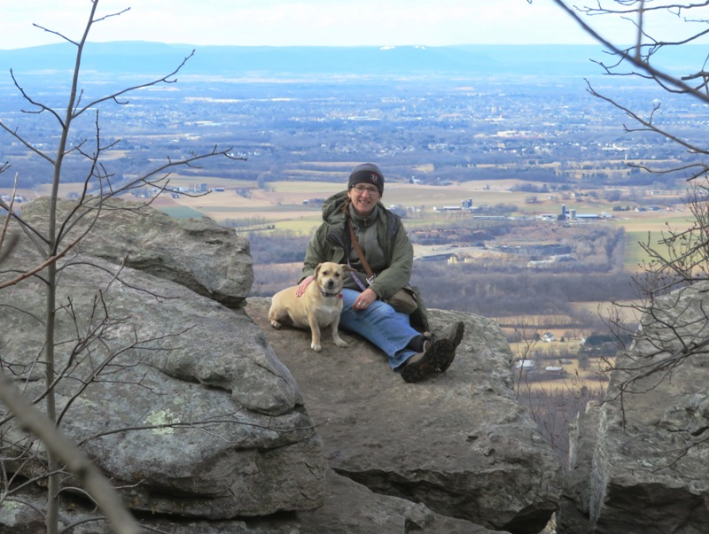
Norma and Daphne at Black Rock.
2 / 3
Jump Daphne, I'll catch you!
3 / 3
Norma and Daphne at Black Rock.
We saw few people on the return trip. In one spot, we saw quite a few downfalls. It was obvious the trail maintenance people did a lot of work to keep the Thurston Griggs Trail clear. 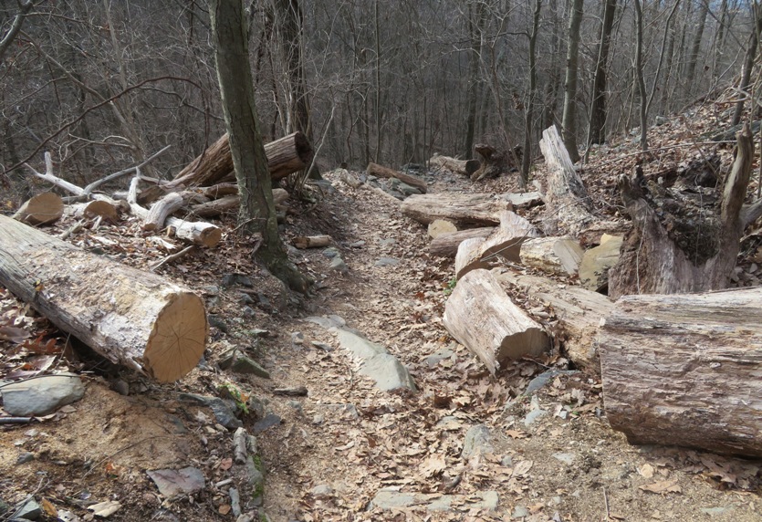
Afterwards, we met at Norma's sister's house for dinner. 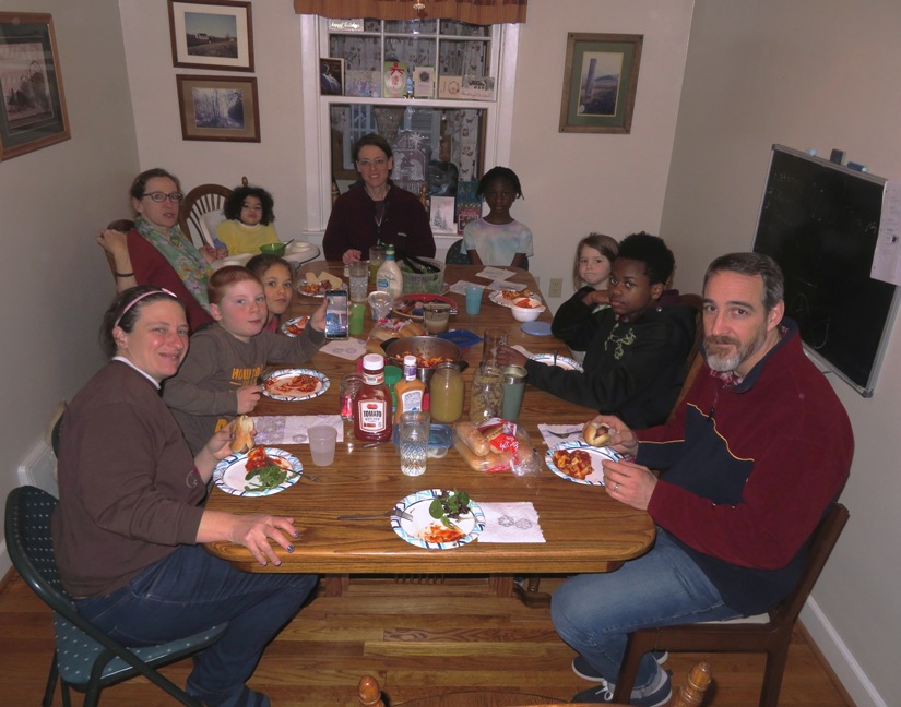
 |
|
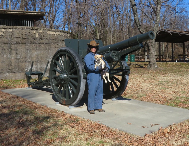
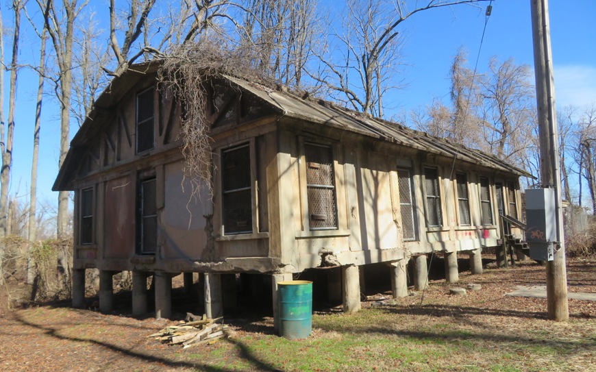
Norma, Daphne, and I visited the park that bears the name of our county's namesake: John Eager Howard. Fort Howard Park is a great place to visit if you enjoy exploring old ruins and learning about local military history.
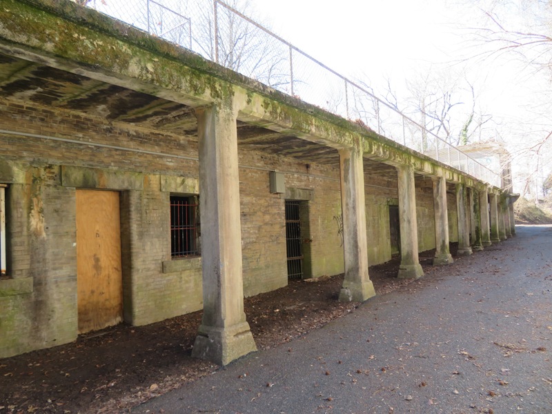
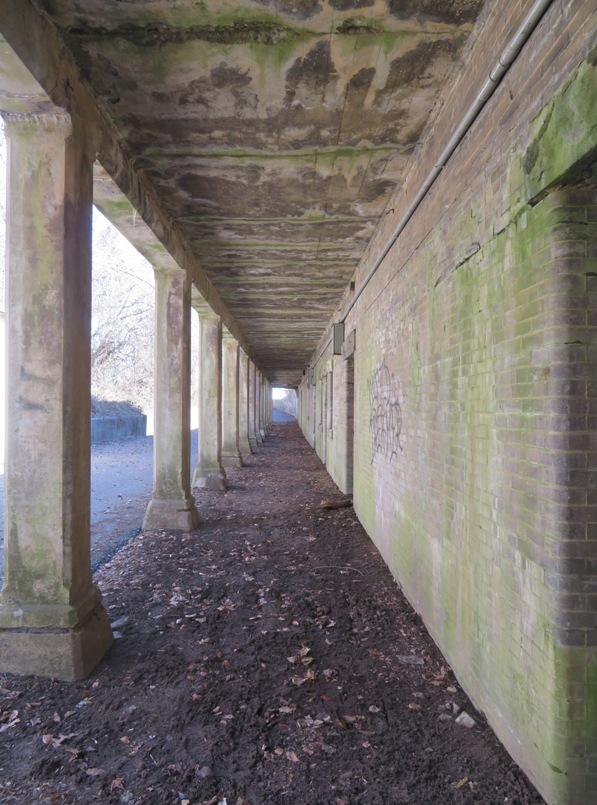
In 1814, the British landed 4000 troops at North Point and sent a squadron of gunboats up the river to attack Fort McHenry. Baltimore turned back the British, but our country never forgot that fearful event and how vulnerable our coastal cities were to attack by sea. By 1885, America's obsolete coast defenses led Congress to create a board to identify those port cities where defenses were lacking and to recommend upgrades to military installations at those locations. Full funding for those improvements took another decade to be implemented, but by 1898, construction began in earnest, spurred by war with Spain and the fear of Spanish naval attack against a relatively unprotected coastline. Baltimore was high on the list of those cities where new installations were needed. Fort Howard and three others on the Patapsco including Fort Smallwood, Fort Armistead, and Fort Carroll, were built or modified to house state-of-the-art, breech-loading artillery and electrically controlled mines. Construction of Fort Howard's batteries began in 1897, and by 1903 the entrance to the harbor of Baltimore bristled with thirty-six artillery pieces and scores of mines at the ready. In 1908, a local newspaper reporting on the completion of the four forts called them "The Bulldog at Baltimore's Gate." Battery Key is a concrete emplacement that housed eight 12-inch mortars mounted on carriages. The battery was named for Francis Scott Key who wrote the Star-Spangled Baner. The mortars were installed in 1898 in two pits of four mortars each. The pits (one shown below) are separated by the main battery structure which housed a power plant and the munitions storage area. The battery was deactivated in 1927. 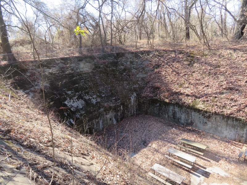
We found a narrow corridor that led to a room inside of Battery Key. I assume munitions were stored in this room. Today, it is home to hundreds of camel crickets that hang from the ceiling. 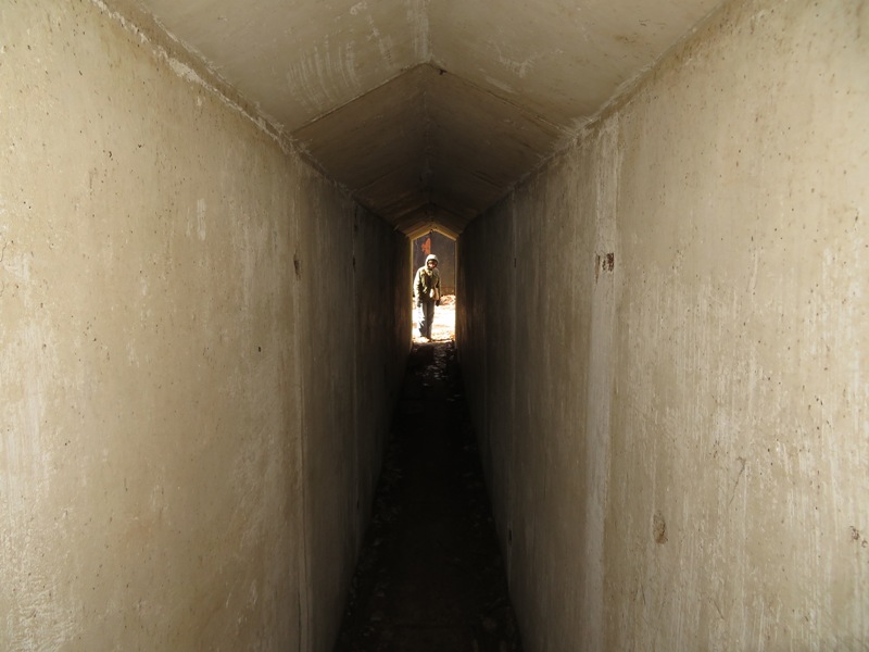
We found several concrete buildings. Most were not accessible. 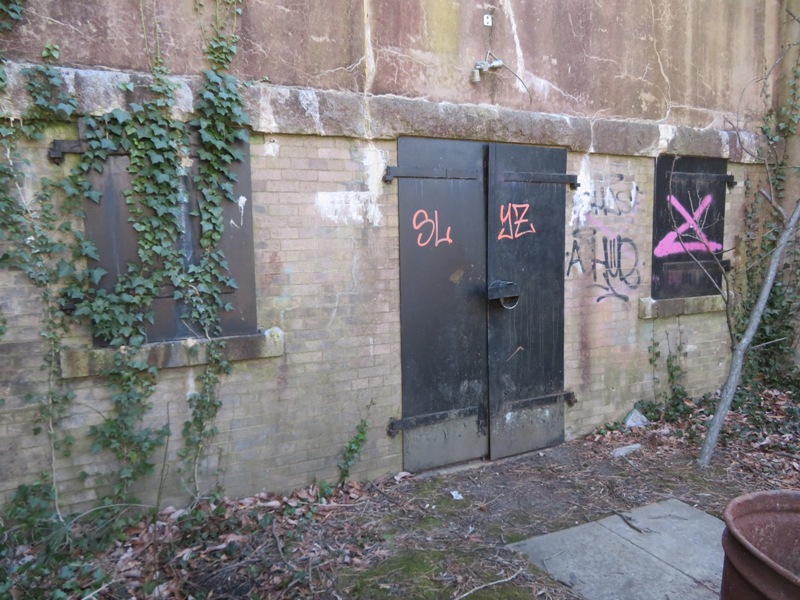
Here's Norma and Daphne at the east end of the park by the Chesapeake Bay. Behind them is North Point State Park. 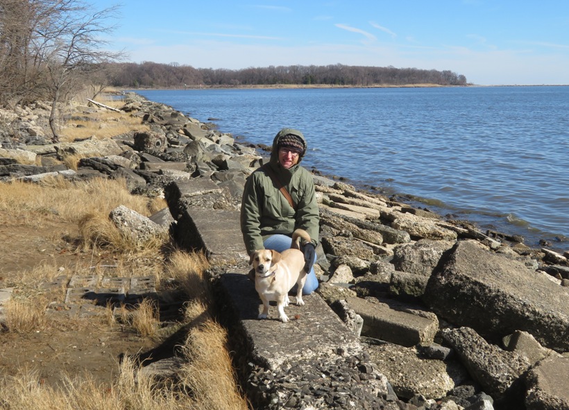
On the east side of the park, rip rap protects the beach from erosion. There's no good place to land a kayak or SUP. We had the whole beach to ourselves. Ice in the shallow areas looked like sea foam. 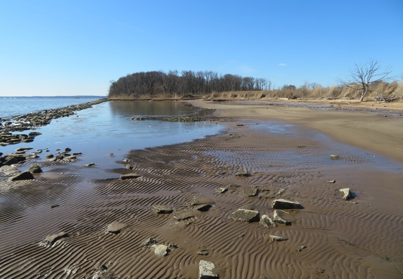
Fort Howard is truly a fantastic place to explore. Not a good place if you want a serious hike but I'm finding I care less about that as I age. In my opinion, winter is the best time to visit because the foliage dies back and you can see the ruins more clearly. |
|
Norma, Daphne, and I went for a short hike at the Melvin G. Bosely Wildlife Conservancy. I have paddleboarded here but this was my first visit via land. Since this is a conservancy, recreation is not their primary goal so don't expect well-manicured trails. But if you like being deep in nature and away from people, then this is a great place.
I saw my first ever firefly larva. It was climbing up a moss-covered tree. 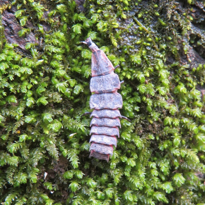
We saw a dead tree about 10 feet tall. The outer part eroded away at the base. Can't say I've ever seen anything like this before. 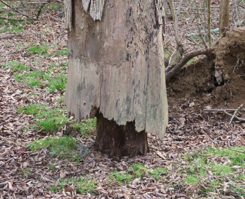
I've never seen so many skunk cabbage flowers before. We saw them primarily on the moist orange trail, which parallels Otter Point Creek. They remind me of Corronavirus. 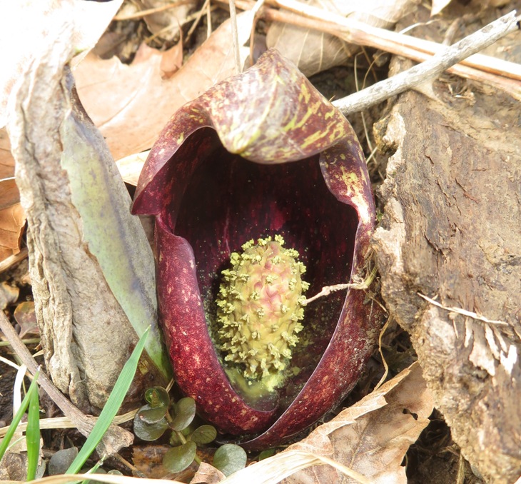
Members of the plant family Araceae, including skunk cabbage, have evolved the ability to metabolically generate considerable quantities of heat. Skunk cabbages can raise the temperature of their flowers to 22 Celcius [71.6 Fahrenheit], even when the surrounding temperatures are much lower than that. - from Temperature Relationships in Eastern Skunk Cabbage Skunk cabbage supposedly smell bad and use their odor to attract flies which help with pollination. But I didn't notice any scent. So maybe I smell as bad as them. We also saw the remains of a dead animal. Not sure what it was. The body looked to be about 18 inches long. Again, I didn't notice any odor. 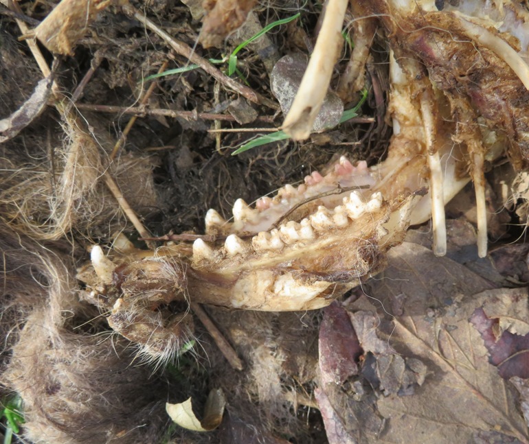
1 / 6
2 / 6
Big crayfish underwater.
3 / 6
4 / 6
At least 1000 on single tree.
5 / 6
6 / 6
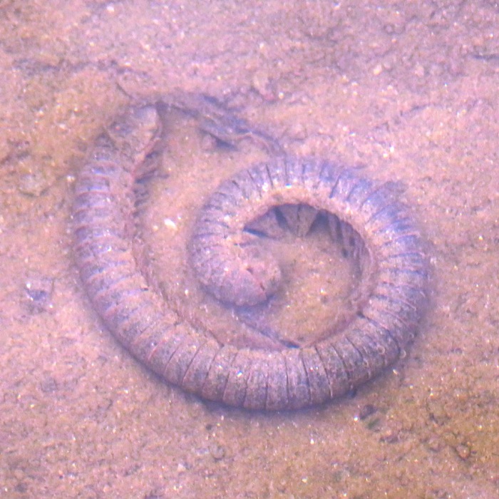
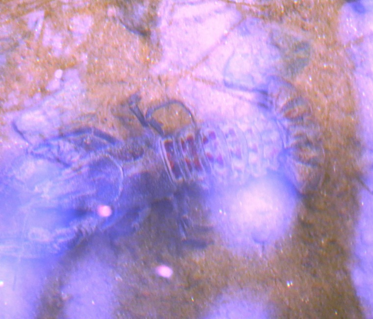
Dead millipede underwater.
Someone at the Anita C. Leight Estuary Center once suggested I do not visit this place in the summer because it is so buggy. I expect that is indeed the case since we were surrounded by freshwater wetlands. We were hoping to find amphibian eggs but found none. Maybe it is because most of the water was flowing, even if just a little bit. I've heard that amphibians prefer to lay their eggs in places where fish are not present. So pools not connected to the creek might be best. |
|
After picking up some native plants that Norma ordered from Adkins Arboretum, she, Daphne, and I went for a 6.6-mile hike at the arboretum and Tuckahoe State Park.
We started walking on the northern side of the arboretum which is very wooded, shady, and scenic. It was possibly the nicest day we've had all year so far and there were quite a few people out. That's not to say this is a busy place. I think most trails were probably busy that day. The trails were well maintained. In the below picture, the three of us pose in front of some downfalls that were cut and cleared from the trail. 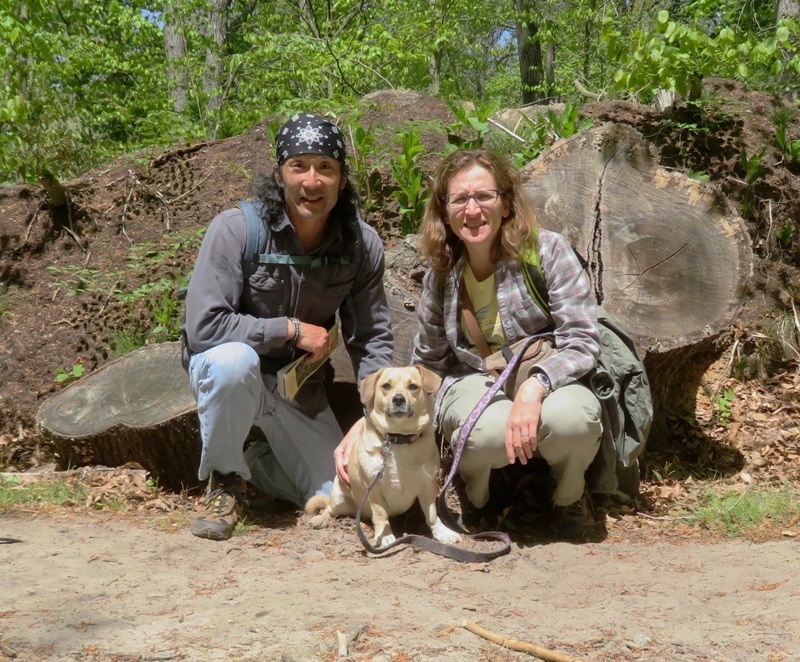
Walking west, we picked up the Tuckahoe Valley Trail and headed south. I have an old map of the park from when Martin O'Malley was governor. It showed this trail connecting with Turkey Hill Trail which leads to a river ford. We went to check this out but found the Turkey Hill Trail is no more. Near the former Turkey Hill Trail, I found a blister beetle, aka oil beetle. This insect releases oily droplets of hemolymph from their joints when disturbed; this contains cantharidin, a poisonous chemical causing blistering of the skin and painful swelling. - from DBpedia - Meloe 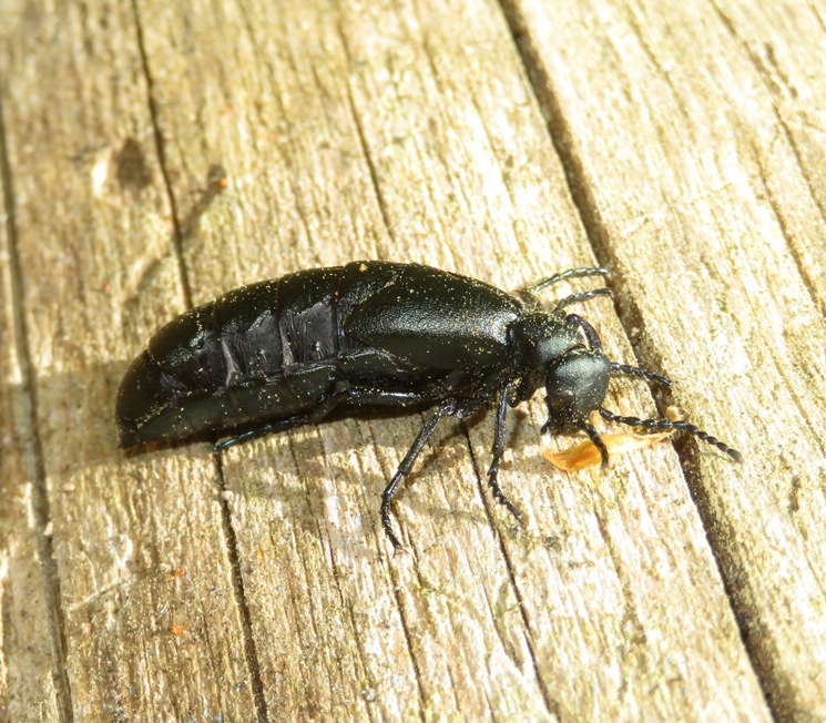
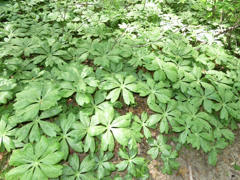
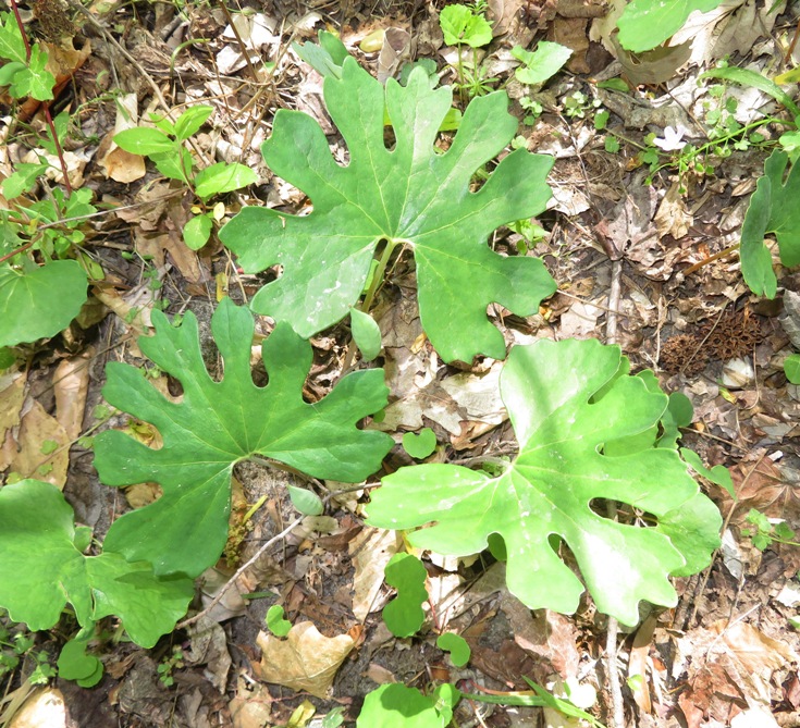
We retraced our steps a bit heading north but then caught the Office Spur Trail heading east to the Office and Ranger Station where we saw the raptors in their enclosures and then took a nap under a tree. Paralleling Eveland Road, we walked on the Tuckahoe Multi-Use Trail back to the arboretum. We didn't see much in terms of wildlife but there were a lot of interesting and pretty plants, such as mayapples, which are shown in this blog's cover photo. 1 / 7
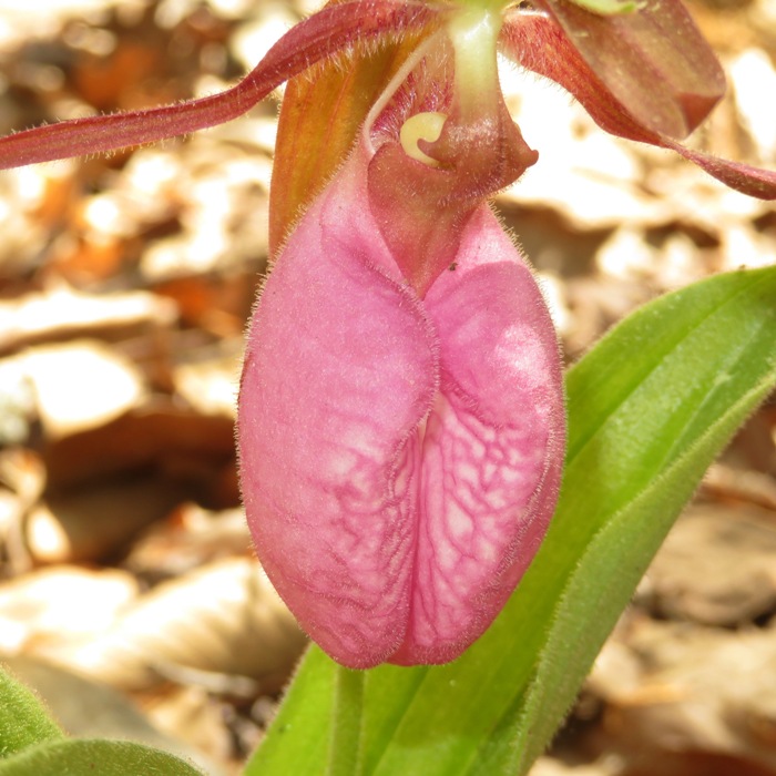
Pink lady's slippers orchid.
2 / 7
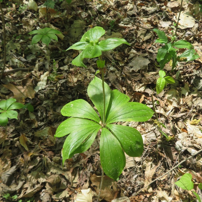
Indian cucumber.
3 / 7
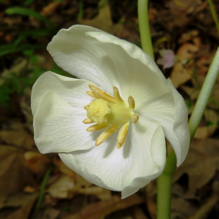
Bloodroot.
4 / 7
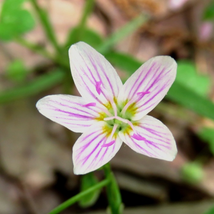
Spring beauty.
5 / 7
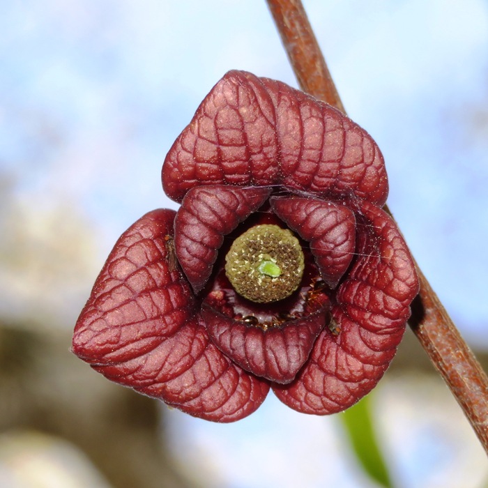
Paw paw flower.
6 / 7
Mayapple flower.
7 / 7
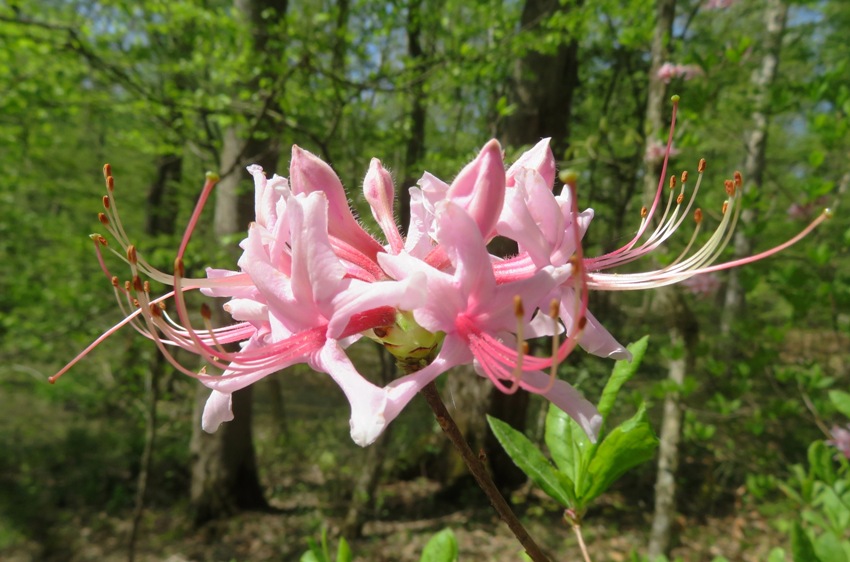
Pinxter flower.
We were hoping to find morel mushrooms but found none. These are perhaps my favorite trails on the eastern shore, through there really aren't that many. The next day, Tanita, one of Norma's co-workers, told me about a new place to hike on the eastern shore called Bohemia River State Park. I'm definitely putting exploration of this place on my bucket list. |
|
During Memorial Day weekend, Norma, Daphne, and I had a great time hiking at Bohemia River State Park.
|
|
After work, Norma, Daphne, and I went on a foraging hike on a trail near Rocky Gorge Reservoir (T. Howard Duckett Watershed).
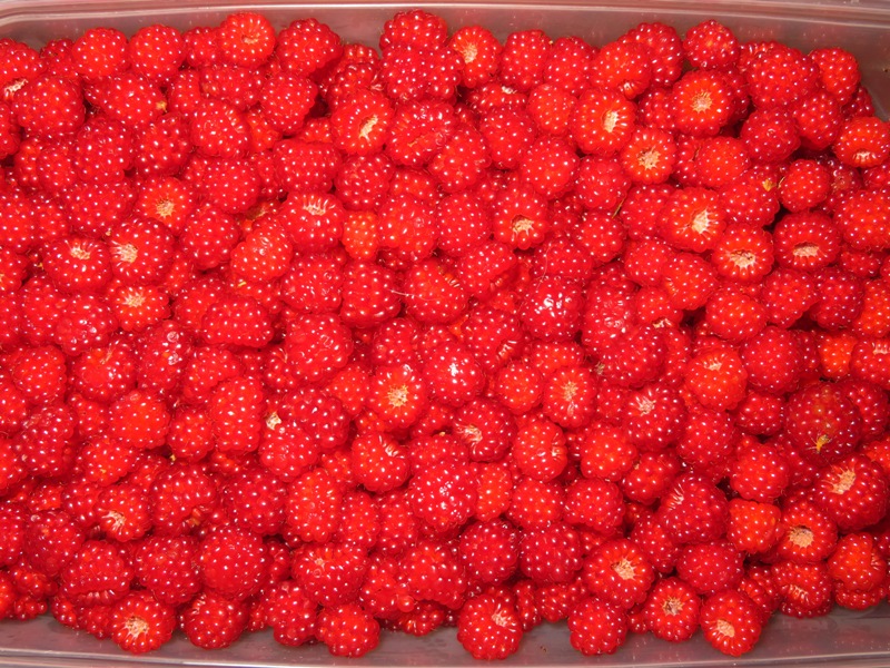
We started around 1800 from Brown's Bridge and then walked towards Tucker Lane along the main path. It was hot, humid, and buggy. I wore a good bit of bug spray but I could have used more. It didn't take long before I was drenched in sweat. The whole purpose for our walk was to look for wineberries and chanterelle mushroms. We found quite a bit of both. Last year, we picked wineberries on July 18 and they were a bit too ripe. But today they were much better. Some were not quite ripe and a few were overripe. Maybe another couple of days would have been perfect but not much more than that. Norma also found quite a few chanterelles. She is a better forager than me and she is also faster at picking berries. We didn't quite make it to the road, turning back after about a mile so we could make it back by dusk. So what did we get? I didn't measure or weight the mushrooms but for wineberries, we got 1.1 gallons, weighing 4.5 pounds! 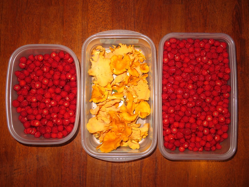
I suspect that if we had another hour and explored the side trails, we would have returned with a LOT more. But we were pleased with what we found. A couple nights later, Norma made mushroom soup with the chanterelles. |
|
During July 15-17, 2022, Norma, Daphne, and I did some hiking in West Virginia at Dolly Sods and Seneca Rocks.
|
|
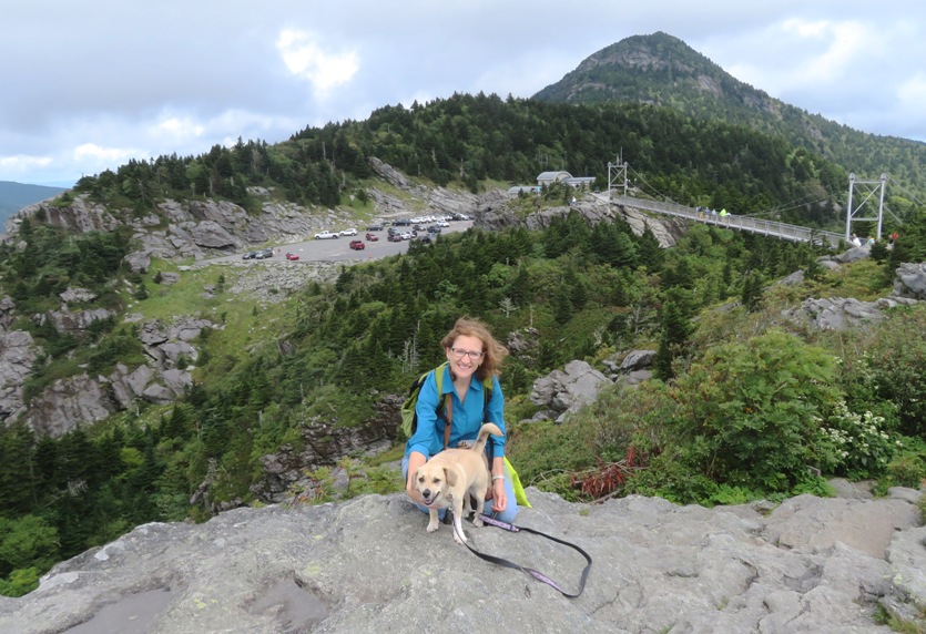
During September 3-6, 2022, Norma, Daphne, and I did some hiking in western North Carolina.
|
|
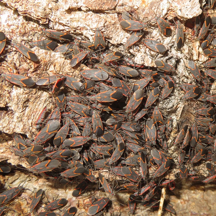
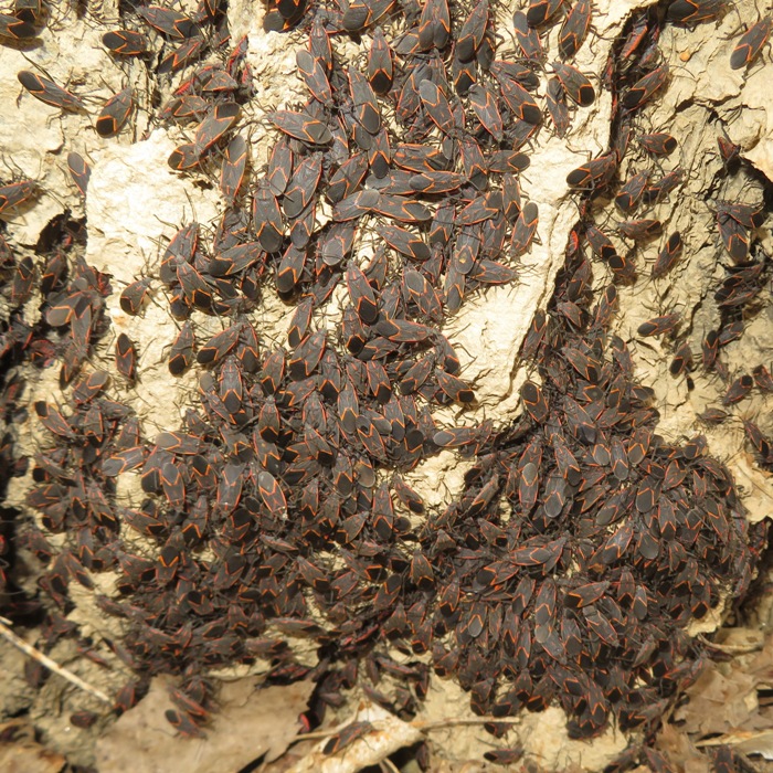
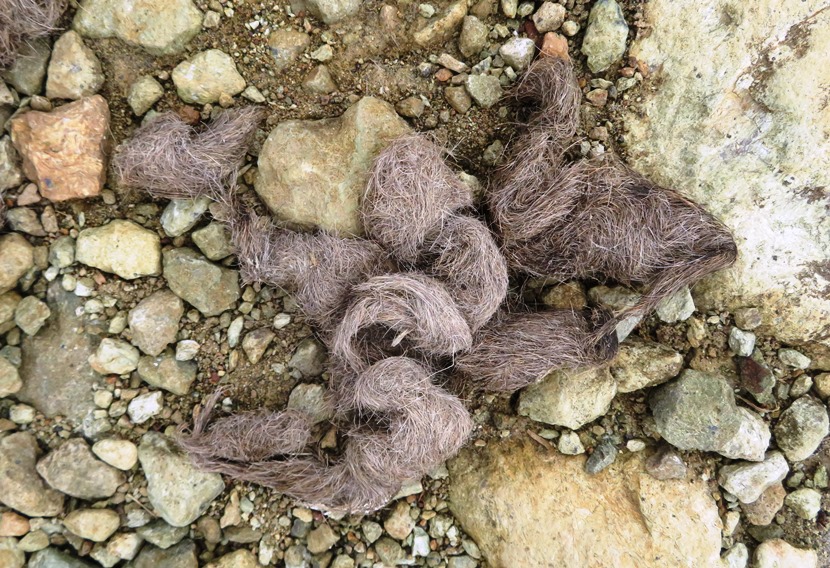
On September 11, 2022, Norma, Daphne, and I saw one of the most unusual creatures we'd ever seen right in our own town. A few weeks later, I found a couple more trees (closer to the Little Patuxent River) infested with this same insect.
|
|
Norma, Sara, Daphne, Cassi (Sara's dog), and I went for a hike at Soldiers Delight. This is one of Norma's favorite local hikes.
We arrived at the visitor center shortly after the park opened and then headed east, walking on the yellow-blazed Dolfield trail. It hadn't rained for awhile so the mines (just deep holes) were dry. But the trail on the south end was pretty wet since a shallow creek passes through it. We saw a lot of chicory flowers (below). I was hoping to see fringed gentians but saw none. The latter are quite rare. 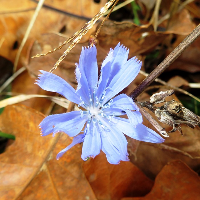
Walking on the orange-blazed Red Run, we got off track on the east side and started heading towards a residential area. If walking counter-clockwise on this trail, the creek should be on your right. After walking on the red-blazed Choate Mine trail, we crossed Deer Park Road and then headed west and counter-clockwise on the northern part of the Serpentine Trail. We saw some coyote scat (shown on this blog's cover photo). The Choate Mine trail has a lot of open views but the overcast weather meant we weren't seeing much in terms of fall colors. Near the visitor center, we stopped at the Red Dog Lodge, built in 1912. I saw some things embedded in some of the stones used to form the walkway. Not sure what they were but my guess is actinolite. 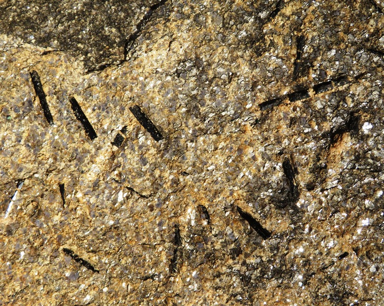
Here's the five of us at the lodge. Had Mars or Rufus also been with us, we would have had a red dog at the Red Dog Lodge. 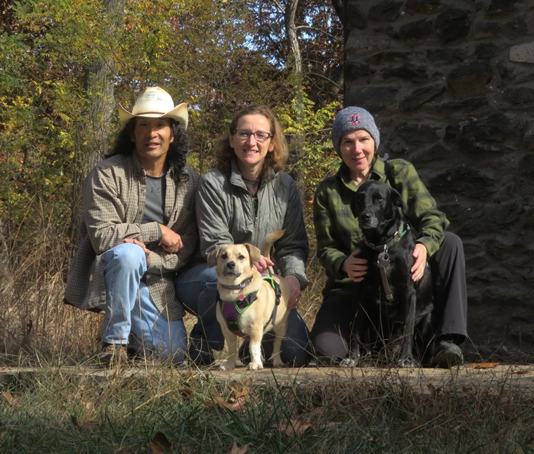
Soldiers Delight has a Scales and Tales area. We took at look at their aviary where we saw a broad-winged hawk. I had never heard of this local raptor. It pretty much looked like most every other hawk to me. The dogs could not go into the bird area so they waited patiently. 
We walked 6.1 miles. One the way home, we stopped in at Farm Chicks, a local produce market. The next day, Norma and I spent several hours on a plane flying out to visit my folks so we were glad to have gotten a chance to do a little walking prior. |
|
On November 1-8, 2022, Norma and I did a couple of short hikes on the Pacific coast in California.
|