|
This page describes a weekend which Norma and I spent exploring some of the natural parts of Sussex County, Delaware in 2009 |

|
This page describes a weekend which Norma and I spent exploring some of the natural parts of Sussex County, Delaware in 2009 |
|
After paddling the scenic upper Tuckahoe Creek a week prior on May 10, 2009, I was wanting to see more pristine, scenic, shaded, tree-lined, narrow, fresh waters. Norma, having missed that trip, was just as eager.
Adventures such as the upper Tuckahoe are typically found on canoe trails. Canoe trails are the paddleable wetlands that someone important believed held some special beauty and should be preserved for future generations. There aren't many in Maryland so we decided to cross the border into Delaware (the first state) to explore the James Branch Nature Preserve Canoe Trail. On the morning of our trip, the forecast called for a 50% chance of precipitation with south wind increasing to 14-17 mph. For the evening, the meteorologist predicted between a quarter and a half inch of rain and south wind between 10 and 15 mph. The next day would be another quarter to a half inch of rain with a 13-17 mph north wind and a high of 64 degrees. Not exactly ideal paddling conditions but we were determined to give it a go and make the best of it.  |
|
While I made the Trap Pond State Park campground reservations several weeks ago, the actual planning all came together at the last minute since I wanted to see what the forecast would bring. I woke up early on the day of our trip and wrote down four days worth of paddling options for our two day weekend. Why so many? Because I wasn't confident that the routes I planned would really be paddleable. My maps show some of them as being extremely narrow. Would they be deep enough? Would the water trail be kept clear? Before launching, Norma and I would spend some of the morning driving around to view the canoe trail from a couple of the bridges that crossed it. It if looked do-able from above, we would try it. Otherwise, I had plenty of backup plans.
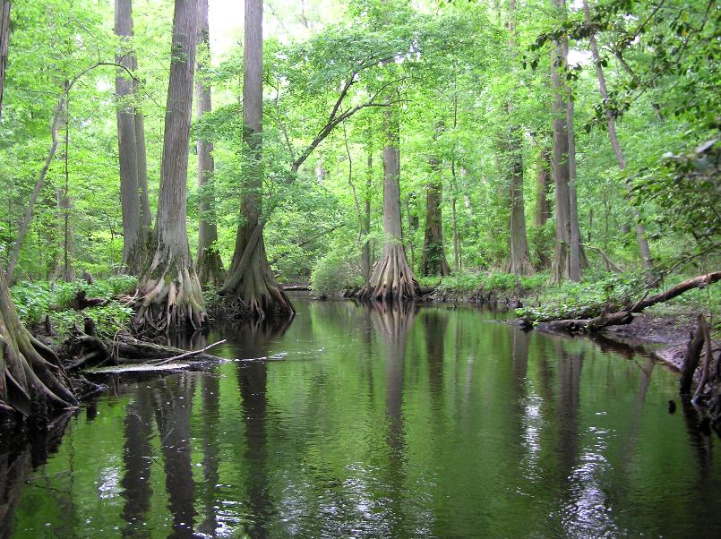
I read about the James Branch Canoe Trail in Edward Gertler's Maryland and Delaware Canoe Trails. In fact, many of my trips are based on this book. It is a great resource and I highly recommend it. But I also suggest not relying 100% on any one source. That is why I like to scout things out first, study maps, check the Internet, and talk to locals...especially when it concerns paddling on narrow creeks. Norma and I also checked out the neighboring Trussum Pond, where we saw what I think is a red-eared slider turtle. 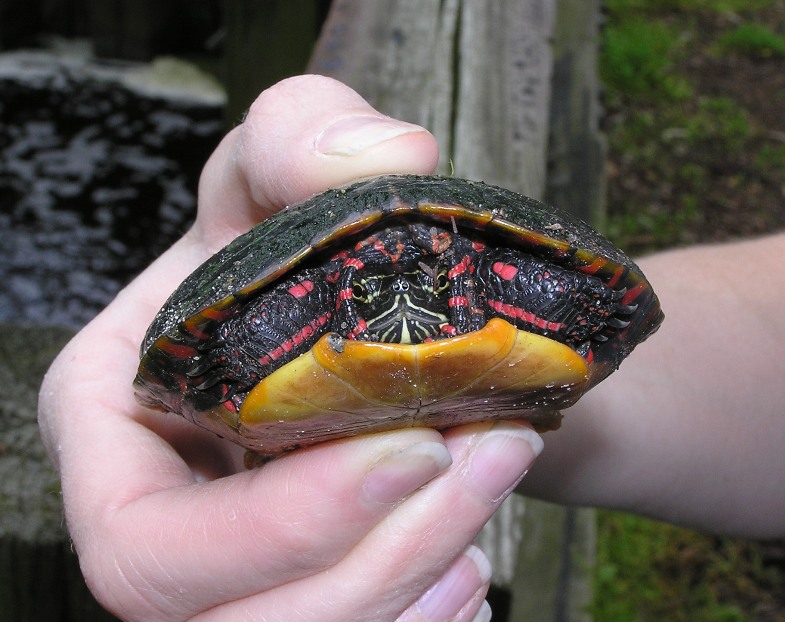
I also saw a goose family. 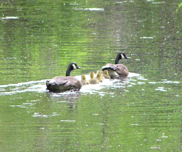
If Trussum Pond looked anything like the canoe trail, I knew we would see some fantastic sights! Here's the pond. 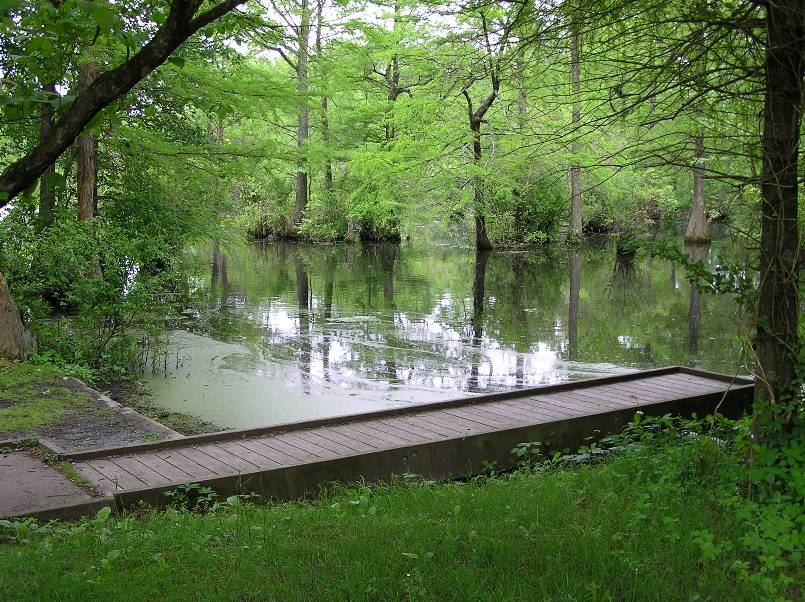
|
|
Our reconnaissance looked good so we started by locking up the bicycles at Records Pond.
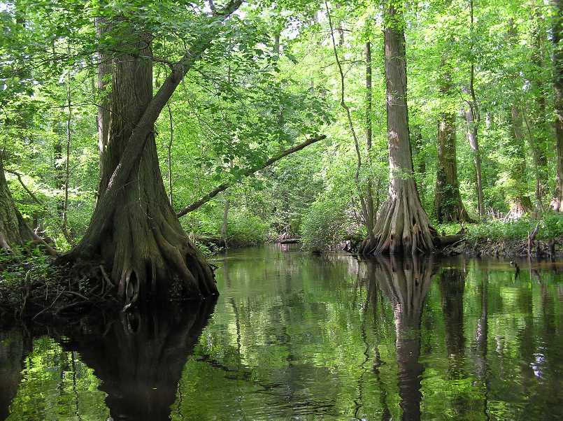
Next, we drove to Trap Pond, and launched my Ocean Kayak Cabo just below the dam on the James Branch Canoe Trail. We actually began on Hitch Pond Branch. Not knowing what to expect, I brought my saw and loppers. Writing about this canoe trail, Gertler claims, "Canoeable streams just do not come any smaller." I definitely agree. The creek started out narrow and shaded. It didn't take more than five minutes until we were running into submerged stumps. It is a good route for a plastic or aluminum boat...definitely not for fiberglass, kevlar, or carbon fiber. After awhile, the creek got even narrower. At one point, it was narrower than the length of my paddle! I know this because I held it horizontally and it got caught on trees on either side of the stream, bringing us to a dead stop. There was about a 1.5-2 mph current. I would have preferred none since the extra speed makes it a little harder to make sharp turns. Sure, we can backpaddle but that doesn't come as naturally. My Cabo is just over 16 feet long. I would not recommend this trip for a longer boat. In brackish areas, the water can get quite shallow and still be wide. But in this freshwater creek, things generally stayed a few feet deep, though I don't think it ever got deep enough to not stand in. The biggest problem was all the submerged stumps. Usually, we could see them as we approached but often they were just a few inches below the brown tannic acid-filled water and undetectable until my boat hit them. We spotted a large frog, about five inches long from nose to butt. Though we were only about two feet away from it, he refused to move, thinking that if he remained still, he wouldn't be seen. He certainly did blend in with his surroundings. 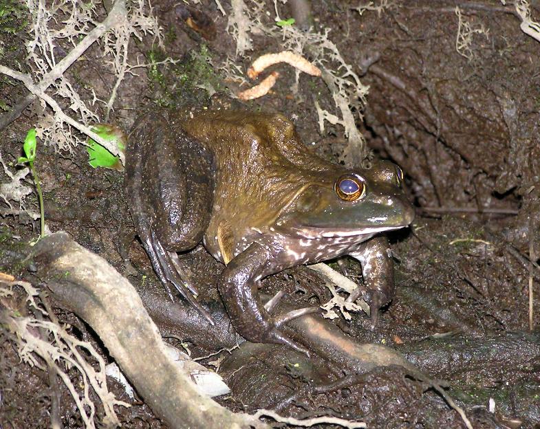
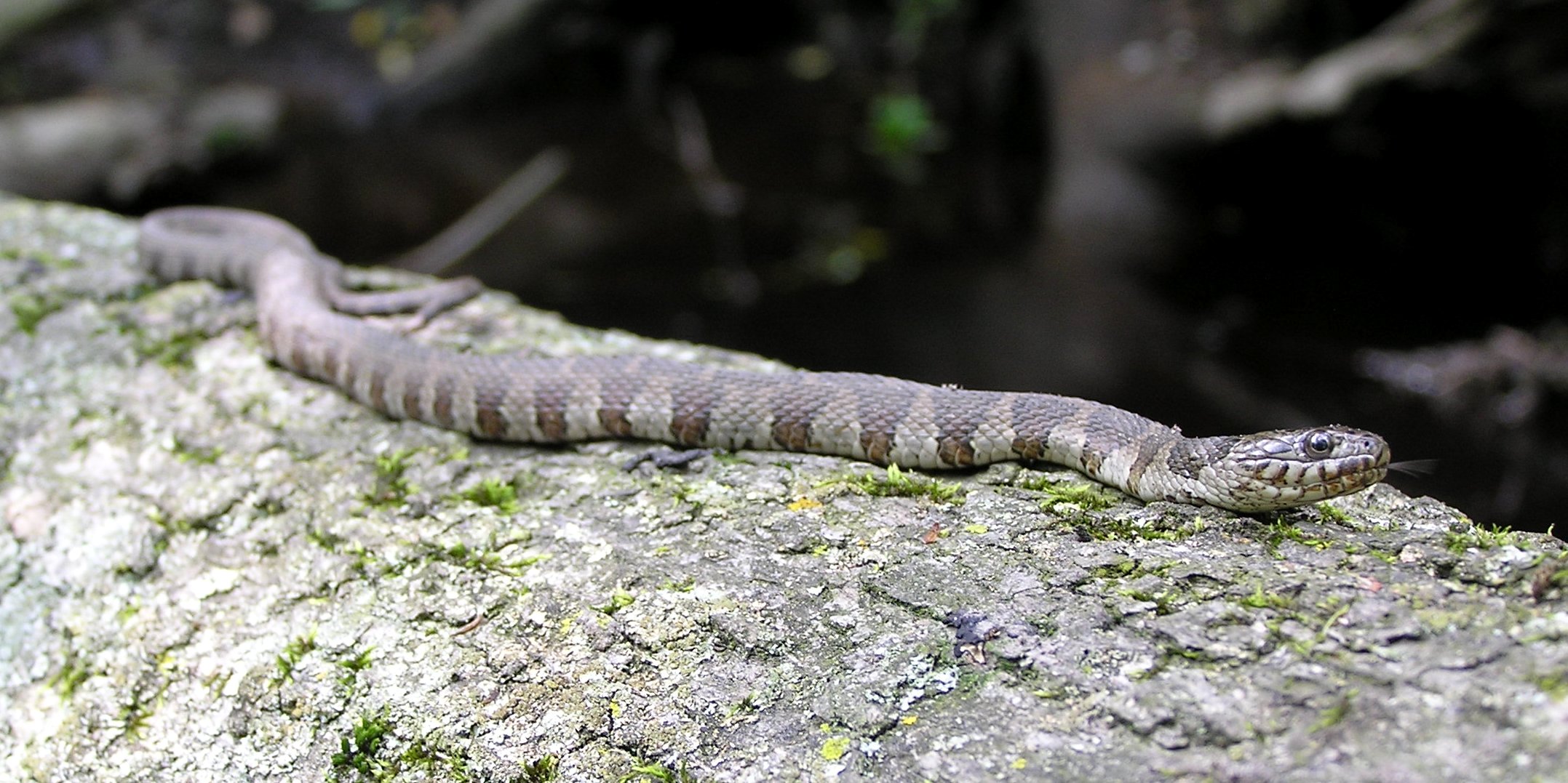
We also saw a small northern water snake shown below and at the top of this page. 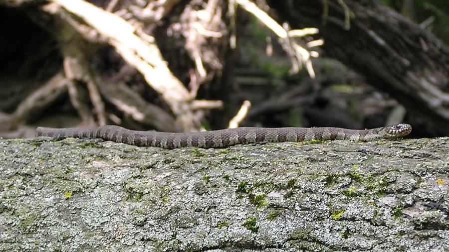
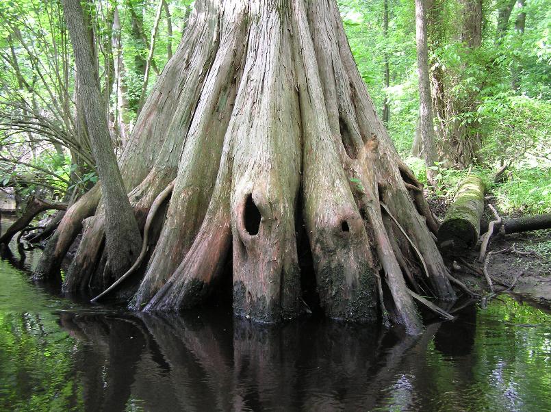
The wetland was really a cypress swamp, similar to that on the upper Pocomoke River. These trees are truly impressive. Their roots branch out, sometimes three feet above the water. Often, the area immediately under the trunk is spacious, as if the roots are trying to form a cage. The roots themselves seem to be hollow...or at least that's the way they sounded when we tapped them. Several had three-inch wide holes that might serve as an entrance for some critter. Surrounding the trees are the mysterious knees that give them their trademark look. Hitch Pond Branch actually merges with James Branch after about 1.6 miles. We were thinking of paddling up it to explore Trussum Pond but with our slow pace, we didn't have enough time. Additionally, we never found the place where the James Branch merges with Hitch Pond Branch. There were a few places where the stream seemed to split temporarily but we were never certain which were just little detours that would connect later and which were separate streams. Pepper Branch was another stream that merged with Hitch Pond Branch (after 0.4 mile from the dam) but we were never sure where that was either. If we weren't trying to avoid stumps or paddling between narrow openings, then we were ducking under low branches. I didn't use my saw to clear obstacles but I did use my loppers. There were some times where it was really needed and other times, I just did my part to help maintain the canoe trail. But it was clear my work was a mere drop in the bucket compared to the serious chainsaw work others had done prior to me. Some of the chainsaw work appeared to have been done recently. For my part, I would try to cut big branches that hung low over the water, thereby removing an obstacle for future paddlers. We would just paddle near these branches and I would cut as many as I could while we kept moving. But sometimes there would be too many branches and I couldn't pick one out. It reminded me of the nature videos I've been watching recently where a predator fish attacks a school of hundreds of fish but has a hard time picking out one because there are so many and it is hard to focus on a singleton. I believe "sensory overload" is the word to describe this. As we paddled past a group of low hanging branches, I cut as many as I could to clear the path, then reached behind to get some I missed while the boat kept moving. The problem was that I was both reaching and leaning to the port side. Norma was leaning too. I think we might have also hit an obstacle that raised the bow out of the water. Before we knew it, the boat flipped. I've paddled the Cabo now for eight years and during that time, it has never been flipped, until now. The water was only about three feet deep and nothing was lost. A little further, we saw another snake. The stream drained into Records Pond. Here, we saw several spatterdock flowers, getting ready to open. While most looked entirely yellow, a few had red on the inside, but not this one. 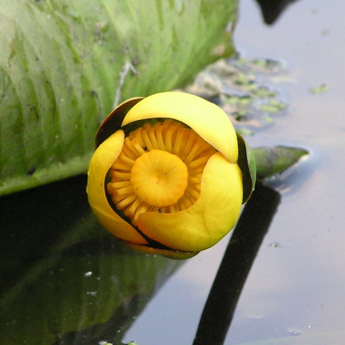
Norma and I ended up paddling seven miles in 3.5 hours! Our slow pace is testimony to the numerous obstacles we encountered. We unlocked the bikes, locked up the boat, then started biking back to the car. Delaware is an unusual place with strange zoning laws. We biked on one street that had an Amish market on one side and immediately across from it was a pornography store. At least they aren't competing against each other. |
|
After about three miles of biking, we saw a gray cat. We stopped to pet it. It was very small and thin. I don't think it weighed more than a large squirrel. It had large nipples, indicating that it recently gave birth. But there were no kittens to be found. Clearly it wasn't feral as it was extremely social. We put it down then started biking again. The cat ran after us. We tried biking faster but the cat just kept following. I was impressed with its determination being as domestic cats are not known for being good endurance runners. There weren't many homes in the area but Norma managed to catch some fellows about to leave the nearest home so she asked them about the cat. They said it just showed up two days ago. We tried to put the cat in my bike saddle bag but it kept climbing out. We decided that Norma would stay with the cat along the side of the road and I would retrieve the car.
I got my car then picked up Norma, her bike, and the cat. I thought "Mini" was a good name for the cat since she was so small but later, we thought "Shadow" might be more appropriate since she followed us around like a shadow. We went to a convenience market to buy cat food then to Hardees where we got takeout burgers and fries. Back at the campsite, Shadow finished off her cat food even more quickly than I devoured my bacon cheeseburger. Hardees burgers are good...maybe as good as Five Guys burgers. I still hope to compare them to a White Castle burger someday. Shadow followed us to the showers. Some boys found her adorable and thought the name Shadow was more appropriate than Mini. We got to bed around 2130. |
|
Norma and I heard a few meows during the night but not too many. I was worried that Shadow would keep us up but after she realized she wouldn't be let in the tent, she kept quiet. Good kitty.
Soon after getting out of the tent, Shadow emerged from the shadows of the woods to greet us. Norma opened another can of food and Shadow began eating. We hoped she would keep eating while we went to the bath house but she preferred to follow us instead. Shadow went with Norma into the women's side. But being the friendly cat she is, she followed some other woman out of the bath house. Where she went, we don't know. We walked around the area looking for Shadow but couldn't find her. Next, we went to the Cypress Point Nature Trail. We walked the not-so-well-marked trail in about 30 minutes. I think we got off the trail quite a few times. It wasn't always clear what was the nature trail and what was the Frizbee golf course. There were some nice views of Trap Pond and cypress trees. The temperature was in the high 50s so we were spared the mosquitos. We noticed that when we walked near a cypress, the ground sometimes felt spongey. Here's Norma at the water's edge with cypress knees. 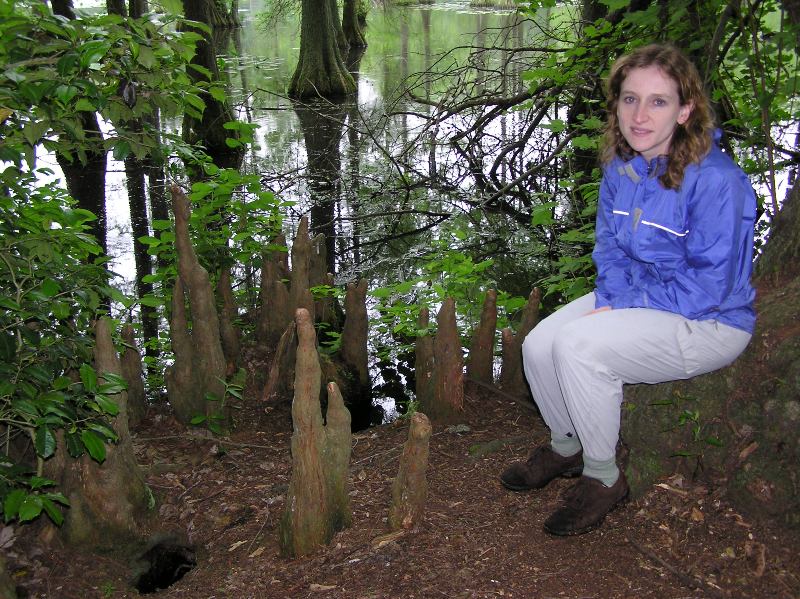
We also saw numerous mountain laurel flowers along the trail. 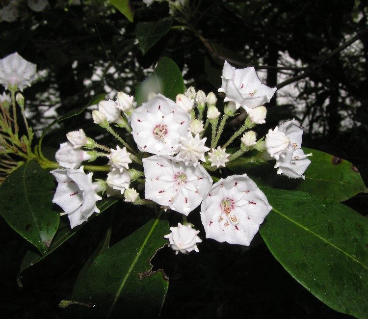
We drove back to the campsite then up and down the roads near the bath house. No sign of Shadow. She is very friendly so there is a good chance she found a welcoming family who adopted her. It didn't rain hard but it rained almost constantly. It was also cold and a little windy. Norma and I had wetsuits but it was still questionable as to whether or not we should paddle. We could explore more launch sites or stick to the plan. Being the adventurous types, we chose the latter. |
|
Norma and I found the Portsville Launch Site on our way to Phillips Landing, where we locked up our bicycles. We then drove back to Records Pond where we lauched.
The cold temperatures kept the other boaters off the water...along with the critters. Not much out in terms of wildlife. We paddled under Sussex Highway (road 2, route 13) in Laurel, Delaware. At the west end of Records Pond, we came to a five-foot-tall dam/spillway. 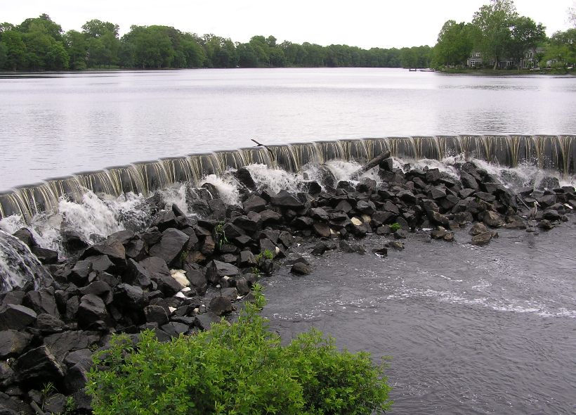
Norma held onto a piece of metal to keep the boat from going over the dam while I climbed onto the other side. It wasn't a big drop since there were lots of slippery rocks that made for a gradual decline. We then carried the boat over the dam and down the rocks. It was pretty easy and with a plastic boat, I wasn't too concerned about babying it. A heron rested at the foot of the dam. 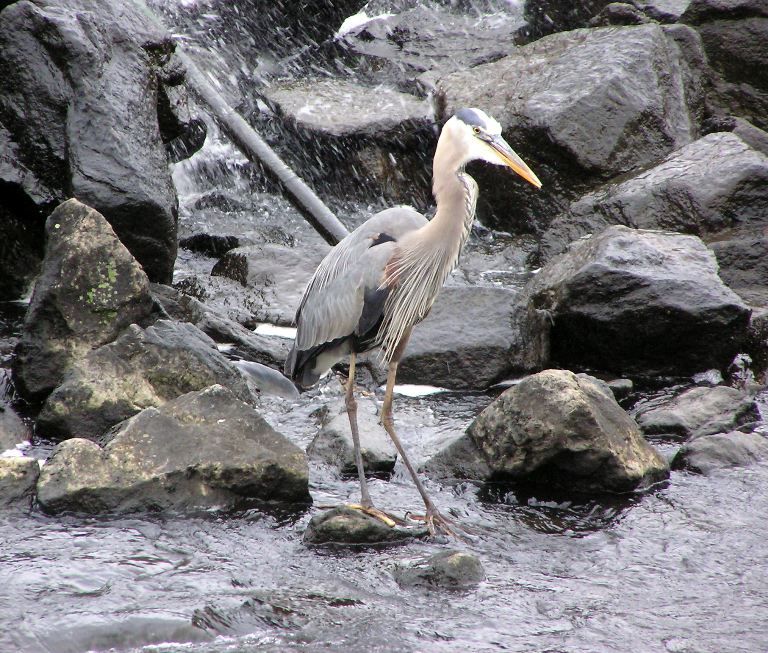
The rest of our trip went smooth and fast. Broad Creek was scenic, tree-lined, and reasonably wide though there were some bridges where we had to duck really low to go under. I reckon one was only two feet above the water. The creek reminded me of some parts of the Anacostia River (minus the litter) or the Monocacy River. We later found that if we wanted to avoid the dam crossing, we could have launched just downstream at Laurel River Park. The prediction was for the rain to end at 1300 but it kept coming a good bit after that. It was just a sprinkle but a fairly constant one. The trees blocked most of the wind so the cold wasn't a problem as long as we kept moving. Two and a quarter hours later, we arrived at Phillips Landing, having kayaked 8.8 miles. The takeout was significantly wider than yesterday's put-in. 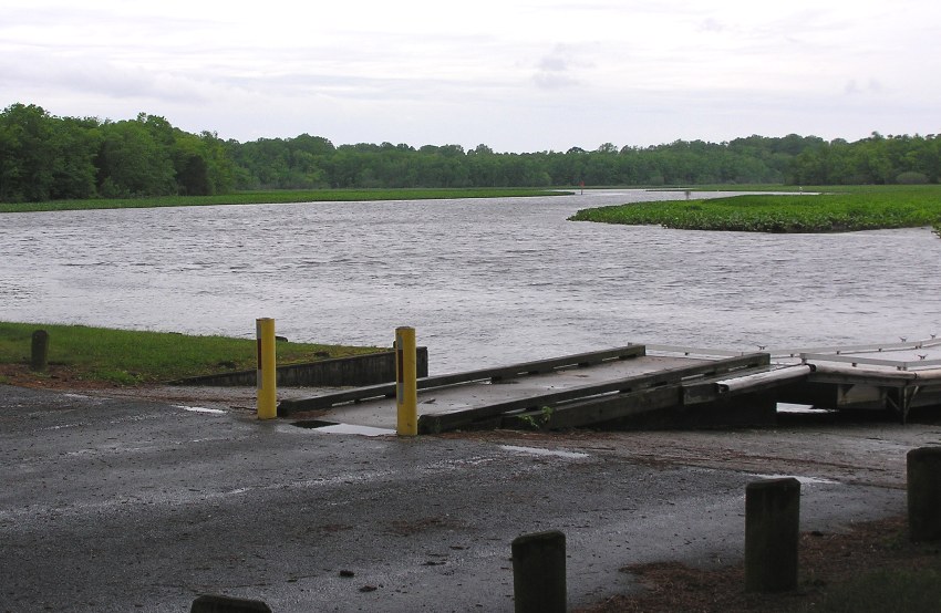
Norma and I felt proud having paddled from Trap Pond almost to the Nanticoke River in two days. Though it was only a total of 15.8 miles, it was one where we encountered almost every type of obstacle one might find while paddling. We unlocked the bikes, locked up the boats, then rode 5.4 miles back to the car. After we retrieved the boat, we stopped for dinner at Oasis Restaurant where I ate the fattiest meal I've ever eaten. I don't plan on returning. On the two hour drive back to Hanover, we wondered what happended to Shadow. A cat like that deserves a good home. |
|
Norma and I had a great time despite the less than ideal weather. I am not surprised. What makes for a good time is good company, an adventurous spirit, and a positive attitude. We had all three so we couldn't lose.
|
