|
This page describes a kayaking, bicycling, and hiking weekend adventure with Norma in Pine Creek Gorge, Pennsylvania. |

|
This page describes a kayaking, bicycling, and hiking weekend adventure with Norma in Pine Creek Gorge, Pennsylvania. |
|
With 2009 half gone, I can honestly say that this year has so far brought the best kayaking ever. I certainly hope the second half is as nice. Part of the reason for all the great paddling is because here in the mid-Atlantic region, we've been receiving a significant amount of rain. Hence, the creeks that would normally be too low to paddle have been very high. I don't like to let a good opportunity pass so I've been making sure to get out and explore these waterways while I can.
I've been wanting to explore the famous Pine Creek Gorge, also known as the Grand Canyon of Pennsylvania, for some time...both by kayak and bicycle. Norma and I came close to it on February 15, 2009. We knew it was a place we would return in warmer weather. Hence, for several days in late June 2009, I monitored the water level at USGS Real-Time Water Data for Pine Creek at Cedar Run, Pennsylvania and ordered maps of the area. Would there be enough water for kayaking? Things were very iffy and even the local Pine Creek Outfitters couldn't give me an answer a week prior. I watched the water and the weather like a hawk, then just five days prior to the long 4th of July weekend, I gave the trip a green light. But by waiting so long to decide, it was now difficult to find a campsite. Norma and I checked out a few campgrounds: Leonard Harrison State Park: My first choice but booked solid. Colton Point State Park: First come, first serve...no reservations. Pettecote Junction Campground: Also booked solid. Canyon Country Campground: No room. Kenshire Campground: One opening...we'll take it! We now had a campsite, maps, a tandem kayak, camping gear, and bicycles. I was intent to make this Fourth of July the best ever!  |
|
Norma and I began our 255 mile drive on the first day of the Fourth of July weekend. We caught a little rain. Along the way, we stopped at a little restaurant in a small town in Pennsylvania. Two old timers chatted with us. One fellow was one of the top five rated rodeo stars in the region. He told us the story about his first rodeo and how he got into it so he could earn money to buy a saddle at a pawn shop. I think he should write up his memoirs and send them to Readers Digest. Now he waits for a break in the rain so he can cut hay.
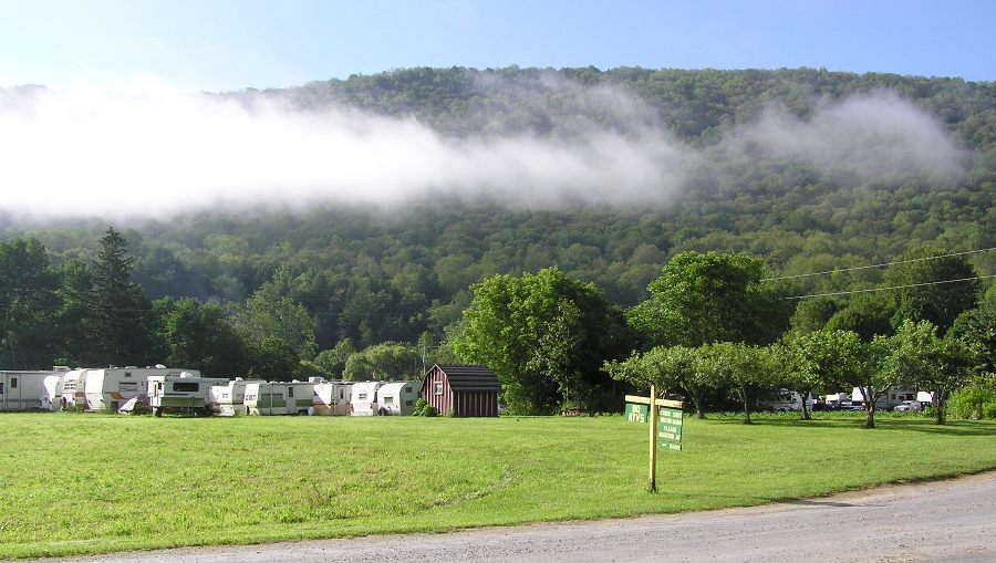
It was a 4.75 hour drive from my home to Kenshire Kampsite in Tioga County, Pennsylvania. This private campground caters mainly to trailers and recreational vehicles. There is enough space for 125 of them but only four sites for tents that I know of. But that suited me just fine. After setting up the tent, I checked out the animals. There were two donkeys, a baby goat, a baby sheep, three chickens, and a turkey. The goat and sheep were very friendly. 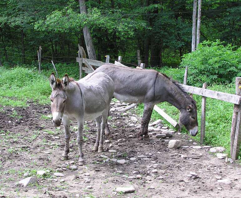
Walking around the campground, it was obvious the staff has a sense of humor. 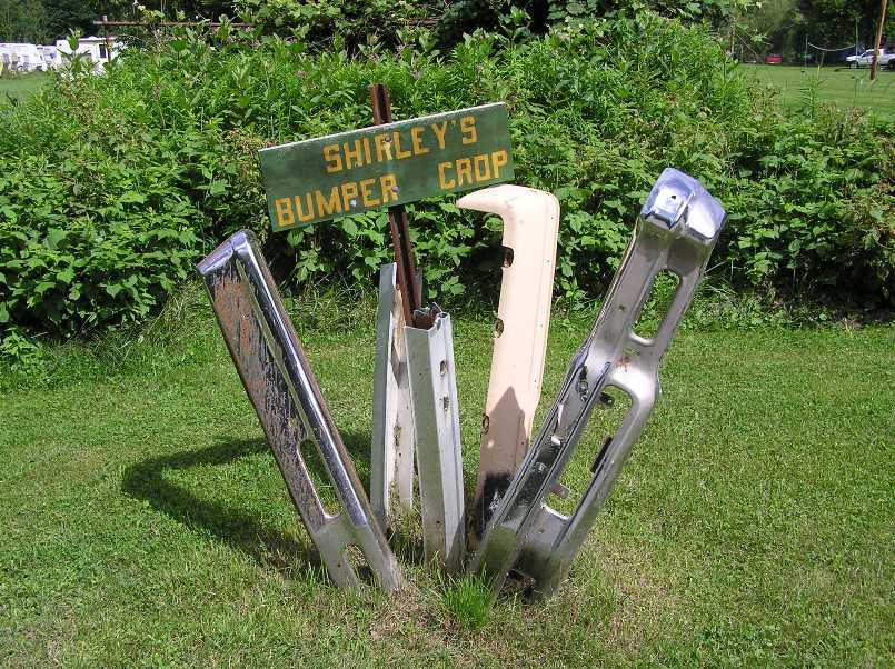
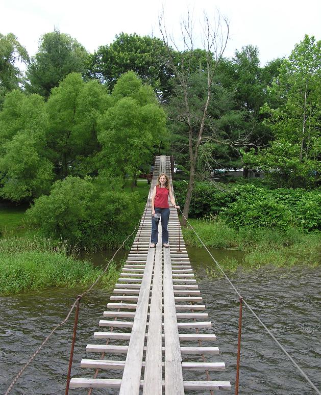
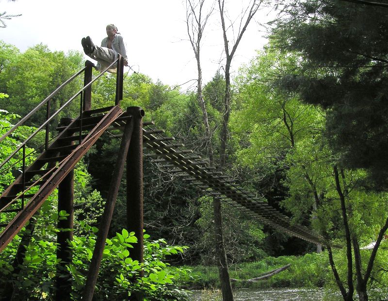
Next, we walked across the swinging bridge over Pine Creek. The campsite lies just north of the creek which was moving at a pretty good pace...I'm guessing five mph. 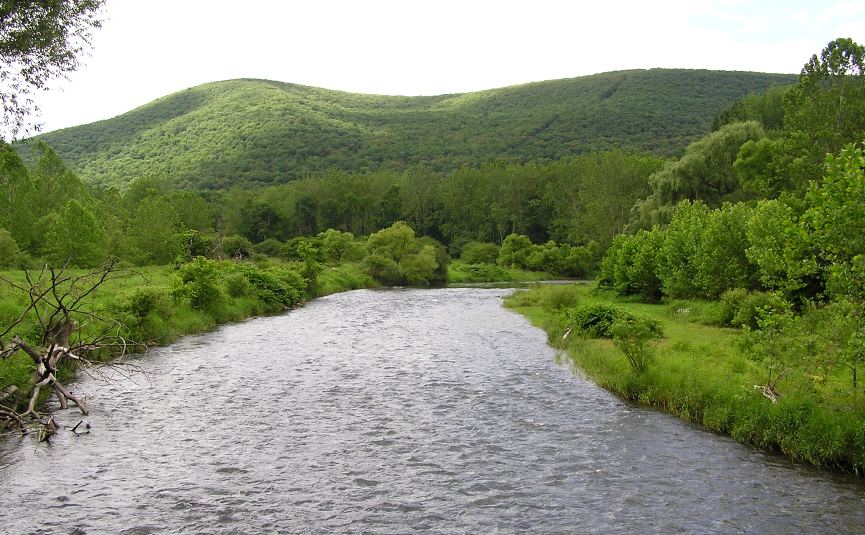
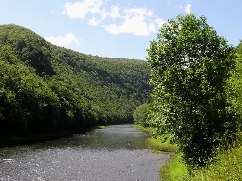
Norma and I drove to Pine Creek Outfitters, less than seven miles away. I spoke to the helpful staff about paddling conditions and launch sites. It seemed everyone I spoke to told me how the river was unusually high for this time of year. They assured me that Pine Creek was now runnable and safe for non-whitewater paddlers even though at other times of the year it might have class three rapids. The staff also made some short hike recommendations. We investigated the place we would launch tomorrow, Big Meadows Canoe Access Area in Ansonia. 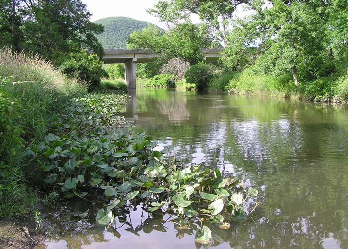
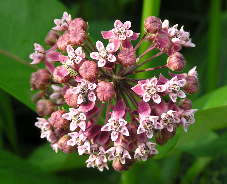
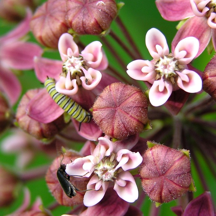
Near the launch site, this is what we saw. |
|
Our next stop was the 368-acre Colton Point State Park. This park
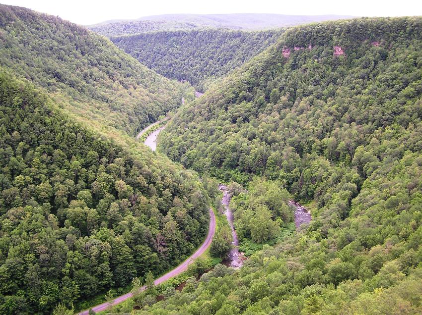
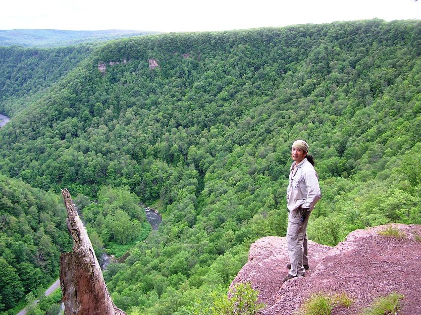
was named for Henry Colton, a lumberman, who ran a logging camp in the area during the 1870s. His loggers felled white pines and floated log rafts to Williamsport sawmills. - from sign at Colton Point State Park We walked a bit on Barbour Rock Trail, named for Samuel Barbour, who died in a log jam on Owassee Rapids in the 1890s. Owasee Rapids is also known as Barbour's Bend. -from trailhead sign From Barbour Rock Trail, we caught the West Rim Trail which gave us fantastic views of Pine Creek Gorge, an 800-foot deep, glacially-carved canyon. Until about 20,000 years ago, Pine Creek flowed northeasterly. Then the Laurentide Continental Glacier, which covered most of northern North America, moved into the area, pushing rocks, soil and other debris, which dammed Pine Creek, forming a lake near Ansonia. The abundant glacial meltwater eventually overflowed the debris dam, reversing the flow of Pine Creek to its current southerly flow. The abundant meltwater of the glacier swiftly carved a deep channel. Thousands of years of erosion by Pine Creek has carved the spectacular Grand Canyon of Pennsylvania. At its deepest point, Pine Creek Gorge is 1,450 feet deep and nearly one mile wide. -from Wildlife Watching at Leonard Harrison State Park Two black bears were spotted, one just below the West Rim Trail, overlooking the creek and the other on Colton Road in the park. I don't think either was bigger than 100 pounds. The prior is shown below. 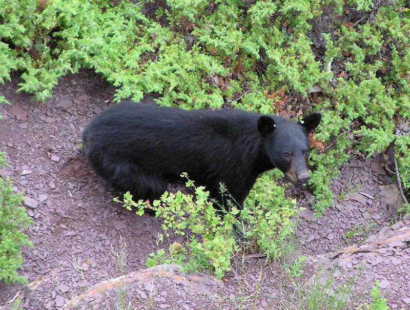
Norma and I spotted some Jack-O-Lantern Mushrooms. 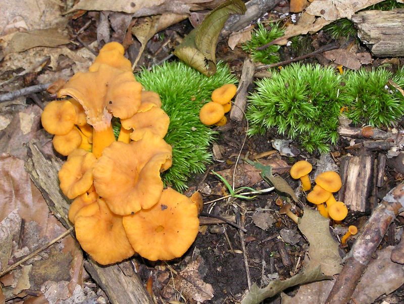
We also came across Indian Pipe, also known as "Corpse Plant." This Marilyn Manson-pale plant has no chlorophyll. 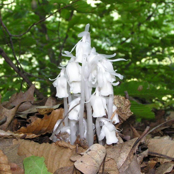
The weather was very nice. This area tends to be about eight degrees cooler than the Baltimore area and there are fewer mosquitos. We walked only about 2.5 miles. As the sun sank low in the sky, we found sustenance at Coach Stop Inn. I ate an elk burger made from an animal raised locally. We arrived back at the campsite just as the fireworks began. The campsite owners put forth a great deal of money to set off a large number of them. It seemed one out of every 15 or so detonated too soon, sending hot sparks onto the grass and trailers. I don't believe anyone was hurt but I was glad to be standing further back. |
|
Norma and I drove to the takeout, Robert McCullough Jr. Pine Creek Access in Blackwell. We tried to take some short cuts but between the detours due to bridges being out and the inaccuracy of our maps, our short cuts ended up being long (and frustrating) cuts. I usually like my ADC Maps but the one for Northcentral Pennsylvania lacked the detail to which I have grown accustomed. My Pennsylvania Delorme map was more helpful in this case. If driving from Ansonia to Blackwell, I recommend taking the longer route east on route 362 and 660 to Wellsboro, then south on route 287 to Morris, then west on route 414 to Blackwell.
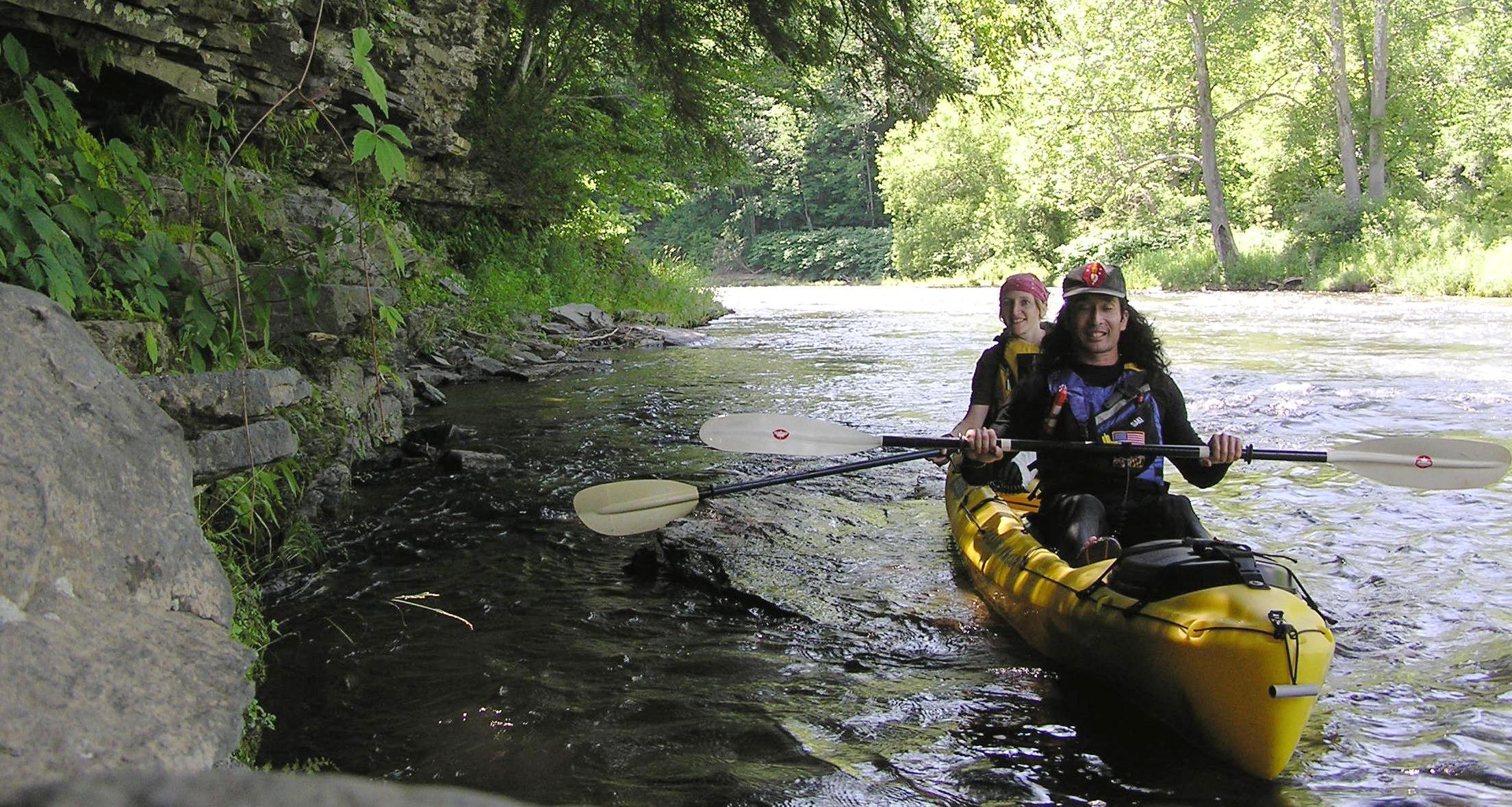
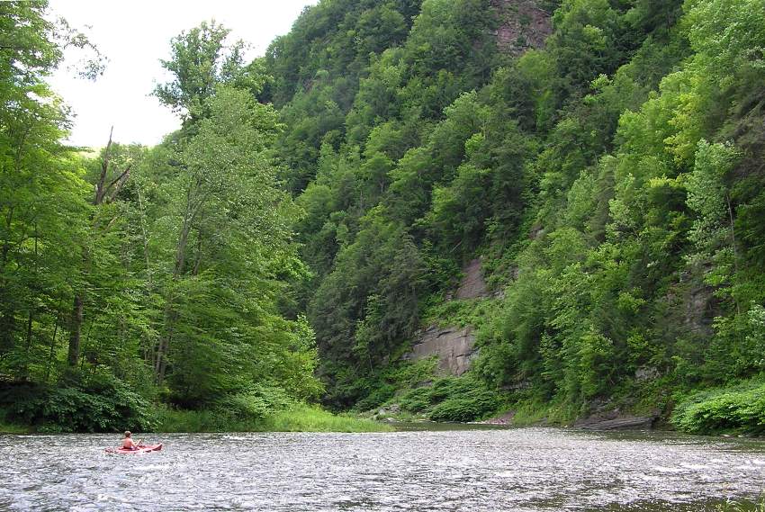
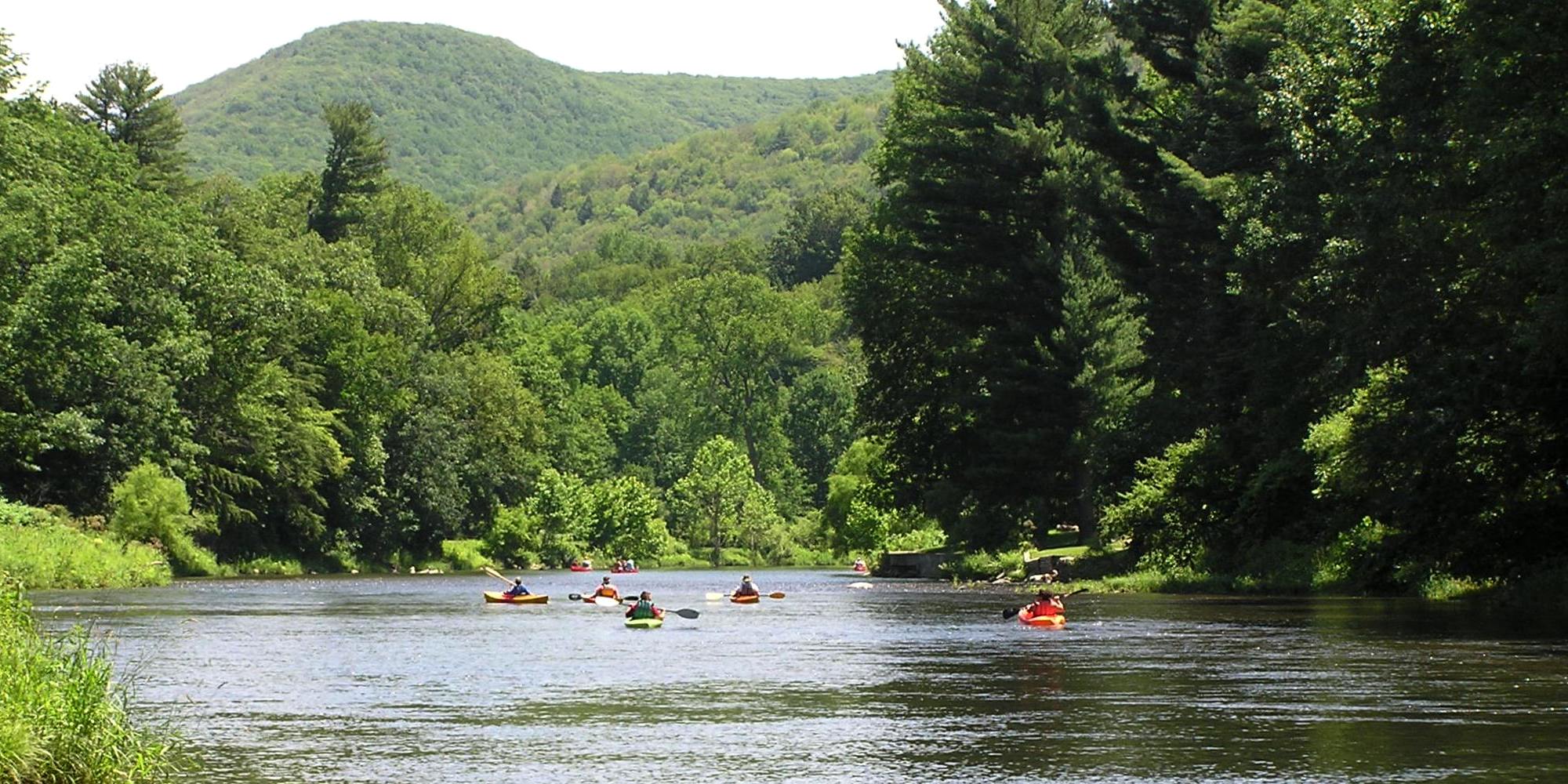
At Blackwell, the parking lot was full. Clearly, this was a popular area with bicyclists and fishermen. There were also two painters putting their version of the scenery on canvas. We locked our bicycles to a tree then drove back to Ansonia. We launched at Big Meadows Canoe Access Area at 1100. Seeing the canyon from the creek was truly amazing. The steep mountains on either side contrasted sharply with the flatlands of eastern Maryland. Greenery was all around. The water was clean and cold, which reminded me of the American River in Sacramento, California. The temperature was predicted to be in the mid-70s. I'm no whitewater paddler but I would say the river never got above a class one rating. According to USGS Real-Time Water Data for Pine Creek at Cedar Run, Pennsylvania, the water level was 2.05 feet. We could have used more water since we were frequently scraping rocks on the bottom. We had to portage about three times. Regardless, the water was much higher than typical for this time of year. A mature and immature bald eagle were spotted. We saw quite a few other kayakers. Most were in recreational boats. Few wore personal floatation devices (PFDs) though I don't think the water ever got deep enough to not touch bottom...even for someone my size. 17.25 miles and 3.3 hours later, we reached the takeout. We unlocked the bikes, locked up the boats, and changed clothes. A very friendly local retiree told us everything we might want to know about the area. |
|
One of us (not me) forgot to bring lunch so it was fortunate that there was a snack stand just 600 feet from the takeout. Snacks were laid out next to a money jar. It was all based on the honor system. Not something you'd see in Baltimore.
Norma and I began biking north on the Pine Creek Rail Trail. This trail parallels the creek in the canyon. In 1883, the Jersey Shore, Pine Creek, and Buffalo Railroad laid tracks along this route, carrying timber, coal and passengers. Rail service ended in 1968. Now the trail leads the adventurous through more than 60 miles of canyon beauty, from Wellsboro Junction to Jersey Shore, part of a statewide network of rail-trails. - from sign at Colton Point State park 
The trail is really more like a gravel road. It is wide and well packed. We rode through Tiadaghton and Leonard Harrison State Park. Wellsboro entrepreneur Leonard Harrison was building a sawmill to process the timber he owned. He sent his logs careening vertically down the canyon wall in narrow "slides," until they crashed into the creek below. A small town named Tiadaghton rose around these short-lived operations. At its height of prosperity, it had two stores, a post office, a hotel, a one room school and over 20 homes. Having built his fortune at Tiadaghton, Leonard Harrison donated 137 acres to the Commonwealth. The land would later become Leonard Harrison State Park. - from sign at Tiadaghton campsite A sign informed us about fishers which live in the area. I have never seen one and until then, I didn't know what they looked like either. I added them to my list of animals to see in the wild...right after porcupines. In Leonard Harrison State Park, we walked a short distance on Turkey Path. 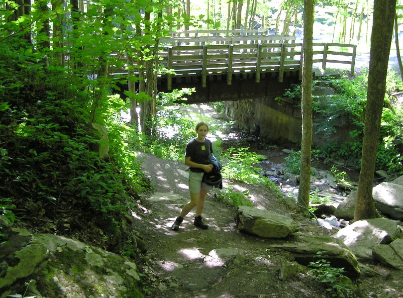
This led us to the waterfalls of Little Fourmile Run. Numerous wooden steps kept us from scrambling on wet, slippery rocks. The falls were definitely low, though I'm sure they must be absolutely lovely in the early spring. 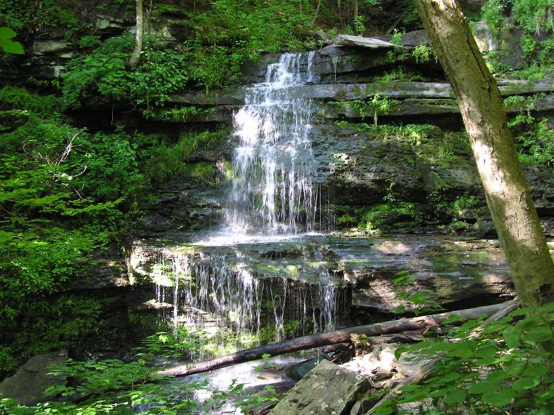
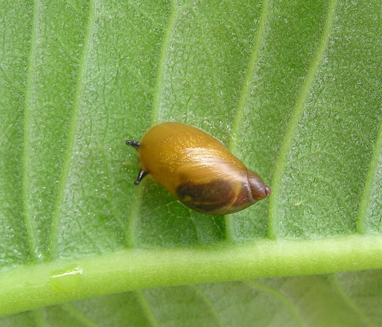
Along the way, I found what looked like a yellow larva or egg sack in a white silk pouch. Perhaps the lighting was playing tricks on me but the yellow object appeared to be glowing...or maybe it just reflected light really well. 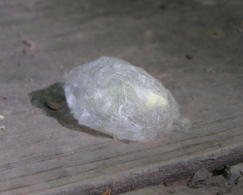
Norma spotted a small snake at the edge of the trail as we approached Ansonia. I'm guessing it is a garter. 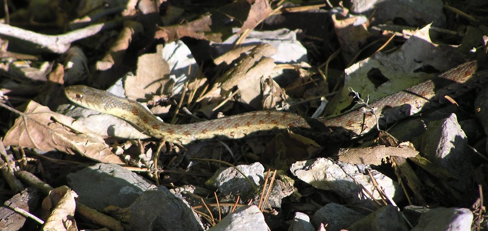
We reached our destination after biking 17.8 miles at a casual pace. After retrieving the bikes, we stopped in Wellsboro for dinner at Frog Hut. Back at the campsite, we saw a few more fireworks. |
|
Norma and I awoke to a crisp, misty morning. I suggested we do the biking first so we could paddle in the cool water during the hotter part of the day.
I found a big caterpillar on my tent. I also saw a woodpecker not in my tent. Judging by the numerous holes in the tree it claimed, I'm guessing it found quite a bit of food there. 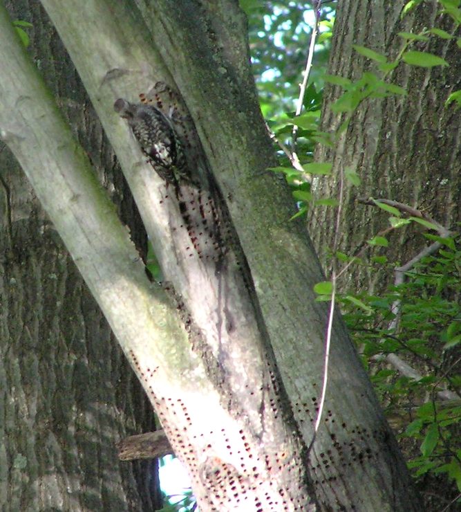
After packing up, we locked the boat up to a tree near the swimming area at the campsite. Then we drove to find a suitable kayak takeout site. We checked a few sections of Marsh Creek upstream of Big Meadows Canoe Access Area in Ansonia but found nothing adequate. Even if we had, I don't know if I would have used it since there was occasionally a strong current that we would have had to fight to get there. Hence, we settled for good ole Big Meadows. The parking area uses old railroad ties as borders. I pulled up to one and got too close. Normally, my front bumper would hit and that would be all. But these ties were secured to the ground with rebars that stuck out of the ties about 2.5 inches! 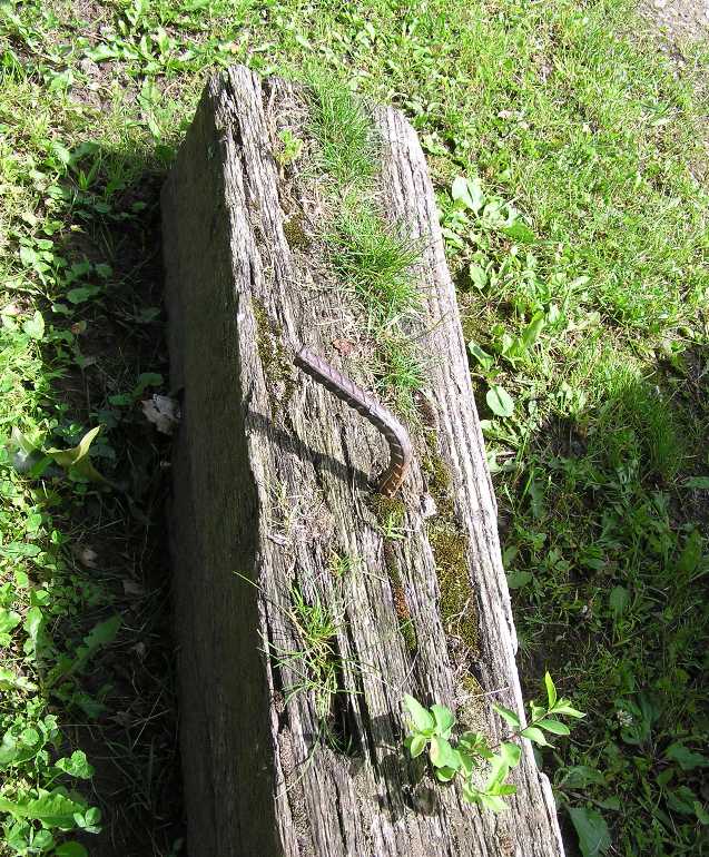
One of the rebars ripped through my front bumper and tore out some of the pins that hold it in place. It was a terrible sound. I was a little perturbed but at least my vehicle was still functional. A fellow drove by a little later and told me, "God doesn't make many days like this so don't let the damage to your vehicle keep you from having a good time." He was absolutely right. The fog cleared up and the day was once again sunny and in the mid-70s. Perfect! We biked west on route 6 back to the campsite, a mere eight miles away. Along the way, we stopped at Pine Creek Outfitters to buy duct tape to secure my front bumper to my car. The bike ride was very hilly and compared to the rail trail, not very scenic. But the shoulder was wide and very safe for biking. Back at the campsite, we unlocked the boat, locked up the bikes, then changed into paddling clothes. |
|
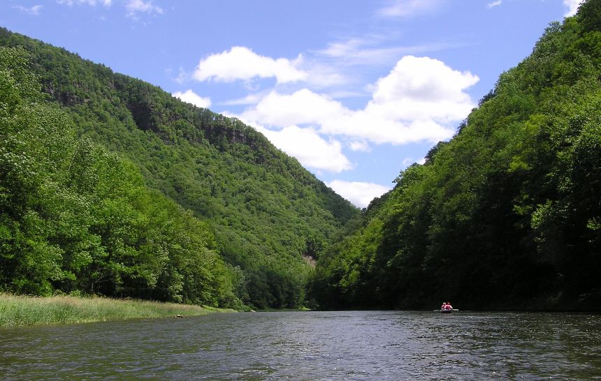
Norma and I launched at 1130 then paddled ten miles from the campsite to the takeout. This section of Pine Creek wasn't in the canyon. Only the south side was hilly. At times, this created a steep wall on one side that was lush with greenery. I'm guessing that since only one side was mountainous, sunlight could shine from the other side onto the vertical wall, allowing vegetation to grow densely.
Numerous kayakers were seen, even more than yesterday. See the below pic and the cover photo. 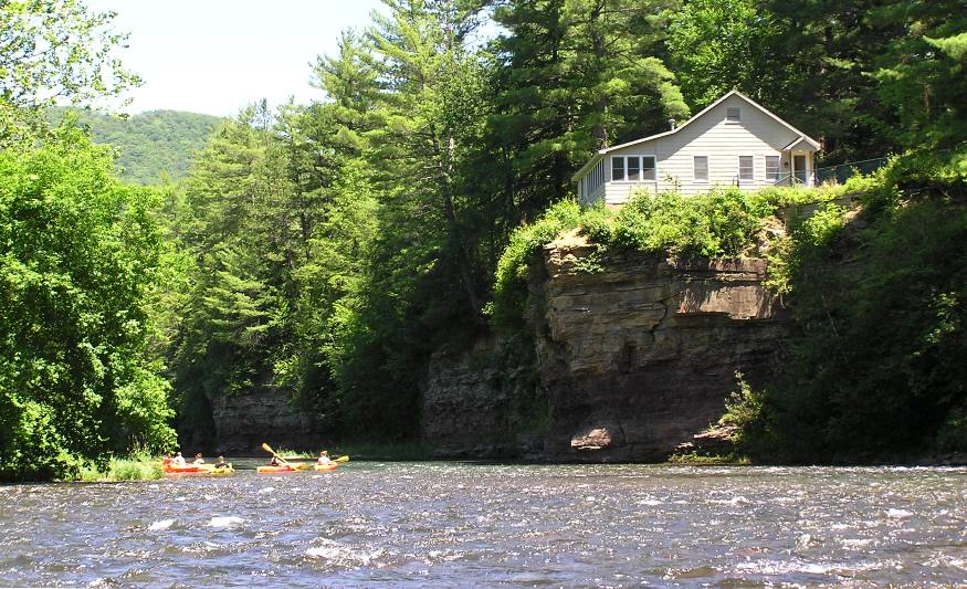
We stopped for lunch after about five miles. I told Norma I would skip a rock across the 40-foot wide creek. It took a few tries but I managed to skip four rocks across. Several skipped ten or more times! A six-inch long shrew was spotted frantically swimming across the creek. We also saw a multitude of tiger swallowtail butterflies enjoying a drink from still water that settled in a concave rock. 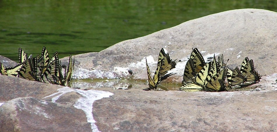
The sides of the creek were often rocky. Water dripped down in some areas. I wondered if they were majestic waterfalls back in April. 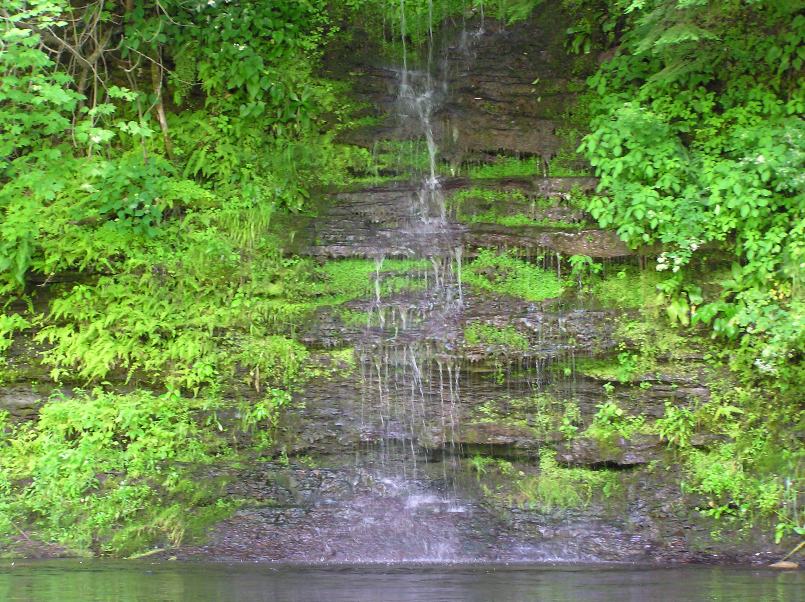
Numerous mergansers were seen. Norma likes them quite a bit. 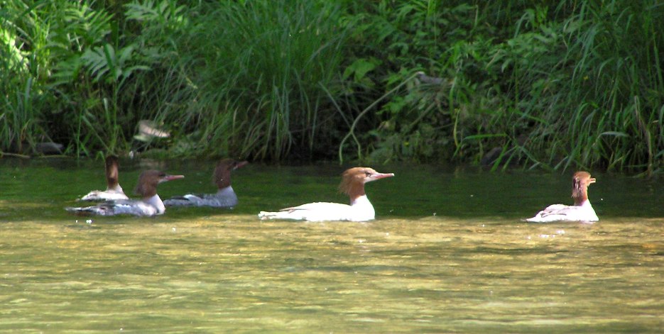
I saw one fish jump out of the water. I also saw about a dozen or so in the water. Some were up to ten inches long. The creek is stocked with trout. The rocky bottom and vertical sides made for some nice swimming holes. I found about two that were deeper than five feet. 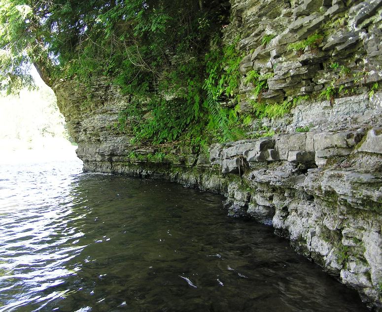
To reach the takeout, we had to paddle upstream on Marsh Creek for a very short distance. After a quick restroom break at the takeout, we continued paddling upstream on Marsh Creek. The current was sometimes too strong in the shallow areas so I got out and pulled the boat about three times. The area was very scenic. 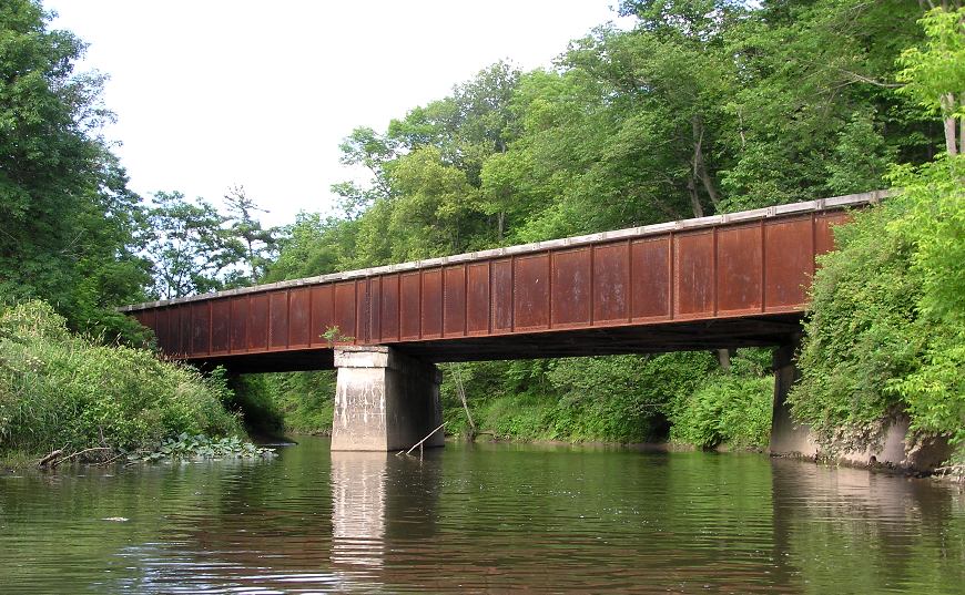
We only made it about 1.9 miles upstream on Marsh Creek but during this time we saw a deer, a huge (six inch long and five inch wide) frog, and a muskrat. A low hanging tree meant we had to climb over a log while pushing the boat under...but it was worth it. The narrow, calmer Marsh Creek was a nice contrast to the more energetic Pine Creek. 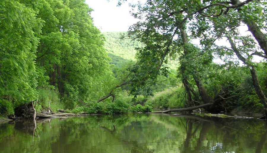
We finished at 1715 after paddling a total of 13.7 miles. After retrieving the bikes, we tried to get a table at the Wellsboro Diner but the place was packed to the gills and the wait was too long. So we went back to the good ole Frog Hut. And they do serve frog legs...we just didn't partake in any. Our long drive home started late but that worked out just fine since we didn't have to compete with the holiday traffic. |
|
One needs to take advantage of a good opportunity. During the Fourth of July weekend of 2009, that's exactly what we did and for that I am glad. There will be plenty of time to paddle the tributaries of the Chesapeake Bay but the ability to paddle on Pine Creek in the Grand Canyon of Pennsylvania on a warm, sunny day occurs infrequently. We got in almost 31 miles of kayaking and 26 miles of bicycling.
This was a most memorable trip that I will cherish for years to come. |
