|
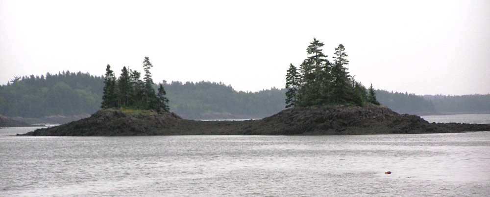
This page describes the vacation that Norma and I took in Maine in 2009. |

|
This page describes the vacation that Norma and I took in Maine in 2009. |
|
Norma and I had discussed taking a trip to Maine for quite some time. We had heard of its short but intensely beautiful summers filled with picturesque scenery,
...its jagged, mostly rocky coastline, its low, rolling mountains, and its heavily forested interior - from Wikipedia - Maine Additionally, the license plates of folks from this state read "Vacationland" so it must be nice. But such a paradise must have its downside, right? The drawbacks included the long drive, crowds, and perhaps the most difficult challenge of all...narrowing down the places to visit in this largest state of New England which accounts for nearly half the region's entire land area. Hence, a few weeks prior to our vacation, we spent several hours intensely considering our options until they were whittled down to just a handful. Being an avid kayaker, my biggest concern was the quickly changing tide. In the places I typically paddle in Maryland, the tide fluctuation might only be three feet, but in Maine, the difference between high and low tide could be up to 52 feet (in the Bay of Fundy). Obviously, a great deal of preparation would need to be done on my part. I printed out tide tables and requested information on the Chesapeake Paddlers Association (CPA) website. I was fortunate in that Jeff B. was willing to share what he learned from his experiences. I followed up with his leads, finding the places he mentioned on my Maine DeLorme Map. This was definitely my most valuable reference. The book Sea Kayaking Along the New England Coast was also helpful. Just three days prior to our leaving, my Garmin GPSmap 76S global positioning system (GPS) became waterlogged and died. I took it apart to dry things out but that wasn't sufficient. It served me well over the last three years...even surviving being run over by a car. Having a GPS is a luxury and it should never take the place of having a map and knowing basic compass skills, but the thick and quickly changing coastal fog in Maine is not something to be taken lightly. Obviously, a map only works if one can see the surrounding area. Though it isn't likely the strong tide would carry us out to sea, it is certainly possible and probably more likely in Maine than in any other place in the continental United States. Thus, I decided it was best to do our vacation paddling with a new GPS. Already being familiar with this model and having experienced much better customer service than with the folks at Magellan, I decided to purchase another unit in the GPSmap 76 series. But where to find it on such notice? The first place I checked was Recreational Equipment Inc. (REI). Unfortunately, they did not have this unit in stock, preferring to carry the smaller models instead. They told us this model was more popular with hunters than hikers and backpackers. Hence, I went to Bass Pro Shop and spent $400 on a new Garmin GPSmap 76CSx. It was $100 more than was listed elsewhere but also the only place I could find on such short notice without too much searching. I spent that night loading the topographic maps for our destination. Though I paid too much for my new GPS, the cost was small compared to what could happen without it. It took a lot of preparation, planning, and packing, but by the early morning of our departure date, we were ready to go.  |
|
Mapquest said it would be just over a nine hour drive from my home in Hanover, Maryland to Portland, Maine. It ended up being 11 hours, mostly because of heavy traffic in the New York City area. We decided it would be easier to drive home at night.
Norma and I have completed some really long drives this year. A couple of years ago, I dreaded three hours on the road but after driving further and further away from home, the three hour trips now seem easy. We take turns driving, navigating, and napping so it really isn't that bad. Also, I've learned what kind of music Norma likes and I make sure we have plenty of good music that is just an iPod click away. When we get tired of music and aren't feeling like conversing, we play "20 Questions" to stay alert. She preferred to factor large integers into a product of prime numbers but that seemed too much like work to me. Back in college, I proved that it could be done via the Fundamental Theorem of Arithmetic...Q.E.D. The goal was to arrive in Portland in the early evening and have time to explore the downtown area. We had both been to Portland several years ago. For me, it was back in my military days around 1989 or 1990. Unfortunately, with the long drive, we arrived much later than we expected, so we preferred to just eat then sleep. We had reservations at Travel Lodge but a computer error (or more likely a user problem) resulted in overbooking. But they managed to get us a room at the Inn at Portland. The motel was a little run down and located in a dubious area but it was sufficient. It also had one of the finest mattresses I've ever slept in. Norma and I ate dinner at Denny's. I like this place because the food is inexpensive and simple, the service is good, it is open 24 hours a day, and the menu has lots of pictures which means I don't have to read so much. |
|
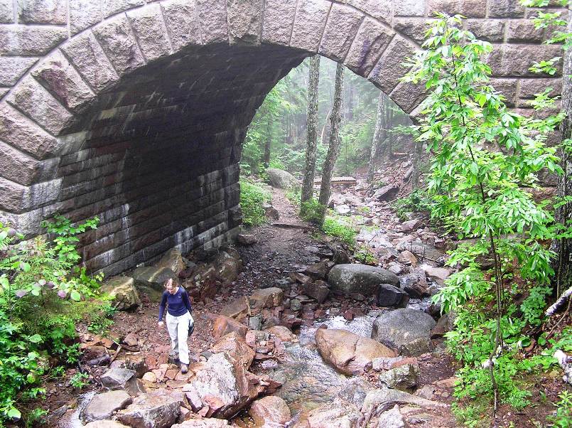
After leaving Portland, we drove east to Bath where we looked around at a visitor center. The weather was foggy, rainy, and cool.
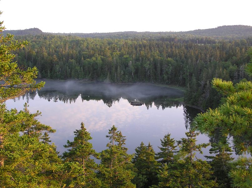
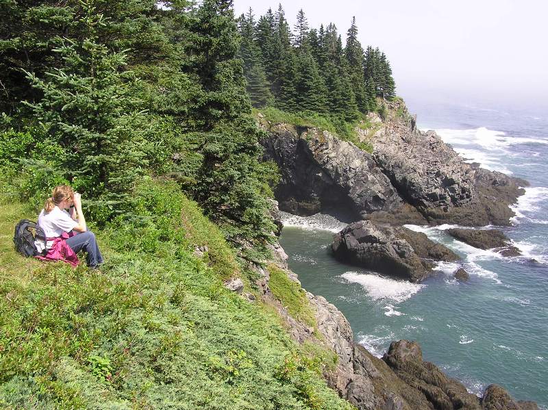
We ate lunch at the very busy Riverside Cafe in Ellsworth. Had we not stopped, our drive to Mount Desert Island would have taken about four hours, which only took us halfway across the state! Maine sure is big. We checked in at Mount Desert Campground, just north of Acadia National Park. We had campsite number B28, a very good site near the restroom/shower. Overall, the place is very nice. They have an area called the Gathering Place where one can buy coffee, ice cream, or just hang out. My only complaint is that some of the dirt roads need maintenance. That afternoon, Norma and I checked out kayak launch sites. The first was about a mile south of route 198/3 on the west side of Sargent Drive. An unmarked road leads one to a big parking area and a small launch beach. This will put one on the east side of Somes Sound, which has been compared to the fjords of Norway because of how the water depth increases so suddenly. 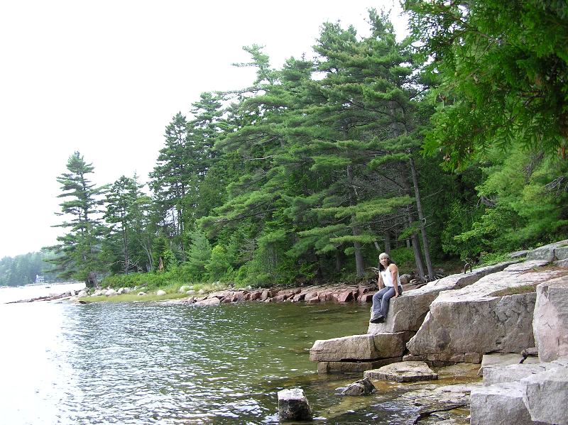
Walking around, we saw a garter snake. 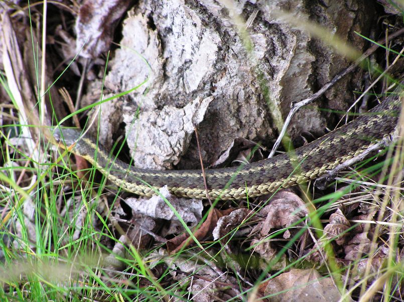
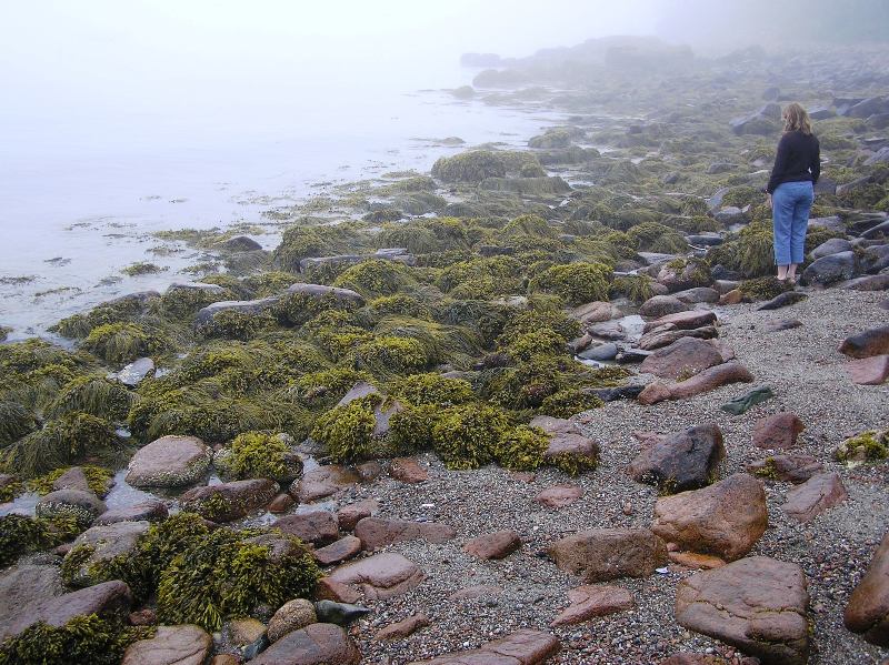
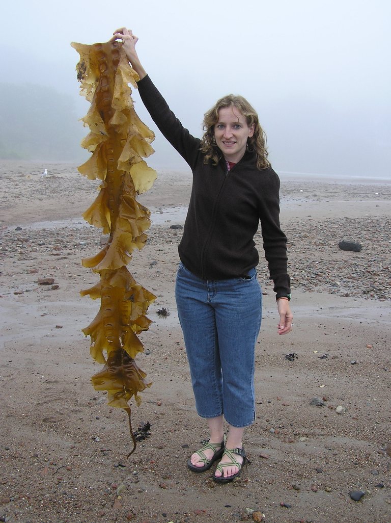
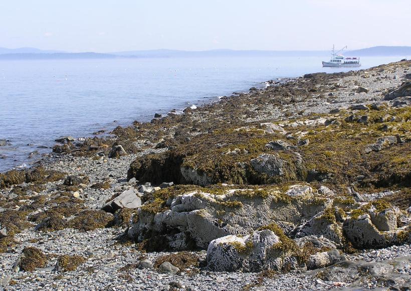
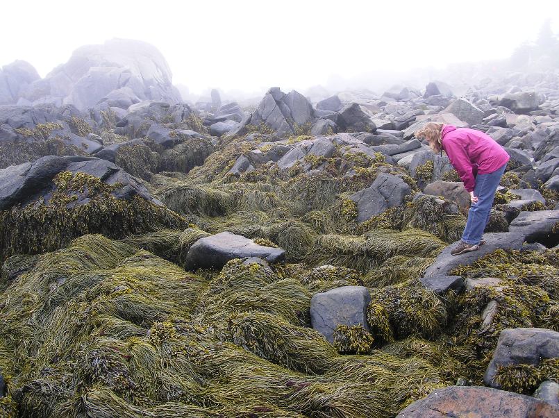
In this area, the water was clear and cold. Much to my surprise, I learned that this is because the current comes from Labrador, Canada. In contrast, the warm waters of Maryland comes from the Gulf of Mexico. I erroneously assumed the whole east coast of the U.S. was fed by this warm clockwise current from the south. Next, we found a public boat ramp near Sea Street and Harbor Drive in Northeast Harbor. If you have the National Geographic Acadia Map 212, this town is incorrectly listed as "Northwest Harbor" but only on the less deteailed side of the map. This map is still worth buying. This sheltered launch area will give one access to the islands just south of Acadia: Bear Island, Sutton Island, and the Cranberry Islands. The open areas near the ramp were covered with seaweed. Most were comprised of narrow leaves and hollow bulbs. A few were quite large. A more direct, easier to find, but less sheltered location that will give one similar launching access as Northeast Harbor is the beach at Seal Harbor. This is near the intersection of route 3 and Stanley Brook Road, about three miles east of Northeast Harbor. Here, I spoke to a local kayaker about the water conditions, weather, and temperature. The 55 degree summer water temperatures, thick fog, and six foot swells let me know I wasn't in Maryland (or Kansas) anymore. With my tendency to get cold (moreso than Norma), it was obvious I might want some insulation on my lower half since my Ocean Kayak Cabo tandem sit-on-top would give little protection from the elements. |
|
That evening, we ventured into town. Neither Norma nor I are much into shopping but in Bar Harbor, it was easy. Unlike Ocean City, Maryland, the stores were interesting and varied. They also reflected the outdoorsy, coastal, Maine lifestyle. For gifts, I bought beer at The Man Store, blueberry soda, and blueberry jam, all made in Maine.
Blueberry harvest in mid to late summer is done with a hand rake and workers are paid by the box. The blueberry plant is a wild, naturally occuring plant called low bush blueberry. More blueberries are raised in Maine than anywhere else. - from display at Quoddy Head State Park While I didn't make any further purchases that night in Bar Harbor, I was intrigued by the trilobite, ammonite, and cephalopod fossils for sale at one store whose name slips my mind. We ate a lobster dinner at Chowdah's in Bar Harbor. This tourist town is popular with Americans and Canadians...many of whom speak French. While Norma and I found the taste of lobster pleasant, the amount of work involved to extract the meat didn't make it worthwhile for us novices. After a night out on the town, we turned in for the evening. |
|
Norma and I went back to Bar Harbor the following morning and rented bicycles at Acadia Bike. Then we rode about a half mile to an area where a free shuttle van took us and the bikes to an area about a quarter mile west of the intersection at Duck Brook Road and route 233 on the south side of route 233. Here, we accessed the Carriage Roads.
Forty-five miles of rustic carriage roads, the gift of philanthropist John D. Rockefeller Jr. and family, weave around the mountains and valleys of Acadia National Park. Rockefeller, a skilled horseman, wanted to travel on motor-free byways via horse and carriage into the heart of Mount Desert Island. His construction efforts from 1913 to 1940 resulted in roads with sweeping vistas and close-up views of the landscape. His love of road building endured a state-of-the-art system. - from Acadia National Park Carriage Road User's Map It was cool, wet, and foggy with some light rain. Together we biked south alongside Eagle Lake then Jordan Pond. At the south end of Jordan Pond, we ate a light lunch consisting of soup and pop-ups at the upscale Tea House. Then we walked on a trail that led us around the fog-covered Jordan Pond where we saw the largest polliwog I've ever seen. It was about six inches long with a head about 1.75 inches wide! 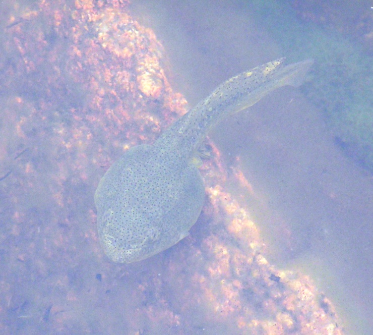
We continued biking, crossing the small stone Little Harbor Brook Bridge, then stopping at Hadlock Brook Trail where we saw an impressive waterfall next to another stone bridge. Our circuit ride took us clockwise back to the start. But we missed the last shuttle van so we had to ride back to Bar Harbor, passing a beaver lodge and the large stone Stanley Brook Bridge. We returned our bikes, having completed a very hilly 24 mile ride on very well-maintained roads. |
|
Norma made reservations for us and her intern, Sarup, to attend a whale and puffin watch boat tour on Wednesday. While she did that, I went to Aquaterra and spoke to the folks there about the tide and paddling conditions in the area.
In the downtown area, we posed next to a life-size replica of a modern whale. 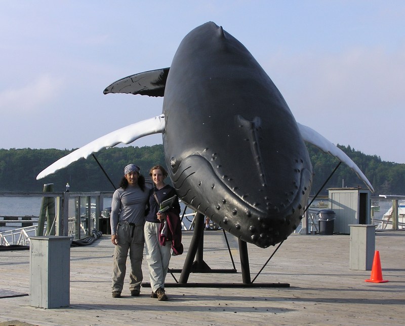
Next, the two of us attended the Bar Harbor Whale Museum. Here we saw a life-size model of an ambulocetus which is believed to be the missing link between modern whales, which are confined to the oceans, and their extinct ancestors who roamed the shores of ancient seas millions of years ago. Ambulocetus existed 49 million years ago and fed along the shores of the Tethys Sea, a body of water that covered what is now India and Pakistan. - from sign at museum 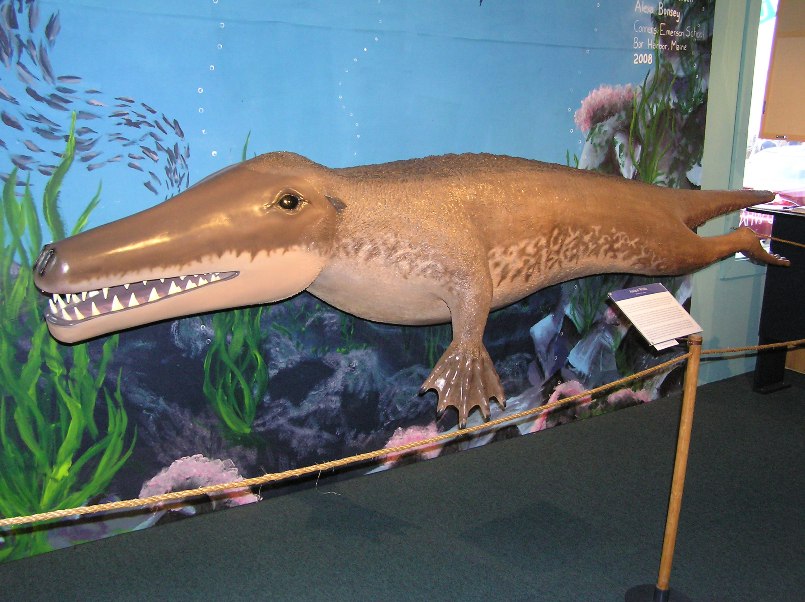
Having built up a sizeable appetite, we first ate inexpensive fish sandwiches at an equally inexpensive restaurant. After comparing prices, we were convinced that the main difference between the expensive and cheap restaurants in Bar Harbor was the waterfront view. Then we ate dessert at Ice Cream Treats. I had blueberry ice cream. Very tasty. Just after sunset, Norma and I walked to Bar Island via a tidal path. This path is only accessible at low tide. We walked around the town a bit, stopping at Cadillac Mountain Sports where I purchased splash pants...actually, Norma purchased them for me as an early birthday present. Thank you Norma. This resolved the cold water problem I would encounter tomorrow. We found quite a few bargains at this store. I bought a waterproof breathable White Sierra jacket for a mere $42. Norma bought a fuscia Marmot rain jacket. Shortly after, we called it a night. We wanted to make sure we were well rested for tomorrow's paddling adventure. |
|
We were up at 0600. I've heard that up in Maine, the morning starts much earlier in the summer than in Maryland. But I would need to get my lazy ass out of the sleeping bag much earlier than 0600 to verify this.
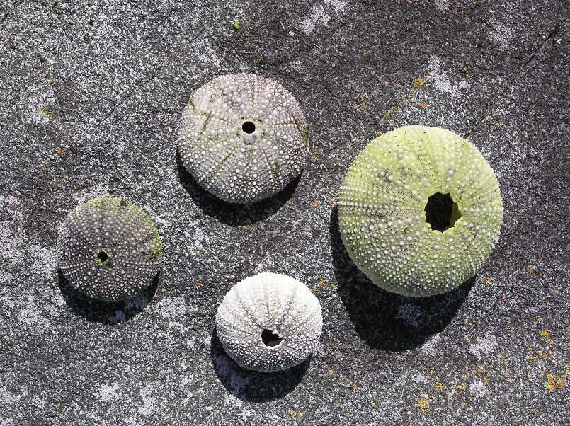
I saw a large red fox trot through the campground. Norma was brushing her teeth so she missed it. We drove out to Bar Harbor and launched my tandem kayak from the boat ramp at the corner of West Street and Main Street. There is also a beach right next to the ramp. The day started out hazy but eventually cleared up to our first warm, dry, sunny day in Maine. We paddled out to each of the Porcupine Islands: Sheep Porcupine Island, Burnt Porcupine Island, Long Porcupine Island, and Bald Porcupine Island. Unfortunately, we never saw any porcupines. But I later learned that sea urchins are also called "sea porcupines" which may have something to do with the naming of the islands. While the sea urchins we typically find do not have external spines, the living ones (or in our case, the more recently dead ones) most certainly do. The bristling, flexible spines and suction-cupped feet are used in locomotion. The feet also serve as a means of respiration and a sense of touch. The urchin's pedicellariae, thin, moveable stalks armed with tiny jaws, are used to repel its enemies. - from display at Quoddy Head State Park The north side of the islands were fairly calm since they faced the sheltered side of Frenchman Bay. But the south side faced the Atlantic Ocean. It was on this side that we sometimes encountered three foot swells. But keep in mind that these weren't breaking waves...these were wide swells that gently made the boat rise and fall. We stopped at Sheep Porcupine Island to explore. We found numerous snails (including a white one), seaweed, and barnacles. The air was clear and just right for picture taking. 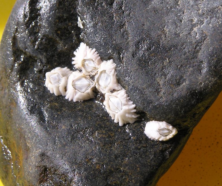
Next, we kayaked to the north side of Burnt Porcupine Island. Then we rock scrambled to the rougher south side. Along the way, we found some colorful sea urchin skeletons, mussels, and lots of orange lichen. 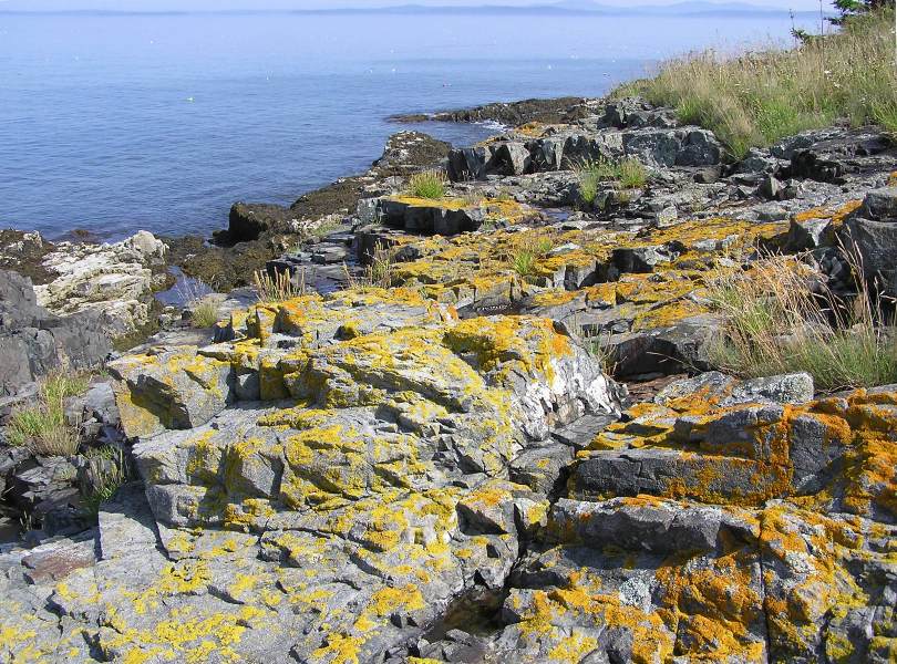
Several groups of kayakers paddled in plastic cockpit tandem boats, led by a tour group leader. They appeared to be having fun but I knew we were having much more fun. 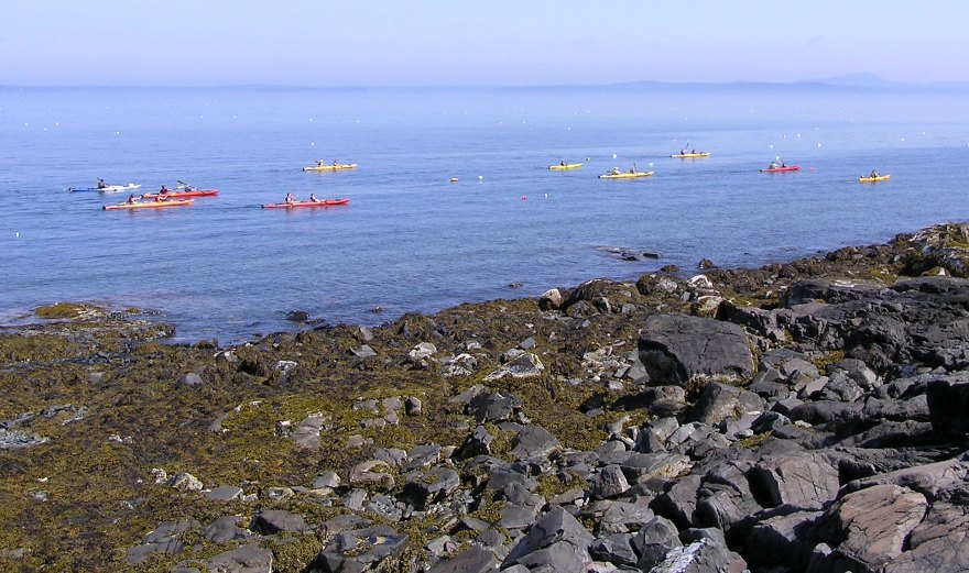
My sit-on-top boat made landing on rocky shores easy. We probably spent as much time exploring on the islands as we did paddling. Our last stop was the biggest island: Long Porcupine Island. The south side had steep rocky cliffs that reminded me of the northern California coast. 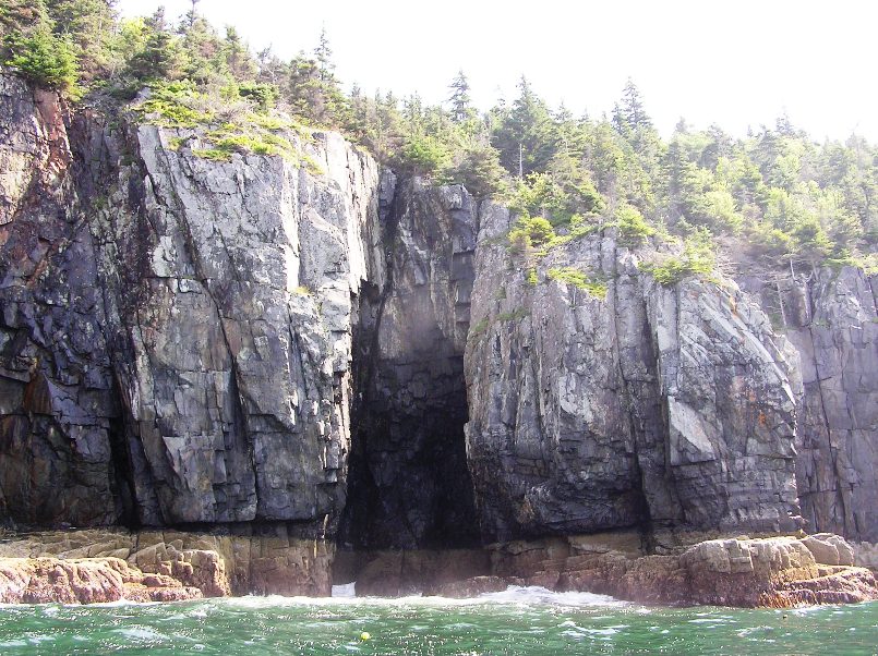
We were starting to get a little headachey from the rise and fall of the swells so we looked for a place to land. I picked a rocky beach on the east side. Unlike our other landings, this one would be in breaking waves. We let the big three foot waves crash while we waited. When I knew the next few waves would be small, we sprinted to the shore and landed without a hitch. 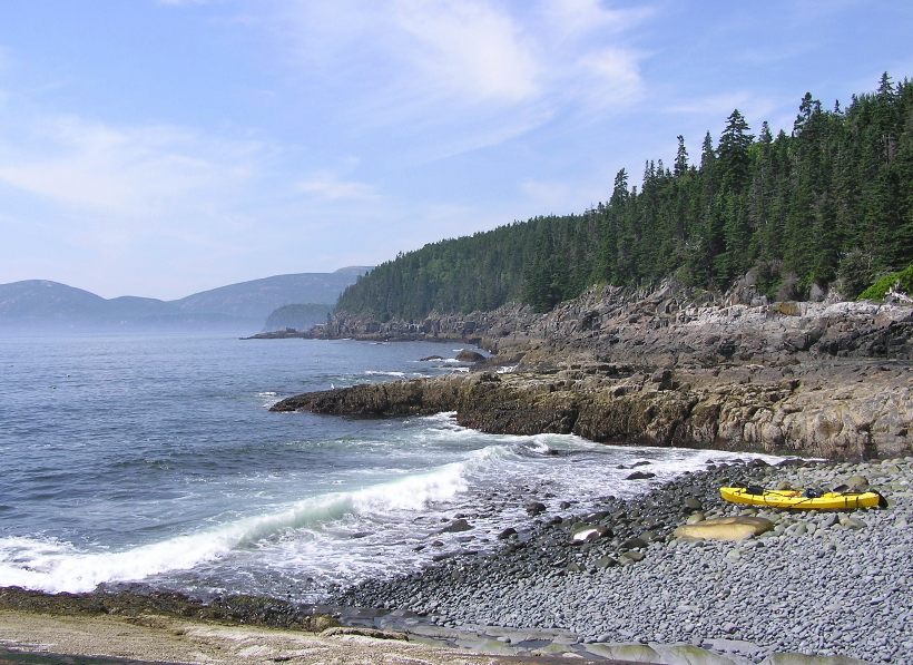
Norma and I found a flat, rocky high point for lunch. After resting up, we prepared to depart. We walked out into the bigger crashing waves to position the boat for launch. After waiting for maybe half a minute for the big waves to die down, we sprinted out into deeper waters. Again, no problem. As we started to round the east end of the island, we saw a calm, easy rock beach that the tour group claimed for their lunch spot. While an easy landing would have been nice, we had a greater sense of satisfaction after having successfully braved the more challenging one. After finishing a counterclockwise circumnavigation of Long Porcupine Island, we did a one mile open water crossing to Bald Porcupine Island. Along the way, we saw a black fin sticking out of the water. It looked too small to be a dolphin. Maybe it was a large ray or a small shark. We never found out. Off in the distance, we saw a large sailing ship with red sails. 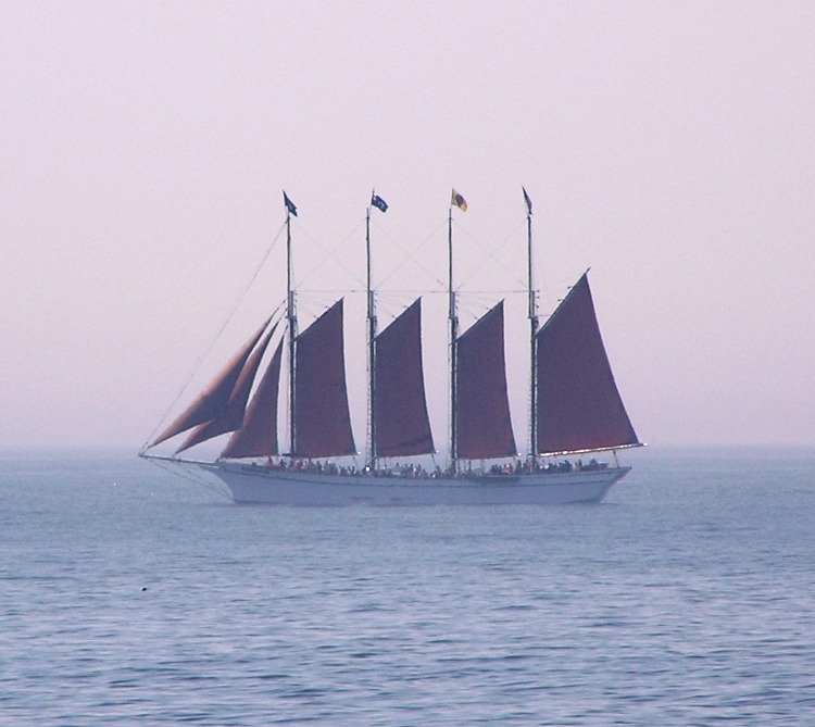
Norma and I paddled around to the south side of Bald Porcupine Island then along the breakwater. On the shore side, the breakwater ended and we paddled through, hugging the shoreline of Bar Harbor. We finished around 1245, having paddled 9.5 miles. This was definitely a new experience for Norma and something I've done very few times. Such a trip should not be taken lightly. I spoke to people about the area, printed out tide information, wore a personal floatation device (PFD), used paddle leashes, marked our launch location in my GPS, had spare batteries, and brought a very high frequency (VHF) radio to contact the Coast Guard or nearby boats in case of emergency. It was a fun trip and not having to worry about all the "what ifs" made it all the more enjoyable. |
|
After loading up the boat, Norma and I met Sarup, her intern, for coffee. Sarup took a bus out to Boston, then Bar Harbor.
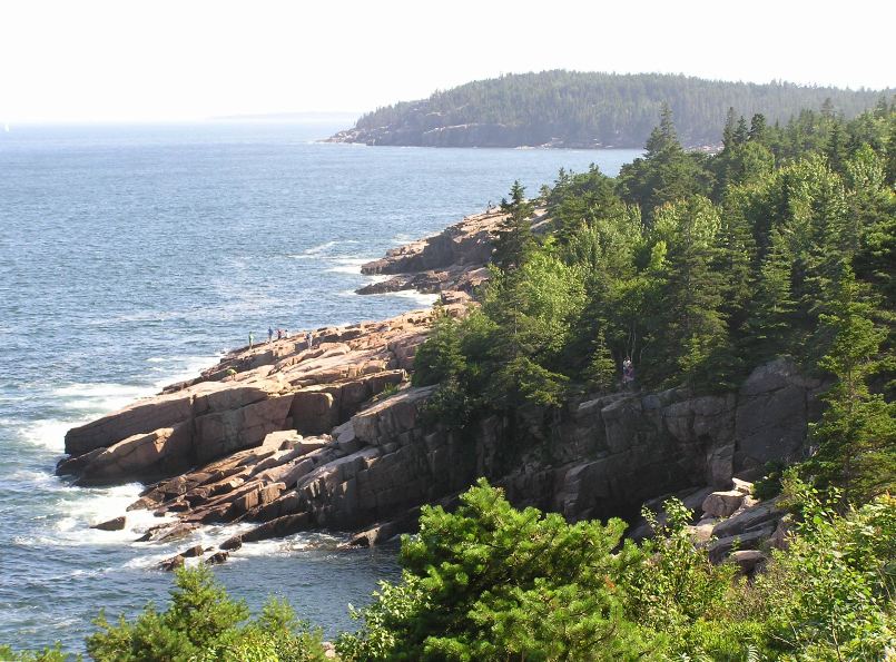
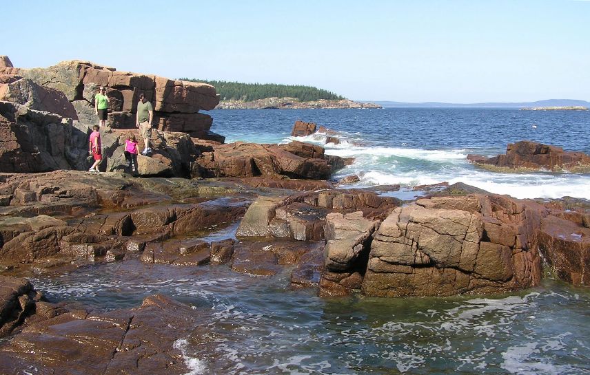
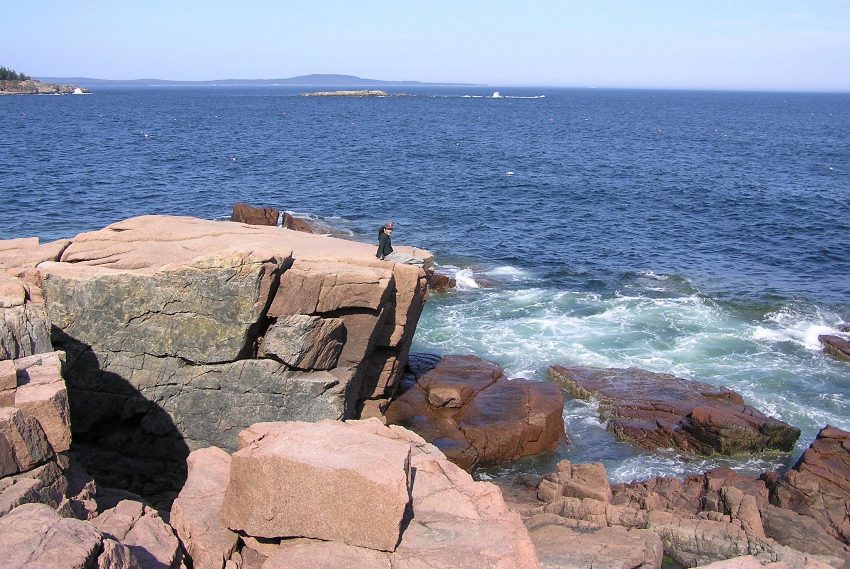
Later that afternoon, Norma and I drove to Sand Beach on the southeast side of Mount Desert Island. This is the only sand beach in Acadia National Park. Over 15,000 years ago, glacial ice carved out this valley. Melting glaciers and rising sea waters flooded it, creating a protected cove. A headland and a rock shelf offshore divert and diminish the power of the ocean, allowing fine particles to settle in the cove. Take a look at a handful of beach "sand" and you will discover mostly bits and pieces of crushed shells, an unusual compositon for a northern beach. - from park sign Sand Beach was a typical pleasure beach: sandy and overcrowded. Not caring for crowds, we decided to walk south on Park Loop Road along the coast. Eventually we came to Thunder Hole. We heard a good deal about this place where air and water is forced out like a clap of distant thunder. Water may spout as high as 40 feet with a thunderous roar! - from AcadiaMagic.com - Thundering Hole The multitude of tourists and the construction done for the viewing platform made me think this was something really spectacular. In actuality, it was nothing special. Supposedly, it is impressive at the right time (perhaps high tide?) but everyone I spoke to later found it equally as uninspiring. 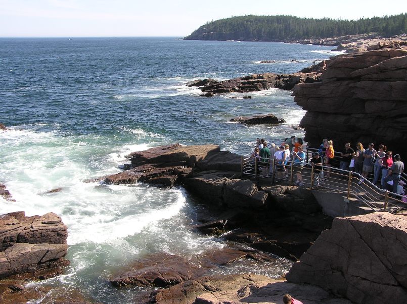
But there were some impressive views of the rocky coastline which made the walk worthwhile. |
|
Our next stop was Cadillac Mountain.
At 1,532 feet, Cadillac Mountain in Acadia National Park is the highest point along the North Atlantic seaboard and is the first place to view sunrise in the United States from October 7 through March 6. - from AcadiaMagic - Cadillac Mountain One can drive or hike to the summit. Being the lazy bums we are, we chose the former. Actually, we weren't sure if we'd have enough time for a hike on another day so driving was the wise choice. But we did walk the 0.3 mile Cadillac Mountain Summit Trail. My feet are still sore from it...just kidding. At the high elevation, we were able to see many of the surrounding lakes. 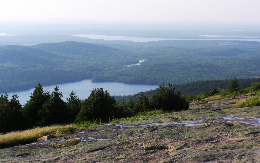
I originally thought the mountain was named because it was a nice moutain. My co-workers used to say something was a "Cadillac" if it was primo (e.g. a "Cadillac taco" is a first class taco). In actuality, The mountain is named for Antoine de la Mothe Cadillac, the Frenchman who was granted possession of this island in the late 1600s by King Louis XIV. Later, Cadillac founded Detroit, inspiring the name of the prestigious automobile. - from park sign From the summit, we could see Frenchman Bay. 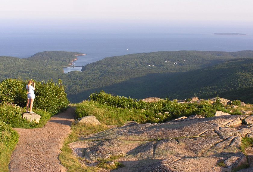
We also had a view of the Porcupine Islands we paddled to earlier that day. 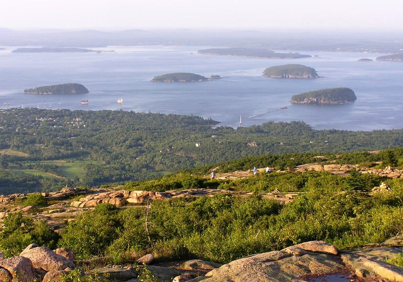
Having grown a little tired of restaurant dining, we picked up some microwaveables at On the Go, the chain of convenience stores attached to gas stations. It was a good day. |
|
Norma and I were up at 0530. This time, Norma saw the red fox while I brushed my teeth. We packed up and left the campsite.
We met Sarup in Bar Harbor for a whale and puffin watching cruise with Bar Harbor Whale Watching Tours. Although I love kayaks, I don't care much for large boats. I get seasick easily. Even when stationed aboard the USS John F. Kennedy (an aircraft carrier) I would sometimes get seasick. Usually it was just enough to give me a headache though once I actually puked. My experiences on other large boats were as equally or more miserable. But Norma was eager to see whales and I was wanting to get a picture of a puffin. Hence, I took a Dramamine pill and donned my Queaz-Away wristbands with the pressure points. I was hoping my preparedness would make this trip enjoyable. The boat took us out 20 miles from shore. See the boat we took below, which I photographed yesterday in clear weather. 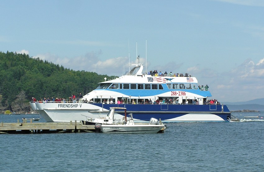
We encountered 3-4 foot swells which weren't enough to make me puke but it definitely gave me a headache. On the kayak, we encountered similar swells but only briefly. In contrast, this cruise lasted a few hours. Several passengers were vomiting. Neither Norma nor Sarup were feeling good though I think they might have felt better than me. We were told to be prepared for 40 degree temperatures but it actually seemed colder because of the wind. The worst thing about all this was that we saw no whales or puffins. It was very foggy and visibility was extremely poor. We did manage to see a few seals poke their heads out of the water but that was it. At over $50 per person, it was an expensive trip to see seal heads for a few seconds. But I must admit that the narrator did a good job of speaking and keeping things interesting. Since we didn't see any whales, we were told we could return for a free trip but I had no such intention. Back in Bar Harbor, Sarup took off while Norma and I took a nap on a grassy hill. It was then that I realized just how many loud motorcycles are in Bar Harbor. Regarding the people, there were lots of families and older folks but few people in their 20s and 30s. Not much racial diversity either. |
|
Now well rested, we headed out. Had we not stopped for eats, our trip would have been 2.25 hours. But we did stop for pizza in Machias.
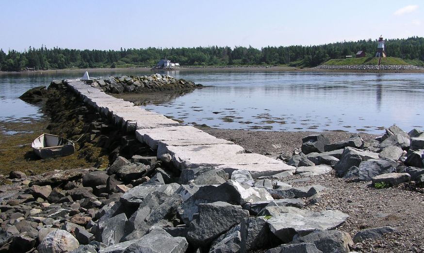
One thing I noticed about Mount Desert Island was how well maintained the roads were. But as we drove east, it became obvious that was not the norm in Maine. The roads on which we now drove were all cracked. Clearly, Acadia is a money-making tourist attraction so the state puts a lot of funding into its roads. We stopped to buy groceries. It remained overcast and foggy almost all day. We checked in at Cobscook Bay State Park. "Cobscook" is Maliseet-Passamaquoddy for "waterfall," referring to nearby falls that reverse with each change of 24-foot tides. - from "The Maine Atlas and Gazetteer" by DeLorme We stayed at site 65. This wasn't my first choice but it was a nice site with a waterfront view. I thought we could launch from it but the steep dropoff from the shore would have made that difficult. Jeff B. of the CPA recommended sites 56T, 57T, 59T, and 62T. After setting up our tent, we walked around, checking out these sites. We found them secluded and scenic, lying on the Cobscook Point peninsula. I think one can launch from this point. Of these, 56T was probably the best since it is closest to the parking lot, pit toilet, and drinking water. The drawback for these sites is that the site is a short walk from the parking lot so if you are more interested in convenience than view or seclusion, then you might want to consider one of the sites that border Broad Cove. Sites 63T, 64T, and 65T are particularly nice drive-up sites that are convenient to the pit toilets and drinking water. If you want to reserve a site on-line for a Maine state park, go to Maine Department of Conservation (DOC) Online Reservations. Cobscook Bay State Park has a scenic, well-maintained campsite but it doesn't have the luxuries of Mount Desert Campground. All toilets are pit toilets. At Mount Desert Campground, there were numerous bath houses with showers just a short walk away but at Cobscook Bay State Park, there is only one bath house that is near the entrance. The biggest drawback were the numerous mosquitos. There were a fairly good number of these biting insects at Mount Desert Campground but at Cobscook Bay State Park, they were much worse. The bugs were every bit as bad (and maybe worse) as at Tuckahoe State Park on May 10, 2009. My clothes were sprayed with permethrin which definitely helped. But that didn't protect me from the mosquitos in the bath house which lied in wait for people after they got out of the shower. The pit toilets also harbored numerous mosquitos. I don't know if this many mosquitos is typical for Maine. We were told that they've been having an unusually wet summer so that may have something to do with it. At least we had a waterfront view. |
|
It rained a lot during the night. We awoke to a misty morning.
Norma and I drove out to the 140 acre Reversing Falls Park in the West Pembroke area. Unlike other parks we've been to, this one was not so well marked and we questioned whether or not we were actually at the right place once we arrived. This town-operated park has a short hiking trail that leads one to Cobscook Falls. These "falls" aren't your stereotypical waterfall. Rather, it is a channel where water flows from Dennys Bay and Whiting Bay into or out of Cobscook Bay. During flood tide, water rushes in to fill these bays, then during ebb tide, the water leaves with just as much force. How much force? 25 knots or 28.8 mph according to Moon Maine. We walked about 2.5 miles on mossy, wooded trails. 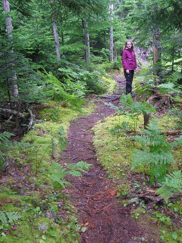
Several cornus canadensis plants with bright red berries were seen. This plant is a member of the dogwood family. 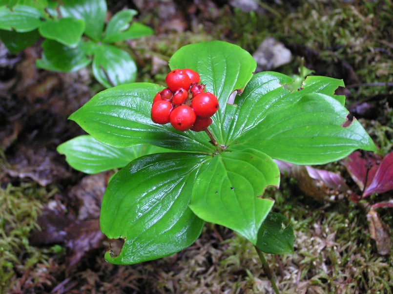
We found several sea urchins at the rocky peninsula near where the water appeared to move the fastest in the reversing falls. 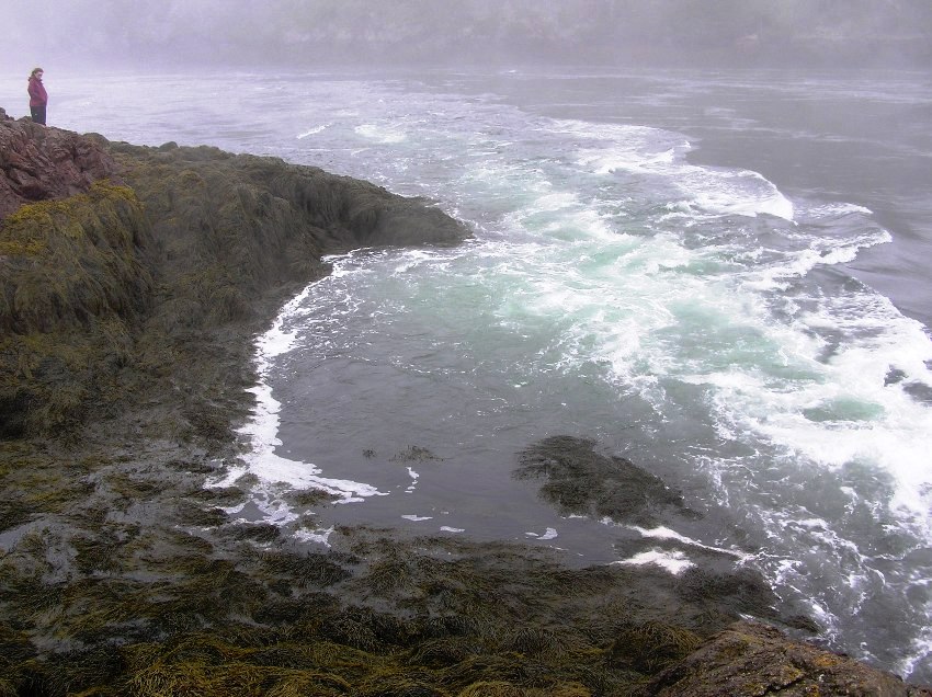
On the walk back, we found a bird's nest that had fallen on the ground. 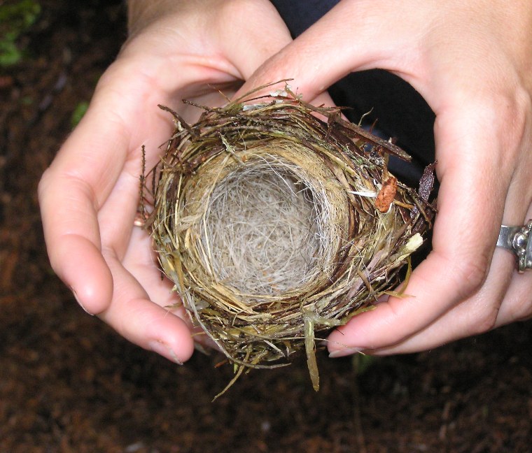
|
|
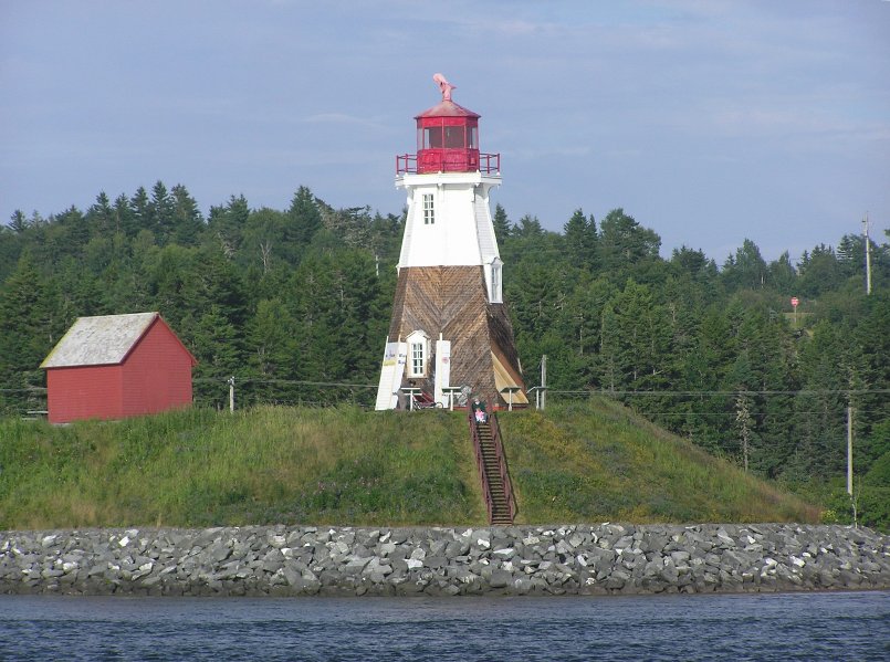
Next, we drove to Quoddy Head State Park where we saw West Quoddy Head Light. Here's a photo of the lighthouse taken two days later, when the weather was clear.
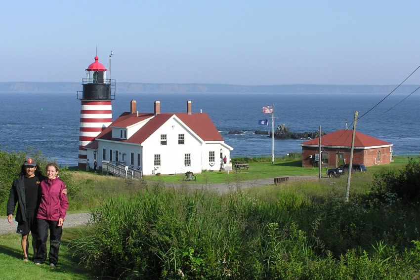
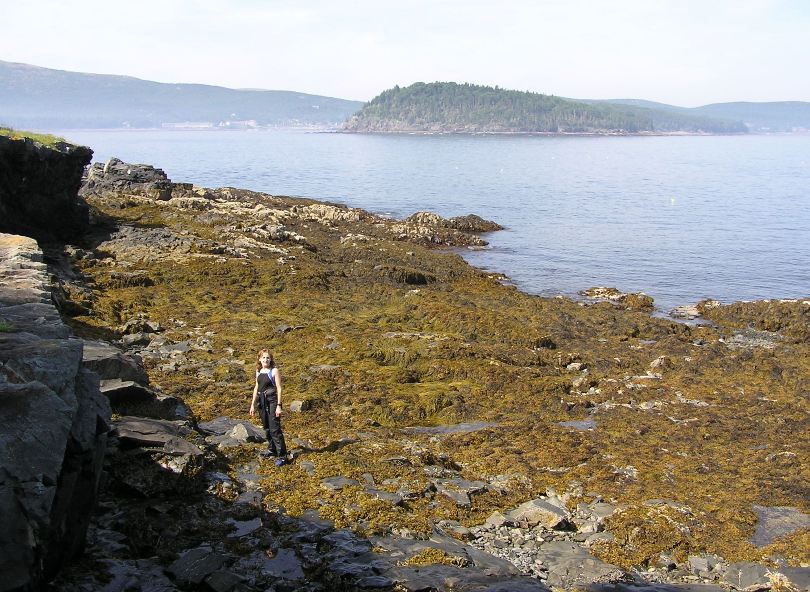
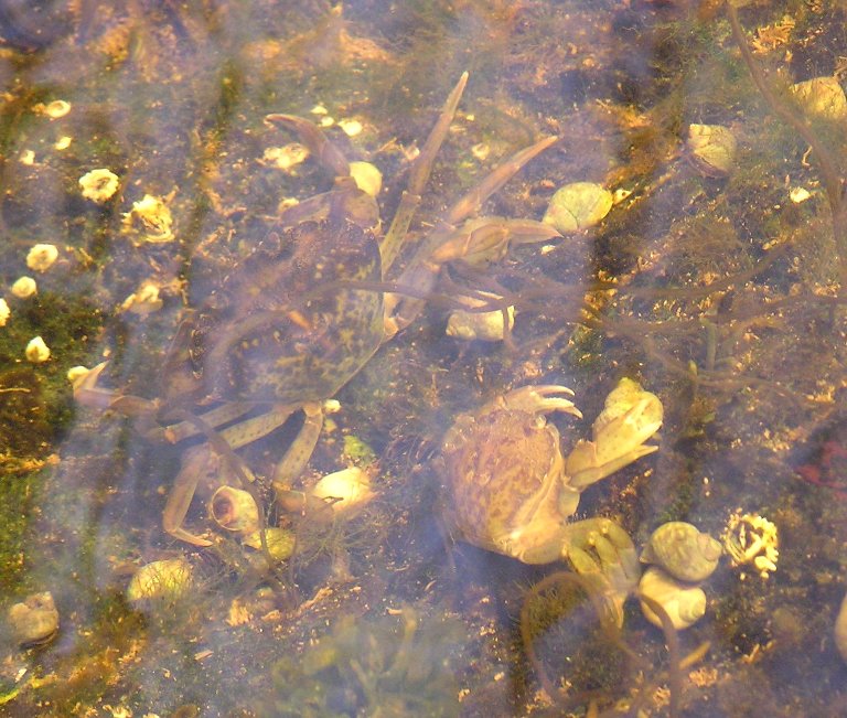
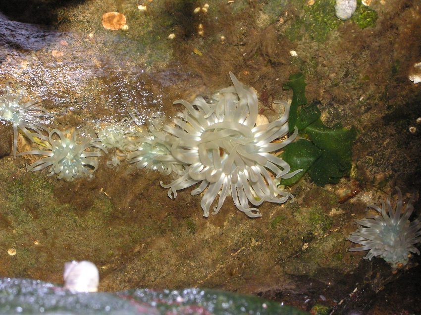
Norma and I went to the visitor center but couldn't go up into the working lighthouse. This is supposedly a good place to see whales but it was much too foggy to see anything. West Quoddy Head in Lubec is the easternmost point in the United States. Norma and I walked west on the Inland Trail along the coast. We did some tidepooling and rock scrambling. The two of us saw crabs and sea anemones which weren't easy to find. |
|
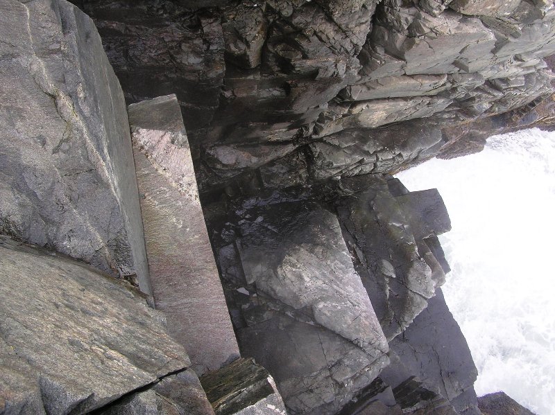
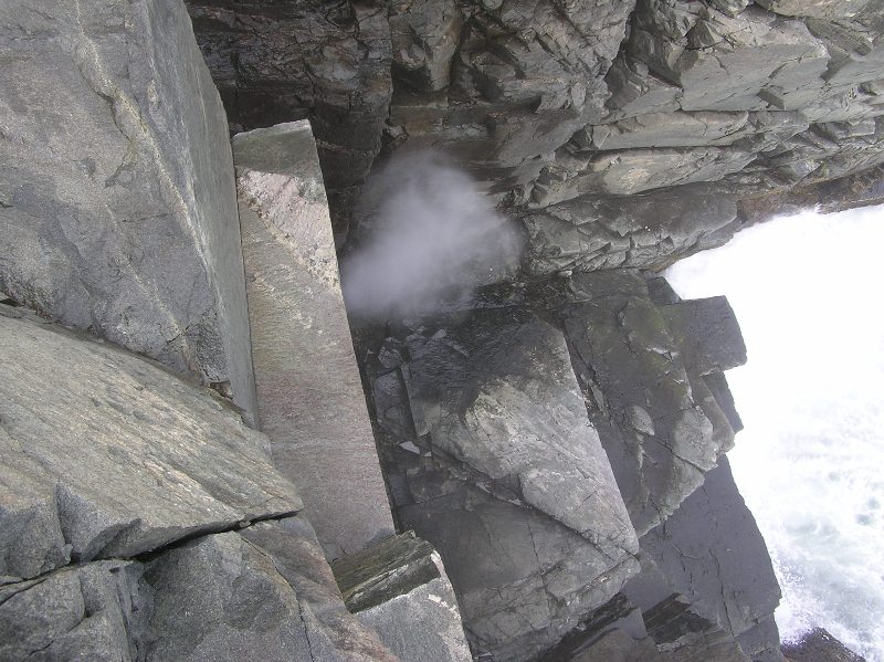
About a half mile from the lighthouse, we came to Gulliver's Hole. We weren't expecting it. We just heard a loud rush of air that sounded like what we might expect to hear from a whale. As the waves crashed into a cave at the waterline, air was forced upward through a small opening. This is what we expected to find at Thunder Hole. While it was easy to hear the air from the trail, I wanted a closer look so I climbed down quite a ways until I could see mist coming out of the opening like water out of a geyser. It was most impressive.
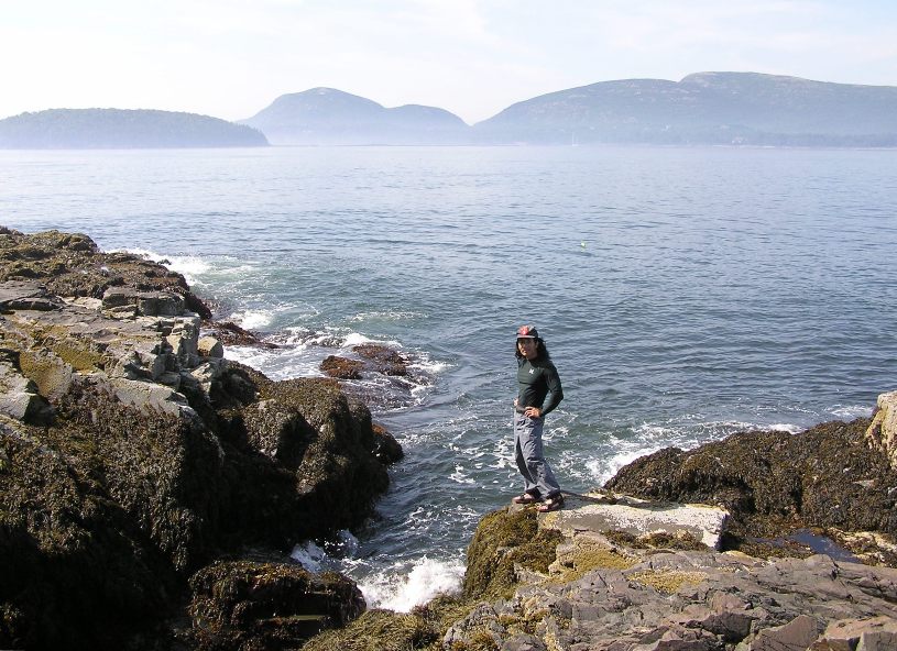
As we continued, the rocky cliffs got taller as we came to High Ledge. The park's rock cliffs are remnants of marine volcanoes that erupted 420 million years ago and now form the bedrock of much of coastal Maine and New Brunswick. The horizonal volcanic layers were tilted almost to vertical along the Fundean fault - a fracture in the earth's crust that parallels the coast just off the park's shores. Glacial scouring and the battering surf have carved the cliffs, which rise 90 to 150 feet from the sea. - from park sign The views from the trail of the ocean at Grand Manan Channel could have been spectacular if it were not for the thick fog. I later learned that this area is wrapped in fog for an average of 59 days a year. It also has some of Maine's coolest summer temperatures. |
|
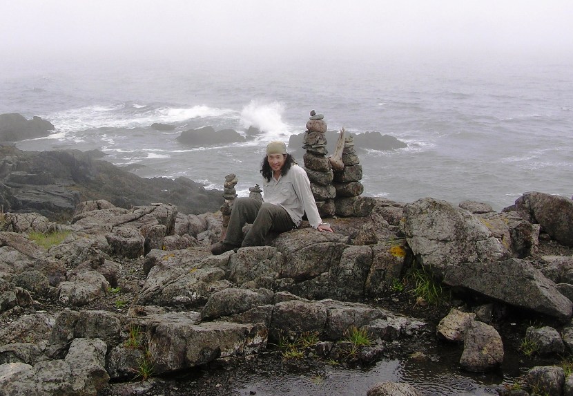
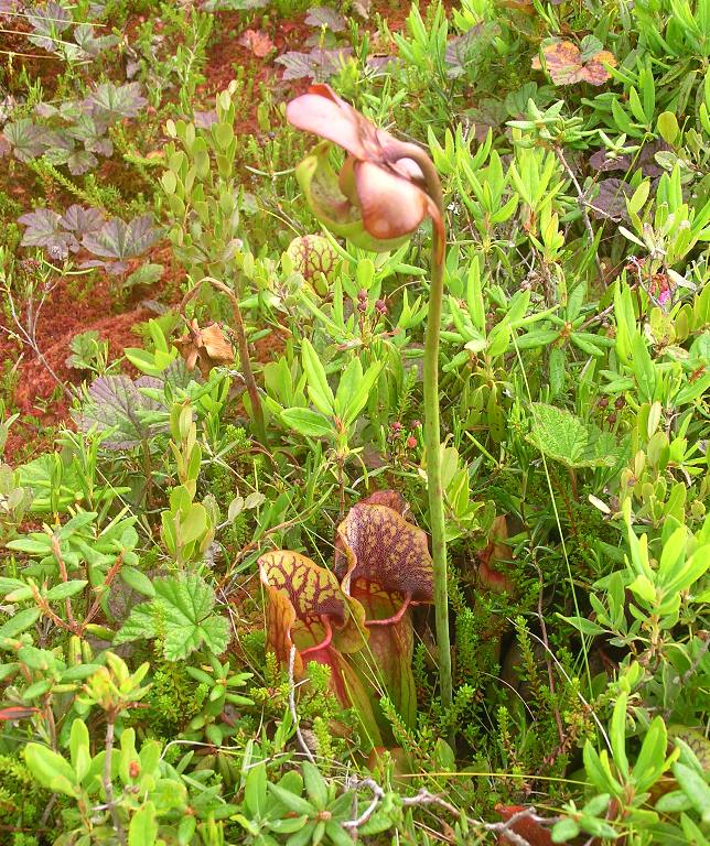
At Green Point, we came to a rocky field full of cairns.
Here, we caught an inland trail that eventually led us to Bog Trail. I expected muddy, wet trails but instead we found a boardwalk through an open area filled with moss and coastal peat bog, a feature typical of maritime eastern Maine and New Brunswick. The vegetation in this bog was unlike any other I've seen. There were dwarf trees, sundews, baked apple berries, pretty pink flowers, and pitcher plants. Specialized plants such as sundews thrive in nutrient-poor bog soils by trapping insects for food. The leaves of sundews are covered with reddish hairs. Each hair is tipped with a sticky fluid that sparkles in the sun like dewdrops and attracts insects. Insects caught in the hairs seldom escape and are held tightly against the leaf surface and digested. Pitcher plants eat insects to obtain essential nitrogen and proteins they cannot find any other way. Pitcher plants have nectar glands that attract insects. The cone-shaped leaves, lined with downward-pointing hairs, also form a natural insect trap. When an insect climbs inside the plant, the hairs prevent its escape. Eventually it falls into the water, which has accumulated in the base of the leaf, and is digested by the plant's secreted enzymes. - from signs on the Bog Trail 1 / 4

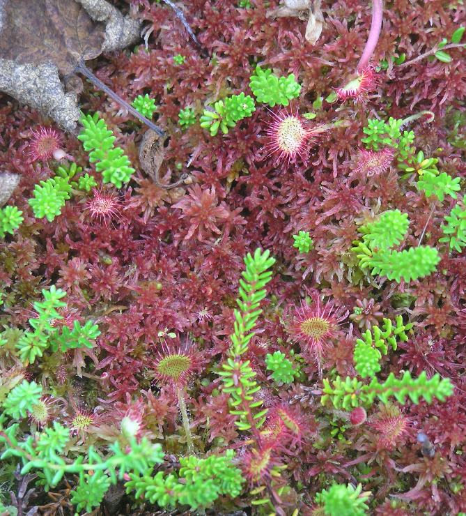
Sundews.
2 / 4
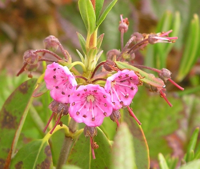
Pink flower.
3 / 4
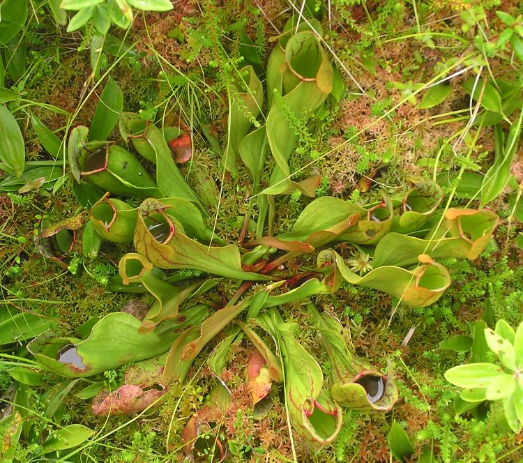
Pitcher plants, top view.
4 / 4
Pitcher plants, side view.
|
|
After our approximately 2.5 mile walk, we drove to the town of Lubec. Here I found a boat ramp at the town wharf on the north end of Water Street. From the middle of Water Street, we could see Campobello Island in Canada and the lighthouse on Campobello, just across from Lubec.
In the narrows between the island and Lubec there were strong tidal currents, though nothing like Reversing Falls. After a snack at Atlantic House/Downeast Coffee, we drove back to the campground. |
|
A little before dusk, we walked on the Cobscook Bay State Park nature trail to Burnt Cove Overlook. It was humid, muggy, and it seemed every mosquito in the park was active and out to get us. But the view from the overlook of Burnt Cove to the southwest was most impressive.
That night we heard several coyotes. |
|
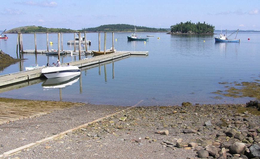
Norma and I drove just outside of the park turning right (east) on South Edmunds Road (which veers left/north) then turning right (east) on Boat Launch Road, following it to the end. Here was a very large parking lot with a picnic shelter, pit toilet, and boat ramp. This gave us access to Whiting Bay, just north of the campground. Launching here was much easier than at the campground.
We paddled north on Whiting Bay, island hopping along the way. This was a route I borrowed from Tamsin Venn's Sea Kayaking Along the New England Coast book. I made sure to stay far from Reversing Falls to our east since the tide was still going out. We didn't want to get sucked in, battered on the rocks, then have to wait for ebb tide or flood tide to return. After we crossed into Dennys Bay, we heard a sound that was a mix of roaring and Predator noises (remember the "Predator" movies?). I was certain they were seals. We paddled to a nearby island then climbed to a plateau to get a better view with my binoculars. 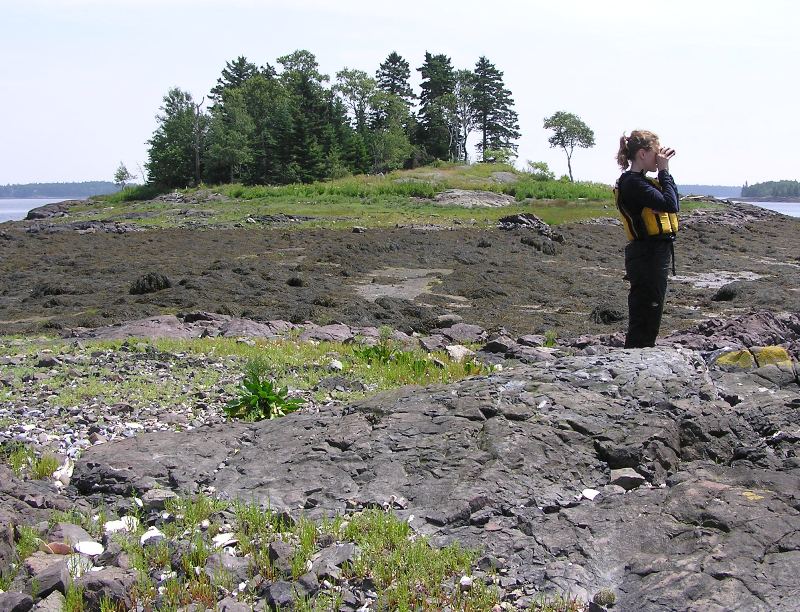
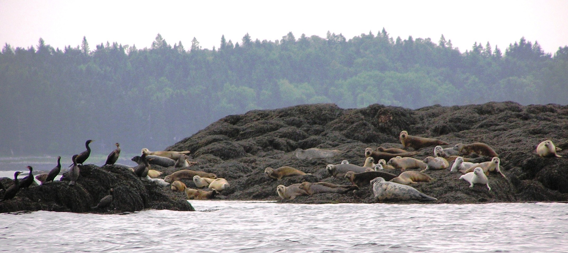
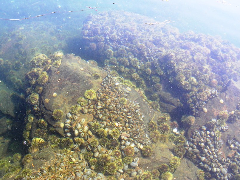
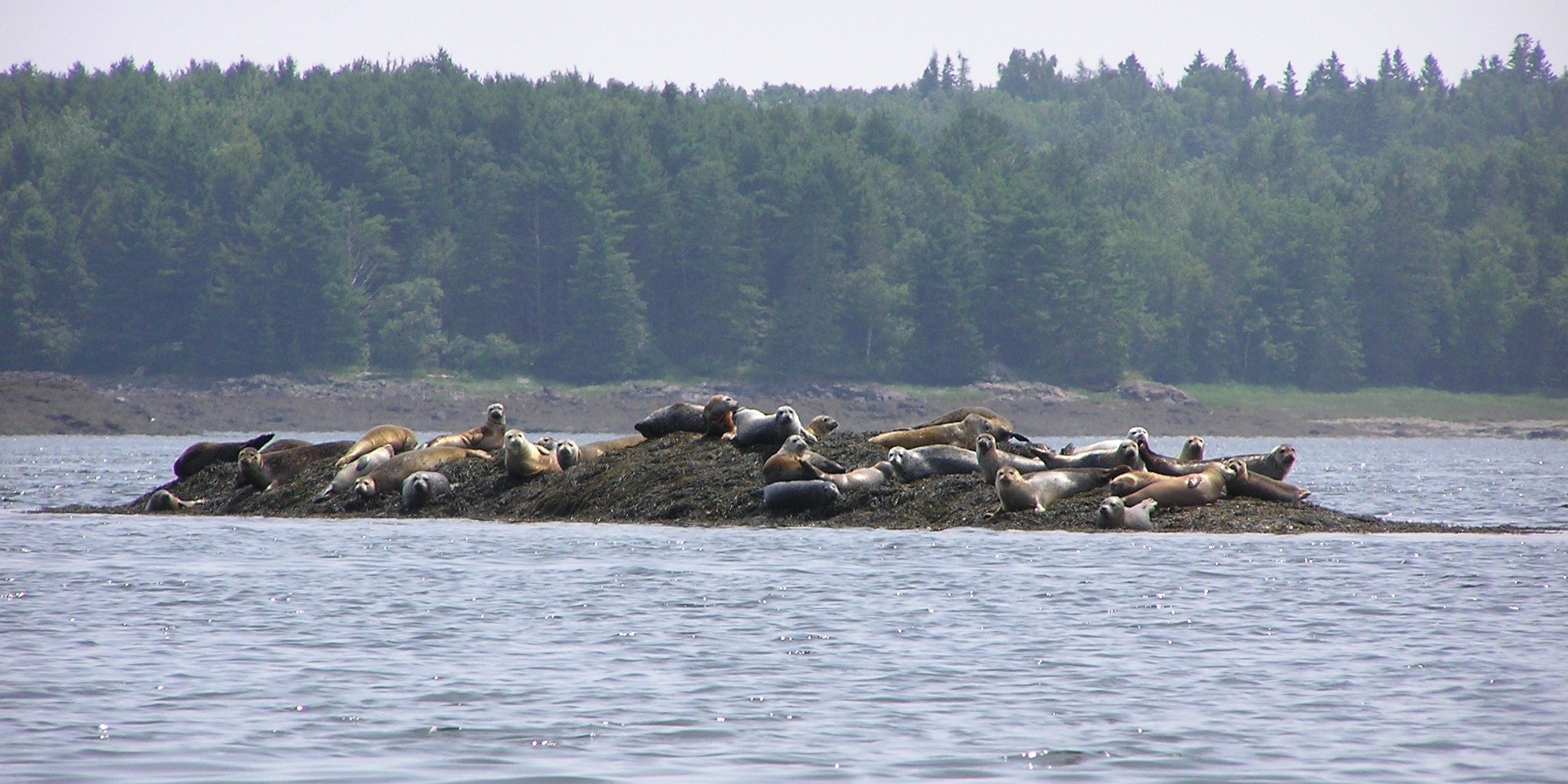
About a quarter of a mile away were several harbor seals sunning themselves on several small islands. When we first heard them, we were at least a half mile away. We would pay them a closer visit...but not until we explored the island we were on a bit. A majority of the island was wooded. The low lying areas were rocky and covered with seaweed. But the rocky, clear area on which we perched was literally covered with shells. There were several shells from mussels and small conches and snails. There were also numerous sea scallop shells, some as wide as five inches! 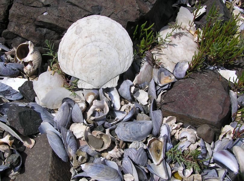
It was perfect weather for photography. Sunny and clear. We only got about 800 feet from the first seals before they dove into the water. I read later that their colonies should not be disturbed and I suppose one can say that our presence was upsetting them but I don't think we ever got closer than 500 feet from any on land. Additionally, we saw no pups, which are born between mid-April and mid-June and nurse for four to six weeks before they are weaned. - from "Harbor Seal Haul Out" Once in the water, the seals swam around the general area, poking their heads above water for a few seconds at a time to look around. 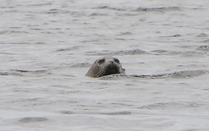
On a single small island, I'm guessing there were at least 30, shown in the cover photo. My estimate is that we saw 60 on land throughout the day. Norma and I continued paddling north, stopping at an island then climbing to a high, sunny spot for lunch and a nap. It was now low tide and there were few places below the high water mark that were not covered with seaweed. 
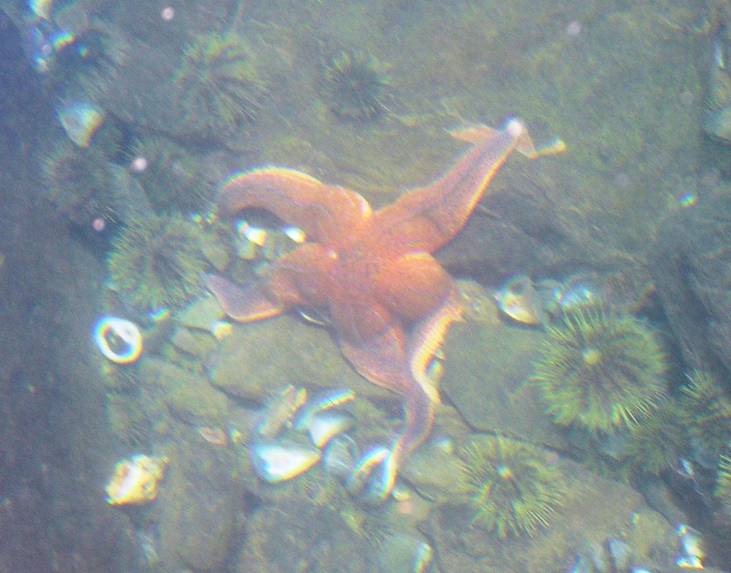
I caught a quick glimpse of a four inch wide white starfish attached to a big leaf of seaweed. The clarity of the water permitted us to see fairly deep down. I also saw a jellyfish but only one. On our way back, we paddled into Reversing Falls. But unlike a few hours earlier, the tide was now coming in so there was no danger of being carried away. We paddled into the current after approaching it from a sheltering peninsula. Then our boat was quickly thrown starboard as we worked hard to keep it facing forward. With a little help, we got my heavy, wide, plastic sit-on-top moving at 9.3 mph! Even with little work, we were moving over 8 mph. This went on for maybe a quarter of a mile. Even a half mile away, we were still feeling the tide push us back to our launch site. Clouds moved in and it began to rain. But an overwhelming majority of our 10.5 mile trip was sunny so I was thankful. Upon landing, I noticed that what were two nearby islands yesterday were now stretches of dry land just two hours after low tide. |
|
Our next task was to do laundry. We drove to Eastport where we bought groceries and met a friendly local with a heavy New England accent who directed us to the town's only laundromat. The rain turned into a downpour. That morning we were considering leaving things out to dry but the park ranger advised against it. I'm glad I followed his advice.
With clean, fresh clothes (but not the stuff we were wearing) we ate a snack and appetizer at Waco Diner on 47 Water Street, Eastport. The service was bad, the food was bland, and the place lacked atmosphere. Hence, we went across the street to The Pickled Herring where the food was delicious, the service great, and the atmosphere a nice mix of oxygen and nitrogen. I ate a lobster cake which I never had before. It was fantastic...much better than crab cake. The price was reasonable too. We arrived back at the campsite to a wet tent. While the footprint was properly placed and the rainfly secure, the heavy rain and poor drainage at site 74 forced water through the seams of my 12 year old tent. The foam mattresses I used as sleeping pads absorbed the water and got my sleeping bag wet. It wasn't terrible...it was just a little damp, not soaked. But it was enough to put me in a bad mood. Still, it was a great day. |
|
Norma and I awoke to a sunny morning. Confident that it would not rain that day, we put things out to dry.
We drove back to Lubec and launched at their town wharf. Once again, we were island hopping. This time it was Popes Folly (shown below), Dudley Island, and Treat Island. It was a warm day so we dunked ourselves in the 55 degree water to cool off at our first island stop. 
From the water, we could see the whole town of Lubec. 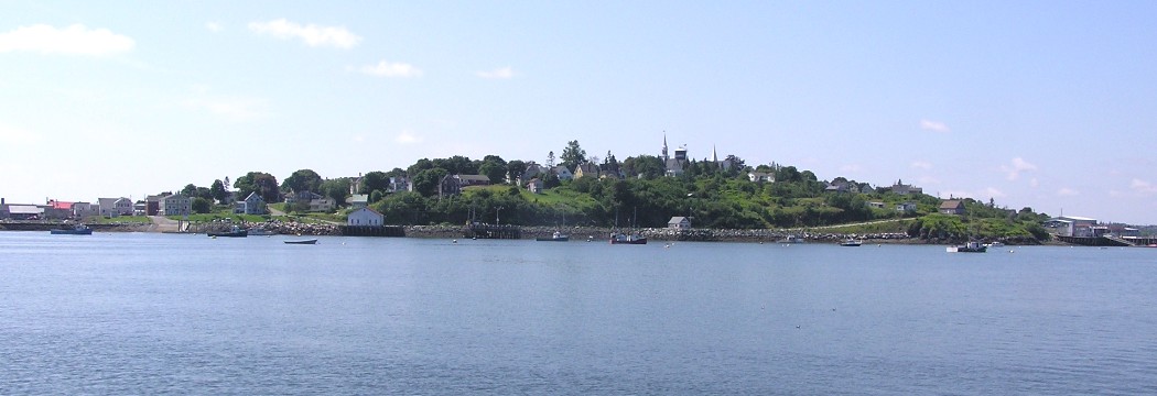
|
|
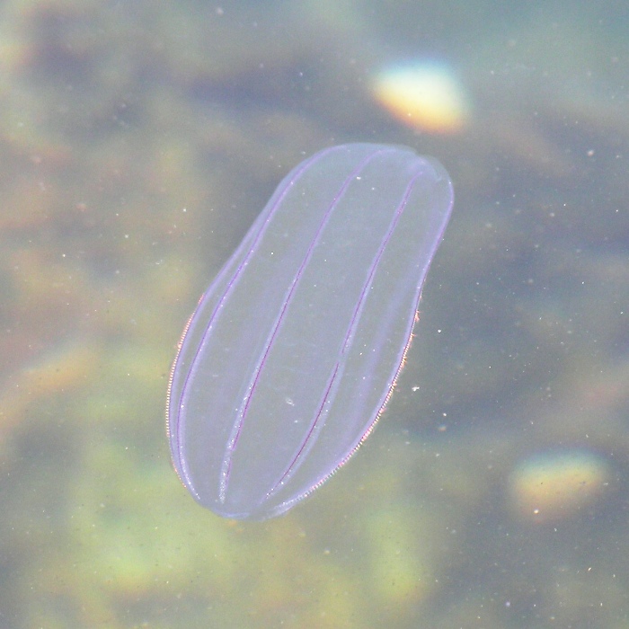
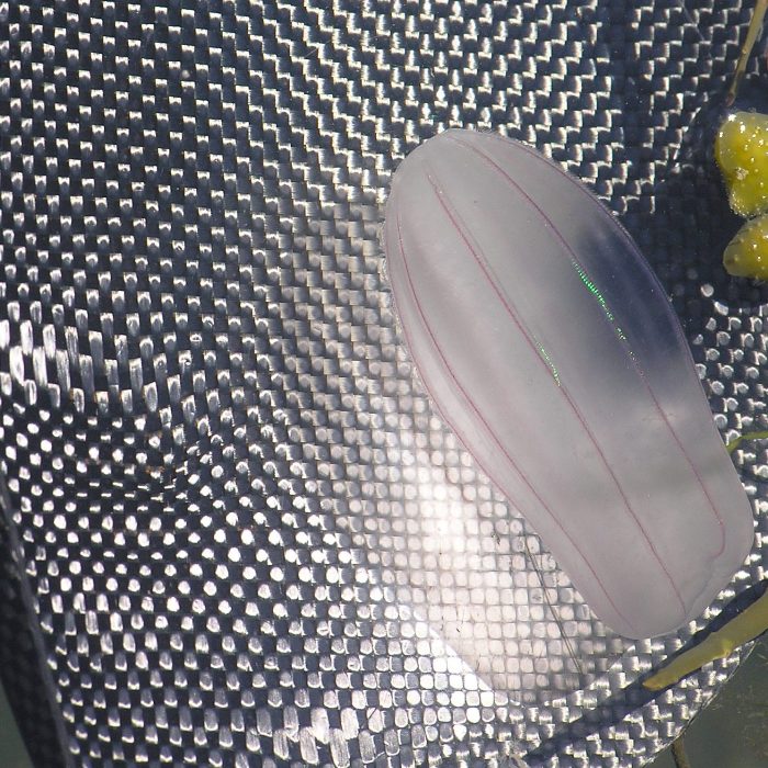
Norma and I saw numerous jellyfish. Many were the familiar round ones that I see in the Chesapeake Bay. But others were a type I'd never seen before except on a nature program. I remembered them because in the documentary, they produced their own light which I thought was rad. They were shaped like star fruit and generally between two and five inches long. I was later told by Lindsay H. and Dr. Paul F. that it is a Beroe cucumis, a comb jelly, which are in a different phylum than jellyfish. I didn't think it looked like a comb but I later learned
Beroe cucumis is a medium-sized, sack-shaped comb jelly. It may reach up to 15 cm in length. It is completely transparent in colour. It swims with eight longitudinal combs that give the comb jellies (ctenophores) their characteristic shimmering appearance. These combs consist of plates of transverse rows of hairs that beat in waves downwards, which produces the shimmering effect. These plates are phosphorescent at night. - from The Marine Life Information Network (MarLIN) - Melon comb jelly (Beroe cucumis) In addition to jellyfish, we also saw Things got a bit windy but the water in Johnson Bay remained fairly calm. On our way back, we made a quick stop at Campobello Island just to say we were in Canada. We finished after paddling 6.5 miles. |
|
After loading up, we ate sundaes back at Atlantic House/Downeast Coffee, just down the street.
With our hunger now satisfied, Norma and I drove back to West Quoddy Head Light. With such clear weather, ideal visibility conditions, two sets of binoculars, and a 180 degree view of the ocean, we thought we would surely see a whale at this location famous for whale sightings. We were wrong. Back in Lubec, we ate a fine fish and chip dinner at Uncle Kippy's. Haddock seems to be the fish of choice out there. |
|
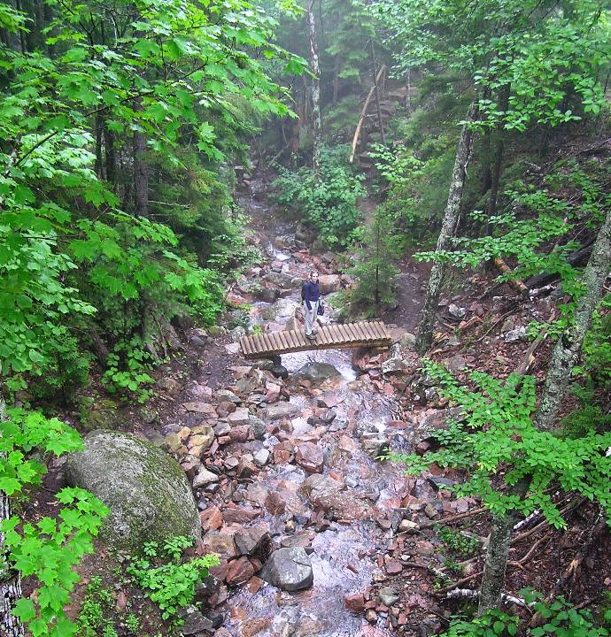
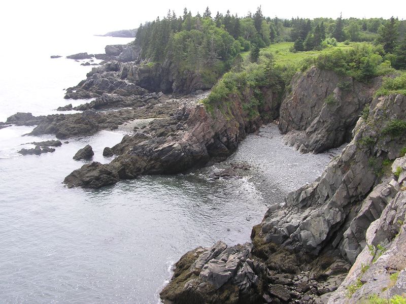
Norma and I packed up our gear then drove to Cutler to hike on the Cutler Coast Trail in the 12,000 acre Cutler Coast Public Reserve. This not-so-well-known trailhead is on the south side of route 191, about 4.5 miles northeast of the center of Cutler. We walked on the 5.8 mile Black Point Brook Loop which includes sections of the Coastal Trail, the Black Point Brook Cut-off, and the Inland Trail.
This trail is famous for its steep, rocky cliffs and spectacular ocean views. Unforutunately, it was foggy but what we could see was impressive. The steep cliffs with the crashing waves below and the fresh ocean air was truly inspiring. 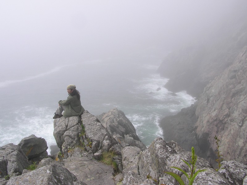
We found a cave at the waterline but it was too far below to explore without fear of falling 50 feet onto sharp rocks or drowning in pummelling waves. 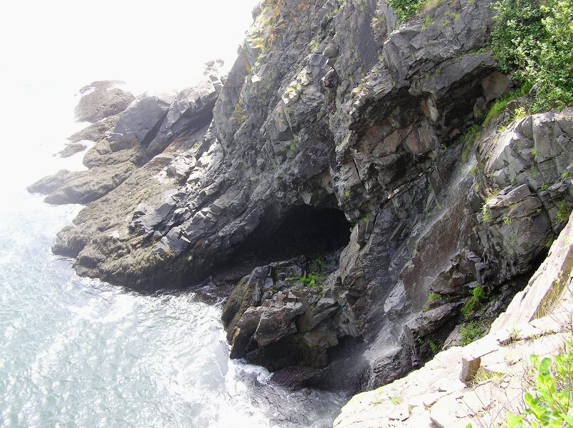
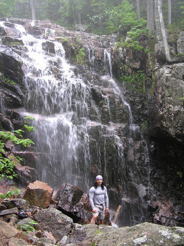
The sun came out for a few minutes then said good-bye. Fortunately, I got some nice photos during these brief moments. Our loop hike took us along the coast to Black Point Cove then turned inland and back to the trailhead. People obviously put a great deal of work into maintaining this trail which was covered with a considerable amount of boardwalk. |
|
Our next stop was Jasper Beach
...piled high with ocean-polished jasper and other rocks - has been preserved by the town of Machiasport. No sand here, just stones, in intriguing shapes and colors. Resist the urge to fill your pockets with sourvenirs, maybe settling for just a single special rock. - from Moon Maine As Norma and I walked along Jasper Beach, we wondered if we were in the right place. There was nothing special about the place and we saw nothing that appeared to be jasper. Instead, the rocks looked like what my father would pull out of his garden in Sacramento and pile next to the fence. |
|
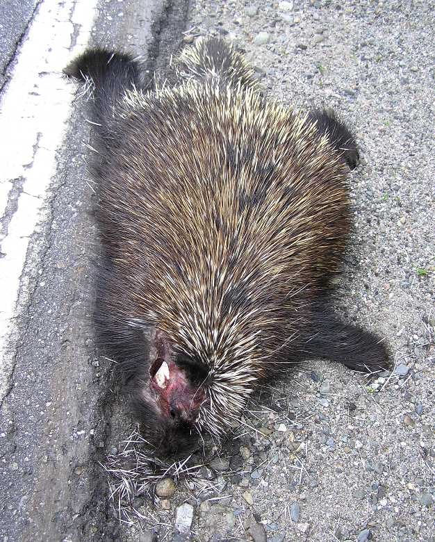
Driving west, we saw several porcupines along the side of the road...all dead. Most had a body about 15 inches long. Unfortunately, we saw none alive. We kept an eye out for moose too but just like the whales, we saw none.
After making it a little more than halfway across the state after nightfall, we decided to find a motel in Newport. We stayed at Loveley's Motel, just off highway 95. With two twin bed rooms starting at $60, the price was right for this time of year. After a late dinner across the street at House of Pizza, it was time to call it a night. |
|
Norma was wanting to stay in Maine as long as she could so I suggested we paddle on Cobbosseecontee Lake just west of Augusta, the state capital, which was inland. I had no tide information for places other than where we'd already visited so I was hesitant to paddle in coastal areas. Plus, we hadn't paddled in freshwater and with Maine having so many natural lakes, it seemed like a good opportunity.
We launched at the north end of the lake, just west of Manchester and south of route 100. Maine does a good job of marking their boat ramps from the road using a blue sign with white lettering so it was easy to find. We kayaked on the east side of the lake, exploring a small creek until it narrowed and we came to a large fallen tree. Then we ventured out to explore the islands in the middle of the lake. Many of them were privately owned. Homes on the islands and the shore were generally luxurious and interesting. Clearly, this was Cadillac real estate. We stopped for lunch off Hodgdon Island. After learning it was open to the public, we went ashore and explored its trails which were blazed. Do you remember how bad I said the mosquitos were at Cobscook Bay State Park? Well these were even worse. I couldn't wait to leave the island, even though I found some interesting flora. 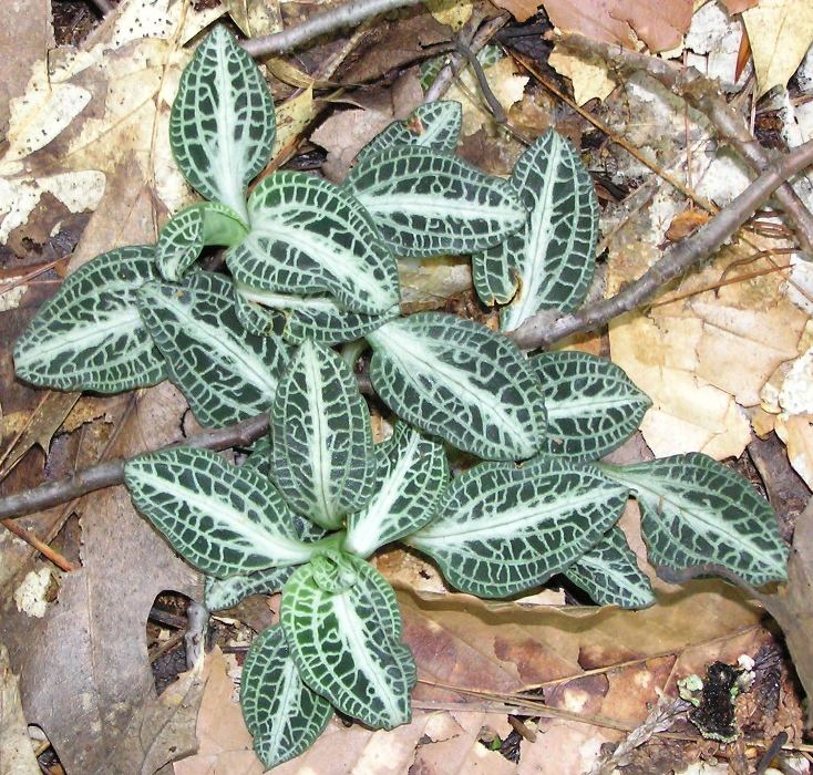
A bald eagle was spotted...not that it had spots, but rather, we saw it. Norma and I sunned ourselves on another island without mosquitos. Much better. We passed the privately owned Ladies Delight Lighthouse which stands 25 feet tall. 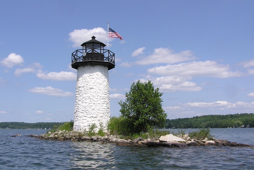
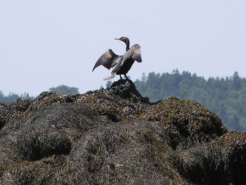
Still more cormorants were seen. 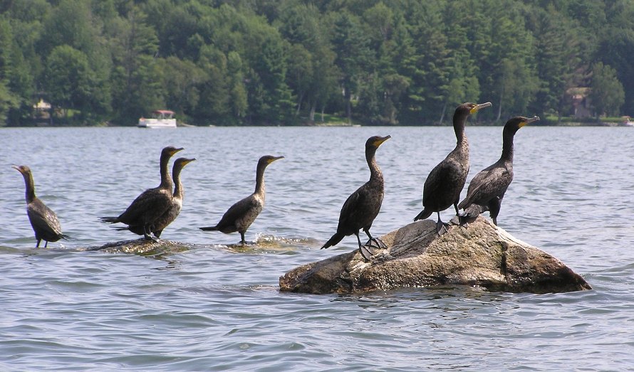
After paddling 8.25 miles, we were done. |
|
We were off again, stopping one last time in Maine at Wells Beach. Good-bye Maine. We spoke about returning some other time to visit the highlands.

|
|
The nighttime drive home was mostly easy. We did hit slow traffic in New York City again but it wasn't as bad as before. This time it was due to construction. While Norma slept, I sang with my iPod, and while I slept,...well, I don't know, I was asleep.
The following morning, we cleaned off our camping and kayaking gear and freshened up my car. After over 1,900 miles of driving in ten days, it certainly deserved and needed it. My Garmin GPSmap 76S (the one that died) came back to life after we returned. I guess that puts it in the category of the "undead." So now I have two GPS units. I suppose I could return the newer one but that just isn't me. As I said before, Maine is a very large state. There is just too much to explore in ten days. We could have visited more places by spending less time in each place but in the end, I'm glad we did things the way we did. The only thing we didn't see that I now wish we had was Old Sow Whirlpool near Eastport. But maybe it is best we didn't...I might have taken us kayaking in it...well, maybe not. A few weeks later, Jenny P.-W. told me about the Northern Forest Canoe Trail. She and Greg W. used the Rangeley Lake to Spencer Stream and the Umbagog Lake to Rangeley Lake maps for their recent trip. They had no problems with mosquitos, were near plenty of hiking trails (including the Appalachian Trail), and they even saw four moose! It is likely that when Norma and I return, we'll spend some time in this area. |
