|
This page describes a weekend kayak trip which Suzanne and I organized for the Chesapeake Paddlers Association (CPA). It involved paddling on Broadkill River and Primehook Creek in Delaware. |

|
This page describes a weekend kayak trip which Suzanne and I organized for the Chesapeake Paddlers Association (CPA). It involved paddling on Broadkill River and Primehook Creek in Delaware. |
|
I've had many good years participating in various CPA events. But what I like even more than the trips are the people I've met. I can honestly say that at this point in my life, most of my friends are kayakers and most of those were met through the CPA. Hence, it was time for me to give back to the club.
In 2009, Suzanne expressed interest in organizing an overnight kayak trip. She's led many day paddles with the CPA but until now, no overnighters. I've led an overnighter with the Maryland Outdoor Club and I know of many interesting places to paddle, but since I've always paddled sit-on-tops, I do not have many of the kayak rescue skills that Suzanne has learned. After talking, Suzanne and I decided to team together, combine our strengths, and put together a spectacular weekend event. Suzanne and I did a scouting trip on May 15-16, 2010. During this time, we scoped out the campground, explored the rivers, and checked out the nearest town. We also mapped out the kayaking and driving routes, studied the tide tables, planned the car shuttle, and organized participants to reserve campsites. Unfortunately, we could not make all the campsite reservations ourselves since Delaware state parks do not allow individuals to make multiple reservations for a club...they consider themselves a family campground. There was a significant amount of other planning involved but I won't go into those details. Let's just say that a good amount of time and effort went into ensuring this trip would be fabulous. |
|
Our destination for the day was Cape Henlopen State Park. This would be our base camp. The place is scenic, strategically located, and rich in history.
In 1631, the Dutch made the first settlement close to what is now modern day Lewes, just northwest of the park entrance. In 1682, William Penn declared that Cape Henlopen would be for "the usage of the citizens of Lewes and Sussex County," making it one of the first public lands established in the United States. With the onset of World War II, the U.S. Army established a military base at Cape Henlopen in 1941. Bunkers and gun emplacements were camouflaged among the dunes, and concrete observation towers were built along the coast to spot enemy ships. In 1964, the Department of Defense declared 543 acres of the Cape lands as surplus property. The State of Delaware accepted the property and established Cape Henlopen State Park. Today the park is comprised of 3,769 acres on the Delaware coast, four miles of beach, and vast expanses of sand dunes, some rising almost 100 feet high. - from Outdoor Places - Cape Henlopen State Park and Delaware State Parks - History of Cape Henlopen State Park, both broken links as of 2024 Tent sites at the campground would only permit two tents and one vehicle per site. Other vehicles would need to park in the overflow lot, which had limited capacity. Hence, we tried to minimize the number of vehicles arriving by encouraging carpooling. Almost everyone followed through with our suggestion...including me. I picked up Geoff in Columbia. After some slow traffic, the two of us arrived at the campsite that afternoon. Suzanne and a few others had already arrived and several more were on their way. Some people went for a walk and climbed to the top of an old military observation tower. From left to right in the snapshot below, see Lisa A., Lisa F., Maryrose, Marilyn, Dave, and Suzanne. Photo provided by Lisa A. 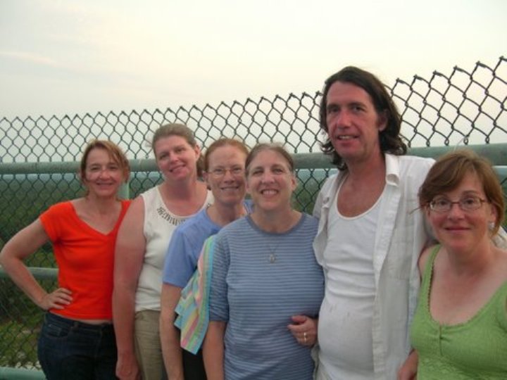
There is no shortage of trails or places to explore at the campground. I set up my big screened canopy which would provide a bug-free environment. This device was used with great success at Marshall's event on April 30 to May 2, 2010. But his group was much smaller so we all fit in. In contrast, this trip had more people than could fit under the canopy and while it could easily cover an eight-foot long picnic table, it could not cover two joined lengthwise which is what we had. Thus, it never got used. At least I got more experience in setting it up. Lisa A. arrived with her new set of wheels...a pimped-out white Toyota Scion that she calls the "Milk Truck." 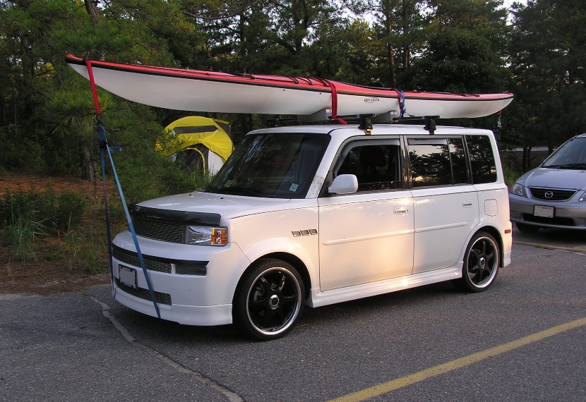
That night, we did what I call a Ralph H. potluck. 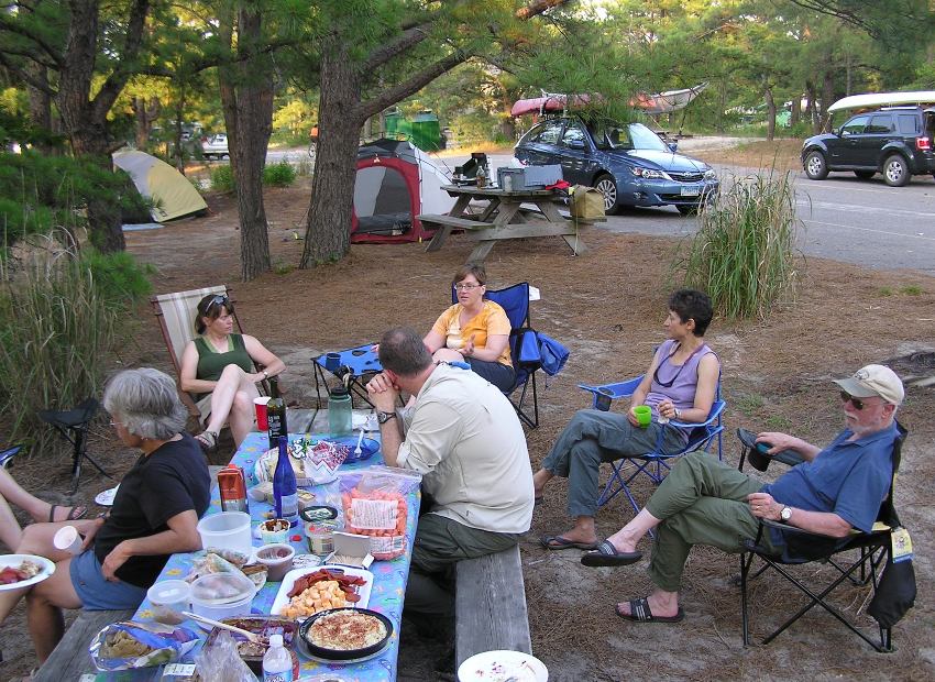
In this style of meal, we determine what folks will bring based on the first letter of their last name: One option for the evening was to go for a night paddle on the Delaware Bay. There is a place in the park where one can drive up to the beach then carry the boats to the water. From there, it is about 1.25 miles around The Point to the Atlantic Ocean. The other option was to go for another walk. Folks chose the latter. Some went to the ocean while others chose a different route. I split firewood into kindling then got a roaring fire going. We all sat around the fire, drank, and chatted. No late night party animals in our group. Most hit the rack by 2200. The campground was mostly quiet except for some snoring.  |
|
Suzanne and I asked that folks be ready to go by 0800. One thing I love about the CPA is how prompt people are. It makes it soooooo much easier to plan an event when people are like this.
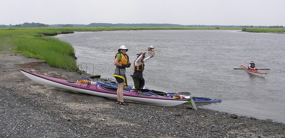
I led the kayak convoy to the Milton Broadkill River (Chandler Street) boat ramp in Milton. Here, we met Amy, Steven, and Aht, who were not camping with us. We were now at 100% (paddler count of 18 and boat count of 17). We unloaded our boats and gear. The passengers stayed at the boat launch while the drivers drove to Oyster Rocks, our takeout. Then we all piled into two large vehicles and drove back to the launch, leaving the other cars at the takeout. Our group was now ready for a journey down the Broadkill River. My first trip on it was on June 1, 2008. While much of it appeared fairly undeveloped, it had actually been used for the last few hundred years. Like the Native Americans before them, the European settlers of the 17th and 18th centuries utilized the Broadkill River as a means of transportation. Clearing of lands resulted in an abundance of grain and wood products. To transport these products to market, local craftsmen fashioned small vessels from the timbers of the prime hardwood forest that covered the land. Expanding settlement and the resulting increase of exports led to the construction of larger vessels capable of sailing to more-distant ports. As the number and size of these vessels increased, the reputation of local builders began to grow as well. - from "Shipbuilding on the Broadkill," a broken link as of 2024 |
|
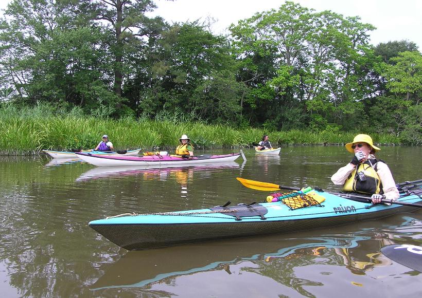
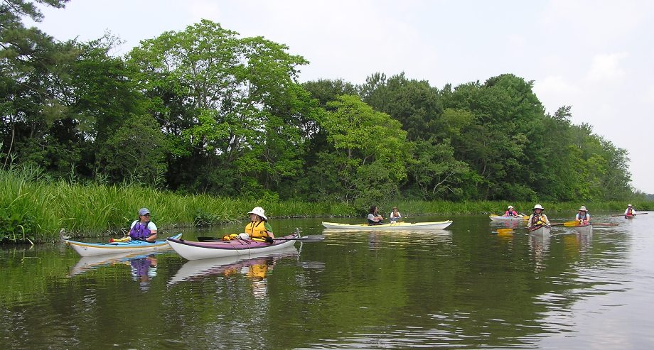
By 1000, we were on the water. From left to right below are
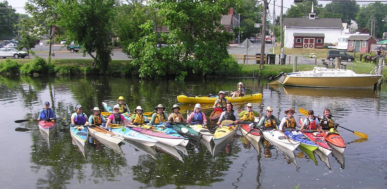
In Maryland and Delaware Canoe Trails, Gertler writes the following about the Broadkill River: The dark waters meander for the first mile past pretty, wooded, mostly swampy shores...the woods recede a bit and are replaced by a narrow margin of freshwater marsh. The marshes gradually widen and then turn to lush salt meadows which, after Rte 1, dominate the scenery. Except around Rte. 1, most of this passage is through undeveloped territory, if you do not count the numerous duck blinds. We paddled downstream, along tree-lined shores, heading east towards the Delaware Bay. 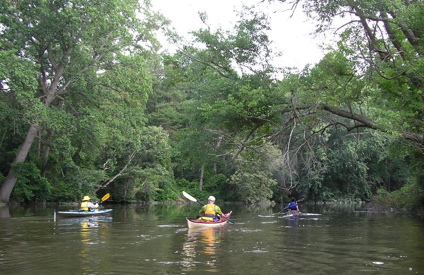
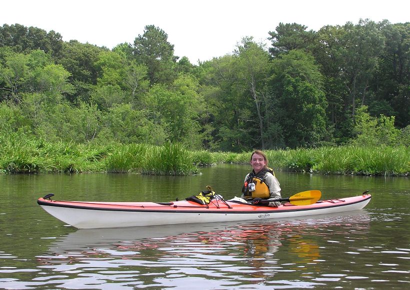
Below, Jennifer paddles her Nigel Foster Silhouette with a Greenland paddle. 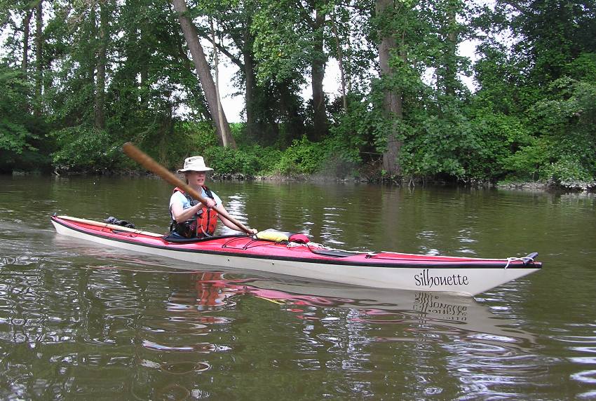
After about 1.6 miles, we passed the Edward H. McCabe Preserve on our right. This is a Nature Conservancy area that has a very small pier and some shaded trails. For anyone returning in a small group (four or less), it is worth a visit. Despite the numerous trees, there was little shade since the sun was mostly overhead. But we did manage to find a little bit near Smith Landing at mile 3.4. Here we took a short hydration break. There was little wind and a 91 degree high temperature so making time to cool off was important. Jennifer used this time to work on her rolling skills. 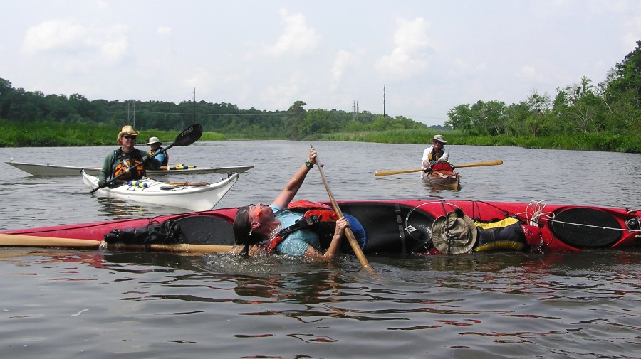
At mile 4.6, we turned south on Beaverdam Creek. Here we paddled upstream for 1.1 miles to Brickyard Road (road 257) before kayaking back downstream. We continued downstream on the Broadkill passing under Coastal Highway (Route 1). The vegetation started to change from what might be found in freshwater woodlands to reeds and grasses more typical of a salt marsh. Near mile 7.9, we pulled the boats out at Steamboat Landing RV Park and Marina. Between their two boat ramps, the marina has a small store where they sell cold drinks and snacks. Up to now, we were pretty much the only people on the water but this would all change as we saw numerous jet skis also make use of the marina. After a good rest, our adventure continued as we paddled the last few miles trying to stay clear of lots of power boat traffic. Hundreds of fiddler crabs were seen on the muddy shores. Despite their giant claw, they are harmless. This stands in contrast to the numerous greenhead flies which bite, attack, fly away, then do it all again after calling some friends. By about 1440, we were done, having paddled 12.5 miles. Talbot (Aht's husband) was there at the takeout waiting patiently for Aht. |
|
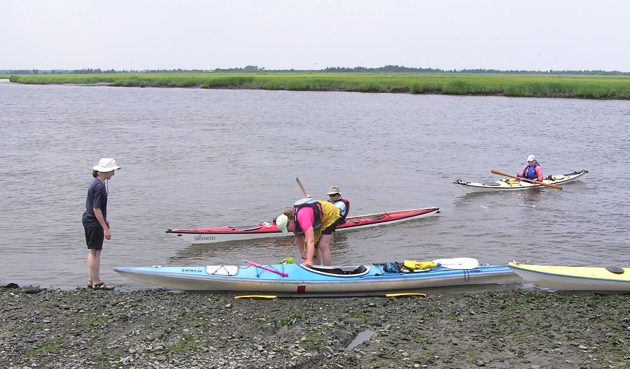
I led most of the group back to the campsite while Suzanne made sure the folks with their vehicles at the launch site were able to retrieve them. Unfortunately, that meant waiting in a shadeless, hot place.
We had plenty of time to get washed up and rested for the evening. While waiting, I found a two-inch long caterpillar grub with six orange legs and a semi-transparent outer shell. 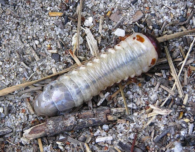
About half the group stayed at the campground while the rest of us ventured into historic Lewes for some fun on the town. This walkable historic town with waterfront views was settled by the Dutch way back in 1631! Jill, Nora, Geoff, Norma, Jennifer, Aht, Talbot, Mike, Linda, Brent and I parked then took a leisure stroll through town on Second Street. We ate at Striper Bites. They managed to seat our large group in less than ten minutes. In my opinion, dinner was good and so was the service. We walked back for a short distance on Front Street along the water. Then we stopped in at King's Homemade Ice Cream for dessert. Before heading back, we checked out Saint Peter's Episcopal Church. Actually, we just checked out the graveyard. This church has been in existence since 1680! Upon returning to the campground, I got another roaring fire going (not really roaring). I guess Suzanne and I wore out much of the group since so many were in their tents way early. |
|
Mike, Linda, and Norma left in the morning. Too bad since they missed the most scenic part of the weekend, the Prime Hook National Wildlife Refuge Canoe Trail. Gertler describes this as
...one of the nicest canoe streams in Delaware. This is one tidal stream that remains mostly narrow and is usually sheltered, as it is snugly guarded by either forest or tall reeds. And although it is tidal, the range is small and the current relatively weak. You will never find a more forgiving stream near the shores of Delaware Bay. We packed up our gear and left the campsite at around 0820. Since the launch site is only eight feet wide, Suzanne suggested I take the first half of the group then she would follow up with the second half a little later. This worked like a charm. We pulled into a small dirt road loop at Brumbley Family Park where we unloaded our boats quickly then moved on to make room for the next vehicle. After my group was done, we left the passengers at the launch site then drove to the takeout at Prime Hook National Wildlife Refuge. We then piled in one car which we took back to the put in. Suzanne did the same thing with her group. It worked so smoothly, that we were actually ahead of schedule. By about 0940 we started launching on Prime Hook Creek. Kayakers paddled through a shaded tree canopy for a short distance. 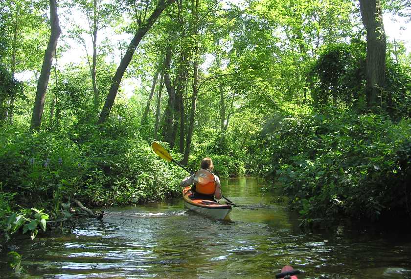
Then they emerged on the main part of the creek about 250 feet away. 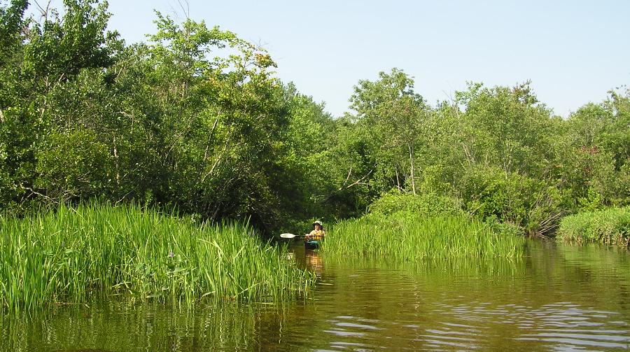
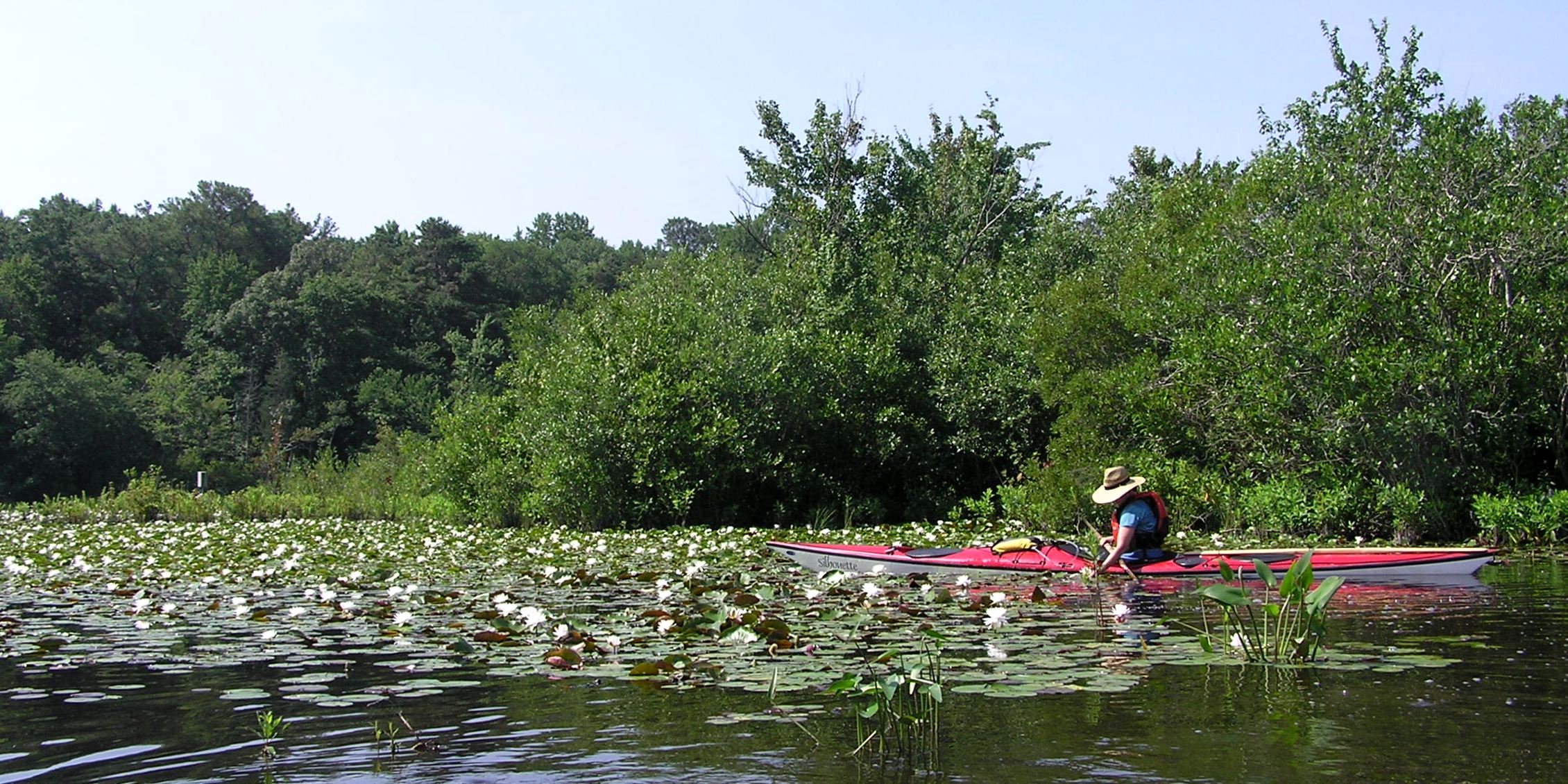
After heading downstream for maybe a half mile, we came to a pond on the right packed to the gills with white flowers. See the photo at the top of this page. The creek opened up a good bit then got narrow again. It was often hard to get two boats to paddle side-by-side without risking collision after a few minutes. 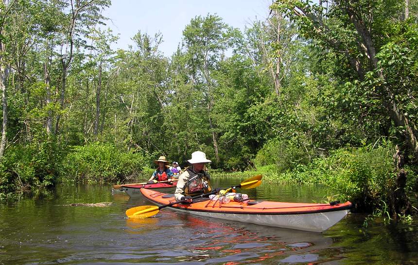
Many turtles were seen, some on logs and rocks above water and others seen poking their noses out above the water until we approached. We also saw about five beaver lodges. What we didn't see were many other boats. There were at least a couple of kayakers that were not part of our group but I don't recall any power boats. This was a nice contrast to the last third of yesterday's trip. There was only one huli (capsize) for the whole weekend. It occurred after someone hit a log on the creek. There were many just above or just below the water line. I don't know of any part of the creek deep enough to not touch bottom but at the same time, I certainly wouldn't want to touch bottom since it is very soft and a little smelly. I helped do a rescue by simply holding the boat steady while the kayaker got back in. No paddle float needed as there was a submerged log to stand on. Easy as pie. Numerous ospreys, herons, and red wing blackbirds were seen. I think I might have even seen a bald eagle but I'm not totally sure as it flew off before I could positively identify it. Lots of fish jumped out of the water as we passed by. As with yesterday, the landscape changed from woodlands to a mix of trees and reeds then to more marsh-like grasses. There were also some tall plants called Phragmites australis. Sometimes called feathergrass or common reed, Phragmites is an invasive plant that grows in dense stands that crowd out other plants. Because most wildlife prefer other kinds of plants and dense stands of Phragmites are at high risk of wildfire, the refuge controls its spread through a variety of methods. - from Prime Hook National Wildlife Refuge Canoe Trail pamphlet The section I found most unusual was the transition between the woods and the grasslands. I saw numerous dead trees. It appeared as if the conditions were once right for trees to grow but then something changed which killed them. Notice some of the trees in the background in the below pic. 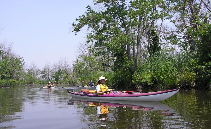
I also saw some orange string-like vegetation which I could not identify. It looked like salt marsh dodder which I saw on my May 27, 2010 visit to California but I didn't think this plant lives on the east coast. Later, Steven told me it is indeed dodder. 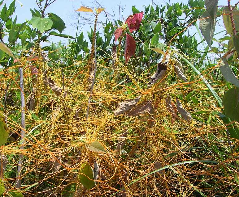
Yesterday was hot and today was even hotter...96 degrees! We took a break with most of us taking shelter under a tree. Aht inflated her paddle float and used it to help her dip half her body into the water too cool off. Yesterday, Norma and I paddled my Ocean Kayak Cabo, a tandem sit-on-top. But with her leaving (with the tandem), I decided to use my Prijon Catalina. At just over 15 feet long and plastic, this was a good boat for this trip which had a few obstacles and several tight turns. However, I sometimes forget that I am not paddling a sit-on-top. 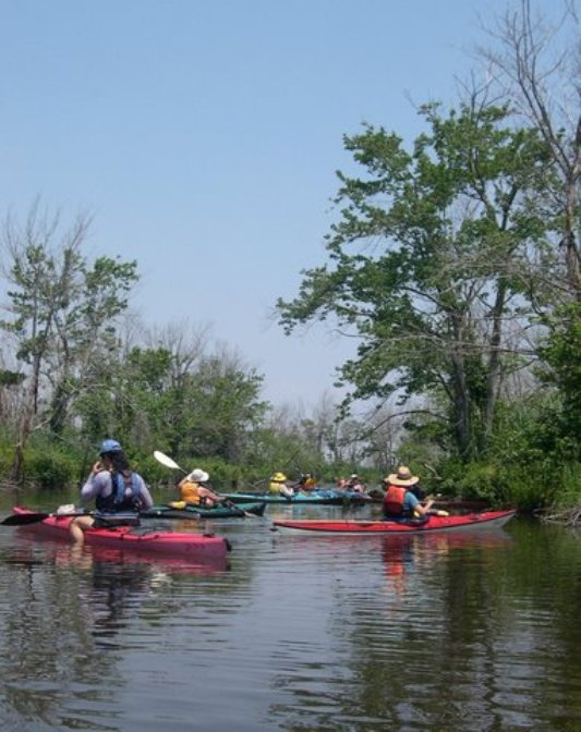
As we neared the end, the trees became much less abundant. 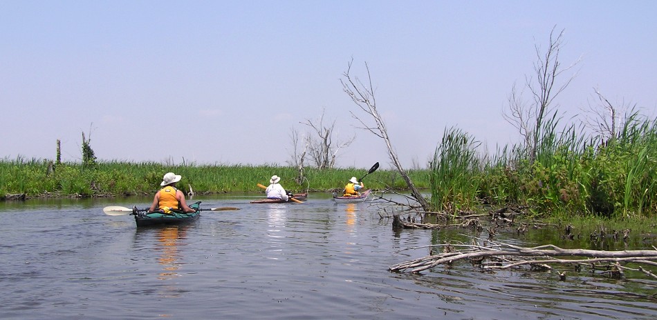
At mile 6.1, we veered right to follow Petersfield Ditch for a half mile. After another 0.6 miles, we turned right at an observation platform. Here things got very shallow. But strangely, the trees returned. 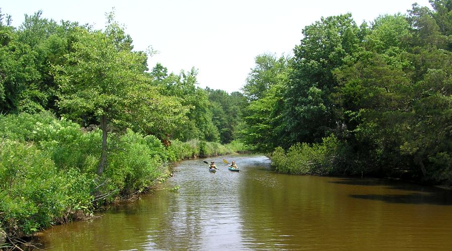
After another half mile we were done. By 1240, we completed 7.25 miles. Folks with vehicles at the launch site retrieved them. Then we posed for one final group pic. 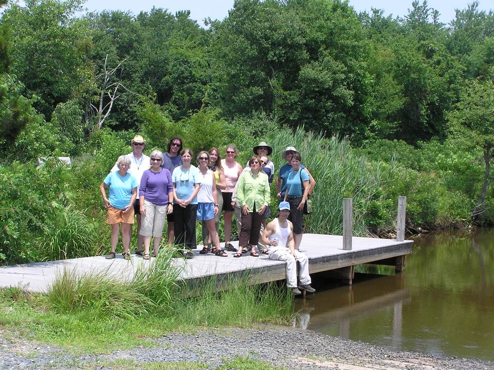
|
|
It was a great weekend. It would have been nicer had it been ten degrees cooler but still it was great.
I would like to lead/co-lead CPA trips in the future. Maybe one per year. People seem to enjoy it and I like the people who participate. I was told afterwards that things appeared to have run very smoothly...even seamlessly. As with any big coordinated event, this is the result of planning and preparation. Suzanne and I kept each other on the ball, each making suggestions and questioning the other if we felt something could be done a better way. I think we make a good team. |
