|
This page is about the Thanksgiving 2011 weekend that Norma and I spent in western Maryland and the surrounding area. |

|
This page is about the Thanksgiving 2011 weekend that Norma and I spent in western Maryland and the surrounding area. |
|
Thanksgiving weekend is a time to spend with family. But since mine are in California, I've adopted Norma's family as my own. They have welcomed me into their homes and hearts so now I am fortunate to have a family on both sides of the country.
Jimmy (Norma's brother-in-law) has a big family and they celebrate Thanksgiving on Thanksgiving Day (what a great idea). Hence, Joyce (Norma's sister) and Jimmy are unable to join the rest of us for Thanksgiving dinner. Thus, we celebrate Thanksgiving the day after. This works similarly for other holidays. As a result, Norma and I were able to drive out to Hazel's house (Norma's mother) at a leisurely pace.  |
|
Along the way, we stopped at Williamsport and walked along the Chesapeake and Ohio (C&O) Towpath starting at Cushwa Basin. The last time I was here was on June 6, 2009.
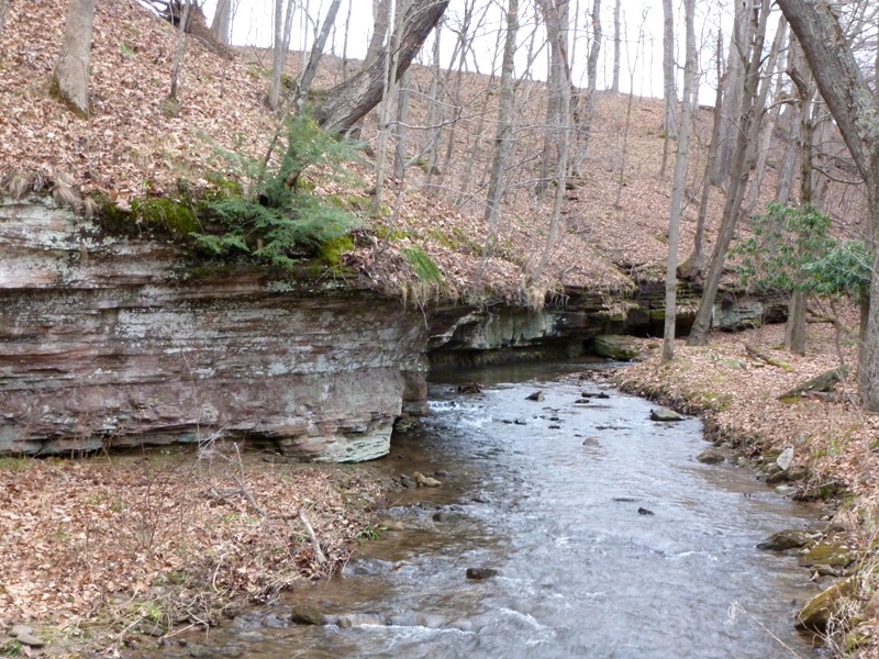
Williamsport is a quaint little town that could have been a major metropolis had things turned out differently. Situated at the confluence of the Conococheague Creek and the Potomac River, Williamsport was first settled in 1740. In 1790, George Washington considered it for the capital city of the United States, but rejected Williamsport because of the inability of large ships to navigate the Potomac to this point. - from Williamsport Visitor Center From Potomac Park, we walked south on the towpath, watching the strong downstream current of the Potomac River. It looked unusually high for this time of year. Living in Maryland, I tend to take the C&O Canal area for granted, often just thinking of it as a recreational area. But it was at one time a major mode of transportation, and Williamsport played a vital role in all this. Williamsport is located near the midway point of the 184.5 mile-long C&O Canal. Cushwa Basin was a turning basin where the 90 or 95 foot-long canal boats could turn around, one of only a few along the length of the canal system. This allowed boats not heading all the way to Washington to unload cargo before returning to the western terminus. - from sign on towpath Not many bicyclists were out, but plenty of folks were out with their dogs. Being dog people, we made an effort to greet each and every one. Norma found a big hollow tree and climbed inside to investigate. No pot of gold at the bottom. 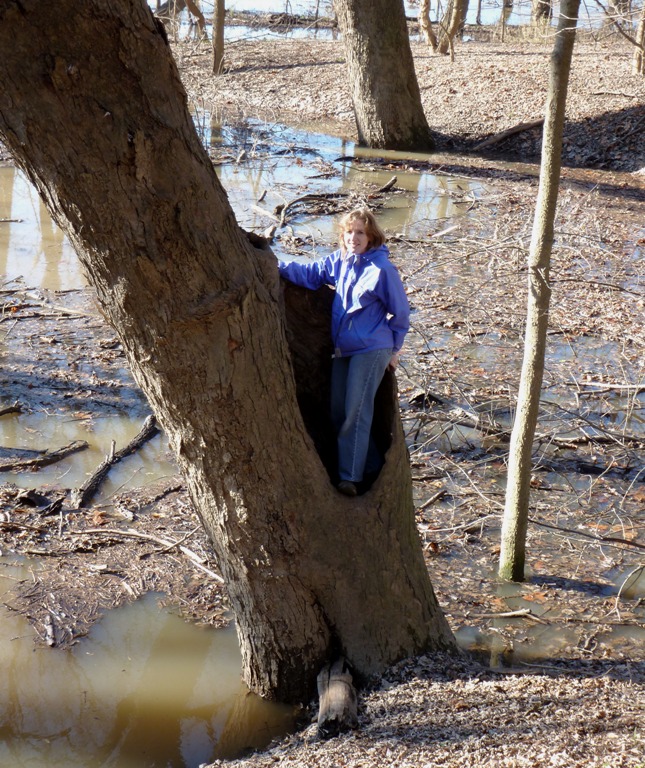
I saw a chickadee. There were other interesting birds and bird sounds. If Stacy were with us, she'd be able to identify them all. 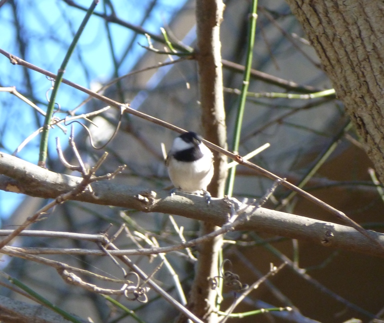
We took a slightly different route back, stopping at the River View Cemetary. 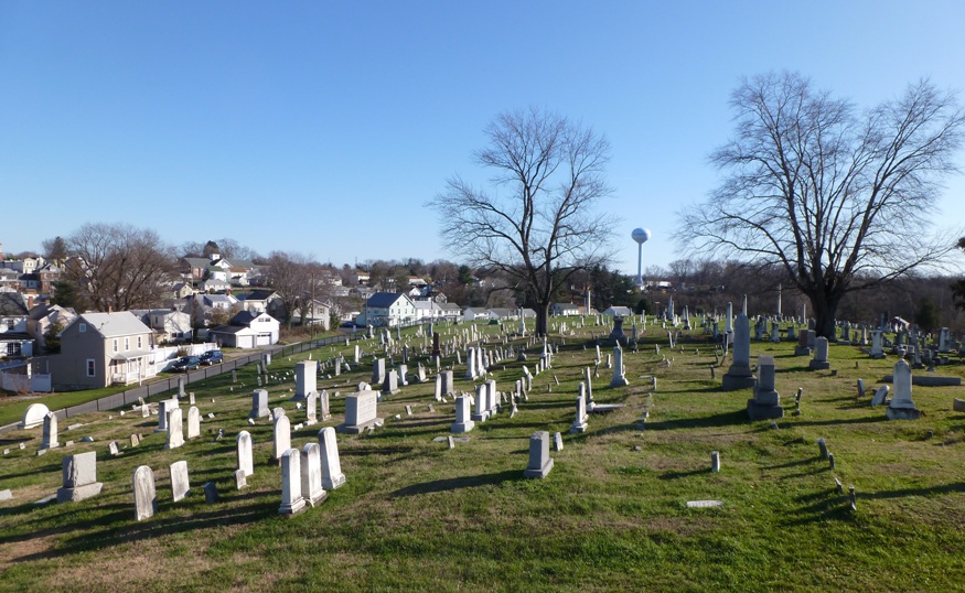
We walked up on Doubleday Hill, named after Major General Abner Doubleday. While a Captain in the Union Army, during the Civil War, he [Abner Doubleday] crossed the Potomac River, at Williamsport, in 1861 and built a breastwork, mounting three siege guns, on this hill, now known as Doubleday Hill. He is credited with inventing the game of baseball in 1835. - from sign at Doubleday Hill We only walked about three miles but it was enough to break up the 3.5 hour long drive to Hazel's house, make us feel like we got a little exercise, and satisfy our urge to get outside on such a nice day. |
|
After getting a ridiculous amount of sleep, I studied my Garrett County ADC map, then set out to look for launch sites on the North Branch of the Potomac River. I've been to Garrett County more times than I can remember over the last five years, and every time we drive over a river, I look to see what it might be like for kayaking. Now I had some time to myself and could do a little exploring. Had I planned properly, I would have brought Ed Gertler's Maryland and Delaware Canoe Trails book. But I did consult it after I got home.
The North Branch of the Potomac, as a matter of historical tradition, is considered the headwaters of the Potomac. This proves to be an embarrassing origin for our "national river." The North Branch has suffered decades of abuse, pollution, and devastation...The price of this development has been half a river poisoned to death by acid mine drainage, hillsides scarred by mining and pollution, and a valley filled with stinking air. - from Maryland and Delaware Canoe Trails But Gertler later mentions ...the times are changing rapidly...the blighted areas are shrinking, and in between are miles of beautiful and natural riverscape and acres of land that have healed over from past abuses. Based on my limited observations, I would agree that much of the land has recovered very nicely. |
|
I drove south to the town of Gorman then crossed the Potomac into West Virginia and pulled over at the town of Gormania. Here I found a little dirt road just off the main street that leads to the river. The water was moving at about four mph and looked high. No rocks or downed trees yet the river was only about 30 feet across. It was very scenic and certainly launchable though a bit muddy and rocky.
This was not an official site by any means...just a piece of public property with river access...but that's all I really need. I deemed this the Gormania launch site. Gertler mentions Gormania as a take out for an 8.4 mile route with class I to III rapids. Near the launch, it is all class I. 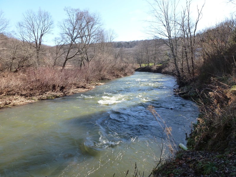
I'm not sure where the class III starts...probably a good bit downstream. Sadly, class III is beyond my comfort and skill level. |
|
Before crossing back over the river into Maryland, I was greeted by a "Welcome to Maryland" sign along with a historical note:
State of Maryland: Named for Queen Henrietta Maria, the wife of Charles I, who gave a royal charter to Cecil Calvert, second Lord Baltimore, in 1632. First settlement at Saint Mary's City in 1634. It was one of the 13 original colonies. I followed the North Branch downstream along Steyr Gorman Road. Here's a view from it of the water. 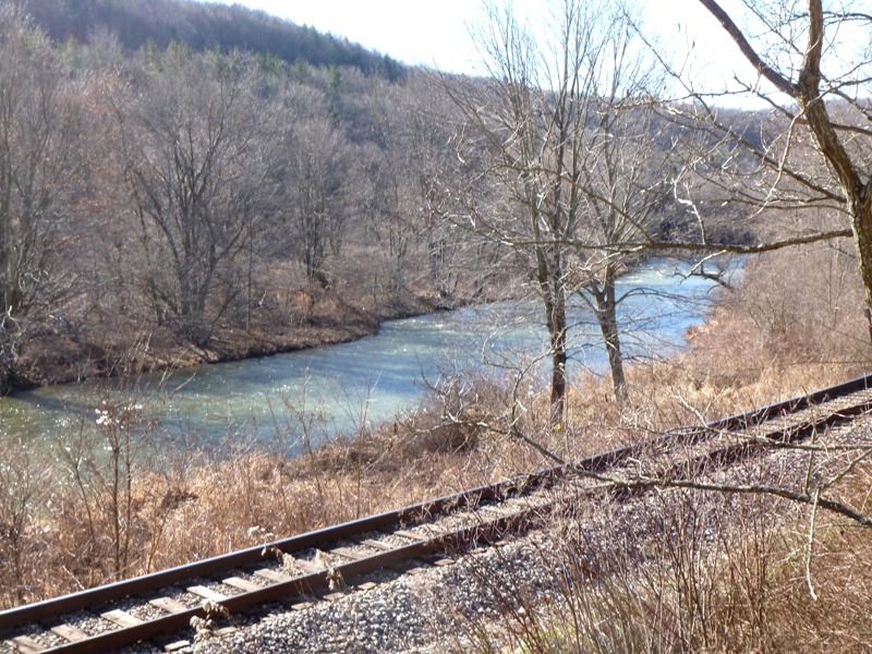
I stopped to watch a garter snake crossing the road. I hurried it along to ensure it didn't end up as roadkill. 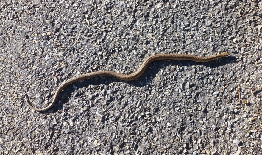
As I turned north on White Church Steyr Road, I thought to myself that this area would make for a nice bike ride. These rural roads are full of trees and fields. Unfortunately, they are also often lacking in road signs so I'd want to make sure to put together a detailed cue sheet if attempting to navigate this area via bike. |
|
My next stop was Potomac State Forest where Norma and I last visited on March 25, 2007. Back then, the water on the North Branch of the Potomac River was high and paddling conditions were suitable only for experienced whitewater kayakers (not me). Today, the conditions were similar, though maybe not quite so extreme. I climbed to an overlook to get a better view.
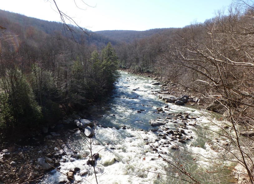
If I absolutely had to tackle this section of the river below where Lost Land Run enters, I would try to stay to the left (Maryland side). I thought maybe things would be much easier when the water was lower but I later learned that this section is known for having up to difficult class IV rapids. Definitely not for me. But if you are a really good whitewater paddler, consider launching at what I call the Lost Land Run launch site. It is very primitive but at least you can park nearby and get to the water without having to get tangled up in the brush. I also made a quick stop to check out Cascade Falls further upstream on Lost Land Run, well before it flows into the North Branch. 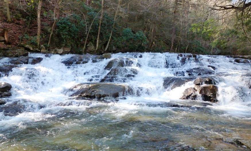
|
|
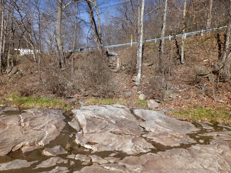
The last launch site I explored on the North Branch was just upstream (southwest) of Kitzmiller. Wolfden Run flows to the river but passes through a drainage pipe under Shallmar Road along the way. It is here where one can park and carry down to the river (shown in photo below). Again, it is quite primitive but doable. See Kitzmiller launch site.
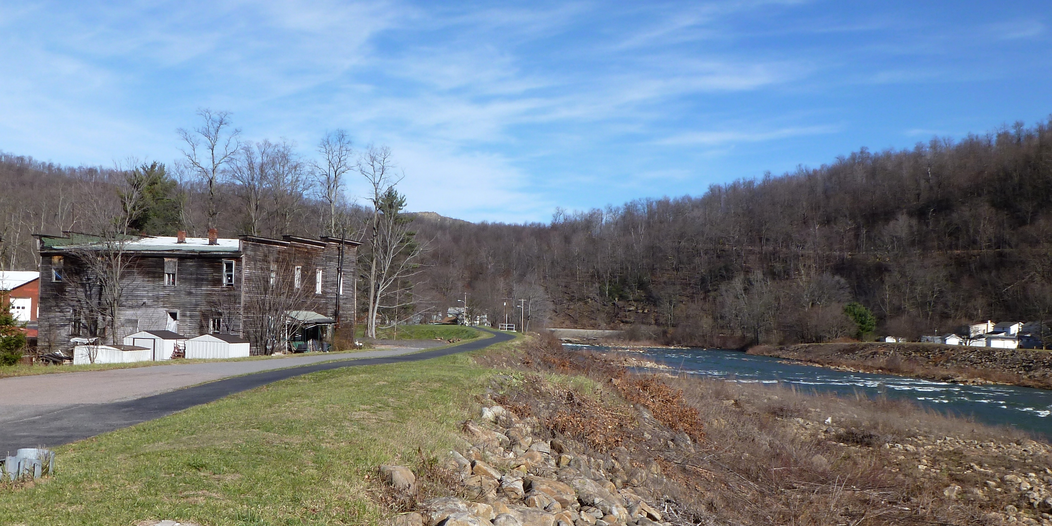
Since I was in the area, I drove to Kitzmiller and looked around town. It is a pretty place where I felt a strong sense of community. They also have a River Walk Trail that runs along the North Branch. The cover photo shows a view of the North Branch at Kitzmiller and the River Walk Trail. |
|
My map shows a boat launch at Jennings Randolf Lake. I didn't go there as I was running out of time but I thought I should mention it. I'm not much into lake paddling but, this is created by a dam on the North Branch. Hence, the Jennings Randolf Lake launch site could make for a take-out if paddling downstream from the previously mentioned areas. Sadly, even the route from Kitzmiller to the lake has up to class III rapids. So it seems no part of the North Branch of the Potomac River in Garrett County is suitable for a kayaker without good whitewater skills.
|
|
I drove back to Hazel's house and ate a nice Thanksgiving dinner with Hazel, Norma, Jimmy, Joyce, Joyce and Jimmy's foster baby, Laah (Norma's youngest sister), Scott (Laah's husband), and Carl (a friend of the family). Then, some of us played Pit. Norma did quite well. We switched to playing Blokus and then I did much better.
|
|
I spent a good deal of time on-line reading about the Youghiogheny River. In Pennsylvania,
The Youghiogheny, usually referred to as the "Yough," is a classic Appalachian River featuring incredible scenery, spectacular rapids and waterfalls, huge boulders, and deep pools. It is one of most famous, and popular rivers in the eastern United States. - from Paddling Pennsylvania: Canoeing and Kayaking the Keystone State's Rivers and Lakes by Jeff Mitchell Despite all the wonderful things to see, my curiosity of the Yough (pronounced "yock") was driven primarily by kayaking interests. Surprised? Mitchell says that the Ramcat Access to Ohiopyle is rated as class I and II rapids, which makes it relatively safe for kayakers like myself. However, Youghiogheny River Water Trail - South Map (which states that this section, called the "Middle Yough") has some class II to III parts. Perhaps the difference is subjective or based on water levels. The Middle Yough is about 11 miles long. I found a great website where I can request Pennsylvania kayaking maps from Pennsylvania Fish and Boat Commission Free Publications (a broken link as of 2016). As the name suggests, they are absolutely free. But my interests were closer to home...Maryland to be exact...Garrett county, more specifically. Unfortunately, kayaking on the Yough isn't as well documented in Maryland as in Pennsylvania. Still, I managed to find a source that mentions a relatively calm section. At Hoyes Run, a relatively smooth stretch of river can be found all the way to Gap Falls, just north of Sang Run. At that point, the most rugged and inaccessible section of the river runs wild and free to the town limits of Friendsville, dropping in elevation an average of over 100 feet per mile. - from Youghiogheny Scenic & Wild River From Hoyes Run to Sang Run, it is 3.25 miles. To Gap Falls, it is another 2.4 miles. Unfortunately, there is no place to take out at Gap Falls. Looking at satellite photos supports the above claim. In summary, unless you want a very short 3.25 mile trip without drama, it is probably not worth your time to launch on the Yough in Maryland. If you know otherwise, I would like to know. |
|
I found mention of a trail along this 3.25 mile section. It piqued my interest so Norma and I set out to explore it on foot. We started at Hoyes Run just a little after 1300.
We walked on a path that heads north (downstream) on the east side of the Yough. We saw some interesting rock formations. 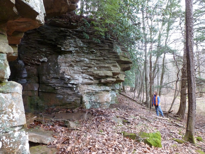
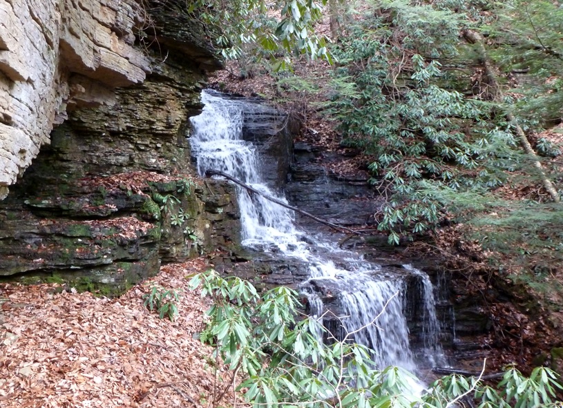
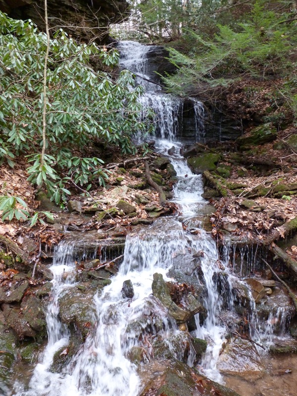
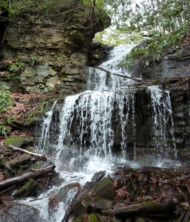
There were also some small, scenic waterfalls. 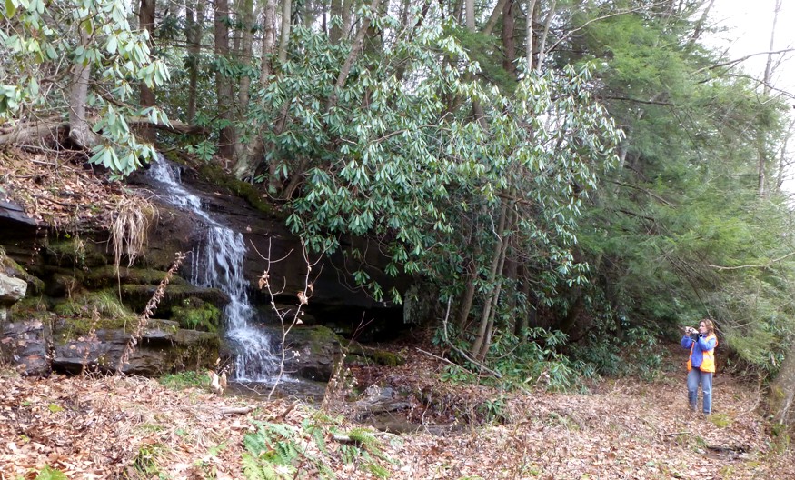
This trail is pretty much unknown in most of the hiking community, but I believe trout fishermen know about it. There was quite a bit of recent beaver activity in the area, though no dams or lodges to be found. 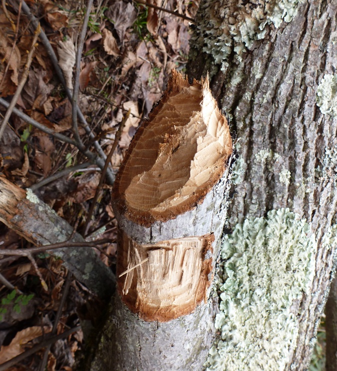
After about 0.75 miles (at longitude 39.53833, latitude -79.41443), we came to a really impressive waterfall on the east side of the trail. We could see it easily from the trail but we had to do a little climbing to get close to it. I later found out that it isn't exactly natural, though that doesn't affect how pretty it is. It comes from a drainage pipe that directs water under Oakland Sang Run Road, only about 600 feet away. The Yough in this area was wide and flowing at about five mph. There were only a few rocks sticking above the waterline. Norma spotted some intricately patterned fungus growing on a log. 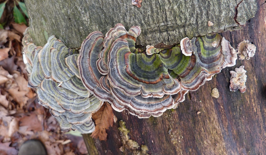
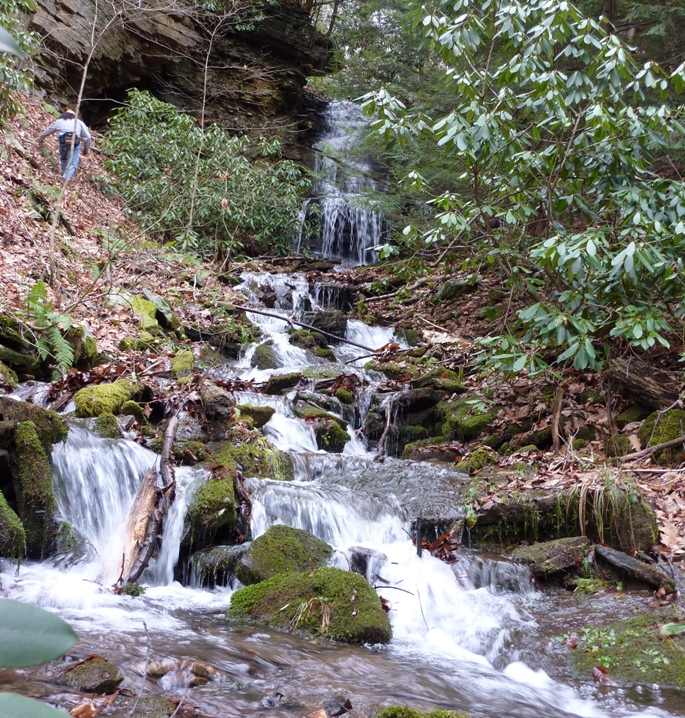
Continuing north (around mile 1.3), we came to a section where most all the trees had fallen. 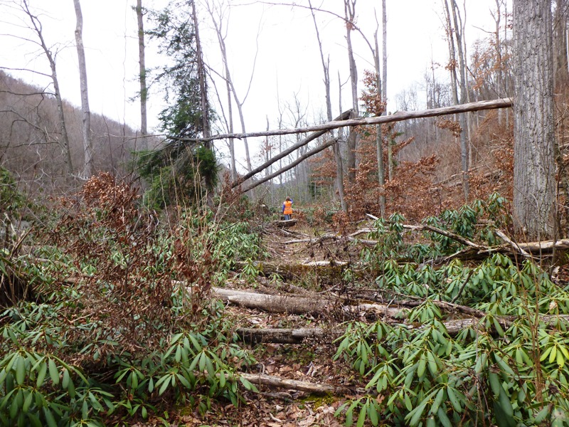
A little further ahead, breyers were taking their place. This slowed us down to a crawl pace...really...I think the foster baby could crawl faster than we could walk through that section. To say the trail is unmaintained is an understatement. This went on for about a quarter of a mile. I don't recommend going this way anytime in the near future. Instead, just do an out-and-back. It will save you lots of frustration. But Norma insisted we venture on and after awhile, we were past the worst part. There were lots of trees with blue marks, indicating we were on or bordering private property. Yet my Maryland Department of Natural Resources - Western Maryland on-line source said this was public property. It is hard to say who was right being as we stopped seeing public fishing signs and the trail seemed to disappear. But after spending so much time getting through the breyers, we were beyond the point of no return. Venturing onward was the only logical choice. As we got closer to Sang Run, we again saw public fishing signs and picked up the trail. We saw one hunter with a .308 caliber Saiga, a rifle that I had never heard of before. Very pretty gun...at least his pimped-out version was. The Sang Run area was nice, to say the least. There is a fee to launch (honor system) and plenty of parking. There are porta-johns and picnic tables. The actual launch site is just south of the Sang Run Road bridge on the east side. Check out the launch area below. 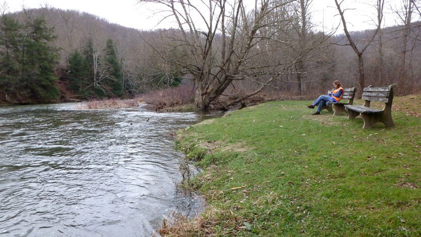
A sign at the launch area warns of class IV and V rapids downstream of the bridge. But the 3.25 mile section from Hoyes Run to Sang Run is easy. The fast, rushing current at the start slowed down to a quiet two mph current near the end. Here's me next to some slow moving water. 
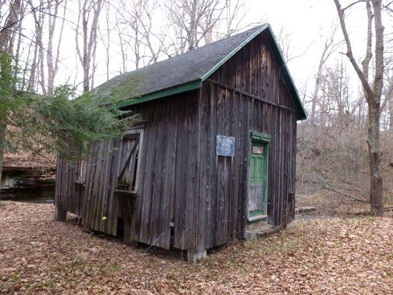
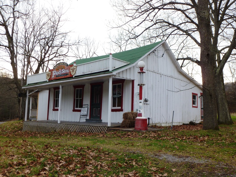
It took us about 2.5 hours to go three miles because of all the breyers. Not wanting to make our way back along this same path, Norma and I walked south on Oakland Sang Run Road to the start. Much faster. We passed Sang Run and some historic structures in the community, including the Election House which had been in operation from 1872 to 1972 along with the Friends Store established in 1769. Further south on the road, we saw about a dozen deer, ten wild turkey, and a bat. No bucks. We finished a little after sunset, having walked seven miles. Back at Hazel's house, we played more Blokus. That is my favorite game. No dice. No cards. No element of chance. Just skill. |
|
I looked for more on-line information about rivers in Garrett County. One that we have driven over countless times is the Casselman River. Unfortunately, like the Yough, most of the information I found was about the sections it flows through in Pennsylvania, not Maryland.
One route in Pennsylvania is the section from Markelton, Pennsylvania to Fort Hill. This has Class II and III rapids. River conditions can be found at Markelton, Pennsylvania. The most promising part of the Casselman in Maryland is described at Maryland whitewater, Casselman River. This is an 11.5-mile long section from route 485 in Maryland to Salisbury, Pennsylvania. Where is route 485? I have no idea. I am guessing this is a misprint. More likely, it is route 495, aka Bittinger Road, probably near Fireclay Road or at the Maple Grove Road bridge. This route goes by Casselman River Bridge State Park then into Pennsylvania. The take-out is also a little unclear but it is downstream (north) of Salisbury. It looks like it is either Depot Street or Ord Street. The latter looks to have more parking available (based on satellite photos). Further downstream is Post Office Street, which, not surprisingly, is near a post office. On Sunday, the post office probably won't mind if you park in their lot. Maybe on a return trip to Garrett County, I'll have time to scout this section. It sounds quite promising. After I got home, I found this route in "Maryland and Delaware Canoe Trails." The Casselman River is the Youghiogheny's largest tributary, born at the confluence of the North and South branches and joining the Yough about 10 river miles north of the Mason-Dixon Line at Confluence, Pennsylvania. As it cuts into the Yough gorge, it creates miles of good scenery and novice to intermediate whitewater. But the initial miles in Maryland are relatively tame and make a fine run for novices...The stream flows through a Mennonite and Amish enclave...in some of the valley's attractive barn architecture... Gertler rates this trip as having class I to easy class II rapids. Right up my alley. But this area is prone to getting too low for easy paddling, so I'll first consult USGS Real-Time Water Data - Casselman River at Grantsville, Maryland before launching. Gertler also mentions things to do in the area. One activity he lists is the Buckwheat Festival in West Virginia. Interestingly, Norma's brother-in-law, Scott, was once the "Buckwheat King." Another place to paddle that looks promising is Town Creek which has a 27 mile class I route from Flintstone to the Potomac River. It is not in Garrett County but rather in the neighboring Allegheny County to the east. As with the Casselman, when I got home, I looked up this route in "the good book." Woodlands and small farms dominate the valley scenery, and there are some pretty cliffs here and there. The impression is that you are far from any place important or busy. - from Maryland and Delaware Canoe Trails |
|
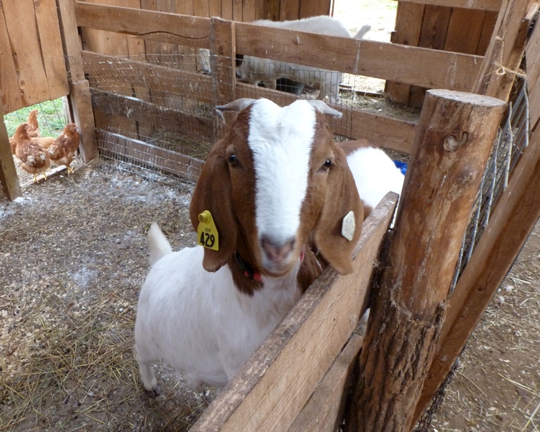
Norma and I left Hazel's house in the morning then drove to Laah and Scott's house on the farm. I saw their new chickens and goats.
I also got a chance to see the eight point buck that Scott shot yesterday. He and Carl were butchering it. About two dozen louse flies left the head after it (the deer) was decapitated. 
Scott was generous enough to give us several bags of fresh venison before we made the long trip back. Yum. In addition to deer meat, we hauled several pounds of pig that was raised on the farm. When we got home, my good friend Jenn drove over in her new Hyundai Veloster to buy half the pig. She showed up with a superfantastic gift for me. It was a bear pizza. Her co-worker shot a black bear in Pennsylvania and gave her a portion of the meat. She used some of the ground bear to make a delicious pizza for me, which I savored over the next few days. It is darker and leaner than beef and tastes similar. Not gamey. But what is interesting is that 24 hours after eating it, I had one of the best weightlifting workouts I'd had in months. I felt crazy strong. Maybe it was just psychological...then again, maybe it wasn't. |
|
In my days of doing research, I've learned that you don't always reach the conclusions you wanted. That doesn't mean you fail. You actually succeed if you come to a conclusion then document it for the rest of the world to see.
I set out to find long stretches of flatwater and class I/II rapids in the rivers of Garrett County. What I found was one 3.25-mile portion on the Youghiogheny and a longer section on the Casselman, of which about 8.5 miles is in the county. Though I have passed by the Casselman and even walked along it for maybe a tenth of a mile, I really haven't had a chance to see much of it up close and personal. Outside of the county, Town Creek (which I have never seen) offers promise with at least 27 miles of water that even a non-whitewater paddler such as myself would find suitable. I look forward to returning to continue scouting. As with many of my trips, when one door closes, another opens. Despite me not finding exactly what I wanted, I still had a good time. I got to spend time with loved ones and do some exploring. The weather was nice and I even got to add a couple of places to my list of future possible creeks to explore. Plus, our trip ended with some tasty and exotic cuisine. So overall, it was good. |
