|
This page is about the Chesapeake and Ohio (C&O) Towpath bike ride that Carmen and I did in October 2015. |

|
This page is about the Chesapeake and Ohio (C&O) Towpath bike ride that Carmen and I did in October 2015. |
|
On August 23, 2015, Team SNaCk got together for a trip to Patterson Park in Baltimore. At that time, Carmen mentioned that she wanted to bike the entire C&O Towpath and she asked if Norma and I wanted to join her. Norma had already biked it but I had not though I had expressed a desire to do so in months past. So Norma suggested I join Carmen without her. I told Carmen to count me in and over the next several weeks, we started making plans.
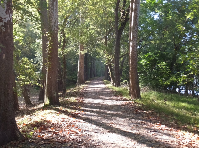
What is the C&O Towpath and why was it built? The towpath is a packed dirt trail which was constructed...along the Chesapeake and Ohio Canal so that horses could pull barges filled with coal, lumber and agricultural products down the canal to market. - from Biking the Chesapeake & Ohio Canal (a broken link as of 2020) The 184.5 mile long Chesapeake & Ohio Canal is located along the north bank of the Potomac River, starting in Washington, D.C. and ending in Cumberland, MD. The canal was built between 1828 and 1850, and it operated sporadically between floods until 1924. In 1954, U.S. Supreme Court Justice William O. Douglas organized an eight day hike up the canal's towpath in an effort to save it from being converted to a parkway. His efforts succeeded, and in 1971 the canal became a National Historic Park. - from The C&O Canal Bicycling Guide Much of the above is known to many people in the area. But what fewer know is how the C&O Towpath was part of a dying mode of transportation which finally yielded to something newer and more efficient which would link our growing country and help make westward expansion possible. This all started on July 4, 1828 with a construction race to Cumberland. On that Independence Day, ground was broken for both the Baltimore and Ohio (B&O) Railroad and the Chesapeake and Ohio (C&O) Canal. Two important historical figures were involved in the ceremonies. Charles Carroll of Carrollton, the last surviving signer of the Declaration of Independence, helped turn the first shovelful of dirt for the pioneer B&O Railroad in Baltimore. Almost simultaneously in Georgetown, John Quincy Adams, sixth President of the United States, officiated at the groundbreaking for the C&O Canal. Along the proposed path of the canal, thousands of laborers toiled with pick axes, shovels, mule scoops, wheel barrows, and black powder. An engineering marvel was carved out of the Potomac River's north bank. Initially not considered a serious rival, the B&O Railroad picked up momentum and was soon competing with the canal for property rights. The construction routes of the two companies collided at Point of Rocks, in Frederick County, Maryland. The bitter battle for the narrow right of way drained countless dollars and caused a four year delay before the courts ruled in January 1832 in favor of the canal's appeal. However, the B&O reached Cumberland first, as the first train arrived on November 1, 1842. Construction of the 184-mile canal took much longer, and it did not reach Cumberland until October 10, 1850. - from The C&O and B&O Essay (a broken link as of 2024) The railroad proved to be very successful, especially the B&O. The B&O was the first railroad to challenge to the country's major canals for western trade. It was also the first regional railroad with a projected route over the mountains to the Ohio River. It had completed this feat by Christmas Eve 1852, reached St. Louis, Missouri by 1857, and connected to Chicago, Illinois by 1874. - from "The C&O and B&O Essay" Not only was the B&O a great engineering feat, it was also an excellent business endeavor. ...the railroad grew from a capital of $3 million in 1827 to a large enterprise generating $2.7 million of annual profit on its 380 miles of track in 1854, with 19 million passenger miles. The railroad fed tens of millions of dollars of shipments to and from Baltimore and its growing hinterland, thus making the city the commercial and financial capital of the region south of Philadelphia. - from Wikipedia - Baltimore and Ohio Railroad In contrast, the C&O was not so successful, although it did play a vital role in our country's growth. The C&O Canal, which operated between Cumberland and Georgetown for 74 years, was also an important commercial link between the East and the West. The project cost investors $14 million, the same percentage of Gross National Product as the Federal government spent putting a man on the moon the following century. Canal business grew slowly, delayed by seasonal floods, then threats to commerce during the Civil War. At its peak around 1870, 750 canal boats hauled 663,500 tons of freight mostly coal, flour, iron, and limestone products. The rich harvest of coal from western Allegany County mines became the mainstay of canal shipping. In 1870, canal boats moved almost a million tons of freight, not only coal, but also building materials, lumber, and flour from local mills. - from "The C&O and B&O Essay" Eventually, the canal proved too costly to maintain. In 1889, a devastating flood destroyed the canal. For 18 months, no boats could move and the canal company went bankrupt. The B&O Railroad took over receivership under the name of the Consolidaton Coal Company. In return for restoring operations, control of the canal passed into the hands of the railroad directors. As the canal's freight business dwindled, the receivers sold parts of the basins. By the early 1920s, railroads made the slow-moving canal boats obsolete. The canal closed in 1924 after a flood destroyed much of its banks and locks. - from "Wikipedia - Baltimore and Ohio Railroad"  |
|
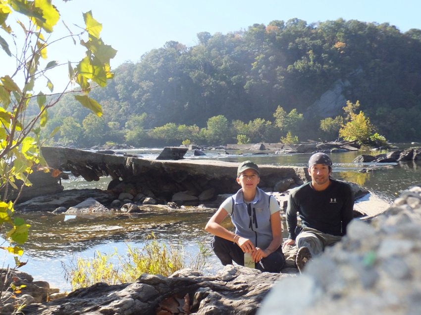
Carmen did the organizing of this trip. My job was to simply come along, have fun, and keep up with her.
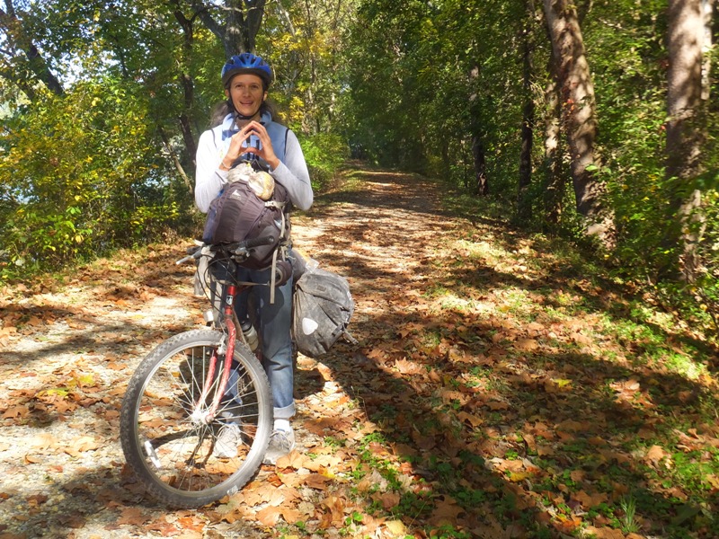
She arrived in Cumberland on October 8 for work. I met up with her the following day, after taking BayRunner Shuttle - Baltimore to Cumberland to my destination. This proved to be a convenient and efficient method to get my bicycle, gear, and myself near the trailhead. It cost me $67. I suggest calling rather than paying on-line so that you can let them know you will be bringing a bicycle. I arrived at the Cumberland Amtrak station around 1500. Carmen met me there with her Trek 820 Antelope mountain bike. 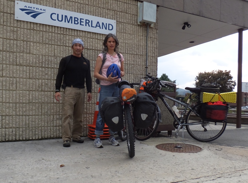
After loading up my Trek 7200 hybrid bike, we biked a short distance to the Cumberland Visitor Center, where the trailhead is located. 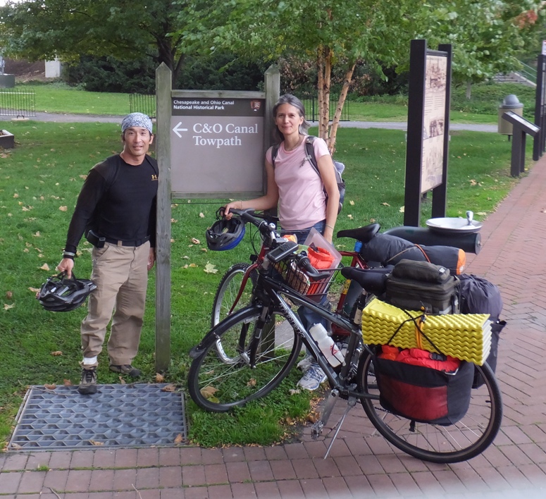
If you have time to spend at the Visitor Center, you might learn about the history of the town and its significance as a transportation hub. Long before the railroad and canal reached Cumberland, this city had a special role as the starting point for the first highway. The Act of Congress that admitted Ohio to the Union as the 17th state on April 30, 1802, specified that a portion of the government's profits from land sales should be spent to build a road within and to Ohio, connecting the eastern seaboard to the Trans-Allegany region. Work was started on the National Road, as it was known, west from Cumberland in 1806. Later designated as U.S. Route 40, many Conestoga wagons and stage coaches passed through Cumberland on the National Road as they bore settlers and commercial goods to Ohio and other states in the developing Midwest. Cumberland's link to the National Road, the C&O, and the B&O resulted in great prosperity and growth during the last half of the 19th century. Many of the city's most impressive commercial and residential buildings reflect this period of prosperity, and a time when Cumberland was the center of economic power and fashionable sophistication for this region of the country. The railroad industry had a tremendous impact on the development and economy of Cumberland, beginning with the arrival of the B&O Railroad in 1842. - from "The C&O and B&O Essay" Our lofty goal for the first day was to ride 40 miles. Unfortunately, we got off to a late and slow start. It began to rain...not just sprinkles but a downpour. 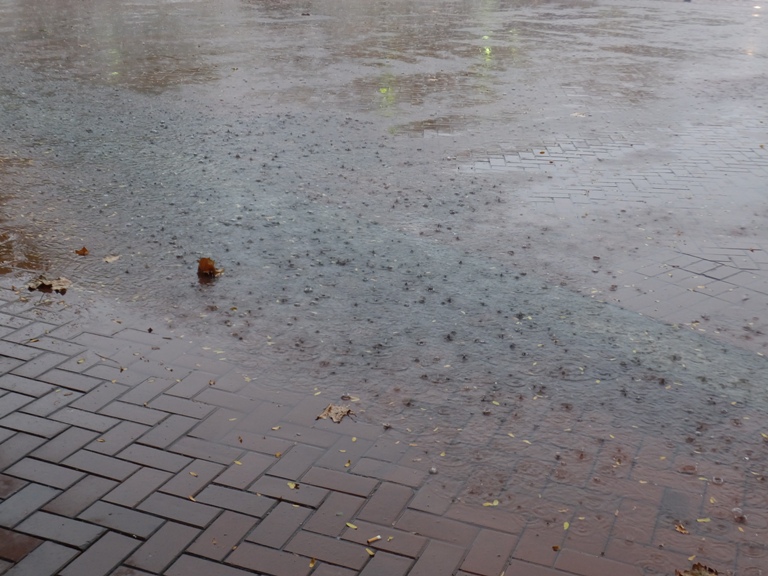
The forecast called for less than a tenth of an inch but the meteorologists were downright wrong. We waited in the Visitor Center until the storm started to pass. Then, faced with only some light rain, we donned our raingear and set out. |
|
It was a muddy and slippery ride. There were many times where I lost control, slowed down, fishtailed, and then regained control once my tires hit a solid part of the trail. I'm guessing I brought about 65 pounds of gear, making my bike weigh around 100 pounds. We probably picked up an additional pound of water and mud on the ride.
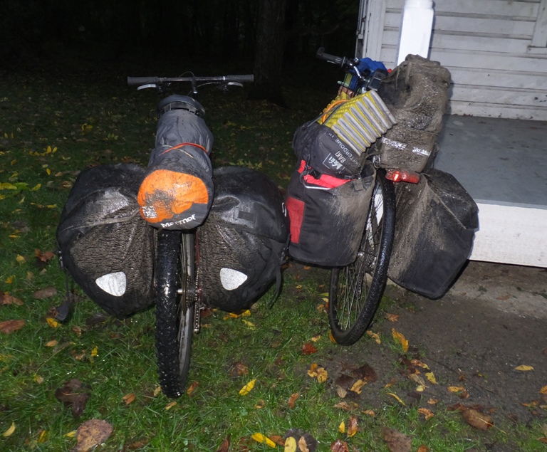
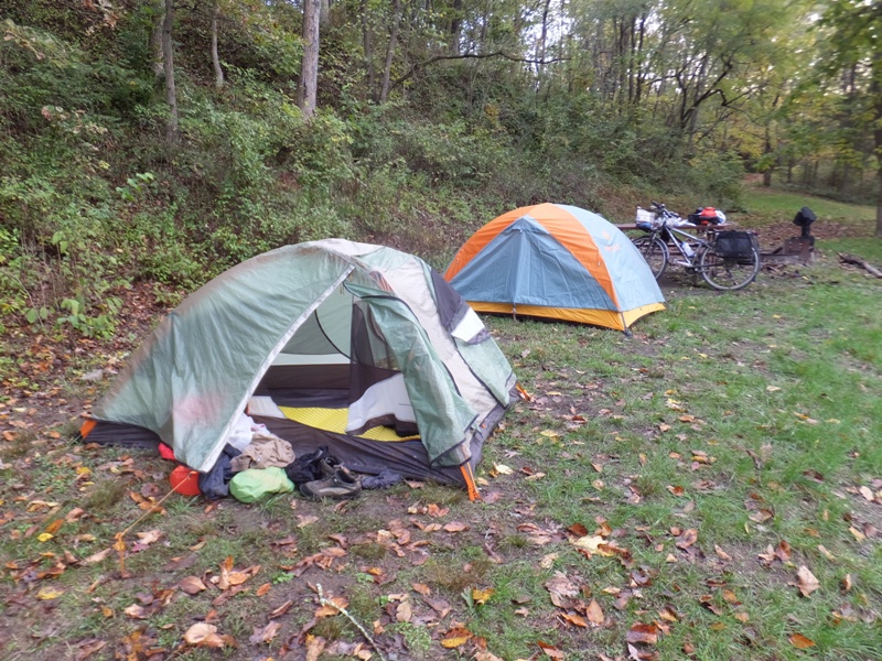
I eventually learned that the best way to get through the mud is to ride straight and fast. Both of us found our hands getting sore from gripping the handlebars so tightly with a kung fu death grip. Around 1800, we decided it was time to set up camp at the Potomac Forks hiker/biker campsite, mile 164.8. 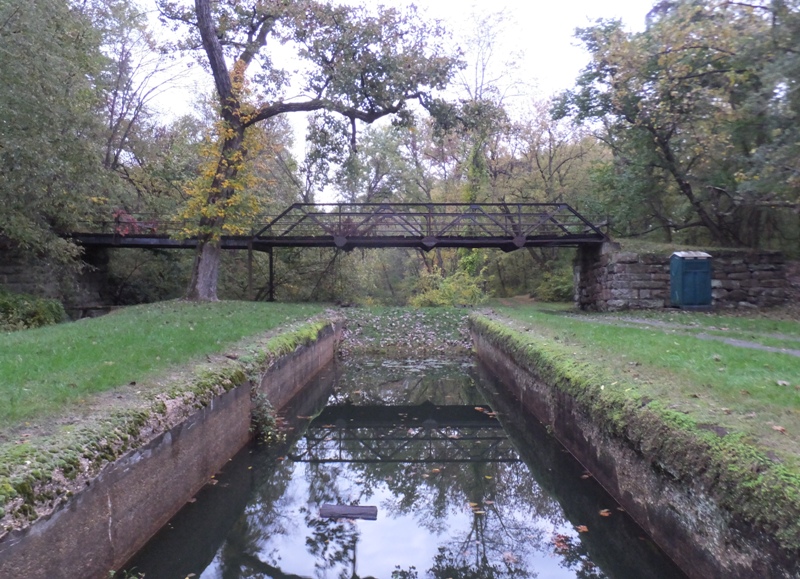
For a list and photos of the various hiker/biker campsites, see Eating the Elephant - C&O Canal Campsite Guide. We started at mile 184.5 and were working our mileage down to zero. My GPS, which I started at the Cumberland Amtrak, said we biked a mere 19.92 miles for the day. Our moving average was 9.8 mph. Like all the campsites we stayed at on our journey, there was a picnic table, fire ring, porta-john/restroom, and pump for fresh water. Campsites are often at the locks, so at this site, there was also a lock house where the lock keeper lived back when the canal was operational. I thought it would make sense to sleep on the porch of the lock house rather than set up tents but Carmen felt it would be warmer in the tents. The only problem with that is it started raining again while we were setting up tents. The night wasn't all that cold so in retrospect, I think I might have been better just sleeping on the porch, thus keeping my tent dry. I tried to build a campfire but failed miserably so instead, we just hung out on the lock house porch and talked until it was time for bed. Every couple of hours, a train ran by and woke us up. The track was pretty close. My suggestion for anyone planning on staying at this campsite is to bring earplugs. |
|
The rain stopped during the night and there was zero chance of rain until we finished the ride, so the worst was over. Yay! Still, we had to deal with some very wet tents and muddy equipment.
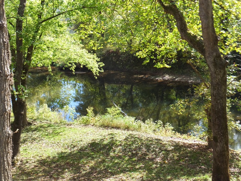
Walking around the campsite, I had an opportunity to see just how scenic it was in the morning. 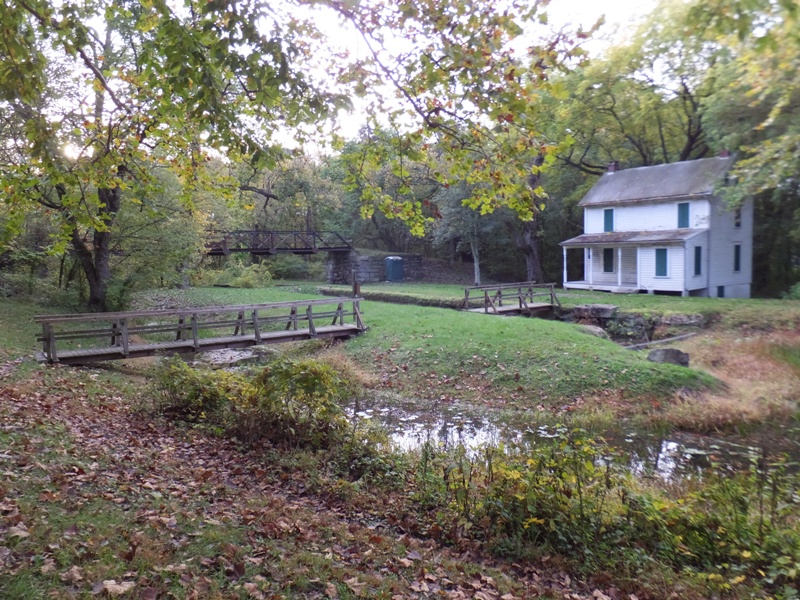
I ate breakfast. For bicycle camping, I pack food like I do when I go backpacking. That meant no stove, no foods with a lot of water (e.g. fresh fruit or vegetables), and lots of food that is calorie dense. Hence, I brought granola bars, nuts, dried fruit, fig bars, tortillas, pepperoni, cheese, and chips. Salty snacks are a must to help prevent me from cramping. I ended up actually bringing about 30% more food than I actually needed. Carmen preferred to sleep in. Since she was leading the trip, I did not object. I knew I would have fun regardless. But that meant we got a later start and had less daylight for riding. We started riding a little after 0930. This turned out to be our start time every day. I wondered what life on the canal was like back when it was in operation. I later read that A typical canal boat was 92 feet long and could carry cargo of up to 120 tons. The waterway was 40-60 feet wide at the surface and had a depth of six feet. The power of the operation was a team of two mules which pulled the boat at the end of a 100 foot long rope. The mules walked along a dirt and stone towpath that paralleled the canal. A trip down the canal to Georgetown took approximately seven days. - from "The C&O and B&O Essay" |
|
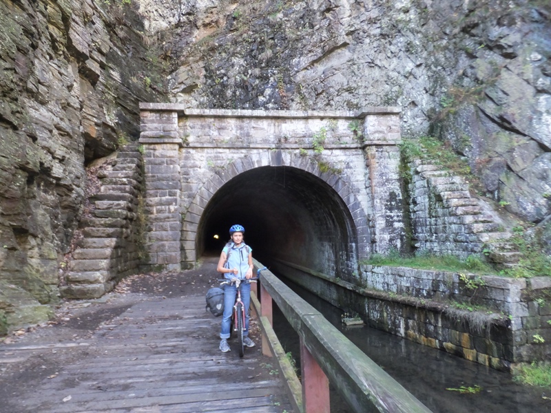
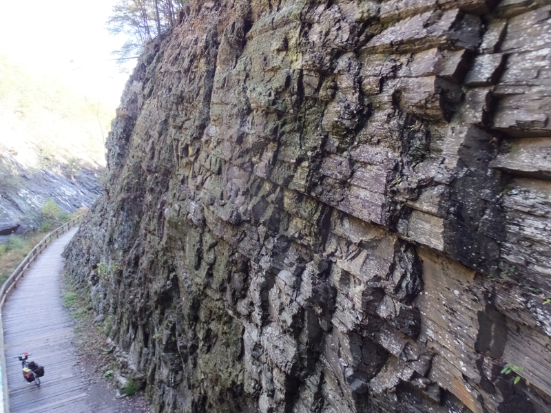
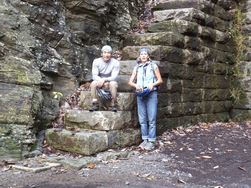
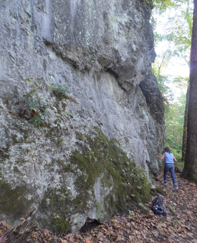
Eventually, we came to one of my favorite places on the towpath, the Paw Paw Tunnel at mile 155.2. Why was the tunnel created?
The Potomac River meanders through six miles of bends...with steep cliffs dropping to the river, making the digging of a ditch canal nearly impossible. The canal company engineers could have followed a natural fold in the rock stratification to burrow the tunnel, but this would have taken them too far from the river. They decided to tunnel a shorter distance diagonally through the rock folds. This decision, however, led to many cave-ins because of the predominate soft shale they encountered. - from sign on trail titled "Going Against the Grain" In the end, the Paw Paw Tunnel turned out to be a huge engineering failure and was one of the major reasons why the canal lost the race with the railroad. When work started in June 1836 on the Paw Paw Tunnel, engineers estimated the work would take just two years and $33,500 to complete. Labor violence, funding shortfalls, and work stoppages slowed construction. Fourteen years later when the 3,118-foot tunnel opened, it cost more than $600,000. - from National Park Service - Paw Paw Tunnel (a broken link as of 2024) Carmen led us through the tunnel. We rode with our lights on...she with her headlamp and me with my bicycle light. Unfortunately, my light did not illuminate my path. It only lit up what was directly in front of me. This is because gear in my handlebar basket blocked any light shining downward. This made for a nervous ride as I occasionally hit bumps that I could not see. I just concentrated on following Carmen. At the east end, we stopped for photos. 1 / 5

Carmen ready for more biking.
2 / 5
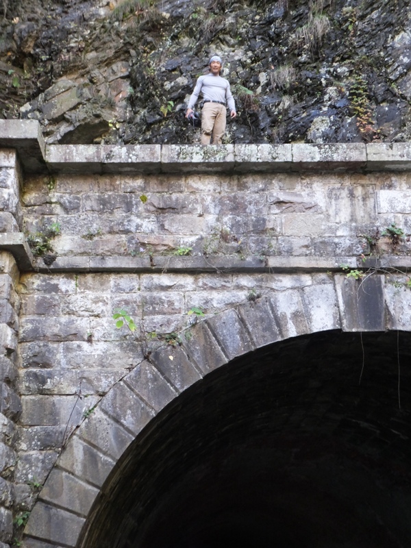
Me above tunnel.
3 / 5

High view of canal.
4 / 5
South side view.
5 / 5
Surprise!
|
|
Carmen said she had never eaten a paw paw. I described it as tasting somewhat like a banana. After awhile, I saw a paw paw hanging in a tree. We picked it and I cut off a piece. It was terrible! It had not ripened, even though this is the time when they should be ripe.
Near the town of Little Orleans, we stopped at Fifteenmile Creek (mile 140.9) for lunch. Unlike the free campsites that one cannot access by vehicle, this is a drive-to campsite. Thus, there are many more sites available and campers must pay $20 for a space. As we ate, we saw several girls swim across the Potomac River from Maryland to West Virginia and then back. The air was cool and I am certain the water was rather cold. The area was quite scenic. 1 / 4
Mushrooms.
2 / 4
Fifteenmile Creek.
3 / 4
Fifteenmile Creek Aqueduct.
4 / 4
Mouth of Fifteenmile Creek.
|
|
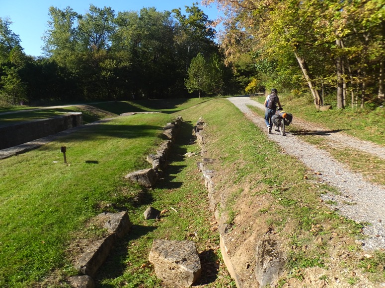
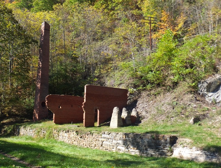
At mile 127.4, we came to the ruins of the Round Top Cement Mill.
Across the canal bed are the remains of the once prosperous Round Top Cement Mill. The abundance of high calcium limestone drew cement manufacturers to this area in 1838. A useful material, limestone can be cut into building blocks or burned and ground for use in fertilizer or natural cement. The Round Top Cement Company provided cement for the construction of the Washington Monument, the U.S. Capitol building, and much of the masonry along the western end of the canal. The Round Top Cement Company struggled to stay profitable in spite of the ease of shipping and the high quality of its natural cement. Fires in 1848, 1897, and 1903 burned the mill to the ground. Even more devastating than fire was the introduction and manufacturing of Portland cement in the United States in the late 19th century. Weakened by the competition, the Round Top Cement Company was forced to close its operation after the 1903 fire. - from sign on trail titled "Round Top Cement Mill" Pushing onward, Carmen and I rode into the town of Hancock at mile 124. [This]...Western Maryland community is notable for being located at the narrowest part of the state. The north-south distance from the Pennsylvania state line to the West Virginia state line is only 1.8 miles at Hancock. - from Wikipedia - Hancock, Maryland 
In Hancock, we passed by Weaver's Restaurant and Bakery and stopped in at C&O Bicycle to put air in our tires. Carmen went in search of bananas at a store while I waited and watched a walking stick insect. 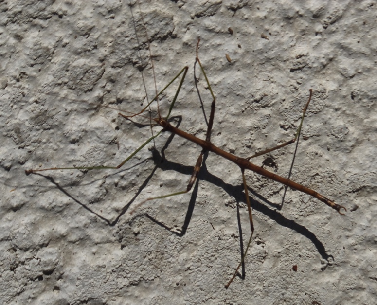
We briefly contemplated making our ride easier by following the 22.5 mile paved Western Maryland Rail Trail which parallels the towpath. It probably wouldn't have made our ride any shorter but a paved surface would have been much easier. In the end, we decided not to so that we could say in total honesty that we biked the entire towpath from Cumberland to Georgetown. 
|
|
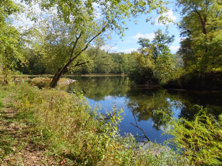
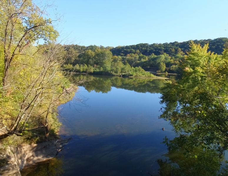
At mile 122.9, we came to the Tonoloway Creek Aqueduct where we had a beautiful view of the Potomac River.
It was getting late so we set up camp at the North Mountain hiker/biker campsite, mile 109.6. Our tents were still pretty wet but at least a lot of stuff was drier than it was the day prior. Since I started my GPS in Cumberland, we had put on 76.00 miles and for today only, we biked 56.08. That includes some riding in town. I was pretty pleased with that distance. If we could do ~55 miles on the remaining two days, then we'd we set. I tried to build a fire. I had some firestarters and a saw for cutting logs but there wasn't much kindling so it took a lot of blowing to get things going. We stayed up for awhile enjoying a nice fireside chat before calling it a night. |
|
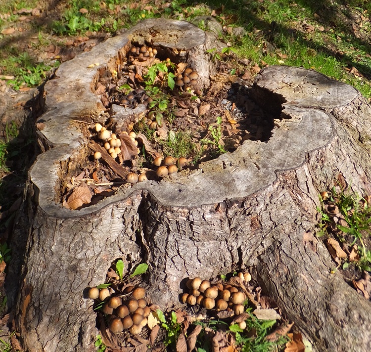
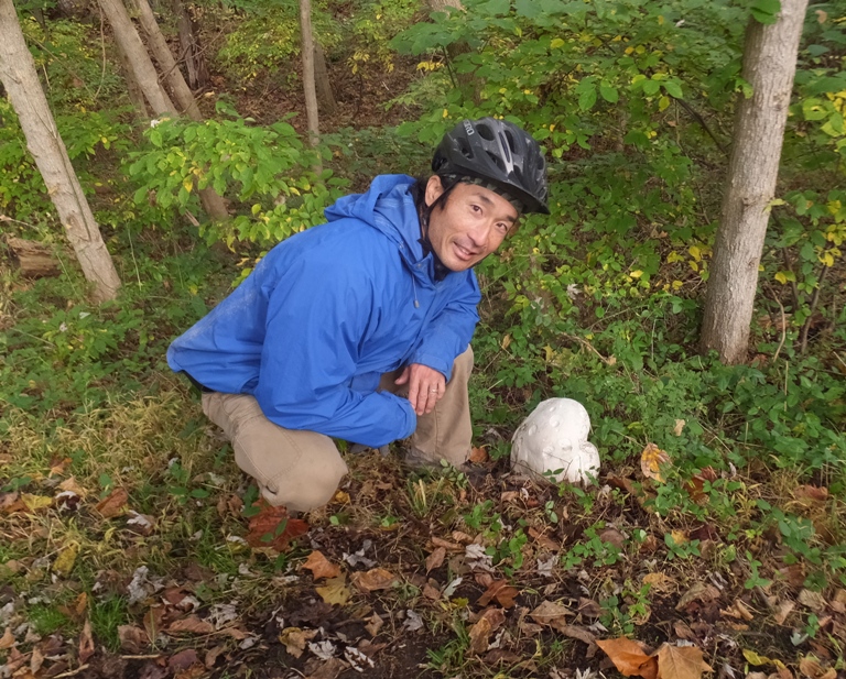
At various sections along the trail, we saw what I believe are Giant Puffball Mushrooms. These are edible and I know someone who ate one and suffered no ill effects.
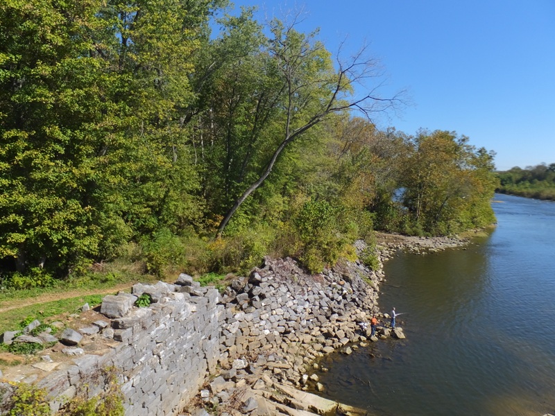
At mile 106.6, we came to Dam 5 near Williamsport. This was a target during the Civil War. At the outbreak of the Civil War, Maryland became a border between the Confederacy and the Union. The Confederacy knew that the canal and railroad were important Union supply lines. Stonewall Jackson's Brigade made several attempts to destroy Dam 5 and cripple the canal. On December 7, 1861, Confederate artillery "commenced throwing shells and shot at the dam and houses on the Maryland shore." Jackson's troops then tried digging a ditch to undermine the dam; Union troops fended off the attempt. On December 17, Jackson attacked again, and again Union forces prevailed. After minor dam repairs, boat traffic resumed on the canal. - from sign on trail titled "Stonewall Jackson at Dam 5" 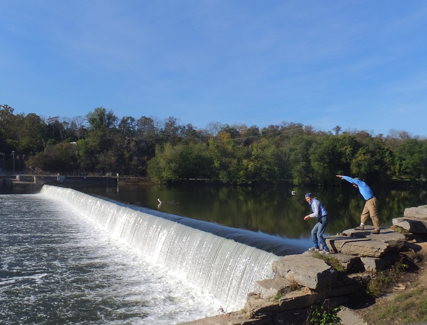
I crossed over the canal via a bridge near the lock house. 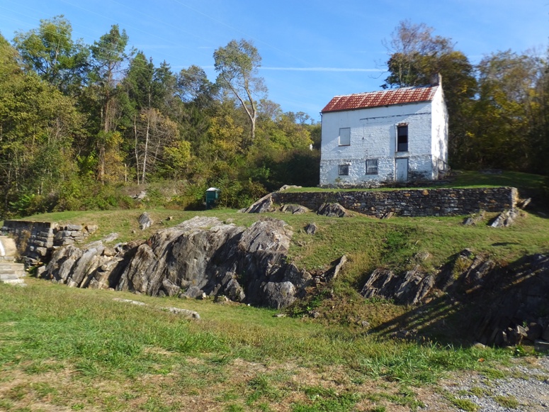
Carmen waited on the other side of the canal reading a sign. I knew the towpath continued on my side but she thought it was on her side. We both stood for what seemed like a long time waiting for the other person to cross the bridge and continue the ride. Then it dawned on Carmen that I was waiting for her. Her expression was priceless. She looked around and realized that the towpath was not on her side of the canal. She came across and we resumed biking. |
|
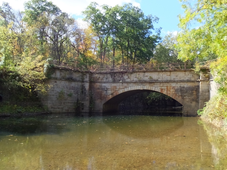
At mile 99.5, we came to the Conococheague Creek Aqueduct. This is a creek on which I've kayaked.
Eleven aqueducts were built from Georgetown to Cumberland to carry water over water. The aqueducts, literally "water bridges," carried the canal over the large streams and rivers flowing into the Potomac River. The Conococheague Creek Aqueduct...was completed in 1834. On April 20, 1920, Captain Frank Myers was steering boat #73 into the aqueducts and lightly bumped the upstream wall. He saw the wall give way and called to his stepson driving the mules to cut the towline. The wall and boat crashed into the creek. Captain Myers jumped to safety and no one was hurt. The aqueduct was repaired with a wooden wall until the flood of 1924 closed the canal for good. - from sign on trail titled "Conococheague Creek Aqueduct" 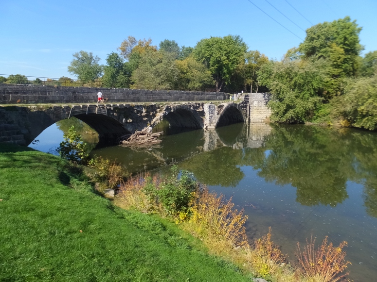
|
|
At this same location, we saw the Williamsport Visitor Center and Cushwa Basin.
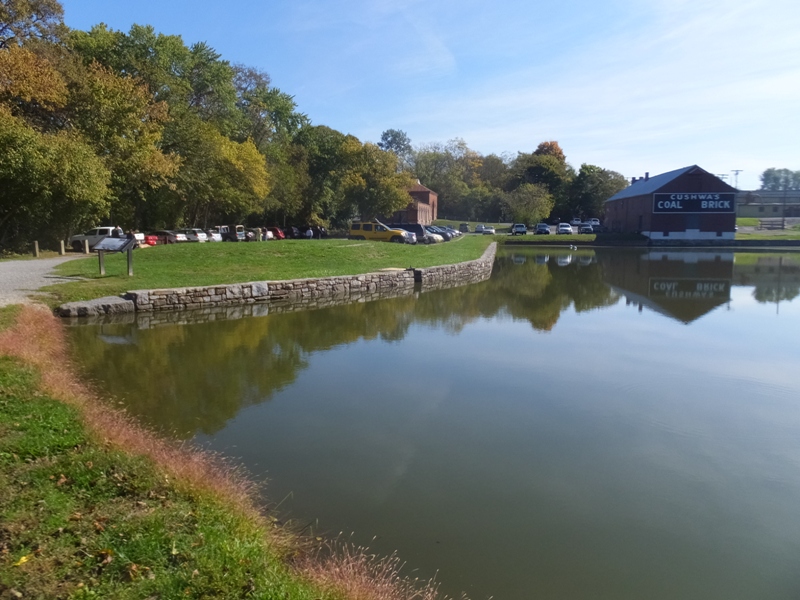
Carmen checked out the visitor center while I stayed near the creek, soaking in the warm sunlight. The towpath is pretty shaded and a little cool at this time of the year so the sun felt good. William's Port lay on the edge of the Maryland frontier in 1787 when founded by Revolutionary War hero General Otho Holland Williams. In 1790, this river town nearly became capital of the United States when President George Washington personally visited Williamsport before selecting the current site of Washington, D.C., 100 miles east. In 1832, Williamsport changed as the C&O Canal reached the town. This town became a major place of transfer for goods transported by canal boats. In 1863, Confederate troops advanced and retreated through Williamsport during the Gettysburg Campaign. Here, the Civil War could have ended when the flooded Potomac River nearly trapped General Robert E. Lee's Army of Northern Virginia. - from sign on trail titled "Williamsport - A Town on the Edge of History" |
|
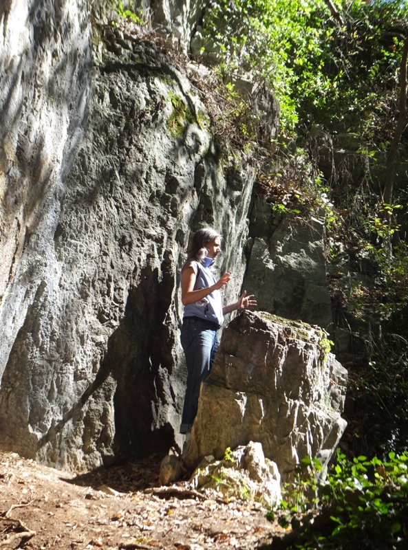
Back on the towpath, it didn't take long before we reached mile 92.25, the halfway point of the ride. Below, Carmen gestures a Gaussian curve to indicate we are at the peak.
At the Opequon Junction hiker/biker campsite (mile 90.9), we stopped for a snack. Without Norma, we were "Team SnaCk" rather than "Team SNaCk." 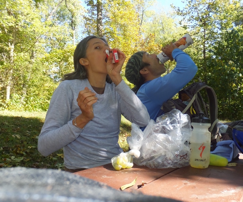
|
|
At mile 88.1, we came to McMahons Mill.
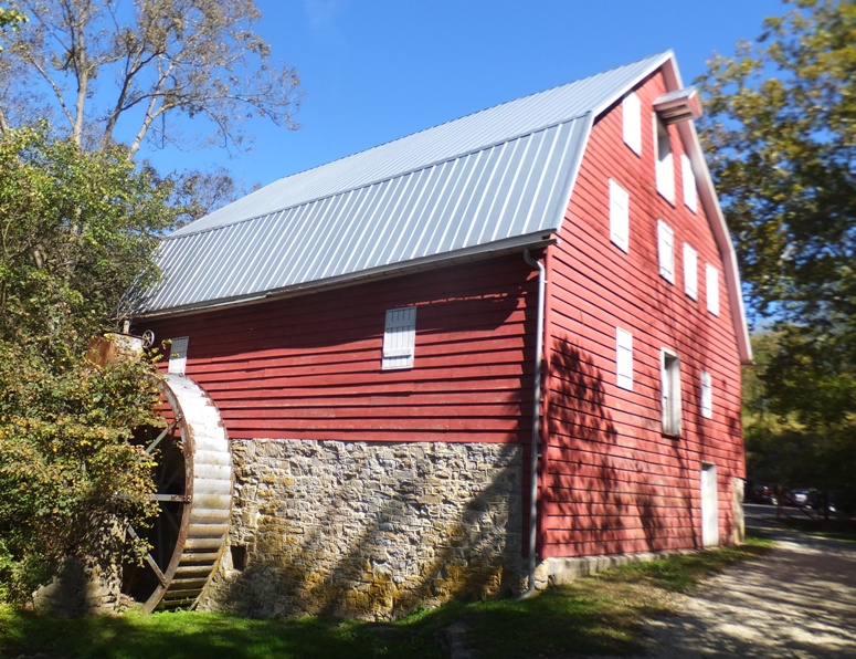
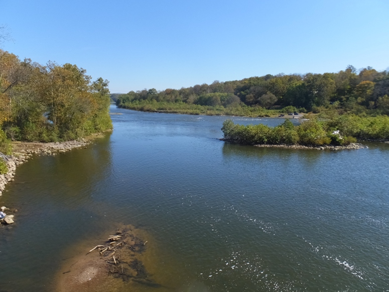
Was the canal built or intended to be built for every section of towpath? The answer is no. Between mile 85.6 and 88.9 is a section called Big Slackwater. There is no canal here. When the canal was in operation, boats navigated in the river. In recent decades, this stretch of towpath suffered major damage and became impassable due to severe erosion from multiple floods. The National Park Service long desired to restore this missing section of the towpath. In 2012, the park completed the largest engineering project in its history here. New concrete towpath sections reestablished the historic towpath alignment and provided bridging over inaccessible areas. - from sign on trail titled "Restoring Big Slackwater" Biking this section was one of Carmen's favorite parts of the trip. It was a wide, paved section that put us right up against the Potomac River. 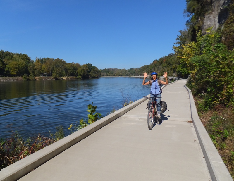
At mile 84.4, Carmen and I stopped at Dam 4. I remember portaging kayaks around this on September 7, 2013. Dam 4, one of the finest masonry dams of its day, was built in 1856 after the first rubble and brush dam proved vulnerable to flood damage. The dam watered the canal between here (mile 84.4) and Dam 3 near Harpers Ferry (mile 62.2). The dam created Big Slackwater, a pool reaching 13 miles upriver. - from sign on trail titled "Dam 4" There were some nice views atop Dam 4. 1 / 3
Carved stones, trees, and water.
2 / 3
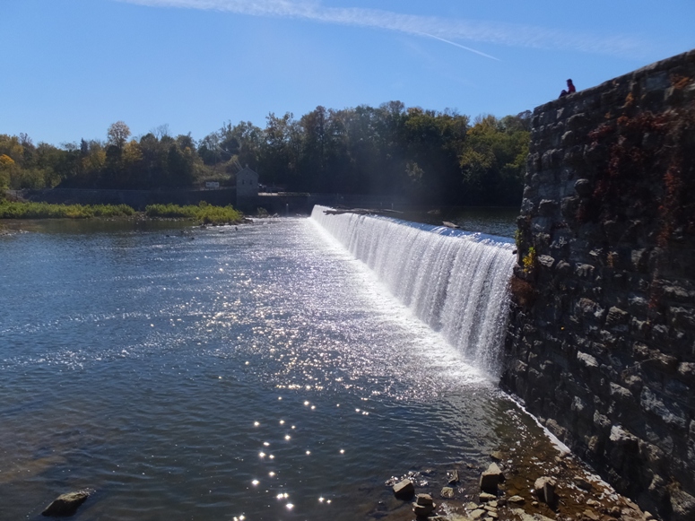
Water flowing over the dam.
3 / 3
Downstream on the Potomac.
We didn't see much wildlife but apparently, there are eels in the Potomac River. American eels are making a comeback along the Potomac River watershed. Young eels born in the Atlantic Ocean drift on currents toward the Chesapeake Bay. Upstream migrations lead eels to freshwater habitat where they live up to 24 years. Once plentiful along the Chesapeake and Ohio Canal, eels made up much of the fish population of East Coast waterways. Over time, dams and other barriers blocked their passage, and eel populations declined. Public and private partners are working to reestablish eel populations by improving upstream and downstream passage in the Potomac River watershed. Special "eelways" at Dams 4 and 5 can enhance habitat while preserving historic structures and recreational access. Such projects will help restore natural aquatic environments and open over 120 miles of historic American eel habitat. - from sign on trail titled "Return to the Potomac" |
|
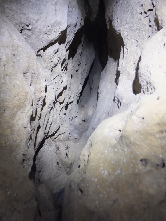
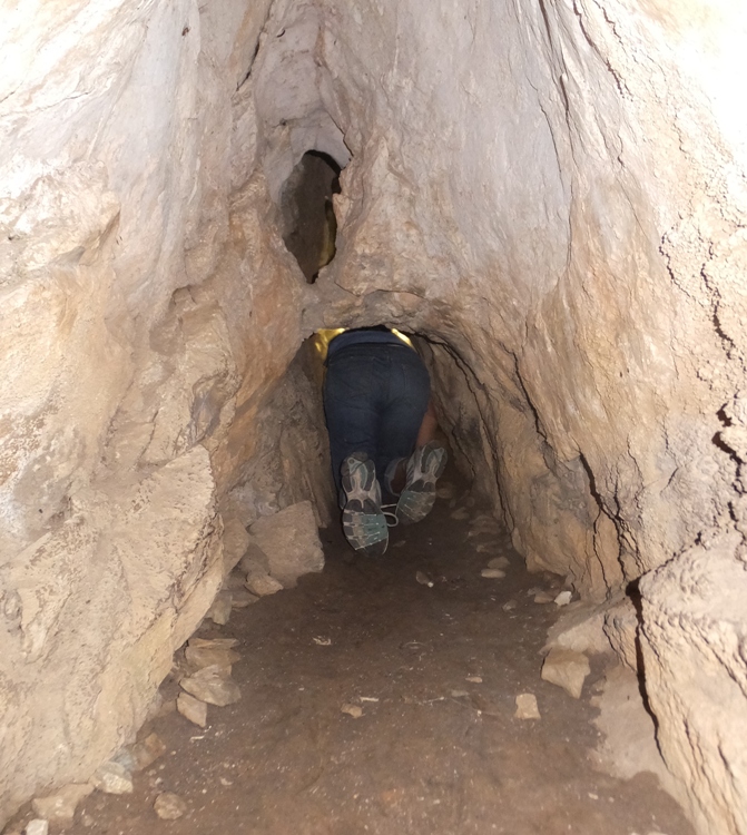
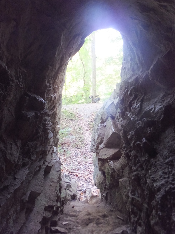
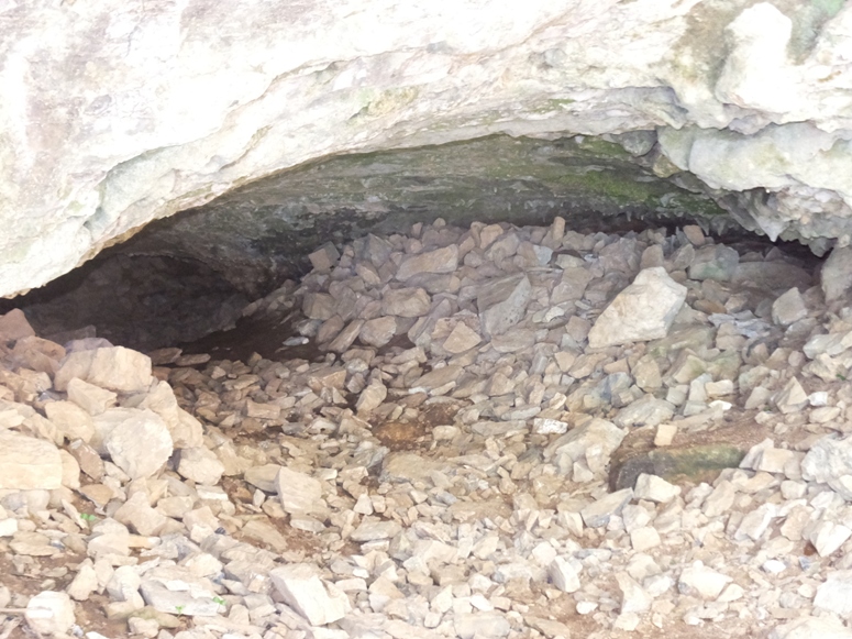
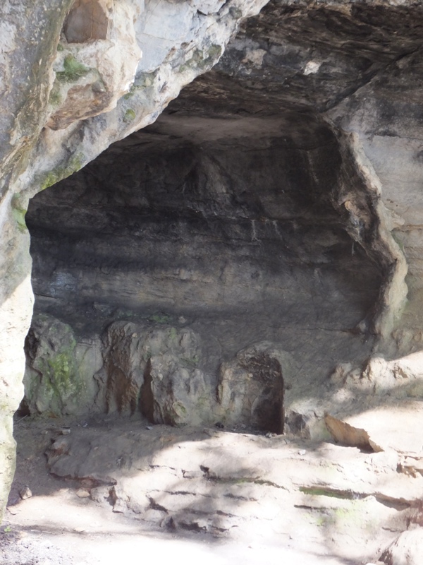
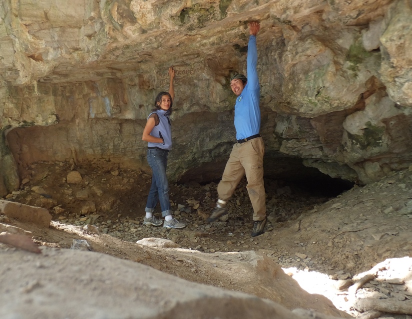
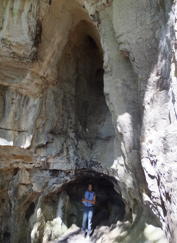
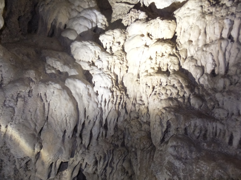
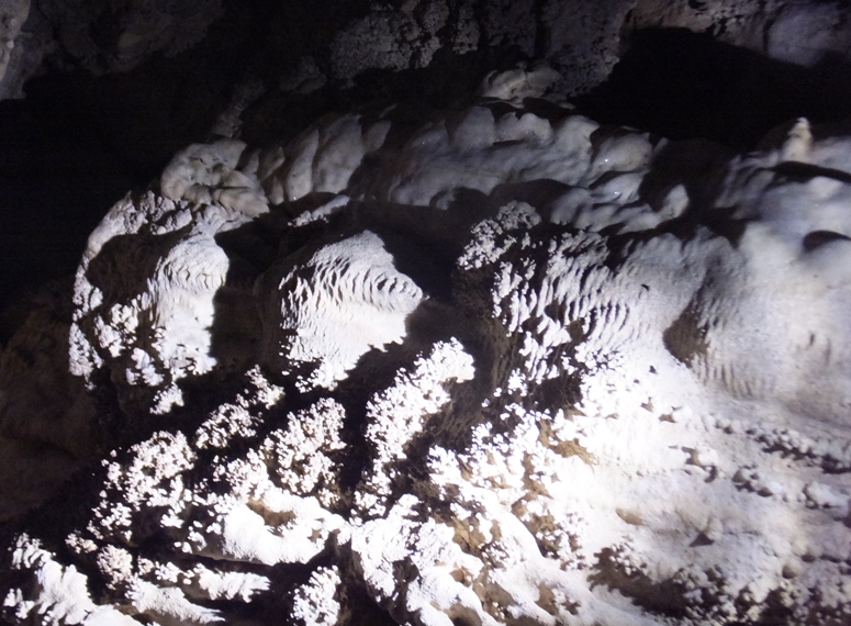
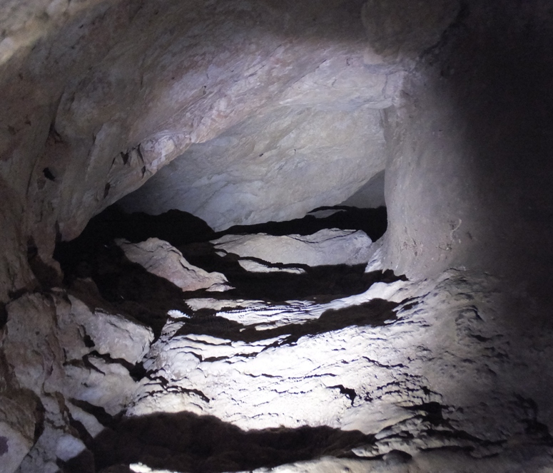
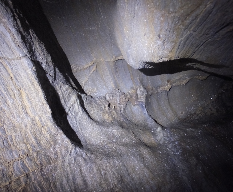
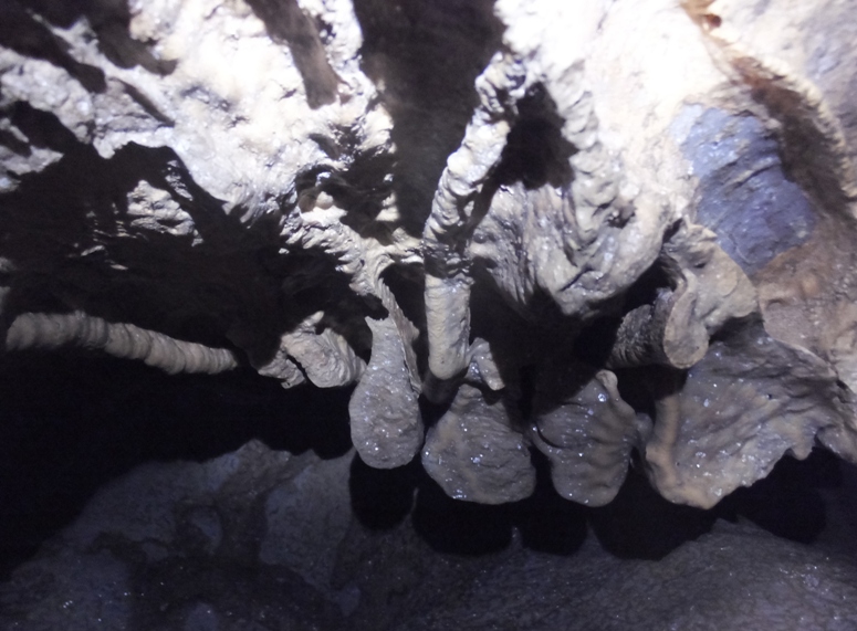
At mile 75.61, we came to my favorite part of the trip, Killiansburg Cave.
During the battle of Sharpsburg (the Union called it called the Battle of Antietam), many of the Sharpsburg citizens sought shelter from the war in these caves. - from mcmullans.org - Killiansburg Cave (a broken link as of 2016) The two of us set out to do a little spelunking. From the trail, one could see the entrance to these two caves which are connected, so Carmen and I could talk to each other through a small passage but not crawl through. 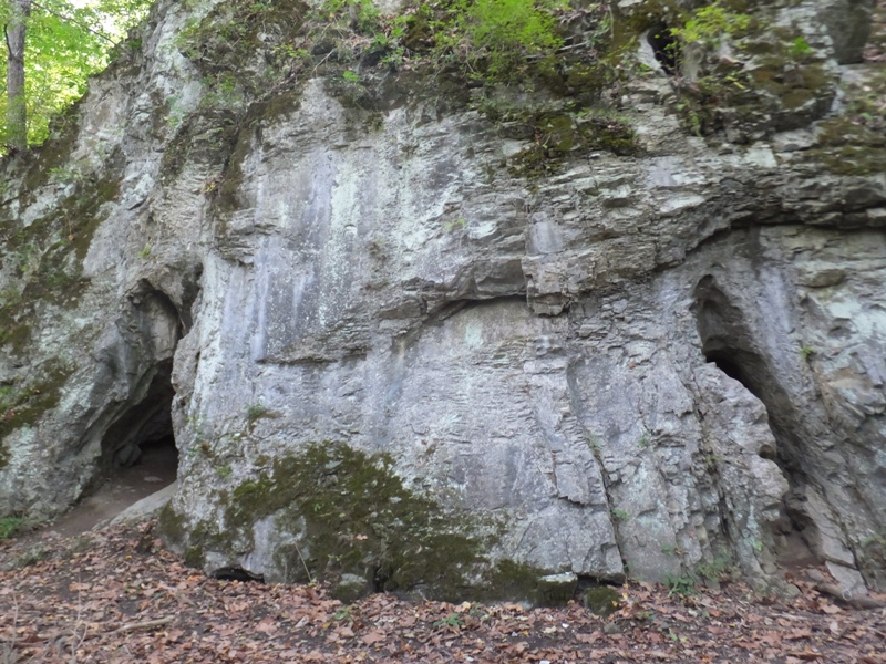
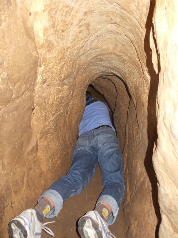
We explored the cave on the left (upstream) side which had a larger entrance. Next, we checked out the cave on the right (downstream) side. This cave went much deeper, but you had to do a lot of crawling to get through. Eventually it opened up into spaces where we could stand. 1 / 6
Heading to other cave.
2 / 6
Tall part of cave.
3 / 6
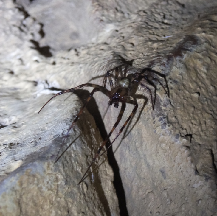
Spider.
4 / 6
Carmen near entrance.
5 / 6
Crawling deeper.
6 / 6
My bike.
As things got narrower in the right (downstream) cave, I let Carmen continue without me. Some clever person tied some twine to a rock which led deeper into the cave. This enabled the person (and Carmen) to crawl further and find their way back easily. Some of these pictures were taken by Carmen and never seen live by me. Carmen found this Longtail Salamander which Sue M. identified. Unlike the closely related Cave Salamander, the black spots on the Long-tailed Salamander are usually arranged into weak rows and form bars on either side of the distal portion of the tail. - from ohioamphibians.com - Longtail Salamander 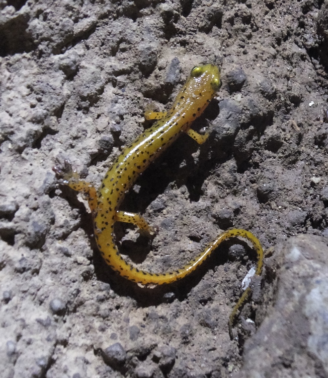
|
|
Heading further towards our destination, we came to lock 38 or 39 near mile 73. After awhile, a lot of the locks started looking the same.
Up until now, we hadn't eaten out. This was about to change. We made our way up Shepherdstown Pike (route 34) and biked across this bridge over the Potomac River into Shepherdstown, West Virginia. There was a nice view of the river below. 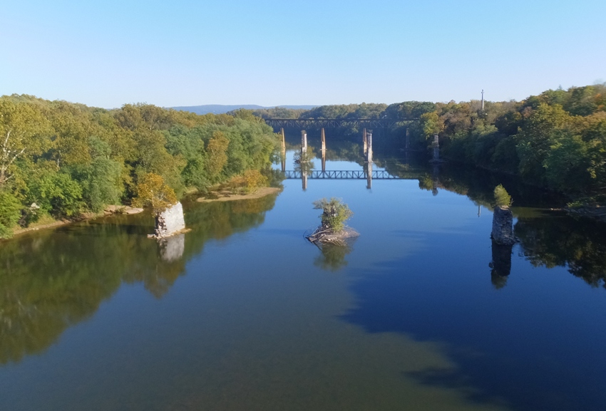
History passed through the town of Shepherdstown for centuries. Native Americans crossed the Patowomack [Potomac] River at the ford below the bluffs. German settlers crossed at Packhorse Ford as they emigrated from Pennsylvania into Virginia's Shenandoah Valley, giving the name Mecklenburg to the town. In 1832, the C&O Canal arrived, providing a controlled transportation route to the west. The canal also brought business to town with a river lock, providing canal boats a means to cross to the Virginia town, then known as Shepherdstown. - from sign on trail titled "Shepherdstown - A Town on the Crossroads of History" We arrived in town after lunch but before dinner so a lot of places were closed. But we did find the Mecklenburg Inn (circa 1793) where we had a tasty meal. The service was slow but maybe it also seemed that way because we were running out of daylight. The place was an oasis in that it gave us a chance to charge our electronic equipment. 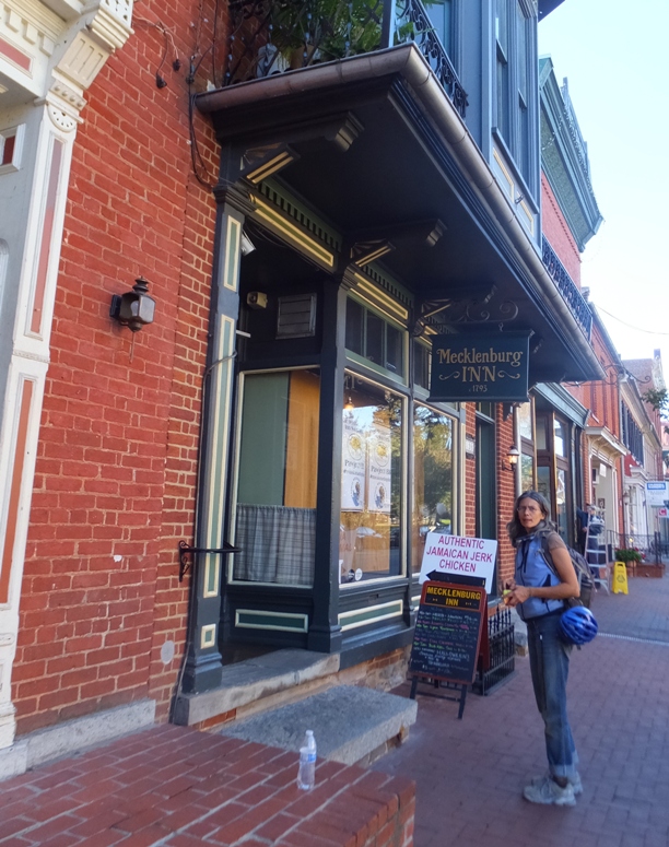
I checked my phone and found that a co-worker of mine who was biking towards Cumberland on the towpath had been in Shepherdstown just a few minutes prior but had now left. The town had a tattoo shop and Carmen and I discussed getting Team SNaCk ink done. But without Norma, it wouldn't seem right. |
|
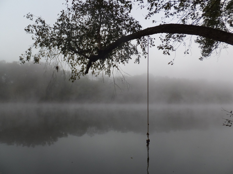
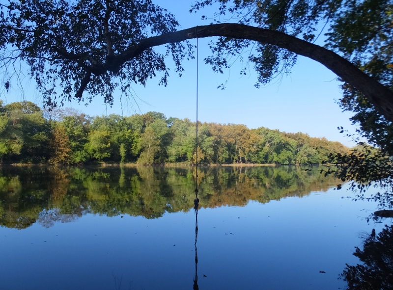
As the sun got low in the sky, we were hoping to make it to Harpers Ferry, but instead we decided to play it safe and set up camp at Antietam Creek Campground at mile 69.7. Unlike our other campgrounds, this one was a drive-in campground so we had to pay $20 to use it. Some other bicyclists told us the well pump didn't work but we had plenty of drinking water so we were fine. Our site (#4) had easy river access in case I ever wanted to return for some kayak camping.
Carmen partially climbed up a rope swing tree. 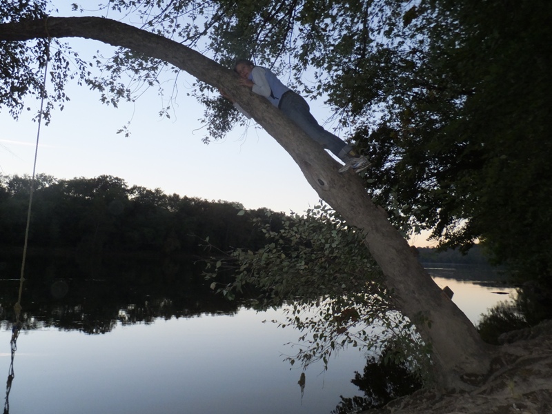
After setting up tents, I built a nice fire. There was plenty of dry wood of various thicknesses so I had no trouble getting a warm campfire going. This would be our last night of fireside chats which I enjoyed. Our total mileage for the trip was now 119.30 which meant we only biked 43.3 miles on this day. This meant we would have to put on quite a few miles tomorrow to make up the miles we didn't do today. But considering all the great stuff we saw today, it was worth it. |
|
Columbus was considered a great explorer. What better way to celebrate his arrival to the Americas than by doing a little exploring ourselves?
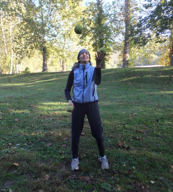
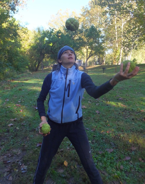
While Carmen slept, I started out by exploring our campsite. Osage oranges littered the ground. We made sure not to pitch our tents under any osage orange trees. In Florida, we learned what happens to people that rest under coconut trees and it isn't pretty. 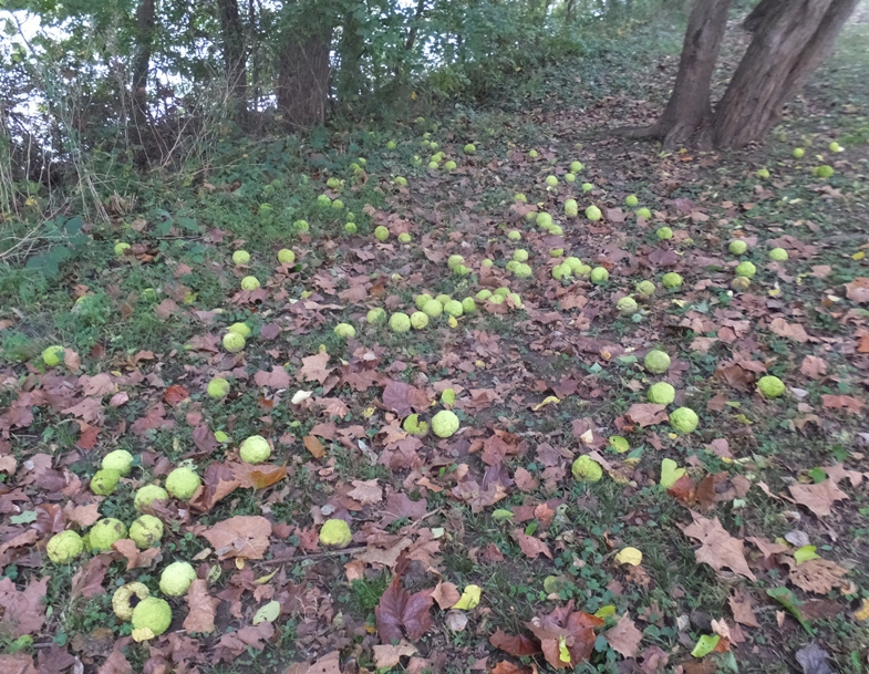
Each morning, we awoke to fog and dew. It seems the tents were always wet. But this morning, we noticed that Carmen's tent was covered in orange dew. Not sure why. I asked Carmen if she could juggle. Being the multi-talented person she is, the answer was yes and she proceeded to demonstrate with osage oranges. |
|
We commenced on our final day of bicycling on the towpath.
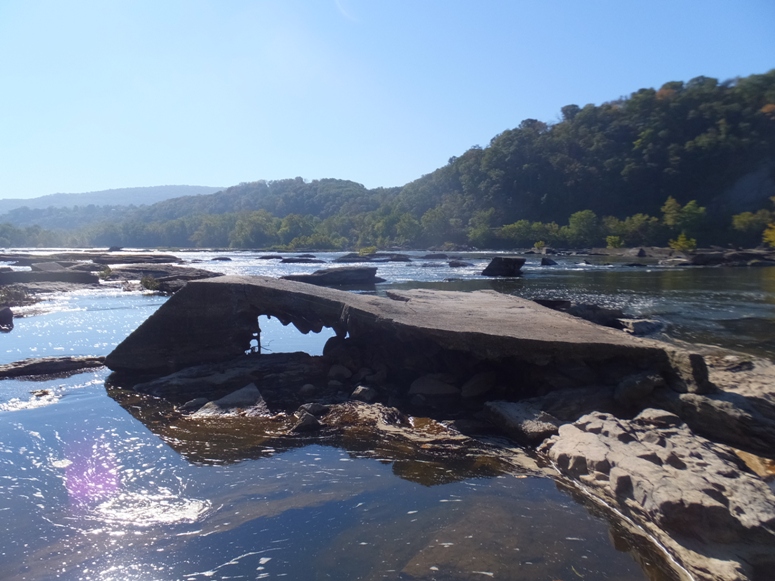
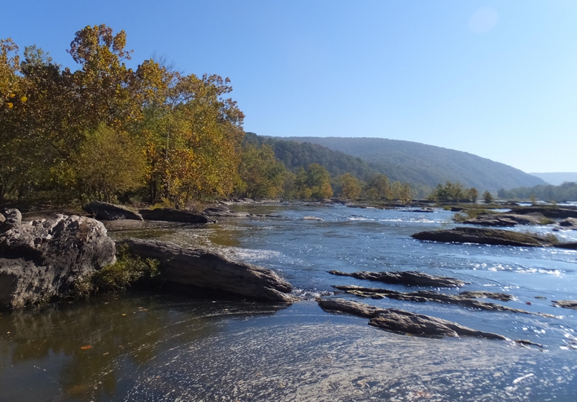
At Harpers Ferry (mile 60.7), the trail got crowded with pedestrians. Getting closer to Washington D.C., we saw a lot more people out enjoying the sunny holiday. I told Carmen about Maryland Heights, which is, in my opinion, one of the most scenic places in the state. Had we more time, I would have taken her to the overlook. At one point along the trail, we pulled over to check out the river. There was some concrete debris that we were able to rock-hop and climb out onto. From here, we had a nice view of the Potomac. Though we had ridden 130+ miles since late Friday afternoon, Carmen was ready to take on the world. 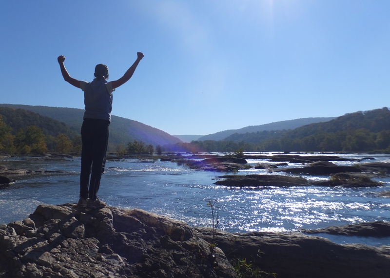
The two of us stopped at mile 55 in Brunswick and rode around a bit. We found a bike shop where Carmen could put air in her tires. Along one part of the towpath, we saw a 40-50 pound dog lying along the side. It looked relaxed but it was closer to the trail than what I wanted. I asked Carmen if she thought it looked friendly and we both agreed that it did. As we rode closer, it hardly even acknowledged us. Then, out from nowhere, a tiny Chihuahua raced out, barking furiously and aggressively. It clearly did not want us near. We continued onward, trying not to laugh too hard. At mile 48.2, we arrived at Point of Rocks where we made sure to see the B & O Railroad Station at Point of Rocks. The Point of Rocks station was completed in 1876 and was designed by renowned architect E. Francis Baldwin who would construct a number of stations and depots for the B&O, particularly along the eastern areas of the railroad. The Point of Rocks station itself in terms of exposure is likely the most well known B&O station as it is heralded as one of, if not the, most photographed railroad station or depot in the country. - from american-rails.com - Point of Rocks Station/Depot At mile 42.1, Carmen and I biked over the Monocacy Aqueduct. This is a river I've paddled several times and it is one of my favorites. The aqueduct, the largest on the canal, was completed in 1833, and features seven arches. It is probably the second-most impressive structure on the canal, after the Paw Paw Tunnel. White and pink limestone were used to build the aqueduct. The stones were quarried at Sugarloaf Mountain and carried by wagon or a special wooden-rail tramway built for the project. - from riverexplorer.com - Monocacy Aqueduct At mile 35.5, we stopped at White's Ferry which still has a ferry to transport vehicles and people across the river from Maryland to Virginia. After crawling around Killiansburg Cave yesterday (which contained small animal droppings), Carmen was happy to use their restroom which had running water and soap. The only regularly operating ferry on the Potomac River is the General Jubal Early, owned and operated by Edwin Brown and Malcolm Brown of Dickerson. The General Early has been in operation nearly 30 years, providing reliable service except during severe ice or flood conditions on the river. - from Potomac River Guide - Whites Ferry I never took the ferry but Norma and I intended to do so on our November 19, 2006 bike ride. High water conditions closed the ferry so we had to make a 20 mile detour. That was a lot of biking that day, as was today. I ended up losing several photos on this last day of our trip. I had hundreds of photos to download so I did them overnight. The next morning, the camera battery was dead. But I thought I downloaded all my photos. Certainly the first and last ones were there with hundreds on my computer. So I deleted the ones on my camera memory chip. This was a mistake. It turns out photos are not necessarily downloaded linearly so several from the last day were lost. This includes 181 photos out of 725 total. Ones missing were shot at Brunswick, Point of Rocks, the Monocacy Aqueduct, and White's Ferry. A lot of these were action shots of Carmen biking. Sorry. |
|
At mile 22.8, the two of us rode over the Seneca Aqueduct.
Seneca Aqueduct opened to traffic in 1833, and along with through-boats from the west, carried a substantial local traffic in lime, grain, fertilizer and sandstone to and from farms and industries around Seneca. Made of red sandstone from nearby bluffs, it has long been one of the most admired canal structures. - from mcmullans.org - Seneca Creek Aqueduct (a broken link as of 2016) Just after the aqueduct, we saw a huge building with an equally impressive fountain across the river. It is the Trump National Golf Club. 
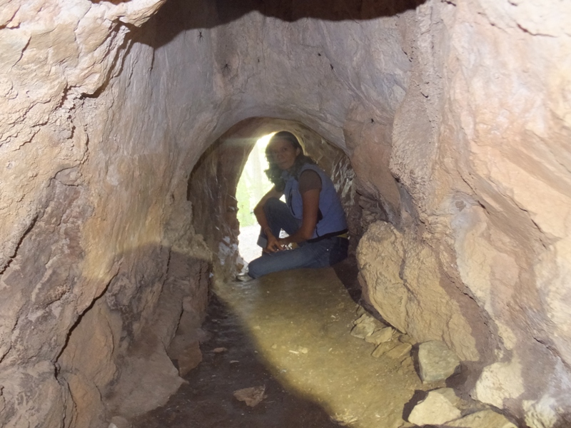
At mile 19.7, we came to Lockhouse 22. For folks that want to bike the towpath over several days but don't want to tent camp, they can stay at lockhouses like these. 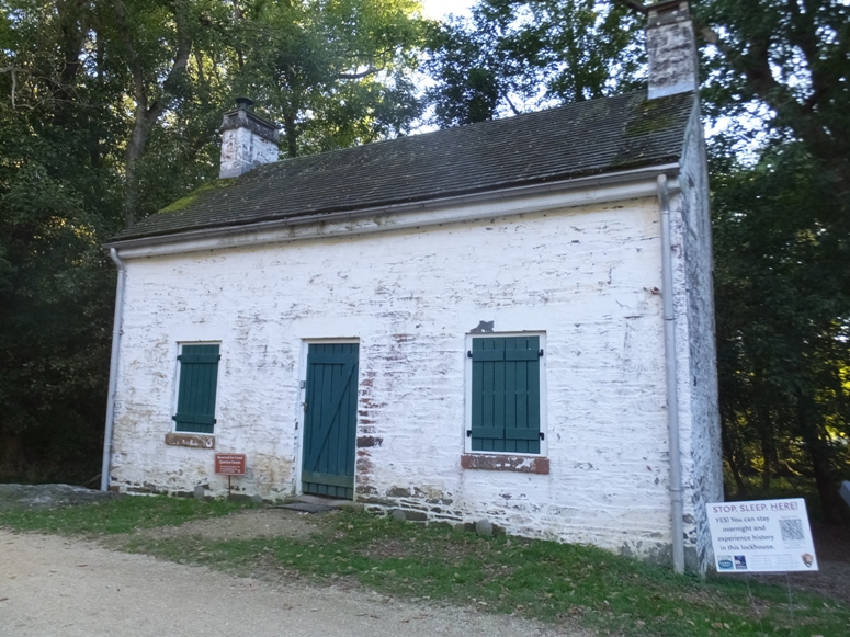
Not all lockhouses are fit for visitors to stay overnight but the one shown above is. There is no heat, electricity, or running water but it beats pitching a tent. Next to this lockhouse was lock 22. 
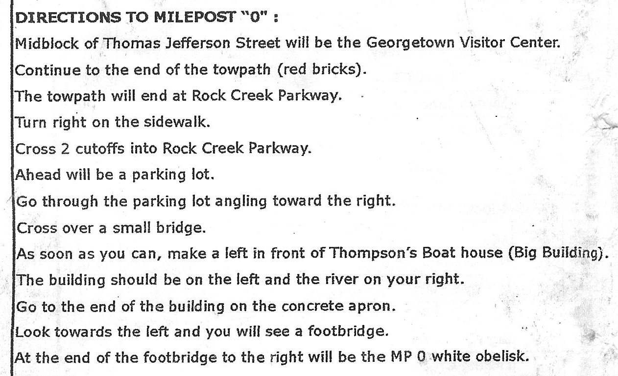
If walls could talk, then Lockhouse 22 could tell some tales. One might hear about President Grover Cleveland who sought refuge from the pressures of the White House by coming here on fishing trips. Or perhaps the lockhouse would tell of one lockkeeper who had too much to drink and let the water out of the lock too quickly, sinking a canal boat and its 113 tons of coal. Built in 1832, Lock 22 is nicknamed "Pennyfield Lock" after father and son lockkeepers, George and Charlie Pennyfield. The Pennyfield family remained at the lock after the canal closed in 1924. - from sign on trail titled "Lockhouse 22" At this location, a volunteer noticed our camping gear and asked if we planned to bike all the way to mile post zero in Georgetown. We said yes. She then gave us a paper with directions on how to get to the end. As the sun set lower in the sky, some of the fall colors were brought out. 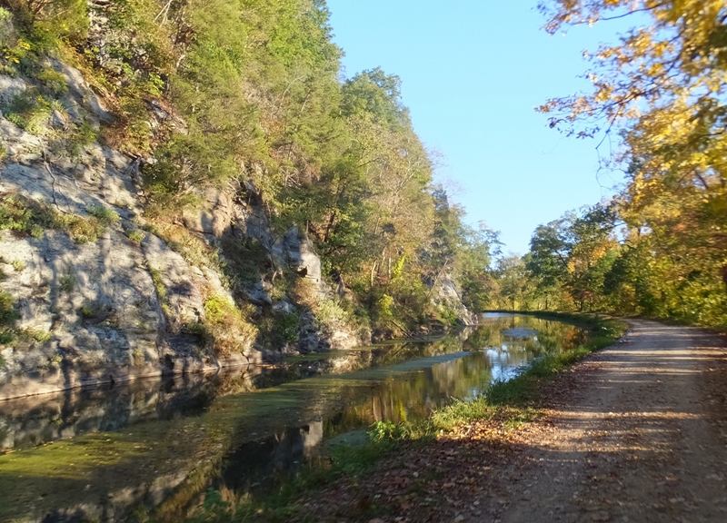
Around this time, Carmen decided it was time to put on the headphones and listen to some motivating melancholy music. Up until then, I had been feeling pretty strong. But after three days of riding with full camping gear, I was showing signs of fatigue. But not Carmen. She was getting her second wind. |
|
At one section of trail, a guy in a red and black jersey flew by us. We then hit a rough dip in the trail that jarred my gear. It clearly jarred someone else's gear too which caused them to lose their wallet. I picked it up and found I.D., credit cards, and a moderate amount of cash. I checked for a phone number but didn't find one. I took it home and did some Google searching which brought up a lot of information about the guy. I called him and told him I found his wallet. It was the guy in the red and black jersey. Since he worked close to Washington D.C., I gave his wallet to Norma and she returned it to him.
The trail got really busy again with pedestrians at Great Falls, mile 14.3. |
|
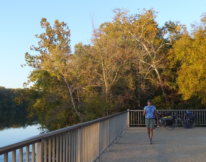
As the sun set, riding became difficult for me. I cleared stuff away in the top of my basket so my light wouldn't be blocked but I couldn't angle it downward because of the basket. So I had a hard time seeing the trail. I let Carmen lead and I just stayed on her tail.
After sunset, we arrived in Georgetown, where C&O construction began in 1829. 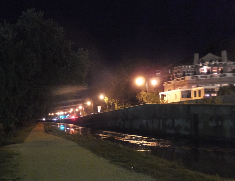
As we got closer to the start of the towpath, we came across the national historic marker. It reads One of the best preserved and least altered of old American canals, the Chesapeake and Ohio grew from Washington's vision of linking the valleys of the early west with the east by "ties of communication." The Potomac Company, fostered by Washington to improve navigation of the Potomac, transferred its rights in 1828 to the Chesapeake and Ohio Company organized to connect the Ohio at Pittsburgh with Georgetown by a continuous canal. In October 1850, after 185 miles were built, the construction ceased at Cumberland. Until 1924, trade continued on the old canal. Today, it is a memorial to national progress and the canal era. 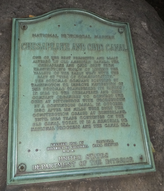
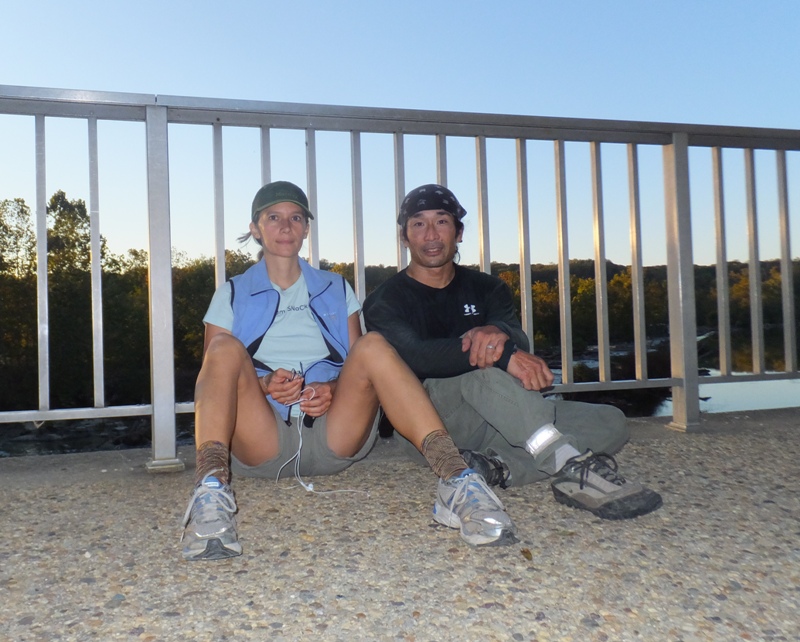
Eventually, we made it to mile zero around 2000. 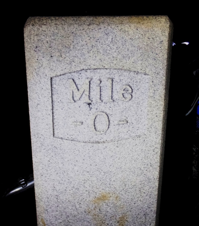
We were tired, sore, dirty, and hungry but we accomplished our goal. 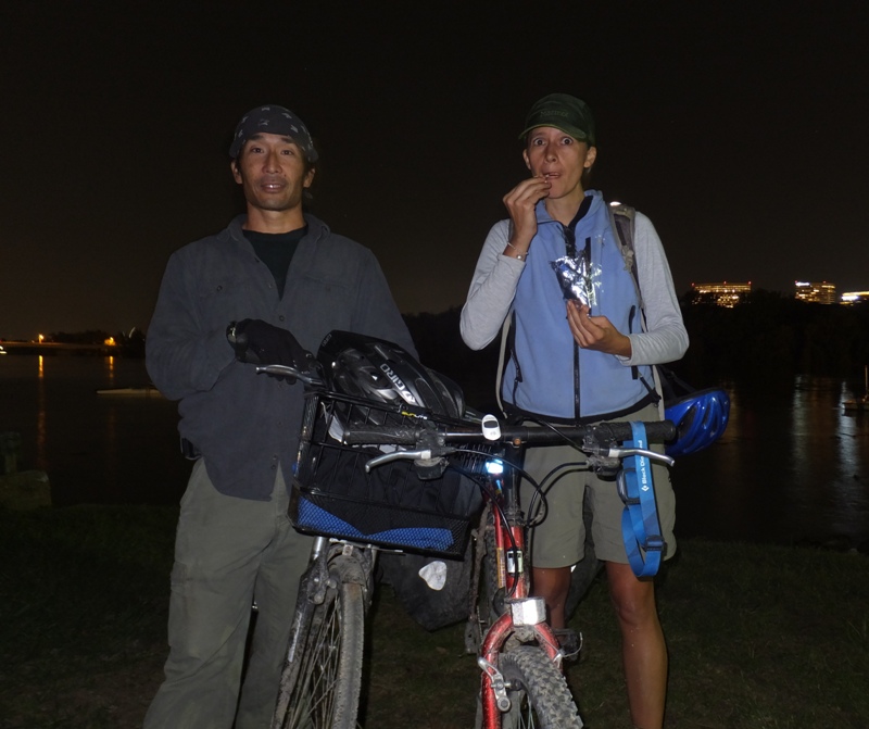
However, we still weren't done. Carmen and I biked through Washington D.C. to where Norma works. After loading up our gear and bikes, Norma gave us a ride home. 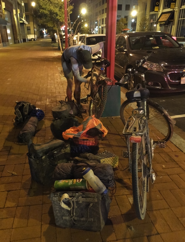
Checking my GPS, it said we rode a total of 194.87 miles with a moving average of 9.8 mph. Just on the last day alone, we biked 75.57 miles! |
|
It took me four days to recover from this trip which Carmen led. It was challenging but also a lot of fun and I would do it all again...but no time soon.
In the spring of 2016, I hope to take Carmen on the Amish 100 century ride in southern Maryland. Fun, fun, fun! 
|