California 2019

It was time for Norma and I to visit my folks. It would have been good to have coordinated our visit with the family reunion on my mom's side of the family but instead, we centered things around the Fair Oaks Chicken Festival, something I had heard about last year and was eager to investigate.


 Tuesday, September 17, 2019

FlightOpen accordion icon
We had a one way flight from Baltimore Washington International (BWI) Airport to Sacramento. It was a long trip. I brought my portable DVD player which I use at work to listen to music that I have burnt to DVD discs. But at work, I plug it into an outlet. There was no place to plug it in on the airplane so I ran it in battery mode. The battery should have been fully charged but it only lasted about 15 minutes. So much for watching a movie.

We flew on Southwest Airlines. They tend to have good rates and don't charge extra for luggage. But they make up for that on seating upgrades. Regardless of when we pre-register online, we are always in the C class, which is the last boarding group. We could pay extra to get moved up but that would defeat the purpose of saving money. So we don't sit together. I'd be curious how Southwest Airline's rates compare to other airlines if we were to pay enough to sit together.
Close accordion icon


 Wednesday, September 18, 2019

FolsomOpen accordion icon
Norma, my parents, and I visited Folsom, California, the city of my dad's birth. This place closely embraces Johnny Cash because of his 1955 hit single "Folsom Prison Blues."

Our first stop was the Folsom Prison Museum. Construction of prison began in 1874 and was completed in 1880.
Folsom Prison Museum

Outside of the Folsom Prison Museum, there was a small Southern Pacific train. This is the railroad company that employed my father in his younger years.
Miniature Southern Pacific train

Next, we went to the Folsom History Museum in historic Folsom. Folsom served as the western terminus of the Pony Express in 1860 and 1861. Once called "Granite City," the town had a railroad that connected it to Sacramento, making it the gateway for gold miners headed to the foothill and mountain mining camps. Here is a sign from the museum.
Pony Express sign

The volunteer working at the museum was very interested in having the Folsom Historical Society interview dad because he lived there for about the first eight years of his life, from 1928.

Norma was having a craving for Burmese food but the closest restaurant wouldn't be open for over an hour so we went home.
Close accordion icon

KarateOpen accordion icon
Later that night, I visited my first martial art instructor, Arnie I. I was hoping to see Bob S. there. I Facebook friended Bob a few months ago and hadn't seen him for several years. But he didn't show up.

I participated a bit in class but my right knee wasn't in the best of shape so I was limited. But I was able to do a line drill of Five Count Chop. I improvised a bit with a Penchak Silat takedown and Jujitsu joint locks.

Across the street from Arnie's Kenpo Karate dojo, a wild turkey flew on top of someone's roof. Wild turkeys have become a common sight in Sacramento but this is the first time I've ever seen one on a rooftop.
Wild turkey on rooftop
Close accordion icon


 Thursday, September 19, 2019

Sulfur WorksOpen accordion icon
Norma and I drove 150 miles north from Sacramento to Lassen Volcanic National Park.

Our first stop was the Rockin R Restaurant in Red Bluff. The place is like a shrine to John Wayne. Very cowboyish, which I like. It felt more like we were in Texas than California.

Eventually, we reached our destination, the steam vents (fumaroles) in Lassen. Fumaroles are the park's principal hydrothermal feature.
A fumarole is an opening in a planet's crust which emits steam and gases such as carbon dioxide, sulfur dioxide, hydrogen chloride, and hydrogen sulfide. The steam forms when superheated water condenses as its pressure drops when it emerges from the ground.
- from Wikipedia

We started at Sulfur Works, just off Lassen Peak Highway. There, Norma and I walked
...past a fast-changing area of fumaroles, mudpots, and boiling springs. A rotten-egg smell permeates the air, affirming the presence of hydrogen sulfide gas - a forerunner in the formation of sulfur.
- from sign at park
Fumarole

Hot bubbling water in the lower right corner of the picture below lies flanked by scenic mountain views at Sulfur Works.
Surfur Works and fumerole

Nearby, we saw a peculiar feature called Lone Rock.
This lone rock pays tribute to the rearranging forces of glaciers. Glaciers carve, grind, and excavate mountains in ways that geologists easily recognize. This huge rock is called a glacial erratic - a boulder out of context.
- from sign at park
Glacial erratic
Close accordion icon

Bumpass HellOpen accordion icon
Norma and I walked a three mile round trip to Bumpass Hell,
...the largest upward-flowing hydrothermal feature in the park. All of Lassen Volcanic National Park's features emanate from one heat source - the same magma system that fed Lassens Peak's 1914-1921 eruptions.
- from sign at park
Norma on trail

As we approached, we saw water runoff from boiling springs. This reminded me of the stuff that came out of the ground at our house when the well was being dug for our geothermal heating and cooling system.
Gray stream water

Molten rock, known as magma, lay miles below our feet. Below, Norma confirms that the ground is warm.
The magma superheats a reservoir of groundwater deep within the Earth. Steam, as hot as 464 degrees Fahrenheit, rises and condenses into water again, mixing with percolating groundwater nearer the surface. The mixture produces sulfate water that escapes through park hydrothermal features at temperatures about 200 degrees Fahrenheit.
- from sign at park
Norma touching the ground from the boardwalk

In some areas, the ground was cracked like a dry desert lake
Gray ground looking dry

In some ways, this place is like a gateway to hell.
Hydrothermal features contain two essential ingredients - water and heat. Except geysers, every known hydrothermal feature is found in Lassen Volcanic National Park.
- from sign at park

Researchers from NASA and academia are working together in Lassen to study microorganisms that thrive in water too hot for humans to touch. They can tell us about the first organisms on Earth, as well as the potential for life to have existed on Mars or other bodies in our solar system.
- from sign at park

Boardwalks ensured hikers stayed safe and didn't fall into areas where the ground was soft and superheated below.
On May 5, 2012, a visitor was air-lifted to a regional burn unit after stepping off the sidewalk at Sulphur Works. The ground appeared solid, but she easily broke through a one-inch crust, exposing her foot and ankle to boiling acidic water and mud.
- from Lassen Volcanic National Park - Hydrothermal Areas
Boardwalk over hot ground

At Bumpass Hell we got to see
...up close the workings of steam vents, mudpots, and boiling springs, which testify that volcanoes in the park are not dead, just resting.
- from sign at park
Boiling spring

We made our way to some higher ground.
Norma standing on higher ground

There, we had a view of the steam vents below.
Looking down on steam vents

Every rock at Lassen originates from volcanoes. Lassen's most recent active volcanic center began to erupt about 825,000 years ago. Continuing volcanic activity feeds Lassen's numerous "hot water" systems including ...Bumpass Hell.
- from sign at park

Bumpass Hell is the largest hydrothermal area in the park and marks the principal area of upflow of steam and discharge from the Lassen hydrothermal system. The temperature of high-velocity steam jetting from Big Boiler, the largest fumarole in the park, has been measured as high as 322 degrees Fahrenheit, making it one of the hottest fumaroles in the world. The steam heated waters are typically acidic and are not safe, even for bathing.

Walking back to the car, we had lots of scenic views on the trail that took us to Bumpass Hell.
Norma walking on trail

On the left is Mount Lassen, tomorrow's destination.
Me and Mount Lassen in the background

It was a great day for a hike.
Me on a rock-lined trail

A Facebook friend told me that if I like this stuff, I will love Yellowstone National Park. That is on my bucket list.

For more information, see National Park Service - Hydrothermal Areas.
Close accordion icon

Devastated AreaOpen accordion icon
Norma and I did a short walk through Devastated Area which showcases the
...aftermath evidence of Lassen Peak's May 1915 catastrophic eruptions.
Overnight the forest landscape changed, from a tranquil meadow-forest setting to a barren moon-like surface. Trees that once stood here were snapped, uprooted, and swept away by avalanches and mudflows touched off during the May 19 and 22 eruptions.

- from signs at park

After the May 19 avalanche carried hot lava rocks here, the surrounding air temperature rapidly cooled them...some of the rocks fractured inwardly and radially like this one, breaking into pyramid-like shapes.
- from sign at park
Broken lava rocks

That night, we checked into the Manzanita Lake Camping Cabins. There, regular unleaded gasoline cost $4.13 per gallon!
Close accordion icon


 Friday, September 20, 2019

Manzanita LakeOpen accordion icon
Norma and I did a few hikes at Lassen Volcanic National Park. We started with the Manzanita Lake Trail, just a short walk from our cabin. From it, we had a nice view of Loomis Peak (8658 ft).
Loomis Peak

The lake itself is young
...compared to those in the park formed by glaciers. The lake formed some 350 years ago when the steep northwest face of Chaos Crag broke away, crashing and spreading for miles.
- from sign at park

We stopped in at the Loomis Museum. Exhibits include photos from B.F. Loomis who documented Lassen's Peak most recent eruption cycle and promoted the park's establishment.
Close accordion icon

Kings CreekOpen accordion icon
Next, we walked on Kings Creek Trail.
This three-mile loop trail provides expansive vistas, a waterfall overlook, and a climb up a creekside staircase.

On Kings Creek Trail, we spotted a golden-mantled ground squirrel.
Golden-mantled ground squirrel

Here are views from what I believe is the Upper Cascades section.
Norma at Upper Cascades

Unlike much of Maryland, we didn't need a scenic overlook. Since the trees are not so dense and the terrain is rocky, it seemed almost every bit of high ground was an overlook.
Panoramic view of mountains

Eventually, we reached our goal, the 40-foot Kings Creek Falls.
Kings Creek Falls
Close accordion icon

Mount LassenOpen accordion icon
The first two hikes today were just an appetizer for this one. We hiked Lassen Peak Trail to the top of Mount Lassen. It was only five miles long (out and back) but included an elevation gain of 2000 feet to the summit, which is 10,463 feet above sea level! In contrast, the highest point in Maryland is only 3,360.
Lassen Peak, commonly referred to as Mount Lassen, is the southernmost active volcano in the Cascade Range of the Western United States.
- from Wikipedia

Below is a view from the Lassen Peak Trail trailhead. The trail was completed in 1931. Can you see the two hikers? A geologic feature called Vulcan's Eye lies in the dome-shaped rock in the upper left part of this picture.
View from the trailhead

We saw some interesting things on the trail such as this rock, shown below. Even if you haven't seen them, many people have seen the work of wood-boring beetles. Part of me wants to believe that this is the work of stone-boring beetles (no such animal) or that this rock is really petrified wood (it is not) that wood-boring beetles once bored though. I'm guessing the real explanation has something to do with air that got into volcanic rock as it cooled.
Rock with small tunnels

It didn't take long before we were hiking through snow. Then, we were walking through, and then above, the clouds.
1 / 3
Norma hiking on snow-covered trail
Hiking on snow.
2 / 3
Hiking with valley below
Snow hike.
3 / 3
Surrounded by clouds
Above the clouds.

Eventually, we made it to the top.
Norma and I at the peak

It wasn't a difficult hike. My biggest complaint is that I wasn't prepared to walk through snow. Had I known we'd be doing a hike like this, I would have packed waterproof boots. My feet were cold and wet.

I just had to one-up Norma by climbing to the top of this rock at the peak of Mount Lassen.
Me on rock at peak

After talking to other climbers at the peak, we were pretty cold. It was time to start heading back.
Norma walking downhill

California's youngest rock, black dacite, resides on Mount Lassen.
With the volatile reawakening of Lassen Peak in 1914, repeated steam explosions tore and tossed existing rocks from the 27,000-year-old crater. But no new rock ever formed in the crater until the evening of May 14, 1915. A growing dome of dacite lava welled up and filled the old crater. And then five days later, a violent steam blast shattered the dome and showered new rock here and about the summit.
- from sign in park
Me with black dacite

Just southwest of the Lassen Peak Trailhead is Lake Helen, shown on the right in the picture below.
Helen Tanner Brodt, the first white woman to climb the peak in 1864, became [the] namesake to Lake Helen, previously named Sapphire Lake.
- from sign in park
Norma with Lake Helen in the background

As of 3:09pm, September 20, 2019, Norma was the last white woman to climb the peak...at least until the next.

Lassen Peak erupted in ash and steam in May 1914. After stewing for a year, the top spewed a huge mushroom ash cloud seven miles high and disgorged a devastating avalanche that turned the snow into a mudflow a quarter-mile wide and 18 miles long. The mountain continued to simmer and steam, then erupted again in 1917. Lassen Peak has remained quiet since 1921.
- from sign at Loomis Museum

This mini-snowman is a symbol of the peace and quiet that Lassen Peak has experienced since 1921. No, we didn't make it.
Mini-snowman with mountains in background

Lassen Peak, which first erupted about 27,000 years ago, is likely the largest plug dome in the world.
- from Geotripper Images - Plug Domes

Plug domes form when gas-poor dacite or rhyolite magma is too thick to flow and piles up over the vent.
- from sign at Loomis Museum

In the picture below, I am near Vulcan's Eye.
This section of rock that contains Vulcan's Eye is what the entire Lassen Peak volcano used to look like: layers upon layers of lava.
Me near Vulcan's Eye

Well maintained switchbacks made this a not-too-challenging hike.
Norma walking down switchback

I spied on a golden-mantled ground squirrel nibbling on some fruit.
Squirrel eating fruit

Norma and I saw several Clark's nutcracker birds while hiking up Mount Lassen.
Gnarled whitebark pine survive on the barren slopes of Lassen Peak with the help of their alpine partner, the Clark's nutcracker. These curious birds flock to the trees' twisted branches for their rich, fatty seeds (with more calories per pound than chocolate), which they cache to help them survive Lassen's harsh winters.
Clark's nutcrackers are such efficient gatherers that a single bird may bury 98,000 seeds in a single year. With so many secret stashes, many seeds are forgotten or simply not eaten. This abundance of stashed seeds is a fortuitous resource for whitepark pines, which grow almost exclusively from seeds nutcrackers have planted.

- from park sign
1 / 3
Clark's nutcracker reaching for a seed
Getting seed.
2 / 3
Pulling out seed
Pulling out seed.
3 / 3
Seed in mouth
Got it!

When we weren't in a cloud, the air was remarkably clear.
1 / 2
Norma hiking down switchback
Switchback.
2 / 2
Norma hiking with valley below
Valley below.

Can you find Vulcan's Eye in the shots below?
1 / 2
Norma with Vulcan's Eye in background
Norma hiking downhill.
2 / 2
Vulcan's Eye near the top of the mountain
Vulcan's Eye near top.

Here's one final view of the mountain that we conquered.
Mount Lassen

This was our final trip in Lassen Volcanic National Park. This is a beautiful and great place but not the most dog friendly. We didn't have Daphne with us but we thought about her every day.
Pets are not permitted on any hiking trail, in the park backcountry (including snow-covered roads or trails), in any body of water, or inside visitor centers or other park facilities.
- from Lassen Volcanic National Park - Pets
Close accordion icon


 Saturday, September 21, 2019

Chicken FestivalOpen accordion icon
The main reason I chose to visit my folks when we did was so we could attend the 14th annual Fair Oaks Chicken Festival. September is National Chicken Month. As of the 2010 census, Fair Oaks has a population of 30,912 and as of 2012, it is estimated that this town also has about 200 wild chickens.

According to the Fair Oaks Chamber of Commerce, where the chickens came from is somewhat of a town mystery. It's rumored that they are escapees from a poultry plant, or that they were dropped off or let loose by a resident.
- from Modern Farmer - Free Range: California Town Celebrates Their Wild Chickens

I thought about buying lots of chickens and letting them run loose in Savage but they would just end up as fox food.

Norma, my folks, and I arrived early for the pancake breakfast. While waiting for a shuttle, we looked around in the Fair Oaks Historical Society building.

Whenever Norma and I attend a festival, we compare it to Savage Fest. Savage Fest is nice but it is small potatoes to the Chicken Festival.
[Chicken Festival] festivities include: Live music on main stage, pancake breakfast, craft brew tasting, 100+ vendors, SactoMoFo food court, kid's park, kid's entertainment, cluck n' crow contest and so much more. An estimated 15,000 people attend this event.
- from Fair Oaks Chicken Festival

It seemed several of the places we visited in California were not dog-friendly. But the Fair Oaks Chicken Festival most certainly was. We saw more dogs than chickens and it seemed like everyone got along fine. This canine bore a striking resemblance to Daphne. We really missed her a lot but knowing that she was in good hands helped put our minds at ease.
Dog resembling Daphne

The Village of Fair Oaks, colonized around 1895, was home to orange and citrus groves as well as olive orchards and assorted farm animals and, without a doubt, chickens were among them.
- from Fair Oaks Chicken Festival

It would be hard to imagine the town without its chickens.
Locals consider the wild chickens part of the town's eclectic atmosphere, and tourists find their presence oddly charming.
- from Modern Farmer - Free Range: California Town Celebrates Their Wild Chickens
1 / 3
Chicken standing in a shady area
Made in the shade.
2 / 3
Chicken walking
Chicken walking.
3 / 3
Two chickens
Two chickens.

This chicken is doing a goose step.
Chicken walking goose step

Cousin Scott's wife, Lydia, took some time out of her busy day to come out and join us for awhile. In the photo below, from left to right are Dad, Lydia, Norma, and Mom. We're listening to some of the live music. The following bands performed:
  • Jax Hammer (Mainstream Rock & Blues Rock)
  • FBI (Motown & More)
  • Mullet Mechanix (80's Rock)
  • Group photo

    Chickens weren't the only fowl to be found in Fair Oaks. On the right in the shot below are guinea hens.
    The name guinea hen, or guinea fowl, correctly identifies this bird's West African origins. This small and hardy bird is a relative of the chicken and partridge, but has a much darker meat than either. The bird's name has always been confusing, since the terms "guinea fowl" and "guinea hen" are used interchangeably, and refer to either female or male birds of the species. In plumage the sexes are indistinguishable, but the males are larger.
    - from Dartagnan - What Is a Guinea Hen?
    Guinea hens

    I bought some gifts, spoke to the guys from the Sacramento Marine Corps League, and met this giant chicken from Fitness 19.
    Me with guy in chicken costume

    Cousin Jodi treated us to lunch and then took us for a walk in Fair Oaks. There are lots of beautiful homes there with mature trees. One great thing about the place is that it is very close to the American River. Norma and I hung out by the Fair Oaks (pedestrian) Bridge which crosses over the river. She took a siesta and a chicken walked by, looking for a handout.
    Norma sleeping as chicken passes by

    This chicken (the same in the previous picture) thought I had food in my backpack. I did not. She stood on it and scratched it for awhile, ignoring the fact that Norma was lying just a foot away. It reminded me of the squirrels at California State University Sacramento.
    Chicken investigating my backpack
    Close accordion icon

    Card gamesOpen accordion icon
    That night, Norma and I played card games with my folks: Five Crowns and Rummy.


     Sunday, September 22, 2019

    Farmers marketsOpen accordion icon
    Norma and I spent the morning at a couple downtown farmers markets: Certified Farmers Market at W and 8th Street and then Asian Farmers Market at 431 Broadway. We had been to the former on our last visit. There, I bought lots of gifts. The latter was a short distance away and had a totally different feel. It seemed English was not the native language for most of the people there. Most of what they sold were vegetables.

    Next, we walked around Southside Park where I saw a muscovy duck.
    Muscovy duck sitting

    According to a park sign,
    In the 1800's, this site which is now Southside Park was swamp land and was used as dumping grounds. By the 1850's, a levee was constructed along R Street which was the southern boundary of the City. The area to the north was raised by ten feet to improve flood control. The area to the south was deemed a 'Nuisance and a menace to public health...' by [the mayor]...As the city expanded, a new levee was constructed along 'Y' Street. During this time, the Southside Park and neighborhood developed.
    Close accordion icon

    Old Sacramento Underground TourOpen accordion icon
    Norma and I walked around the downtown Amtrak area, a place that I had never been. We saw some old buildings at the Sacramento Railyards, established in 1862.

    I saw this roof and my first thought was that my roofer neighbor, Dominic, could fix it.
    Metal roof blown back

    The highlight of the day was the Old Sacramento Underground Tour. This is something I've been wanting to do for a few years but our previous visits and activities never quite synched up with the tours.

    When I was a teen, an older friend of mine told me that Old Sacramento was built on top of existing buildings. He claimed to know how to break into this underground section and see this rat-infested place along with stuff left over from the gold rush era. Back then, I didn't know whether to believe him.

    Then a few years ago, I read that the Sacramento History Museum was leading tours of this underground area. I had to see it with my own eyes. So Norma and I signed up for a tour. Unfortunately, they did not allow photography in the underground sections.

    It was a very good tour and a lot of work went into making this an interesting and safe place to visit. No, I didn't see any rats.

    According to an information sign:
    In the winter of 1861-62, nearly 20 feet of muddy water from the American and Sacramento rivers deluged the city. This was the third flood since 1859 to inundate the young capital, leading some to think that the city might be forced to move. Instead, Sacramentans came up with a dangerous, controversial, and expensive solution that would elevate their city above the rivers' destructive force.
    Between 1862 and 1873, hundreds of streets, sidewalks, and buildings were raised, in some places up to 19 feet higher than their original position. Today, hollow sidewalks and other remnants of the past below our current streets remind us of the ongoing struggle for balance between the force of nature and the power of man.

    Sacramento History Museum - Underground Tours
    Close accordion icon

    Fair Oaks Horticulture CenterOpen accordion icon
    I took my parents to the Fair Oaks Horticulture Center (FOHC). Yes, this is the same Fair Oaks that hosts the chicken festival.
    At this one-acre center, you can learn how to grow edible crops and water-efficient landscapes using practices that save water, improve soils, and manage pests with the least toxic methods.
    - from sign at FOHC

    Water-efficient landscapes have become quite popular in Sacramento. Compared to Maryland, water and gasoline are very expensive. People often pay twice as much for water as we do in Howard County, Maryland while regular unleaded gas sells for about $4 per gallon in Sacramento.

    The dry weather in Sacramento leaves things looking brown unless it is watered. It is very different from the lush summertime greenery of Maryland. But the dry weather isn't all bad. Insect pests are not as big of a problem. During my visit, I never wore mosquito repellent and I only got one bite.

    My parents replaced their front lawn with a lovely rock garden a few years ago to help conserve water. That has become a common thing to do there.
    1 / 3
    Norma in FOHC garden
    Norma at the FOHC.
    2 / 3
    My parents at FOHC
    My folks.
    3 / 3
    My parents and I
    Me with my folks.

    After visiting the FOHC, we went out for Thai food.
    Close accordion icon


     Monday, September 23, 2019, Autumn Equinox

    Drakes EsteroOpen accordion icon
    Whenever we travel to someplace warm, I like to get out on the water at least once if possible. This trip was no exception.

    My cousin Alex took the day off and joined us for the day. The three of us went kayaking at Drakes Estero, an expansive estuary in the Point Reyes National Seashore of Marin County, California.

    We arranged a guided tour through Point Reyes Outdoors. The last time we did a trip through them was at Point Reyes with my folks on August 1, 2008. Outfitter companies don't usually last so long so they must be doing something right.

    The following is our Drakes Estero trip description provided by the outfitter:
    On this wonderful tour we will kayak into the heart of one of the last pristine estuaries on the California coast. Drakes Estero, protected by the Point Reyes National Seashore, is a 160-acre tidal salt marsh which supports highly diverse plant and animal life. Wildlife encounters with harbor seals, bat rays, leopard sharks and an array of migratory and resident birds are common.

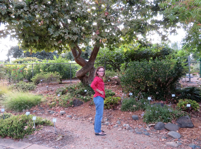
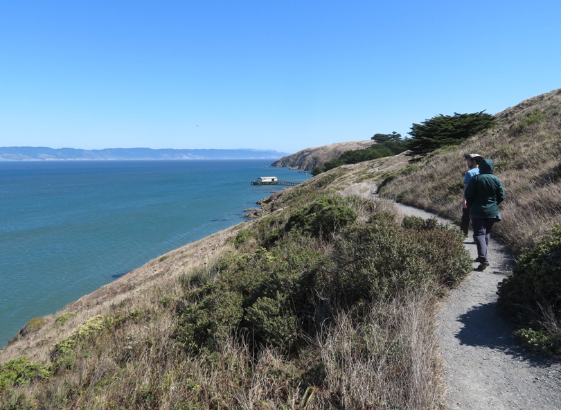
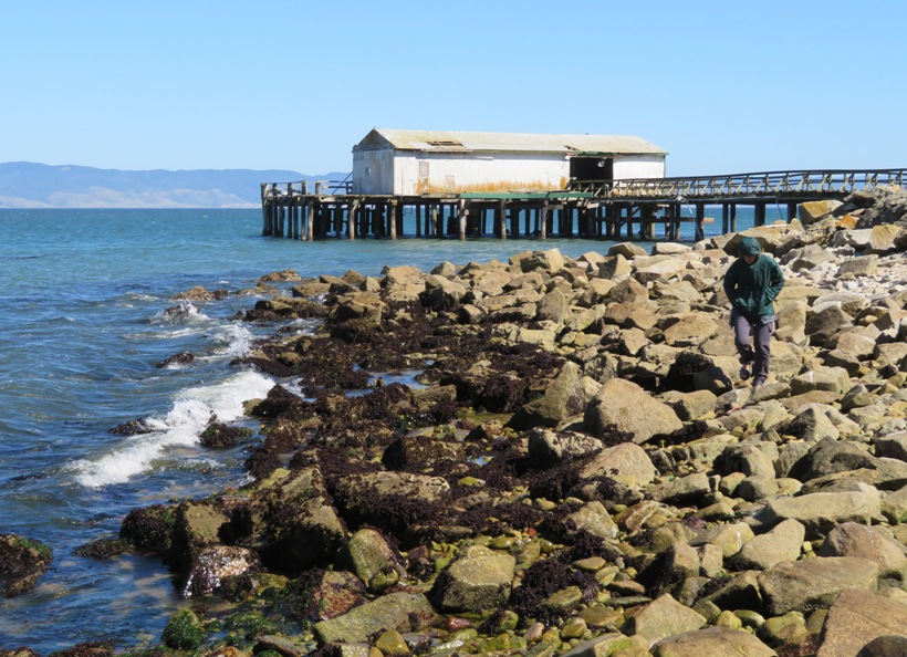
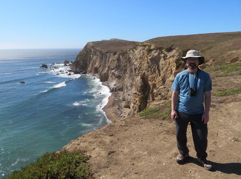
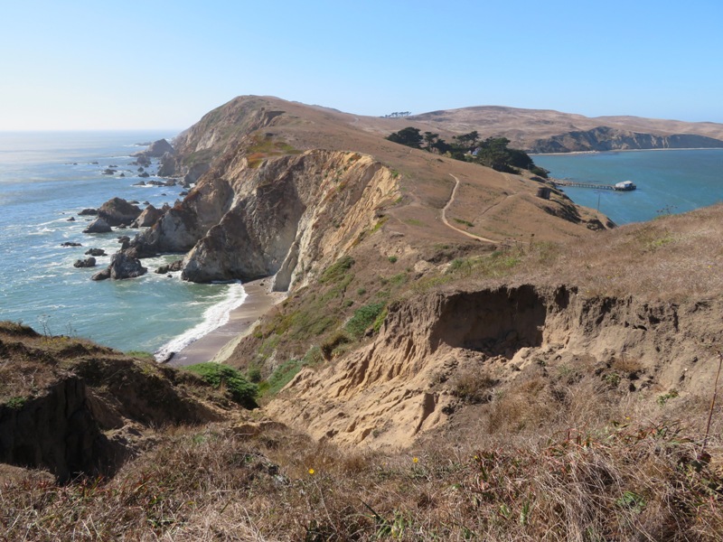
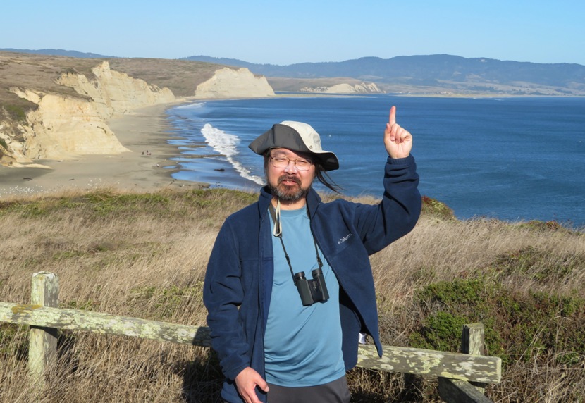
    It was a long drive and traffic was heavy at times. Fortunately, we left early and gave ourselves plenty of time to get there. Norma and I arrived early, which was fine because it was a nice place to explore on foot.

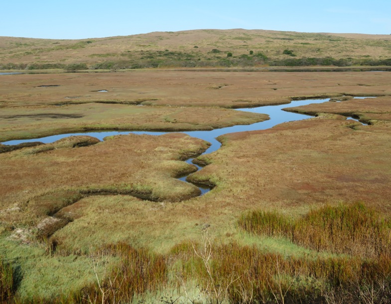
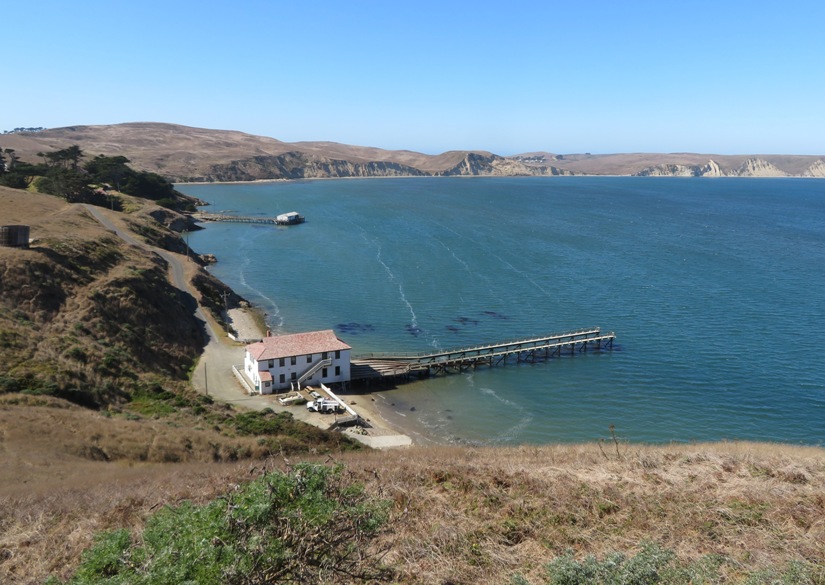
    Here is a view upstream of where we launched at Drakes Estero at 38.085972, -122.932500. We didn't paddle this part but I'm sure it would have been fun, especially on a SUP.
    Winding waterway lined by vegetation

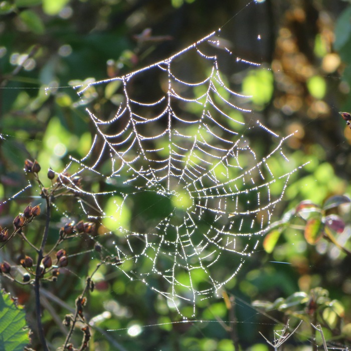
    I explored the cliffs near our launch site and found several dew-covered spider webs.
    Dew-covered spider web

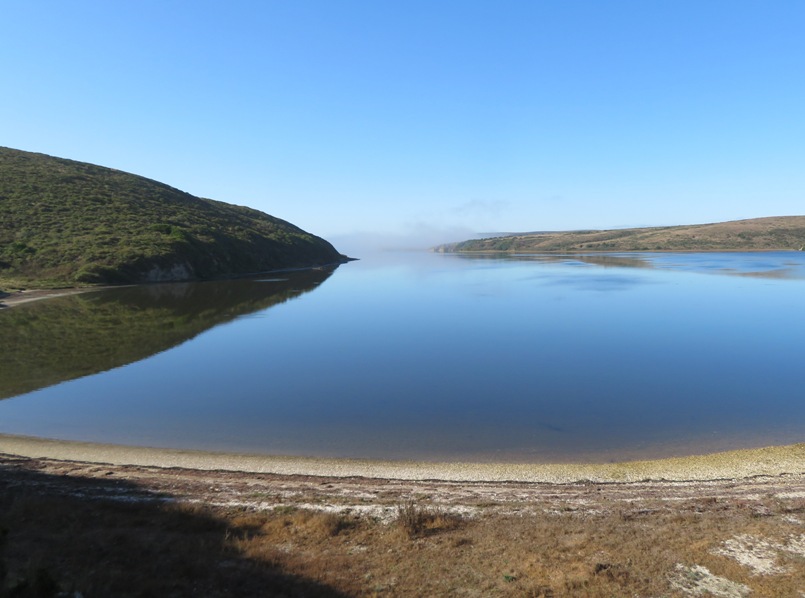
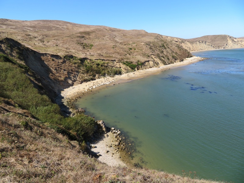
    Here is where we launched, a beach looking south to Schooner Bay. We got an early start so the water was calm. In the afternoon, the winds typically pick up. If you head out there, be forewarned that there is no cell phone service as of 2019.
    Calm water view from beach

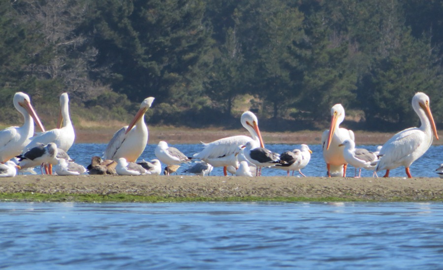
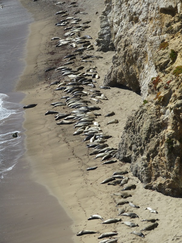
    Out on the water, we saw several white pelicans near Bull Point. There were also sea gulls, cormorants, and brown pelicans (which are smaller) but the white pelicans were the main attraction.
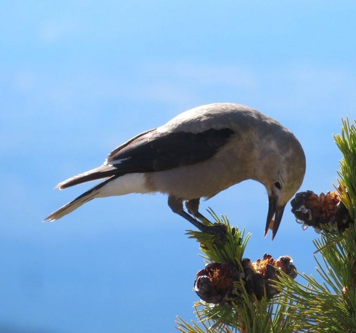
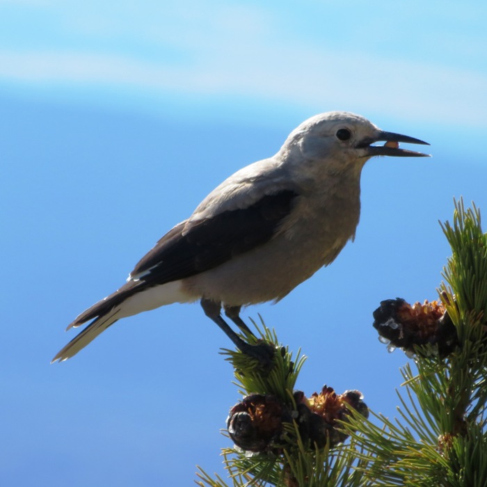
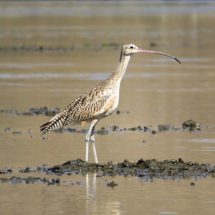
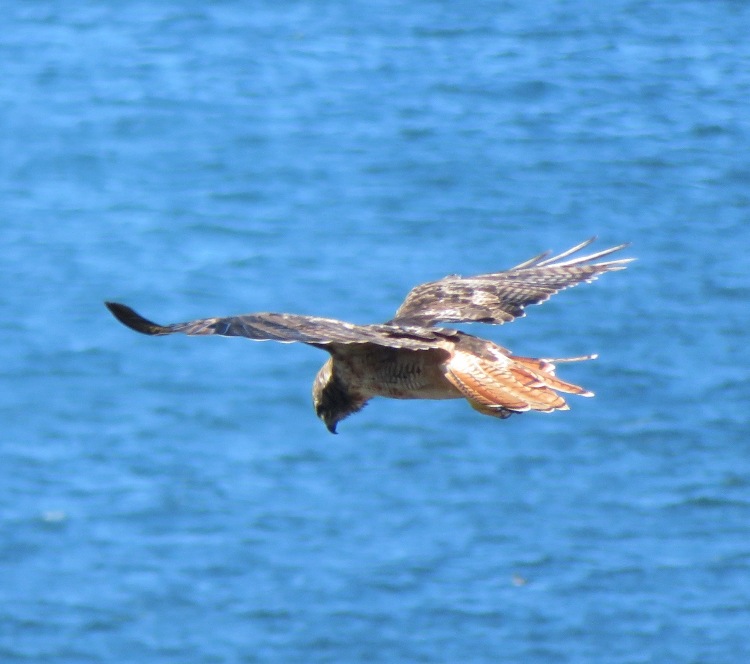
    White pelicans

    I believe this is a Long-billed Curlew.
    Long-billed Curlew

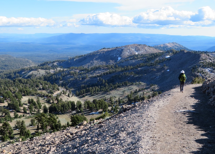
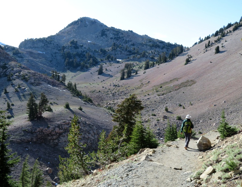
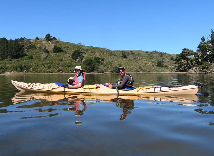
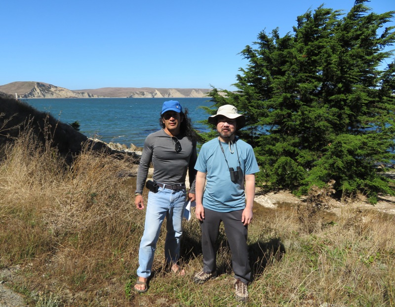
    Here's Alex with our guide, Ian. Ian took good care of us and knew where to take us to see plenty of wildlife. He also made suggestions of where to hike after kayaking.
    Alex on kayak with guide

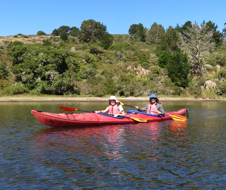
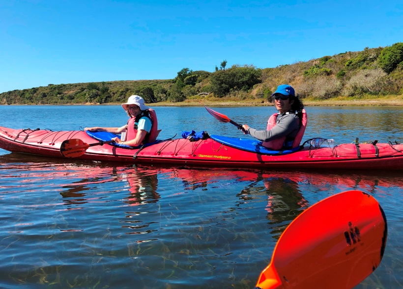
    Here's Norma and me in a Current Designs Crosswind plastic tandem kayak.
    1 / 2
    Norma and I in a kayak
    In tandem.
    2 / 2
    Norma and I in a kayak
    Side view.

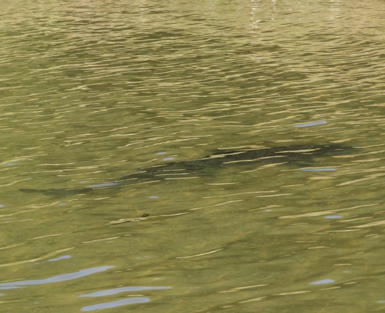
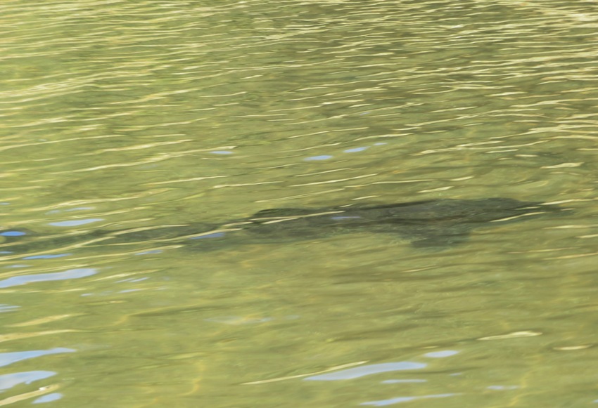
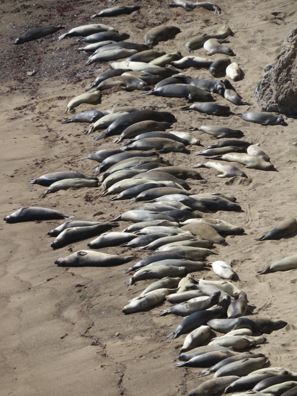
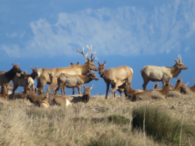
    We probably saw a couple dozen leopard sharks.
    Leopard shark

    We also spotted one bat ray which Alex spotted. The sharks were up to five feet long and the bay ray was about 18 inches across.

    According to a park sign,
    Bat rays are common in Drakes Estero, Bolinas Lagoon, and Tomales Bay. These areas serve as critical nursery and feeding spots where the rays forage on crabs and other invertebrates. When they forage, rays dig large pits that are up to 12 feet wide and 6-8 inches deep, which in turn provides habitat for other species.

    The sharks moved pretty fast so it was often difficult to get a good look at them but we could definitely see their spots which give them their name.
    Leopard shark

    I would like to return here on a really calm day on a SUP to get better pictures of the leopard sharks. I've been kayaking for over 20 years and this was the first time I'd ever seen a shark while paddling. It was a great experience!

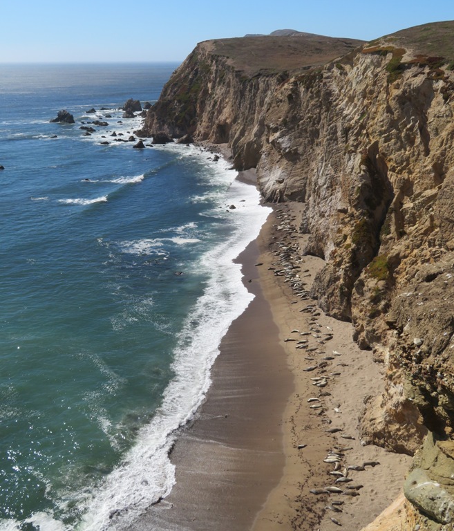
    Most of the leopard sharks were on the west side of Home Bay at 38.068389, -122.923722. Make sure to visit when the tide is high.

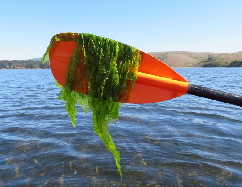
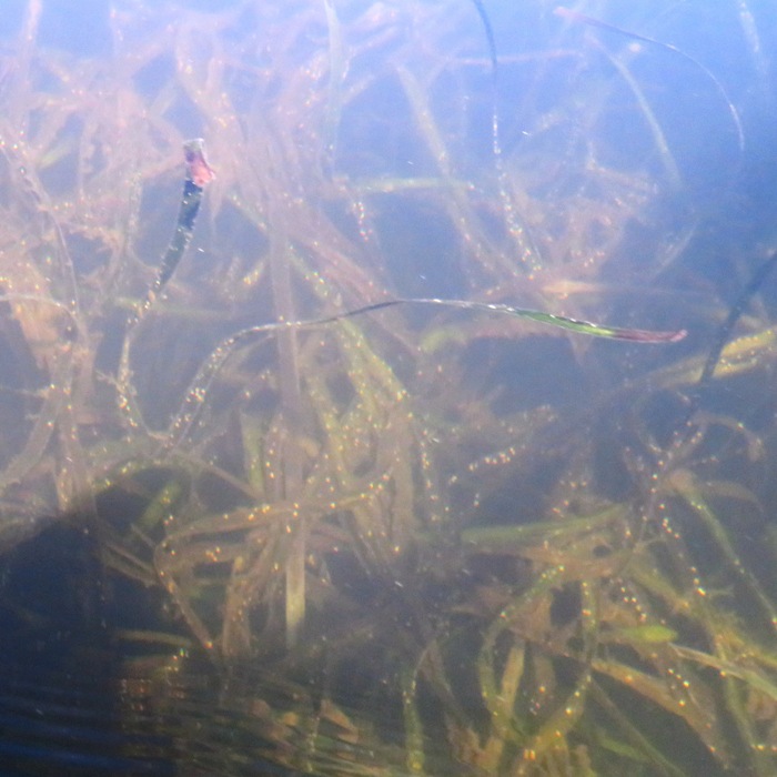
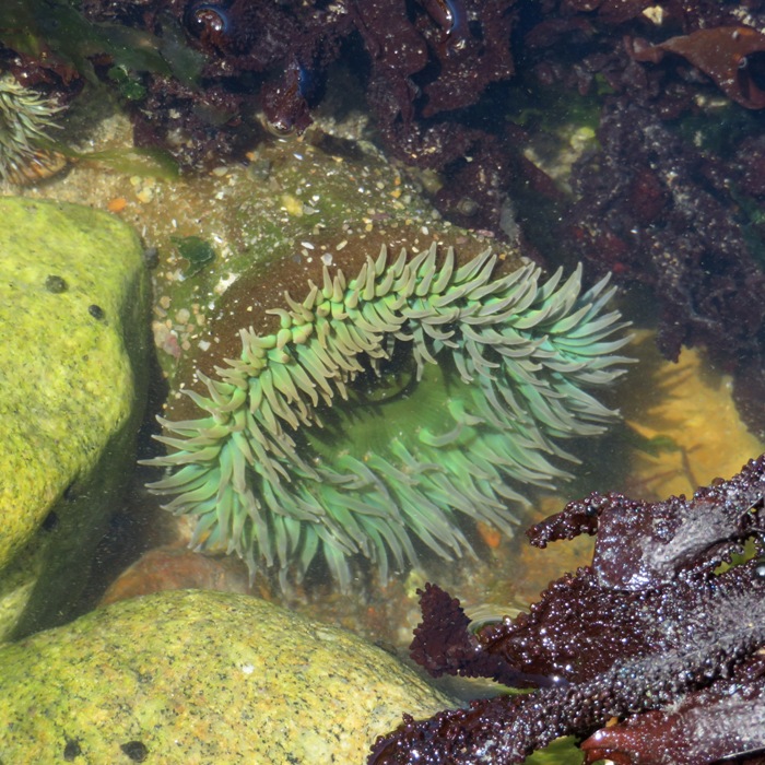
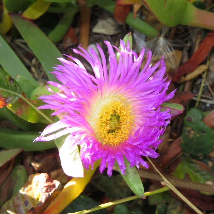
    The area was full of aquatic vegetation including something that Ian called elephant snot but I don't believe this is it.
    Aquatic vegetation at end of paddle

    Ian also spoke about lichens which was growing on the shore. He explained that it is a dual organism, something I did not know.

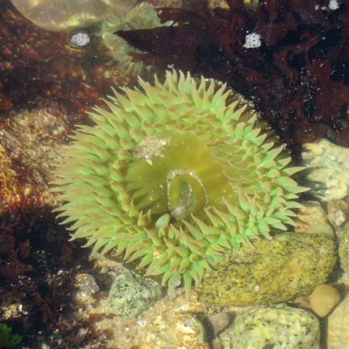
    Here's more aquatic vegetation.
    Aquatic vegetation

    The water was fairly clear...about the same as the cleaner parts of the Chesapeake Bay if it hasn't rained for awhile.

    I enjoyed talking with Ian. He and his girlfriend are quite adventurous and live a lifestyle that I envy though I don't think I'd be quite as comfortable as them with a "live for today" outlook versus "plan for tomorrow." Then again, maybe they are much better prepared for tomorrow than what things appear. And perhaps I will die soon after writing this and, in the afterlife, regret having worked so long in a windowless office.
    Close accordion icon

    Chimney RockOpen accordion icon
    After kayaking, the Norma, Alex, and I drove south to Chimney Rock to do a little exploring. We saw lots of interesting wildlife. On previous days, we saw very little wildlife. That generally seems to be the case in California when I compare things to Maryland. Actually, most of the places I visit don't have as much wildlife as Maryland. But along the coast, that is where California wins.
    Some of the world's richest water exist right off California's coast. An explosion of life occurs here due to a combination of the sun's energy, wind, ocean currents, and contours of the sea floor. Microscopic phytoplankton form the base of the food chain, which are fed upon by zooplankton and fishes, providing a feast for seabirds, seals, whales, sharks, and humans.
    - from information sign

    Chimney Rock wasn't far from where we paddled but it was much windier. I don't know if was because we were closer to big, open water and at higher elevation or because it was later in the day...probably both.

    As with many trails in California, there were vistas all over the place. Here is a view from the elephant seal overlook looking northwest.
    View of the water from elephant seal overlook

    This is a zoomed-in look of the previous view. Are these elephant seals, as the name of the overlook implies? If there are, I don't think there are any adult males. We might have missed the elephant seal window and if we did, then these are probably harbor seals.
    From November through April each year, many northern elephant seals come to shore at Point Reyes to establish territories and give birth to young. They stay until the last few pups are weaned from their mothers and return to sea.
    - from information sign
    Seals on beach

    Twenty percent of California's harbor seals breed in the Gulf of the Farallones.
    - from information sign
    1 / 2
    Seals on beach
    Seals.
    2 / 2
    More seals on beach
    More seals.

    As much as they sleep, they should be called "cats of the sea."
    Sleeping seals

    When they aren't sleeping, they might be fighting.
    1 / 3
    Seals fighting
    Creating a stir.
    2 / 3
    Seals fighting
    Place your bets.
    3 / 3
    Seals roughhousing
    Fighting or playing?

    We walked to the fish dock (the white building).
    Waterview trail

    To our left is Drakes Bay. It wasn't a good time or place for tidepooling but we did find a few interesting things.
    Solitary Anemones are the most common non-aggregating anemones. The colors range from bright green, to pale green and even grayish and yellow. When under water, the tentacles are exposed and visible. When the anemone is exposed to air or disturbed, they will close up and sometimes have lots of small bits of shell and other objects attached to the body.
    - from California Tide Pools - Anemones (a broken link as of 2023)
    1 / 3
    Norma walking on rocks
    Not great tidepooling.
    2 / 3
    Green sea anemone
    Green anemone.
    3 / 3
    Light green sea anemone
    Light green anemone.

    Here's a pic of Alex and I with Drakes Bay in the background.
    Alex and I standing with Drakes Bay in the background

    The wind really picked up and it was very gusty. We were glad to be off the water. Here, a raptor (I assume some kind of hawk), hovers in the breeze while scanning for prey.
    Raptor hovering

    From the east side of the Chimney Rock Trail, we had a nice view of Drakes Bay. The terrain out here is nothing like Maryland.
    Drakes Bay

    Just west of Chimney Rock on the south side of the peninsula, we saw several dozen seals at the base of the cliff. This must be a pretty popular hangout for them because they even show up in the Google Maps satellite picture at this location.
    1 / 3
    Seals on beach next to steep cliff
    Seals and cliff.
    2 / 3
    Seals on beach
    Seals.
    3 / 3
    Close-up of seals
    Seals zoomed-in.

    Much of the California coast is wide open. This means you really need to watch where you walk or you might fall off a cliff. Fortunately, Alex was smart enough to not get too close to the edge. If you look closely, you will find seals in the middle of this picture on the beach.
    Alex with seals in the distance

    Here's one last view of the trail.
    Looking back at the trail

    It would have been nice to have stopped at the Point Reyes Lighthouse but it was closed for repairs.
    Close accordion icon

    Drakes BeachOpen accordion icon
    Our next stop was Drakes Beach. On the way there, we saw several tule elk on the east side of Drakes Beach Road.
    The tule elk are the smallest of all the elk species in North America and they are endemic to California. Given this, location and size are the easiest way to differentiate between the species. The adult bulls have an average weight of 450-700 lbs., with some topping the scales at over 800 lbs. The adult cows average 375-425 lbs.
    - from California Department of Fish and Wildlife - Tule Elk
    1 / 2
    Tule elk
    Tule elk.
    2 / 2
    Zoomed-in view of Tule elk
    Close-up.

    [Tule elk] numbers were severely reduced in the mid-1800s, primarily due to uncontrolled market hunting and displacement by cattle. By some accounts, fewer than thirty remained in a single herd near Bakersfield in the mid-1870s. A conservation minded cattle rancher named Henry Miller had the foresight to preserve this last isolated group discovered on his ranch in 1874. Until this discovery, tule elk were thought to be extinct. All of the estimated 5,700 tule elk present in twenty-two herds across California (as of 2016) were derived from this small remnant herd, thanks to his initial efforts.
    - from National Park Service - Tule Elk

    At Drakes Beach, we saw lots of ice plants which were in bloom. We don't have these in Maryland.
    Hardy ice plant (Delosperma) is a succulent, perennial ground cover with daisy-like flowers. The ice plant is not called an ice plant because it is cold hardy, but rather because the flowers and leaves seem to shimmer as though covered in frost or ice crystals. The plants grow to be about 3 to 6 inches tall and 2 to 4 feet wide.
    - from Gardening Know How - Ice Plant
    Ice plant flower

    In the snapshot below, Alex points to where Drakes Estero empties into Drakes Bay. Recall that Drakes Estero is where we were kayaking just a few hours prior. Drakes Bay is part of the Gulf of the Farallones and that connects to the Pacific Ocean.
    Alex with index finger raised

    On June 17, 1579, Captain Francis Drake sailed his ship into the Gulf of the Farallones and the bay that now bears his name. He sighted these white cliffs and named the land Nova Albion.
    - from information sign

    Francis Drake was quite the explorer. He circumnavigated the world in 1577-1580. It is hard to comprehend anyone completing such a feat back then. I imagine that today, that would be like sending a man to Mars.
    In the Golden Hind, Sir Francis Drake's most famous ship, he became the first Englishman to circumnavigate the globe, on an epic expedition of discovery and adventure.
    Drake had previously made a number of voyages to the Caribbean on trading missions and had carefully learned and recorded how to navigate around the West Indies on these previous travels.
    Drake sailed between the five continents of Europe, Africa, North and South America and Asia, a journey taking him 1020 days. Five ships set sail in 1577 from Plymouth, the Golden Hind being the largest at 120 tons. Only the Hind completed the voyage and returned to Plymouth. The hardship endured in overcrowded and primitive conditions was unbelievable with only 56 men returning with Drake three years after setting sail and 36,000 miles later.
    Long given up for dead, the Plymouth residents were amazed to see Drake and the small ship return into Plymouth Harbour in September 1580. Once Drake had been reassured that Queen Elizabeth I was still alive, he...became one of the most famous men in the world. The total value of the items on board was 160,000 Elizabethan pounds, or almost half a billion pounds in today's money.
    Queen Elizabeth's share alone was more than the England's annual national debt...

    - from Golden Hind Brixham's Treasure (broken link as of 2020)

    The above mentions that Drake returned with 56 men. What it doesn't say is that he started with 164. That means 66% did not return. Source: Wikipedia - Francis Drake.
    Close accordion icon

    Inverness Park MarketOpen accordion icon
    Norma, Alex, and I intended to dine at Vladimir's Czech Restaurant but they were closed. So instead, we ate at Inverness Park Market which had nice outdoor seating.
    Norma and I in front of Vladimir's Czech Restaurant sign
    Close accordion icon


     Tuesday, September 24, 2019

    Flying homeOpen accordion icon
    We flew out of Sacramento early in the morning. We had one brief layover in Austin, Texas. I managed to sleep most of the way. I had a window seat on the second half of the flight. As we flew over Maryland, I quickly identified the waterways and then was able to point out things as if I was reading a map. It is amazing how well I know Maryland and how poorly I know California.

    Norma and I returned home to a warm welcome from Daphne.
    Close accordion icon