|
This page describes an extended weekend trip that Norma, Daphne, and I took to Cape Charles, Virginia during April 19-21, 2024. |

|
This page describes an extended weekend trip that Norma, Daphne, and I took to Cape Charles, Virginia during April 19-21, 2024. |
|
On the way to Cape Charles, we stopped at the Brownsville Nature Conservancy - William B. Cummings Birding and Wildlife Trail for a ~three mile hike.
The weather was cool and overcast but at least we weren't expecting to get a lot of rain. We started out walking on a boardwalk. 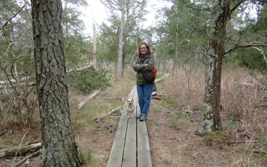
I was looking for snakes and Norma was looking for morels. We found neither, but we did see a turtle. Maybe a mud turtle? 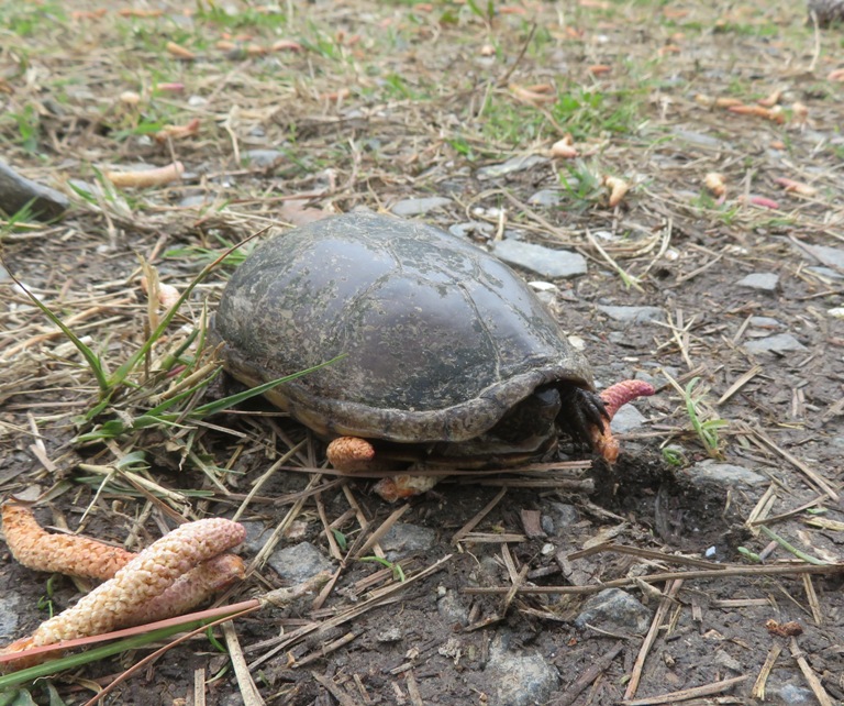
We were also keeping an eye out for amphibian eggs. Didn't see any of those either, though there was plenty of water. Some of it was very black, probably due to tannic acid. 
We looked inside a screened structure used by the Nature Conservancy for nature programs. Nearby was an observation deck for viewing the marsh. Here we saw lots of egrets. Just off the trail, I stumbled onto an old, abandoned house. 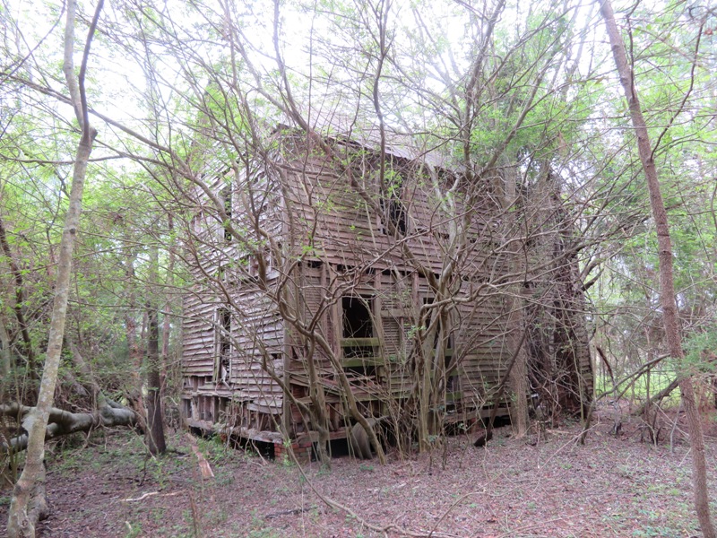
Peering inside, it resembled something out of a horror movie. 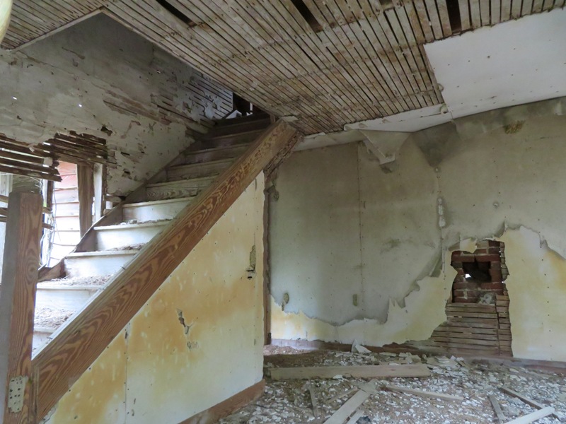
We never saw anyone else on the trail. We drove past the Barrier Island Center. It wasn't open. Hopefully we can visit it another time.  |
|
Our next stop was our room at the Milestone Lodge. We didn't think we'd have a hard time finding lodging since it was April but we were wrong. We didn't check the really expensive places and of the things left, many did not allow pets. I was really wanting to stay at the Cape Motel but they had no vacancy due to a wedding.
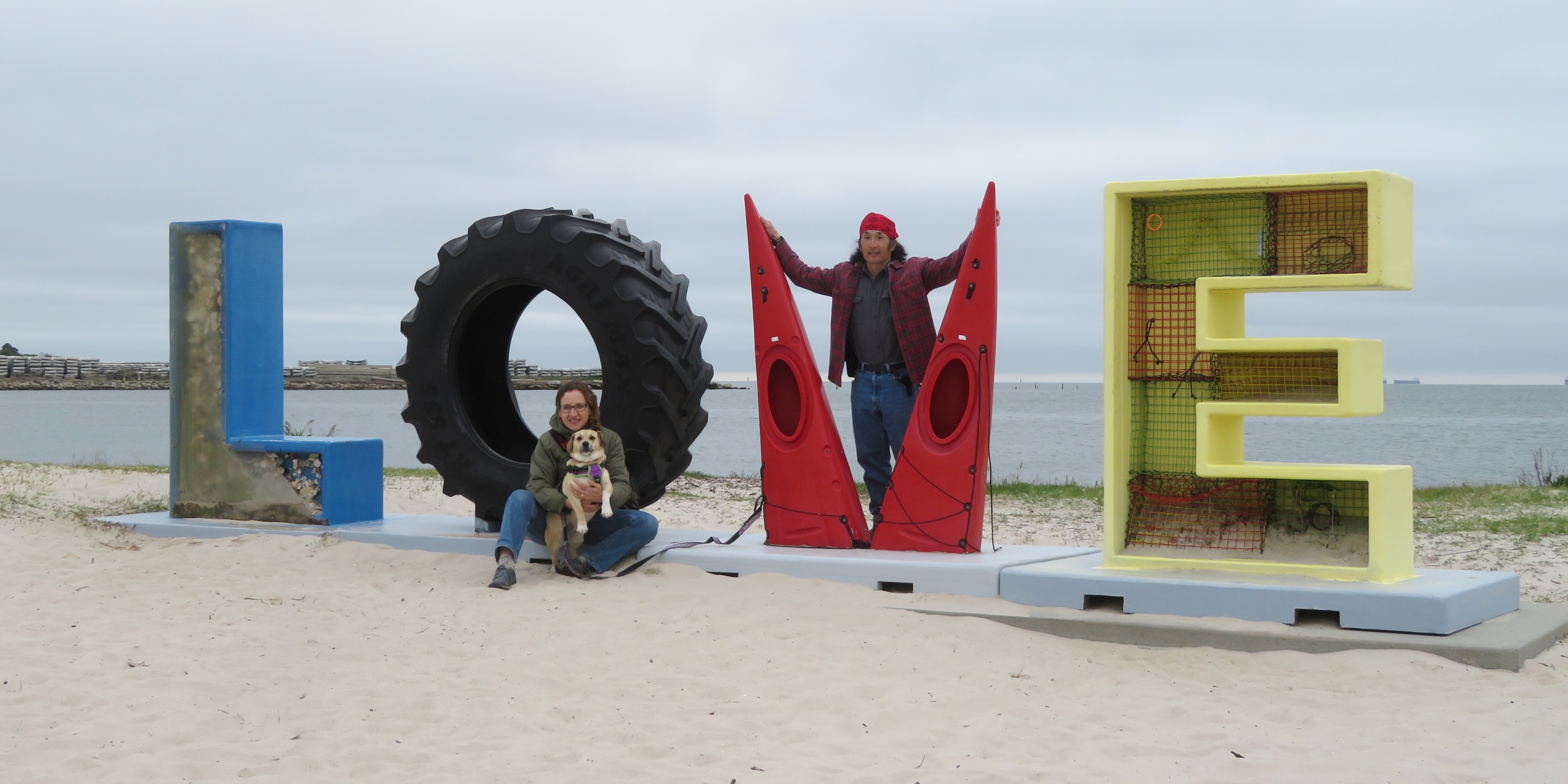
Milestone had plenty of rooms. I think that is because they don't have much of an on-line presence. One has to call in to check availability and book a room. The rooms are fine and there is lots of greenery, which we like. There were also a lot of cats, which Daphne liked. The place is being renovated and still has a ways to go. I do hope they are successful. The motel is only three miles from the heart of Cape Charles. We drove into town and then checked out the beach. We were disappointed to learn that pets are not permitted from 0900 to 2100. The three of us posed at one of the more recognizable landmarks in town...the LOVEwork love sign. The LOVEwork in Cape Charles truly reflects the history and community by incorporating materials that represent what Cape Charles is all about. So how did the town come to be? The construction of what is now the Bay Coast Railroad led to the evolution of Cape Charles from a small agricultural community to a bustling railroad town. By October 1884, the railroad's first passenger and freight trains began running. Trains soon arrived daily from New York, and the Eastern Shore's towns prospered as their produce could easily be exported to metropolitan areas. With the decline of the railroad industry and the increase of local truck shipping after the opening of the Chesapeake Bay Bridge-Tunnel in 1964, the Town experienced an economic downturn for several decades. However, the Town has recently seen an increase in its growth and economic prosperity due in part to its focus on tourism. - from sign at Cape Charles Beach titled "A Changing Way of Life..." We drove across the Old Cape Charles Road (route 641) bridge to the south side of town. Here, we found the Cape Charles Boat Ramp. 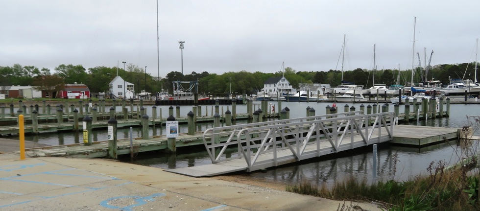
Just across the Cape Charles Harbor, I saw the Elizabeth Ferry III. 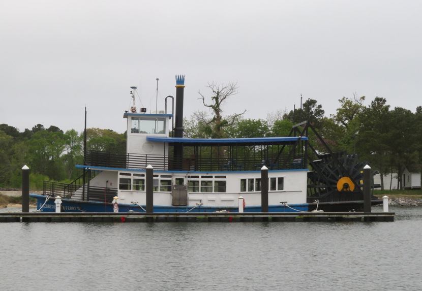
After driving around town a bit, it didn't take long before I was well oriented and able to get around easily. It really is a small town, and a very charming one. That evening, we had dinner at the Cape Charles Brewing Company. I was very impressed with their beer keg which was turned into a urinal. This natural sound amplifier made me think of steel drums and resonating guitars (dobros). I'm guessing the distinctive tone encourages men to drink more beer just so they can enjoy the soothing musical reverberations. 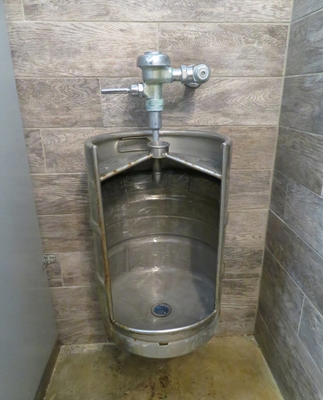
|
|
We walked on the beach with Daphne during the time when pets were permitted. Daphne really likes all the interesting smells and the feel of the sand between her toes.
Exploring the shore, we found a whelk egg case, or mermaid's necklace as it is sometimes called. 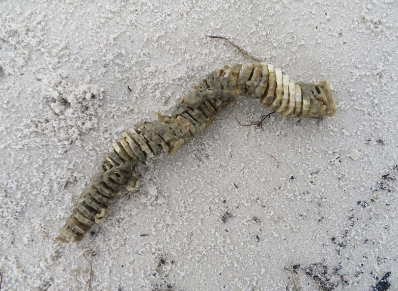
I also came across some other eggs caught in vegetation. Not sure what they are. 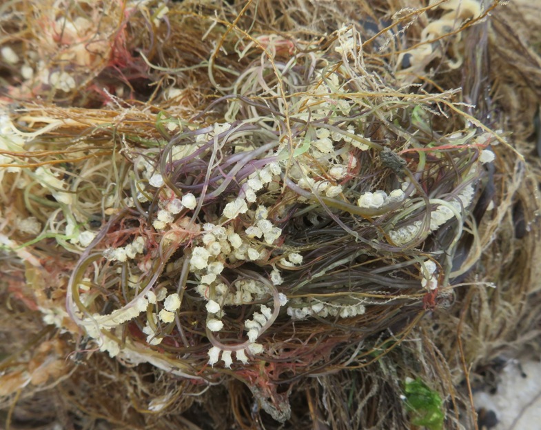
Near where we walked was a place that really piqued my interest when I saw it in a satellite photo. For centuries, shellfish have been important to the economy of Virginia's Eastern Shore. They require high water quality. Today, hard clams are the second most valuable crop. Cherrystone Aqua Farms has been family owned since 1895. It is the largest cultured oyster grower on the east coast and the largest hard clam operation in the U.S. Cherrystone partners with a number of local growers to supply markets throughout the country. - from sign at Cape Charles Beach 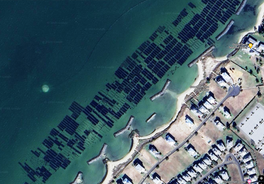
Right next to the beach, on Bay Avenue, the 10k/5k/one mile Love Run started. It was a festive crowd. I'm guessing they had a few more people than the Savage 7k race. 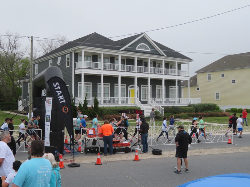
Our next stop was the Oyster Farm Marina Farmers Market. This was pretty small and a little disappointing. For breakfast, we went to the Coastal Baking Company. |
|
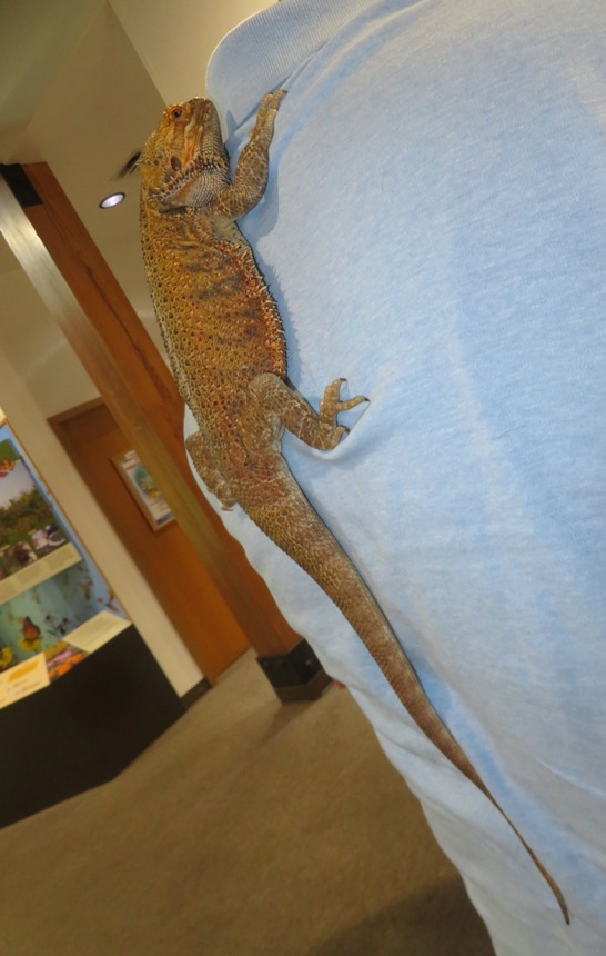
Norma, Daphne, and I drove to the Visitor Center at the Eastern Shore of Virginia National Wildlife Refuge. Here, I saw a bearded dragon perched on the back of one of the employees or volunteers.
After talking to the staff, we set out to do a short hike on the Butterfly Trail. We saw no butterflies, but this area is known to be a good place to see monarchs in September and October when hundreds of thousands migrate south along the Delmarva Peninsula to sites high in the Mexican mountains. The following spring, the wintering monarchs make the long return journey back north. Migration spans multiple generations. The first three generations each just live two to six weeks. The fourth generation, however, lives six to eight months in order to travel all the way to Mexico. - from sign at Visitor Center titled "Amazing Monarchs" The trail merged with the Wildlife Trail where we found the remains of Fort John Custis which was defended by a number of batteries with various artillery, including Battery Winslow with its two 16-inch guns. These large guns were similar to the ones used on the battleships of World War II. A rail system was laid throughout the fort by the Pennsylvania Railroad to provide coal, ammunition, and other supplies to the soldiers manning the guns. - from sign on the Wildlife Trail Loop titled "Winslow Battery" 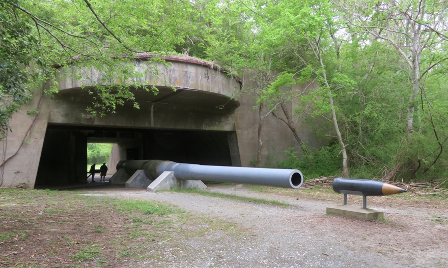
These large guns could fire a 2,000 pound projective over 25 miles. [Each weighing 239,000 pounds and] Traveling at 1,834 mph, the projectiles met their target in less than a minute! - from sign on Wildlife Trail Loop titled "A Blast from the Past" 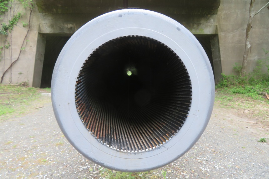
Some of the trail was lined by trees supporting lots of blooming wisteria. 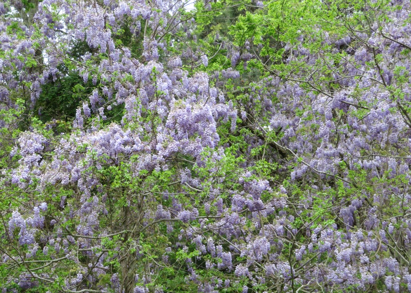
A short detour took us to the Chesapeake Bay Bridge-Tunnel Welcome Center. Operating since April 1964, Chesapeake Bay Bridge-Tunnel [CBBT] functions both as a bridge and a tunnel, as its name implies. After the $200 million structure's completion, the American Society of Civil Engineers named it "one of the seven engineering wonders of the modern world." The CBBT is a 23-mile (37 km) fixed link, crossing the entrance of Chesapeake Bay in the U.S. state of Virginia. It connects Northampton County on the Delmarva Peninsula with Virginia Beach and originally combined 12 miles (19 km) of trestle, two 1-mile-long (1.6 km) tunnels, four artificial islands, four high-level bridges, approximately 2 miles (3.2 km) of causeway, and 5.5 miles (8.9 km) of approach roads. - from GeoEngineer - Chesapeake Bay Bridge-Tunnel: An "engineering wonder" of the modern world We walked back to the Visitor Center. Norma had been looking for morel mushrooms but found none. We did, however, find fiddleheads, which are edible. But I'm sure the Visitor Center staff would not have appreciated us taking them out of their entrance planter. 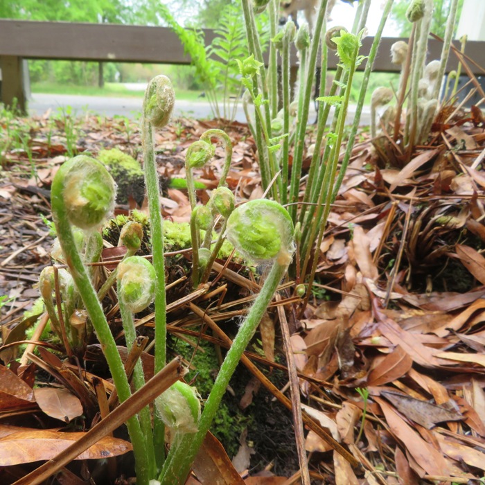
On the north side of the Visitor Center parking lot, we checked out the Southern Tip Bike and Hike Trail. This is a finished portion of the Eastern Shore of Virginia Rail Trail. There is no completion date. The future ESVA Rail Trail will be a 49-mile walking and biking trail along the historic Eastern Shore railroad corridor. 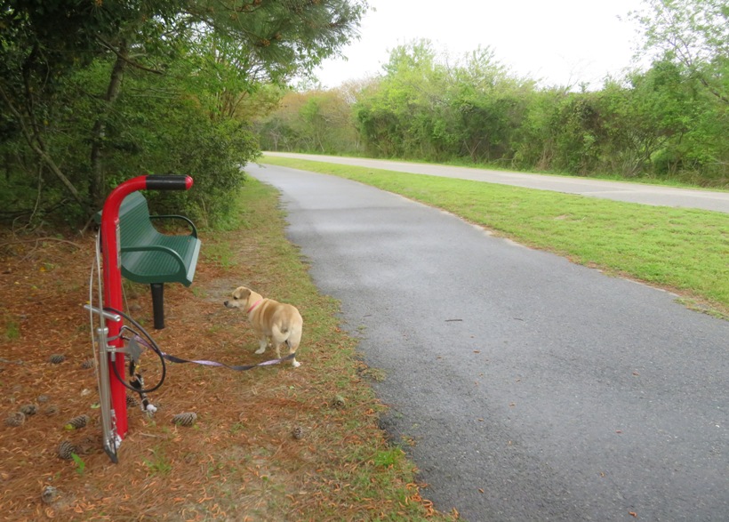
|
|
Less than a mile away, we ate lunch at the Sunset Beach Bar and Grille.
From here, we could see the Chesapeake Bay Bridge-Tunnel. I had been looking for pelicans all weekend. I never got a good look at any but I think I caught one in this photo. 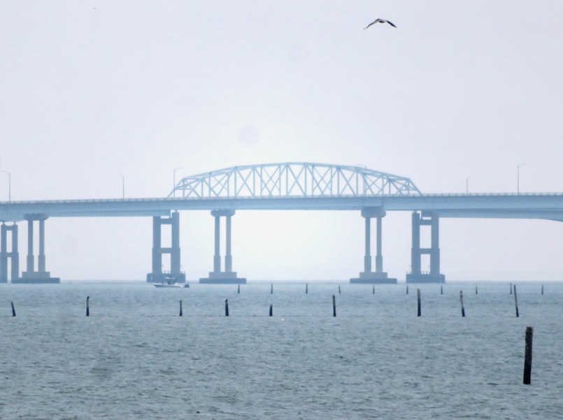
I was also looking for dolphin but saw none. At least I saw this Atlantic ghost crab on the beach from the restaurant. 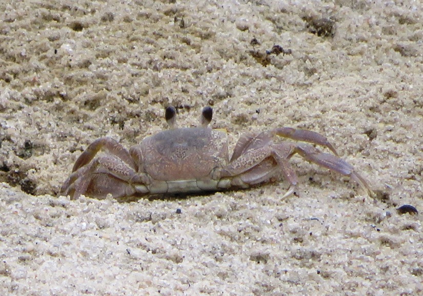
|
|
I plan many of our overnight trips around kayaking and this trip was no different. The whole weekend was forecast to be cool and cloudy with some rain. But there was a small window where it would be sunny and warm. I scheduled our time on the water around this.
There were two launch sites to choose from in the Eastern Shore of Virginia National Wildlife Refuge. The first was Wise Point Boat Ramp but dogs are not allowed here. The second was the Northampton County Kayak/Canoe Launch which is not accessible at low tide. It was only an hour and a half after, and while Raccoon Creek was low and narrow, it was plenty sufficient for paddling. 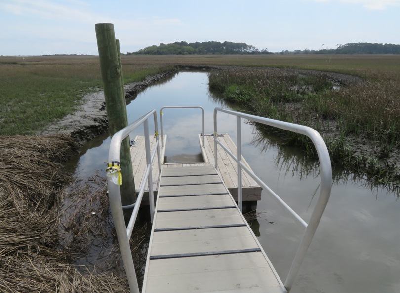
We saw lots of fiddler crabs dotting the muddy shoreline. 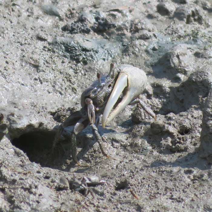
As I expected, the vegetation was very homogeneous...pretty much just bay grasses. Normally, such scenery would not interest me. But we were there for a different reason...to explore the beaches. I don't much care for pleasure beaches where people lie out to work on their tan or play volleyball. I am into finding aquatic flora and fauna. I figured that being so close to the ocean, we would surely see things that we wouldn't see further north in the Chesapeake Bay. Leaving the creek, we kayaked in the Virginia Inside Passage. My original plan was to explore the shoreline of Skidmore Island. But a sign at the launch site said it was part of the Eastern Shore National Wildlife Refuge and declared off limits. This same sign mentioned The southern end of Raccoon Island is open for low-impact recreational use. We paddled southwest in the passage to the south side of Raccoon Island, pulling ashore at various beaches. We found lots of shells but on the passage-side, none were interesting. From the southwestern point of the island, we could see the Cape Charles Lighthouse, the tallest lighthouse in Virginia. It was built in 1895 and resides on Smith Island, Virginia. 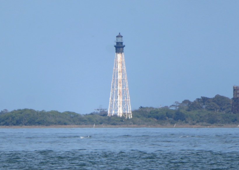
The first interesting shell I found was a moon snail. Moon Snails are voracious predators on the clams that share their habitat. They find a clam, presumably by chemoreception, and envelope it in their big foot and often drag it more deeply into the sand. The radula has seven rows of teeth, with which they dig a hole (easily recognizable as made by this species because countersunk) into the clam shell. A gland on the proboscis secretes enzymes and even hydrochloric acid to help accomplish this. - from Puget Sound Museum of Natural History - Moon Snail 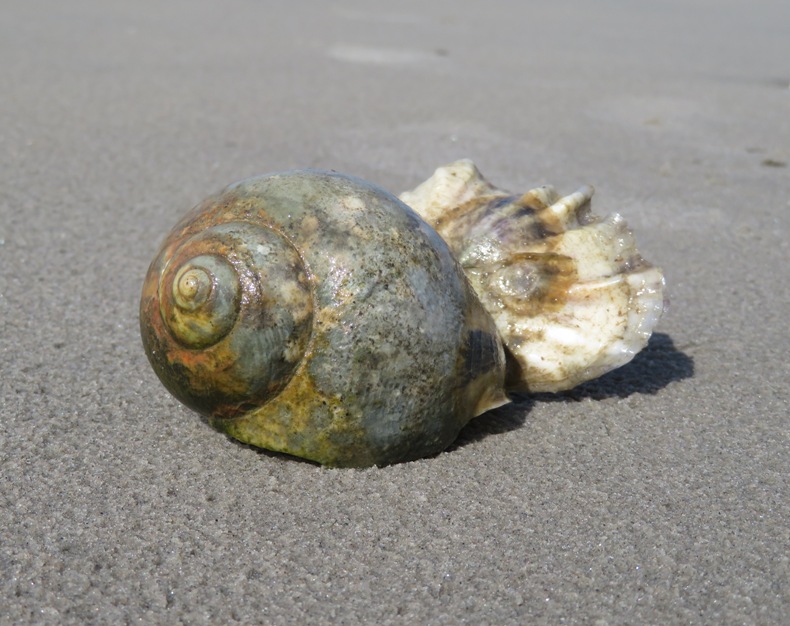
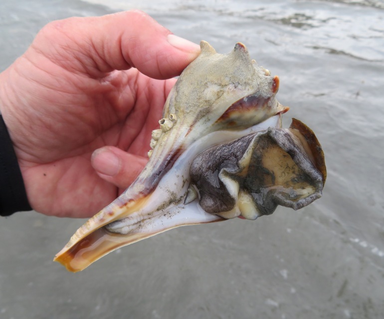
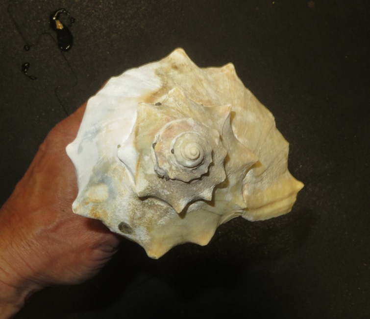
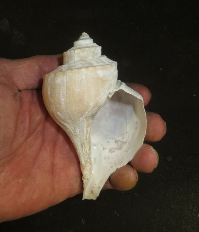
As we paddled on the south side of Raccoon Island, the shells on the beaches became more diverse. We found several shells with animals living in them. The ones that got stuck on land after the tide went out were retracted into their shell. To prevent them from drying out, they use their operculum. Whelks have a separate hard, horny plate, called an operculum, which acts like a trap door when the snail withdraws into the shell. Sometimes called a "shoe," the operculum is attached to the top of the living animal's foot. - from Barnegat Bay Shellfish Here are some of the shells we found which still had critters inside. 1 / 6

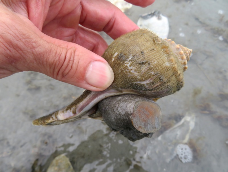
Channeled whelk.
2 / 6
3 / 6
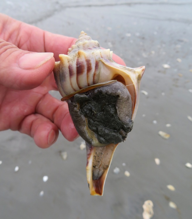
Knobbed whelk.
4 / 6
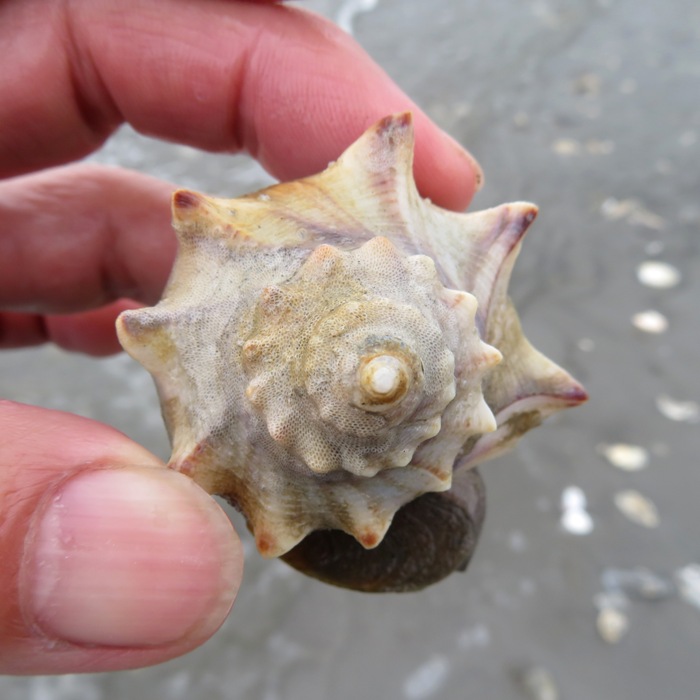
Knobbed whelk spire.
5 / 6
Knobbed whelk operculum.
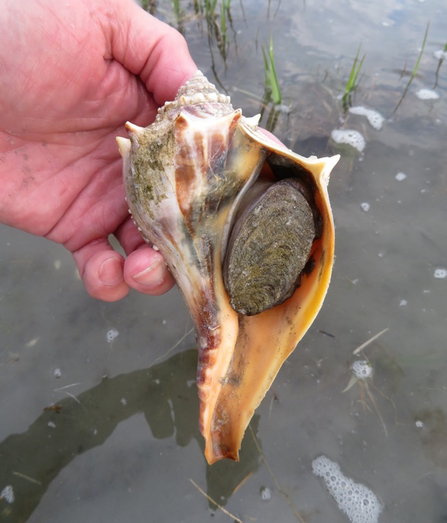
6 / 6
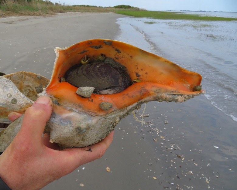
11-inch long knobbed whelk.
We only kept the unoccupied shells. Norma and I paddled through the waterway that separates the northern and southern halves of the island. On the northern side, I saw a big raptor nest. I'm guessing these are juvenile bald eagles. 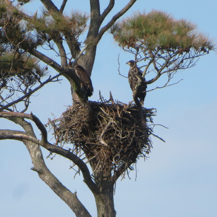
Across from the Wise Point Boat Ramp, we saw various water birds. 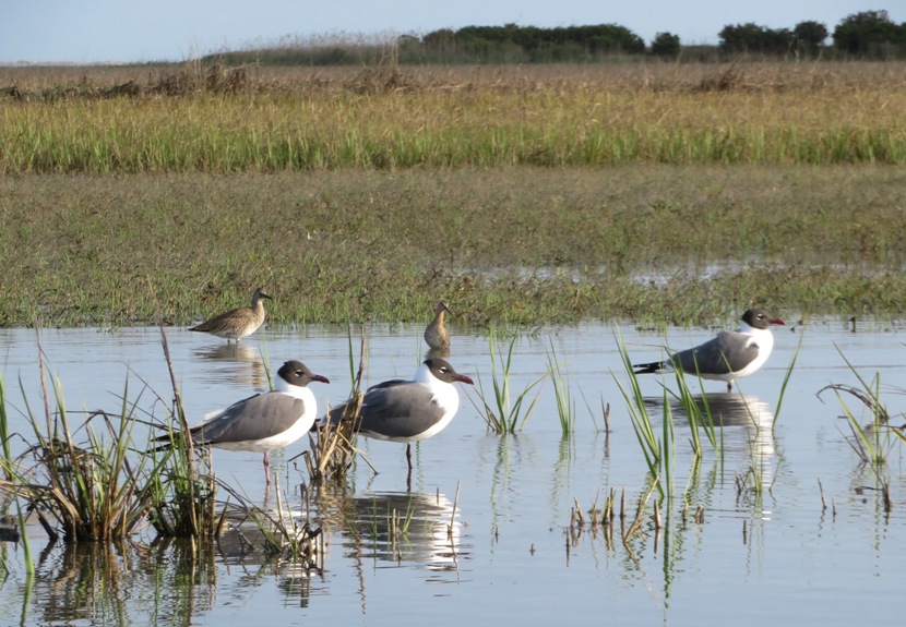
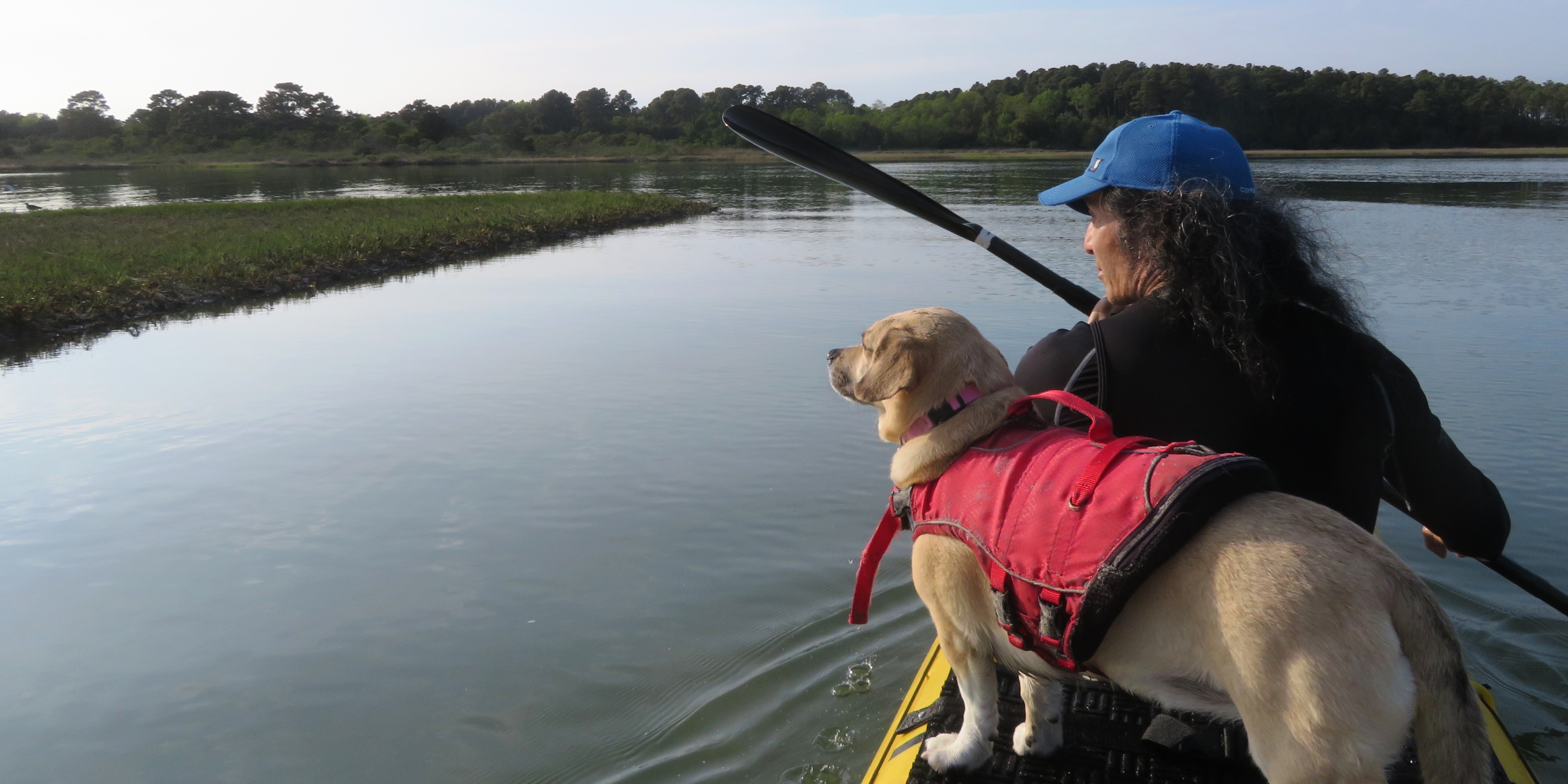
Here's Daphne and me with the Chesapeake Bay Bridge-Tunnel in the distance. 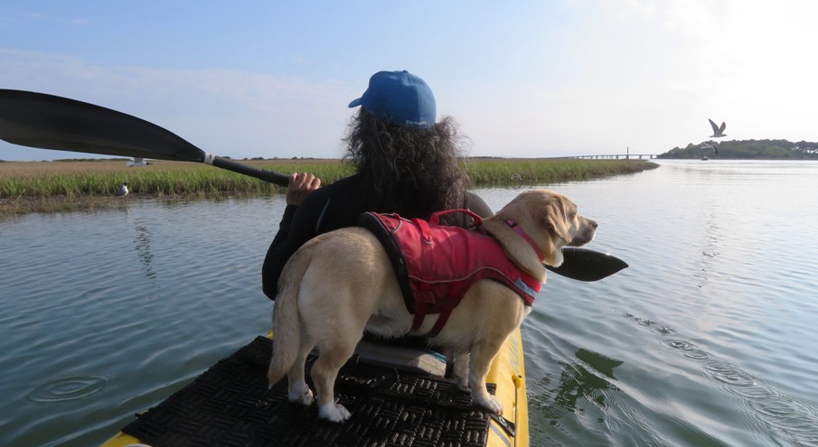
We paddled back up Raccoon Creek. It was three hours after we started and the tide had risen considerably, making it look like a whole different waterway. What was about an eight-foot wide area was now about 30 feet wide. Here's the launch area. 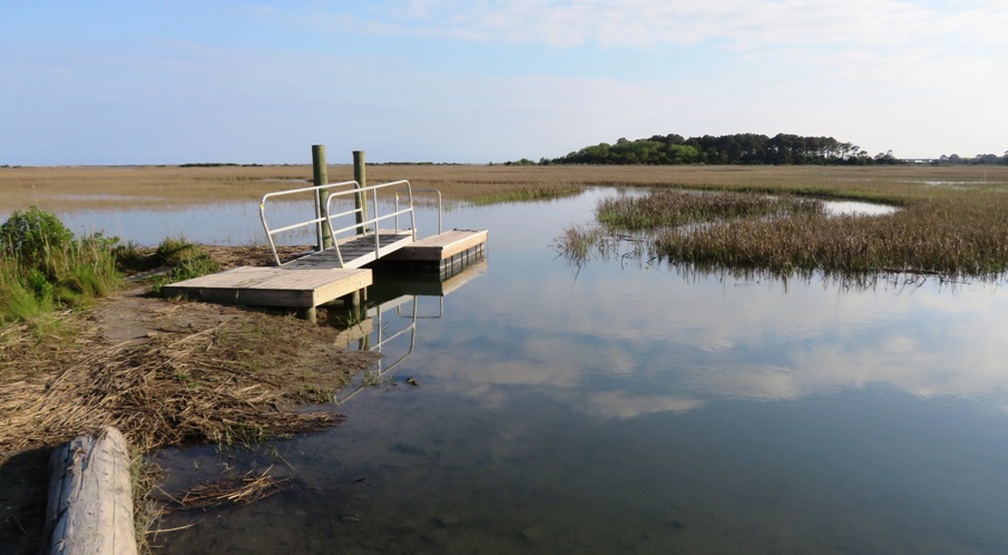
This is our paddling route. We only got in four miles. I think we spent half our time on the shore. 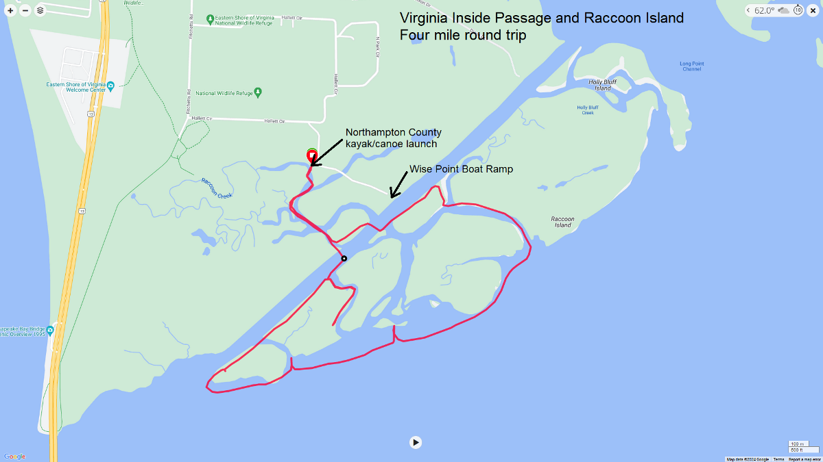
Norma expressed interest in returning in the autumn to see the monarch butterflies and to also to a guided ecotour out to some of the islands that are off limits during the rest of the year. |
|
We returned to the motel to change clothes and then went out to eat at the Shanty Seafood and Bar. Why did we choose this place? One reason is because a local told us that Cape Charles has beautiful sunsets. If you look west, you can see all the way to the horizon because the western shore of the Chesapeake Bay is about 12 miles away. At the Shanty, we had such a view.
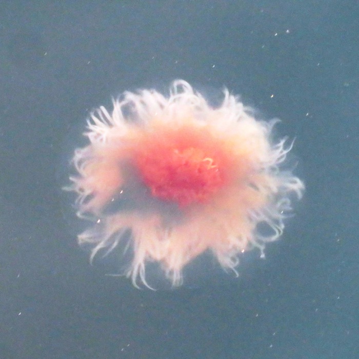
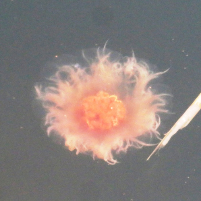
While waiting for our meal, I walked on the boardwalk by the Cape Charles Harbor. Still looking for dolphin, I instead spotted several lion's mane jellyfish. It is the world's largest jellyfish, with a bell up to six feet wide and tentacles exceeding 100 feet, although it grows much smaller in Chesapeake Bay. - from Virginia Institue of Marine Science - Lion's Mane Jelly I spotted an osprey in flight, carrying its dinner, while I waited for mine. 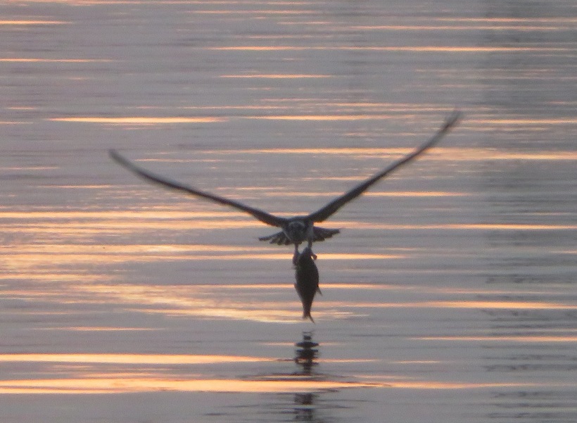
The osprey carried its fish back to its nest, shown below in this sunset photo. 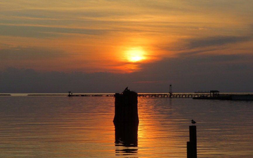
|
|
The weather over the last two days was not the best but today it got a lot worse. We faced strong winds and rain.
Rather than stick around, we decided to start heading home. Our Cape Charles trip was a memorable one. But what made me pick it in the first place? Most people I know have never heard of it but I knew it because in some ways, it is where the Chesapeake Bay was initially formed. The following is from a sign at the Cape Charles Beach titled "The Chesapeake Bay Impact Crater." A meteor/comet two miles wide crossed paths with [the] Earth 35 million years ago. Moving at a speed of 21 miles per second, it crashed at what is today the town of Cape Charles, creating the sixth largest impact crater on Earth. The meteor blasted into the shallow sea that covered the state's eastern half, and exploded with more force than the combined nuclear arsenal of today's world powers. Rocks flew skyward, bedrock fractured seven miles deep and enormous tsunamis raced westward to the top of the Blue Ridge Mountains. Melted rock splashed upward in the center, hardening into a central peak nearly a mile tall, which is directly under Cape Charles. Over the centuries, sediment and debris have filled in the crater and what is now called the Chesapeake Bay lays over much of it today. Although the crater is not visible today, small earthquakes occasionally rock its fault lines and two low ridges appear to mimic its contours far underground. I had also read about the ancient seawater below Cape Charles. Ancient seawater was recently [as of 2013] discovered near Cape Charles, VA. Scientists, drilling approximately a half mile below the water's surface to explore a 56-mile crater at the mouth of the Bay, found trapped water that is nearly twice the salinity of today's seawater. The ancient water is thought to be between 100 and 150 million years old and a remnant of Early Cretaceous North Atlantic Sea water. - from Ancient Seawater Discovered Near Cape Charles |
|
Leaving town, we headed north into Maryland. We stopped in Salisbury for brunch at the Mad Hatter Cafe where we were entertained by an acoustic guitarist/singer.
Looking at the Wicomico River just across the cafe, I thought about coming back to paddle this upstream urban section of the river. |
|
Once we got home, I rinsed out the shells then soaked them in diluted bleach overnight. The next day, I scrubbed them and let them dry out.
I mentioned that we checked the shells before taking them to ensure they were unoccupied. But one of the smaller shells had a hermit crab which retracted deep inside when I picked up its house. I didn't know anything was living in it. Needless to say, it perished. I felt pretty awful about that. 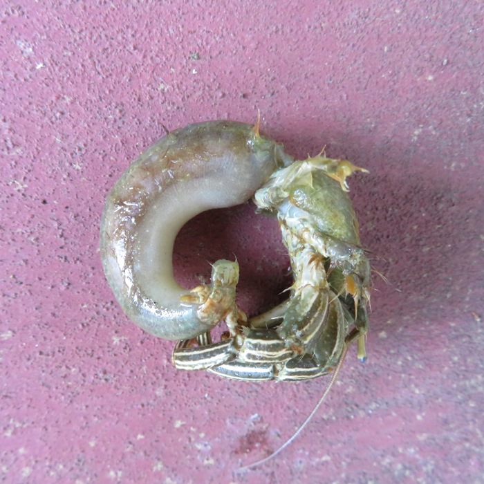
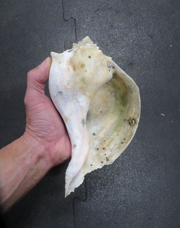
Here are some of the shells we found. They are now decorating our front yard. One shell I brought back was special. It is a lightning whelk. If you hold the shell with the spire facing upward, you'll notice that the opening for this one is on the left. For a knobbed and channeled whelks, the opening is on the right. The lightning whelk is considered a left handed shell. The percent of left handed whelks that I have found in the wild are about the same as left handed people, roughly 10%. 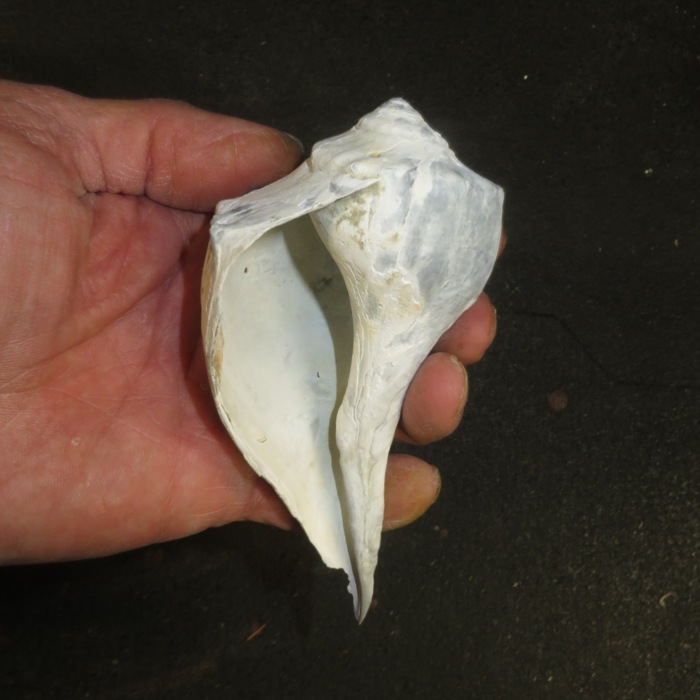
Here's the whole lot. 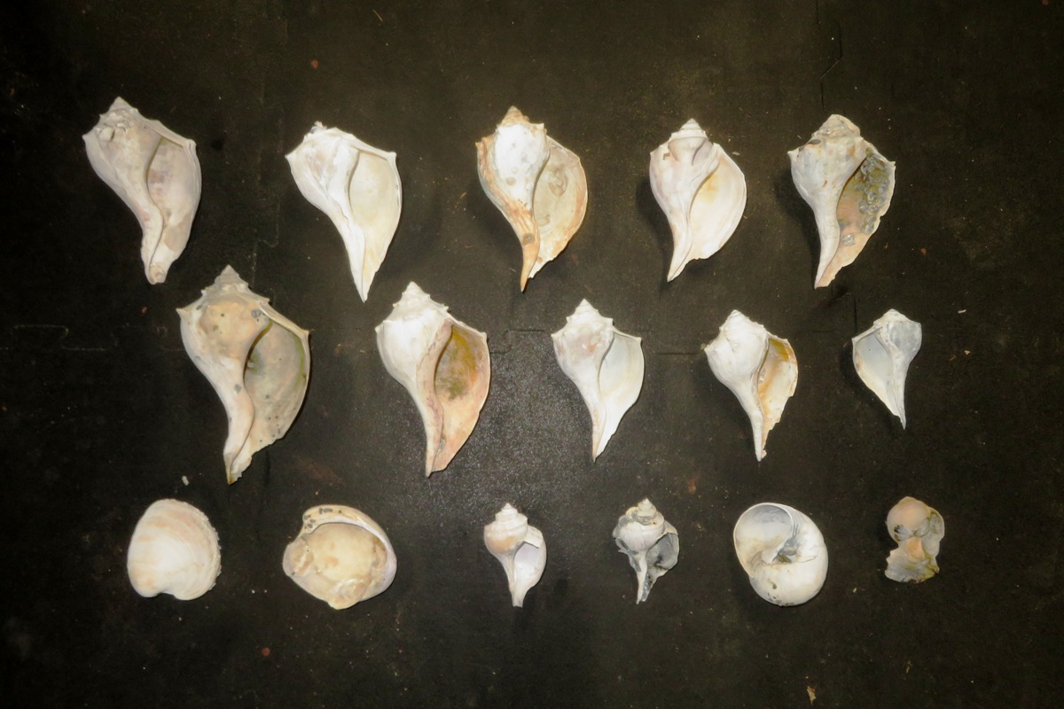
|