|
This page is about a road trip which Norma and I did to see the Arthur Kill Ship Graveyard in Staten Island, New York. We also took this time to do a little exploring in New Jersey for a potential future overnight bicycle trip. |

|
This page is about a road trip which Norma and I did to see the Arthur Kill Ship Graveyard in Staten Island, New York. We also took this time to do a little exploring in New Jersey for a potential future overnight bicycle trip. |
|
During the winter, when the weather was too poor to make me want to do anything outside, I used that time to plan a spring outing for Norma and me. We decided to shoot for a long Easter weekend since Norma gets Good Friday and Easter Monday off. In contrast, my company gives us only Easter Sunday off.
Regarding where, I decided on New Jersey. It is a state that is close to us that I had not explored. The only time I spent there was passing through to another destination. I read quite a bit on destinations and then put together an itinerary. The goals of this trip would be to While reading up on New Jersey, I also learned a lot about the Pine Barrens area but decided this would best be left for another trip. At work, I read "fun facts" after some meetings. After one such day, I presented info about New Jersey:  |
|
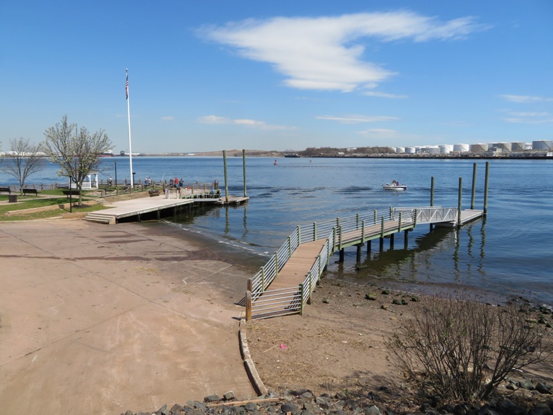
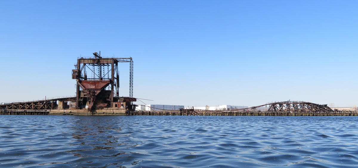
Norma and I left our house in the morning and drove two hours and 50 minutes to our destination, Captain Carlsen Park...at least that's how long it would have taken had we not stopped along the way. The goal was to kayak to the Arthur Kill Ship Graveyard. This trip was on my paddling bucket list.
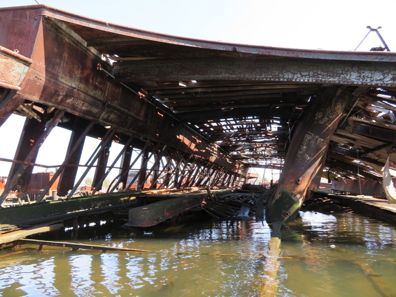
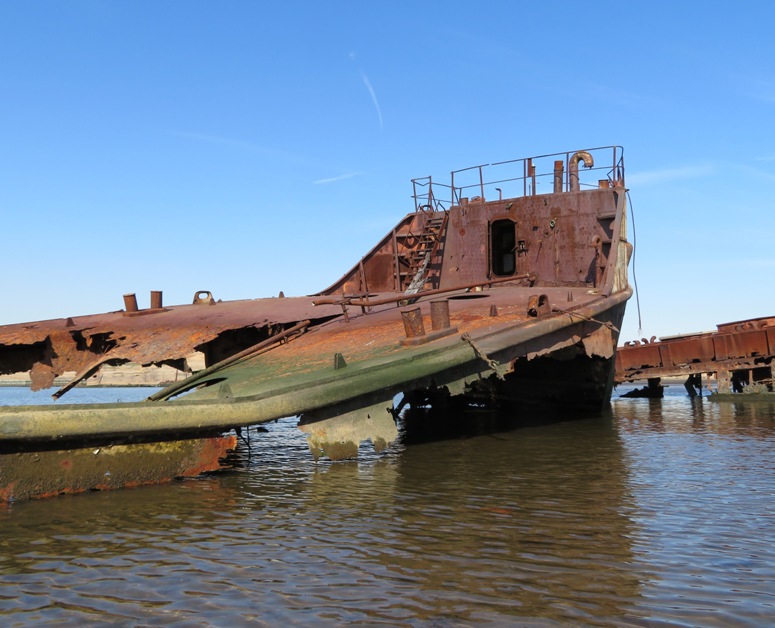
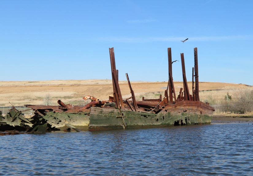
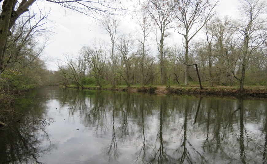
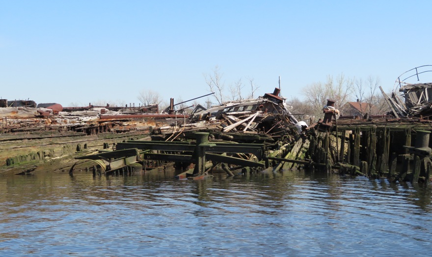
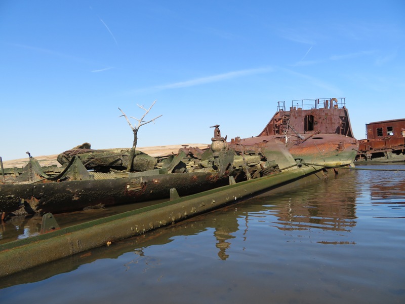
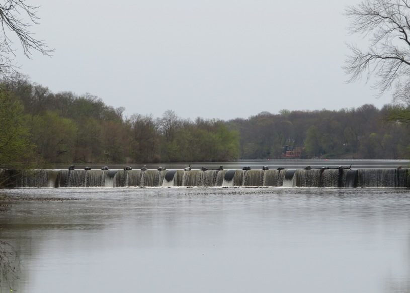
I had read about this location from various places over the last few years. After paddling at Mallows Bay and the Shipwrecks of Curtis Creek and Curtis Bay, I had the shipwreck bug and wanted to see more. I asked around and one fellow from my kayak club told me about Arthur Kill. But after reading up, it sounded like it might be off limits to kayakers. However, many kayakers paddle there and organized groups even visit. Low tide was 1716. I wanted to be there near low tide so I could see as much of the shipwrecks above water as possible. In retrospect, I don't know if that was a good idea. Unlike Mallows Bay, the wrecks stick up out of the water quite a bit and the difference between low and high tide isn't significant (about six inches) so visually, one might not gain much by being there at low tide. However, those few inches of water depth at high tide could make it much easier to paddle about and explore without getting your kayak or SUP scratched up. By being there at high tide, one could also have a little tidal push going upstream and then another push going downstream if you time it right. We launched at 1430. Captain Carlsen Park has a big ramp and a beach area for launching. Lots of big cargo ships accompanied by tugboats sped through the shipping channel in the Arthur Kill waterway. 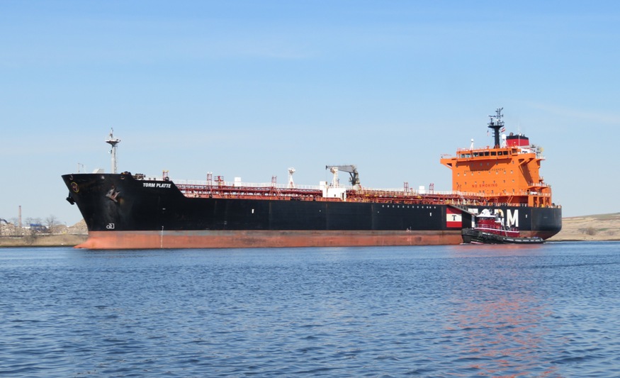
"Arthur Kill" is a strange name for a body of water. The name Arthur Kill is an anglicisation of the Dutch language "achter kill" meaning "back channel," which would refer to its location "behind" Staten Island and has its roots in the early 17th century during the Dutch colonial era when the region was part of New Netherland. - from Wikipedia - Arthur Kill We waited until no ships approached and then quickly paddled my Ocean Kayak Cabo tandem sit-on-top kayak across Arthur Kill. We started in Sewaren, New Jersey near Perth Amboy and crossed over to Staten Island, New York. |
|
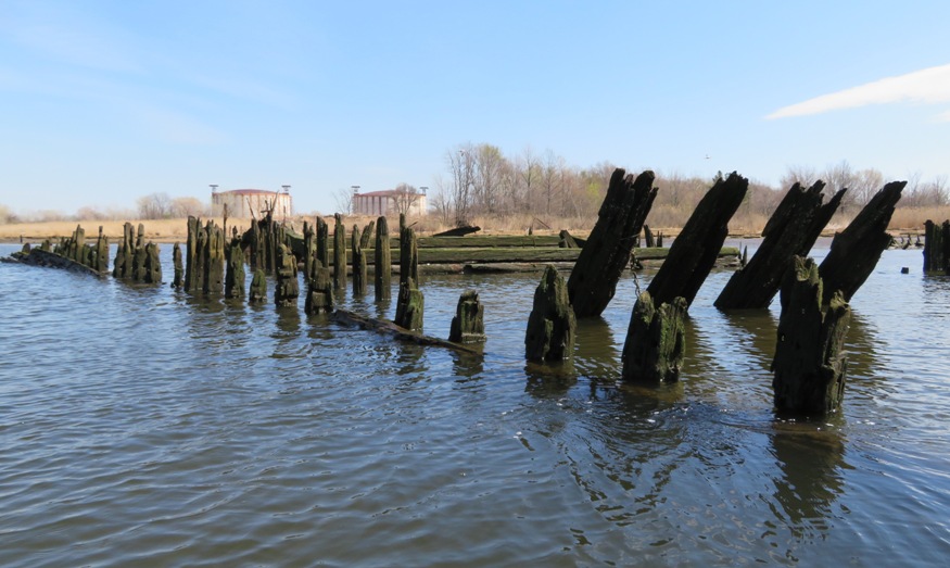
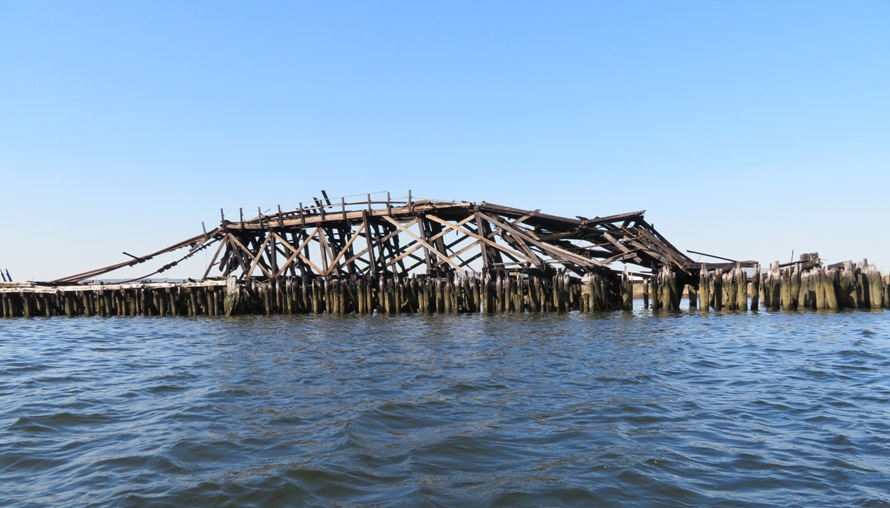
Paddling upstream, against the ebb tide, we saw what looked like the remains of a ship's frame and possibly a pier.
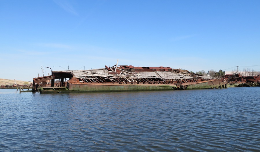
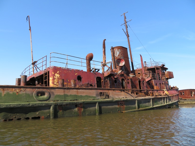
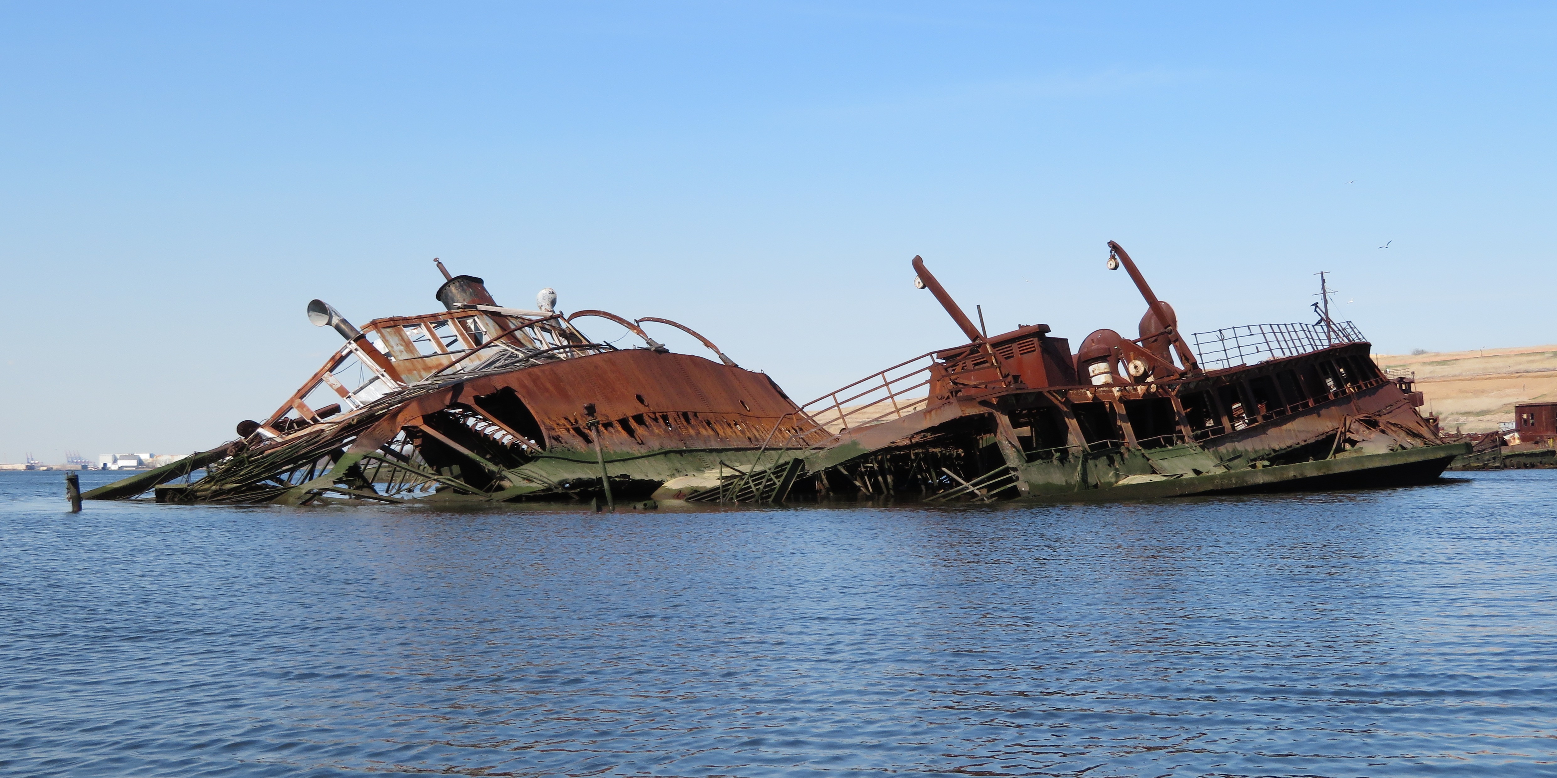
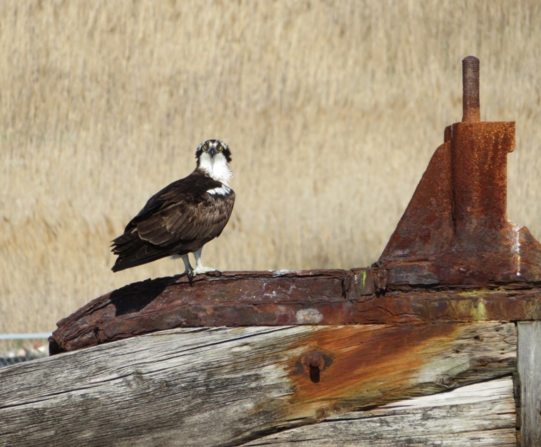
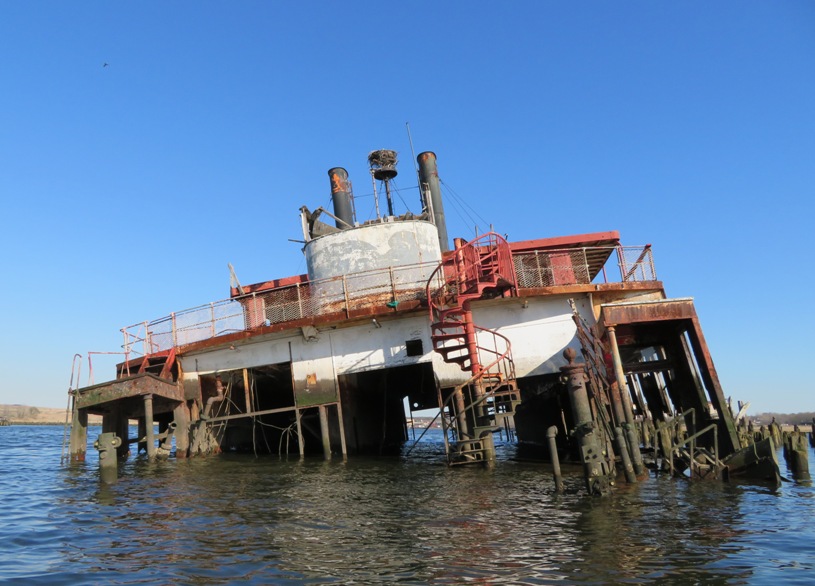
After two miles of kayaking, we approached the southwest edge of the ship graveyard. It is actually a boat scrapyard. Operational since the 1930s, Witte's Marine Equipment Company in Rossville served to dredge, salvage, and resell materials from the wrecked and disused vessels of the New York and New Jersey waterways. Eccentric owner John J. Witte refused to dismantle the majority of the ships that came to rest in the yard, amassing a prodigious collection of over 400 historic watercraft. As the ships slowly decomposed and the area gained a reputation as a mecca for artists and photographers, Witte gained his own reputation as a ferocious defender of his property, known for scaring off unsolicited visitors personally until he passed away in 1980. The yard is now controlled by the Donjon Marine Company, which seems to be taking a more proactive approach to actually salvaging materials from the wrecks... - from AbandonedNYC - A Watery Grave for Historic Ships on Staten Island I don't imagine the boat scrapyard is too active commercially. One of their cranes was home to an osprey which tells me it doesn't get used much. 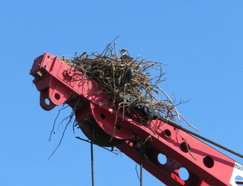
We paddled around, taking photos. The weather couldn't have been better for this. The sky was clear and the sun was shining brightly. 1 / 14

Colors of rust and algae.
2 / 14

Not safe to climb on.
3 / 14
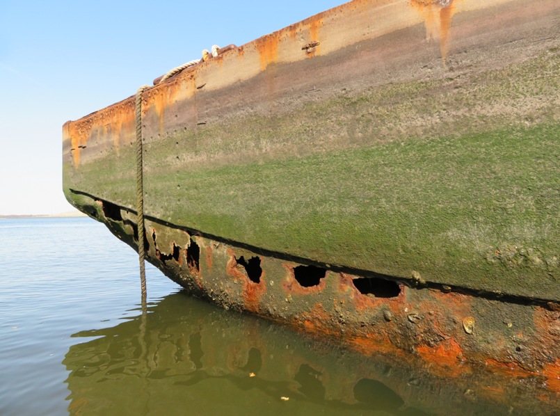
Holes rusted through.
4 / 14
Dock bollard on right.
5 / 14
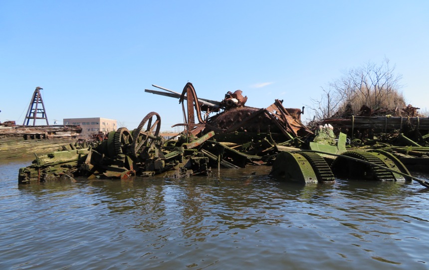
Big gears and other parts.
6 / 14
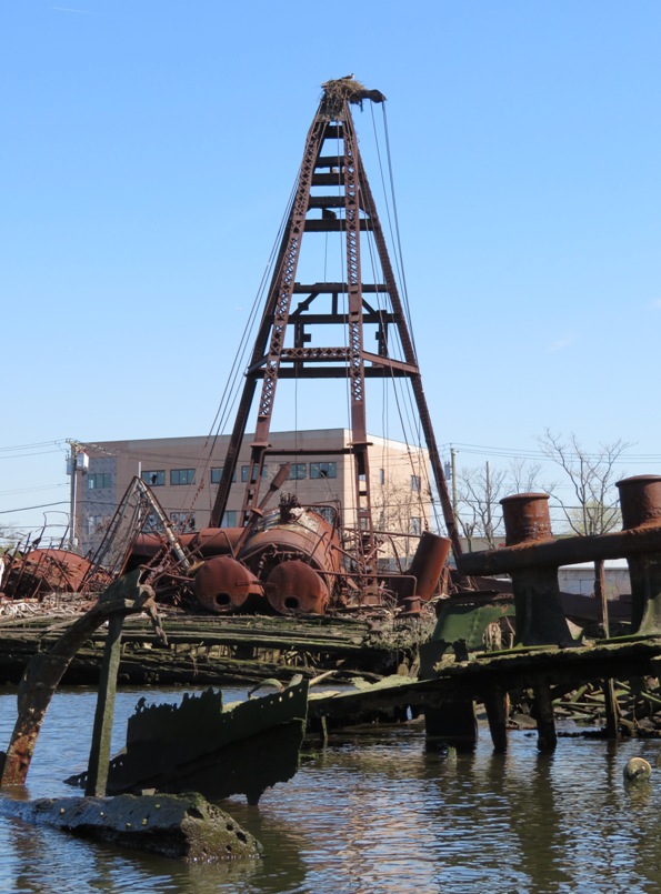
Osprey high up.
7 / 14
Biggest ship in graveyard?
8 / 14
Tiny portholes up top.
9 / 14
Same ship from different angle.
10 / 14
We paddled into this ship.
11 / 14
Inner view.
12 / 14
Miscellaneous junk.
13 / 14
Not sure what this is.
14 / 14
Fuel tank on a boat?
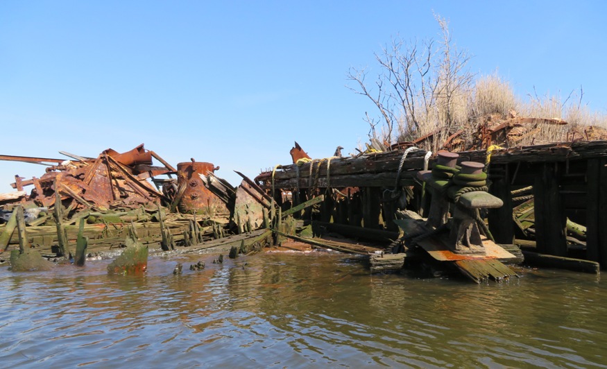
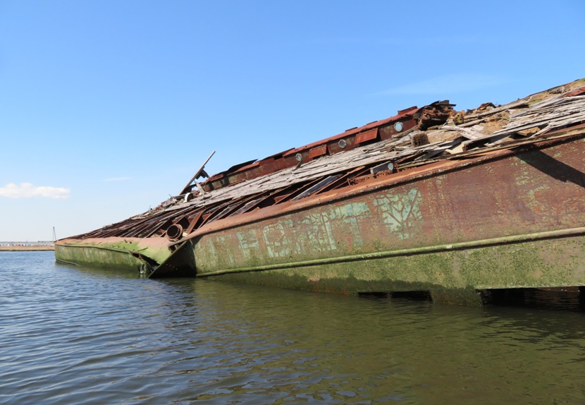
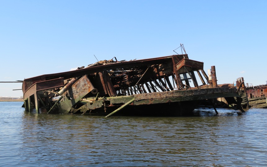
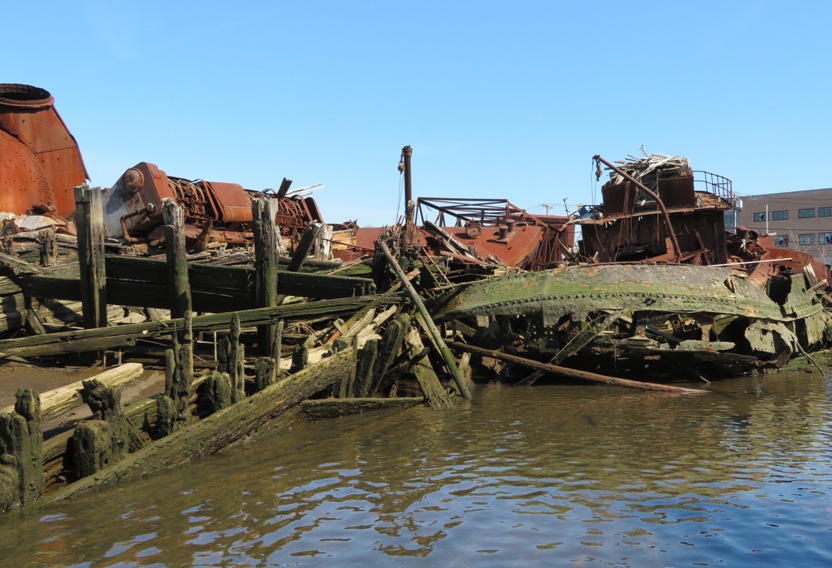
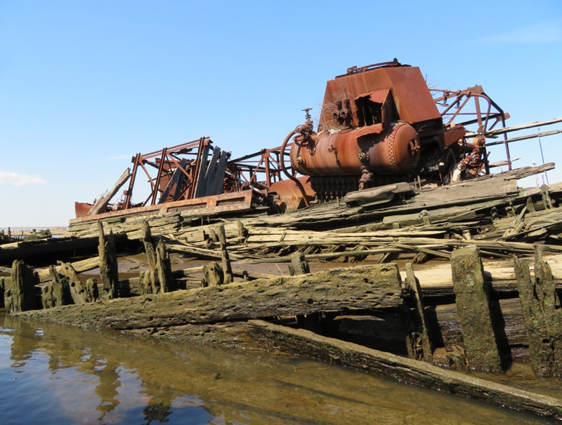
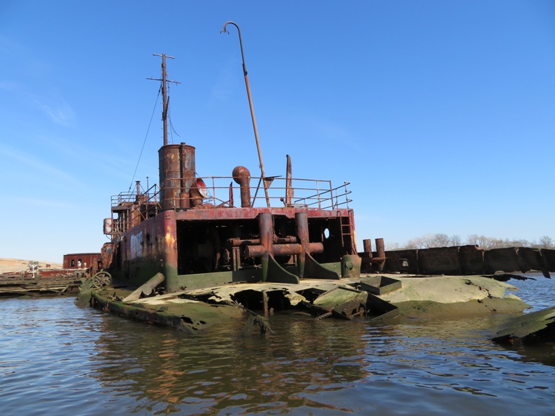
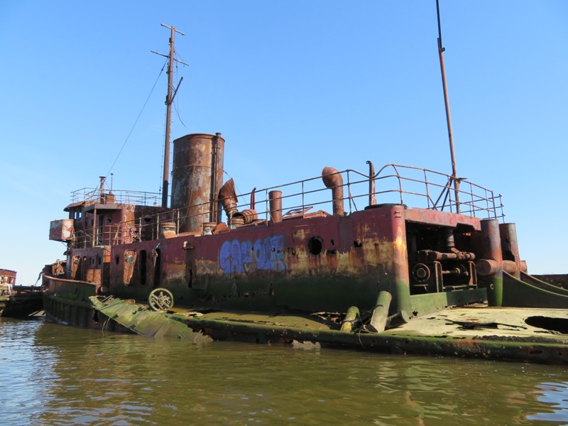
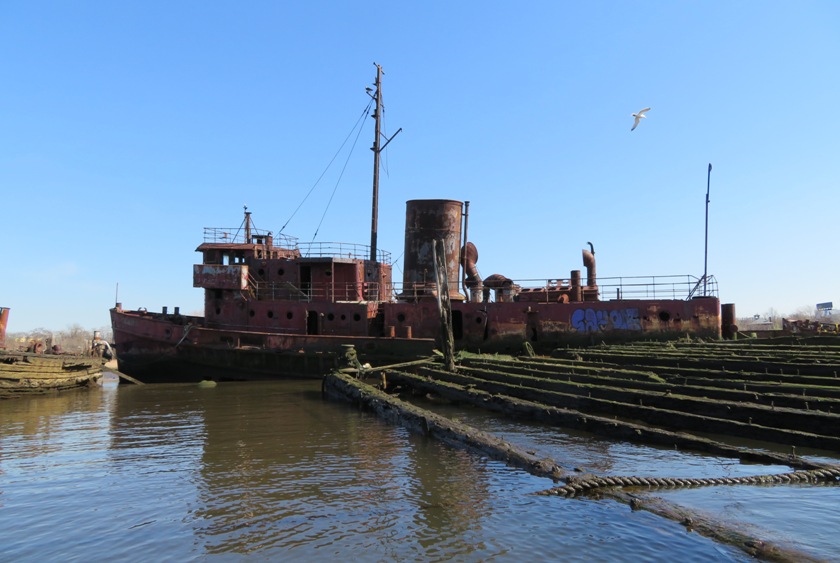
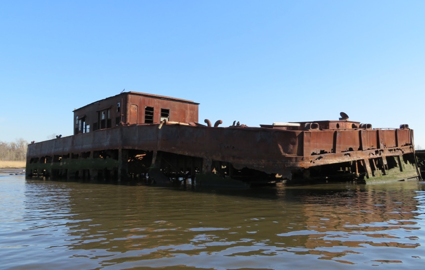
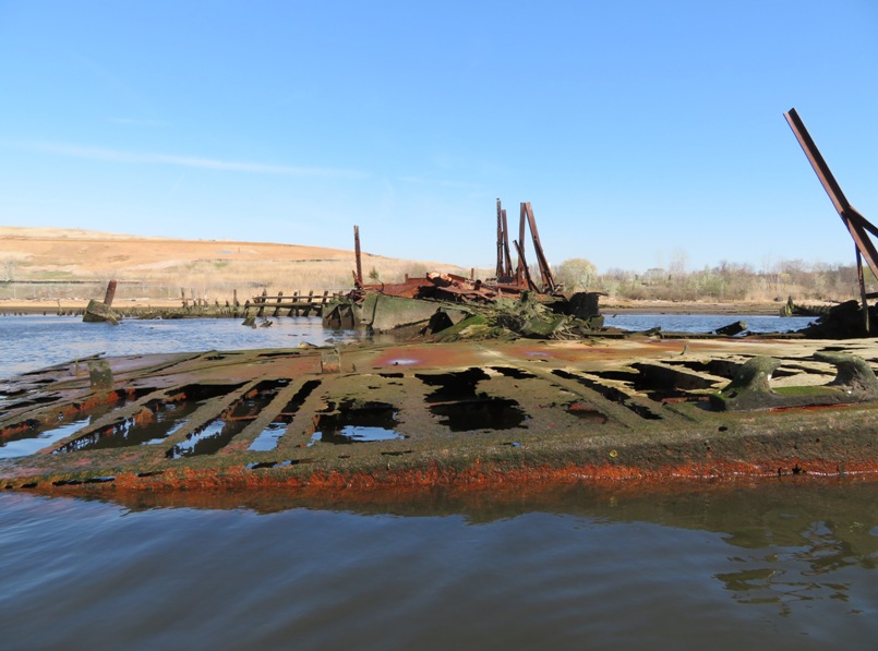
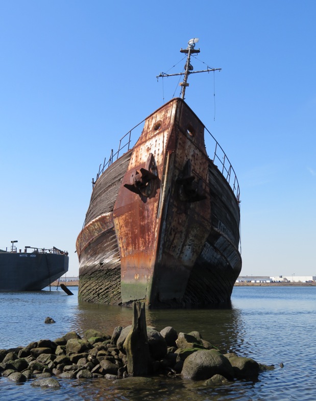
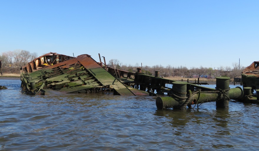
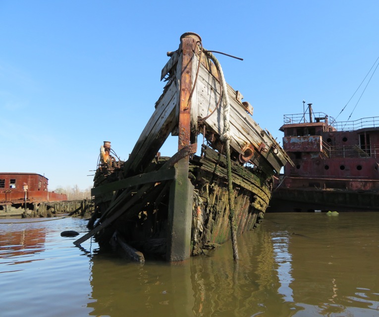
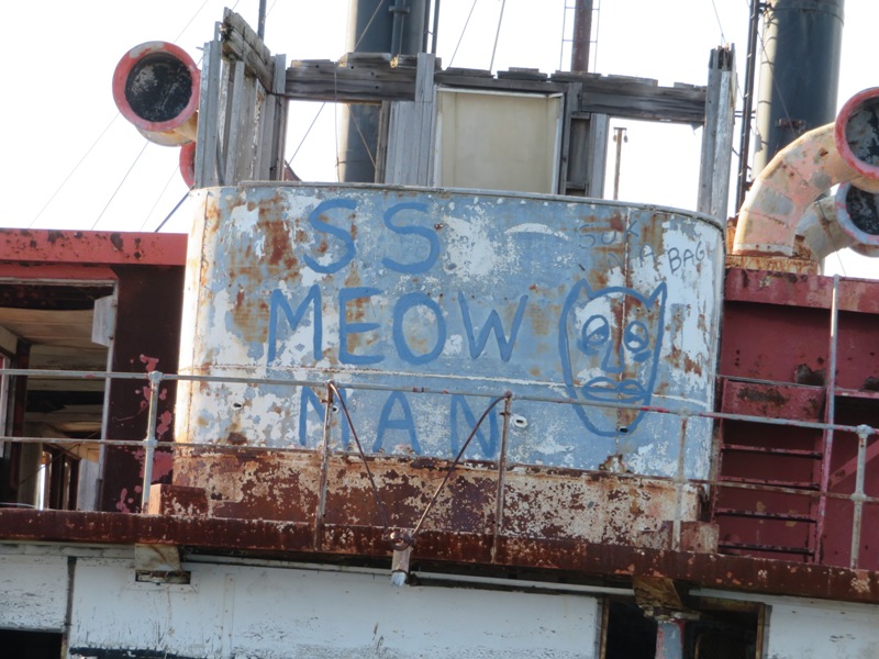
There were some ships we could paddle into. Doing so might be easier at high tide since there was a lot of debris just below the surface. The southwest side had quite a bit of "junk" while the northeast side, which we were now approaching, contained more recognizable relics. How many are there? A 1990 New York Times story reported that 200 ships were sharing space in the Tugboat Graveyard. Today, kayakers visiting the area report that there are fewer than 25, each a jumble of broken beams and rusted metal. - from Atlas Obscura - Tugboat Graveyard We eventually came to a very old wooden wreckage with a not-so-ancient wood and metal tugboat behind. 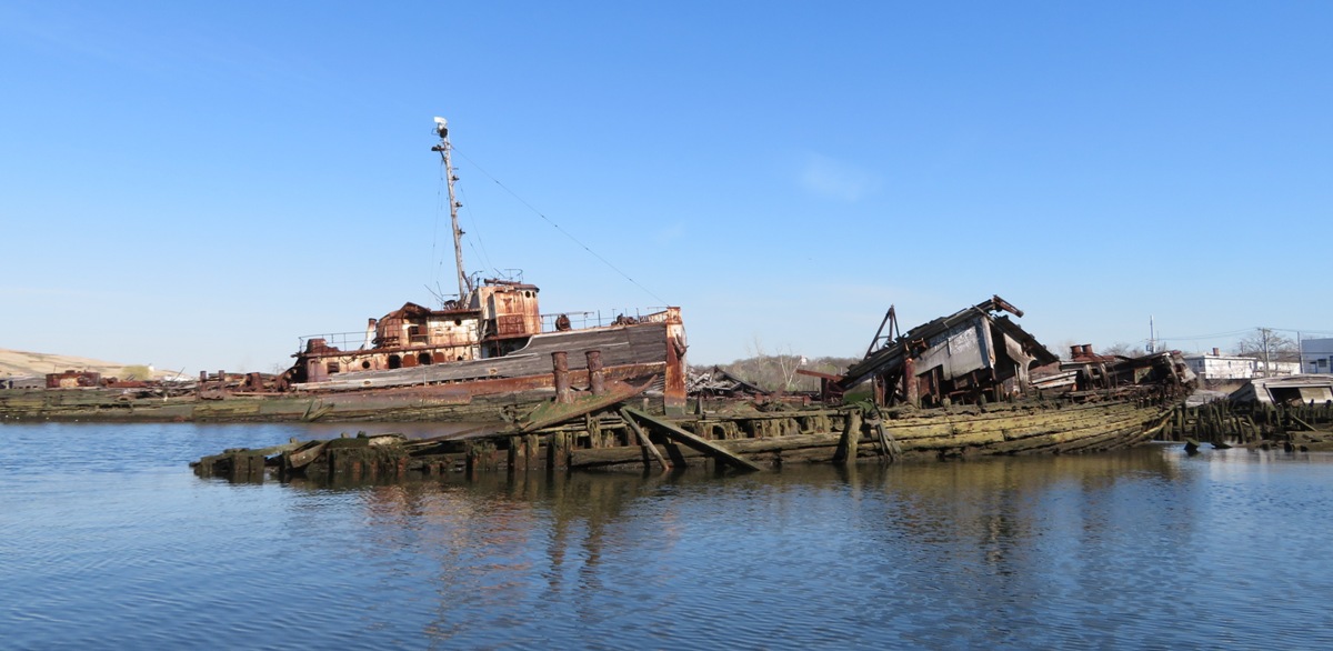
Of the different boats I've seen in articles about this place, this is the most photographed. On the port side of this ship, a graffiti poet wrote the following: Life is a shipweck But we must not forget To sing in the life boats. 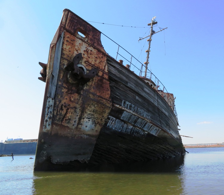
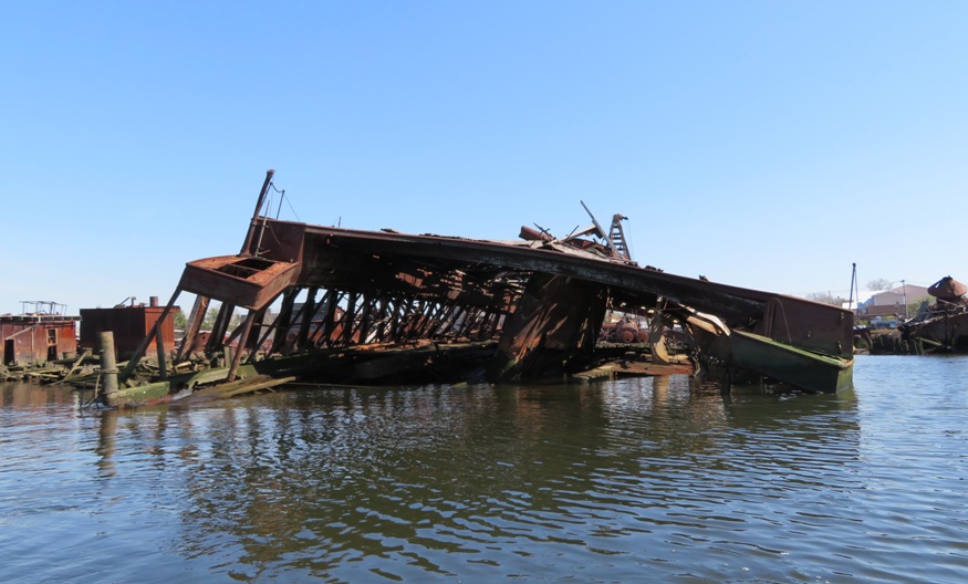
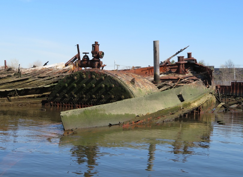
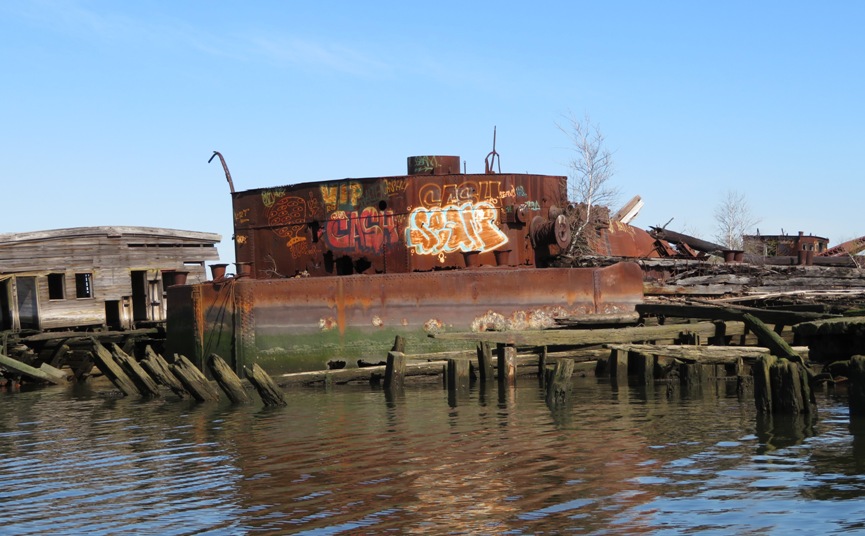
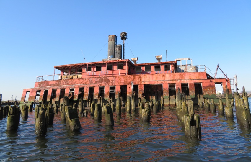
Here's more of what we saw. In the below picture, a seagull uses the railing from this tank ship as a perch. But this isn't just any tank ship. Nearby sits the rust striped shell of YOG-64, its middle eaten away by corrosion that chewed a lacey pattern into its metal sides, long removed from its heyday as a World War II gasoline barge muscling its way across the Pacific Ocean for the U.S. Navy. After the war, YOG-64 participated in nuclear weapons tests at the Bikini Atoll in the South Pacific in 1948. - from Huffington Post - Staten Island Ship Graveyard Becomes Sight-Seeing Destination 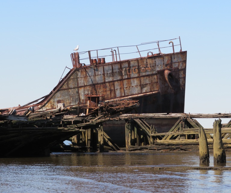
One could easily paddle through the YOG-64. Built in 1945, by the Albina Engine and Machine Works Incorporated of Portland, Oregan (hull #64) as the YOG-64. The vessel was later acquired by the Reinauer Transportation Companies of Staten Island, New York...she was renamed the Frances Reinauer. - from Tugboat Information - YOG-64 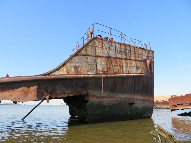
Some wooden shipwrecks at Arthur Kill reminded me of the Ghost Fleet at Mallows Bay. This tugboat was quite a sight. 1 / 4
Boat in good shape...
2 / 4
...but not the aft side.
3 / 4
Graffiti on the port side.
4 / 4
Zoomed out.
Here's some more views of the graveyard. 1 / 6
Rusted all the way through.
2 / 6
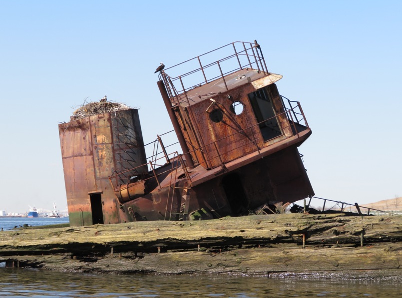
Pair of ospreys.
3 / 6
This has seen better days.
4 / 6
Shopping cart.
5 / 6
Osprey landing.
6 / 6
Not good for walking.
We didn't see any fish. Based on what I've heard, even if there were fish, they may not be safe to eat due to large amounts of pollutants in the water. In the years following World War II, the adjacent scrapyard began to purchase scores of outdated vessels, with the intention of harvesting them for anything of value. But the shipbreakers couldn't keep pace with the influx of boats, especially once people started to use the graveyard as a dumping ground for their old dinghies. Plenty of ships fell into such disrepair that they were no longer worth the effort to strip, especially since many teem with toxic substances. And so they've been left to rot in the murky tidal strait that divides Staten Island from New Jersey, where they've turned scarlet with rust and now host entire ecosystems of hardy aquatic creatures. - from Wired - The Secret NYC Graveyard where Ships go to Die While the area was lacking in fish, there were plenty of birds. I've read there are various signs in the area including a "No Trespassing" one but we didn't see any. Based on what I've read, they are not enforced unless safety is an issue. |
|
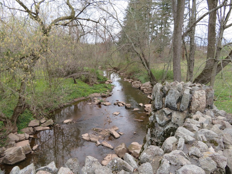
Norma and I made our way to the opposite side of the Arthur Kill. There, we were able to get a different view of the shipwrecks.
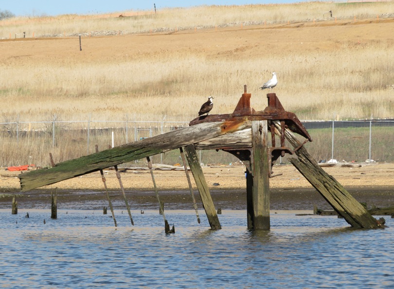
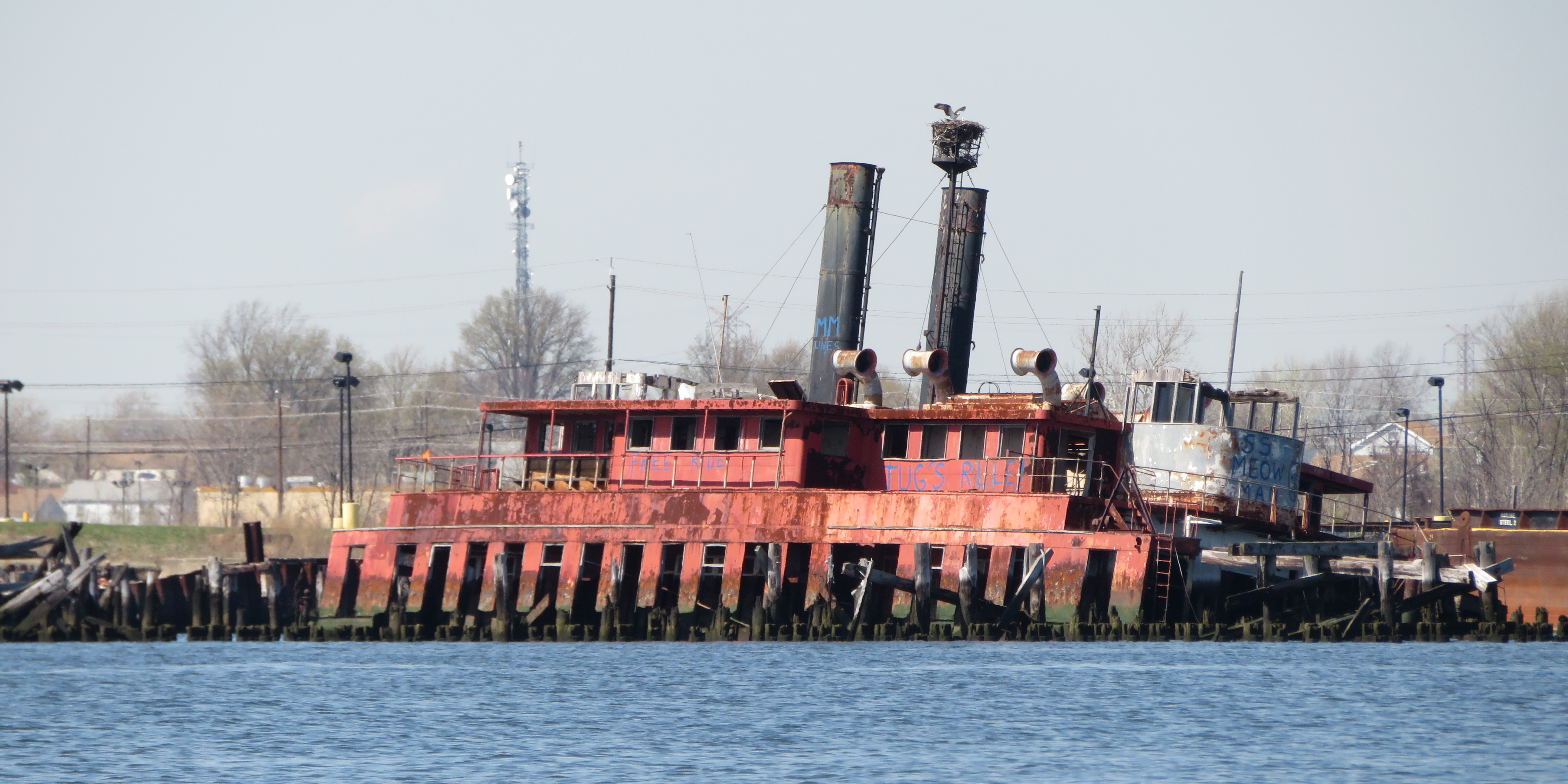
On the New Jersey side, we found some other crumbling structures such as these old piles. Notice the osprey nest on the left side. 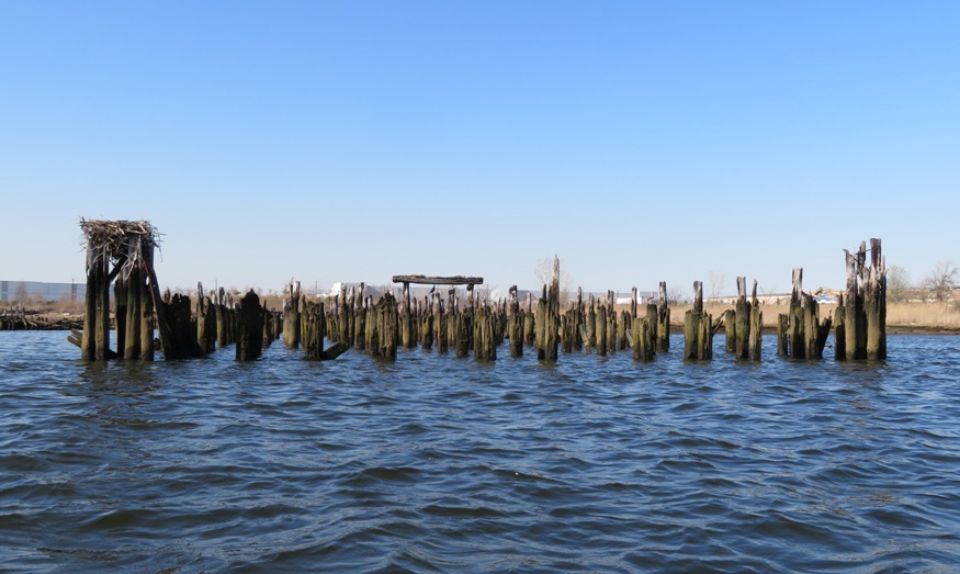
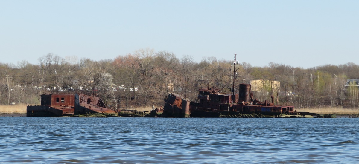
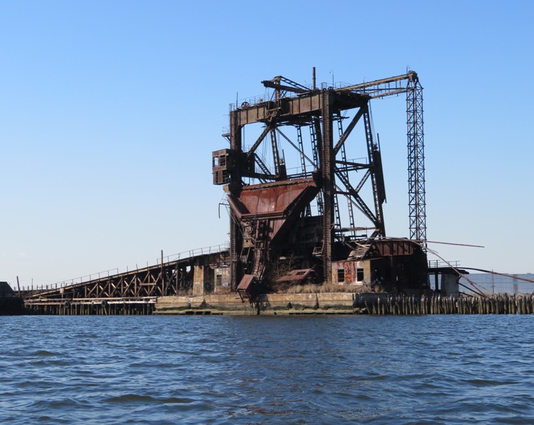
We found a large red tugboat just asking us to take its picture. It appears in the below pics at the top of the page. In one area, we found a former elevated railroad track that led from the ships to a place where their cargo could be unloaded. After exploring for a couple of hours, we started heading back. I wondered how the ship graveyard came to be and what would become of its future. I'm glad I didn't wait to visit because there are fewer boats now than there used to be and perhaps in a few years, there will be less yet. For decades the Witte Marine Equipment Company, the lone remaining commercial marine-salvage yard in the city, has given mothballed, scuttled, abandoned and wrecked ships of all sizes a final port. Through the years it has become, an "accidental marine museum," as a nautical magazine described it, with one of the world's largest collections of historic ships. Like many waterfront artifacts, however, the old ships in the yard are disappearing. There were up to 400 vessels, some dating from before World War I. Now 200 remain. - from New York Times - A Lesson In History Of Old Ships I intended for us to paddle the rest of the way back heading downstream on the New Jersey side. But a big cargo ship was ahead. It appeared to be moored but I could see turbulence in the water from a tug boat pushing up against it. I felt it would be safest for us to head back to the New York side so we crossed back over. |
|
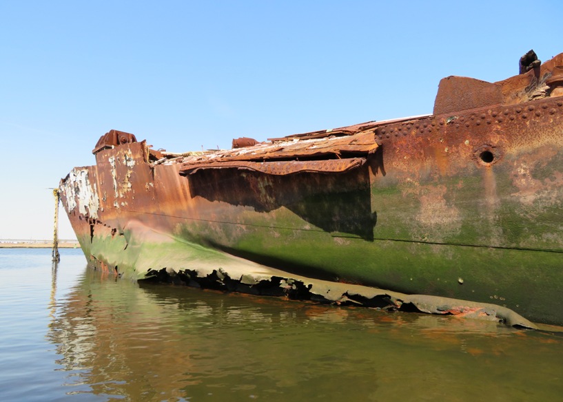
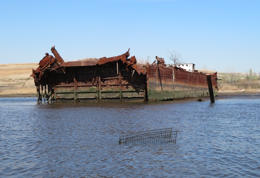
On the New York side, not far from our launch site, we saw a barge with some history. It was involved in a fairly recent oil spill in the area.
The spill occurred around 11:30 p.m. Friday near Mariner's Harbor, where the fuel oil was being transferred from Barge Boston No. 30 to Barge DBL 25. The responsible company, Boston Marine Transport, told officials that workers spotted the leak during the transfer process and then deployed boom around the two barges, the Coast Guard said. - from Fuel oil leaks from barge near Newark Bay, threatening sensitive environmental areas, December 16, 2012 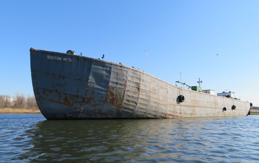
Norma and I finished our 6.9 mile trip at 1750. Next to our launch site, slightly downstream, was a modern ship and pier that looked incredibly pristine after seeing the wrecks. 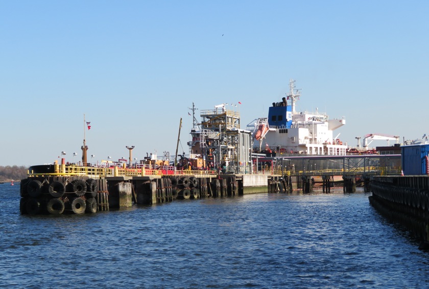
Once I got home, I checked out satellite photos of the area. 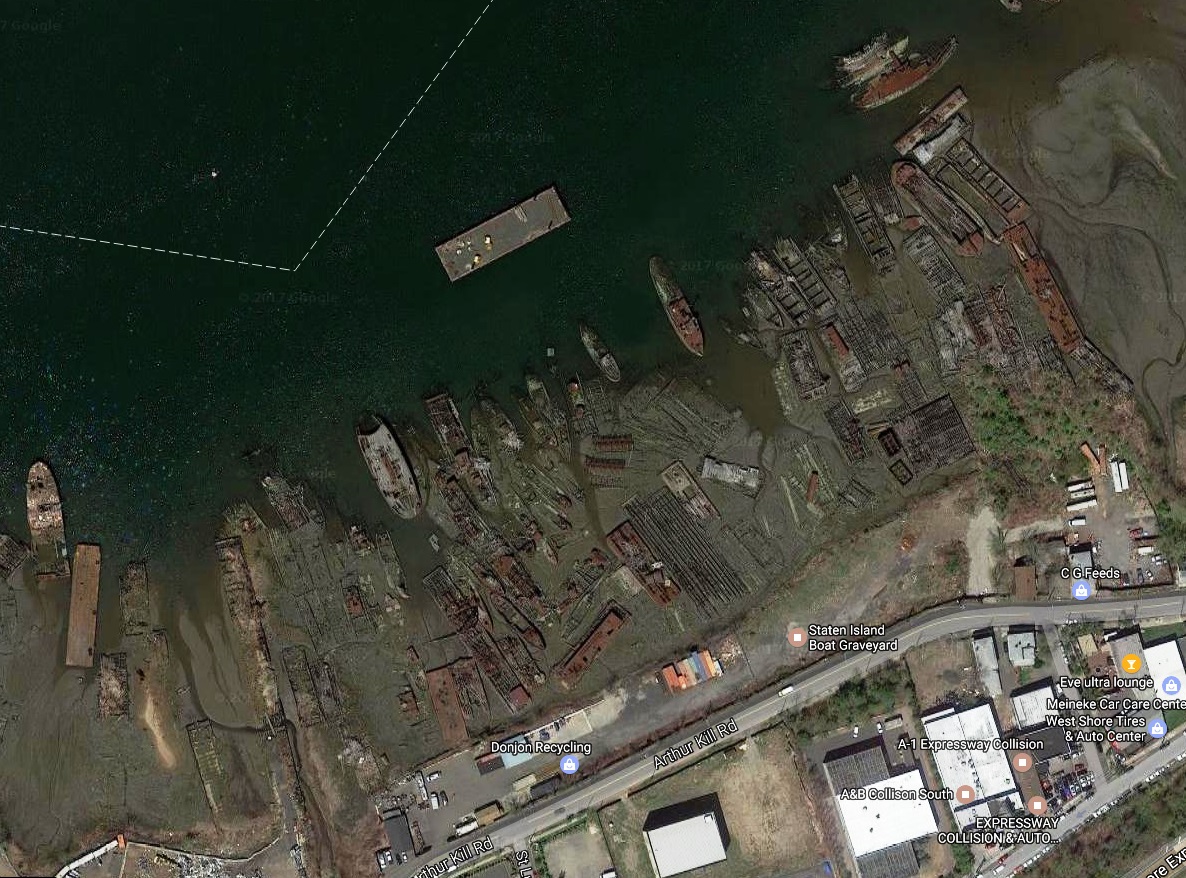
Also once I returned, I ordered a DVD documentary about the ship graveyard from CreateSpace - Graves of Arthur Kill. |
|
Norma and I loaded up the boat and then checked into our motel. It was Motel 6 at 244 State Route 18, East Brunswick, New Jersey 08816. For three nights, it cost $190.02. It was basic but clean and not too far from the launch site. If paddling there again, I'd probably return to this Motel 6.
That night, we ate at the Portuguese Fisherman which was very close to the motel. The swordfish was to die for but the cod left much to be desired. I am not a foodie so if I remember food as being exceptional (like this swordfish), then that really says a lot. |
|
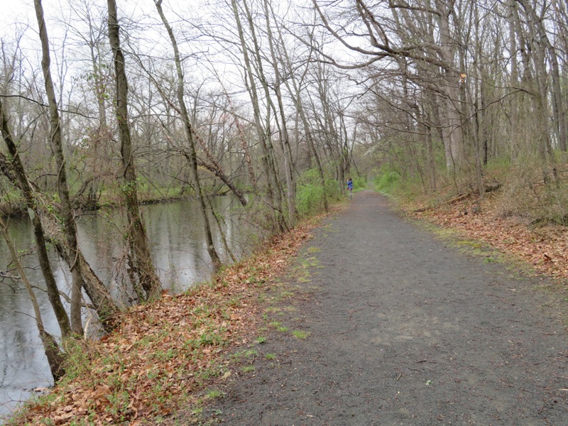
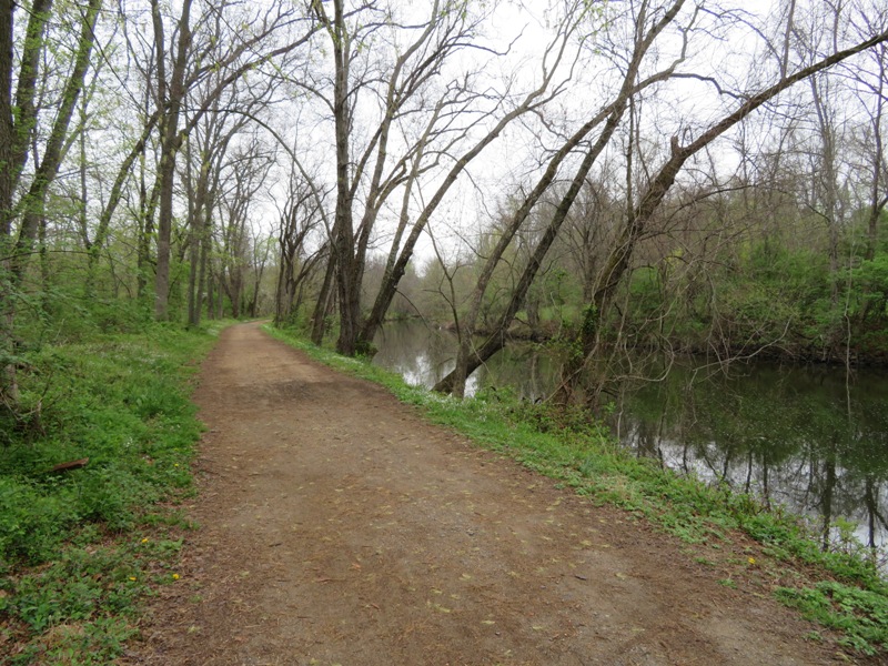
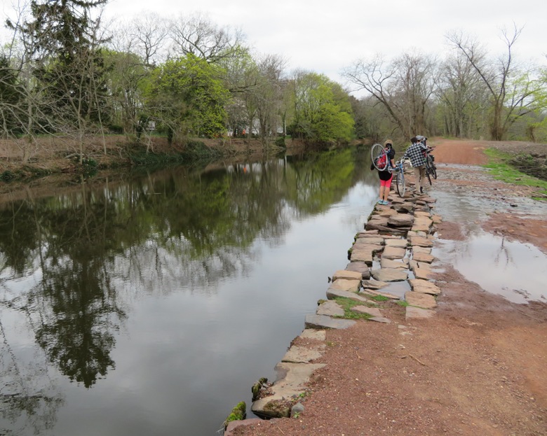
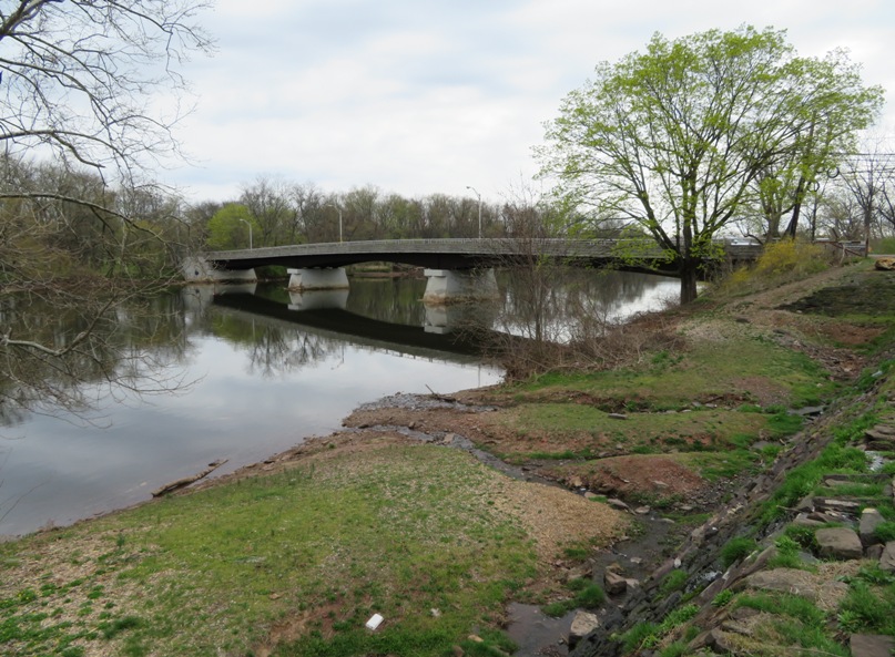
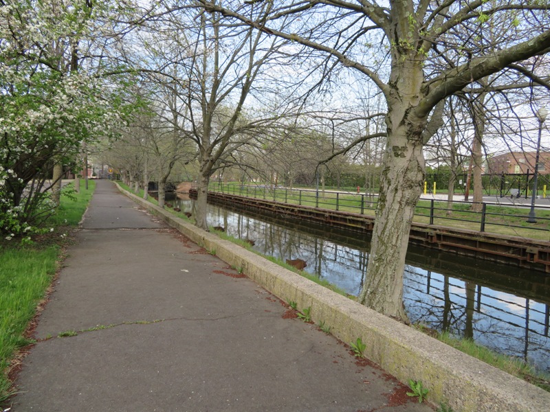
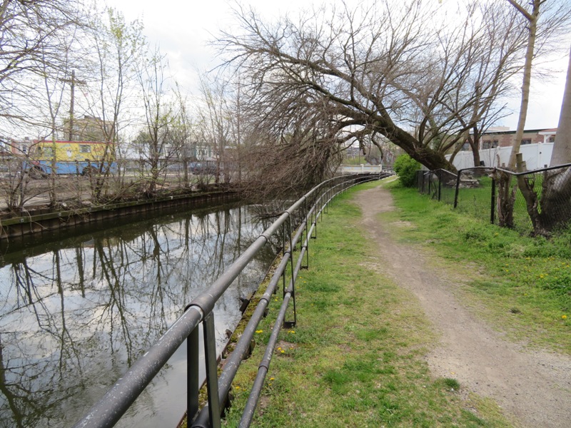
The next morning, we took a drive out to Johnson Park. It was only eight minutes from the motel. There, we checked out Landing Lane Bridge over the Raritan River in New Brunswick. This is the eastern terminus of the 69.5 mile long Delaware and Raritan Canal State Park Trail, hereafter referred to as the Delaware and Raritan Trail. This area is home to the historic community of Raritan Landing.
The trail meets the bridge on the south side of the river. Norma and I didn't see much of the trail but it appeared to be in good shape...certainly suitable for the hybrid bikes we would be riding when we return for a multi-day trip. We commenced scouting This part of the trail was built up but it appears water from the canal still flows over. At least it isn't eroding. 
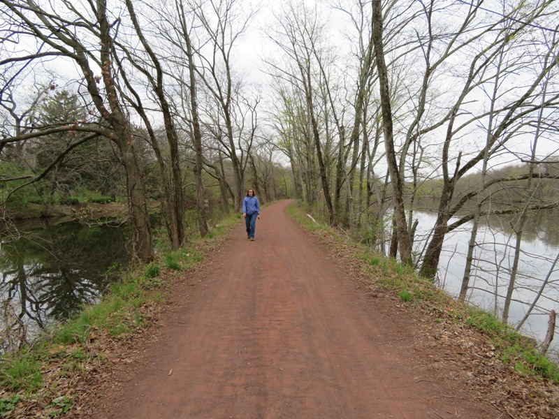
Here are some other sections of the trail. |
|
One place I found on my map that was only 21 minutes from the motel was Dismal Swamp.
Known as the "Everglades of Central Jersey," the 1240-acre Dismal Swamp Conservation Area is the largest natural area remaining in northern Middlesex County, spanning portions of Edison, Metuchen and South Plainfield. - from Endangered NJ Blog Spot - The Everglades of Central Jersey Like many of the natural areas we would see in New Jersey, the website didn't give us as much information as we would have liked. It took us awhile to find a place to walk but eventually, we found the very short Songbird Trail. Except for a few flowers, the place was very uninteresting. We realized it is important to the area from an environmental point of view but for the visitor, it was not worth the trip. 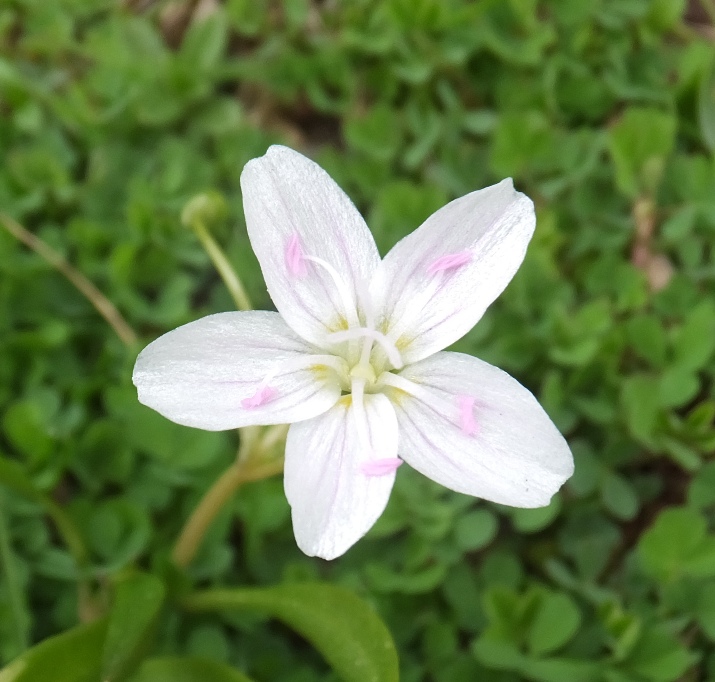
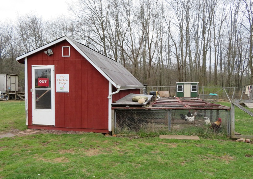
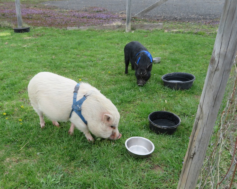
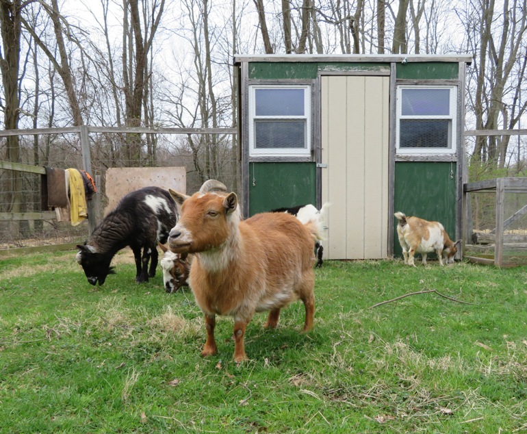
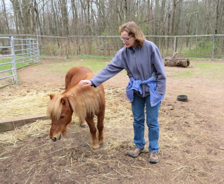
In that area, we found a place called Triple C Ranch. Norma and I paid a visit here and got a little tour of the place. Their big opening would be the following week on Earth Day but we got a sneak preview. |
|
Our next stop was Rutgers Gardens, a mere five minutes from the motel. Since we were in the "Garden State," we had to visit at least one garden.
We started with their community garden. 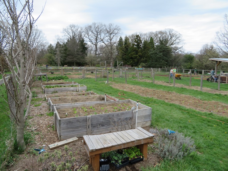
In the garden, we also saw a bee apiary. 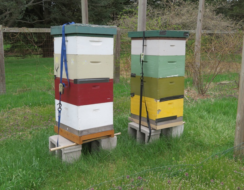
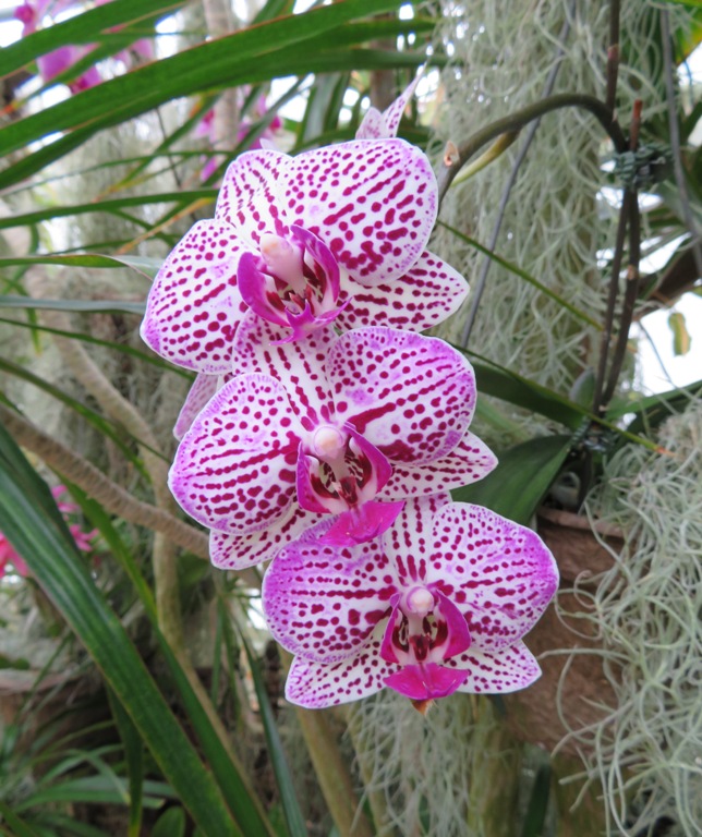
Walking around the garden area controlled by the university, we saw a few interesting plants and flowers. 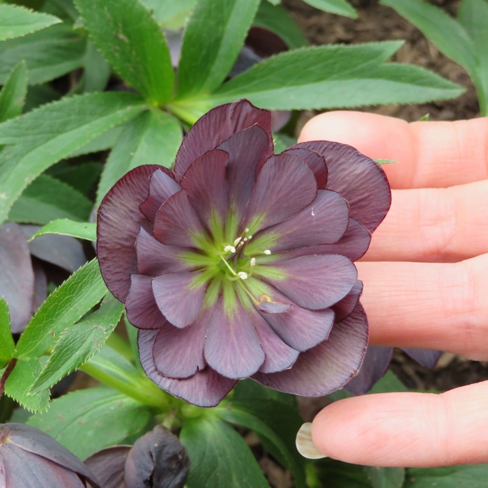
Next, we set out to explore their trails. 1 / 6
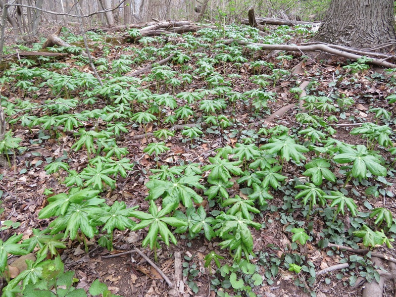
May apple plants.
2 / 6
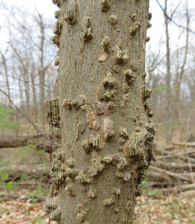
Tree with interesting bark.
3 / 6
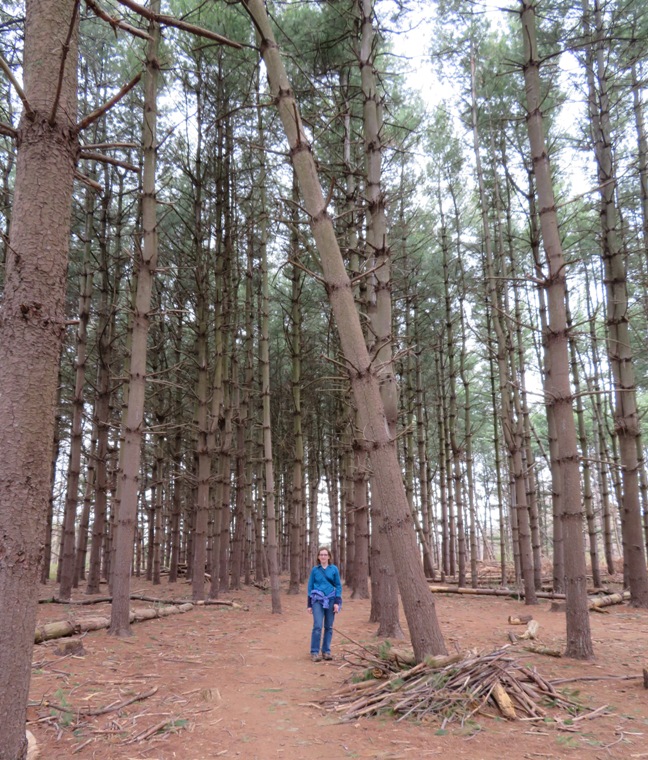
Norma in pine forest.
4 / 6
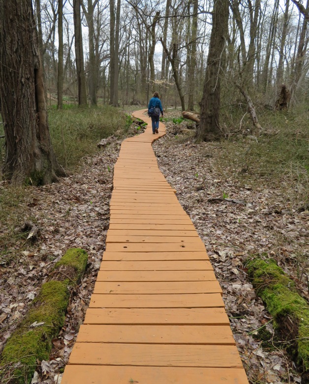
Boardwalk.
5 / 6
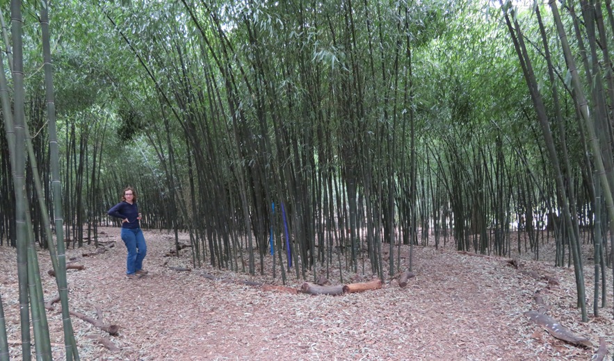
Bamboo grove, inside.
6 / 6
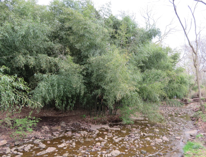
Bamboo grove, outside.
|
|
Our last stop for the day before dinner was Duke Farms (sometimes referred to as Duke Gardens). Here, James Buchanan (J.B.) Duke transformed more than 2,000 acres of farmland and woodlots into an extraordinary landscape known as Duke Farms. I hadn't planned on this visit in my itinerary but we had some time and I saw it on the map. It turned out to be a nice place. We would definitely consider returning to explore the place on bicycles. There were a lot of families out doing just that.
There were a lot of Asian people present. I think it is often stereotypical for Asian people to like gardens. Staff at the Farm Barn Orientation Center highlighted a circuit walk we could do in about an hour. The below structure was Mr. Duke's hay barn. It was built in 1905 and a fire in 1915 destroyed all but the stonework. Today it is a sculpture garden. 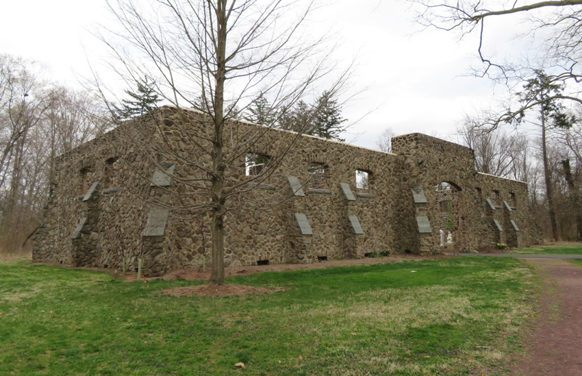
On the second half of our walk, we saw the Old Foundation overlooking the Great Meadow. 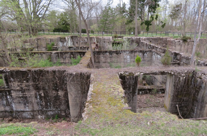
J.B. Duke abruptly halted construction after the landscaping was completed and the foundation was laid. While his reason for doing so is not known for certain, we do know that Duke shifted many of his business affairs to Europe and spent less time at Duke Farms after the court-ordered dissolution of the American Tobacco Company in 1911. - from information sign |
|
That evening, we dined at the Esquina Latina Restaurant and Lounge in New Brunswick which served Cuban and Latin cuisine. My Cuban sandwich was nothing special and I didn't much care for the club-like atmosphere but the mango cheesecake was spectacular!
|
|
Norma and I continued scouting the rail trails in the area. Yesterday, we checked out the eastern terminus of the Delaware and Raritan Trail. Today, we would check out the southern section of the 60 mile long Delaware Canal Towpath (Delaware and Lehigh), hereafter referred to as the D&L Trail.
Innovative entrepreneurs produced iron, coal, slate, cement, zinc, and textiles throughout the 18th and 19th centuries, transforming the region into a center of the Industrial Revolution. The Delaware and Lehigh Canals transported hundreds of tons worth of goods to New York and Philadelphia, fueling industry and creating jobs - a legacy the D&L works to preserve and celebrate. - from Delaware and Lehigh - For over 300 years, history happened here We started our day eating breakfast at Cafe Chorba in Morrisville, Pennsylvania. This is just across the Delaware River from Trenton, New Jersey. The river separates the two states. The parking lot at the strip mall where the cafe resides is very close to the D&L Trail so it was a good place to leave the car for the day. Almost all our biking today would be in Pennsylvania. The two of us checked out the trail. It resides in Delaware Canal State Park. 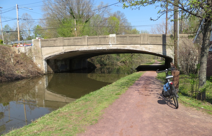
Since we were doing an out and back ride, we started biking on a short trail called the River Vista Loop between the D&L Trail and the Delaware River. Here, we had a nice view of downtown Trenton. 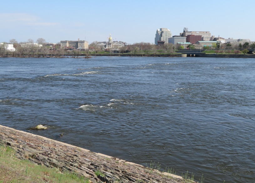
This ride took us about 0.75 mile to East Bridge Street where we again picked up the D&L and continued south. Our destination was Historic Bristol, a section of Bristol Borough, in Pennsylvania. This is 9.1 miles from where we picked up the trail. In some ways, the D&L Trail reminded me of the Chesapeake and Ohio (C&O) Towpath in Maryland. Not just because both are rail trails but because of the large number of turtles that find refuge in the canal. We saw several dozen that day including a few snapping turtles. 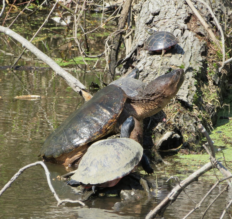
A few American toads were also seen. 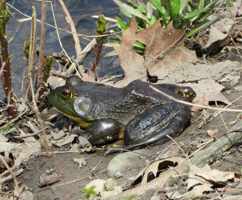
We also saw a large paper wasp nest. 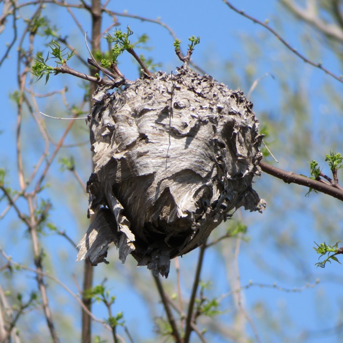
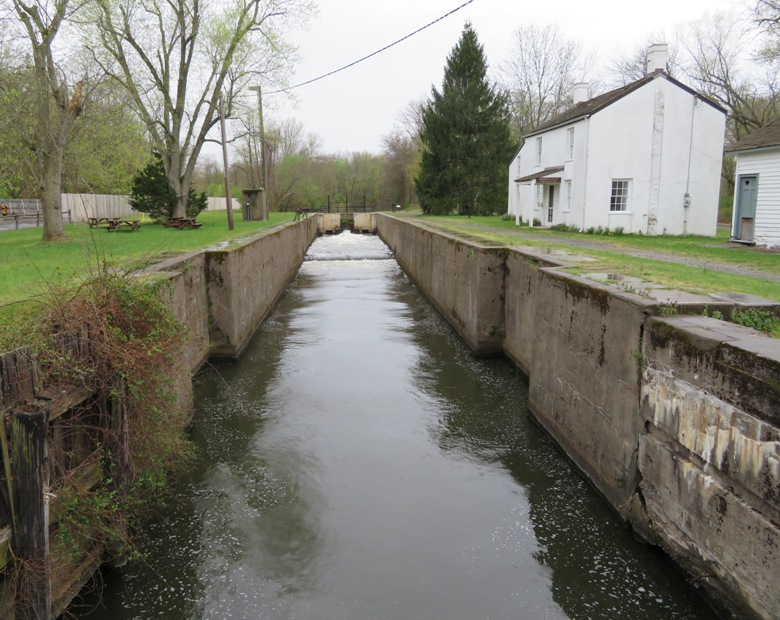
In order to move boats through the canal across different elevations, locks were installed. 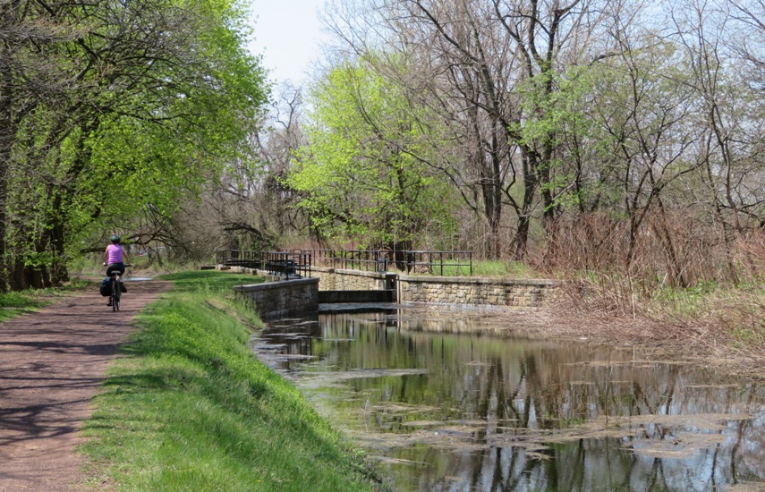
In Bristol, we stopped at the Adams Hollow Community Garden where the caretaker gave us a tour. A large number of 8'x4'x2' raised garden beds were built on this old tennis court. The high fence of the tennis court kept deer out. 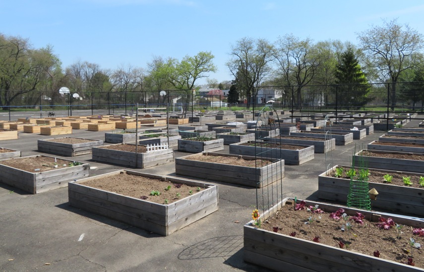
One thing that stands out in our minds about Bristol is how friendly the people are. It is a small town with a lot of pride where four people we met made time to engage us in conversation. In Bristol, we found the end of the trail. Then we ate lunch, took a nap, and checked out the waterfront area. After that, we rode through Bristol Spurline Park and the historic section before heading back. 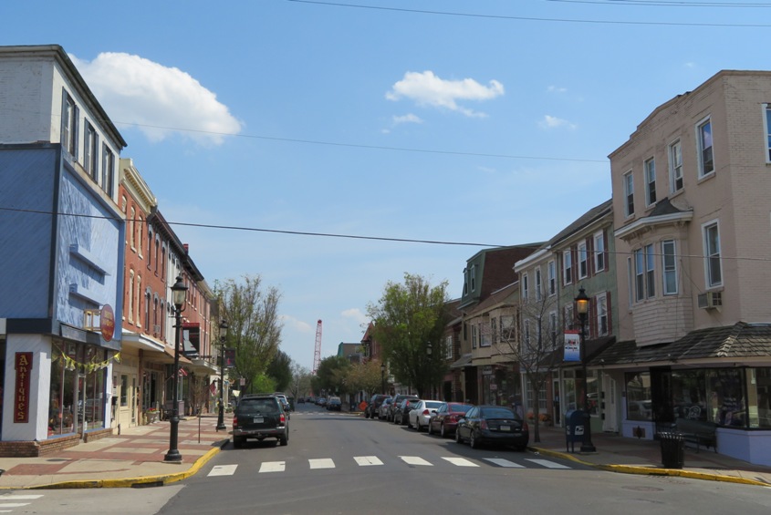
Some parts of the trail deviated from the canal due to development. In these sections, we had to walk our bikes along the railroad track and under roads. 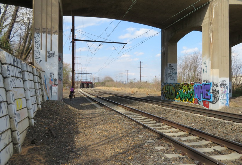
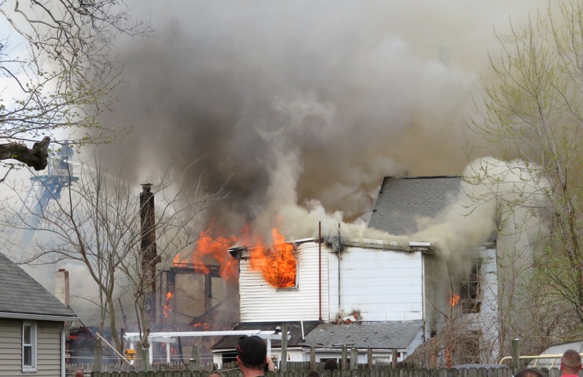
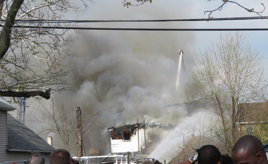
In this area, I found bones from a deer, some of which I brought back to show at work as a fun fact. Back in Morrisville, we stopped to watch a multi-home fire. Several fire departments joined forces to battle this blaze. A turkey vulture kept an eye on us. 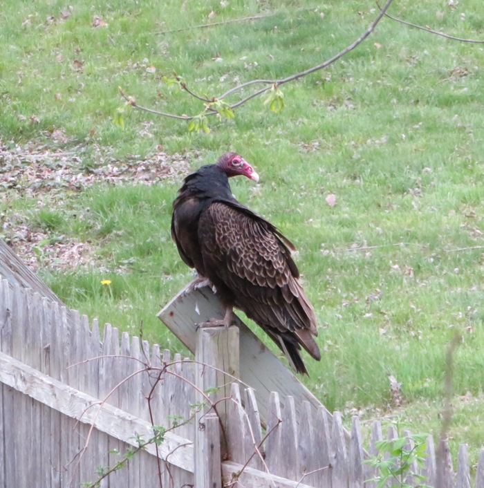
What was my impression of the D&L Trail? It is fairly well maintained and a pleasant, easy ride. However, like many places we saw during our visit, there was quite a bit of litter. We crossed the Calhoun Street Bridge over the Delaware River into Trenton, New Jersey. We were going to explore there for a bit but then it started to rain hard so instead we threw in the towel and headed back to the car. After biking 25.25 miles, we were back where we started. 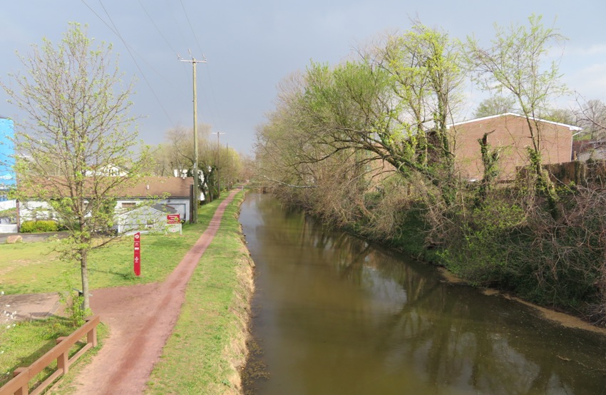
|
|
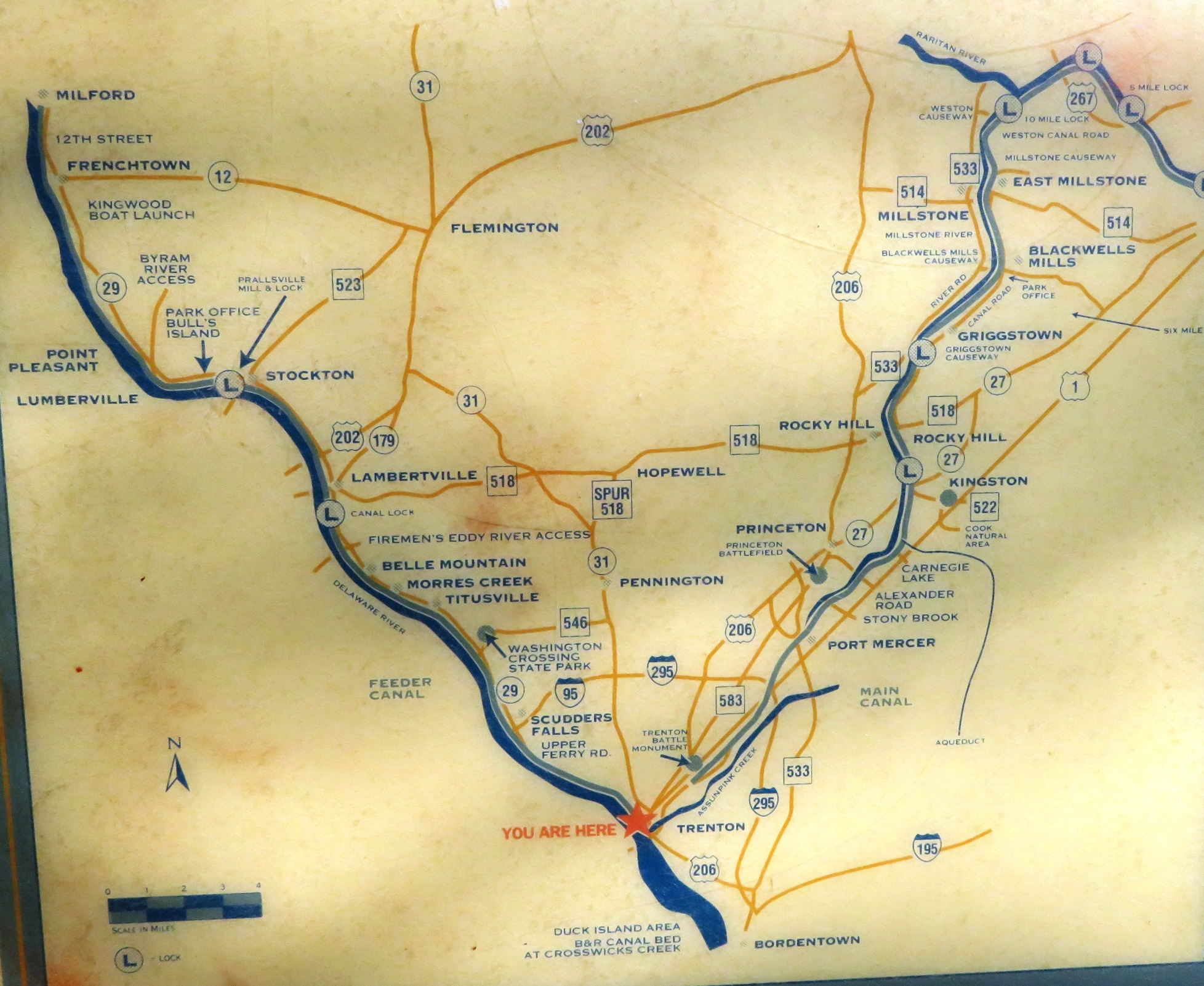
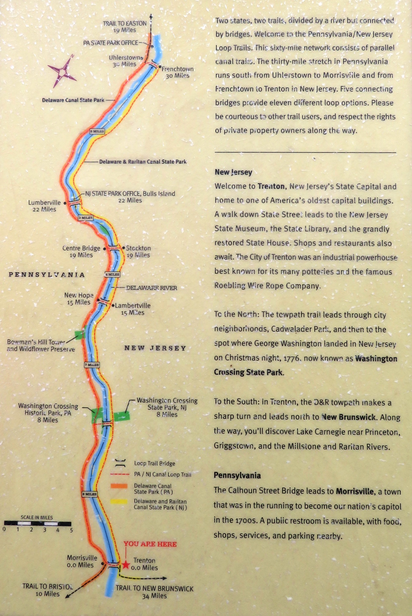
Our reason for wanting to explore Trenton was to see where the Delaware and Raritan Trail passed closest to the D&L Trail. Indeed, it was very close. The proximity of the two would allow us to easily bike on one and then transition to the other. Maps along the trail indicated highlights and other points where such a transition could take place. See map one and map two.
Though we didn't see much of Trenton, what I did see reminded me of Baltimore. There were boarded up, run down buildings and quite a bit of litter. 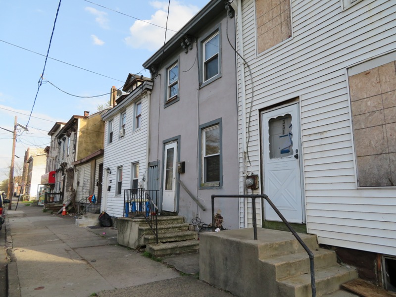
However, we did see signs of community involvement such as the Incubator Community Garden. The Delaware and Raritan Trail ran along the Raritan Canal through urban sections of the city, offering residents a place to walk, run, and bike where they could get away from traffic. The trail has a similar history to other east coast rail trails. The 66 mile long Delaware and Raritan Canal was dug by hand from 1830 until 1834. It was built to provide a safe, fast inland passage between New York City and Philadelphia. The Delaware and Raritan was one of America's busiest canals, during its peak years, in the two decades following the Civil War. Coal from Pennsylvania accounted for as much as 80% of the freight shipped on the canal. Years of operation: 1834-1932. - from signs on trail I determined that a multi-day bike ride from New Brunswick, New Jersey to Easton, Pennsylvania (the northern terminus of the D&L Trail) is indeed feasible. We will almost certainly return (hopefully with friends) and do this route, going up one side of the Delaware River to Easton on one trail and back to Trenton on the other. We could camp at one of the parks north of Trenton along the Delaware River but as far as I can tell, there are no camping options between New Brunswick and Trenton so we might need to motel it. |
|
That night, we ate Mediterranean food at Ibby's. I was disappointed to find that they had no Italian cuisine. The last time I checked, Italy is in the Mediterranean.
|
|
Norma and I drove out to the Princeton area to walk on the Kingston Branch Loop Trail in the John W. Flemer Preserve. The John W. Flemer Preserve is a 7.4-acre preserve adjacent to the Delaware and Raritan Canal in Kingston which features a two-mile trail on the east bank of the Canal that offers a connection to the towpath on the west side of the canal for a round trip hike.
It sprinkled most of the time during our 4.5 mile walk. We planned to walk two miles on the John W. Flemer side, cross over at a bridge, and then return on the Delaware and Raritan Trail. Unfortunately, construction was taking place on the bridge so instead we returned on the same path. The trail was not terribly exciting but it was scenic. 1 / 4
Delaware and Raritan Canal.
2 / 4
Kingston Branch Loop Trail.
3 / 4
Canal lock and lock house.
4 / 4
Delaware and Raritan Trail.
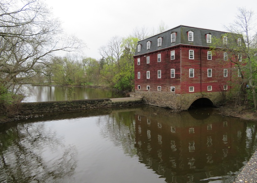
In one area, we saw the Millstone River. Next to it was a big, old building which I assume was once a mill. The river flowed into Carnegie Lake. |
|
We caught a bite to eat at Applebee's. I had a sandwich that I found more flavorful than the Cuban sandwich at the Esquina Latina Restaurant and Lounge.
|
|
We started heading home. Our final nature stop in New Jersey was Rancocas State Park. Like Dismal Swamp, it was not easy finding information about this place. Upon arrival, it seems like the state had done little to make the place attractive to visitors. There wasn't much signage but there were lots of potholes. We drove to the end of the road where one could launch a kayak into Rancocas Creek. Supposedly launching at New Lisbon and taking out here is a scenic route. Much of the creek had very muddy shores. I would be cautious about getting stuck at low tide.
Norma and I explored one of the longer trails in the park. We saw a fallen shack and some vernal pools devoid of amphibian life. The place was natural but only moderately scenic. We heard a rooster crowing as we walked. Only upon leaving, we did see it walking towards us as we drove. 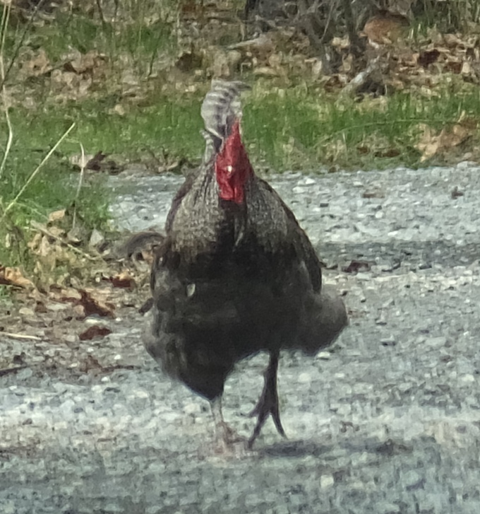
We walked 3.3 miles in the park. |
|
Norma and I crossed back into Maryland. We had one last stop before heading home. I wanted to show her the great blue heron rookery I saw on April 9, 2017. Back then, I wanted to see it from the Susquehanna River but could not because there was so much water being released from the Conowingo Dam that I could not paddle upstream.
We launched from Moore Road and paddled down Octoraro Creek to the Susquehanna. Then we paddled upstream to see the rookery on the east side (right). 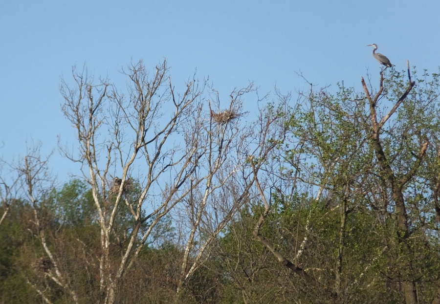
I think there are about 17 nests in this picture. 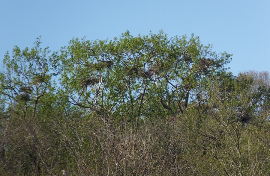
We're not supposed to land on the east side of the river where the rookery lies. So instead we stayed in the kayak or landed on little rock islands. 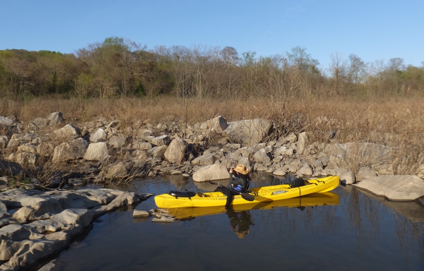
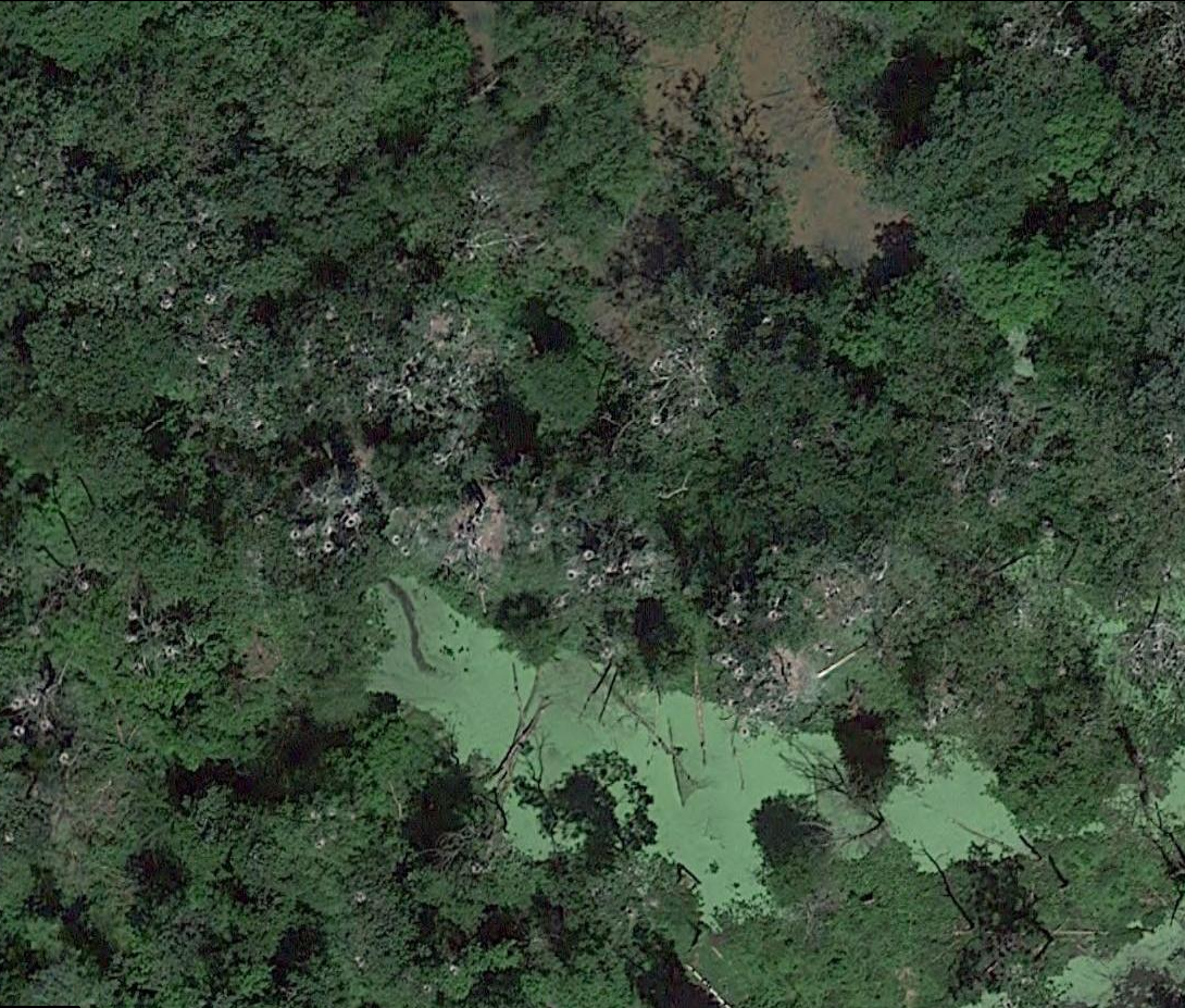
It was only eight days since I last saw the rookery but there were more leaves on the trees now, making the nests harder to see. At the time, you could see the rookery in satellite photos at Google Maps coordinate 39.662774, -76.165209. Or see satellite photo of rookery. |
|
Norma and I had a good trip. For me, the ship graveyard was definitely the highlight. We look forward to returning and doing a multi-day bike ride on the rail trails.
I know there are very nice parts of New Jersey but the area between New Brunswick and Trenton left images in my mind of potholes, litter, and graffiti. After our trip, I spoke to others who lived in or spent a lot of time in New Jersey and their impression was similar. Still, our trip was an enjoyable one. It was far from perfect but sometimes it is the imperfections that make things memorable. |


