Ricketts Glen 2020

The last time Norma and I visited Ricketts Glen was October 17-18, 2015. In my opinion, this is one of the most scenic places to hike and the best place that I know of for finding so many great views in a short distance. So on October 10-12, 2020, we figured it was time to return...this time with Daphne.

The above photo shows the 11'-high Cayuga Falls.


 Saturday, October 10, 2020

Cherry Springs LoopOpen accordion icon
Ricketts Glen State Park is a long drive from Savage but well worth it. We arrived a little after noon. It was a sunny day and the place was packed! Finding parking wasn't easy. Who wouldn't want to come to this place in the autumn? The fall colors are spectacular and when you add the waterfalls on top of that, you'd think you died and went to heaven. Yes, it is that good.

Our first stop was the visitor center where I saw some historic pictures and tools once used in the area. This place was once known for logging.

I knew a lot of people would be wanting to see the falls so I chose a different hike for our first day, the less popular but still scenic Cherry Springs Loop.

We started from Beach Lot #2 Trailhead Parking. Then we headed east on Cabin Colony Road to Lake Leigh. Here, we found a decrepit dam.
The dam was built for hydroelectric power in 1905. It was a failure due to the water out flow not being strong enough. The dam was condemned for structural weaknesses and a hole was blown in it in 1957.
- from Geocaching - Lake Leigh Dam
1 / 2
Daphne in front of dam
Old dam.
2 / 2
Hole in dam
Hole in dam.

We saw a few signs that read
Hunting, shooting, trapping, and dog training prohibited.
Being the rebel that I am, I decided this was a good spot to work on training Daphne.
Me telling Daphne to sit

For the most part, I don't really do much training with her. That is more Norma's job. I tend to just do fun stuff with her, like hiking.
Me hiking with Daphne in the woods

We walked the loop in a counterclockwise direction, starting with the red-blazed Mountain Springs Trail. We saw a lot of ferns and some spinulum.

After awhile, we lost our sun to clouds.

Next, we headed north on the yellow-blazed Little Cherry Run Trail. This is the most scenic part because of all the water flowing on Cherry Run. Here, we saw this small unnamed waterfall. It was nice but I'm not sure if it is really big enough to qualify as a waterfall. According to Falzguy - Glossary Of Waterfall Terms
The water must drop a minimum of five feet to be considered a true waterfall.
Small waterfall

Norma and I found some interesting fungi, including this one that reminds me of the tip of the weapon that Spock used to fight Kirk.
Red crescent-shaped fungi

Back at Lake Leigh, we checked out the other side of the dam and found a beaver dam. Without it, the lake would just be a pond.
1 / 2
Lake on other side of dam
Lake behind dam.
2 / 2
Beaver dam forming lake
Beaver dam.

The three of us walked 6.6 miles.
Close accordion icon

No restaurantsOpen accordion icon
That night, we checked into a motel. I don't believe we ate out during the whole weekend; we brought our own food. The coronavirus pandemic is still strong and unless we can eat outside, we'd just as soon stay away from restaurants.


 Sunday, October 11, 2020

Falls Trail LoopOpen accordion icon
Norma, Daphne, and I got up early and commenced our slightly modified Falls Trail Loop hike at 0800. Due to the popularity of this route, I figured it was best to start early. Of course, doing it on a non-holiday workday would have been even better.

It was overcast. But that wasn't bad since bright sunlight would have created harsh shadows. The low light lended itself well to slower shutter speeds on my camera when in the manual setting.

There weren't many people out when we started. But I did run into a former Marine machine gunner who saw my USMC bumper sticker. We chatted for awhile.

We started our hike from the Lake Rose Trailhead Parking. Back in 2015, we did this hike clockwise so I figured this time we'd go counterclockwise.

One can see 21 waterfalls in less than five miles! I took a multitude of snapshots but I'm only showing my favorites here.
1 / 11
Oneida Falls, 13' high
Oneida Falls, 13'.
2 / 11
Ganoga Falls, 94' high
Ganoga Falls, 94'.
3 / 11
Conestoga Falls, 17' high
Conestoga Falls, 17'.
4 / 11
Tuscarora Falls, 47' high
Tuscarora Falls, 47'.
5 / 11
Norma and Daphne at Erie Falls, 47' high
Erie Falls, 47'.
6 / 11
Harrison Wright Falls, 27' high
Harrison Wright Falls, 27'.
7 / 11
Daphne and I at Harrison Wright Falls
Harrison Wright Falls again.
8 / 11
Sheldon Reynolds Falls, 36' high
Sheldon Reynolds Falls, 36'.
9 / 11
B. Reynolds Falls, 40' high
B. Reynolds Falls, 40'.
10 / 11
R.B. Ricketts Falls, 36' high
R.B. Ricketts Falls, 36'.
11 / 11
Shawnee Falls, 30' high
Shawnee Falls, 30'.

This is the 39'-high Mohican Falls, 39'. Notice the stone stairs on the left. Such structures were commonplace. A lot of work went into creating all this.
Mohican Falls, 39' high

A more comprehensive catalog of these falls is in my October 17, 2015 blog.

After seeing the falls, we walked back on the Highland Trail.

About halfway through our hike, we started encountering a lot of people. Three-fourths through, it was unnerving how many people were there during pandemic conditions. I think the park could have helped reduce close encounters by telling people to only walk in one direction. Many parts of the trail were just too narrow to ensure social distancing.

Here is the route for this hike and yesterday's hike.
Our route
Close accordion icon

Lake JeanOpen accordion icon
After the waterfalls, the best thing about Ricketts Glen is the fall colors. Unfortunately, we didn't have much sun to really make them stand out. I found the ideal place for viewing was at Lake Jean, near the park entrance.
View of fall colors at Lake Jean

Seven TubsOpen accordion icon
Norma, Daphne, and I left Ricketts Glen and drove to a place called Seven Tubs Recreation Area in Pinchot State Forest.
This 537-acre scenic treasure is home to the beautiful "whirlpool valley" and is conveniently located just off Route 115 in Plains Township, Luzerne County.
There are a series of pothole-like formations in Wheelbarrow Run, which are referred to as the Seven Tubs. This unique natural resource has been in the making for thousands of years. These interesting formations were formed when the 350-million year old sandstone bedrock was gouged out by glacial meltwater roughly 12,000 years ago. When the Wisonsinan glacier, which covered the area at the time, began to melt, it sent water and debris funneling down into the bedrock. The strong current, coupled with the debris, ate away at the rock and formed today's stream which continues to slowly erode the gritty sandstone.

- from sign at trailhead

What do we know about Pinchot State Forest?
The Pinchot State Forest is named in honor of former Pennsylvania governor and state forester Gifford Pinchot. Pinchot was a visionary of forest management whose considerable influence helped spark a national awareness of forestry practices and conservation.
- from sign at trailhead

Following the AllTrails - Seven Tubs Nature Area route, we started at 41.235515, -75.810649 and walked 2.2 miles counterclockwise on the yellow and blue-blazed Audubon Loop Trail which took us along Laurel Run.

Here's Norma and Daphne at the tub near where Wheelbarrow Run meets Laurel Run.
Norma and Daphne on a rock by the water

We found an unusually shaped leaf which I was unable to identify.
Spiral-shaped leaf

We also found some teaberries and witch hazel.

Most of the trail away from the water wasn't particularly interesting but there were some nice views at this powerline clearing.
View at powerline clearing

By far, the best part of the hike was the steep rocky gorge at Whirlpool Valley. We saved that for last.
Water surrounded by steep rocks

There were no real waterfalls but that's fine. I got my fill at Ricketts Glen.

Here is our route.
Map of our route
Close accordion icon


 Monday, October 12, 2020

Buttermilk Falls Open accordion icon
It rained quite a bit during the previous night and morning. But by the time we hit the road, it was starting to lighten up. So we started our day by visiting the 30-35 foot tall Buttermilk Falls (aka Bear Creek Falls), just south of Bear Creek Village, in Luzerne County, Pennsylvania. It is located at 41.166974258964906, -75.7432919652357.

Here's Daphne at the falls.
Daphne

If you don't like to walk, this is the waterfall to see. It is right off the road.
Trickle of a waterfall

This is Daphne and me at the falls. It was still pretty dark.
Daphne and I at the falls

Due to its convenient location, I think this would be a great (and easy) waterfall to see when it is frozen. During our visit, it could have used more water.

Why does it have two names? Because there are supposedly 15-20 waterfalls named "Buttermilk" in Pennsylvania.

We saw some witch hazel near the parking lot.

There were some big, rocky walls that I thought might be good for technical climbing.

Don't expect to see signs at the parking lot or any signs in the area telling you where the falls are. I have to wonder if the locals took them down to prevent tourists from disturbing their rural peace and quiet.
Close accordion icon

Bear Creek PreserveOpen accordion icon
Our last hike of the day was at the 3,400-acre Bear Creek Preserve in the Poconos.

What is the story behind this place?
In 1960, F. Otto and Dorothy Haas - members of one of Philadelphia's most philanthropic families - purchased a spectacular 6,400-acre expanse of forest in the village of Bear Creek, and established a wilderness retreat for their family.
When their three sons - John, Bill, and Tom - inherited the property nearly two decades later, they began to explore ways to preserve the land so it would forever remain the wild and special place they'd come to treasure. The Haas family placed nearly half of the land under conservation easement with North Branch Land Trust and donated the remaining acreage to Natural Lands, thus establishing Bear Creek Preserve. The transaction is the largest single land acquisition in Natural Lands' history.

- from Natural Lands - Bear Creek Preserve
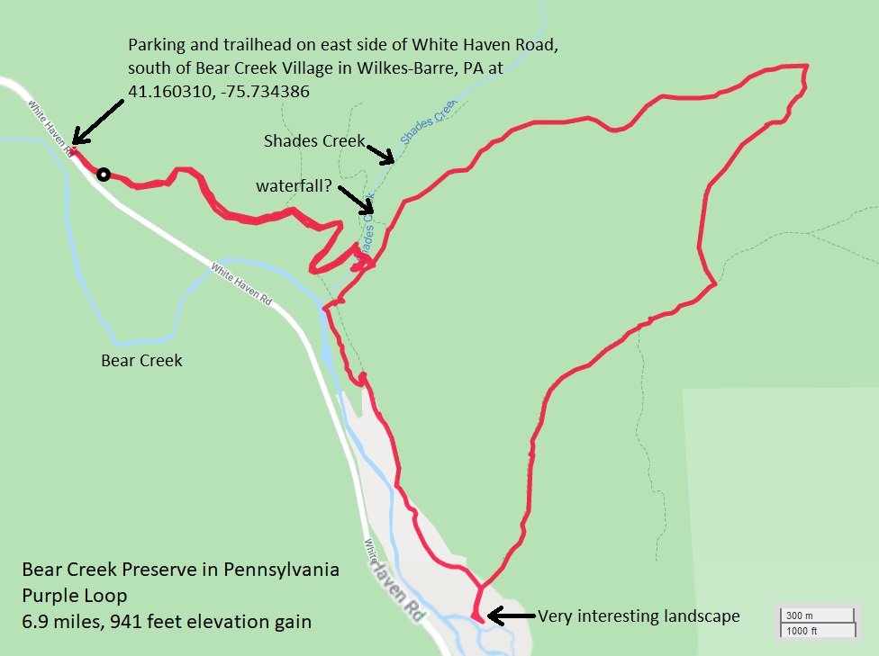
We did the AllTrails - Bear Creek Preserve Waterfall and Purple Loop route, starting at 41.160306, -75.734361.

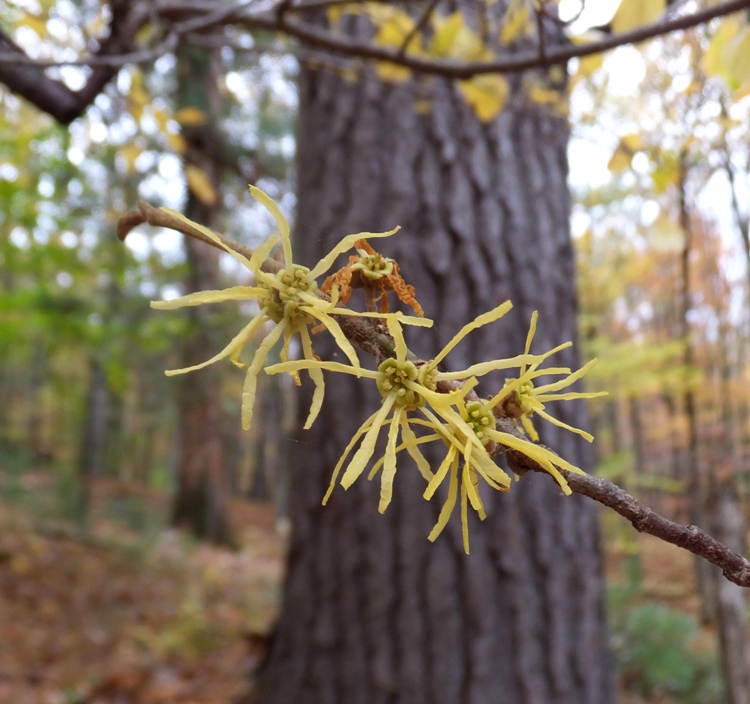
During our weekend in Pennsylvania, we saw a lot of witch hazel flowers. But we definitely saw the most on this hike.
Witch hazel is a natural remedy made from the bark and leaves of a plant called Hamamelis virginiana. Long used in traditional medicine, witch hazel is usually applied topically in order to treat certain skin conditions.
Witch hazel contains tannins, a type of natural compound with astringent effects. By acting as an astringent, witch hazel helps to constrict skin tissue.

- from VeryWellHealth - The Health Benefits of Witch Hazel
Witch hazel flowers

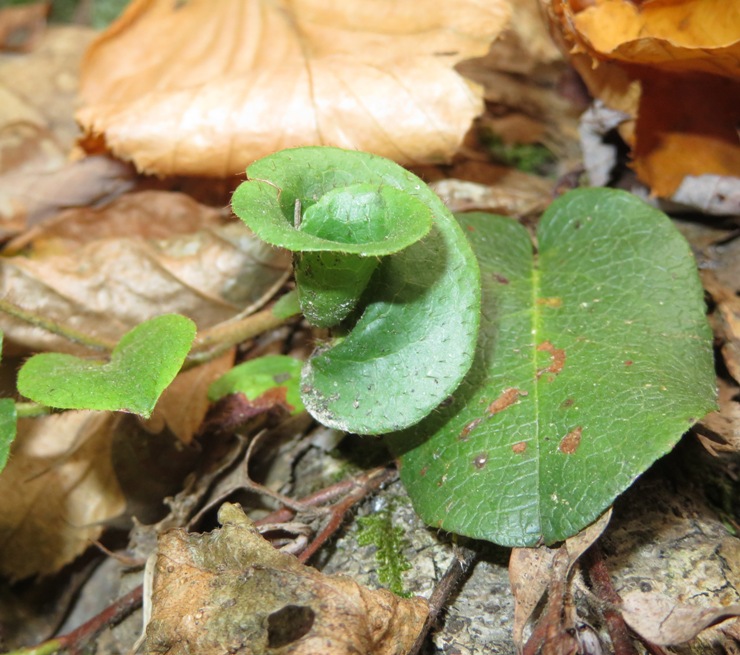
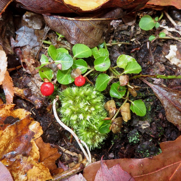
We also saw sweetfern and partridgeberries.
Partridgeberries

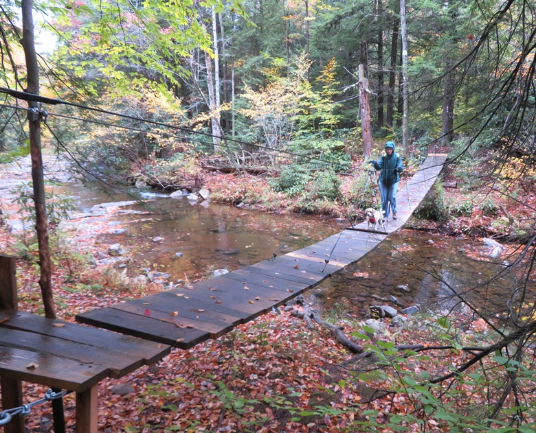
There was one rivercrossing at 
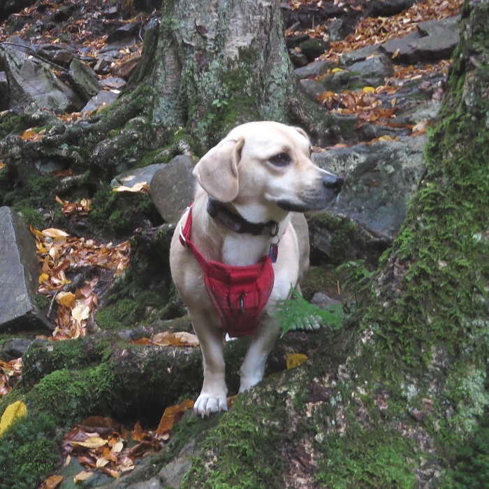
Shades Creek. Daphne wasn't very sure about that missing board.
Norma and Daphne on swinging bridge

This is the kind of footbridge I would like to see in my town, connecting the River Trail on the west side of the Little Patuxent River to the green trail at Wincopin and then a similar bridge connecting the Savage Mill Trail on the east side of the Middle Patuxent River to the green trail at Wincopin. I have mentioned the idea to both the former Howard County executive (when he was in office) and the current one, as of 2019.

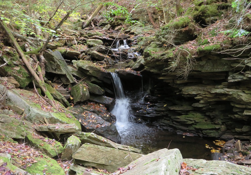
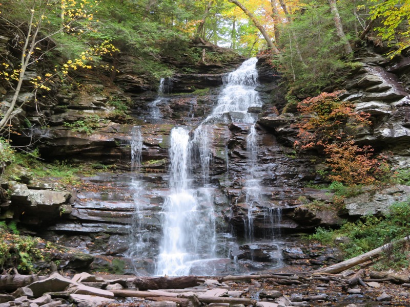
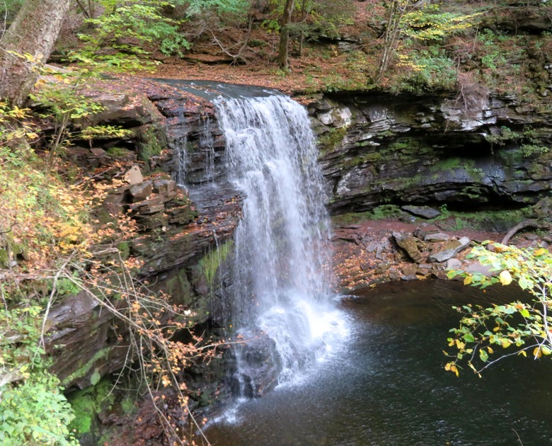
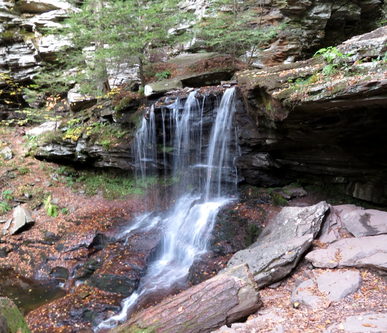
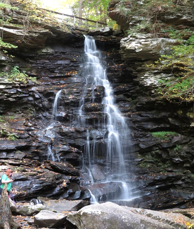
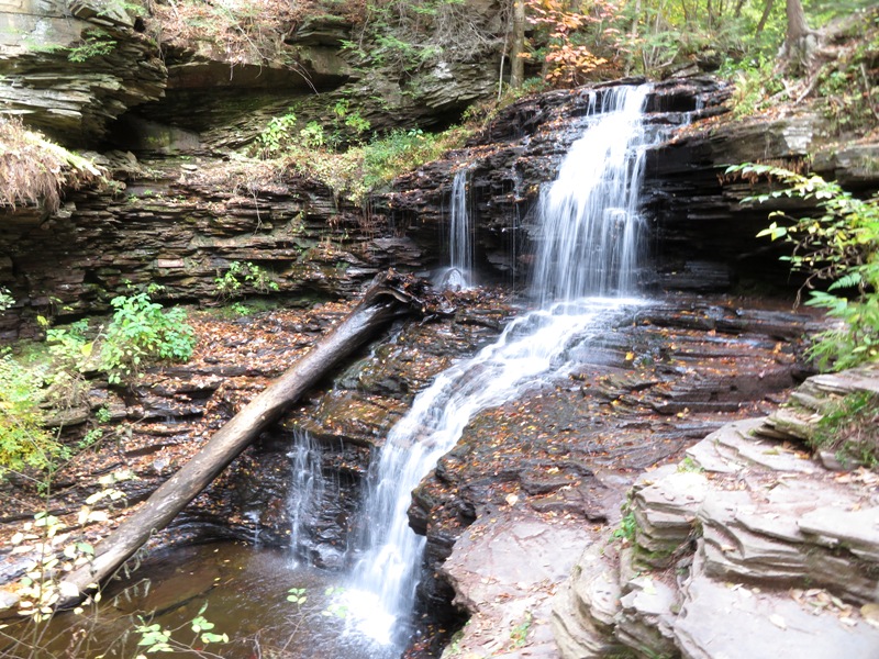
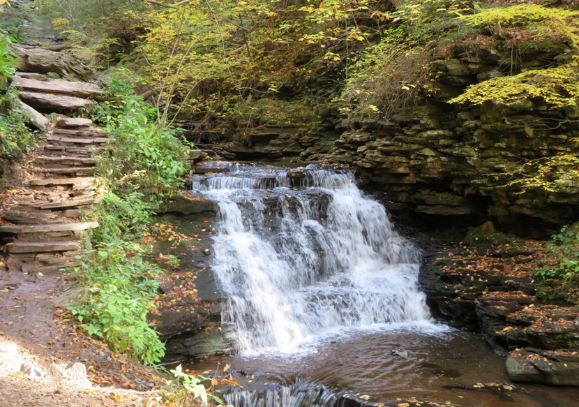
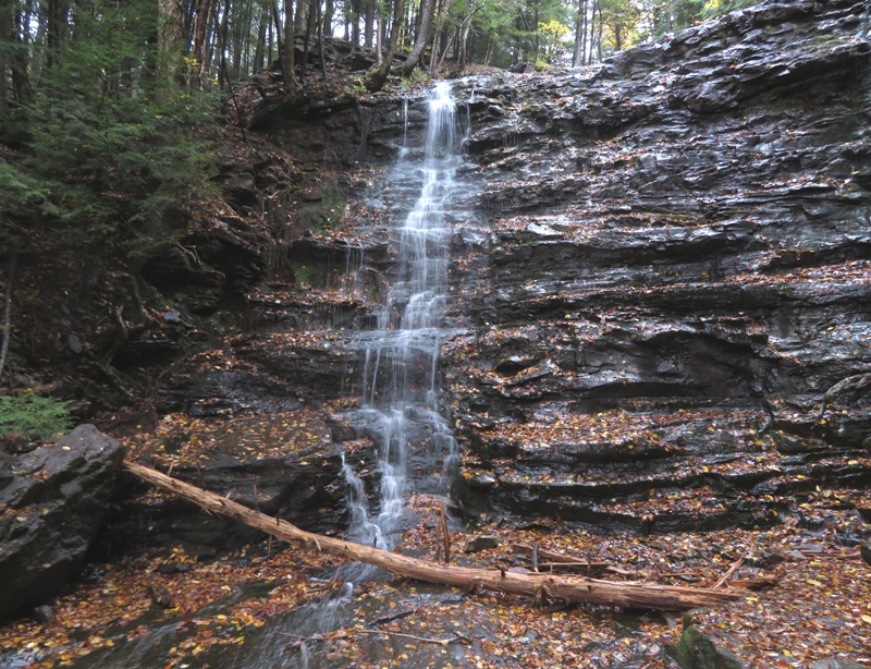
We spent some time looking for what AllTrails said was a waterfall just downstream from the footbridge. But we never found it. Once we finished our hike, I checked the map at the trailhead which said that the waterfall was upstream from the bridge.

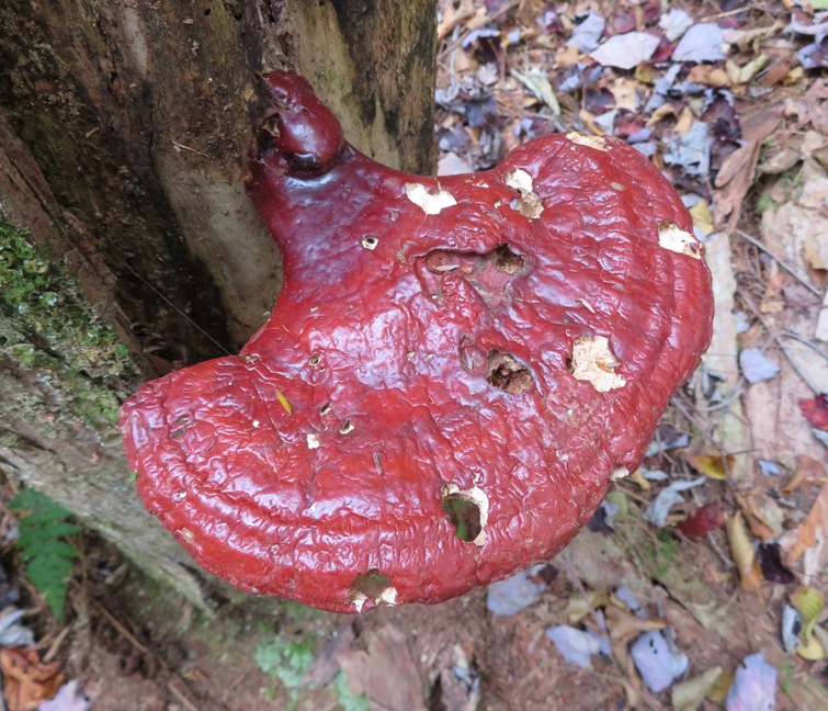
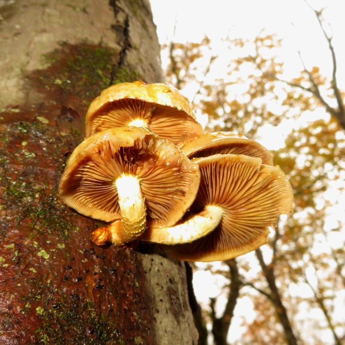
There were some interesting gilled mushrooms to be seen. Not sure what kind they were.
Gilled mushrooms

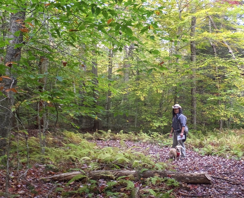
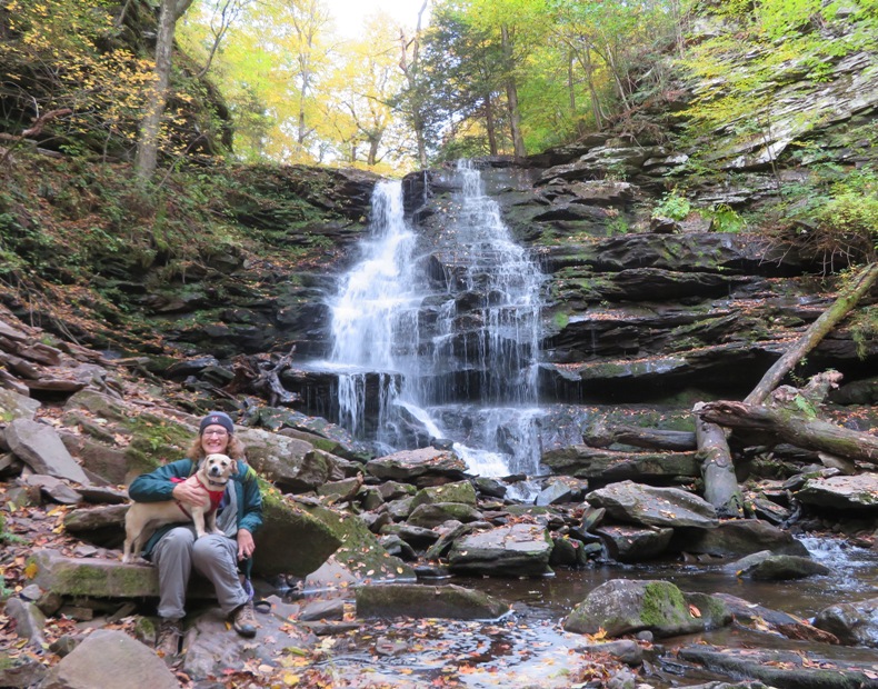
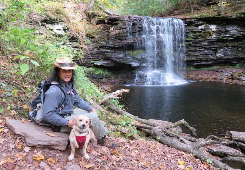
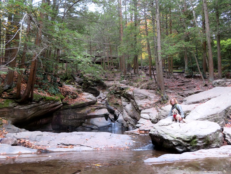
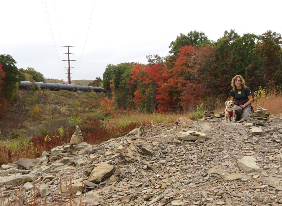
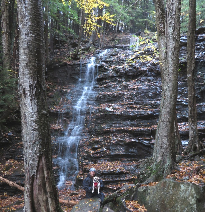
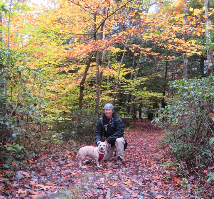
Here's Daphne and I on a leaf-covered trail.
Daphne and me on leaf-covered trail

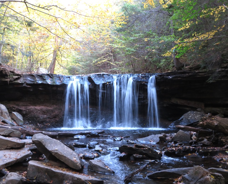
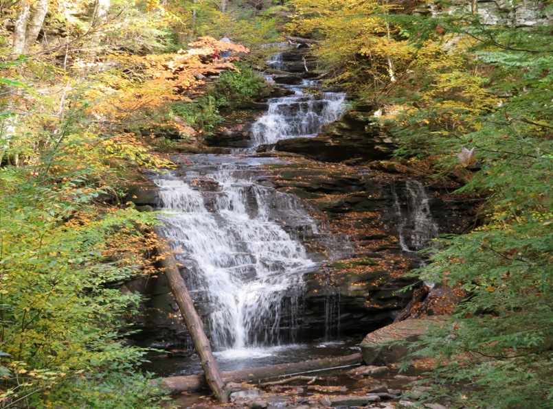
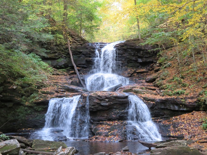
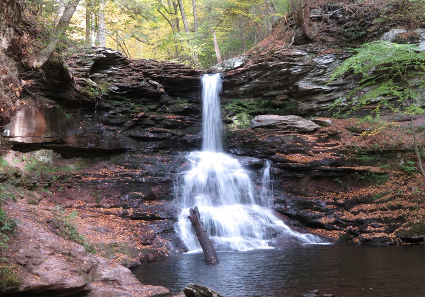
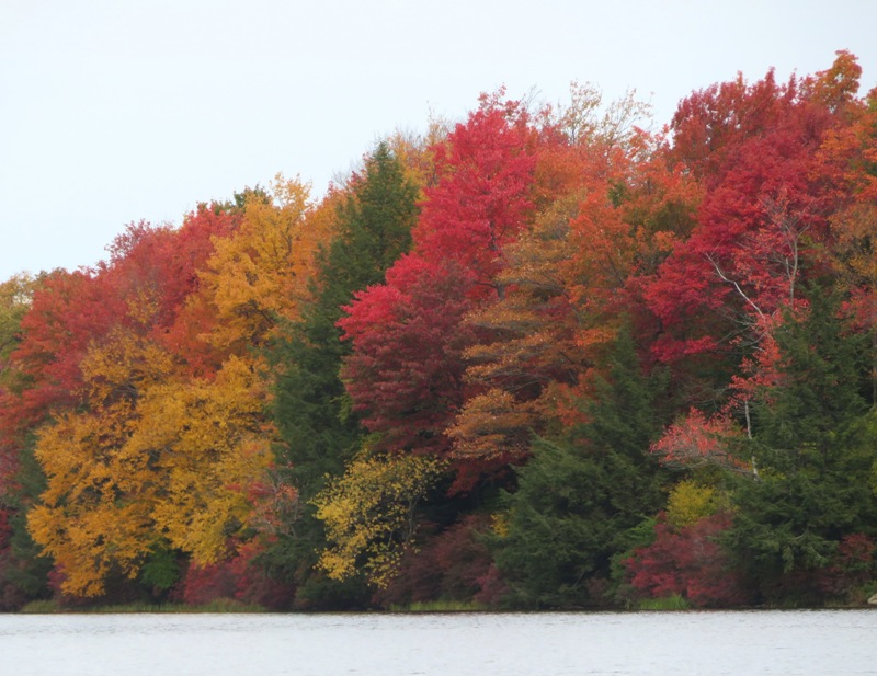
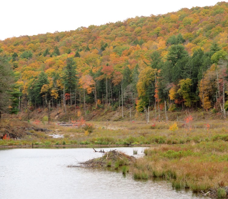
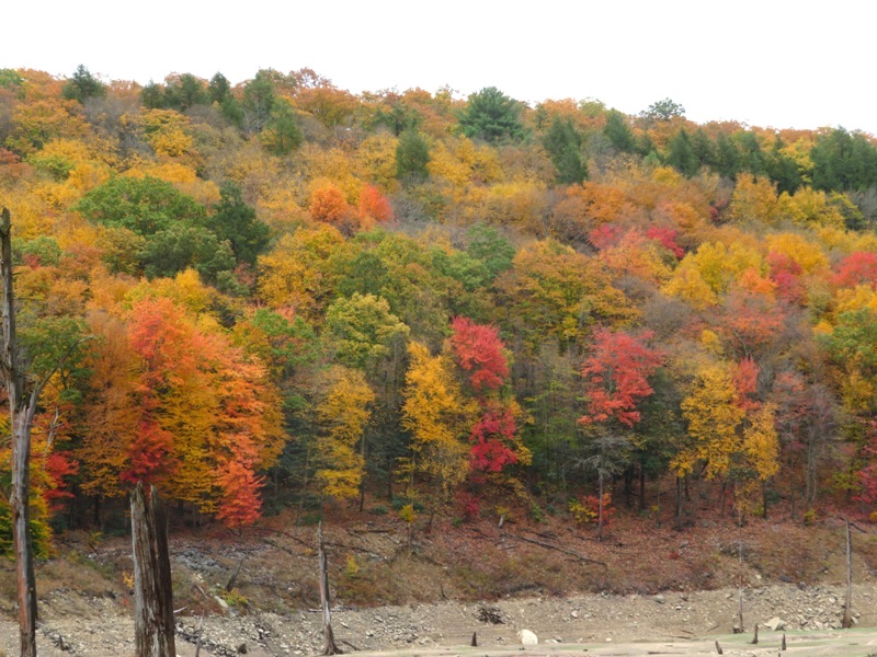
The falls colors were nice but unfortunately, the sun never came out. It didn't rain much when we were hiking but there was often a light mist.

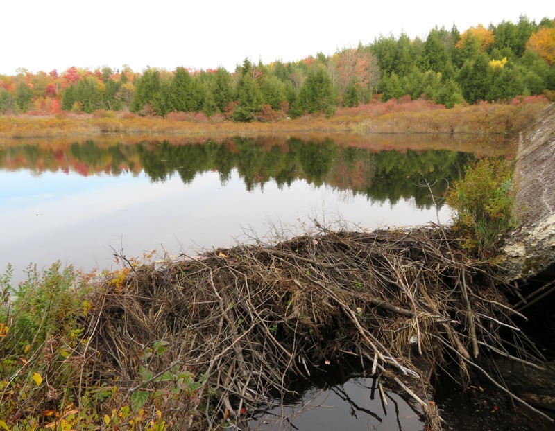
Much of our hike was along 
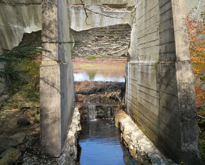
Bear Creek. Though we usually couldn't see the road just behind it, we could definitely hear the traffic. We saw a beaver lodge on the creek.
Beaver lodge on the creek

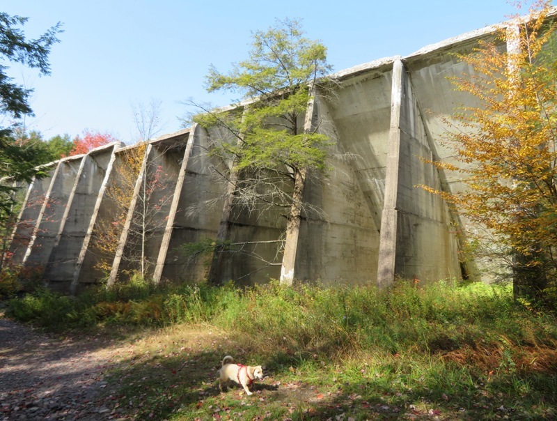
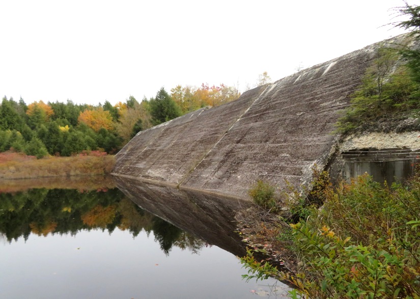
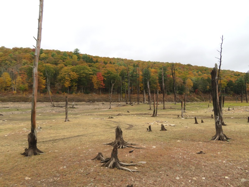
There is one part of Bear Creek where it looks like there was once a lake but there is no more. This place had an otherworldly feel to it.
Dead trees

The autumn colors would have really been nice had the sun come out.
Autumn colors

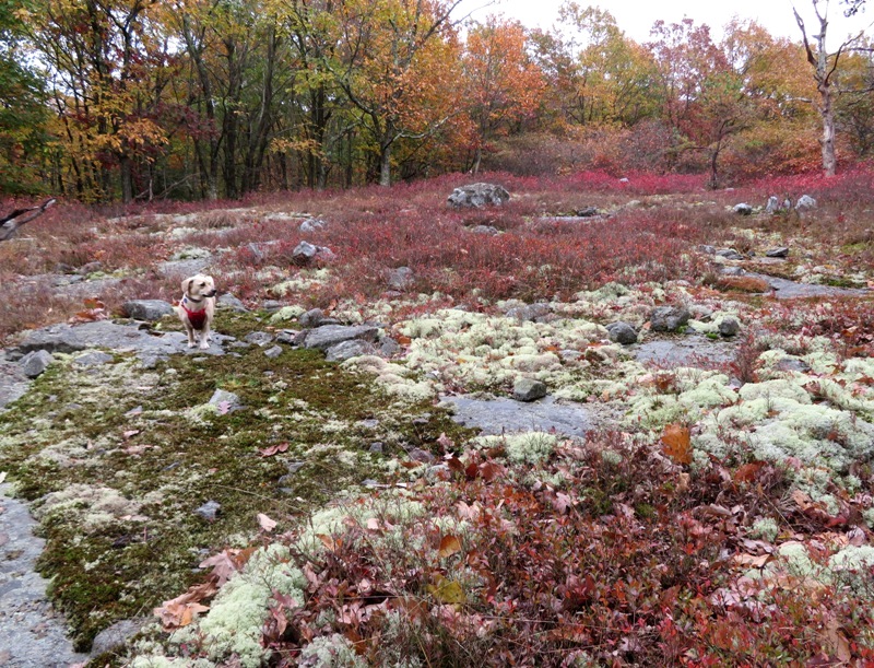
In some areas along the trail, there were a lot of rocks just below the surface that prevented large plants from growing. But it was a haven for moss.
Daphne with moss growing on rocks

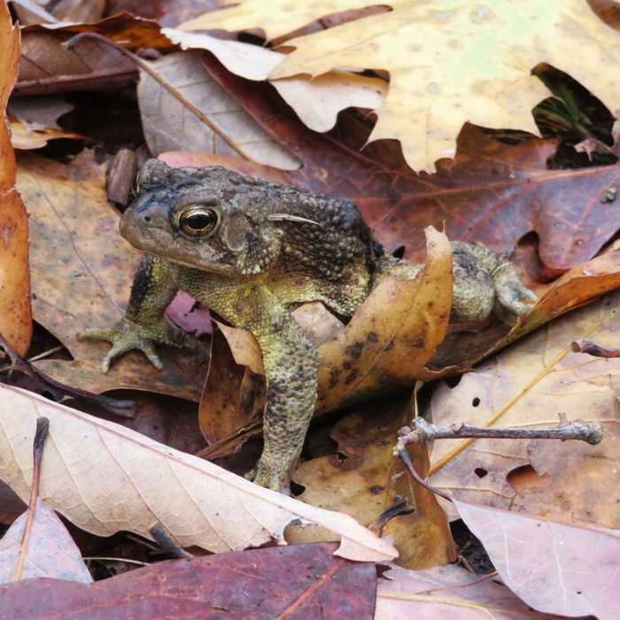
The only wildlife we saw was an American Toad or Fowler's Toad.
Some kind of toad

It wasn't a great day for a hike but it was nice being the only ones on the trail, especially after seeing far too many people visiting the falls in Ricketts Glen.

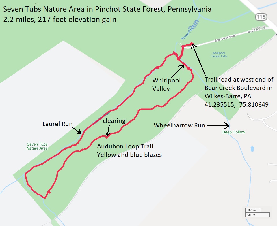
Here's our route. After walking 6.9 miles, we were ready to head home.
Map of our route
Close accordion icon


ConclusionOpen accordion icon
We definitely enjoyed our time in the Ricketts Glen area. Sometimes I think it would be good to time our visit after a really big rain so we could see a lot more water coming off the falls. But a storm might also take a lot of leaves from the trees that frame the falls so nicely with autumn colors. If we return, I expect it might be at a different time of year.