|
This page describes my hiking adventures in 2021. |

|
This page describes my hiking adventures in 2021. |
|
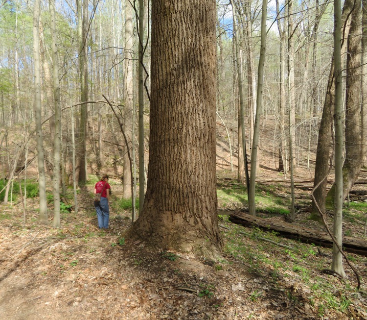
Norma, Daphne, my co-worker (tall) Paul M., his sons Mark and Kevin, and I did a hike starting from Woodstock in Patapsco Valley State Park. We explored the Howard County section (south of the river) heading southwest. This is a section I've never hiked before.
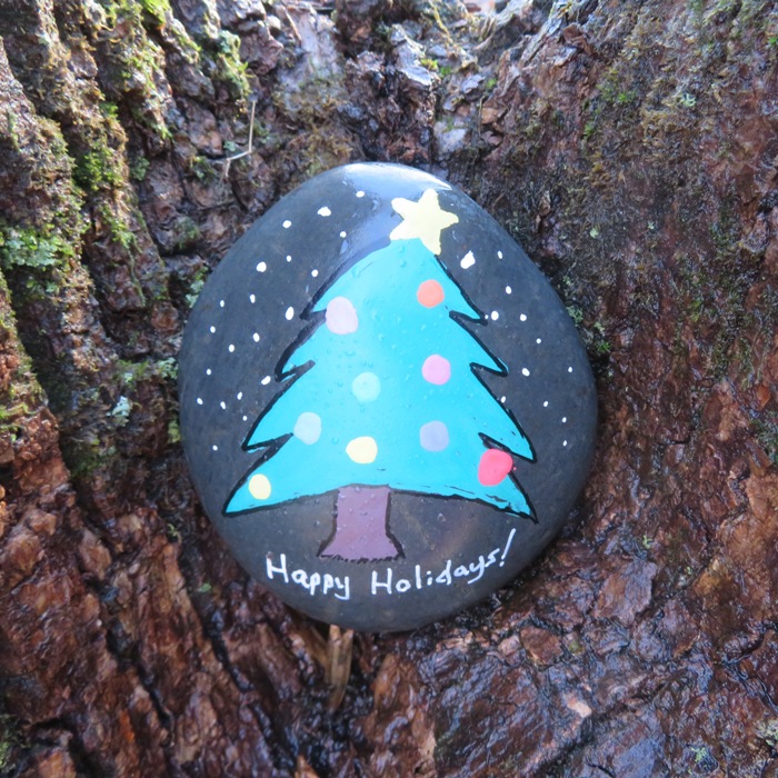
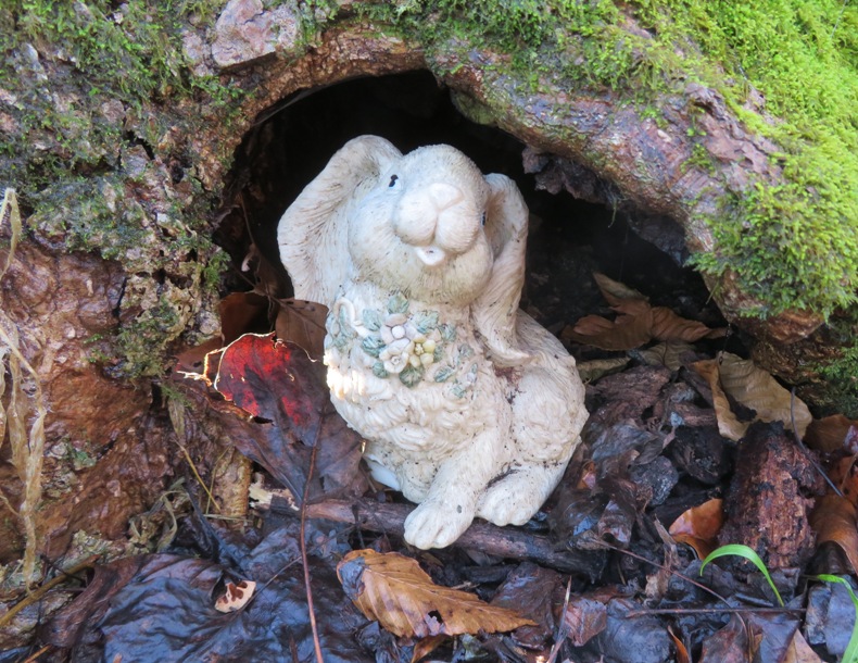
New Years Day is typically a big hiking day and indeed, Norma, Daphne, and I did get out briefly with Sara and Don at Wincopin Park for a First Day Hike, but the weather was pretty bad and we didn't want to stray far from home for fear of freezing rain. Instead, Norma and I decided to do a bigger hike on the day after New Years...a Second Day Hike. It was supposed to get into the low 50s and be sunny, though a fog hung in the valley where we started. We commenced our hike at 0910 to temperatures in the high 30s and low wind. Woodstock is a great place for a First (or Second) Day Hike. I did First Day hikes there in 2019 and 2020. The route I planned for today was a modification of the point-to-point 4.3 mile AllTrails - HoCo, Affeldt me Gasline, Wall Trail. I studied this route and found a few places where one might be able to access neighborhoods, which would provide new trail access points between Woodstock and Daniels, which are pretty far apart. These neighborhood trailheads would be like "oasis" trailheads, if indeed they existed. We started our hike walking parallel to the Patapsco River, following it downstream. For about the first hour, we didn't see anyone else. It rained quite a bit during the previous day and while the trail was wet, there were very few puddles since we mostly walked along the side (not the bottom) of a hill, so drainage was good. We saw mostly deciduous trees. In a few, we saw painted rocks and at the base of some trees, we saw little statues. I don't know if some people would consider such things littering but I like them and feel that the environmental impact is negligible, assuming the rock is painted with non-toxic paint. As the fog started to burn off (below photo), there were some places where the sun shined on all the water in the trees. It reminded me of how things look after freezing rain, when limbs are coated with ice. 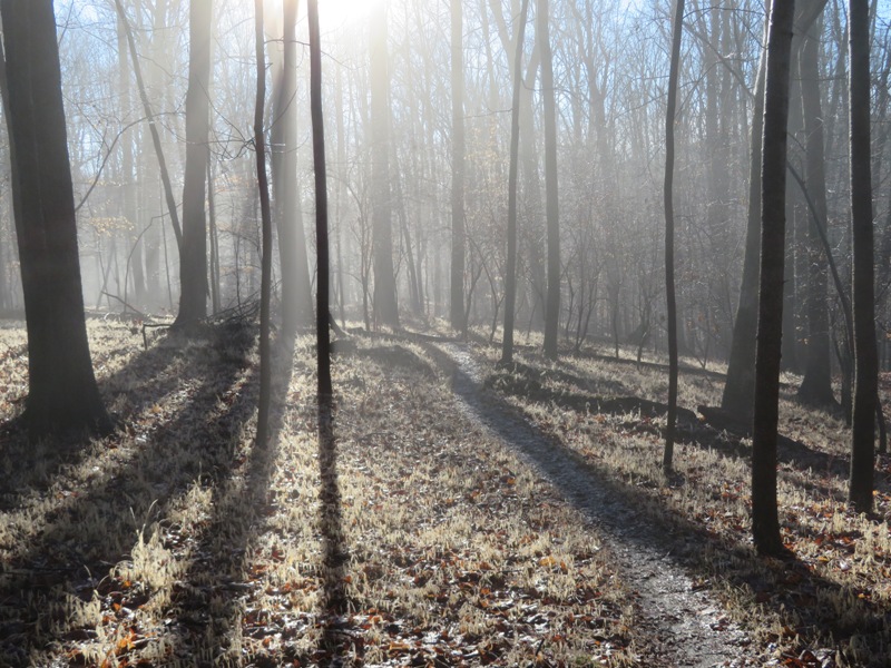
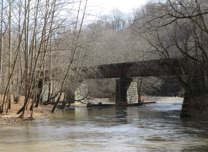
Daphne was full of energy and quick to chase every squirrel she saw. But after getting some of that out of her system, she calmed down and stayed near us for the rest of the walk. We crossed the Davis Branch which empties into the Patapsco just a little downstream from our trail. Further upstream, it flows right past the trails in the Howard County Conservancy. Our route is a "lollipop" in that it starts and ends with an out-and-back with a circuit in the middle. The circuit part was quite long and easy to get lost on. Fortunately, I had the route downloaded to my phone so we never got too far off track. I momentarily saw a woodpecker and a deer swimming across the river at the Eureka Train Bridge, shown in this blog's cover photo. Also at the bridge, we saw a pickup truck driving, which was modified so it would stay on the tracks. The wind picked up to gusts of around 20 mph as clouds rolled in, taking away our nice sun. We saw the west side of the Davis Tunnel which had the date 1906 on it. It isn't long and in the picture below, you can see light at the other end. This and the Dorsey Tunnel, just across the river, were part of the Baltimore and Ohio (B&O) Old Main Line, the first commercial railroad in the United States. This construction, which ushered in an age of westward expansion from Baltimore to the Ohio River, began in 1828 and included a stop in the Daniels Area. 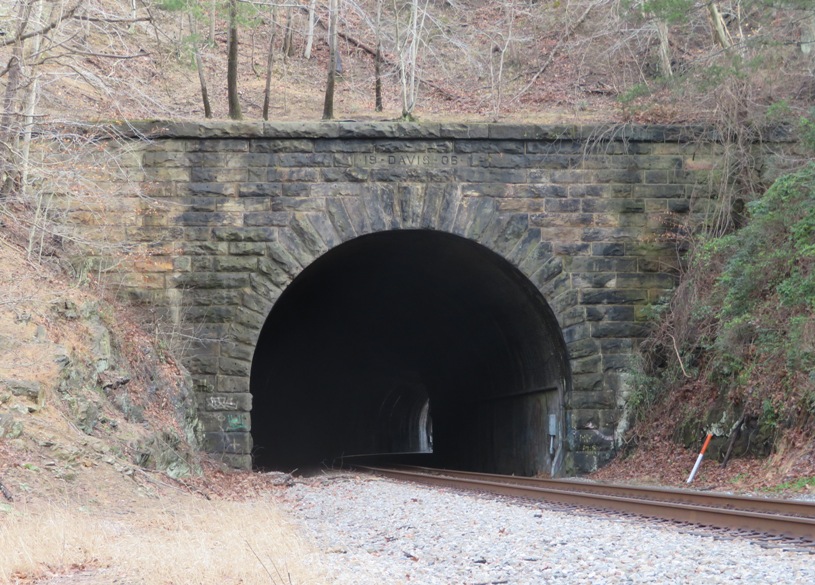
Based on the information from the AllTrails "HoCo, Affeldt me Gasline, Wall Trail" route, I estimated our trip would be 6.3 miles but it ended up being 8.1 miles. Fortunately, Paul and his sons were in good shape so it was easy for them. So did I find any oasis trailheads? Yes, I found two. Samantha Way: There is a paved path on the northwest end of the cul-de-sac at the west side of Samantha Way in Ellicott City which leads to a well-defined trail. This paved path joins Samantha Way at 39.310851, -76.850519 and looks like the image below. I suggest that if you're with a group, don't all park together...spread out and walk a little to get to the trailhead since this is a neighborhood, not a parking lot. 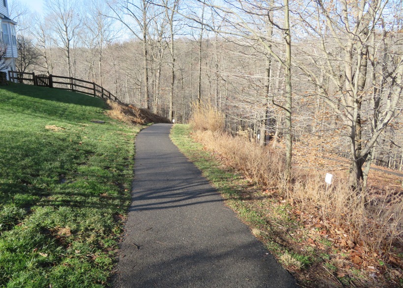
Greenhaven Court: There is a not-so-well-defined trail just east of 3078 Greenhaven Court in Ellicott City. It is on the west side of a field under power lines. Walking north, it will lead to a narrow, steep, eroded path that leads downhill to the Eureka Train Bridge. I don't recommend using this route since the trail is really more of a bushwhack route where the barren ground isn't level enough to prevent runoff, so there are some environmental stressors at play. Best to use Samantha Way. This so-called path joins Greenhaven Court at 39.314482, -76.842005 and looks like the photo below. 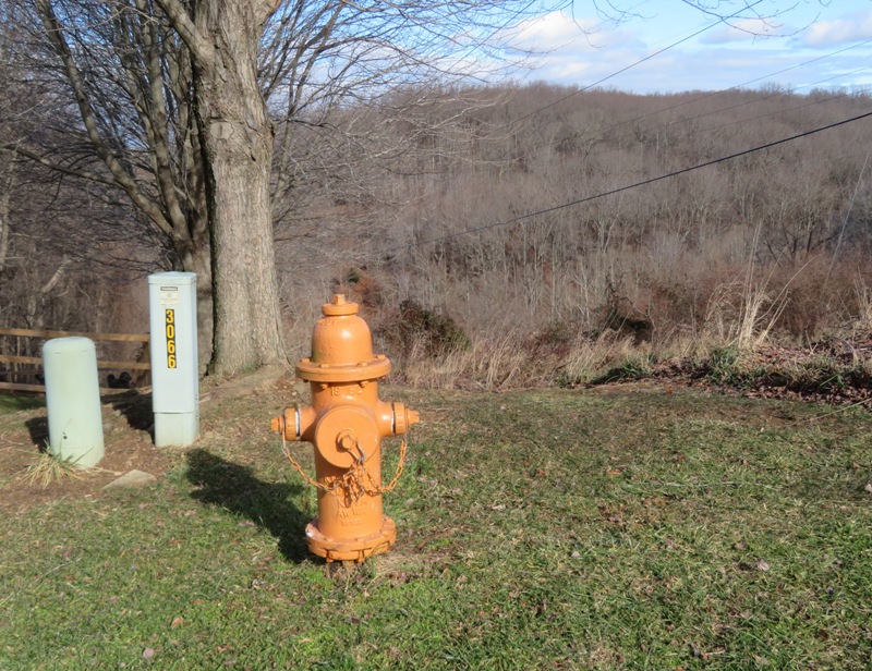
Here is our route. 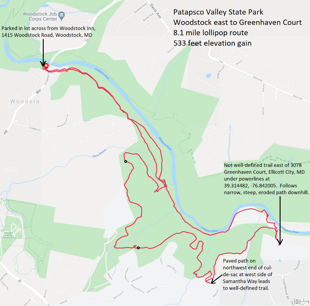
When we returned, there were ALOT of cars parked near the trail. But unlike what I've seen at Daniels, there was sufficient parking here, though that might not have been the case had the weather been nicer. There was a kiosk at our lot showing the Woodstock parking configuration. It was a little hard to orient so I did a little image modification to create the following, which, in my opinion, is much more readable. 
In December 2020, I reached out to the park manager to ask about parking and Daniels Dam for an article I was writing. Regarding parking, he wrote, As far as the parking in Woodstock, we only own a very small sliver of land in the far corner of that parking area. It is private property, Woodstock Inn, and CSX property. The landowner currently allows parking there but for a limited time. He does this to encourage the proper use and not all day swimming, cooking, and bathroom use along the river. Norma ordered lunch to go at the Woodstock Inn. I had a bacon cheeseburger with sweet potato fries. It was very good. Norma's food was good too.  |
|
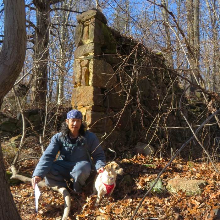
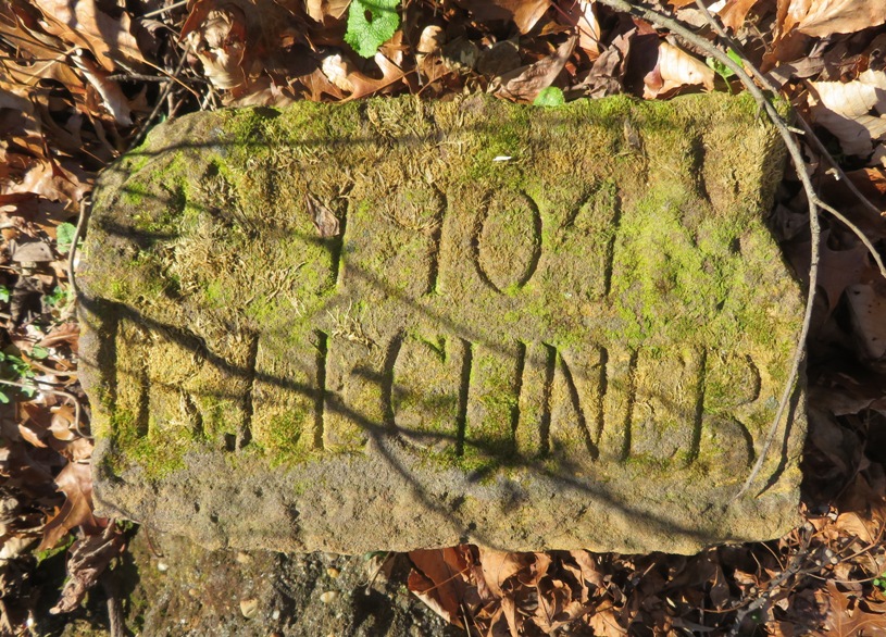
Norma, Daphne, and I explored Rockburn Branch Park, following the Rockburn, Pain Cave, Belmont and Nacho Trail Loop. We started at Lot for Fields 1-5.
The woods were beautiful and we found some historic relics. Crossing Landing Road, we entered into Patapsco Valley State Park. We saw some interesting fungi growing out the side of a tree. Possibly of the xylaria genus. One particular species of this genus is known as dead man's fingers. 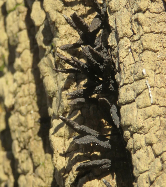
Norma and I discussed chicken names for our third generation flock, which should arrive in April 2021. In the past, we gave the girls old-fashioned names where the first letter of the first name matched the first letter of the breed. This year, we are considering giving them names of country music singers or songs. For the second generation flock, I did that for Gretchen. She was named after Gretchen Wilson. Here are the names we brainstormed: Loretta, Crystal, Reba, Barbara, Patsy, Lucille, LeAnn, Shania, Wynonna, Dolly, Elvira, Terri. We need something that starts with an 'O'. The three of us had a good time but compared to other walks we had done in the area, this was not a great hike. The area is very popular and many sections were extremely muddy, despite the fact that it hadn't rained in several days. There were lots of hikers, mountain bikers, and horses. Below is our route. Click the image to enlarge. Had we continued west, we would have ended up at the Patapso River, in the Avalon Area. 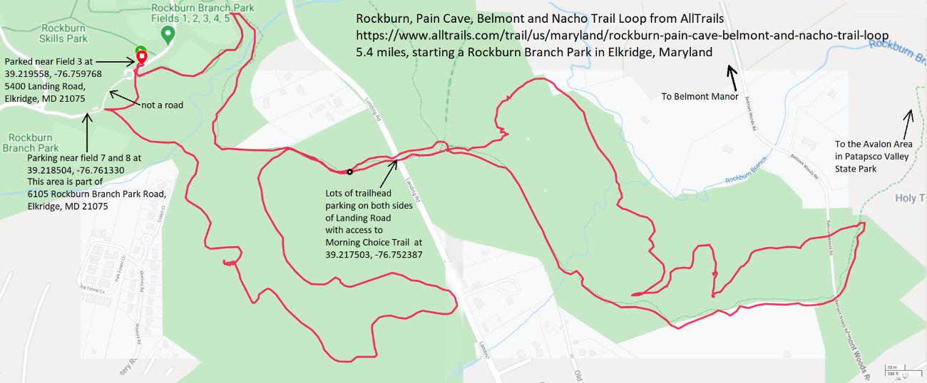
I find that the AllTrails routes often end up being a good bit longer than what they claim, based on what my GPS says. This was supposed to have been a 4.3 mile hike but it ended up being 5.4 miles. There was one detour due to a trail being closed but that wouldn't have added more than 0.4 mile. |
|
Norma, Daphne, and I hiked in Gorman Stream Valley from Murray Hill Road to Kindler Road and back. Daphne wore her MiniGPS and I carried my Garmin GPSMAP 64st. The goal was to see how far Daphne walked as compared to us. We know she covers more distance but just how much more?
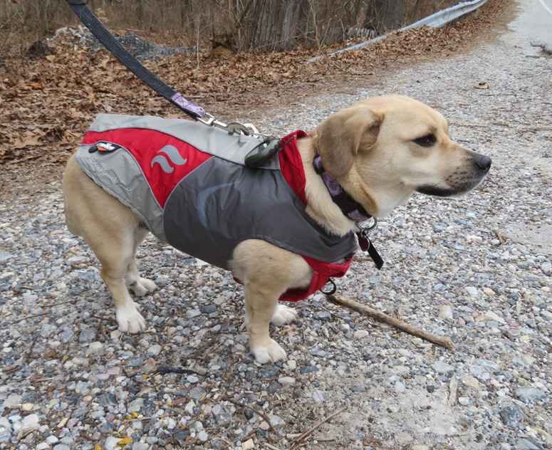
The first thing I did was test the MiniGPS. On January 16, 2021, I took both GPSes with me while bicycling. The Garmin said I biked 33.49 miles while the MiniGPS said I did 34.5 miles. The difference was -1.77%. On January 17, 2021, I took the two GPSes for a drive so I could compare them to the car's odometer. The odometer said 26.0 miles, the Garmin read 26.07 miles, and the MiniGPS claimed 25.6 miles. So the MiniGPS differed by 1.56% as compared to the car and 1.84% as compared to the Garmin. In my opinion, 1-2% accuracy is good enough for what I need, especially for a device that only cost me $34 on Amazon. We generally let Daphne run off-leash when we are out in the woods and there is nobody else around. Untethered, she runs ahead then returns to us, ventures away from the trail to follow a scent, or does other things to ensure she covers a much greater distance than Norma or me. At Gorman Stream Valley, Norma and I walked 6.06 miles, but Daphne covered 7.3 miles...~20% more than either of us or, based on the result of my tests, 18-22% more. At shorter distances, the percent difference is greater. 
But we weren't all business that day. Here's me being silly in the below photo. If you don't get it, see YouTube - Men Without Hats - Safety Dance (Official Music Video). It was one of my favorite songs of the 80s. 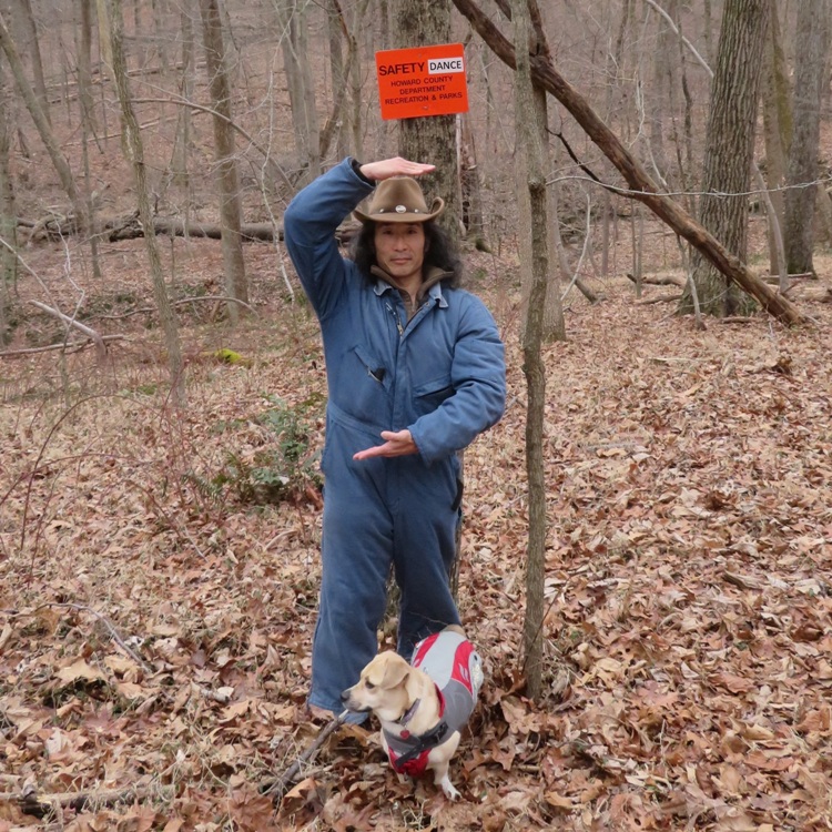
A few days later, I loaned Sara my MiniGPS so she could run a similar test with her dog, Cassi. Cassi is lab mix just a little older than Daphne but much taller and more athletic. Sara walked 4.69 miles, while Cassi covered 5.82 miles, so about 24% more. That sounded about right, especially since a shorter distance was covered. If I was a serious nerd, I would gather more data and use polynomial interpolation to plot a function. I guess just suggesting that makes me at least somewhat nerdy. |
|
On January 29, 2021, my twentieth article was published with the Chesapeake Conservancy, Hiking through History in Patapsco Valley State Park. The cover photo for this article and the one above was taken with my drone at Patapsco Valley State Park - Daniels Area. Yes, I have an FAA sUAS Part 107 drone pilot license.
|
|
On February 13, 2021, my twenty-first article was published with the Chesapeake Conservancy, Three Hibernal Hikes in Harford County. It is about Rocks State Park and Eden Mill Park
|
|
On April 1, 2021, my twenty-second article was published with the Chesapeake Conservancy, A Foraging Revival. This one is totally different from the others because it isn't about paddleboarding, kayaking, or hiking at a particular place. But it is about stuff you might very well see while hiking so I included it on this page.
|
|
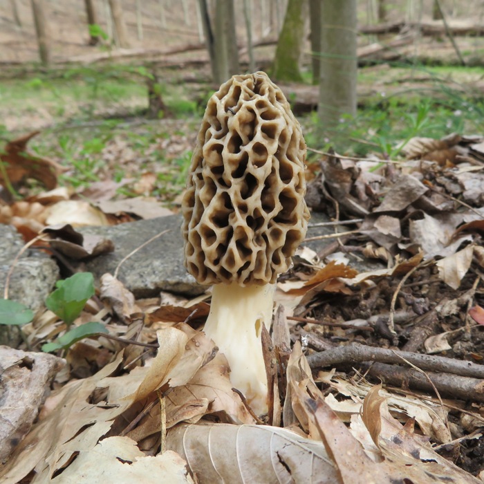
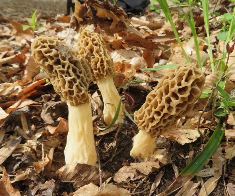
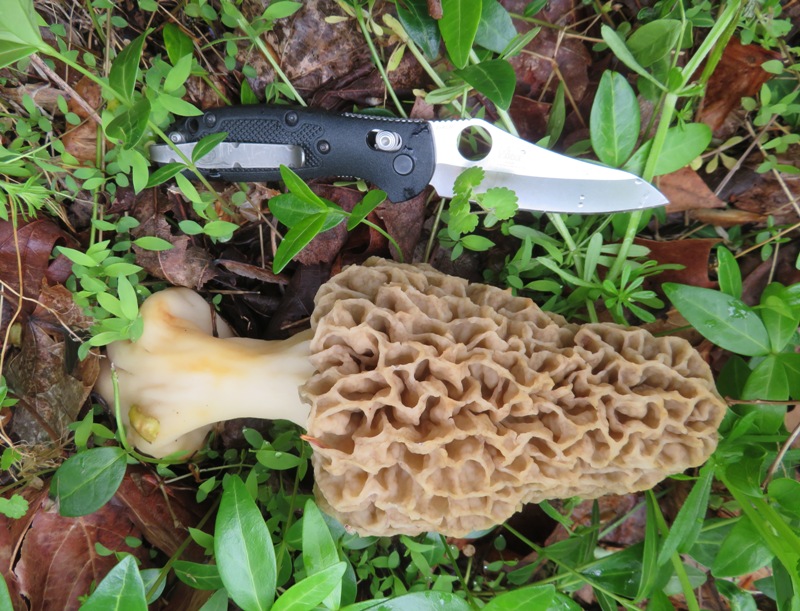
Norma, Daphne, and I went hiking and foraging in the Woodstock section of Patapsco Valley State Park. Our goal was to find morel mushrooms. According to The Frederick News Post - Morel mushroom hot spots: A secret worth keeping:
April 15 to May 15 is the best time to look for them. It was a nice day and we knew there would be a lot of people out hiking. We wanted to avoid the crowds. So we did a little scouting and found a really great and not so popular place to access the trails at the north end of the parking lot at Saint Alphonsus Preschool, 10800 Old Court Road, Woodstock, MD 21163, 39.339843, -76.861306. The signs there are a little confusing. Some make it sound like you can't park there while others imply you can but at your own risk. There were other non-churchgoers that were there. I just wouldn't go during a time when the preschool parking lot is being used. 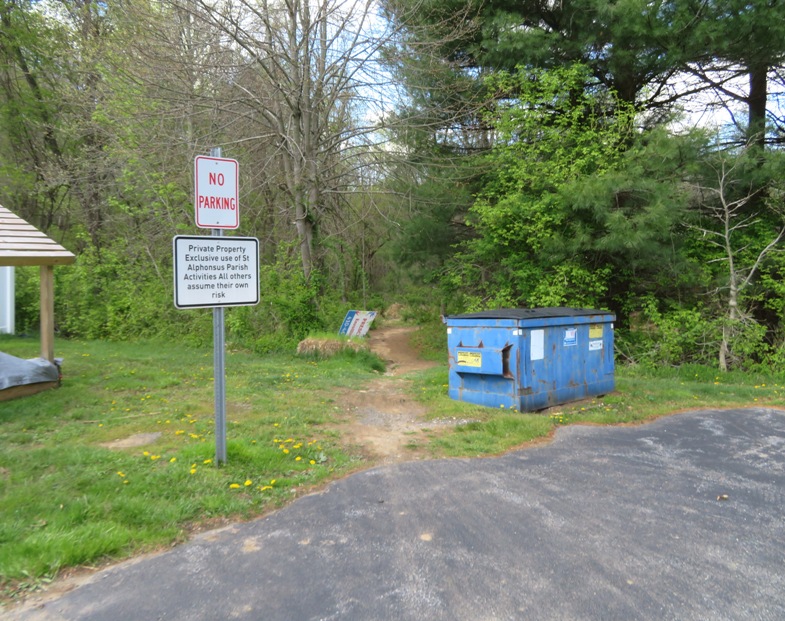
Norma and I left the trail to do a little bushwhacking since we figured that morels near the trail would probably be taken. We really took our time walking so we wouldn't miss any. I found a nice rock where I took a short nap while Norma kept looking. We got back on the trail and explored sections we hadn't seen before. There were some wet areas where we were hoping to find salamanders. We didn't see any of those but we did see hundreds of polliwogs. 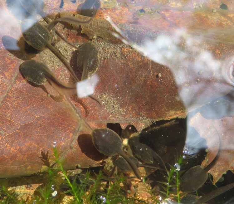
Norma spotted an interesting fungus which folks on Facebook thought was Gyromitra brunnea or Gyromitra esculenta (false morel). It is not advised to consume Gyromitra brunnea. Gyromitra esculenta is potentially fatal if eaten raw but it is a popular delicacy in Scandinavia, Eastern Europe, and the upper Great Lakes region of North America. 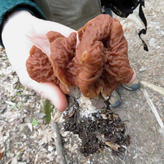
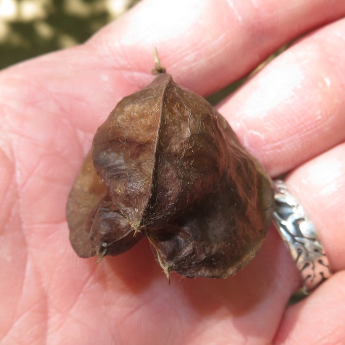
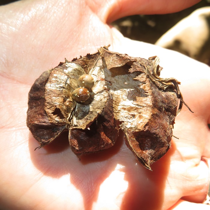
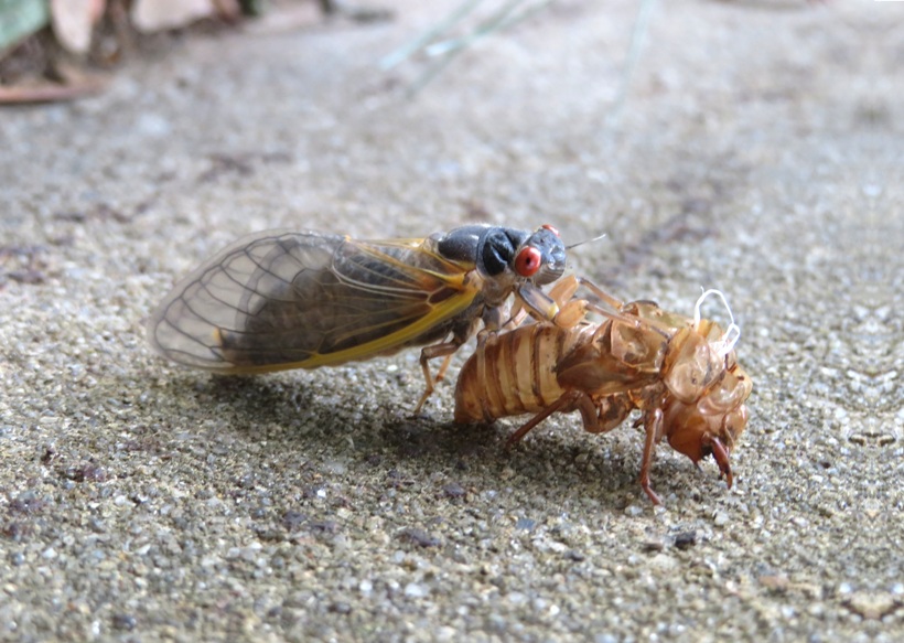
If you live in the Baltimore area, then you probably know that 2021 is the year that the 17-year brood X cicadas will be emerging in May. According to The Baltimore Sun - Get ready, Maryland: The 17-year Brood X cicadas are coming in May: Millions of cicadas are likely to rise from the ground around mid- to late May and stick around for two to four weeks. During that time, they'll breed and leave behind the next generation, which will surface en masse in 2038. I saw some things near the base of a few trees that reminded me of the crayfish mounds I see in my backyard. But these were smaller and didn't have a hole at the top. I opened one up and found a fourth instar cicada nymph inside. I found a few more mounds and opened them up. I always saw a perfectly formed tunnel made by a cicada nymph. 1 / 3

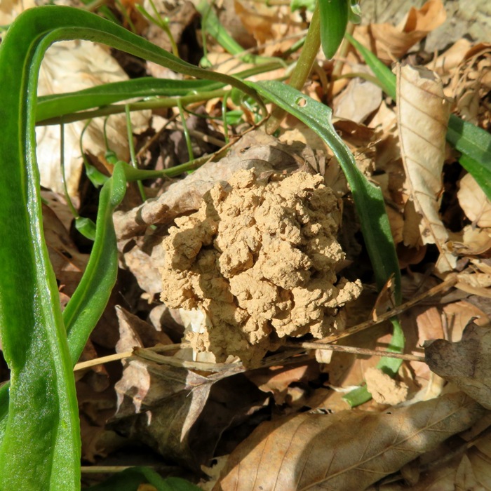
Reminds me of a crayfish mound.
2 / 3
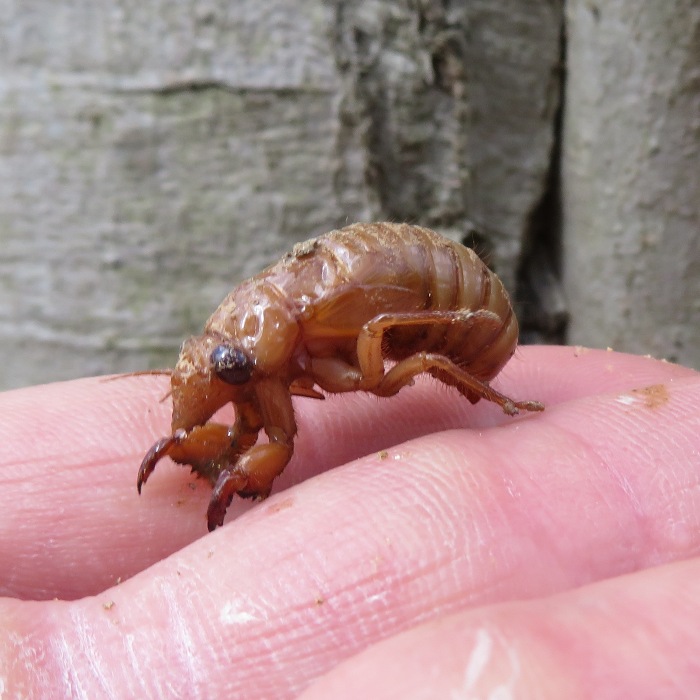
Fourth instar cicada nymph.
3 / 3
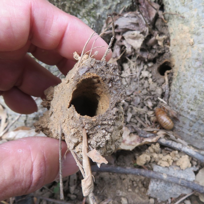
Perfect tunnel made by nymph.
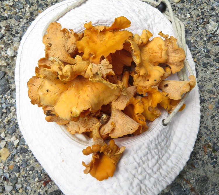
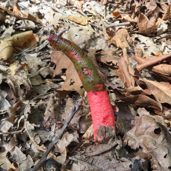
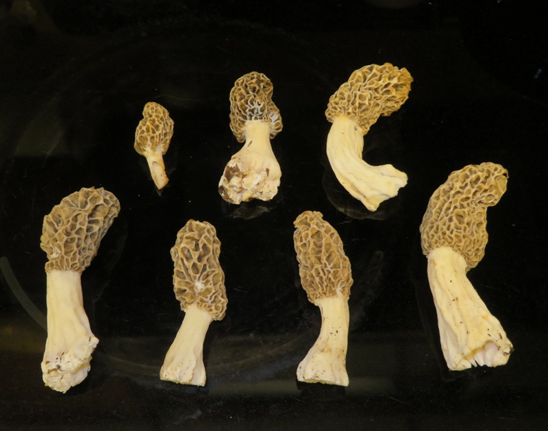
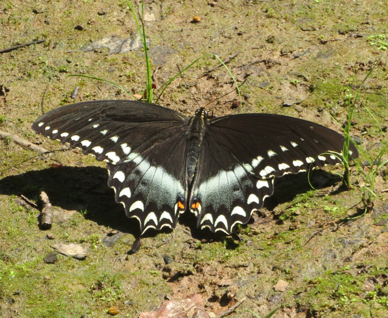
How long will they be around? According to USA Today - When will the cicadas emerge in 2021? How long will they be around after they come out? When will they be back?: Their [adult] lifespan is four to six weeks, and will they will start to die off in late June into July. I didn't time things right with my current flock of chickens. They will be too young to fully enjoy the horde of cicadas that will be emerging. But maybe they will be big enough by summer to sample a few. I ended up creating a page with cicada information at Brood X cicadas. We saw some mayapple plants and jack-in-the-pulpits. Eventually, Norma spotted a cluster of morels. That really made her day. She picked seven of them. They appear in this blog's cover photo. If you're going to forage for morels, we recommend looking We found the morels at 39.342347, -76.865988. This location is just southwest of a double stone or concrete structure that runs perpendicular to the Quarry Trail near a big tulip poplar. We saw them from the trail. If I were going to go look for morels tomorrow, I would go to Susquehanna State Park in Harford County. On August 8, 2020, we found several chicken-of-the-woods mushrooms there, and thinking back, we suspect it might have been a good environment for morels. Unfortunately, we weren't there during morel season. Norma carried the morels in a mesh bag. The idea is that as she walks, they will release their spores and produce more morels. We saw some fern fiddleheads. These are edible too though I've read that certain varieties are carcinogenic. We don't know enough about them to be confident to eat them yet. Maybe next time. 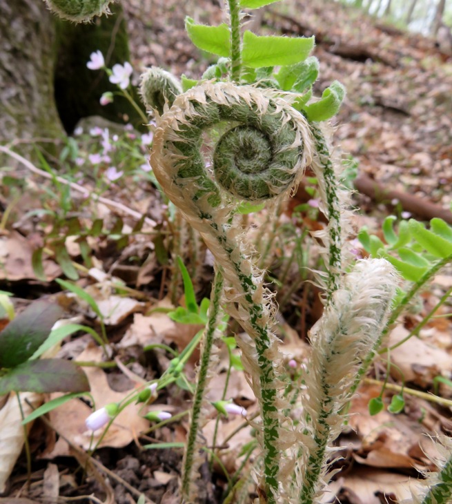
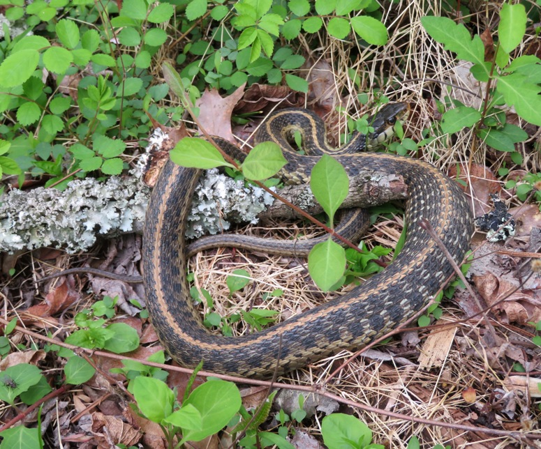
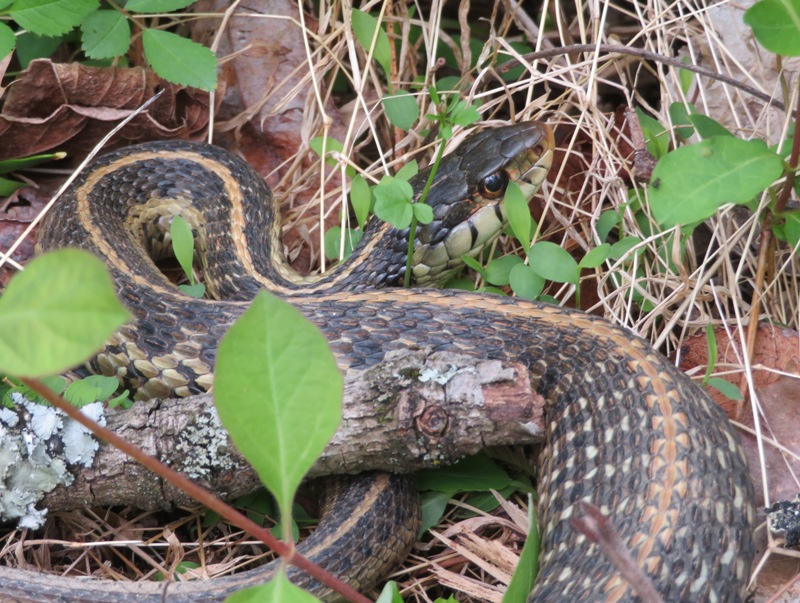
It was good finding the morels but Norma is really the one that likes them. I just like finding them because I know they make her happy. I prefer to see animals...especially snakes. So to make my day, Norma found me a big garter snake. It was our first snake find of the year. On April 25, 2021, we found a six to seven inch long worm snake in Savage! That was our second find. A couple days later, we ate the morels in a soup. They were delicious. According to OliveNation - Morel Mushrooms: A Rare Delicacy: Morels are probably the most sought after mushroom by connoisseurs. We ended up walking 5.4 miles in about three hours. 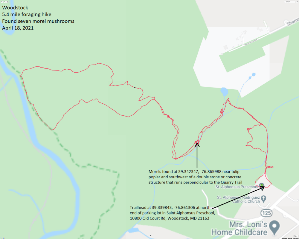
So what did we learn? Looking for morels can be exhausting and disappointing. I think most less-experienced foragers end up empty-handed. I suggest making a slow hike out of it and if you don't find any, then at least you got in a nice hike. A few days later, I was in touch with an archaeologist in search of morels. I gave her some pointers but she didn't find any. I asked her about finding arrowheads. I would much rather find arrowheads than morels but I never have. This is what she said. I haven't found any arrowheads in Maryland. But in Virginia, which has the same Native settlement patterns as Maryland, we'd tend to find them on the tops or edges of landforms with well-drained soils near bodies of water. Kind of like morels! Usually where two bodies of water meet--like a creek and a river--you tend to find some as well. But I've also found some in the most random, unexpected places, like in a very wet swampy area with hydric soils (very rare, though). As an archaeologist, I am obligated to tell you to only look for arrowheads on private lands and to drop a pin on your map's app to identify where you find them in case you or the landowner runs into an archaeologist in the future. |
|
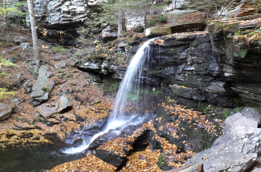
On May 1, 2021, my twenty-second article was published with the Chesapeake Conservancy, The Waterfalls of Ricketts Glen. I can't think of another hike in the mid-Atlantic region where you will see as much beautiful scenery on such a short hike.
|
|
This really doesn't have anything to do with a specific hike but if you do hike in my area in the spring and early summer of 2021, then you've probably seen the Brood X cicadas.
|
|
Norma, Daphne, Teresa, Mia, and I went on a foraging hike on a trail near Rocky Gorge Reservoir (T. Howard Duckett Watershed).
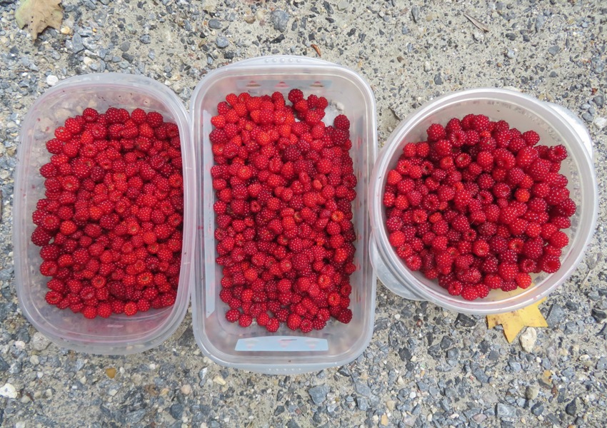
Who is Mia? She is Daphne's sister. Norma and I were dogsitting for her owners while they went on holiday in Utah. So we had Mia for a full week and some change. It was a pleasure having her around and the two of them got along just great. Our first stop was the Brighton Dam Visitor Center where we purchased a day pass so we could hike on the trails. That cost $5 per person. I tried to buy them on-line but their system is screwy. I had to select what we were going to do from a dropdown menu but hiking was not an option. I sent a question via email and it took them several days to reply. We started from Brown's Bridge and then walked to Tucker Lane along the main path. Our goal was to collect wineberries and whatever other edibles we could find. There were quite a few butterflies out. In this blog's cover photo is a black swallowtail. Below is a red-spotted purple butterfly on poop next to a carrion beetle. I guess you can think of it as beauty mixed with ugliness but of course those are just our standards. Nature doesn't think of it that way. 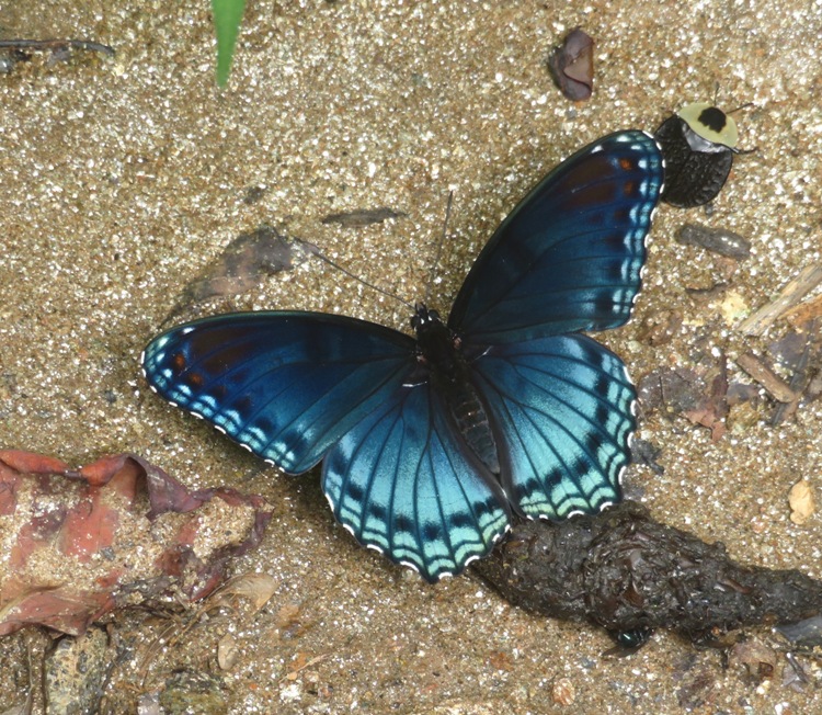
Not many people use these trails so we don't mind letting the dogs off leash. Of course if we see anyone, we leash them up. Here they are by the Patuxent River. 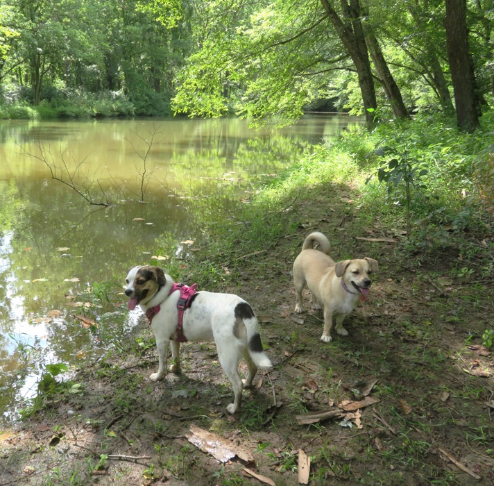
There were a good number of wineberries, though last year we saw more on the main trail. This year, we saw a lot on the side trails. Many were a little past their prime. I think if we had been out a week or two prior, they would have been better. Norma identified some chanterelle mushrooms, which are edible. So she picked some. 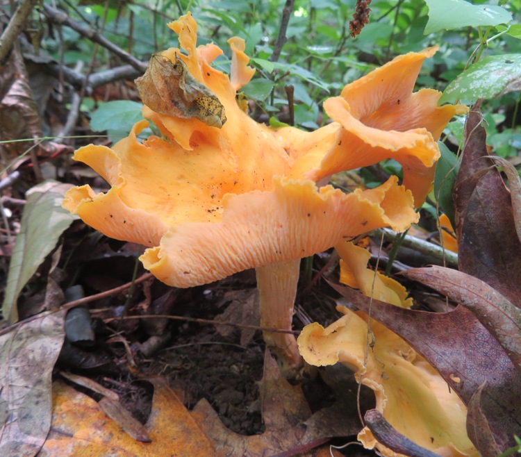
Below is Teresa, Daphne, and Mia on one of the side trails. We walked on the main trail going out and then hit the side trails on the return trip. I don't think the side trails get used much. Both last year and today, we ran into a lot of spider webs. 
I found this huge, healthy fungus. We didn't know what kind it was so we left it. 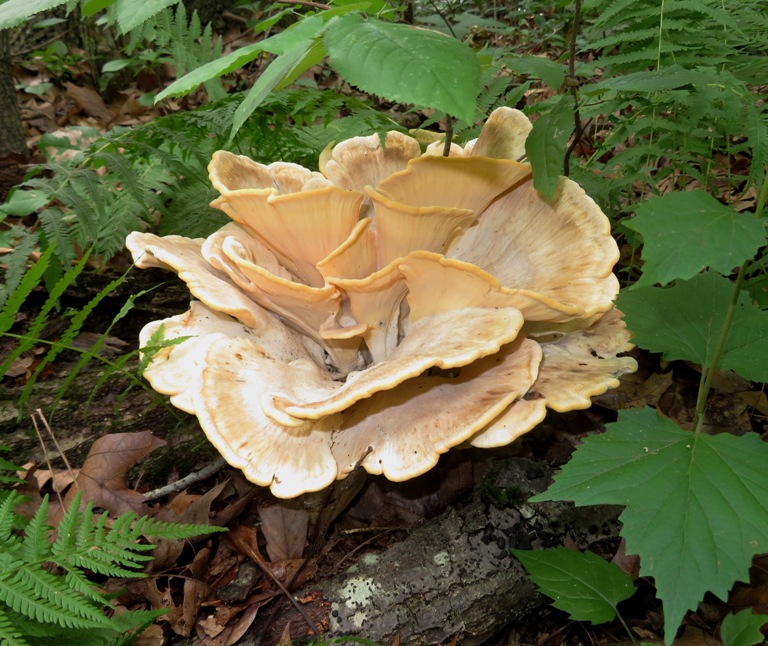
The three of us collected a lot of wineberries and Norma also picked some chanterelle mushrooms. We made sure Teresa got a third of the wineberries. I didn't think I'd enjoy picking them but I did. Not as rewarding as finding shark teeth but still rewarding. Norma baked a delicious wineberry cake that evening. A few days later, she cooked the chanterelle mushrooms and mixed it with pasta. I didn't think it had any flavor. I'm not a fan of mushrooms but if Norma serves it, I'll eat it. 
|
|
Norma, Harlem, Daphne, Mia, and I did a hike in Silver Spring, Maryland. We started at the Rachel Carson Greenway and Northwest Branch Stream Valley Park Trails - Burnt Mills West. This is where Burnt Mills once resided. It was one of Montgomery County's earliest grist mills. We followed the Northwest Branch of the Anacostia River.
Who is Mia? If you read my July 18, 2021 blog, you'll get your answer. Daphne loves to chase deer. But the deer in this area (first photo) did not run when she approached them. So she quickly gave up. For Daphne, it's like Deep Purple says, "It's not the kill. It's the thrill of the chase." 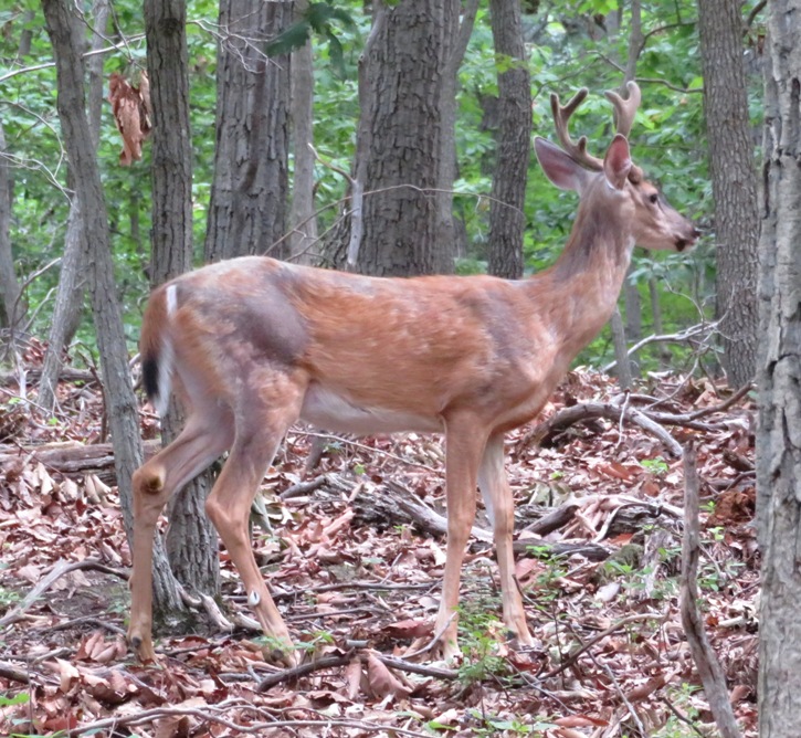
Cicada really did a good job of aerating the ground here, second photo. Either that or someone shot buckshot into the earth. 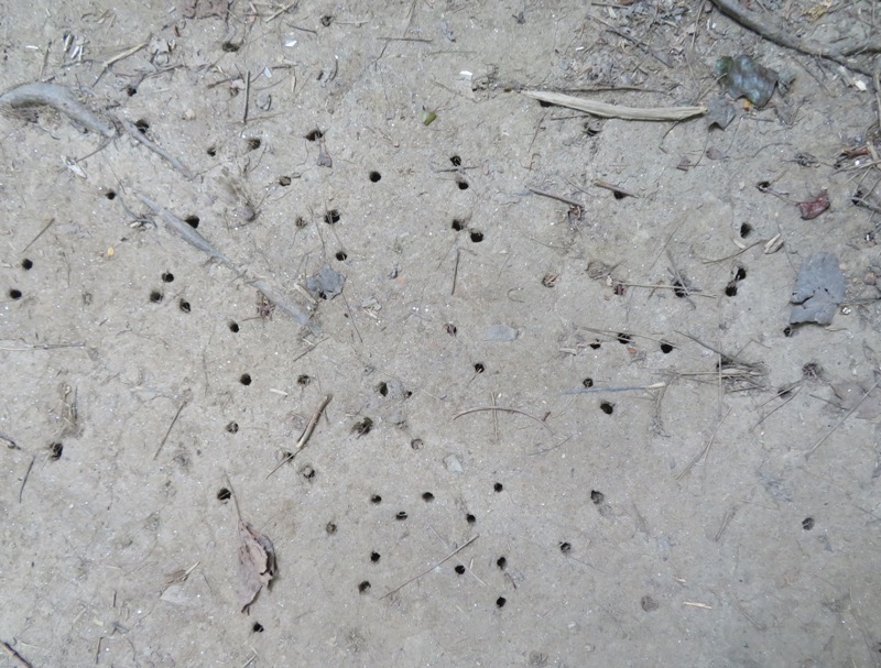
We spent a lot of time exploring along the water. 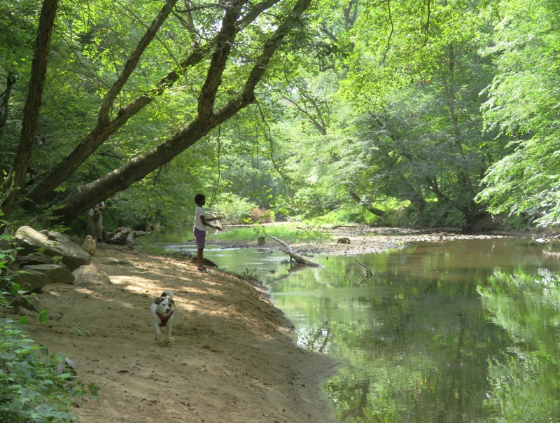
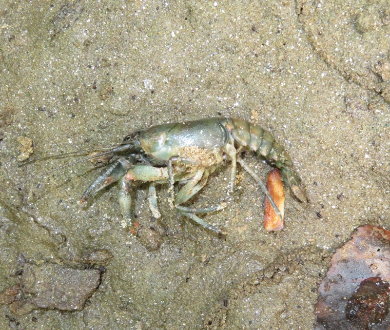
This is a great place for a summer hike because the trails are so shady and well-drained (perhaps partly due to the cicadas aerating the soil). Not much mud. Harlem is pretty young for a serious hike so spending time looking along or in the water is great for her. We saw a dead crayfish along the shore (as shown in this blog's cover photo) and this 12-inch long fish swimming in the Northwest Branch. 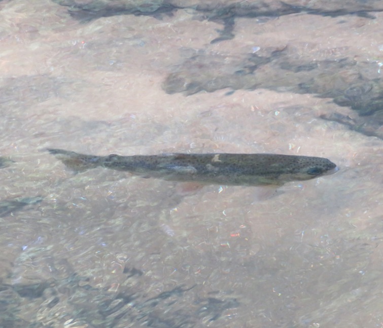
I found a lot of muscovite near the water, sixth photo. There were quite a few embedded in larger rocks. 
The five of us checked out some of the side trails that deviated from the river but they all led to neighborhoods. On one of them, we ate our lunch at a picnic table near a playground. Here's Norma, Harlem, and Mia on the seesaw, seventh photo. When is the last time you saw a seesaw? 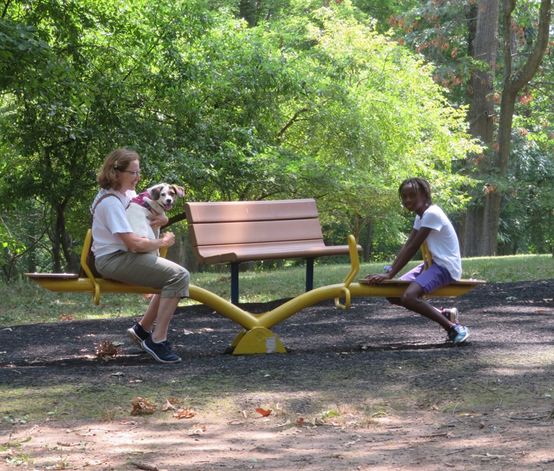
All done with the hike. This was our last trip with Mia, eighth photo. We are sad to see her go but we know she will be glad to be back with her parents. It was truly a pleasure to have her as a guest. 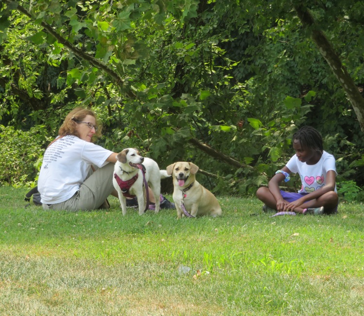
It had been several years since Norma and I hiked this trail. Maybe next time we can walk downstream on the Northwest Branch Trail or start at the opposite end of the Rachel Carson Greenway Trail near Kemp Mill Road and Glenallan Avenue. We are very fortunate to live in a place with so many trails. |
|
I still call this place Purse State Park but it is no longer a state park and is now just the southern part of the Nanjemoy Wildlife Management Area (WMA). Even so, that place we actually visited was not really Purse but the place just north of it called Douglas Point Recreation Area.
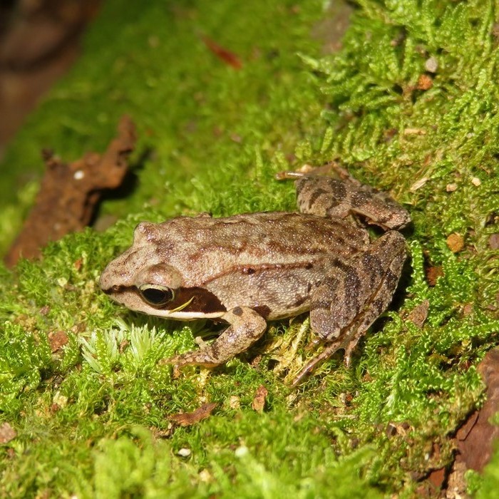
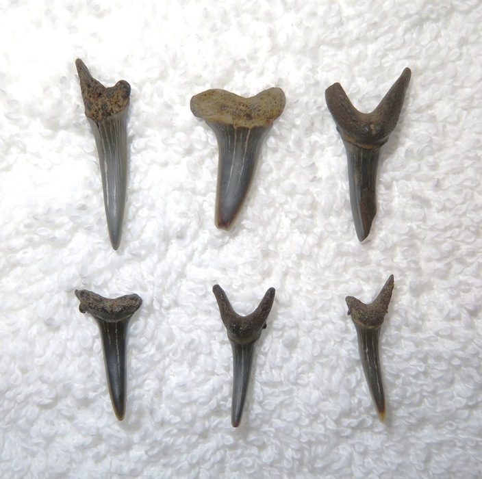
On this day, Norma, Alisha, Daphne, and I arrived at the north lot at about 1030. I invited others who showed up such as my co-worker Scott, his wife Jenn, and his kids Mykala and Sophia. Also, there was my former co-worker Karen, her daughter Erin, and a few of Karen's grandchildren. The lot was well marked and so were the trails. I checked three websites that morning for the forecast, and all called for very light or no rain that morning. But by 1000, it was pouring, and didn't let up until after we left. So we made the best of it. Since the forecast was so wrong, nobody brought raingear. We walked about a mile on the Cal Possey and Blue Banks Beach trails to the Potomac River. Along the way, I saw a frog and lots of pawpaws. Arriving at our destination, it didn't take long before we found some shark teeth. We also found pieces of ray dental palate and lots of turritella. Norma and Alisha shared chocolate chip cookies they baked the day prior. Low tide was around 1230. The good thing about the bad weather is we didn't have much competition. We almost had the whole area to ourselves! According to Fossil Guy - Potomac, the fossils in this area are from the late Paleocene (Selandian) This means they are between 61.6 and 59.2 million years old. Here are some pointers I sent out to the group: Despite our enthusiasm in looking for fossils, the constant rain chilled us to the bone and we had to leave. But now everyone knows where to go and what to look for. If I can share my passion and get children (and adults) interested in paleontology, then I have achieved my goal. I came home with 22 shark teeth, three turritella gastropod molds (far left), and 9 pieces of ray dental palate (lower). 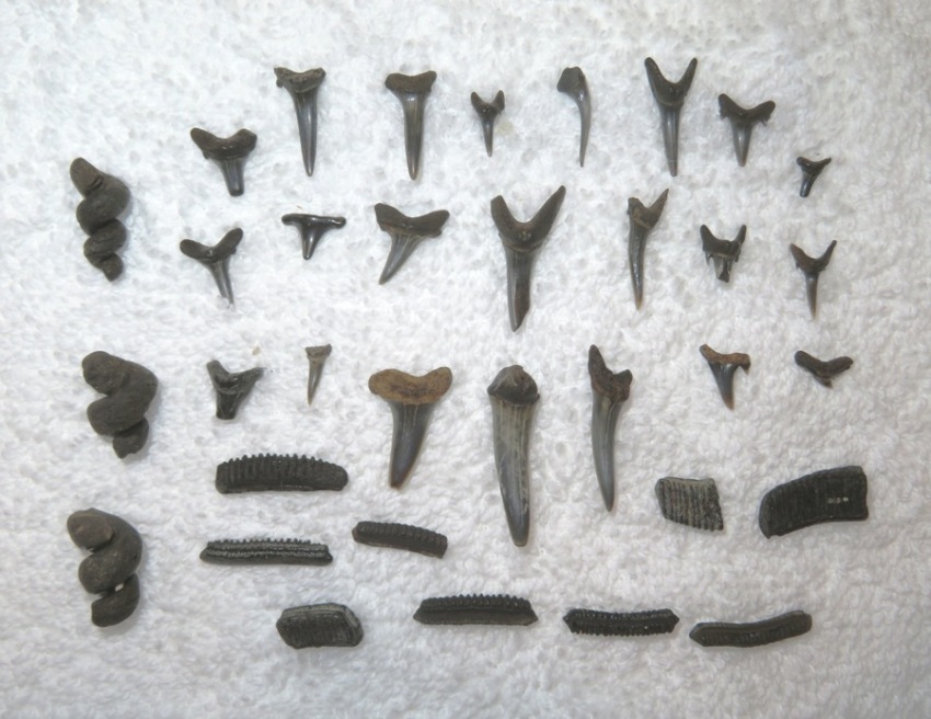
The lower three teeth have at least one little barb on the side which tells me they came from a sand shark. The one on the far left is broken. 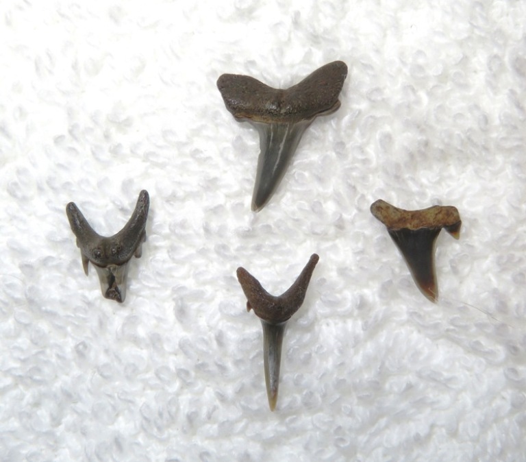
This was the biggest tooth that I found...28 millimeters! 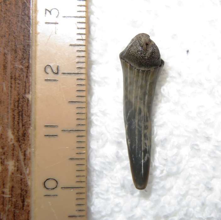
The fossils on the Potomac River are different than the ones in on the Chesapeake Bay in Calvert County. This may be due to their age difference (~40 million years). But did the teeth really look different? Yes, we found a higher proportion of long, skinny teeth (e.g. sand skarks) and no serrated teeth (e.g. snaggletooth sharks). There was also a higher proportion of broken teeth. Norma didn't find that many because she was being a good aunt by helping Alisha. Norma found this tiny six millimeter long shark tooth. 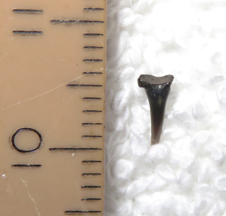
Here are some of Alisha's finds. She found 13 shark teeth, 7 pieces of ray dental palate, and 4 turritella gastropod molds (with help from Aunt Norma). 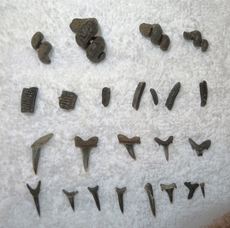
Here is a fine specimen of a turritella gastropod mold which Alisha found. 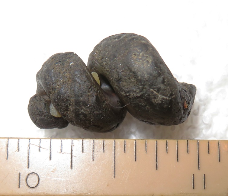
Alisha found all these turritella shells. They are quite common in this area but not so along the Chesapeake in Calvert County. I don't know how old these are or if there are still turritella in the Potomac. 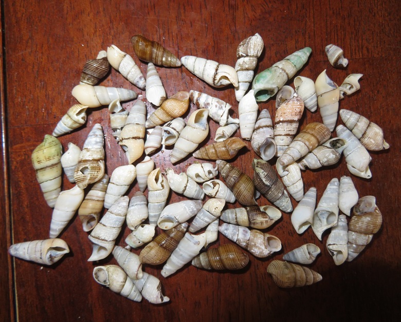
Here are some of the shark teeth that Alisa found (with some help). 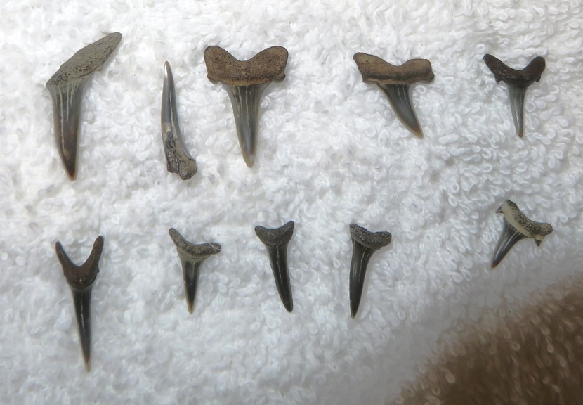
For more information, see |
|
Norma, Daphne, and I did a short hike on the south trails in the American Chestnut Land Trust (ACLT). Read about it in the second half of my August 14, 2021 blog.
|
|
On August 21, 2021, Norma, Teresa, Bob, Daphne, and I hiked 8.6 miles from Harpers Ferry, West Virginia to Loudoun Heights and back. Much of this was on the Appalachian Trail in Virginia.
We started at the Harpers Ferry parking lot at the highway/route 340 overpass. This place has become extremely popular. We got a late start and the lot was full. So Norma dropped off Daphne and me while she, Teresa, and Bob parked at the visitor center and then took the bus into town. Not sure if dogs are allowed on the bus. Unfortunately, the bus didn't stop at the lot where Daphne and I were so they then had to walk to the lot, which was on the way to the trail. These historic areas aren't always set up the best for parking so it is best to get there really early. I based our route on AllTrails - Loudoun Heights Trail to Split Rock. The five of us walked across the overpass from West Virginia to Virginia. Norma worked up a light sweat which attracted a hackberry emperor butterfly. 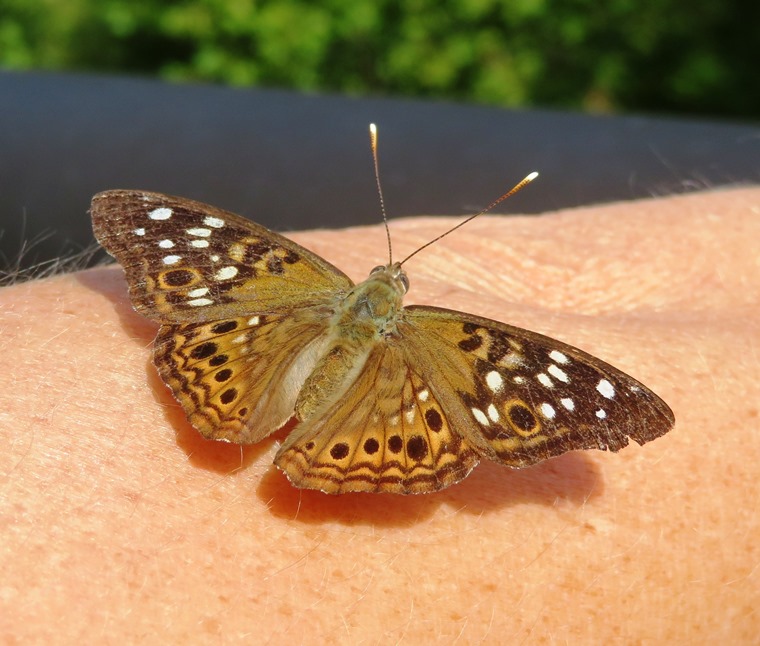
You will know pretty quickly if you are in the presence of this attractive butterfly. No sooner are you out of your car than one will land on your skin or clothes, probing away with its green proboscis. For this reason we informally call this species the "hackberry greeter." - from New Jersey Butterflies - Hackberry Emperor 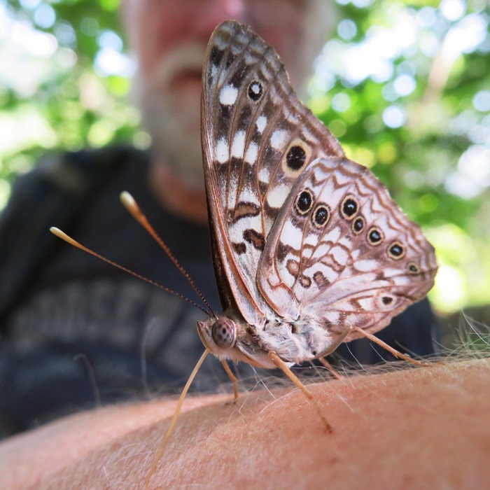
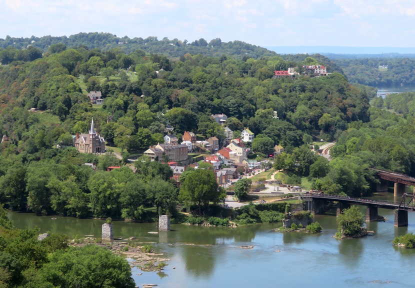
Bob decided to turn back early and meet us in town. Getting up to Loudoun Heights takes quite a bit of climbing so be sure to pace yourself. But it is well worth the view. From the overlook, we had this fantastic view of Harpers Ferry, the Potomac River, and the Shenandoah River. 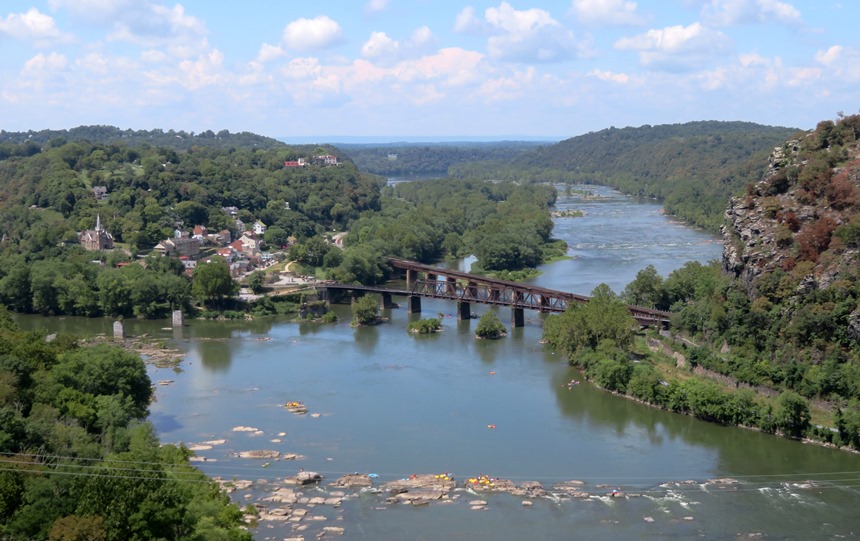
Check out this blog's cover photo for a close-up of the view of Harpers Ferry. Here's Norma, Teresa, Daphne and I at Loudoun Heights. 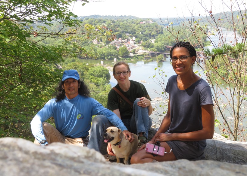
Back in town, we met up with Bob and then had a snack together before parting ways. The area has some very interesting history. John Brown left an indelible mark on American history. His so-called raid at Harpers Ferry resulted in both reverence and revulsion. When Brown and his small, integrated army of twenty-one men invaded Harpers Ferry and took over the federal armory, arsenal, and rifle factory, it was the fulfillment of a pledge to God to increase hostility toward slavery. It was an attempt to disrupt the security of investing in people as property. It was treason, murder, and insurrection. John Brown's raid was also a turning point in American history, away from compromise and toward war. - from National Park Service - John Brown Before I ever moved to the east coast, I knew the face of John Brown from my Kansas albums. |
|
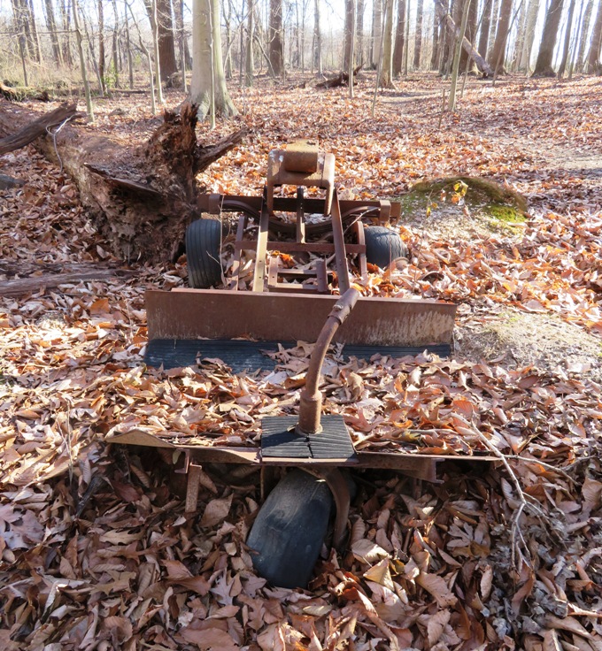
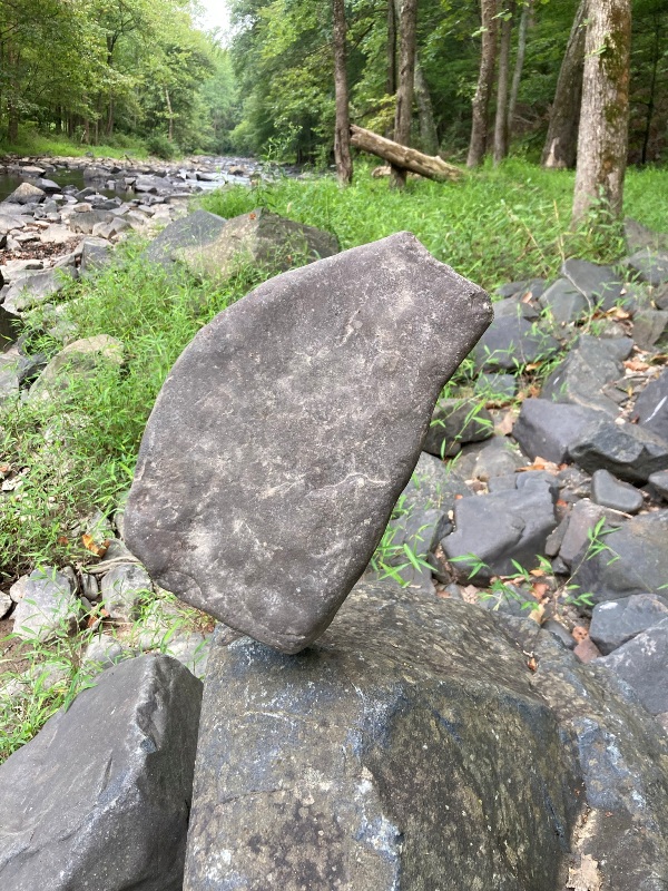
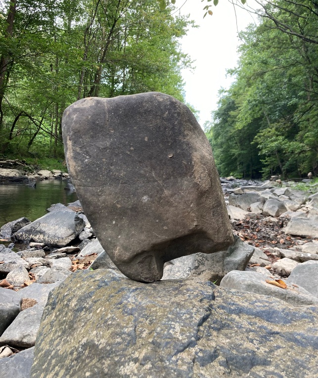
On August 29, 2021, I took Daphne for a walk at Wincopin. This place is known for its balanced rocks along the Little Patuxent River. I saw nine of them. Thinking that they might be glued in place, I picked one and examined it. No adhesives! Just pure balancing. It took awhile for me to put it back in place. Believe you me, balancing rocks is no simple task, especially with the larger stones. It takes a good eye, spatial reasoning, and a steady hand. Some balanced rocks even had rocks balanced on top of them! The mastermind that does this is very skilled indeed. I've been told his name is "Pete Moon" but I have never met him.
1 / 4
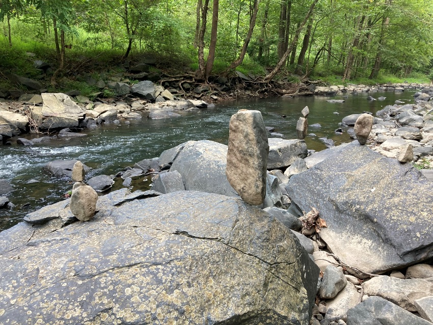
Balanced rocks along Little Pax
2 / 4
Single balanced rock
3 / 4
Another single
4 / 4
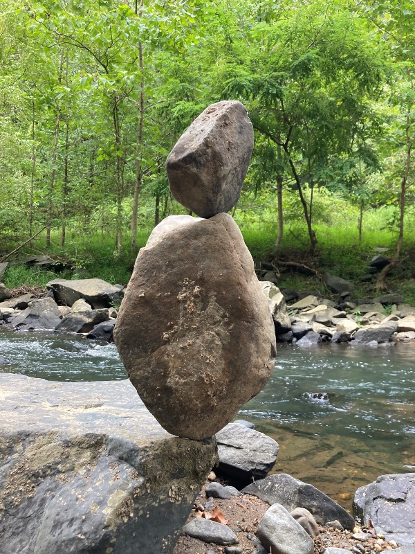
Double balanced rock
I've been told that this chainsaw bear is also the work of Pete Moon. Notice that he carved the inscription "Hi Ann" on it. 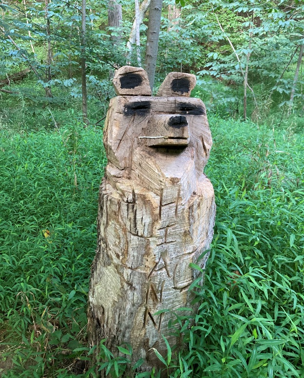
|
|
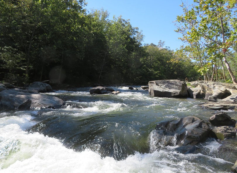
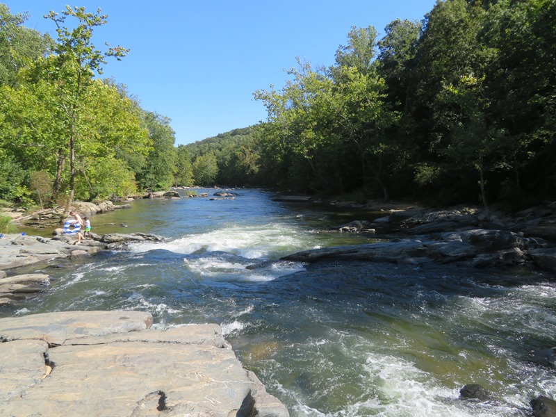
On September 4, 2021, Norma, Daphne, and I did a 6.4 mile hike in Patapsco Valley State Park from Woodstock to Driver, following the south side of the Patapsco River upstream and west of Woodstock Road. Woodstock is a great place for doing hikes because there aren't usually many people once you get away from the trailheads. We only saw four other hikers that day.
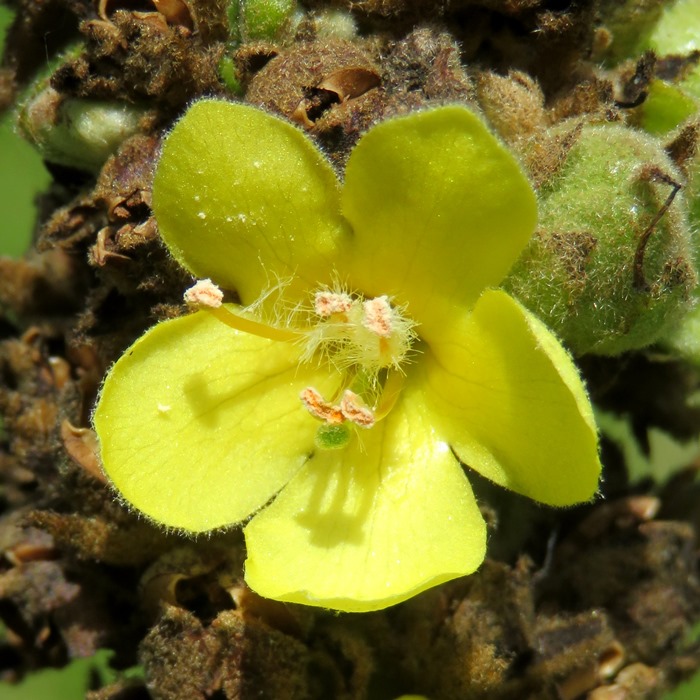
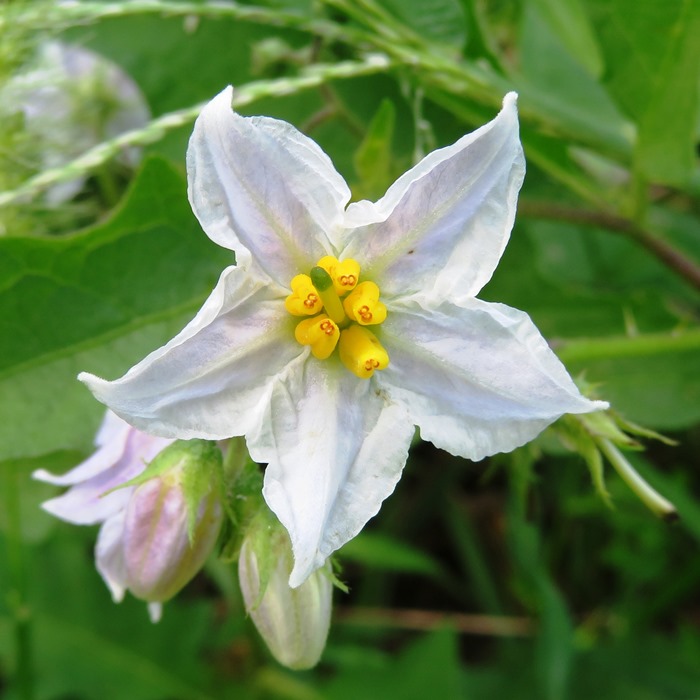
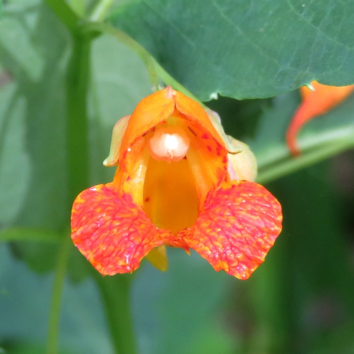
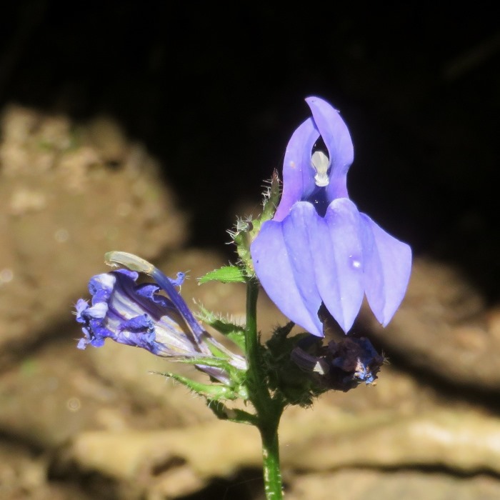
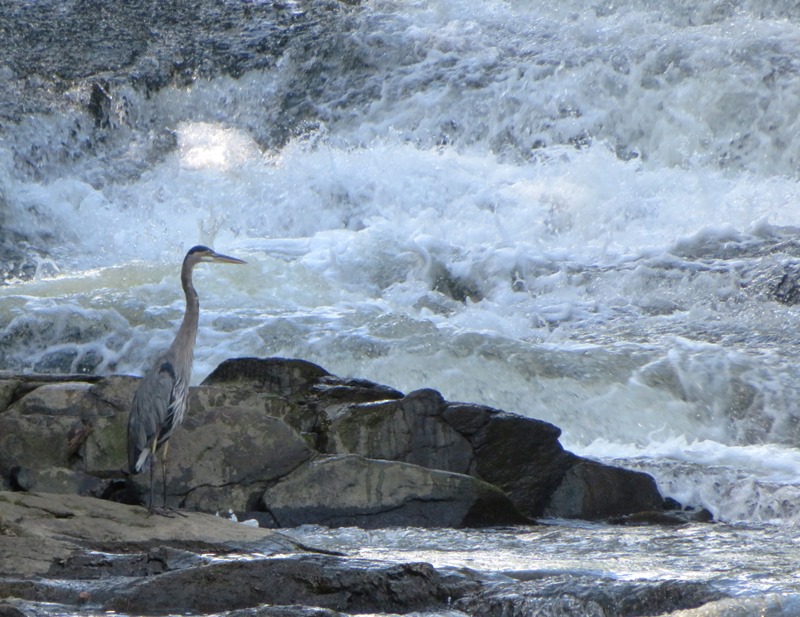
Norma, Daphne, and I saw several beautiful flowers: The last flower above, jewelweed, is an interesting one that we have growing in our back yard. The seed pods have five valves which coil back rapidly to eject the seeds in a process called explosive dehiscence or ballistochory. This reaction is where the name 'touch-me-not' comes from; in mature seed pods, dehiscence can easily be triggered with a light touch. - from Wikipedia - Impatiens capensis I've seen the McKeldin Rapids many times before but this is the first time I saw it from south of the South Branch Patapsco River (in Howard County). In the rushing water of the rapids, I saw this great blue heron. 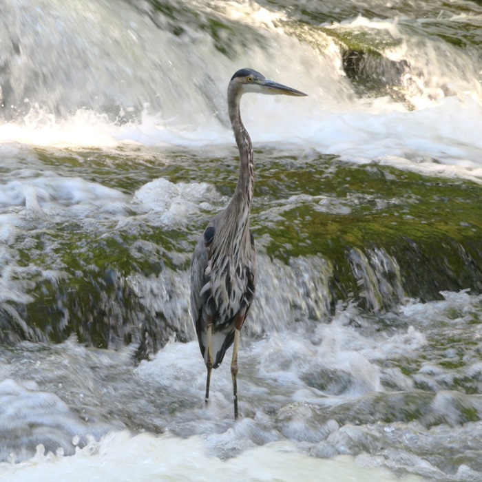
We have Hurricane Ida to thank for the high water in the Patapsco during our visit. Here's another view. 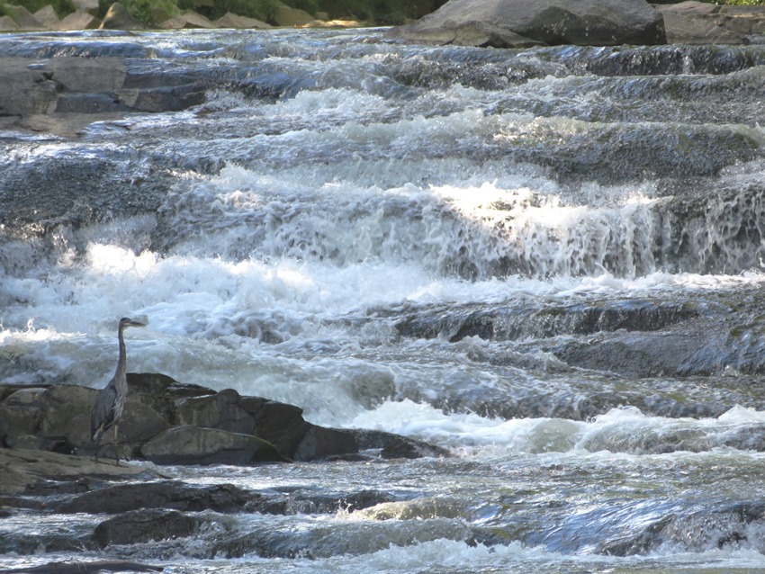
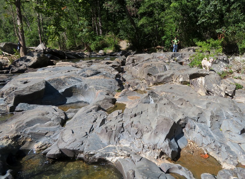
We passed Woodstock Rock where we saw a few climbers. Can you see Norma and Daphne in the lower left corner of the below photo? 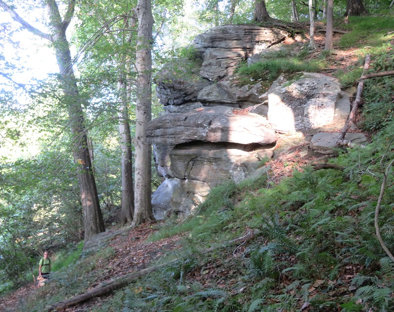
On the east side of Woodstock Rock, we found a shallow cave. 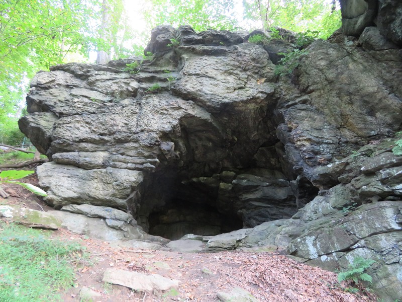
Here's a map of our route. 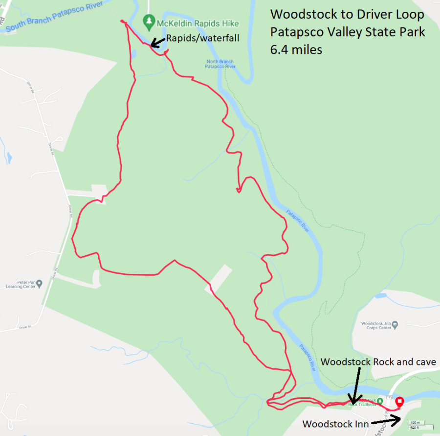
Once the Covid-19 pandemic is over, we'll have to be sure to pay a visit to Woodstock Inn. Looks like an interesting place. |

|
On September 26, 2021, Norma, Daphne, and I hiked in Gunpowder Falls State Park. We parked at the Bel Air lot and then commenced our hike at the Kingsville trailhead. We walked to Pot Rocks along Big Gunpowder Falls and then past Lost Pond.
The first part of the walk was easy and scenic with a nice view of the river. It was also very crowded. We saw a lot of paw paw trees and some American bladdernut trees. American bladdernut seeds can be eaten raw or cooked. The seed can be used in place of walnuts in making chocolate-chip cookies. A sweet edible oil is obtained from the seed used for cooking purposes. - from North Carolina Extension Gardener - Staphylea trifolia Here's some of the things we saw. The highlight of the trip was Pot Rocks, shown in this blog's cover photo. The rapids and rugged boulders reminded me of the North Branch of the Potomac River in Garrett County, Maryland. It was a fun place to explore. I expect kids would love climbing around on the rocks. West of Pot Rocks, we saw few people. We tried to find Lost Pond but it was low and/or overgrown because we never saw any water. Around here, Norma thinks she saw a mammal acting strangely. Concerned that it might have rabies, we quickly left the area. We tried to follow directions at AllTrails - Lost Pond Trail but the south part of the loop was too overgrown. So we made it an out and back hike. Here's a map of our route. 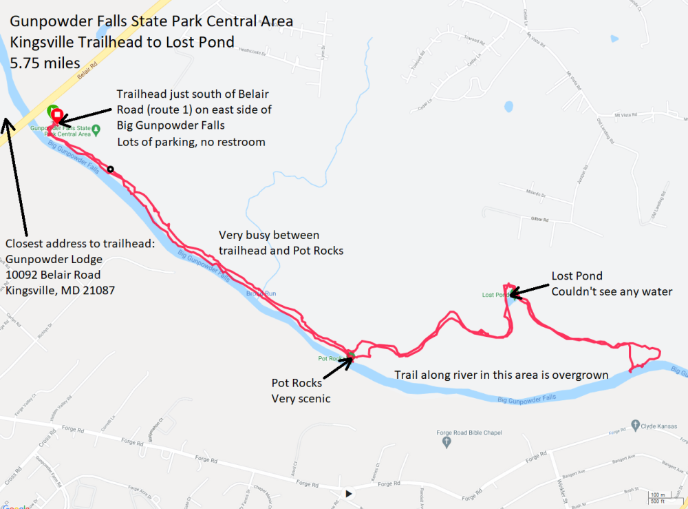
Afterwards, we did takeout from Mount Everest Restaurant (Indian and Nepalese food). I expect we will be returning to Kingsville. There are numerous trails here and it isn't too far from home. Lots to explore. |
|
On October 2, 2021, Norma, Daphne, and I did a 5.7 mile hike in Pennsylvania, mostly on the Appalachian Trail. The highlight of the hike was a place called Chimney Rock Overlook, though some maps call it Buzzard Point.
We started at Rattlesnake Run Road in Michaux State Forest and followed most of the route described at AllTrails - Chimney Rocks via Hermitage and Appalachian National Scenic Trail. Here's some of the things we saw. The highlight of the trip was Chimney Rock. It was a little crowded. We were hoping to see some fall colors but it was a little early for that. The three of us crossed Tumbling Run via boardwalk. 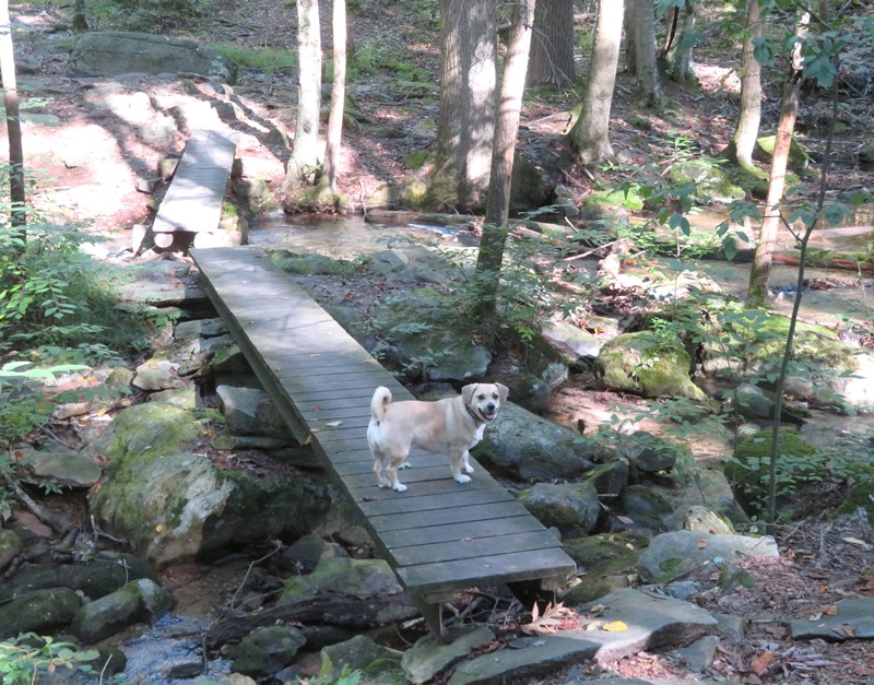
We checked out the Potomac Appalachian Trail Club (PATC) Hermitage Cabin where I took this blog cover photo. Looks like it would be a nice place to stay. Next, we climbed to Monument Rock where the view was not so good because the trees. Not even worth taking a picture. Here's a map of our route. 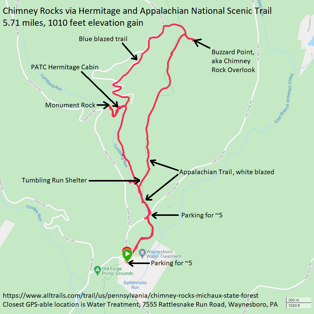
After our hike, we took a drive through Waynesboro before heading home. |
|
Norma, Daphne, and I spent the weekend in Garrett County, Maryland from October 9 to 11, 2021. We stayed at her mother's house and attended a joint birthday party for her nephew and niece. We managed to get outside, but the weather wasn't so great so I didn't take too many pictures. At this time of year, the weather can go either way...it can be beautiful or miserable. Unfortnately, it was leaning towards the latter, though it could have been much worst.
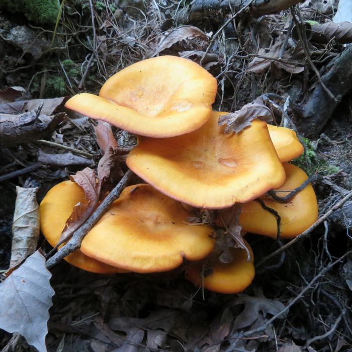
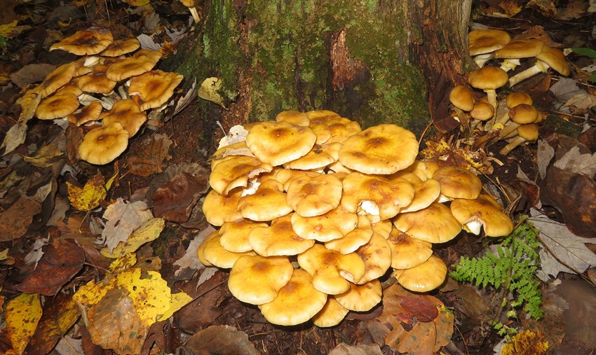
We spent some time bushwhacking through the woods in the Swanton area. Ever since Norma found her first morel mushroom, she has been interested in mycology. At this time of the year, fungi are often the most striking things to see in the woods, with other plants going dormant and wildlife being less active, especially in Garrett County where the higher elevation yields colder temperatures. The fungi that we saw (such as the ones growing around the base of a tree in this blog cover photo) looked extremely healthy. But we looked hard and found plenty of other interesting things to round out our nature loving experience. 1 / 4
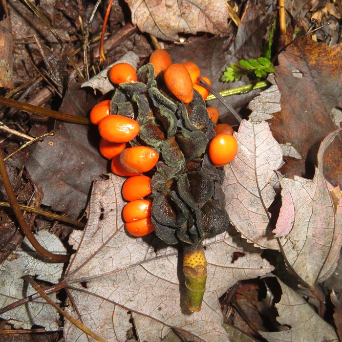
Fruit from a jack-in-the pulpit
2 / 4
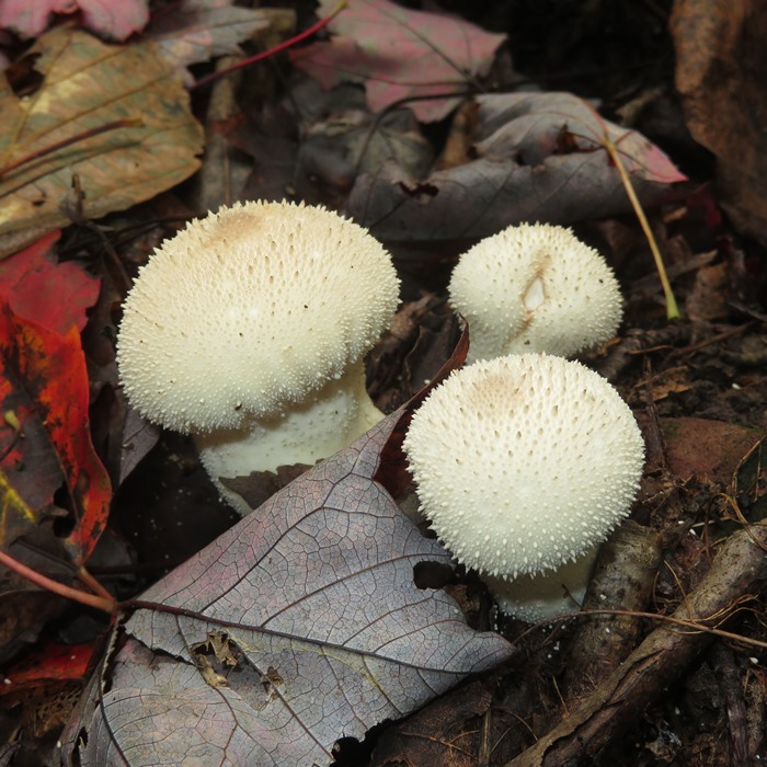
Common puffball mushroom
3 / 4
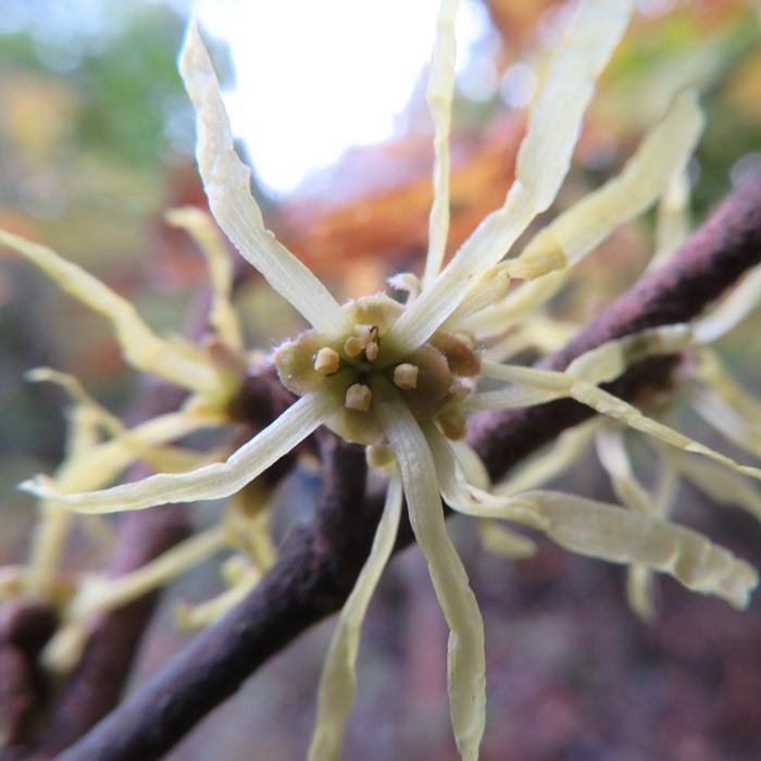
Witch hazel flower
4 / 4
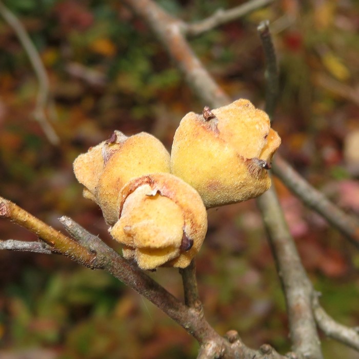
Witch hazel fruit capsule
If you want to learn more about fungi, particularly the edible ones, check out the article I wrote titled A Foraging Revival. Leaves were changing, but it was so overcast that landscape photos wouldn't have captured their glory. So here's an individual multi-colored autumn leaf I found that represents what we saw. 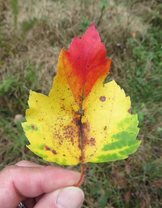
Hopefully, if we are in this part of the state next year, we will have better weather so we can truly appreciate the fall colors, but like I said, it is often a hit or miss. Best to plan things at the last minute. |
|
From November 4 to 7, 2021, Norma, Daphne, and I rented a vacation house in Canaan Valley, Davis, West Virginia with Norma's family. We spent a lot of time preparing meals, playing with the kids, and doing a few short hikes. This is becoming an annual event and I am hoping that the next one will be someplace like Calvert County so I can take the kids out to look for shark teeth.
The vacation house was in a gated community that gave us access to the Valley View Trailhead in Dolly Sods Wilderness and Monongahela National Forest on November 5. 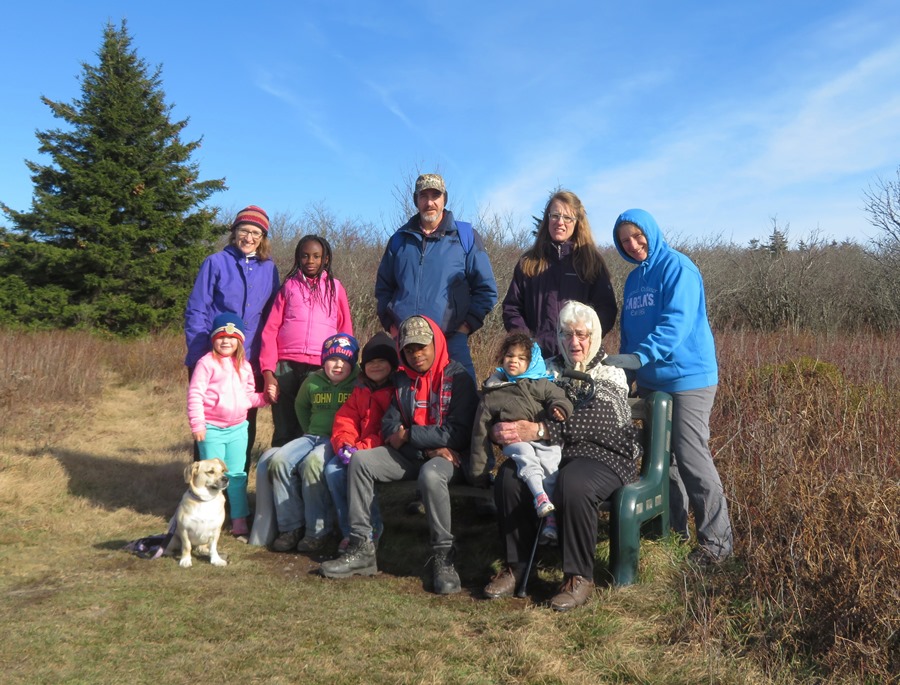
The oldest and youngest (Hazel and Lily) waited at the bench while the rest of us did a short circuit walk at the top of the ridgeline. 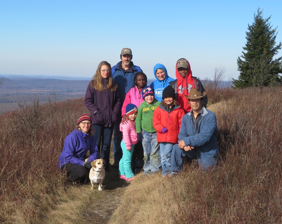
Autumn comes early in this part of the country since the high elevation brings colder temperatures. So we missed the fall colors. But the openness of the low scrub was a nice contrast to the heavily wooded trails that Norma and I typically hike. 
We had some lovely views to our west. 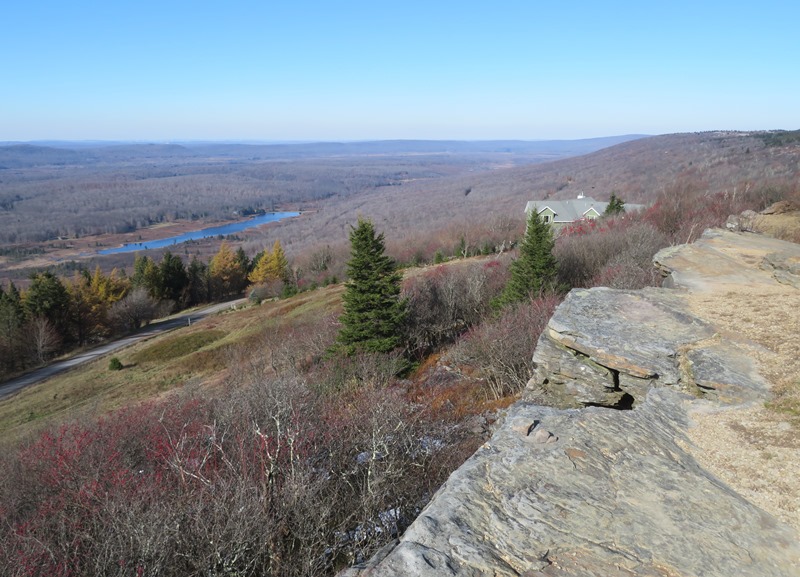
After completing the circuit, we met back with Hazel and Lily for one more group photo. I figure that with this many people from one extended family together, you can never have too many group shots. 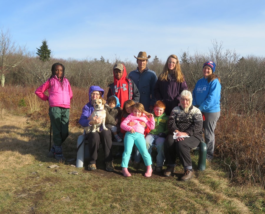
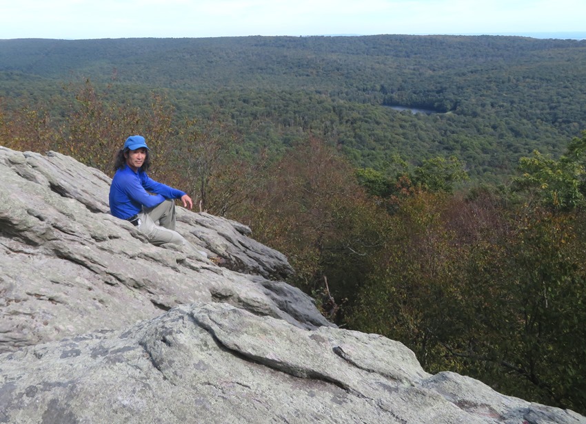
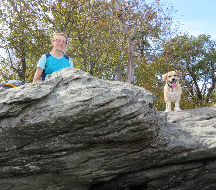
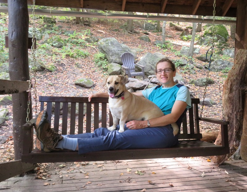
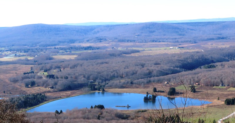
Back at the vacation house, I sparred with the kids in the basement. I brought the padded Escrima sticks I made several years ago. They made for some good sword-play. The next day (November 6), Norma, Daphne, and I did a much longer hike on our own. We walked on both Valley View Trail and Rocky Ridge Trail and then headed north to Rocky Knob before heading back. It was pretty easy to lose the trail though we were never far from it. At the top of this page, is a snapshot of me on Rocky Knob. On the return trip, we found some interesting impressions in one of the boulders. I took some pictures and told one of the kids it was possibly a footprint from Bigfoot. 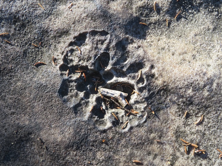
The cabin was nice but there were some things about the maintenance company that we didn't like. Some basic things you would expect to have were lacking such as a scouring pad and adequate dishwasher soap. They also didn't communicate that they had a huge supply of firewood, instead telling us we needed to bring our own. But overall, it was not bad. On our final day, we did a walk around an unnamed body of water that flows into Yoakum Run. I found some mystery snails which I showed the kids. That got them looking for other wildlife. We also spotted a buck. 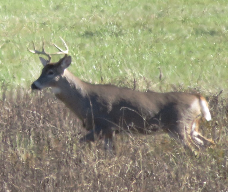
We were fortunate to have nice weather during our stay. It was a long drive home. Fortunately, the traffic wasn't too bad. I'm already thinking about what I can do to make next year's adventure even better. |