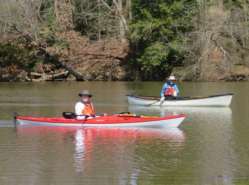
|
This page describes my kayaking and standup paddleboarding adventures in 2021. |

|
This page describes my kayaking and standup paddleboarding adventures in 2021. |
|
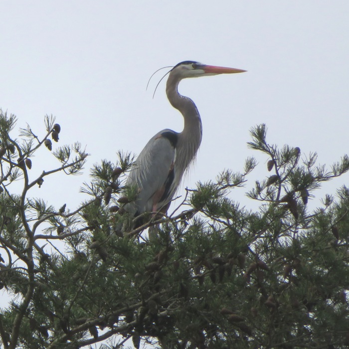
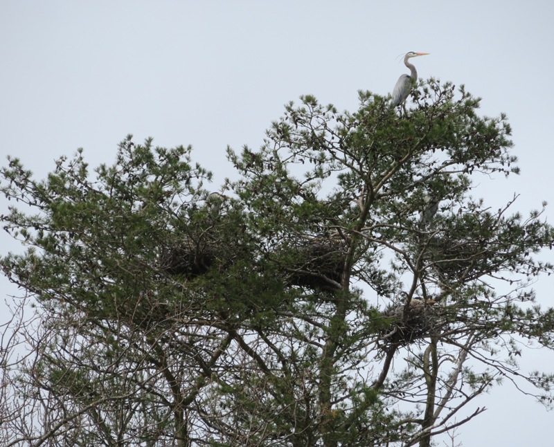
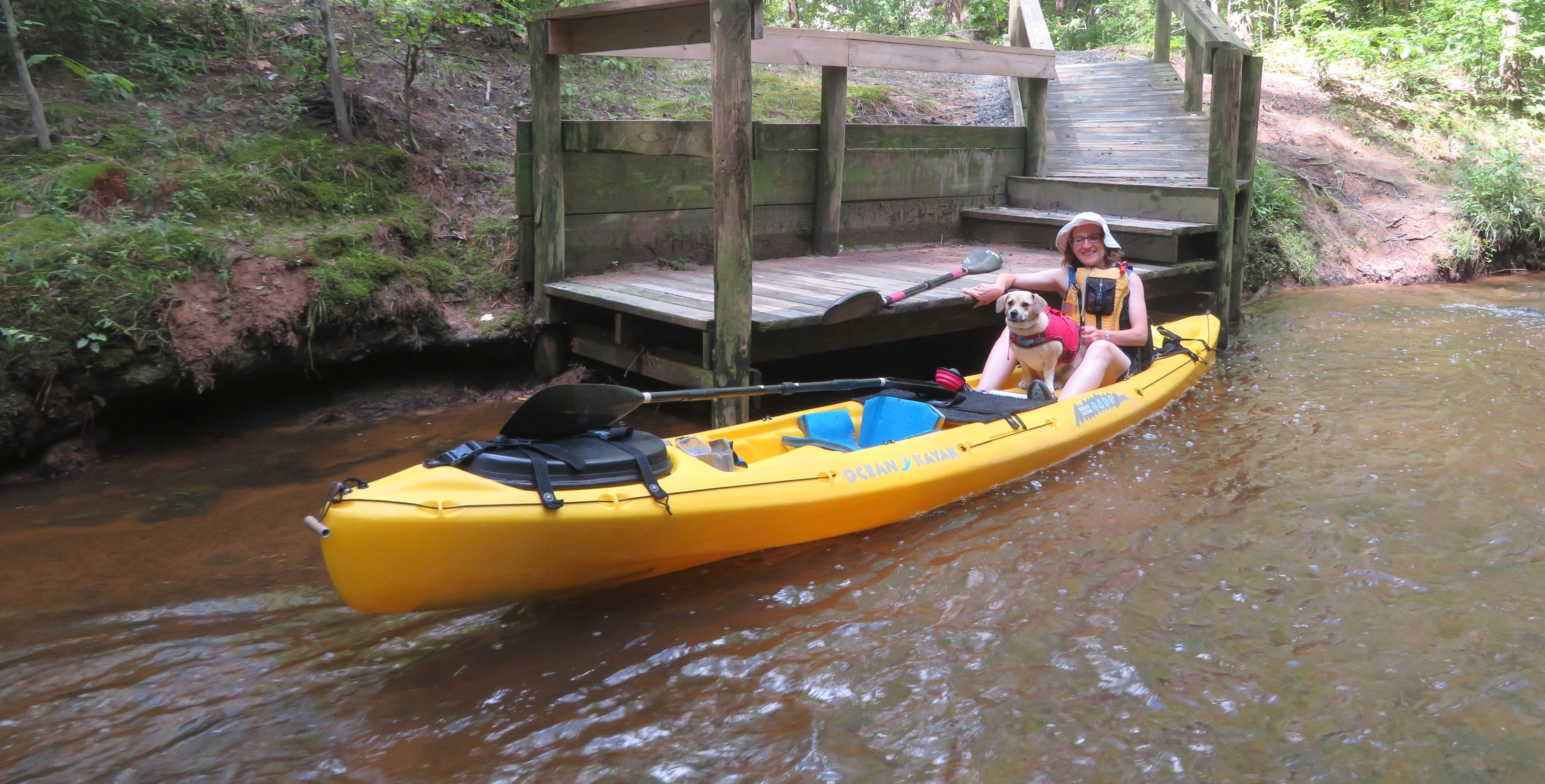
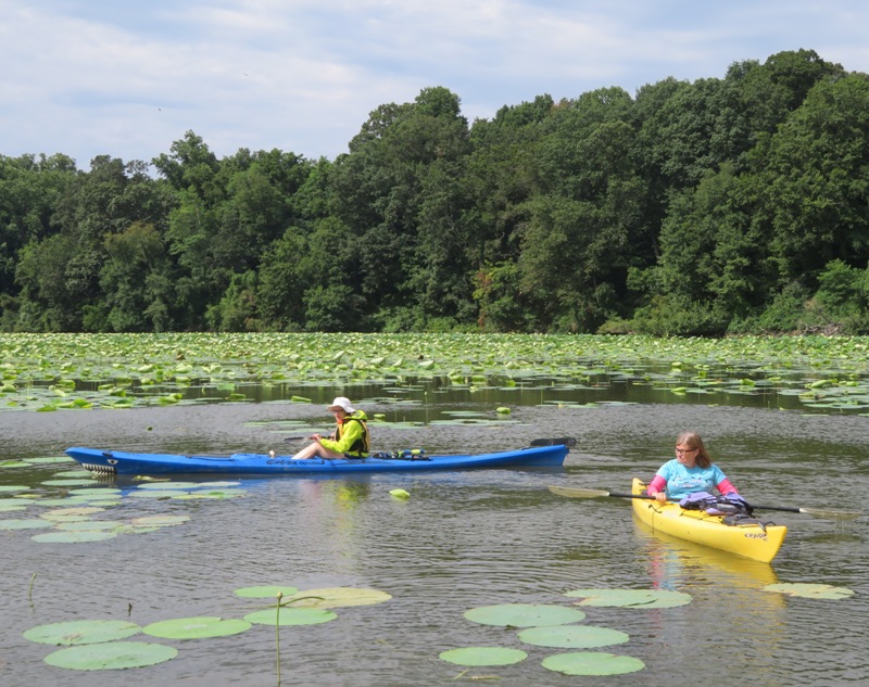
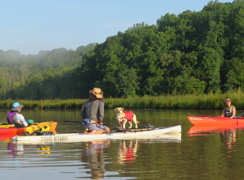
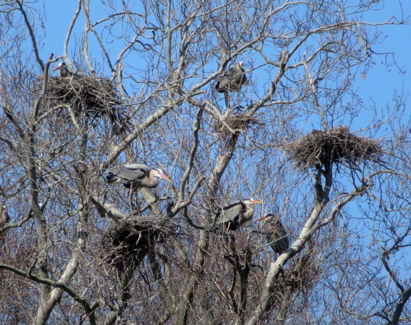
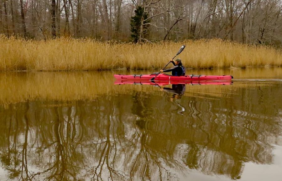
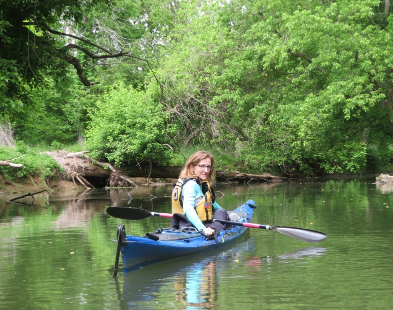
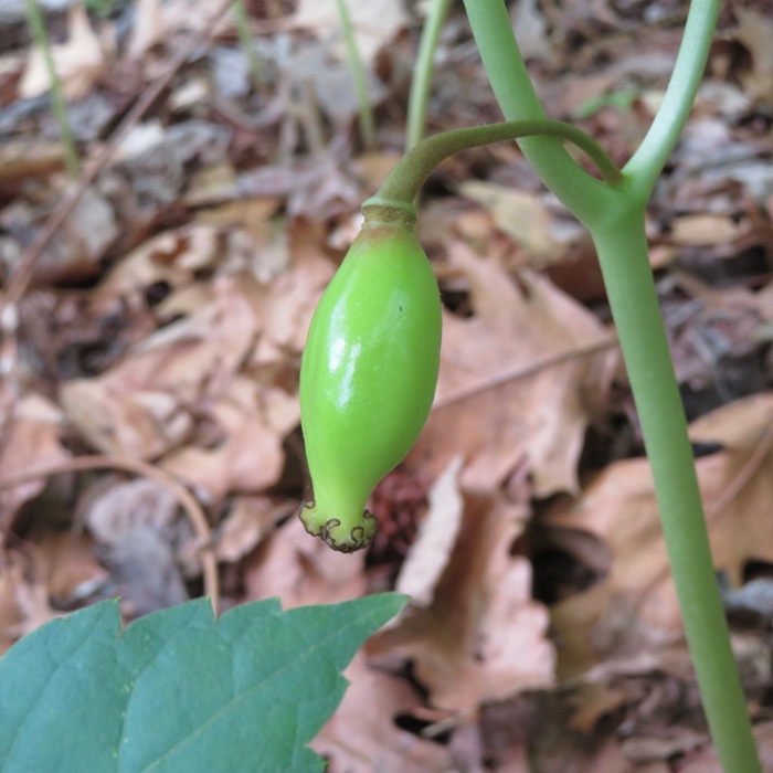
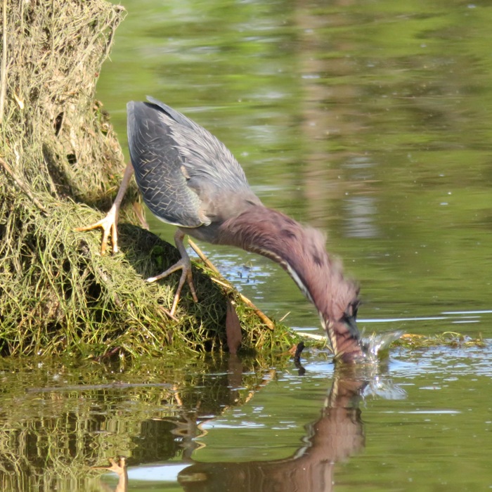
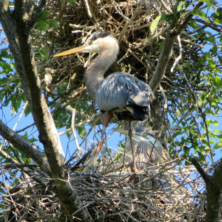
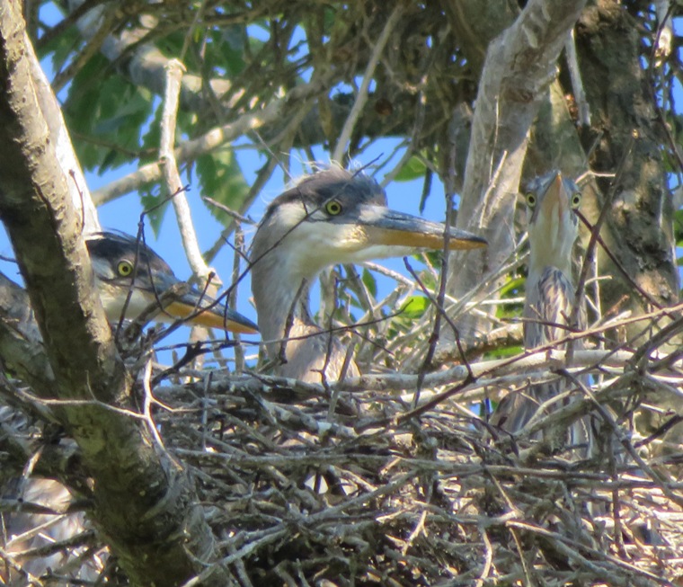
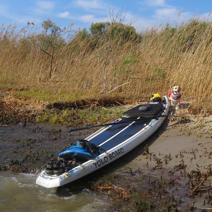
I took the day off to go paddleboarding with Daphne. We launched from Foxhole Landing on the upper part of the Sassafras River. My goal was to see great blue heron rookeries. I saw two.
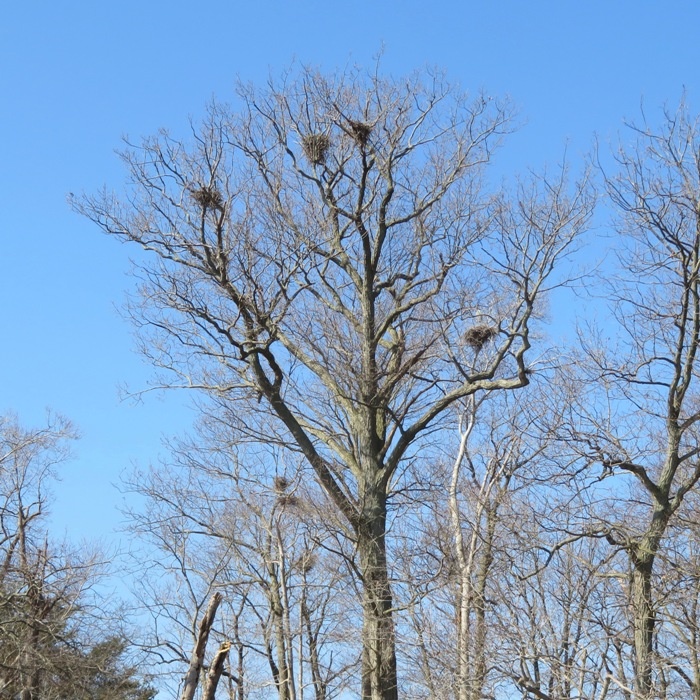
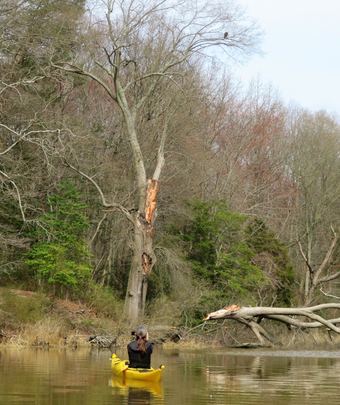
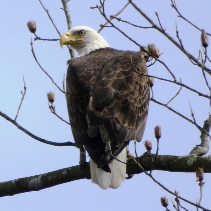
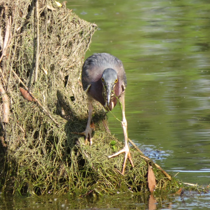
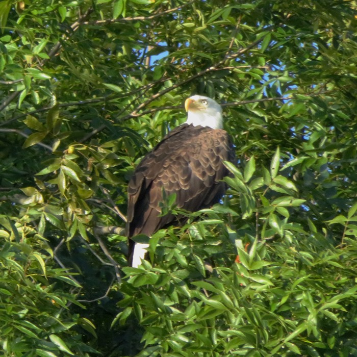
The first rookery was at Hen Island. I've been there a few times before in previous years. It was once a very impressive rookery but it has dwindled significantly. I only saw about two or three herons at their nest. Paddling upstream from the island, I saw a few bald eagles. 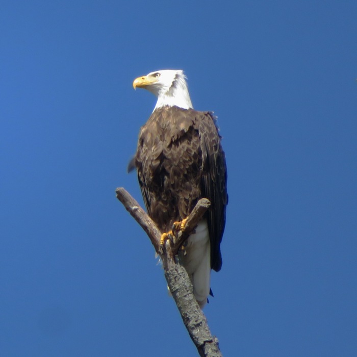
The second rookery was very close to the launch site at 39.377028, -75.832028. Like the first one, this used to have a lot more herons. It was hard to get close to it from the water because it was so far inland. To get to land, I would have had to walk through a lot of mud. I tried to go as far upstream as I could but the tide was too low. I was running out of water. Maybe I'll return during a supermoon high tide. 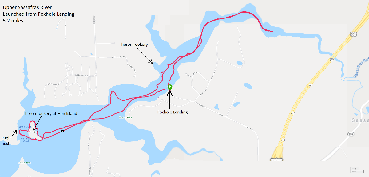
It was a short trip...shorter than I liked, considering I drove so far. But I got lucky and managed to make it a double. See trip two.  |
|
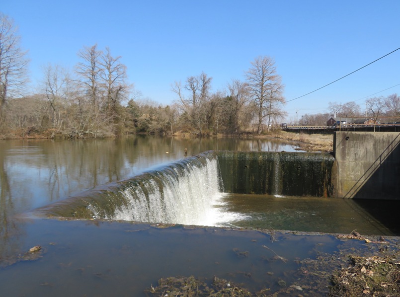
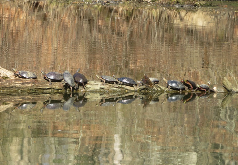
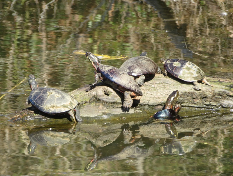
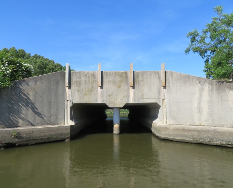
After my Sassafras River paddleboarding adventure, I had some time so I took the scenic drive home. Along the way, I passed a body of water I never noticed before. It was Urieville Lake. Pulling over to investigate, I saw that it had a boat ramp. So Daphne and I ended up doing a spur-of-the-moment second SUP trip that day.
At the dam shown in this blog's cover photo, the water from the lake passes under route 213 and then feeds into Morgan Creek. I saw only one turtle on the Sassafras but at Urieville, I saw more than I could count. From atop the SUP, I also saw a lot of turtles swimming. I had to paddle through some very shallow areas to get to the narrow feeder creek which took me within a stone's throw of Still Pond Road. 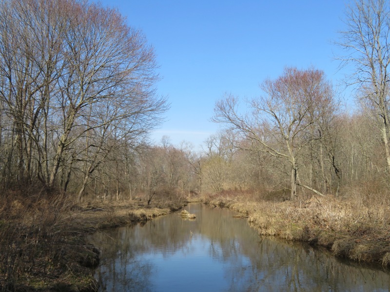
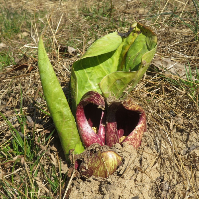
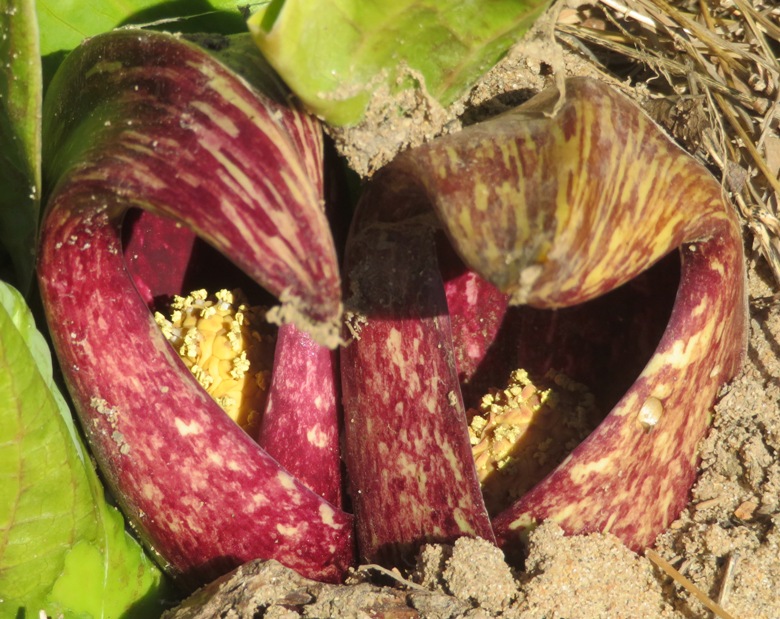
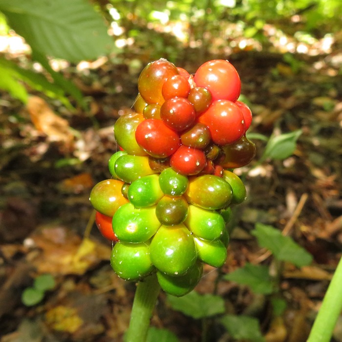
Some skunk cabbage plants flourished along the shore. Their lovely flowers reminded me of the coronavirus. I found dozens of depressions under the water created by fish. They use their fins to fan away the sand and then deposit their eggs. 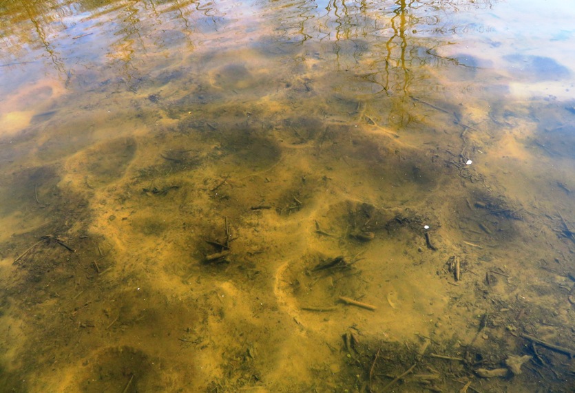
Not a lot of birds at the lake. Certainly nothing exotic. But I did find this group which proves that birds of a feather don't always stick together. 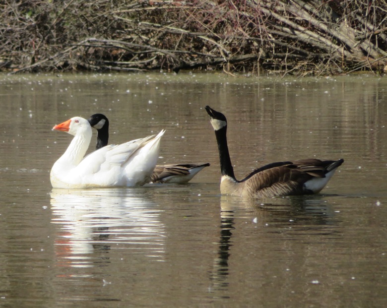
After I got home and posted my pictures on Facebook, Greg W., commented For most of the year that lake is so polluted from farm runoff that it is a solid green mass of algae. Know locally as "urea-ville" lake. I would tend to agree with Greg. There was a lot of stuff in the water that didn't look healthy. Here is my route. 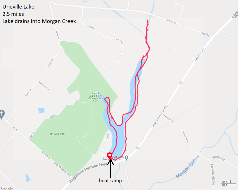
|
|
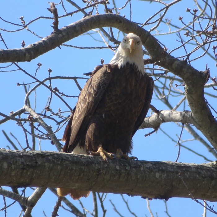
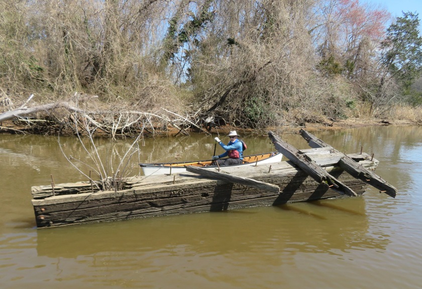
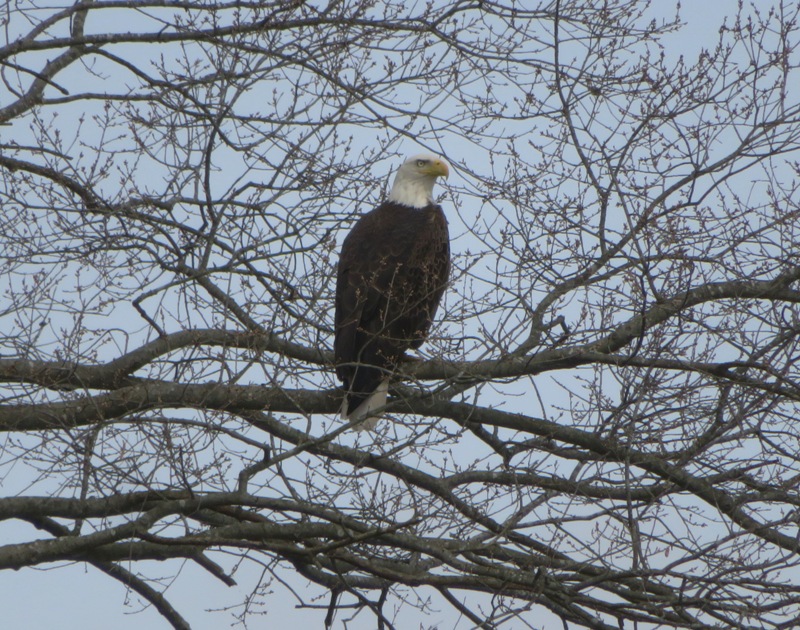
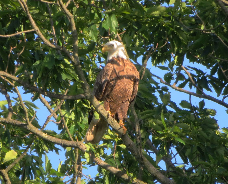
"Ego Alley" is a historic waterfront section of Annapolis where people show off their yachts. "Eagle Alley" is what I am calling Nanjemoy Creek after my latest paddling trip there where I saw a multitude of bald eagles.
On this day, Chip W. organized a trip with the WatersEdge Kayak Club on this creek. The group consisted of five kayakers and Daphne and me on the SUP. One woman canceled and one just didn't show up. Guess it was the "Saki Effect." We launched from Friendship Landing. 
It didn't take long before we started seeing eagles. If it was a few weeks later, this tree would be covered with leaves and I never would have seen this one. 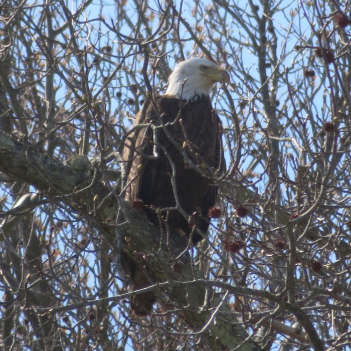
Here is what else I saw: 1 / 15

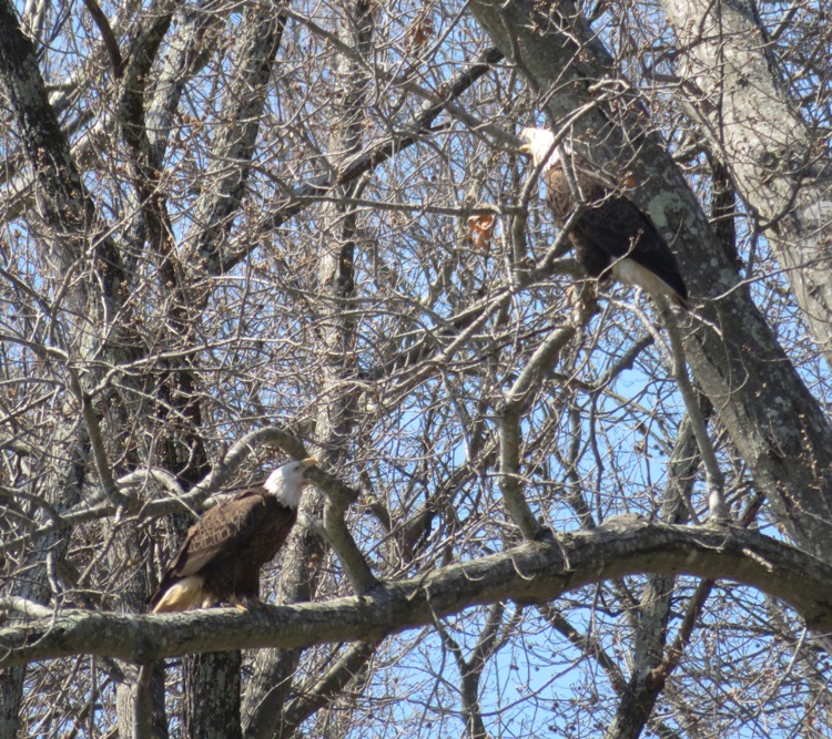
Squawking like a married couple.
2 / 15
He sees me.
3 / 15
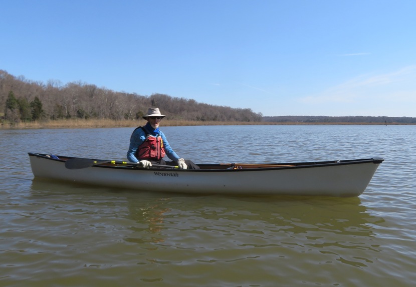
Chip in Wenonah kevlar canoe.
4 / 15
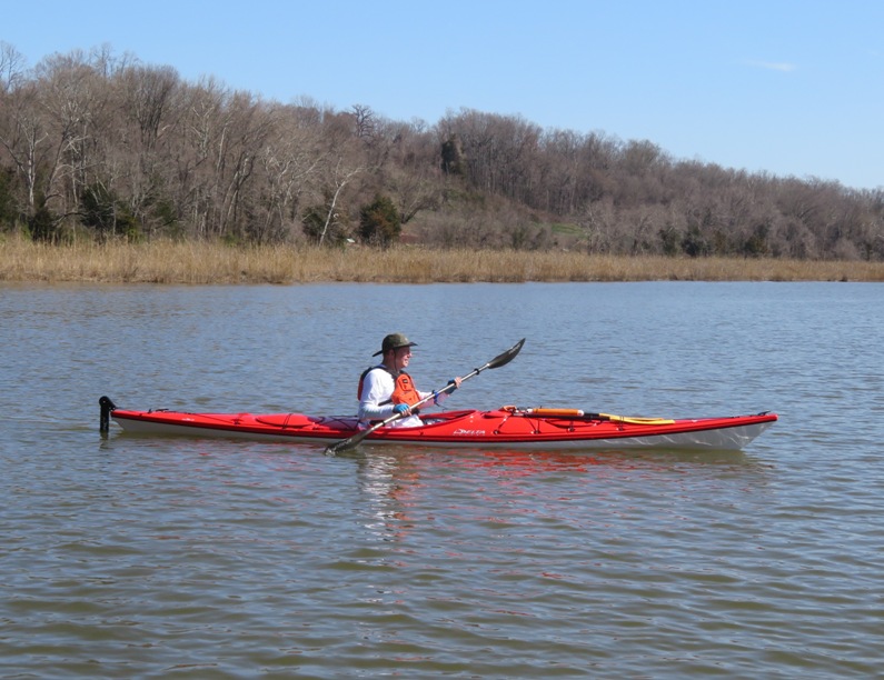
Joseph kayaking.
5 / 15
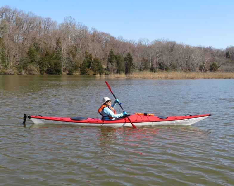
Kathleen kayaking.
6 / 15
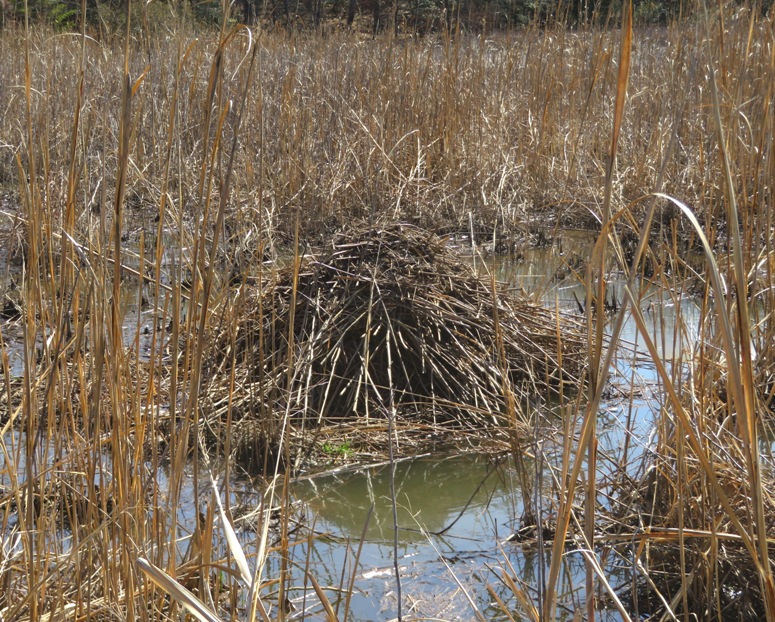
Lots of muskrat mounds.
7 / 15
Joseph and Chip.
8 / 15
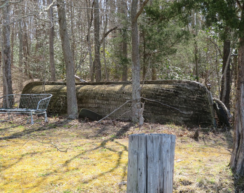
Old, wooden, heavy boat.
9 / 15
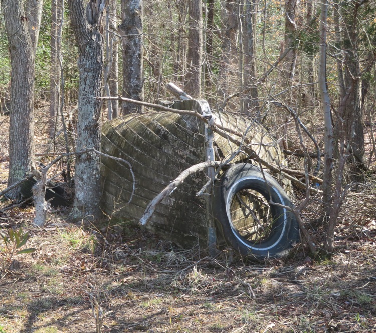
Same boat with tire.
10 / 15
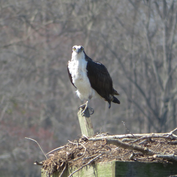
Osprey outnumbered by eagles.
11 / 15
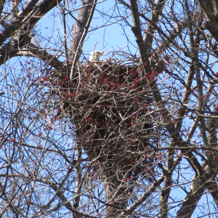
I saw three eagle nests.
12 / 15

Sam in his kayak.
13 / 15
Chip investigating ruins.
14 / 15
Illuminated eagle.
15 / 15
Chip trying to be like me.
Here's our route. We never made it to the most scenic part. High tide was earlier than Chip expected and we were moving pretty slow. 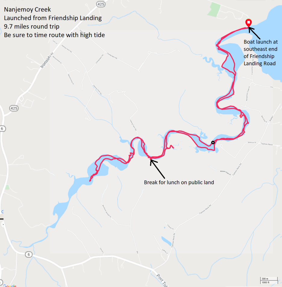
After paddling, I took Daphne on a walk at Friendship Farm Park. 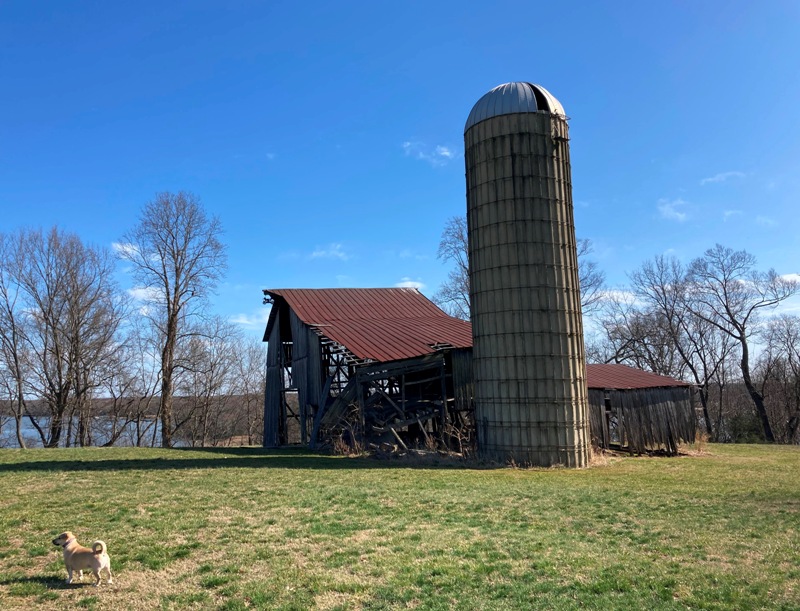
We walked on the muddy Hog Hole Bend Trail where we had a nice view of the creek that we had just paddled. I would like to return and explore the other trails. 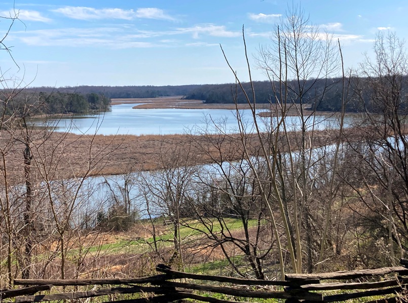
|
|
Sara and I celebrated Maryland Day by kayaking on Mill Creek and Skipton Creek in Talbot County.
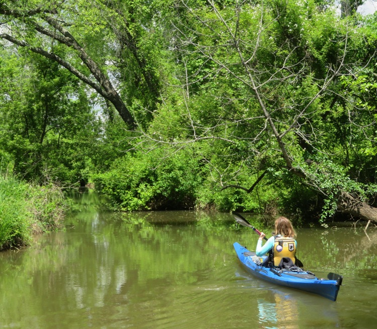
We did a car shuttle, placing one vehicle at Skipton Landing and the other on Old Wye Mills Road (route 662) where we did a commando launch under the bridge onto Mill Creek. I had never launched here before and didn't know what to expect in terms of downfalls. I brought a saw and loppers. I also brought a kayak instead of a SUP and I left Daphne at home. 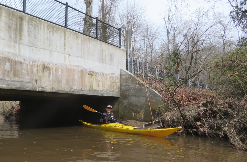
Soon after launching, we did a portage over a couple of fallen trees. But after that, everything was clear. I should have brought my SUP and Daphne. Here's Sara paddling downstream on Mill Creek. 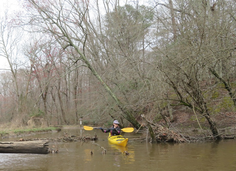
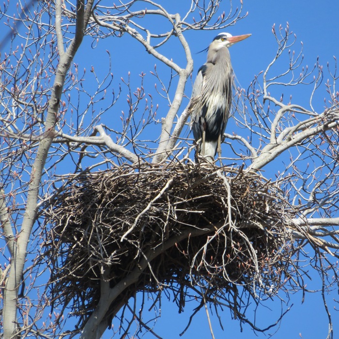
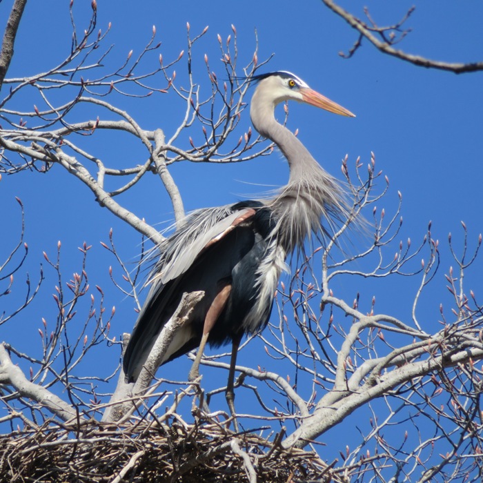
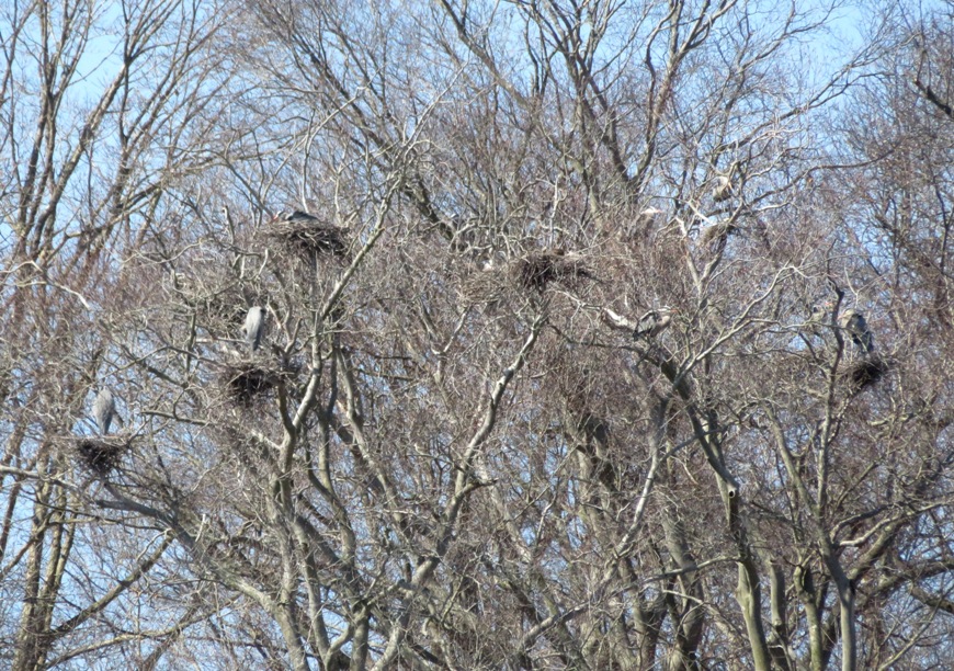
Paddling downstream, we noticed lots of skunk cabbage in bloom. We also spotted a muskrat mound and heard a barred owl. But the main reason we ventured out was to see the great blue heron rookeries. The first heron rookery we encountered was on Mill Creek at 38.897423, -76.081989. 1 / 4
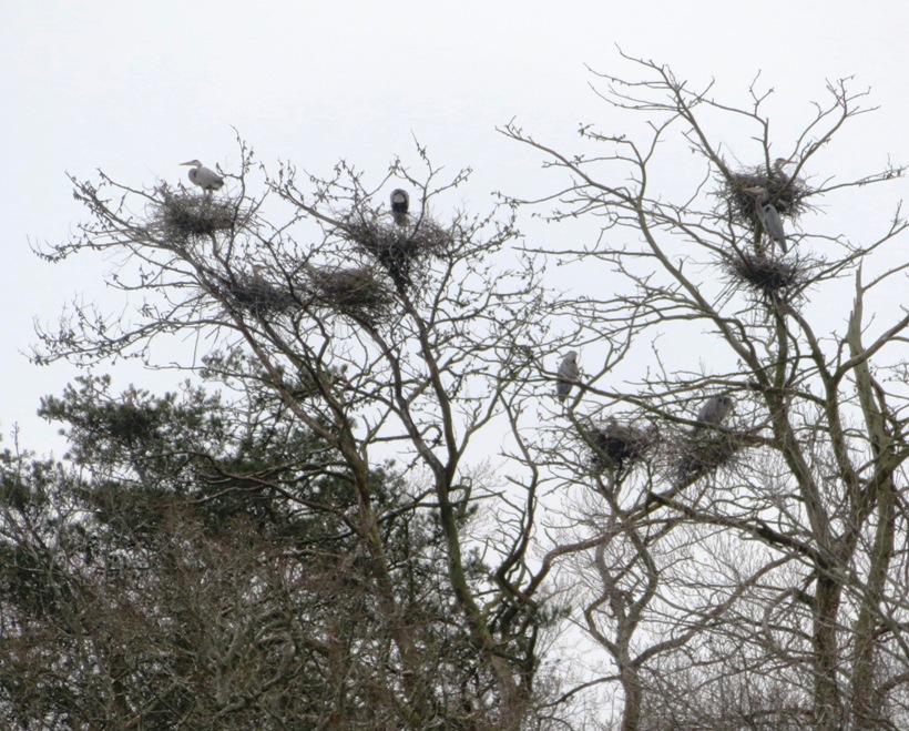
The rookery.
2 / 4
These two don't look happy.
3 / 4
Standing watch.
4 / 4
Nests are hard to see on evergreens.
Here's Sara paddling her Necky Chatham 16. 
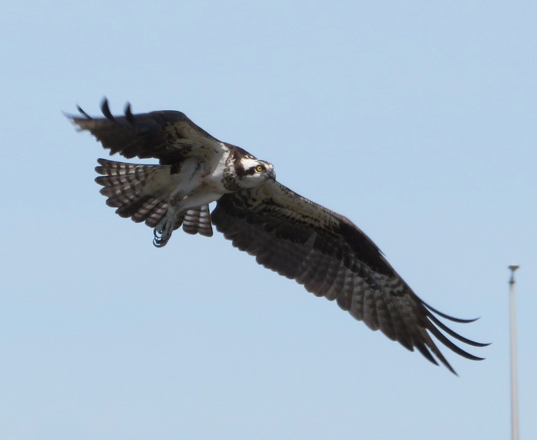
Herons weren't the only things we saw. There were also a few bald eagles out. We saw a second great blue heron rookery on Skipton Creek at 38.886069, -76.066713. It was nowhere near as impressive as the first. There were a lot of nests in this one particular tree but we didn't see them until the birds flew away. 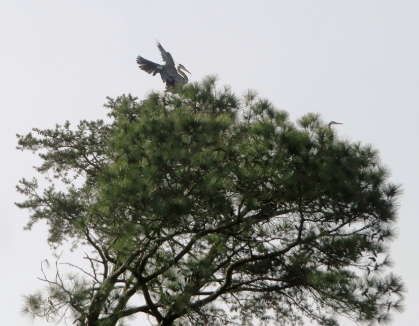
The best time to see either rookery is in the morning because then you'll have the sun on the east. Sara got a couple of snapshots of me. Thinking about our trip, I don't think it was worth it to launch where we did. It would have been better to just do an out and back from Skipton Landing rather than do a cumbersome launch and have to coordinate a car shuttle. Here's our route. 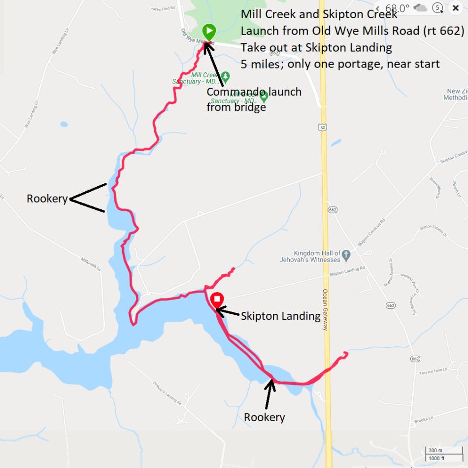
|
|
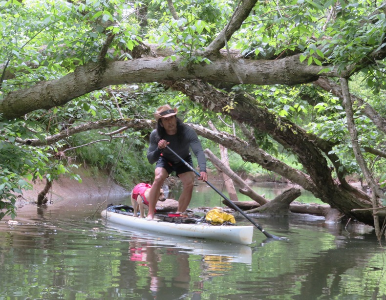
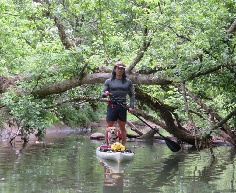
Daphne and I went paddleboarding in Dorchester County, Maryland. We launched from Vienna, then paddled on the Nanticoke River upstream for about a mile before entering Chicone Creek, which we explored until the portages became frequent. This outing was one of my 2020 bucket list trips so now I can cross that off.
One reason I chose this trip is because it was the day before the "Super Worm Moon" which brings more extreme tidal fluctuation...not just on the day of, but often on the day before/after. On such days, I like to either look for fossils at low tide or paddle into areas that might otherwise be too shallow during the high tide. I chose the latter. There were lots of osprey on the Nanticoke, like the one in this blog's cover photo. It was great seeing them hover and then dive for food. Afterwards, they would do a "shiver" to shake off the water. I like taking photos of them when they are hunting because I can zoom in on them when they hover. Of course a nesting platform is also a good spot. 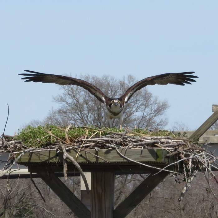
Near the mouth of Chicone Creek, I saw this duck blind. But what is the thing on the left? I'm guessing it is for a retriever dog to lie in wait until his master shoots some waterfowl. Then he can quickly run down the ramp, swim into the water, and retrieve the kill. 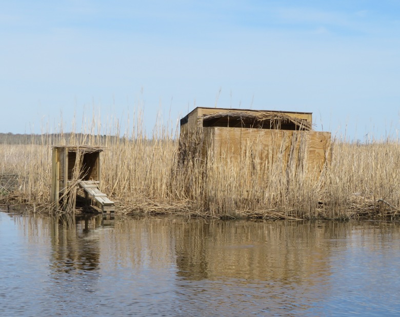
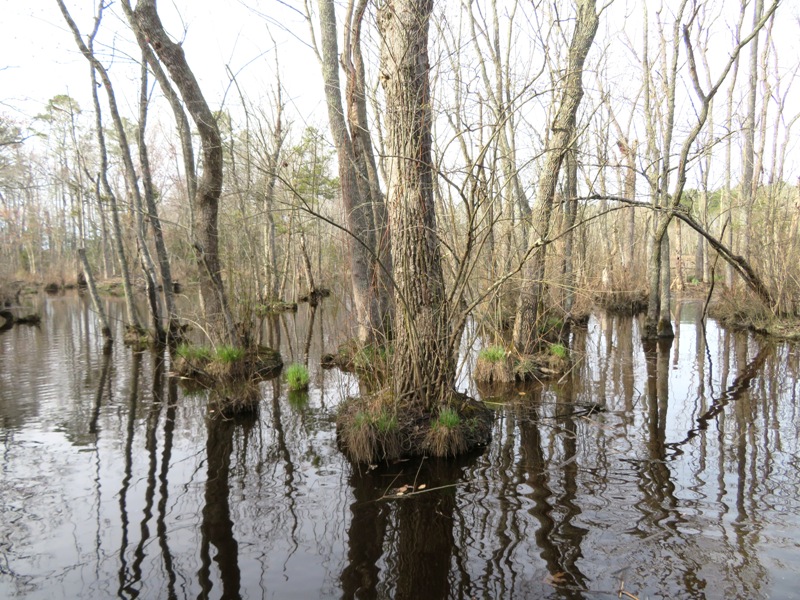
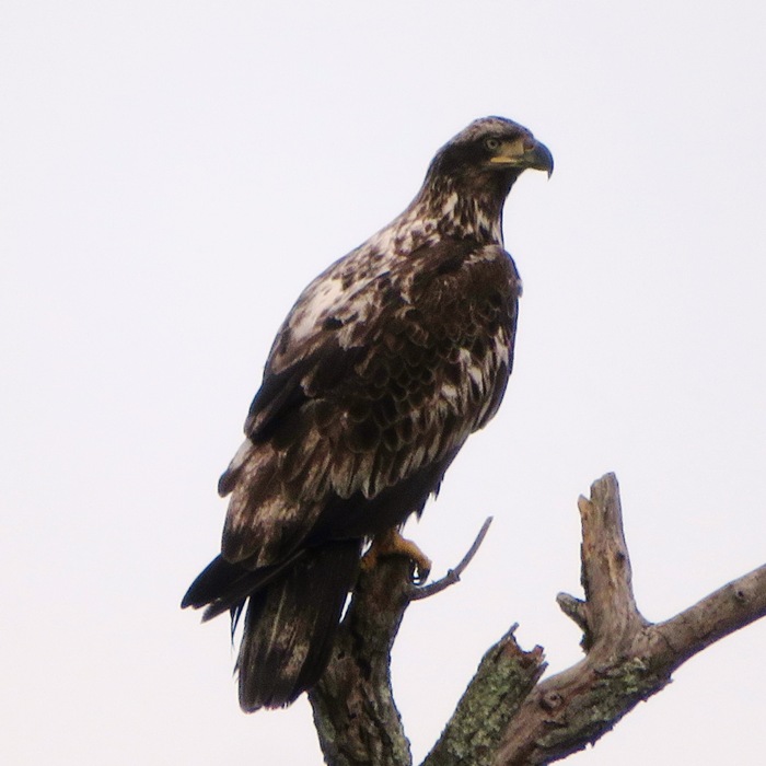
On the average, the creek was narrower than the Monocacy River and stayed fairly deep for a long time. But unlike the Monocacy, the shoreline reminded me sometimes of Florida because there were so many trees growing out of the water, creating "micro-islands." It was a very swampy environment. I did not find any heron rookeries or bald eagle nests but I did see about three adult eagles along with some juveniles. The lower part of Chicone Creek and the Nanticoke were marshy grasslands but it didn't take long before the rest of the creek became scenic swampy woodlands. I think this would make a great group trip but not in the early spring. There were lots of deciduous trees that went right up to the shoreline. These would be much prettier once they have leaves, which they did not in March. There were lots of kingfishers out. They are always elusive targets with my camera because they never let me get close and they don't stay in one spot for long. I had to zoom in a lot to get this one so it is a little fuzzy. 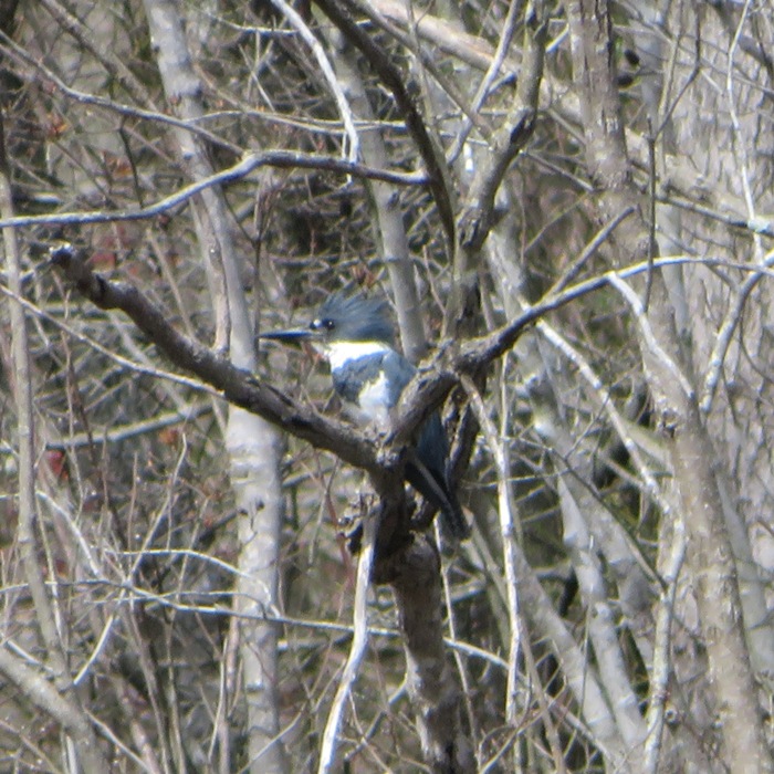
Here is my route. On the last leg of my trip, I encountered strong headwinds which made for slow paddling. 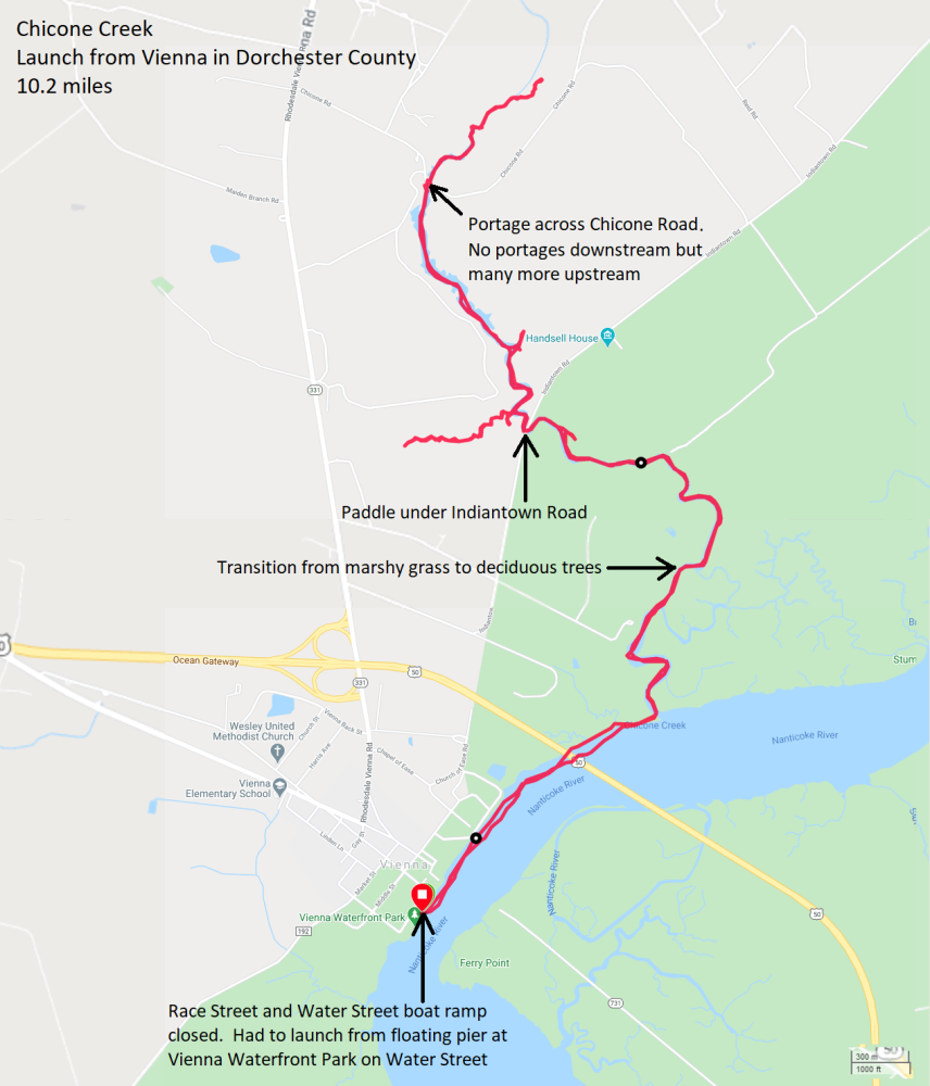
I never saw any other paddlers. Just a couple of friendly fishermen on the creek and a couple of powerboats on the Nanticoke. Unlike the satellite photo map from my 2020 bucket list notes, I never did the circuitous route from Chicone to Stump Point. I might have been willing to try it if it wasn't so windy and if I had more time. But based on what I saw, I expect that route would be mostly grasses with not a lot of trees. Still, I think it would be fun to do. It was a very nice trip but my expectations were higher. It was "very good" but not "excellent" in my opinion when it came to scenery. Probably not worth an hour and 40 minute drive one way for just a day trip. But if it was part of a weekend excursion on the eastern shore, then it would definitely be worthwhile to paddle it. After SUPing, I took Daphne on a walk in historic Easton where we strolled on part of the 2.5-mile long rail trail before heading home. We'll definitely come back to that and check it out with Norma. |
|
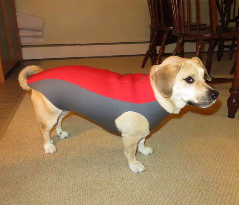
Daphne now has a custom-made wetsuit made by Doggie Wetsuits so she can get out on the water with me when it is still cold. I don't expect I'll use it anytime soon but if I'm on the water in March of next year, she'll definitely be wearing it. I might also have her wear the wetsuit the next time we go hiking in the snow.
|
|
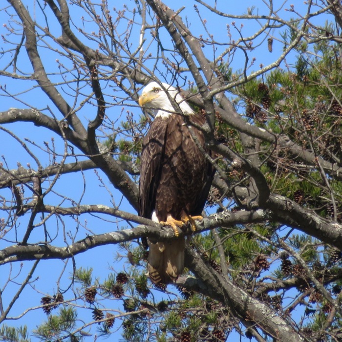
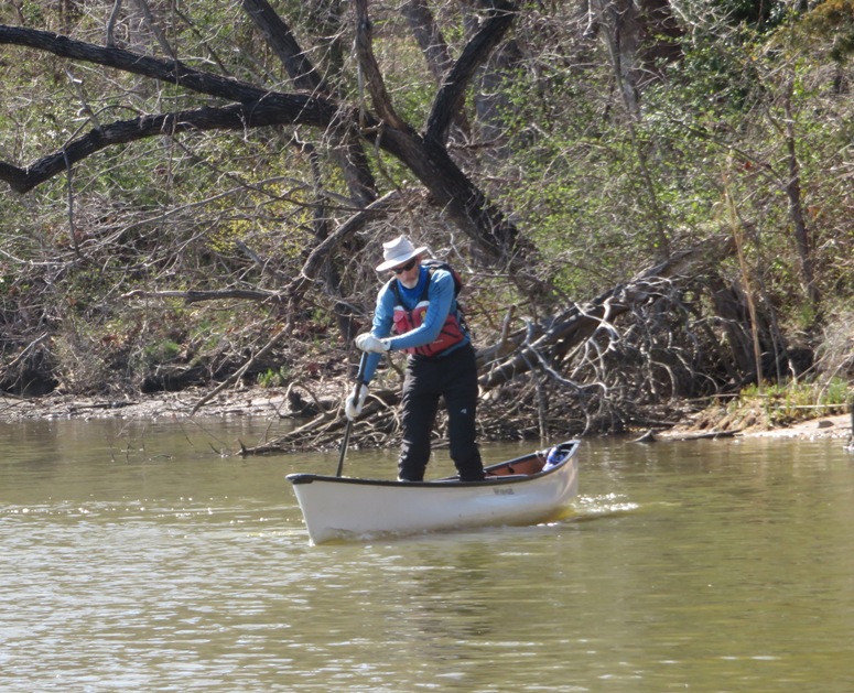
John S. of the WatersEdge Kayak Club led nine paddlers on Bodkin, Back, and Main Creeks in Anne Arundel County, Maryland. We launched from Locust Cove in Downs Memorial Park and paddled 10.95 miles. Daphne joined me on the SUP.
We were underway promptly at 1000. I love how the kayakers are so on time. It started out sunny and then became overcast later in the day. An eight mile per hour headwind on the return trip meant I had to put it in high gear. For a kayak, that isn't bad but on a SUP, you really feel it. We saw at least two bald eagles and a red fox on the beach. I saw a motley assortment of ducks. 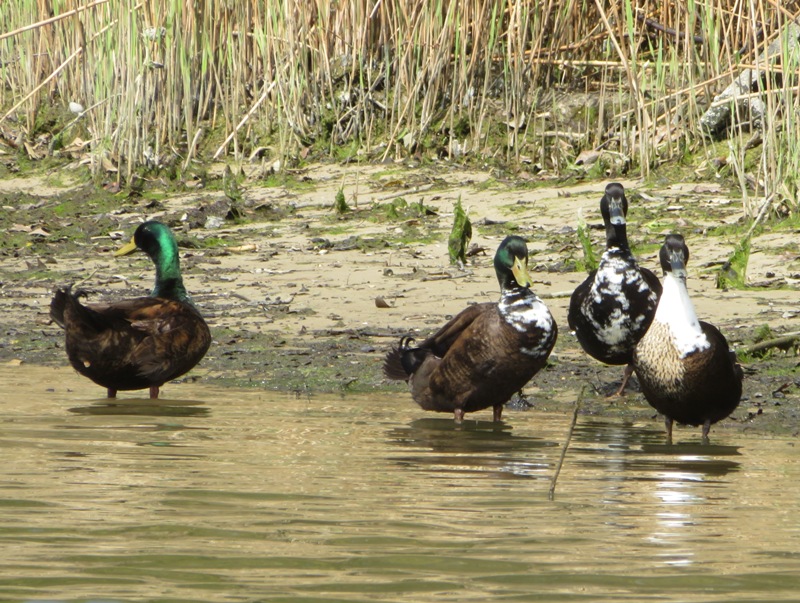
In the below snapshot, John returns from exploring a shallow area. I wasn't using my Frogfish fin so I didn't follow for fear of getting stuck in the mud. 
We stopped for lunch at Hancock's Resolution. Notice how Suzanne is the only one who is socially distancing herself. The covid-19 pandemic ain't over yet and she's playing it extra super safe. 
1 / 5
Great blue heron.
2 / 5

Daphne waits for a handout.
3 / 5
Suzanne with her Greenland paddle.
4 / 5
Mark, John, and an angry osprey.
5 / 5
John S., our fearless leader.
In the early afternoon, there was a ring around the sun. According to Spectrum News - What Causes a Halo Around the Sun? Halos are caused by cirrus clouds They are made of tiny, ice crystals. Sunlight through the ice crystals causes the light to split, or be refracted. When at just the right angle, it causes us to see the halo. The same thin clouds can cause a ring, or halo, around the moon at night. 
In this blog's cover photo is Ironwoman Julie, who I talked with a lot. I was proud that I did a one mile elevation gain bike ride last summer but she more than doubled that with 12,000 feet! This is Serge, a really fast kayaker and another guy with super terrestrial endurance. 
Here's our route. 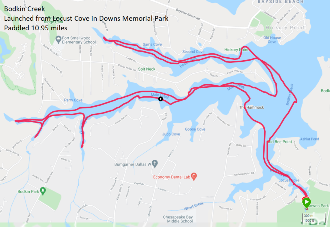
It was a nice trip and I met some interesting people. Of course, Daphne loved getting so much attention. The WatersEdge group always makes us feel welcome. |
|
I paddled this route countless times before but it was Sara's first time. The two of us and Daphne launched from Solleys Cove. I was hoping to put in at the new boat ramp but it wasn't open yet. It ended up opening sometime around June 20.
We headed south (upstream) on Marley Creek in Glen Burnie. 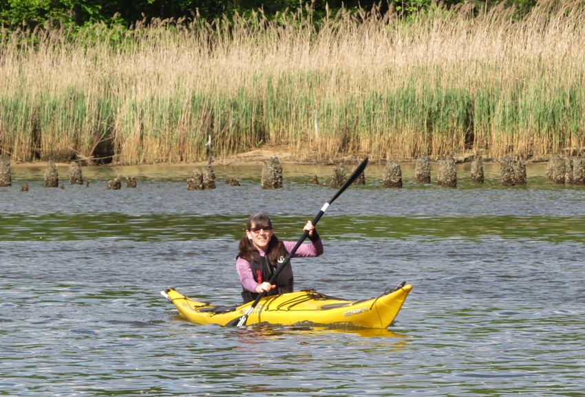
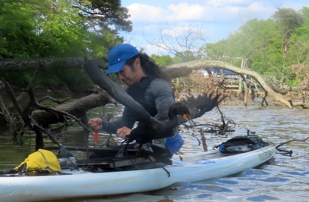
For some reason (I know not why), Daphne fell in. She was standing too close to the bow and then slipped. I quickly fished her out. I was worried about her getting cold but then the sun came out and she was fine. As we approached the first bridge, a flock of cormorants flew away...except one. I got closer and realized it was hanging upside down and flapping its wings. It was caught in fishing line. I passed Daphne to Sara (below), approached it on my SUP, and then commenced the rescue. 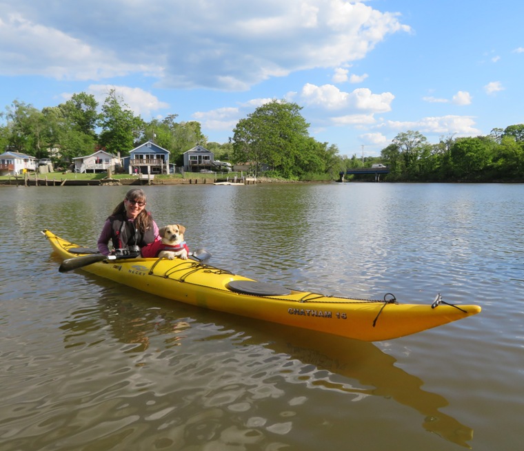
The bird was quite nervous. I pulled out my knife and then cut the line. But I wasn't done. I still had to free the cormorant from the part of the line that was wrapped around its body. I held it on my SUP and worked on removing the remaining line. In this blog's cover photo, it tried to fly away, but I wasn't done. It flopped around and then bit me, but not very hard. Completing my task, I let it go and it flew away. If there is a heaven, I felt like I was one step closer. 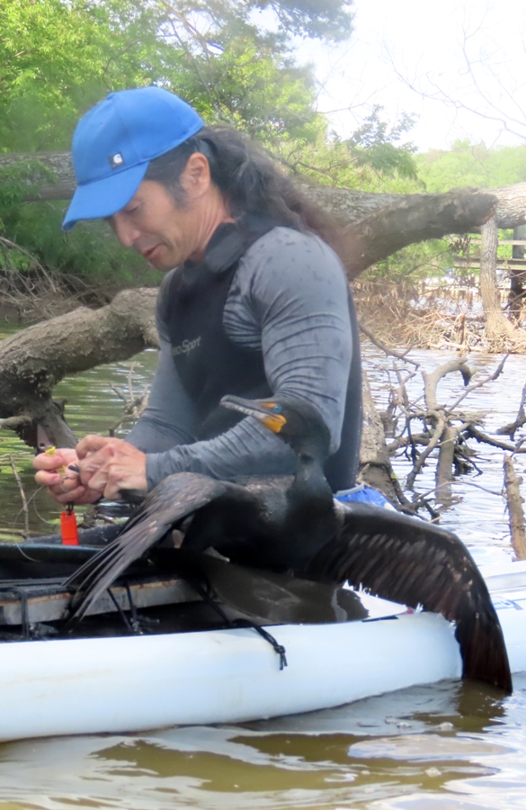
Glen Burnie probably isn't one of the first places that comes to mind when you think of wildlife but this place has quite a bit...especially muskrats, of which I saw four. Sometimes, I refer to this area as Muskrat Alley. Sara and I made our way pretty far upstream on Marley Creek. The lighting was perfect. 
On a small island, I saw a pair of goose eggs. I'm guessing these were duds because there was no goose attending them. 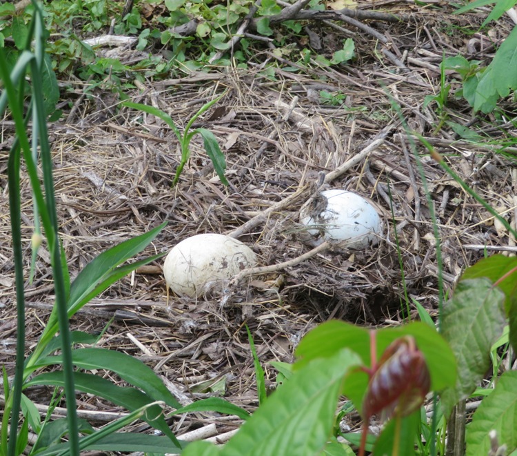
A little later, we saw a green heron walking through the mud. Sara got much better pictures than me of it. But she was so focused on the bird that she never saw the muskrat walking on the shore to her left. Unfortunately, the muskrat was too far away for me to get a shot. 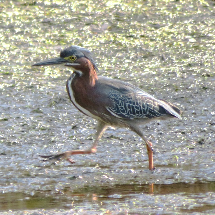
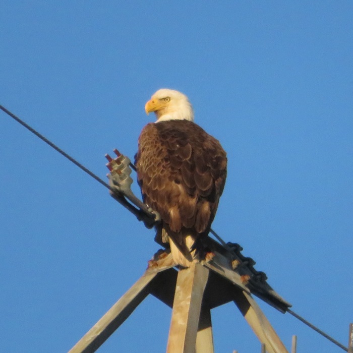
I often see bald eagles in this area. On the transmission line tower, there is even a large platform that holds an eagle nest. I'm guessing it was put there for that purpose. So you're likely to see at least one there when they are incubating their eggs or raising their young. Here is our route. We got in eight miles. Because of the cormorant rescue, I think I will remember this as one of my most memorable trips. 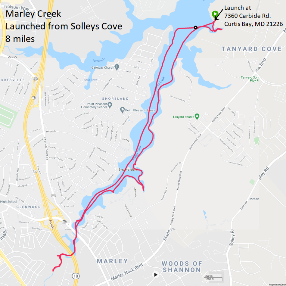
|
|
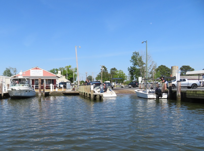
Norma, Daphne, and I drove out to Harford County, Maryland to do a little paddling. Along the way, we pulled over on Pulaski Highway (route 40) to check out a couple of possible launch sites. They were indeed launchable but not very. Too far to carry the boats. We ended up putting in at Otter Point Public Landing.
The parking at the launch site is limited. The signs are also very confusing. We parked in the spot closest to the ramp and had no problem. But I contacted the director of the Harford County Recreation and Parks to let her know about the confusing signs. After we put in, we paddled upstream on Otter Point Creek as far as we could go. This place is a real gem. One can explore this narrow, wooded creek for several miles and see lots of natural beauty. It is now one of my favorite places to explore within one hour of home. 1 / 5
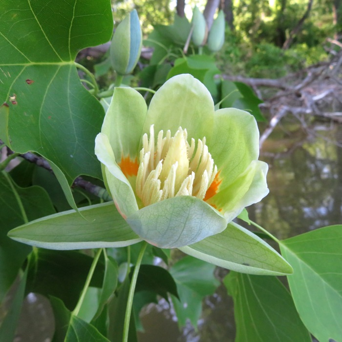
Tulip poplar flower.
2 / 5
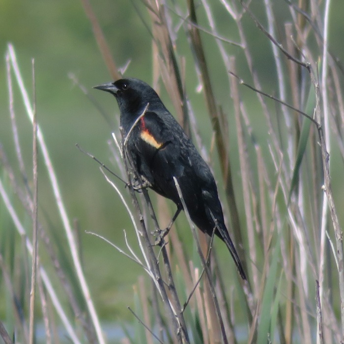
Red-winged blackbird.
3 / 5
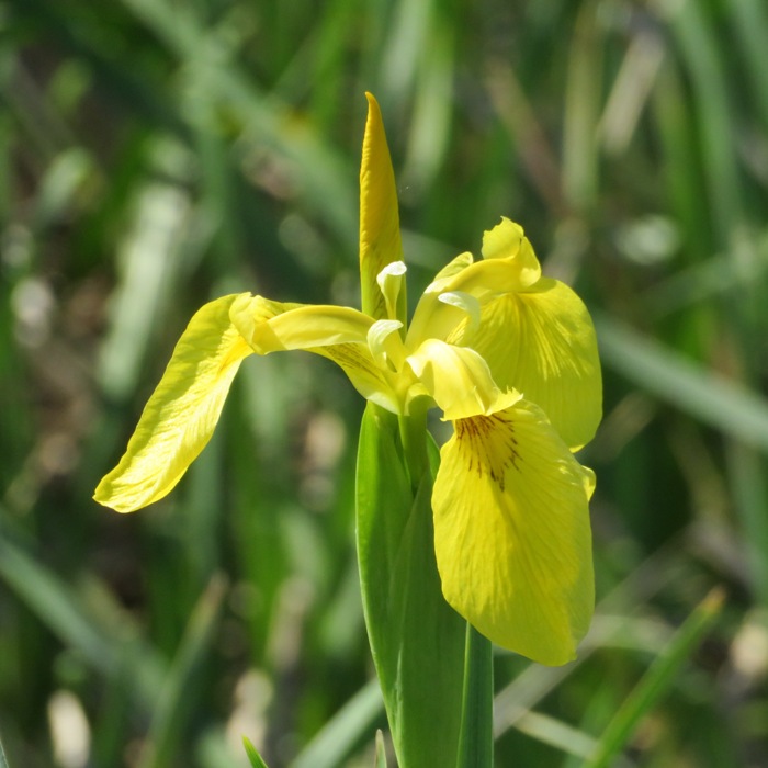
Yellow iris.
4 / 5
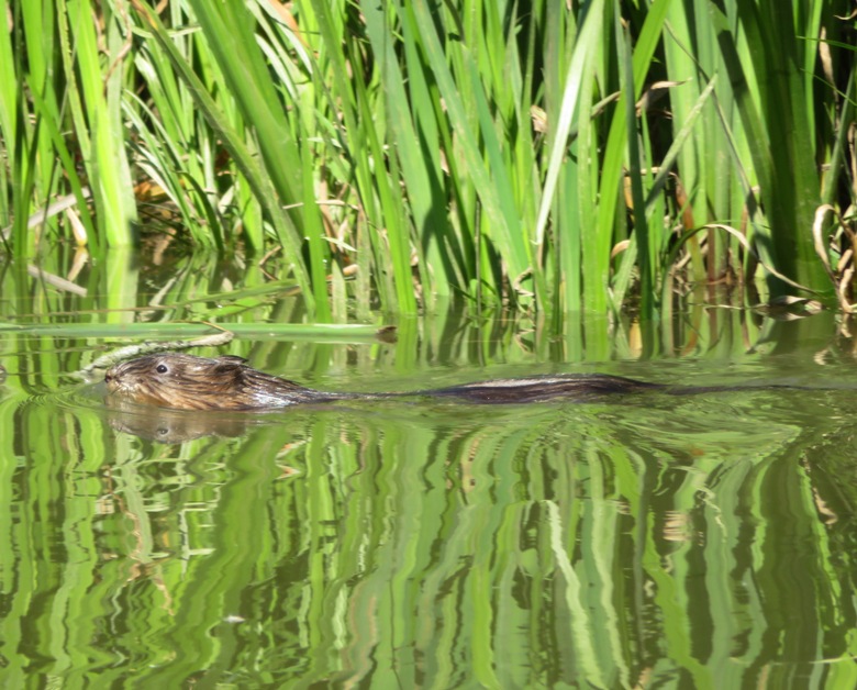
Muskrat swimming.
5 / 5
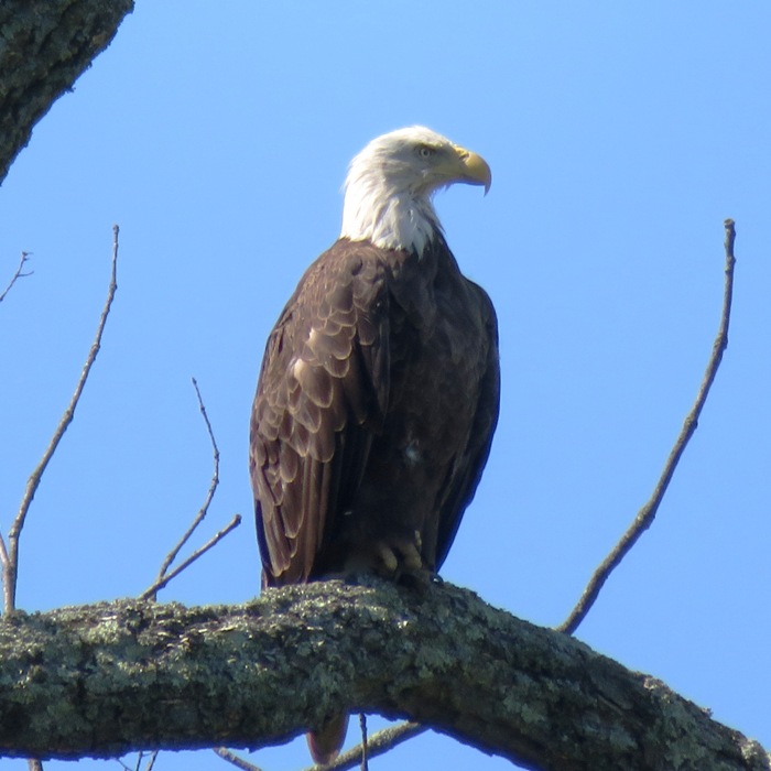
Bald eagle.
Unlike more brackish parts of the Chesapeake Bay, the water here has low salinity and trees grow all the way up to the shore. So you'll get lots of shade on a hot, sunny day. 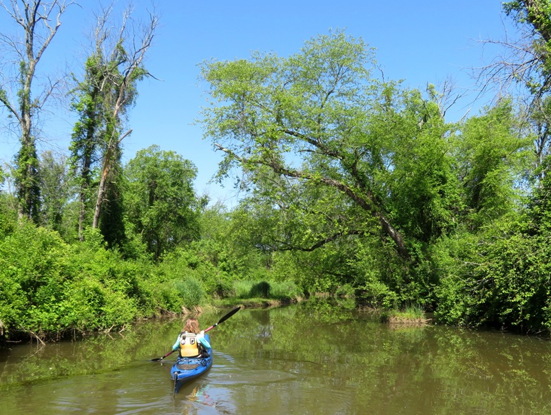
We saw a crayfish mound not unlike the ones we've found in our back yard. 
We did a few portages. I sawed through one log and used my loppers to cut branches so we could go further upstream. We also pulled the boats over logs, as Norma is doing here. 
If you want to avoid portaging, stick to the designated paddle trail that runs counterclockwise from the launch site. The route is indicated by numbered signs. We saw a lot of cool stuff: 1 / 4
Pretty flowers.
2 / 4
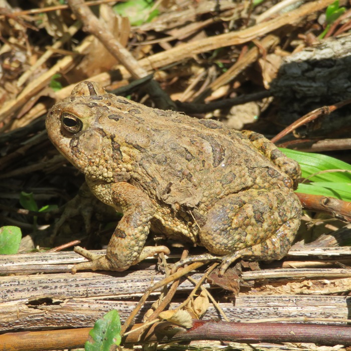
Toad on dirt road near water.
3 / 4
4 / 4
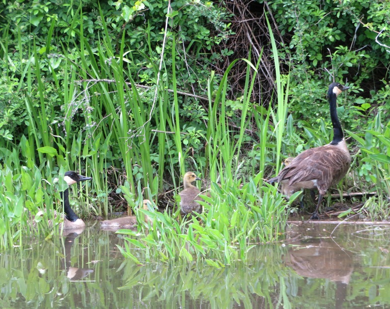
Canada geese with goslings.
If you like exploring narrow creeks, then this is the place for you. Daphne and I make our way under some fallen trees. Daphne doesn't often lie down on the SUP. In this snapshot, she is either very relaxed or very tired. I'm guessing the former. 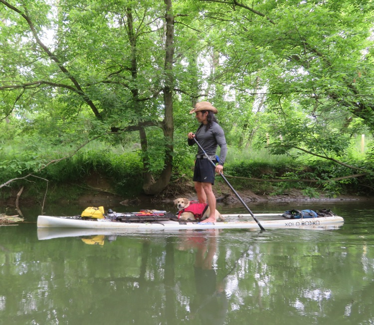
Shortly after the below picture was taken, we hit the open water and encountered strong winds with light rain. I found it difficult because the shallow water meant I couldn't put my paddle very far down into the water so I didn't have a lot of power in my stroke. Very slow progress. 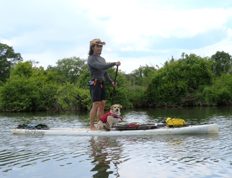
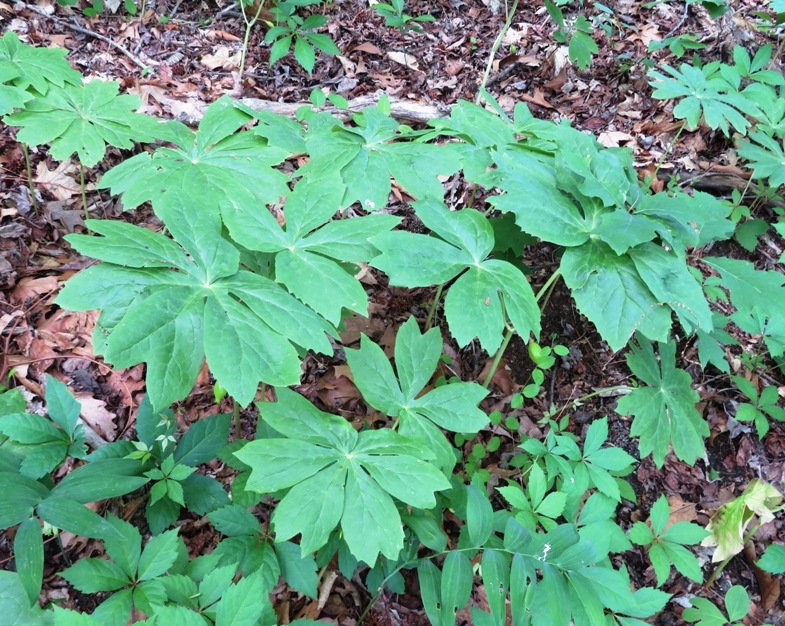
We pulled ashore at the Anita C. Leight Estuary Center and explored some trails. Here we found lots of mayapples. This place is the research and education facility of the Otter Point Creek component of the Chesapeake Bay National Estuarine Research Reserve in Maryland. The Estuary Center is located on one of the few remaining large freshwater tidal marshes in the upper Bay. Two land areas, Leight Park and the Melvin G. Bosely Conservancy, are contained within the Estuary Center. Leight Park consists of 93 mostly forested acres owned by the Harford County Department of Parks and Recreation, while the Bosely Conservancy has 350 acres of tidal marsh and wooded wetlands owned by the Izaak Walton League of America - Harford County Chapter. Leight Park and the Bosely Conservancy are open to the public and offer opportunities to explore and learn about birdlife of the Chesapeake Bay. Both Leight Park and the Bosely Conservancy offer foot trails through deciduous woods and through or near the marshes. A boardwalk behind the estuary center building leads to an overlook at the marsh. The Estuary Center has marked water trails for kayaking and canoeing and provides a public launch site. - from Birder's Guide to Maryland and DC - Anita C. Leight Estuary Center - Otter Point Creek Back on the water, we got pretty close to a great blue heron. 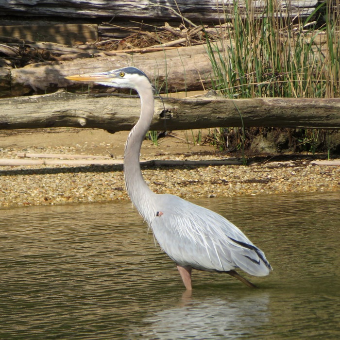
A little later, we were done. Here's what the launch site looks like from the water. 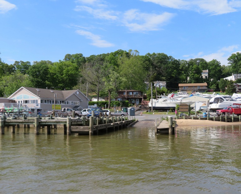
This is our paddling route. 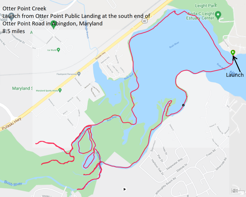
The director of the Harford County Recreation and Parks replied to me about the parking near the boat ramp. We are actually about to start working on this launch/parking lot. We will keep your suggestions in mind. In the meantime, Anita C. Leight Estuary Center is just up the hill from this location and they have limited kayak/SUP launch available - as well as a bigger parking lot. Please reach out to them for some more information/direction. After paddling, we stopped in at the main entrance to the Anita C. Leight Estuary Center and walked some of the trails. They are nice but nothing spectacular. |

|
Daphne and I went paddleboarding on the Tred Avon River in Easton, Maryland. We put in at Easton Point. This was my second time launching from this location though I don't remember the first. It is a great public site with a boat ramp, porta-john, and a decent amount of parking. Here is a view of the ramp.
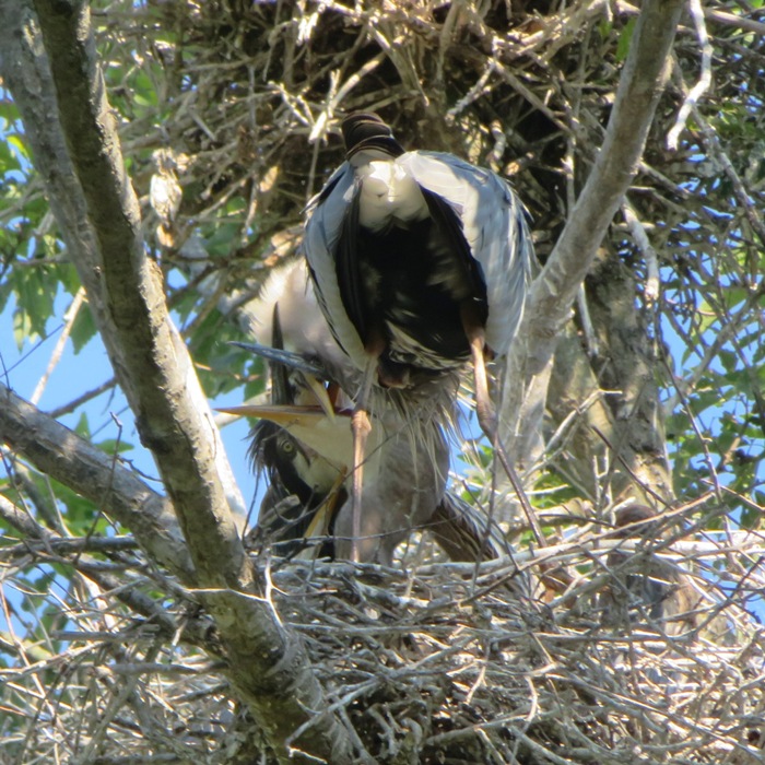
Not far from the launch site, I found a great blue heron rookery. But there wasn't much to see because there was so much foliage on the trees. Best to return in April. 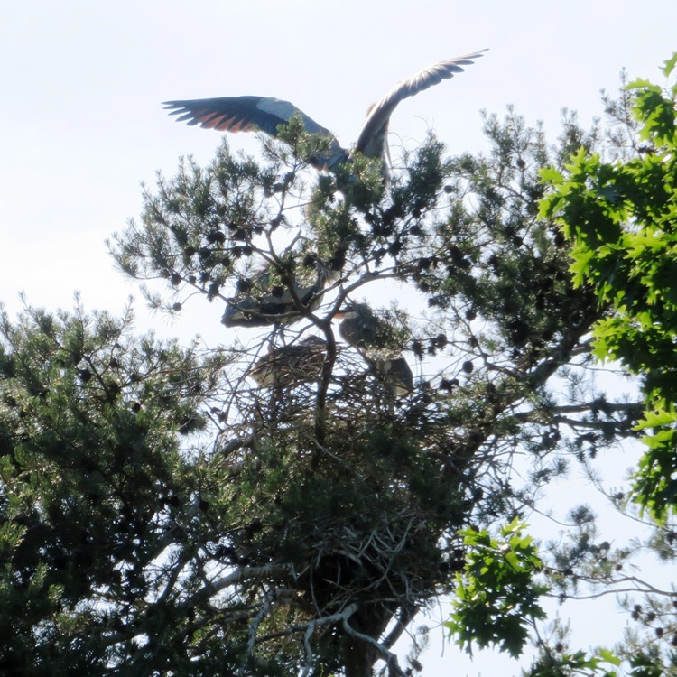
Two small fish jumped up onto my SUP. Here is one of them. 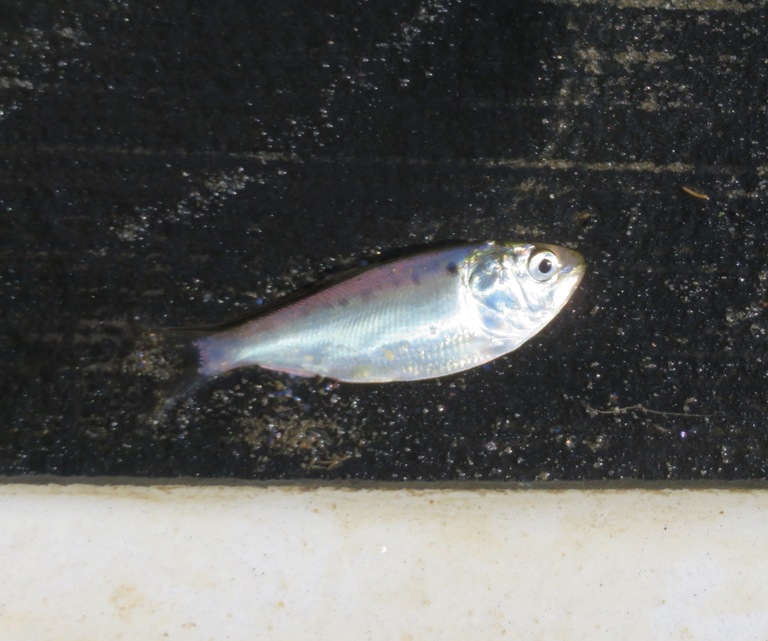
I took us under the Easton Parkway (route 322). I found a green heron that was willing to pose for me, which isn't so common. I saw two northern water snakes. Great blue herons in motion are always very difficult for me to photograph. Usually, my shot comes out blurry but this one wasn't too bad. 
Next, Daphne and I explored the areas downstream which were nice but mostly comprised of multi-million dollar homes. Not as much nature but we did see a deer (blog cover photo). We pulled over briefly and Daphne took a break on land. 
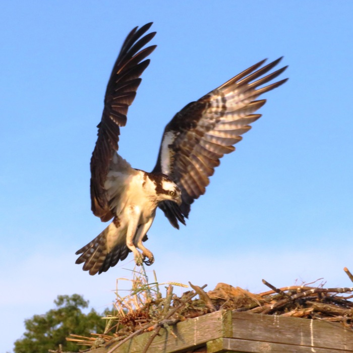
Closer to the launch site, I spent a lot of time taking pictures of ospreys. I stayed out late so I could watch the sunset. 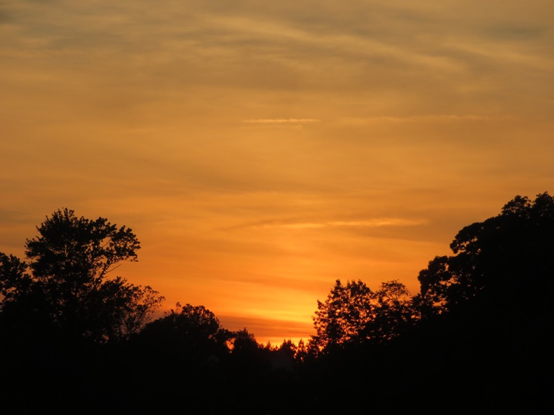
We got in 11.2 miles. It was a good trip but the tide was a little too low to explore the two most scenic, natural areas that comprise the easternmost portions of the river. 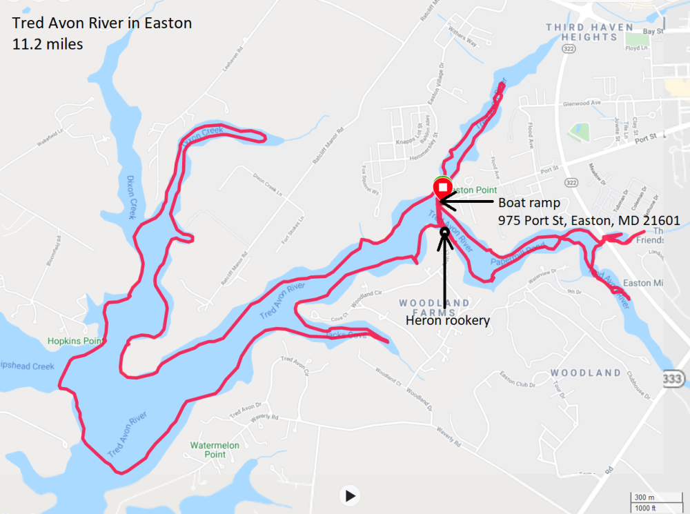
|
|
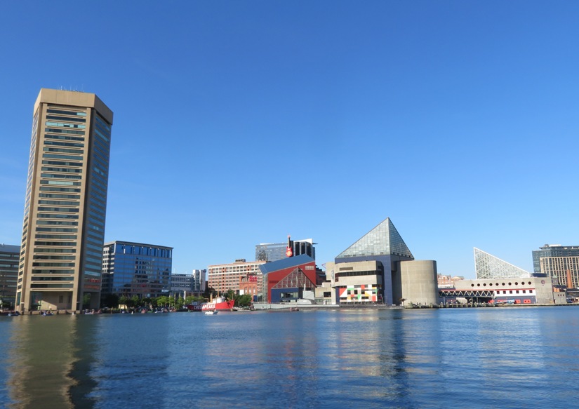
Inner Harbor
On Memorial Day 2021, Daphne and I got in a little over 12 miles on the stand up paddleboard (SUP) in Baltimore. We launched from Broening Park. Sometimes you find nature where you least expect it. I know bald eagles are becoming plentiful but this is the first time I'd seen one while paddling in Baltimore City. 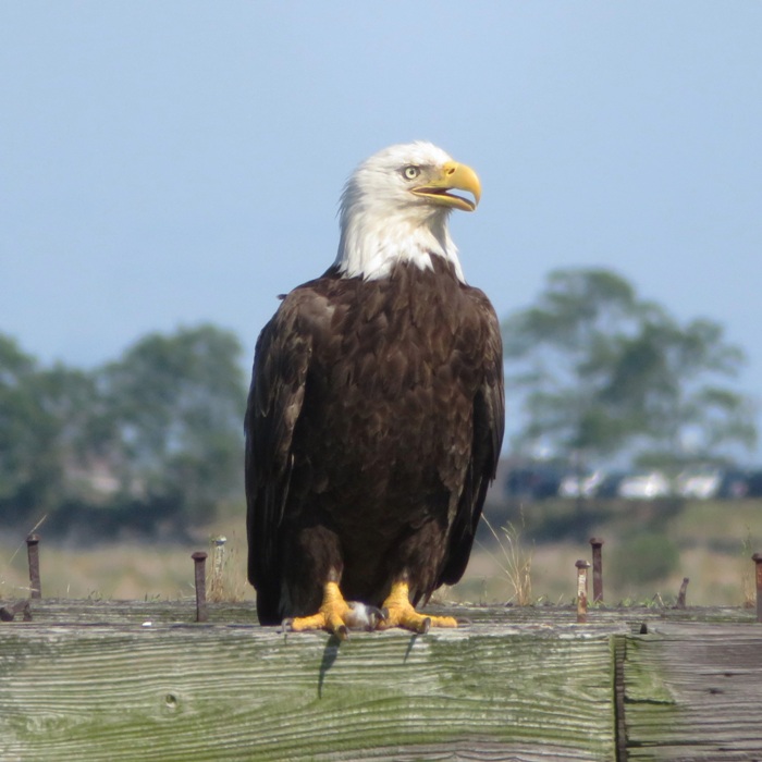
I always attract a lot of attention with a dog on my SUP. It puts a lot of smiles on people's faces. We had a nice view of the Baltimore skyline, as show in this blog's cover photo. Here is our route. 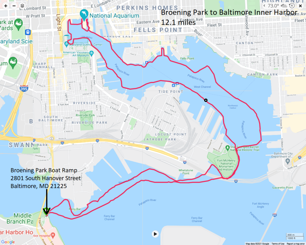
|
|
I was up at 0400 for a 0550 launch at Pohick Bay Regional Park in Lorton, Virginia. Why so early?
This park opens at dawn but they let me in before that. I got on the water just in time to see the sunrise. 
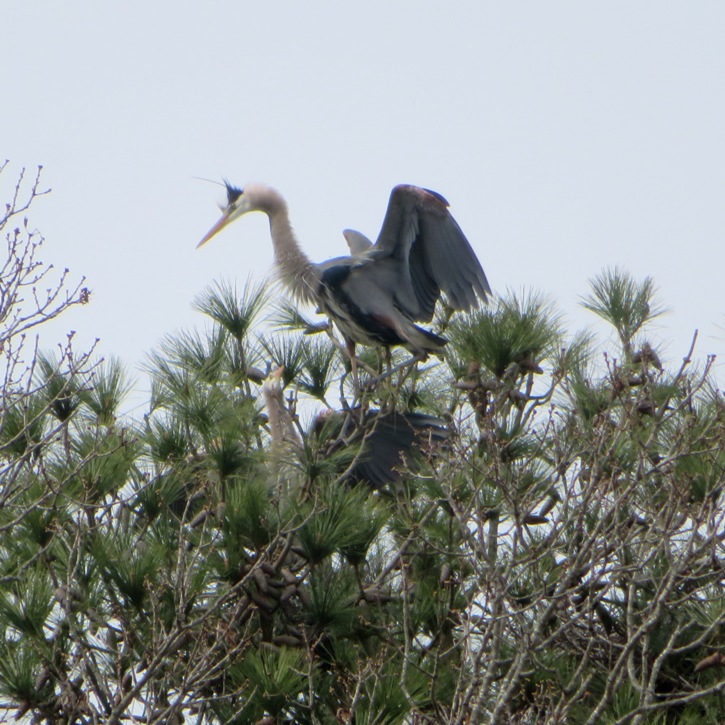
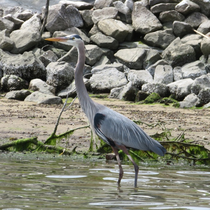
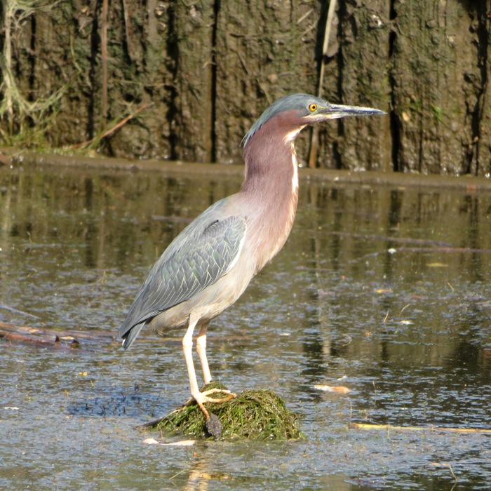
I kayaked in Pohick Bay without Daphne. Norma had her while she visited her mother. I don't get out on kayaks as much as I used to. Since there was a good chance I'd be paddling in very shallow places and possibly encountering a lot of aquatic vegetation, I figured my Prijon Catalina would be a good choice. There ended up not being much aquatic vegetation. There is something special about being out on the water so early. The lighting is magical. Here is a great blue heron illuminated by the early morning sun. 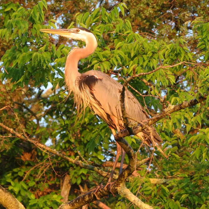
I saw some cypress trees along the shore. 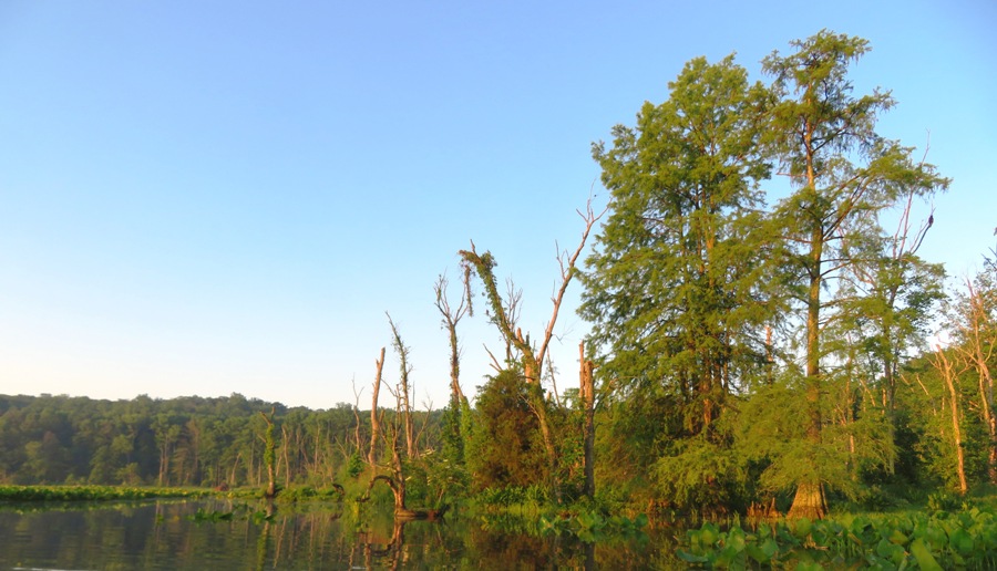
I paddled up Pohick Creek as far as I could. Water was flowing pretty swiftly. There's no way I could have gotten as far upstream as I did on a SUP. Floating back downstream, I saw a couple of people making their way upstream on SUPs. 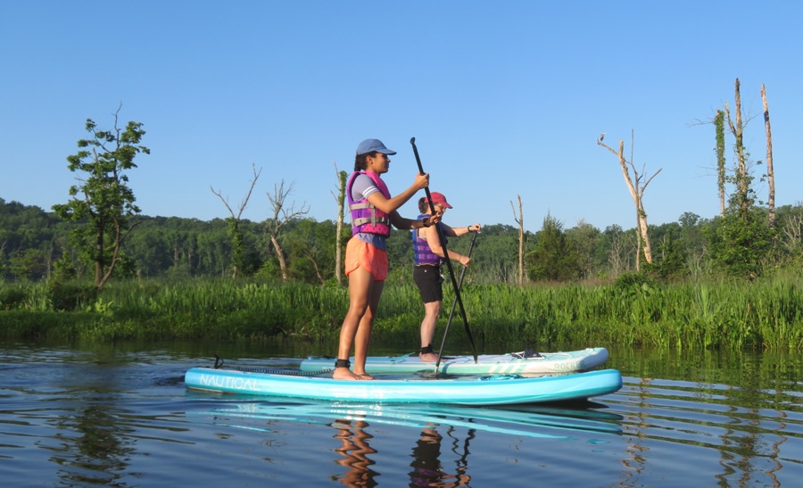
There was a lot of spatterdock and I enjoyed winding around it but having a view from above on a SUP is always nicer so I can look down on such low vegetation. 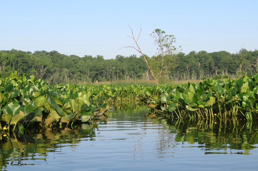
The flowers are pretty but for my camera, they are usually hard for me to photograph. But the lighting this morning was most accommodating. 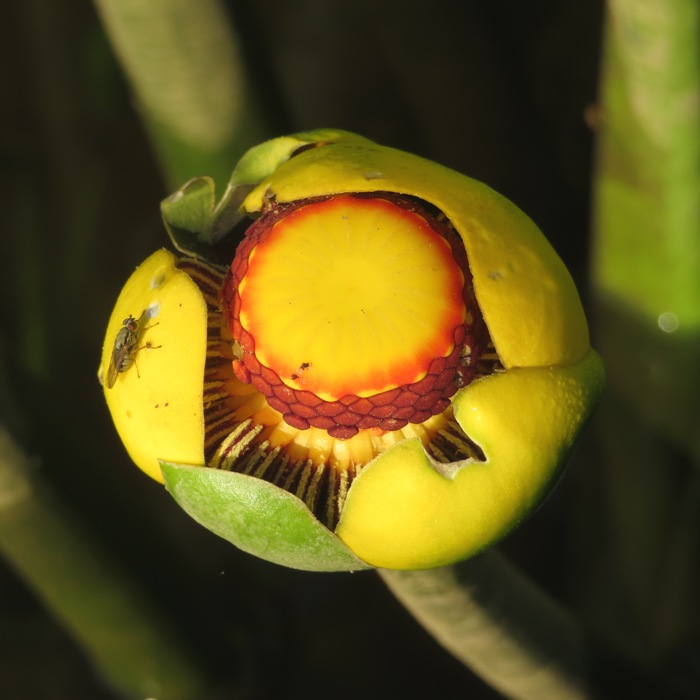
I spotted a very pristine beaver lodge. Clearly, a beaver was maintaining it. I paddled up close and listened. I could hear babies inside making noise and chomping away at stuff. I tried to make a recording of the sounds but the cicadas were so loud, I really couldn't hear much in the playback. 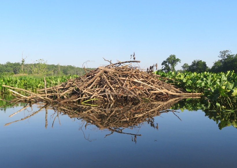
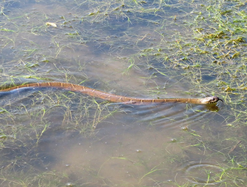
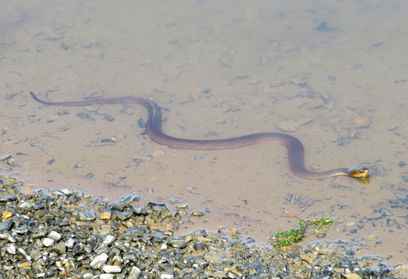
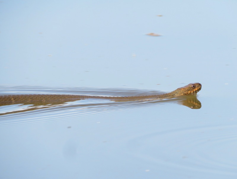
I saw two northern water snakes sunning themselves on the beaver lodge. There is only one in the photo. 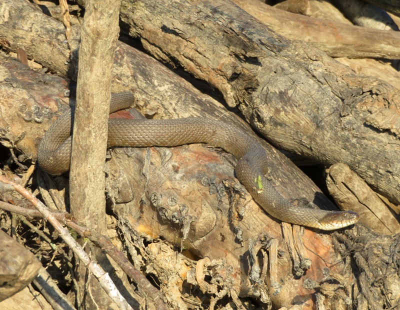
A little later, I saw something big in the water. I paddled closer and noticed it was a snapping turtle. It kept splashing around and then it lifted out of the water. That's when I realized there were two of them and they were mating. I don't think they appreciated me watching. 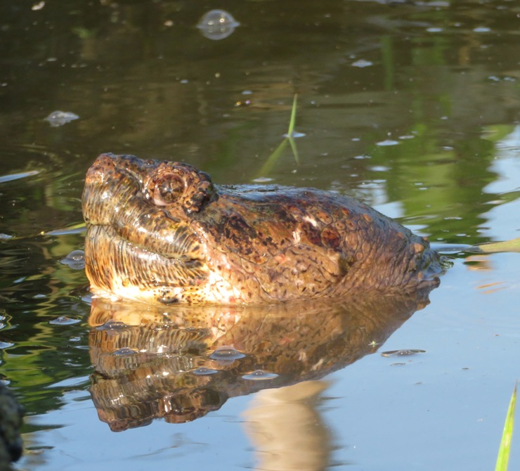
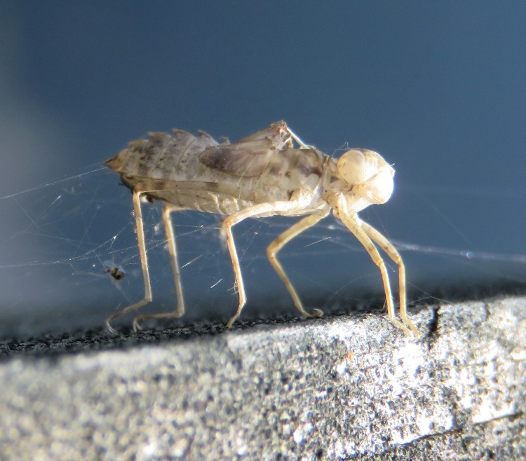
I kayaked to a great blue heron rookery. I didn't know it was there until I heard their umistakeable clatter. What does a great blue heron rookery sound like? Turn up your speakers and click on this to find out. Check out the antennae on this little guy posing on a pink damask flower. He can probably pick up radio stations all the way in China. 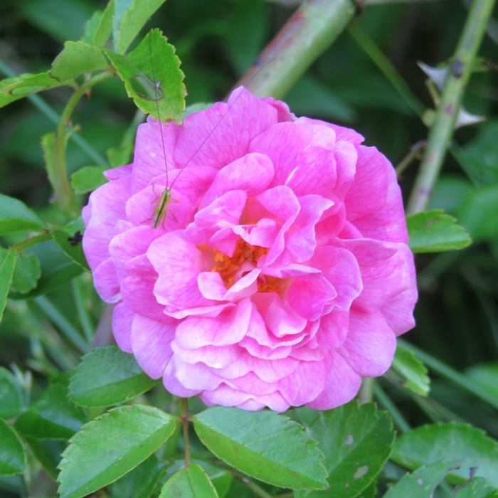
I saw lots of mystery snails on the shore. These are invasive, from Asia. 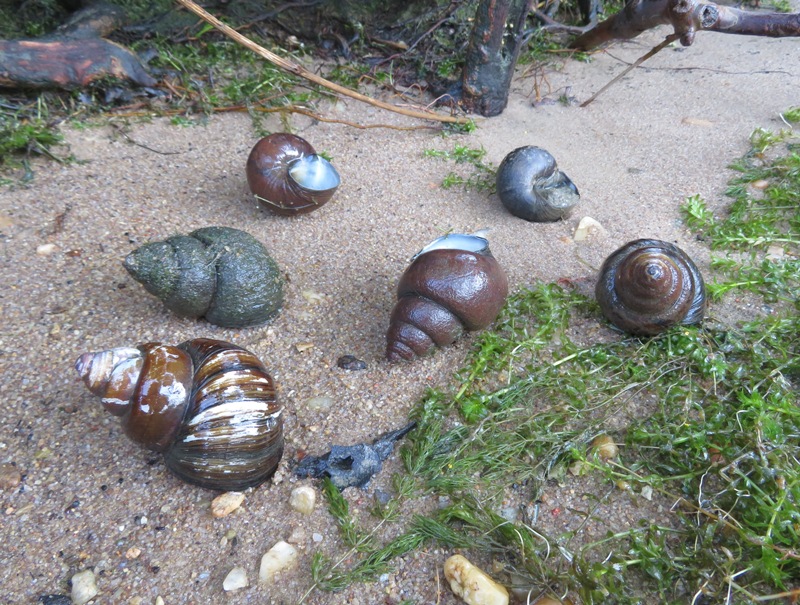
I also paddled past several black vultures, including one standing spread eagle. 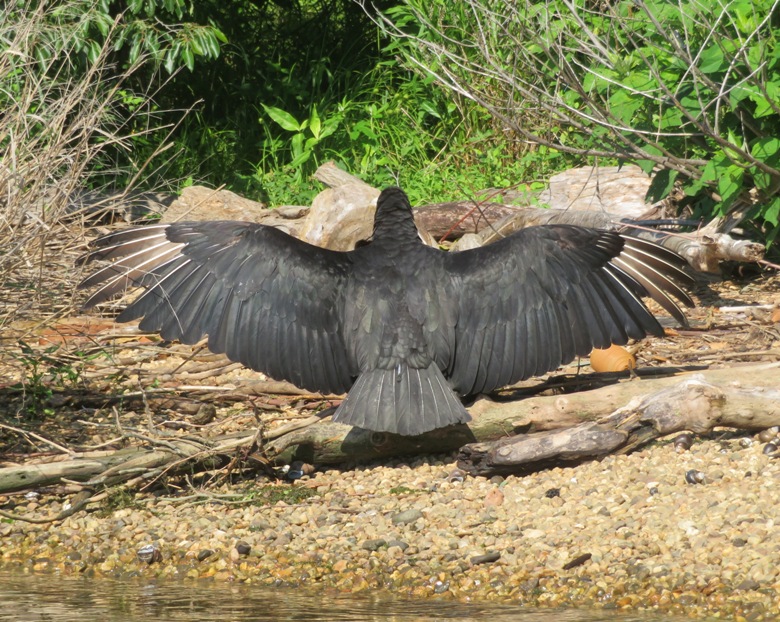
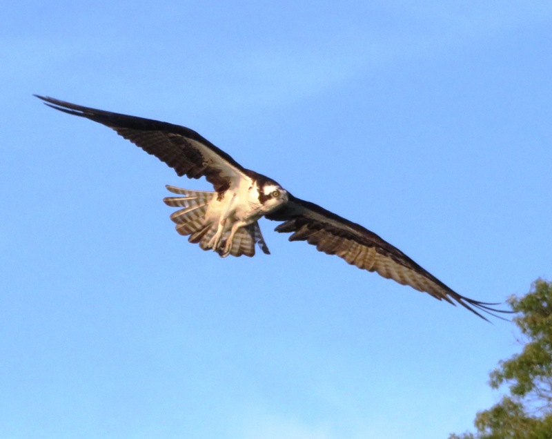
I made my way to Accotink Bay. By now the tide was lower. I really could have used more water. I don't recommend exploring this area unless the tide is high. I saw a few osprey, including this one with a fish. 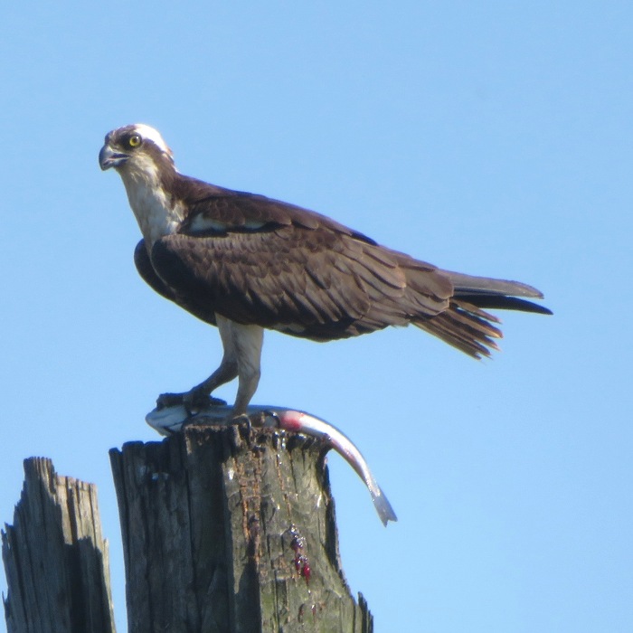
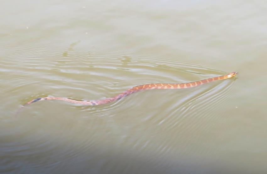
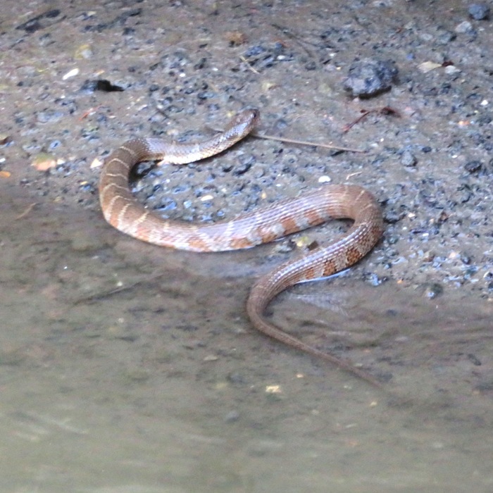
I landed at Fort Belvoir...I'm sure I wasn't supposed to but there were no signs telling me not to. They let military folks and their families borrow and launch boats there. I saw a couple of snakes swimming in the water. I saw more snakes that day than I'd ever seen before. I lost count but I estimate ten. Unfortunately, there was no diversity. I think they were all northern water snakes. This has been a great year for snakes. It was a truly fantastic trip and I know I will return...hopefully with others that appreciate nature as much as me. 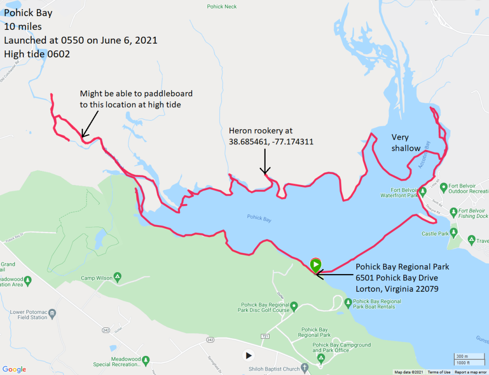
|
|
Norma, Daphne, and I shared a vacation house with Mark, Allison, Viviana, and April in Saint Mary's County. We got in a little bit of paddling each day during our visit.
|

|
Norma, Daphne, and I launched from Truxton Park in Annapolis and then paddled on Spa Creek to the City Dock to see the tall ships that arrived for the Independence Day Weekend Celebration.
We were up pretty early and on the water at the right time to get some good photographs. Paddling downstream, we saw two very impressive tall ships. In this blog's cover photo, you can see the Providence on the left, while on the right is the Pride of Baltimore II. Below is Norma with the Providence. I had never seen this ship which is based out of Alexandria, Virginia. Hopefully someday I'll get to board it. 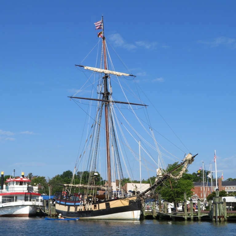
Norma got an up-close view of the Providence. This ship is a 100-foot, full scale replica of the Continental Navy's first warship. 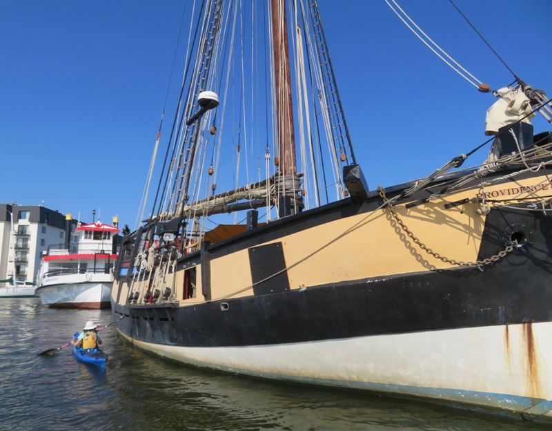
The next shot is the Pride of Baltimore II with a historic flag waving in the breeze. It wasn't in a good position in regards to lighting. I guess if I was really serious, I would have been on the water when they arrived. 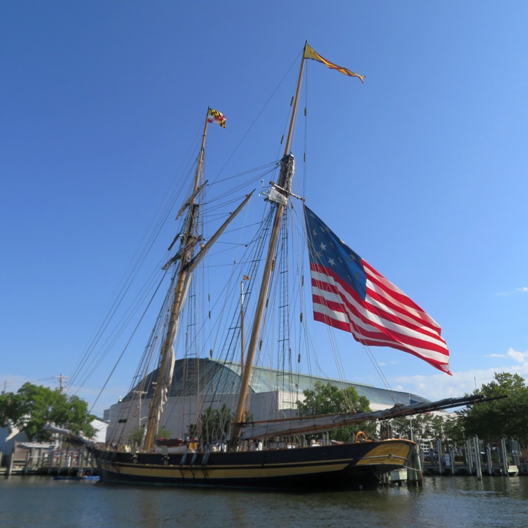
Daphne and I checked out the Pride of Baltimore II. This ship serves as a sailing memorial to the original Pride which sunk in 1986. Like the original Pride, the Pride II is not a replica of a specific vessel, and, although it represents a type of vessel known as a "Baltimore Clipper," it was built to contemporary standards for seaworthiness and comfort but like its predecessor, is a topsail schooner. - from Wikipedia - Pride of Baltimore 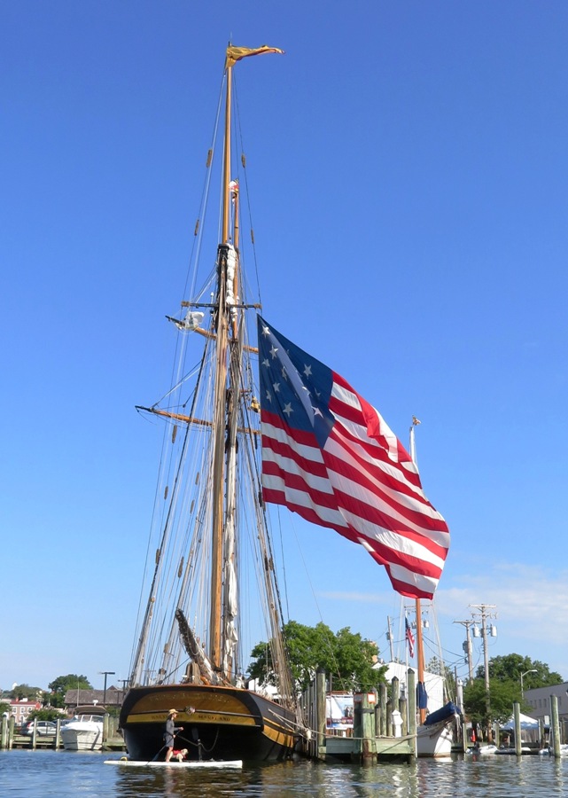
Paddling to the west side of Truxtun Park, we saw a young and curious fox. 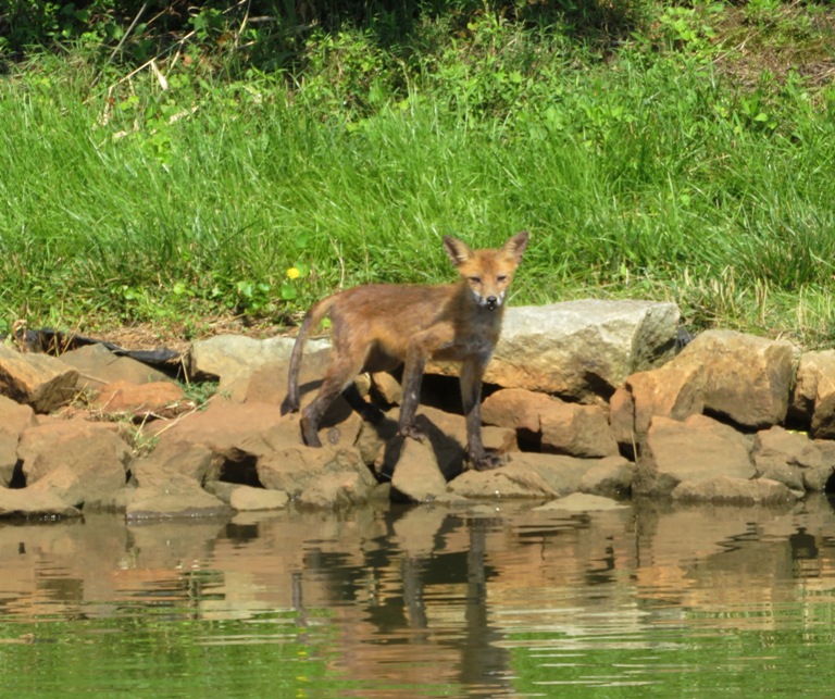
After paddling, I took Daphne for a walk on the trails in Truxtun Park where we found this marker for Lookout Point. The trails there are short but nice. 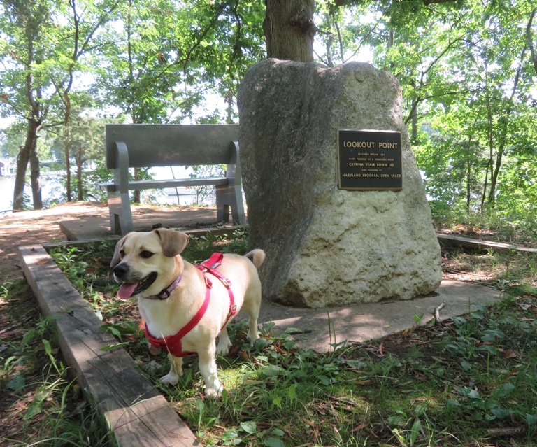
From July 1 to 4, I was on the water every day with Norma and Daphne. Sounds like a great way to start the month. |
|
On July 9, 2021, my 25th article was published with the Chesapeake Conservancy, Paddleboarding through Nature around Washington, D.C. Even though I wrote it about paddleboarding, I think it will appeal to anyone that likes scenic, natural paddling trips and wildlife. Folks with recreational kayaks and those that don't have watercraft but are interested in renting them should also check this out.
|
|
On July 22, 2021, my 26th article was published with the Chesapeake Conservancy, Exploring Kiptopeke's Concrete Fleet. It is about kayaking at Kiptopeke State Park on the eastern shore of Virginia. Give it a read and you'll learn about ships made of concrete and maybe pick up a new word like "pharyngeal."
|
|
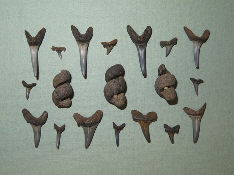
Norma, Daphne, Sara and Don, Norma's niece, Mia, and I went paddling to look for fossils at a secret location that I call the Alpha Site. We were mainly looking for shark teeth.
We launched from Breezy Point Marina. Norma and I used Sara and Don's canoe while they used my tandem kayak. I'm not much of a canoe fan but if you're carrying two dogs and a kid, then it is hard to beat a canoe. They are the pickup trucks of human-propelled watercraft. Sara took this shot and the cover photo.
Here we are heading out to our destination, which is only accessible to the public via water. Note that the personal floatation device (PFD) that Norma's niece is wearing has Mia's name on it. 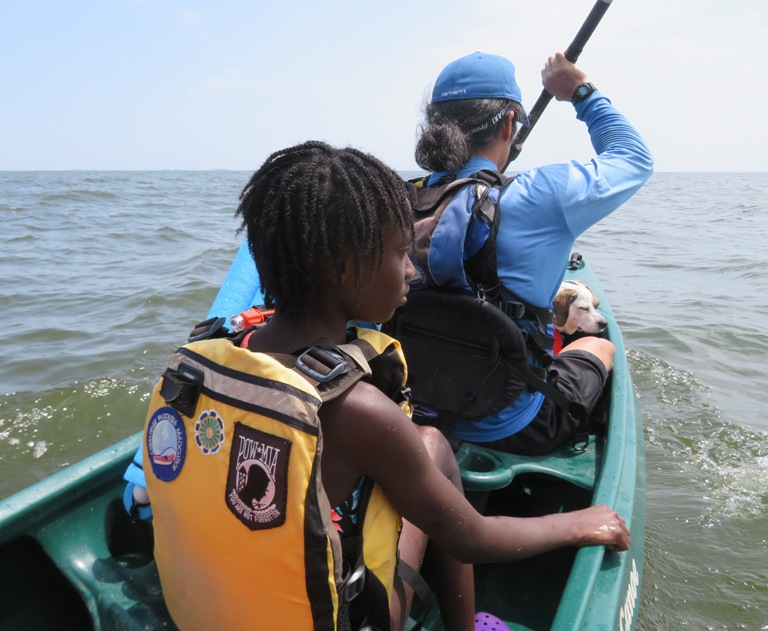
Us humans spent about 2.5 hours looking for teeth while the dogs chased each other. It was a very fast 2.5 hours. We could have easily stayed longer but I wanted to be off the water before the wind picked up. It's always a little competitive when it comes to looking for shark teeth and I put together some contests: I think we should also have a fourth category for most interesting non-shark tooth fossil. Norma found a nice mix of teeth, ray dental palates, rocks, turritella, and shells. She would have found a lot more but she was busy helping her niece look for things because she is a good aunt. 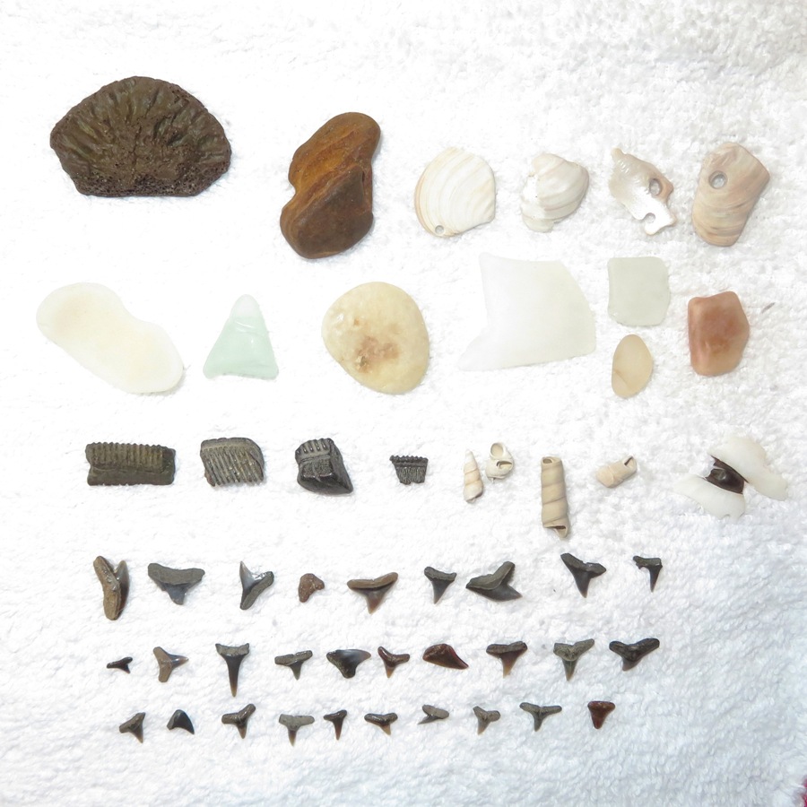
This is Norma's most interesting fossil, a dolphin or whale epiphysis (cookie). In my opinion, this was the most interesting non-shark tooth fossil find of the day. Sara agreed. Epiphysis are soft cartilaginous ends on a bone. As the animal ages, the cartilage epiphysis ossify into bone and fuse onto the bone ends. If the animal dies while still a juvenile, the epiphysis are not yet fused and often fall off the bone and can be found as isolated fossils. Epiphysis from vertebrae are thin, round, and look like a cookie, hence the nickname. Vertebral centrum epiphysis disks from juvenile cetacea vertebrae are usually 1/2 - 3 inches across, but due to their thinness, are often found broken [like this one]. - from Fossil Guy - Cookies 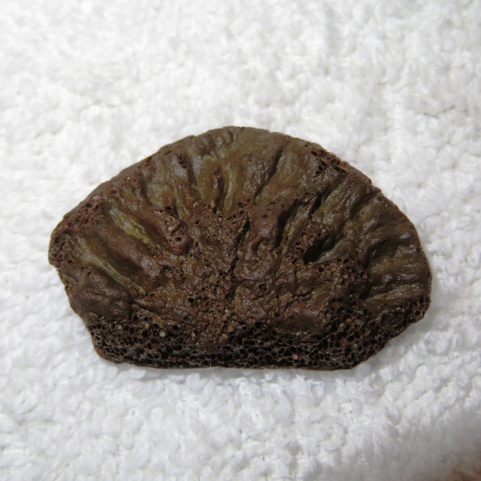
Here is what Norma's niece found, with some help from the grown-ups. 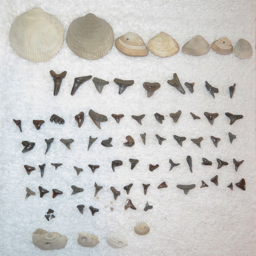
This was Norma's niece's most interesting shark tooth. It is from a cow shark, also known as a seven gill shark. In my opinion, it was the most interesting shark tooth find of the day. Cow sharks are considered the most primitive of all the sharks, as their skeletons resemble those of ancient extinct forms, with few modern adaptations. - from Wikipedia - Cow Shark 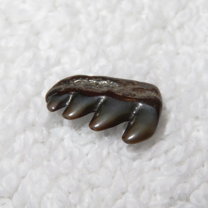
I found 122 shark teeth! I won for finding the most shark teeth. Sara might have beat me but she is much more concerned with finding intersting teeth than a lot so there are quite a few that she doesn't pick up. 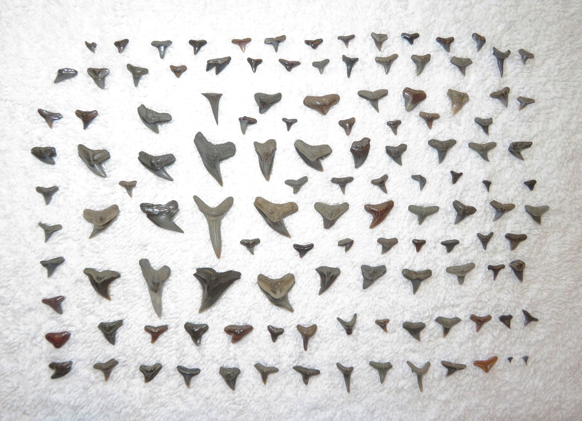
These are my non-shark teeth finds. The long, dark thing on the bottom left is petrified wood. The five things to the right of the petrified wood are pieces of ray dental palate. The shell has a hole in it created by a moon snail. Norma and her niece found similar shells with moon snail holes in them. The species of the family Naticidae [which includes moon snails] are carnivorous animals that prey upon other mollusks. They seek out another shell and, using a peculiar tooth ribbon that is common to almost all snails, drill a small round hole through it and suck out the juices of the animal inside. These holes, usually about one-eighth inch in diameter, are often seen in the shells of bivalves and gastropods in the Maryland Miocene [23.03 to 5.333 million years ago] fauna and are mute reminders of the unpleasant death suffered by the animal that formed the shell. - from Fossils and Other Living Things - Just Making a Living in the Miocene - Defense of the Moon Snail 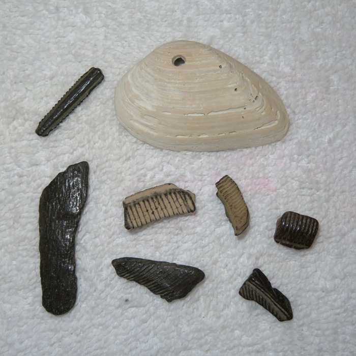
I found what I believe is a fossilized ray tail spine. 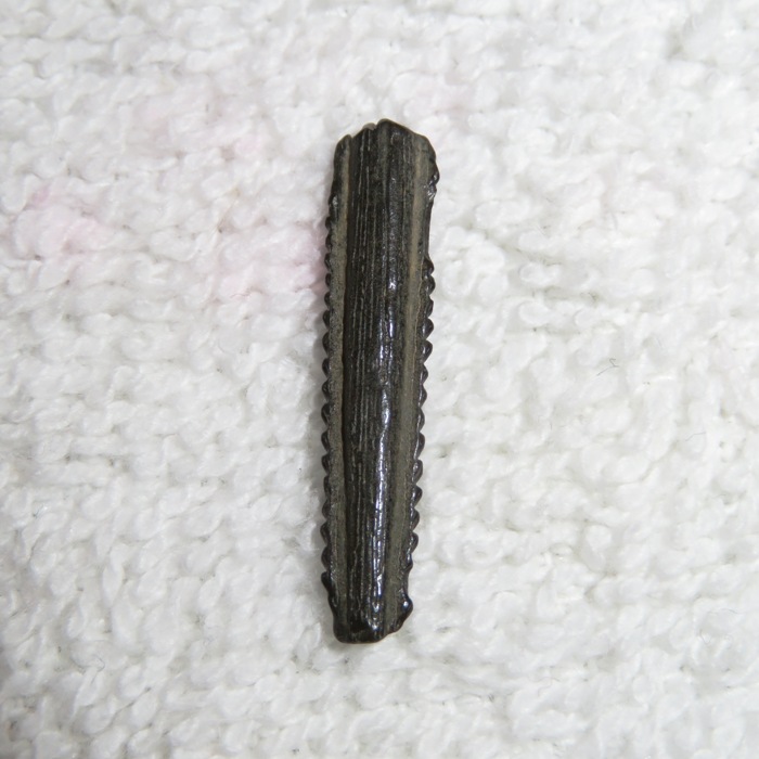
This is the smallest shark tooth that I found...a mere three millimeters. There was no category in the contest for this. 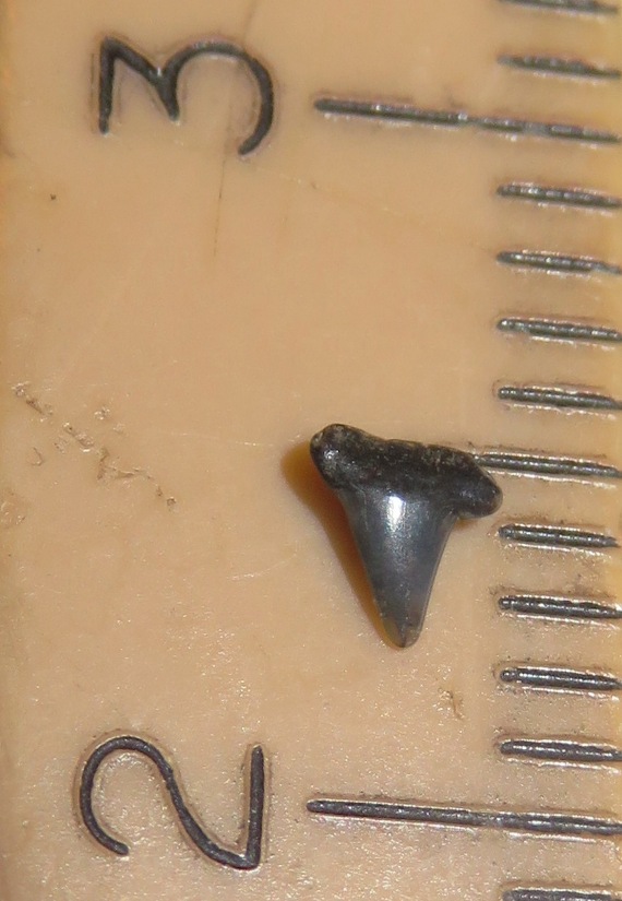
Here are my favorite shark teeth that I found today. These include teeth from snaggletooth sharks, a cow shark, a sand shark, a mako shark, and tiger sharks. For more information, see Fossil Guy - Calvert Cliff Shark Tooth Identification. 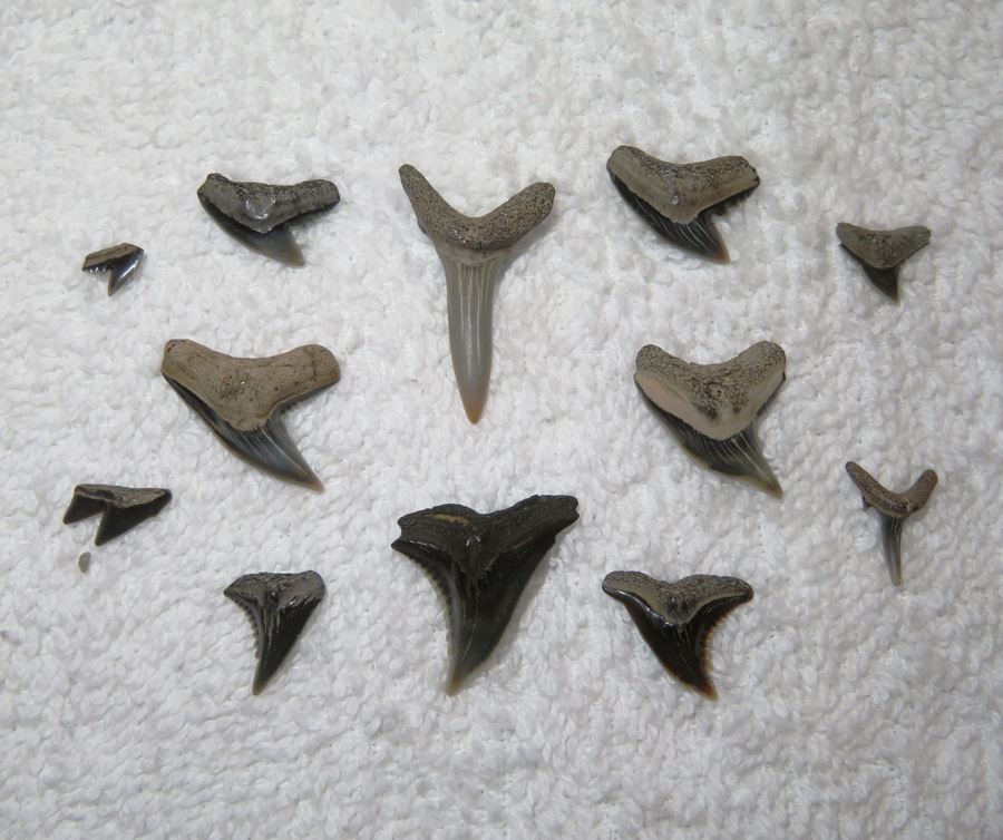
This is the largest tooth I found...28 millimeters. It is from a mako shark. Nobody else had any teeth as large. 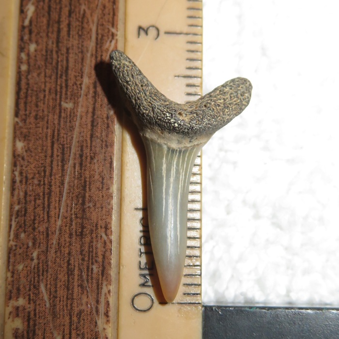
This is my best shark tooth find of the day. It is from a snaggletooth shark. Not as interesting as the cow shark tooth but I still like it. Their scientific name is Hemipristis. Hemi is Greek for "half" and pristis is Greek for "saw." The name "Half Saw" refers to their odd and jagged teeth. - from Fossil Guy - Hemipristis serra tooth morphology 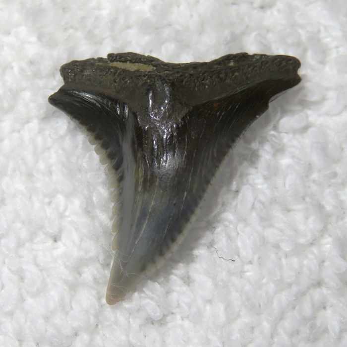
Sara and I teamed up using the big floating sifter I made. She has a nice spade shovel that worked really good. Afterward paddling, we went out to eat at Mod Pizza in Dunkirk. They have outdoor seating and it was totally on the way. I expect we will return. I like finding shark teeth. But I also like being able to instill my love of fossil hunting in others, especially young people. |
|
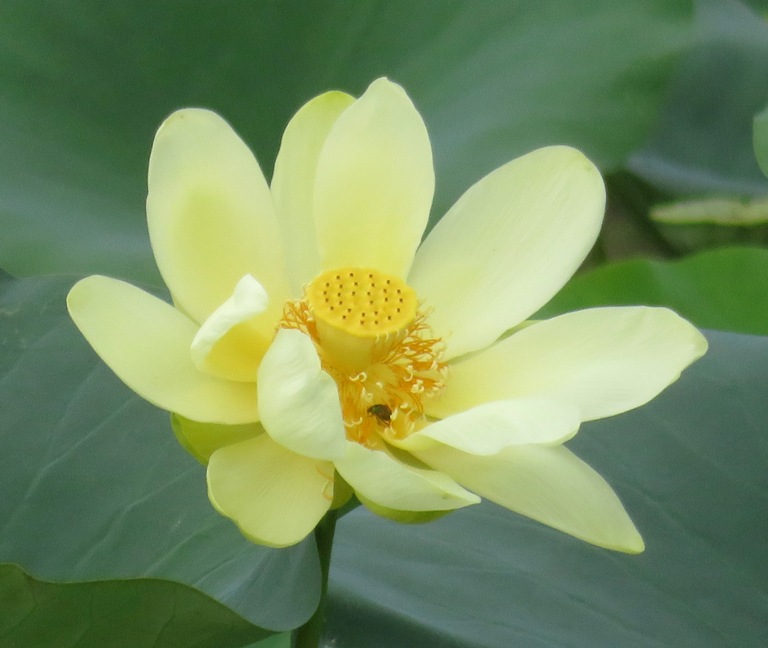
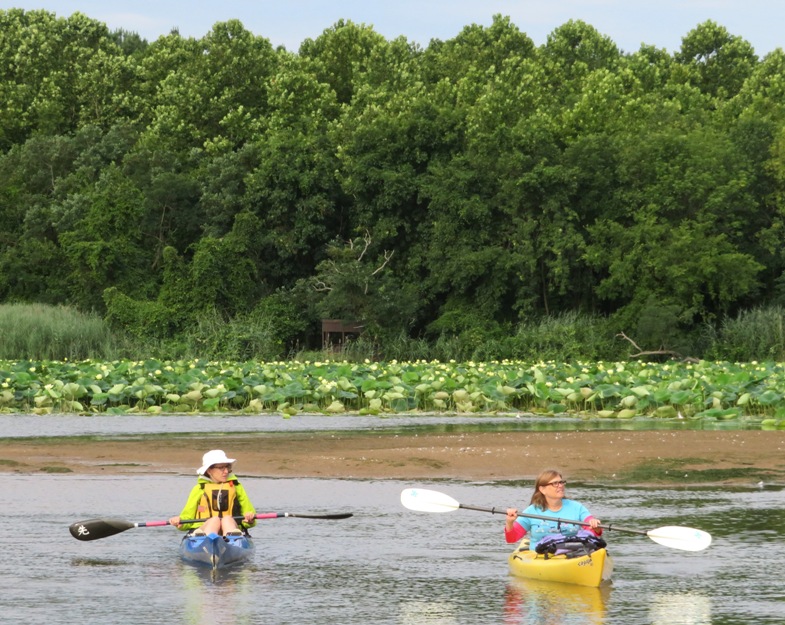
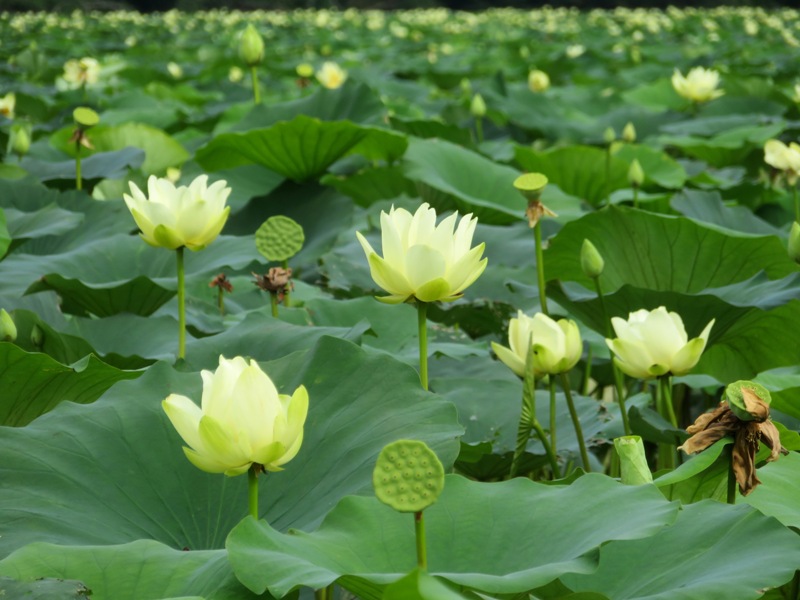
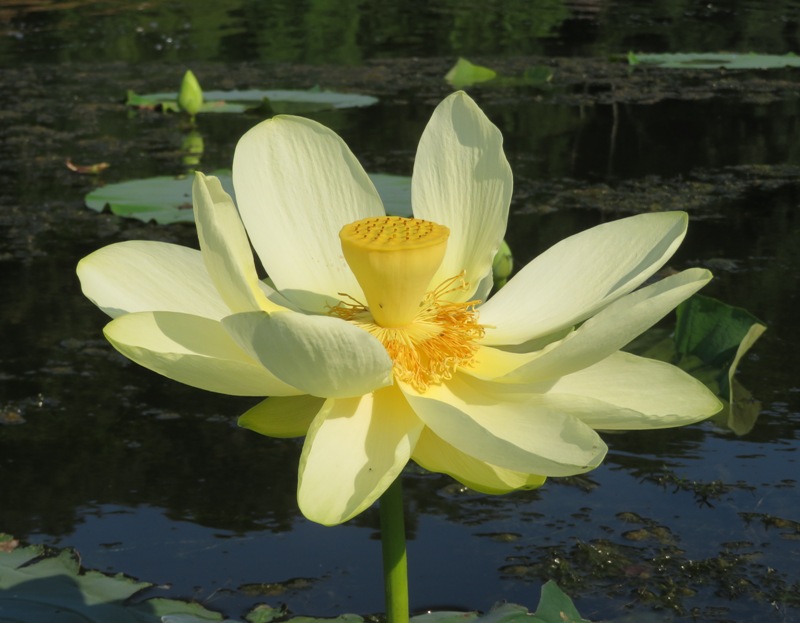
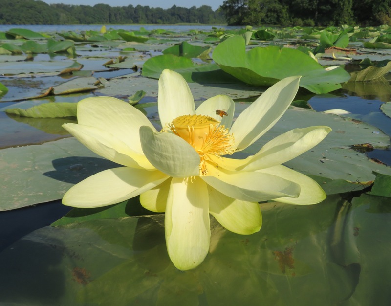
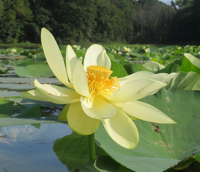
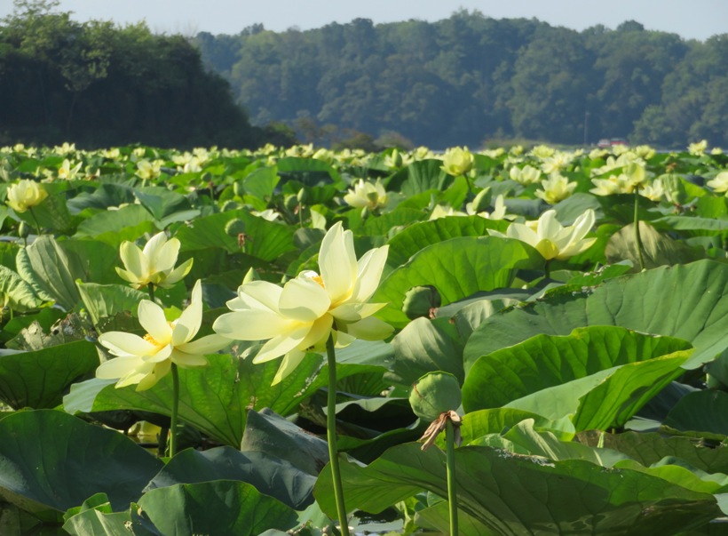
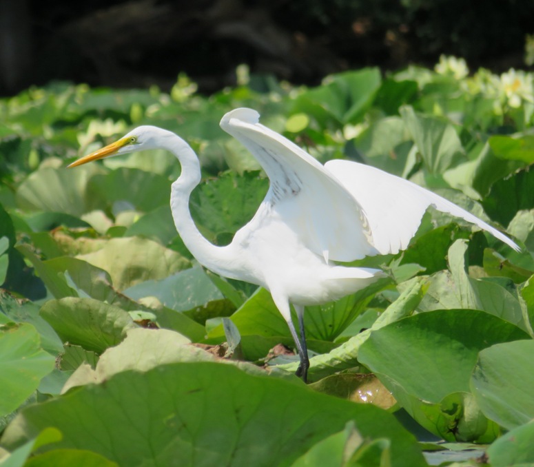
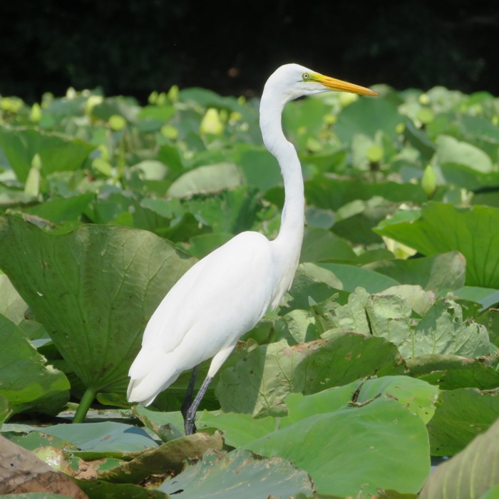
Norma, Daphne, Stacy, and I launched from Turners Creek Park to see the American lotus flowers on tributaries of the Sassafras River. These are wild flowers living in their natural environment, not a garden.
We launched at 0730. The morning was overcast. I think we were a little too early. The flowers were only partially open. Our first stop was a place I call the lotus lagoon, though Google Maps refers to it as Ponds Bar. Here's Norma and Stacy in the lagoon. It was quite cool for a July morning. Norma got to try out her new Jack Wolfskin raincoat. 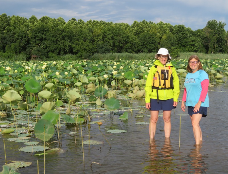
This is a view from the lagoon. It is best to go when the tide is high but if it isn't, you can simply wade through the water. The bottom is sandy, not muddy. 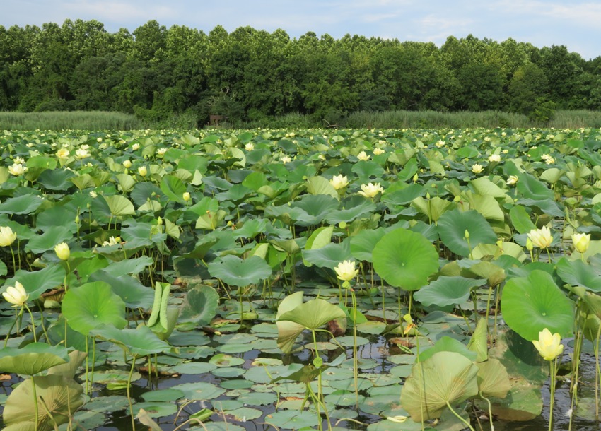
1 / 6
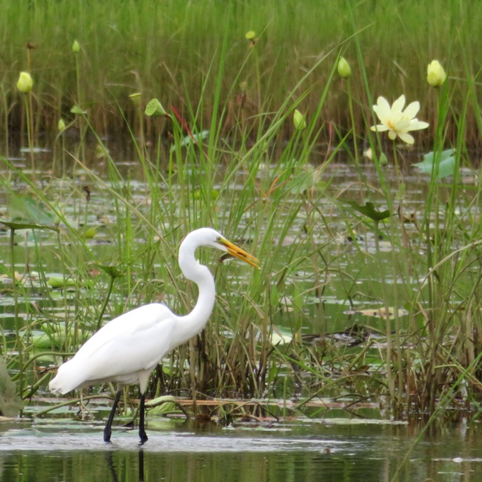
Great egret with fish in mouth.
2 / 6
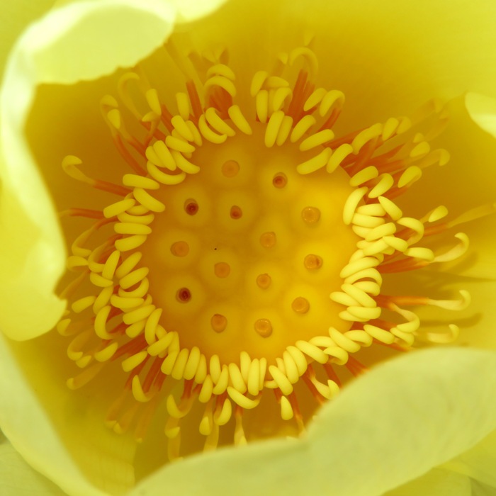
Looking inside a lotus flower.
3 / 6
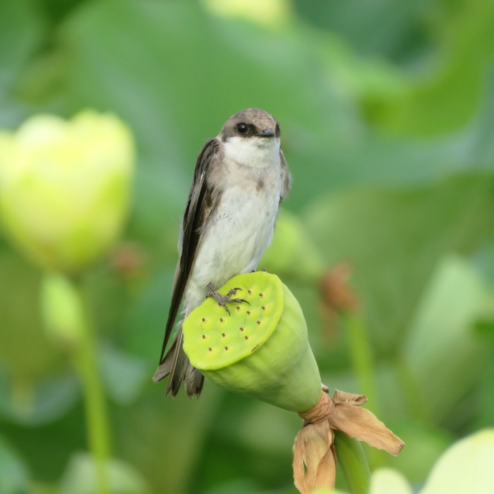
A tree swallow bird.
4 / 6
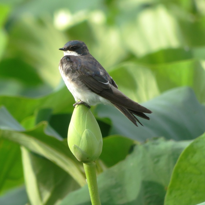
Another tree swallow.
5 / 6
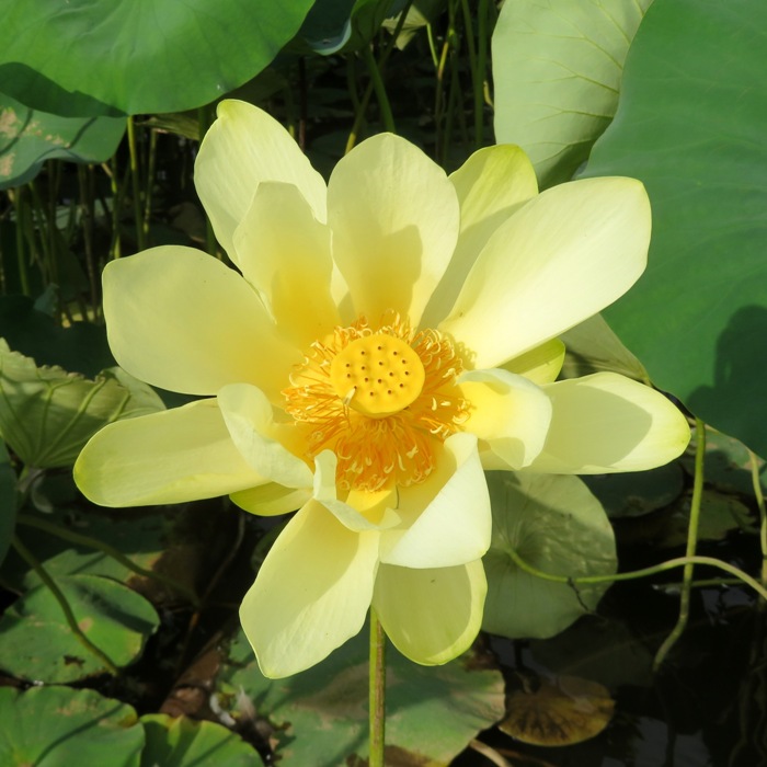
Lotus flower catching the morning sun.
6 / 6
Norma and Stacy kayaking.
We paddled across the Sassafras River and then around Ordinary Point into Money Creek. 1 / 4
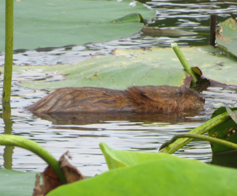
Muskrat.
2 / 4
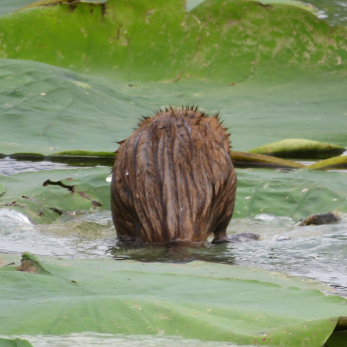
Muskrat on buoyant lotus leaves.
3 / 4
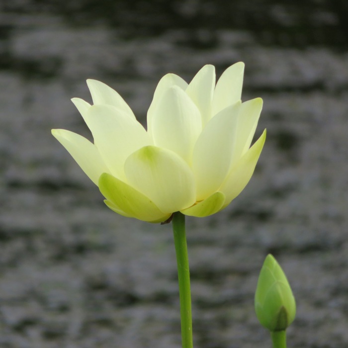
Profile of a lotus flower.
4 / 4
Lotus flowers on Money Creek.
Next, we paddled back across the river and explored a section of Turners Creek. 1 / 4
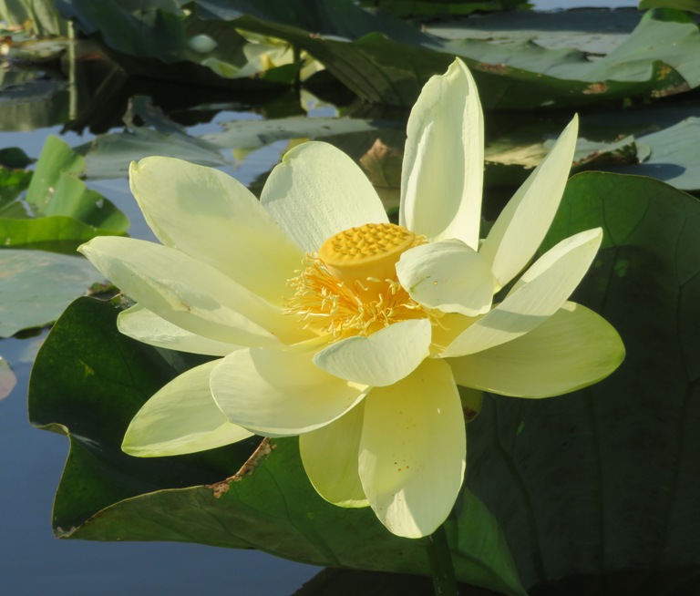
Around 1000, the flowers were opening up.
2 / 4
Stamen grasping obconical receptacle.
3 / 4
Norma looking happy.
4 / 4
Norma and Stacy on Turners Creek.
By the time we finished (1030), the launch site was full of boaters getting on the water. This place is very popular at this time of year. After paddling, we visited the farmers market in Chestertown. This is still my favorite farmers market outside of Sacramento and it is the best place I've found to buy dog treats. Then we ate lunch at Play It Again Sam. Stacy left and then Norma, Daphne, and I took a nap at Wilmer Park before heading home. It was a good day. |
|
I launched from Millard E. Tydings Memorial Park to see the American lotus flowers on tributaries of the Swan Creek. Daphne wasn't with me on this one because Norma's niece, Alisha, was visiting and they kept Daphne with them. So instead of taking my SUP, which is best for taking Daphne, I brought my Prijon Catalina.
I was up at 0500. It was Friday and I took the day off from work to go play. It took a little longer than it should have to get to my destination because I thought I told my phone to take me to Millard E. Tydings Memorial Park and instead it took me to the bridge. By the time I realized the mistake, I was crossing over the Susquehanna River. So I had to pay toll when I didn't need to. At the launch site, there are signs that say you have to pay $10 to use the ramp. But my notes from last year say that cartop boats don't need to pay. This is confusing because there are no signs to support this. I found someone (maybe the owner), asked, and confirmed that this is still the case. I was on the water at 0730. It was a perfect day. Sunny, clear, and almost no wind. There was quite a bit of submerged aquatic vegetation (SAV) but if you stick to the channel, then it isn't much of a problem. But if you have a fin or non-retractable rudder, then you're bound to pick up something. Paddling south, I saw a curious red fox. Seems like I've been seeing a lot of them this year. 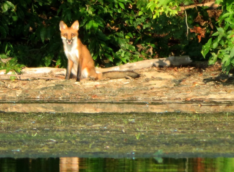
I was kayaking against the tide because I wanted to see the lotuses when the tide was high. I figured that would allow me to get closer to them and not have to worry as much about SAV. I saw an osage orange tree with lots of fruit. I spotted quite a few bald eagles, including one that was particularly gracious in posing for me. 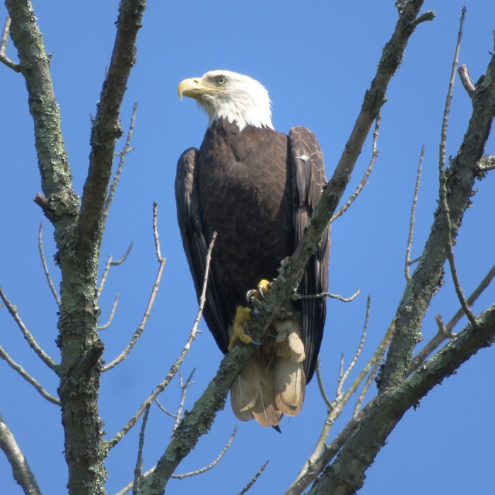
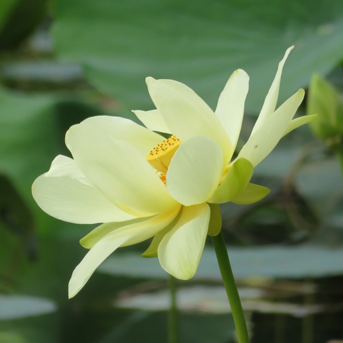
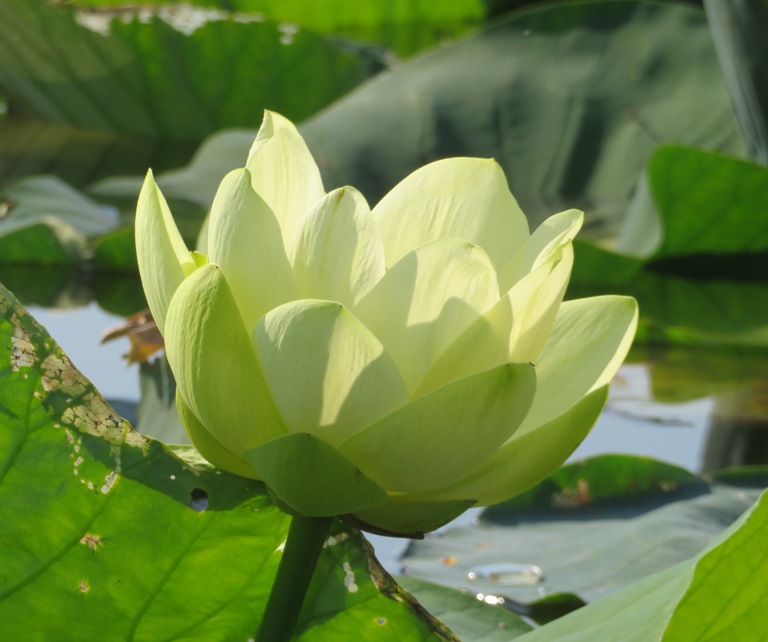
As I rounded Swan Creek Point, I saw my first destination. It was a huge American lotus grove, just northwest of the point. I don't know if they are really called "grove" but I can't find the proper term so that's what I'm calling it. I hung out here for quite awhile, taking pictures. The best place to get close to the flowers is at the west end because there are fewer leaves between the open area and the flowers. These lotuses look very similar to the ones I saw on the Sassafras on July 31, 2021 except that I think the leaves on these are bigger. I can't say one has prettier flowers than the other but I can defintely say that the ones on the Sassafras are much easier to get to. 1 / 6
Notice pollen on bee's legs.
2 / 6
Perfect morning sun.
3 / 6
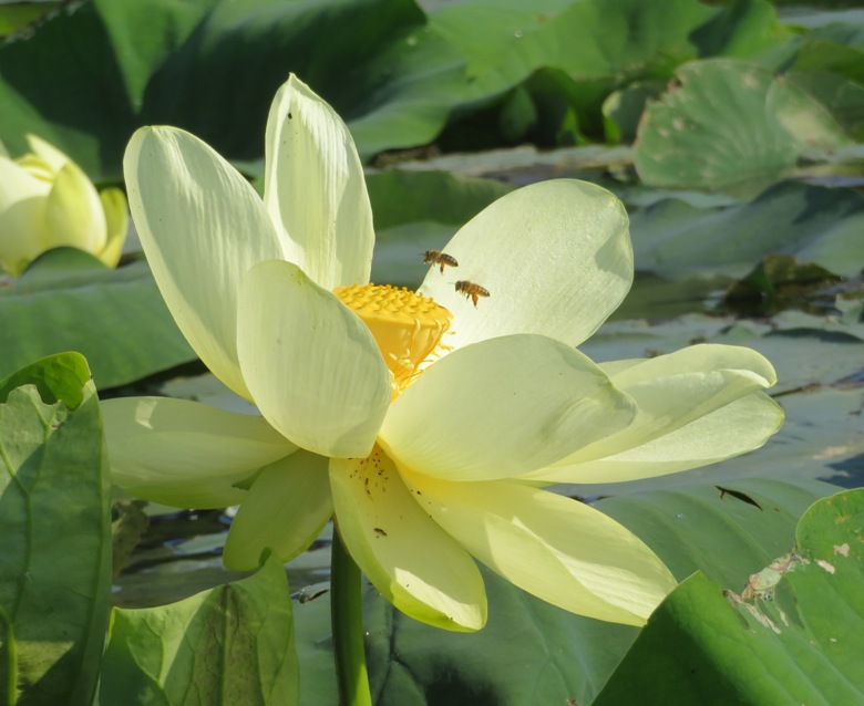
Two bees pollinating flower.
4 / 6
Profile shot.
5 / 6
Couldn't have picked a better day.
6 / 6
Covering several acres.
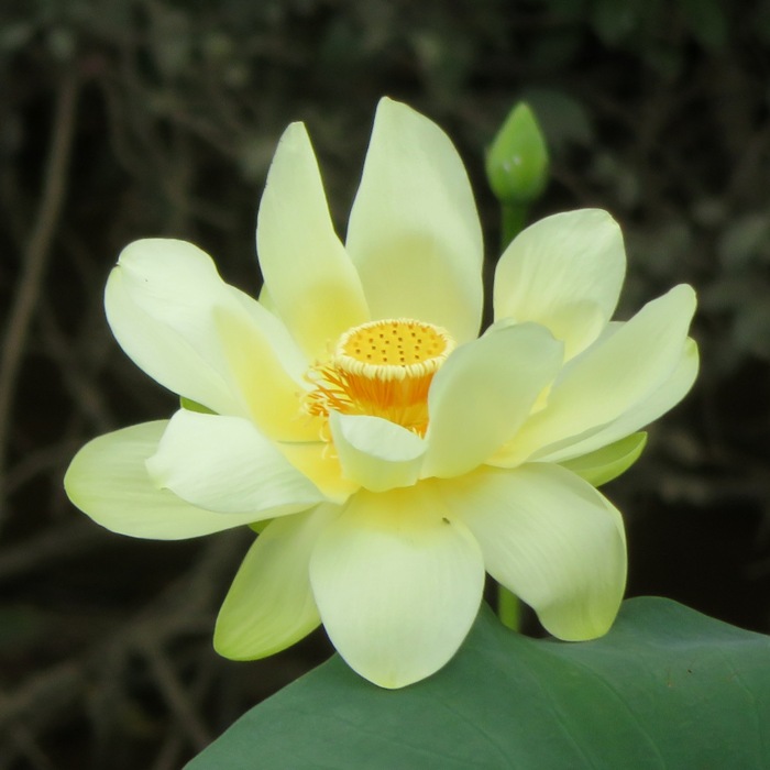
High tide was 0900. Lots of flowers were open up widely so I could easily see their obconical receptacle. That is the cone-shaped showerhead part that is clearly shown in the cover photo of this blog. The last time I was on Swan Creek was August 8, 2020. Back then, Norma, Daphne, and I explored the east side of the creek. Today, I wanted to check out the rest. So I continued paddling west, heading upstream. As things got narrower, I started to see a LOT of great egrets. I can't remember the last time I've seen so many. Further upstream, I saw lots of wild rice. 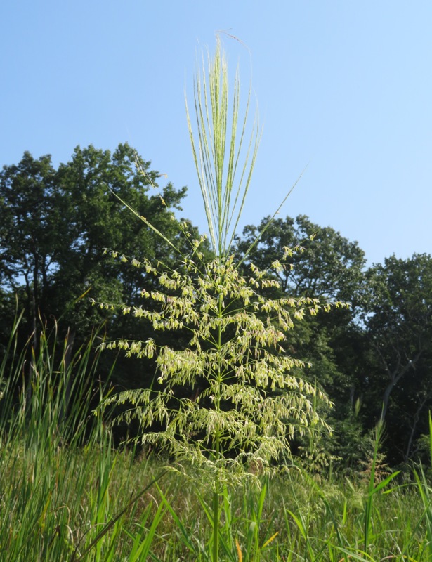
Continuing upstream, the water was cool and the area had lots of beautiful natural scenery. I saw a lot of paw paw trees bearing fruit. It was big but still hard. It will take about another month before they get ripe. 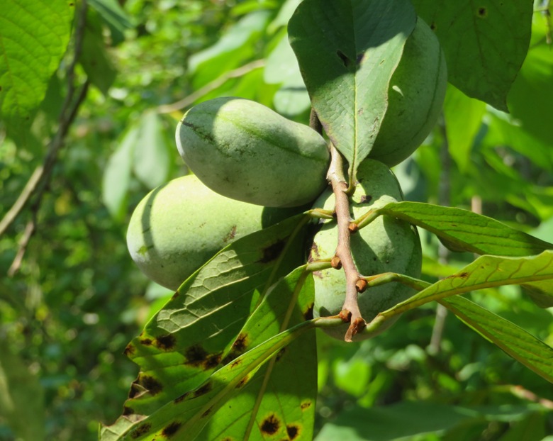
The water stayed deep. I only turned around because things got too narrow or because I would have had to portage. Depth was never a concern. It is probably a good thing that Daphne was not with me. She might not have liked this trip because people were blowing stuff up at Aberdeen Proving Ground. The sound was distant but she is very sensitive to such sounds. Coming back downstream on the south side, I found two more lotus groves. There were lots of great egrets looking for food. I saw three spotted lanternflies. Two were downstream on the creek and one was just north of the mouth. Not good. Once I got home, I reported them to the Department of Agriculture. It is a shame they are so invasive. They really are beautiful, especially when they spread their wings. One jumped off my hand like a flea. Then it flew but it couldn't travel far and was trapped in the water again. All three are no more. 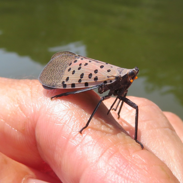
The final stretch of paddling from Aberdeen to the launch site went quickly because I had a nice tailwind. I worked on using the waves to my advantage. I tried to keep the bow of my boat pointed downward so that my kayak was constantly falling forward...or so it felt. It was like mini-surfing. I could tell it really helped my speed. I ended up paddling 16.2 miles. I was out for 5.5 hours and ended up taking 443 pictures. Some people think I'm a good photographer but I think I always say that if you take enough pictures, some are bound to come out good. But these were some of my favorite of the year. 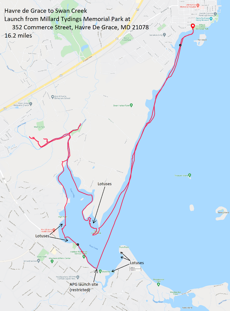
This launch site is normally really busy but on a Friday (or probably any non-holiday weekday), it is really chill. |
|
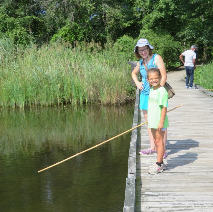
Norma and I took her niece, Alisha, and Daphne to Marshy Point Nature Center for their Fishing the Dock event. This was a great opportunity for Alisha to do some bamboo pole fishing from their pier.
1 / 3
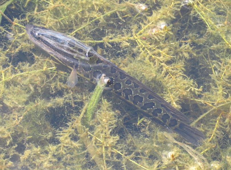
First living snakehead fish I'd seen.
2 / 3
Alisha getting nibbles.
2 / 3
Exuviae on the pier piles.
Next, we drove across Dundee Creek to Dundee Creek Marina. I brought my SUP and Norma's Cobra Expedition kayak. We were thinking we could convince Alisha to be on the SUP with me but she insisted on being with Norma so instead we rented a tandem from the outfitter. It was significantly shorter than my tandem and probably easier for Norma to handle with Alisa. There was a lot of submerged aquatic vegetation (SAV) in the creek that made paddling slow and cumbersome. I believe most of the stuff shown here is wild celery. 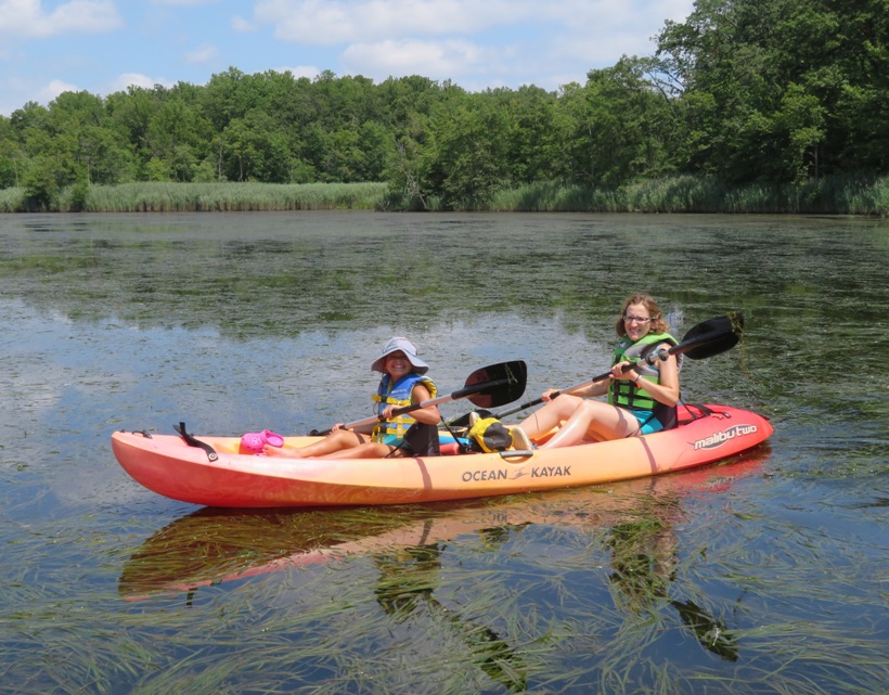
We saw a great egret and great blue heron looking for fish. 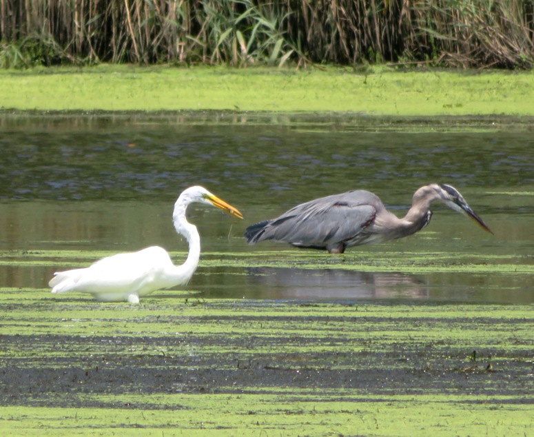
We paddled back to Marshy Point and then under their pedestrian bridge. That was our turnaround point. Some folks walking on the bridge were very impressed with how calm Daphne behaved on the SUP. On most of the return trip, I sped things up by towing the kayak with my SUP, shortly after taking this picture. This is one of my favorite shots of the year. 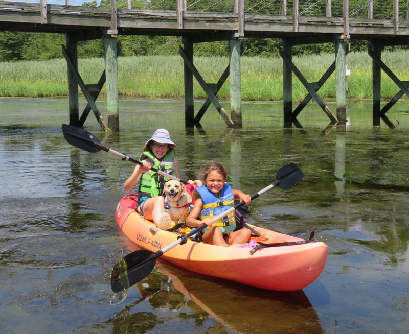
The drive home was not so great as Alisha was complaining and chattering imcomprehensibly. But then she had a nap and had a reboot. We took her back to her parents and joined them for a cookout at Pinecliff Park where I saw a four foot long snake in the water. The Monocacy River was extremely low, yet quite a few people managed to kayak in it. |
|
I'm adding Talbot to the list of Maryland Counties where I have found shark teeth. The others are Calvert, Saint Mary's, Anne Arundel, and Charles.
I started out the day with a little reconnaissance. I had read about a launch site on the east side of the Dover Bridge, which crosses the Choptank River. On the northeast side, I found a parking area, a small paved road that is now closed off to traffic, and an old bridge, but no way to get to the water. Next, I drove to Kingston Landing and then paddled 4.6 miles downstream to an area I had read about called Boston Cliff. If you have an old Talbot County ADC map, you'll find it at map 21 B1. I timed my arrival for the low tide, which was around 1634. Paddling this area near low tide is not that great. It is hard to get near the shore so I frequently had to stay further out, in deeper water. The river is wide so it has that "big water" feel. This was my first time in the Boston Cliff area. I wasn't too sure about who owned the land but I read the following: The mean high tide line separates areas of the shore, which are intermittently covered and uncovered by the flow of the tide, from the dry sandy beach. It is that line, under Maryland law, which separates the land that is held by the state in trust for the benefit of the public from land that can be owned by individuals. (See, Md. Code Ann., Envir. 16.101(o).) - from Eastern Water Law Eastern Water Law - Maryland High Court Affirms Property Owners' Right to Exclude the Public from Privately Owned Beach Land I landed at an area near high voltage power lines. I can't imagine any land owner would complain about me exploring there so it seemed like a good spot. Here, I found a cliff full of old shell remnants...a very good indicator for the presence of fossils. 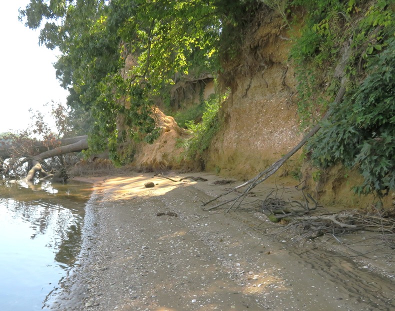
So what did I find? The most unique thing (that I haven't found elsewhere) was barnacles. According to Chesapeake Bay Program - Barnacles, Chesapeake barnacles are up to 1 inch in diameter. The largest I found near Boston Cliff was 1.5 inches in diameter. So it was likely a fossil. 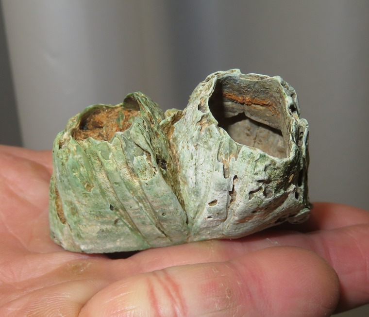
Later, I was told from a mediocre source that they are most likely 10-15 million years old. 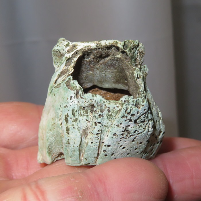
I found this ecphora. It is the Maryland state fossil. This is only maybe the third I have found. 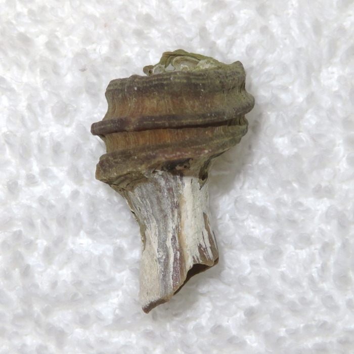
I found two pieces of ray dental palate. The one shown here is the better. They typically look like a file but this one is more comb-like. I haven't seen many having as much detail as this. 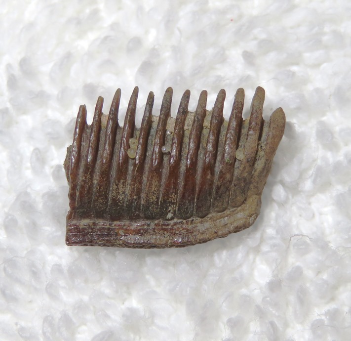
This was the only shark tooth I found that day. Notice the serrations. It is only one centimeter wide. 
I saw a few turritella but not many. Scallop shells were most common, including some that were six inches wide. Most were broken. The one here on the left below is just under 4.5 inches wide. Modern Chesapeake Bay scallops only get up to three inches wide. 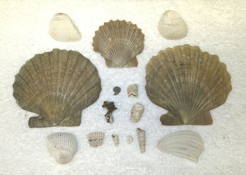
Fossils weren't the only things I saw. I spotted this Autumn Meadowhawk (Sympetrum vicinum). 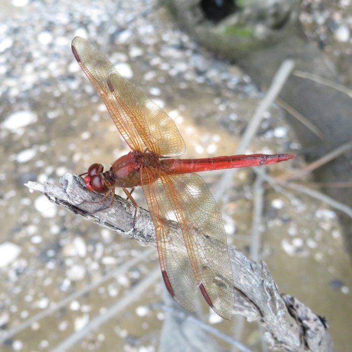
I don't always like to tell folks the location of paddle-to fossil sites because I worry that these sites will be overrun with fossil hunters. But this took some work to get there. It is at least a 9.2 round mile trip so I figure that if someone is willing to paddle that far, then they deserve to find a few fossils. 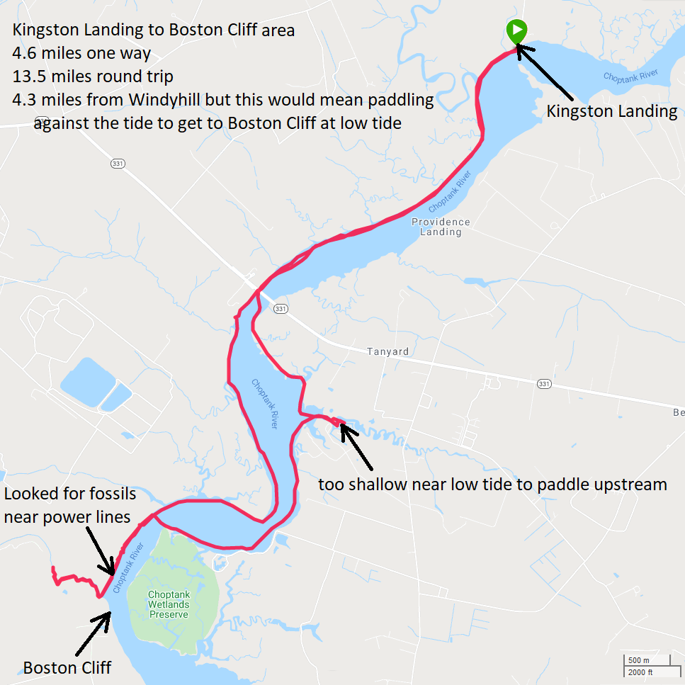
For more information about Boston Cliff, see |
|
Norma, Daphne, and I did a guided trip up Parkers Creek with the American Chestnut Land Trust (ACLT). I did this trip once before on September 28, 2019 so I could write Parkers Creek - the Chesapeake Bay in Miniature. But today, I was just out for fun.
There is no launch site open to the public anywhere near Parkers Creek. Participating in this trip gave us access to Warriors Rest Sanctuary where we launched on a beach just south of the mouth of the creek on the Chesapeake Bay. Be sure to keep an eye out for shark teeth on the beach. They are quite common in this area. If you don't have a boat, they will be happy to provide you with one. You can sign up at ACLT's Guided Canoe Trips. About 18 of us were led by three master naturalists up the creek. Connie, on the far right of this blog's cover photo, led the trip with help from Sandy and Tim. In this picture, she is telling us about Parkers Creek and the ACLT. I expect I will become a master naturalist once I retire and have more time to take the training and complete the mandatory volunteer hours. We saw quite a few cool things, including Apios Americana. This native vining plant produces a tuber which is Described as like a potato with a nuttier flavor, they’re said to be quite tasty! - from Epic Gardening - Apios Americana 1 / 4
Apios Americana
2 / 4
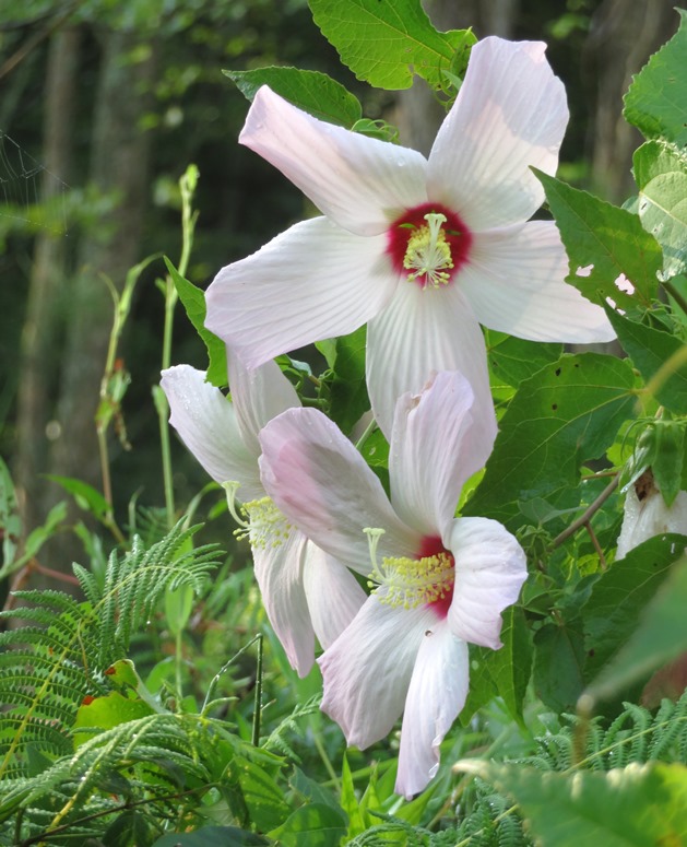
Swamp hibiscuses
3 / 4
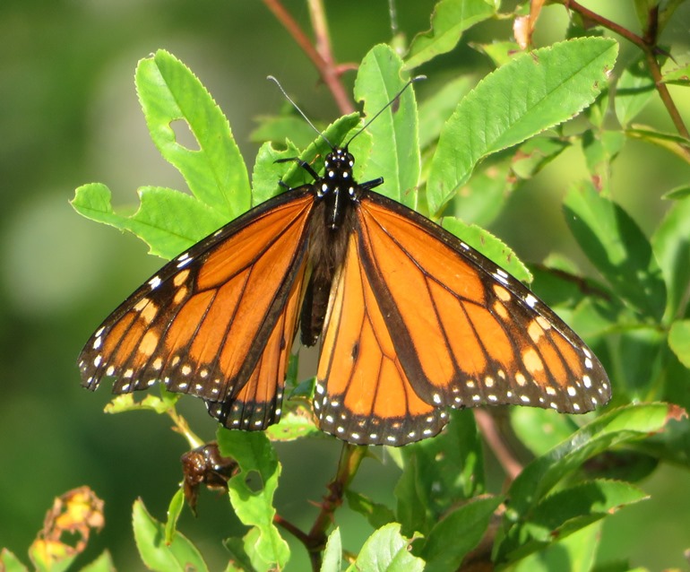
Male monarch butterfly
4 / 4
Tooth from extinct tiger shark
We also saw saltmarsh mallow flowers. The entire trip was five miles. We helped put away boats, thanked our trip leaders, and then commenced to explore the south trails of the ACLT. The trails are sandy, shaded, and well-drained. It is a good place to hike on a hot summer day. Regarding the last photo above, although the jack-in-the-pulpit fruit looks tasty, do NOT eat it. The plant's leaves, berries, and corms contain calcium oxalate, which is a chemical compound that takes the form of tiny crystalline structures. Getting this on your bare skin can cause irritation, and ingesting the plant raw can be dangerous, sometimes resulting in choking or blisters. - from New England Today - Are Jack-in-the-Pulpits Poisonous? It was a great day to be out but getting up at zero-dark-thirty for a not-so-local early launch left me feeling less than 100%. Should have got to bed earlier the night before. We stopped for lunch at Mod Pizza at 10084 Dunkirk Way Unit 303, Dunkirk, MD 20754. They have outdoor seating so Daphne is welcome. They are also on the way home (for us) from pretty much anything in Calvert County. Their food is good too! |
|
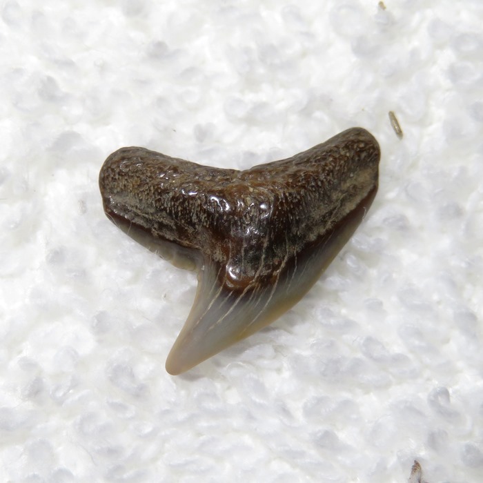
I paddled from Mallows Bay to Nanjemoy Wildlife Management Area (formerly known as Purse State Park to gather information so I could write Foraging and Fossiling in Nanjemoy Wildlife Management Area. On this trip, I found 150 shark teeth in 1.75 hours!
Here is my route and notes. 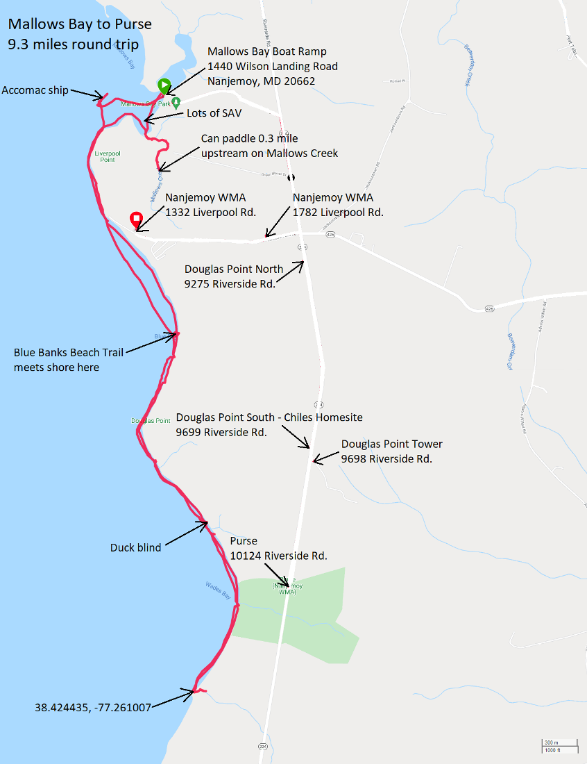
Check out the blog for my previous fossil hunting trip there on August 7, 2021. |
|
My 27th article, titled Paddleboarding through Nature in the Baltimore Area, got published by the Chesapeake Conservancy on August 19, 2021. This should appeal to paddleboarders and kayakers interested in short, scenic trips within 20 miles of the heart of Baltimore City. Special thanks to my guest photographer, Sara.
|
|
Daphne and I launched my SUP from Franklin Point State Park. We saw a tricolored heron...the first I'd ever seen. Unfortunately, it didn't stick around long enough for me to get a photo. Next, we paddled upstream as far as we could on Flag Pond, getting upstream about a mile. It was near high tide but still quite shallow. We saw a lot of snowy egrets.
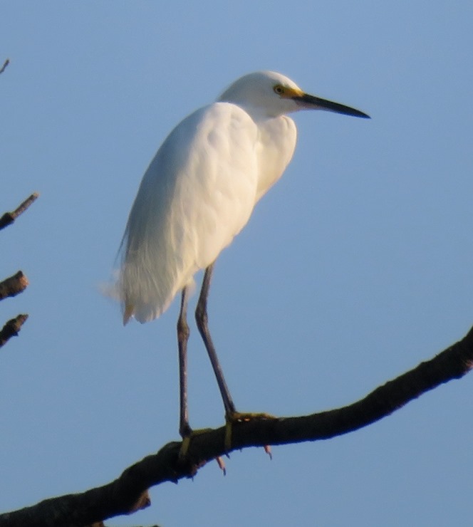
Here's another snowy egret. 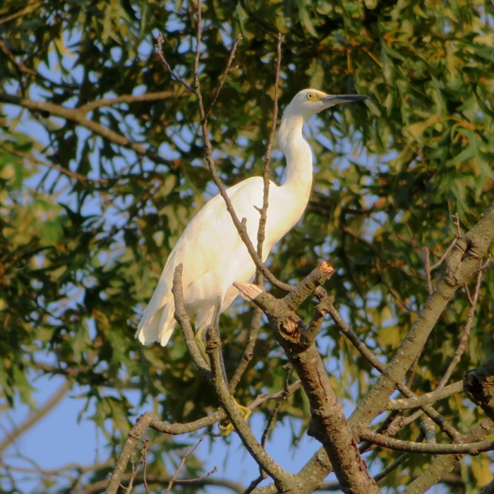
I paddled around a few islands on Flag Pond. The rest of the time we spent out in the Chesapeake Bay. In the bay, the water was warm and full of jellyfish. We got in 7.6 miles. We stayed out a little past sunset, which is after the park closes. But nobody mans the place so I didn't think it was a big deal. As I drove away, a local flagged me down and said that a park ranger came by to lock up the gate and she told him there was still a paddler out on the water. He supposedly left and said he would return later. Good thing I didn't get ticketed. Here's my route. 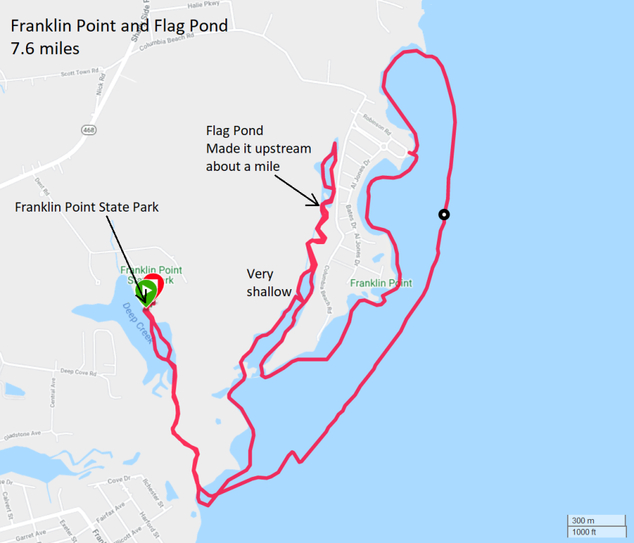
|
|
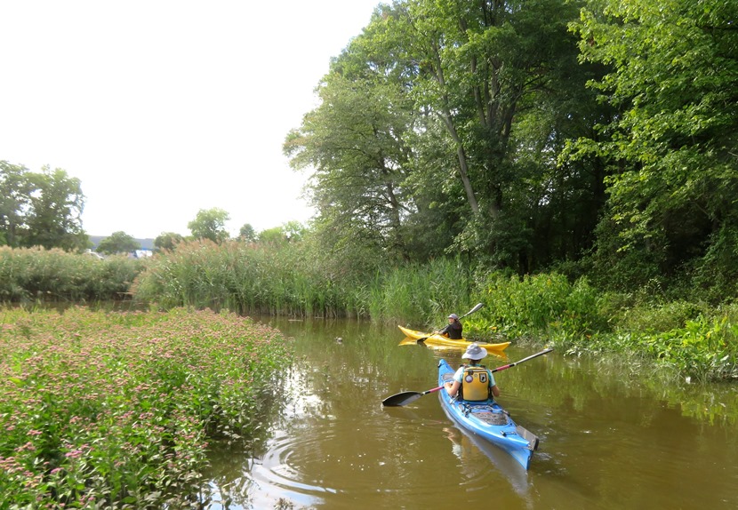
Norma, Sara, Daphne, and I launched from Solleys Cove and then paddled up as far as we could (without portaging) on Back Creek and Furnace Creek. Some spots on Back Creek can get pretty shallow but with Hurricane Ida having dropped a lot of rain just two days ago and with us timing our trip with the high tide, the four of us got pretty far upstream in areas that normally would have been very difficult.
This was our first time putting in at the new Solleys Cove launch. We were very impressed with the new road, parking, ramp, porta-john, and beach. The place is now quite popular. I unloaded my SUP and found a dead bat under one of my bungees. I don't know how it got there. The last time I took it out was at Franklin Point State Park where I left a little after sunset. I'm guessing it got trapped and died on the drive home. Very sad. 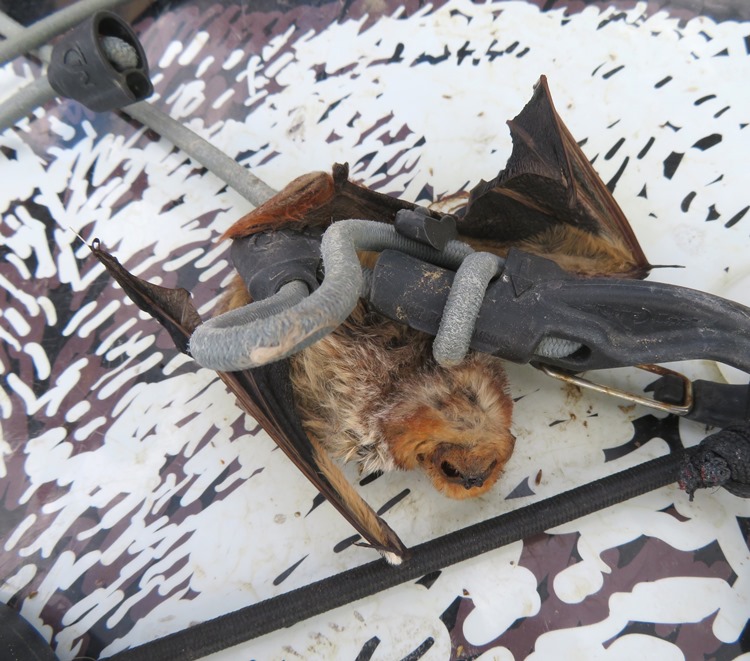
We made our way out to Back Creek, a very scenic and fairly natural creek. It is shown in this blog's cover photo. We also found a persimmon tree loaded with a lot of fruit. Unfortunately, it won't be ripe until after I've put away my watercraft for the season. 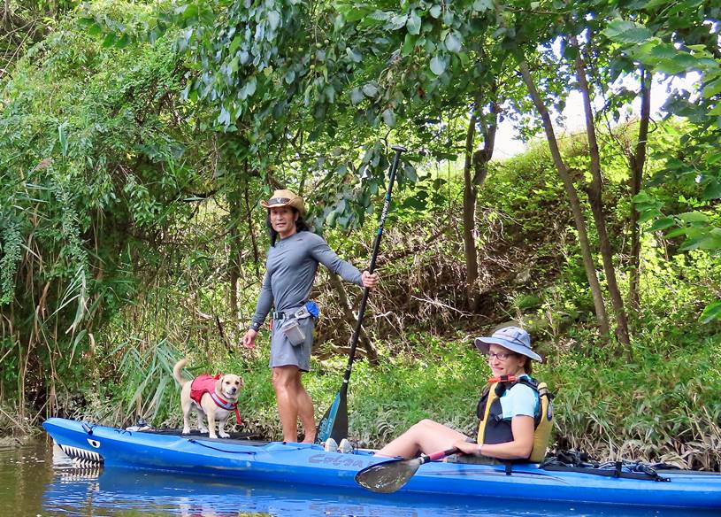
Norma is interested in native (or at least non-invasive) plants that grow well in wet areas. So when she saw lots of swamp hibiscus plants with seed, she figured she'd take a few to grow in our yard. We know it is a good environment for them since they already flourish there. Here is one getting ready to expose its seeds. 
And here is one with seeds exposed. 
We saw a few bald eagles. One might not expect to see them so close to Baltimore City but I've seen quite a few in the area over the last several years. They like to hang out on the high voltage towers. 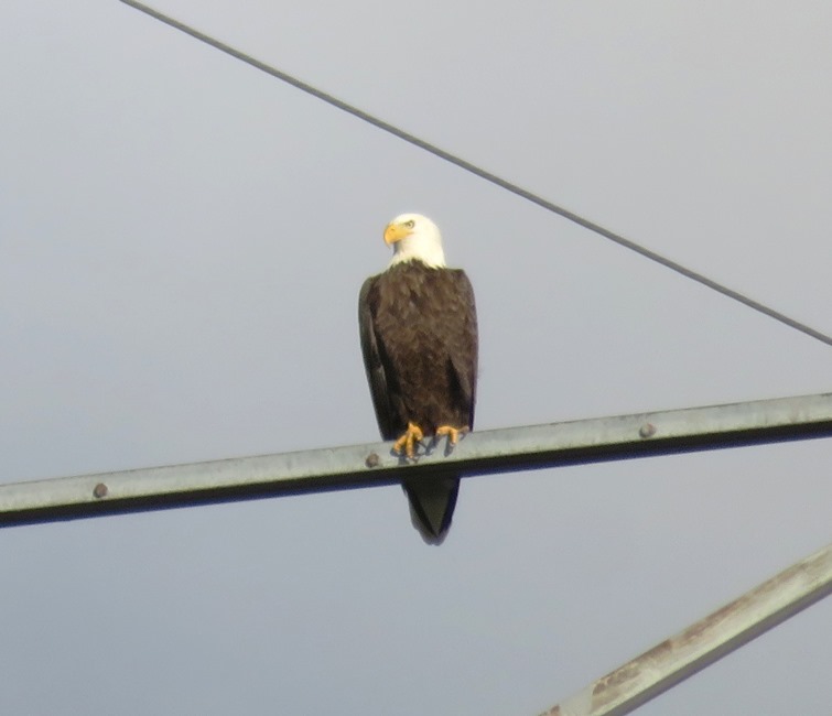
The four of us paddled as far as we could upstream (west) on Furnace Creek before heading back. Here's Sara kayaking under Arundel Expressway (route 10). 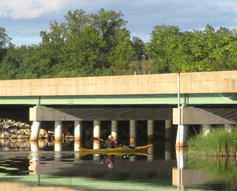
The north side of Furnace Creek is undeveloped, along with the western side of the south side. Sara took this picture of Norma, Daphne, and me on the latter. 
Heading home. 
The Rams Head is a local chain that used to have a restaurant in our town, Savage, Maryland. But they sold it about a year ago. As of late 2021, it has been replaced by the Dive Bar and Grille. They are pretty similar. Now if you want to find a Rams Head, you can simply paddle to the Rams Head Dockside on the south side of Furnace Creek. In the below photo, you can see it in the background. Just don't drink and paddle. 
Norma (the photographer) has Daphne's attention. 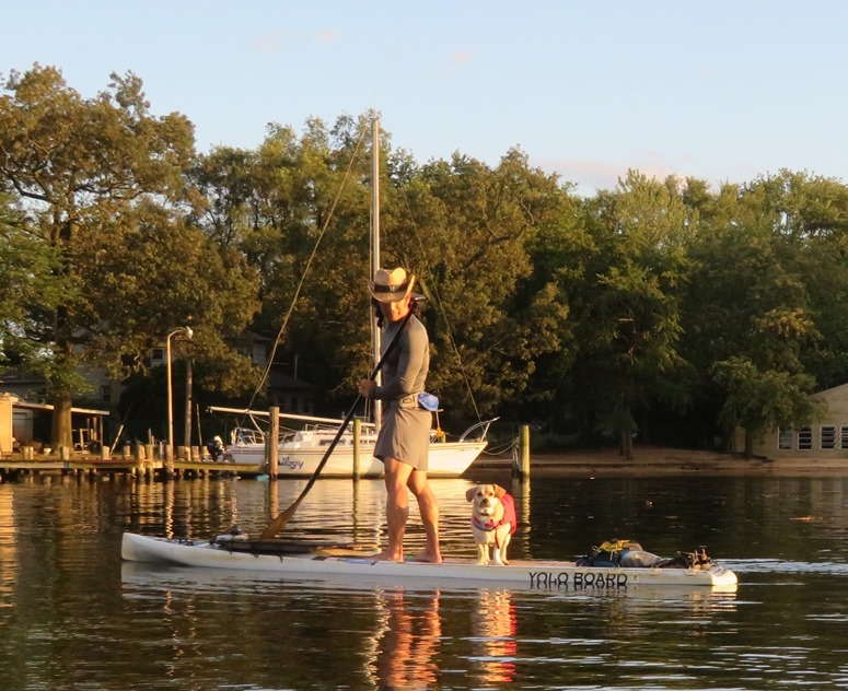
It was a great day to get out on the water with two of my favorite people. Here is our route. 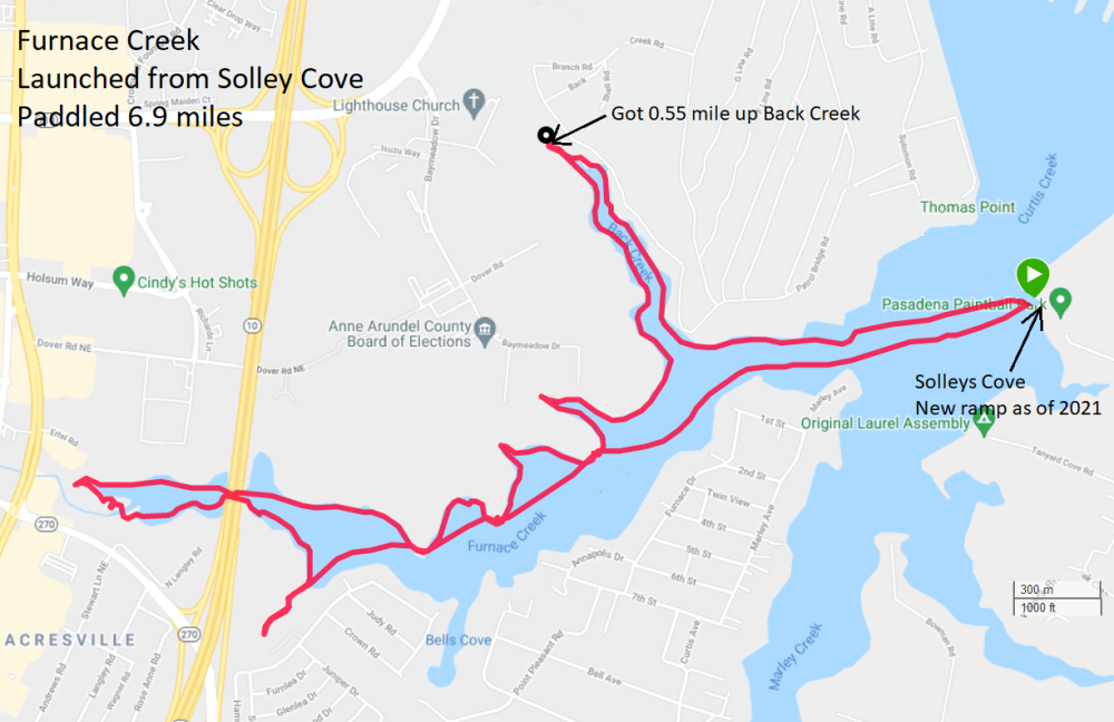
|
|
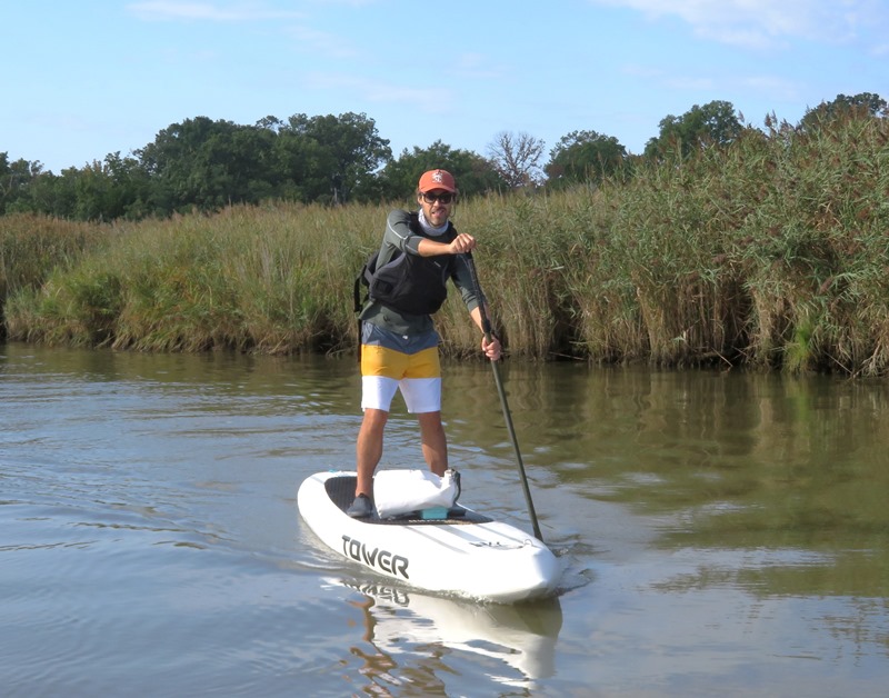
Ryan and I launched from Discovery Village and then paddleboarded to Franklin Point State Park and back. This was my first time paddleboarding with Ryan. He has a 14' Tower iSUP (inflatable standup paddleboard).
The original plan was to launch at Jack Creek Park. I got the lock combination from their website but wasn't able to open the lock. So I switched to plan B, which was Discovery Village. It's always good to have a plan B. That worked fine but it meant we started later and had to paddle further to reach our destination. We were exposed to more wind in the latter part of the morning than I would have liked. It got a little rough where the West River meets the Chesapeake Bay but we did fine. Got in 11.5 miles. Here's Ryan on the south side of the West River, heading towards the bay. 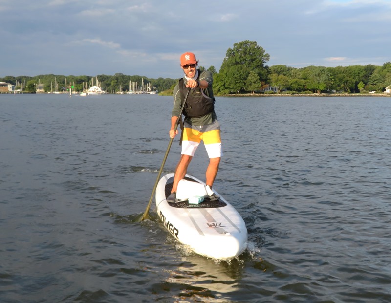
We reached our destination, Franklin Point State Park, pretty quickly. After taking a short break on a beach near the mouth of Deep Creek, we paddled up the creek. The cover photo of this blog shows Ryan on Deep Creek. There were several places in the park where we saw what looked like snot. Given that they were all caught in vegetation just a few inches above the waterline and we were there near low tide, I concluded they were unfortunate jellyfish. 
I saw this northern water snake on the shore in Deep Creek. 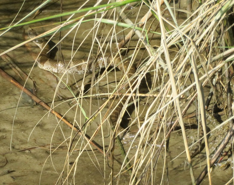
Here's our route. 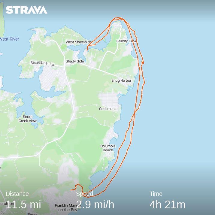
I was really hoping to see dolphin. I read about lots of sightings this year and despite spending quite a bit of time on or near the bay this year, I did not see any. |
|
I took Daphne paddleboarding on the Rhode River. We launched from Carrs Wharf and got in 10 miles. Now that the summer has ended, there isn't nearly as much wildlife to see, though occasionally I see something I don't expect...but not today.
We paddled by some of the islands. Due to erosion, landing on them (especially with a dog that likes to dig) is frowned upon. Here are our long shadows against Big Island. 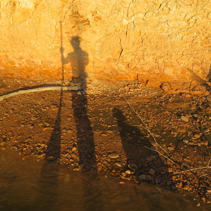
This is always a great place to paddle, partly because it is pretty sheltered from the wind and there are lots of natural areas. The place also has some interesting history. Rhode River Hundred is listed in records of some of the earliest settlements in the Province of Maryland. In 1651, Robert Harwood surveyed Harwood Plantation on the Rhode River. A deed was written by Thomas Harwood of Streatley, Berks County (Berkshire), England to his son Richard Harwood for Hookers Purchase at the head of Muddy Creek. The steamboat Emma Giles served the Rhode River between 1891 and 1932, making five trips per week. - from Wikipedia - Rhode River It was warm enough to stay out late and catch the sunset. Not too many days like this left in the year. 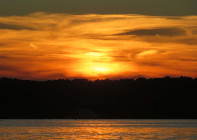
Here's our route. 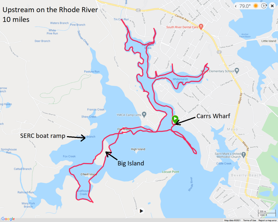
|
|
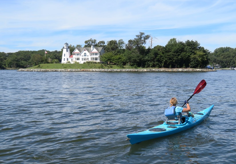
Daphne and I joined the WatersEdge Kayak Club for an 11.4 mile trip from Beachwood Park to Dobbins Island and then Little Island via the Magothy River.
The morning was as beautiful as could be. Bright sun, low wind, and a temperature that was perfect. I arrived a little early and took Daphne for a short run on the dirt trails in the park since I knew she would be standing in one place for a long time once we were underway. Paddling this part of the Magothy River can get a little confusing since so many sections look similar. That's why it is good to have something to orient yourself like the totem pole in this blog's cover photo which is located at 39.088417, -76.525056. Our fearless leader and organizer for this trip was John S., leading the way in the below photo. I've done other trips with him and they are always enjoyable and well planned. 
We saw a rough green snake about 0.2 mile from shore. They are very good swimmers. This is the first time I've seen one in Maryland. It was about four feet long. 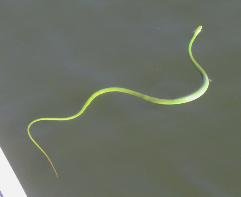
Our group approached our destination, Dobbins Island. Dobbins Island – which has also been known as Big Island, Raspberry Island and Dutch Ship Island throughout the years since the Chesapeake region was settled – has long been what local historian Marianne Taylor described as a "focal point for rendezvous" and "a center of social life" on the Magothy River. In her book "My River Speaks: The History and Lore of the Magothy River," the former English professor touches on how Dobbins Island was once used as a hunting camp by Algonquin and Piscataway tribes, and would have been passed by Dutch, Spanish and English trading ships. Its early nickname Dutch Ship Island comes from stories of a shipwreck nearby in the river. The island has been privately owned since 1769, when its first owner was William Gambrel, for whom the town of Gambrills was named. The property later passed to Annapolis attorney John Gibson, who owned Gibson Island, and was bought and sold several more times before George Dobbin bought it in the late 1800s. The Dobbins name stuck with the island ever since. - from Pasadena Voice - Dobbins Island: A Jewel Of The Magothy 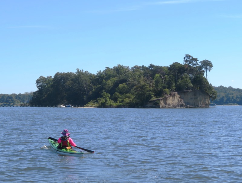
We pulled ashore at Dobbins Island to take a break and eat lunch. Had it been a few weeks earlier, this place would have been packed with power boaters congregating for social recreation but today, not so much. 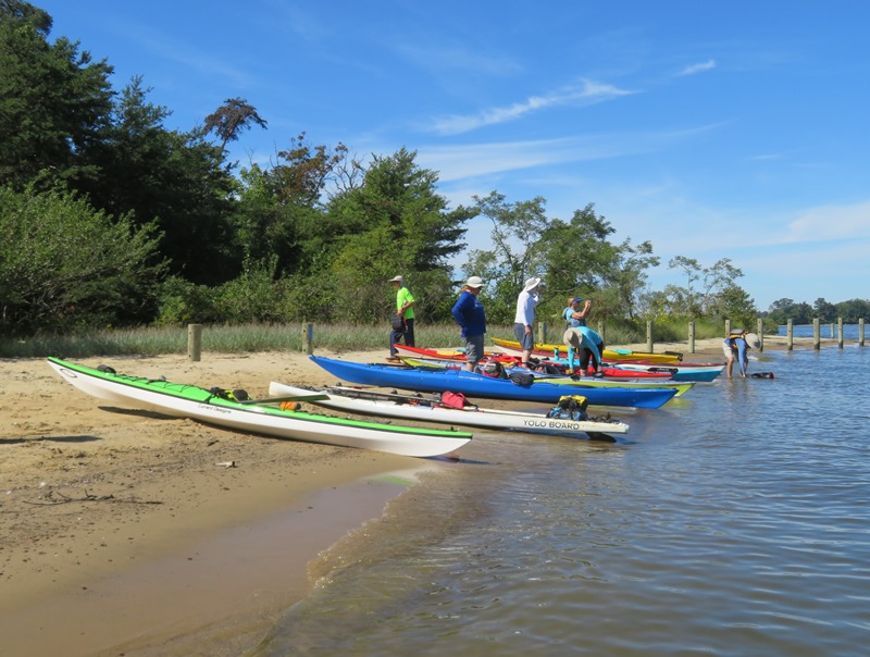
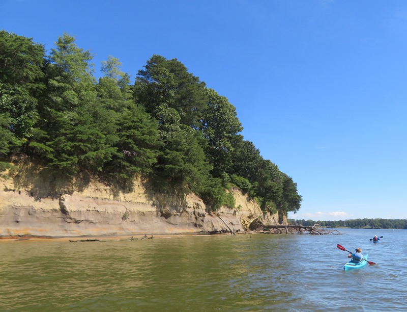
I walked to the south side of the island on some sandy trails to a steep cliff overlooking the water. You definitely don't want to fall here. I could see the top of the Chesapeake Bay Bridge in the distance. We got back in/on our watercraft and then continued paddling, circumnavigating both Dobbins Island and Little Dobbins Island (aka Little Island). The Baltimore Sun wrote the following about it in 2017: Two and a half years after Maryland's highest court ordered much of a compound on Little Dobbins Island torn down, the property still stands. The house lies in a state-designated critical area, but its construction in 2001 was not submitted for an environmental review. 1 / 4

On south side of Dobbin Island
2 / 4
Continuing around Dobbin Island
3 / 4
Linda near Little Island
4 / 4
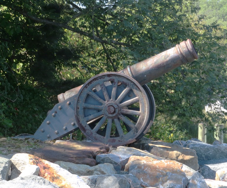
Cannon on Little Island
The return trip was pretty uneventful. It was great getting out on the water with the club. This was my second and last kayak club activity of the year. I'm not a very social person but I do enjoy getting out with a group once in awhile. I think Daphne enjoys it too. Here is our route. 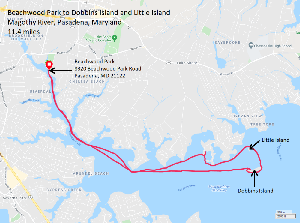
|
|
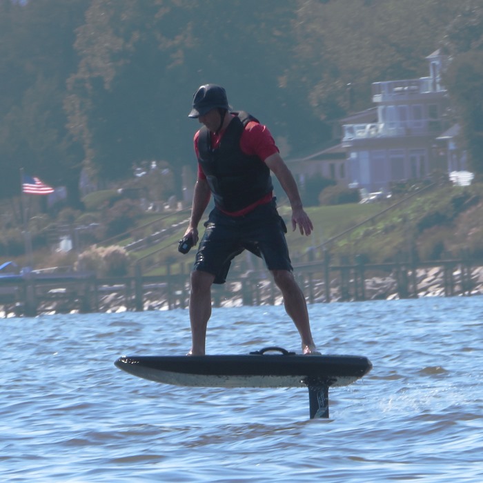
Daphne and I paddleboarded 14.3 miles on the Chesapeake Bay, from Rose Haven Memorial Park to Franklin Point State Park and back. A ray swam under the SUP.
I saw two men on electric hydrofoil surfboards. They were very impressive. Very fast and extremely quiet. I made the mistake of underestimating the effect of the wind on open water. It was calm on the way north but picked up on the way back. It wasn't a lot of wind but it was enough to make for a rough and slow trip back. I don't think Daphne was having fun. The water is definitely getting colder but it isn't yet what I consider wetsuit weather. But it will be soon. In the springtime, the air warms up while the water stays cold while in the autumn, the water retains some warmth while the air cools off. But so far, this fall has been pretty warm. Here's my route. 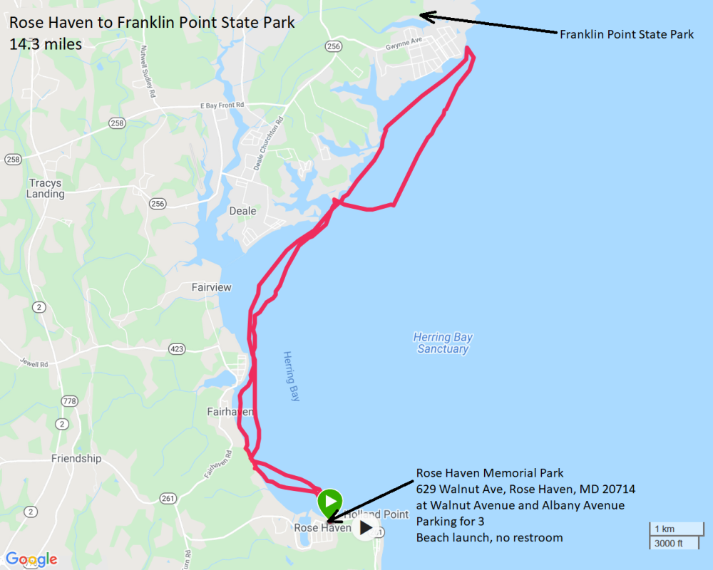
|
|
Sara, Daphne, and I paddled 7.9 miles. We launched from Jonas and Anne Catharine Green Park (formerly known as Jonas Green Park), paddled across the Severn River, and then explored Weems Creek, all the way up to highway 50. Then we paddled back into the Severn River and made our way to College Creek before heading back.
The speed limit on Weems Creek is 6 mph but I think the rowing shells are doing twice that! Those midshipmen really know how to make a boat move. Best to stay out of their way. It got pretty rough on the Severn River near the Naval Academy because there is a concrete wall that goes down to the water so whenever a boat passed and kicked up waves, they bounced off the wall. Definitely a "washing machine" effect. I had to kneel on the SUP to get through this area. Not much wildlife to see at this time of year but it sure is nice to get some sun and warm weather while I still can. Here's our route. 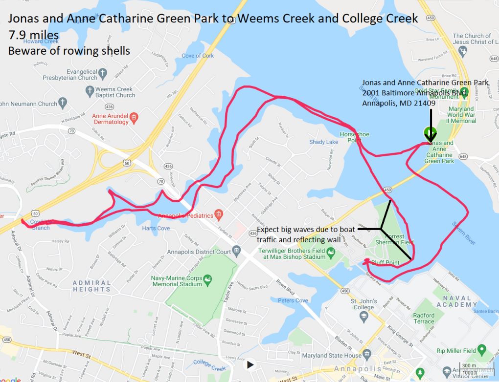
It would have been nice to have stayed out longer but the days are getting noticeably short. That is what I hate most about this time of year. |
|
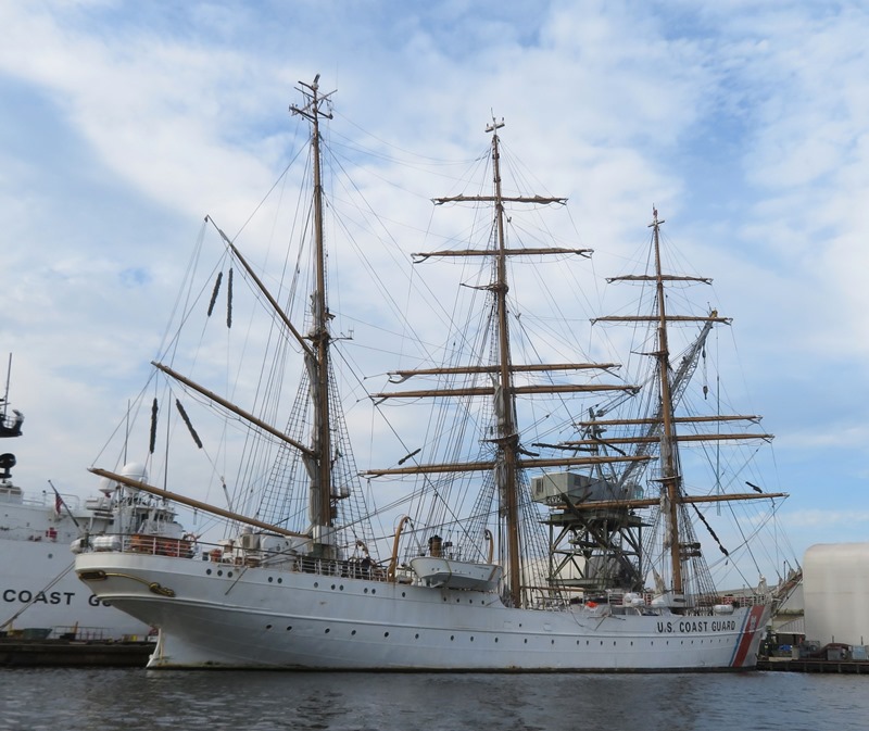
Ryan and I paddled seven miles on Curtis Creek and Marley Creek. We launched from Solleys Cove and then made our way to the Coast Guard Yard to see the United States Coast Guard Cutter (USCGC) Eagle, a tall ship, built in Hamburg, Germany in 1936, that serves as a training vessel for cadets at the Coast Guard Academy and candidates from the Officer Candidate School. It appears as the cover photo of this blog.
After seeing the Eagle, we paddled south to Brewers Island. I don't like the fact that the sun set so early but at least the day was warm (eighty something degrees). After today, it would definitely be wetsuit weather. Ryan and I tried out each other's SUPs. Mine is a 14 foot Yolo Prowler racing hard board. I bought it in 2012 but I think it was made in 2011 or earlier. By 2021 standards, it is more of a touring board with the racing boards being much more streamlined. Ryan has a shorter inflatable Tower board. I much prefer mine since it is faster, retains its forward momentum, cuts through the waves, is smoother, and quieter. But his is more maneuverable, stable, and as an inflatable, it is great if you don't have much storage space or a roof rack. In the end, I think I convinced Ryan to start looking for a 14 foot hard board. 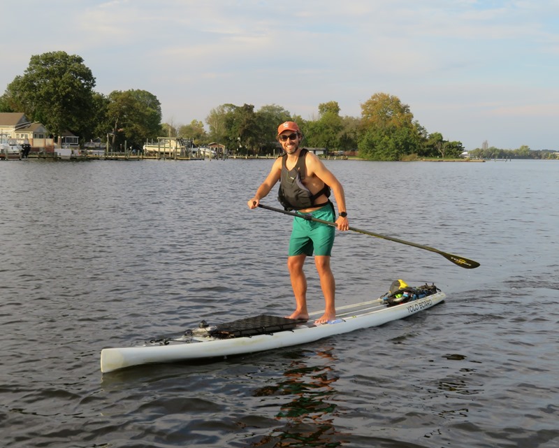
I'm guessing that if Daphne had a say in the matter, she would have preferred the smoother ride of my hard board. 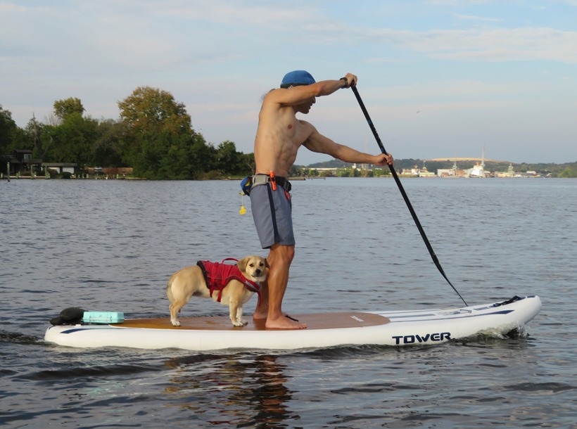
Ryan is extremely fit and has pretty good technique on a SUP. I expect he would make a great racer, if he wanted to go that route. Here, he is getting some speed on the Prowler. 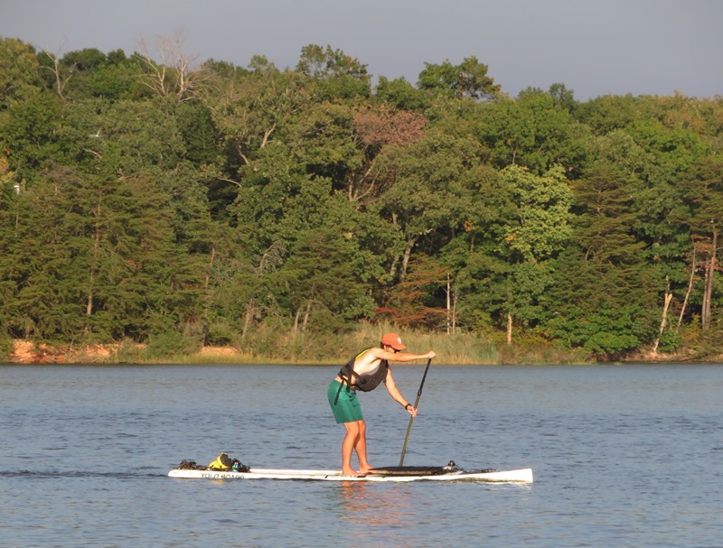
Here's our route. 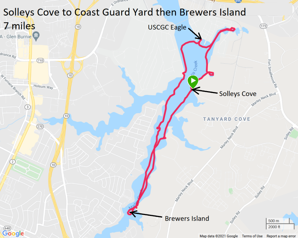
|
|
From October 21 to 24, 2021, Norma, Daphne, and about 40 other people gathered at Westmoreland State Park for a multi-day birthday celebration. Read more about it in an article I wrote titled There's Something for Everyone at Westmoreland State Park.
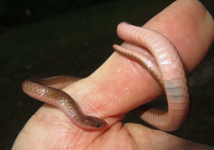
Above is a worm snake that I moved from a high traffic area near our cabin so it wouldn't get stepped on. |
