|
This page is about a group kayak trip on the eastern shore of Virginia. |

|
This page is about a group kayak trip on the eastern shore of Virginia. |
|
If you haven't read my trip reports from Broadkill River and Primehook Creek 2010 and Challenge Weekend 2010, then I suggest you start there since this trip is motivated by those.
After Suzanne and I led our Broadkill River and Primehook Creek car camping kayak trip on June 25-27, 2010, a few folks in our group thought it would be a good idea for us all to get together for another trip. Dave G. suggested his neck of the woods on the eastern shore of Virginia. Another person suggested Chincoteague Island. After much discussion, it was decided that we would rent a house on Columbus Day weekend and explore some of the various local waterways. I was nominated to put together some trips so I drove out there and did some scouting during my "Challenge Weekend" on August 13-15, 2010. I found a few places to launch, acquired a map, and reported my findings to the group.  |
|
I was up at 0300. I could have slept until 0420 but I was excited about the trip. Some folks drove down on Friday but they said traffic was a bitch. Not so for me. I made it in about three hours. Along the way, I passed several people heading out to the eastern shore to participate in the 22nd Annual Seagull Century bicycle ride.
I arrived at our vacation house, The Wild Heron 6138 Fir Landing Road Chincoteague Island, Virginia 23336-2720 at about 0730. The place was very nice. There was parking for about eight vehicles if some folks didn't mind being blocked in. The deck had a nice water view. I believe there were three bathrooms and three bedrooms...some of which were quite large. Everything except the screen doors and a piece of floor were in very good shape. Unfortunately, the north side of the house (the main parking area) had a very high concentration of mosquitos...much too high for October. The group was already up and eating breakfast. I was greeted by Nora C., Brent C., Jenn B., Mike C., Linda C., Geoff U., Marilyn F., Aht M., Maryrose W., and Suzanne F. Dave G. showed up a little later. I went over my proposed trip for the day. It was a short, scenic trip on a creek. Suzannne asked if afterwards we might be able to paddle out to the ocean and I said that I believed we could. But I threw in the caveat that I had never actually launched from the place we were heading to. I just found the launch site, read about the up and back trip on the creek, and studied maps of the area. |
|
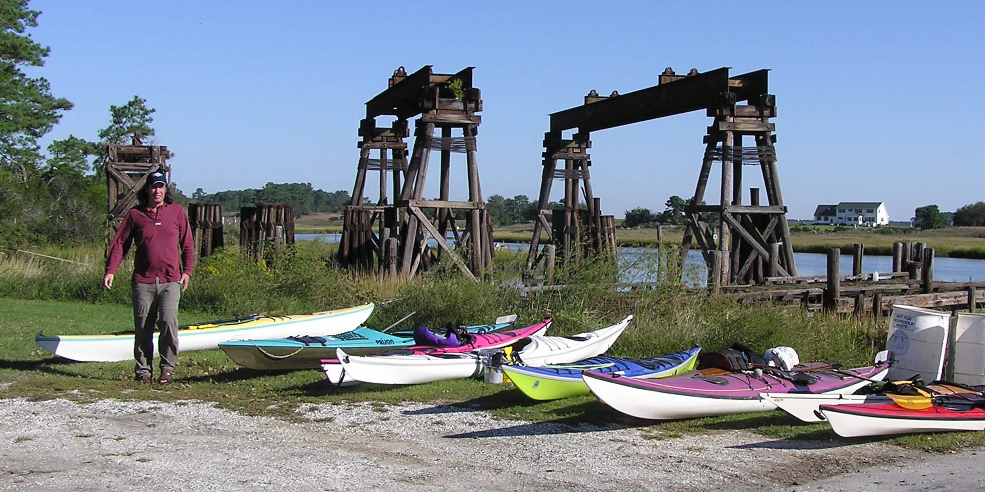
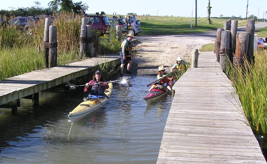
The 12 of us went to NASA Dock. It was about a 30 minute drive from the Chincoteague house.
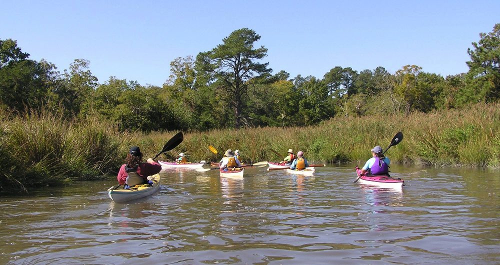
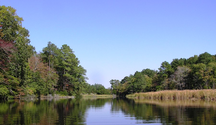
The plan was to paddle the Assawoman Creek route. If you don't think this is a funny name for a creek then you must be a native. It was sunny with high temperatures in the 70s. The whole weekend was forecast to be like this. We couldn't have asked for better weather. Near the launch, the creek was about 100 feet across. We took turns carrying boats to the ramp which only allowed two at a time to launch. As we paddled upstream with help from the flood tide, it sometimes widened but usually narrowed as it took several twists and turns. 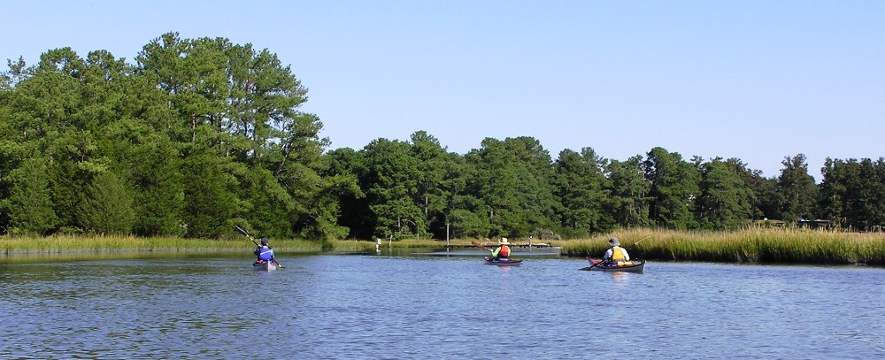
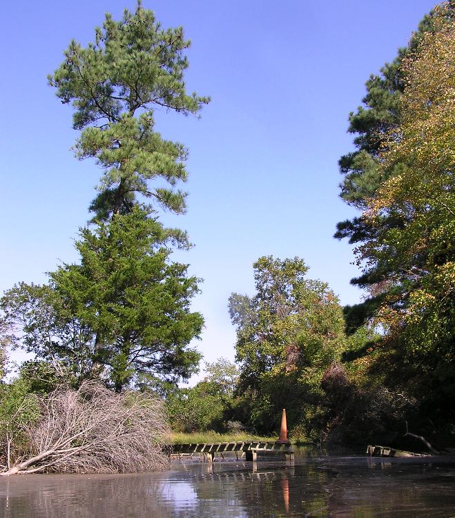
Several parts of the creek were shallow and those of us in front spent some time looking for the deeper parts. I don't believe we saw any power boats on the creek. But some of us did manage to see a bald eagle. We made it up the creek almost three miles before we were stopped by a downed tree. I cut a few branches so we could go a bit further. 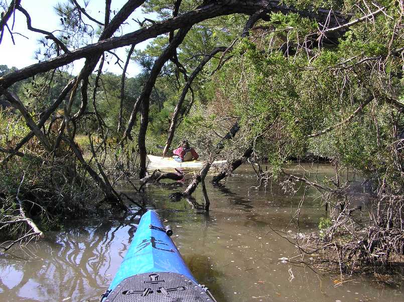
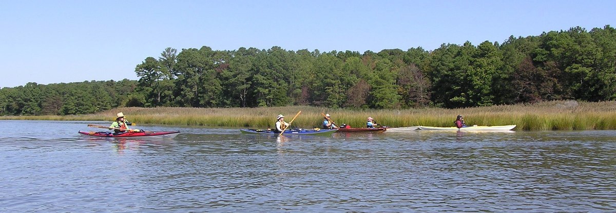
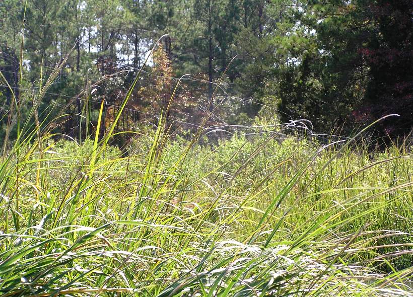
But at mile 3.16, it was time to turn around. Thick foliage blocked my path and the view on the other side. The creek was soon as narrow as my paddle. The tide came up a bit so it was much easier getting back downstream. Back at the launch site, we took the boats out and ate lunch at the covered picnic table. Soon afterwards, we were once again paddling. We reached the mouth of Assawoman Creek then continued east across Woman's Bay using the Wallops Island radio tower as a landmark. At Wallops Island, we turned south and kayaked to Pie Hammock. My Garmin MapSource Topo map version 3.02 and 1995 Virginia DeLorme map both showed a continuous waterway connecting Pie Hammock with the ocean but Google satellite photos indicated otherwise. Unfortunately, I did not have access to the satellite photos until after we were done paddling. We returned to Womans Bay. Half of us then returned to the launch site to complete an 11.5 mile trip. That half headed back to the house and prepared dinner while the rest of us (Dave, Suzanne, Geoff, Jenn, Aht, and me) paddled south, following the channel markers. After a little more than a mile, I paddled east. Both my map and global positioning system (GPS) indicated the ocean would be about 0.7 miles away. The rest of the group followed the channel markers south. I came to Assawoman Inlet, a sandy strip about 500 feet wide with the ocean just on the other side. I saw a sign which said that continuing south on land led to some natural area that was off limits. I saw no signs indicating the sandy strip connecting to the ocean was off-limits. I tried to call the others via my very high frequency (VHF) radio but they were too far away. After about three miles, I caught up with the rest of the group at Kegotank Bay. Both the GPS and map showed this bay connecting to the ocean at a few different points. But it was 1530 and we had a good distance to cover to make it back to the launch site so we decided to turn around. We had lost faith in my GPS and map. The paddling we did east of Assawoman Creek was all in salt marsh. It was rather monotonous scenery. Here's Aht speeding along near the bay grasses. 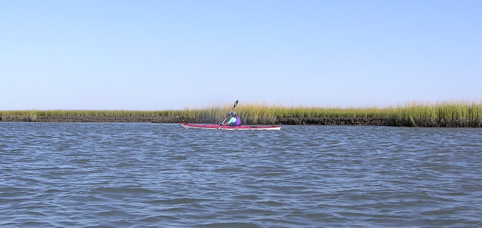
About a half mile downstream of our launch site, we saw an immature bald eagle. With the take-out in sight, a few of us turned on the turbo thrusters. The rest of us kept a steady pace. But we were all tired. Here's Jenn rounding the corner to the ramp. 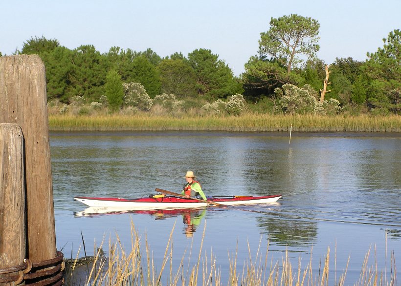
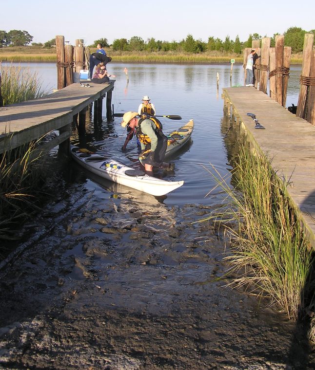
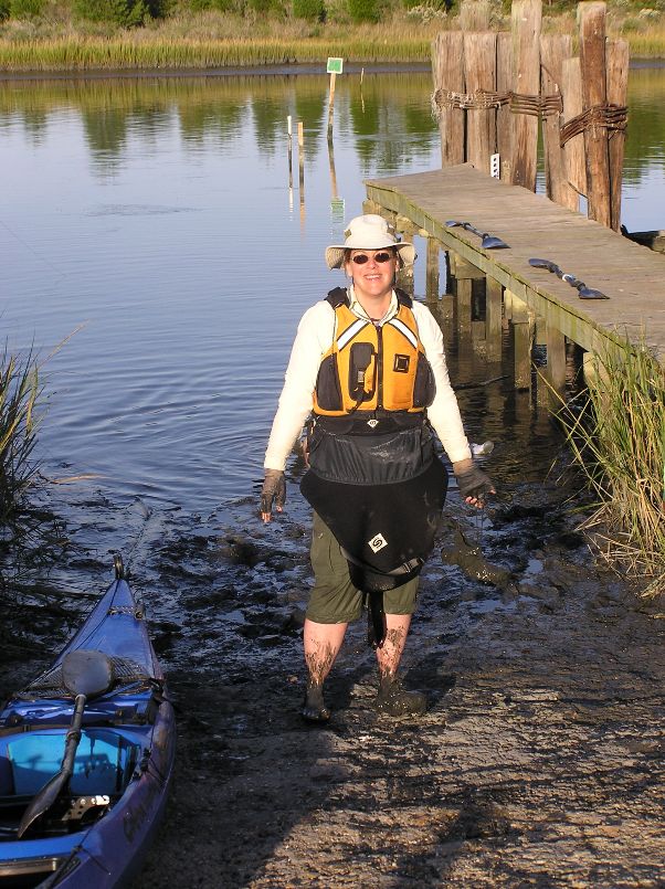
We made it back to the car at about 1730. I paddled 21.35 miles. I estimate the rest of the group paddled about 20 miles. The tide had gone down a good bit so our once concrete-ish boat ramp was now muddy as a pig sty. Satellite photos (examined later) showed the opening to the ocean about two miles south of our turnaround position. This opening is known as Gargathy Inlet. In retrospect, it is good we turned around when we did. Otherwise, we might have risked returning in the dark, after paddling an exhausting 24 miles. But more likely than not, we would have investigated several other possible inlets before finding the right one. So nobody knows how long we would have been out there. Check out the route we paddled below. The 'X' marks our start/finish. 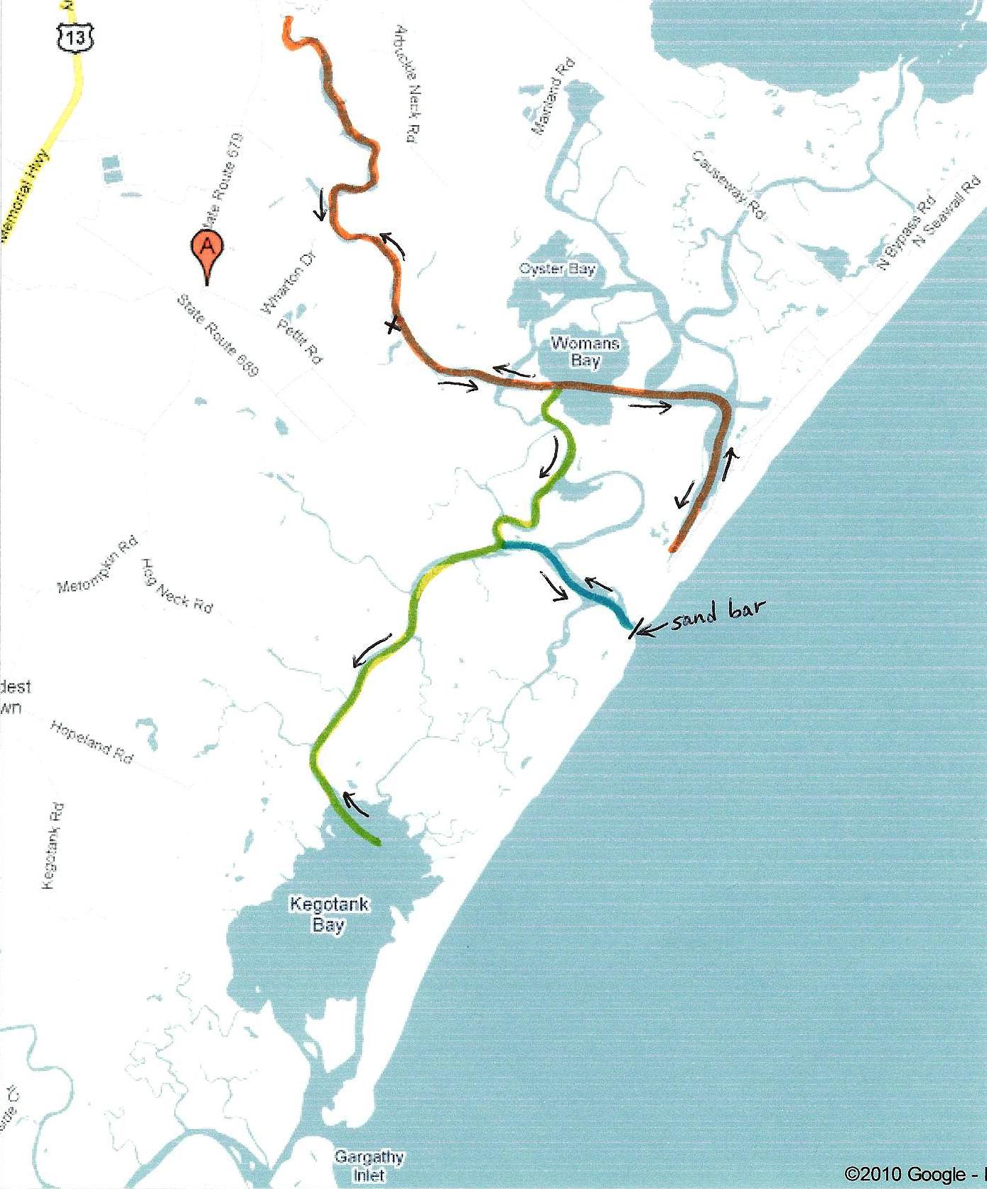
Returning back to the house, we feasted on fantastically fabulous fresh flounder filet. Marilyn's husband, Alan, drove out on his motorcycle to hang out with us. Dave said his farewells. He would not be with us for the rest of the weekend. |
|
I urged the group to launch from Fir Landing. The boat ramp was about 600 feet from the house and there was no place to park for an extended period of time which meant they might not be able to return to launch from there again unless they were renting the same house. Fir Landing provides access to Little Oyster Bay, which in my opinion, is near some of the most scenic parts of the island. I suggested the group paddle south on the Assateague Channel to Chincoteague Inlet. This would put them out in the ocean. Unfortunately, it would be a good 15 mile round trip with most of it against the tide. But being the hardy paddlers they are, they were willing to give this out and back trip a go, rather than shorten it with a car shuttle. I chose not to join them because on my August 14, 2010 circumnavigation of the island, I had already paddled most of that route...all except maybe two miles.
|
|
My plan was to explore Little Mosquito Creek and its tributaries.
I launched from Queen Sound then paddled 0.75 miles north to Cockle Creek. From here, I turned southwest and paddled up the creek, crossing under route 175. A good amount of boat traffic was encountered. After about a mile, I turned north on Mosquito Creek. After 0.9 miles, I came to Jenney's Gut which leads to Wallops Neck (NASA Visitor Center). There were signs warning of explosives at the entrance to Jenney's Gut. I've paddled around Aberdeen Proving Ground enough so that I don't worry when I see such warnings...I just make sure I adhere to them. 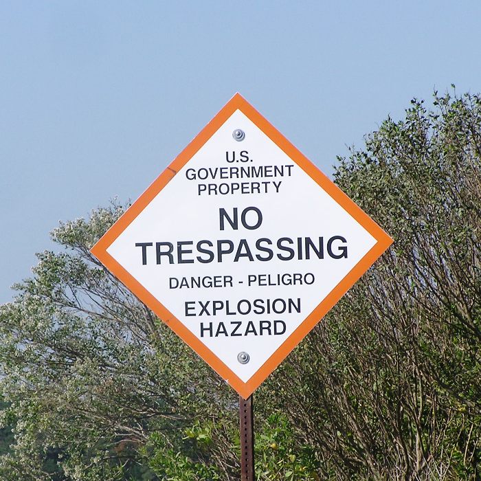
I continued another half mile past Jenney's Gut to the intersection of Mosquito Creek and Little Mosquito Creek. I turned northwest onto Little Mosquito Creek. After about a mile, things started to look a little less "salt marshy" as the creek narrowed and trees lined the sides. I found several red plants that were bright enough for even my colorblind eyes to see clearly. Steven J. identified this as a Salicornia virginica (Annual Glasswort). 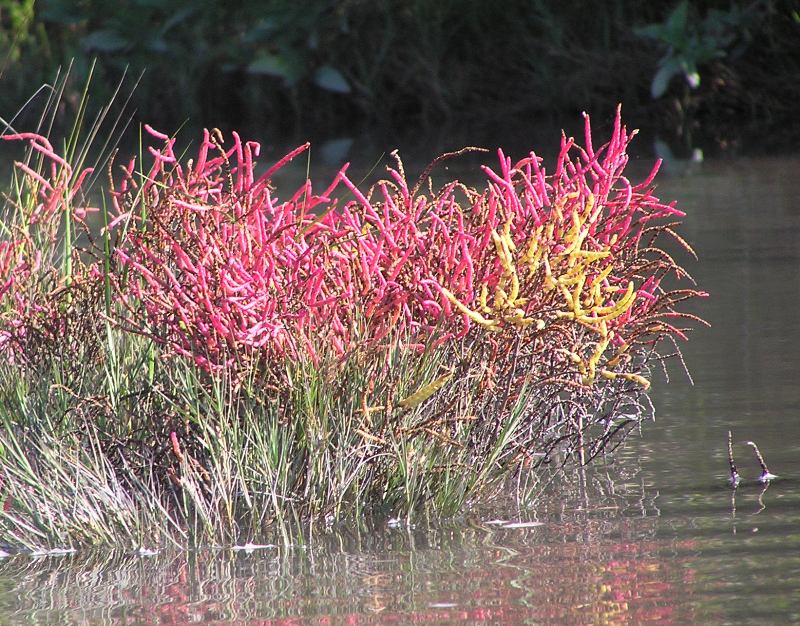
I saw what I thought was a sika deer in the woods on NASA property. I took numerous pictures but after I got home, I realized it was just a common white-tail deer. 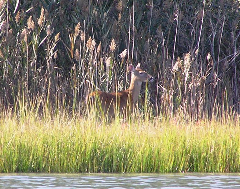
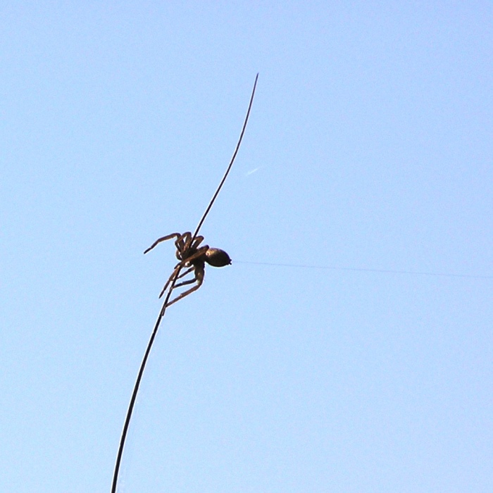
I paddled south up Wattsville Branch until I was 400 feet north of Mill Dam Road (Route 798). I was hoping to make it to Wallops Pond but that was not the case. As I stopped to cut my way through, I was attacked by numerous mosquitos. Hence, I turned around. On the remaining creeks, I turned around once the creek got very narrow. Fallen trees were never an issue. I saw two mature bald eagles (the second one may have been the first...just further upstream) and an immature eagle. I also saw several oyster catchers. I ventured northwest, further up Little Mosquito Creek to within 600 feet east of Fleming Road (Route 679). On the return trip, I made my way north up Snead Branch to 800 feet south of Fleming Road (Route 679). Then I paddled up some nameless creek traveling north towards Fleming Road. This creek is about 1,700 feet east of Dublin Farm Lane. I kayaked up it for maybe a half mile before turning around. In the grasses, several spiders hung webs that stretched 2-3 feet from a blade of grass to the open air. I am assuming they patiently waited for prey to stick to their silky trap. I also saw a spider with a web sticking out of its ass. I stopped to take a photo of a NASA radar dish. 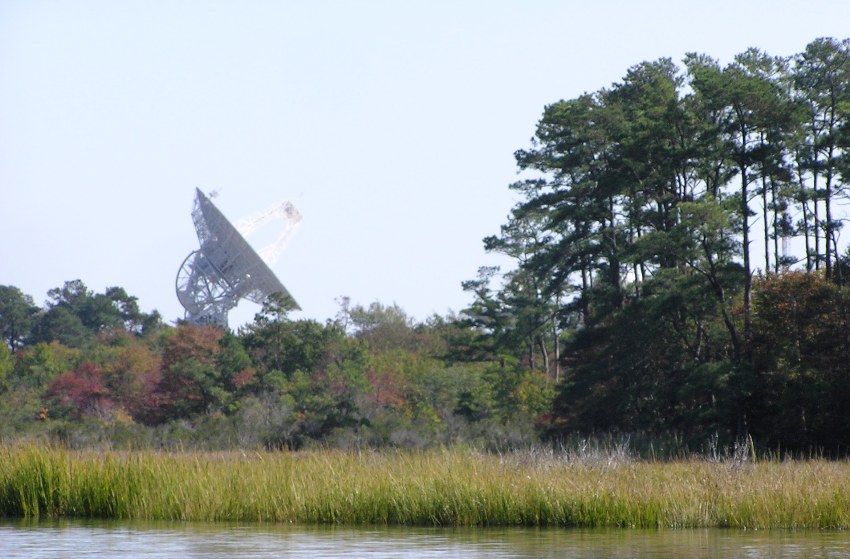
Soon after taking this snapshot, my camera stopped working. I wondered if the NASA people don't like folks taking photos of their G-14 classified equipment so they use high tech electronic gear to render cameras useless when they are aimed in their direction. Or perhaps it is because my refurbished camera has been dropped, water damaged, and has suffered various other injuries in the five years that I've owned it. I found a boat ramp off Nautilus Drive, 200 feet east of Nautilus Court on the south side. I believe this is Trails End Campground Resort 6195 Nautilus Drive Horntown, Virginia 23395 Phone: 757-824-3311 Not sure if one can pay to launch but it is worth asking. Launching from here could take off 3.25 miles off the first and last part of the trip which isn't particularly interesting. If paddling this route, be sure to bring a GPS since the grassy salt marsh all looks the same after awhile. This time my GPS was dead-on accurate. I paddled 17.5 miles that day. The tide was usually on my side. Here's my route. The 'X' marks my start/finish. 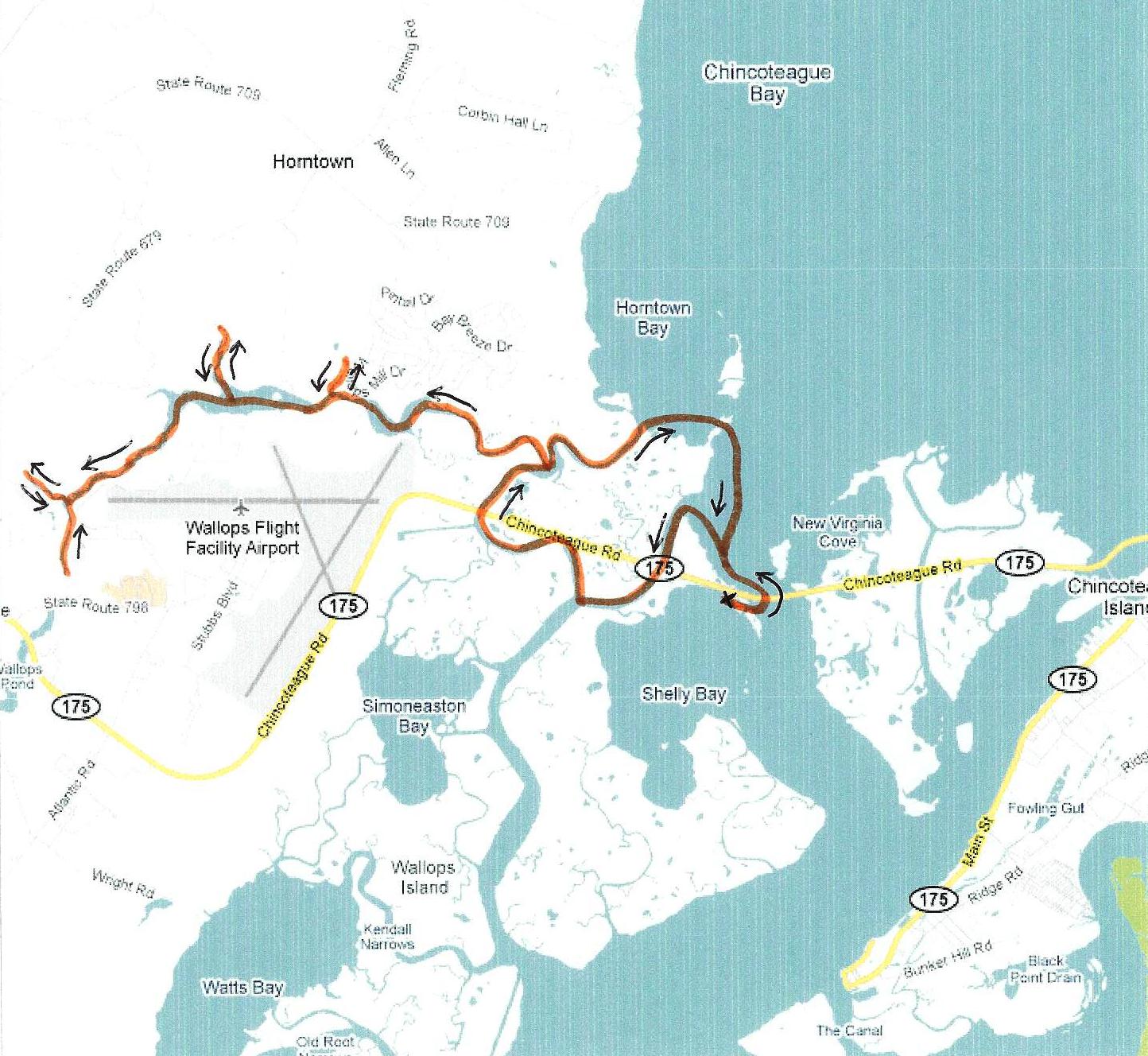
|
|
I went back, washed up, then rode my bicycle out to Chincoteague National Wildlife Refuge. As I crossed the bridge to the refuge over Assateague Channel, I saw my group paddling north about a quarter mile away. I called them on the radio and wished them well. I would have taken a photo but my camera still wasn't working so good.
I rode on all the trails that bicycles were permitted including the Wildlife Loop. Late in the day, the westward views at Snow Goose Pool were spectacular. There were multitudes of egrets. I biked on Swain Cave Trail east then walked to the ocean. The waves were small...much smaller than what I am used to on the Pacific side. I went to Toms Cove Vistor Center, spoke to the ranger, and found the boat launch, almost due south of the visitor center. It was starting to get dark so I headed back. My camera started working again. See the view north from the bridge to Chincoteague National Wildlife Refuge in the cover photo. I ended up biking an easy 15.5 miles. |
|
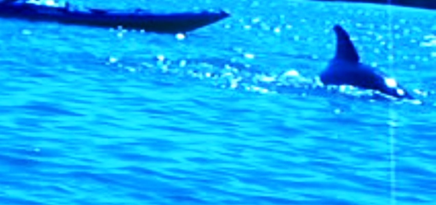
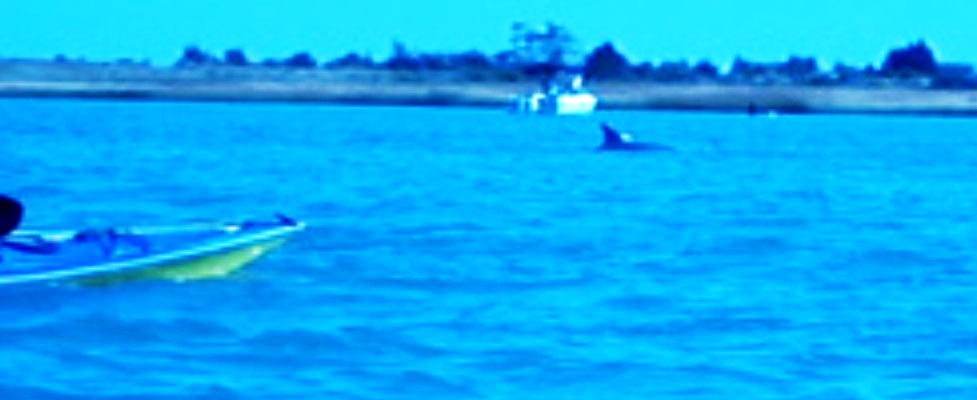
Later that night, I was told that the rest of the group paddled into the ocean, just south of Fishing Point off Toms Cove Hook. They put in about 16 miles though most of that was against the tide. Undoubtedly, they worked harder than me. Just north of Fishing Point, they saw a school of a dozen dolphin, including some juveniles. These majestic creatures were seen at 1330, almost midway between high and low tide. I was green with envy, but of course I had no one to blame except myself since I told them the route and chose to do something else. After hearing this, I swore to head out towards the ocean the next day and not return until I saw dolphin, ran out of food, or ran out of water. The below photos were taken by Aht.
|
|
Christopher Columbus was a great seaman (the juvenile side of me chuckles whenever I say that word). What better way to honor the holiday that carries his name than to go boating in the ocean that he is famous for crossing?
I woke up at 0600, packed up, helped clean the house, then launched at Curtis Merritt Harbor just before 0800. I paddled south, towards Fishing Point. At 0830, I saw a single dolphin, about 40 feet on my port side. I was a quarter mile north of Fishing Point. I only saw it for a split second but there is no doubt that it was a dolphin. Unfortunately, that was my only sighting. I rounded Fishing Point, paddled southeast, then went ashore at the southernmost end of Assateague Island National Seashore. 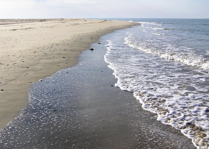
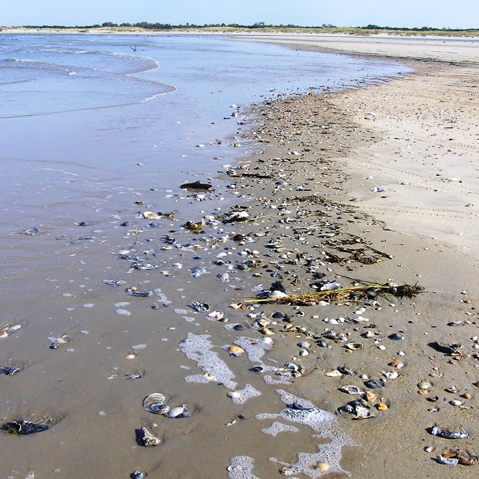
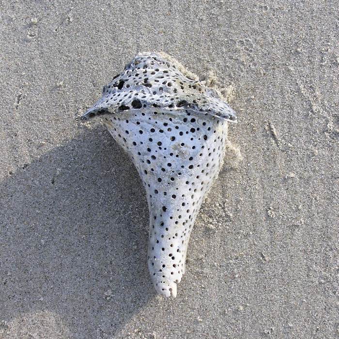
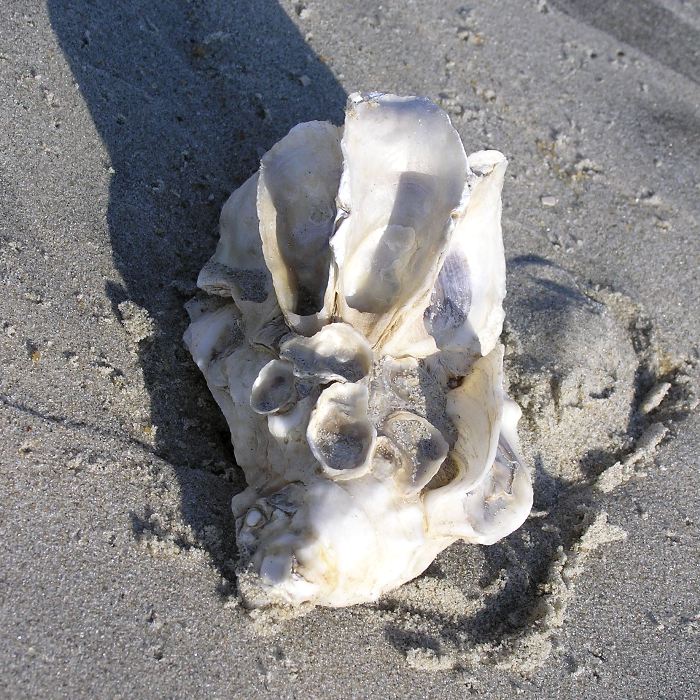
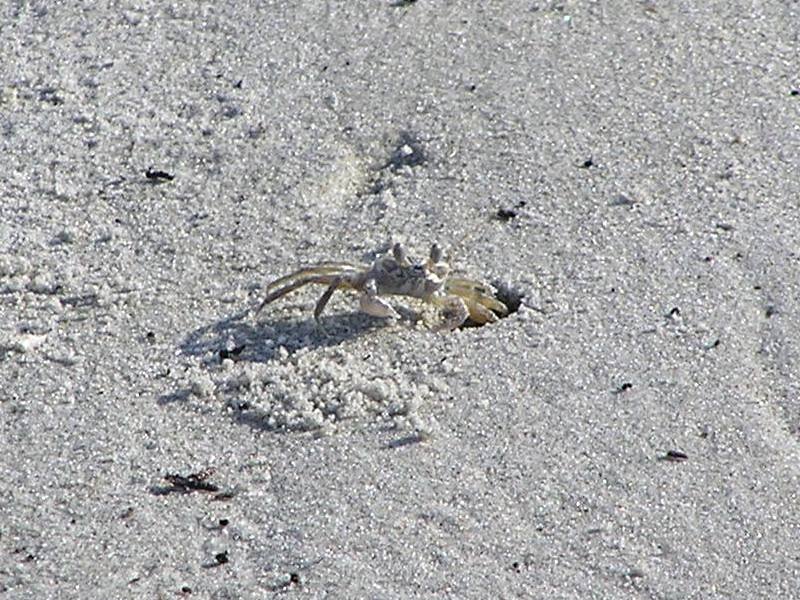
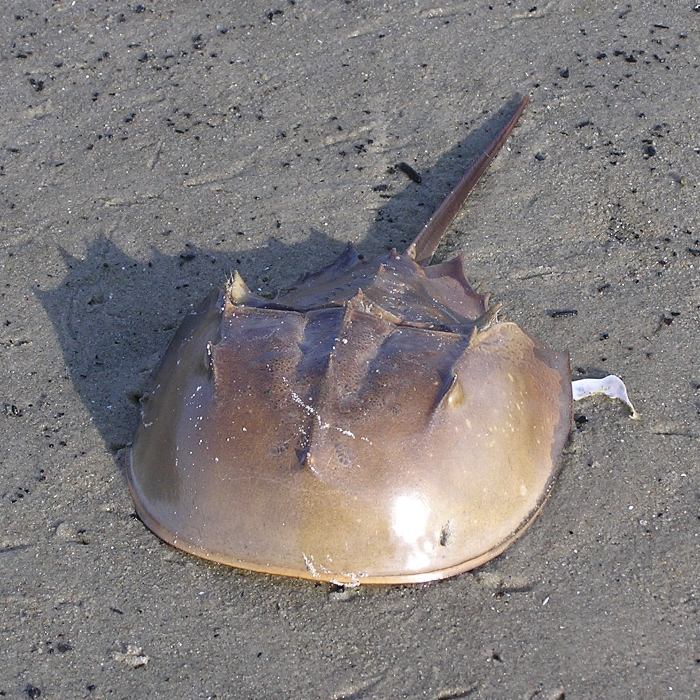
Here I found a shell collector's paradise. I saw dozens of conch shells (a few of which I brought home), scallop shells, oyster shells, and a few unusual ones. I also saw some fiddler crabs and several dead horseshoe crabs. About a dozen brown pelicans flew overhead. Later, I would see at least three more. 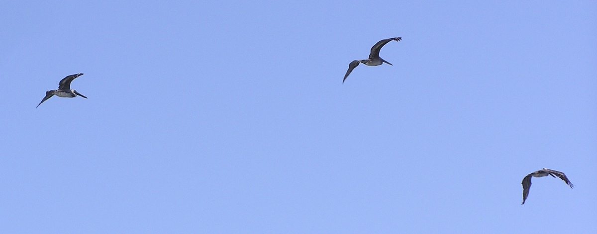
I also saw several sandpipers (that's what I call them) that didn't mind getting close to me as long as I didn't move. 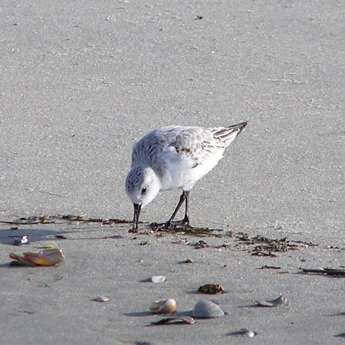
I turned around near the southern tip of the Assateague Island National Seashore. Swells were two to three feet high and spaced about 4.5 seconds apart. My Cobra Expedition did not surf them well. 
On the return trip, I saw something in the water I had never seen before. Like the dolphin, I only saw it for a split second but I saw it clearly enough to draw it from memory. I turned the boat around to see it again but I could not find it. After I got home, I determined it was a Stomolophus meleagris or cannonball jellyfish. They are round, milky in color and somewhat rigid with a reddish-brown pattern becoming darker towards bell margin. Its tentacles are short and dense under the bell. Their sting is very mild, if felt at all. They often have small crabs and fish living all the way inside under the bell. Their round bell presents a ball-like appearance, from tennis ball size to soccer ball. - from Spyhog Log Here are some photos (none of which I took) of this fascinating creature. I rounded Fishing Point, then headed east to a little area called The Gut. When I was overseas, this was a generic term for the red light district. Here I saw and just scanned the horizon to my north for signs of dolphin. I saw nothing. I returned on the east side of the sand bars. It was fun to play in the waves but it would have been much more fun in my surf ski. I heard that yesterday, Nora totally kicked ass on the waves. I saw a bald eagle. It was easy to find where I launched...just head towards the white house at Chincoteague Point. I paddled nine miles and accomplished the mission for the day. I may have only seen the dolphin for a split second but by golly I saw it. It left me wanting to see more but that will be for another trip...possibly to Cape Cod or Folly Beach, South Carolina. After I landed, I found a sign stating that a boat ramp license is needed to launch. The sign was on the far side of the ramp. A kayaker carrying their boat from the parking lot (such as myself) might not see such a sign...and I didn't. Fortunately, I did not find a ticket on my car. I headed home. After having seen so much, the drive back wasn't so bad. I felt satisfied. |
|
I got to hang out with some good people, eat good food, and do some exploring. I saw one animal in the wild that I'd never seen before and saw another that I didn't even know existed.
I didn't paddle as much this summer as in previous summers. But I did start earlier this year than in most. With the fair weather paddling season coming to a close, it is good to get in big trips such as this. Like my drive home, it makes the winter more bearable. |
