|
This page is about my 2011 summer challenge and time spent with Norma and Carmen at Chincoteague. |

|
This page is about my 2011 summer challenge and time spent with Norma and Carmen at Chincoteague. |
|
In previous years, I found a summer challenge to keep me goal-oriented and focused. I was inspired to do this after reading about Jack LaLanne, who died this year on January 23 at age of 96. Previous challenges include the following:
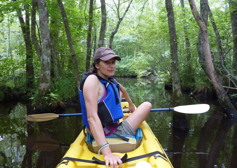
One physical feat I had been wanting to accomplish for the last few years was to kayak the entire paddle-able section of the Pocomoke River. This is one of my most favorite rivers in Maryland. On July 14, 2011, I saw that the forecast would be great. Sunny and not too hot. Neither Norma nor I had any plans for the weekend. I kicked around the idea of paddling the Pocomoke but I wanted to go at my own speed in my S1-A. Thus, I wouldn't be spending much time with Norma...at least not on the first day. It just didn't seem right to ask her to drop me off, go do her own thing, then meet me at the take-out. So she called her former housemate and good friend Carmen to see if she would be willing to join us for a last minute weekend camping trip on the eastern shore. Much to our suprise and joy, she said yes.  |
|
The three of us left at 0520. I drove while they caught a nap. I could have used more than the five hours of sleep I received the previous night but they got even less and I knew the route. I stopped about five miles north of Snow Hill, Maryland on the southwest side of the Porters Crossing Road bridge and the Pocomoke River. One can't park there but one can stop to drop off boats. This is what the Pocomoke River Canoe Company does with their rental boats. By 0820, I was on the water, paddling downstream into the cypress forest.
For about the first mile and a half, I averaged less than four mph. The upper part of the Pocomoke is narrow and winds around quite a bit. Additionally, there are a few logs that lie just below the surface. Ramming into a submerged obstacle at six mph could wreak havoc on my carbon fiber and fiberglass boat so I traded speed for caution. At about mile 1.5, the river widened up considerably and got much deeper. I felt confident picking up some speed so I maintained a moving average of about 6.2 mph for the next 18.5 miles. But I did have about 0.7 mph of help from the downstream current. At the Snow Hill Road (route 12) bridge in Snow Hill, I found that the bottom of the bridge was only about three inches higher than the top of my boat. It was about 2.5 hours after high tide. The banks of the river were built up or steep, so rather than go around the bridge, I got out of my boat and swam under, pulling my boat and paddle. The water felt good. Continuing downstream, I saw some very large fish. Two of them were between 2.5 and three feet long. I know they weren't rockfish but that's about all I know. I saw a snake fall out of a tree and slither away. Throughout the day, I saw three bald eagles. But I wasn't out on a nature paddle...this was strictly business. At Milburn Landing of Pocomoke River State Forest and Park, I pulled ashore on a rocky beach that led to the campground area. I used the restroom then watched a lizard climb a tree while I ate a snack. For food, I packed Pringles chips and beef sticks. For drink, I packed a mix of water and Gatorade. That was all I needed. I would only be doing this for most of the day so I wasn't concerned about my arteries clogging. I needed electrolytes, carbohydrates, and some fat. I needed dense calories. After this short break at mile 13, I was back at it. My next stop was Pocomoke City at mile 17.6. This is where I sent Norma and Carmen. I instructed them to launch at Winter Quarters Golf Course Landing, paddle upstream for a mile, then turn left (north) onto Dividing Creek. They were on my sturdy and stable Ocean Kayak Cabo. I stopped at the boat ramp and saw my car without the tandem so I knew they were out exploring the creek. I left my business card in the door to let them know I was there. My hips were feeling uncomfortably tight. This is a problem I have with kayaking and my physical therapist has commented that my tight hips are one of the reasons I've had knee problems. I have no intention to give up kayaking, so instead, I learned a really good hip stretch. Standing upright, cross one foot over the other. Then bend sideways at the hip as if you are at a ballet bar. Do the other side and switch feet too. This works great and allowed me to continue for another 45 minutes or so without too much pain. Around mile 20, the tide changed. Now instead of having a 0.7 mph downstream push, I had a 0.5 mph upstream pull. An eight to nine mph headwind was picking up. I tried to paddle on the more sheltered side of the river. The tide would be against me for the rest of the trip and the wind would not weaken until I was done. Overall, it would have been faster had I started at the takeout and paddled upstream but logistically, it would have been much more difficult since there is no place for Norma to park and wait at Porters Crossing and the place I planned to take out was much further away than where I launched. Besides, a little resistance from mother nature builds character, right? During the second half of my trip, my moving average dropped down to a pitiful 4.9 mph. At mile 30, I called Norma to let her know my estimated time of arrival. I started to notice changes in the landscape as the freshwater turned brackish. The woodlands were now replaced by bay grasses. Power boat traffic was really starting to pick up now. Sadly, I only saw about four other kayaks throughout the day. At around mile 32, I crossed into Virginia, then around mile 35, I entered the Pocomoke Sound. The water was fairly calm, even though it was completely open on the west side. I knew I was going to be about two miles short of my mileage goal so I paddled up Holdens Creek for a mile to get in a little extra distance. At 1655, I landed at Tall Pines Harbor Campground after paddling for eight hours and 33 minutes. I kayaked a total of 40 miles! This was a new personal distance record for me. I could have easily kept going another six miles...maybe even 10 as long as I could have gotten out and stretched my hips. The other muscles in my body were fine. No cramping thanks to all the electrolytes in my food and drink, of which, I brought way too much. I drank less than 2.5 liters and ate one Sasquatch beef stick and a can of Pringles. But for a trip like that, it is better to overpack than underpack. I brought five liters, expecting I would drink at least three. The high temperature was only 85 degrees so I didn't sweat much. I jumped in the water two or three times throughout the day which kept me cool too. The main problem with packing more than I needed was that it made my boat top heavy and a little less balanced, through I hardly noticed it. One might think that not being sore is mainly due to conditioning but I think it has more to do with good paddling technique. There are lots of fit kayakers that would be very sore after such a trip, but if their technique is good, then they should be able to go all day in calm water. Of course, one needs the right boat and paddle too (which I have). But with good technique and the right equipment, I think one only needs a moderate level of fitness to travel such a distance. Norma and Carmen were about 150 feet from where I landed. They were setting up our tents. When they saw me, they ran over to greet me. I think they expected me to be more tired than I was. I certainly would have expected that. But I was feeling rather energetic. 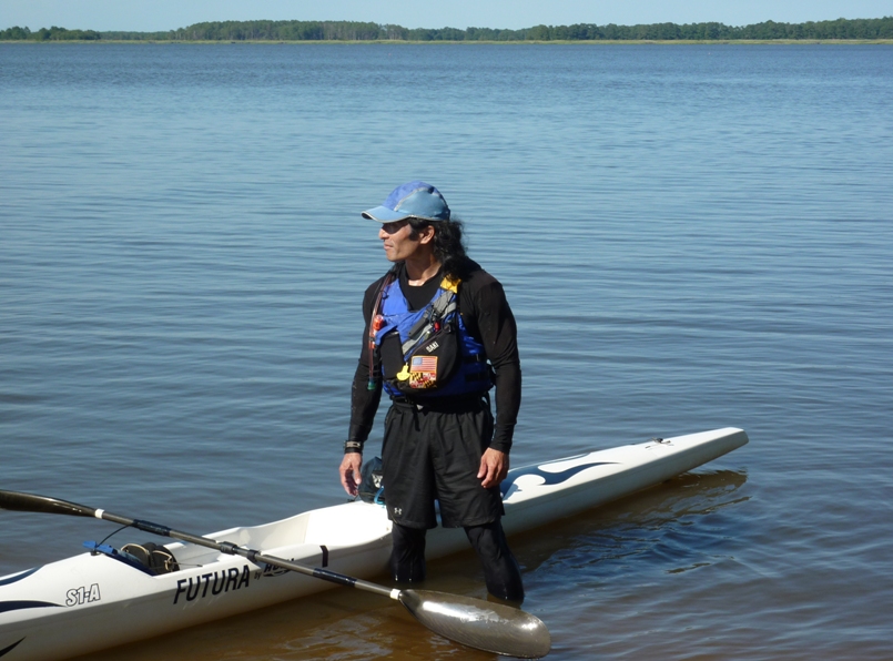
I would have liked to have completed this trip in under eight hours so I could say my overall average (not moving average) was over five mph but that was not the case. Regardless, I felt pretty good, both mentally and physically, after having accomplished my big summer goal. |
|
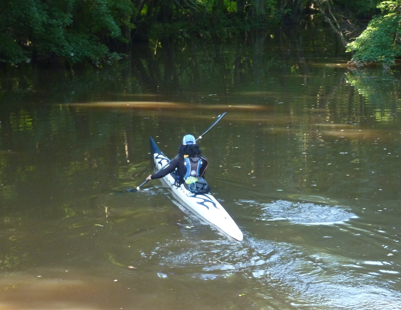
While I was out on the Pocomoke, Norma and Carmen were doing their thing. As I mentioned, they drove to Pocomoke City and launched at Winter Quarters Golf Course Landing. I was worried that they would have problems unloading the Cabo because it is so heavy and awkward. I also had gear stored in the hatch which made it about 10 pounds heavier (~86 pounds). But they managed just fine in lifting the beast.
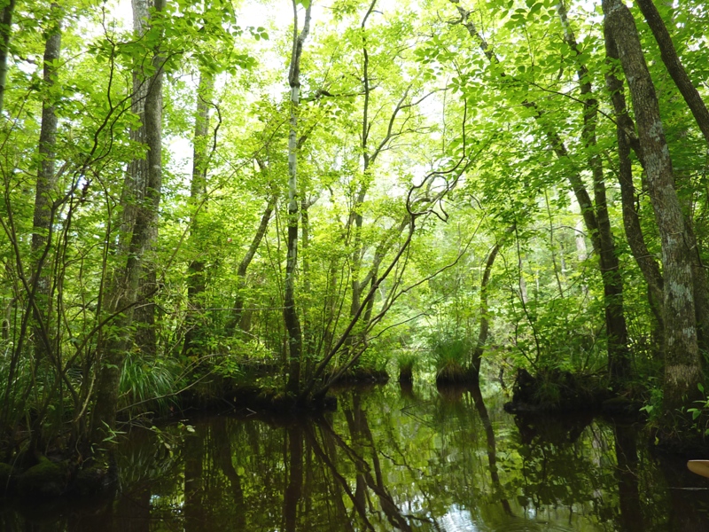
After paddling upstream (to the right/east) for a mile, they turned left (north) into the narrow but scenic Dividing Creek. I have paddled here only once before (on June 21, 2009) and really enjoyed it. I saw quite a bit of wildlife on this short creek. I only made it up to Dividing Creek Road but urged them to go further, which they did. I let them use my saws, loppers, and Ivy Block in case they wanted to cut/portage their way beyond what the creek might naturally allow, but they didn't need it. According to them, the creek was indeed natural and scenic though they did not see as much wildlife as I had. They saw a turtle in need of a pedicure and one snake but that is pretty much it. Still, I think they had a good time. 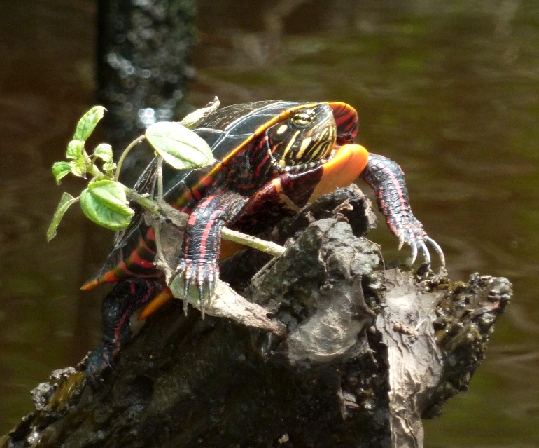
|
|
After paddling, I suggested they go explore the Chincoteague National Wildlife Refuge on bicycle and foot but with me finishing my trip a little earlier than expected, they instead chose to visit the Wallops NASA Visitor Center. Here, they took goofy photos to send to their rocket scientist friend, Clark.
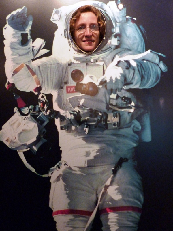
Not only because of Clark, but with the last space shuttle mission having been just eight days ago (on July 8), the visit seemed appropriate. |
|
At the campsite, we finished getting the tents set up then got washed up. That campground has changed SOOOO much since I first stayed there back on October 9, 2004. Back then, it was much more primitive and informal. Now they have a nice website and a huge office building. They also have a gate that you need an electronic key to get through after dark. So be sure to pay your $10 deposit at the office and get a key if you plan on going out at night.
The three of us drove out to Chincoteague and stopped at Curtis Merritt Harbor so Norma and Carmen could get an up-front and close view of the water. I launched here last on October 11, 2010. Back then, I didn't know one needed a permit to launch until after I finished paddling. But if we wanted to get out into the "dolphin zone" early tomorrow, then we wouldn't have time to find the place to purchase the permit, and we didn't even know if the place would be open on a Sunday morning. We could instead launch at Toms Cove Visitor Center but that would mean considerably more paddling and reaching our destination much later than I'd like. So I figured that tomorrow we'd just launch at Curtis Merritt Harbor without a permit and pay the fine if I was given a citation. It was a risk worth taking. |
|
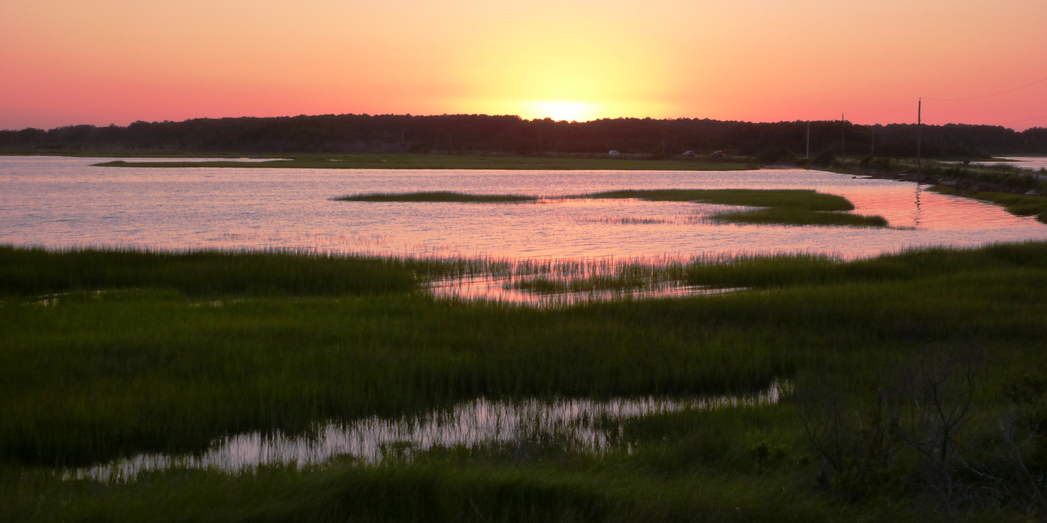
Next, we drove out to the Chincoteague National Wildlife Refuge. We saw a few wild ponies in the distance along with several egrets. The three of us stopped at Toms Cove Visitor Center and walked on the boardwalk. We saw a lovely sunset, shown at the bottom of this page. Just being a few feet above the ground gave one a nice view of all the bay grasses.
We walked over to the ocean and watched the body surfers ride in the waves. Had it been earlier in the day, we might have joined them. 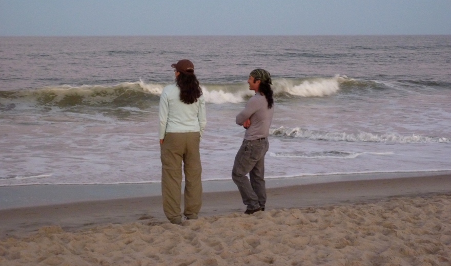
Our last stop of the evening was dinner at the Seashell Cafe. The food was just o.k. We got to bed around 2230. I think I was asleep as soon as my head hit the pillow. |
|
The night was cool (high 60s) and without too many biting insects considering we were on the eastern shore in July. No rain. We couldn't have asked for nicer weather.
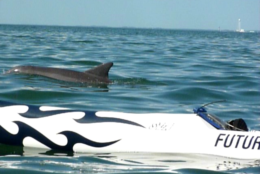
We launched at 0820. I wanted to get out early because I know fishermen like to fish early in the morning and of course dolphin eat fish so it only made sense that they too would be out. 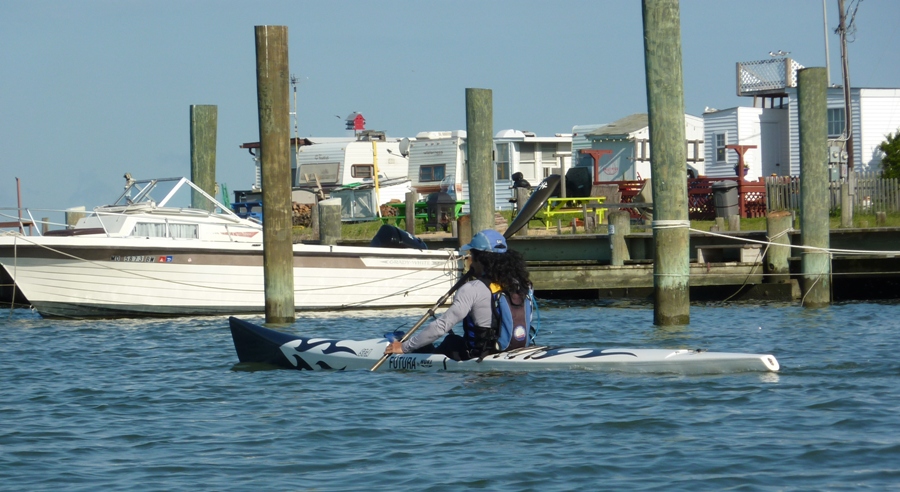
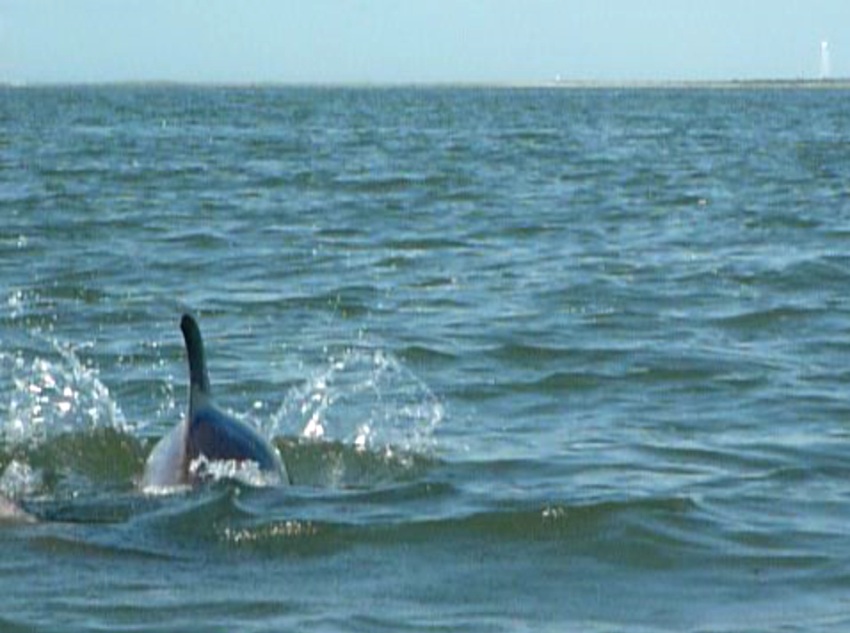
I led Norma and Carmen southeast through The Canal. Here, the water from the ocean pushed into the Chincoteague Inlet at two mph in some spots. Within about 20 minutes, I heard Norma screaming. She saw a dolphin. I was surprised. The last time I was here, I saw just one such creature over about three hours. I only saw its dorsal fin pop up out of the water once, then I never saw it again. So when Norma saw her first dolphin so quickly, I felt really good since I knew she would truly appreciate seeing such an animal in its natural habitat. I would have been disappointed had she not seen any. We stopped to take photos and make videos. Norma was the photographer for the weekend. Hence, I am in numerous shots. The dolphin we saw was not alone. There were about four of them...possibly a bachelor pod. About 600 feet to our east, we saw several other dolphin so we paddled closer to get a better look. We found a whole school of them, maybe 13. These were the adult females with their offspring. As the mother would surface, so would the juveniles, so if we saw one, it was likely another one or two would be right behind. We were close enough so we could hear them surface and breathe. One even came within about six feet of my boat. The experience of seeing such beautiful creatures in motion was breathtaking. As the school moved on, we paddled south to a sand bar where we saw numerous pelicans. 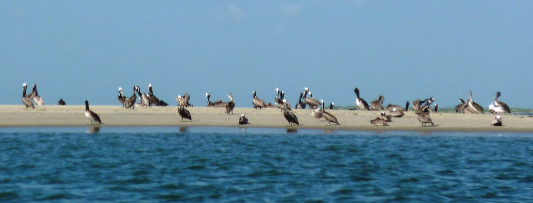
From here, we continued south to Fishing Point. Around this area, we found another school (I'm assuming it was a different school but I could be wrong) of about 10. They typically surfaced about every 11 seconds and moved at about 5.5 mph. I could easily keep up with them in my surf ski. If I was in their path, they would swim under (or around) and I wouldn't see them again for a long time. They did not interact with us like they do on television. Along with the school, we also saw a few others (probably bachelors) in smaller groups. Norma caught some really nice video footage of the dolphins we saw that day. 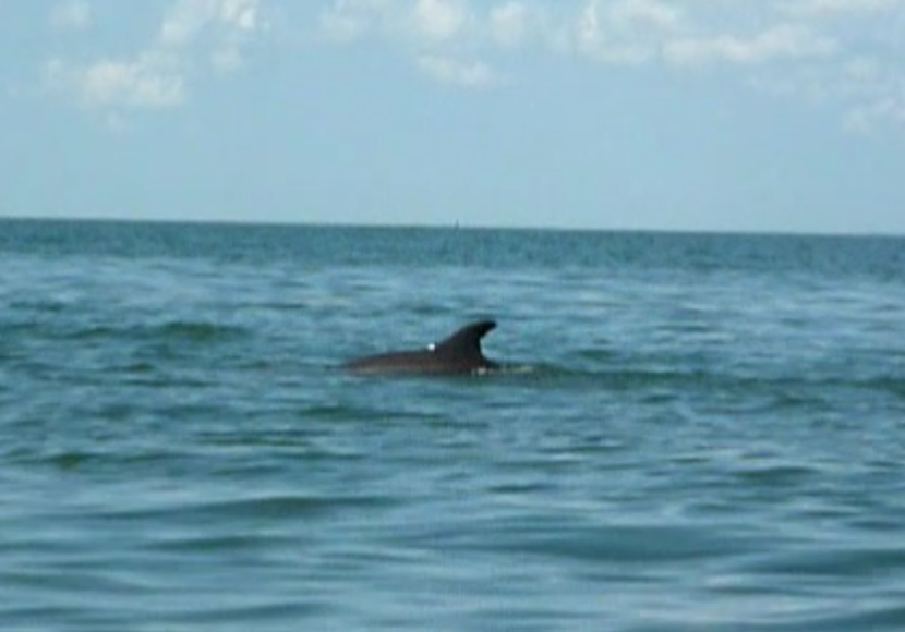
Here's a slo-mo shot of one breaching on the starboard side of my surf ski. 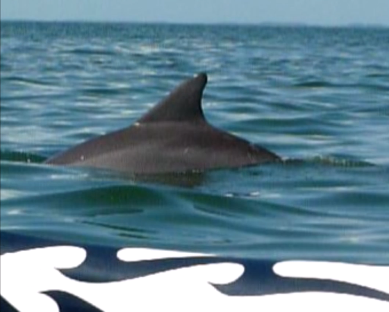
Turn up the volume and hear the excitement in Norma's voice. 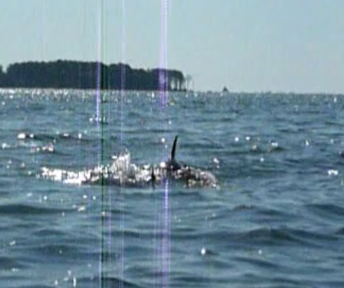
Just south of Fishing Point, we saw a bald eagle on the beach. It wasn't moving so I thought it was a log until it flew away. But after seeing about 30 dolphin, seeing the eagle seemed insignificant. We pulled ashore on the beach just southeast of Fishing Point. This is the southernmost end of Assateague Island National Seashore. It is here that I stopped last year to collect several large conch shells. But I was only able to gather two before park personnel asked us to leave. It turns out that a certain type of small bird was nesting or mating on the beach so it was closed from March 15 to August 31. Next, I led Norma and Carmen west to Wallops Island. There were numerous signs on the shore that warned of explosives. Here I am kayaking away from such a sign. 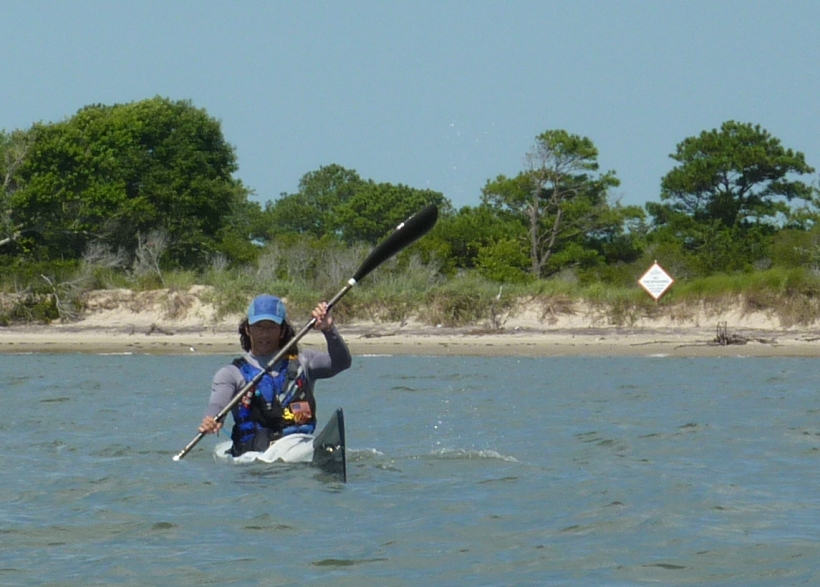
We paddled north on the east side of the island to Gunboat Point. There were no signs here so we pulled ashore on the beach for a rest. Unfortunately, there were no conch shells here. 
The last part of our journey was the roughest. We had to paddle from Gunboat Point heading north to Chincoteague Point. Here, the waves were strong. I had to try to keep from surfing or else end up in the wrong place quickly. I found myself far ahead of Norma and Carmen so I found a pile to grab onto to keep from drifting. But the waves pushed me and my boat up against the pile so I had to use both my feet and hands from crashing into it. One big wave pulled my boat away from the pile as I held fast. My boat flipped and I fell out. My fingers got scratched up from the barnacles. Much to my surprise, the water was only four feet deep. Once Norma and Carmen caught up to me, I continued on. Big waves sent buckets of water against my upper chest. Fortunately, we only had about a half mile left. A washing machine-effect was created with waves reflecting off two sides and heavy boat traffic only made things worse. But in the slow and stable Cabo, Norma and Carmen had no problems staying upright. We finished at about noon after paddling 7.7 miles. Today's trip is definitely in my top 10 of most memorable kayak trips to date. |
|
After loading up the boat and changing clothes, we started driving back. It was a great trip but I'm glad we were only out for a weekend. Three people, two kayaks, two bicycles, and camping gear is about as much as my tiny little car can carry.
We stopped for lunch at Plaza Tapatia where the food was pretty good but the service slow. The big reason we ate there was so Carmen could watch the Women's World Cup Soccer match between the United States and Japan. This only happens every four years. I'm not much of a soccer fan (or sports fan) but I found the game impressive and the players to be phenomenal athletes. We left after the first half. Carmen and Norma listened to the game on satellite radio for much of the trip back. I slept soundly while Norma drove. After we made it across the Bay Bridge (always an accomplishment on a summer Sunday afternoon), we stopped at Red, Hot, and Blue to watch the last few minutes of the game which was now in overtime with a tie score of two to two. We ordered a fine pie and ice cream dessert. One serving was easily enough for two people. Even after overtime play, the score was still tied so the decision was made with penalty kicks. This is where Japan came out the winner. We dropped Carmen off at the Greenbelt Metro then headed home. Norma and I made it back with enough time to unload, clean, and put away the gear before dusk. |