|
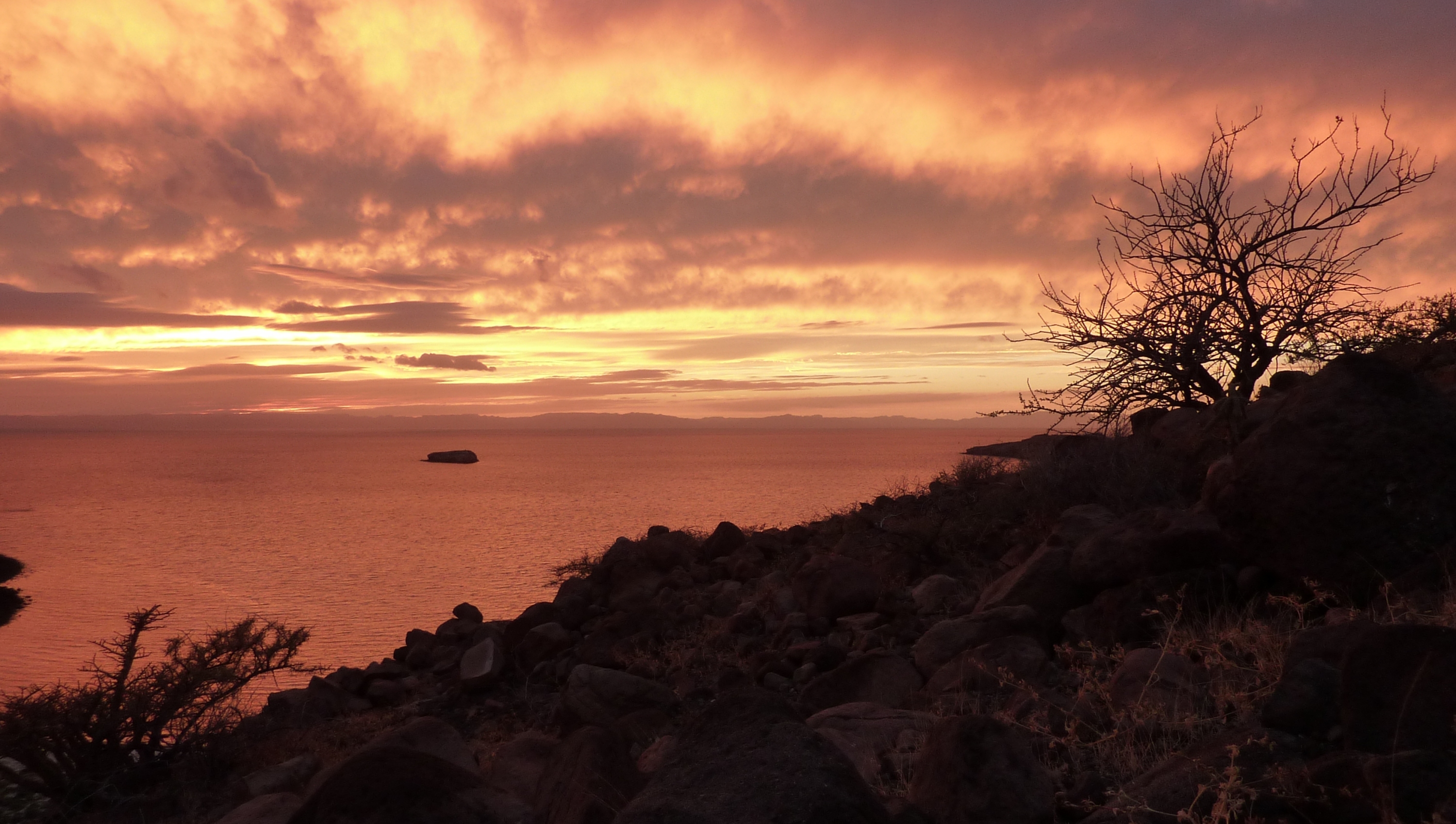
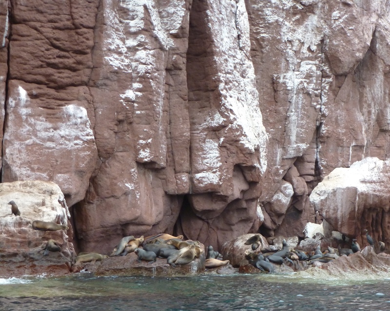
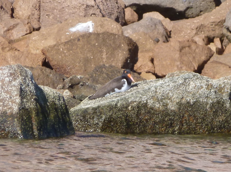
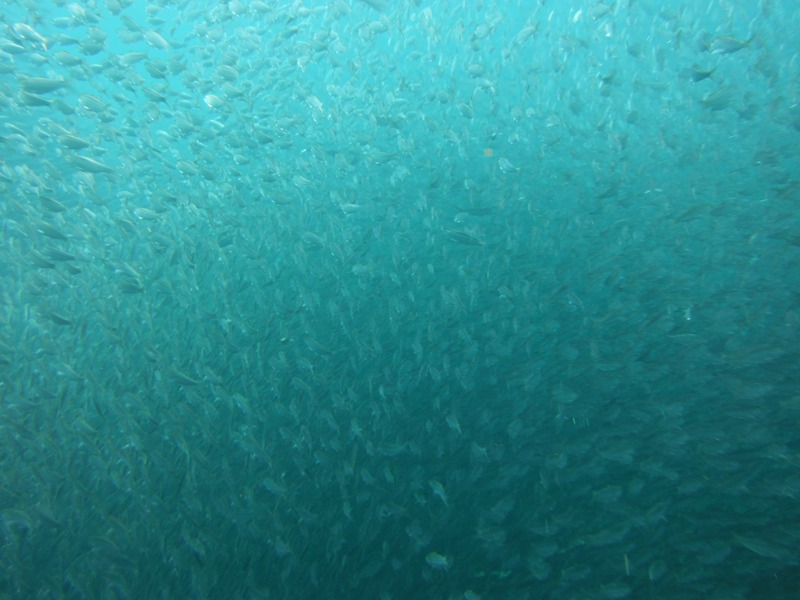
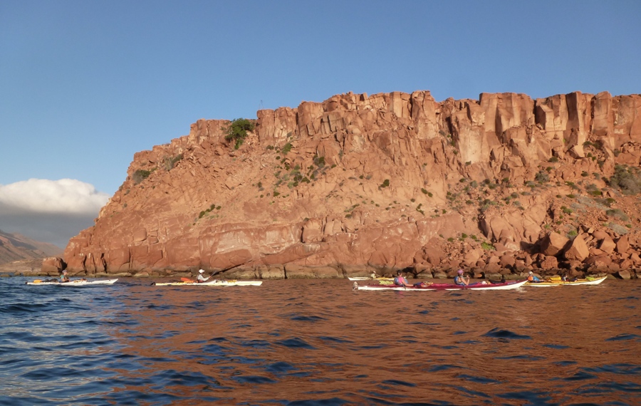
The above photo was taken January 3, 2013, just off Espiritu Santo Island, Mexico. This blog documents a fantastic honeymoon vacation we spent there kayak camping. |

|
The above photo was taken January 3, 2013, just off Espiritu Santo Island, Mexico. This blog documents a fantastic honeymoon vacation we spent there kayak camping. |
|
On October 7, 2012, Norma and I got married. But unlike most newlyweds, we didn't head off on our honeymoon right away. We still had guests to entertain for the following week. Plus, with all the planning, preparation, and entertaining, we just needed some time at home to recover. But we figured by December, we would be ready for a big getaway.
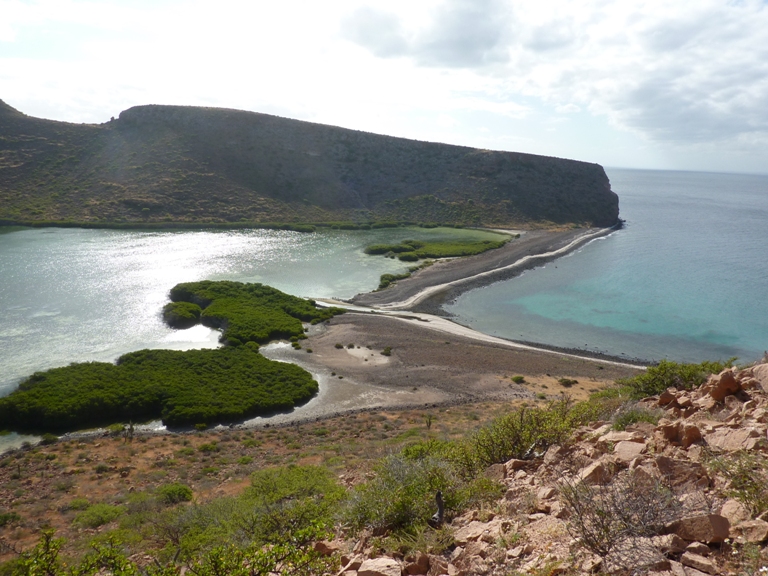
The first question was where to go? Norma gets some time off at the end of the year and I always have a few days of leave around then. Winter can be nice if it involves cross country skiing but it is also nice to go someplace warm. The latter seemed like a good option. We considered the Arizona and New Mexico areas but she thought someplace more exotic would be better. After much research, we decided on Baja California, Mexico. Our trip would be on the east side, with an outfitter called Baja Outdoor Activities (BOA). They would take us kayaking in the Sea of Cortez (the east side of the peninsula) around an island just north of the city of La Paz called Espiritu Santo Island. "Espiritu santo" means "spirit of the saints." Isla Espíritu Santo is an island in the Gulf of California, off the Mexican state of Baja California Sur ["sur" means "south"]. It is connected to Isla Partida ["isla" means "island"] by a narrow isthmus. It has a land area of 80.763 km² (31.183 sq mi), the 12th-largest island in Mexico. Isla Partida's land area is 15.495 km² (5.983 sq mi). They are part of the Municipality of La Paz and are both a short boat trip from La Paz on the Baja California peninsula. - from Espiritu Santo Island According to Visit Mexico (a broken link as of 2020), Espiritu Santo is one of the world's best-preserved sanctuaries. You haven't fully experienced La Paz until you take a boat ride to its barrier islands: Espiritu Santo and Partida. Closest to the Pichilingue Peninsula, Isla Espiritu stretches 11 miles long and 3 miles wide. It boasts dozens of lovely bays, rich marine life, and land-based reptiles, birds, and amphibians. This 23,800-acre desert is one of the most unspoiled ecosystems in Baja. It boasts five species of mammals and reptiles, including a ring-tailed cat, black jackrabbit and a ground squirrel that are unique to the island. Archaeologists have found evidence that humans stepped upon this island as long as 40,000 years ago. Isla Espiritu Santo is a marvel of natural conservation and evolution. This Mexican island is not to be confused with a different Espiritu Santo Island near Australia. Maybe that will be another trip. Working through an outfitter is a good idea when exploring such a remote, foreign area. Otherwise, there would just be too many unknowns and too much planning: where to stay, what to see, how to get around, etc. Then of course, the language and culture barrier further complicates things. Maybe we could do it on our own but we did enough work to get ready for the wedding. Now it was time to relax and have fun. BOA would take us from La Paz to Espiritu Santo Island via motor boat. Then we would paddle three to four hours per day, carrying all the needed gear for the group. We would set up camp, help with meals, and spend some time on our own, hiking and exploring. This is what they refer to as a co-operatively catered expedition. I did a trip like this in early 2006 in New Zealand. This is a great way to go for people that want to have an active, outdoorsy vacation surrounded by nature. One of the first questions I have for any kayak trip is "what will the weather be like?" According to La Paz, Mexico, the January average high is 73.9 degrees while the average low is 49.5 degrees. Average rainfall is 0.657 inches with an average of 2.2 rainy days in the month. BOA FAQ mentions that the January air temperature at Espiritu Santo Island typically reaches 68-72 degrees in the day and the 40s at night while the sea is 66 to 68 degrees. I decided it would be best for us to bring our own wetsuits and neoprene shirts (Norma got one for Christmas from her sister Joyce, just a few days prior). We wouldn't have much room in the kayaks for packing personal gear so I figure one pair of paddle shoes (sandals), one pair of hiking shoes (light duty boots), and layered clothes to keep us comfortable in cool to warm conditions would suffice. BOA rents quite a bit of gear but to keep costs down, we brought our own tent and sleeping pads, and I brought my own snorkeling gear.  |
|
I took a couple of years of Spanish in high school. Norma took Spanish in college. Between the two of us, we knew little. Prior to leaving, I brushed up on some words and phrases we might need which I found at Spanish Dict:
airplane: avión airport: aeropuerto bathroom: baño boat: barco breakfast: desayuno coffee: café coffee with cream: café con crema dinner: cena food: comida guide [noun]: guía how long does it take to walk to: ¿Cuánto tiempo tarda para caminar a? how much: Cuántos how much does it cost to drive is to: ¿Cuánto cuesta para llevarnos a? hotel: hotel juice: jugo kayak: kayak lunch: almuerzo minute: minuto taxi: taxi tea: té where is: dónde es By the time the plane landed, I knew how to say "hotel," "kayak," and "taxi" in Spanish. We flew out of Reagan International Airport on an American Airlines flight then stopped at Dallas where we had a bit of a layover. I exchanged some dollars for pesos there. Then we flew into San Jose del Cabo, Mexico. Walking off the plane then onto the runway was pleasant. The temperature was most comfortable. I am guessing it was in the high 60s. It was sunny too. I was glad I brought my sunglasses. San Jose del Cabo Aeropuerto (Los Cabos International Airport) has a bus station and a couple of places to get something to eat. One was an American Subway sandwich shop and the other was a little Mexican restaurant. I chose the latter, ordering a burrito. It was a little different than I expected (no rice) but still good. An airport shuttle bus (really more of a van) took us from the airport in San Jose del Cabo to La Paz, Baja California Sur (BCS) Malecón. On this trip, we got our first eyeful of the terrain. It was definitely a desert, but totally unlike the desert I spent a few months in during the Persian Gulf War. The latter was barren, flat, void of vegetation, dunes, or rocks. In any direction, one could see all the way to the horizon. It was like a bare canvas that God had forgotten to paint. In contrast, the Baja desert was full of life. There were lots of cacti and other plants, There were hills, rocks, bushes, and most certainly animal life, though we didn't see any from the bus. The sun set about 90 minutes later than in Maryland, giving us more opportunity to check things out. At least that's what Norma did. I, on the other hand, was fast asleep. Our bus driver was a nice fellow with good English. I remember sitting by a Canadian couple who flew out for some really serious scuba diving. The man seemed a little negative (and occasionally misinformed) about some world issues that he discussed which included overpopulation, energy, China, and climate change, but otherwise he was friendly. He ran into the unfortunate incident of having his scuba gear lost (or stolen) in transit. This is always something I am a little paranoid about and thankful when it doesn't happen. Our original plan was to take a taxi from the bus station to the hotel but instead, our driver took us directly there. He seemed cheerful and very helpful, despite working really long hours and not getting to spend much time with his family. |
|
Norma and I checked in at Hotel Araiza, which is located at the northeast end of the sea promenade in La Paz. The hotel is roughly 5-10 minutes driving time or 30-40 minutes walking time from downtown La Paz. It is a nice hotel. On each floor is a water cooler with drinking water suitable for our fragile American bodies. But it sometimes ran out before it got refilled. Fortunately, we had enough in our water bottles that night to last us until the next morning.
We walked south, to the downtown tourist area and the central part of the Malecón. The Malecón is one of La Paz’s most endearing features and has long been a focal point of La Paz life. The walkway along the frontage of the Ensenada de La Paz, or Malecón, is a favorite place to stroll on Sunday afternoons, enjoy the sunset on almost any evening and of course is the home to Carnaval La Paz. The word 'Malecón' literally translates to levee or jetty, but in this case it really means boardwalk. - from The La Paz Malecón Along the way, we passed an area full of Christmas lights and decorations. Though Christmas was only three days past, it hardly felt like the holiday season with such warm weather and the desert landscape. I guess having a white Christmas is rather foreign in these parts. On the Malecón, a few people rode around on three-wheeled recumbent bicycles. These were obviously rented and for tourists. Those things maneuver fairly well and look like fun. Nobody rode them on the street since they are too low to be seen. They must be pretty easy to get used to. Otherwise, we would have seen some people falling off the Malecón and into the water, sand, or rocks. I call them "lowrider tricycles." We ate dinner at a place called Bismark Cito. Here, we both ordered fish. It was somewhat expensive but also delicious. It cost less than the fish I recently ate at the Cheesecake Factory and was much better. Still, things seemed pricey considering we were in Mexico. Norma read that in Baja, things are not much cheaper than in the states, in contrast to the rest of Mexico. This is probably due to two factors - the distance things have to travel and number of tourists. There were a good number of what I believed to be Americans and/or Canadians out and about but mostly I saw Mexicans. Some were probably local but I am thinking many were wealthier folk from the non-Baja side on holiday. The last time I was in Mexico was around 1983. I was with my parents in Puerto Vallarta. I had just completed a year or two of Spanish and got to try out what I had learned. It wasn't too terribly helpful but certainly better than nothing. But as is typically the case for tourist areas (such as La Paz), many of the people that work at restaurants, stores, hotels, and outfitters speak a good bit of English. So we got around pretty well. When words were not sufficient to communicate, I found miming to be helpful. |
|
Norma and I headed downstairs for breakfast. There was both indoor and outdoor seating. The outdoor temperatures were somewhere between cool and comfortable. The hallways in the hotel were covered but open to the outside air. The climate reminded me of Sacramento in springtime.
Our continental breakfast (included with our stay) was most impressive. Norma got an omelet made to order. I filled up on scrambled eggs and breakfast meat. It was nothing like continental breakfasts I've sampled elsewhere. We headed out into town. I wore my new trilobite shirt which Norma bought me for Christmas. I was hoping a shopkeeper would see it then try to sell me one, which I would have gladly bought. Then maybe he would try to sell me the beak of a Humboldt squid or a giant squid, which live in the area and are known to attack humans. Giant squids have three hearts and eyes the size of soccer balls. They hunt in groups of at least 1,000. The giant squid can grow up to 40 feet long and 500 pounds, making them very difficult to combat. They survive so deep underwater that no light penetrates whatsoever. The pressure at that extreme level would crush any elephant or large land animal. - from Giant squids kill fisherman The view from the Malecón was nice. On one side was the Gulf of California (synonymous with the Sea of Cortez). 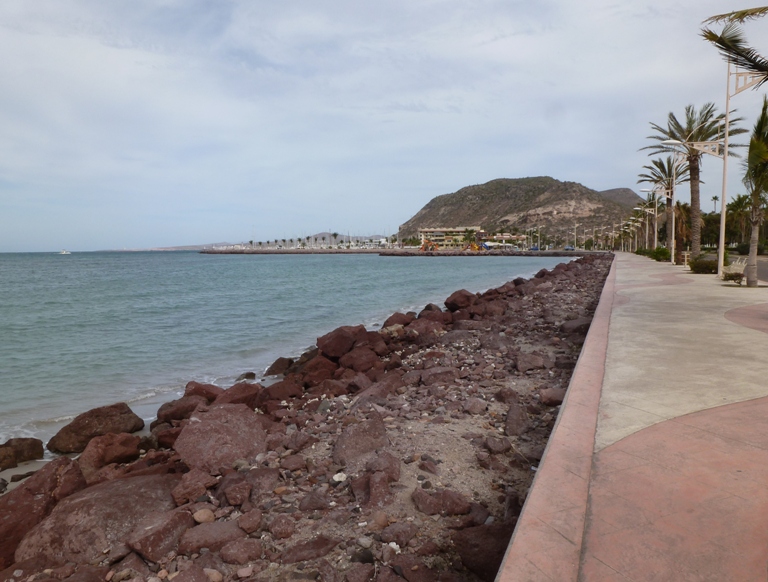
To our northeast, we saw hills. To our south was the city. Palm trees blew in the breeze as we strolled. 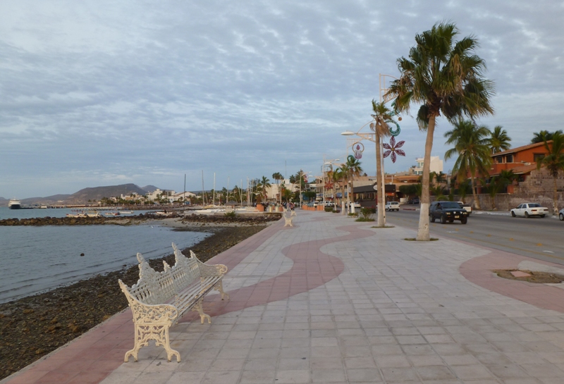
More lowrider tricycles raced by as we occassionally stopped to look at statues by the water. The one in below is a manta ray, which can have up to a 30 foot wide wingspan and live locally in the waters around La Paz. 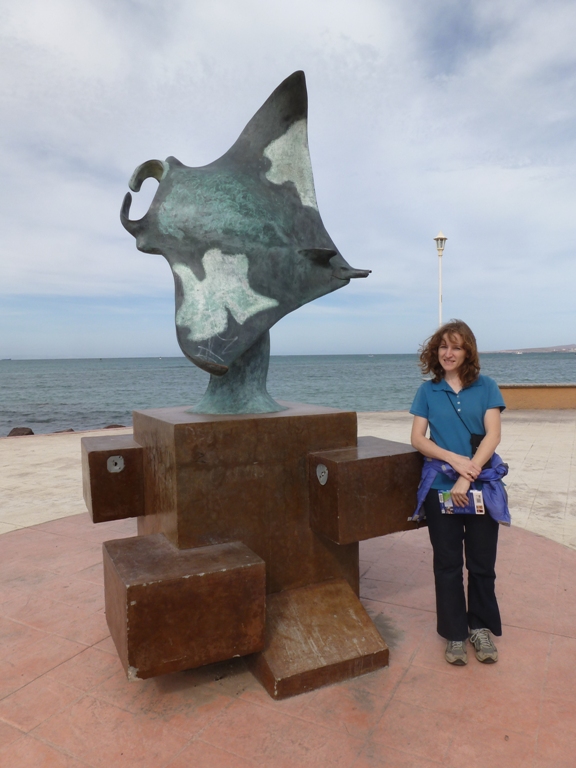
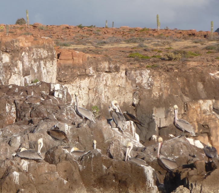
There were some fishing boats pulled up along the beach that provided resting spots to pelicans. I spotted reddish egrets. 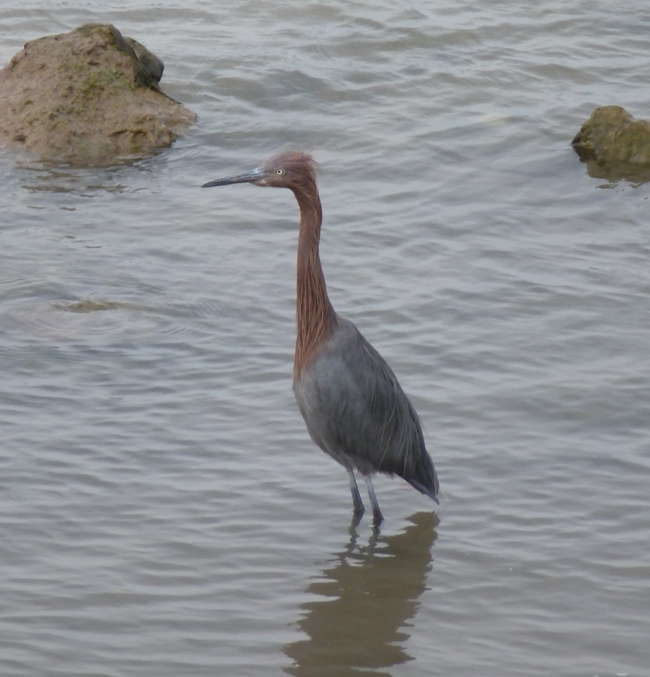
Away from the Malecón, things looked a little more urban and less touristy. Graffiti was common. Sidewalks were uneven, torn up, and broken. This isn't the place to be if you use a wheelchair. We made our way to the Museo de Antropologia, which is the Regional Anthropology and History Museum of South Baja California. 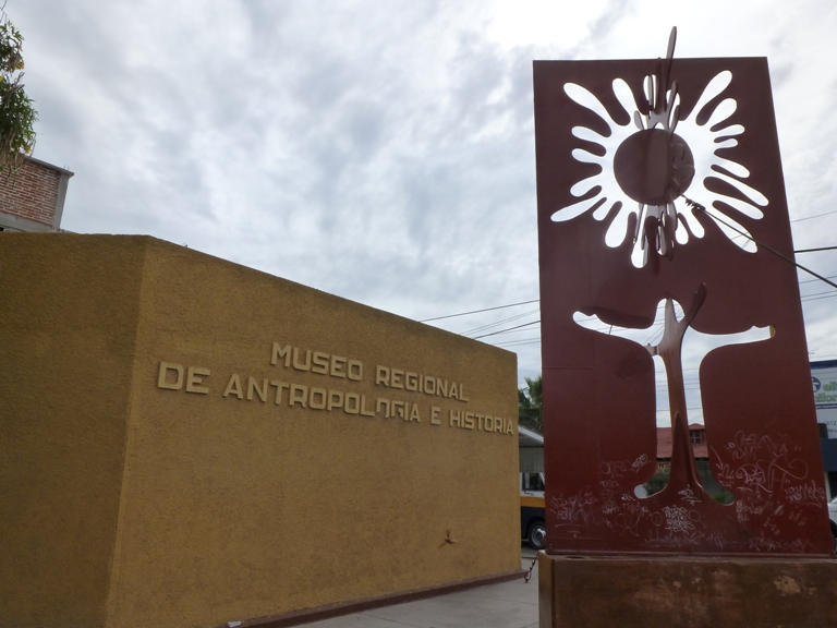
The museum had a small entrance fee which I believe was something like the equivalent of $3.50 per person. We saw a Mayan exhibit, some stuff about prehistoric cave paintings, and some local fossils: woolly mammoths and saber toothed tigers...but no trilobites. The staff was friendly but they clearly overestimated our ability to comprehend Spanish. Most of what they said was jibberish to me but once in awhile I would pick up key words like "mammoth." Norma and I walked by Our Lady de La Paz Cathedral. We wanted to go in but there was a wedding about to be performed so we just kept moving. 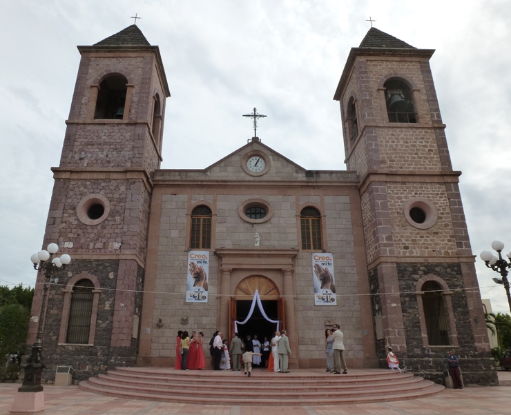
In 1988, I spent six months touring the Mediterranean on an aircraft carrier. One thing I noticed back then is that Coca Cola was everywhere. Diet Coke was harder to find and only the more well-to-do countries had it. Pepsi, on the other hand, was only in the most modern countries. Hence, I began to associate Pepsi with the elite. La Paz is amongst that caste. 
We stopped at a pharmacy to buy vitamins. I bought some Airborne vitamins at the airport but they wouldn't be enough to last the whole trip. The pharmacy didn't have Airborne but they did have vitamin C so I bought that instead. After leaving the store, I chewed a tablet. It almost knocked my socks off because the taste was so powerful. They were much too big to swallow so I figured I was consuming it correctly. But since the directions were written in Spanish, I wasn't certain. I found out later that they are like Alka Seltzer and should be dissolved in water. But with a glass of water not usually handy, I just chewed them for the remainder of the trip. First thing in the morning, chewing one was a good way to wake up. Our next stop was the Museo Comunitario de la Ballena (Community Whale Museum). Unfortunately, it was closed but we were able to see several whale skeletons on display outside. Numerous whales can be seen in the Gulf of California though they are not typically seen in late December and early January. 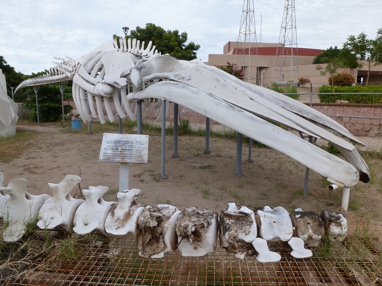
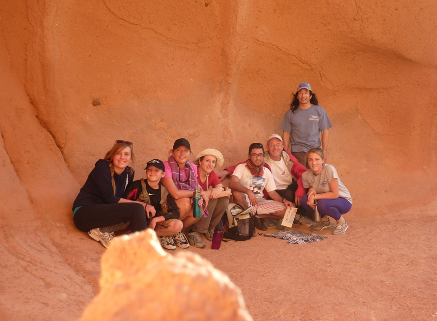
Though we didn't get to see what we wanted, we were having a good time anyway. I enjoy walking around new places and seeing things I have not seen. Trees along the street and on private residences were exotic as compared to the mid-Atlantic region of the United States. However, some resembled plants I grew up around in California. It was a little hard to dress appropriately for the weather. I think I've been away from California for too long, being acclimatized instead for more humid environments. Away from the wind but still in the sun, it was warm. With sun and wind, it was cool/comfortable. In the shade, it was cool. In the shade and wind, it was cool/cold. I think the high temperature that day was in the high 60s and in the latter part of the evening, it felt like the low-50s. It would be like this for most of our stay. Norma got us around town, using a Baja & Los Cabos Lonely Planet book which she picked up from the library. While it was certainly helpful, it was also a little outdated. It was published in 2005, which doesn't seem so long ago, but she thought many things changed between then and now. Finding things in the city was a little difficult because street signs were not so common. At least there were maps with the familiar "You are here" arrows. One thing we looked for but didn't find was one of the supposedly many taco stands. After giving up on that, we found ourselves at a newly reopened restaurant called Blue Room. We were standing around in front when the owner came out and talked us into trying out his food. The last time this happened was June 13, 2012 with Carmen in Pittsburg. That was a good choice because the owner was so enthusiastic. Our dining experience at the Blue Room was also positive. It was only about 1600 so we were the only ones there. He was expecting a big party later that evening and encouraged us to return. We ordered tacos. Behind the building, he prepared our dinner on a grill. He brought out six tacos, three with one cut of steak, and three with another. These weren't tacos with a small sprinking of ground beef like I would expect at Taco Bell. Instead, each had good meat on freshly made tortillas. When we went to pay for them, the owner had to think for awhile. He wasn't sure what to charge and when he told us, we were a little surprised he didn't charge more. Back at the hotel, we attended a trip briefing in the lobby at 2100 with Francisco (one of the guides) and the rest of the group, which consisted of a family of five from Canada: Rob, his wife Anita, daughters Kim and Leah, and son Scott. Francisco gave us each a 30" x 9" dry bag. All our personal gear that we wanted to keep dry had to fit in there. Norma and I started packing then called it a night. |
|
After finishing packing, Norma and I went downstairs, expecting another fine breakfast. But this time we were told that the continental breakfast only includes cereal, fruit, toast, bagels, and pastries. The eggs, meat, and omelet is only for the full breakfast, not the continental. So yesterday, ignorance was bliss. At least the fruit was fresh. And the orange juice was freshly squeezed.
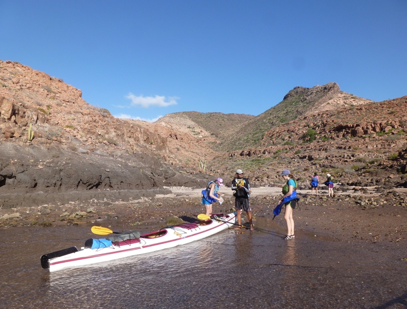
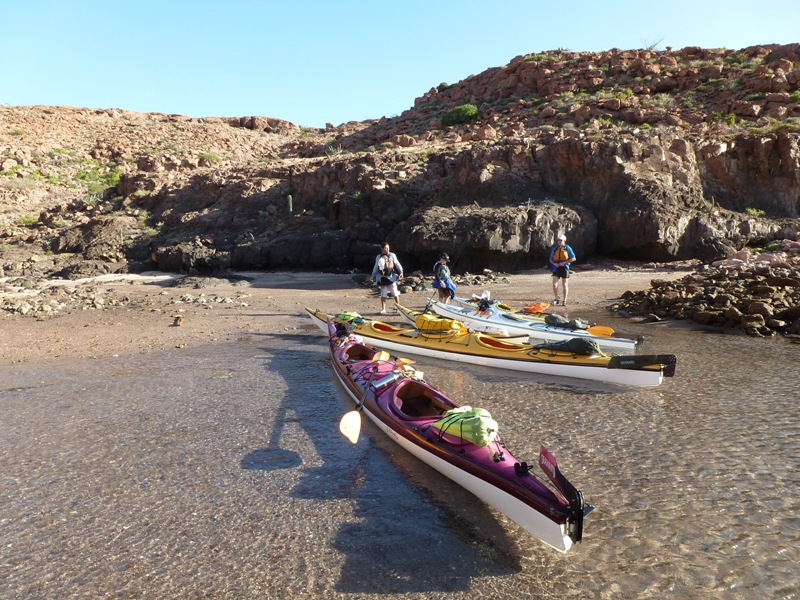
Francisco picked us up in the company van then drove us to the BOA building. There, we were issued our gear and introduced to the other guide, Raphael. Both were quite friendly, knowledgeable, and spoke very good English. Their kayak training was through the British Canoe Union (BCU) which has a good reputation so I figured they must be competent. Another trip took us to the dock, where we loaded up our gear then headed out to Espiritu Santo Island in BOA's motor boat. 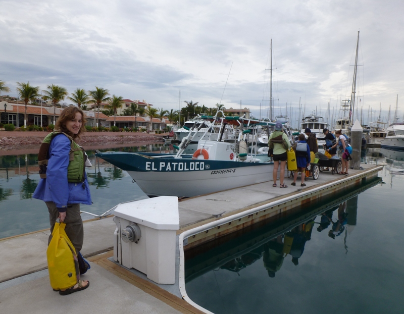
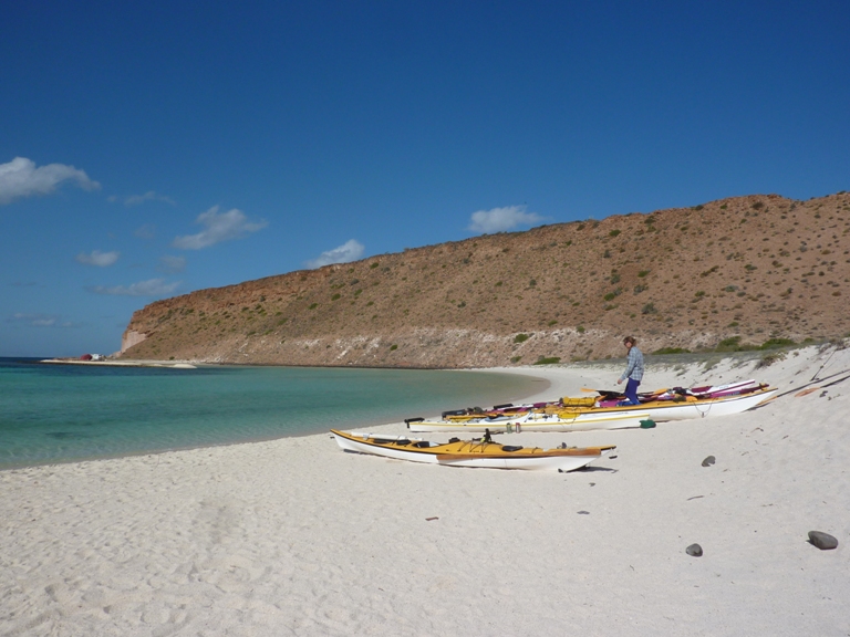
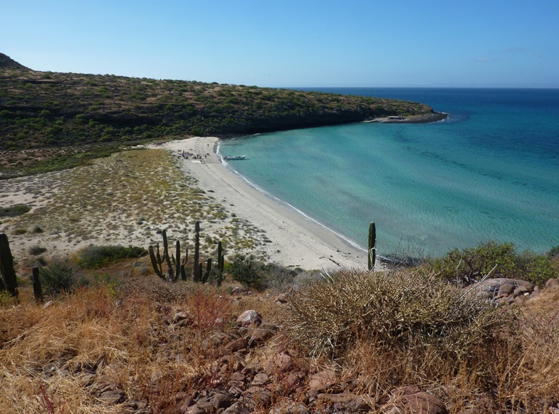
It took about 40 minutes to get to the island, which is about the same size as Kent Island in Maryland. I shouldn't have had my morning tea. Tea rhymes with pee and that is what I had to do after about 15 minutes. I finally had my chance once the boat stopped. I decided that with all kayaking we would be doing, it would be best to go without caffeine for the remainder of the excursion. We were at a place called Playa Dispensa (Exemption Beach). 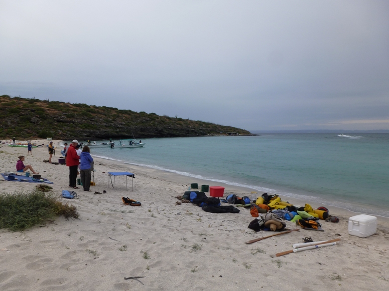
This beach appears at #3 on the BOA island map, shown below. 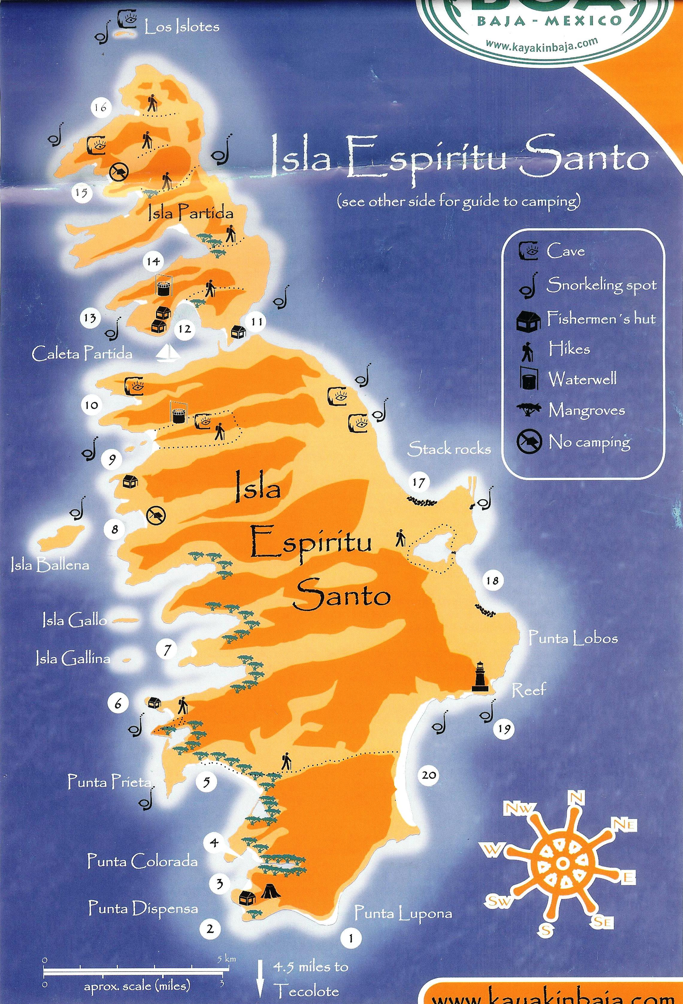
The island is not far from the South Baja mainland, as one can see in the below map of Espiritu Santo Island and La Paz. 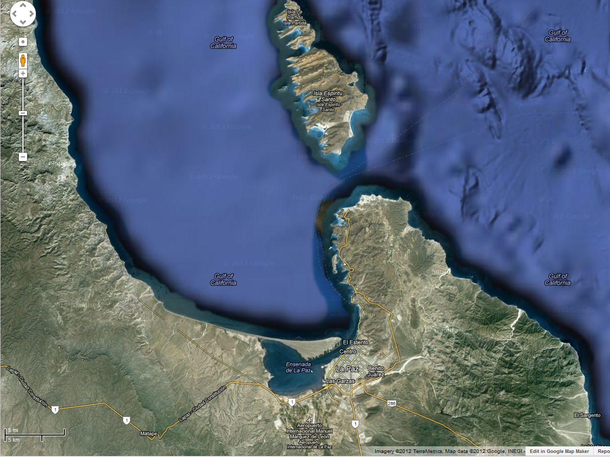
Here's a satellite view of just Espiritu Santo Island. 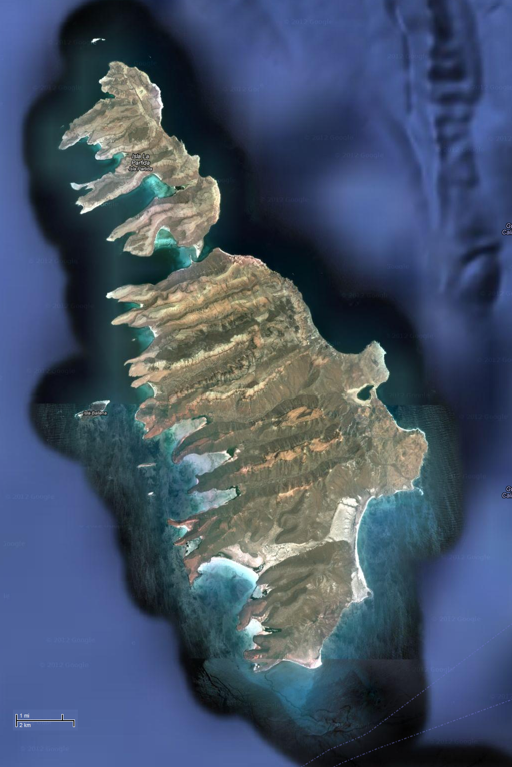
After getting our gear unloaded, Francisco showed us how to set up the sun canopy. Instead of using tent stakes, we used flat, square pieces of wood, each about 5"x5". I call them "tent squares." These were buried about a foot into the sand. A 2' long rope attached to the center of the square and stuck out of the ground. We used one tent square to support each canopy line. If the sand was too soft, we poured water over the sand to make it heavy. Putting a rock on top of the sand over the tent square helped too. It worked pretty good in up to moderate wind...certainly much better than tent stakes. Our guides spoke about how we would set up our kitchen. Utensils were carried in a big canvas roll-up. Pots and pans were carried in a mesh scuba bag. Two collapsible buckets were filled with sea water. Then, one had biodegradable dish soap added while the other got some bleach. Wash in soapy water then rinse in bleachy water. The two buckets comprised our dishwashing station. There were also two camp tables. One supported our two burner propane stove. The other was used for food preparation. Raphael introduced us to "Paco," a Coleman toilet. That's not the model name, just a name they gave it. It fit easily into the center hatch of the largest tandem kayak, which Norma and I paddled. Paco was our number two (s**t) collector, with number one taking place anywhere below the high tide mark. Used toilet paper was folded infinitesimally small and put in a garbage bag which we carried away. Meanwhile, number two was mixed with bleach (and/or possibly something else) to kill germs and render things harmless before dumping into the sea, far, far away from shore. Raphael mentioned that we would all have a chance to learn to do and demonstrate a "wet exit." This is how one gets out of the kayak if it capsizes. It simply involves pulling the tab on the sprayskirt to release it, pushing oneself out of the cockpit, then floating to the surface. It is easy but a little unnerving for folks who have never done it. I've done it numerous times but a few people in our group had not. Since the weather was overcast and a little cold, Raphael said that we would postpone doing the wet exit. But we never got around to it during the remainder of the trip which surprised me. This was also the case for my New Zealand kayak trip and that water was much rougher. After loading up the boats, we set out to do a little paddling. We started on the south side of the island and paddled north on the west side of the island. The east side is more open while the west side is full of nooks and crannies that offer lots of interesting exploring and sheltered kayaking. This also made launching and landing easy since the beaches were all in the coves. 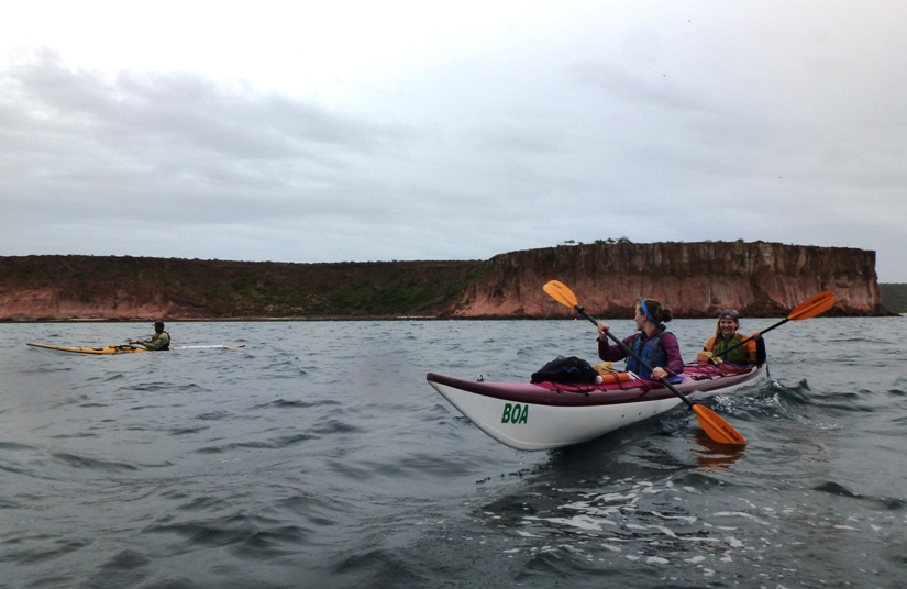
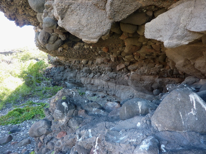
The scenery was different from anything I've encountered before. The multi-colored, layered, volcanic rocks and steep cliffs gave me a lot to look at. 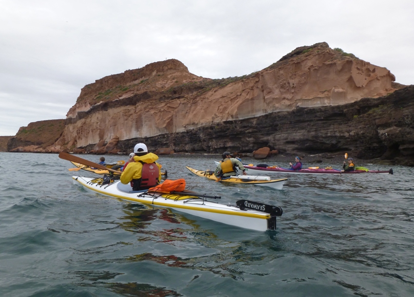
Further back, there were rolling hills in various shades of gray, overlapping each other. 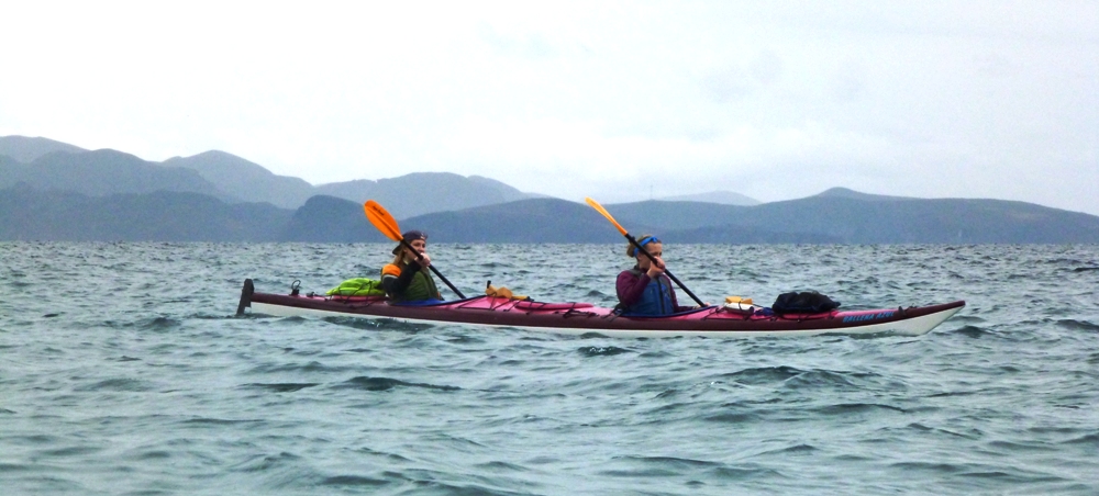
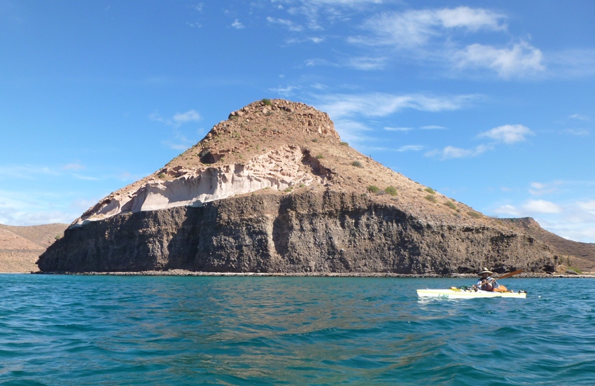
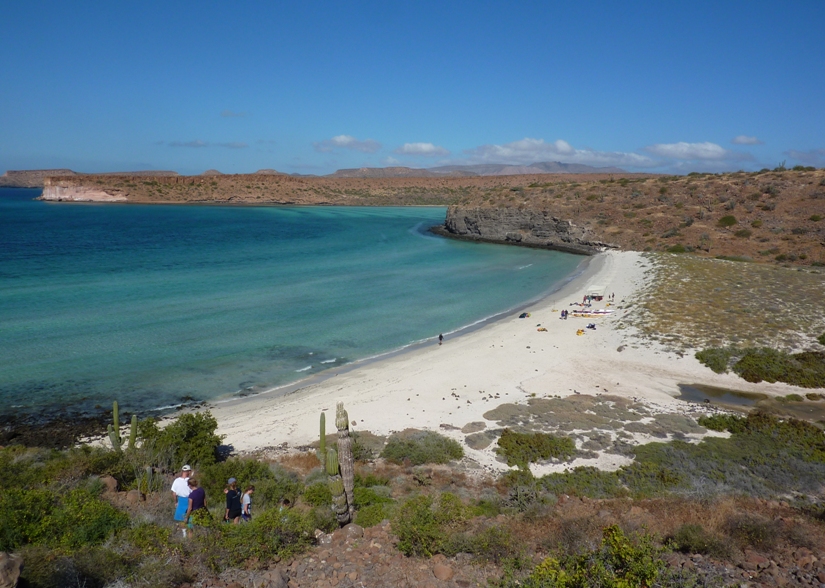
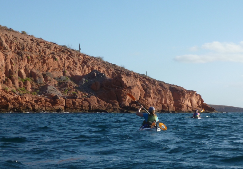
This place was totally unlike the Chesapeake Bay. The water wasn't rough but it usually wasn't totally flat either unless we were in a cove. The air temperature was probably in the high 50s or low 60s but since the sun wasn't out, it felt cold. At least that was my interpretation and that of the Mexicans. Our Canadian friends, on the other hand, had a much different interpretation of the word "cold." I think they were comfortable. Raphael and Francisco spread themselves out amongst our group, keeping watch, maintaining control, and ensuring we stayed on path. They both carried waterproof very high frequency (VHF) radios which they used to maintain contact with BOA headquarters and emergency personnel. Like a lot of the veteran sea kayakers I know, they both used Greenland paddles. A group our size could have either one or two guides but BOA chose to use two because they were forecasting lots of wind. This turned out to be a mixed blessing. The wind would make for rougher paddling conditions but would also give us the luxury of having two guides for safety. Our cost was the same but BOA would make less profit. Everyone did fine in the kayaks. All of Rob's family had kayaking or canoeing experience and we were all pretty outdoorsy. After 4.7 miles of kayaking, we landed at Playa Gallo (Rooster Beach), situated opposite Isla Gallo (Rooster Island) and due west of Isla Gallina (Hen Island). See #7 on the BOA island map. |
|
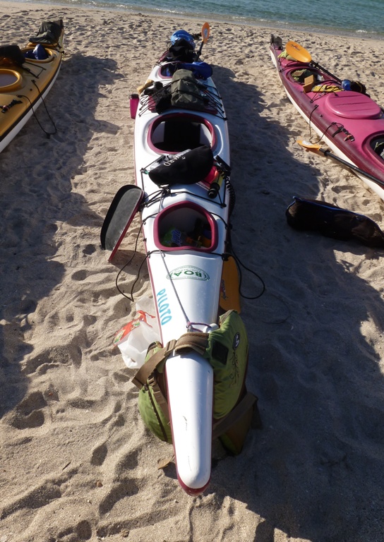
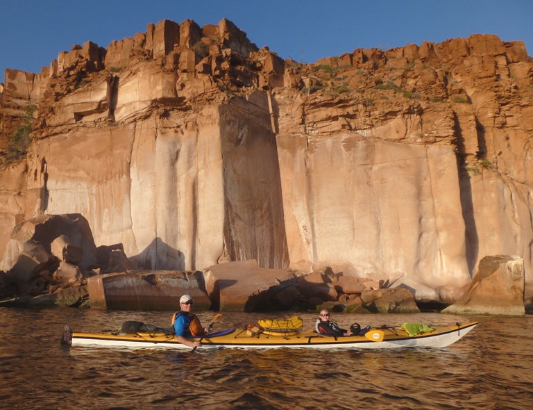
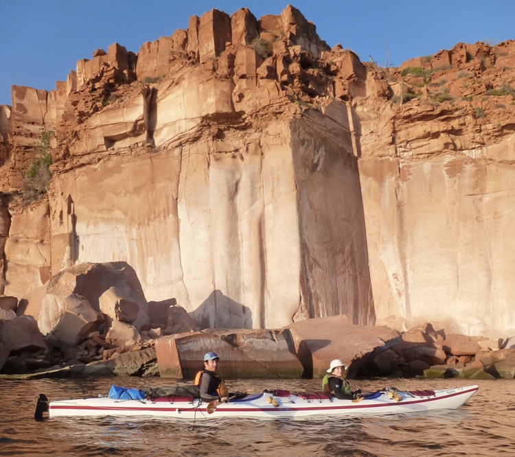
The gear provided by the outfitters was good. The kayaks were big, stable, and made of fiberglass (or kevlar, or some mix of the two). Each had a retractable rudder. I couldn't tell who made the boat that Norma and I paddled since the make and model was not visible. I asked Francisco and he said the maker is "Southwind" but I couldn't find anything about them on-line. But it was wide, very heavy, and durable. Its name was "Piloto." I brought my own bungees and rigging gear but except for a carabiner for my water bottle, I didn't need any of it.
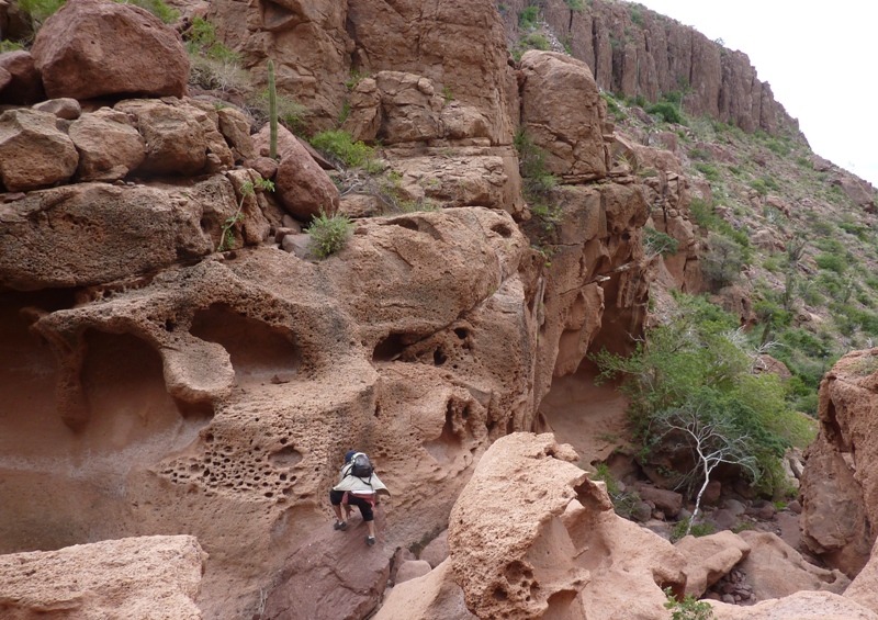
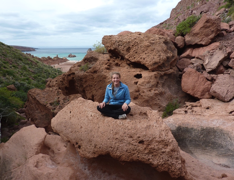
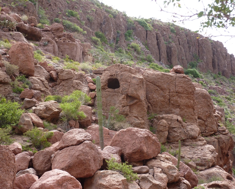
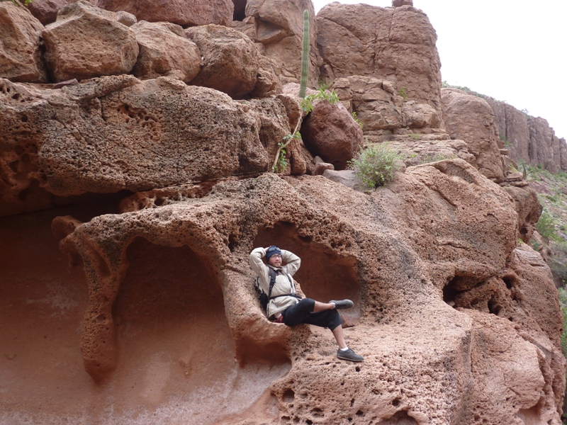
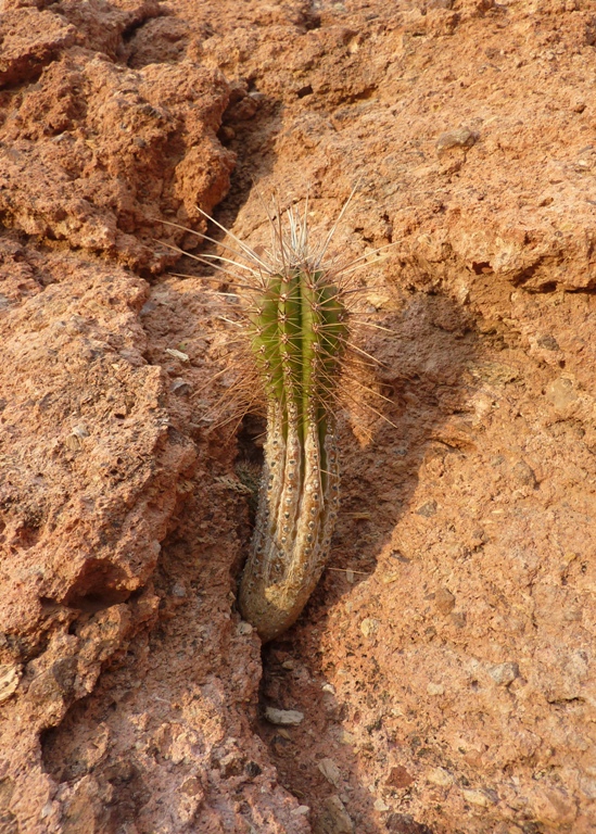
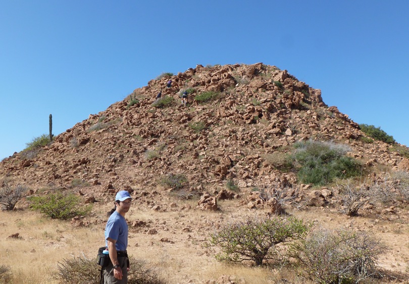
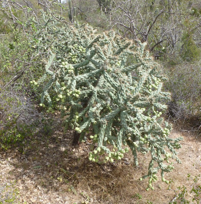
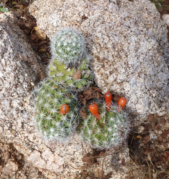
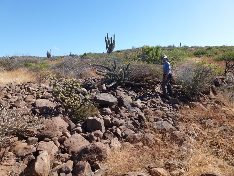
We had spray skirts and Aqua-bound adjustable feather paddles. The rented tents had big vestibules, which came in handy when it rained. In contrast, my REI Quarterdome Tent is more minimalist and better suited for backpacking. Six tent squares ensured it didn't blow away on the sand. Espritu Santo Island is a national park. That is why we carried our own toilet. Campfires were prohibited. To keep things pristine, we were told to stay off the sand dunes. But otherwise, we could pretty much walk anywhere. On the beach, broken pieces of coral and shells were everywhere. I found a scallop shell that was six inches wide! Our beach wasn't the best place to walk around barefooted. Scott learned this the hard way one day after stepping on a dead puffer fish. They are sometimes called "balloonfish," "porcupine fish," or "blowfish". Further inland, volcanic rocks, cactus, and other plants dotted the landscape. Like some of the plants in the Sacramento area, spiky seeds clung to our clothing to aid in seed dispersal. I call them "velcro seeds." Other plants, which I was not familiar with, attached themselves to our pants. But these weren't seeds...they were leaves. The didn't peel off so easily. Scraping what did not peel seemed to be the best way to remove them. We climbed up one of the hills where we had a fantastic view of the area below. On the ridgeline, we could see into the next cove, which looked lush with vegetation. There were lots of cacti around us, living, dying, and dead. Some of the dead ones were particularly interesting because their woody trunks were as holy as the pope. 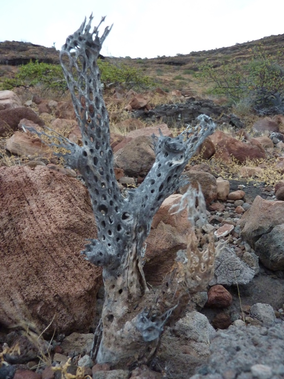
"Red skies at night, sailor's delight" was the view in the photo at the bottom of this page as we made our way down the hill. Around 1800, Norma and I finished our exploratory walk then commenced to help make dinner. I grilled beef while she and a few others cut veggies. Our meal was satisfying and tasty. We weren't totally sure what to expect with the co-operatively catered expedition but we figured that anyone signing up for this trip (rather than the fully catered one), would be social and eager to help out. This was definitely the case. Rob's family was easy to get along with and very helpful whenever there was work to be done. |
|
I didn't sleep well. The wind made my rainfly flap around a lot. The waves crashed on the beach, making me wonder if we would wash away. But I awoke to find the waves small and far from our tent. I reminded myself that some people pay a lot of money to buy soothing sound machines that create ocean noises. And as for the rainfly flapping, simply tightening down the tent lines should prevent that in the future.
It would have been nice if our group of nine had the whole beach to ourselves but this was not the case. We took the north side while the fully catered BOA group took the south side. It isn't their intention to share campsites but sometimes it just works that way. It depends largely on how far each group can paddle and weather conditions. Still, the beaches are large enough so we weren't crowding each other. We ate breakfast near our little protected rocky windbreak. Notice Leah and Kim up on the rock, shown below. 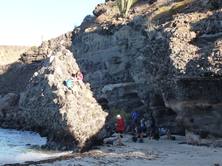
Next, we loaded up the boats and set out for another day of adventure. 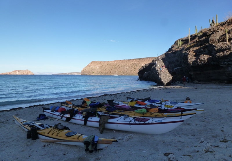
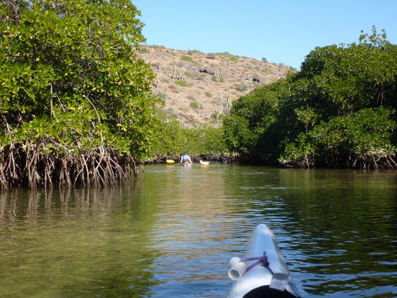
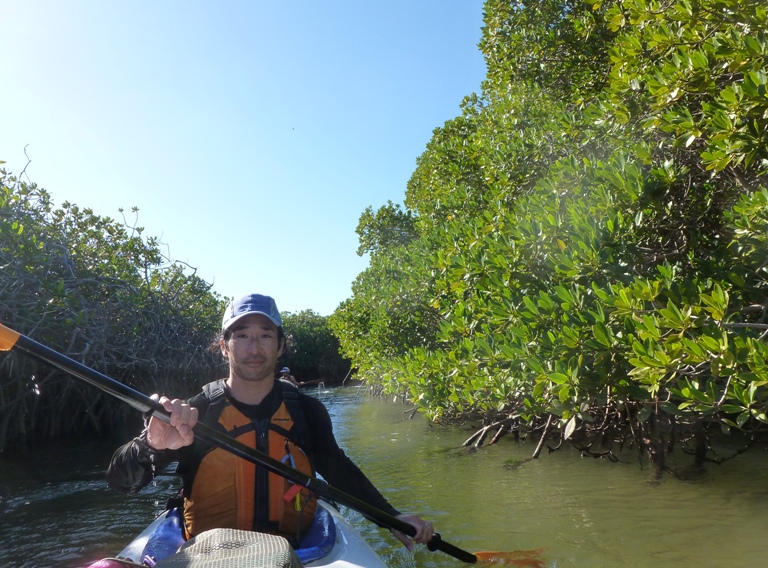
It was still windy but, unlike yesterday, now it was at least sunny. Our first paddling stop would be the cove that Norma and I spotted from the ridgeline the day prior. The green area we saw below was a mangrove swamp. We had the opportunity to paddle into it. Mangrove swamps are coastal wetlands found in tropical and subtropical regions. They are characterized by halophytic (salt loving) trees, shrubs and other plants growing in brackish to saline tidal waters. These wetlands are often found in estuaries, where fresh water meets salt water and are infamous for their impenetrable maze of woody vegetation. - from US EPA - Mangrove Swamps 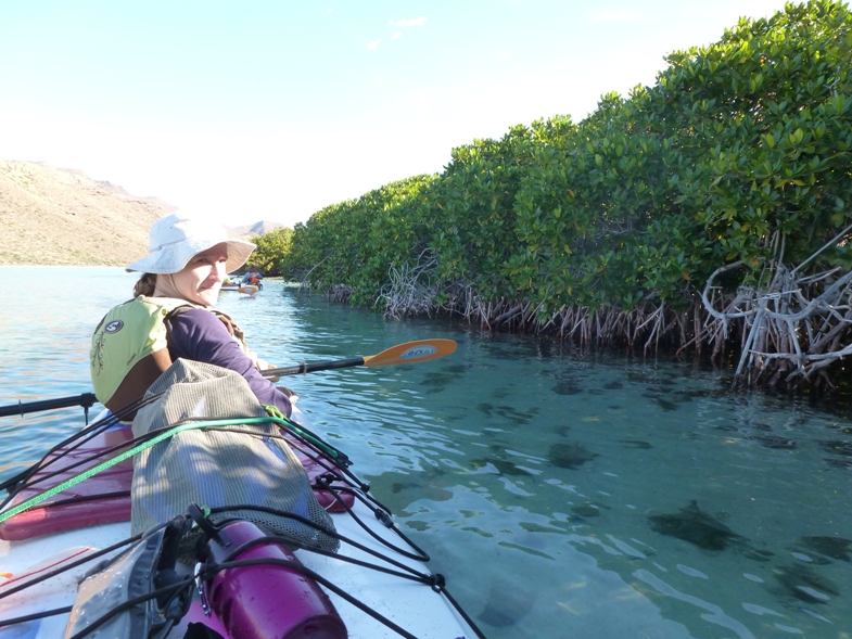
Scott shared a tandem boat with Rob. 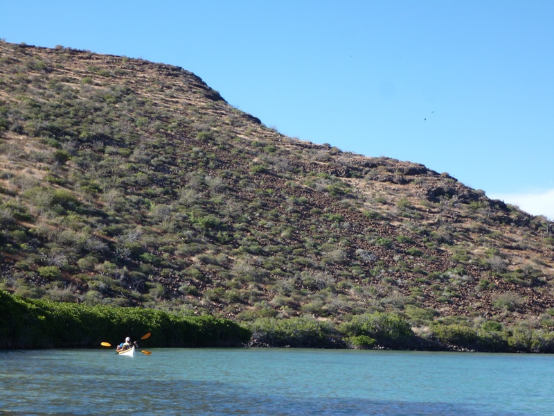
Along with Rafael, they managed to get in a little fishing. While I didn't see it, Rafael claims Scott caught a bullseye pufferfish in the swamp. The swamp was home to numereous waterfowl including great blue herons and egrets. Here's Raphael. 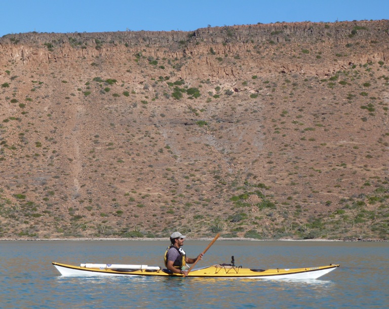
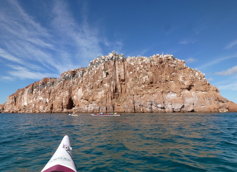
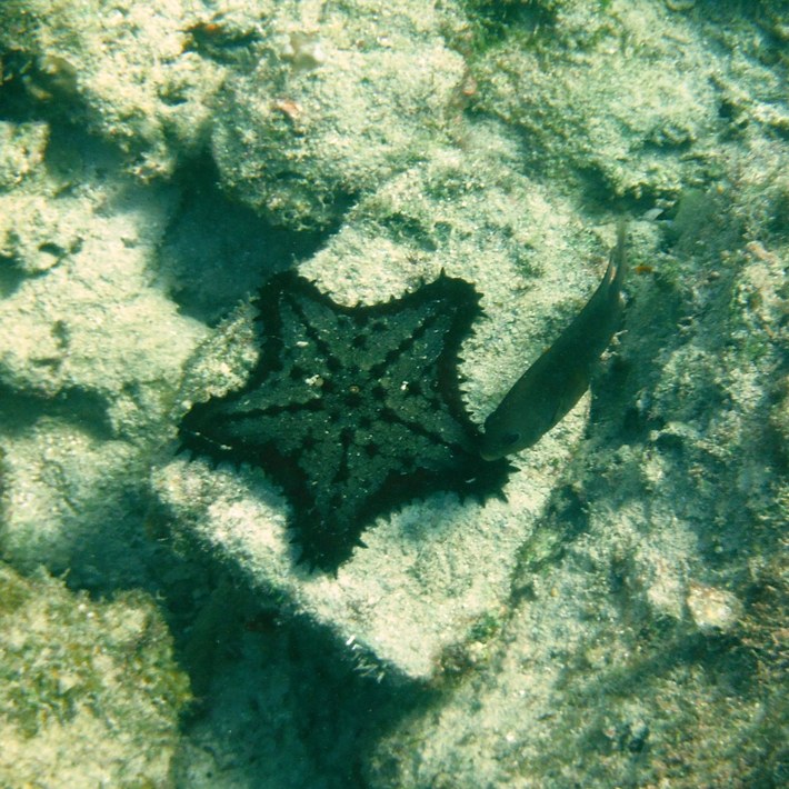
We paddled by Isla Gallo and the much larger Isla Ballena (Whale Island). Near the latter, we saw numerous colorful crabs crawling amongst the rocks. In the shallow areas, we saw sea urchins about six inches in diameter and skinny white starfish about nine inches in diameter. There were also angel fish, pelicans, and frigate birds. Unlike cormorants (which we also saw), Francisco told us that frigate birds do not swim. I was looking forward to seeing more of these birds, which I have seen on various nature documentaries. Sheltered from the cool wind by the island, I enjoyed the warmth of the sun. 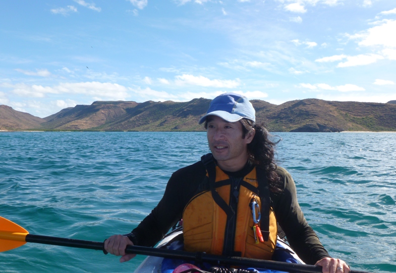
When the water wasn't agitated, it was pretty easy to see down deep into the clear water. I am guessing we were able to see down 25 feet without much difficulty. As we paddled to the west end of Isla Ballena, Francisco paddled out into open water where he dumped our compostable trash. Numerous sea gulls gathered for a free meal. Then he "took Paco for a swim." With the number two neutralized by the bleach, it was now safe to dump. While Francisco was on latrine duty, Raphael kept watch over us. Francisco caught up with us and led us to our new campsite while Raphael joined Rob and Scott for fishing. After seven miles of kayaking, we pulled into Candelero (Candlestick). See #9 on BOA island map. This area is comprised of two beaches. We occupied the north half of the north beach. 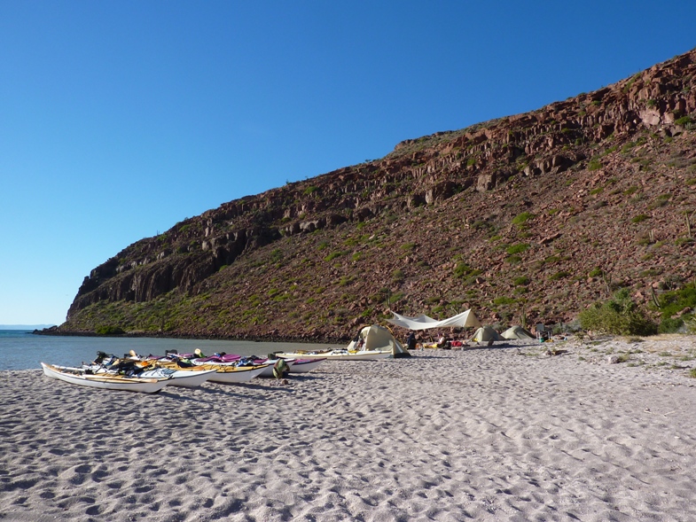
A few minutes later, Raphael, Rob, and Scott landed with Scott's newest catch, a trumpetfish. All the fishing done that week was catch-and-release. I don't imagine we would have gotten much meat off the trumpetfish anyway. 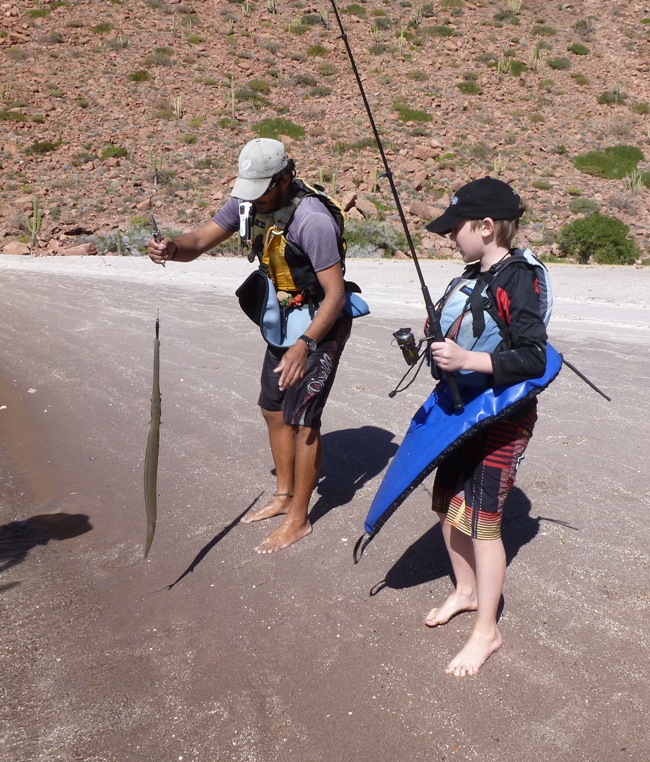
|
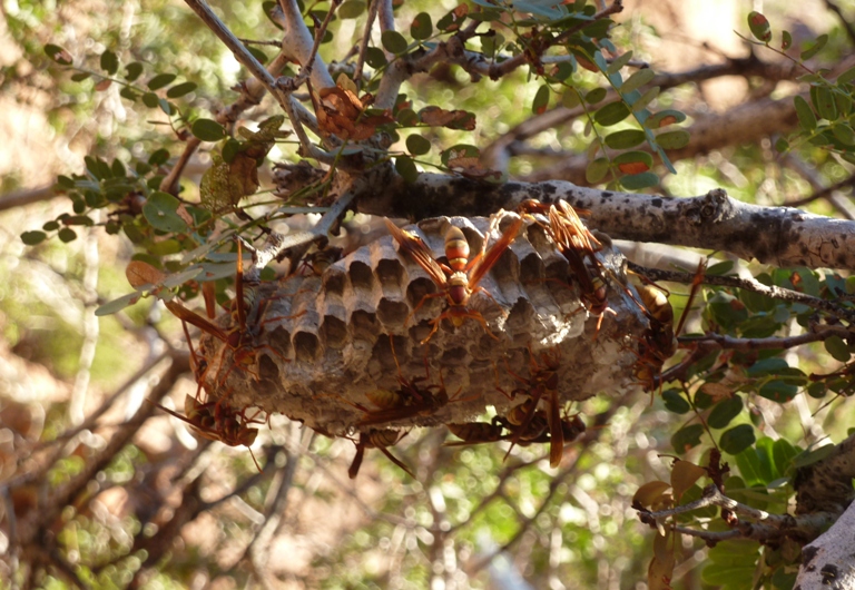
|
Near the beach, pelicans rested on the water. Periodically, they flew up and then dove after fish, smacking the water hard.
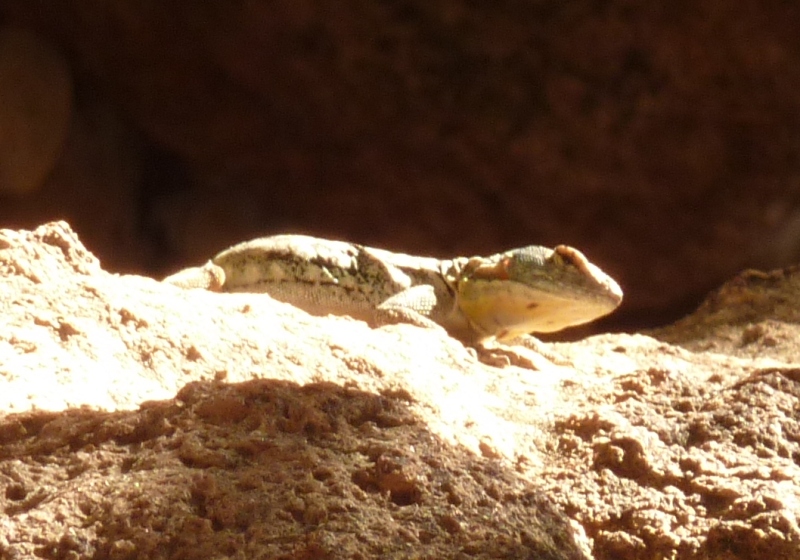
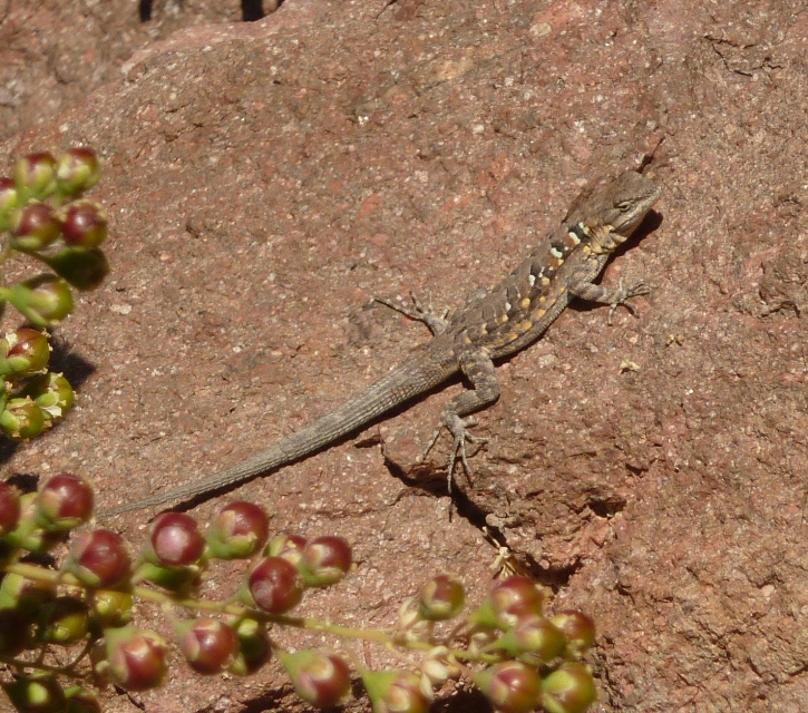
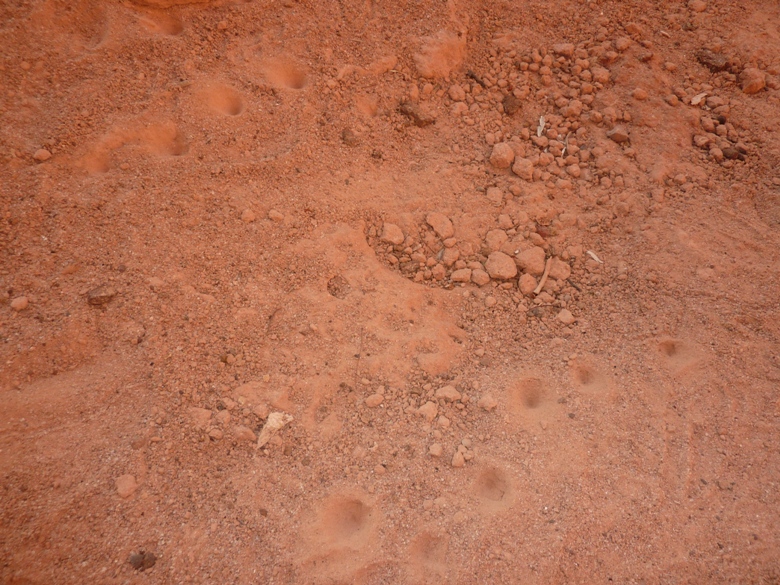
On the south side of the north beach, another group set up camp. A shallow lagoon with crabs separated us. Just to their south was a rocky structure that divided the north and south beaches. Yet another group occupied the north half of the south beach. We set up the canopy, kitchen, and tents, then made lunch. Francisco led us on a short hike. He pointed out different types of cacti. Cardón are the big ones we often associate with the southwestern part of the U.S. and desert of Mexico. Road Runner and Coyote cartoons just wouldn't be the same without them. I remember the coyote getting his hindquarters stuck with cardón needles after backing up into one. What he probably didn't know is that despite its reputation for pain, other parts have analgesic properties, according to Francisco. Also, if he backed up into a very mature cardón, he wouldn't have had this problem being as they lose their needles once they fully mature. The needles are to protect them when they are fragile, but once mature, they don't need them. Some of the cardón were dying because of fungus. The cardon is one of the most massive of all cacti. An average mature cardon may reach a height of ten meters, but individuals as tall as eighteen meters are known. It is a slow growing plant with a life span measured in hundreds of years. Most adult cardon have several side branches that may be as massive as the trunk. The resulting tree may attain a weight of 25 tons. Adult cardon is adapted to the harsh climate of Baja California, characterized by drought and high temperatures, but as a seedling and juvenile it depends for survival on nurse plants, such as mesquite. In alluvial soils in southern Baja California, the cardons, and other cacti, occupy an extensive area. - from Facts about the cardon cactus We also saw There were also lizards and wasps. I saw a San Lucas rock lizard and what I think were some antlion (doodlebug) sand pits but no ant lions. We took refuge in a sheltered overhang of some lava rock where Francisco pulled out photos and told us about the area and its flora and fauna. Nearby, Francisco showed us an indentation in a horizontal section of rock created by natives for grinding stuff into food. The original inhabitants of the Baja region were known as the Pericúe. They have been linguistically and culturally extinct since the late 18th century although some of their genes may survive in local populations of mixed descent. - from Wikipedia - Pericúes 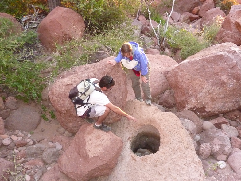
I found a dung beetle, not unlike the many I found in Saudi Arabia and Kuwait. 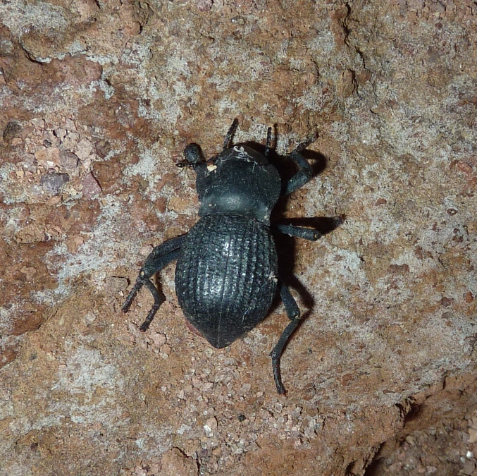
Our little hike was a lot of fun, mainly because it involved so much rock scrambling. That night we ate tuna steak for dinner. A kangaroo rat was found running amok near our kitchen. The sky was clear. I saw two shooting stars. Norma and I laid out on the sand looking at the star-filled sky. It was a good and different way to celebrate New Years Eve. Winds got up to 16 knots that night but I slept better, with the tent being more snug than the first night. |
|
Norma woke up with a sore neck. Her inflatable pillow and inflatable sleeping pad on the sand just wasn't cutting it. I think her sleeping discomfort was her biggest complaint for the whole trip. I, on the other hand, did just fine after the first night. My gear wasn't any better than hers. I just seem to do better sleeping in less than ideal conditions.
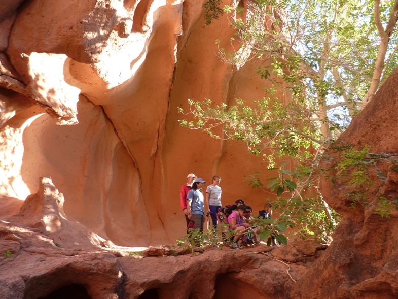
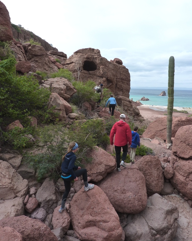
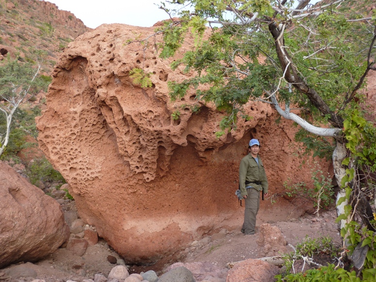
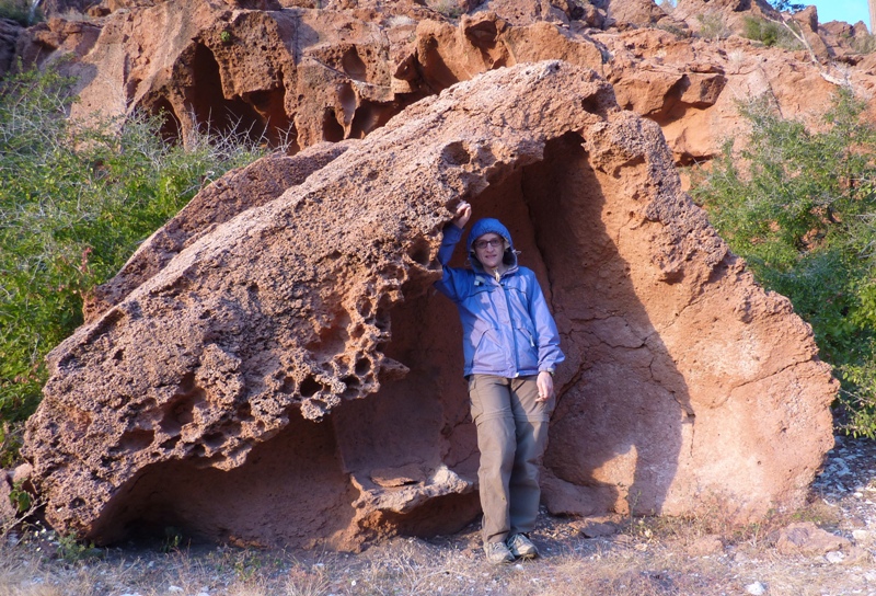
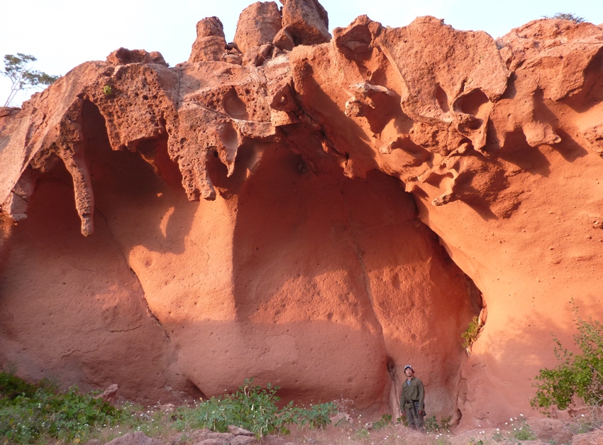
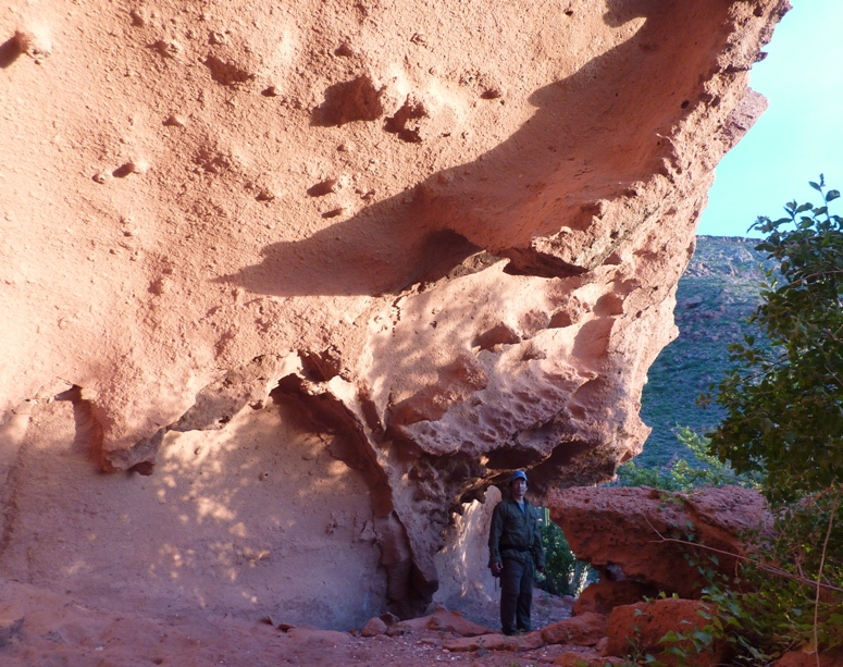
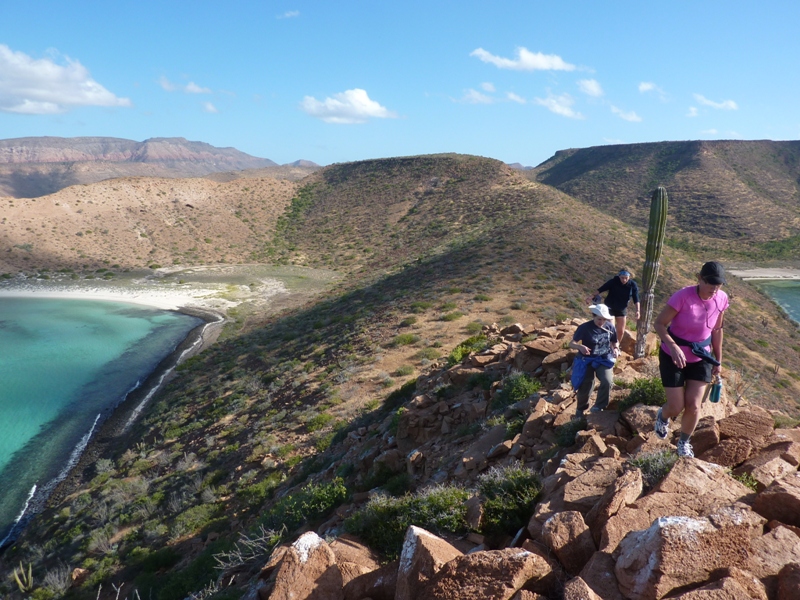
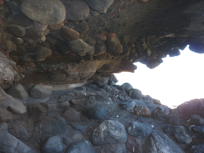
It was a very windy morning and cloudy. Our guides called into BOA to get a weather report. It was decided that it was not safe to paddle that day. I trusted their judgement. While things might have looked safe from the campsite, beyond the reaches of the cove, in open water, things were much different. Norma and I were fine with missing a day of paddling. Seeing things on the hikes was every bit as fun as kayaking and certainly much safer given the weather. Norma and I spent some time tending to personal grooming. There were no showers on the island and we hadn't bathed since we arrived. With a limited amount of clothes that we could bring, I hadn't yet changed my outer garments. But it had been cool enough so we didn't sweat so it really wasn't that bad. Still, we were feeling a little unclean. So we spent some time brushing our hair to loosen up and remove debris. Not quite a shower, but certainly better than nothing. I brought along a can of KMS California Hair Play Makeover Spray which is supposed to absorb oil for in-between shampoos. I used it a couple times during the trip. It helped but regular brushing was almost as good. Hair brushing became a daily activity for us, partly because it was so windy that regular brushing kept our manes from getting all tangled. I spoke with Rob about trips that he recommended. Francisco led us on a three hour hike up the valley. For the first part, we had a nice view of the water. We walked by a well that was built by the military. A bucket on the rope went down into the ground where one could retrieve brackish but clean water for bathing. The volcanic rock sounds hollow when you hit it with a solid object. That is because there are so many air bubbles trapped inside. Some areas have more air than others and this leads to interesting and varying shapes, sizes, and patterns. There were also some small caves. We got to stick our noses in the first and climb up into the second. In the below, we sat in the cave and spied on the fully-catered group from inside. 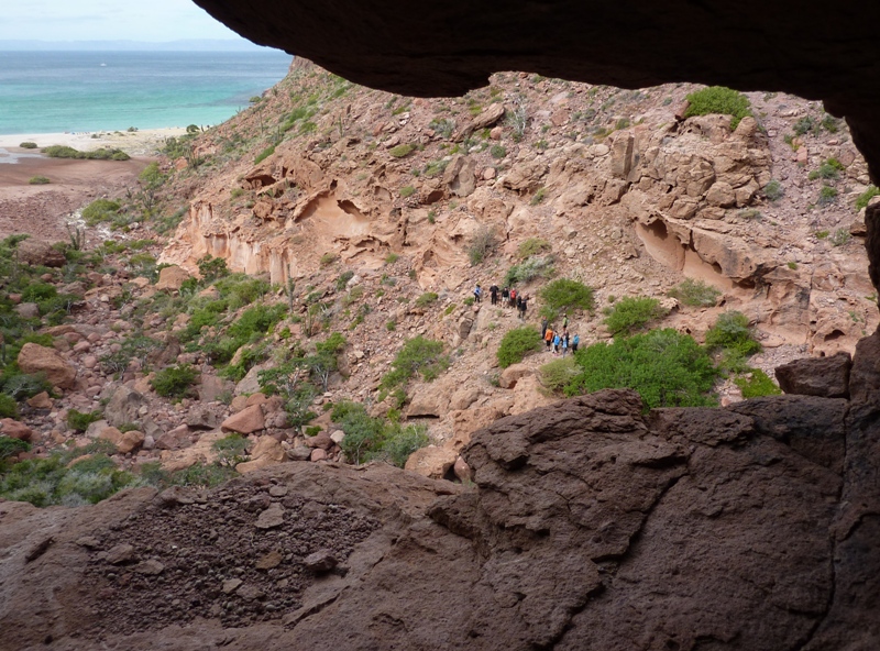
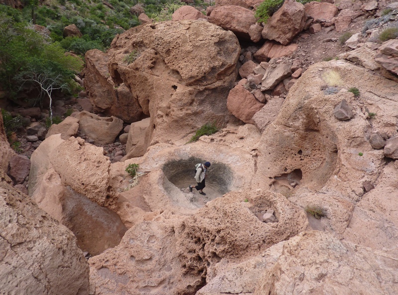
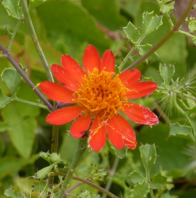
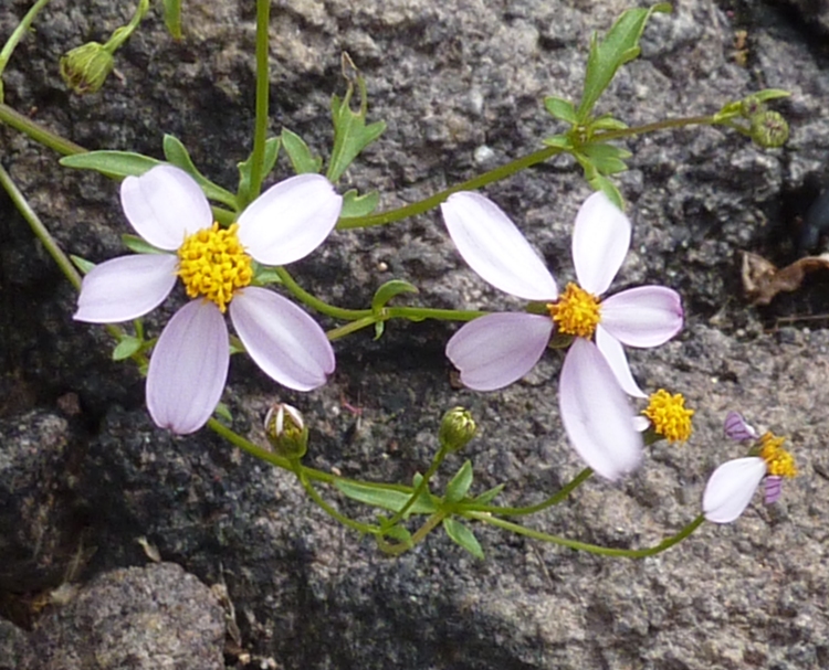
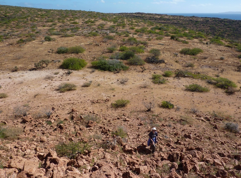
We found various depressions in the rocks. One would have made for a nice hottub. Another looked like a chair. I was glad to be with our smaller, more mobile, co-operatively catered group rather than the larger fully-catered group. Maybe it was just psychological but we seemed faster and more adventurous though I am sure there were individuals in the other group that would have fit in fine with our group and maybe even ran circles around us while hopping on one leg. Some of the desert flowers were pretty. I saw desert bleeding hearts and a few small flowers I didn't recognize. Low, rocky spots in the valley naturally collect water. It is here that we find some of the greenest vegetation and oasis-like scenery. 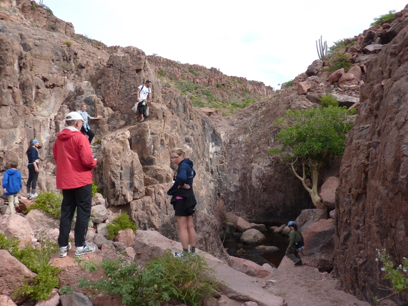
Just behind the tree in the below photo, I found another cave. I hoped to find some bats but did not. 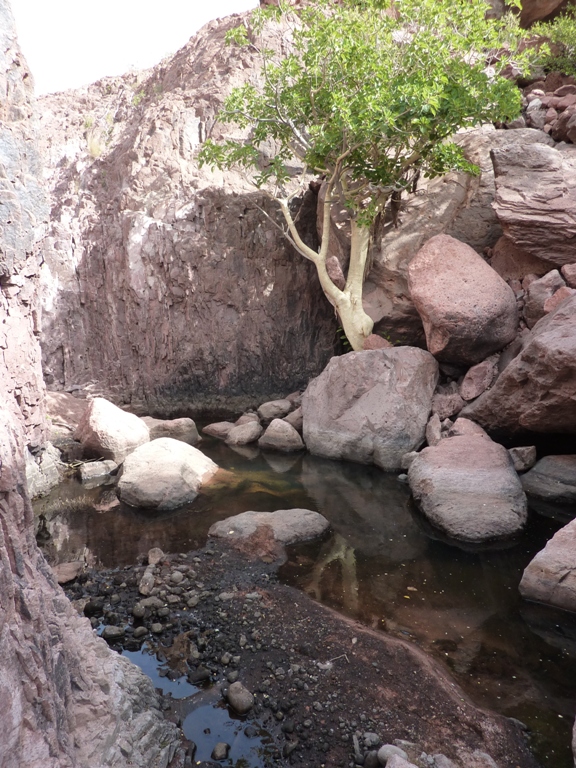
Under some rocks, I found the shed skin moults of some insects. 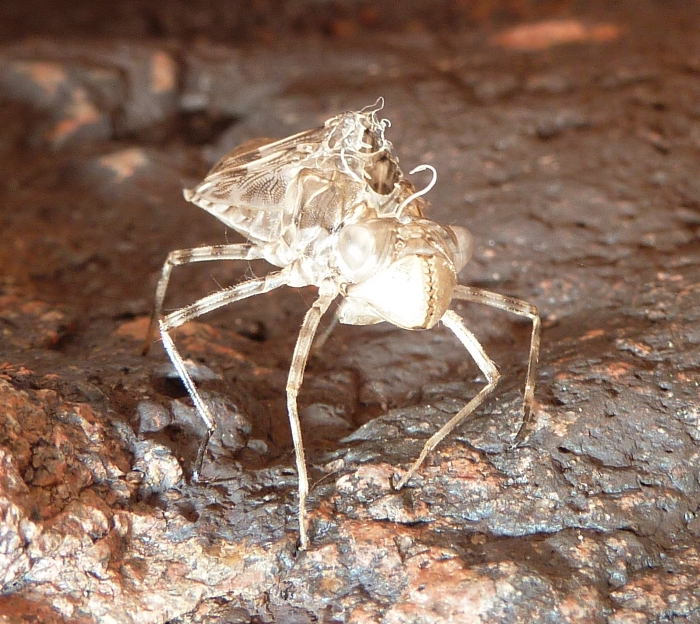
Continuing onward, we found some small ponds. 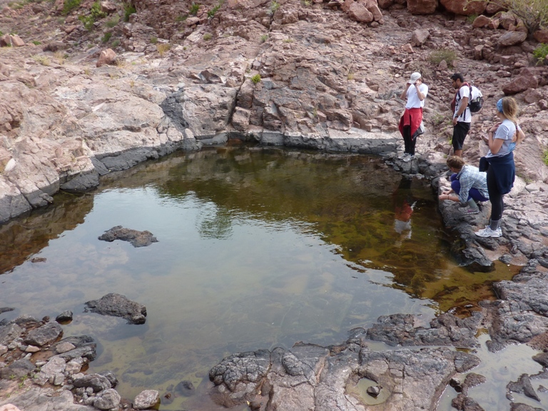
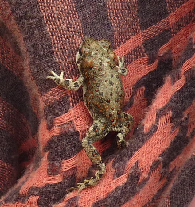
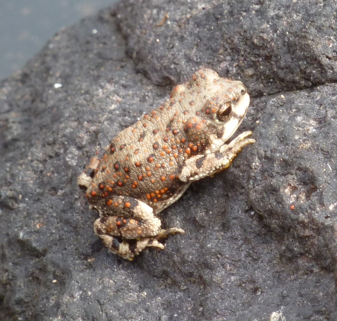
In one, we found several red-spotted toads. They had small orangey-red bumps and were about 1.5 inches in length. It was here that we turned around. I don't know how far we walked but I don't think it was more than six miles since we never saw the sea on the east side of the island. Our pace was slow as much of the hike involved rock scrambling. That's what made it so fun. It was like hiking the Billy Goat Trail in Maryland. During our hike, Norma walked in the back for awhile. She likes to do that when she takes photos of flowers. But the problem with being in the back is that there is nobody to say anything if you drop something or leave gear behind. That was the case for this hike. She started with her pink fleece top but finished without it. Needless to say, she was pretty bummed about that. We still had several days left and the nighttime temperatures were often in the low 50s and could drop into the 40s. Our limited storage space didn't allow us to pack much clothes so we had to make good use of what we brought. |
|
We ate prickly pear salad and fruit for lunch then caught a few winks.
After resting up a bit, Norma and I decided to explore the south half of Candelero. We headed out on our own. Along the beach, I found the skeleton of what I believe was a trumpet fish, much like the one that Scott caught fishing. 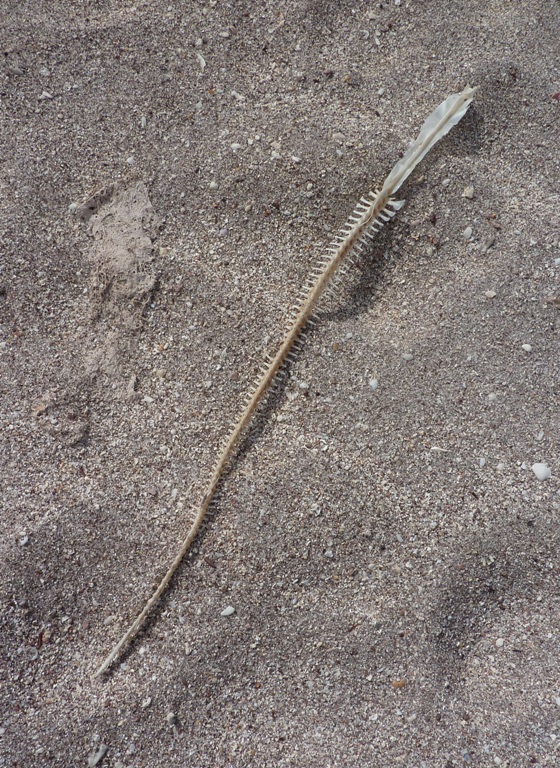
We walked through the fully-catered BOA campsite then through a gap in the rocks that separated the north from the south beach. On the north side of the south beach, another outfitter supported a group similar to ours but not as good-looking. Parts of the ground were so covered with coral and shells that we couldn't see the sand underneath. 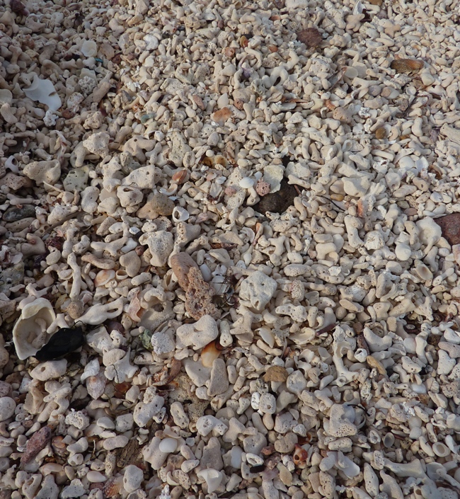
I never ceased to be fascinated by the volcanic rocks on the island. We saw many fine examples of cacti though I am embarassed to say that I still have problems telling the difference between sweet pitaya and sour pitaya. Maybe I just need to bite into them to tell the difference. 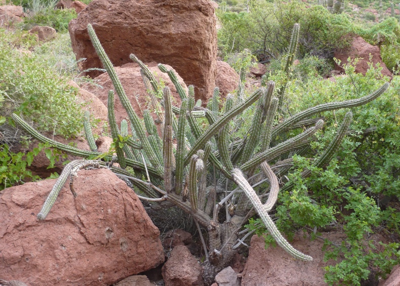
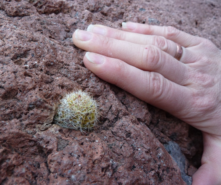
These cacti are amazing survivors. They are a testament to how things are evolved to live in the harshest of environments. Here are a couple of cacti that took it one step further, overcoming adversity where others would have surely failed. Under several rocks, we saw numerous moths or butterflies. There didn't seem to be many big shady areas where these moths/butterflies didn't hide. Of course, once I stuck my head under a rock, they dispersed. We climbed up one hill that led us to a big sheet of volcanic rock. Despite the fact that we were probably a hundred feet above the water, there were shells all around. Under a rock nearby, I found a whole bunch of bones. I grabbed a few to take back and show the group. Making our way down to the water, we came across a large boulder resting on what looked like a narrow pedestal. I'm guessing it might all be one piece that was formed naturally but it looked more like a work of modern art. Interestingly, it seemed to point to the place where I had found all the bones. 
On the return trip, we passed again through the gap that separates the north and south sides of the beach. Passing through the fully-catered BOA site, I saw a pink fleece top draped over a chair. Then someone asked if it belonged to one of us. Norma was pleasantly surprised, to say the least. I don't know who exactly found it but if they had seen Norma's face light up, then they would have known that she was thankful beyond what words could express. She was happy so I was happy. Back at camp, I showed the bones I found. Scott was most impressed as I suppose any boy his age would be. Francisco was familiar with the place we explored. He said the natives lived and ate there. That is why there were so many shells so far above the water line. The bones that I found included some kind of rodent, a bone from a sea turtle, and vertebrae from a dolphin. The sea turtle bone was especially interesting because it was so short and stocky...as if it was from a short leg that supported a lot of weight. We reinforced our tents to protect them from the high winds that we expected. Kim's tent didn't stand up to the wind. Part of the tent frame broke but it was fixable. While I had concerns about my Quarterdome, it did just fine. That night we ate leftover tuna along with pasta and octopus. We saw more kangaroo rats. One of the things the guides bring is a dry bag full of books about the area. I looked through one of them that had lots of photos of native reptiles and amphibians. Everything seemed soooo exotic. I wondered if Francisco and Raphael would find the animal life in Maryland to be as interesting as I found their animal life to be. Maybe "yes" for horseshoe crabs but that's probably about it. |
|
We were still faced with windy weather and the wind would only get worse as the day continued.
Rather than stay another day at the same campsite, our guides decided it would be best to get out on the water early and make it to the next campsite before lunch. So we packed up camp, loaded the boats, and were off. This was a good move as we later learned that the fully-catered group was stuck at that same campsite for another day or two. Raphael warned us that swells could be up to five feet. I'd been in worse conditions while kayaking in New Zealand. The boat I paddled back then was very similar to the one Norma and I had now. It was wide, heavy, and loaded down with so much gear that it would be very difficult to capsize. Norma paddled up front while I controlled the rudder in the back. Our guides had a chance to see how we all performed on the water over the previous days so they knew what we could handle. I trusted their judgment. If the conditions got too rough, we could always duck into one of the many coves on the west side of the island. With winds coming from the north, we were paddling into the wind on the west side. This made for a slower trip but it was good for maintaining control. In contrast, the east side was not so protected. There we would have a tail wind (and therefore less control) and no coves. The forecast didn't call for a break in the wind over the next few days so the possibility of a circumnavigation was aborted. I was disappointed but knew it was all for the best. The safety of the group came first. Once we left the protection of the cove, the winds did kick up the waves but it wasn't as bad as I expected. Swells were more like three feet. The sun shined brightly which made our view of the island even nicer than usual. 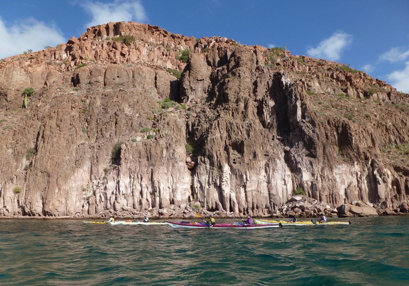
Paddling north, we crossed Caleta Partida, the straight that separates Espritu Santo Island from Isla Partida (Partida Island). With little to block winds from the east, we had what I call a mild case of a "washing machine effect." This is when waves come from multiple directions. A few times, we caught a quick glimpse of a sea lion poking its head out of the water to get a better view of us. Of course we were ecstatic when we saw them. But this was just a foreshadowing of what was to come. Norma and I paddled near the front of the group, by Raphael. In Caleta Partida, he was to our two o'clock and only about 16 feet away. For a fraction of a second, I saw something about four feet long and light green pass from my three o'clock then under the boat, not to be seen again. Before I could ask what it was or question if I had seen it at all, Raphael said, "that was a sea turtle." He said it calmly as if he had seen countless sea turtles in the past. That was probably the case. But for me, it was my first except for the time I saw baby sea turtles make their way from the beach to the ocean at Camp Lejeune, North Carolina back in 1991. Unfortunately, Norma did not see what Raphael and I saw. We kept looking into the water, trying to find another. No more were seen for the rest of our journey. We finished our 6.7 mile trip, ending at the sheltered north beach of Ensenada Grande (Big Inlet), shown at #15 on the BOA island map. 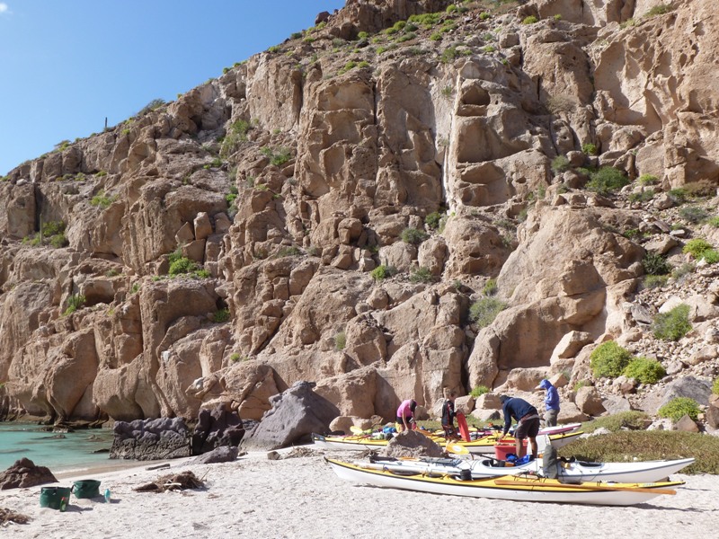
I brought my global positioning system (GPS) because I like to know how fast and how far we go. In open water, we were moving at about 2.5 miles per hour (mph) which isn't bad, in my opinion, considering the headwind and the weight of the boats. Once we landed, I asked people to guess how far we paddled for the day. I do this with Norma and she seems to enjoy it. So did the group. Francisco was pretty good at guessing but in the end, Leah was the best. I think she should be a contestant on "The Price is Right." |
|
On the shore, I found lots of dead pufferfish, another trumpetfish skeleton, and part of a parrotfish skull. This unique fish changes color, shape, and gender throughout its life. But what fascinated me most about it was how strong the jawbone felt. I wouldn't want to stick my finger in a parrot fish's mouth. I might not be able to count to ten if I did. The reason the jawbone is so strong is because its diet
consists primarily of algae extracted from chunks of coral ripped from a reef. The coral is pulverized with grinding teeth. - from National Geographic - Parrotfish 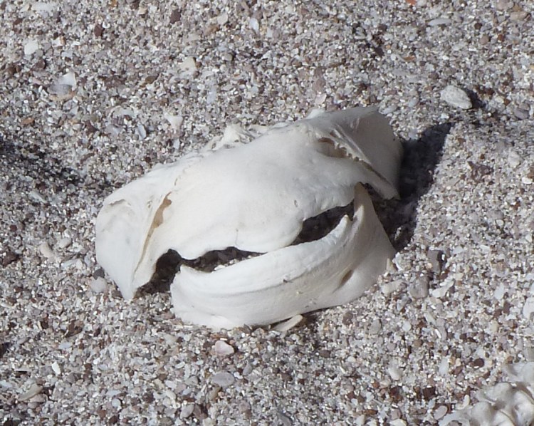
Norma did just fine in the kayak that day but once we landed, she wasn't feeling so good. It might have been partly due to the swells, which she isn't used to. After setting up the tents, we ate sandwiches and chips for lunch. I made one for Norma to eat once she felt better. She laid down in the tent to catch some shuteye. Our resupply boat came to haul off trash, refill our water bladders, and drop off food. 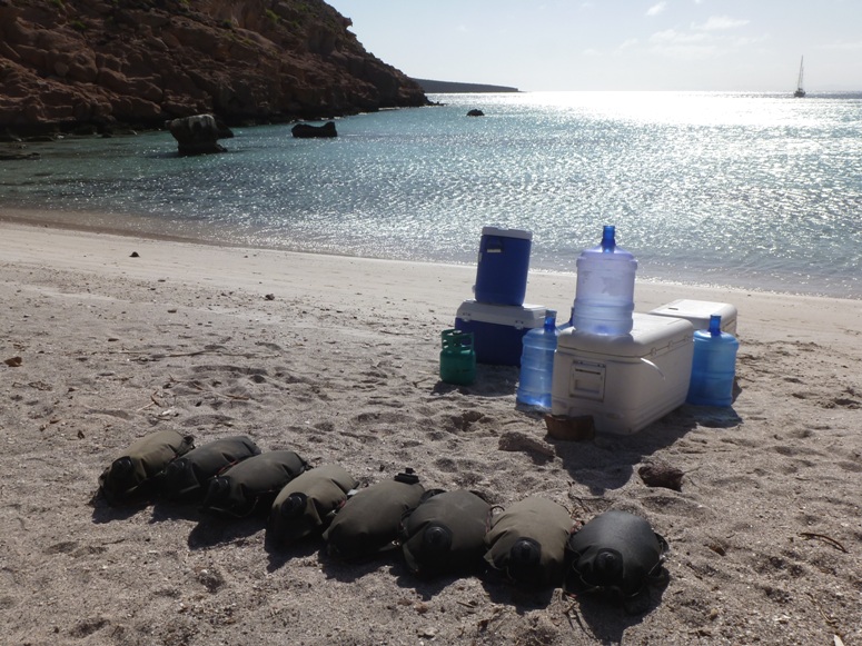
I changed into my Farmer John wetsuit and neoprene top. Then I donned by mask, snorkel, and fins. I got in the water and went for a swim, exploring the rocks along the south side. Rob and his family were right behind me. I saw lots of angelfish, pufferfish, trumpetfish, 8" diameter sea urchins, 14" diameter starfish, and a zebra moray eel hiding in the rocks. Leah later identified the eel with one of the many books that our guides brought. 1 / 5

Several small fish.
2 / 5
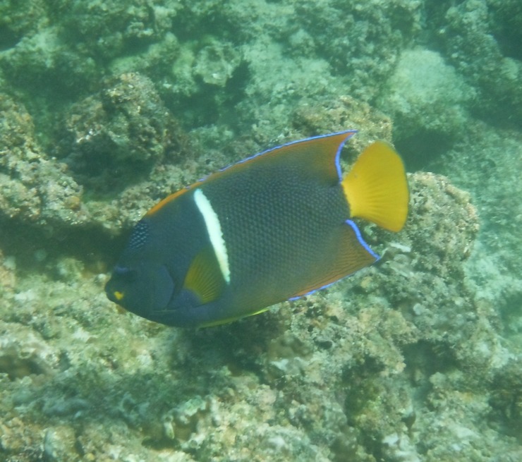
Angelfish.
3 / 5
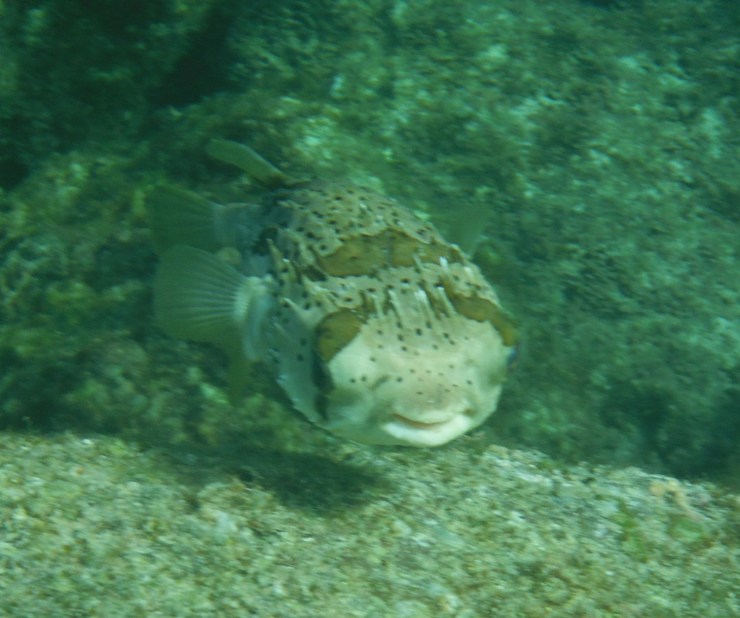
Pufferfish.
4 / 5
Black starfish.
5 / 5
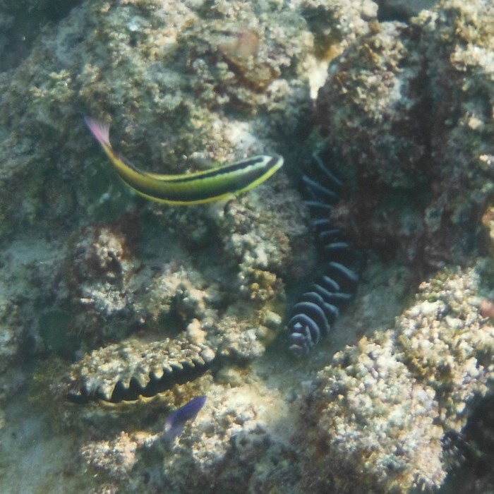
Zebra moray eel.
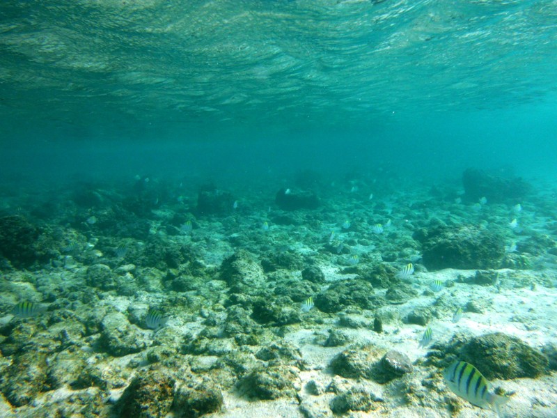
There were fish everywhere, many of them brightly colored. I found the fringe areas of the rocky sections to be the most interesting. Further out in open water, the rocks gave way to sand. That wasn't so interesting. But amongst the rocks just before the sand, fish were abundant, perhaps because they had places to hide. There wasn't a place I could look and NOT see fish. They were everywhere. There was also lots of brightly colored coral. I wish I had bought a disposable underwater camera to capture what I saw. Fortunately, Rob's family were good to share their photos with me. That day of snorkeling was truly one of the highlights of the trip. Sadly, Norma missed it. I was in the water for about 40 minutes. After about 30, I was pretty cold. Rob's family had the shorty wetsuits so they weren't nearly as well insulated as me but I don't think the cold bothered them as much. I guess that's because they are rugged Canadians. I saw no jellyfish in the water but I think one or two people in Rob's family got minor stings. That night, we ate shrimp for dinner. It felt good to swim and feel rinsed off. I changed into some clean clothes. Much better. Norma and I stood by the shore at night before the moon came out and looked for bioluminescence in the water. We did see some but it was very subtle. As the waves stirred up the sand, there would be a faint white glow that would last for a second or two before it faded away. It rained during the night. |
|
The previous day, many of us, especially Rob's family, set up tents near the steep cliff to be protected from the wind. But what we failed to consider was falling rocks. None fell but given the rain, which lasted most of the night, falling rocks in a place that doesn't get much rain is certainly a possibility. Rob mentioned this during breakfast. After that, we were a little more cautious about where we set up our tents.
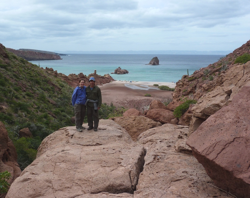
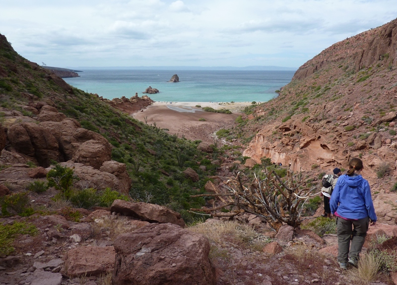
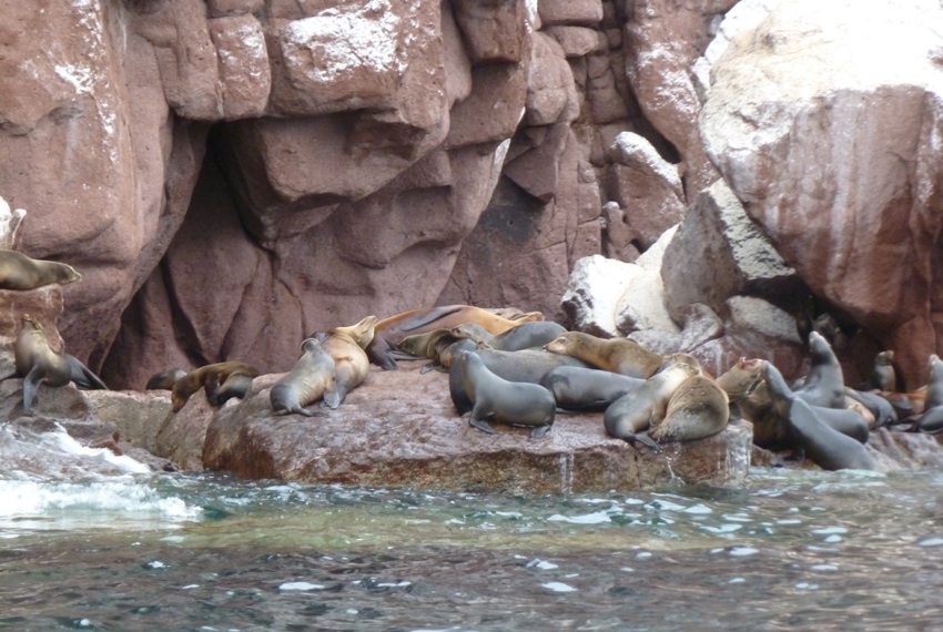
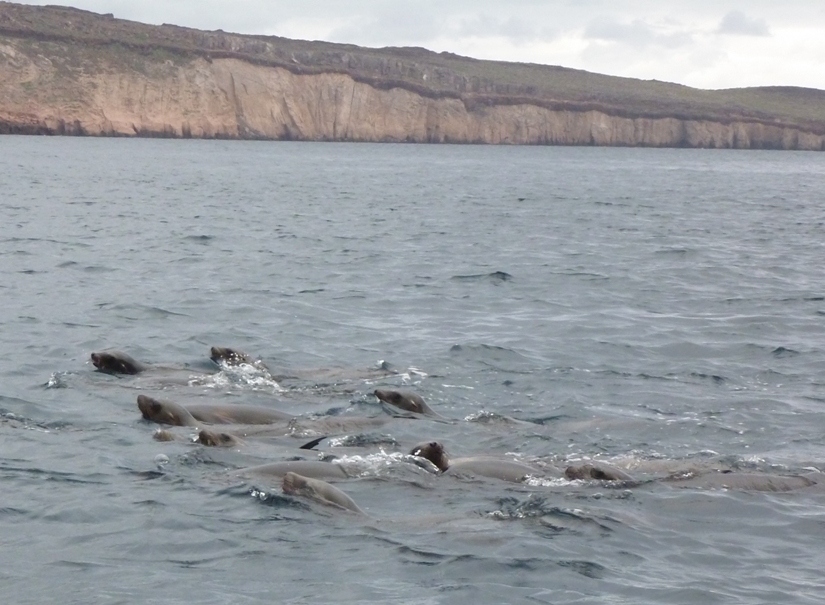
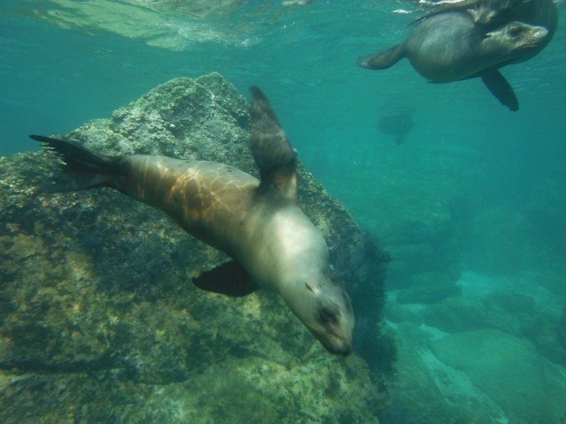
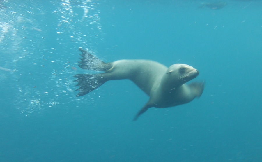
It was cloudy and cool in the morning. A powerboat came at 0900 to take us to the sea lion rookery at Los Islotes, the small island to our north. At the southwest side were some of the mature sea lions lying on the rocks. 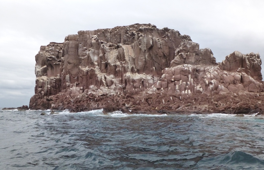
We slowly made our way to the southeast side, where the juveniles play. We saw plenty of sea lions along the way. You can tell the difference between a seal and a sea lion by looking at its hind flippers. Look closely at the one that looks like he is trying to climb the rock in the below pic. On seals, the hind flippers angle backward and don't rotate. This makes them fast in the water but basic belly crawlers on terra firma. Sea lions, on the other hand, are able to "walk" on land by rotating their hind flippers forward and underneath their big bodies. This is why they are more likely to be employed in aquaria and marine shows. - from What's the difference between seals and sea lions? 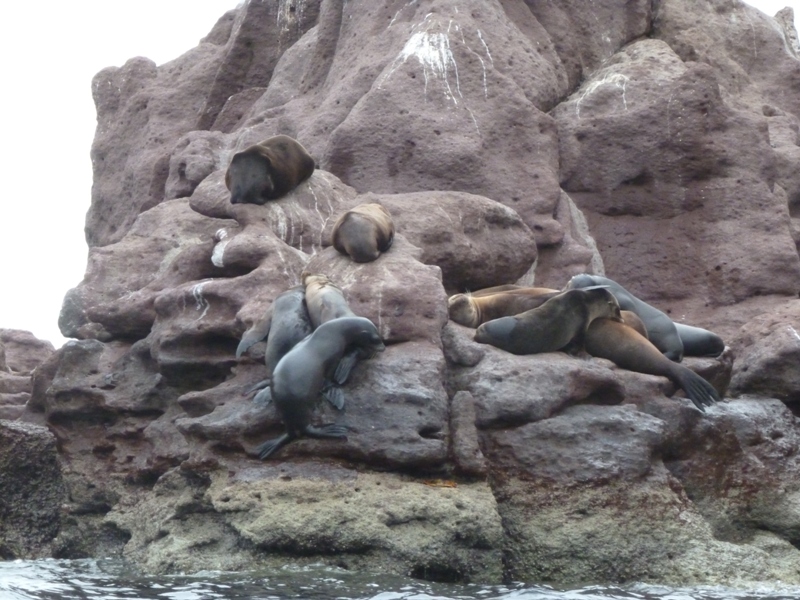
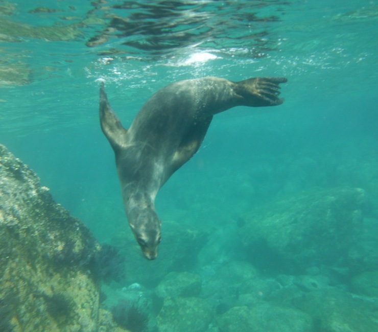
We noticed various shades of color in these marine mammals. California sea lions' color ranges from chocolate brown in males to a lighter, golden brown in females. Males reach 850 pounds and seven feet in length. Females grow to 220 pounds and up to six feet in length. - from The Marine Mammal Center: California Sea Lion Stopping in a suitable spot, we got ready for snorkeling. Francisco was fascinated by my diving mask because it is so old. It is a classic design that I guess is no longer made. I think I bought it around 1992. Norma does many things very well (e.g cooking, language, driving, gardening, hiking, reading, and entertaining), but swimming is not her greatest strength. So on top of her Farmer Jane wetsuit and neoprene top, she wore her personal floatation device (PFD). Then, in the water, she held onto me. We swam amongst the sea lions...or more appropriately, they swam amongst us. The adults don't much care for humans. If we get too close to the rock where they rest, they can make aggressive gestures, so instead we keep our distance. But the juveniles are curious and playful. They swam around and under us. Schools of fish also swam below which prompted Brandt's cormorants to dive down and fish for them. The cormorants were not shy. They swam within what seemed like four feet of me. The sea lions got close too. The excitement was almost overwhelming. So was the cold. 1 / 5
Fish swimming.
2 / 5
Sea lion swimming.
3 / 5
Heading down.
4 / 5
Just below the surface.
5 / 5
Face shot.
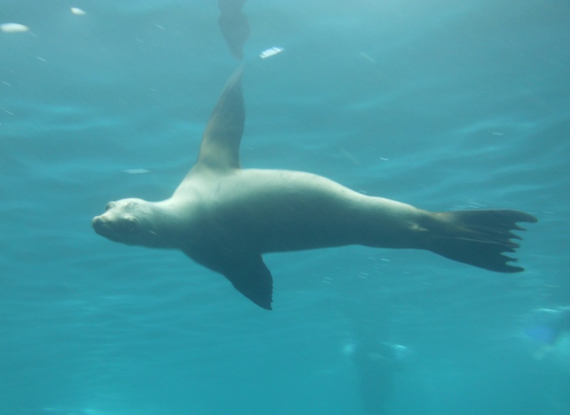
I got back on the boat to warm up for awhile. Norma got out with me though I don't think she was as cold. Rob's family stayed in the whole time. I am clearly a cold water weenie. Had Carmen joined us (yes, we tried to recruit her for this trip), she probably would have been uncomfortably cold too, being the Floridian native that she is. After warming up a bit, Norma went back in, but this time she didn't need my help. She was like that on our 2010 Florida trip. That is, her confidence builds up quickly. Still, I kept my eye on her just in case. I'm glad I did. She didn't need my help but what I saw next was something I hope I never forget. A sea lion got right in front of her (easily within arm's reach). It looked at her then opened its mouth wide and shook its head. I think it wanted to play. Norma saw a big pink tongue in her face. She wasn't sure what to do so she didn't do anything. The sea lion swam away, probably disappointed because it wanted to make a friend. That was the high point of the trip. Just two weeks after this event, I told this story countless times. Back on the boat, we saw a fellow in the water who was not part of our group. A sea lion swam circles around him, leaping out of the water every few seconds. Anita was bleeding a litle from her leg. She said one of the sea lions gave her a gentle bite. She said it didn't hurt and she didn't feel any pain but I guess its teeth were sharp enough to cut the skin without much effort. It wasn't an aggressive action on the part of the sea lion but rather a playful one. I guess they just don't know how fragile we humans are. |
|
Back at the campsite, we finished packing then ate lunch.
I found more colorful crabs at the north end of our beach area. Had we stayed an extra day, I would have certainly explored this area via snorkeling. 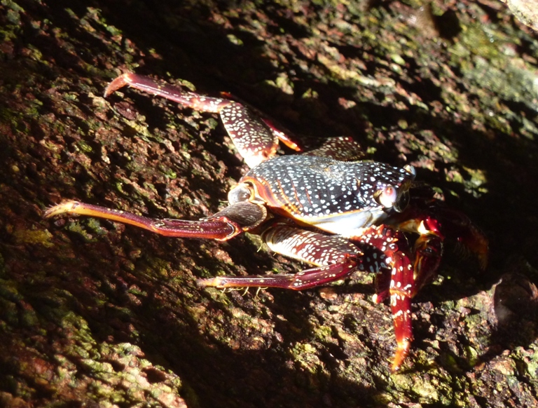
I can't remember if it was this day or not but an older American couple pulled ashore in folding kayaks. They used their kayaks to get to shore from their sailboat, which took them all the way from the state of Washington. What a great life! By 1400, we were on the water. This time we were heading south, leaving our northernmost campsite. This was our longest kayak trek yet. At 1600, we stopped in a cove for a snack and short break. Then we were paddling again. The wind was at our backs in the open water. With it giving us a little push, Norma and I were easily maintaining 4 mph with a maximum speed of 5.2 mph (though probably just for a second or two). This was a good opportunity to get some photos. With me in the back, controling the rudder, Norma was free to work the camera. 1 / 6
Kim on the go.
2 / 6
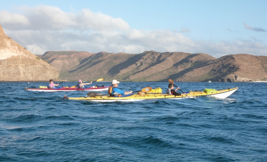
Two tandems.
3 / 6
Red rocks.
4 / 6
Brown pelicans.
5 / 6
Rob and Scott.
6 / 6
Norma and I.
By 1730, we were done for the day, having paddled 10.6 miles. We set up camp at Playa Coralito (small coral beach). See #6 on the BOA island map. Our guides planned everything just right. We had just enough time to set up the kitchen and tents and then change into dry clothes before sunset. After unpacking my gear, I found that my bottle of soap leaked and my headlamp was cracked. I guess I packed things too tightly. I didn't need the soap but I was using the headlamp every night. It was a brand new Black Diamond Storm headlamp that I received as a Christmas present. I didn't think the case should have cracked so easily. Once I got back, I contacted Black Diamond. Mike E. in their warranty department got back to me and inquired about the problem but once I mentioned that the case was cracked, I didn't hear from him again. So much for good service. That night, we ate chicken and potatoes. Food tastes especially good after a long day of physical activity. |
|
We awoke to a sunny day.
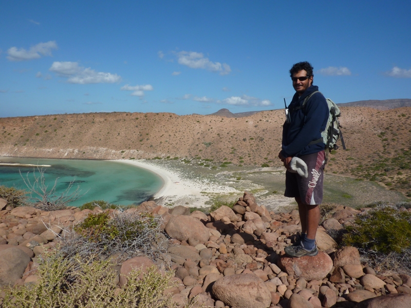
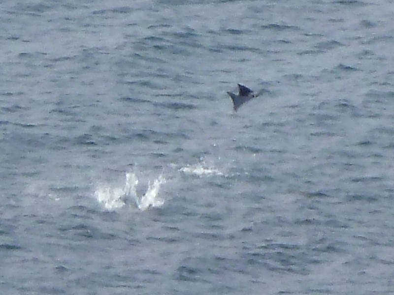
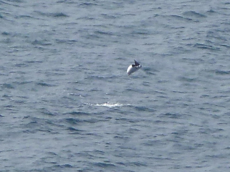
A short walk up a hill to our south put us at a point where we had a fantastic view. Raphael pointed out Isla Gallina, Isla Gallo, and Isla Ballena to our north. To our south, we could see a lagoon containing another mangrove swamp. Looking southwest, we saw and heard something splashing in the water. It was a few mobula rays! This is one of the reasons I wanted to go kayaking in the Sea of Cortez...to see the mobula ray. I had heard of these creatures in my kayak club's forum. Then I did some on-line searching to learn more about them. Mobula ray are also called devil fish though some might argue they should be called "daredevil fish" because they leap out of the water (an act called "breaching") as much as two meters. They are up to ten feet across which explains why we could hear them bellyflop onto the water despite the fact that they were a quarter of a mile away. Why do they do this? Scientists do not know. I wonder if they might be demonstrating their strength to attract the opposite sex. There looked to be about 2-3 mobula rays that were breaching. They kept this up for about ten minutes. I know they are just fish but they looked like they were having the time of their lives flying through the air like that. After the sea lions, this was the high point of the trip for me. Check out YouTube - Mobula Rays Jumping. I wish I could say I shot this video but I cannot. On and around the hill, we saw more fine specimens of cacti...some with colors I hadn't seen on them before. Can you see the red at the base of some of the needles in the below snapshot? 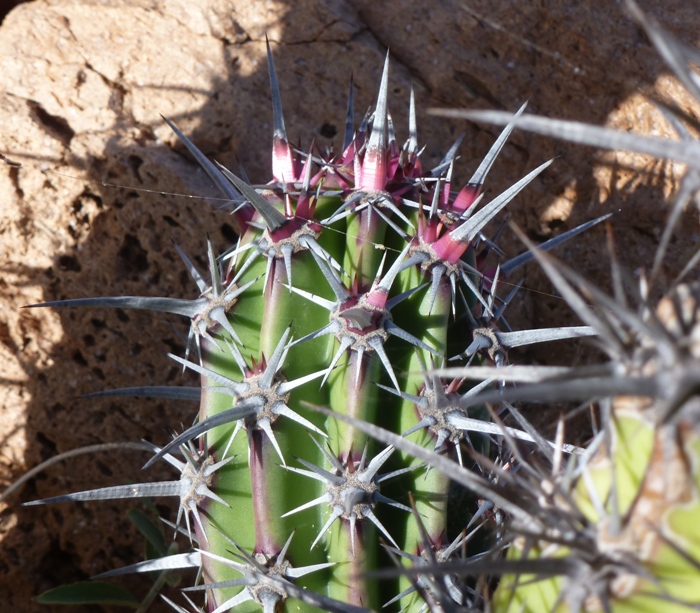
|
|
We said our farewells to Playa Coralito.
Then, we paddled to a place that I am reasonably certain is called Punta Prieta (dark point). This is between #5 and #6 on the BOA island map. On the south side of this point, we pulled into a tiny beach so we could go snorkeling. 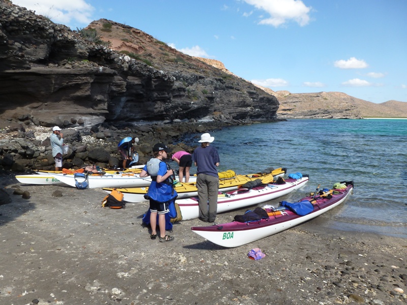
Like some of the other beaches, parts of the ground was covered with broken coral. Under a rocky overhang, there was a Catholic shrine set up. We were told it was set there by fishermen. We changed into our wetsuits then went for a swim. Norma was having a hard time getting past the rocks so I had her grab my arm and pulled her out into the more scenic spot. There were certainly lots of fish and coral but it was nowhere near as good as Ensenada Grande. We saw trumpetfish and sea urchins but no starfish or eels. But at least Norma had a chance to snorkel again. |
|
Our next stop was the frigate bird colony.
We paddled our way through clear blue water that looked like it was taken out of a Carribean holiday resort commercial. But this was far better. It was natural and we were the only ones there. 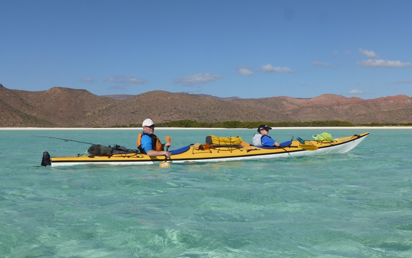
We approached some small trees that literally held hundreds of frigate birds. 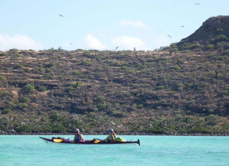
As as got closer, it appeared that most of these birds were female or immature males. The mature males have bright red chests which they inflate to attract females. We paddled by their rookery which was conveniently located right next to the water. The rookery ran parallel to it for about a sixth of a mile. For me, this was the third high point of the trip, after the sea lions and the mobula rays. Frigate birds are also sometimes called Man of War birds or Pirate birds. Since they are related to the pelicans, the term frigate pelican is also a name applied to them. - from Wikipedia - Frigatebird 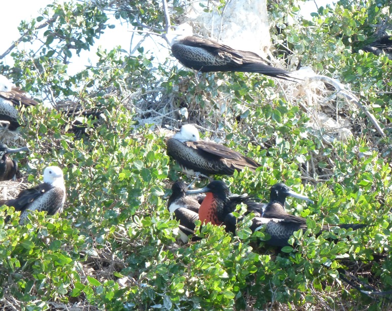
The frigatebird has the largest wingspan in comparison to it's body of any bird species in the world, so the frigatebird is naturally an adept pilot. Frigatebirds have been known to stay in the air for nearly a whole week and only land on the rocky cliffs to breed or to rest. Unlike the incredible flying ability of the frigatebird, the frigatebird is unable to walk that well and cannot swim. Frigatebirds have a diet that consists of marine animals and so frigatebirds have to pluck their prey from the water without landing as they are unable to take-off from a flat surface such as water. - from Frigatebird (Fregata) - A-Z Animals 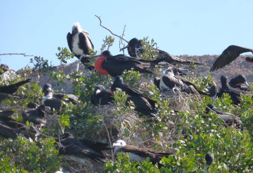
Something tells me this red-chested showoff is the alpha male. 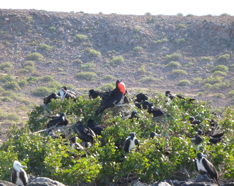
It is pretty easy to identify the males. But why do some of the others have a white head while other have a black head? [The] Juvenile [is] similar to adult female, but head entirely white, blending with white chest. - from Cornell Lab of Ornithology - Magnificent Frigatebird 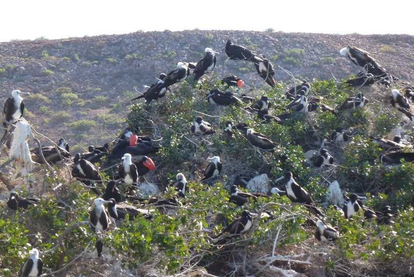
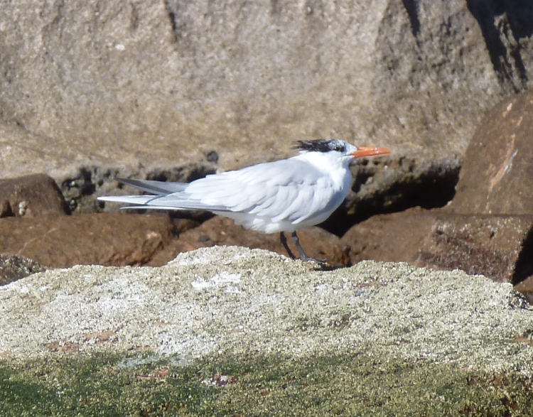
Some other birds made their appearance that day too. |
|
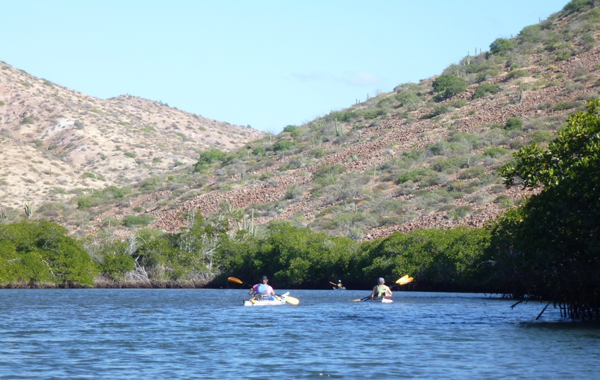
Our last adventure for the day was another mangrove swamp. I believe this was just south of Playa Colorado (Red Beach). This is between #3 and #4 on the BOA island map. Some of the narrow sections reminded of the kind of kayaking Norma and I enjoy in Maryland. Interestingly, sections that were sometimes only 10 feet wide opened up to protected waters 125 feet wide. Herons and other water birds sought refuge in the mangrove trees.
Mangrove swamps fill a very important niche in the ecology of Baja. The saturated mud flat of the typical mangrove swamp is a hostile environment for typical plants, because the soil has very low levels of oxygen for roots and toxic levels of sulfides...certain mangrove species can tolerate soils more than double the salinity of ocean water. - from Mangral (Mangrove) (broken link as of 2016) We finished the day after paddling 6.4 miles, landing back at Playa Dispensa, where we started on the first day. 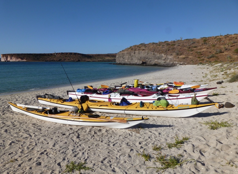
We were done kayaking. Tomorrow, the BOA power boat would pick us up. Over the last six days, we paddled a total of 35 miles (excuse me if my daily mileages don't add up but I did some rounding), averaging 5.8 miles per day. Our moving time was just under 14 hours and our moving average was 2.5 mph. That night, we ate spaghetti and garlic bread. Rob found a hermit crab. I can't remember what day or night it was but at some point during the trip, Rob used the term "oodles" during one of his many stories (he's a good storyteller). I don't know what it was in reference to. Francisco asked what "oodles" meant. Nobody could give a good definition other than "a lot" which hardly seemed satisfactory. So for the rest of the trip, we found ourselves using the word "oodles" liberally - oodles of times. |
|
This was our final day. I thought alot about the trip. Here are some random observations.
We had eggs, fruit, beans, and tortillas for our final breakfast. We always ate well. I noticed how Raphael liked to teach Scott about fishing. He even gave him a little introduction to fly fishing. Francisco spent some time showing Scott stuff in the books. 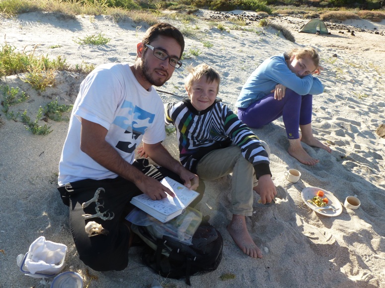
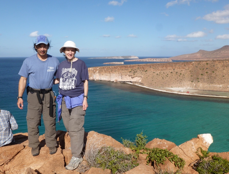
Our guides worked together well and worked well with us. They were great both on the water and on the land. They could tell us about the plants, animals, history, and archaeology of the place. Raphael even has an archaeology degree! Raphael led us up a hill on the north side. At the high point was a big white cross supported by rocks. We made our way along the ridgeline to the south side. We found what I think is a garden spider and a goat skull. 1 / 5
View from north side.
2 / 5
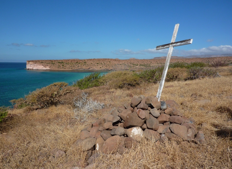
White cross.
3 / 5
Me on ridgeline.
4 / 5
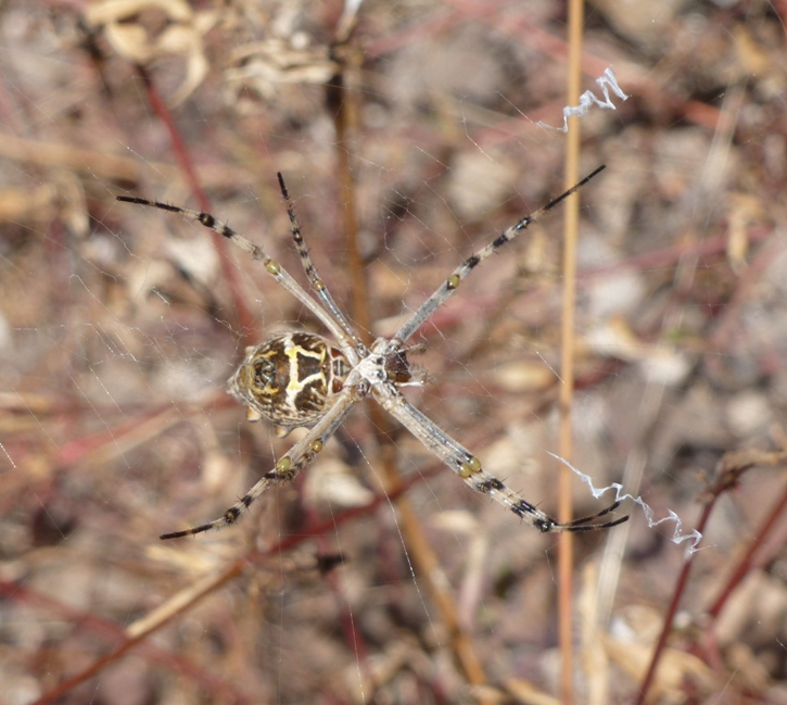
Garden spider?
5 / 5
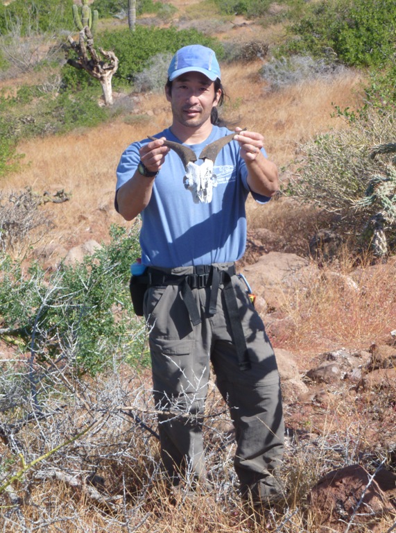
Goat skull.
On the south side, we climbed up a rocky hill. On the hill, a volcanic boulder came loose and hit me in the shin, cutting open the skin. It wasn't bad but I would have preferred to have been bitten by a sea lion because it sounds much so much more impressive. Another white cross marked the high point, but this time on the south side. 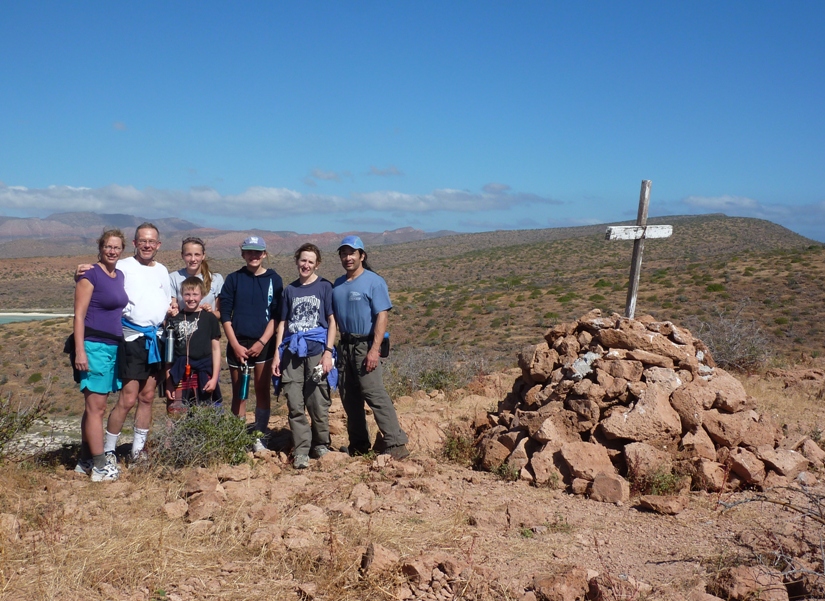
Making our way down, I stopped to investigate a sheltered rocky area. Someone wrote "1858" on one of the walls. Of course they could have written it last week but I prefer to think otherwise. In one cool and shady section, I finally got a picture of one of those butterfly/moths that I found so frequently under rocks. Looking more closely at the photo, I am convinced it is a moth but I can't tell you what kind. 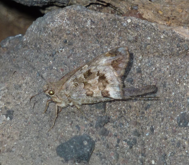
For our last meal, we ate sandwiches, peaches, and ice cream. The BOA power boat came. We loaded up our gear and headed back to La Paz. I was hoping to get one last look at a mobula ray but there were none to be seen. I was sad to leave the island but also looking forward to getting cleaned up. I know Norma was wanting to get a good nights sleep without her neck hurting. |
|
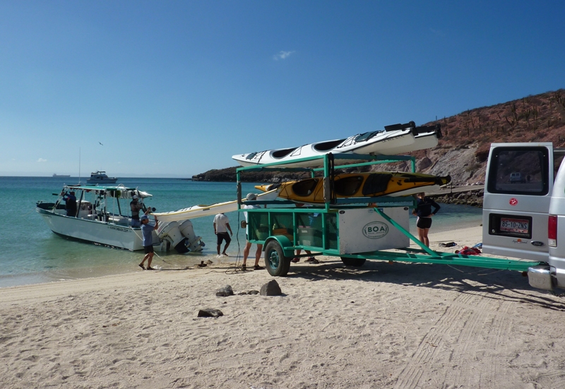
We transferred our gear and kayaks from the power boat to the van and trailer then drove back to the BOA office. I slept along the way.
At BOA, we filled out evaluation forms. We were presented with a one year pass to return to national parks in Mexico for free. Norma and I bought some BOA logo clothes as souvenirs then went back to the hotel. We got washed up and I shaved. Mucho better. Then I took a short nap to recharge my batteries which were a little low. Norma and I took a taxi ride out to the downtown area. At Casa del Artesano Sudcaliforniano, we bought gifts. I bought an Atemba necklace for Mom's birthday and a DVD about South Baja. We eventually made our way to Los Magueyes Restaurant for our last meal with the group. From left to right are Francisco, Leah, Raphael, Rob (standing), Anita, Scott, Kim, me, and Norma. 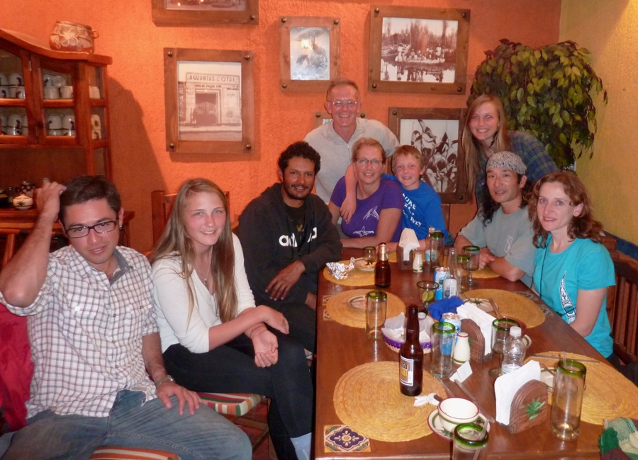
A teenage girl in the fully-catered BOA group trained in opera sang a song. She sounded like a pro to me. We all said something we were thankful for or liked during our trip and I mentioned how much I appreciated that everyone in the group had such a positive attitude and willingness to help out. We exchanged e-mail addresses then said our final farewells. |
|
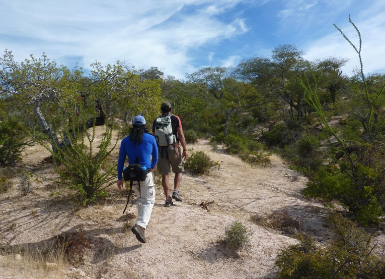
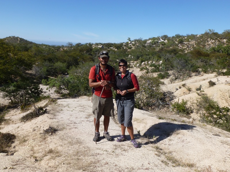
For our final full day in Mexico, we hired Raphael to take us on a hike. He owns his own tour company, called Katun. He specializes in mountain bike tours but he also does hikes. After discussing our time constraints and interests, he recommended a day hike where we would walk through a ranch to some old cave paintings.
He picked us up at the hotel at 0700. He and his girlfriend, Fernanda (who also holds an archaeology degree), drove us out of town to the ranch. Norma, with her farming background, was interested in seeing how cattle are raised in Mexico. Raphael arranged to meet the owner but was uanble to find him. He did find his daughter, however, who gave us permission to walk on the property. But without her father, it would be difficult to find the cave paintings. We set out on foot, carrying lunches that Raphael and Fernanda made. The ranch was much different than what I expected. It was basically untouched land. Unlike Maryland, the ground wasn't plowed and no crops were planted. Desert plants grew wild and the cattle just ate what was there. We never saw any cattle but we did see evidence they were there (poop). I imagine they must be some breed (perhaps longhorn) that is well suited for desert climates. Certainly not Hereford. We saw many of the same plants we saw on the island but these were much bigger. We also saw some new ones that Raphael pointed out. We saw a century plant (agave). This misnamed plant typically only lives 10 to 30 years. 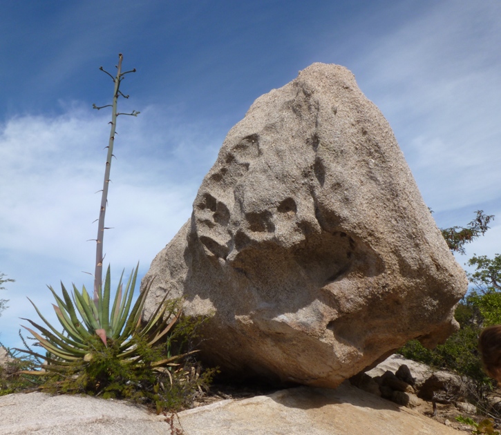
A barrel cactus is a plant from which one can get water. It twists as it grows. 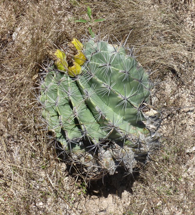
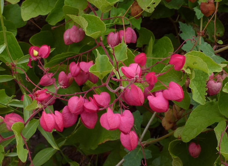
Chinese lantern is a plant that my dad would grow outside in Sacramento. 
Wild fig trees on the mainland are considerably larger than the ones on Espiritu Santo Island. 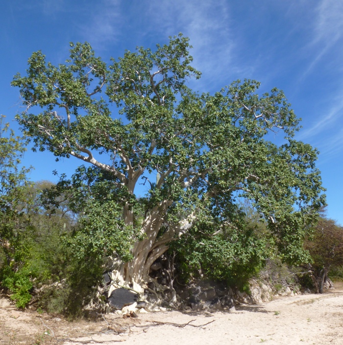
Raphael got us to a point where he was certain the cave paintings were nearby. Norma, Fernanda, and I waited in a comfortable area under a tree and ate lunch while he set off to find the paintings. He was gone awhile, looking all around the area. Unfortunately, he could not find them. Vegetation in the South Baja desert isn't extremely dense but it is thick enough in some areas so that you don't want to bushwhack if you don't have to. Sticking to the worn paths or at least staying on top of the rocks is the best way to keep from getting scratched up. 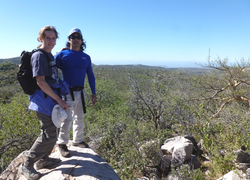
Flowers and fruit aren't exactly abundant but they are there if you look. We found some lizards and bird nests. Unfortunately, we saw no snakes. 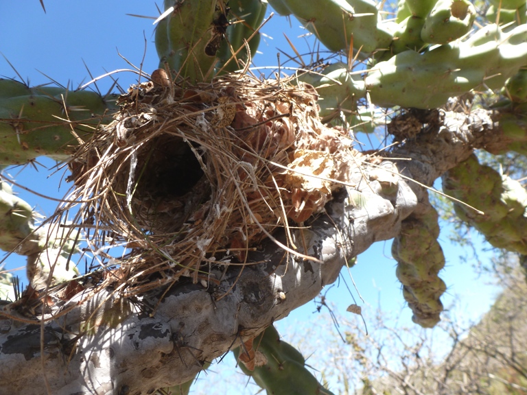
While we didn't see cattle, we did see goats. In this environment, I would think goats would do well. 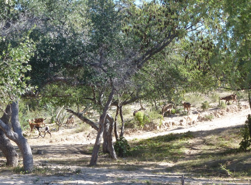
I was a little disappointed to not see the cave paintings but I know Raphael did the best he could. He and Fernanda did a good job at keeping us entertained. Raphael and Fernanda dropped us off at the bus station where we said our farewells. |
|
We bought our tickets. Then in about 20 minutes, we were on our way, sitting in an Aguila bus. It was a 3.5 hour bus ride on a winding road. I made the mistake of not taking my motion sickness medicine early on. I dry heaved at a rest stop. I didn't feel good for most of the trip though I did manage to sleep during the last part.
The bus took us to San Jose Del Cabo. We heard people playing Creedence Clearwater Revival (CCR) and Lynyrd Skynyrd on their car stereos. That was a good sign. The two of us walked to Hotel Colli in a nice part of town. The guy working at the front desk seemed really efficient and friendly. We dropped off our luggage and then walked around town. Norma and I ate at Molly's Restaurant and Bar just around the corner from the hotel. After exploring the area more, we soon realized that we should have spent all day here. We didn't because we thought there wouldn't be enough to do, but clearly there was. We checked out their Christmas displays which included lights and a nativity scene. 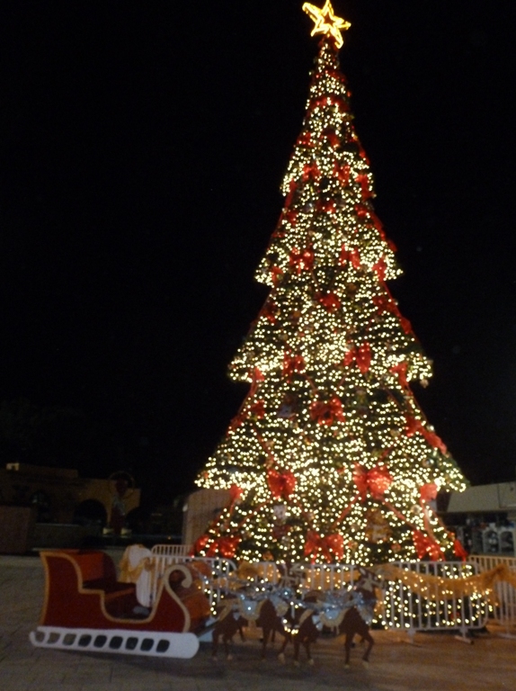
We made our way around the historic district which dates back to 1730. Here we saw Misión de San José del Cabo Anuiti. Founded by the Jesuit Priest, Nicolas Tamaral in 1730 and watered with his own blood when tortured in 1734, the Mission of San Jose is a testimony of the immense evangelized work in these lands. - from Misión de San José del Cabo Anuiti 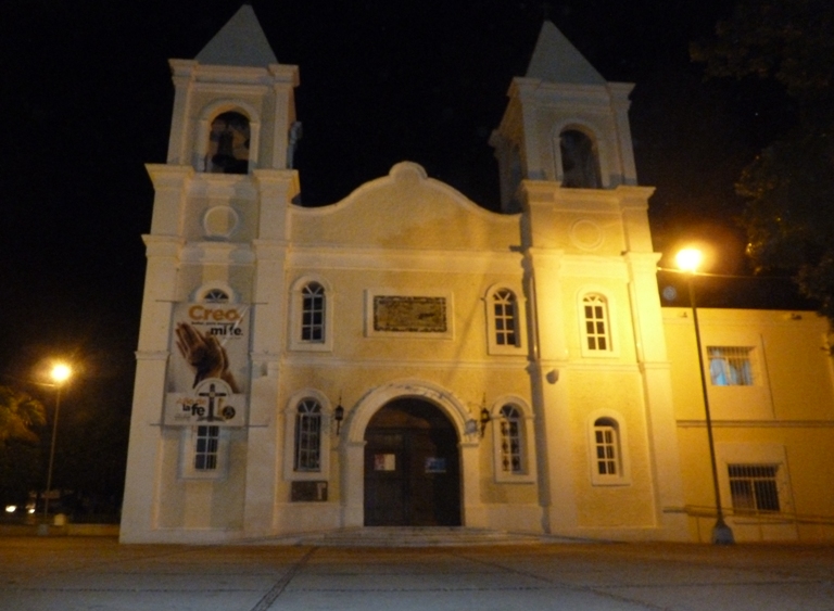
Across from our hotel was the Cabo Wabo Store which may or may not have something to do with Sammy Hagar's Cabo Wabo Cantina in Cabo San Lucas. The place was closed. 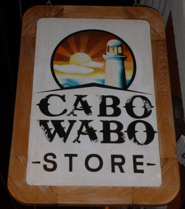
We did a little souvenir shopping at a store right across from our hotel. In addition to trinkets, logo clothes, and things you'd stereotype with the area, they had football wall hangings done San Jose Del Cabo style. A worker at the store asked where I was from and I replied "Balitmore" just to see if he'd try to sell me something associated with the Ravens but he did not. I did not see any Ravens merchandise. |
|
Norma and I were up at 0430 to catch an early flight. Everything went as smooth as silk. No problems with the taxi, the flight, getting through security, customs, or anything. In fact, checking in our luggage was ridiculously easy. "Oodles" of people were flying business or first class but there was nobody in line for flying coach so we checked in our stuff really fast. The rest of the common folk showed up later.
We flew out of San Jose Cabo via American Airlines then had a long layover at Dallas Fort Worth. We ate a leisurely lunch at Pizzavino, chatted with our waitress who was going to Germany, then walked through some shops to waste time. Browsing through a book store, I found something that caught my eye. It was an autobiography of Sugar Ray Leonard called The Big Fight: My Life In and Out of the Ring. I say, "I'm not a reader, I'm a writer." But every couple of years, I come across a book that will actually hold my attention. Generally, they are about rock stars, elite military units/people, or fighters. This satisfied the latter category. I started reading it and managed to get through quite a bit before our flight left. I only ended up with about seven insect bites for the whole trip which is pretty good for me, especially since I never wore bug spray or clothes sprayed with Permethrin. I did wear lots of sunscreen and while I started off the first and second days wearing sunglasses, I found them more of a nuisance so I never wore them again. I felt that we did a pretty good job of packing. I'm really glad I brought the wet suits and neoprene tops. Splash jackets might have been useful but regular Gore-Tex rain jackets were sufficient and more versatile for off-water use. It seemed like everything was going too easy. I was worried that maybe upon arriving home, our house would be robbed or my car would be missing. But no, everything was fine. Even Asha (our cat) was fine and glad to see us. It was a great trip but it was also good to be home. |
|
To say Norma and I had an awesome time would be an understatement.
Was it perfect? No. The whale museum could have been open. It could have been warmer and less windy. We could have seen more wildlife. Norma could have felt better on January 2 and her neck could have hurt less. We could have found the cave paintings. I could have not been bus sick. But overall, it was great and well worth the money. Far, far, far more things went right than went wrong. Would we do this same trip again? Probably not. But that's only because the world is such a big place, we want to see more before doing the same stuff again. Would I recommend this trip to my friends? For my adventurous kayaking friends, yes, without a doubt. I'm sure they would have a superfantastic time. People don't generally think of camping with a group, helping cook meals, or living in a tent as an appropriate honeymoon. But that is just what Norma and I wanted and it worked out just peachy. |