|
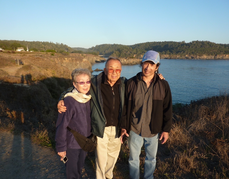
Every other year, Norma and I visit my folks in California. On the years we don't visit them, they fly out and visit us in Maryland. Our last visit was December 25, 2011 to January 2, 2012. It was nice to be around for the holiday season. |

|
Every other year, Norma and I visit my folks in California. On the years we don't visit them, they fly out and visit us in Maryland. Our last visit was December 25, 2011 to January 2, 2012. It was nice to be around for the holiday season. |
|
I was glad to get away from Maryland for awhile. I had spent a lot of time preparing the house and creating my 2013 Maryland Solar and Green Homes Tour presentation. On the big day, October 6, 2013, we had about 25 people from the area show up to see and hear about our solar photovoltaic system, solar thermal hot water heater, geothermal heat pump, and 500+ gallons of rain barrels. The event was a big success! With that done, I was ready to relax and have fun out west.
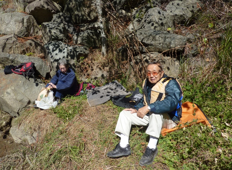
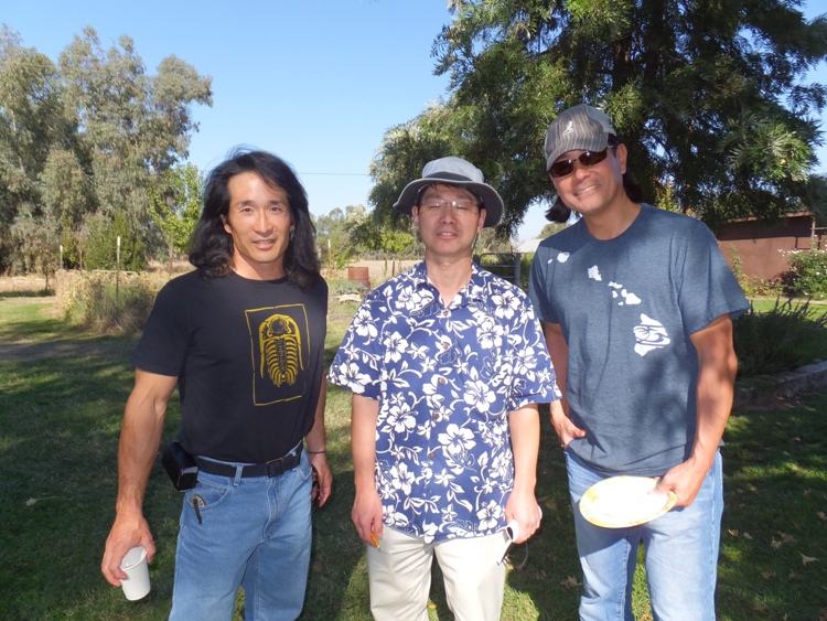
Norma and I took a shuttle from home to Baltimore Washington International (BWI) Airport and then flew out around 1000 on Southwest Airlines. We used tickets that Norma won at a silent auction for charity. They ended up being worth a few times more than what she paid. I took a Dramamine so I slept for much of the flight. I struck up a conversation with the passenger next to me. We ended up talking about the relocation camps that the Japanese Americans were put in during World War Two and eventually I gave a plug for Aunt Kiyo's book. We landed at Sacramento International Airport which is abbreviated SMF. I only know of the Twisted Sister reference to SMF so I had to look up what it stood for in the airport context. It stands for Sacramento Metropolitan Field. My parents were there to greet us and take us to their place, my childhood home. The weather was warm and sunny...a little too sunny. I forgot to bring my sunglasses which I don't often wear in Maryland. But the sun in Sacramento is much more intense. Fortunately, Mom held onto an old pair of mine that I used during our visit. We spent the rest of the day taking it easy and getting caught up on things. Mom had a lot of good comfort food out on the kitchen table: chow mein, nuts, fruit, bagels, yogurt, and Diet Pepsi. |
|
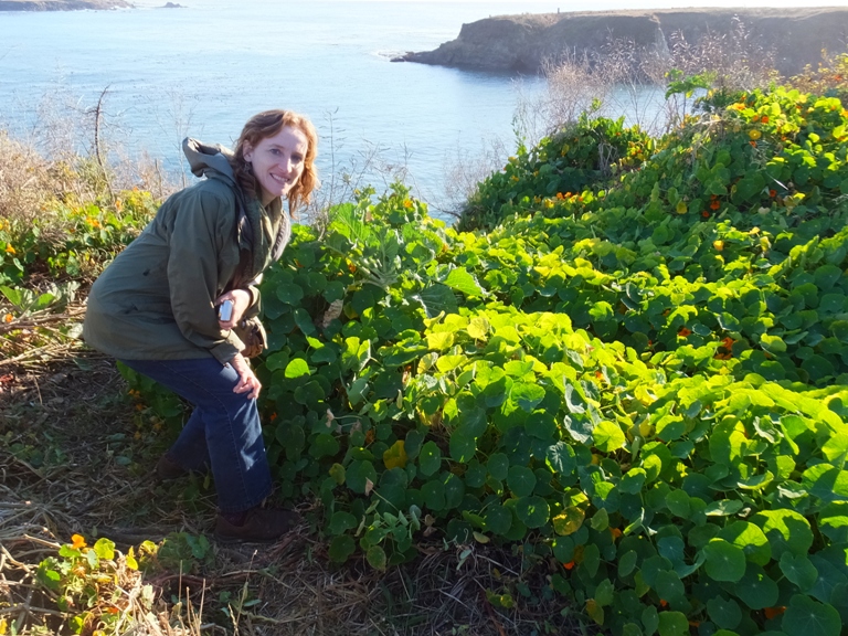
We loaded up my parents' old Toyota Corolla and then Norma, Mom, Dad, and I headed to the coast.
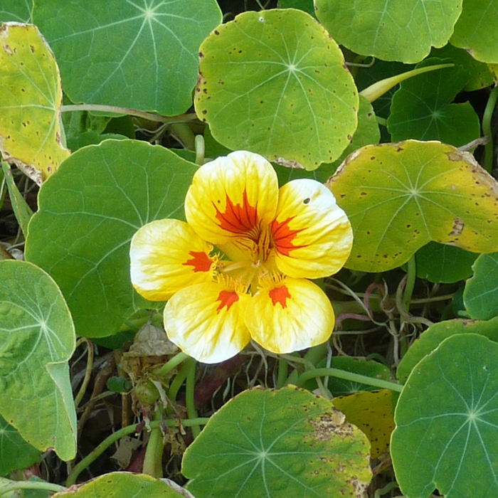
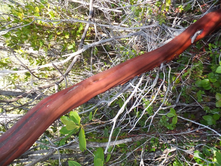
Driving through wine country meant we had to stop along the way to do some tasting. Our choice was Trattore Farms in Dry Creek Valley. Unfortunately, of the four of us, Norma is the only one that drinks. But the rest of us tried various olive oils made from their 150-year old olive trees. Norma bought a few bottles. We stopped in a small town along the way to look around and buy groceries. Our destination was a placed called Big River Farm in Mendocino. We rented out a vacation home called Zendo. It was built as a Zen commune in the 1960's around a historical apple and cherry orchard that was part of an old farm that belonged to the Rose family "back in the day." The buildings were modeled after Japanese inspired structures and have been modernized while maintaining their Zen flavor. Big River Farm is a rustic retreat in the redwoods...surrounded on three sides by Big River State Park. - from information brochure 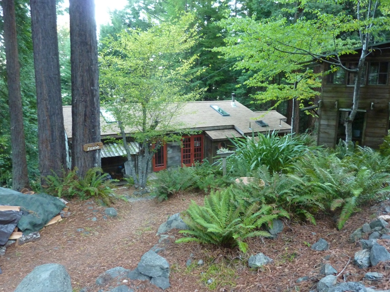
That night we cooked dinner, ate, and ended the day by watching Call of the Wild.  |
|
When Norma and I travel, we often do a pretty good job of saving money with accommodations but have a tendency to eat frequently at restaurants. This trip was a nice change in that we made use of food that we picked up at the store and then prepared at the house. That included breakfast.
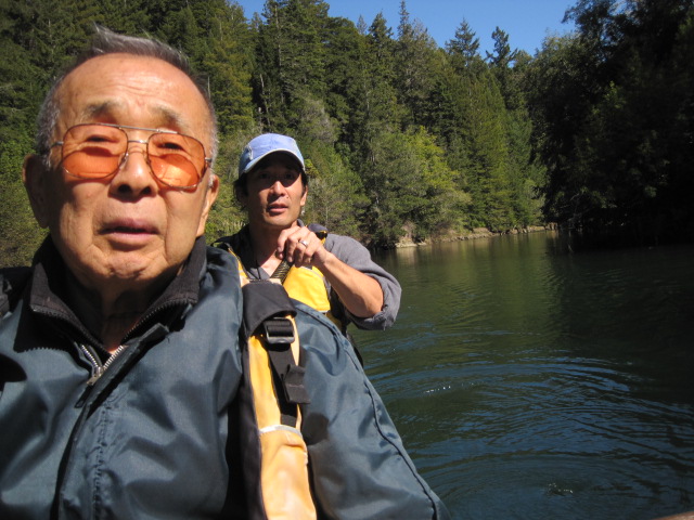
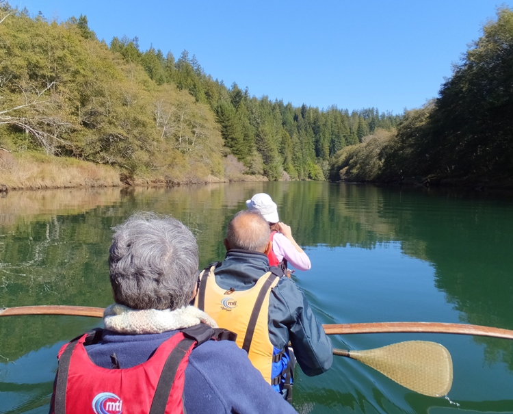
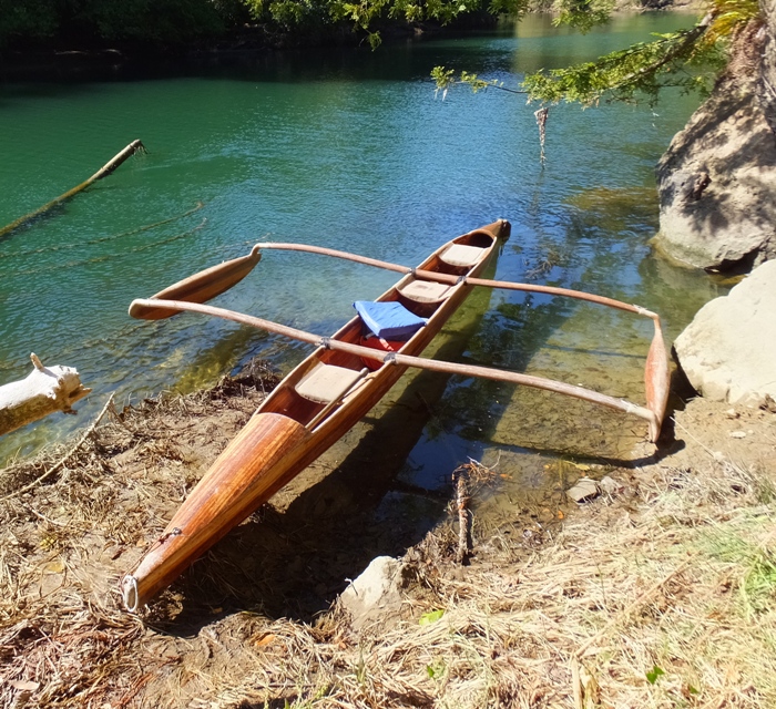
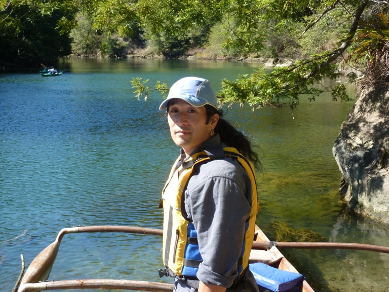
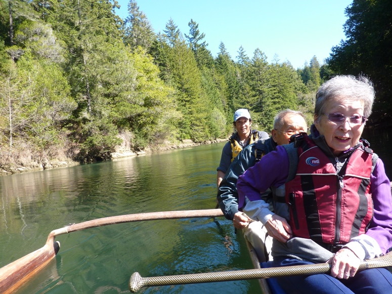
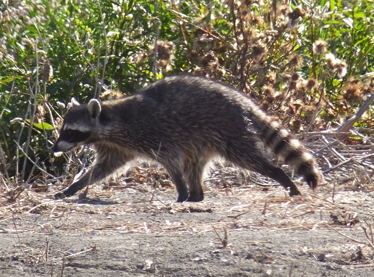
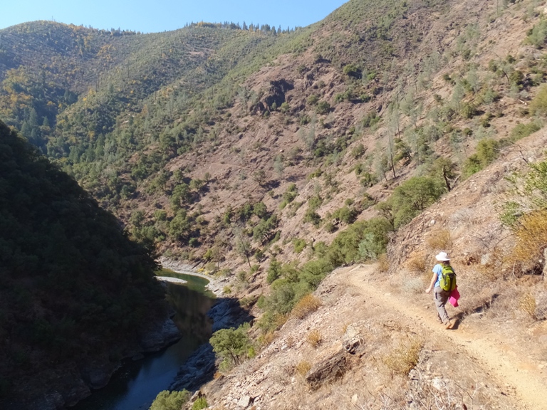
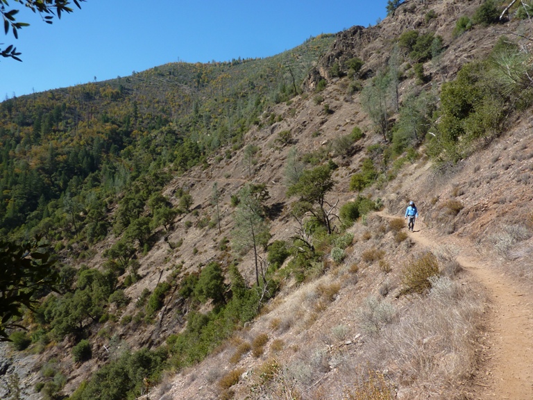
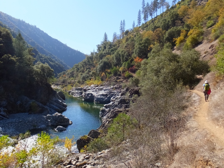
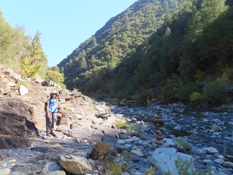
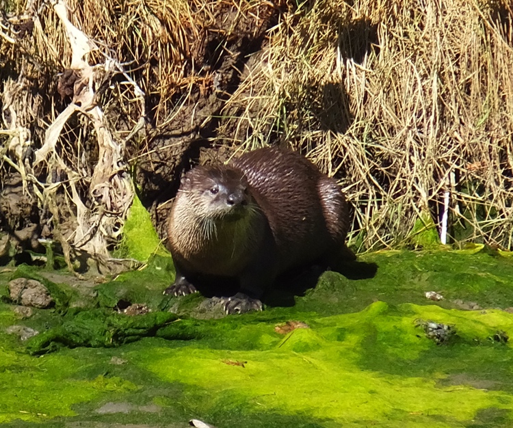
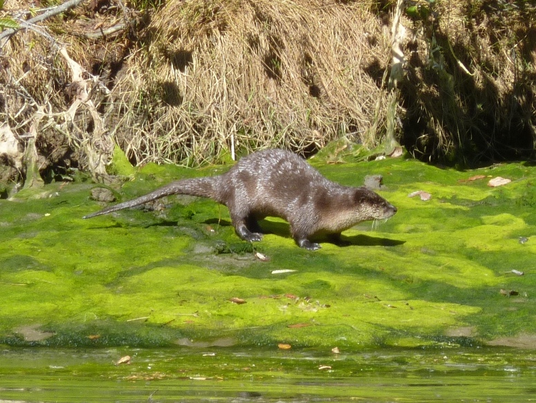
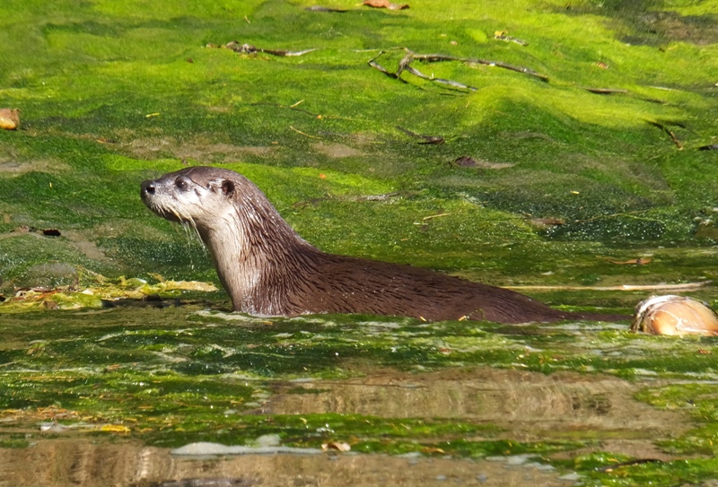
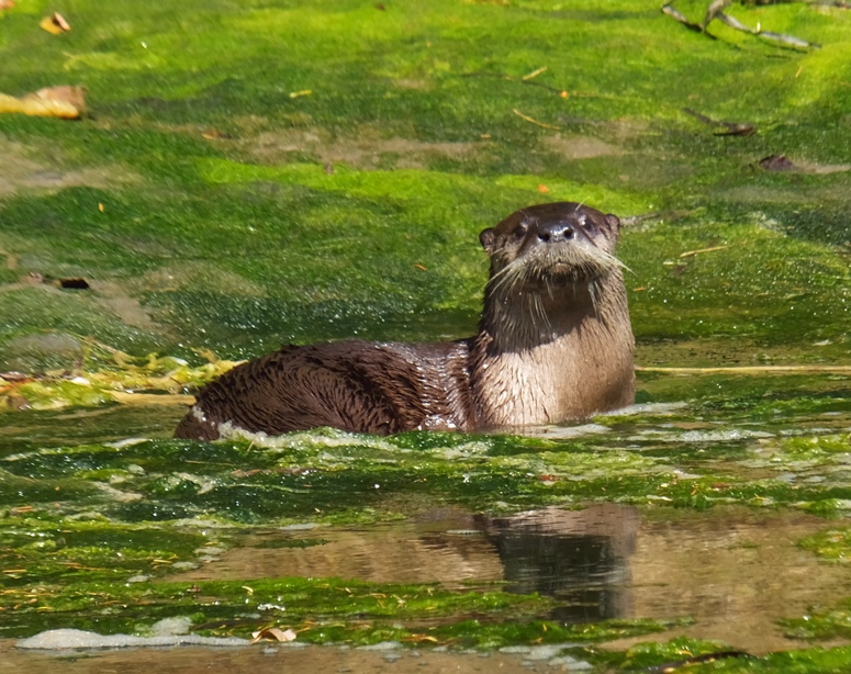
We drove a short distance to the Big River. On the west side of the Big River Bridge, the waters of the river drained into Mendocino Bay where big waves made any water sport activities difficult. But on the east side, the river was calm and secluded. It was here that we walked around for a bit on a sandy beach. Some giant pieces of redwood lay worn away on the shore. Some may have been left from the harvesting that took place in the 1850s. Water birds ran amongst the seaweed. In the early morning, it was cool but as the intense sun began to rise, things quickly warmed up. Signs warned of mountain lions. On the south side of the river near the bridge, we found a place called Catch-a-Canoe and Bicycles Too. They rented outrigger canoes made locally out of redwood. They had one big enough for all of us so we took that. Norma paddled at the bow with me at the aft, controlling the rudder. The boats were very stable and fairly streamlined. We had no trouble paddling upstream and going against the outgoing tide. The river was pristine. We canoed through the tree-lined canyon, occasionally seeing another paddler and maybe a bicycle through the trees. After about three miles, we pulled ashore for a lunch break. Outriggers aren't the easiest things to land and get out of in the wild. Just above us was the Big River Trail which ran along the river for at least 6.5 miles. Packed with gravel like a rail trail, it looked like a place that Norma and I might want to explore on a future trip. During lunch, we saw a seal stick its head out of the water. We saw some more on the return trip. By far the most spectacular sight throughout the day were the river otters. We must have seen about eight. Unlike muskrats which are all about work, otters are very playful. And unlike the Maryland otters, these were not camera shy. 1 / 5

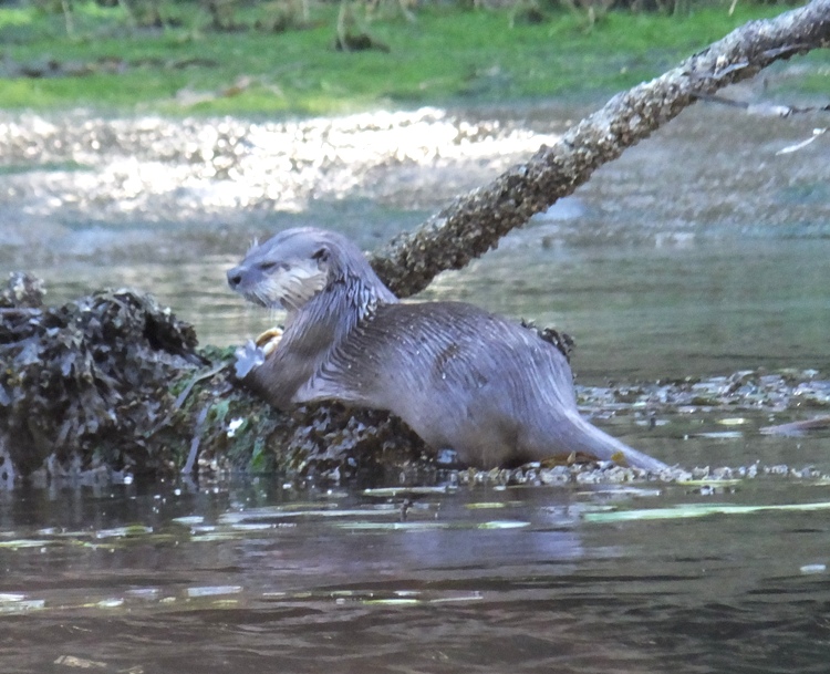
Otter looking tired.
2 / 5
Webbed feet.
3 / 5
Shiny coat.
4 / 5
Long whiskers.
5 / 5
Looking at camera.
River otters are swimming mammals that reside in the water on a part-time basis, as they also spend significant amount of time on land. The nocturnal creatures, who are related to weasels, are a common presence in oceans, wetlands, reservoirs, rivers and lakes, and also throughout marine coastal locations. - from Five Interesting Facts About River Otters (a broken link as of 2023) I guess nobody told these otters that they are supposed to be nocturnal. |
|
Next, we drove west to the town of Mendocino. We stopped in at the Ford House Museum and Visitor Center and learned how the area was shaped by the logging industry during the gold rush.
When logging along the Mendocino Coast began about 1850, the trees were cut by hand by axe and the logs were brought to the mill by horses and oxen. The cut timber was shipped out of the doghole ports along the Mendocino Coast by sailing schooners. Steam came to the woods around 1883 in the form of steam driven donkey engines (dolbeers). Railroads went into the woods and steam locomotives hauled the logs to steam driven mills. Steam ships joined sailing schooners to move the lumber to market. - from Redwood Logging History around Mendocino and Fort Bragg (a broken link as of 2023) 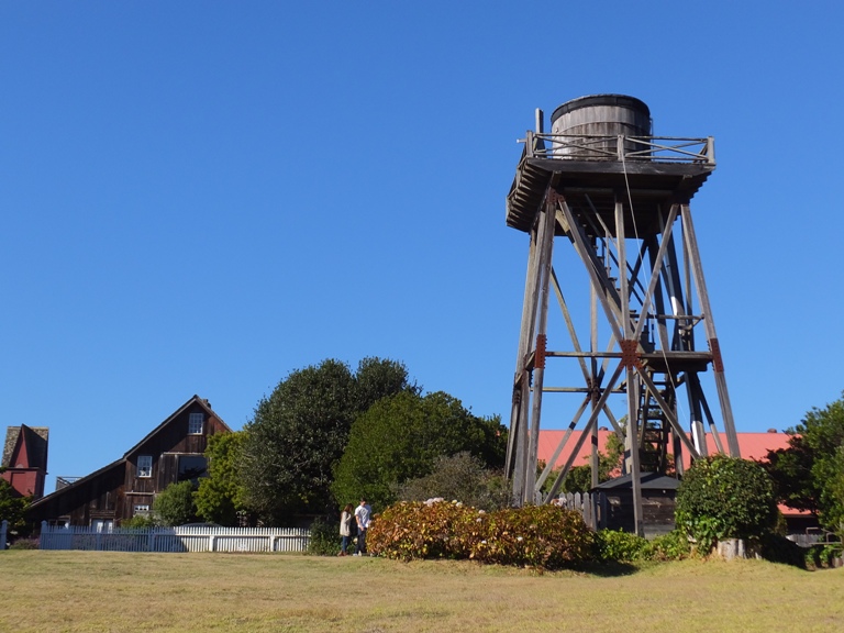
The four of us caught a trail in Mendocino Headlands State Park that took us to overlooks along the Mendocino Bay. We spotted a fellow surfing on a stand-up paddleboard (SUP). 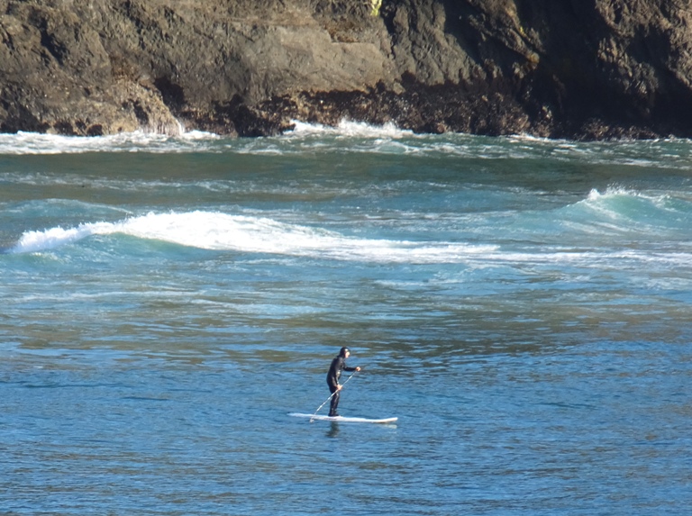
We could see the Big River Bridge further west along with two rocky islands, shown below. 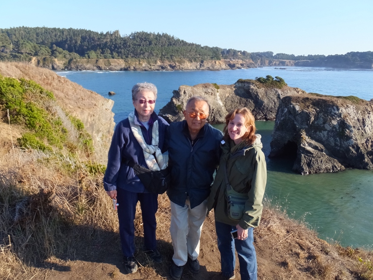
Closer, some interesting flowers and vegetation lined the trail. My parents sat at a bench while Norma and I continued on. 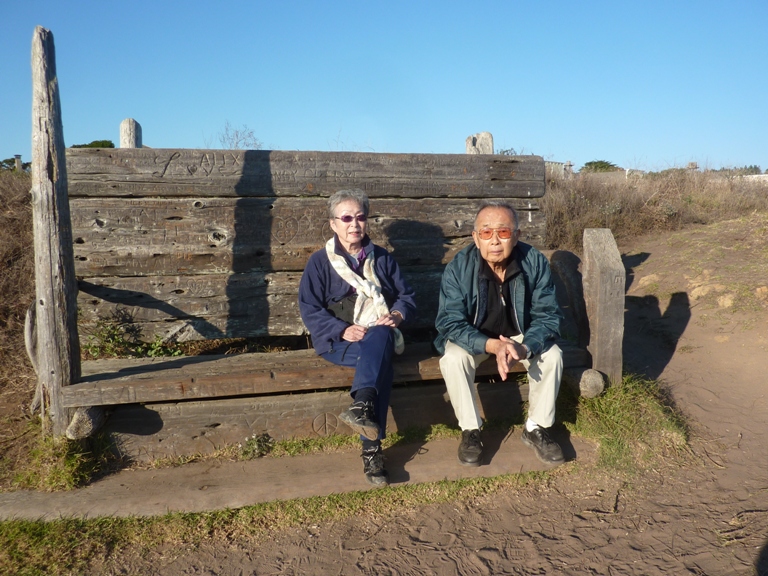
Down at the water, we saw small jellyfish, each about the size of a 50 cent piece. 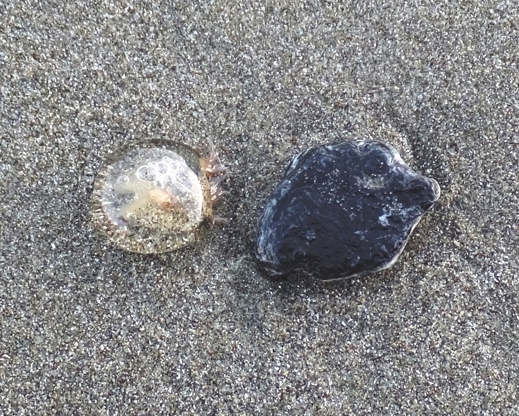
Out on the peninsula, we saw a large cave. The water went clean through the rocks to the other side. 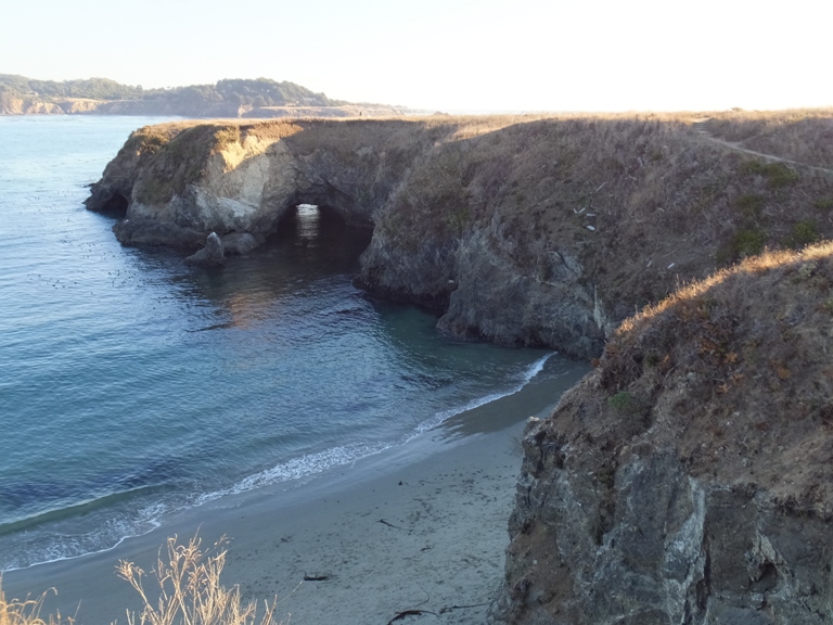
Norma and I investigated and found that the cave was also open at the top. 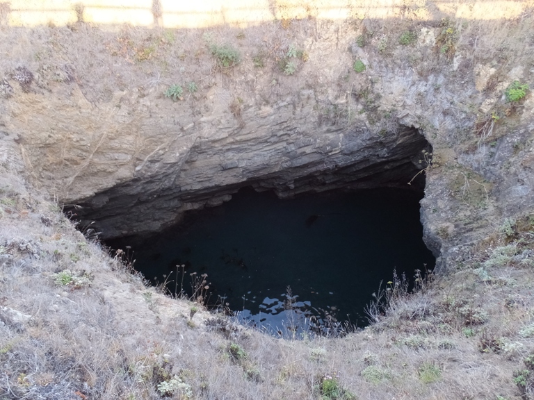
Nearby, there also appeared to be the ruins of what looked like the structure used to transport redwood logs down to ships. 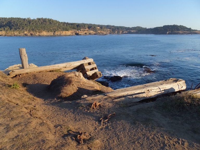
A pair of black oystercatcher birds looked for food among the rocks. 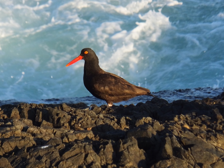
One walked away with something in its mouth so I assume it was successful. We found a lot of mussels and a few sea anemones in the tidepools. 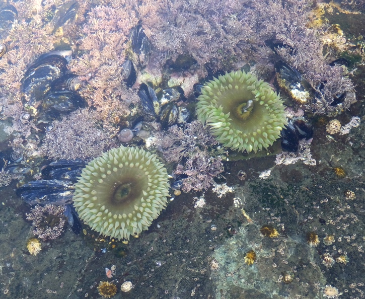
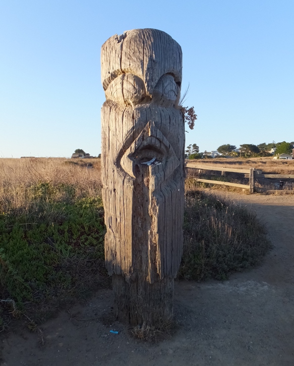
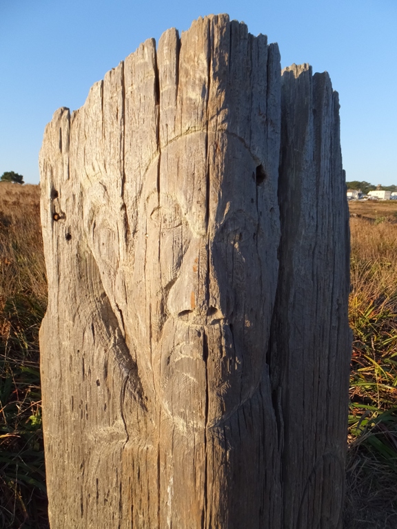
Norma and I found some totem pole-like carvings on posts along the trail. We took plenty of photos of each other with the scenic Mendocino Bay in the background. As the sun set, the town with its cowboy-like architecture took on a glow. 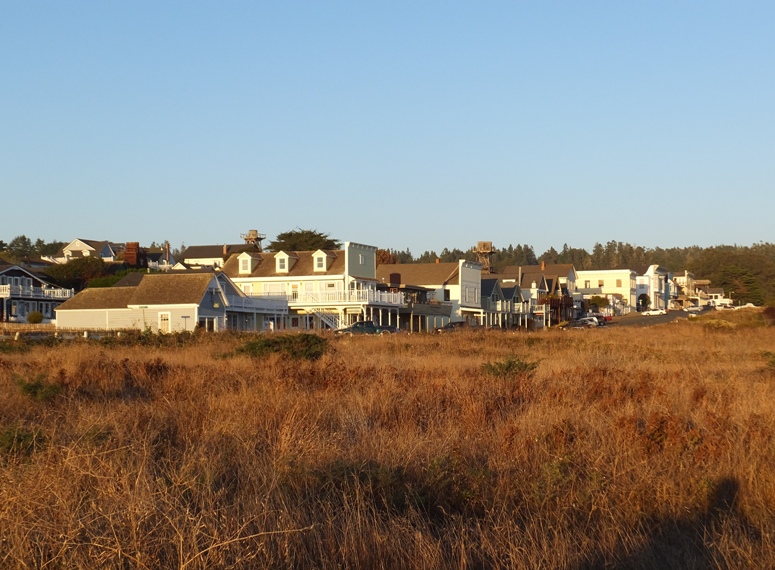
The four of us walked around town. That place has a lot of character. Though small, there was a Chinese temple called Kwan Tai dating back to the 1850s, a natural food store, and residents demonstrating an artistic flair in their yards. 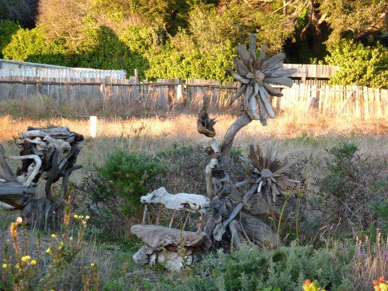
|
|
We packed up our things and said good-bye to Zendo.
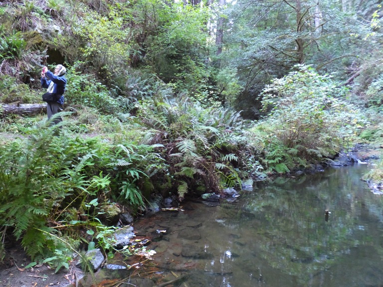
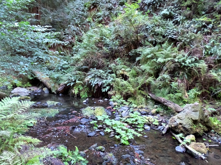
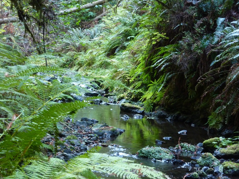
The four of us drove to Van Damme State Park. Dad stayed in the car while Norma, Mom and me went for a short out and back walk on the Fern Canyon Trail. As the name implies, it is a canyon full of ferns. I thought it had a sort of rainforest feel to it. The river that flows though the park is the Little River. The Coho or silver salmon that spawn in Little River are unique because unlike most of the coastal streams in northern California, no hatchery-raised fish have ever been introduced to this river. Wild salmon have evolved in this stream with its own home blend of chemistry, temperature, geology, plant and animal life. In other words, these fish, with their special adaptations, differ from all others. - from sign on trail I wondered if the salmon here in the Little River tasted different from other salmon. |
|
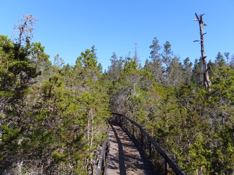
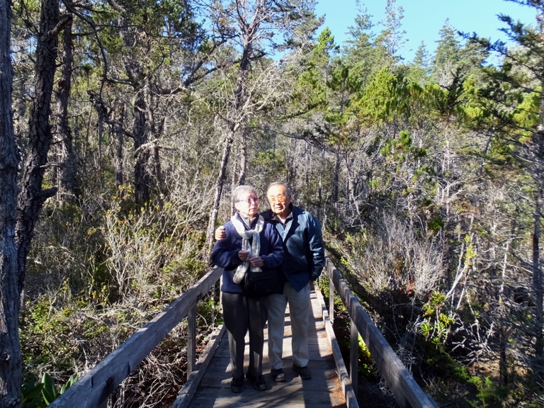
Next, we headed to another side of the same park and walked on the Pygmy Forest Discovery Trail. Dad was with us on this one. This is a very special place where
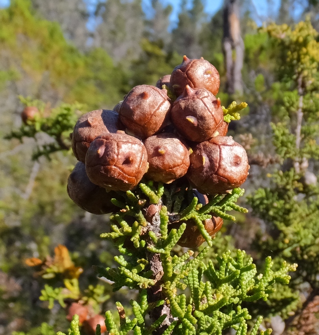
nature, practicing a form of bonsai, has created vegetation that is dwarfed and stunted. What is unique here? These soils are between five hundred thousand and one million years old. Why is the soil so old? Because the flatness of this coastal terrace prevents new soil formation, and there is not a higher terrace draining into it to bring new soil through the process of natural erosion. This flat terrain restricts drainage and allows rain to leach most of the basic nutrients away, creating an extreme acidic soil. Extreme acidity limits the ability of plants to grow and created an iron hardpan, which prevents root growth. Slow growth and poor drainage creates wet soil, that limits oxygen available for roots. All these factors contribute to making an environment that causes stunted plant growth. - from signs at trailhead and on trail The trail is a boardwalk because there is a fluffy lichen called Reindeer Moss that occurs here and more commonly in Alaska. It is very fragile and easily destroyed by walking on it. The boardwalk has helped it and other lichen and plants survive. - from sign at trailhead We saw some interesting plants including a manzanita tree and a Mendocino Cypress. The Mendocino or Pygmy Cypress is found only on coastal terraces between Fort Bragg and Anchor Bay. When not in poor soil, a tree can grow over a hundred feet tall; here, a tree with a trunk diameter of one quarter inch, standing only a foot or two high, may have as many as eighty growth rings. - from sign on trail Plants weren't the only things to see. I also saw a snail eating ground beetle identified by my friend Stacy. They also eat slugs. We can use some of them in Savage. 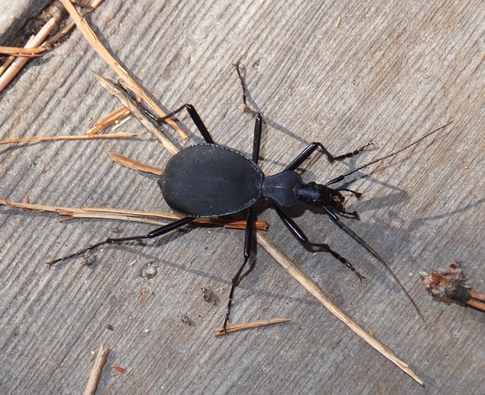
|
|
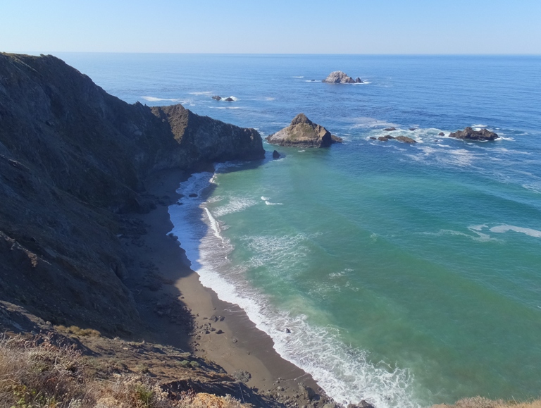
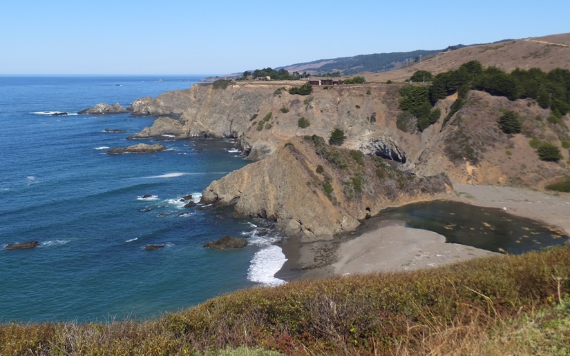
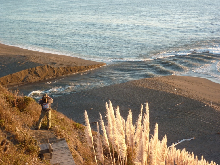
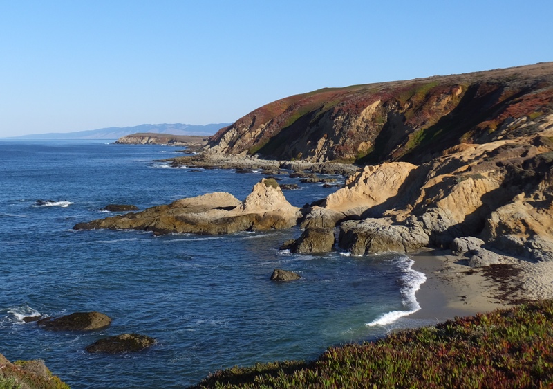
Continuing south on route one, we saw lots of scenic views of the ocean and rugged cliffs leading down to it. In the shot below, notice the small beach nestled amongst the rocks. It looks like there is a stream flowing into the ocean.
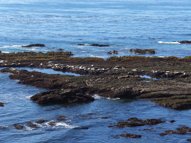
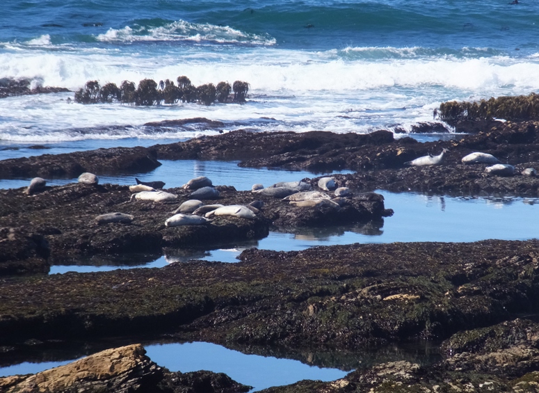
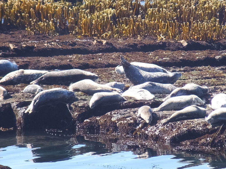
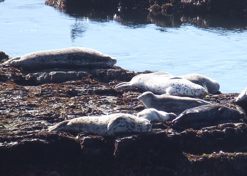
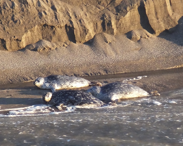
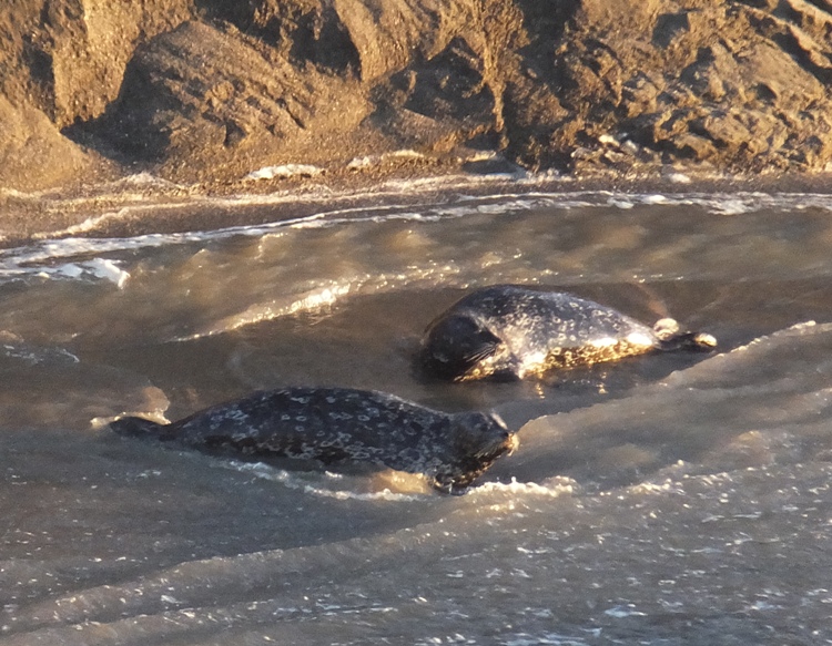
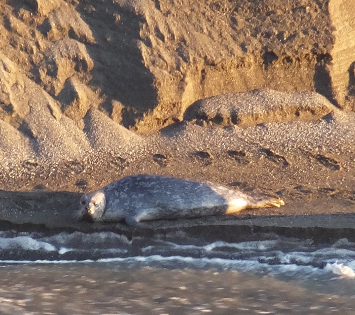
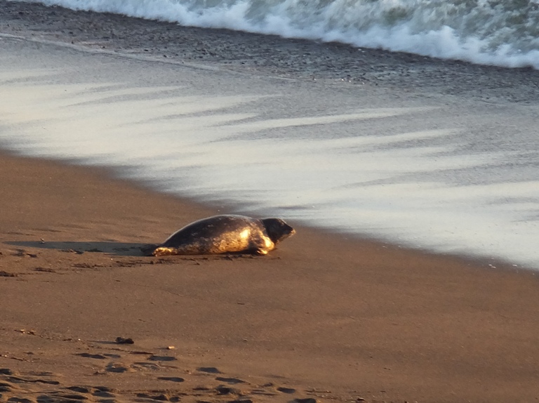
Here are some other views. Occasionally, we saw a low, rocky island that served as a rest area for numerous seals. I assume these were harbor seals. They certainly were not the elephant seals we saw on December 30, 2011. The habitat of the seals and other wildlife is protected in areas designated as State Marine Reserves and State Marine Conservation Areas. We met a couple that were bicycling the entire Pacific coastline of the United States. They were from Germany. Norma struck up a conversation with them, impressing my parents with her bilingualism. For lunch, we stopped at Rollerville Cafe. |
|
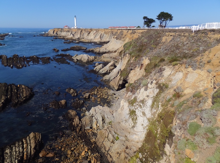
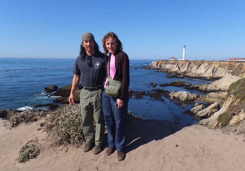
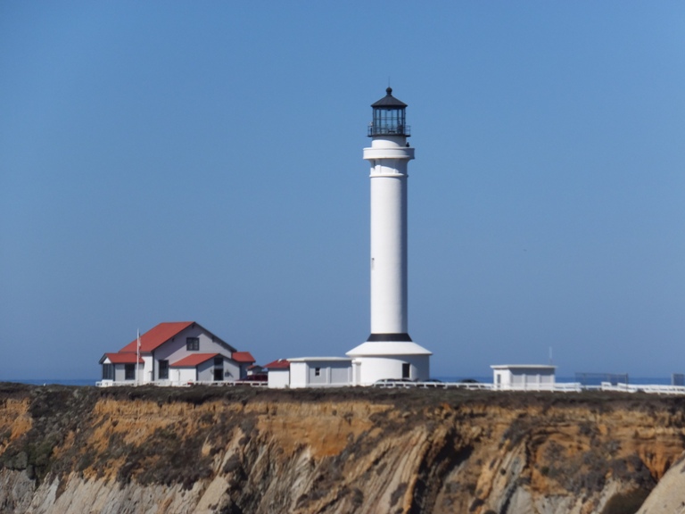
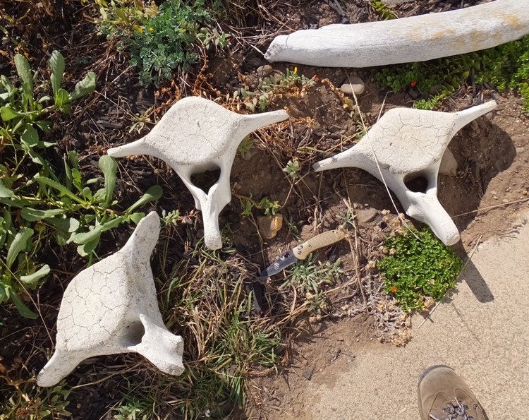
We stopped at the Point Arena Lighthouse and Museum. This is the tallest Pacific Coast Lighthouse and the closest point of land to the Hawaiian Islands in the continental United States.
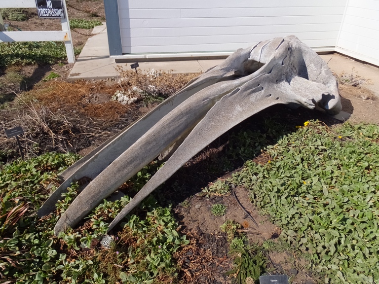
The lighthouse at this site was constructed in 1870. The brick-and-mortar tower included ornate iron balcony supports and a large Keeper residence with enough space to house several families. In April 1906, a devastating earthquake struck the Light Station. The Keeper's residence and Lighthouse were damaged so severely that they had to be demolished. The new Lighthouse began operation in 1908, nearly 18 months after the quake. - from Wikipedia - Point Arena Light We had some nice views from afar. Around the lighthouse lay the bones of large marine animals. Inside the museum, a docent spoke about the history of the lighthouse and how it operated. I was reminded of our July 31, 2008 visit to the Point Reyes Lighthouse. Next, Norma, Mom, and I climbed to the top of the lighthouse while Dad waited down below. We had quite a view up there but it also got hot quickly with all of us in that little glass room. I was amazed at how small the current light is. 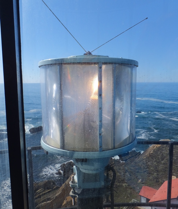
In contrast, here is the one used back in the day. 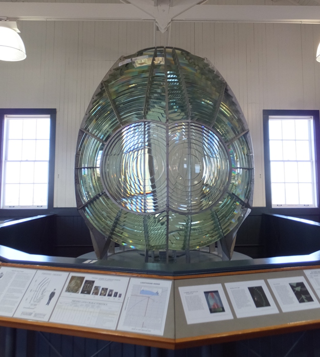
[The 1908 reconstructed lighthouse] featured a 1st Order Fresnel Lens, over six feet in diameter and weighing more than six tons. The lens was made up of 666 hand-ground glass prisms all focused toward three sets of double bullseyes. It was these bullseyes that gave the Point Arena Lighthouse its unique "light signature" of two flashes every six seconds. This incredible optic, that held an appraised value of over $3.5 million, was set in solid brass framework, and was built in France. June 1977 brought the installation of an automated aircraft-type beacon on the balcony tower, and the historic 1st Order Fresnel Lens was discontinued. The 400 pound aircraft beacon had been replaced by a 40 pound modern rotating light that incorporates the Fresnel principles for the efficient projection of light. - from Wikipedia - Point Arena Light |
|
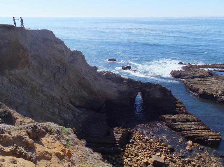
About 30 miles south of Mendocino, we stopped along the side of the road. Then Norma, Mom, and I walked on a trail to Schooner Gulch State Beach.
From an overlook, we looked to our north and saw a beach. 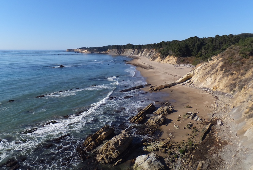
Zooming in with the camera, it was obvious there was something unusual there. 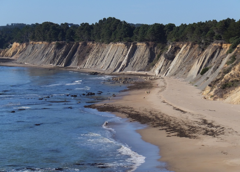
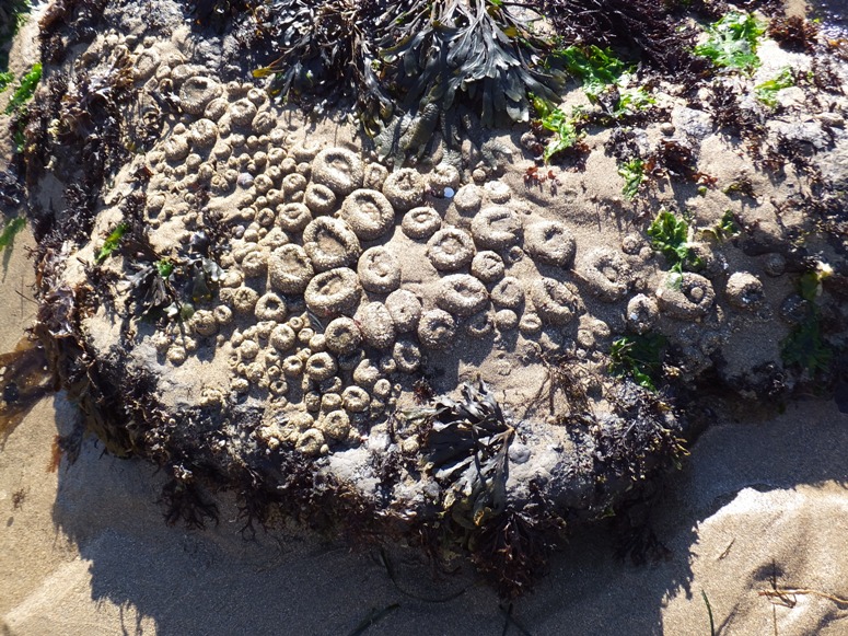
On maximum zoom, I could see Bowling Ball Beach where there were dozens of large, round rocks that showed themselves at low tide. 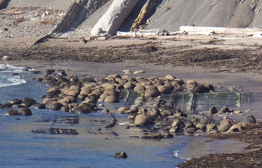
Technically called concretions, these hard spheres are composed of materials far more resilient than the Cenozoic mudstone that once surrounded them. Over millions of years, this has eroded away under the constant onslaught of the Pacific Ocean, forming the cliffs that line the shore behind the beach and leaving the tougher "bowling balls" behind. - from Bowling Ball Beach The San Andreas Fault runs right through this area and the striated sandstone formations we see at the beach are part of the Pacific Plate, and probably were deposited 100 million years ago. Of course 100 million years ago these deposits were about 300 miles further south and subsequently carried north as the Pacific Plate advanced along the interface of the Pacific Plate and the North American Plate to the east. The San Andreas Fault demarks the juncture of this ongoing collision between these two plates. - from Bowling Ball Beach: 100 million years in the making (broken link as of 2023) Rather than head north to get a better look at the bowling ball rocks, we walked south to do some tidepooling. While we certainly saw some interesting things, it wasn't quite as impressive as our August 1, 2008 tidepooling adventure. 1 / 4
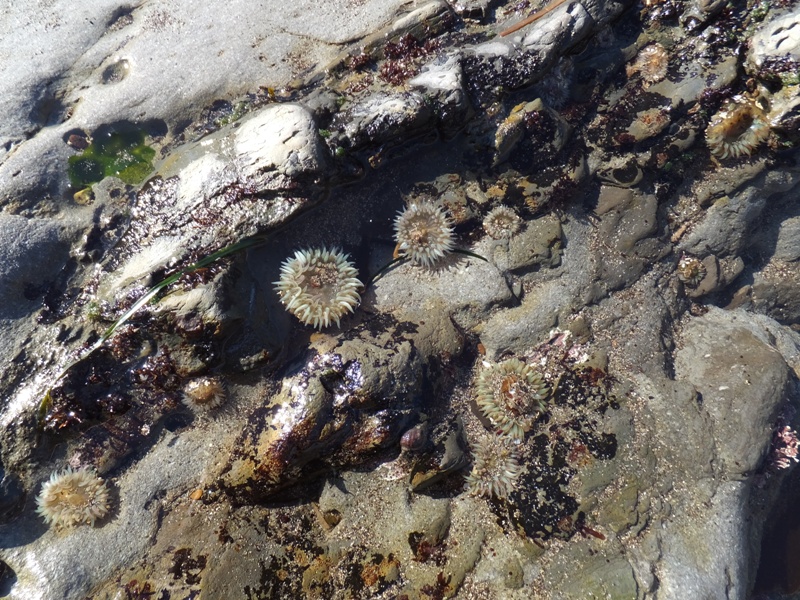
Sea anenomes below water line.
2 / 4
Sea anenomes above water line.
3 / 4
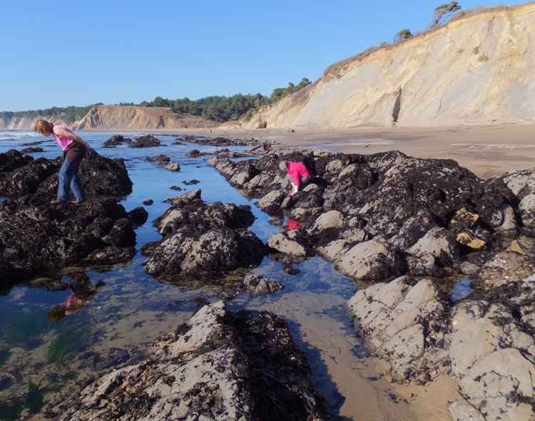
Norma and Mom looking for critters.
4 / 4
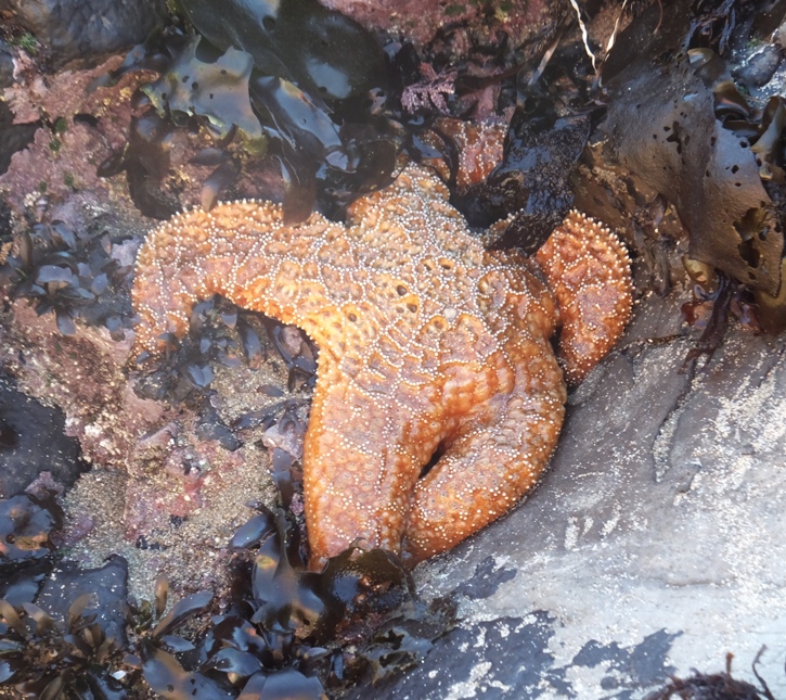
A starfish that Norma found.
By far the most interesting thing I saw that day was something called a chiton, pronounced "kite on." 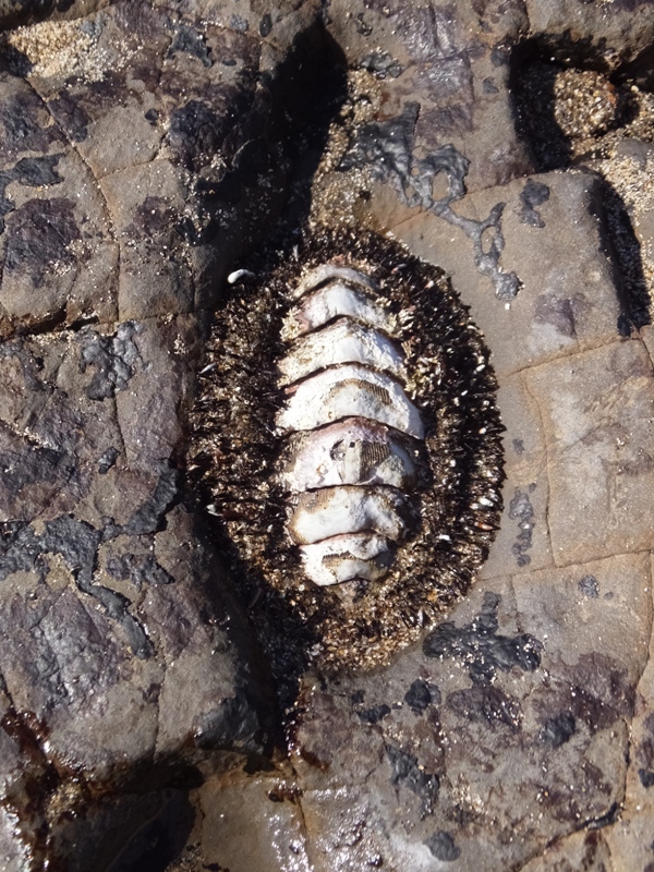
Chitons are small to large marine mollusks...also sometimes commonly known as sea cradles or "coat-of-mail shells." Chitons have a dorsal shell which is composed of eight separate shell plates or valves. These plates overlap somewhat at the front and back edges, and yet articulate well with one another. Because of this, although the plates provide good protection for impacts from above, they nonetheless permit the chiton to flex upward when needed for locomotion over uneven surfaces, and also the animal can slowly curl up into a ball [like an armadillo] when it is dislodged from the underlying surface. They live on hard surfaces, such as on or under rocks, or in rock crevices. Some species live quite high in the intertidal zone and are exposed to the air and light for long periods. Others live subtidally. A few species live in deep water, as deep as 20,000 feet. Chitons have a relatively good fossil record, stretching back 400 million years. The largest chiton (up to 13 inches) is the brick-red gumboot chiton of the Pacific Northwest. The primary sense organs of chitons are...light-sensitive cells just below the surface of the shell, although they are not capable of true vision. A relatively good fossil record of chiton shells exists, but ocelli [eyes] are only present in those dating to 10 million years ago or younger; this would make the ocelli, whose precise function is unclear, the most recent eyes to evolve. - from Wikipedia - Chiton The hardest part of a human body is the teeth. This is also true of chitons. But for them, their teeth are made of magnetite, an iron compound, which is also the hardest material made by any living organism. They use their teeth to scrape algae from rocks. The iron crystals in their magnetite teeth may also be involved in magnetoception, the ability to sense the polarity or the inclination of the Earth's magnetic field, and thus may be used in navigation. - from Wikipedia - Chiton and Zoologger: mollusk grows hardest teeth in the world |
|
Driving onward, we saw several cars pulled over. "They must see something interesting" was our thought so we pulled over too. As we got out of the car, we saw the Russian River flowing into the ocean.
The river was flowing with quite a bit of force...enough to make for very rough conditions. Only a very skilled kayaker or a seal should attempt to enter such waters. What we saw was the latter. Several seals made their way up the river along the side. They then swam out towards the middle and body surfed downstream into the ocean. I wondered if this served some practical purpose but I was told they were just doing this for fun. It did indeed look like they were enjoying themselves. This was near Goat Rock Beach, a subset of Sonoma Coast State Beach. 1 / 5
Three seals head upstream.
2 / 5
Two seals in shallows.
3 / 5
Lone seal by the river.
4 / 5
Seal on the beach.
5 / 5
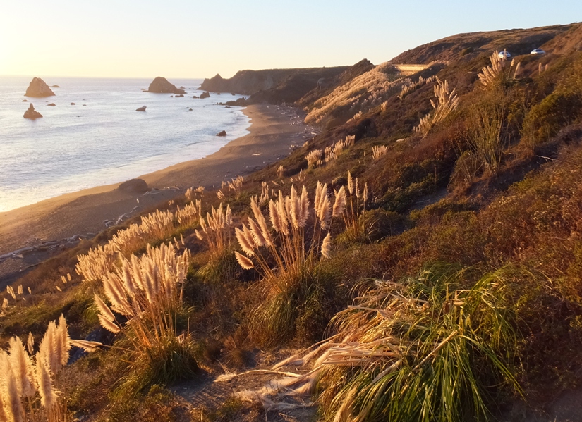
Pampa grass along the hillside.
That night, we checked into our room at Bodega Harbor Inn in Bodega Bay. We picked up dinner at a nearby market then called it a night. |
|
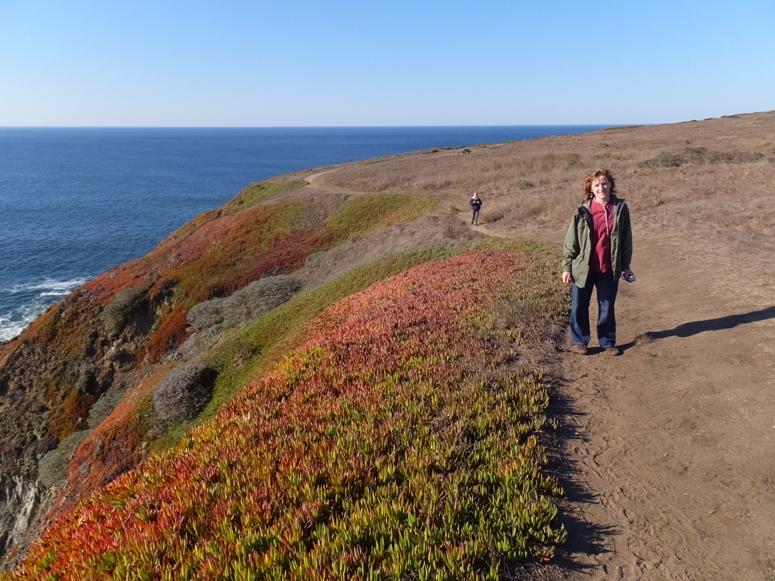
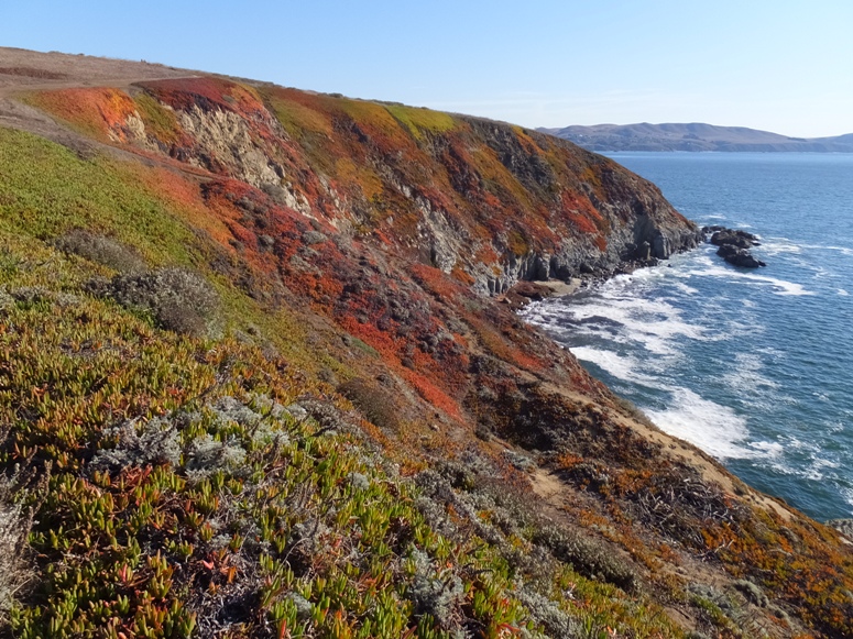
After loading up, we took a drive out to the peninsula that shelters Bodega Bay. Here we found Bodega Head Trail. From the parking lot, we had quite a view.
Mom, Norma, and I walked along the high cliffs. 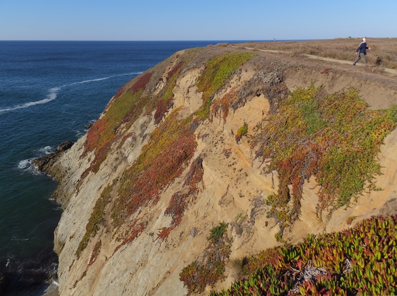
Bodega Head, a massive granite promontory jutting out into the sea, marks the entrance into Bodega Harbor. The 800-acre harbor is protected and enclosed from Bodega Bay by a narrow two-mile-long sand spit known as Doran Spit. This hike circles the exposed, southern tip of the grassy headland 200 feet above Bodega Harbor and Doran Spit. - from Trails.com - Bodega Head Trail There was a lot of low, colorful vegetation, to include ice plants, poppies, and a few other flowers. About 1500 feet from the shore was an island. We couldn't see it clearly but we could hear a lot of barking. Only one thing made that noise...sea lions. If you look carefully, you'll see the silhouette of a few below. 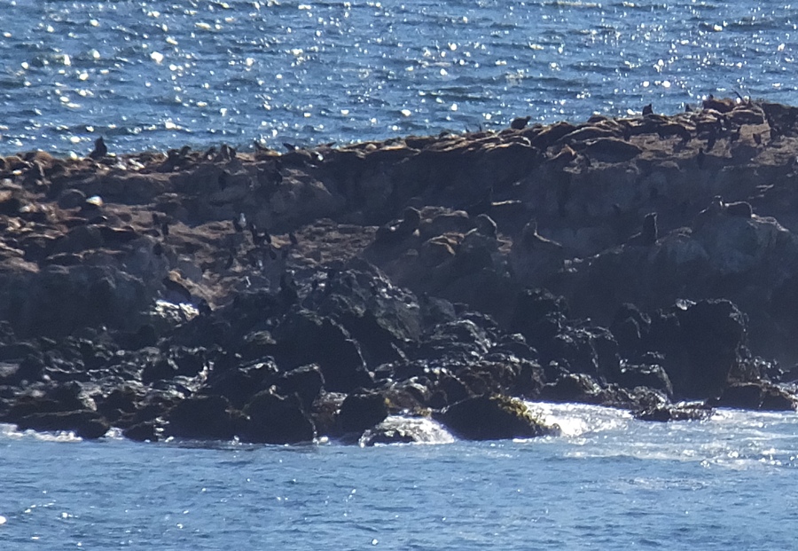
The most familiar noise they make are called "barks" due to the short, loud, and abrasive quality they share with dog barks. Sea lions use barks to communicate various messages to each other, like territorial marks and mating status. Male sea lions use the bark to first mark their territories during mating season and also when defending their space. Non-alpha males, or the less powerful males, tend to bark more than the alpha males around them as a means to call attention to themselves. Female sea lions also bark but less frequently. Their bark is part of a series of distinct threatening noises they emit when defending their young. This occurs most often just before, or just after, giving birth to their pups. - from eHow - How do sea lions communicate? (a broken link as of 2016) Maybe in the winter, we can return here since it is supposedly a good vantage point when looking for migrating whales. We stopped briefly at Spud Point Marina and watched the numerous seals swimming about. Had we not had so many great views of seals over the previous days, our encounter would have been more exciting. Further northwest in the Bodega Harbor, we ate lunch at Lucas Wharf Restaurant and Bar before commencing our long drive back home. It was a great road trip and while I would like to take some credit, I cannot. Norma masterminded the whole thing. |
|
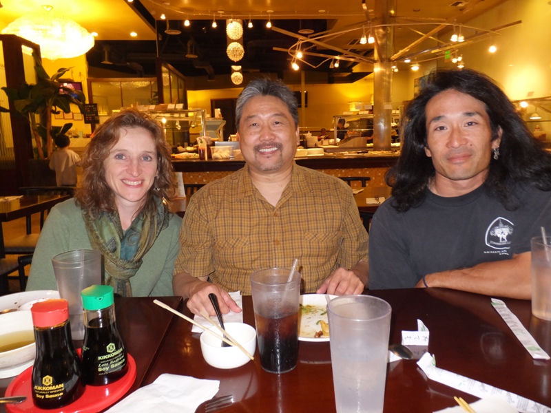
Back in Sacramento, I saw Robert I. drive past. I went to college with him. We were in the same differential equations class. He came over and we chatted briefly.
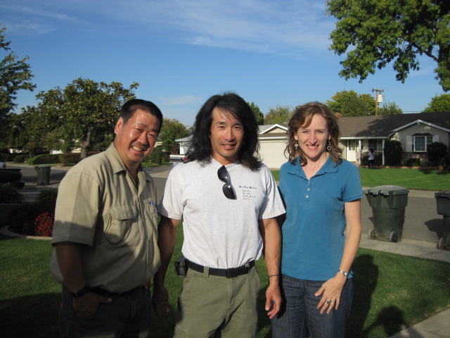
That night, I went to Arnie I.'s class. Arnie is my first martial art instructor. I saw a lot of old, familiar faces, some of which I recognized quickly and some I needed a little reminder as to who they were. I participated in class. I was surprised I remembered the kata through long three even after not having done them for about 18 years. With some help, I even got through form four. 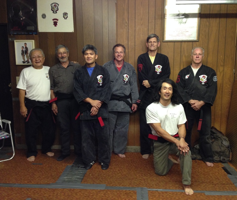
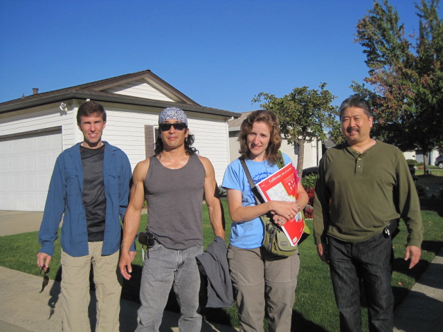
I texted my good friend Ken and my cousin Steve to join me at class. Both of them studied under Arnie several years ago. Steve made it out but Ken could not. I'm guessing Arnie hadn't seen Steve for maybe 30+ years but he still remembered him. |
|
Ken and Steve showed up at the house around 0900.
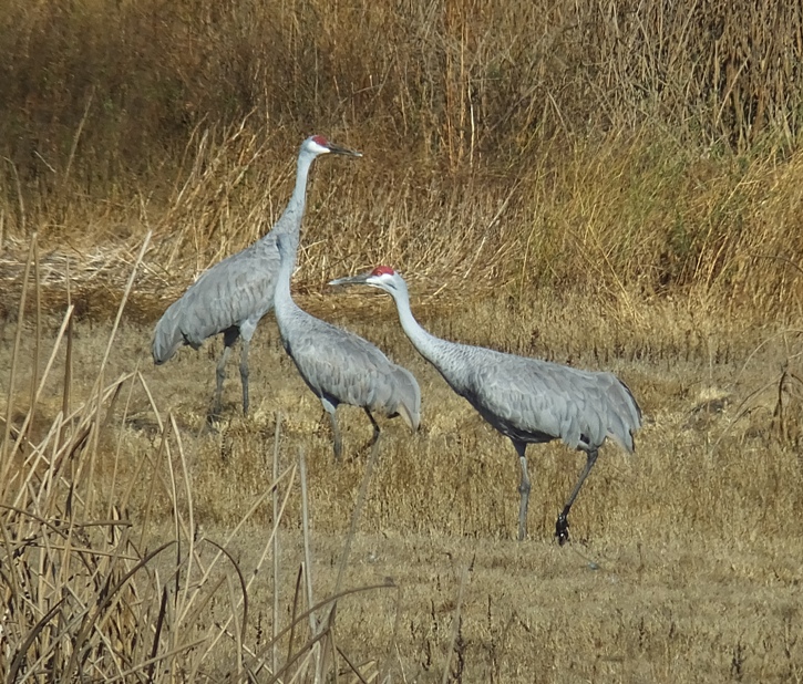
We took Steve's truck out to Gray Lodge Wildlife Area, a place Ken suggested. Gray Lodge Wildlife Area consists of over 9100 acres of marshes, glistening ponds and lush fields, which are connected by tree-lined sloughs. This diverse wildlife habitat is like an island, surrounded by miles of rich agricultural lands. Seasonally, you may see blackbirds, herons, geese and other wildlife visiting nearby farmlands. Protected wetlands, such as Gray Lodge, provide permanent sources of food, water and shelter for a vast number of wildlife species. - from information sign 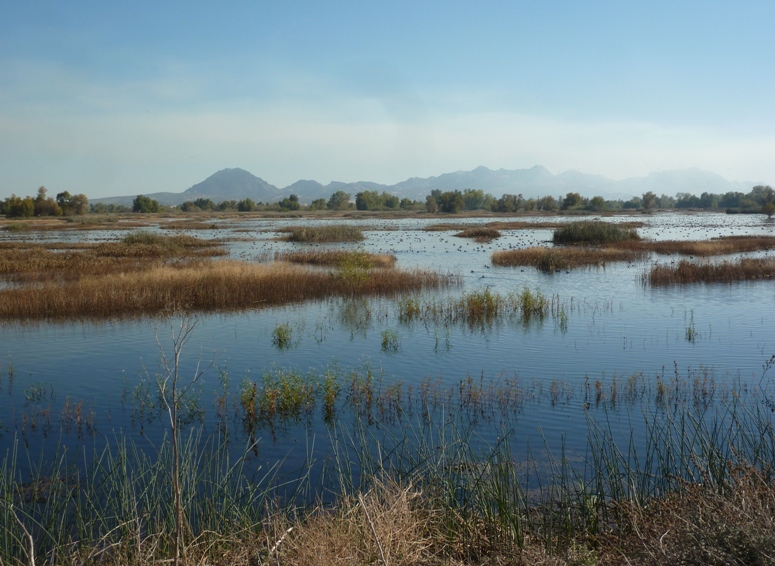
The area is a haven for birds, many of which stop for a rest during their long migration. The Pacific Flyway stretches along the west side of North America, from Mexico north to Alaska and into Siberia, Russia. Like an invisible "road," this is a major migratory route traveled by millions of ducks, geese and other birds. Habitats are linked through this unique corridor, by geologic features and wind currents. For centuries, California has been a resting point and destination for traveling wildlife. - from information sign Here's some of the birds we saw. 1 / 8

Gray geese.
2 / 8
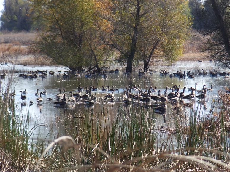
More gray geese.
3 / 8
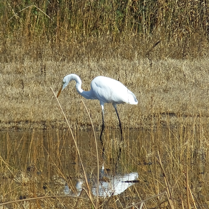
Egret hunting.
4 / 8
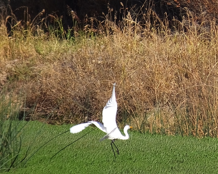
Taking flight.
5 / 8
6 / 8
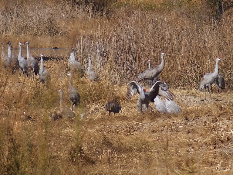
Several sandhill cranes.
7 / 8
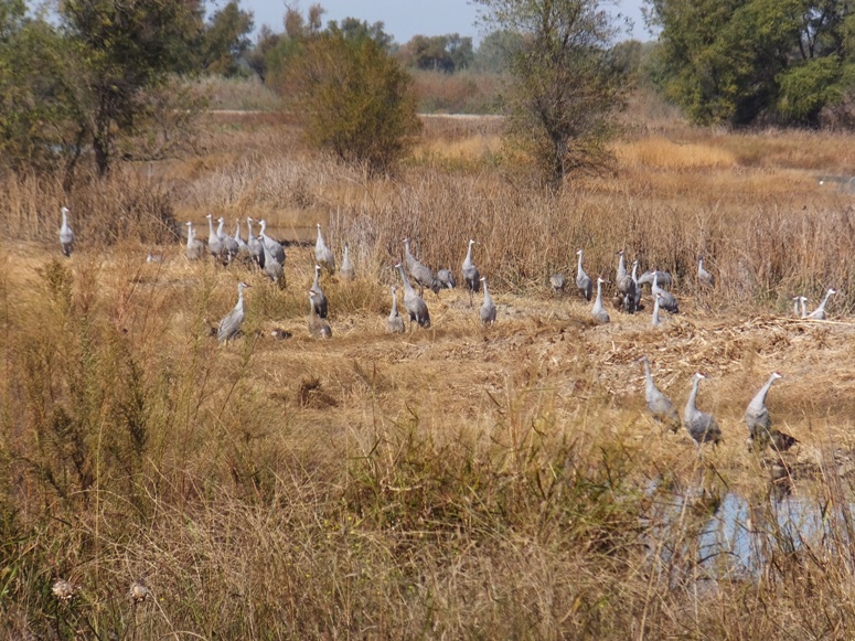
Plethora of sandhill cranes.
8 / 8
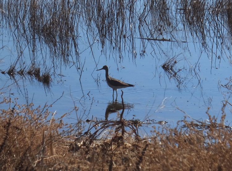
Sandpiper.
I believe we also saw some American Coots but they weren't being cooperative when posing for us. Birds aren't the only things we saw. There were a lot of western fence (blue-belly) lizards, like the kind that Ken and I would catch when we were kids. 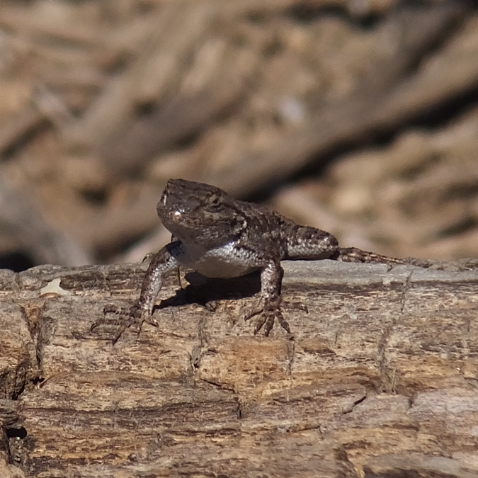
Here are some other critters we saw. We only saw one raptor, a hawk. 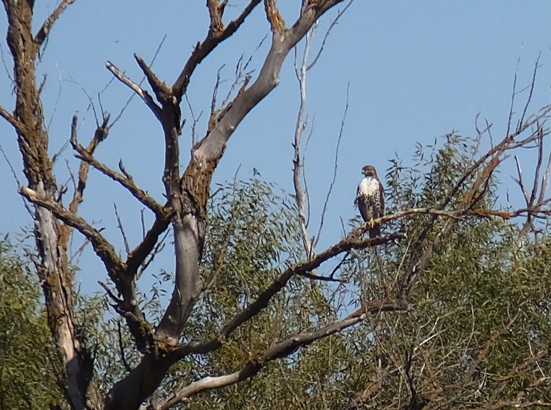
Nearby, Steve found what we think were a couple of raptor pellets. A raptor pellet is a small dense ball of indigestible material such as fur, bones, feathers, insect exoskeletons, claws and teeth that carnivorous birds cannot digest. This material cannot pass through a bird's digestive tract and must be expelled back through the bill. A pellet forms roughly 5-10 hours after a bird has eaten, and is typically expelled 10-16 hours after the meal. - from Bird Pellet Definition 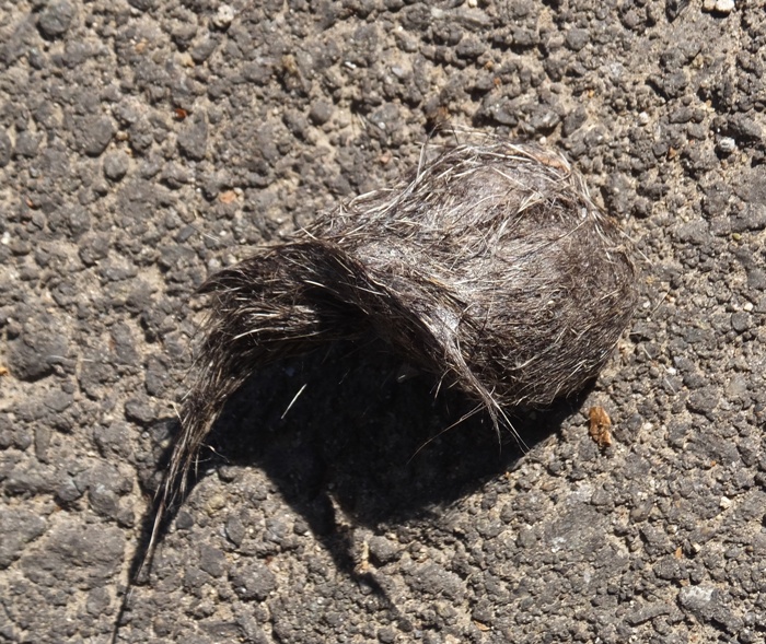
There was also some interesting vegetation to see. 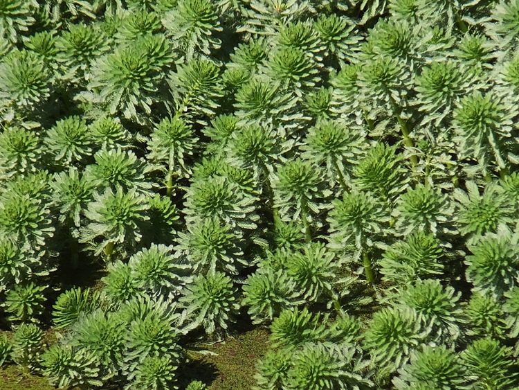
One thing when visiting the area is that one must move slowly and quietly in order to get close enough to get a photo. Once one bird gets spooked, it seems they all take to the air. Check out the pic below and the one at the top of this page. 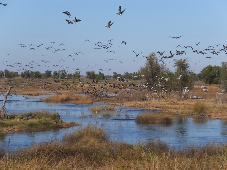
Like every day of our visit, the weather was warm and sunny. We were glad to be outside. 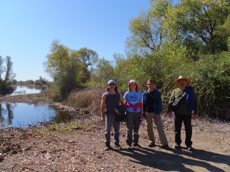
|
|
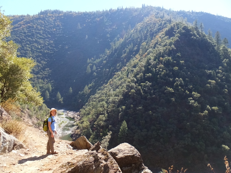
With as much time as Norma and I had spent sitting in a car, she wanted to spend the day doing something more physical. I looked online and found a trail an hour away in the town of Colfax, on the other side of Auburn.
We loaded up the car with water and snacks then headed out. Driving northeast, we could see the geography start to change as we left Sacramento. Things got a little greener and more mountainous. Soon, we were at the parking lot and trailhead of the Stevens Trail. This trail is on the National Register of Historic Places. It was built by Truman Allen Stevens...[and]...used as a toll road for miners that needed to get from the mining town of Iowa Hill to the railroad town of Colfax. The trail was forgotten but then rediscovered in 1969 but a boy scout, Eric Kiel, and recharted as part of his scouting project. Today it is maintained by the Bureau of Land Management. - from Every Trail - Stevens Trail The trail started out in the woods. 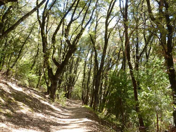
Eventually, it opened up at a big rock looking out over the valley. 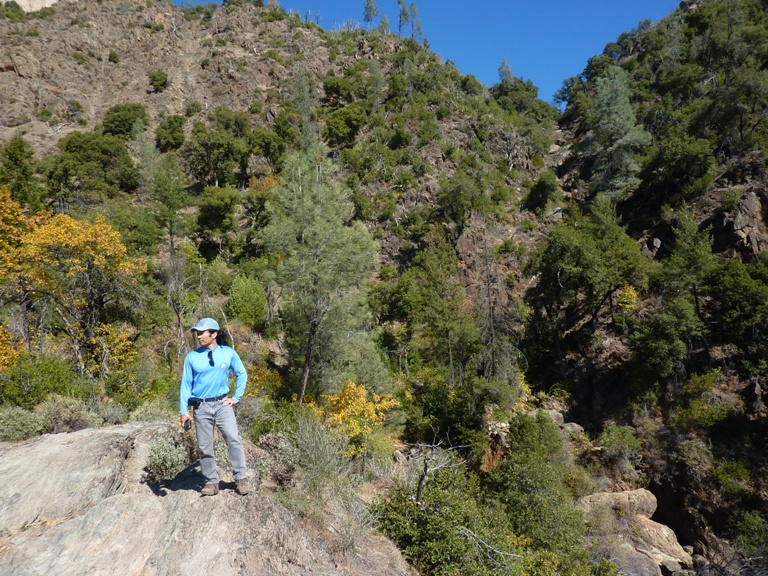
On this rock were some depressions that looked like they might have been used for grinding plants by Native Americans. 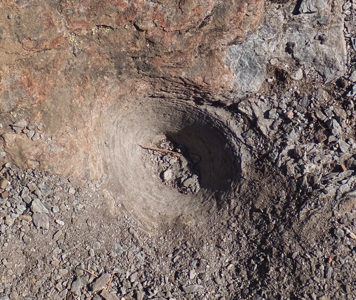
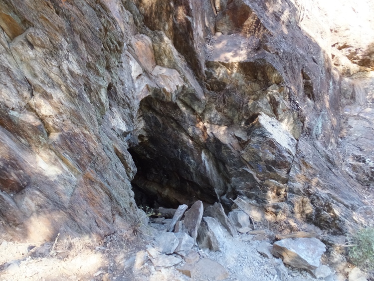
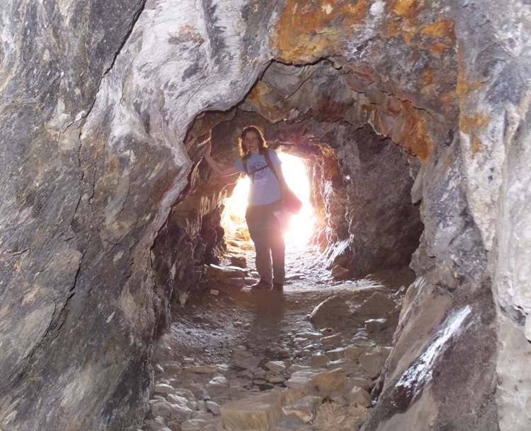
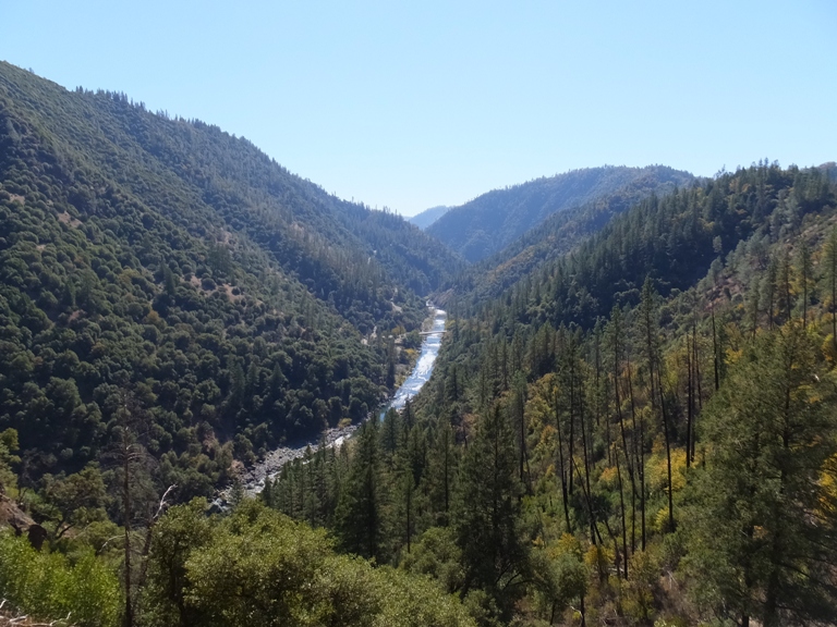
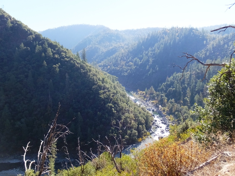
Eventually, we came to a cave that I am certain must have been used for gold mining. We ventured in but it got narrow quickly and we didn't have lights. I think a bat flew out. Down below, we could see the North Fork of the American River. Above, for a short part of the hike, was a modern wall but we didn't know why it was there. The trail followed the north side of hills overlooking the river. It was steep enough so we had a great view most of the time. There were a good many trees though some parts of the hill along which we hiked looked a little bare, as if there might have been a fire a few years ago. The water was clean though there wasn't enough for water sports like kayaking or canoeing. 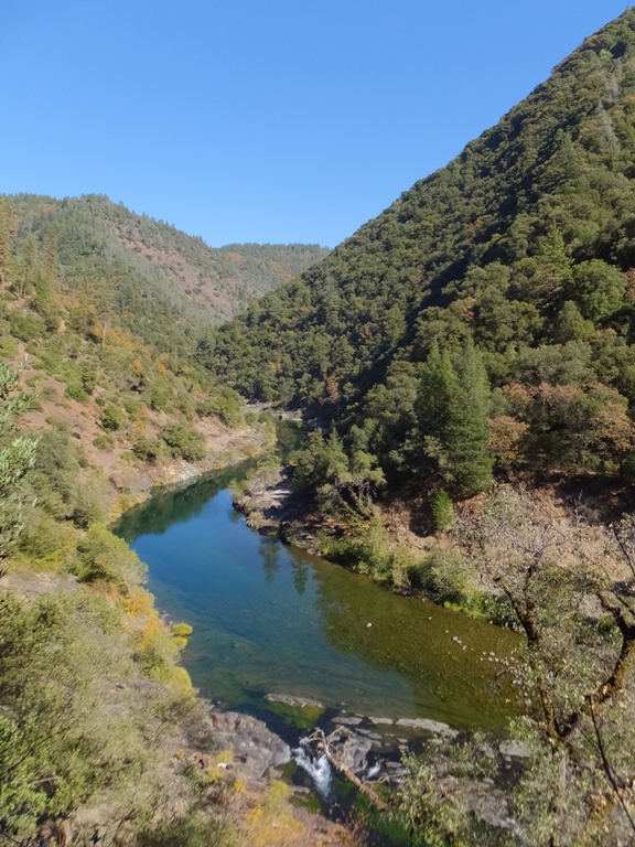
We found some interesting plants. Closer to the trailhead, there were manzanita trees. 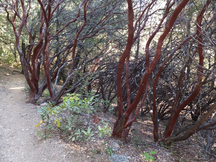
Further out, we found California buckeye (horse chestnut) trees. The nut was huge as compared to the tree. I figured it must be a domesticated farm product that became wild but it turns out that the nut is poisonous. Local native American tribes, including the Pomo, Yokut, and Luiseño, used the poisonous nuts to stupefy schools of fish in small streams to make them easier to catch. The bark, leaves, and fruits contain the neurotoxic glycoside aesculin, which causes hemolysis (rupturing) of red blood cells. - from Wikipedia - California buckeye 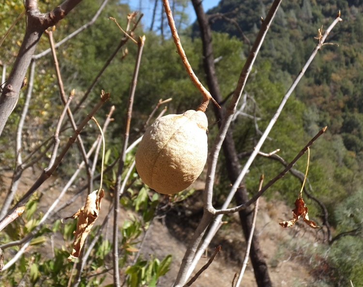
We also found something that resembled kumquat. 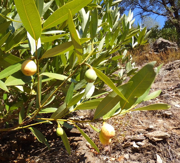
The hiking was easy and the trail well maintained. It gradually made its way down to the river after crossing over a small stream around mile four. It was here that we ate lunch and took a short nap next to a very small waterfall, a big cairn, and a frog. I found a nice indentation in the rocks that made for a comfortable bed. 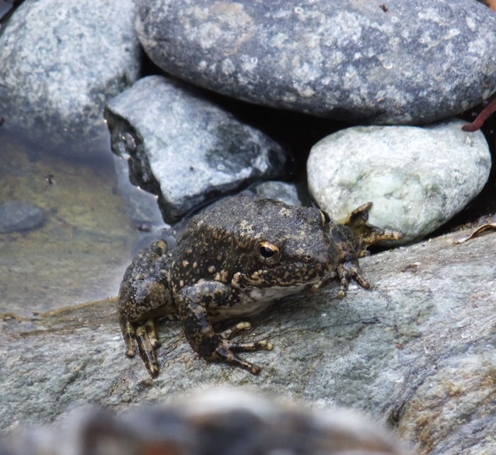
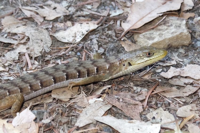
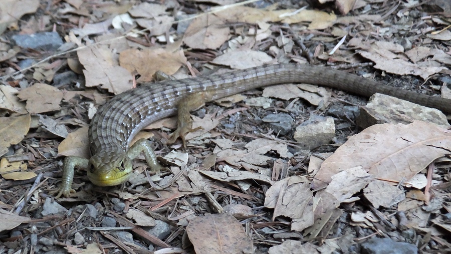
On the other side of the river was a fellow with a few five gallon buckets and waders. He was panning for gold. I didn't know his situation but if I was out of a job, spending my time in a beautiful place like this trying to strike it rich would be as good a way as any to spend my time. Though much of the river was shallow, there were certainly deep sections that would have made for excellent swimming holes if it was a little warmer and if we had the proper attire. Once we got away from the valley view and back under tree cover, we were stopped by a California Alligator Lizard. It didn't move until we touched it. I'm guessing it was 14 inches long from nose to end of tail. We found a very large pine cone which we were tempted to bring home but it was all covered in sap. Our hike was 8.1 miles. |
|
We got cleaned up then joined my parents and cousin Steve for dinner. We were celebrating his birthday which had recently passed.
|
|
I spent much of the morning getting photos copied over from all our cameras and then organized. Norma spent a good bit of time preparing pumpkin whoopie pies. This is a dessert item with origins back east.
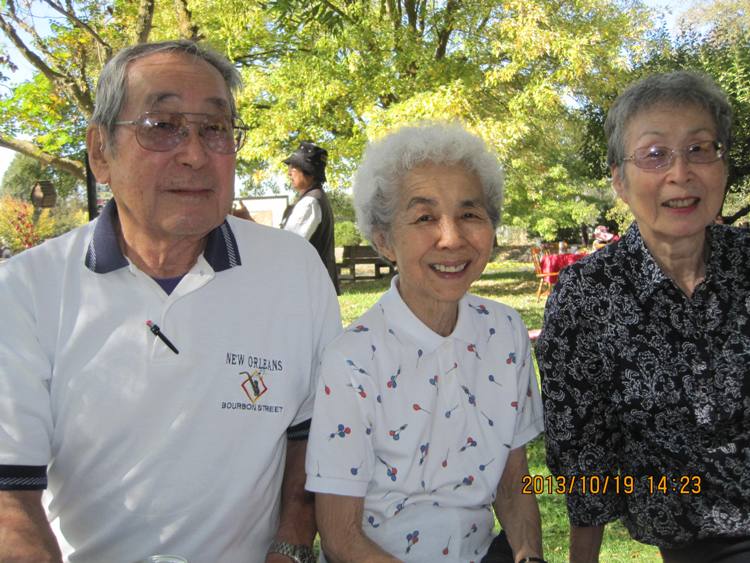
Pennsylvania's story about the mystery-cloaked origin of the whoopie claims Amish women invented the black-and-white dessert, and the confection got its name when they packed the desserts for their children's school lunches. If the children opened their lunch boxes and found the chocolate treat, they would invariably exclaim, "Whoopie!" - from Making Whoopies My parents, Norma, and I drove over to Marie's house. Marie is an old friend of the family that we know through Aunt Kiyo. She owns a beautiful farmette in Wilton, complete with a big pond, fruit and nut trees, sheep, and chickens. Annually, for the last few years, Marie has hosted a reunion for my mother's side of the family. This was a great opportunity for Norma to meet a lot of my relatives and for me to see some that I haven't seen for over 25 years. Some of the first people we met there were Cousin Rhonda, husband Steve, and Rhonda's son Masashi, who I had never met before. 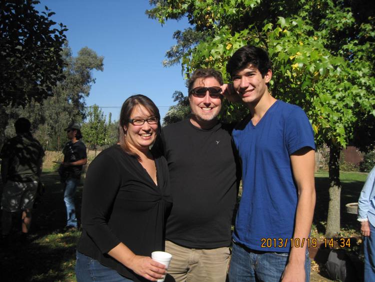
Here are some of the other pics from the reunion. For the people in the snapshots below, all names are listed in order of left to right. 1 / 12
Marie's pond.
2 / 12
Aunt Kay and Aunt Trudy.
3 / 12
Uncle George, Aunt Shirley, and Mom.
4 / 12
Aunt Kiyo and Timothy.
5 / 12
Cousin Tanya and Aunt Kiyo.
6 / 12
Me, Cousin Alex, and Cousin Scott.
7 / 12
Cousin Scott and Ken.
8 / 12
Norma, me, and Cousin Jodi.
9 / 12
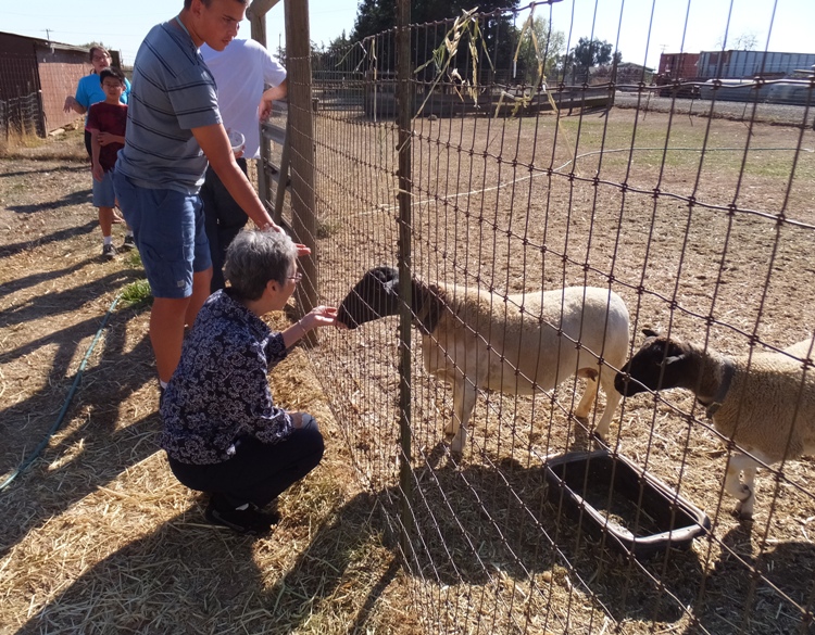
Mom feeding sheep.
10 / 12
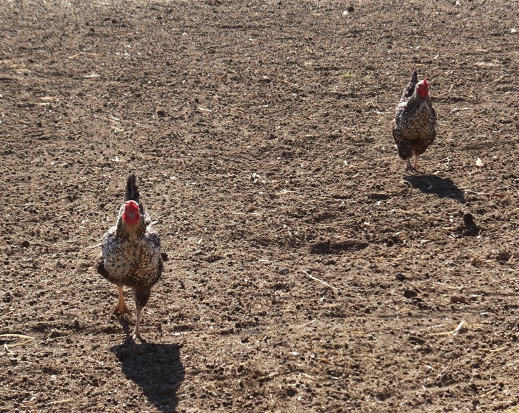
Chickens a runnin'.
11 / 12
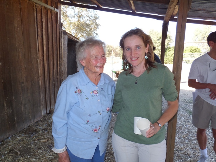
Marie and Norma.
12 / 12
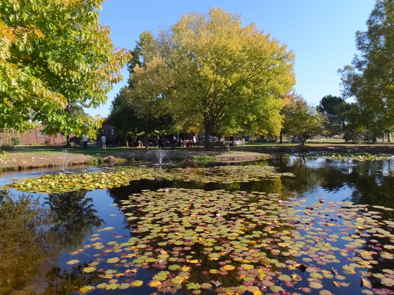
Beautiful pond.
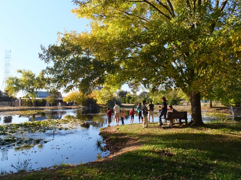
I think the water lilies are gone for the season in Maryland but in California, they are still blooming...at least they are at Marie's pond. 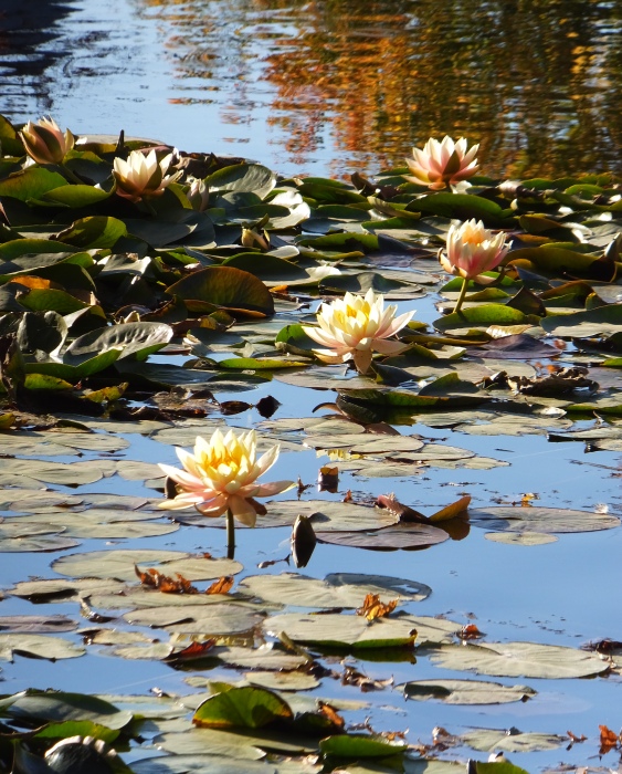
People had a really good time. The kids (and adults) enjoyed feeding the sheep and finding eggs laid by the chickens. The food was great. Folks really seemed to enjoy Norma's whoopie pies. Towards the end, a few people tried their luck at fishing. Here's cousin Mark and daughter Makayla with a fish. 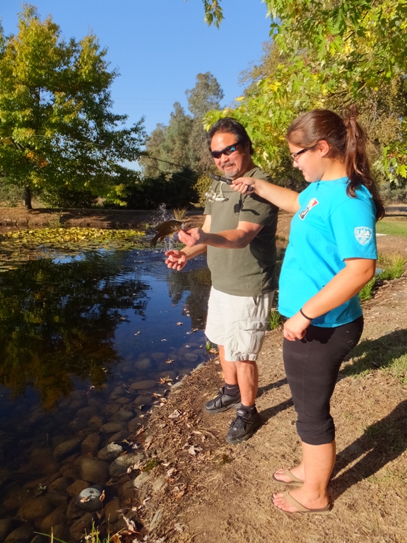
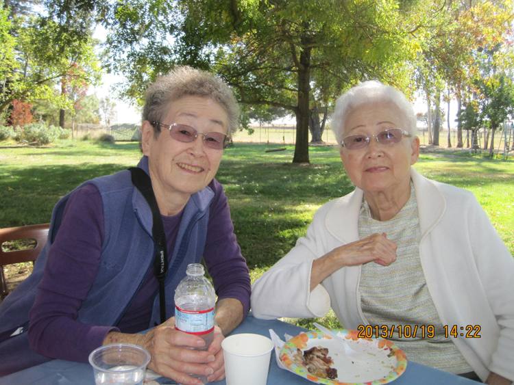
A table was put out to display various things associated with Mom's side of the family. Two things that I hadn't seen before were the Congressional Gold Medals earned by Uncle Steve and Uncle Don for their service in the Army. Uncle Steve served in the 442nd Regimental Combat Team while Uncle Don served with the Military Intelligence Service. After the reunion, we followed Cousin Steve and Aunt Trudy to a local nursery called Pietro Talini's Nursery and Garden Center since Norma had expressed interest in seeing some plants. I had never been there, even though I passed by it hundreds of times on my way to and from Kit Carson Middle School, which is only 0.2 mile away. |
|
That evening, Mom, Dad, Norma, and I went to see a musical called Ring of Fire. This is a show about the life of country music star Johnny Cash. As a child, I remember that Dad had a few Johnny Cash record albums so I figured he'd appreciate this show.
The performance was at the Harris Center in Folsom. While Sacramento is a much bigger city, having it in the nearby town of Folsom made more sense since Johnny Cash helped make Folsom famous with his Folsom Prison Blues. Dad was born in Folsom but the Folsom we visited that night was much different than the town where he grew up. Dad's childhood home is now underwater, in Folsom Lake. He lived there before Folsom Dam was built. We had box seats with a good view of the stage. We were lucky to find this considering we purchased the tickets just two days prior. The show was a big hit. We all enjoyed it. My favorite part was hearing fiddle player Amberly Rosen play "Orange Blossom Special." Afterwards, Norma bought me her Fiddly compact disc, which she autographed. Seeing this musical brought back memories of going to see musicals at The Music Circus with my parents when I was a child. We saw "Oklahoma," "Fiddler on the Roof," a Liberace concert, and other shows there. It was a good day. |
|
My parents drove Norma and me to the airport for our flight home. As always, it was difficult to say goodbye.
Each visit to Sacramento is slightly different than the others. This was our first trip in the autumn and the first time Norma has seen so many of my relatives. Hopefully, Norma and I will have the opportunity to visit and spend more time with my parents for many years to come. We made it back home to Savage, Maryland without any trouble. Our cat, Asha, was most happy to see us and we were glad to see her. |