|
This page is about the August 23-25, 2024 WatersEdge Epic Tribal Gathering to Kayak Janes' Island 2024. |

|
This page is about the August 23-25, 2024 WatersEdge Epic Tribal Gathering to Kayak Janes' Island 2024. |

|
I had heard about the WatersEdge annual trip to Janes Island. It sounded like a great event, so after having a fantastic time on their Smith Island, Tylerton trip a month prior, I figured I'd join them on this one too.
Norma isn't much into the big open water and prefers trees over bay grasses, so I figured this might not be to her liking. I debated bringing Daphne but I felt it would be too much for me to manage her alone for the whole duration. I left work early. It was my final day in the office. I commenced taking a three week vacation before starting in my new office. It was good to have my mind totally clear, not having to think about what I'd have to do come Monday. The drive down was a little heavier than I expected at 1300 but still not too bad.  |

|
I checked into non-electric campsite 76 in the C loop and quickly set up my tent. I shared it with a quiet guy named Mark, who I hadn't met before. Dr. Greg arranged everything, including the reservations. For three nights, I only paid $37!
A fellow came by the sites handing out pamphlets for a John's Smoked Barbeque restaurant. This worked out perfectly since the group was having a potluck and I hadn't brought anything. So I drove out and picked up a couple pounds of pulled pork. That, along with two big bags of firewood and kindling were my contribution. I also stopped at the nearby Food Lion for groceries. While there, I got a call from Sara who said she would text me a photo. In it, she was holding a 3.25" megalodon shark tooth which she found at Calvert Cliffs State Park. This was shortly after I told her that it isn't a good place to find shark teeth because too many people go there. Boy, was I wrong! Her finding this tooth was sort of my punishment for not taking her on my August 18, 2024 shark tooth hunting trip, though I would have done so had she been in town. For the potluck, we met at the Daugherty Center, a big house which the group rented out. I saw a lot of friendly, familiar faces along with plenty of new ones.  |

|
In the late afternoon, we met at the Janes Island State Park boat ramp for a sunset paddle. Here's where we launched.
Near the ramp is an area specifically for launching kayaks, though I don't recall anyone actually using it. Given a choice, I think kayakers prefer a beach, and if that isn't available, a ramp is the next best thing. Dr. Greg asked me to be the sweep which is a big responsibility when kayaking at night since it is so easily for folks to get separated. We paddled south on Daugherty Creek Canal to Crisfield. The temperature during the daytime was perfect but I wore a neoprene top because I expected the temperature to drop a lot once the sun went away. Each boat had a light. This is a legal requirement. It also makes my job as sweep much easier. Looking west, we could see the sunset and Janes Island. Someone from a high-rise building in Crisfield took this photo, which made it back to Dr. Greg. 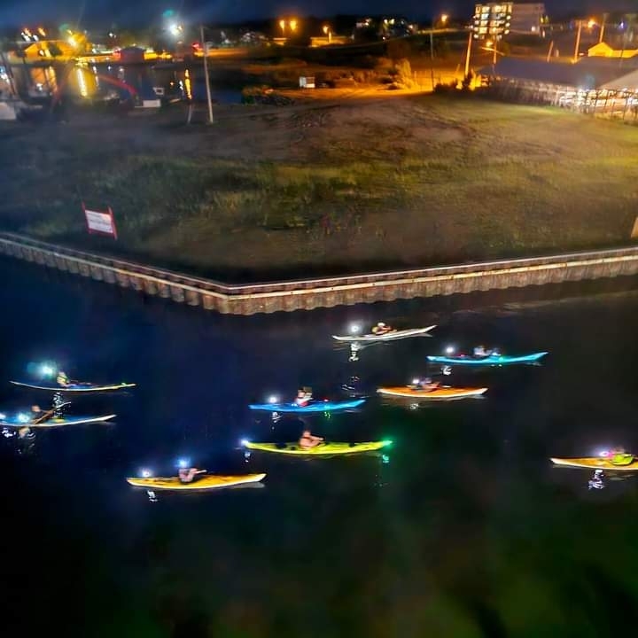
We paddled into and then turned around at Somers Cove after seeing the restaurant we planned to eat at tomorrow. Here we are leaving the cove. 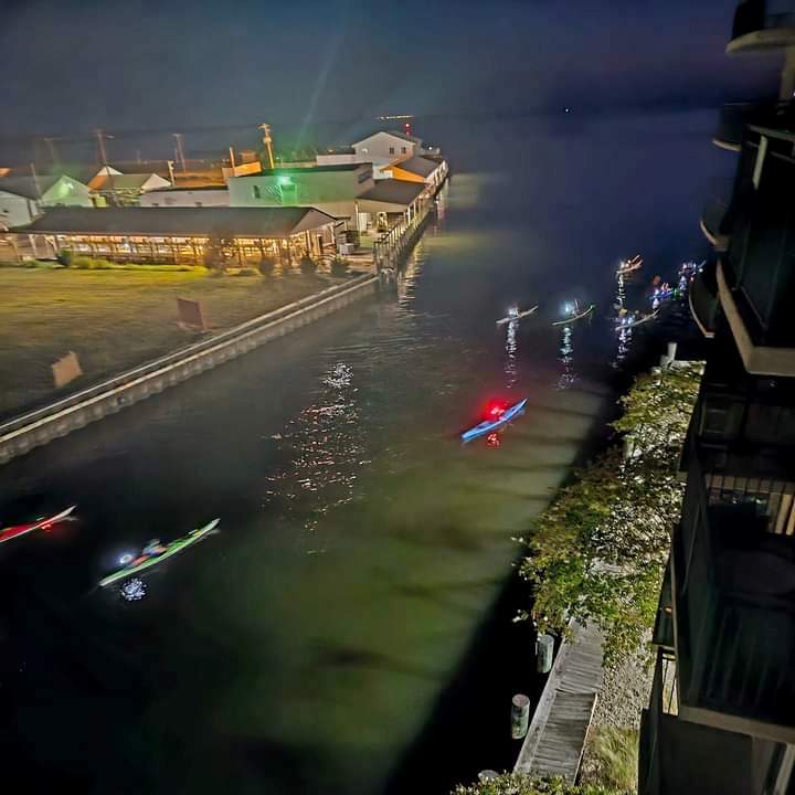
I kayaked 5.8 miles and slept better that night than I had in a long time.  |

|
I drove out to McDonald's to purchase several breakfast burritos. I can eat several of these per day with little else. I suppose if I just had to live on one food, this is what it would be.
The WatersEdge group planned to launch at 1000. I wanted to do a little birding on my own so I launched my SUP ~0840. I paddled west on the Yellow Trail (Ward Creek) and then hit some of the dead-end tributaries, including the White Trail. I saw several green herons. Few posed for me but one did. I paddled 3.9 miles.  |

|
I returned to the boat ramp as the others were getting ready to launch. I swapped my SUP for my kayak.
A local pointed out a soft shell crab under the pier. I had never seen one before. I assumed the blue thing was the soft shell crab and the thing above it was its hard, exterior shell which was recently shed. So what is a soft shell crab? To shed the old shell, a crab swells with water, and busts the old shell along the back edge. The crab then wiggles out through the back. The new shell has already formed and is about a third larger, but it is still soft. The crab will remain truly soft for only a couple of hours in the water. - from Louisiana Fisheries Forward - Basics of Soft Shell Shedding I was correct about there being a soft shell crab. But not correct about its shed exterior shell. That was actually another crab. Someone from the You know you're from the hood in Crisfield, Maryland when Facebook group wrote: Actually, this one has already shed. It is a female soft crab (on the bottom) and a Jimmy crab, together called a doubler. This is mating time. This was an opportunity to expand my vocabulary:  |

|
On the water, we gathered across the ramp as Dr. Greg gave us instructions. Here's Charley eager to get going.
From left to right, this is Joe, Otilia, and Andy patiently waiting. Backtracking our steps from yesterday, we kayaked south on Daugherty Creek Here I am with Crisfield in the background. 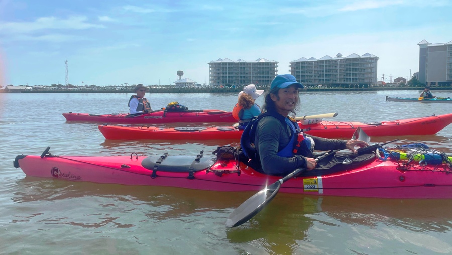
Here's Otilia, Hector, and Virginia (Ginzy). This is Stacey who appears to be having a great time. I think we all did.  |

|
I met one very interesting fellow by the name of Nate. He's a serious endurance racer who competes in multi-day several-hundred-mile long events. Here he is paddling past "The Stack" which resides at the south end of the island.
This 50 ft. chimney on Old Island is all that remains of a circa late 1870s menhaden fish processing plant that closed in 1908 when menhaden fishing was outlawed in the state. It reopened after World War I to make fertilizer until closing for good in 1929. The factory was destroyed by fire in July 1932. - from Bay to Bay News - 'The Stack' a landmark for Crisfield worth saving We pulled ashore at a beach near the Stack. This gave me the chance to get a closer look. I walked/waded out to the concrete boxes and then climbed up on them. 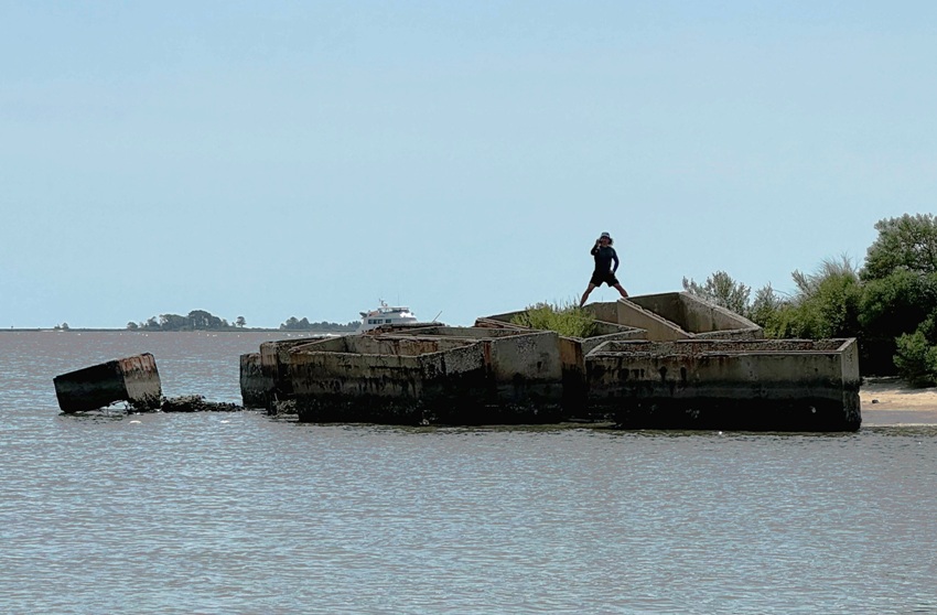
From a distance, the boxes look like burial vaults. There are about 70 of them. Is that what they are? I think not. According to one source, The interior dimensions of the average burial vault in the United States is a little over two feet (25 inches) deep. These boxes were closer to five feet deep. In this pic, you can see the rusty rebar exposed from where the concrete wore thin. Nobody in the kayak group could tell me the story behind these "coffins" so I set out to find the answer myself. I searched the web but found no answer. But after posting to You know you're from the hood in Crisfield, Maryland when, I got some good leads. Patty A. wrote: They are septic tank encasements. They have been there for around 40 years. I followed up with this. At Oldcastle Infrastructure - Septic, I found septic tank encasements made of concrete having dimensions very similar to the ones near the Stack. Later, Christina C. posted the following: Based on information obtained from the feasibility study of shore protection measures for Janes Island State Park, there are 72 concrete tanks measuring 14' long x 5' high x 4.3' wide. The tanks were placed on the island in anticipation of their being used as an erosion control measure. Their initial use was as acid pickling tanks. They weigh approximately 7,800 lbs each and the date placed on the island is not listed. They are not coffins, vaults or septic tanks. This led me to learn about pickling tanks. Various types of pickling tanks are essential to the corrosion process because they provide an acid solution with a secure and controlled environment. They can easily withstand the acid's corrosive nature. In addition, manufacturers tailor them to meet the specific requirements of various industries. They vary in size and shape, including rectangular, cylindrical, and conical, based on the type of metal parts being pickled and the amount of acid solution required. - from Arvind Anticor - Pickling Tanks Types and Applications: A Comprehensive Guide So why were these concrete boxes put there? My guess is for the same reason there are concrete ships at North Point State Park and Kiptopeke State Park. Concrete ruins serve as cost-effective breakwaters, preventing soil and sand from eroding away. Later, someone from Janes Island State Park confirmed this. They are concrete blocks that were placed to act as a bulkhead to protect the marsh from the wake of boats going by. On the south side of the Stack is rip rap and a jetty. Many of the concrete boxes reside much closer to the Stack on the south and east sides as if they are protecting it by holding the ground in place. In five more years, the processing plant will have been closed for 100 years with the chimney likely still standing. Hopefully, these concrete boxes will help it stand for another century. 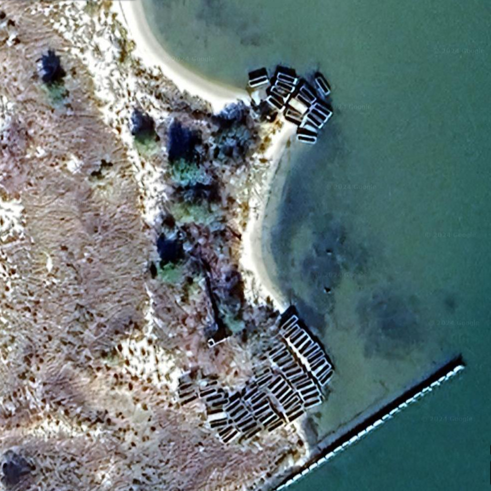
I read more about the Stack. Apparently, it is on a patch of land called Old Island which has an interesting story. Old Island Beach - When standing on the beach of Brick Hill / Wellington Beach you can see marshland across the river, a portion of Janes Island which we call "Old Island." Today, this area is an abandoned marsh with a long sandy beach and is only reachable by boat. However, in the 1800's this area featured homes, a fish fertilizer factory, a pest house used to quarantine smallpox patients, and farmland that produced watermelons, cantaloupes, apples, and peaches. - from Facebook - You know you're from the hood in Crisfield, Maryland when I also found a pamphlet from the state park that confirms the presence of a pest house for people with smallpox in 1882. At the Stack, I found lots of other interesting things. There is a hole in the Stack. It isn't one resulting from wear...rather, it was clearly made during the construction of the Stack. For what reason I know not. Here, you can see a persimmon tree growing in front of it. In the water, I found some machinery part, covered in barnacles. Scurrying around on the concrete boxes were hundreds of sea roaches. I also found lots of what I think is slag. It is likely from the coal furnace.  |

|
After leaving the beach near the Stack, we passed by a couple of brown pelicans. Unlike Smith Island, we didn't see many of them.
Rounding Island Point, we paddled north in Tangier Sound. This area is very exposed and not particularly interesting. I was hoping to see some dolphin but did not. We had been communicating via channel 69. But so were folks in Crisfield. It was a big day for the town as a plethora of power boats with Trump flags showed up to participate in the "2024 Trump take America back boat parade." One of the local politicians delivered a speech over channel 69 so we switched to 71. Not everyone wanted to do the circumnavigation so near Rock Hole, Cheryl led that group on the Green Trail and then the Yellow Trail back to the launch while the rest of us continued north. On the north side of the island, the group I was in pulled ashore at a beach on the north side of Janes Island. Here's Nate in his kayak which he decorated himself, mostly with a Sharpie. Behind him are boats from the parade. While the rest of us took a break, Jessica tried out someone else's kayak which she clearly enjoyed. Zhen practiced his rolling. He has really good control. As I chatted with Debbie on the last part of our trip, a black snake swam by. I ended up paddling 13.3 miles with the group. 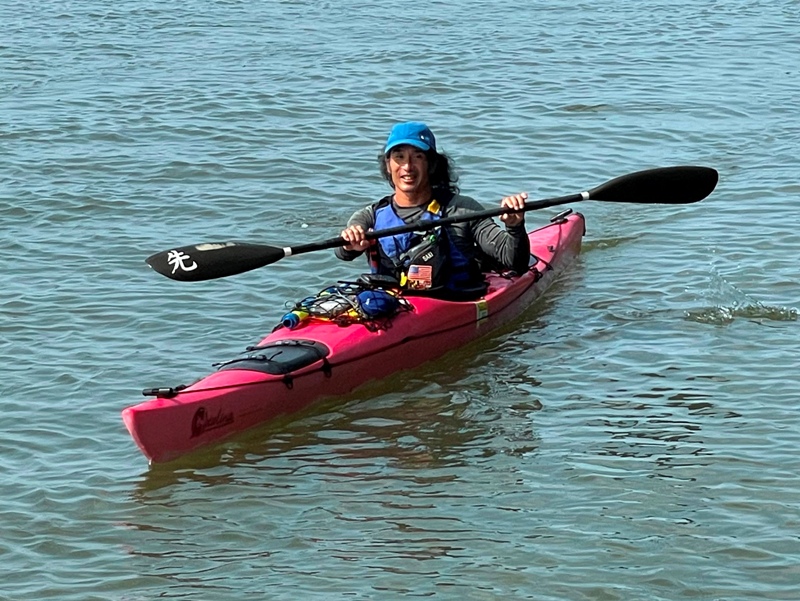
 |

|
After paddling with the group to circumnavigate the island, I visited the park's nature center and then climbed their 24-foot-high observation platform. From the top, I had a nice view looking northwest on Janes Island. Not many trees.
That night, we ate dinner at Fisherman's Grille in Crisfield. Seated at my table from left to right are Jennifer, Ginzy, Robert, Debbie, and Zhen. After seeing the softshell crab this morning, I was wanting to taste one so Debbie and Zhen let me try a piece of theirs. I mainly just tasted the batter. It was good. I might order one for an entree the next time I'm at a place that serves it. Some of us then went out for ice cream at Johnny's Sweets.  |

|
After picking up more breakfast burritos at McDonald's, I was ready for a full day of paddling.
Some of our group launched from Rumbly Point to paddle across Pocomoke Sound. Others kayaked out to Jones Creek which lies just northeast of Janes Island. I set out alone on my SUP to do some birding and explore the Blue, Black, and Red Trails in the interior of Janes Island. I saw this juvenile little blue heron. They are easily mistaken for egrets. In front of me is Island Dock, near where the Yellow, Green, and Red Trails merge. I paddled on the green trail to Tangier Sound and saw these oystercatchers near Rock Hole. In this same area, I saw a great egret looking for a meal. I was out at low tide. Here you can see interesting patterns in the sand at an area that would normally be underwater at high tide. On the right and in the distance is Tangier Sound. I made my way northeast on the Red Trail. In one tributary off Acre Creek, I briefly spotted about a dozen small diamondback terrapins. Most jumped into the water once they saw me but a few stuck around long enough for me to snap their picture.  |

|
From a beach on the north side of Acre Creek, I saw several things on a beach about two-thirds of a mile away. Zooming in with my camera, I saw several sea kayaks. I figured it was the WatersEdge group that explored Jones Creek so I rushed over to catch up with them.
Here's my SUP on the beach with sea kayaks behind. Looking around, I found some sponges. Before getting back on the water, we posed for a group photo. Instead of returning via Daugherty Creek, the group wanted to paddle southwest on the Red Trail and then east on the Yellow Trail. Since I had just come from the Red Trail, they put me on point. I paddleboarded 13.7 miles that day. Not sure how much was solo and how much was with the group. During my three days at Janes island, I got in 36.7 miles total. 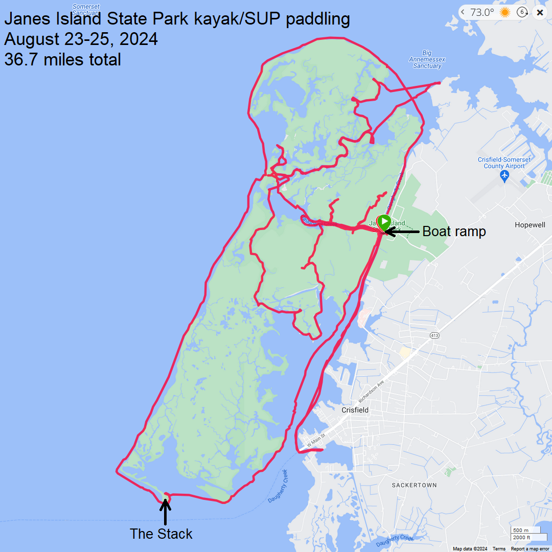
 |

|
I returned to John's Smoked Barbeque to pick up more meat but they were closed, despite their pamplet and door saying they were supposed to be open. Fortunately, there was plenty of food left over from Friday's potluck.
Here are the folks at my table. From left to right are Debbie, Robert, me, Carolyn, Ginzy, Jennifer (standing), another Jennifer (sitting), and unfortunately for the woman in white, I did not catch her name. That's what happens when you have 31 people. 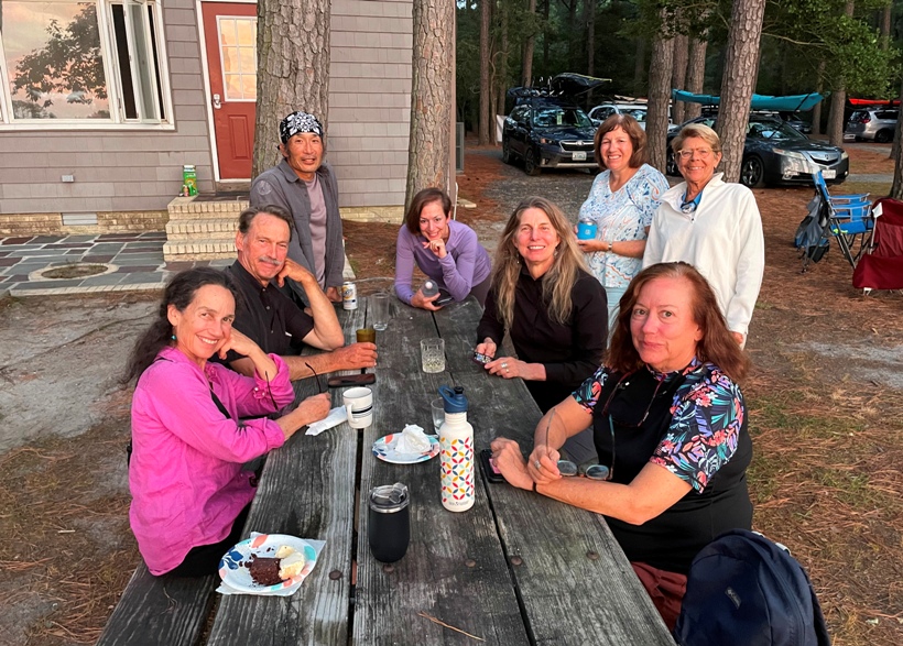
Later that evening, we sat around the campfire at the Daugherty Center and watched the sun go down. Much of our group left after paddling that day. These are the ones that stuck around. Definitely a very high-class crowd. 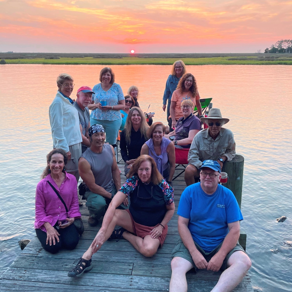
 |

|
I pondered leaving after paddling yesterday to join Norma for a get-together she was hosting with some neighbors, but Robert said he was sticking around to avoid the heavy traffic. Even without traffic, it would be almost a three hour drive. I decided to follow his advice and leave Monday morning. I'm glad I did. I enjoyed my last night with the group.
Rather than packing up neatly, I just threw things in my car, trying not to wake Mark, my site-mate who was still in his tent. I figured I'd clean things off and put things away properly once I got home. There was some traffic on the drive back but it wasn't bad. I didn't really notice many mosquitos or biting flies but I certainly had my share of insect bites, mainly around my neck. In my opinion, the August 23-25 weekend had the best weather we had all year. It was a perfect time to be out on the water and camping. I couldn't have asked for a better weekend. Over the next few days, it got hot and humid again.  |