|
This page describes my kayaking and standup paddleboarding adventures in 2024. |

|
This page describes my kayaking and standup paddleboarding adventures in 2024. |
|
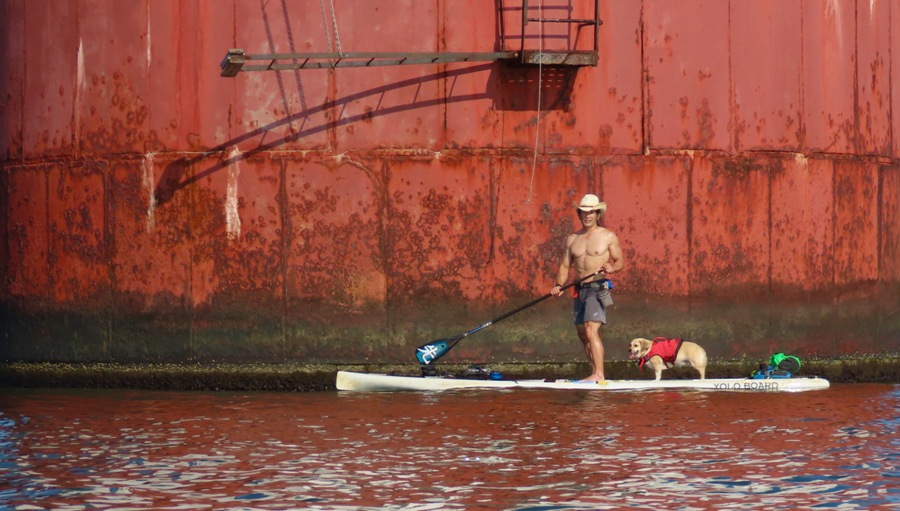
In my opinion, it was so far the most perfect day of the year: low wind, bright sun, and high temperature in the mid-60s. But the water was still around 50 degrees so I wore my 5mm wetsuit. I had Daphne wear her wetsuit for awhile but I eventually removed it because I felt there was a chance of her overheating.
We launched from Canton Waterfront Park and then paddleboarded a total of seven miles to see the B.A.P. Union, a visiting Peruvian "tall ship." B.A.P. stands for "Buque Armada Peruana" and means "Peruvian Navy Ship." Here's Daphne and I in front of the ship. 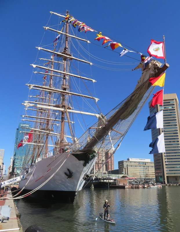
From March 2-5, 2024, Baltimore plays host to the incredible BAP Union, a 379-foot, four-masted flagship vessel and training ship of the Peruvian Navy. The steel-hulled barque carries a crew of 250 officers and trainees and is currently undertaking a circumnavigation to showcase Peruvian culture. - from Chesapeake Bay Magazine - Peruvian Navy's Tall Ship Docks in Baltimore, Bringing Deck Tours, Peruvian Culture 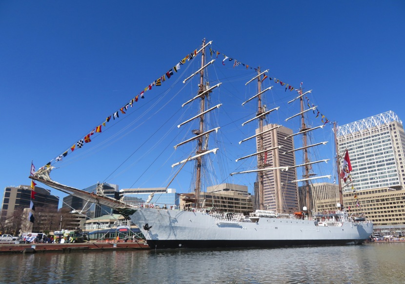
BAP Union is the first sail training ship of the Peruvian Navy. It acts as a training vessel for officers and naval cadets and as a sailing ambassador, promoting Peru in its various voyages around the world. It was launched in 2015 after a three year building project that took place in Spain. - from Sail Training International - Union 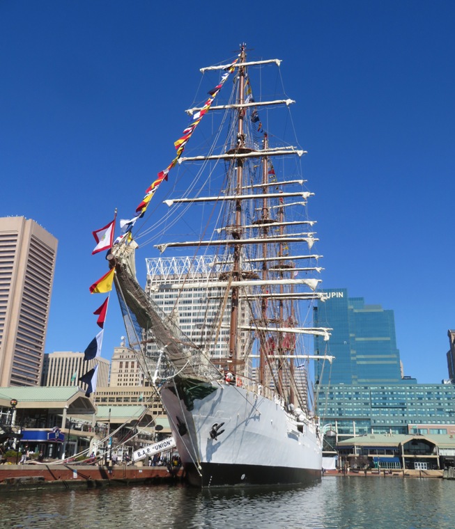
The ship's figurehead is made of bronze by the Peruvian sculptor Pilar Martínez Woodman and features symbols of Inca culture. - from Fox 45 News - Peruvian tall-ship open free to the public through Tuesday 
After Daphne and I got off the water, we met up with Norma and Hazel (her mom), shown here, for lunch. We bought food from a Peruvian food truck. 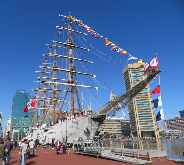
One thing I noticed was the sections of rope that had a thick fuzzy covering. I later learned this is called baggywrinkle. It is a form of chafe gear that is attached to points on the ship where a sail might rub against it. The goal is to provide a soft surface that will not wear a hole through the fabric of the sail. - from Scott's Hobbies - Baggywrinkle: Or what's that fuzzy stuff on the ship? Here's the aft side of the ship, proudly displaying a very large Peruvian flag along with colorful bunting. What we didn't see were the sails. The ship carries a whopping 34 sails covering 36,620 square feet of sail area. - from Facebook - Sail Baltimore 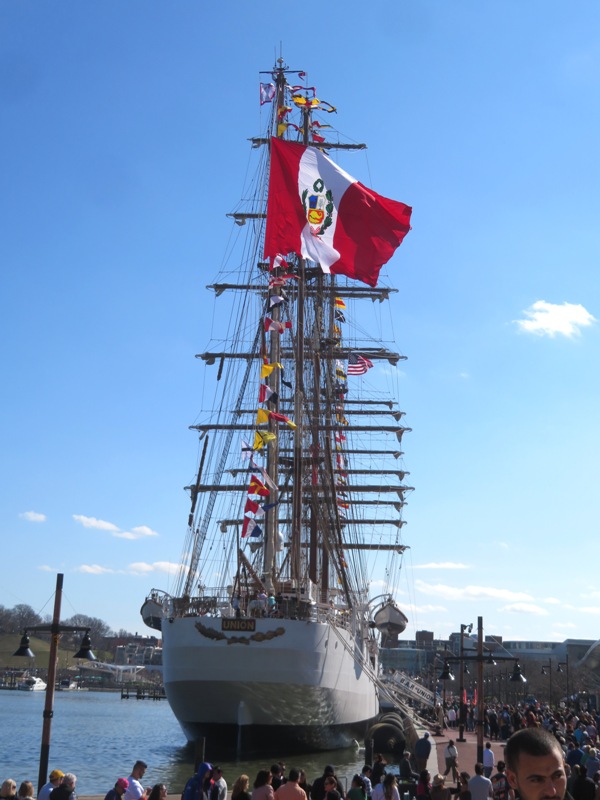
We thought about boarding the ship but the line was REALLY long and I didn't think Hazel would want to wait for so long. But that's fine. In my opinion, I had the best view of it from the water. The three of us walked around the Baltimore Inner Harbor area. We stopped by the USS Constellation where we found this cannon on display. The USS Constellation is a sloop-of-war, the last sail-only warship designed and built by the United States Navy. She was built in 1854, using a small amount of material salvaged from the frigate USS Constellation, which had been disassembled the year before. - from Historic Ships - USS Constellation 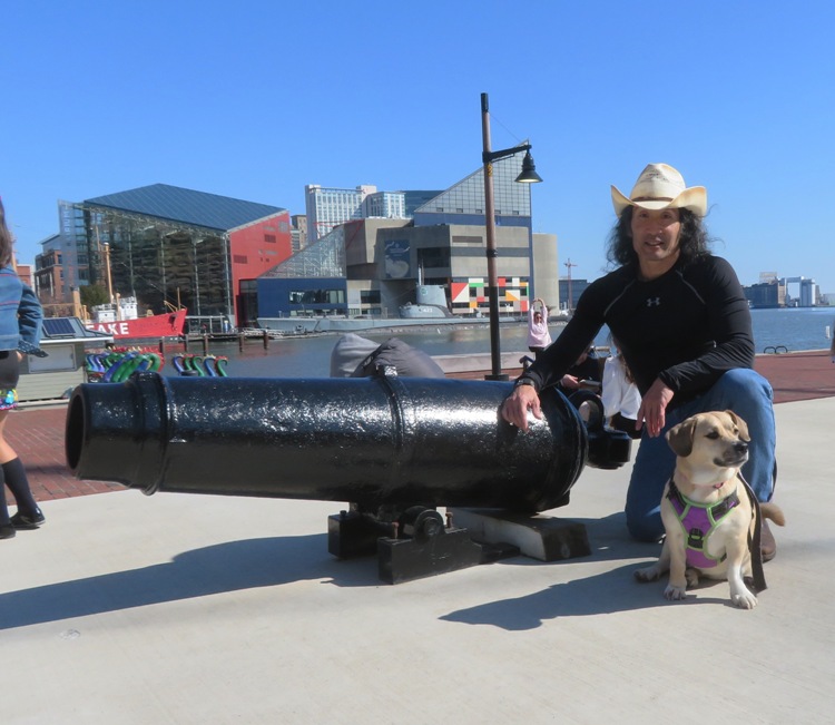
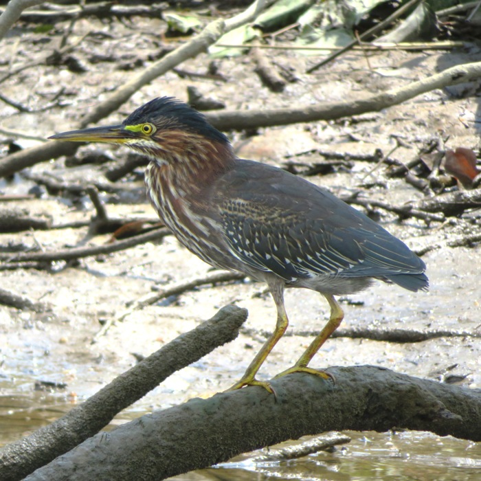
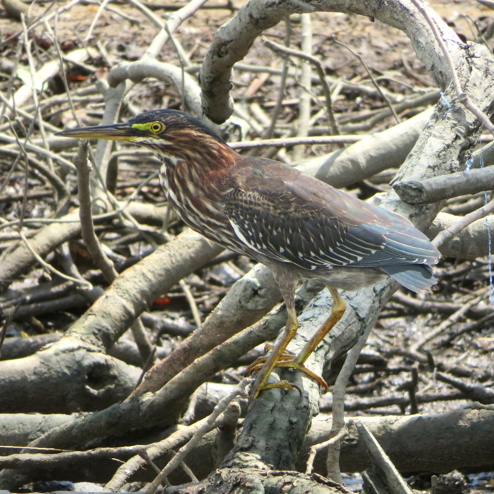
I saw quite a few mallard ducks and sea gulls. But the most interesting bird I saw were American coots. 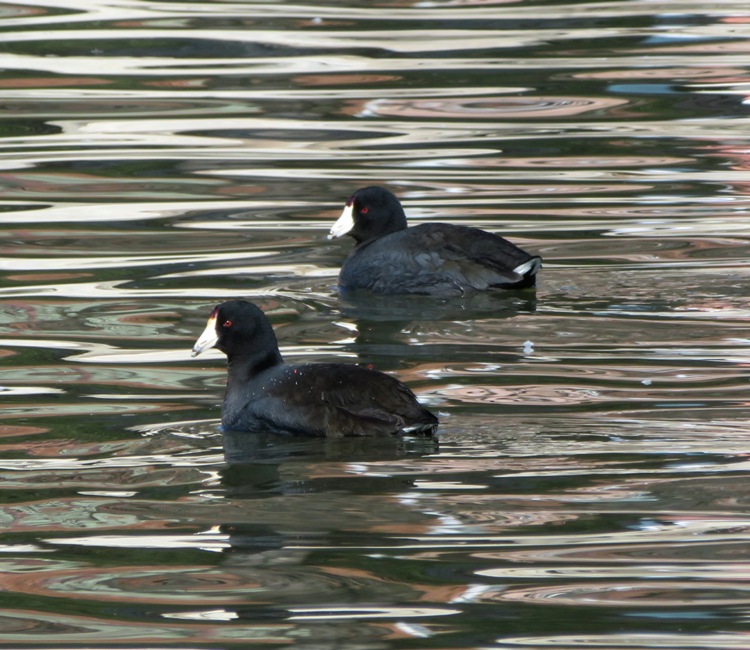
This was my first day on the water this year. I had been pretty stressed from all the home renovation work but today I actually felt at peace today.  |
|
I worked a short day, came home to pick up Daphne and my SUP, and then headed out to Southwest Area Park. It was a dark and dreary day but it was going to be better than the weekend which called for lots of rain on Saturday followed by high winds on Sunday.
Normally, from this launch site I paddle upstream on the Patapsco River but I figured I'd leave that for a warmer day when there would be more wildlife out. Heading downstream, we came to a culvert under Highway 895 on the right. 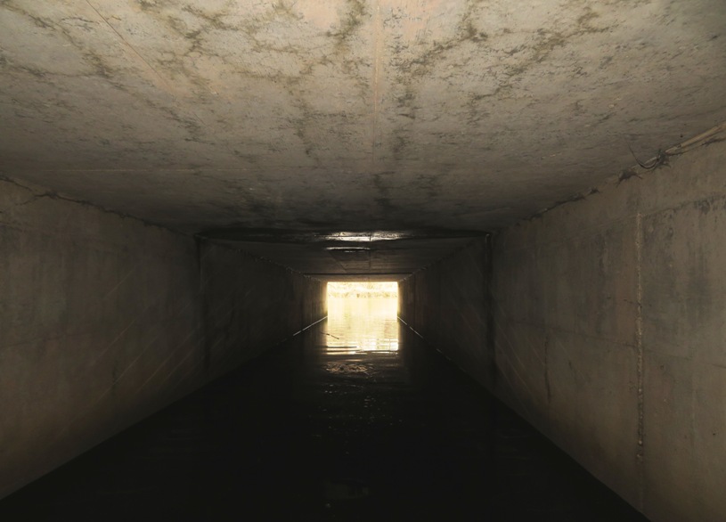
Inside the culvert, I looked for bats but saw none. Below is Daphne and me on the other side. I passed through at high tide which helped since it was shallow. 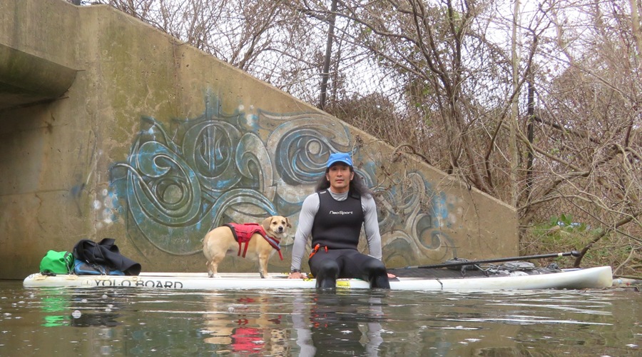
We passed under four bridges. Three were for motor vehicles and one was for trains. 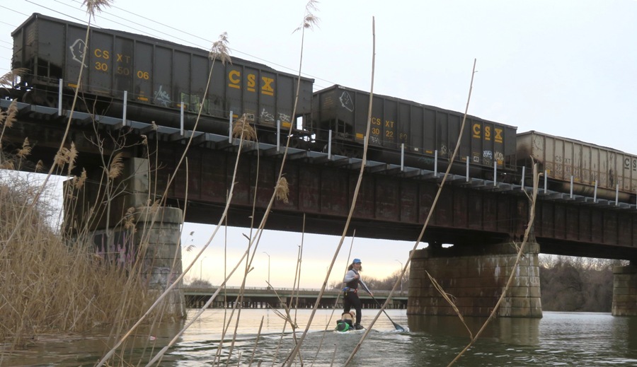
After the South Hanover Street Bridge, the Patapsco River widens considerably. I call the section upstream of this bridge the "Little Patapsco" while the part downstream is the "Big Patapsco." Baltimore has a reputation for being very dirty. A lot has been done to clean up the touristy sections but many of the other parts on or near the water are filled with trash. 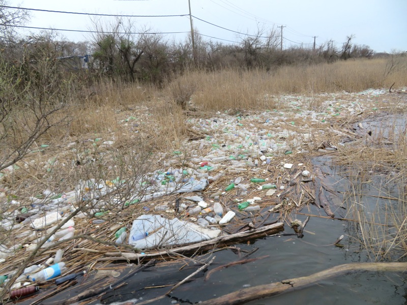
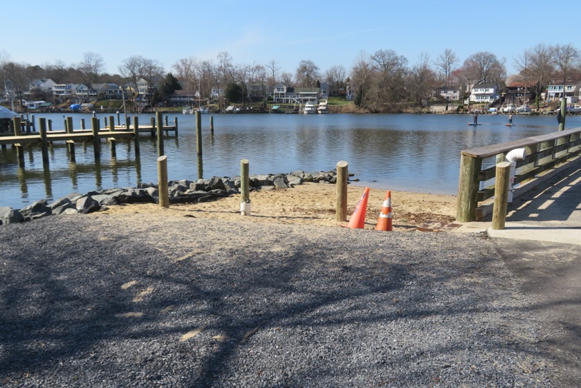
I later read that a trash cleanup is planned for tomorrow but I highly suspect it will be canceled due to heavy rain. We landed at a small beach at the Masonville Cove Environmental Education Center, the nation's first Urban Wildlife Refuge Partnership and home to Captain Trash Wheel. This is the southernmost of the four Baltimore trash-collecting solar and hydro-powered trash interceptors. The most litter that one of these wheels has collect in a single day is 38k pounds! 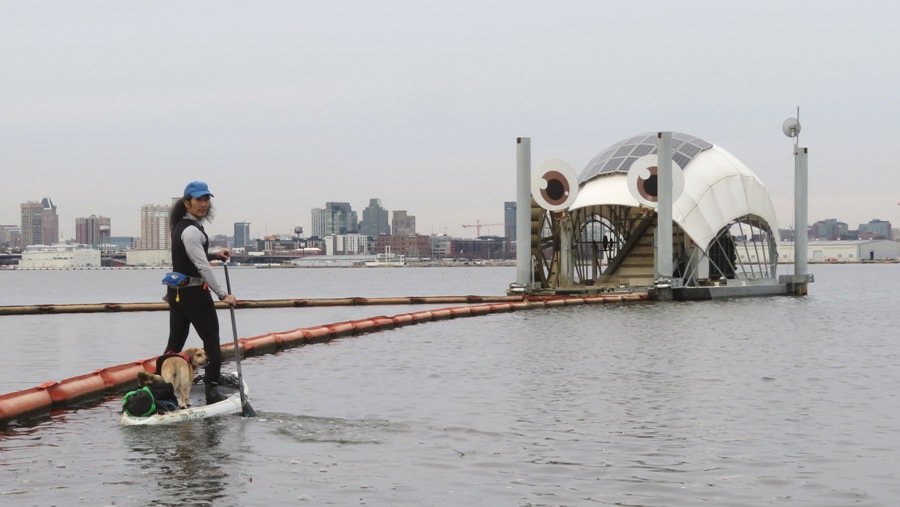
The beach where we stopped is the northern terminus of the Captain's Trail. The Education Center has several short trails. I saw a bald eagle and some buffleheads. Paddling back upstream, we looked around on land. I found a smashed-up white Kia and a really big pipe. Here, Daphne's ears are looking rather Yoda-ish. 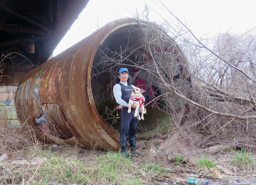
Some people say we put Daphne on a pedestal. Here is proof of that. 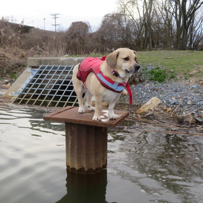
This is our paddling route...a mere 5.5 miles. Afterward, I took Daphne for a short walk in the park. 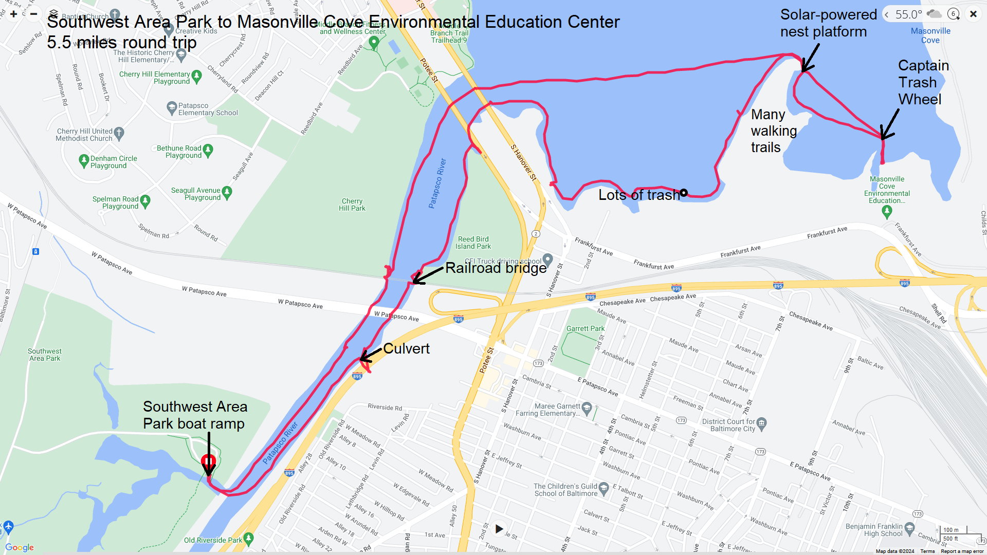
|
|
With a high temperature of 79 degrees, I was very much wanting to get out on the water. So Daphne and I drove out to Green Haven Wharf. I hadn't been there for awhile and a few things changed. Previously, I carried my boat down some stairs to the water on the downstream side of the pier. But now there is a much nicer beach launch on the upstream side.
As I prepared to launch, two paddleboarders landed. One of them recognized me. It was Ellison S., a very well-known paddleboarder in the area. He and I had never met before but we knew each other by reputation. In a Facebook post, he referred to himself as the "Maryland SUPbassador" and me as the "Maryland Magellan." I think the names fit given his effort to promote paddleboarding and my explorations. I launched on Stoney Creek and paddled downstream. Daphne and I saw a muskrat, a bald eagle, and some greater scaup. 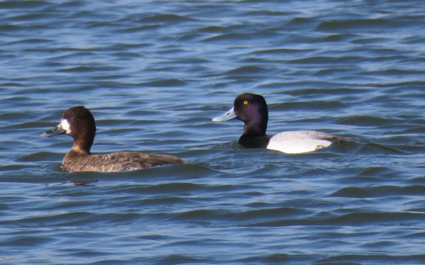
There was other wildlife too. Here's a red-eared slider. Notice the red ear. 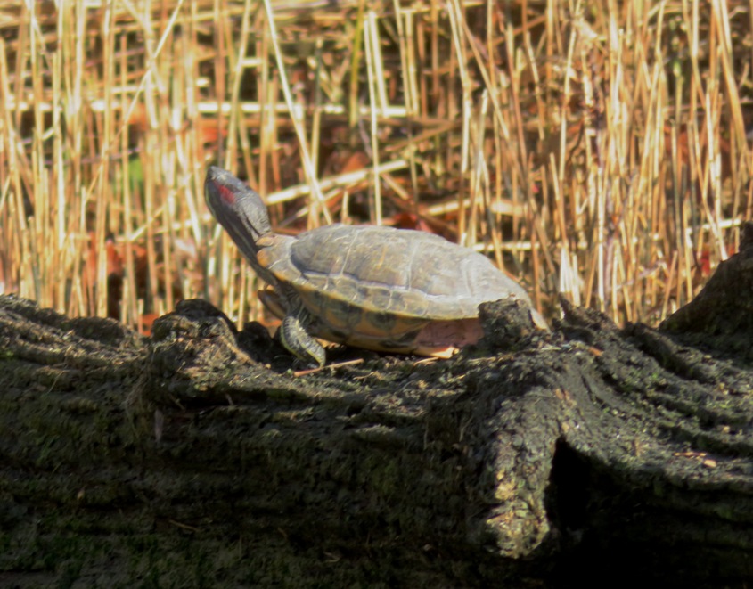
Hugging the shore, I explored some of the shallower areas. I didn't make it far upstream on the narrow tributary shown below. Heading back downstream, I saw the Herbert A. Wagner electric generating station in the distance. 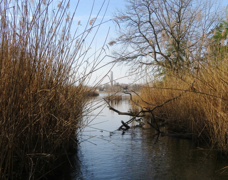
Eventually we came to Black Rocks which resides at the mouth of Stoney Creek. Here's a view with the Francis Scott Key Bridge in the background. Unfortunately, this is the last time I would see this bridge before it fell on March 26, 2024. Tragic. 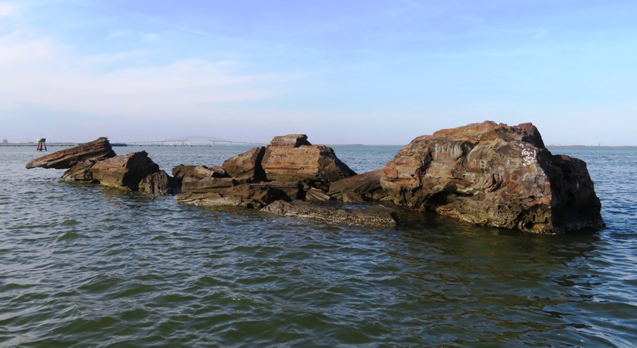
There are many topics I know very little about and geology is one of them. I asked many people about the origin of these contorted rocks, which seem so unlike others I've found in the area but none of the people I knew could provide an answer other than a guess. 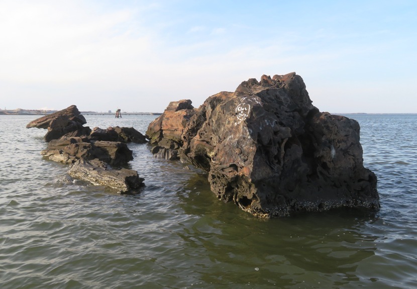
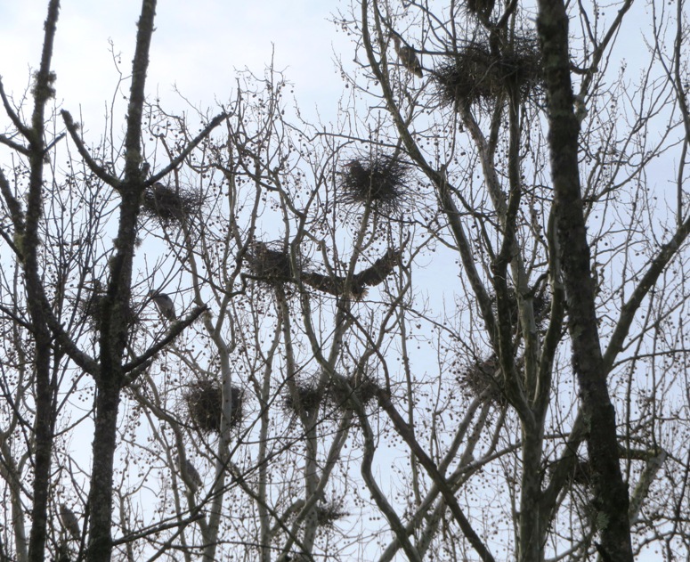
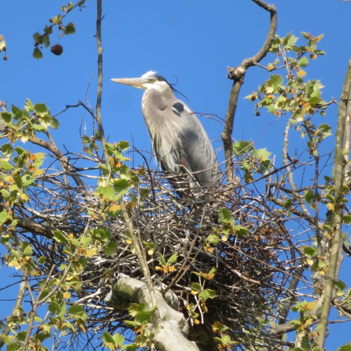
I've found stuff written about the nearby White Rocks, which lies about 1.5 miles to the east. But nothing about Black Rocks. I even joined a geology Facebook group but nobody could tell me anything about these rocks. I ended up writing to the University of Maryland, College Park, Department of Geology and received the following reply from Phil P., a senior research scientist: I have not been out to look at those rocks in detail, but I am a bit familiar with some of the lore behind those: being that they were dropped off of a ship (there was an article in the Pasadena paper about that at one point). I am going to speak off the cuff here, and I have not been to the rocks. Although the exposed rocks are limited in size, it has been reported that at depth, the rocks at depth cover about a square acre. If that is correct, it is more unlikely that they were dropped off a boat. Locally, rocks around the Stoney Creek inlet are part of the Potomac Formation. Rocks that make up that formation are a mixture of white/gray/red sedimentary rocks that have a variable texture. From the photos, I would guess that may be the most likely answer. My opinion only. And the only way to get a better feel for sure is for me to take a kayak trip to the rocks to have a closer look, and I am happy to do so when the weather gets better. I replied that I would be happy to accompany him on his journey if he wanted. I was keeping an eye out for black-crowned night herons, which I have seen in this area. I saw none. But I did find a large nest. From a distance, I was certain I saw a really big bird in it. But once I zoomed in, I realized it was just a bunch of fluff. I wonder if a bird is planning to line its nest with it to make it more insulated. 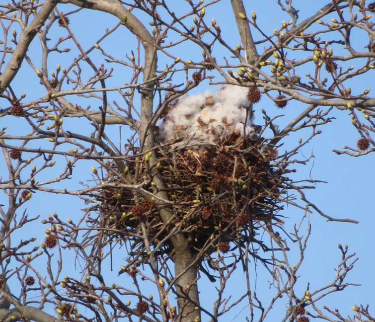
I paddled 7.6 miles and then took Daphne for a walk in the neighborhood. 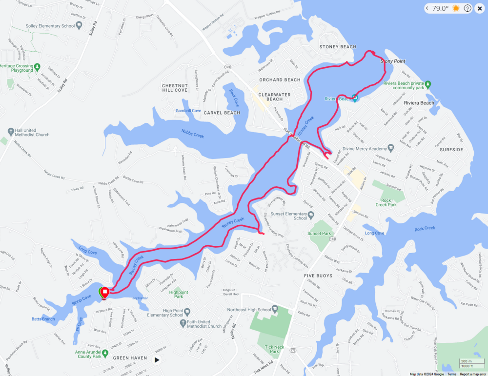
|
|
March 22, 2024 is World Water Day. It is also the start of the weekend prior to Maryland Day which falls on March 25, 2024. To celebrate the latter, the Pride of Baltimore II paid a visit to Annapolis. So did Daphne and I.
Almost all week, it had been very windy, which is typical in Maryland during the springtime. But on the morning of March 22, the winds were light. It was a Friday so I had to work but I decided to go in late to see Pride II. This ship is a topsail schooner built to the lines of an 1812-era Baltimore Clipper. The temperature was 40 degrees with a wind chill of 34. I wore my 5mm wetsuit with a separate neoprene top. We put in at Truxtun Park. There were signs up saying that kayaks and SUPs were not permitted. I assumed they referred to the beach, possibly because of excessive erosion. There was no explanation. So I launched from the ramp onto Spa Creek. I paddled out to the ship, which was moored between Susan Campbell Park and the Naval Academy. Here's a view from afar. 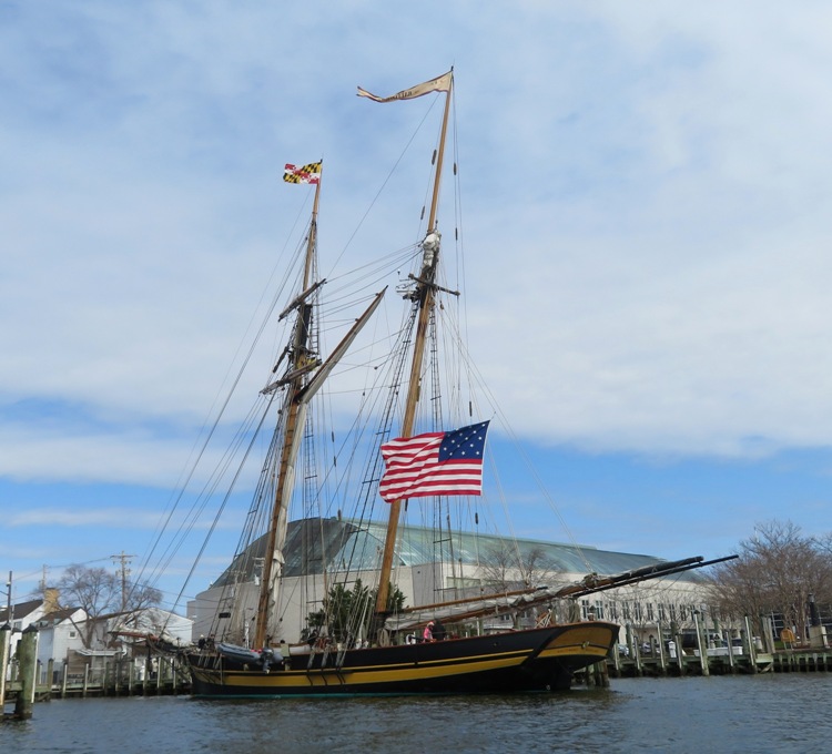
There was a reporter from the Capital Gazette taking pictures. He took some of Daphne and me but we didn't make the cut for his article. Folks could go on board for free. But unlike the B.A.P. Union which visited Baltimore on March 3, 2024, there was no wait. Hopefully they will get more visitors over the weekend. 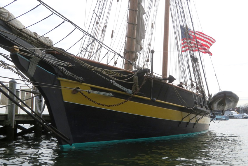
Here's Daphne and me. She's wearing her wetsuit which she hates. 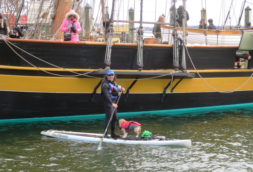
I raced back to Truxtun, loaded up the SUP, took Daphne home, changed clothes, went to work, and worked late. It was all worth it. Once I got home, I found out that kayaks and SUPs are indeed prohibited from launching anywhere at Truxtun. Supposedly, the reason is because of an electrical problem that leaks current into the water. I felt nothing. |
|
On October 4, 2023, I wrote that that trip would be my final one on the S1-A because it is too hard on my left shoulder. I've been thinking about it ever since then. I could sell it but that may not be easy because it is so specialized. Instead, I decided to give it away if I could find the right owner. I posted the following in the "Surfski Annapolis" Facebook group:
It needs a very special owner: After paddling surfskis for 22 years, this was a big decision to throw in the towel but I knew it was for the best. Finding a good home for it was now my goal. Ideally, I want a competitive racer to own it. I am not; rather I am an explorer. A surfski can be good for covering the long distances I typically do when I am touring but it isn't good for getting into the shallow areas or taking photos. Various people inquired about the S1-A. I reached out to the first person, Susanne V. Looking at her Facebook page, it was obvious she was a competitive racer. I saw that we had a common friend, Neil so I reached out to him. He spoke very highly of Susanne and felt she would make an excellent owner for my S1-A. On March 24, Susanne and I met at Homeport Farm Park. She brought along her friend, Kevin L., who brought his Epic surfski. I brought my SUP and the three of us, along with Daphne, paddled upstream. Susanne fell out several times. While she has raced very narrow SUPs, single-person outrigger canoes, and six-person outrigger canoes, she has little experience on kayaks and none with wing paddles. So I gave her a crash course. Fortunately, her strength to bodyweight ratio is high so getting back on the surfski by herself was not an issue. 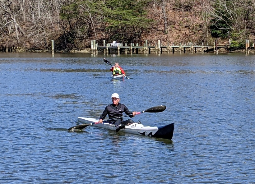
What Susanne lacks in experience, she makes up for with discipline. She is extremely fit and goal-oriented. I am confident she can master this boat. I wish someday she races it and wins. That would make me very happy. I never gave the S1-A the home it deserves. I hope she can. |
|
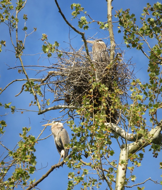
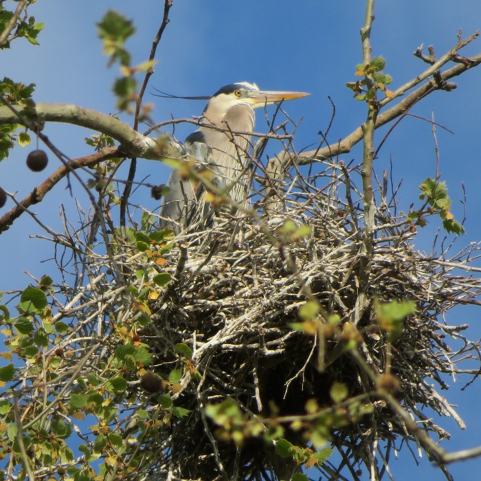
Back in 2021, Greg W. told me about a great blue heron rookery on Lyons Creek. I figured it was finally time to investigate it. Would it still be there? I loaded my SUP and took Daphne to go find out.
I drove to the launch site, Selby's Landing in Prince George's County. From the top of the hill, I saw lots of muskrat mounds across the Patuxent River. I should have taken a picture but I was in a rush to make use of the high tide. I did, however, stop to take a photo from my SUP of an osprey that was posing very nicely. 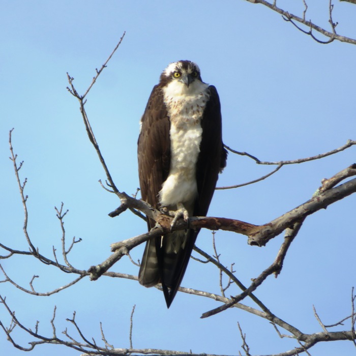
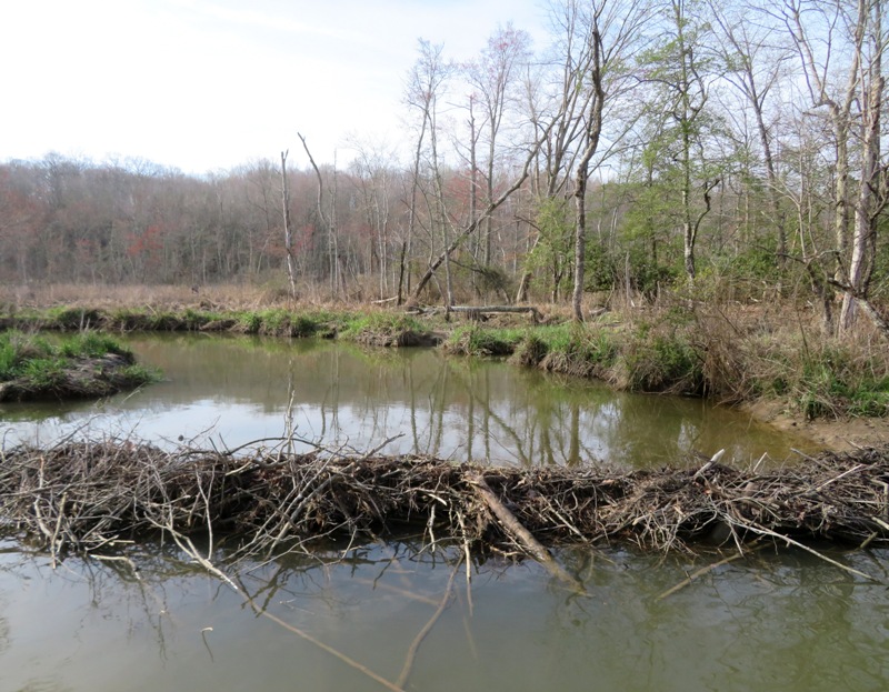
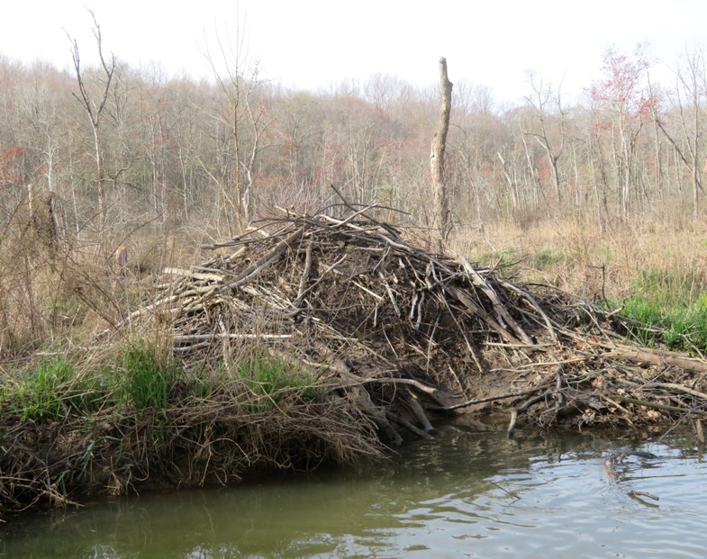
I paddled across the river to Anne Arundel County then up Lyons Creek. This is the dividing line between Anne Arundel and Calvert Counties. I explored every paddleable tributary. Quite a few areas were very shallow. I did a couple of portages. I saw lots of beaver activity but no beavers. Daphne and I eventually saw the rookery on the Calvert County side. I went ashore and shot the following pics with my camera. I had morning light which was not good because that put the sun behind the rookery. I might return in the afternoon on a later date. Paddling back downstream, I spoke to an old timer in a kayak picking up trash. He said a few years ago, there were about 60 nests in the rookery! What little sunlight I had quickly disappeared as the clouds rolled in. Here is my 6.6 mile route. 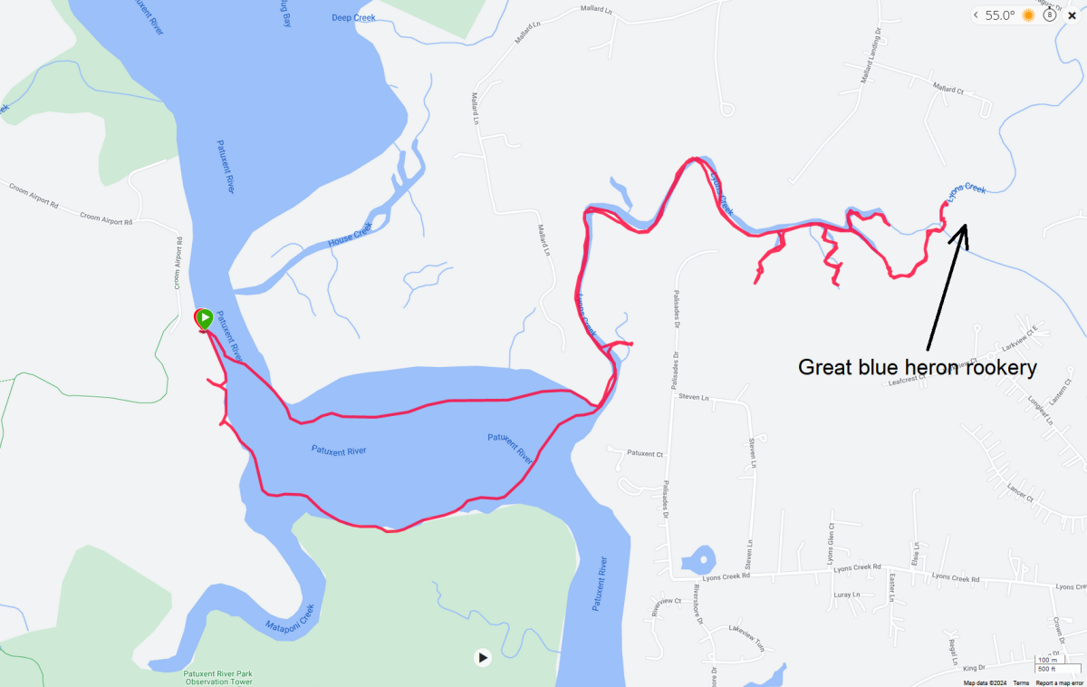
Afterwards, I took Daphne for a little hike. |
|
On June 10, 2023, I paddled out to Indian Rock Island and saw a cormorant rookery and a great blue heron rookery. But since it was June, there were a lot of leaves on the trees so it was difficult to see the birds. I figured I'd return in the early spring while the trees were still bare to get a better look. That was my plan today.
I figured putting in at Pequea would require me to paddle further but I could approach the island from downstream. This would be safer because the current from Safe Harbor Dam outflow would be weaker than if I approached from upstream. Unfortunately, the Pequea site was closed. There was no sign explaining why. Plan B was to do the same route as last year, launching from Safe Harbor Park. Before driving out, I checked Safe Waters - Safe Harbor which said Estimated Levels of Lake Clarke at Safe Harbor Dam Elevation: 227.2 Normal Top Level at Safe Harbor Dam is 227.2. Estimates are made assuming normal load conditions and no subsequent changes in river flow. The forecasted average daily river flows into Safe Harbor for the next three days are 138,000, 120,500 and 97,500 cubic feet per second. For today, the river flow was 120,500 cubic feet per second. But what does that really mean? I walked to an overlook to see how much water was being released from the dam. It was quite a lot. 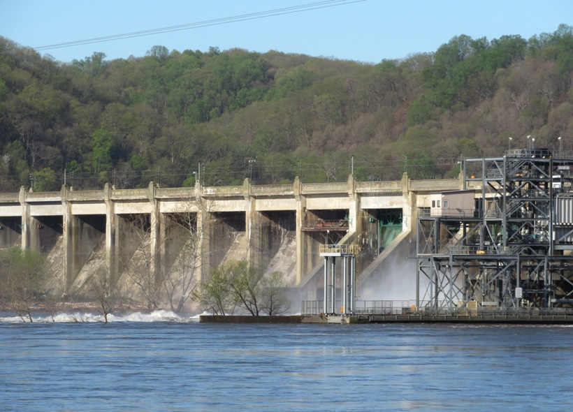
The river was very high and I'm guessing the Susquehanna River current at the mouth of the Conestoga River was six mph. Further towards the island, it was all whitewater. Clearly, it was not safe for me to make this trip. It might be difficult to find a time when there are few leaves on the trees, the birds are in their rookeries, and the water is low enough to paddle out to see them. The issue is that in late March and early April, the water is often high. A dry spell might give me my window of opportunity. I settled on plan C, which was to paddle upstream on the Conestoga, something I had never done before. Here is where I put in. 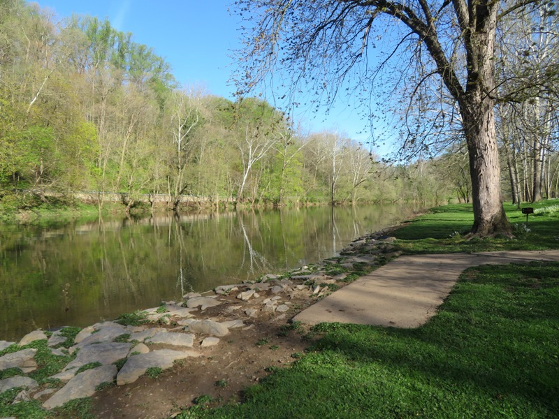
It was sunny and the winds were low. As I started making my way upstream against a two mph current, I noticed a bald eagle in a tree. I pulled ashore to take its picture. It didn't pose for long but it was just long enough to get a crystal clear shot. 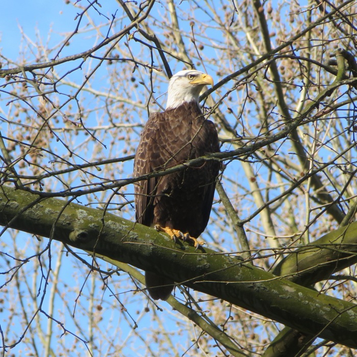
The scenery reminded me a bit of the Monocacy River. Making my way further upstream, the current got stronger. I only made it about 2.5 miles upstream from the mouth before I could go no further. Turning around, I kayaked through a tunnel and up Witmer Run for a very short distance. 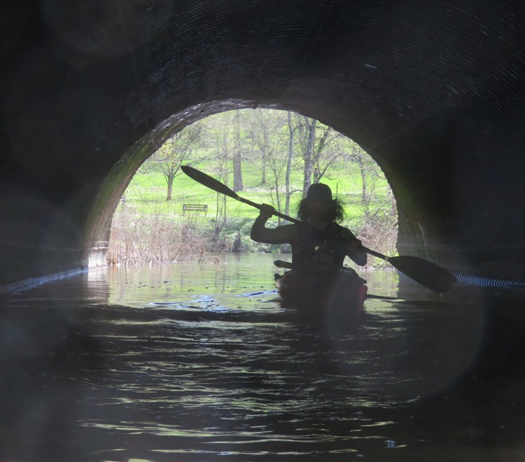
I found a scenic, sandy area on Witmer Run and pulled ashore. I did some exploring on foot and then tried to take a nap. I searched for morel mushrooms but found none. 
I continued downstream on the Conestoga River until I was at the mouth, where it empties into the Susquehanna River. I was hoping the dam had stopped releasing water but that was not the case. Testing the strength of the current, it was obvious that venturing to Indian Rock Island was not safe. Here is a map of my route. I got in 5.2 miles of kayaking. 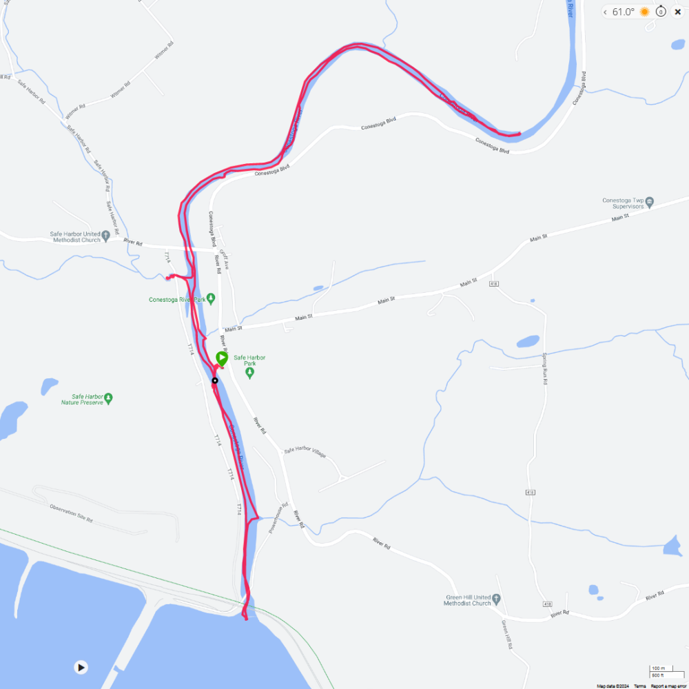
I told my phone GPS to take me home. In this area, it is hard to get a GPS signal so I had to drive around a bit before it would pick up anything. I don't think I was heading back via the most direct route, but since I don't know the area very well, I figured a longer route that would take me to my destination was better than guessing. The circuitous route ended up being a blessing in disguise. I saw signs for the Enola Low Grade Rail Trail and the Turkey Hill Trail Nature Preserve. These are both places I've been wanting to explore. I followed the signs to a huge parking lot. Both the rail trail and the nature preserve trailhead meet at the same place. The two of them appear very inviting. I look forward to returning with Norma and Daphne. 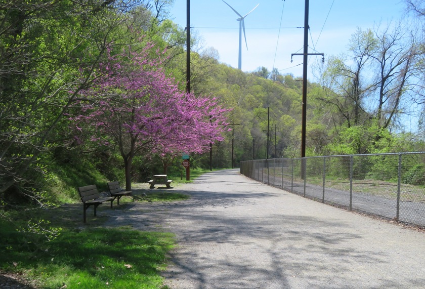
|
|
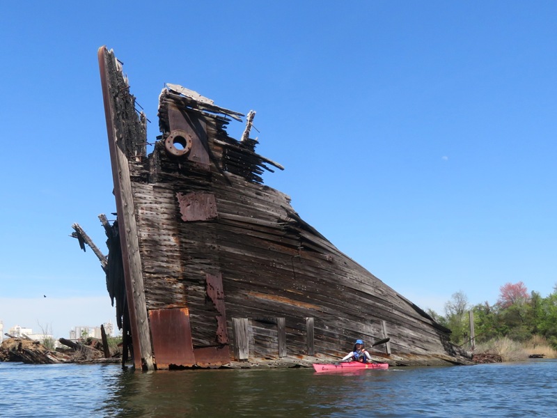
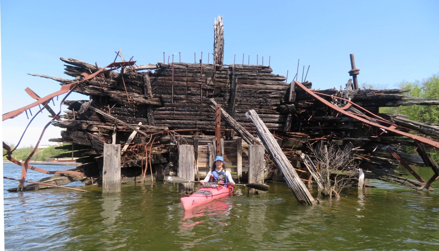
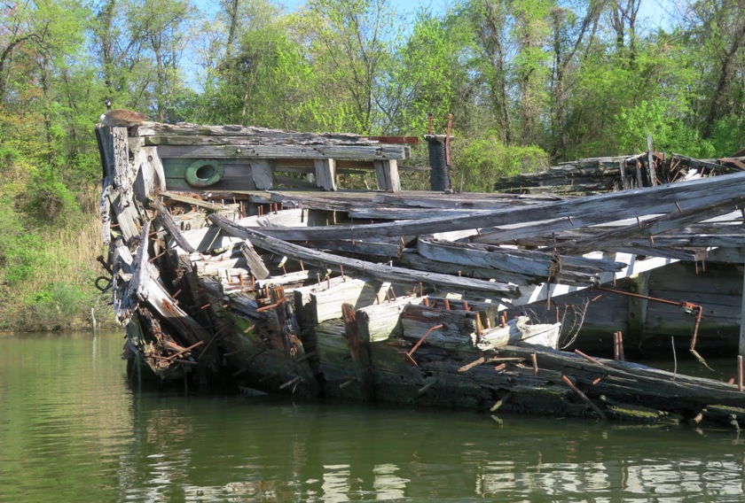
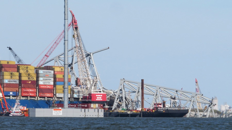
After kayaking on the Conestoga River, I drove out to Jaws Marine and launched my kayak onto Curtis Creek. Normally, I prefer to launch for free at Solleys Cove but after doing one kayak trip and a long drive, I felt justified in paying at a location to put me closer to my destination, the ruins of the Key Bridge.
Recall that the Francis Scott Key Bridge fell on March 26, 2024 after the container ship Dali struck one of its piers. I started my trip by stopping at the Curtis Creek Ship Graveyard. Kayaking north, I saw an American coot. 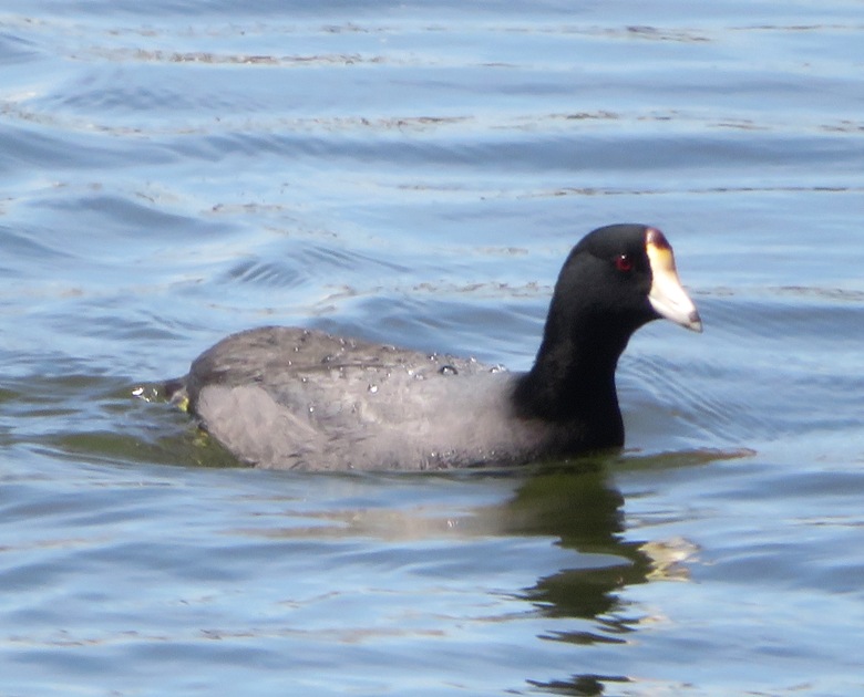
As I rounded Sledds Point, I had an eastward view of the bridge ruins. I was still pretty far away but the damage was clear. I paddled closer to get a better look, but made sure to stay out of the 2,000-yard radius safety zone established by the Coast Guard. 1 / 4

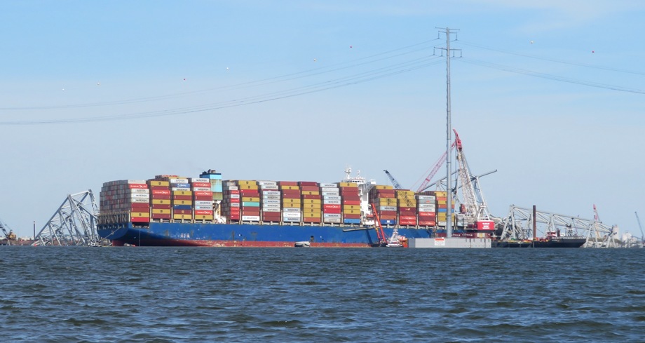
Dali and ruins.
2 / 4
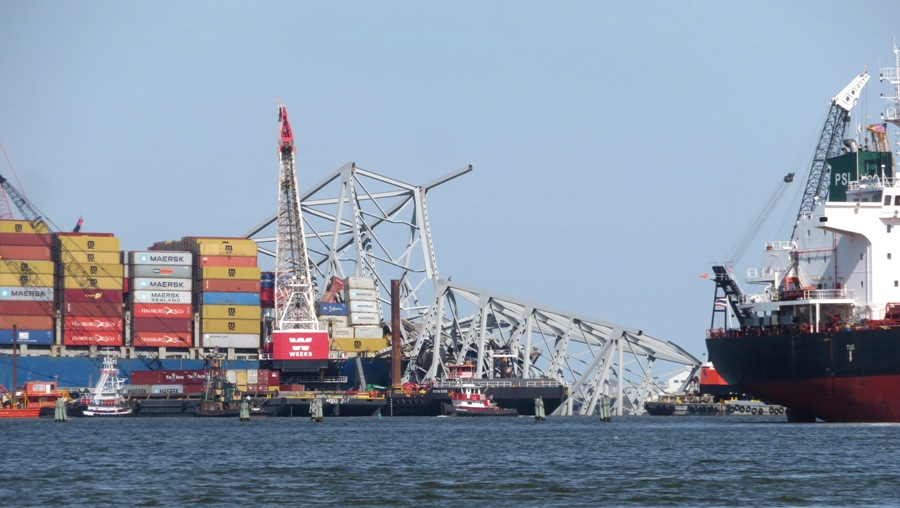
Southwest ruins and tug.
3 / 4
Southwest ruins.
4 / 4
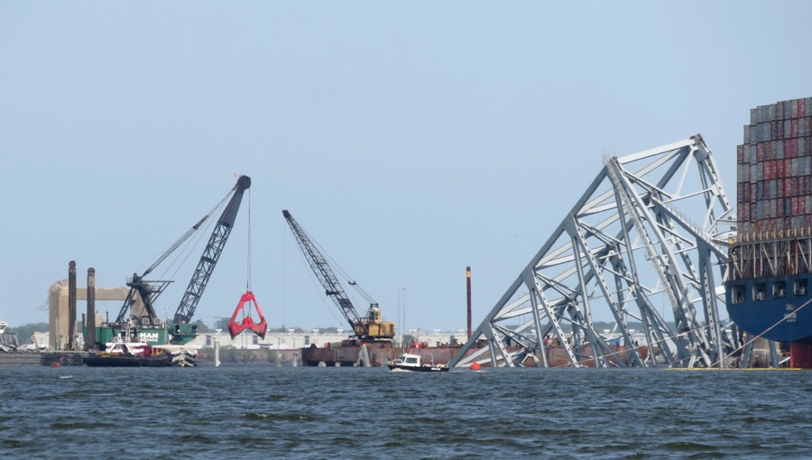
Northeast ruins.
Here is a zoomed out view that shows both ends of the bridge that are still intact. 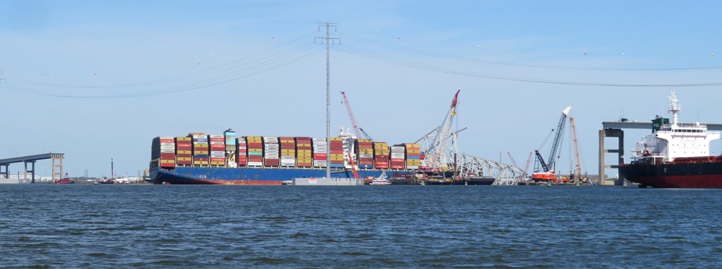
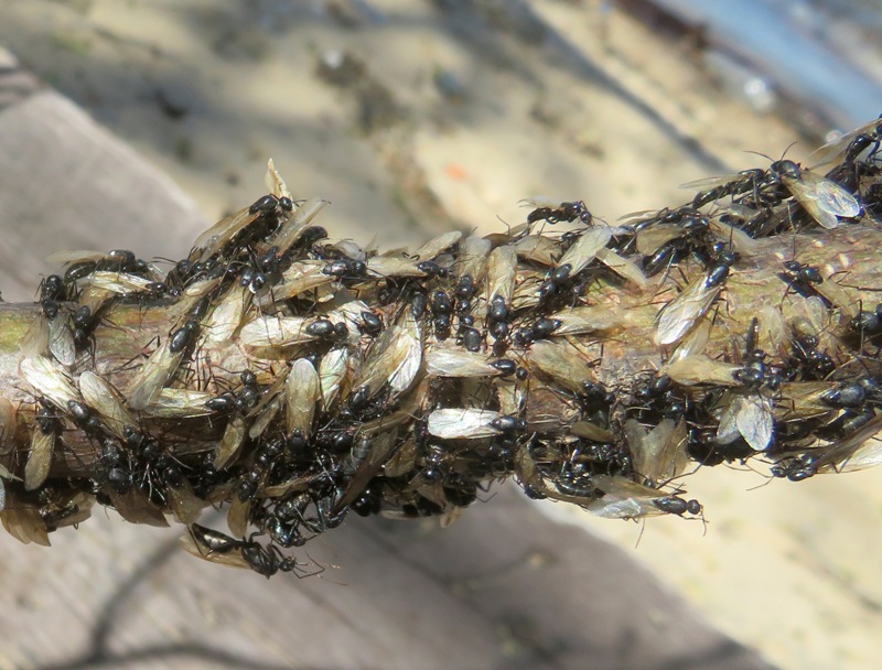
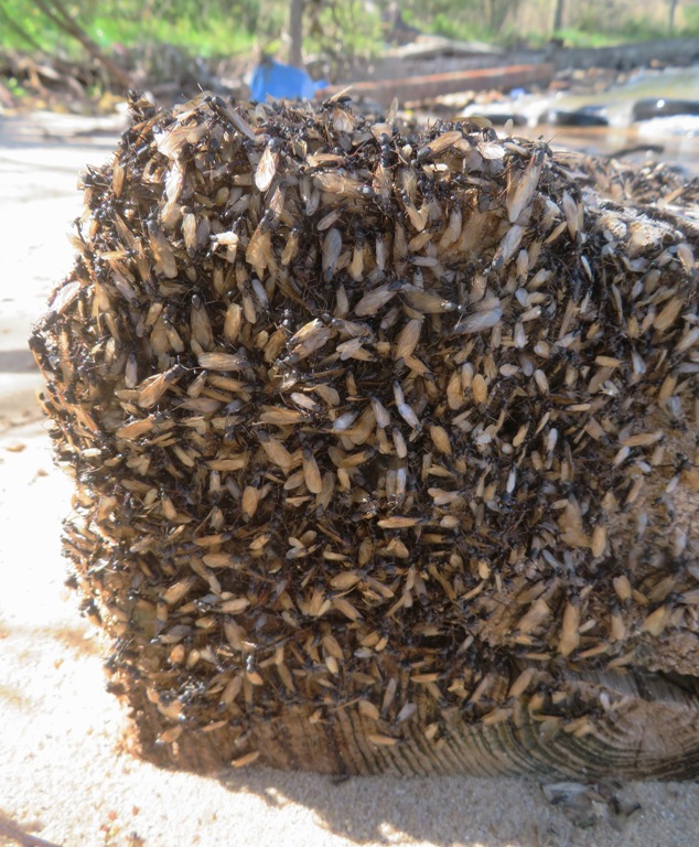
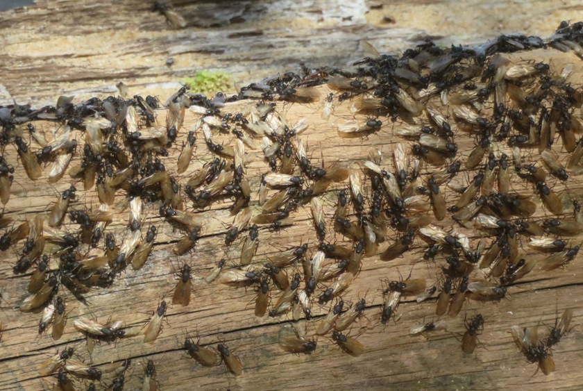
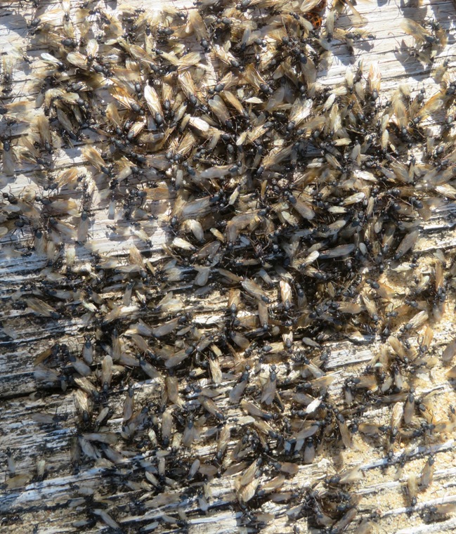
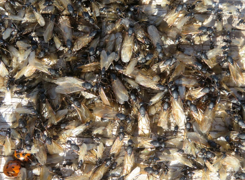
I pulled ashore at a view places to get a different view. In one location near Thoms Cove, I saw what is likely a swarm of carpenter ant alates. I kayaked back to where I started, having completed six miles, or 11.2 for the days total. 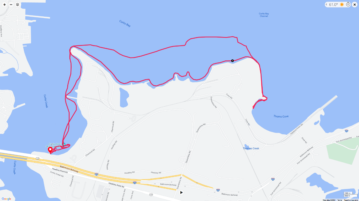
|
|
On April 20, 2024, Norma, Daphne and I circumnavigated Raccoon Island via kayak at the southern tip of the Virginia eastern shore.
|
|
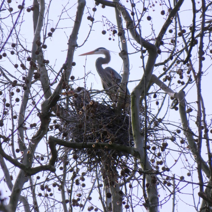
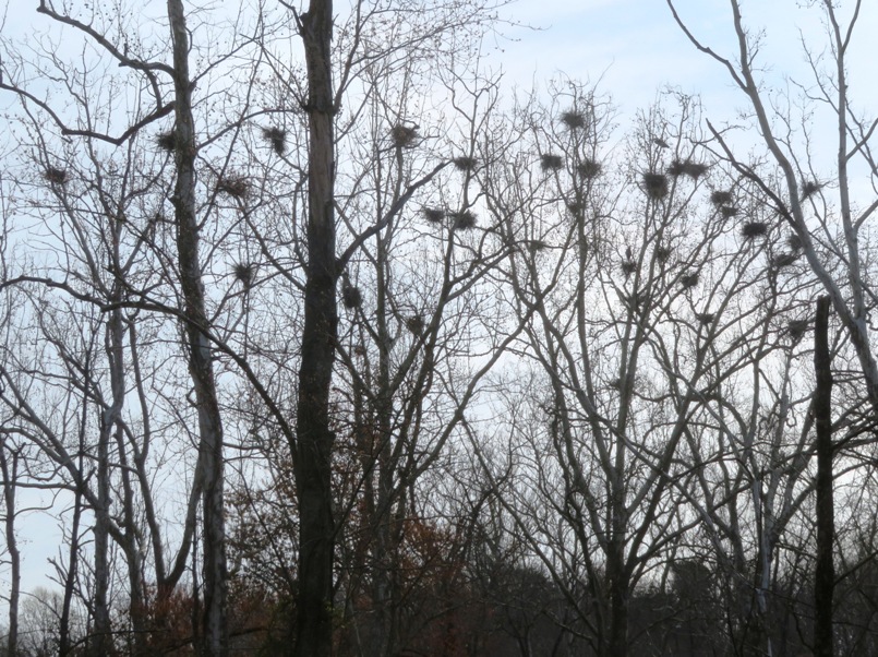
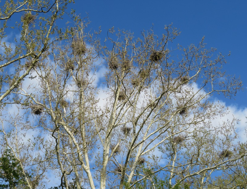
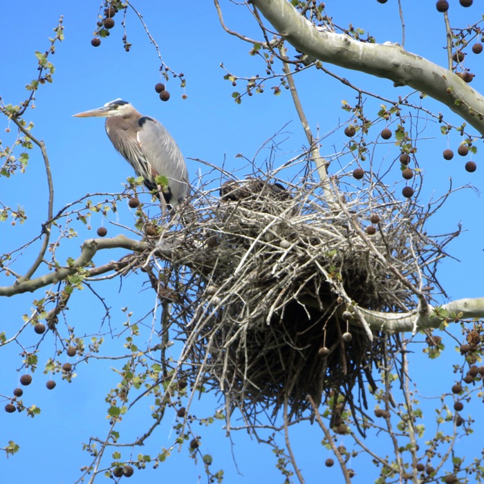
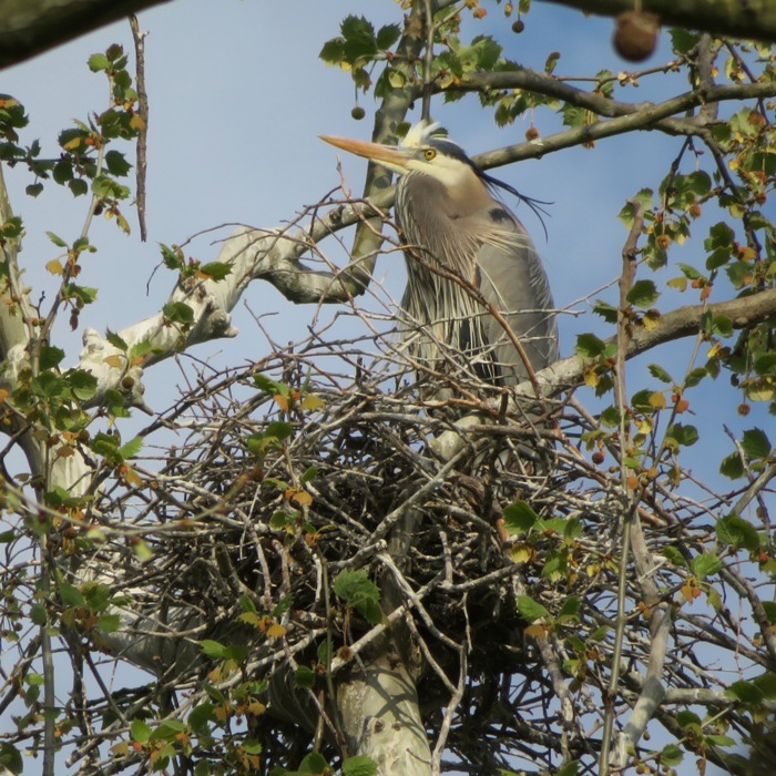
Recall that on March 31, 2024, Daphne and I paddleboarded out to a great blue heron rookery on Lyons Creek. I took pictures in the morning light which created silhouettes. Today, we returned to take photos with the late afternoon light.
We launched from Selby's Landing. It was a little windy but not too bad. Arriving at the destination, I spent quite a bit of time ashore, wading through the swampy areas to get the best views. Sometimes clouds rolled in but the wind kept them moving. 1 / 6
On nest.
2 / 6
Double.
3 / 6
Rookery.
4 / 6
At nest with one inside.
5 / 6
Horizontal head feather.
6 / 6
Heron.
Here's Daphne and me near the mouth of Lyons Creek. 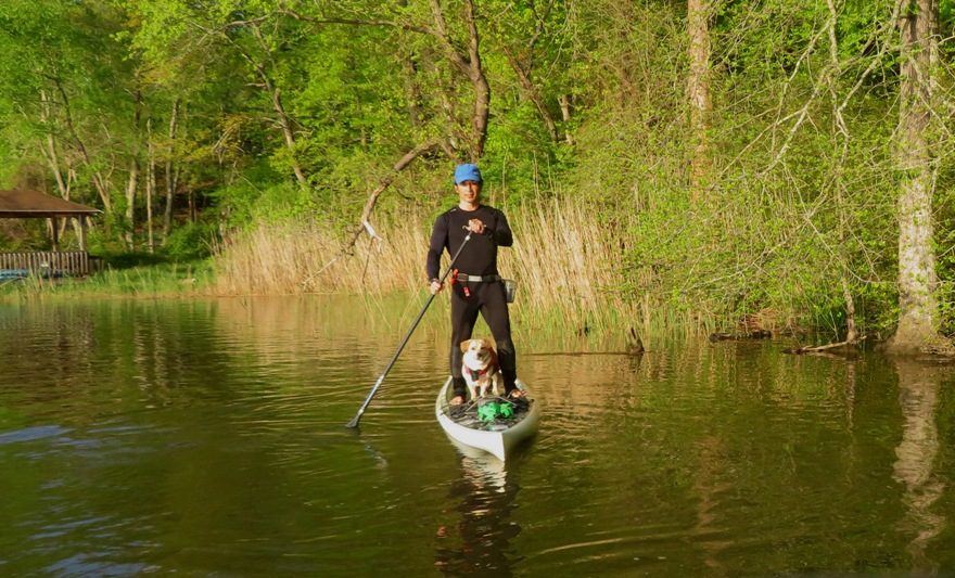
Not every bird we saw was a great blue heron. 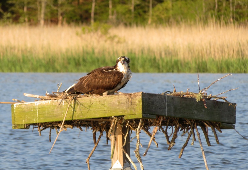
I took Daphne on a short walk in the park before they closed. |
|
Back on March 8, 2024, I went paddleboarding and came across Captain Trash Wheel. This is one of four of Baltimore's trash wheels. These are semi-autonomous trash interceptors placed at the end of a river, stream, or other outfall. Together, they
collect approximately 500 tons of trash and debris from the Baltimore Harbor each year. - from Mr. Trash Wheel - Trash Interception. The only Trash Wheel I had yet to paddle to was Gwynnda: the Good Wheel of the West. Gwynnda was installed in 2021, making her the newest of the trash wheel family. I've paddled this area a few times and have always found it frustrating because the water is so low. But on this day, I timed my route with high tide AND coastal flood warnings. So water depth was not an issue. Launching from Broening Park, I paddled the entire shoreline north of the Spring Garden Swing Bridge and some of Gwynn Falls. I'm not much of a city person but I do enjoy them if I can visit the lesser-seen parts and get a point of view that few get to see. Towards the downstream section of the falls, I saw Gwynnda. 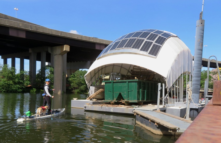
She resides next to Wheelabrator Incinerator. 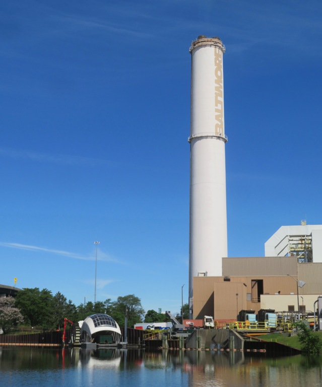
Wheelabrator Technologies, which owns property next to the new trash wheel project, will assume the cost of offloading trash from the wheel to Wheelabrator's incinerator. - from Baltimore Fishbowl - Baltimore's newest trash wheel, Gwynnda the Good Wheel, will be installed next month Trash enters the opening in the below pic and is pulled up a conveyor belt, operated by a waterwheel and solar power. 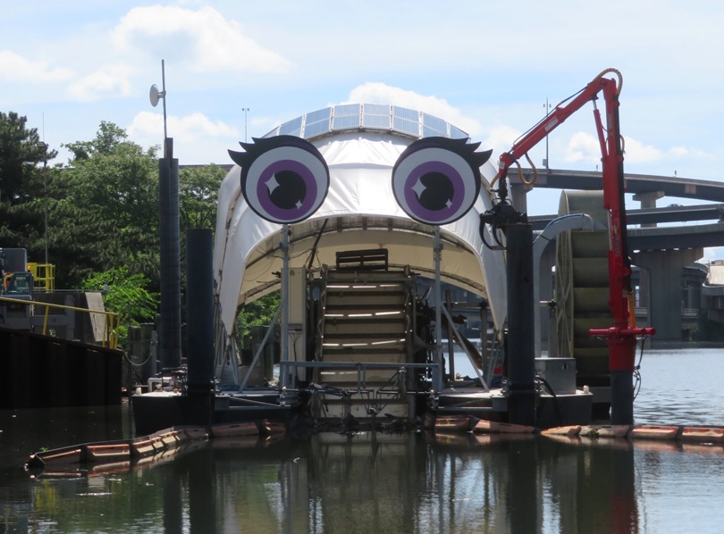
It's estimated that Gwynnda will pick up 300 tons of trash each year, which is more than the other three wheels combined. Like her family members, Gwynnda runs fully on hydro and solar power, boasting 72 solar panels that sit just behind her googly eyes. - from Chesapeake Bay Program - Gwynnda the Good Wheel works her magic on West Baltimore There was a good bit of trash but not as much as when I first kayaked in this area ~20+ years ago. Despite the litter, I still found the area rather scenic. I saw this black-crowned night heron. I used to never see them, but over the last couple of years, I have been finding quite a few in the Baltimore area. 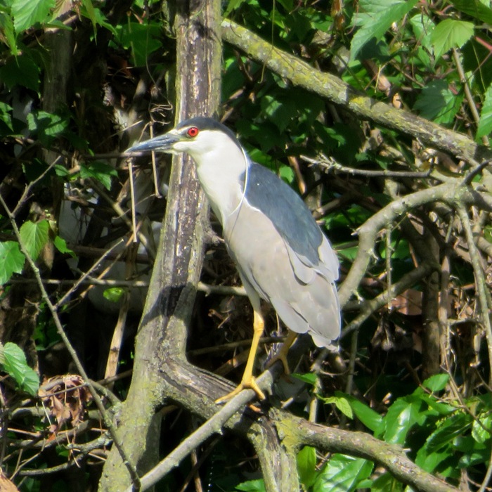
I turned around at 39.26997928574512, -76.64115037502063, which is 1.2 miles upstream from the mouth. I would have kept going but I started encountering riffles. South of the railroad bridge that connects to the Spring Garden Swing Bridge, I saw the foundation of something on the west side of the Middle Branch Patapsco River at 39.264117534247355, -76.62822561961342. Any idea what it could be? 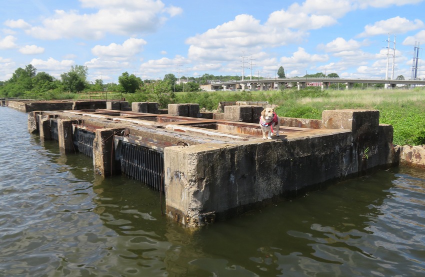
We spotted one and a half radio towers at Middle Branch Marina. 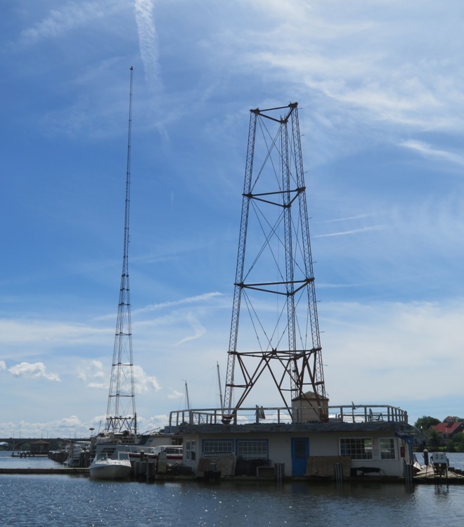
Near the launch site, we stopped at Hanover Street Bridge. Also known as the Vietnam Veterans Memorial Bridge, it is a double-leaf bascule bridge (drawbridge) that opened in 1916. 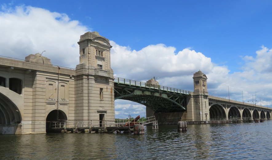
In the above photo, there are two towers, one at each end of the portion of the bridge that hinges to lift up. I paddled up to the leftmost tower and peered inside. This is what I saw. 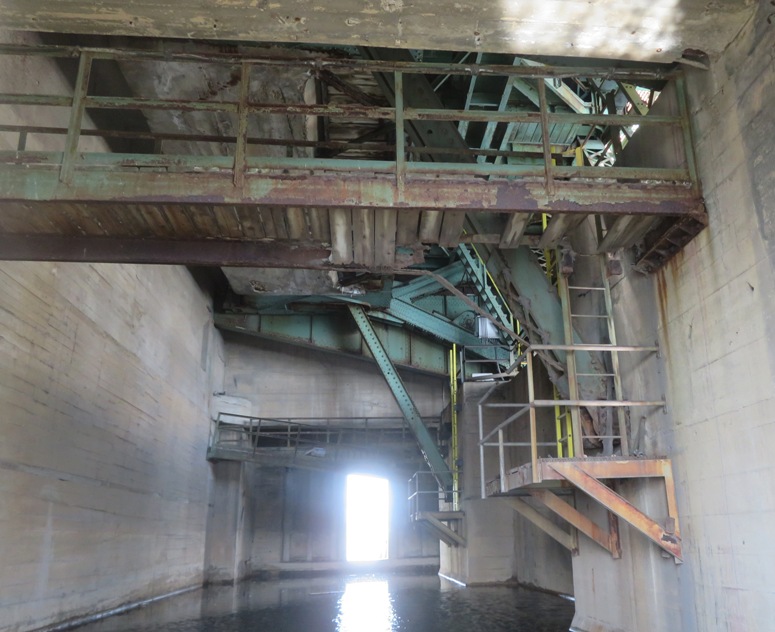
I paddled under ~16 bridges. At least one was a non-functioning train bridge. I was going to take Daphne for a walk in the area but there are too many chicken bones that people throw off into the grass. She loves chicken bones, but of course they are not good for her. So she didn't get a walk until we got home. Daphne and I got in 8.2 miles. I tried to download my route from my GPS but was unable to do so. I upgraded the software and then the download feature quit working. |
|
I left work a little early, picked up Daphne, and then drove out to Mount Calvert. My goal was simply to get out in nature. It seems like that's what my mind has been craving lately...or maybe I am just realizing and accepting that things like "getting in the miles" or being with people really don't matter as much to me.
Traffic sucked. A dump truck stalled out on Route 3. I ignored Google Maps and followed this route which I was familiar with. I ended up regretting it. Sometimes the driving app knows best. Not always, but probably more often than not. After launching my SUP, I paddled upstream on Western Branch, hugging the shoreline on the right. Lots of red-winged blackbirds were out. I photograph the males quite a bit. The females are very uninteresting in appearance with streaked brown markings and a yellowish wash around the bill. 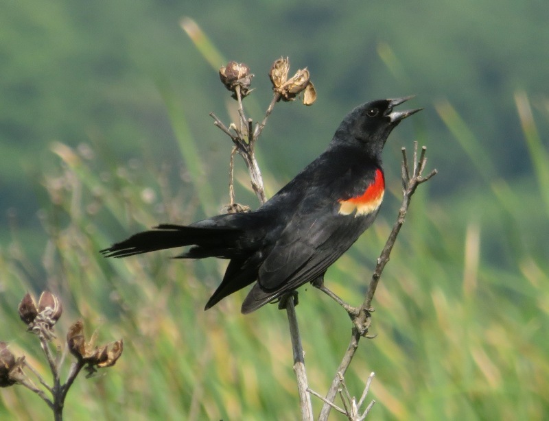
Near Ironpot Landing, I saw this 18"-long snakehead fish. It is not the first time I've seen one in this area. I love their coloration. It reminds me of Vietnam tiger stripe camouflage. 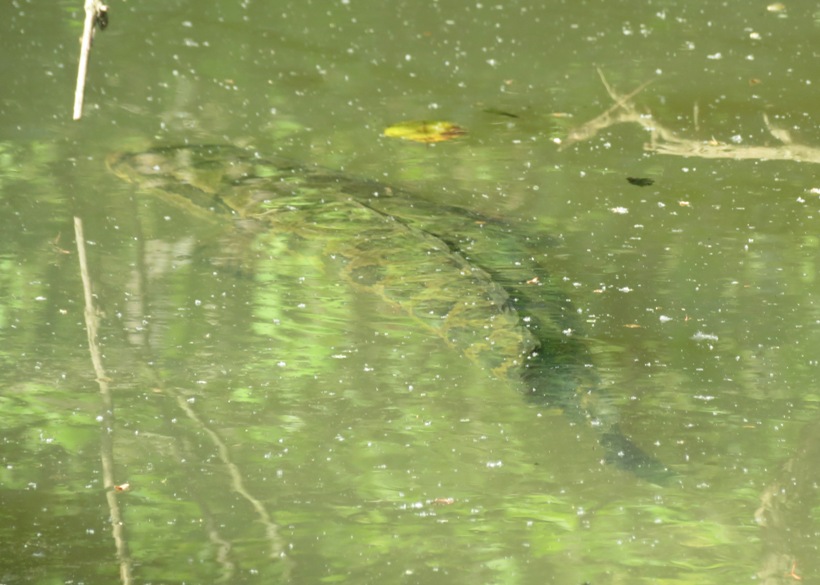
I didn't make it up too far past the bridge at the water treatment plant before I encountered a downfall. I decided not to portage. Heading back downstream, I pulled over at Ironpot Landing for a short nap. Then I continued exploring all the tributaries. They are much more interesting on the southwest side of Western Branch than on the northeast side. I did not see any bald eagles or snakes but I did see one muskrat and plenty of osprey. 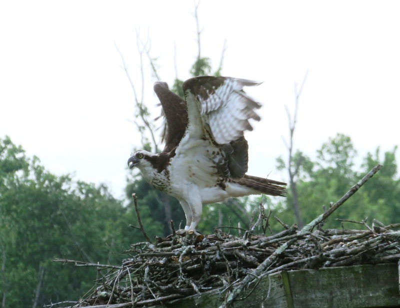
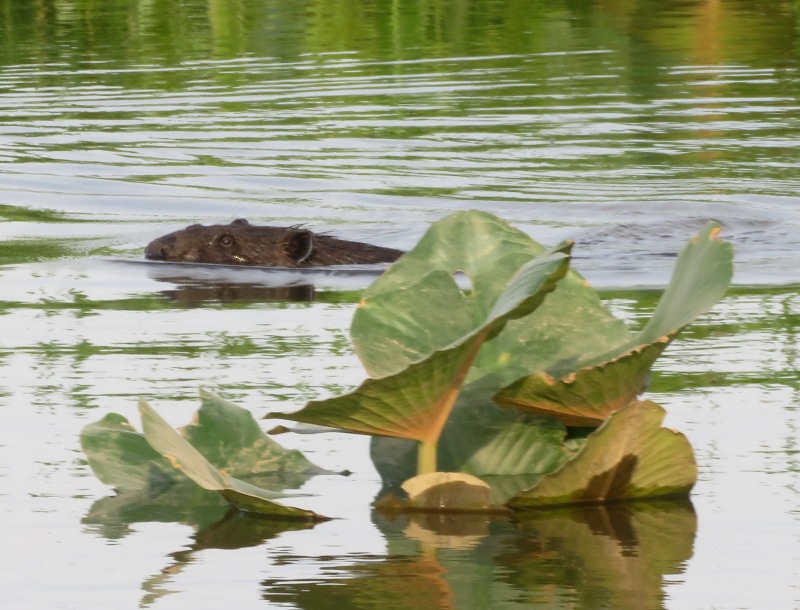
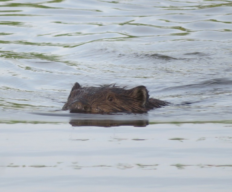
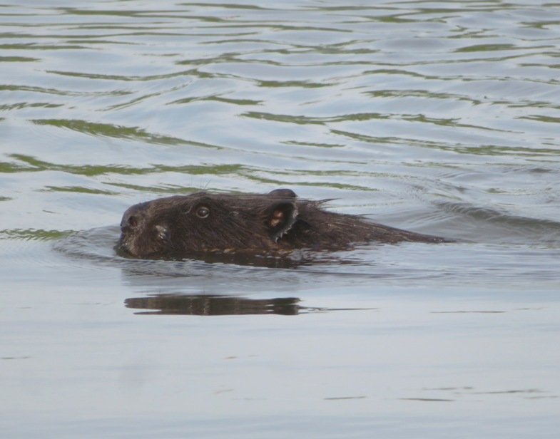
The highlight of our trip was seeing two beavers. The second one was elusive but I got quite a few shots of the first, which I reckon was about as big as Daphne. Daphne was very curious about it. In addition to their large size, beavers act much differently than muskrats or river otters. They are not curious like otters or as quiet as muskrats. In order to warn family members of danger, beavers slap their tails against the water, creating a powerful noise. -from Chattahoochee Nature Center - Nine Interesting Facts about Beavers 
It was around 1830 when we saw these beavers. They are nocturnal for much of the year, but during the light summer evenings they can be seen during daylight hours, especially from late afternoon to early evening, and – for early risers – soon after dawn. -from Devon Wildlife Trust - Where to See Beavers Mount Calvert closed up at 1900. I would have liked to have stayed out later since that is when wildlife is most active. I love this area but my biggest complaint is that they lock their gates too soon. |
|
This year has not been the best for paddleboarding. We've had more than our share of rain and high winds. Yesterday was the latter. Today was windy in some places but not so bad in Lower Marlboro so I took Daphne out to Clyde Watson Boating Area / Magruders Ferry for a 0800 launch.
There was some big bike event taking place so driving was a little slow as I safely navigated around cyclists. It was a beautiful day for a ride. At the launch site, I chatted with one of the volunteers about paddling and pointed her to my website. The tide was not in my favor. I prefer high tide so I can get further up the narrow creeks. Fortunately, many of the named tributaries on the Patuxent River are fairly deep so I was able to get further upstream than I expected. Here is an upstream view of Full Mill Branch, a tributary on the west side of the Pax. I was pleased I was almost able to make it to the tree line, over a half mile from the mouth. This is the view from where I turned around. 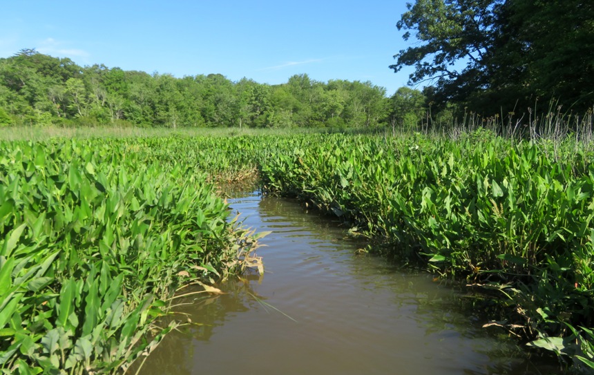
On the east side of the Pax, I paddled for three miles on Tyverne Creek. I saw some pickerelweed flowers. Here's one with a honeybee. 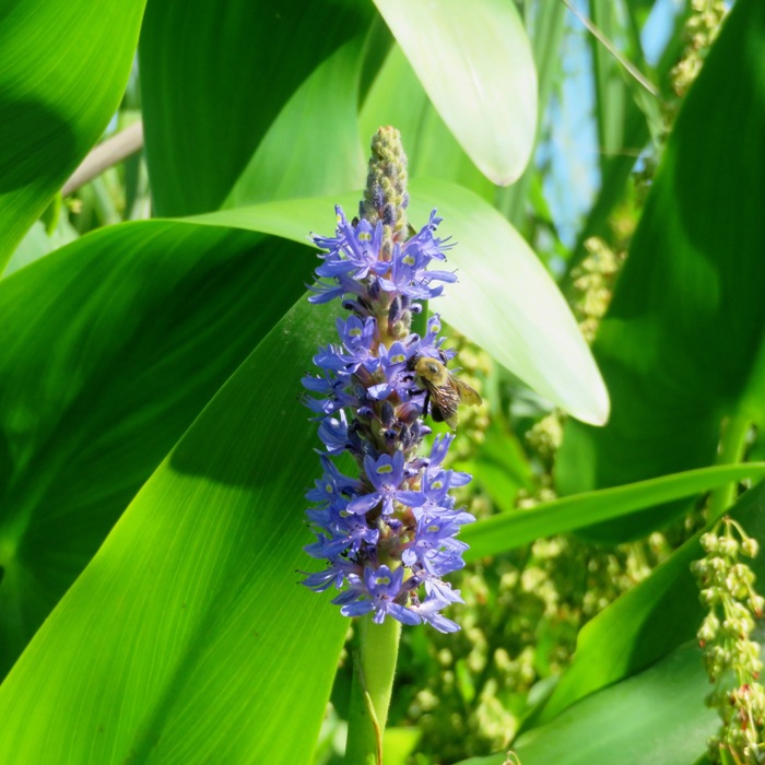
Here's Daphne and me on Tyverne. If you visit via SUP, you'll likely be able to see above many of the grasses that line the creek. Not so if you're on a kayak. 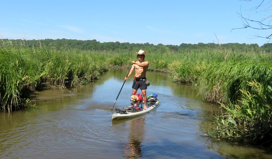
One might think we would have seen lots of wildlife on these narrow creeks. We did see turtles and one muskrat but that was pretty much it. Here's our route. 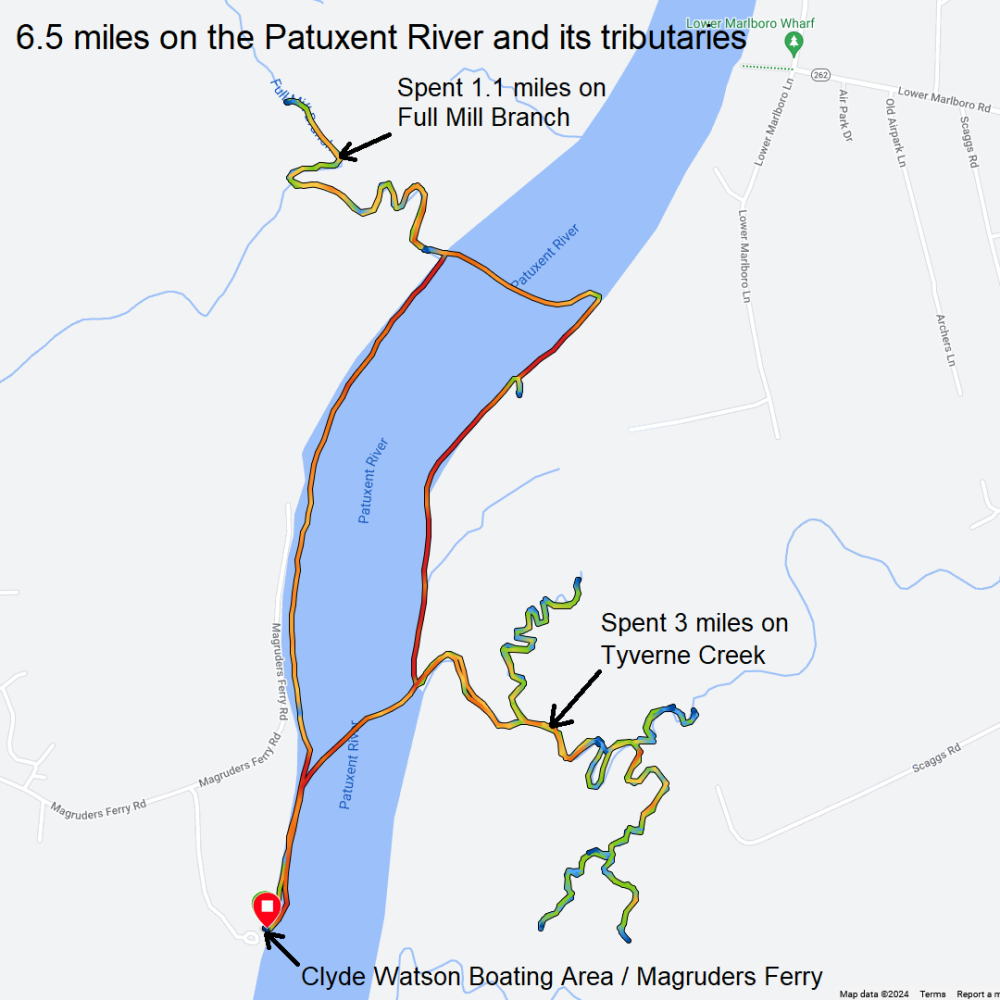
On the way home, I made a little detour to take Daphne for a short walk. |
|
At about 0740, Daphne, Ellison and I launched from Canton Waterfront Park to see the ships visiting for Maryland Fleet Week. I deemed this to be the best time to visit in terms of having calm wind, good lighting for photography, and not interfering too much with my job.
Unfortunately, this Fleet Week was disappointing, compared to previous years. I suspect this might have something to do with cancellations resulting from waterway access to the Baltimore Inner Harbor being blocked until recently due to debris from Francis Scott Key Bridge, which collapsed on March 26, 2024. One ship that was advertised as being present was the USS Gonzalez DDG 66, an Arleigh Burke-class destroyer. Unfortunately, we never saw it. DVIDS - USS Gonzalez transits newly-reopened Baltimore Federal Channel for Maryland Fleet Week shows it arriving in Baltimore but Facebook - USS Gonzalez mentioned Due to unforeseen circumstances, USS GONZALEZ will not be attending Maryland Fleet Week. No official reason was given but someone left the comment She's not there, headed back to Norfolk due to poor pier space planning. I know parking in Baltimore City can be a bitch, but seriously?! Many of the ships we saw were locals, so they didn't seem particularly special to me. Here's Ellison with the James Rankin Coast Guard buoy tender. 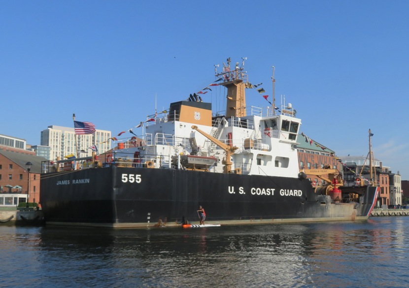
This is him pointing to the Coast Guard Cutter 37, built in the 1930s. 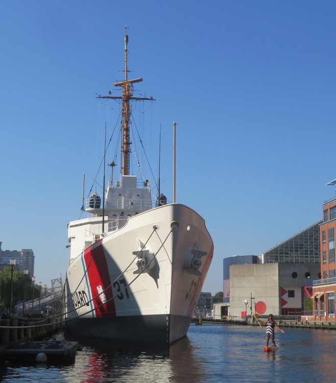
To get to Cutter 37, we had to duck under a low pedestrian bridge. 
Of the visiting ships, we saw training patrol craft YP 698. 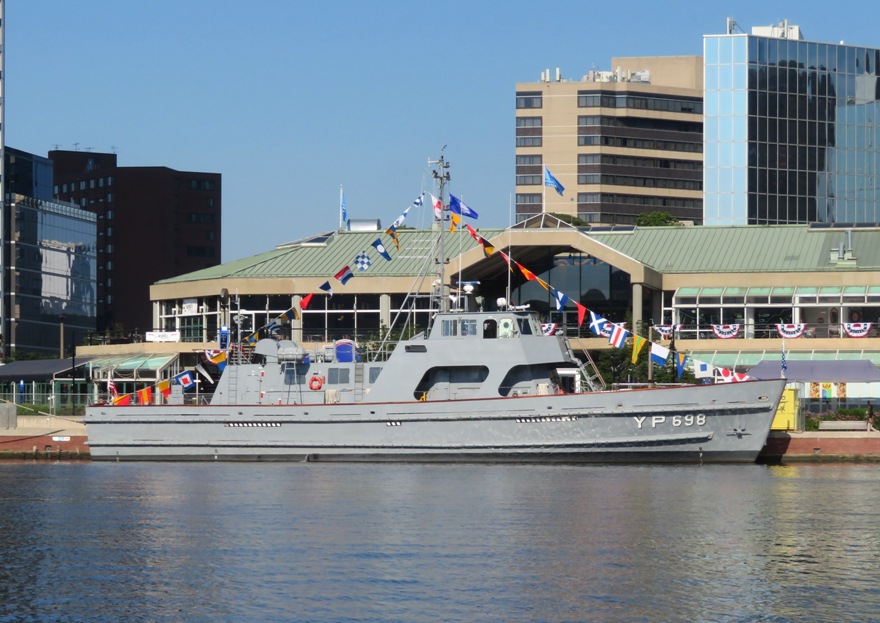
One of the more impressive ships there, in my opinion, was the USS Marinette Littoral Combat Ship, LCS 25. The police didn't want us getting very close. 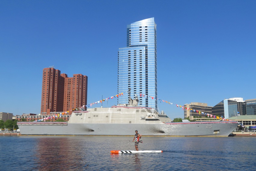
Here's Ellison with the Baltimore skyline in the background. 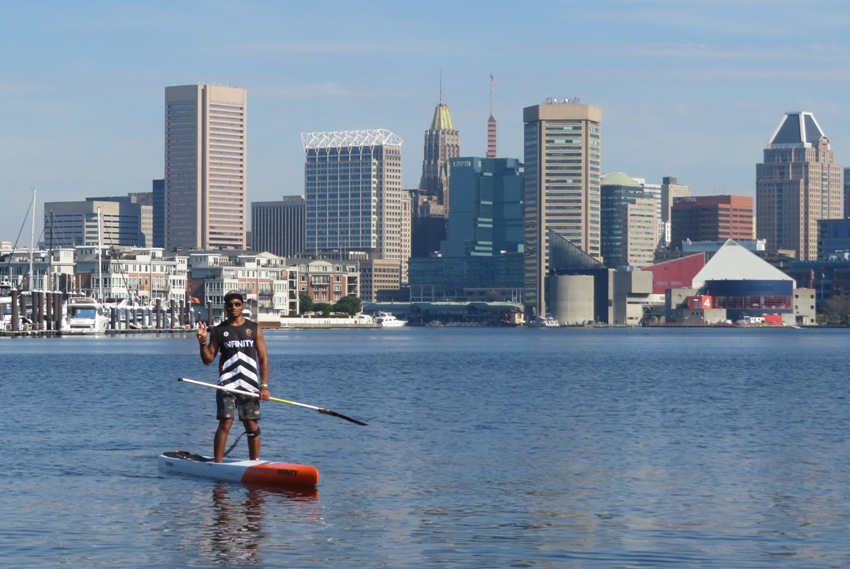
The other impressive ship was the Amphibious Transport Dock ship USS Fort Lauderdale, LPD 28. It is only two years old. 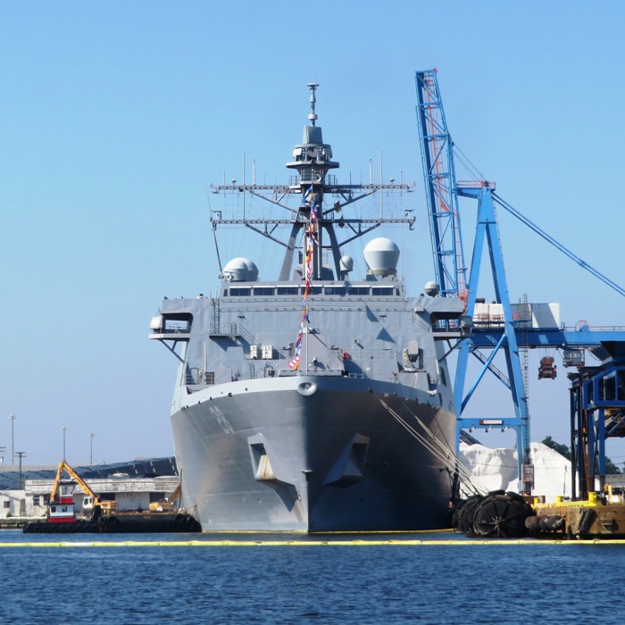
Here's a front starboard view of LPD 28. This is another one that the police monitored closely. 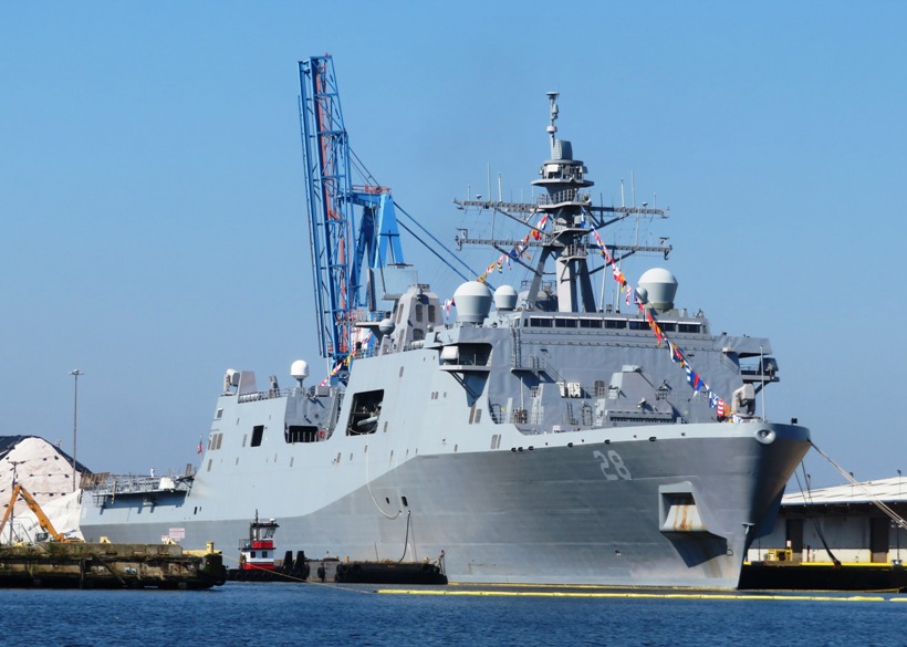
After paddling 6.4 miles, Ellison and I parted. Then I took Daphne for a walk in the city along the water. We saw various boats. Here's one with double Old Glorys flying. Did I mention that today is Flag Day? 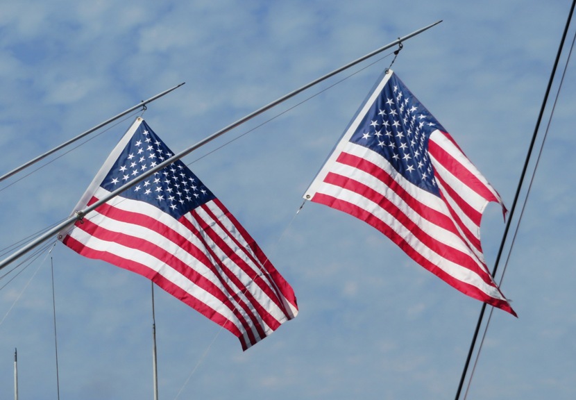
We turned around near the mouth of Harris Creek. Here's Professor Trash Wheel collecting litter that flows out of the creek. 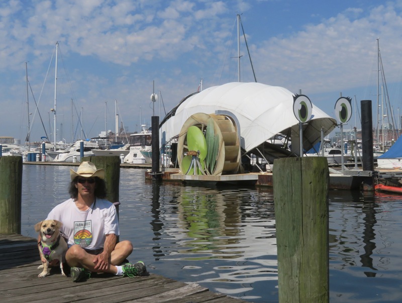
Despite not seeing as many ships as I would have liked, it was still a worthwhile activity. For info and photos from previous Maryland Fleet Weeks, check out Aerial Stunts and Naval Grandeur: Fleet Week Returns to Baltimore in 2022. |
|
Daphne and I launched at Greensboro Boat Ramp to put in on the upper Choptank River. I've put in here quite a bit since 2006 and was shocked to see a sign that read "No pets." No explanation was given. I'd driven over an hour to get there so I figured I'd simply pay the fine if I was given one.
I was really hoping to see some interesting wildlife. Unfortunately, I saw none. But the flora was pretty spectacular. This area has lots of trees and bushes that come right up to the water. We saw lots of swamp roses in bloom. 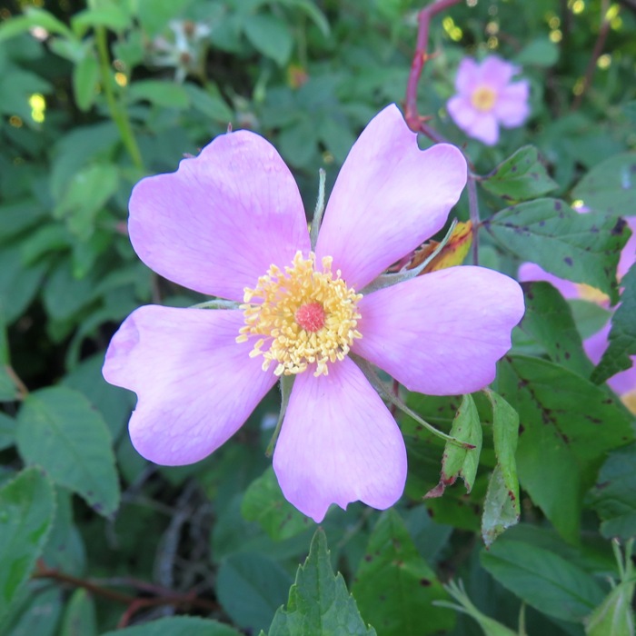
I saw no eagles but I did spot some osprey. 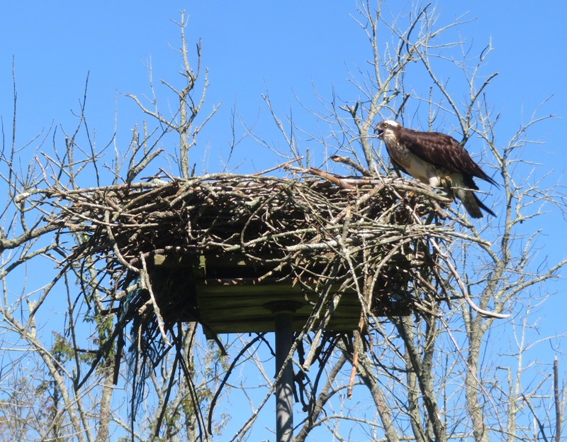
I witnessed that birds not of a feather sometimes stick together. I saw this couple while paddling both downstream and upstream. They stuck together like BFFs. 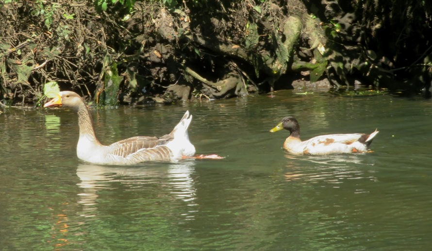
After paddling downstream for a ways, we headed back upstream after the tide bottomed out. Then we continued past the launch site. Here we are at Greensboro Road (route 313). Upstream of this, we encountered lots of deer flies. 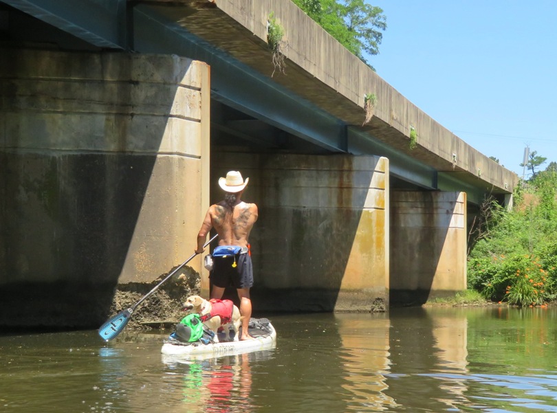
We made it 1.15 miles upstream of the launch site for a total trip of 11.4 miles. Here's our route. 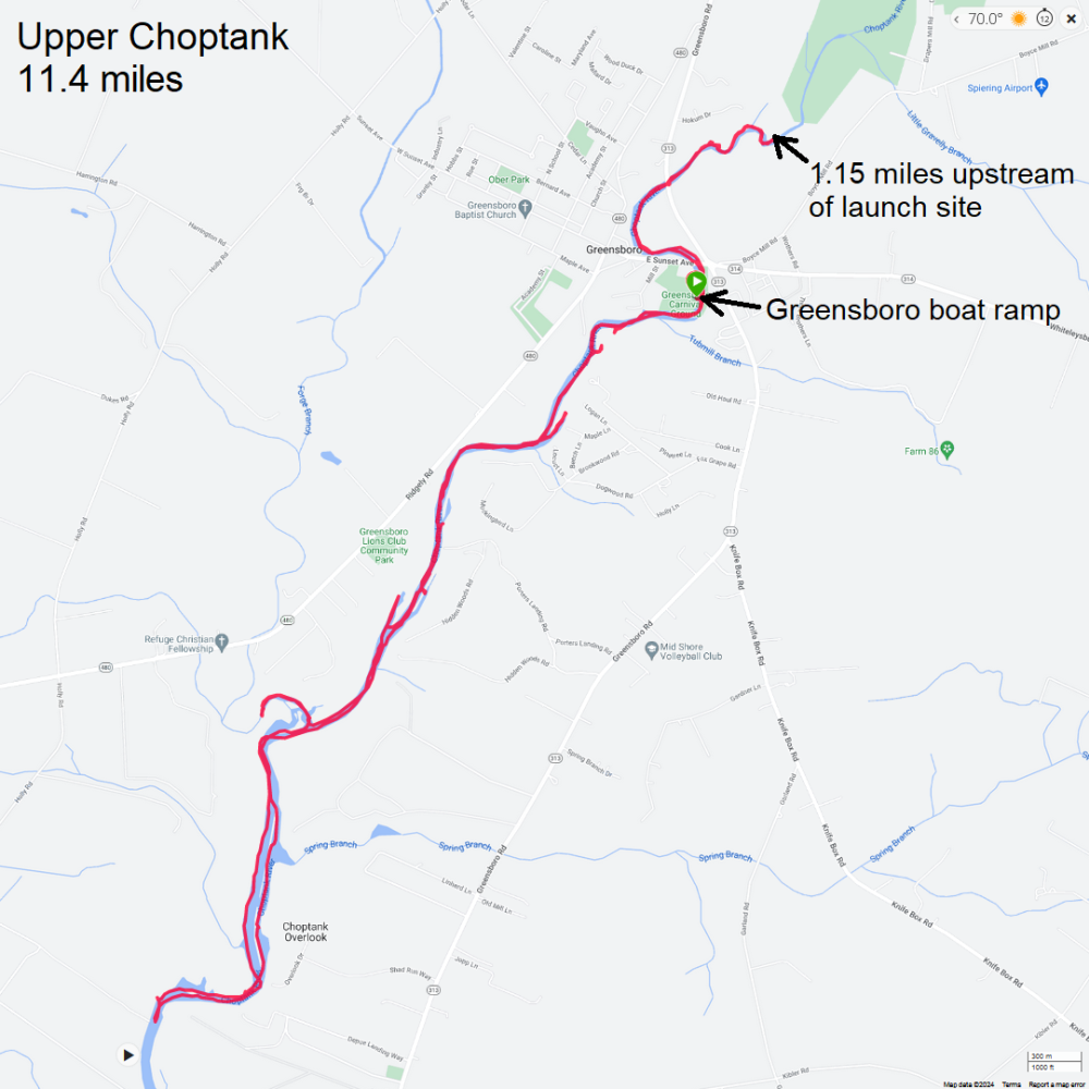
The drive home sucked. I was reminded why I avoid the eastern shore on summer weekends. |
|
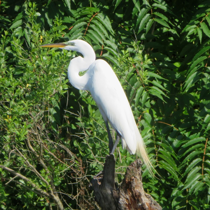
Daphne and I launched from Solleys Cove and paddled up as far as I could on Marley Creek.
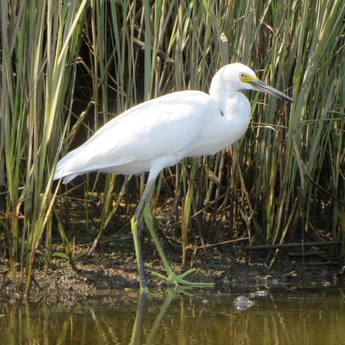
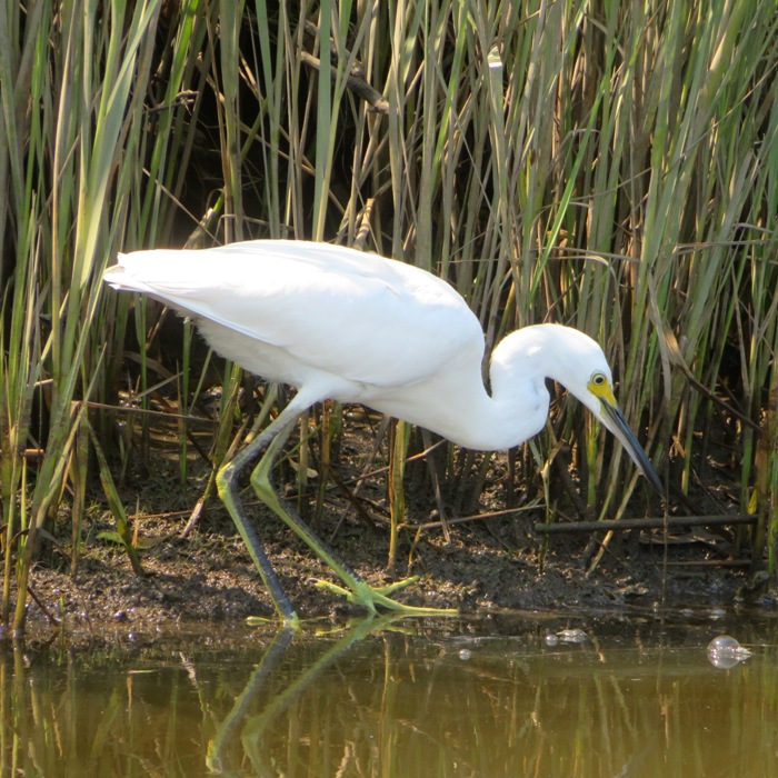
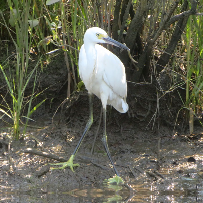
We saw a couple of bald eagles and plenty of great egrets. I got us upstream of the big pipe that crosses the creek. Around here, we saw plenty of mimosa flowers. 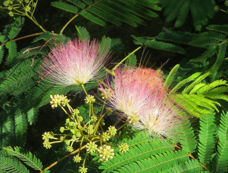
The area upstream of Arundel Expressway (highway 10) was lush with greenery that came up to the waters edge. 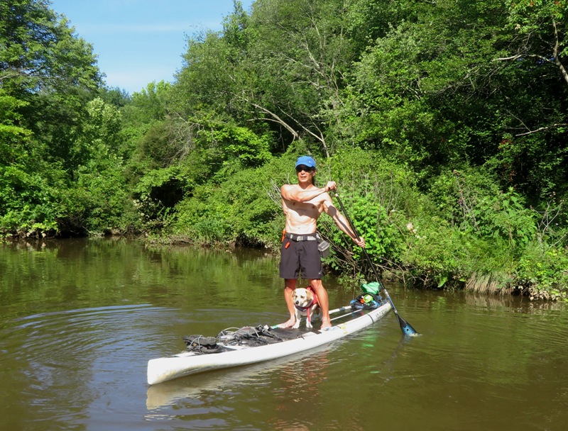
I've called this area "muskrat alley" because I see so many. Today was no different. 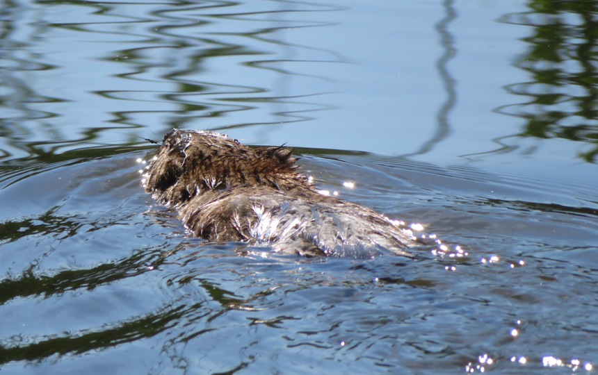
We pulled ashore at a sandy area. I studied some raccoon footprints. 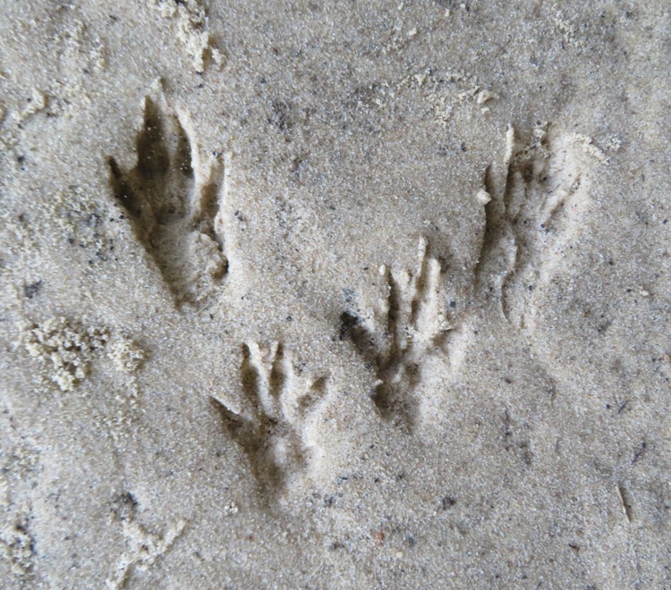
Just south of where I launched was American Legion Post 277. Here I spoke to some Home Depot employees that were fixing up the building. 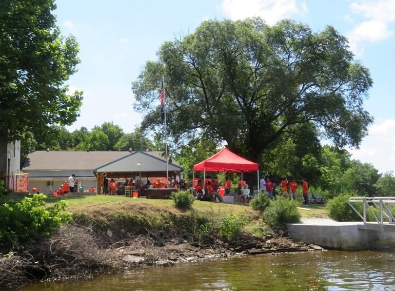
Continuing upstream, I took a look at the USCGC Steadfast (WMEC-623) and USCGC Decisive (WMEC-629). These are Coast Guard medium endurance cutters. 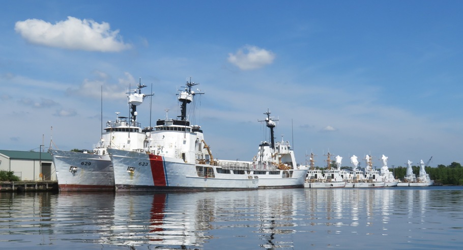
Back home, I spent the afternoon volunteering at my town's Juneteenth festival. It was a good day. |
|
Daphne and I launched from Patuxent Wetlands Park onto the Patuxent River near high tide.
I saw two muskrats, a bald eagle, a green heron, and the obligatory turtles, great blue herons, and ospreys. For the picture below, in addition to the muskrat, I managed to inadvertently capture what I think is a red dragonfly in flight. 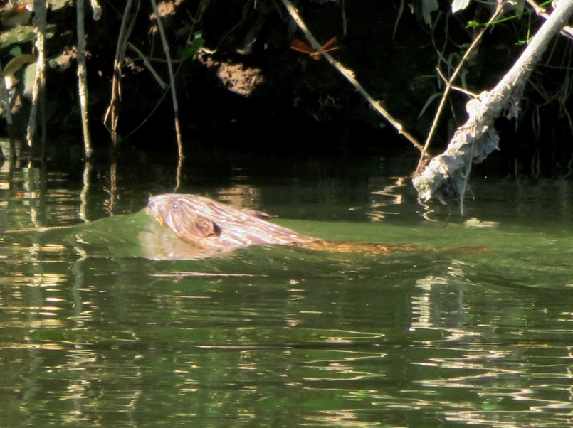
Hanging above the water, some paw paw fruit was starting to get big. 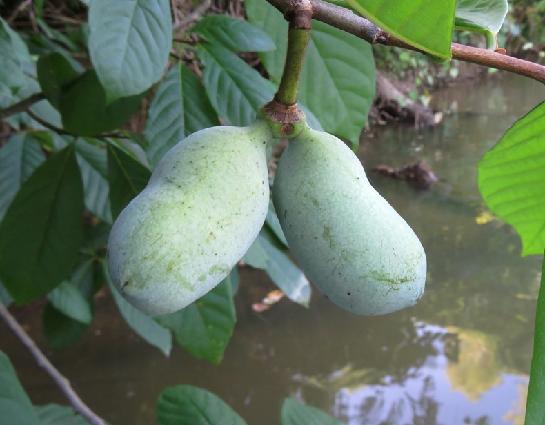
I paddled up the river and turned around at some powerlines. The scenery was nice with all the trees at the waters edge, but after awhile, it all started looking the same. Just east of the launch site, I had a nice view of the narrow, spatterdock-lined waterway. 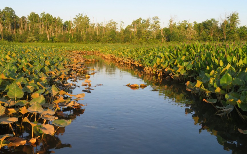
Here's a spatterdock flower. 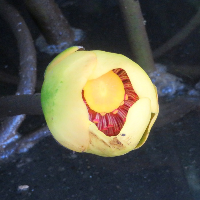
This is my shadow in the low sun against the pickerelweed. 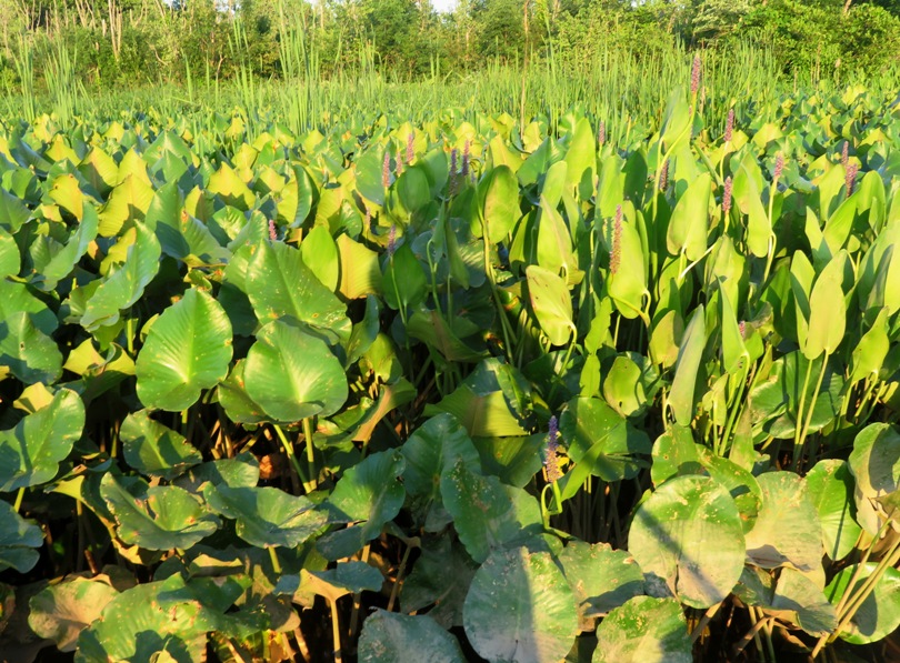
We managed to get 3.3 miles upstream for a total trip of 8.6 miles. 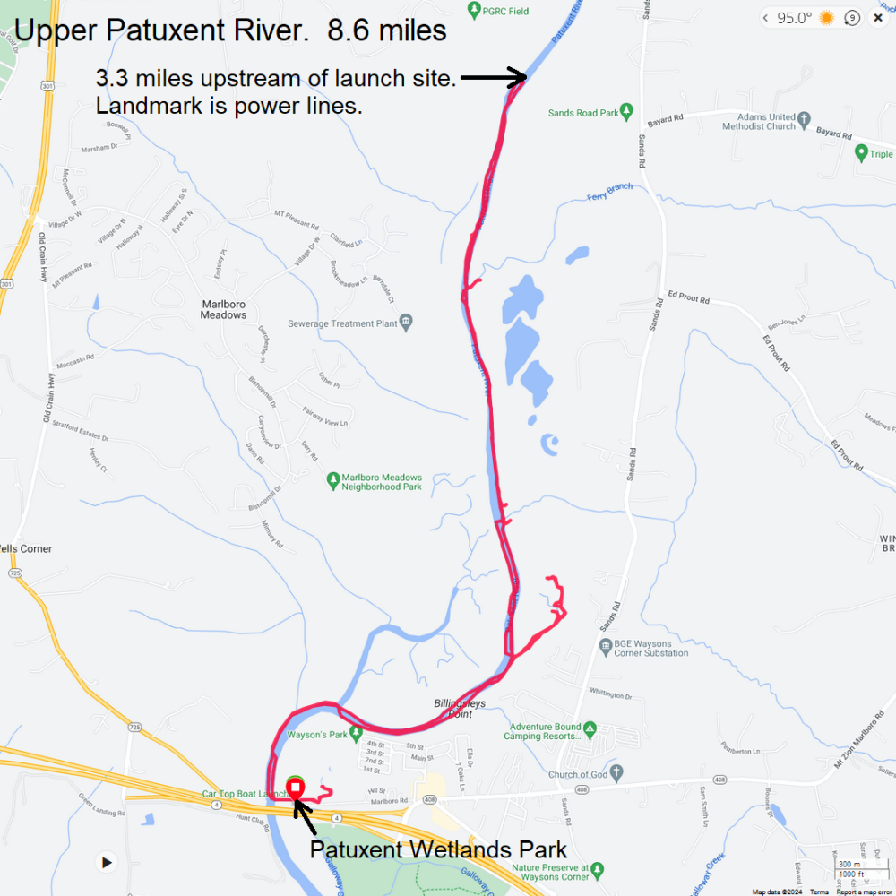
There wasn't any place to take Daphne for a nice walk around the launch site so on the way home, we stopped at the Canter Farms neighborhood in Gambrills. I have a friend who lives there so I know the area. There are nice trees, sidewalks, and very little traffic so it is a good place to take a four-footed friend for a stroll. |
|
Norma, Daphne and I stayed at a vacation house on the Rappahannock River. During our time there, we kayaked on the Mattaponi River on July 4, 2024 and then Menokin Bay on July 5, 2024.
|
|
Daphne, Sara, and I launched from Spriggs Farm Park. We were on the water by 0720. the wind was about two miles per hour.
I spotted a snake swimming. 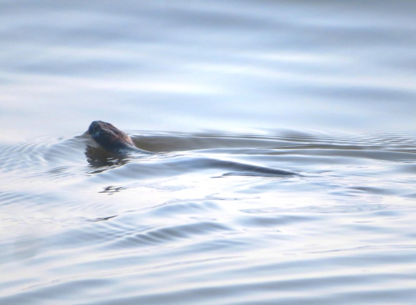
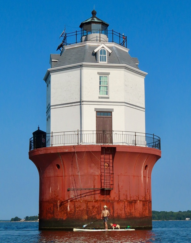
We paddled east on the Magothy River. The heat index was ~87 degrees and we were heading into the sun. I made sure to dunk Daphne before we got started. As we approached Mountain Point, we could see our destination ahead...the lighthouse. A cargo ship passed behind it, creating the illusion that they might collide. 
Here we are at the Baltimore Lighthouse. On May 20, 1964 the Baltimore Light became the first and only lighthouse powered by nuclear energy. Two years later the reactor was removed, and a conventional electric generator was installed. Today the lighthouse is operated by solar power. - from Chesapeake Chapter, United States Lighthouse Society - Baltimore Harbor Lighthouse On the left side of the lighthouse is what looks like a phone booth. Just outside on the gallery, a cast-iron structure resembling a guard shack was cantilevered over the water to serve as the station's privy. - from Baltimore Lighthouse 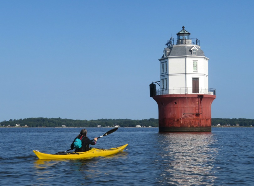
Here's a view of Sara looking south towards the Chesapeake Bay Bridge. If you look closely, you can see the Sandy Point Shoal Lighthouse on the left. 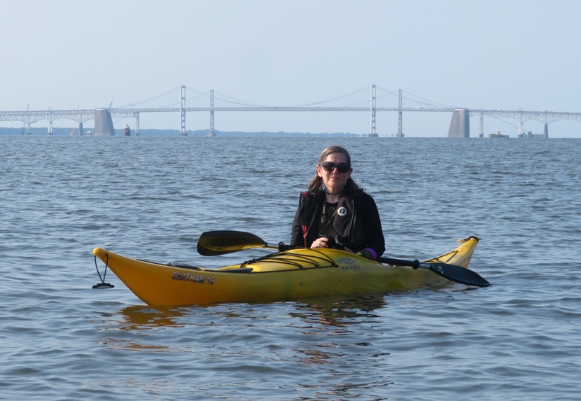
The water was a perfect temperature for a hot day. Sara and I soaked our legs while Daphne got a full Baptist-style dunking. 
On the return trip, the heat index climbed to ~95 degrees. But it was more comfortable because we now had a refreshing breeze of six miles per hour and the sun to our backs. Sara and I paddled 8.8 miles. Here's our route. 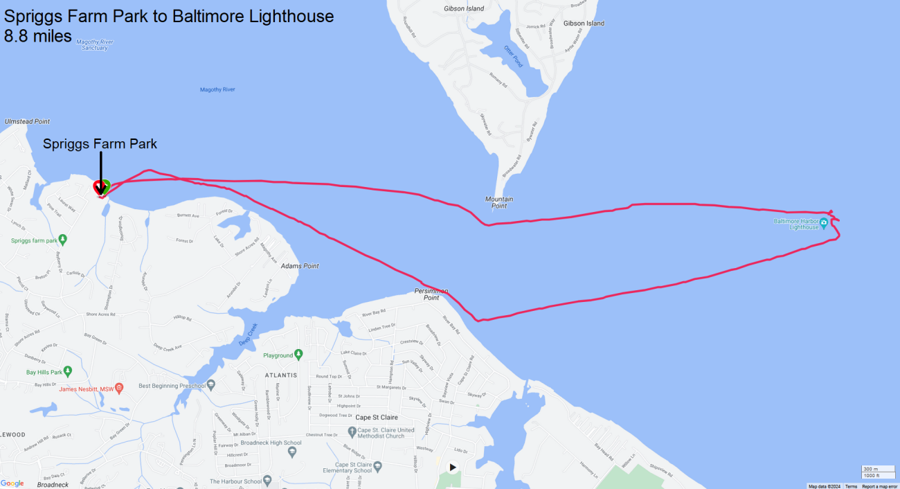
We were off the water by 1010. The heat index was already 98 degrees and it was forecast to reach 106 degrees. Good to be done before it got hotter. |
|
I joined the WatersEdge Kayak Club for some group kayaking at Smith Island, Maryland on July 19-21, 2024.
|
|
Around 0730, Norma, Daphne, and I launched from the outer boat ramp at Rocky Point Park. I picked our route because the wind was extremely calm so we'd be able to paddle places that would normally be much rougher.
We made out way out to the Chesapeake Bay and then headed southwest to Black Marsh Natural Area. Norma saw a snake swimming in the water. This is a great place to visit and see wildlife but not in the middle of summer. It was extremely overgrown and difficult to get around. Best to return in the early spring. 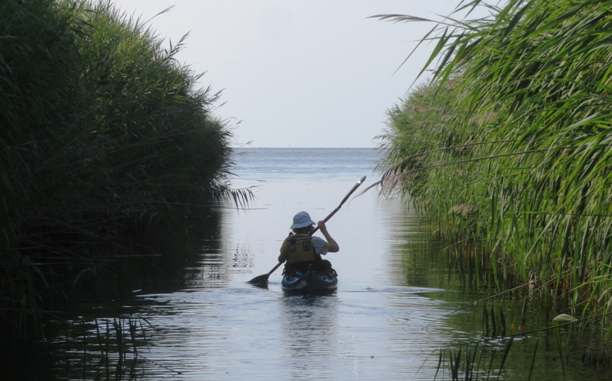
Near the mouth of Black Marsh, we could see the concrete ships at North Point State Park and the Craighill Channel Lower Range Front Light, built in 1873. Paddling northeast, we passed Craighill Channel Lower Range Light Rear (aka Miller's Island Lighthouse). It was constructed in 1873. At 105 feet, this lighthouse is the tallest in Maryland. 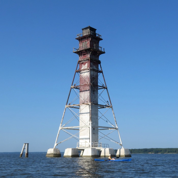
We landed on the south side of Pleasure Island and let Daphne run around on the beach. They have plenty of beaches that I never see being used. There are few things Daphne enjoys more than running on the sand. Here's my SUP and Norma's kayak with the Miller's Island Lighthouse in the background. 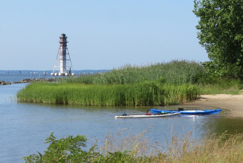
Our next stop was Hart-Miller Island State Park. We pulled into an open area and planned to catch the trails from there but a sign said it was not open to the public. A ranger told us we had to check in at the public beach. Unlike most other islands in Maryland that are eroding/sinking, Hart-Miller Island is growing due to dredged material being brought in. A total of 16 million cubic yards were placed in the South Cell from 1984 to 1990. The North Cell is expected to hold ~84 million cubic yards of dredged material. - from information sign titled "Hart-Miller Island Dredged Material Containment Facility" The beach was pretty crowded with lots of power boats anchored nearby. We walked to the ranger station where we encountered the rangers seen earlier. They were extremely friendly and helpful. The place had a real restroom and snack bar. They gave Daphne a bowl of water with ice. Nearby, I found this feather. 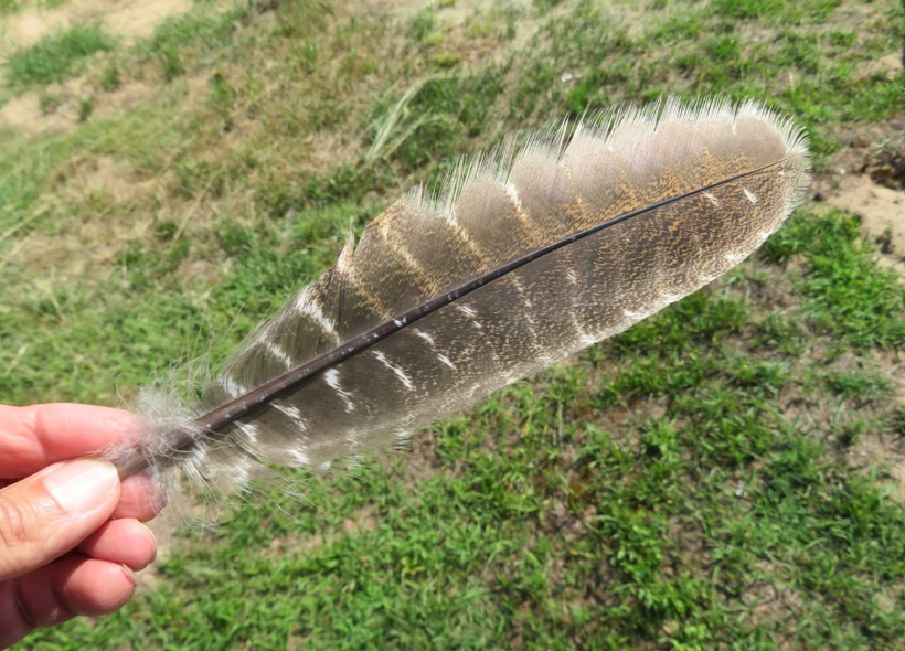
The three of us walked on the White, Red, and Blue Trails where were saw the mudflats, water intake pond, possibly a raccoon, several monarch butterflies, and this Fowler's toad. 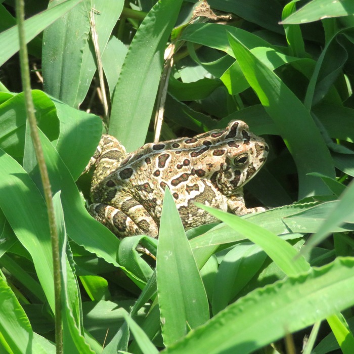
It was really hot and Daphne was pleased that we did not walk further. I didn't find the trails all that interesting. I think this would make a much nicer winter hike, though I wouldn't want to paddle out here in the winter. Some people rented bicycles at the ranger station. If we didn't have Daphne with us, that would have been an ideal mode of transportation since so many of the trails are wide and gravel-packed. On the trail, I found these solid gold (colored) nuggets. 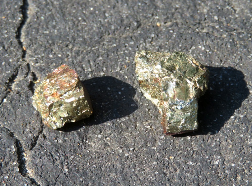
Back on the water, the wind was still fairly calm but there was a tremendous amount of power boat traffic so it was a little rough on the return trip. We paddled about 8.2 miles that day. 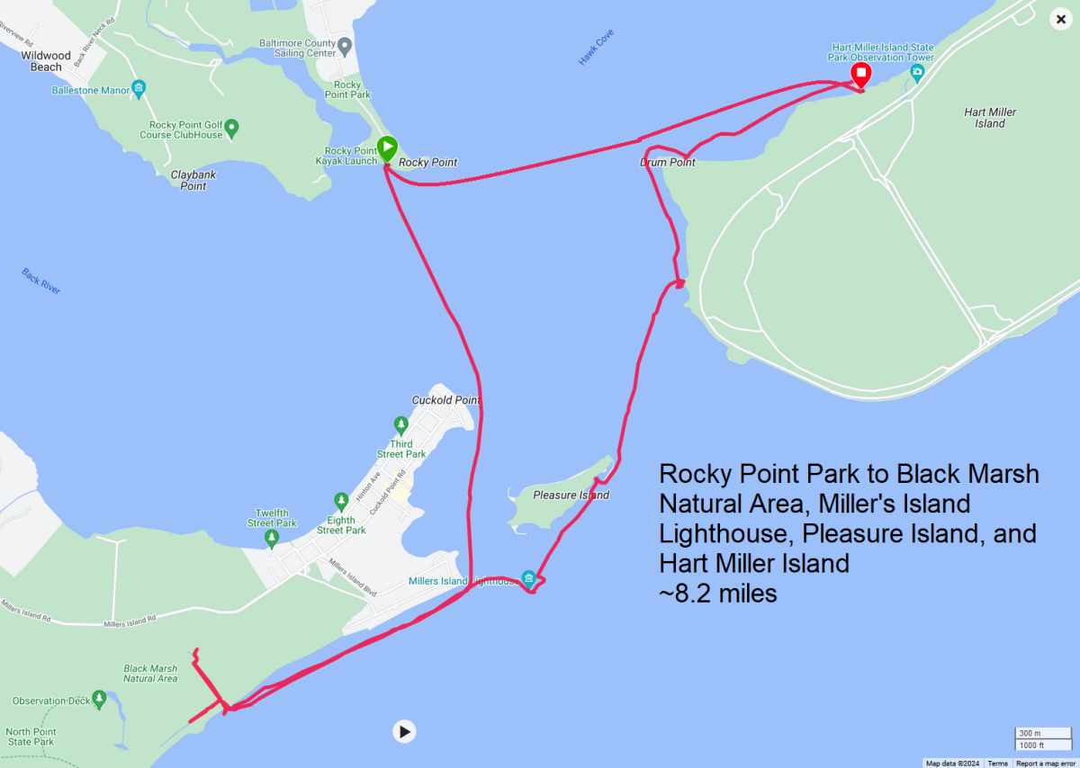
|
|
Norma, her nephew, and I did an organized canoe trip at Jug Bay Wetlands Sanctuary - Proper.
Join archaeologist Drew Webster, from Anne Arundel County’s Cultural Resources Section, in a kayaking expedition to learn about the archaeological and cultural history along the Patuxent River. Drew will share how archaeological sites inform us about past ways of life from early occupations over 10,000 years ago to historic times. - from Archaeology of the Patuxent River: Kayaking through History About 14 of us met at the sanctuary where we were greeted by Deborah and Sue. While receiving a safety briefing, I spotted something at the top corner of the Sanctuary's shed. It was the tail of an eastern fence lizard. 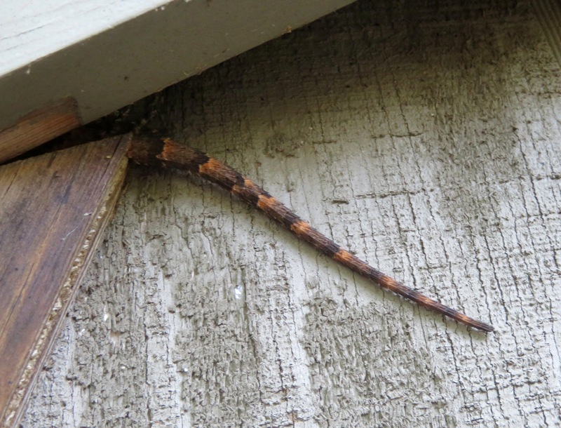
We walked to the west end of the Railroad Bed Trail and then launched onto the Patuxent River. We had quite a lively group. Most were all part of one family which included their significant others. A couple volunteers also joined us. 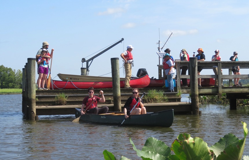
On the former railroad bridge support, I found the exuvia of a dragonfly and the actual dragonfly that emerged next to it. Normally, dragonflies have their wings perpendicular to their body but ones like this which just came out of their old skin hold theirs like a damselfly, with their wings parallel to their body. 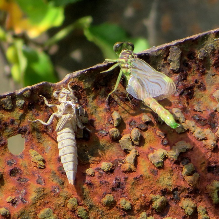
Norma sat in the same canoe as our archaeology trip leader, Drew. Drew was a big guy who sat low in the boat while Norma was perched high above the water. Behind them is spatterdock and wild rice. 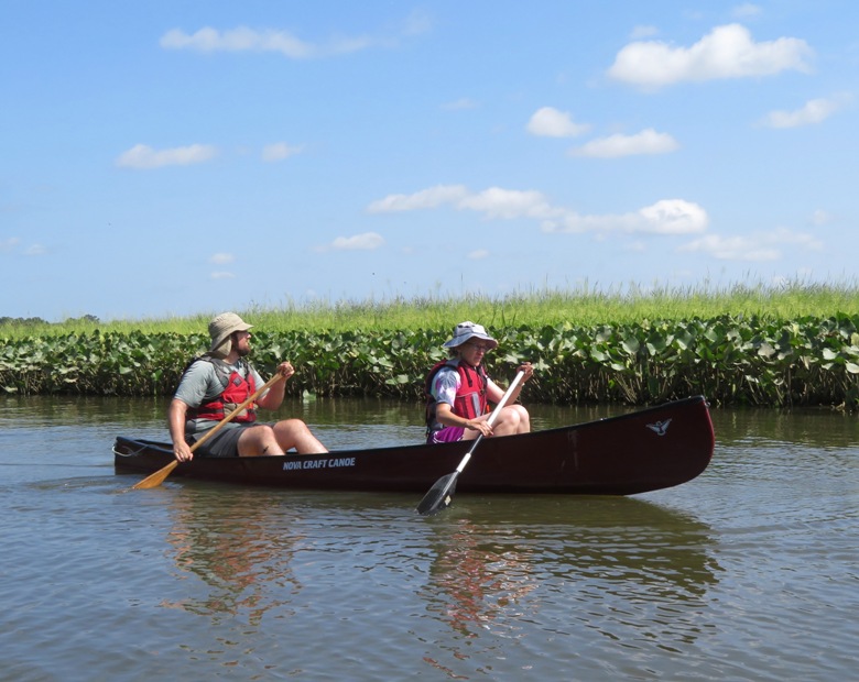
Norma bought her nephew a Jug Bay cap at the visitor center to help keep the sun out of his eyes. It doesn't serve that function well when worn backwards. 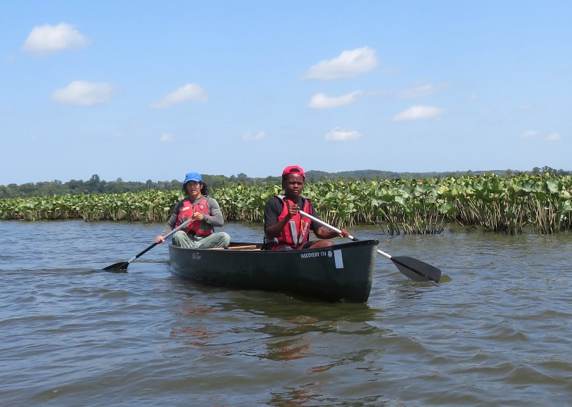
Drew told us about how finds from the Clovis culture date local civilizations back to 13,000 years ago. He also spoke about the Susquehannock and Piscataway tribes. 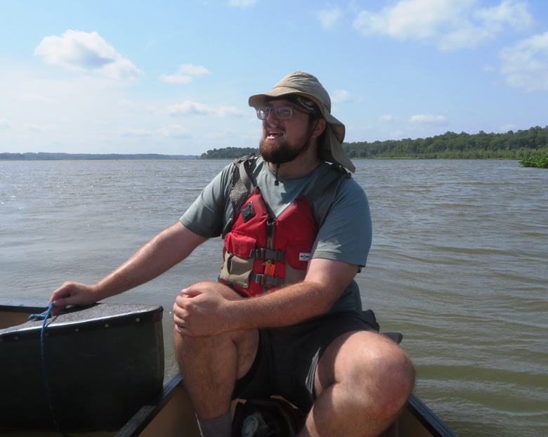
The Susquehannock people lived along the Susquehanna River, which flows from New York through Pennsylvania into Maryland, where it empties into the Chesapeake Bay. A powerful nation, the Susquehannock were a rival of the Piscataway and Patuxent peoples who lived along the western side of the Bay. Villages were constantly under threat of raid by the Susquehannock, being pushed from these territories by their aggression. The Susquehannock were facing aggression themselves from the Haudenosaunee (Five Nation Iroquois) to the north, likely one of the reasons they kept raiding further and further south along the bay. Such fighting between the Piscataway and Susquehannock was largely due to actions taken by the Maryland colonists. - from Clio - Susquehannock Treaty Signing The Susquehannocks were powerful, having aquired firearms which they used against the Piscataway. ...the Maryland General Assembly passed a special tax in 1673 to provide gunpowder to the Susquehannocks. - from Virginia Places - The Susquehannock in Virginia Here's another view of Norma's nephew and me. Behind us is Patuxent River Park which lies on the Prince George's County side of the Patuxent River. 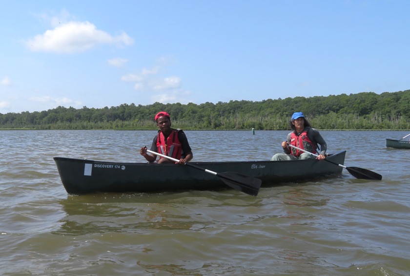
We stopped for lunch at a place called River Farm. Here, I found a cicada exuvia on a tree. Can you see its tiny wings? 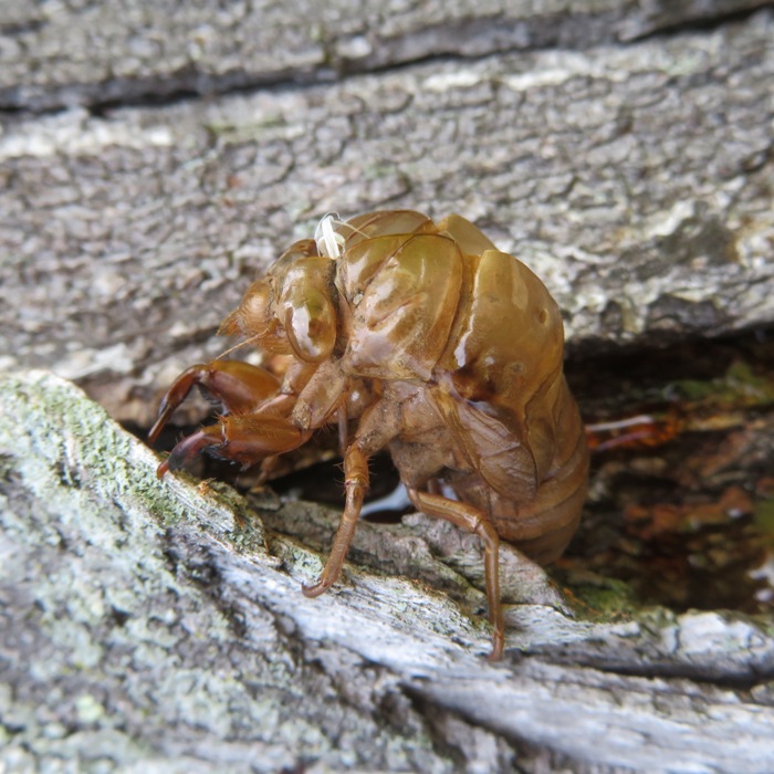
Just a few inches from the cicada exuvia was a green cicada. I believe this is a "dog day" cicada (genus Neotibicen). 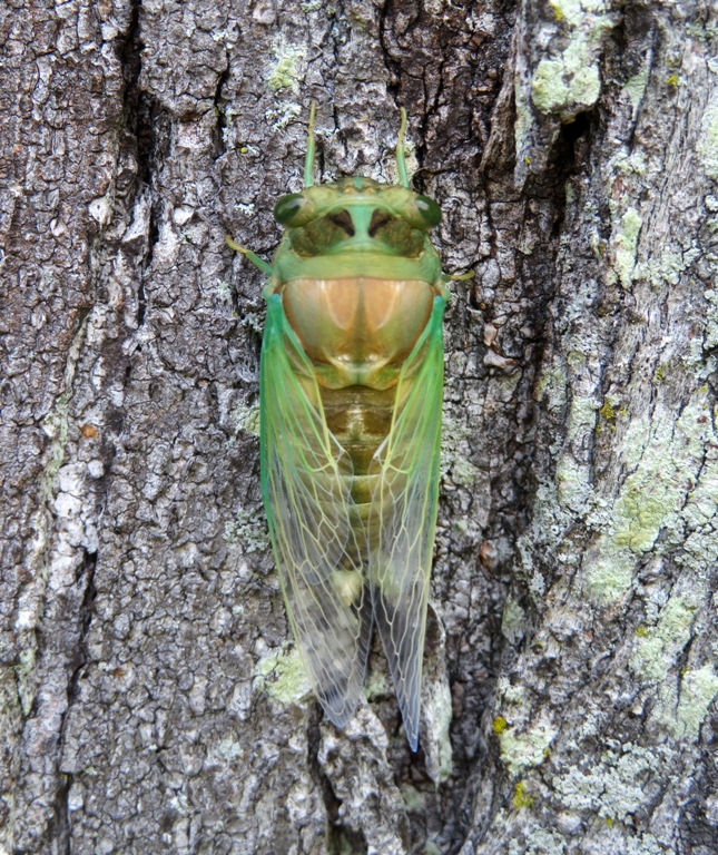
After lunch, we boarded our canoes and paddled back to the launch site. The wind picked up a bit but Sue (left) and Deborah (right) made sure we all made it back safely. Behind them is an osprey platform with camera and weather station. 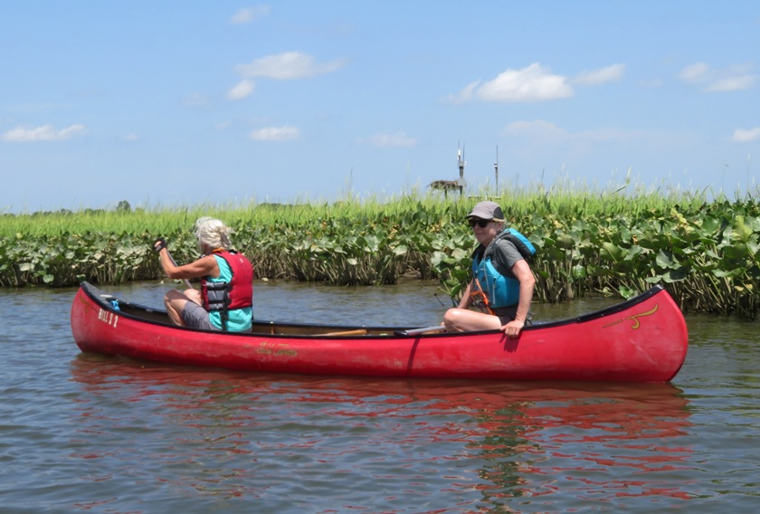
We helped put away the canoes and then walked back to the visitor center where we learned more about archaeology of the area before heading home. |
|
Norma, Daphne, and I stopped in at the North Beach Farmers Market. It is nice, though not as good as the Savage Farmers Market...but of course I am biased.
Our next stop was Chesapeake Paddle Sports. I went to where it was in 2022 but found nothing there. So we called and found they have moved. We drove a short distance to their new location and launched from their floating pier onto Rockhold Creek. 
It was a little after high tide. During the night prior, there were flood warnings. I was hoping this would help us get far upstream but by the time we put in, the water level was back to normal. Lesson learned: flood conditions are brief. Once we got north of the developed section, things got shallow and muddy quickly. Since the tide was still falling, I was not too willing to go very far upstream. For a split second, I thought I saw a river otter, but I'm not certain. I saw what I thought was a snowy egret but once I got home, I realized it was a juvenile little blue heron. Paddling back downstream, Norma and Daphne stopped back at the launch site, having completed 4.5 miles. I continued on. I paddled up Trotts Branch and then Tracys Creek as far as I could. On the latter, I saw about eight green herons. Also on Tracys Creek, I saw a seagull with a crab in its mouth. 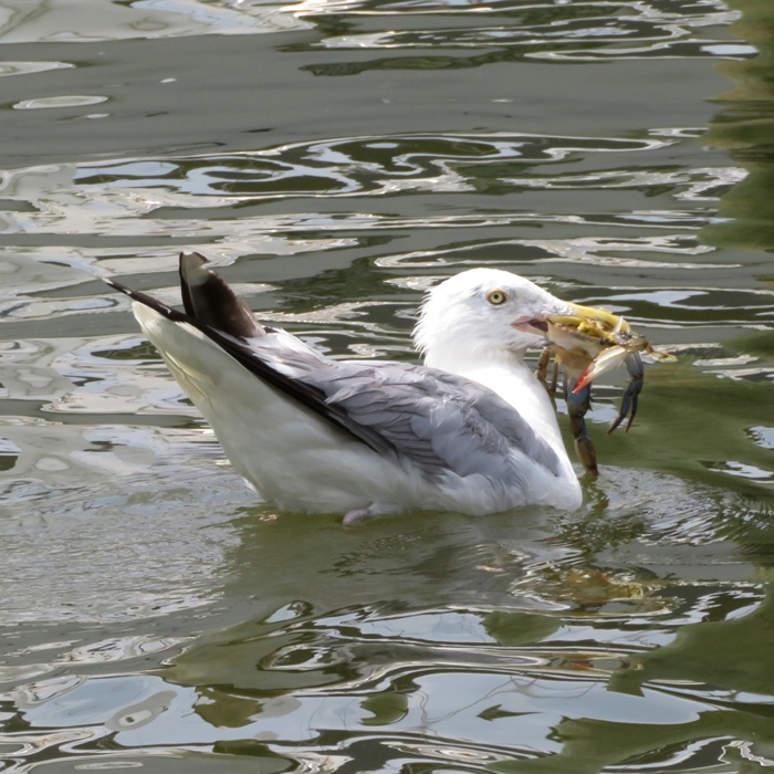
I got in 8.1 miles. Here's my route. 
After paddling, we went out to lunch at South County Cafe before heading home. |
|
Daphne and I launched from Canton Waterfront Park. The goal was to see the "floating wetlands."
The Baltimore attraction plans to open a new exhibit Aug. 9 in the Inner Harbor: a 10,000-square-foot "floating wetlands," an artificial saltmarsh habitat planted in buoyant plastic-fiber mats. By taking up nutrients, the plants help improve water quality in the ecologically troubled harbor. The greenery reintroduces a type of habitat that the harbor long ago lost to development. - from Bay Journal - Baltimore harbor gains "floating wetlands" and a hint of its marshy past 
Thousands of plants on the wetland provide habitat for wildlife. These grasses and shrubs are planted into a porous material that allows water to seep through without adding much extra weight. It also lets the plants' roots draw excess nitrogen directly from the water, promoting water health. - from National Aquarium - Building the Aquarium's Newest Exhibit 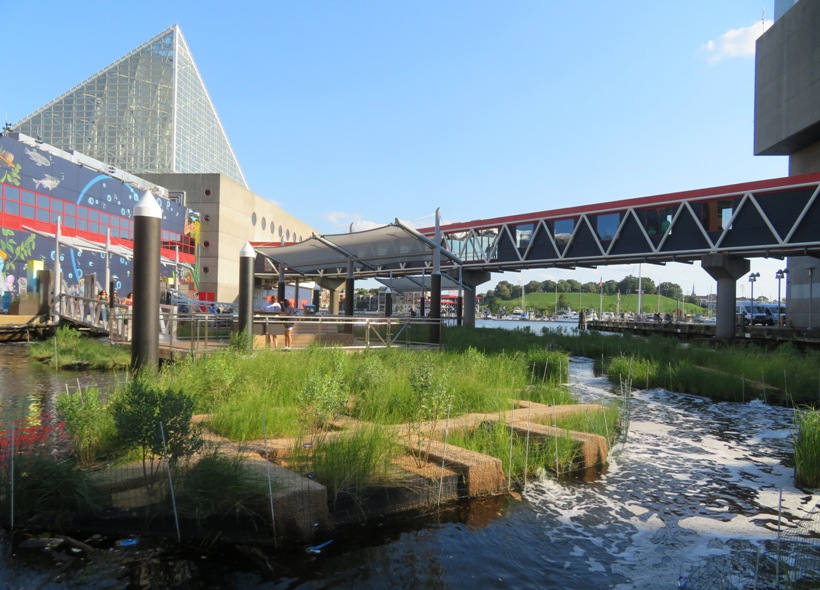
I saw this duck swimming near the floating wetlands. This is just one of a plethora of wildlife that is expected to be drawn to the area. 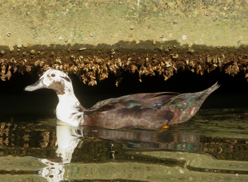
The wetland also has aerators that keep the water moving and add oxygen, promoting healthy water and preventing algal and bacterial blooms that thrive in stagnant water. - from "National Aquarium - Building the Aquarium's Newest Exhibit" 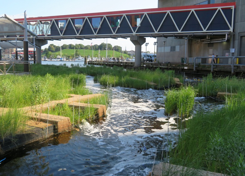
The goal is to bring the natural Chesapeake Bay tidal marsh habitat back to the Inner Harbor, help clean the water and inspire those who pass it. - from Maryland Matters - Floating Wetlands Planned for Inner Harbor to Revive Urban Ecosystems, Clean Water 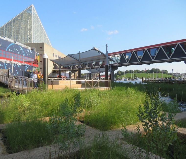
I spotted this crab which had taken refuge at the floating wetlands. 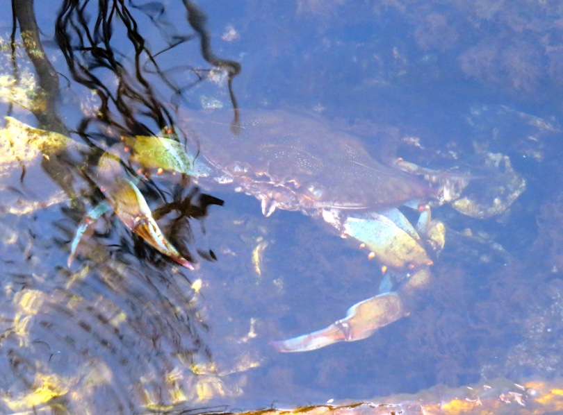
Here's a photo I took when I was paddleboarding at this same location on March 3, 2024. You can see a lot of the construction material laid out for creating the floating wetlands. I had no idea what it was going to be at the time. 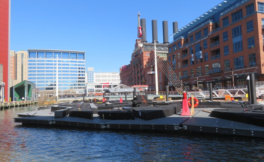
On the return trip, I stopped to see another environmentally friendly structure...Mr. Trash Wheel at the mouth of Jones Falls. 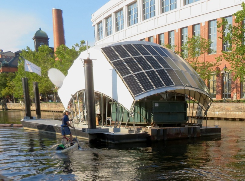
My GPS says I paddled 9.1 miles, much of it against a ~9 mph headwind. In the below map of my route, you'll notice a couple really straight sections that cross over land. I'm guessing that's where my GPS lost its signal as I paddled under some houses built on things to raise them above the water. 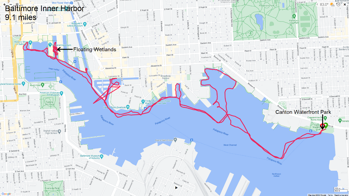
|
|
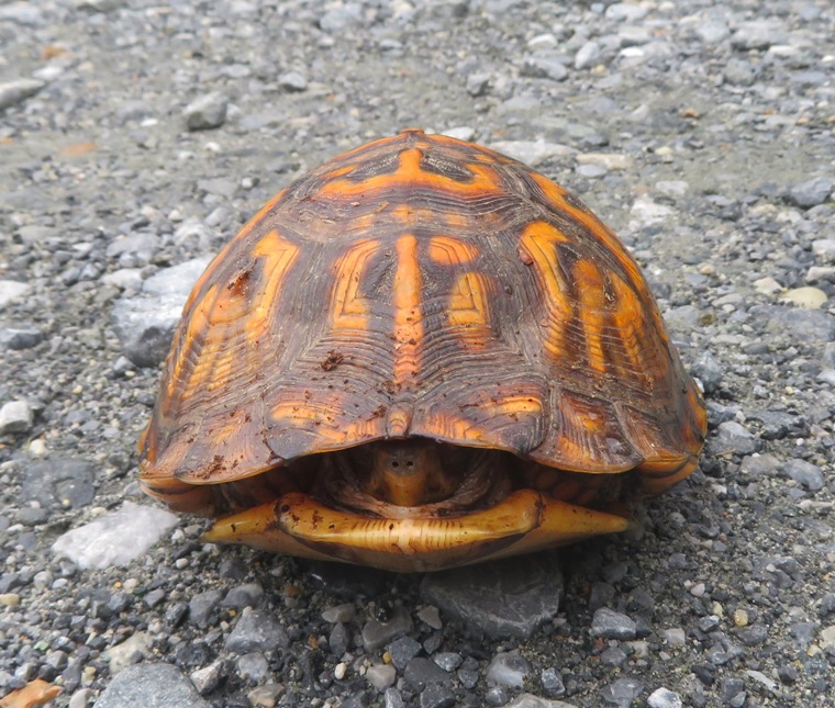
Daphne and I headed out to Mallows Bay. On the gravel road in the park, I saw a box turtle. I moved it off to the side, in the direction it was facing.
There was a lot of activity in the park. It looks like there might have been an organized hike taking place. There were also lots of people gathered for a kayak tour with Atlantic Kayak. Paddling near the launch site, I saw some pretty flowers and wild persimmons. You can still see the stigma on these. 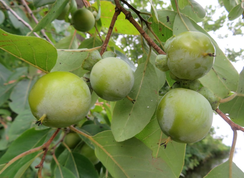
Most of the wild rice seeds were gone but I managed to find some plants bearing seeds on a narrow creek. 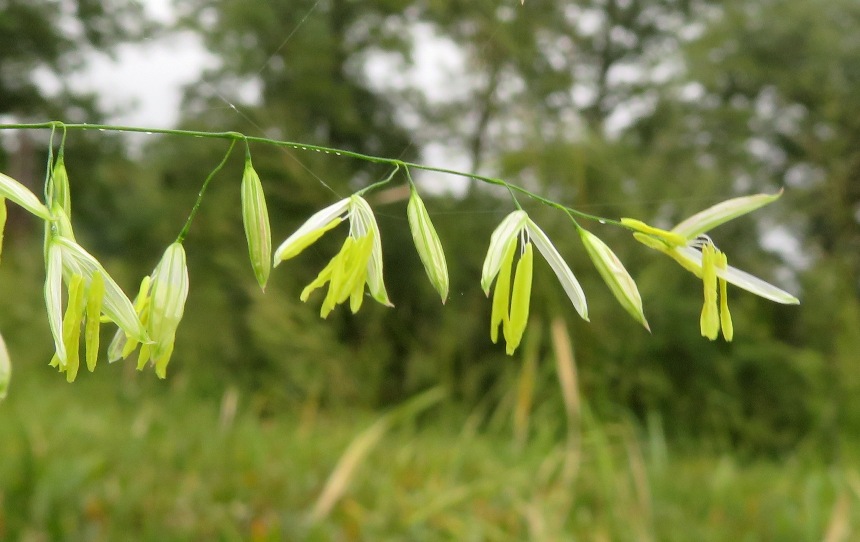
Making my way upstream on an unnamed creek, I saw some sizeable paw paw fruit. 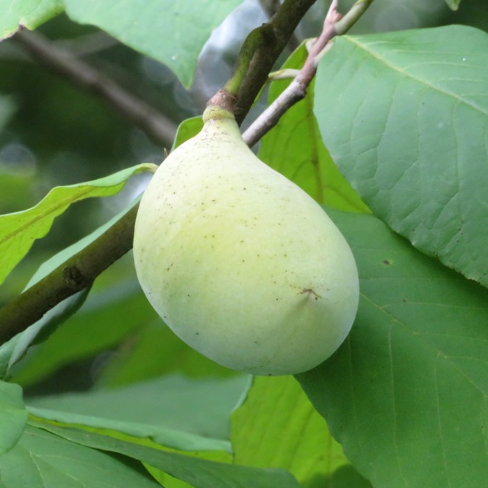
In the Potomac River, I paddled downstream, making a few stops to scout for new places to search for shark teeth. I did find some teeth here and there but nothing as good as my favorite location. Lots of bald eagles were out...too many to count. 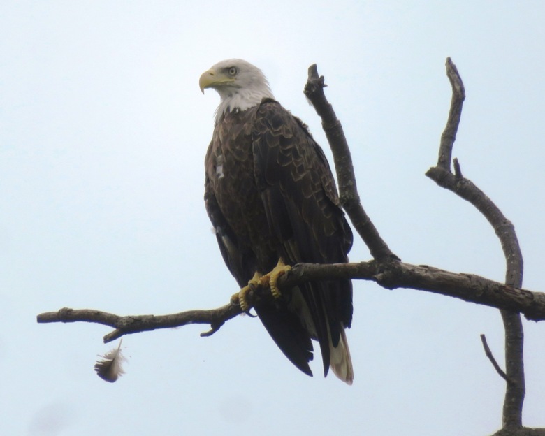
We reached our destination, a secret oasis of shark teeth. I searched from roughly 1115 to 1305 and found numerous teeth, along with other fossils. I don't count them until I get home because it is like Kenny Rogers says, There'll be time enough for countin' When the dealin's done Daphne mostly sat in the shade on the beach. Low tide was 1243. Normally, I would stay at last an hour after but there was a chance of thunderstorms at 1400 so I headed back early. Here's Daphne and me. 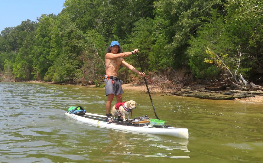
On the return trip, I saw a young bald cypress tree. It seemed out of place. I would expect to see something like this further south along creeks. 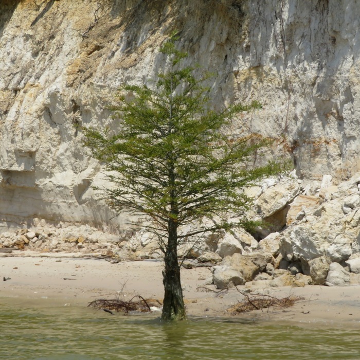
To make sure the tree was indeed what I claimed, I looked at the seed pods...yes, definitely a bald cypress. 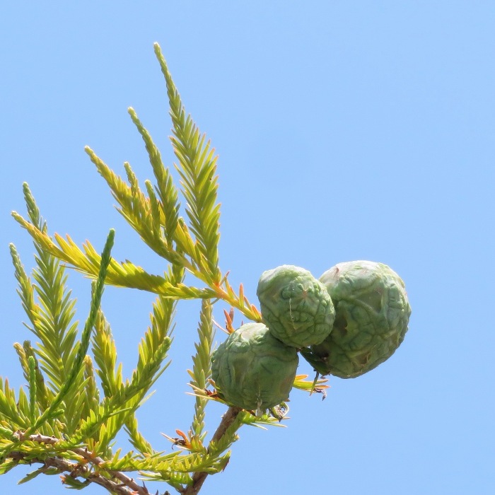
I paddled by the Accomac where I encountered the resident osprey. 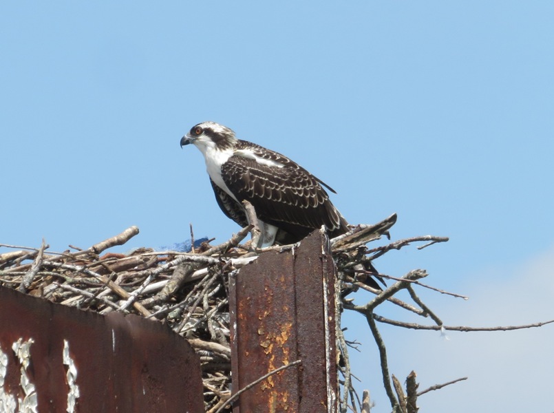
The drive home was slow and mostly uneventful. After putting away my gear, I cleaned off my finds and then photographed them. I found 111 shark teeth and other fossils in about 2.5 hours. 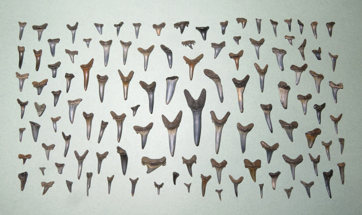
My favorite finds were cow shark teeth. 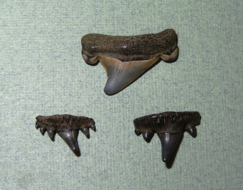
I found some sand shark teeth with "nubbies." 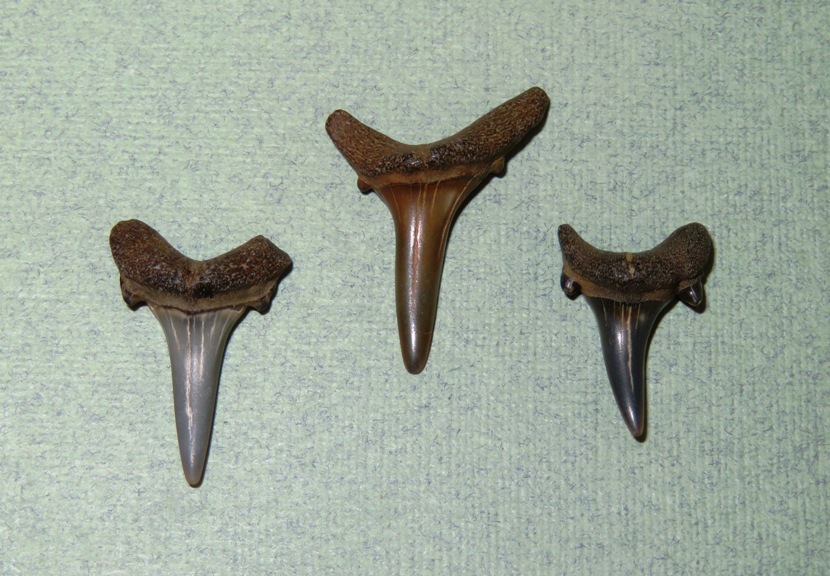
These larger specimens might also be from sand sharks. 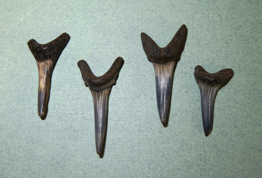
Here are pieces of ray dental palates. 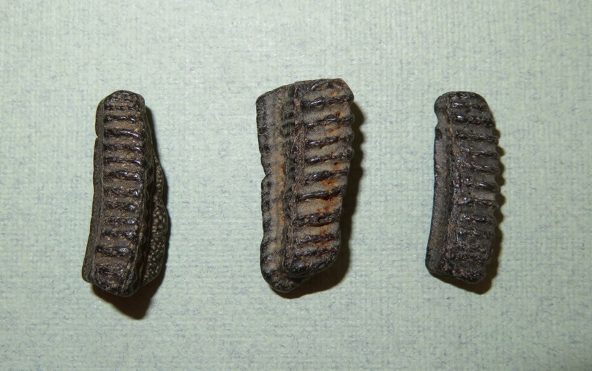
I don't always know what I find. I'm guessing the things below are pieces of fulgurite which are also known as "fossilized lightning." The longest is almost 2.25 inches long. 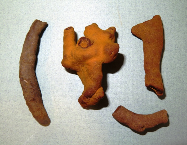
Overall, it was a good day and I'm glad to have gotten out. The rainstorm didn't come until very late that day. |
|
I joined the WatersEdge Kayak Club for some group kayaking at Janes Island, Maryland on August 23-26, 2024.
|
|
During August 31 to September 13, 2024, I did a five day, group kayak trip at the San Juan Islands and also did a little paddling in Seattle. This was in addition to lots of short hikes, museum visits, and exploring.
|