|
This page describes my bicycling adventures in 2023 and 2024. |

|
This page describes my bicycling adventures in 2023 and 2024. |
|
I did a decent amount of biking in 2023 but most of it wasn't what I consider blog-worthy. Unlike paddling, I tend to ride more for exercise than to see stuff. But there were a few trips I did where I took a lot of pictures worth posting.
On this ride, I only did about 23 miles but with wind gusts over 30 mph, it was a bit challenging at times. I saw a lot of things that reminded me that autumn is in the air. If you ordered local free-range turkeys for Thanksgiving, there is a good chance you'll be eating one of these Sho Nuf birds. My pic below is from the most concentrated area...rest assured they have plenty of space to spread their wings. 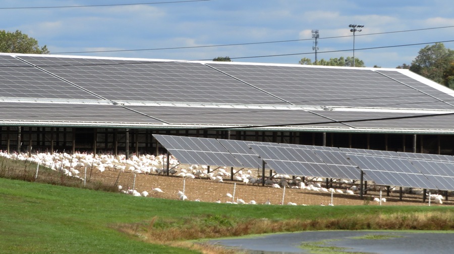
I rode though the upscale community of Maple Lawn, passing by one of their ponds. There were still a few water lilies in bloom...but not for long. 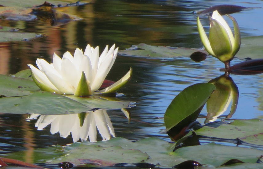
The swamp rose mallow (Hibiscus moscheutos) flowers are no more but their fruit capsules have opened to release seeds. 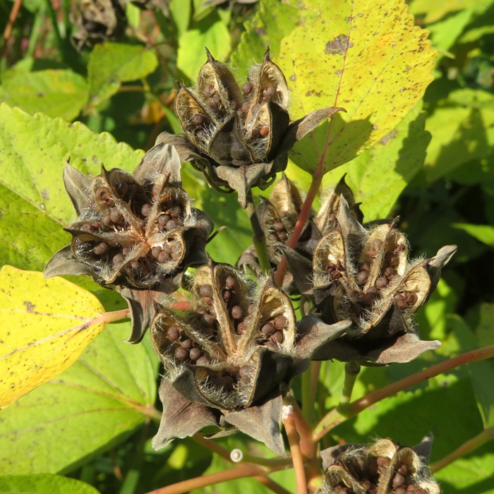
Perhaps this is why Maple Lawn is called that. There are lots of brilliant red-leafed maple trees lining their streets. 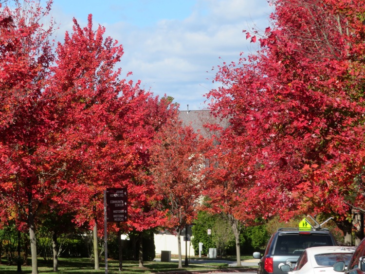
Howard County is not known for its fall colors but if you look, you'll find some. This is along the west side of Murray Hill Road. 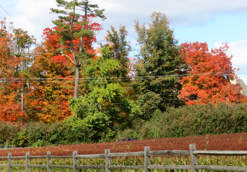
Sorghum is the fifth most-produced grain crop in the world and there is a farm that grows it on the corner of Murray Hill Road and Gorman Road. Right now it is a deep red. 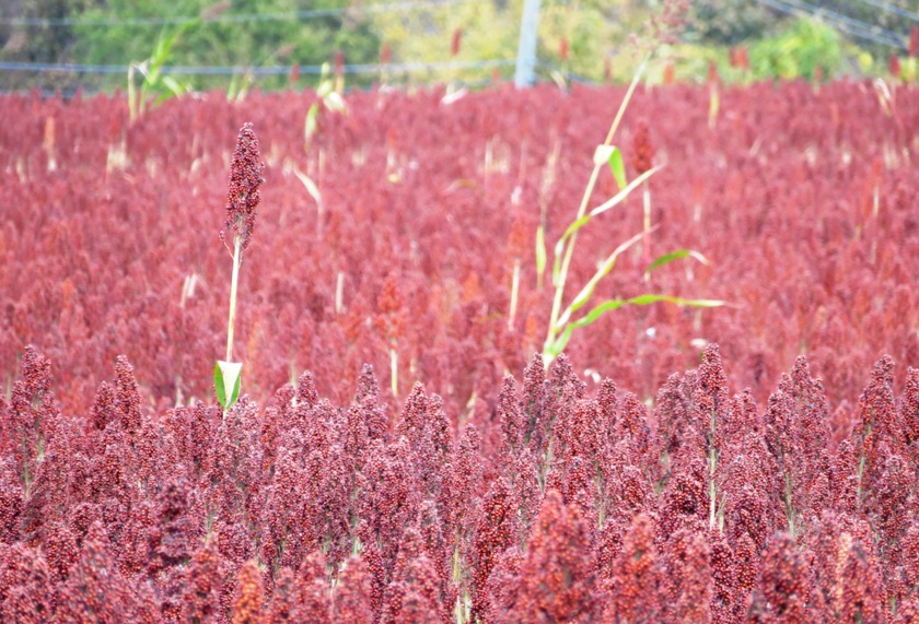
It was a good ride, despite the wind.  |
|
After leading my one mile historic walk in Savage on October 22, my mind was still thinking about local mill history. So this ride was a good one for me. I rode 40 miles from Savage to Patapsco Valley State Park and back. The fall colors were truly stunning that day.
This ride took me through Jessup, Elkridge, Hanover, and Annapolis Junction. But the most scenic part of the ride was definitely the park. Here I am on a stone bridge over Soapstone Branch near Glen Artney Road and Gun Road. 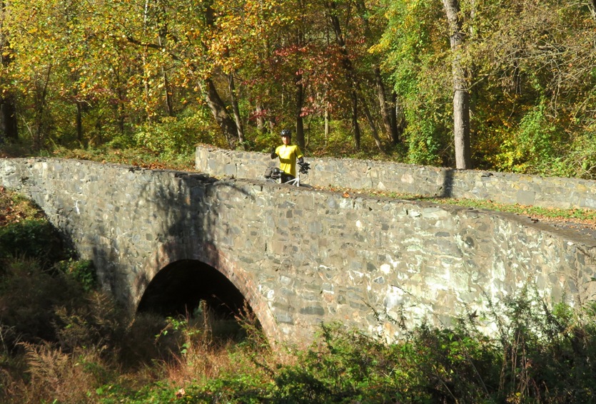
I met Ed, a park employee who was downsizing his collection of paintings. I spoke to him for awhile about the history of the grist mill at Patapsco Valley State Park. 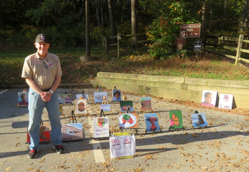
Ed told me about the Orange Grove flourmill of the C.A. Gambrills Manufacturing Company. Built as a modest gristmill in 1856, the mill became the 'largest flour mill east of Minneapolis' by 1900. At its peak the mill produced between 1,200 to 1,500 barrels of flour a day. - from sign on Grist Mill Trail 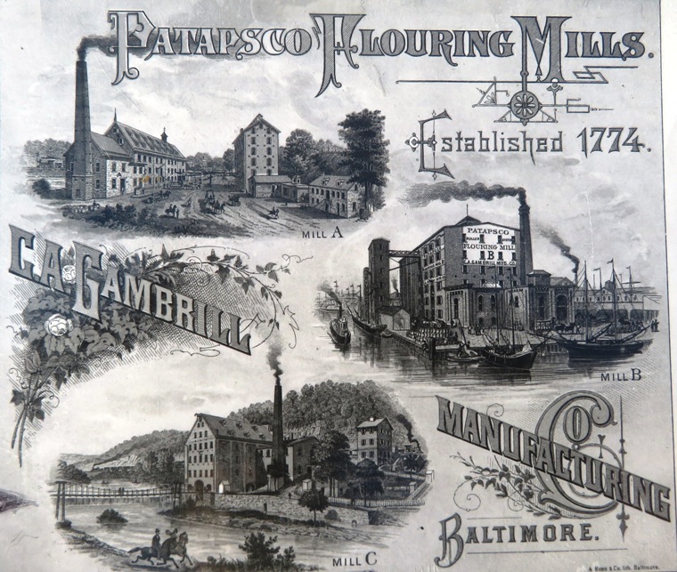
Perched on a hillside between the B&O Railroad and the Patapsco River, the factory complex was ultimately comprised of an eight-story grain elevator, a six-story mill and a powerhouse. The grain elevator stored wheat and used gravity to feed grain into the mill's "rollers." The rollers ground the wheat into flour. The flour was then "bolted" (or cleaned) and packed and loaded into boxcars. - from sign on Grist Mill Trail 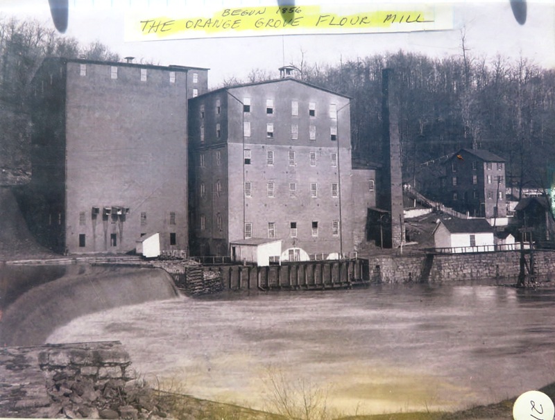
Beginning in 1872, a stationary steam engine powered the mill. Railroad hopper cars dropped coal into the powerhouse through the shoot that is still visible at the top of the hill. - from sign on Grist Mill Trail I believe these stone ruins are the remains of the coal shoot. 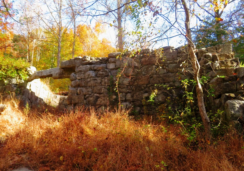
A fire destroyed the mill on May 1, 1905. In addition, most remnants of the mill were destroyed by Hurricane Agnes in 1972. All that is visible today are parts of the stone retaining walls. - from sign on Grist Mill Trail Here's a view looking upstream near where the mill one resided. 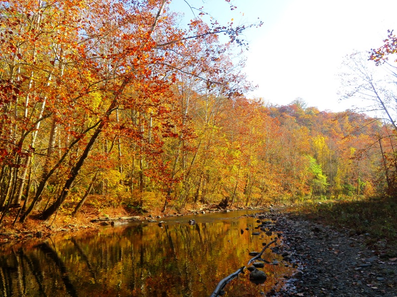
This is the Swinging Bridge at Orange Grove. I would like to see a pedestrian bridge like this connecting the Green Trail at Wincopin with the Savage Mill Trail and the River Trail (east side of the Little Patuxent River). 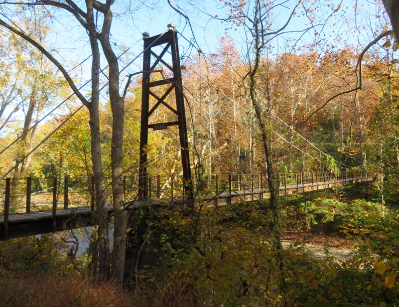
Of course, no visit to the Glen Artney, Orange Grove, Avalon section of Patapsco Valley State Park would be complete without seeing the Thomas Viaduct. Thomas Viaduct was completed in 1835 and is the world's largest multiple arched stone railroad bridge with an arc. - from Maryland DNR - Patapsco Valley State Park - Thomas Viaduct 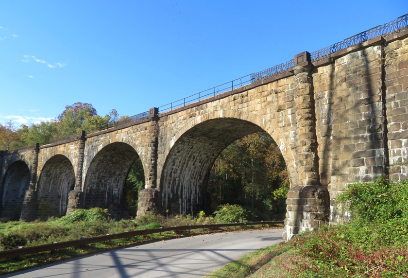
Leaving the park, I took a back road in Elkridge where I saw a cemetery behind Melville Chapel United Methodist Church. 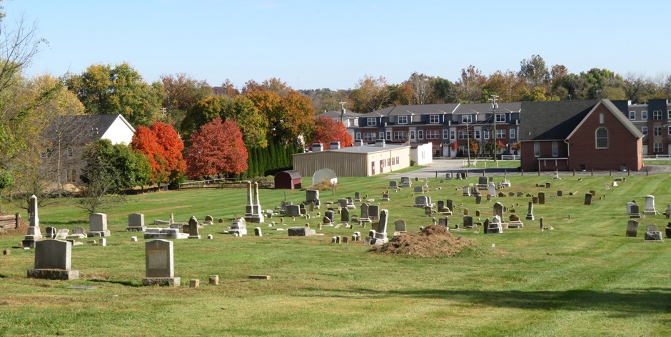
The nicest autumn colors that day were in Annapolis Junction along Corridor Road. Unfortunately, the sun wasn't shining as brightly in the afternoon as it was in the morning. 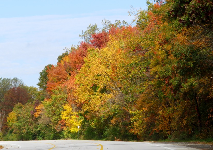
Here is my route. It includes 2200 feet of total ascent. 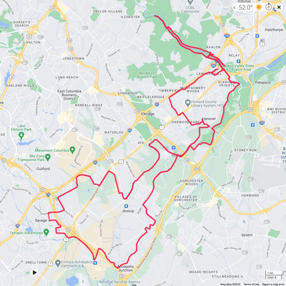
|
|
After spending the last several weeks working hard on a major home renovation, I took time to enjoy the outdoors and celebrated Presidents' Day by bicycling 77 miles in Dorchester County, Maryland. I rode to Taylors Island, Hoopers Island, and Blackwater National Wildlife Refuge. I also stopped at the trailhead for the Tubman Road Trail, near where Harriet Tubman was born.
A few nights prior, I put together a rough draft of my route. I knew this area wouldn't have much traffic so I'd be fine biking anyplace that was paved. I was really wanting to get off the beaten path and do some exploring...seeing stuff that most others do not. I started at the Madison launch site at 0930. The air temperature never got above the mid-40s and there was a slight north wind, but at least it was sunny. I started out and ended wearing four layers above my waist and three below. I also wore mittens and a headband for my ears. Dressed so warmly, I was still a little cold. I should have brought a windbreaker jacket. I biked east on Taylors Island Road (route 16) to Harrisville Road. My plan was to ride south and then come back north on White Marsh Road. Unfortunately, the sign said it was a dead end. Maybe it wasn't so I figured I'd find out for myself. But eventually, the paved section of road ended and things got rougher. I turned around. Back on Taylors Island Road, I biked to Taylors Island. I planned to go as far south as I could but I found that while the roads were paved, the ones heading south were very roughly so. Wanting to get in some serious miles, I figured I'd stick with the smoother areas so I headed north. I saw lots of old churches, many of which appeared to no longer be used. The prettiest one I saw on the island was the Chapel of Ease Old Trinity Episcopal Church, circa 1707. 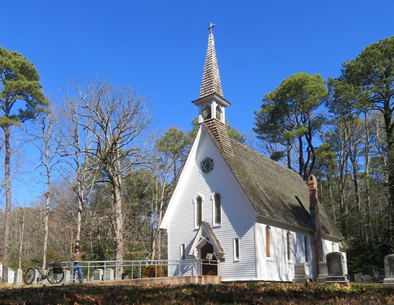
When I ride, I wear a jacket or vest that is very bright, but for these pics, I removed it so it wouldn't detract from the beauty of my surroundings. Maybe I blend in too much? Near the Taylors Island Road (route 16) bridge, I saw a cannon ...captured in 1814 from a tender of the British ship of war "Dauntless." - from "The Becky Phipps" sign 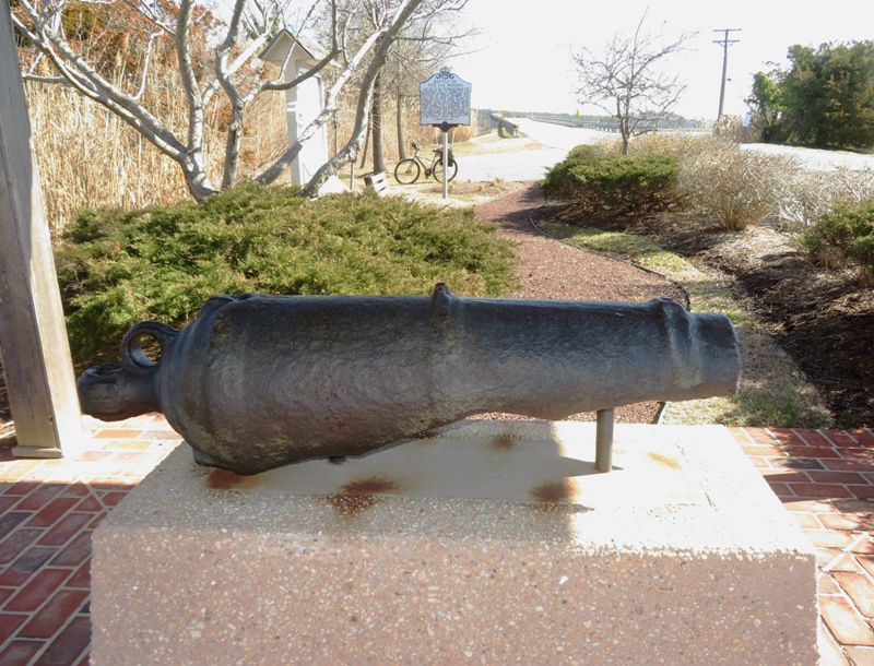
Shortly after leaving the island, I saw the Black-Eyed Susan Riverboat, which until just a few months ago, resided in Snow Hill. 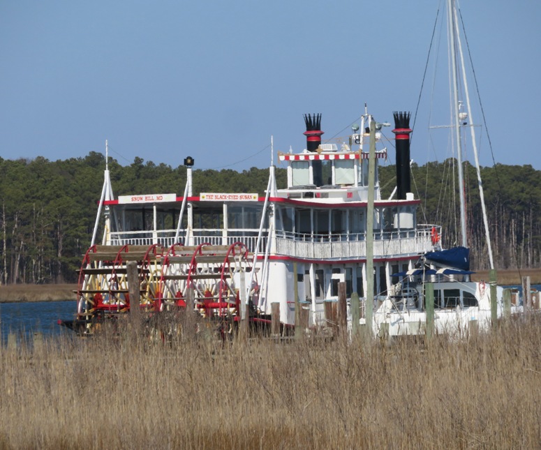
I headed southeast on Smithville Road. On the east, I saw some muskrat mounds, while on the west, I passed the Smithville Cemetery and a church nearby. Founded in 1876 as Jefferson Methodist Episcopal Church, New Revived United Methodist Church was one of five African American congregations established in this vicinity between 1864 and 1880. - from "Family & Faith Connections" sign 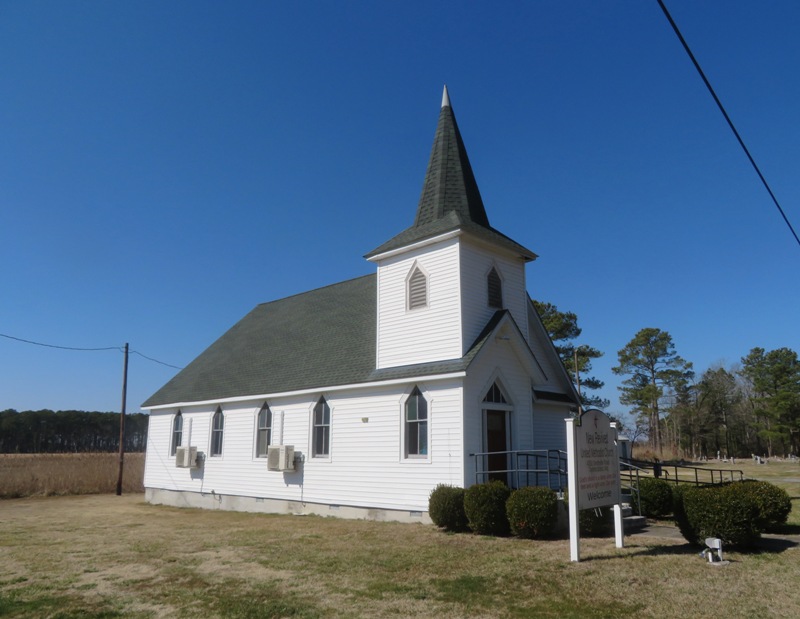
A little further south, I came to another church that was beautifully maintained. This is me at the Oak Grove M.E. Church South, circa 1874. 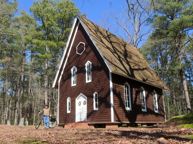
I saw a couple of turkey vultures helping keep the area tidy. 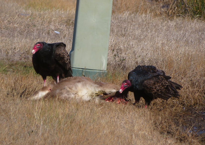
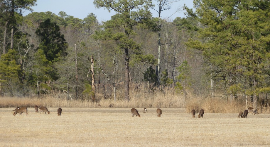
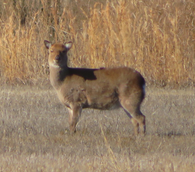
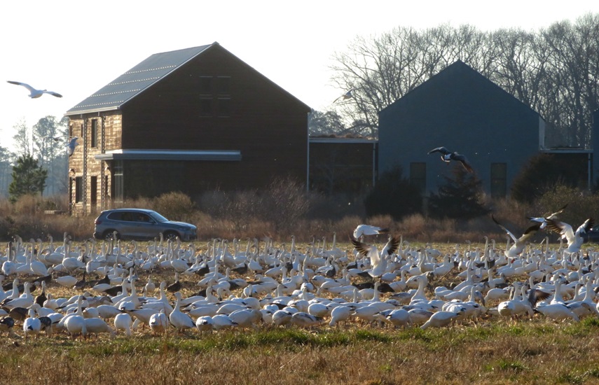
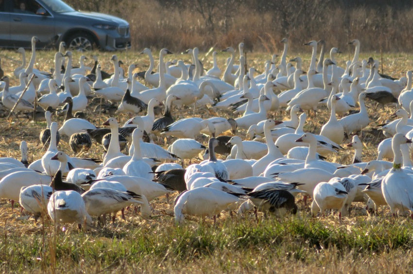
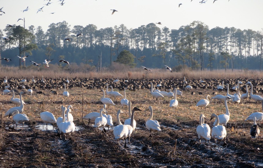
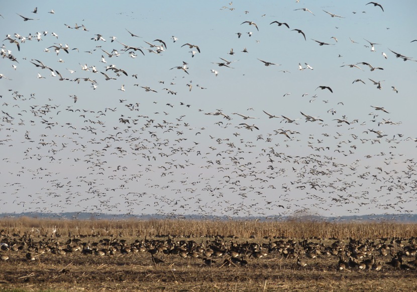
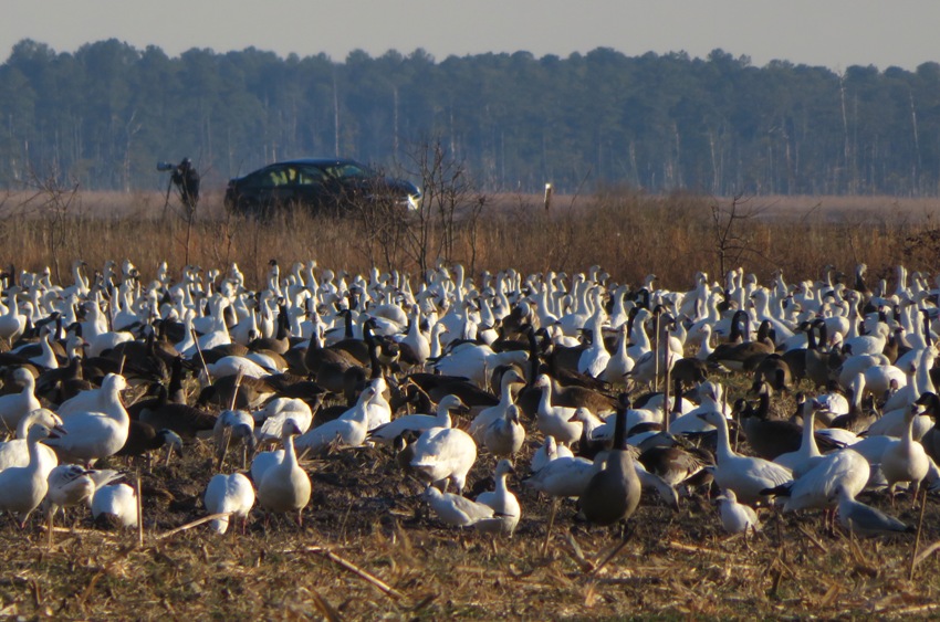
Not having planned things all that well, I retraced my steps a bit to get to Hoopers Island. Long a community of watermen, this chain of islands bears [the] name of [the] family who settled in Dorchester County from southern Maryland in [the] latter part of [the] 17th century. Active in colonial affairs in [the] 18th century was Colonel Henry Hooper, whose seat was "Warwick Fort Manor" near Secretary. His son, Brigadier General Henry Hooper, as commander of militia for [the] lower eastern shore was resonsible for defense of this region during the Revolution. - from sign titled "Hoopers Island" I saw the Tubman Chapel but the sign made no mention of any connection with Harriet Tubman. Hoping to see more wildlife, I came across over a dozen sika deer. Now I was biking on the Blackwater Wildlife Refuge designated bike route. It is a very nice place for riding because there is little traffic, the scenery is peaceful, and the roads are well-maintained...but that could describe a lot of places on the eastern shore. I stopped briefly at Shorters Wharf. The sun was getting low, it was getting colder, and I still had quite a ways to go. I am definitely looking forward to the warmer weather and longer days in the coming months. South of Key Wallace Drive and east of Golden Hill Road (route 335), I saw over a thousand birds. Most were Canada geese, snow geese, or tundra swans. 1 / 7

Snow geese.
2 / 7
Snow geese zoomed in.
3 / 7
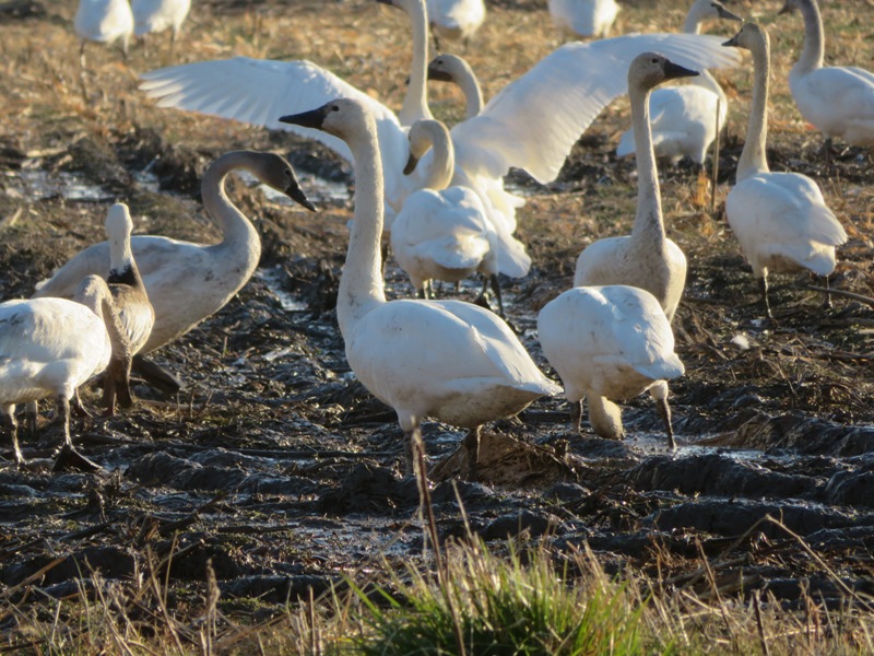
Tundra swans.
4 / 7
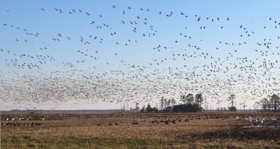
Cloud of birds.
5 / 7
Canada geese in back.
6 / 7
In flight.
7 / 7
Mixed birds.
Seven hours and 50 minutes after starting, I finished my ride. Considering I didn't do a lot of planning, it turned out to be a good route and I made great use of daylight. 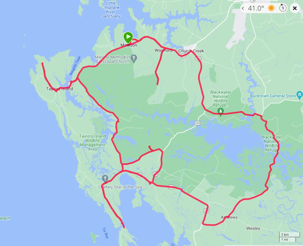
|
|
On June 17, 2024, Norma led her sister's family on a ~15-mile bicycle ride which took us from Rehoboth Beach to Lewes, and Cape Henlopen State Park.
|
|
I typically do a local ride starting from home at least every other week, sometime early on the weekend. On this day, I did ~24 miles, riding out to the Rocky Gorge Reservoir, Fulton, Maple Lawn (to include their farmers market), Columbia, Jessup, Laurel, and Emerson. It was a particularly scenic day. I was on the road by 0700 and done sometime before 0900.
Out at the Sunflowers of Libson, they are ready for their Sunflower Festival. 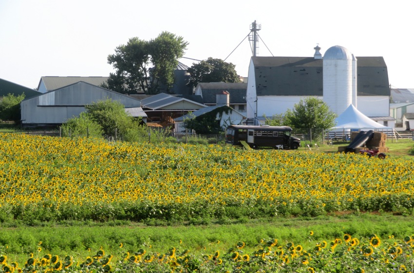
Maple Lawn is a newer, very upscale community in Fulton. They have a nice nature trail that passes by a few ponds. Near at least one of the ponds, you can see lots of pink hibiscus flowers. 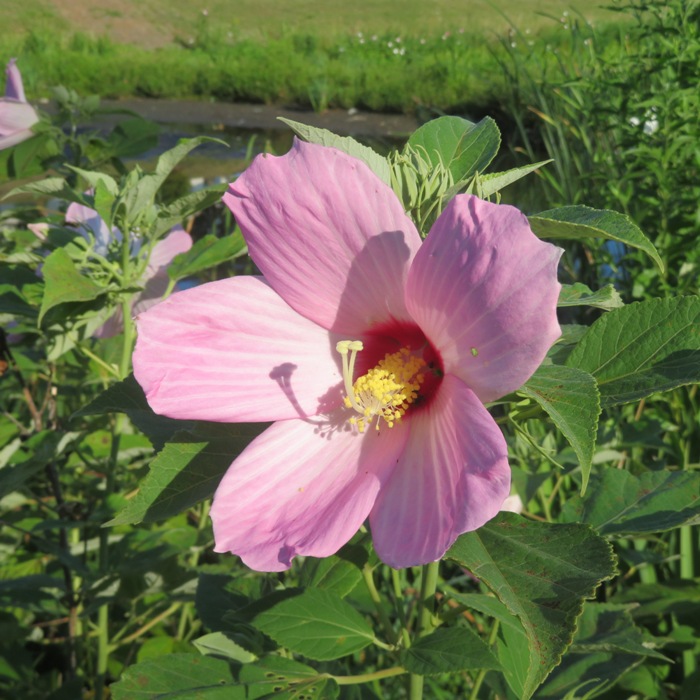
Also at one of the ponds, I saw several water lilies. 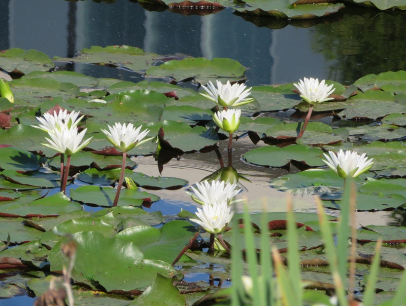
A great blue heron was kind enough to pose for me while I took its photo. 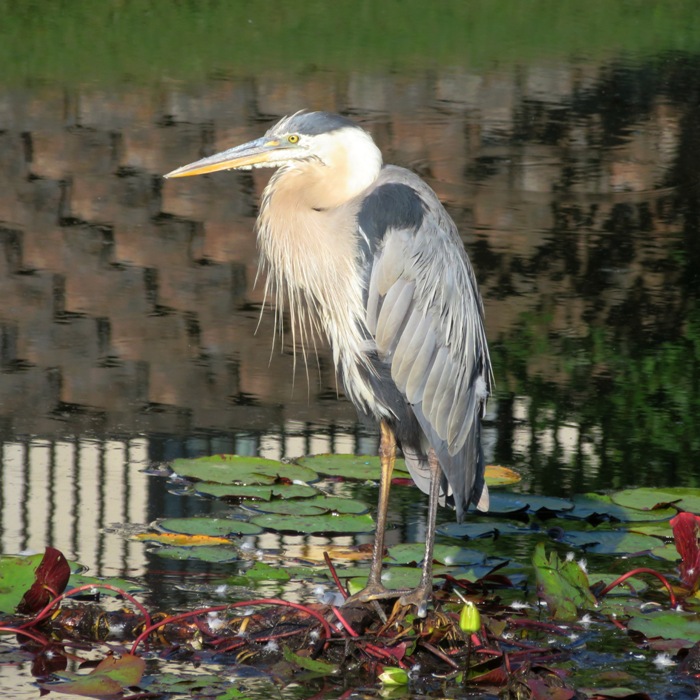
The Maple Lawn Farmers Market was still being set up. I walked past with my bike, checking out the various vendors. Out by Emerson, I saw some people playing cricket. They play regularly. Check out the airborne pose of the pitcher. There are many sports I do not understand and this is one of them. 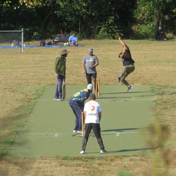
Getting in an early ride was a great way to start the day, beat the heat, get outside, and avoid the heavier traffic that would pick up later in the day. |