|
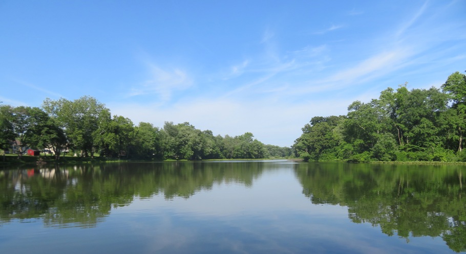
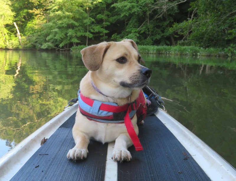
This page describes my kayaking and standup paddleboarding adventures in 2022. |

|
This page describes my kayaking and standup paddleboarding adventures in 2022. |
|
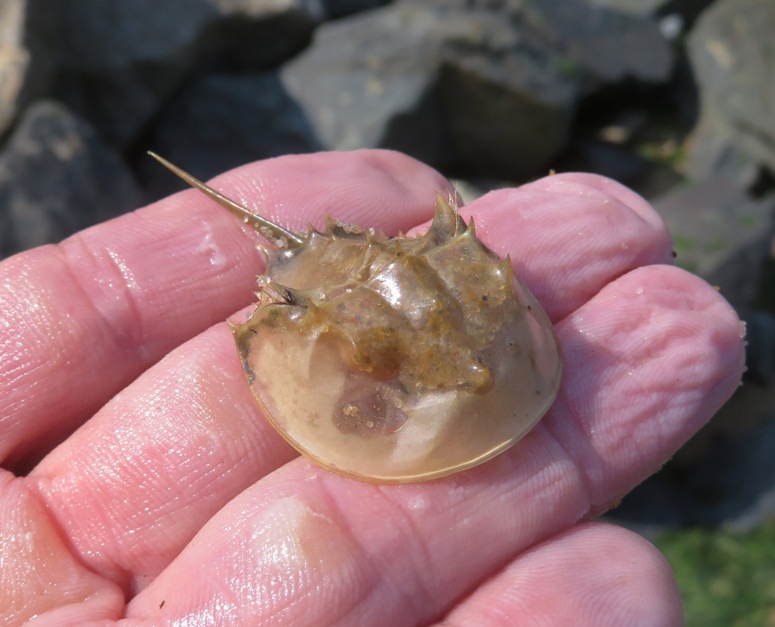
There are some things that I hold secret.
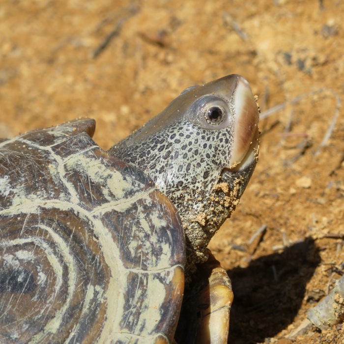
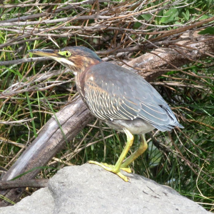
On this day, I found 31 morel mushrooms in a small area. I won't tell you where it is but this is what I will tell you. I was looking for amphibians, not morels. I found no amphibians but I did find some other wildlife. 1 / 3

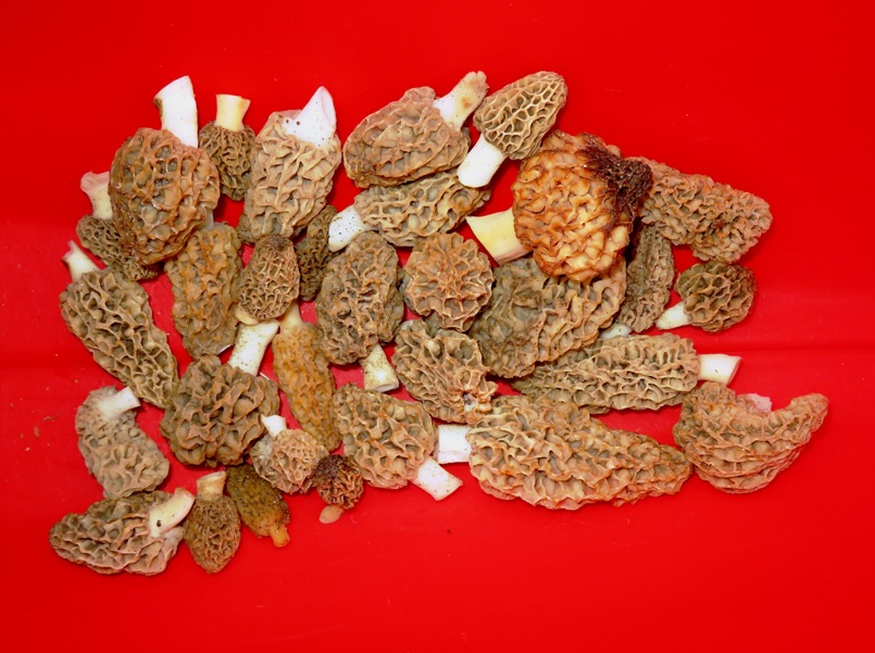
Morel mushrooms in my kayak.
2 / 3
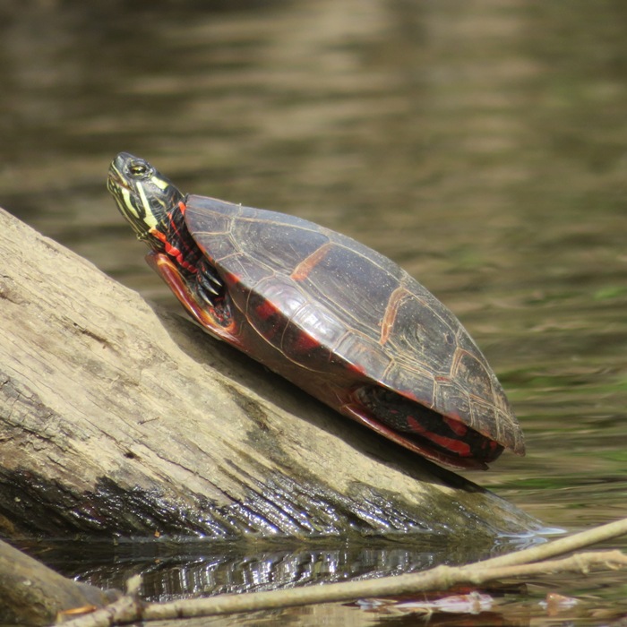
Eastern painted turtle.
3 / 3
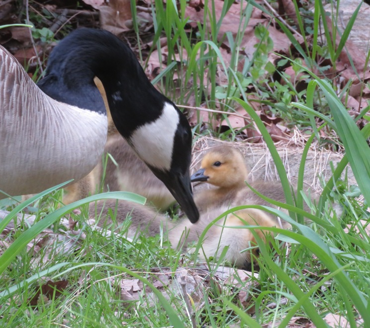
Canada goose with gosling.
The next day, Norma cooked up the morels and we ate them. They still had some sand but they were delicious. I normally don't care for mushrooms but I do like morels. Cut and cooked, they look like little brains.  |
|
I launched my surf ski at Franklin Point State Park and then paddled north of Franklin Point and then south to the mouth of Broadwater Creek. I also explored Deep Creek and Deep Cove Creek. Got in 9.4 miles.
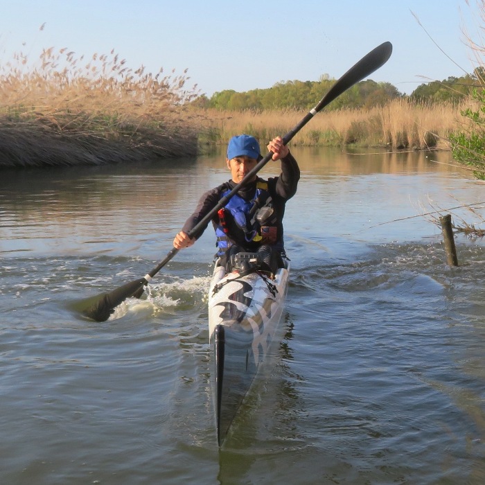
I saw my first muskrat of the year but wasn't able to get a snapshot of it. Here are the things that would pose for me. Here's my route. 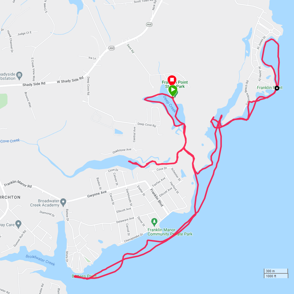
|
|
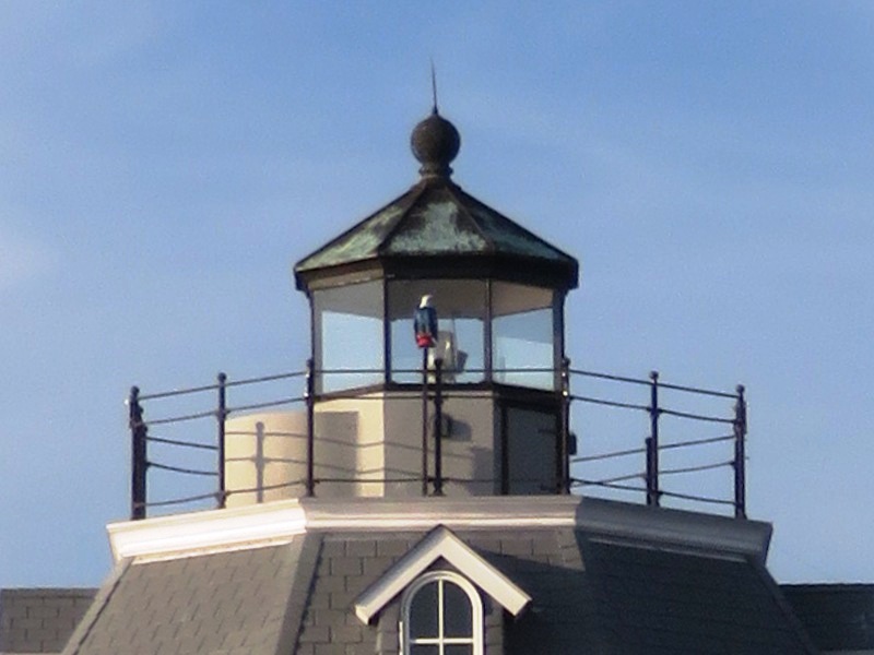
Daphne and I launched the SUP from Spriggs Farm Park on the Magothy River and then paddled out into the Chesapeake Bay. I let her run around on a beach at Sandy Point State Park before we paddled out to Sandy Point Shoal Lighthouse. We got in 12.8 miles.
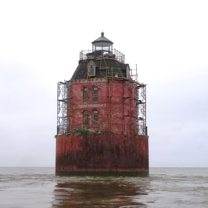
The Sandy Point Shoal lighthouse was built in 1883 and features a 37-foot Empire-style, eight-sided red brick tower with a white roof and black lantern, which houses a 4th order Fresnel lens. - from Maryland DNR - The Sandy Point Shoal Lighthouse This lighthouse was one of the first places I paddled to when I got into kayaking. The below photo was taken June 1999. It was much prettier back then. 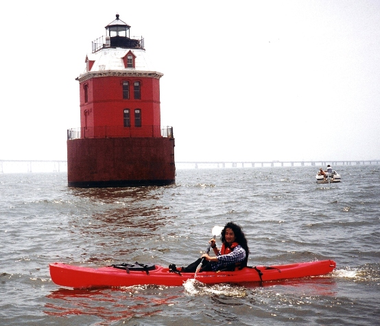
It was a very foggy morning. Gray skies for most of the day with very little wind. Here is our view of the Chesapeake Bay Bridge. 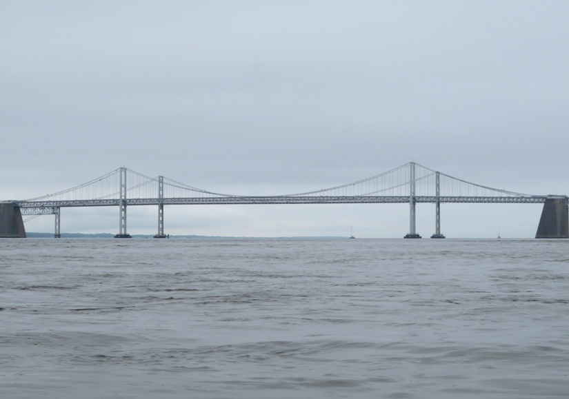
Around this time of the year, I typically shed the wetsuit. I often err on the side of caution so I wore it. But after an hour, I was working up a sweat. On the way back, I saw Neil M. I attribute him to getting me into paddleboarding since his was the first stand up paddleboard I ever tried. That was in 2009. He's a real serious paddleboarder who frequently competes in races. 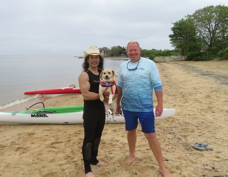
Neil was hosting an outrigger canoe demo day at his community beach. I took one out for a spin. It was a carbon fiber boat that weighed about 25 pounds. I think it was about as fast as my surf ski. I'll stick with the SUP since that's better for carrying Daphne. 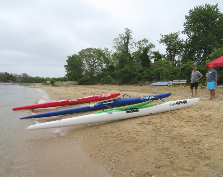
Here's our route. Maybe next time we'll go to the Baltimore Harbor Light which would make for a much shorter trip. 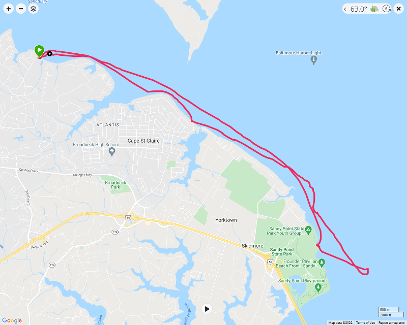
|
|
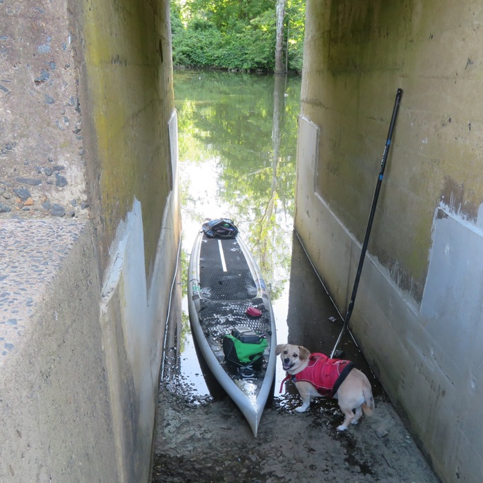
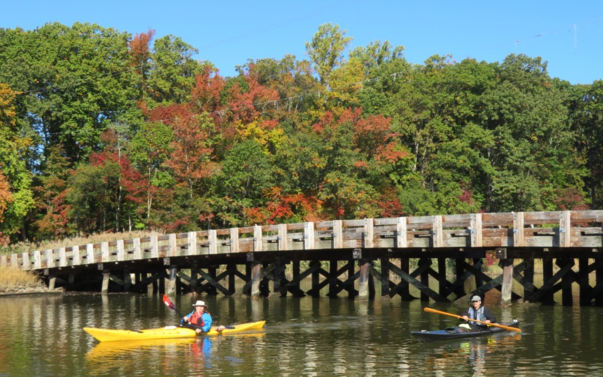
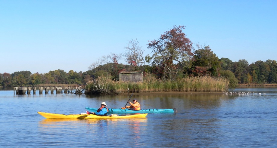
Norma, Daphne, and I launched from Easton Point and explored the uppermost sections of the North Fork and South Fork of the Tred Avon River, North Fork Tanyard Branch, and Papermill Pond. We took advantage of the high tide to get through five culverts so we could see waters less paddled.
The flood tide gave us a slight push up North Fork Tanyard Branch which was shady and wooded with cool water. But Daphne was not impressed. She showed her lack of interest with a big yawn. 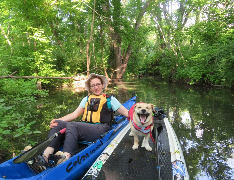
As we made our way up the North Fork Tanyard Branch, we encountered a big tree in the middle of the creek. 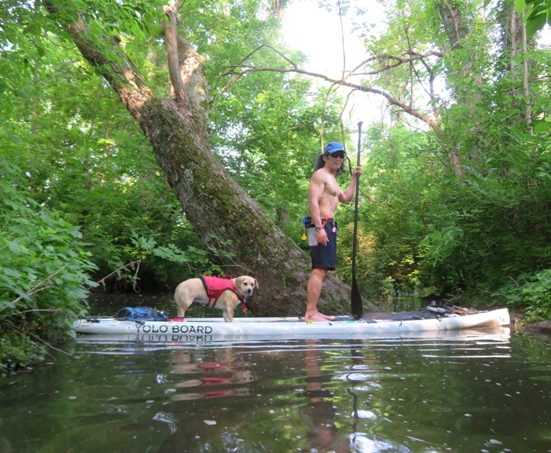
Last year, I launched from Easton Point and paddled this same direction but wasn't able to get very far upstream on either branch of the Tred Avon River. However, today's tide was really high. How high? The kayak launch platform at the marina was about three inches underwater. All that water helped us get to scenic places that I don't think many people get to see. 
We were on the water around 0730 so we hardly saw anyone. Just a few fishermen. It felt like we had the whole place to ourselves. 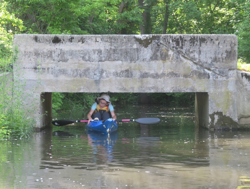
We saw the backside of the satellite dishes at 403 Bay Street. 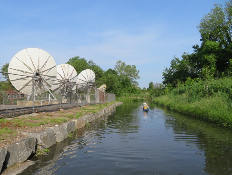
In the below picture, Norma enters one of many culverts. This kind of paddling is not for the claustrophobic. 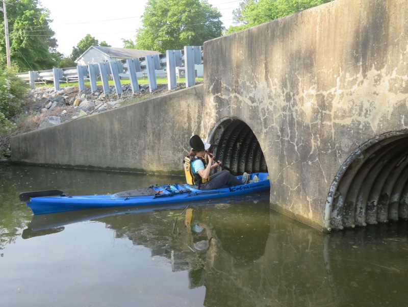
On the return trip, we passed under a pedestrian bridge. Last year, this is about as far as I got before it got shallow. 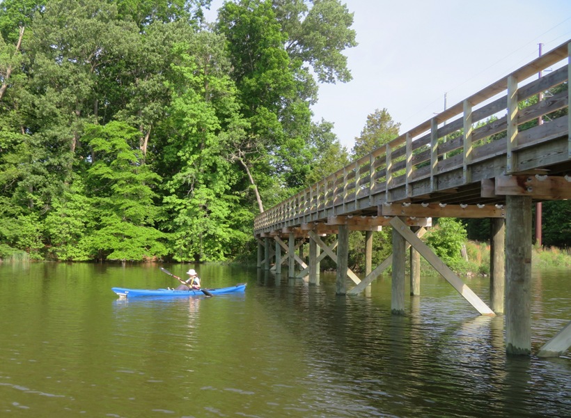
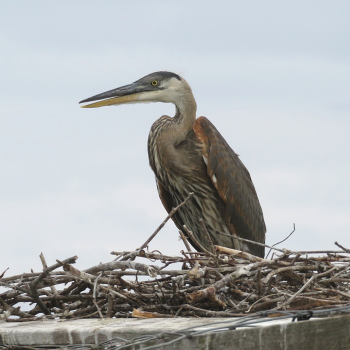
Just south of the launch site, we encountered the same small great blue heron rookery that I saw last year. It is difficult to see but you can find it if you are quiet and follow the chatter of the young herons. Look closely in the below photo and you'll see seven great blue heron nests in this one tree. It is located in someone's backyard. 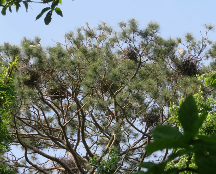
Here's a great blue heron in its nest. 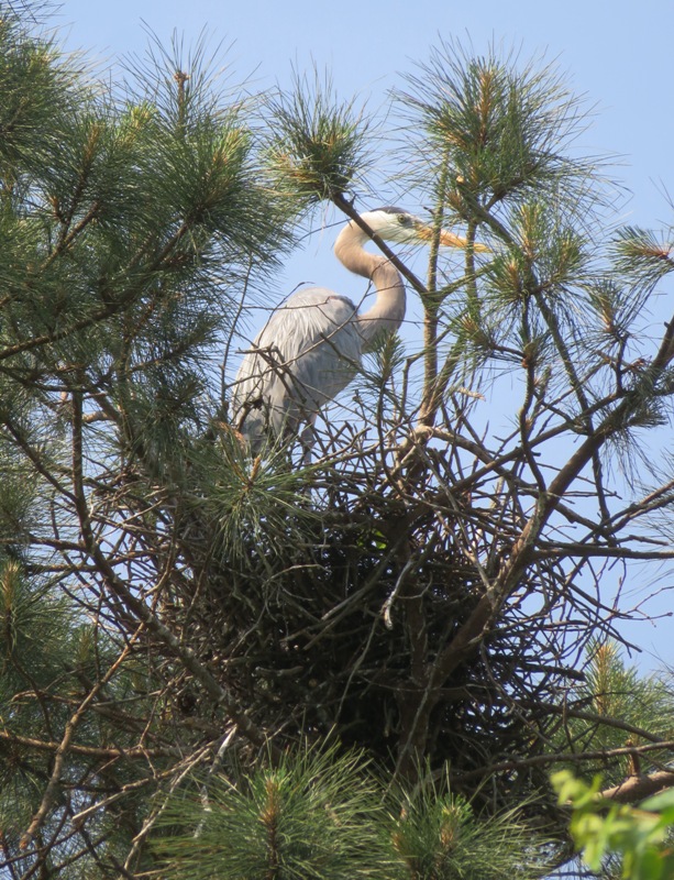
The three of us made our way up the South Fork and then continued to Papermill Pond. I don't know why it is called a pond. It is just an extension of the South Fork of the Tred Avon River. Below, Norma waits for me at the other end of a culvert. 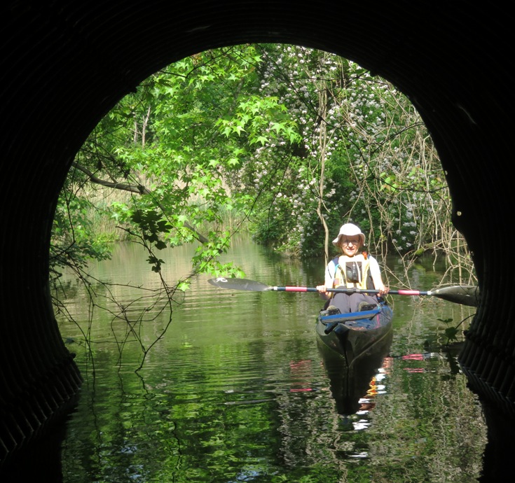
Here's Norma just before we turned around at South Washington Street. You can't tell there's water there by looking at the satellite photo but believe me, there is. But some parts are too narrow to turn around a boat as long as Norma's. 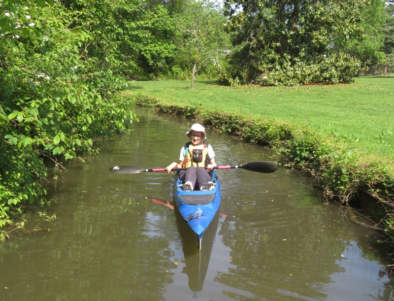
There was another culvert at South Washington Street but the tunnels were very small and they didn't have a lot of water. Besides, it was now ebb tide and we had to head back or risk being stranded. I saw thousands of fish. Some were 18" long catfish. Some were carp up to three feet long. Many of the carp were mating. Most of the fish I saw were very small and traveled in large schools like this one. Norma couldn't see a lot of what I saw because her point of view was much lower since she was on a kayak while I was standing on a SUP. 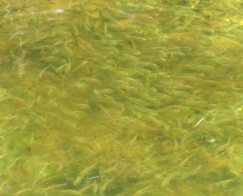
In the following snapshot, Daphne takes a break after we paddled under Easton Parkway. This was actually our second pass under this road. We also paddled under it on the North Fork. We saw a lot of barn smallows here. 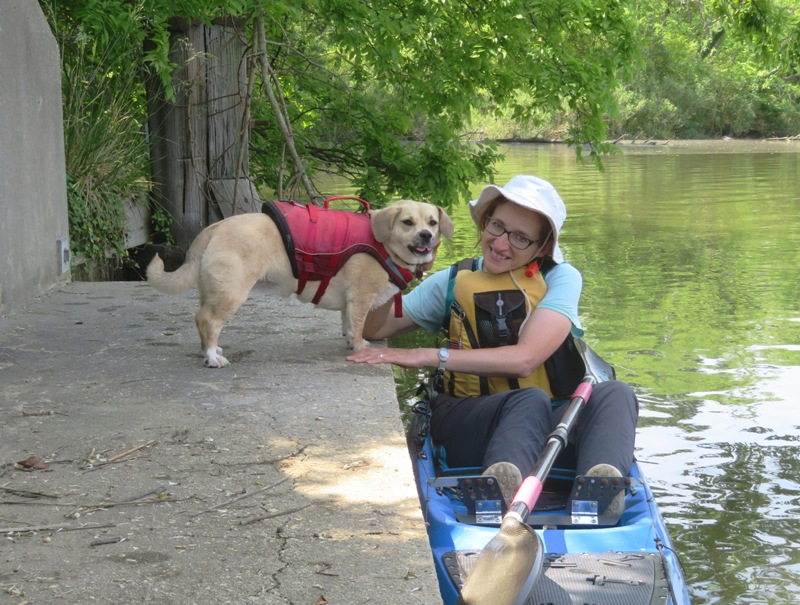
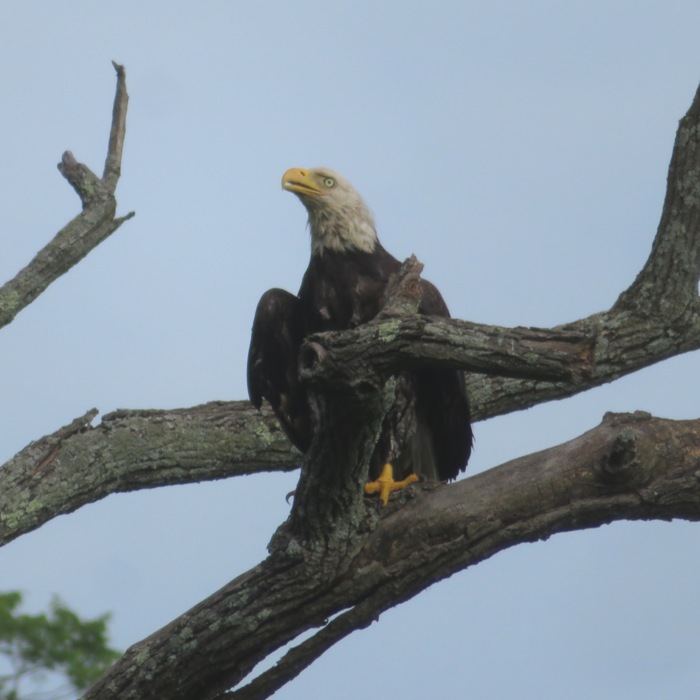
Other animals we saw that I didn't get a chance to photograph include a snapping turtle, muskrat, eagle, and red fox. The three of us got in a leisurely 7.5 miles over about four hours. By the time we finished, the temperature was in the high 80s. It was hot in the sun but perfect in the shade. Here's our route. 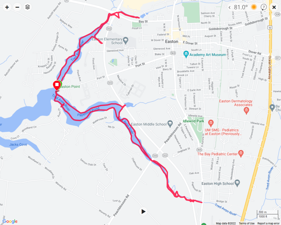
After paddling, we headed over to the Easton Farmers Market where we heard live music by Island Fusion. Then we walked over to Bonheur for ice cream. Yes, Daphne got her own dessert cup. They have nice outdoor seating in the shade. 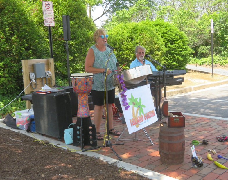
|
|
During Memorial Day weekend, Norma, Daphne, and I had a great time paddling on the Eastern Shore.
|
|
Daphne and I drove out to the eastern shore to explore some new creeks and launch sites. Our first stop was Kates Point Road. This passes over an unnamed creek. We parked on the shoulder and then dropped the SUP into the water, which was just a few inches below the road. Not a designated launch site and not even that good of a place to put in but there isn't anything else nearby.
I paddled us out into the Choptank River where we saw an unnamed island. I figured I'd stop there on the way back. We went up Raccoon Creek as far as we could, getting about a mile from the mouth. It was extremely scenic. 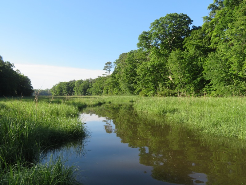
I spotted a muskrat mound and a couple of muskrats swimming. 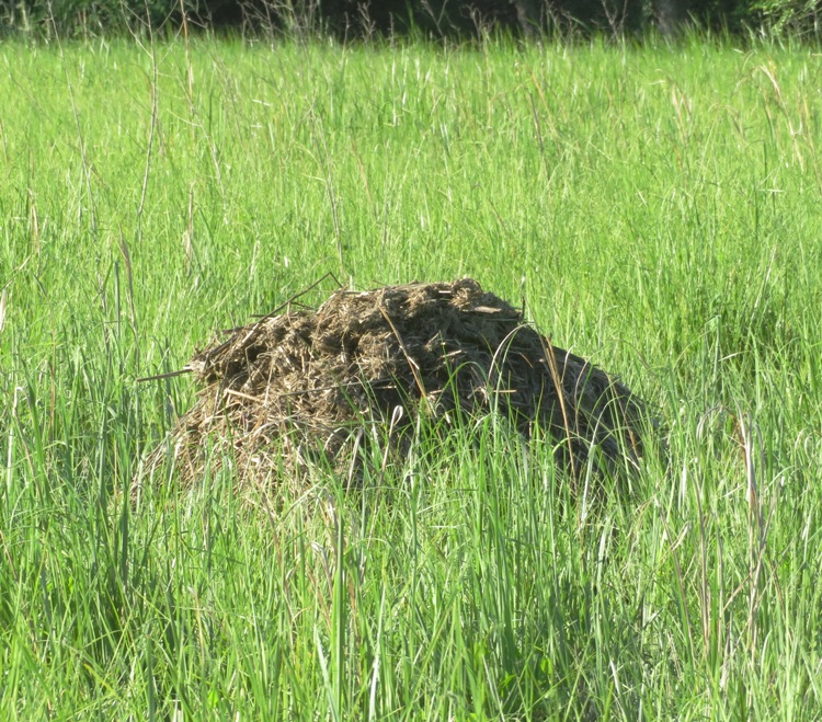
I also saw a couple of water snakes swimming. This is a great place to see wildlife. 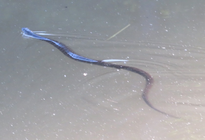
On the way back, we stopped at the unnamed island. There wasn't much of a beach and I think it would be under water at high tide. 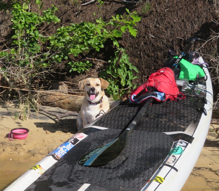
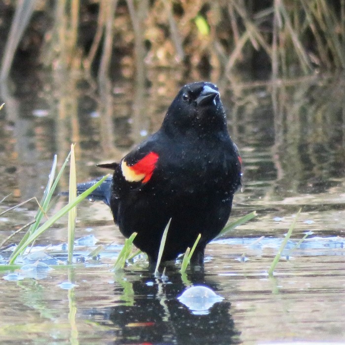
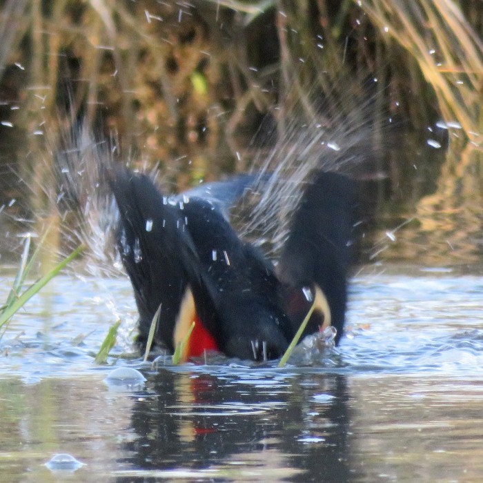
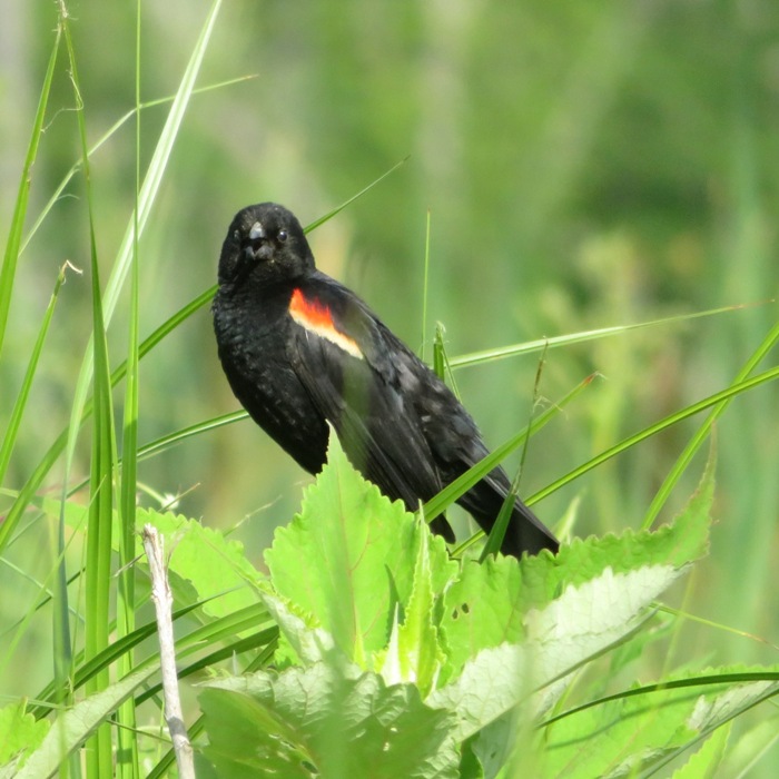
Looking around on the island, I spotted a diamondback terrapin laying eggs. It is rare for me to see a terrapin and this is the first time I'd ever seen one laying. What a treat! On the unnamed creek where we launched, I saw several red-winged blackbirds. 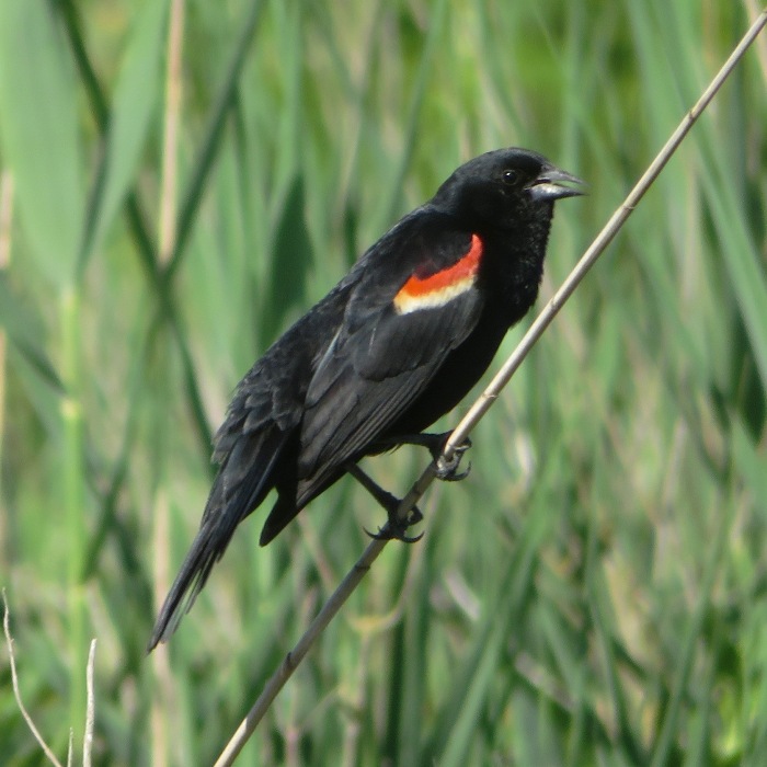
Here is a view from where we put in. 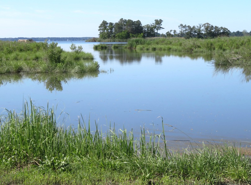
This is our route. We got in 3.9 miles. 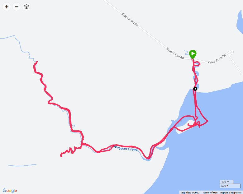
Next, we drove a short distance to Windy Hill Landing. It took awhile to get there because there were so many bicyclists out doing the Tour de Talbot bicycle ride. One of the rest stops was my destination. Daphne and I crossed the Choptank River and then paddled 3.25 miles upstream on Marsh Creek. We had to portage over the Poplar Neck Road bridge on the east side. We couldn't go under it. Getting from the water to atop the bridge was easy on the downstream side but to get upstream of the bridge, I had to fit the SUP below a handrail and then drop it into the water. Not sure how easy that would be for a kayak, especially since the tide would be moving things around. Below is a view looking downstream at the bridge. 
High tide was supposedly at 1020 but I think it hit earlier. From the moment I started paddling upstream on Marsh Creek, the water was flowing out. We got within 1000 feet of Havercamp Road. The biting flies were really bad. Bug spray did not repel them. There were a few homes on the shore that were set back from the water. We never saw anyone so it felt like we had the whole creek to ourselves. The last half mile was extremely scenic and filled with spatterdock. 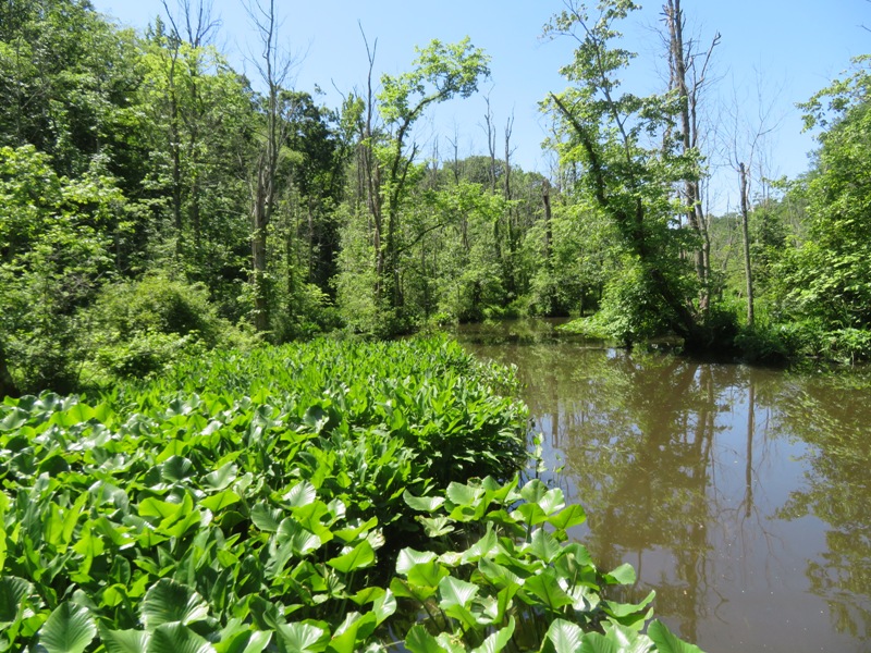
Going back downstream, I had to use Daphne's leash to lift the SUP up to the bridge. At the mouth of the creek, we turned north and explored Little Marsh Creek. Got up about 0.4 mile. Not so interesting. 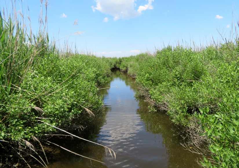
Marsh Creek was nice but I don't think I will return. The flies and the portage were a bit of a turn off. Here is our route. We got in nine miles. 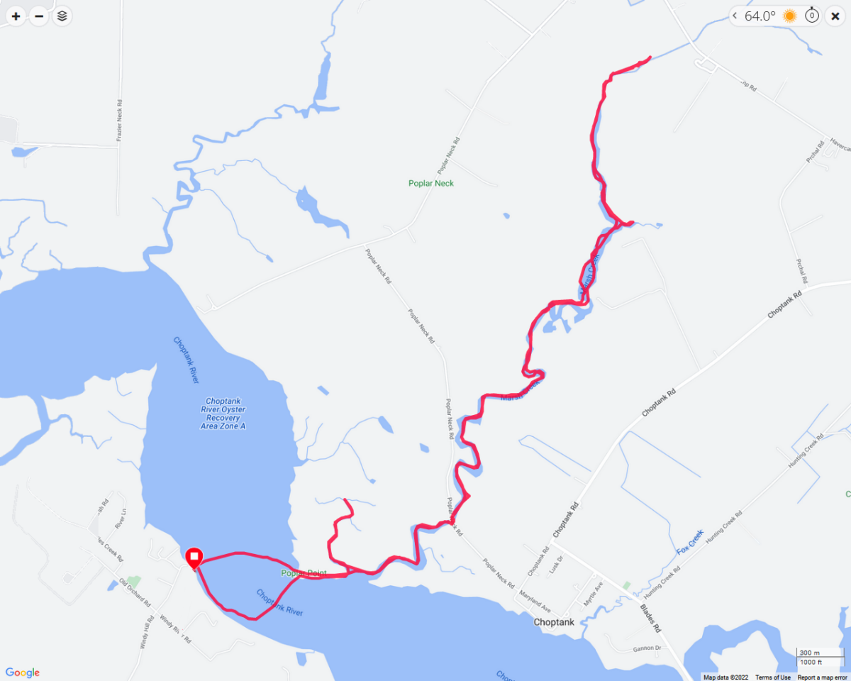
After paddling a total of 12.9 miles, I decided we would spend some time on land exploring launch sites. So I drove to the town of Oxford. I haven't spent much time here but it seems like a nice place. It could make for a nice weekend getaway, especially with the bicycles. We stopped at the town ramp at the end of Tilghman Street. 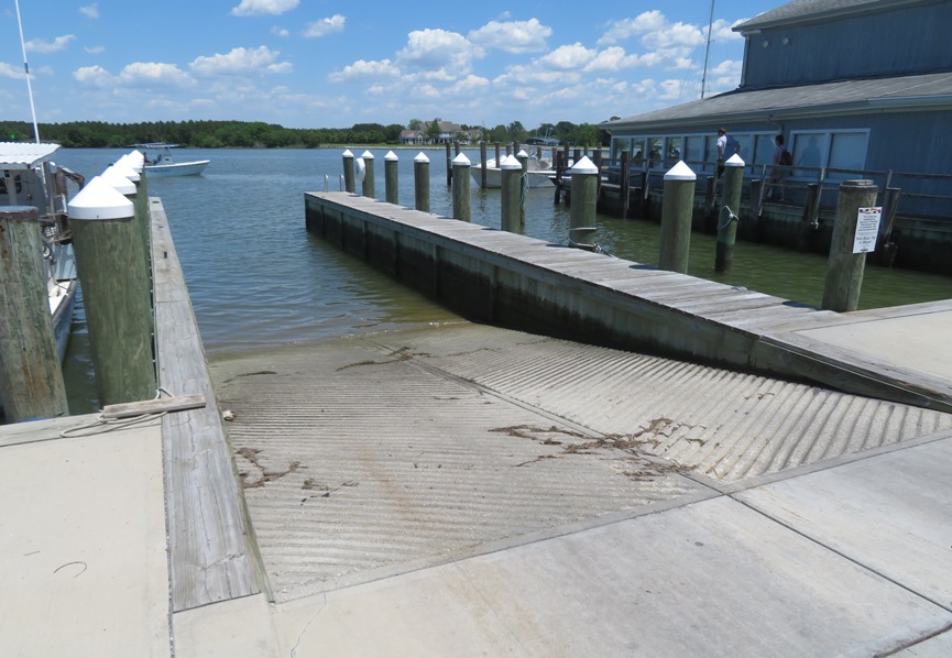
Daphne and I walked around town. We found a boat ramp just west of the Oxford Bellevue Ferry. 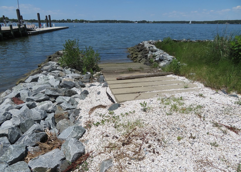
Then we walked northeast on Strand and found the Strand parking lot where beachgoers could park. A sign said something about watercraft not being permitted on the beach. But on the west end of the lot, there was a break between the grasses where one could put in a kayak, SUP, or canoe. This was the best launch site I've found so far in Oxford. 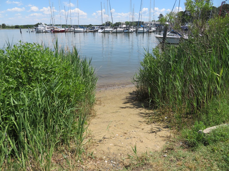
Back on Tilghman Street, we stopped for ice cream at the Scottish Highland Creamery. I had the chopped strawberry ice cream which was absolutely delicious. I would highly recommend it. 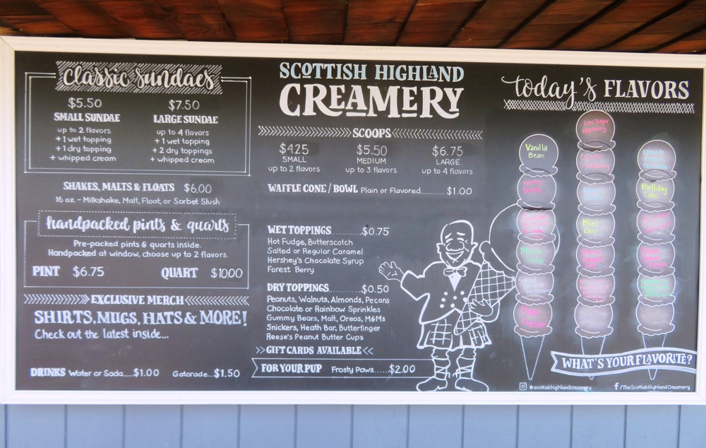
I got Daphne the Purina Frosty Paws for Dogs, frozen dog treat. 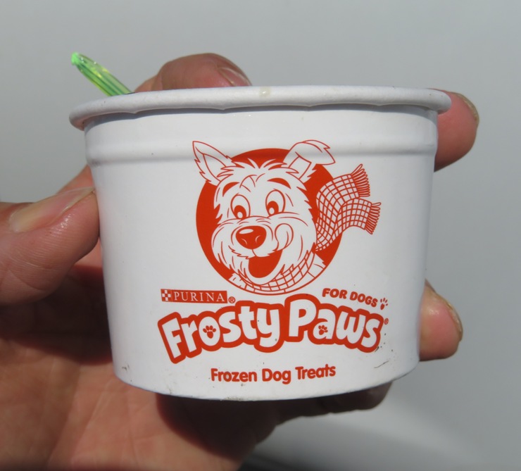
I got pretty tired on the drive home so I pulled over at Kent Island for a nap. Then we explored and found a place one can drop in a small watercraft at Ferry Point Nature Park. Like the last place I found, it is just a break in the grasses. 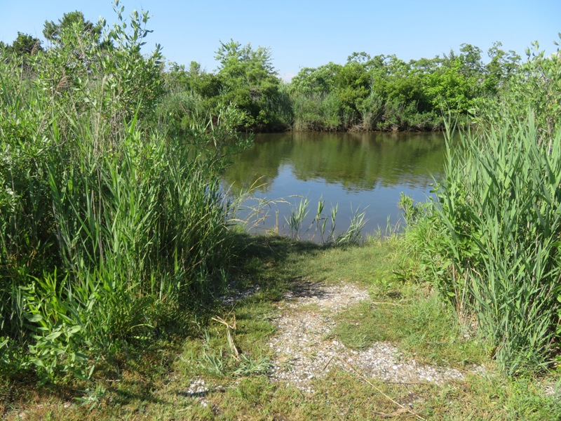
It was a fruitful day. I got in some paddling, saw plenty of wildlife, and did a lot of exploring...just the kind of stuff I enjoy. |
|
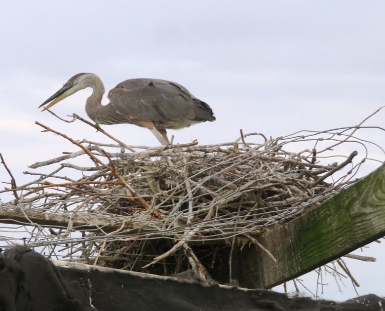
Daphne and I launched from Shipping Creek Landing on Kent Island. It was a dark and dreary day but at least it wasn't raining when we were on the water. I wasn't expecting to see anything interesting but I most certainly did...the smallest great blue heron rookery I've ever seen!
Great blue herons form breeding colonies known as rookeries which can have anywhere from a handful to well over 100 nests. Nests are often built high in the tree canopy. Today was the first time I'd ever seen a rookery built on an old duck blind. It was on the south side of the mouth of where Long Creek flows into Shipping Creek. I counted only four nests. While it is easy to get really close to these birds, I highly suggest keeping your distance to prevent the young birds from trying to leave their nest by attempting to fly prematurely. 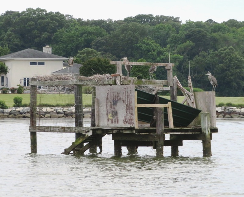
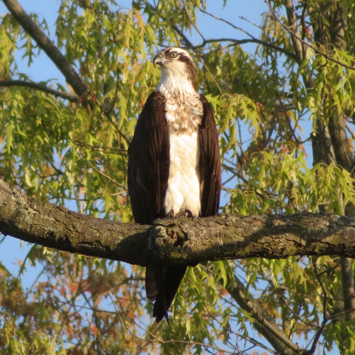
Nest building can take from 3 days up to 2 weeks; the finished nest can range from a simple platform measuring 20 inches across to more elaborate structures used over multiple years, reaching 4 feet across and nearly 3.5 feet deep. - from All About Birds - Great Blue Heron I also saw a lot of ospreys. They have an average wingspan of five feet. 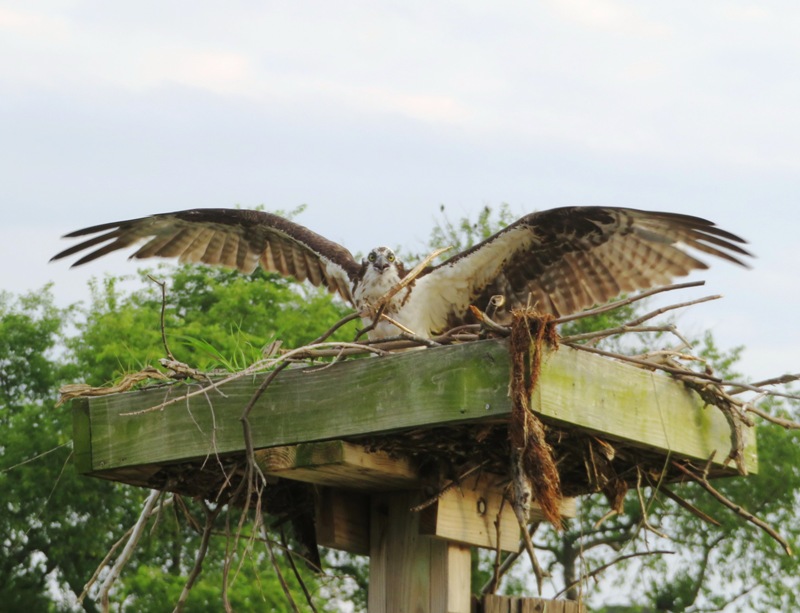
I paddled 8.2 miles. I tried to circumnavigate the Philpots Islands but they have been built up and reinforced with rip rap. They are all now connected to the mainland as a peninsula. 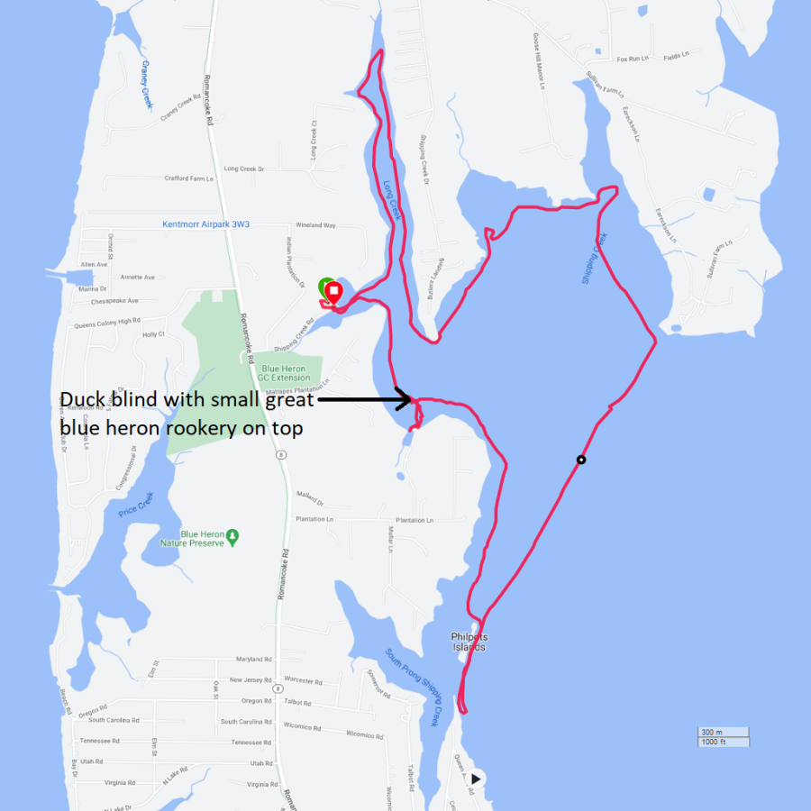
Aquatic vegetation was thick in some areas. Best to stay in deeper water. After paddling, I took Daphne for a walk on the Kent Island South Trail. We saw a couple of these fungi and a lot of Virginia creeper. 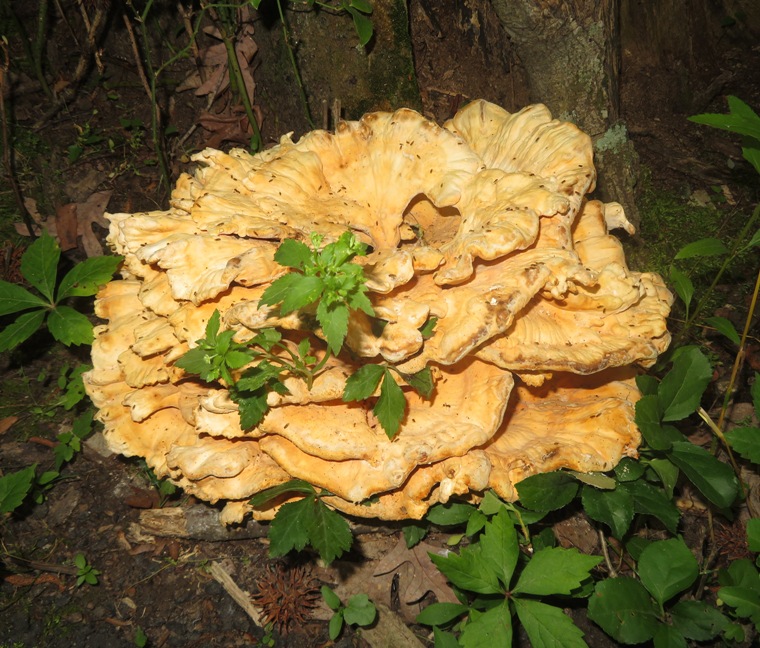
|
|
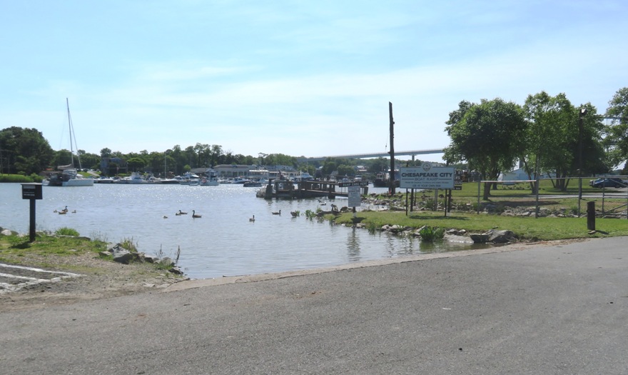
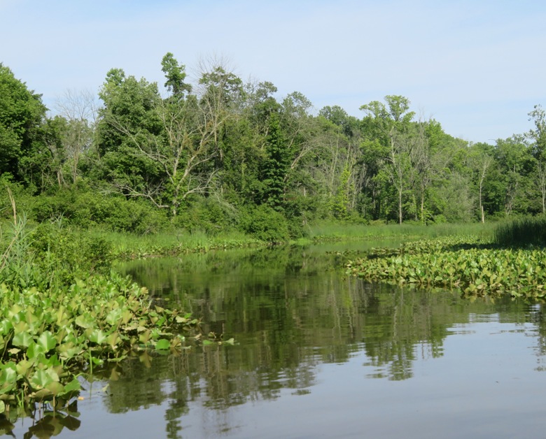
Daphne and I launched from the Chesapeake City Boat Ramp. This was a rather questionable decision. Very much a gamble. No danger involved but I drove about an hour and a half each way to paddle in this area that I knew very little about. Would it be a waste of my time?
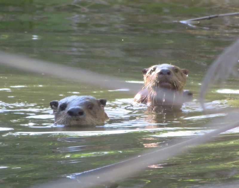
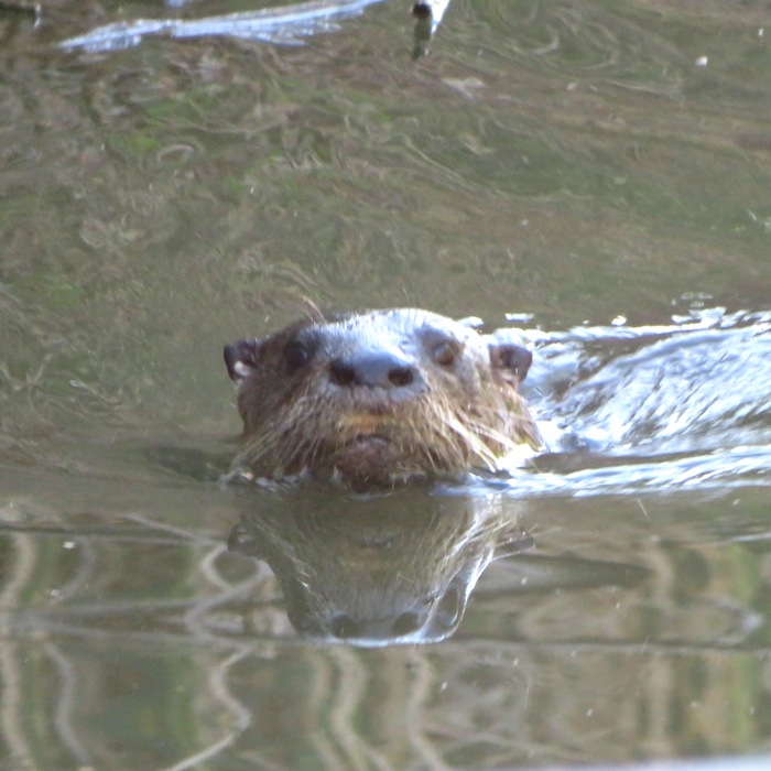
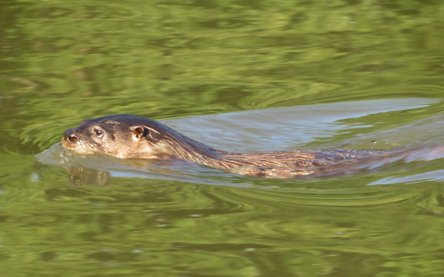
I searched online and checked my Ed Gertler book to learn about this place. Nothing. I knew that this launch site would put me onto the Mooring Basin. From here, power boats go into the Chesapeake and Delaware (C&D) Canal, but kayaks, canoes, and SUPs are not permitted there. The only choice outside of the very small basin is Back Creek which runs southeast towards the state line. The first thing was to get under the Second Street Bridge. I had to crouch down to fit under it. I think most kayakers with average flexibility could also fit under it except maybe if the water was really high like during a supermoon high tide or right after a heavy rain. A SUP would definitely be easier because one could lie down. I noticed that the tide was really strong. Perhaps it was because there was a dual effect between both the Chesapeake Bay and Delaware Bay high tides...the latter being stronger. When I studied satellite photos of this place, I saw nothing to indicate that the creek was dredged. There were no piers. Was it shallow? Definitely not. I was impressed at how deep it was. The scenery was beautiful. This was as good as it gets. Very natural, though I did see a couple of houses offset from the creek. I never saw another person while I was on the creek. This was the kind of place where you want to savor the scenery and not paddle fast, though that was not easy because the flood tide was really giving me a push. I heard a noise and looked back. I saw two small mammals running down a hill and then into the water. My first thought was that they didn't have beaver tails and they were too skinny to be groundhogs. I paddled closer and realized they were river otters! I rarely see them...maybe once every two or three years. One could easily confuse their appearance with something else from a distance but what really makes them distinct is their personality. They are often with another otter and they love to play. When they saw me, they were very curious. They kept a safe distance, watched, and made noises that sounded like loud breathing or coughing. Then they dove under and popped up someplace else to observe. Muskrats, on the other hand, are not curious and will simply try to leave the area. But with muskrat's poor vision and hearing, they might not know I'm around until my SUP almost runs into them. Beavers will rarely let me get close. They see or hear me from afar, hit their tail on the water to alert other beavers, and then dive under, not to be seen again. It is the otter curiousity that makes them great subjects of photography. The problem is that they don't sit still and when they dive under, I never know where they will pop back up. It is a fun challenge for me. After watching this pair for awhile, I continued on. Then I saw a group of four more otters! I had no problems paddling from the mouth to about 2.25 miles upstream. Then I came to a really big fallen tree that we had to portage over. The view on the other side was far too tempting to not. 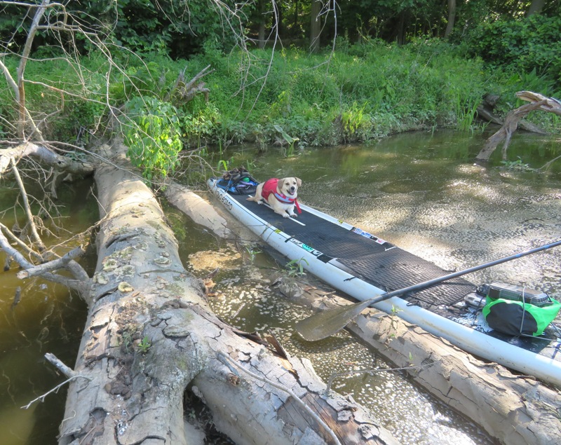
I saw two muskrats, a few bald eagles, a couple of turtles, a crab swimming, great blue herons, and ospreys. 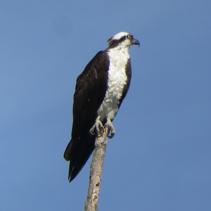
I did another minor portage after another 0.2 mile. About 2.5 miles from the mouth, I was stopped at a five foot high spillway at Sammons Pond, just east of Old Telegraph Road. I thought about portaging over but I figured too much could go wrong with damage to my SUP. I turned around. We were less than 0.2 mile from the Delaware border. I did not see any way to launch from or near the spillway. On the return trip, I saw two more otters. They might have been two that I had already seen. A little later, I saw a group of four otters round a bend and then swim straight towards me. Three of the four looked like juveniles. They dove under and I stuck around for awhile taking their pictures. Daphne was really enjoying watching and listening to them. In total, I saw between six and twelve otters. I give that range because some could have been repeats. This is by far the most otters I have ever seen on the east coast. I am nicknaming this creek "Otter Alley." Daphne was feeling quite relaxed. She doesn't normally lie down on the SUP. 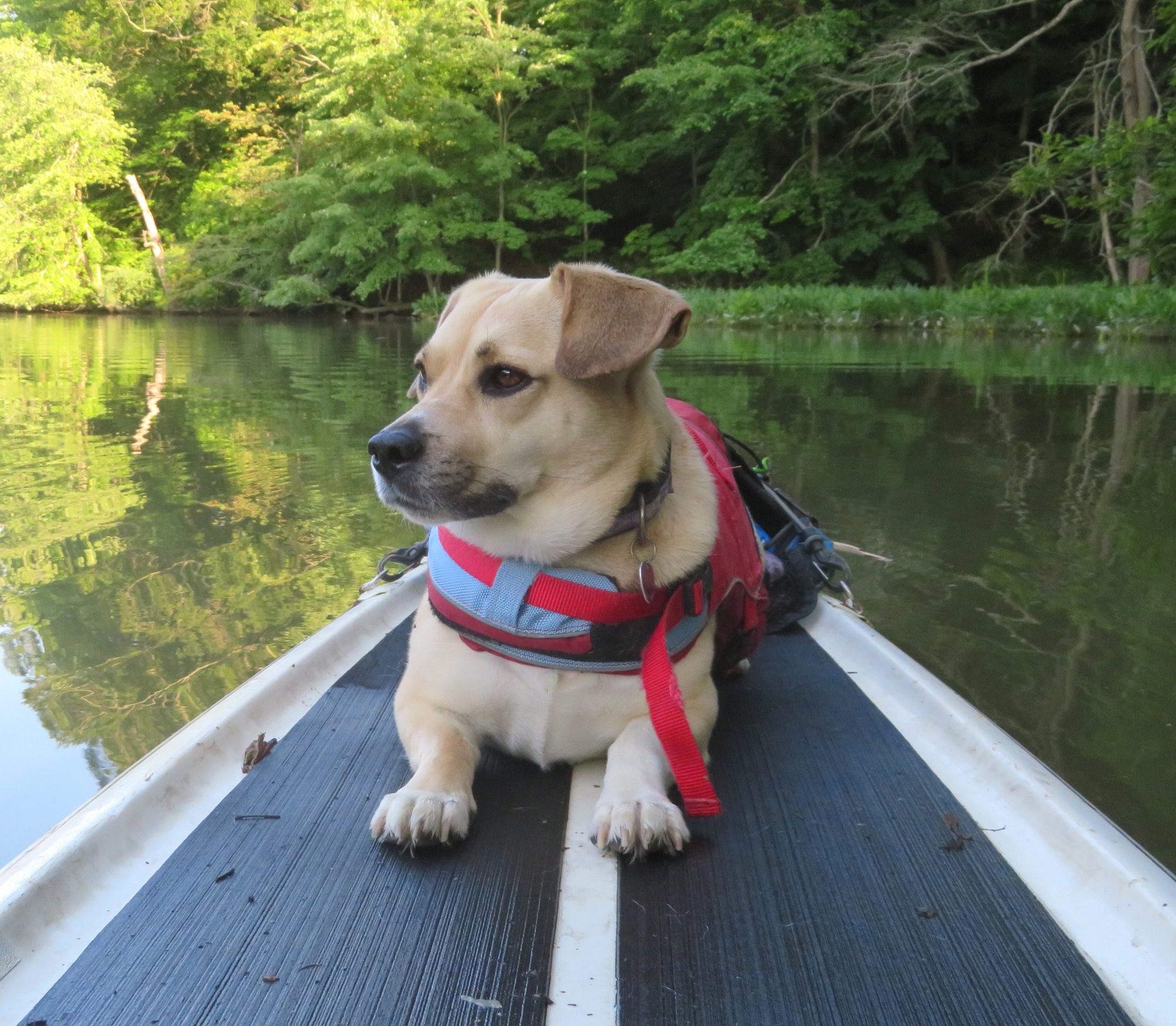
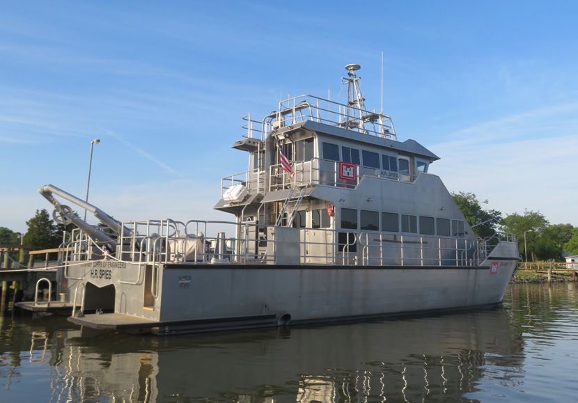
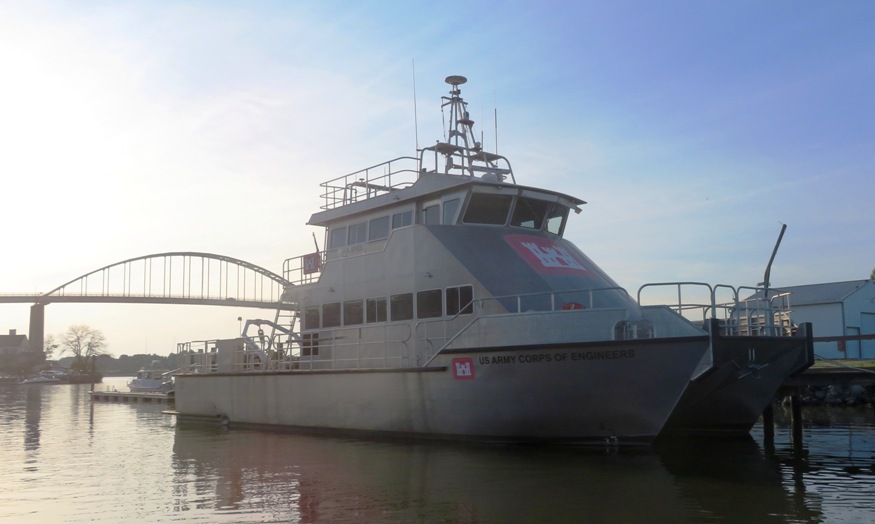
Close to the mouth of the creek, I could see the Chesapeake City Bridge in the distance. Back in the Mooring Basin, I paddled along the shore. I saw the U.S. Army Corps of Engineers Survey Vessel H.R. SPIES. I think I saw it at one of the previous Baltimore Fleet Week events. Here is our paddling route. 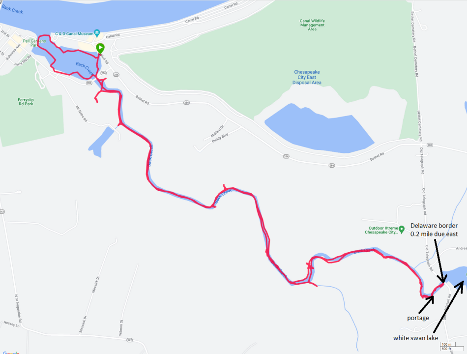
After paddling, I took Daphne for a walk. We parked on the southwest side of Chesapeake City and then headed west along the south side of the C&D Canal. We walked on a packed gravel road. Then we came to a yellow vehicle gate. It was clearly only meant to stop vehicles so we continued walking. Without the threat of vehicles, I let Daphne off leash. We walked for about 0.8 mile on the gravel road before turning around. But the road just kept going and going. I don't even know the name for this road. On the way back, we had a nice view of the Chesapeake City Bridge illuminated by the low sun. 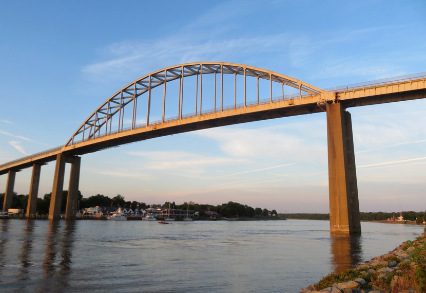
After I got home, I looked at satellite photos of the area. It seems there are extensive roads (probably gated-off gravel roads) along the south side of the canal, on either side of Chesapeake City. I know the north side has the nice, paved Ben Cardin C&D Canal Trail but what I was on was a totally different animal, though it might have had a similar origin. The one that Daphne and I walked on was functional and not made to be pretty, though I suppose one could argue that the beauty of it was the fact that we didn't see anyone else on the trail. Sometimes solitude is beautiful. |
|
Norma was out of town so I took care of Daphne and Mia. Mia is Daphne's sister and we were dogsitting her while her owners were on vacation.
First, I took them to the Severna Park Farmers Market. I've never been to it before. It was small but nice. Their hours at 0800 to noon but we were there at 0745. I bought some bread and wine for Norma. The latter was made in Dunkirk, Maryland. People there really loved seeing Daphne and Mia. 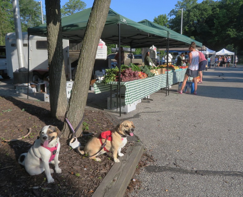
Next, we drove 5.3 miles to Beachwood Park. On the way to the porta-john, I saw a five-lined skink on a telephone pole. 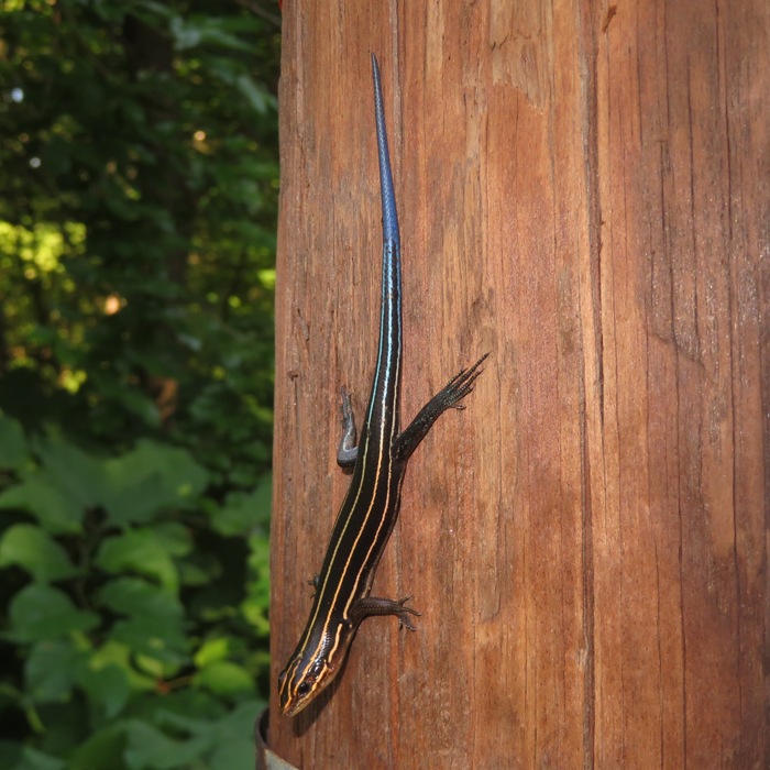
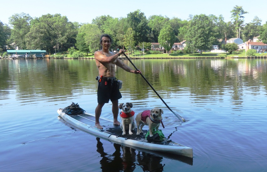
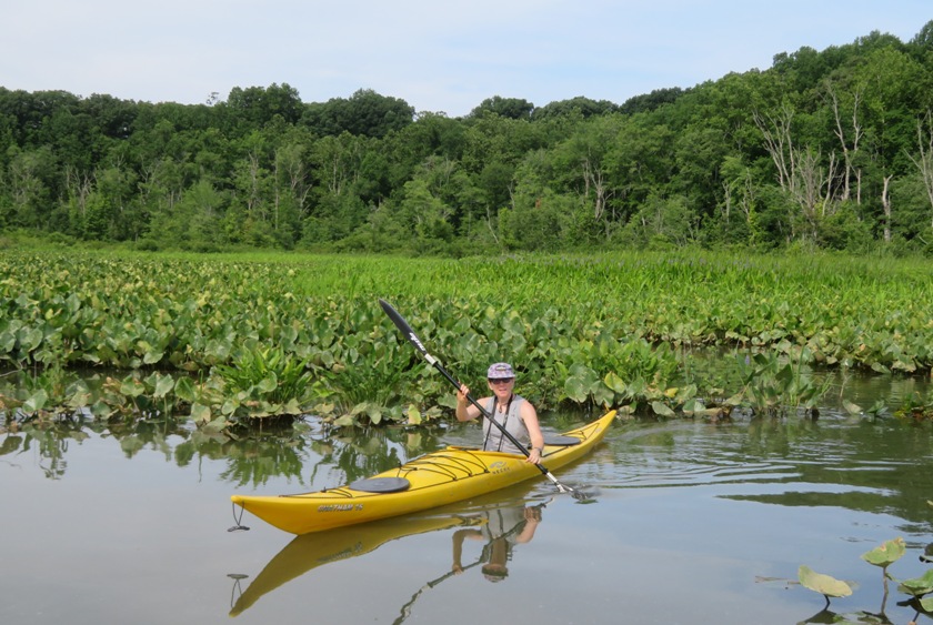
This was Mia's first time on the SUP with me. Her owners had taken her a few times. She was very hesitant. I had to chase her and force her to get on. Fortunately, like Daphne, Mia does not like to swim so once she was on the SUP and a few feet from shore, she wasn't going anywhere. 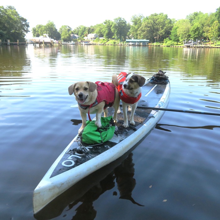
We paddled upstream on the Magothy River. I think Mia was a little scared at first but she quickly calmed down. Unlike Daphne, who likes to stand, Mia was a sitter. Daphne ended up sitting later but then stood when boat wakes got the deck of the SUP wet. Daphne does not like having a wet butt. I took it easy, kept a moderate pace, and tried to keep the SUP from rocking. I also kept them in the shade when I could. Mia did a great job. She mostly stayed in one place and I hardly noticed she was there. We saw a couple bald eagles and great blue herons, including this one that I caught red-handed trespassing. 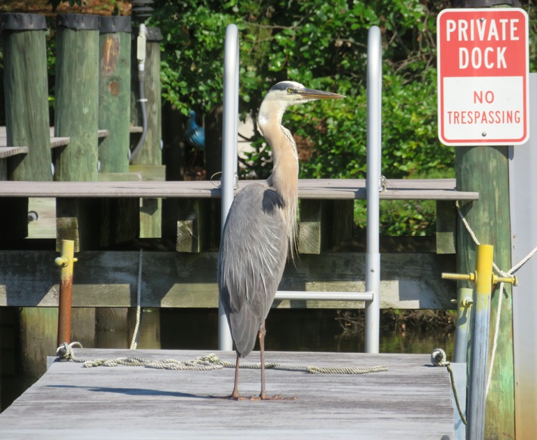
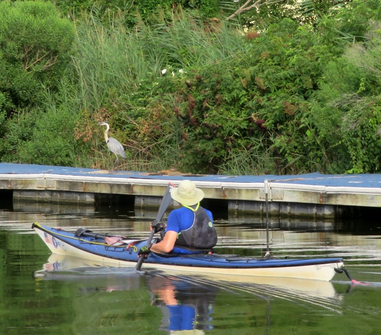
We almost made it to the Catherine Avenue bridge but it was getting shallow so we turned around. Back at the launch site, we joined the WatersEdge Meetup Group for the first part of their trip from Beachwood Park to Dobbin Island. Daphne and I did this event with them on September 25, 2021. But today, I felt that would be too far and maybe too rough for Mia. But I wanted to see them so I said I would join them until they hit the big water. They started a little late, which is most unusual for sea kayakers, who tend to be notoriously prompt. But that was fine. We had a nice shady spot and I got to socialize. I'm not generally social but when I'm on the water, I'm in my element. I got Linda and Ray to take some photos of me on the SUP with the two dogs. 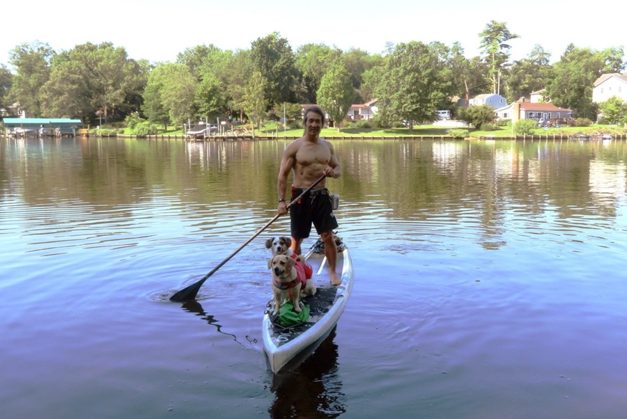
I took a lot of pictures of the group. I think they like having me around for that. Kayakers aren't generally the best for taking snapshots of folks paddling unless it is the back of someone's head. I tend to go to the front and then look back with the camera so I can get their faces. When I'm done, I might be at the back but it isn't a problem for me to put in a little extra effort and get back to the front. In the below photo, John S., our trip leader, is in the front. 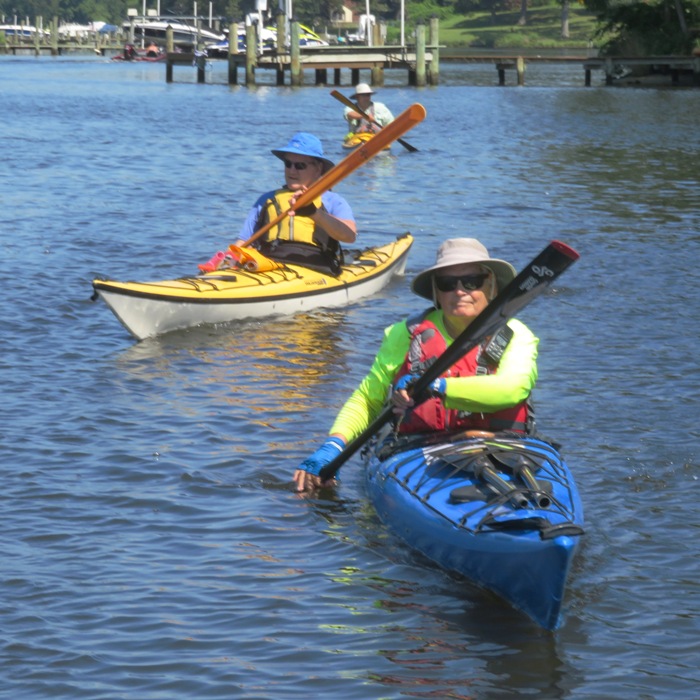
I also saw Chip W., shown below in the middle. 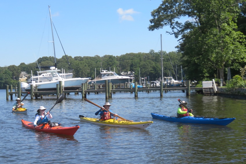
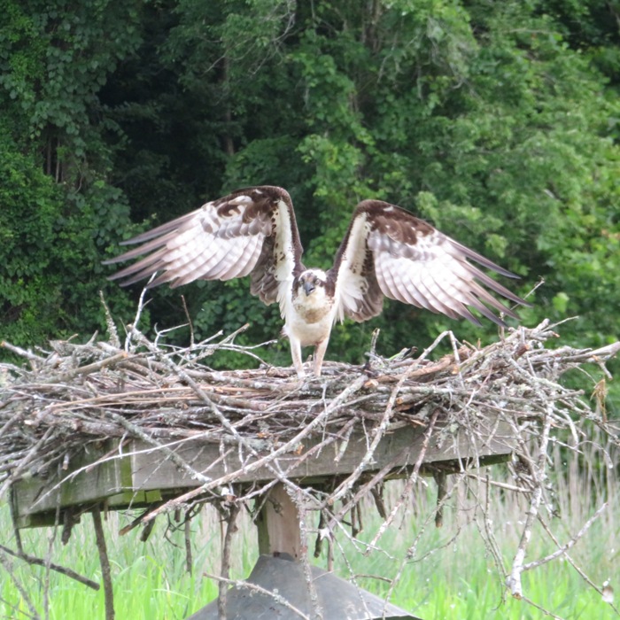
I took a bunch of other pictures and sent them to the group. The group leader quickly made one of them their new Facebook cover photo. Once the group hit open water, I said my farewells and then headed back. They would be out for probably another three hours. It was already getting hot. I don't think Daphne and Mia would have enjoyed being out in the heat. On the way back, I stopped to take a picture of a parent osprey at a nest. You can't see it but there are two or three juveniles laying low. 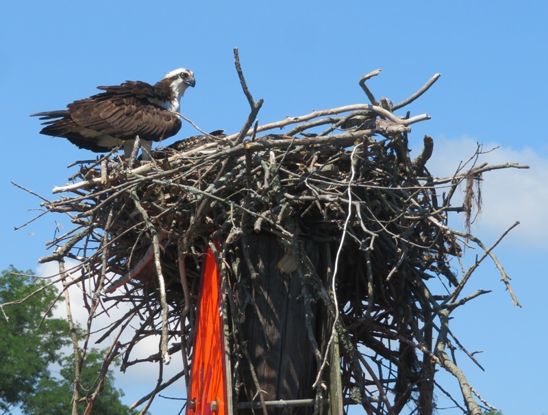
I saw a muskrat swimming. I stayed just far enough away so it didn't dive under. 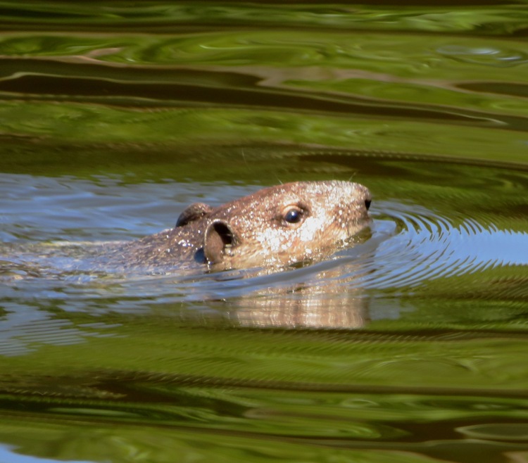
I watched it come ashore. They are not the prettiest things when wet. It was looking like a drowned rat. 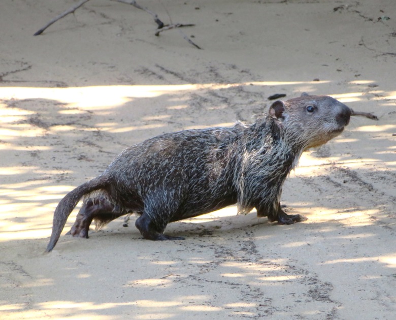
I ended up paddling 6.4 miles. Here is our route. 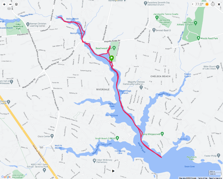
I spoke to some paddleboarders on the shore. I was feeling social. After loading up, I took Daphne and Mia for a short walk on the trails in Beachwood Park. We probably didn't walk more than a mile. 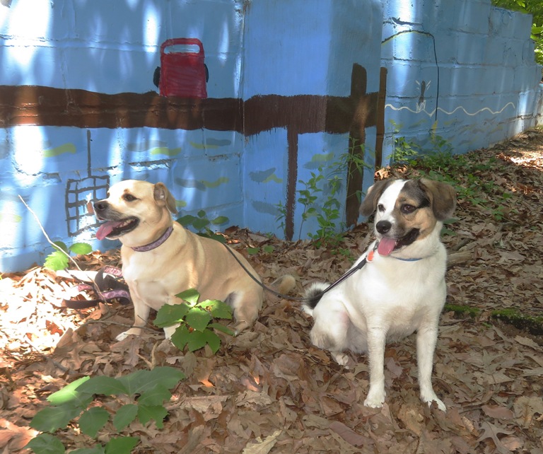
It was good spending time with the dogs outside on the water. I would be happy to take Mia out on the SUP again. |
|
The plan was to launch from Selbys Landing. The last time I was there, Sara and I arrived at 0740 and found the gate open and there were folks who had arrived before us, despite the fact that they don't actually open until 0800. So this time, we got there at 0715 and found the gate closed. But on the way in, we saw the gate to Jacksons Landing open. That spot isn't supposed to open until 0800 either. We drove to the latter and were on the water by 0740. No telling what time that gate opened.
High tide was supposed to be 0753. It gave us a little push up the Patuxent River. We saw a lot of birds: ospreys, a few bald eagles, and some red-winged blackbirds. One of the eagles took to flight from the water, which I have not seen very often. Sara and I stopped to take pictures of a woodpecker. Later, we compared pics and realized that we were looking at two different woodpeckers. Hers was red-bellied woodpecker while mine was pileated. At a beaver lodge, Sara heard noises inside. They could have been beavers or muskrats. The latter have been known to occupy old beaver lodges. We saw a few muskrats that day, including one near the lodge. Daphne was very curious about it. 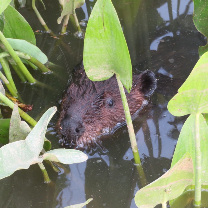
Passing by the Mount Calvert Historical and Archaeological Park, we saw a guy launch his kayak. It was still quite early so when I got home, I checked this place out and found that one can drive down to the launch area and put in from dawn to dusk. These hours are much better than Jacksons Landing. We paddled up Western Branch where we saw a few mimosa trees, buttonbush flowers, ripe black raspberries, some hedge false bindweed flowers, and lizard's tail flowers. Shortly after the bridge at the water treatment plant, we came to a downfall, which we portaged over. We were able to get 0.7 miles upstream from the bridge. There were a few obstacles, including some smaller downfalls but we were able to get past them without portage. I don't think I would have been able to do so without my retractable fin. Most of the upstream section on the Western Branch was shaded, scenic, and peaceful. Coming back downstream, we passed a lot of spatterdock. 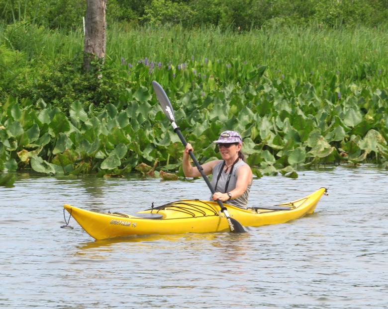
We explored an unnamed tributary and saw a lot of pickerelweed flowers. 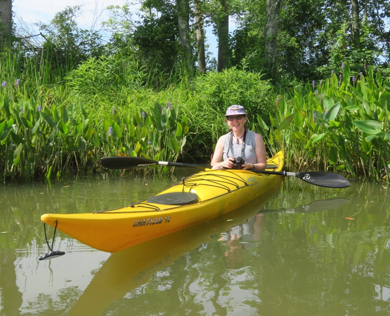
By 1000, it was pretty hot and humid. It never really cooled off during the previous night and it was supposed to get into the 90s today so it was a good thing we got an early start. Something tells me Daphne doesn't like wearing her PFD on a warm day. 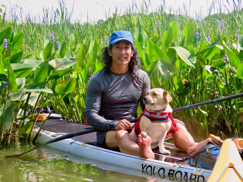
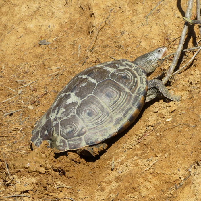
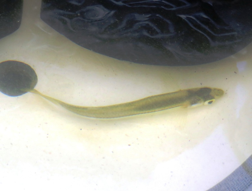
I saw various turtles but one in particular caught my eye. It was small and swimming at the surface. Something about it wasn't right. It tried to get away from me but couldn't go under. I pulled it out of the water. At first I thought it was a box turtle but upon closer examination, I think it was a mud turtle. These are often found near brackish water. Mud turtles are semi-aquatic, though they often wander away from water in mid-summer. They can be found in fresh or brackish water, including marshes, small ponds, wet ditches and fields, and offshore islands. They prefer shallow, soft-bottomed, slow-moving water with abundant vegetation. - from New York State - Department of Environmental Conservation - Eastern Mud Turtle 
This turtle was bloated. Retracted in its shell, I could see skin sticking out. Maybe that is why it couldn't dive under. Maybe it had been in the water too long. Where I pulled it out, there was no land anywhere nearby. Once we got back to Jacksons Landing, I released it on land near the water. At least then it could chose if it wanted to be on land or in the water. We got in 7.3 miles in about three hours. It was a very casual, leisurely paddle. 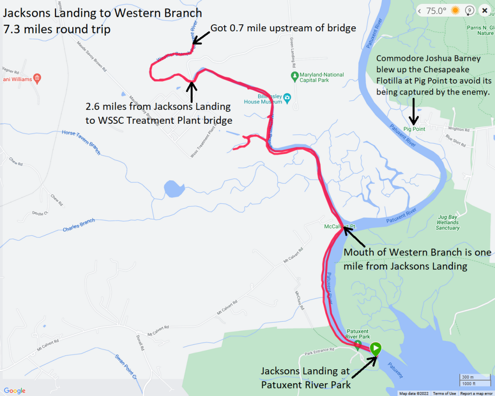
I dropped off Sara and then headed to the Maple Lawn Farmers Market. Afterwards, I took Daphne for a walk on some of the paved paths. We saw various flowers, including some water lilies. 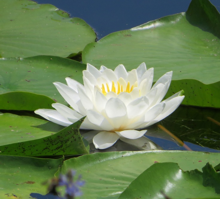
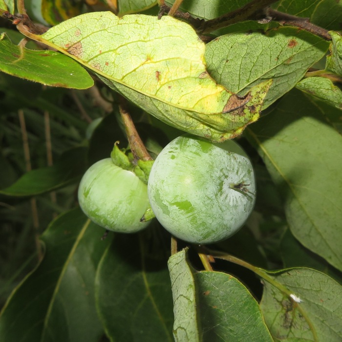
On another path, I found some unripe wild persimmons. 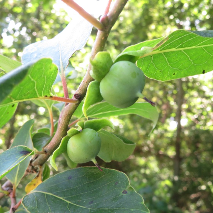
Back at home, the temperature reached 92 degrees. I think the bees in my south hive thought it was too hot so they congregated outside the hive, maybe to keep the colony from overheating. 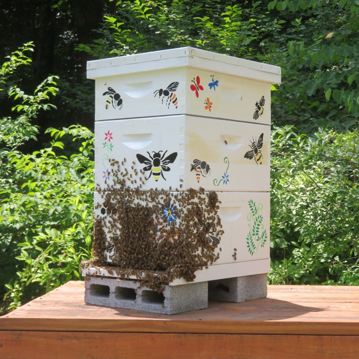
|
|
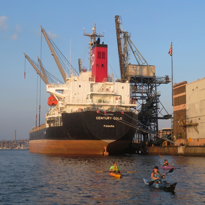
On the way to our final destination, Sara and I checked out Chesapeake Paddle Sports. I've never been there before. We spoke to the owner who had been in business there for seven years. Kayak/SUP outfitters don't generally stay in business very long so I was impressed. She has a new floating pier that I plan to launch from so I can explore Deale. There are no public launch sites here so this was a really good find.
We arrived at Breezy Point Marina and were on the water around 1620. We had some time so we kayaked up Plum Point Creek a bit before turning around and then heading out into the Chesapeake Bay. We had a 7-8 mph wind from the east. That may not seem like much but that was unobstructed for nine miles which means it can kick up some waves. It wasn't that bad but it would have been a little rough for a SUP. So I brought my Prijon Catalina kayak and left Daphne at home. Sara was on her Necky Chatham 16. 
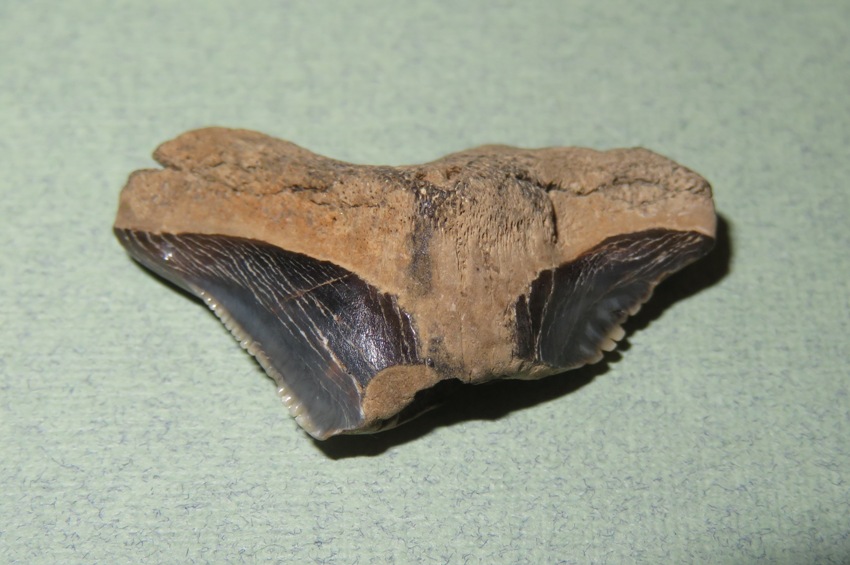
Upon reaching our destination, a place I call the Alpha Site, I was disappointed to see other people looking for shark teeth. We saw about four others during the time we were there. It rained a lot during the previous day so today was a good day to be looking for fossils. We weren't sure how some of then got there. I'm guessing they might live nearby. We searched for about 2.25 hours. There weren't many shark teeth on the surface that we could see so we spent most of our time sifting. We searched in one location for almost an hour and then paddled to a different spot nearby and continued searching. The second spot was much better because the ground near the shore was more sandy so it was easier to sift. Of the shark teeth I found, here are my favorites. The one on the upper left is from a tiger shark. The middle one in the upper row is from a snaggletooth shark. Notice the serrations. The bottom three are from sand sharks. 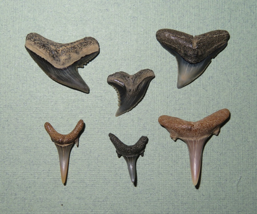
Here are my favorite shark teeth from Sara's collection. The upper two are from tiger sharks. The three in the middle row are from sand sharks. Not sure what the bottom one is. It is broken, but if it wasn't, it would be really big. It is 27 millimeters wide! 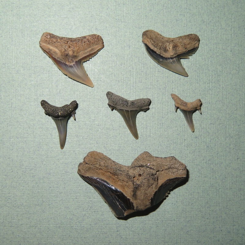
Here are some other pictures of the stuff we found. 1 / 5
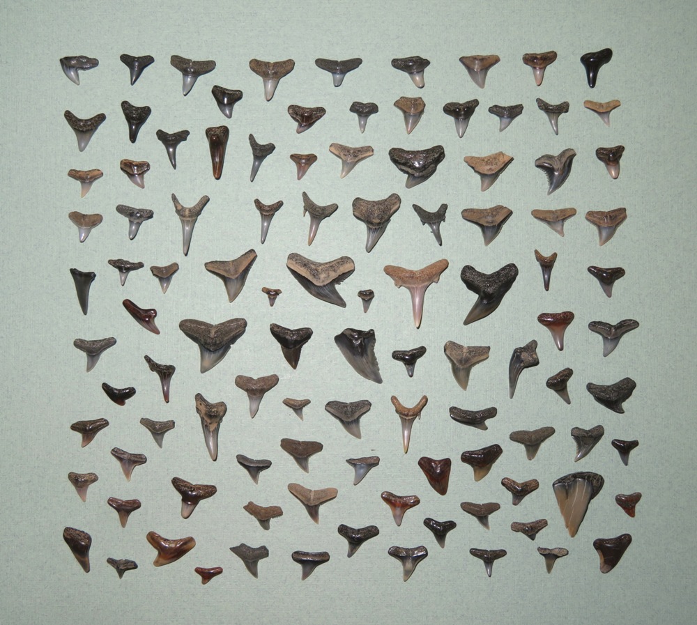
I found 106 shark teeth.
2 / 5
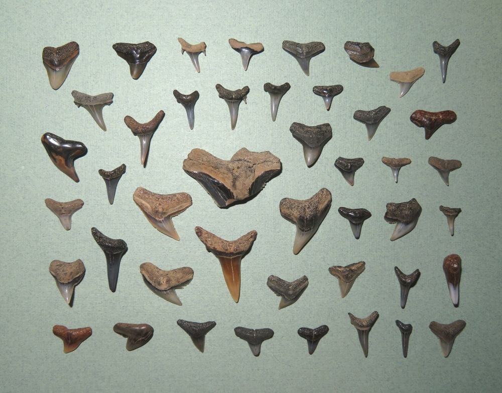
Sara's 45 shark teeth.
3 / 5
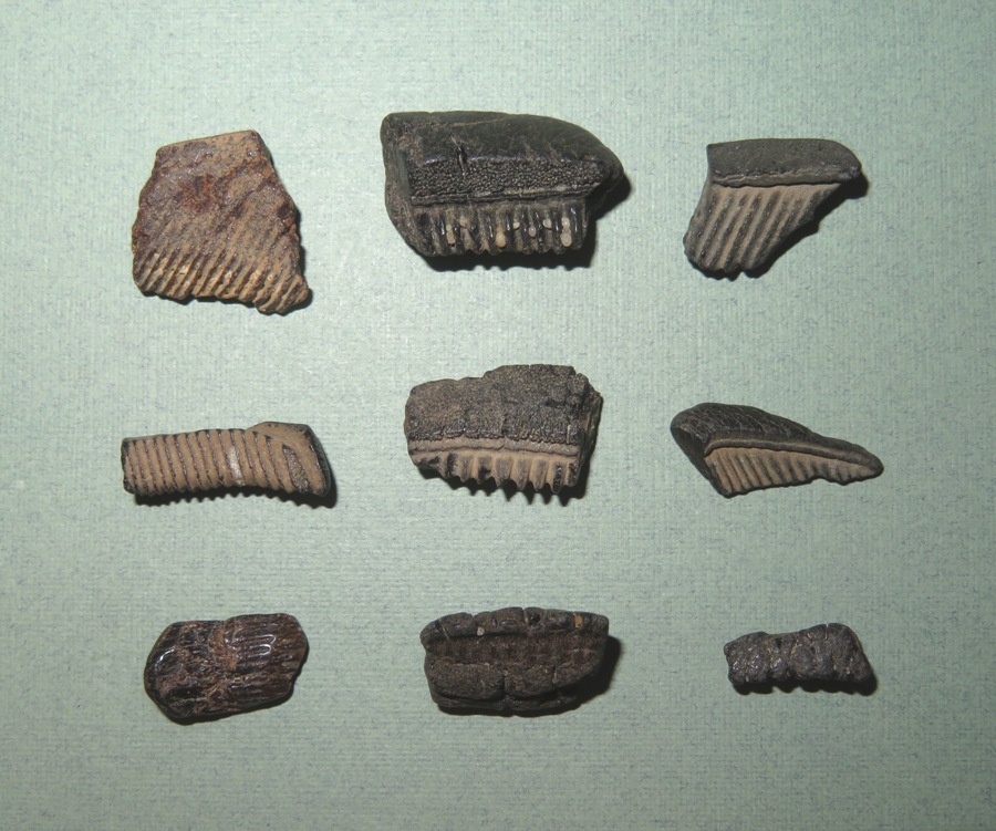
Sara's ray dental palates.
4 / 5
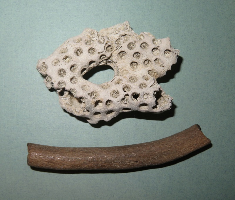
Sara's coral and rib fossil.
5 / 5
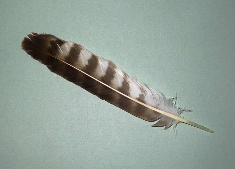
Sara's osprey feather.
We headed back at 2000. Both of us are rather addicted to shark tooth hunting so it is good that we have the rising tide, darkness, and cold to force us to head back. Otherwise, there's not telling how long we'd keep looking. The waves picked up and I was glad to be wearing a spray skirt. I pulled into the launch site just after dusk. We got to try out the new Kayalu Kayaklites I recently purchased. They provide good visibility so boats can see you, and if you place it behind you, then it doesn't ruin your night vision. We paddled about 5.5 miles. 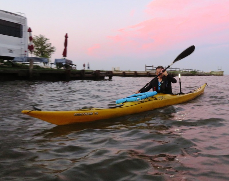
Just before paddling back, Sara found a cow shark tooth. But we never found it once we left. Maybe it is still on the beach. Perhaps it is in some crevice of my car. If it is the former, then I hope whoever finds it appreciates it...cow sharks have really awesome teeth. |
|
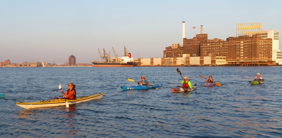
The name of this WatersEdge Kayak trip was Paddle the Beautiful Baltimore Inner Harbor at night! Easy Goin' Mid Week Paddle. Naturally, I brought my SUP so I could take Daphne.
It was windier than forecast with what I'm guessing were 10+ mph gusts from the south. But most of the time, we were pretty sheltered and as it got later, the wind died down a bit. Launching from Canton Waterfront Park around 1900, 17 of us paddled south across the Northwest Harbor and then hugged the shoreline so we could view the Baltimore Inner Harbor going clockwise. Here's Daphne and me in the Northwest Harbor. 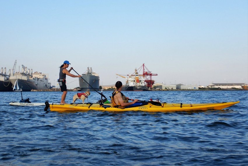
Marla A., who I hadn't seen in awhile and my former co-worker, Karen K., and her husband, Mark, were part of this group. For the latter two, this was their first trip with WatersEdge. Here's Karen in her Current Designs boat. Marla sold it to her. 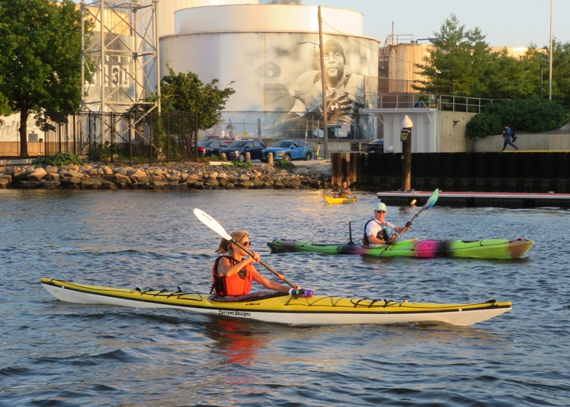
I've paddled this area more times than I can remember but this was my first time with this group and my first time paddling at night in this area. 1 / 5
Big ship.
2 / 5
Locust Point.
3 / 5
Cargo ship.
4 / 5
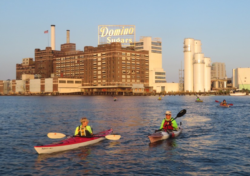
Domino Sugars.
5 / 5
Karen in front.
As the sun started to set, I turned on my Kayalu Kayalite Portable Bright White Led Kayak Light. 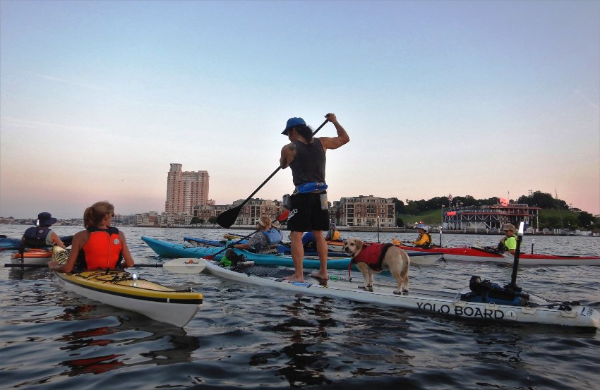
It was difficult to take pictures in the dark. Here's the last one that came out good. 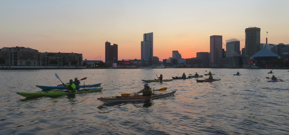
We were done around 2120, having paddled 7.25 miles. It wasn't a difficult trip but I definitely had to work harder than I expected with the wind. But I very much enjoyed it. Mid-week trips like this make the work week more tolerable. |
|
Norma and I were up at 0400. It got up to 97 degrees that day where we paddled but I figured we'd be off the water long before then, so the heat would be tolerable.
The two of us and Daphne headed out to Shore Park where we met Richard C. Richard and his wife Esther are the parents of Mia, Daphne's biological sister. I was hoping Mia would join us but Richard chose to leave her at home. The early morning sun cast a beautiful glow on things. 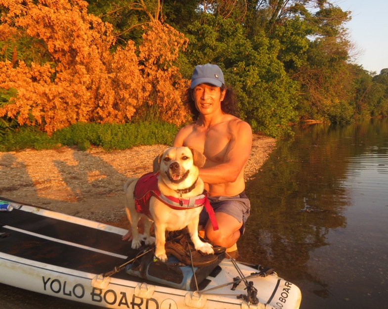
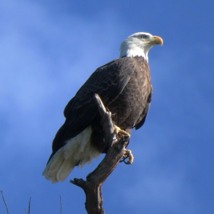
We launched at 0630. Norma was on her Cobra Expedition while Richard and I were on SUPs. His has an 11 foot long inflatable iRocker. It was 78 degrees. I wish we had started at 0600 when the sun was just starting to creep over the horizon. High tide was 0638. It could have helped us go up Swan Creek had I chose that route but I figured I would instead use the extra depth to get through any bay grasses as we made our way to the three island to our northeast: Susquehanna State Park North Sand Island, Susquehanna State Park South Sand Island, and Susquehanna National Wildlife Refuge at Battery Island. Paddling towards the first island, we had no wind and sun in our faces. With the 72% relative humidity, it felt hotter than it was. We paddled clockwise around the North Sand Island and then to the South Sand Island. The bay grasses were thick. There appeared to be algae blooms floating on the surface. It did not look healthy. I was dunking Daphne to keep her cool but in this area, I did not. The four of us landed at South Sand Island and took a short break. The bugs in some sections were terrible. We saw some people camping. Back on the water, I spoke to one of the campers who was on a SUP. She said camping there is first-come, first-served. No need to make a reservation. I checked this out on the internet later and could find nothing to either confirm or deny her statement so I will assume it to be true. There were a lot of bald eagles on both North Sand Island and South Sand Island. Here are some we saw on the latter. 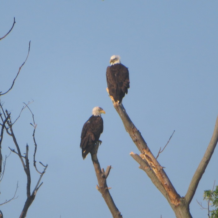
We saw a good number of other paddlers. There were a few power boats but not many. The wind was calm enough so the water was flat. 
Heading clockwise around Battery Island, we got some glimpses of Fishing Battery Lighthouse which was mostly overgrown with foliage. It would have been nice to go ashore to get a better view of the lighthouse but people are not allowed to walk past the shoreline. It's an artificial island, built from rock and soil in the early 1800's as a base for the shad fishing industry. According to Cronin's book, fishermen slept and lived on the tiny plot of island, using its strategic location to stretch long nets across the top of the bay. They caught millions of American shad every spring as the fish migrated from the Atlantic Ocean up the nearby mouth of the Susquehanna River. The men of Fishing Battery Island were so extraordinarily successful, they put themselves out of business by the end of the 19th century. - from WYPR - As Many Chesapeake Bay Islands Sink and Disappear, Battery Island Rises Paddling south, I had a nice view of the two Sand Islands with Norma kayaking in the foreground. 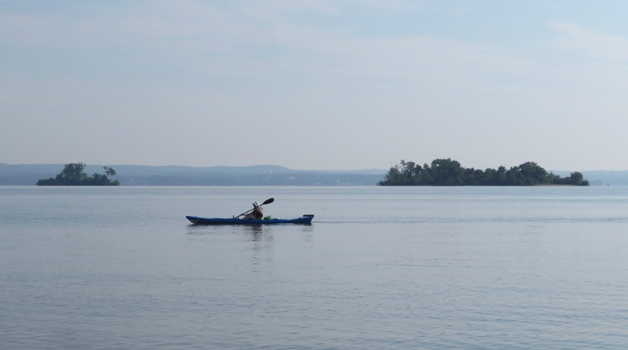
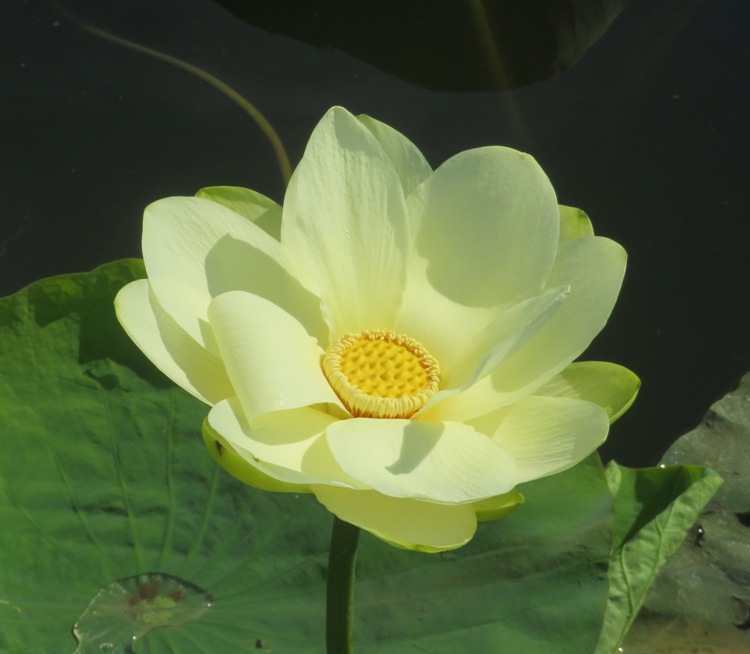
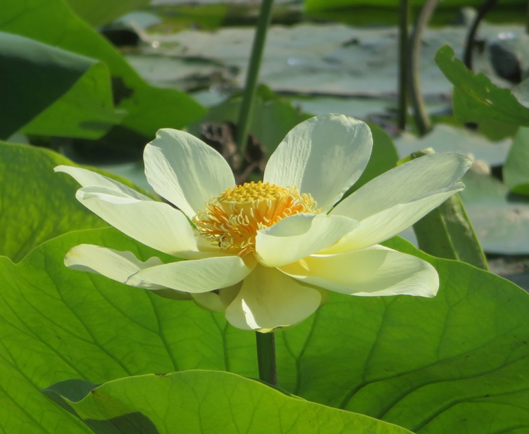
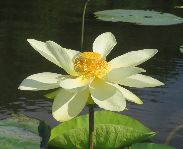
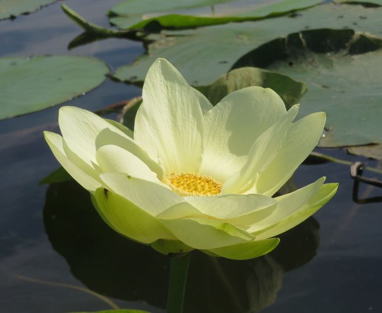
Our next goal was to see American lotus flowers growing in their natural habitat. We explored a small lagoon near Plum Point. Norma and I had been there before. There were indeed lotus flowers but it was also shallow and so thick with vegetation that it was hard to paddle. Just south of this lagoon were a lot more lotus plants but there were no open flowers. I seem to remember this being the case on our previous visit to this location. Next, we paddled around and then north of Swan Creek Point to 39.492024, -76.122555 where there were a good number of lotus flowers, especially at the northwest end. But Norma and Richard were feeling tired and hot so they were ready to head back. It was 88 degrees with 55% relative humidity. The launch area was in sight so they went back on their own while I spent a little time taking snapshots of the lovely flowers. I'm not sure of the best time to see lotus flowers but I'm thinking mid or late morning might be best. I think they close up in the afternoon and don't open until they get sunlight. I found a spotted lanternfly which I then killed because they are highly invasive. Once I got home, I reported this sighting at Maryland Department of Agriculture - Spotted Lanternfly. 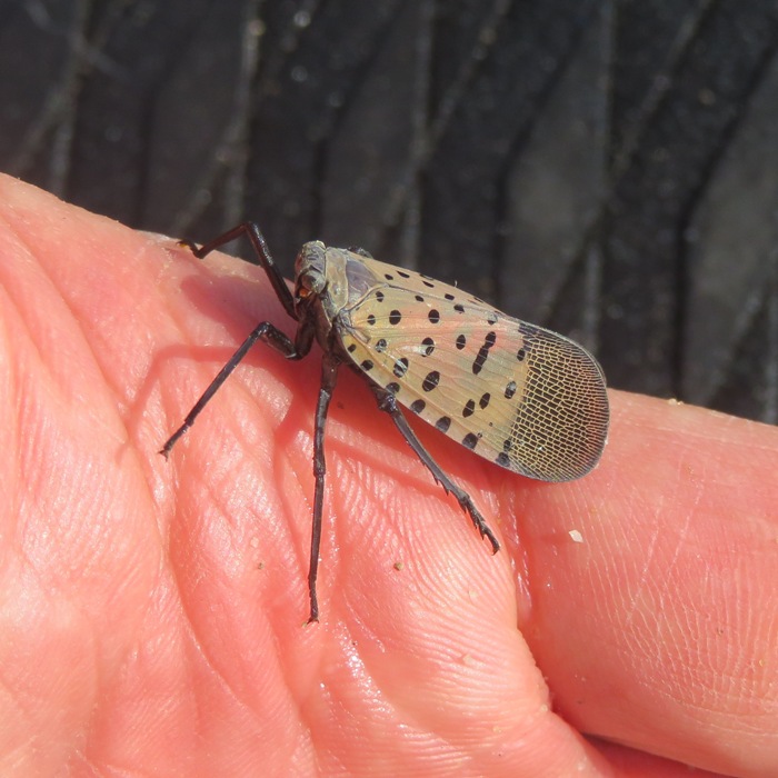
We were done by 1000, having paddled 7.8 miles. 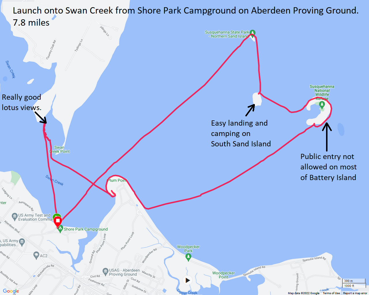
Richard was feeling pretty tired so he headed home while Norma and I set out to explore the city of Bel Air. We went to the Bel Air Farmer's Market. We've never been to the downtown area of Bel Air. It seemed pretty nice. Norma bought a LOT of stuff there and I purchased things from a couple of vendors selling dog treats. It was really hot so I made every effort to keep Daphne in the shade and off the hot asphalt/concrete, though she really didn't seem to care. I thought this farmers' market was nicer than most and it was very dog friendly, which Daphne appreciated. Norma, Daphne, and I hooked up with my former co-worker Phil W. and his wife Tracey who live in Bel Air. We met them for lunch at Sunny Day Cafe. They told us about the Ma & Pa Heritage Trail which I'm sure we will see on a future trip this area. I got a little tired on the drive home but I quickly perked up after I got Norma to quiz me on the state slogans. |
|
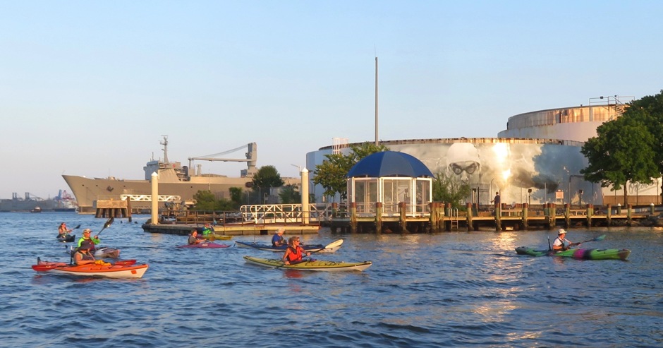
Daphne and I met the WatersEdge Meetup Group at Bowley's on the Bay. This was my first time launching here.
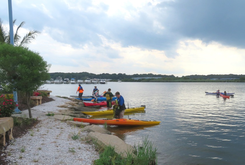
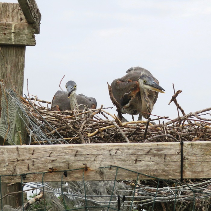
We explored most of Frog Mortar Creek and Limehouse Cove. We turned back at Galloway Point, paddling a total of 6.5 miles. The waterways here are fairly protected so you don't get the full effect from the wind. Otherwise, there was nothing really noteworthy here. There were a few moderately natural areas but it was mostly developed. I saw an osprey family with two youngsters lying low in the nest. 
Here are some other views from the trip. I had a nice chat with Serge, who is an ultra-marathon phenom and a fast kayaker. 
Here is our route. 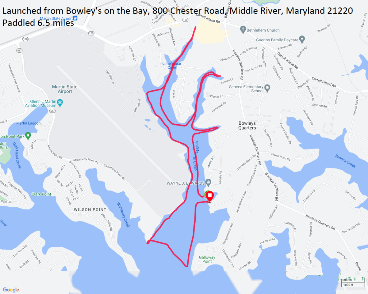
I don't consider myself a social person but I did enjoy having dinner with the group. I think we had about a dozen on the water and about eight for dinner. I'm not used to seeing folks in their non-paddling attire but I got to that night. |
|
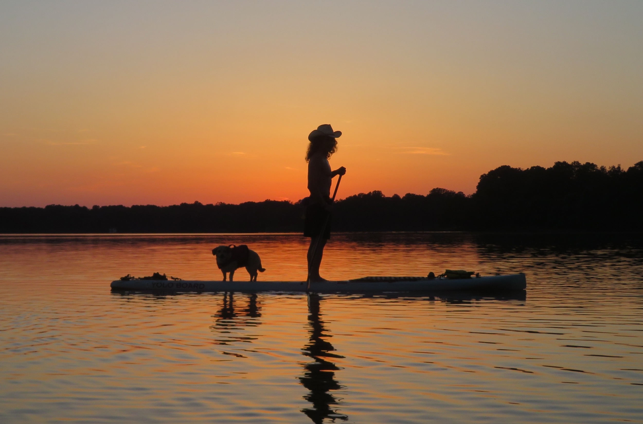
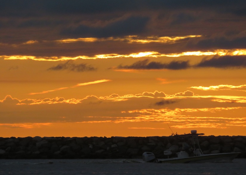
As I write this, the summer isn't over but I wouldn't be surprised if it breaks some heat records. It already has in many parts of the world. I have to wonder what kind of a world my generation is leaving to my nieces and nephews with climate change making our summers so hot.
It is easy to just stay in an air conditioned house but I cherish my time outdoors too much for that. To take advantage of the nicest part of the day, I often wake up early on the weekends. On this day, Daphne and I launched from Spriggs Farm Park around sunrise. The park doesn't officially open until 0700 but as long as you have the gate combination, I see no reason why you can't launch earlier. I don't think the police care too much about early birds who are typically harmless. It is generally the night owls that are the troublemakers...at least that is the stereotype. 
We paddled on the Magothy River out to Mountain Point, near the south end of Broadwater Drive on Gibson Island, and then out into the Chesapeake Bay. In the distance, we could see our destination, the Baltimore Harbor Light (aka Baltimore Lighthouse) which resides 1.7 miles from land. From our vantage point, it looked like a luxury cruise ship was on a collision course with the lighthouse. 
As I approached the lighthouse, I could see the Chesapeake Bay Bridge in the background. 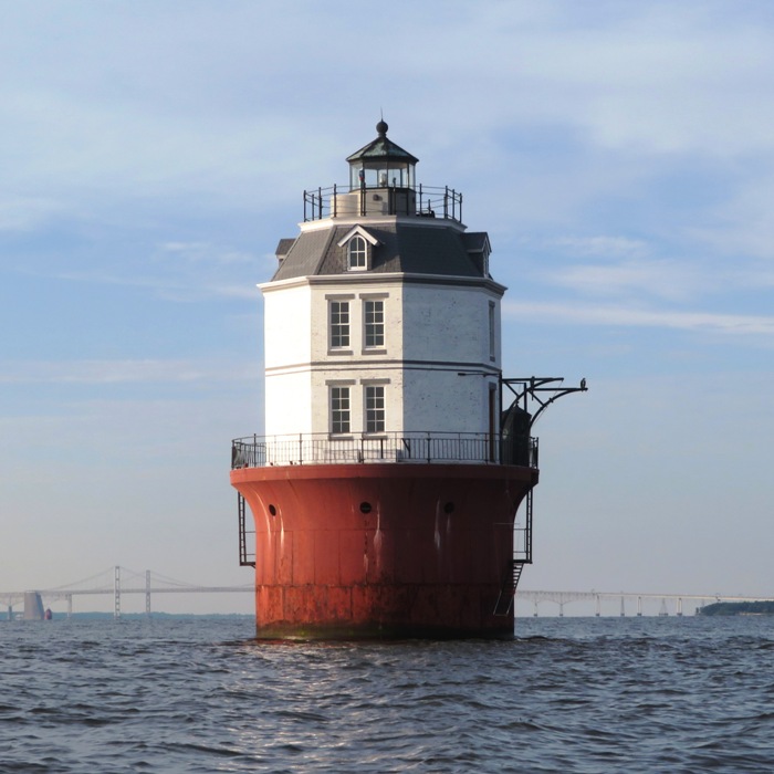
While not the prettiest lighthouse, in my opinion, it is one of the more interesting ones. ...it was not until 1904 that construction [of the Baltimore Light] actually began. It was the last lighthouse to be constructed on the Chesapeake. In May 1964, the Baltimore Light became the first and only American lighthouse powered by nuclear power, as a test of the SNAP-7B [Systems Nuclear Auxiliary POWER] 60 Watt radioisotope thermoelectric generator [RTG]. One year later the RTG was removed and a conventional electric generator was installed. Currently, the lighthouse is solar-powered. - from Wikipedia - Baltimore Harbor Light A fake bald eagle guarded the lighthouse's illuminating lens. 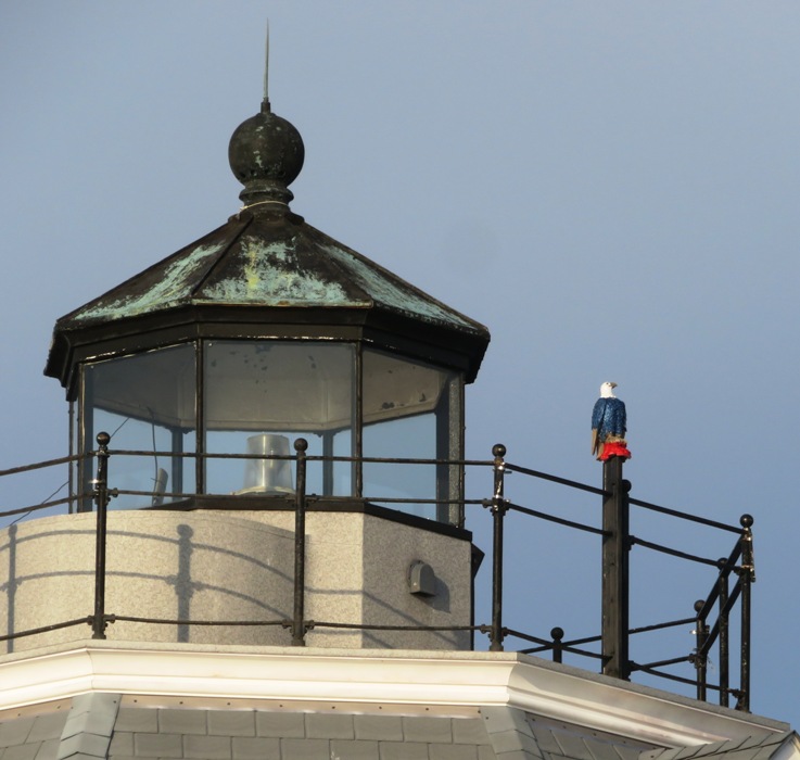
While the lighthouse looked big compared to the cruise ship, in this snapshot, it appears a little smaller than Daphne. 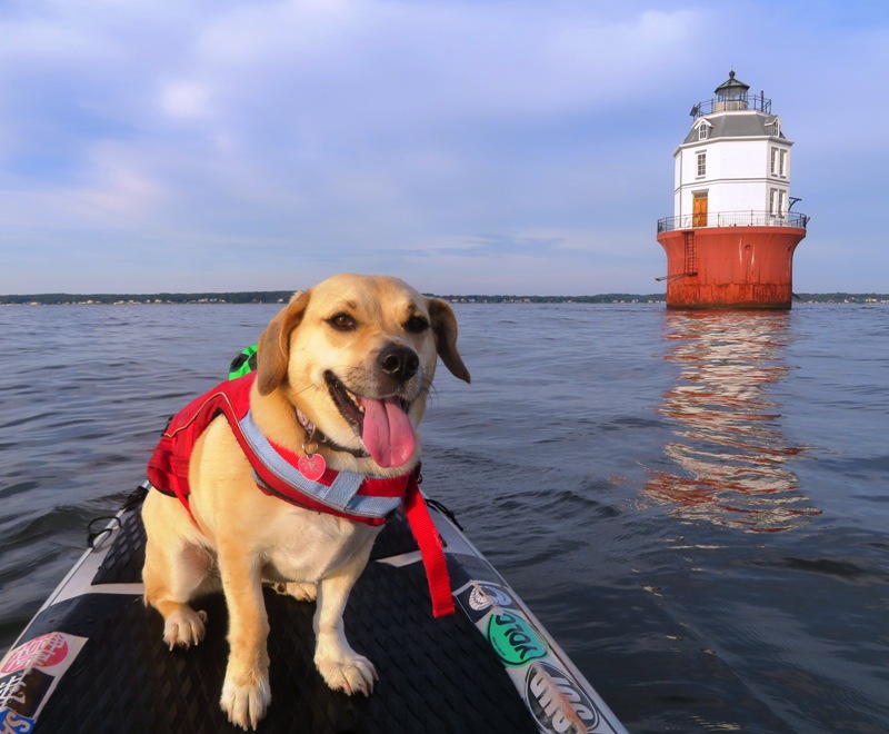
What is that thing on the left in the below picture? A phone booth? Just outside on the gallery, a cast-iron structure resembling a guard shack was cantilevered over the water to serve as the station's privy. - from Lighthouse Friends - Baltimore Lighthouse 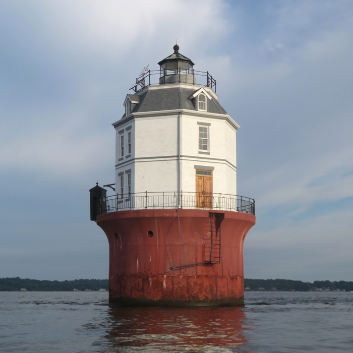
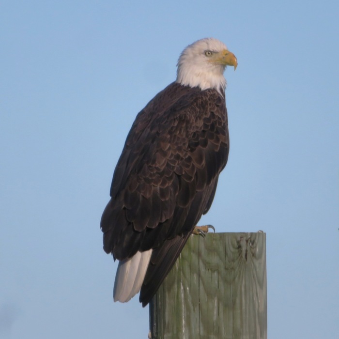
I noticed a fake great-horned owl standing watch over the privy. On the return trip, I saw quite a few birds (real ones), including this bald eagle. 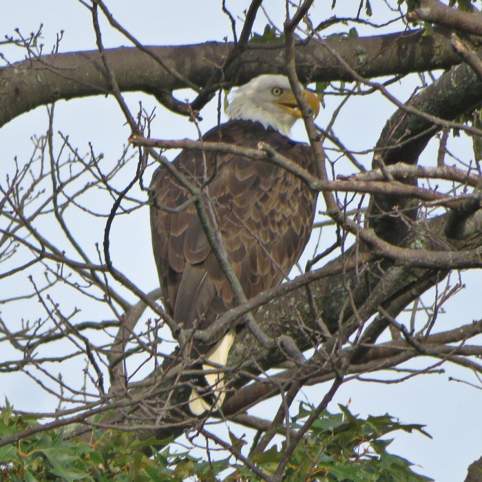
The juvenile ospreys are starting to look like adults. 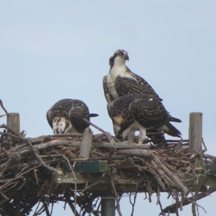
I practiced executing a reverse paddle turn. 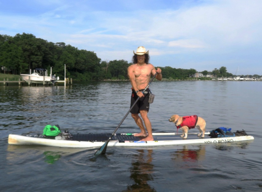
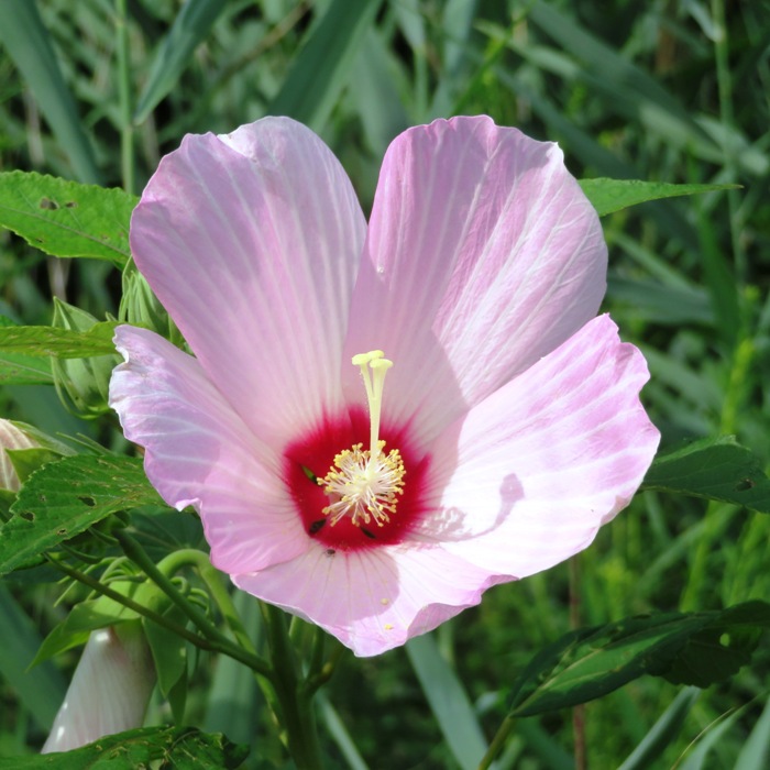
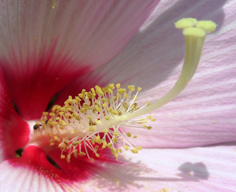
Back at the launch site, I saw some swamp hibiscus flowers. Pulling ashore, I saw three outrigger canoe people getting ready to launch. I did some name dropping and asked if they knew Neil M. One of them did. He's pretty famous in the outrigger canoe community. Here is our route. 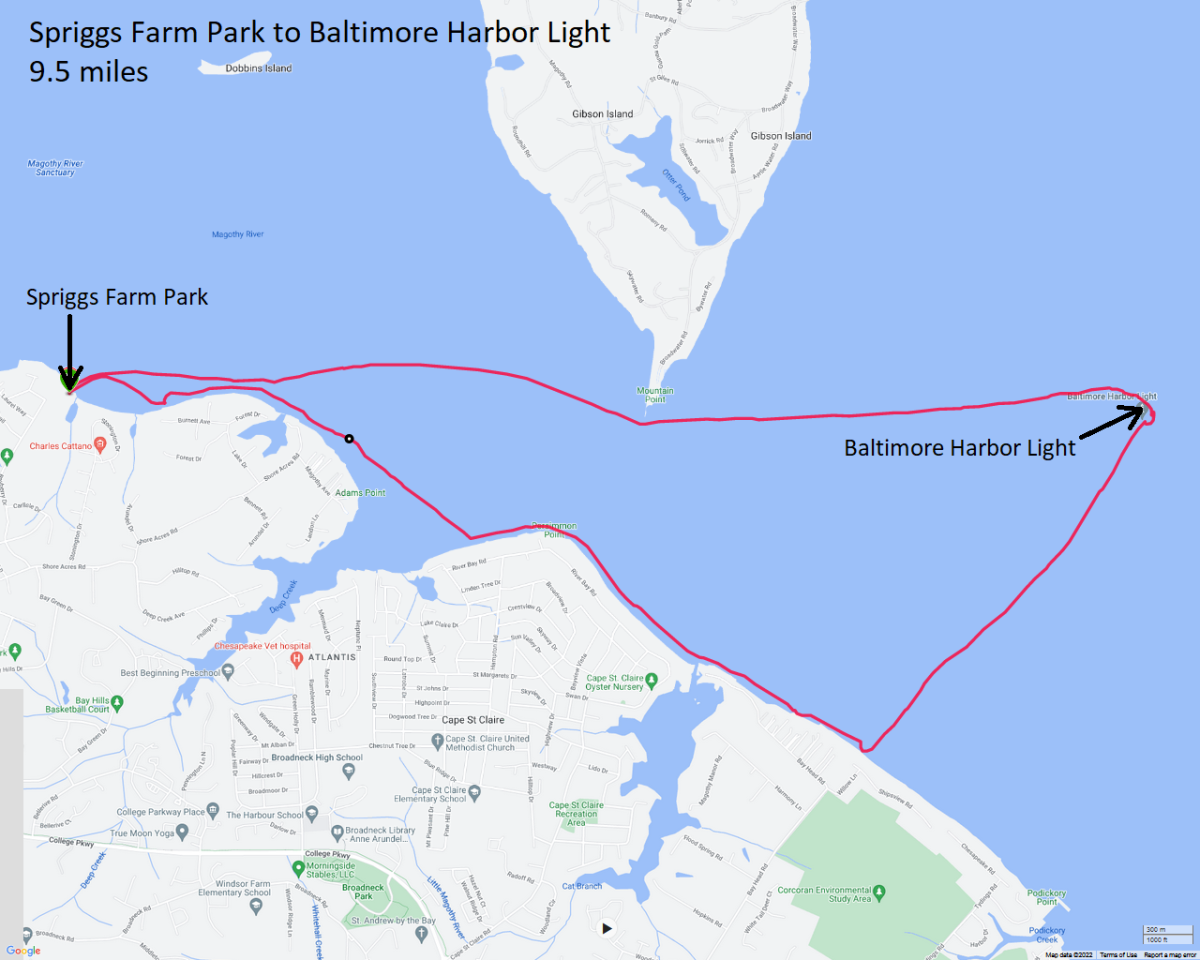
|
|
Daphne and I launched from Chesapeake Paddle Sports around dawn. It was a mostly dark and cloudy morning.
We passed Town Point and then paddled out into Herring Bay. I was looking for dolphins but instead found an Antheraea polyphemus, stuck to the water. I tried to get it to shore but it kept flopping around and ending up back in the water. It was about six inches wide. 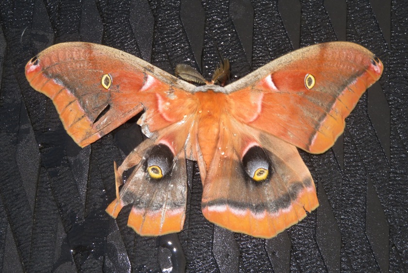
A little south of Fairhaven, I pulled ashore to look for shark teeth. I have found a few in previous years on the shore of the Chesapeake Bay in southern Anne Arundel County. But today I found nothing. I think I needed to be further south. I paddled under Fairhaven Road (route 423) into an unnamed inlet. I had to lie down on my SUP to fit under the bridge. The water in the inlet was shallow and muddy. I could have used more water for paddling but then I might not have been able to fit under the bridge. The place was scenic and natural. We saw four snapping turtles. Two of them were mating. 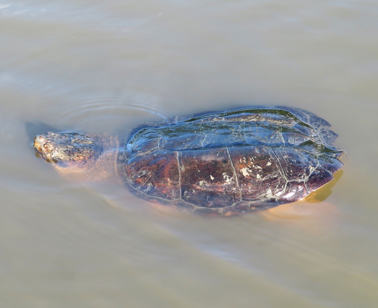
One of the snapping turtles was curious about my SUP. 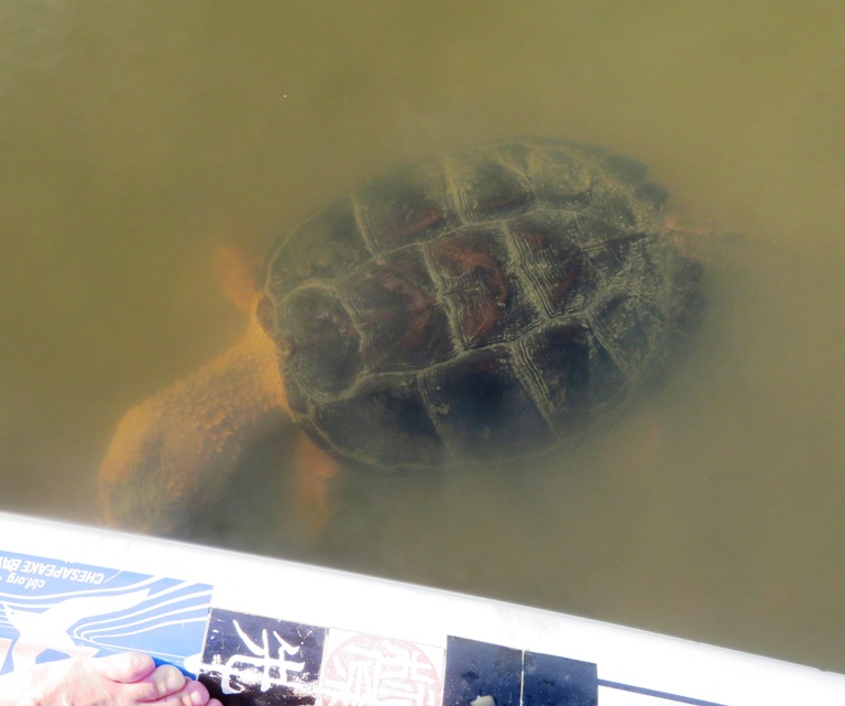
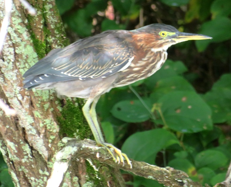
I would have liked to have stayed in the inlet longer but it was ebb tide and I didn't want to get stuck. I am calling this place Snapping Turtle Inlet. We saw lots of snowy egrets, terns, ospreys, and green herons. What we didn't see were bald eagles, which is becoming rare...rare to NOT see them because there are so many. We paddled up Rockhold Creek 1.3 miles upstream of the launch site before it got too shallow. The tide was about midway between high and low. It would be nice to return here during a supermoon high tide and see how far upstream I could get. Rockhold Creek has a lot of marinas but the upper part is natural. This and the neighboring Tracys Creek are pretty sheltered from east/west wind. 
Daphne and I got in 11.6 miles, finishing at 1000. Here is the Chesapeake Paddle Sports floating ramp, from where we launched. 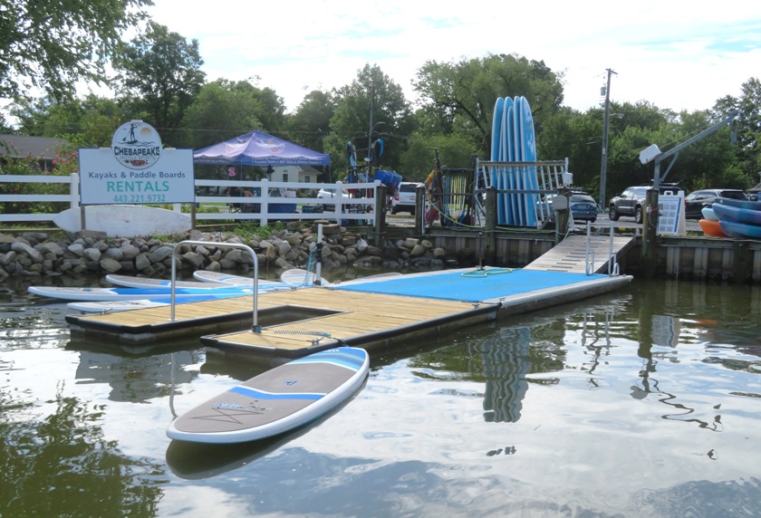
Next, we drove out to Mayo Beach Park to do a little scouting. I plan to return when the wind is extremely calm and then paddle out to the Thomas Point Shoal Lighthouse. This park is very nice. Here is the section of the beach designated the cartop boat launch. 
Lastly, I drove out to the Anne Arundel County Farmers' Market. Dogs aren't permitted here so Daphne had to wait in the car. The place was packed. I purchased two mini-fruit pies. |
|
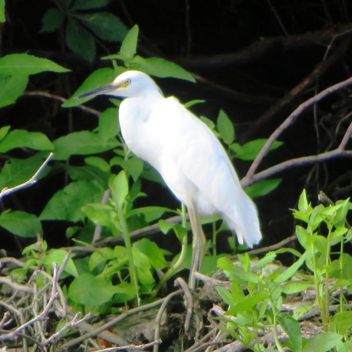
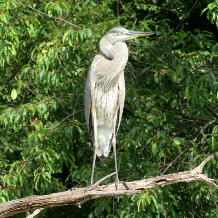
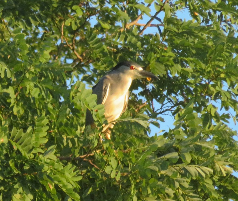
I kayaked 14.3 miles after work on Marley Creek and Curtis Creek, launching from Solleys Cove. It was a good day to see birds. I saw great blue herons, green herons, ospreys, bald eagles, great egrets, snowy egrets, and probably more black-crowned night herons (BCNH) than I'd ever seen. Where is the best place to see the BCNHs? Anyplace north of Solleys Cove
A small fish jumped into my boat. 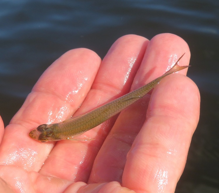
Here's my route. 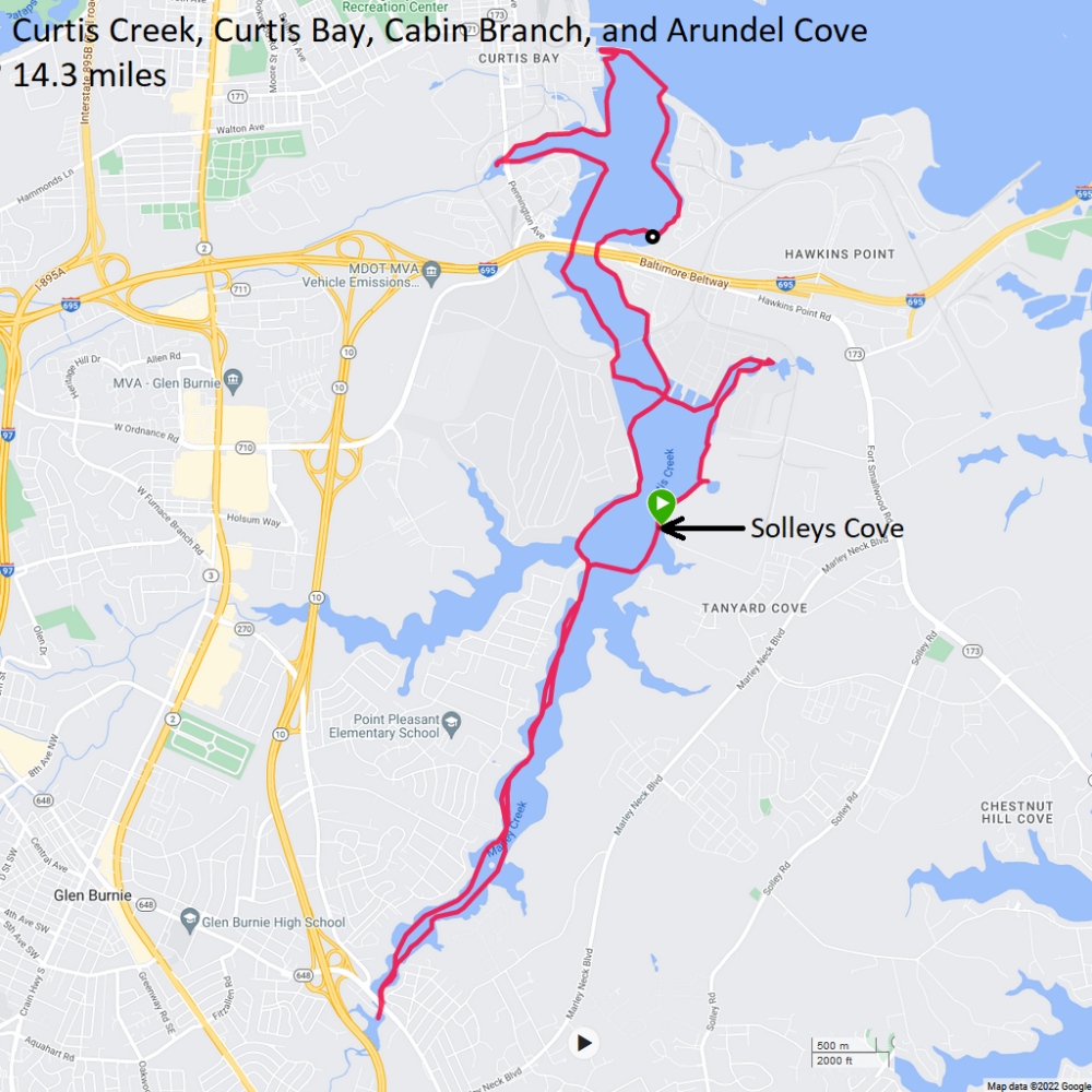
|
|
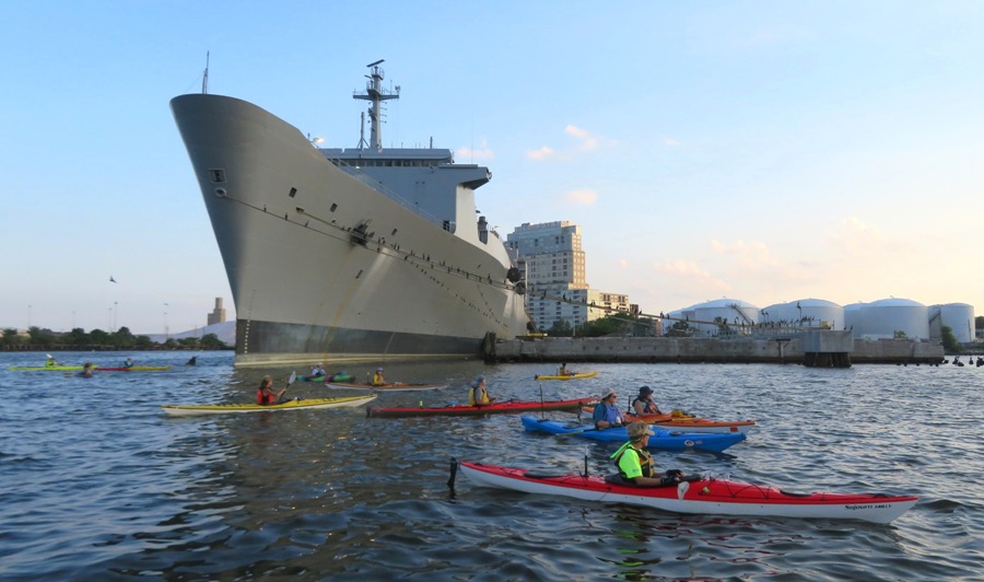
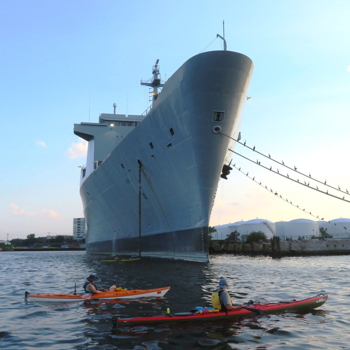
Daphne and I launched from Canton Waterfront Park and got in 10.3 miles on the SUP before work to see the ships that came to Baltimore for Maryland Fleet Week. This is my third one...haven't missed any!
You can see pictures I took of the previous Maryland Fleet Weeks and learn about the current one at Fleet Week Baltimore, Past and Present. Below is the USS Carter Hall, a dock landing ship. Had I re-enlisted, I might have deployed on a ship such as this, which is used to transport Marine personnel, landing craft, vehicles, and cargo. This was parked slightly west of Fort McHenry. Passing by the Fort, I noticed that the bridges in the marshy area just west of it were in shambles. 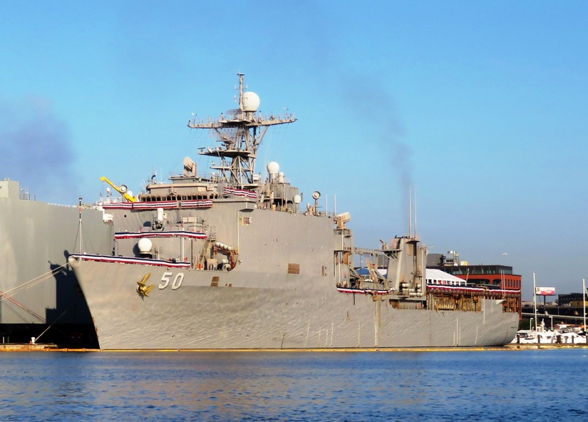
This is YP 708, a patrol craft used for training. Boats like this are called "Yippy Boats." 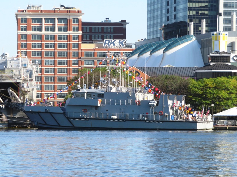
I love the tall ships but I thought this one looked a little plain. The Danish Government had the Danmark built in 1932. The purpose was to have a proper Training ship. Now, as then, young people who want a career at sea can have their basic training on board the Danmark. There is room for 15 crew members and 80 trainees on board the ship. - from Martec - Training ship DANMARK 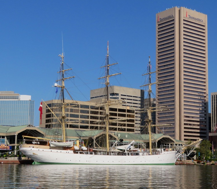
It is interesting that the Danmark, which resembles a historic ship, was parked next to the USS Minneapolis-Saint Paul, the Navy's newest littoral combat ship, commissioned in Duluth, Minnesota on May 21, 2022. 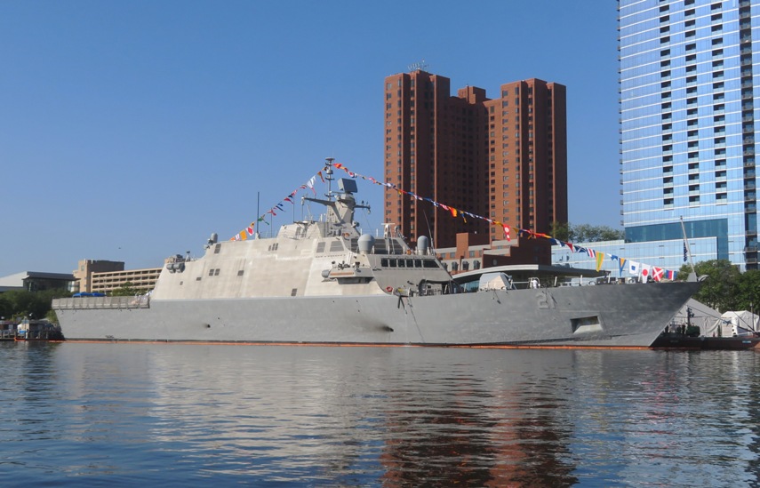
The USNS Newport is a very non-ship-looking ship. It is an Expeditionary Fast Transport (EPF) vessel. A small police boat photobombed my picture. 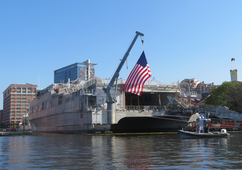
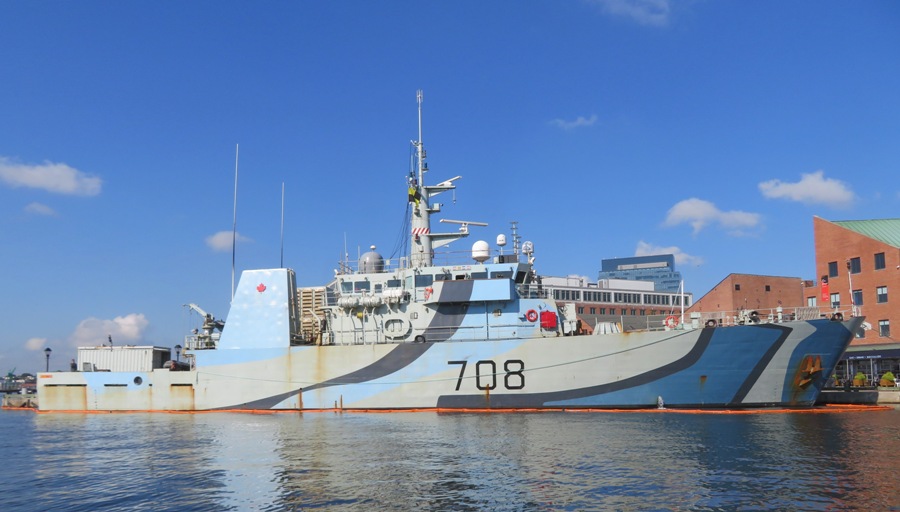
The HMCS Moncton is a Canadian coastal defence vessel. I saw it at the 2018 Maryland Fleet Week. Back then, it was all gray but today, it was sporting a fancy paint job. 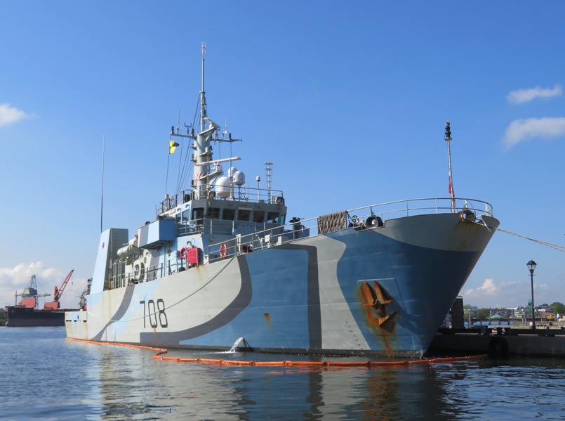
In this blog's cover photo is another view of the HMCS Moncton. Unlike many of the other ships, where the police ensured I kept my distance, I could paddle really close to this one. The boats shown below weren't here for Maryland Fleet Week...they are here year-round. In the background are the USNS Denebola and the USNS Antares. The boat in the foreground reminds me of a Mississippi riverboat without the paddle wheel. 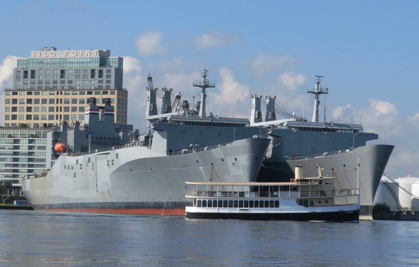
Below is Mr. Trash Wheel. It is a solar-powered water wheel that has removed 1.1 million pounds of trash from the water as of 2017. It is also in Baltimore year-round. 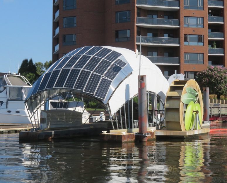
Here's me, Daphne, and a side view of Mr. Trash Wheel. 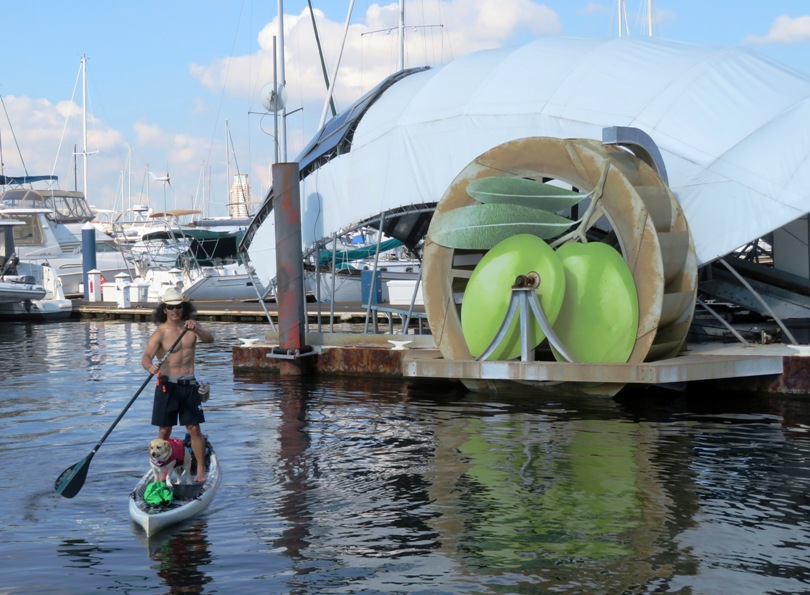
This is something near the Canton Waterfront Park that I never paid any attention to until today. This railroad transfer bridge allowed the Pennsylvania Railroad to land freight cars transferred on ferries (carfloats) between Locust Point and the Canton area. Carfloating started in the Baltimore Harbor about 1871 and ended in 1969. This two-story steel gantry, built in 1912, was left behind as a remnant of the industrial revolution that began in the Canton area in 1828 under the aegis of the Canton Company and lasted until the 1980s. It is a reminder of the working harbor that was needed by the railroads to transfer cargo across the harbor. - from historic sign 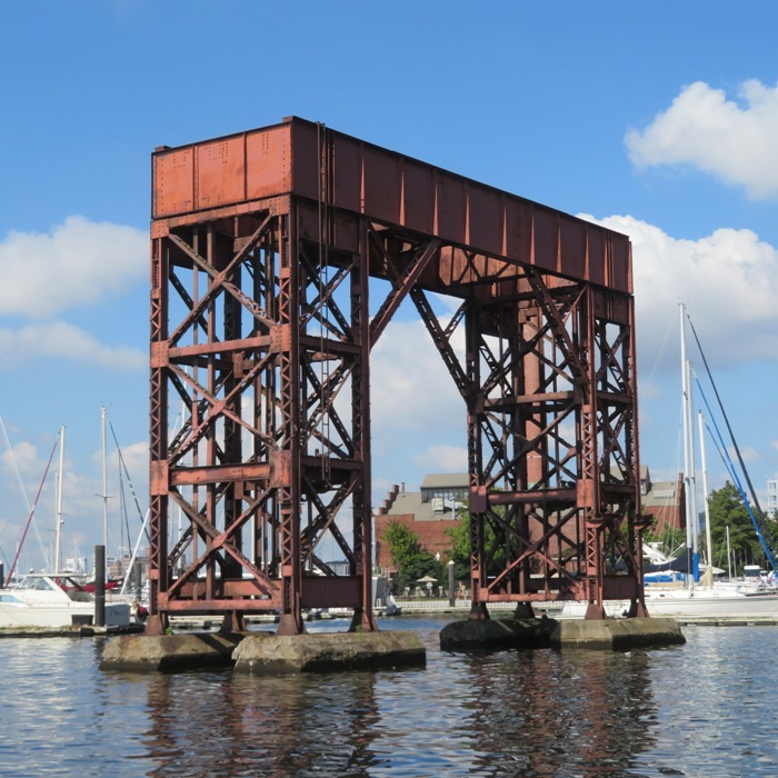
Here's our route. 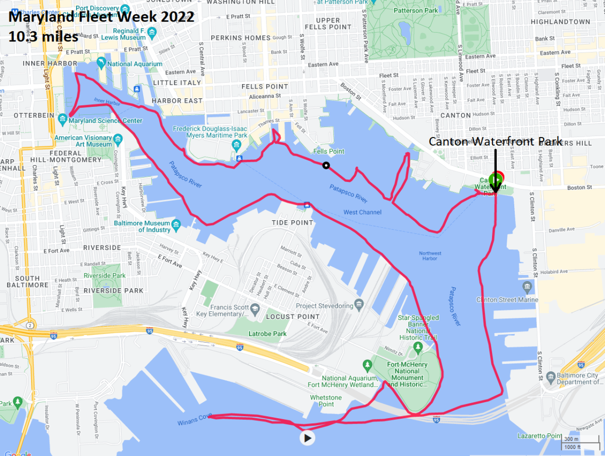
One great thing about Maryland Fleet Week is they actually bring porta-johns to Canton Waterfront Park. |
|
Daphne and I headed out to the Maryland eastern shore for the day. Our first stop was the Easton Farmers Market where I purchased delicious ginger and snickerdoodle cookies made by T's Divine Sweets & More.
Next, we launched my SUP from Windyhill on the Choptank River and explored Skeleton Creek where I saw a few Virginia saltmarsh mallow flowers. 
The high water line left its mark on the bay grasses. 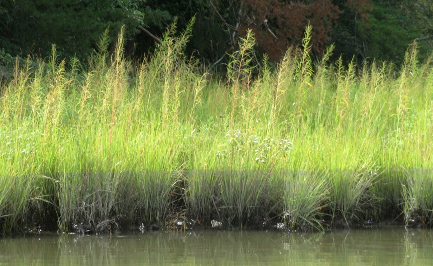
Then we paddled to Boston Cliff an area known to have 10 to 12 million-year-old fossils. I normally don't like to divulge the location of such places but this is not a very fruitful site for finding fossils and it take a lot of work to paddle there. I can't imagine that this place would ever get overrun with fossil hunters. It was the day of the Harvest Moon so the tide fluctuation was greater than normal, though not as great as if it were a supermoon. I timed my visit so I could search for fossils at low tide. But that meant I was paddling against the tide in both directions. At the fossil area, I found some marsh fleabane flowers. 
Here's Daphne in front of a wall of shells. There were so many shells on the ground that it was impossible to walk without stepping on them. 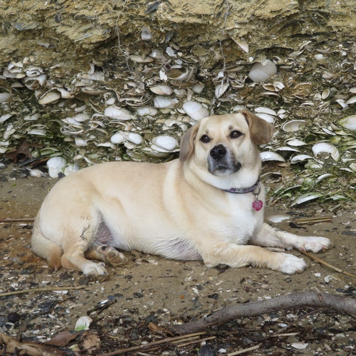
My most interesting find was a dental plate from an eagle ray. Eagle rays still live in these local waters so it could be recent. It didn't feel like a fossil. 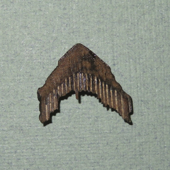
Gastropods (such at moon snails) make holes in shells and eat the flesh of the animal that lives inside. I don't know if these are old. 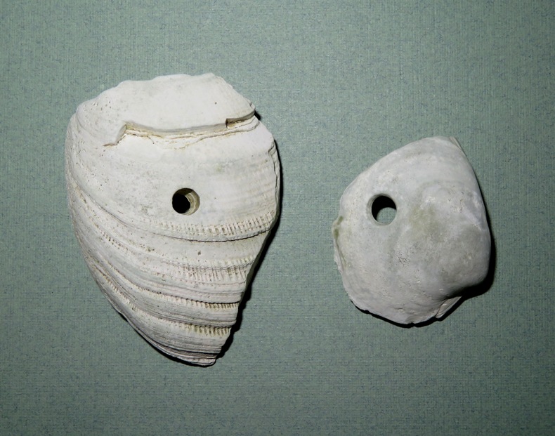
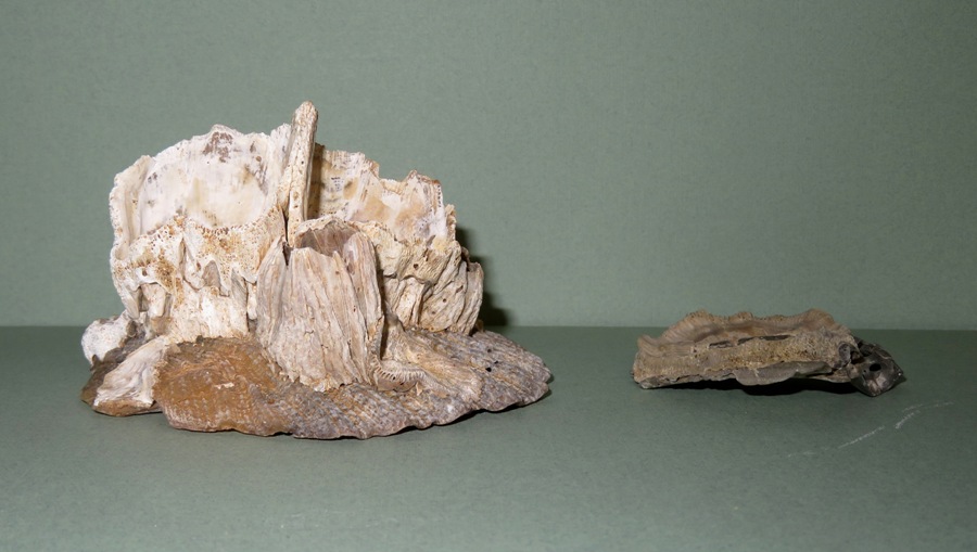
I believe these shells are of the Noetia ponderosa, more commonly known as ponderous ark. Not sure if these are old either. 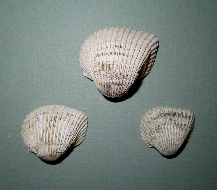
Scallops still live in the Chesapeake Bay but modern ones only get 3.5 inches wide. In contrast, the scallops shown here are 4-4.5 inches wide so it is safe to assume they are prehistoric. I also found one that is 5.5 inches wide. They are rather brittle. 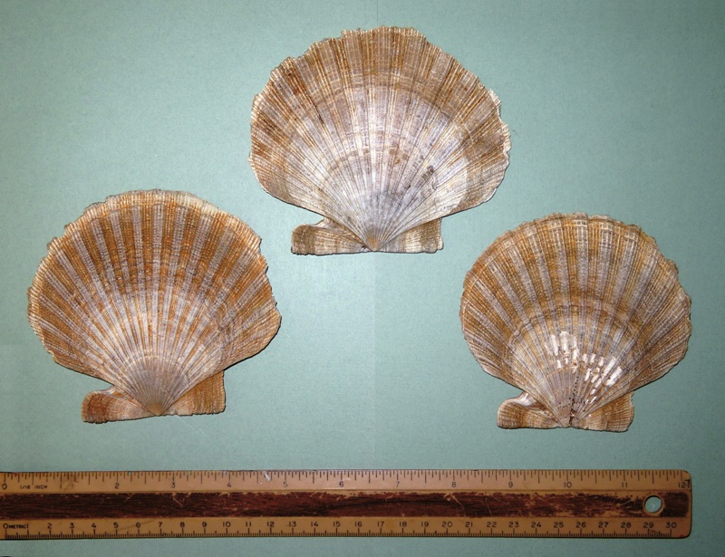
According to The Natural Historian - A Fossil Scallop from Calvert Cliffs, MD ...you may wonder if this is really a fossil or just a shell buried in some sand hundreds or thousands of years ago. The term "fossil" is not easy to define as the process of becoming a fossil is not made of discrete steps but rather is a gradual process. The shells here retain much of their original molecules rather than having been replaced by minerals. So they are not "rock" in the sense of many older fossils. Nevertheless, they are best thought of as fossils because they are embedded in rock and their chemistry is altered. I found the remains of barnacles on one of the scallop shells (left side). On another shell fragment (right side), I thought I found evidence that a barnacle was once attached to it but it could actually be part of a horn coral fossil. 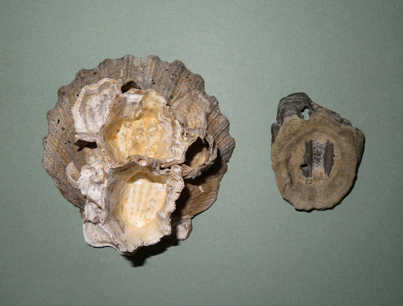
Some of the barnacles shown here (like those above and this blog's cover photo, which is simply a side view) have diameters up to 1.5 inches, indicating they are very old because modern barnacles in the Chesapeake Bay only get up to one inch in diameter. On my previous visit in 2021, I found similar barnacles and was told they are likely 10-15 million years old. Here are some arrow arum seeds and seed pods that I found. I mention them in my blog Kings Creek - A Water Trail Fit for Royalty. 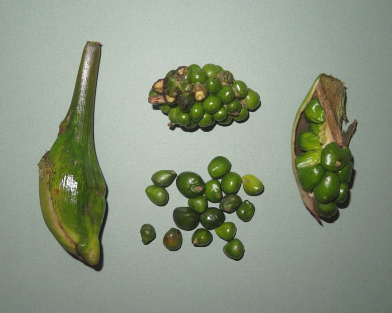
I considered cooking and eating the seeds as some Native American tribes did, but after reading what happens if they aren't properly cooked, I decided it might be in my best interest not to. Seed - cooked. A slightly sweetish flavour, resembling parched corn. A bread can be made from the dried and powdered seeds, it tastes like corncake with a strong flavour of cocoa. The plant is rich in calcium oxylate, this is toxic and if consumed makes the mouth and digestive tract feel as though hundreds of tiny needles are being stuck into it. However, calcium oxylate is easily destroyed by thoroughly cooking or drying the plant. - from Practical Plants - Peltandra virginica I put the arrow arum seeds in a cup of water that I took to work. It ended up rooting and growing leaves about three months later. Here is our route. Got in 13.7 miles. Except for Skeleton Creek, it was very boring, big water paddling. Next time I go, I'll probably bring the surf ski to make it go faster. 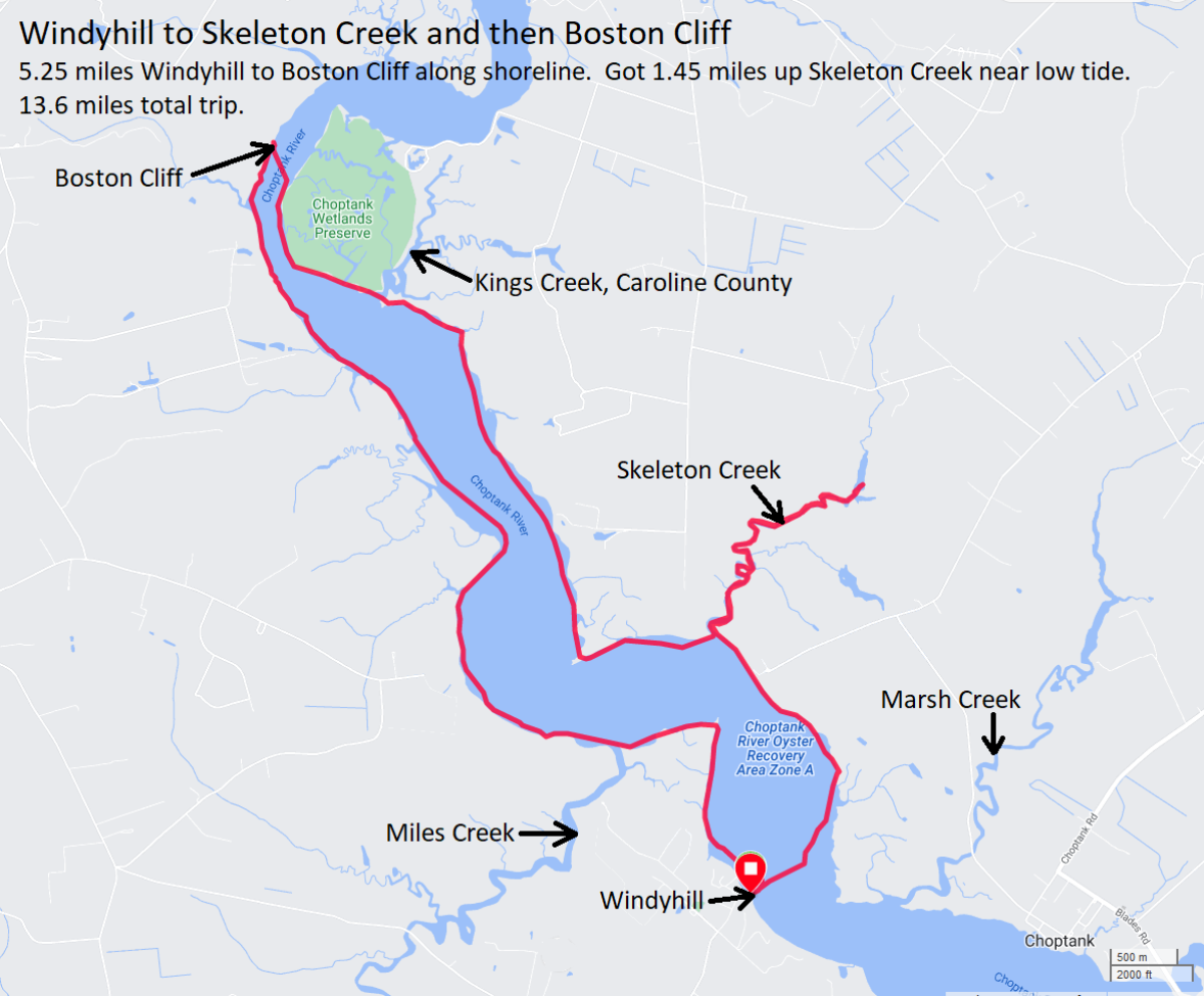
|
|
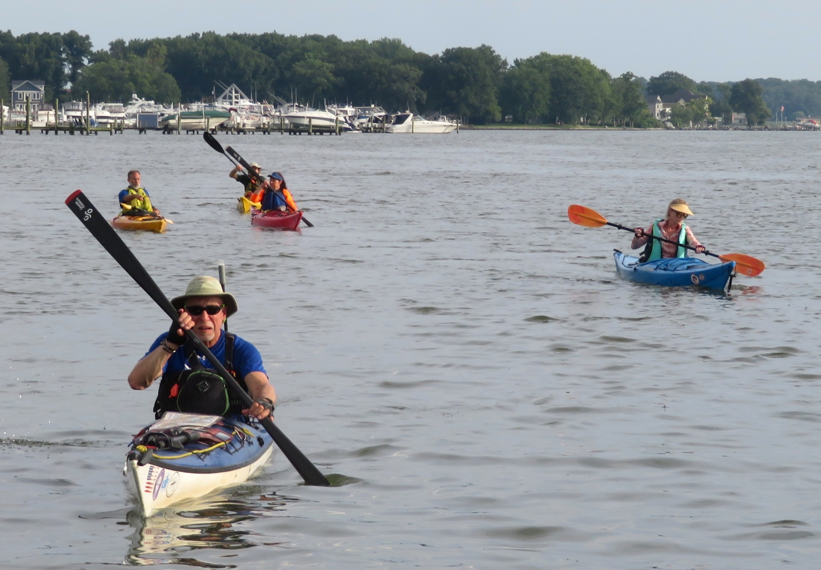
Anyone who knows me well would say I'm an introvert. That being the case, I paddle alone far more frequently than with a group. But sometimes I like to get out with a group, especially if it is something new. That's just what Daphne and I did on this day. We met up with the Maryland SUP & Kayak Meet-Up - Tortilla Flotilla at Stoney Creek Bridge Marina.
Normally, one must pay to launch here. But the group has an agreement with the marina to launch for free at certain times. Launch time was 1800. I arrived around 1700, not knowing the agreement with the marina. Fortunately, they were nice enough to let me launch for free anyway. I saw several wild persimmon trees on private land and five black-crowned night herons at 39.16641760774783, -76.52594428854009. I've seen them at this location in previous years. They are shy and don't like to pose for pictures. 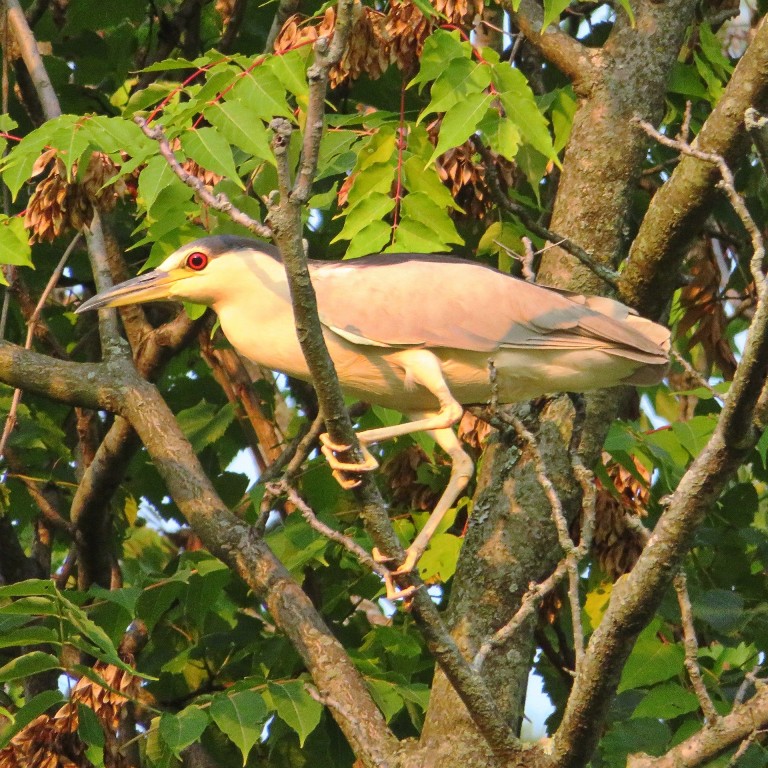
I returned back to the marina at 1750, expecting the group to be almost ready to launch. But they didn't actually head out until 1825. They were younger than the average sea kayaker. Most were women. One person had a recreational kayak and everyone else had an inflatable SUP. The culture was much different than what I've encountered with the sea kayakers. It was much more casual and folks were happy to just get out on the water without having a particular destination in mind. We only paddled about two miles, heading upstream on Stoney Creek. 
|
|
Wanting to get my money's worth out of my Queen Anne's County annual launch permit, I launched from Romancoke Pier on the southeast side of Kent Island. I paddled through Eastern Bay, south around Kent Point, and then north on the west side of the island in the Chesapeake Bay.
I visited Bloody Point Bar Lighthouse which stands about a mile from the shore. It was built in 1882. Notice in the photo below that you can see the sky through the open door. Why is that? 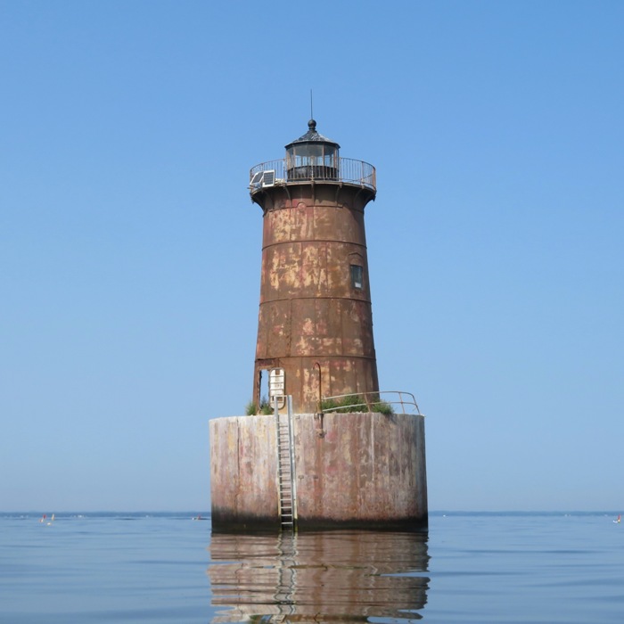
Looking at the lighthouse from a different vantage point, you can see why the sky is visible through the open door in the previous picture. Also notice that the lighthouse is askew, leaning to the south or southeast. According to Lighthouse Friends - Bloody Point Bar Lighthouse Severe storms during the winter of 1883 struck the lighthouse, "scouring the sand from under the northwest side of the light-house and causing a settling of the structure toward that direction." Bloody Point was found to be leaning five feet from perpendicular at its lantern room, and riprap stone was hastily put down around the affected northwest corner. This solution was inadequate, though, as that stone was either carried away by storms or so heavy that it sank into the soft mud of the Chesapeake. In November 1884, the Board tried a more drastic means of eliminating the lighthouse's tilt. Sand was dredged out from beneath the side opposite the list, successfully reducing the inclination by half, and heavy brush mattresses were placed all around the lighthouse and weighted down with small stones. In the spring of 1885, the seabed around the lighthouse was further secured by 760 tons of larger stones, which were used to form a 'scour apron.' This technique has kept the lighthouse aligned within two degrees of vertical to this day, and the scour apron is visible at low tide. My measurement indicates that it is tilted at least three degrees. Not sure I buy the story about the severe storms. I think Chuck Norris kicked it. 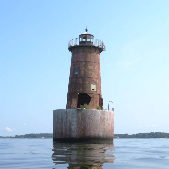
I kayaked back to shore and then continued north. Near the same latitude as where I launched, I entered Carter Creek. Some areas were very shallow and I had to do a couple of portages after running aground. Here's my S1-A surf ski at the entrance to Carter Creek. At 16.5 inches wide, it doesn't like to go slow. 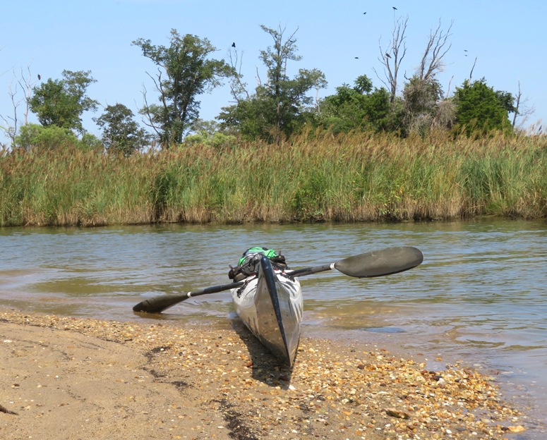
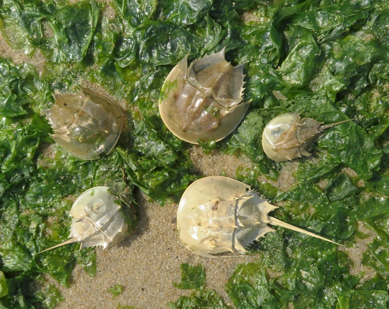
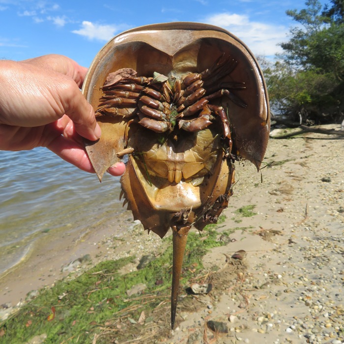
I paddled back to the southeast side of the island and explored a couple of creeks: Holligans Snooze Inlet and Tucky River. The name of the latter was on a sign near the entrance...I never saw it on any map. It is really just a small creek. On both, I saw bald eagles, great blue herons, and green herons. Here's a couple of other birds I saw on the Tucky: Back at Romancoke, I found several horseshoe crab molts. In order for arthropods to grow they need to molt. Approximately 20 days after the egg hatched, the larvae will molt for the first time. At a young age the horseshoe crab will molt many times throughout the first year of its life. As the crab ages it will molt about once a year. - from BioWeb - We Ain't Nothing but Arthropods! I also saw hundreds of small fish at Romancoke. 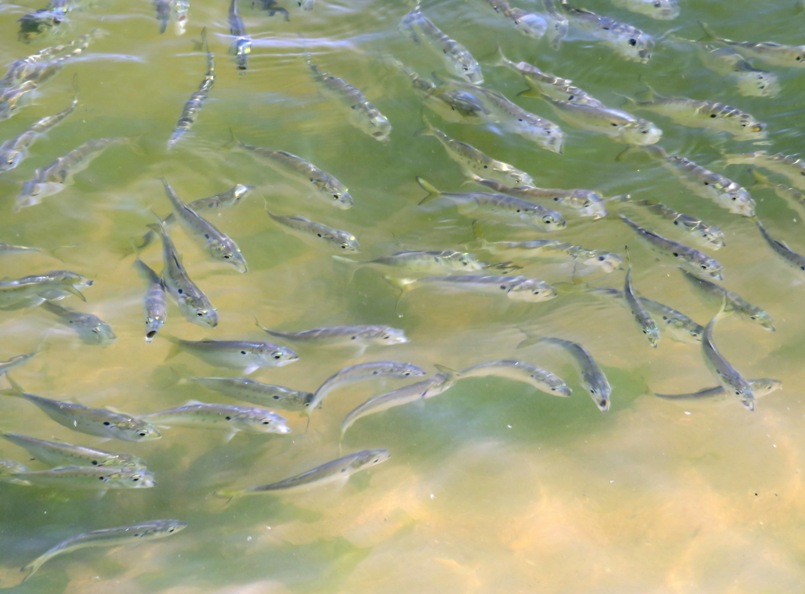
Here's my route. I never found the South Capitol Beauty Academy, despite it appearing on the map. 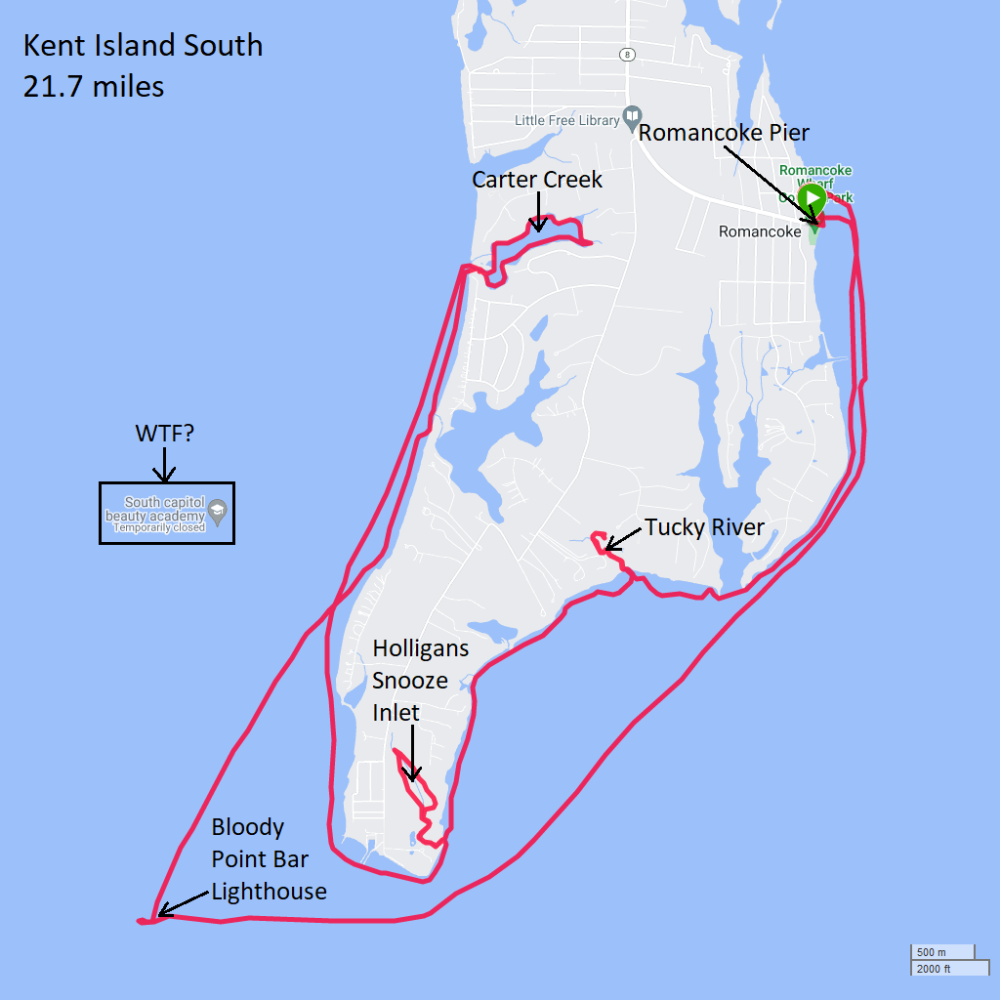
I get pretty hungry after paddling a long distance like this...21.7 miles over 4.5 hours to be exact. So I purchased a Pizza Hut meat-lovers pan pizza. It really hit the spot. |
|
I don't do as many long kayak trips as I used to...mainly because I spend more time on the SUP with Daphne. But every once in awhile, I like to push myself.
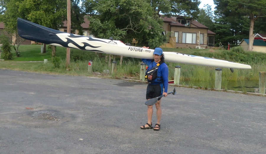
I launched my S1-A surf ski from Bennett Point Landing onto the Wye River. The east side of the launch area has a small beach. 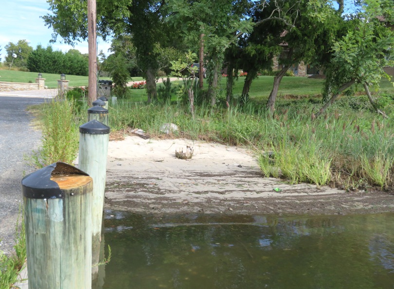
My plan was to explore some of the areas south of Wye Island and then to possibly circumnavigate it...something I've only done once before, 20 years ago. Just the circumnavigation is 13.1 miles. I paddled south to Bennett Point. I was not expecting to see any lighthouses but I saw the Bennett / Kilby Point Lighthouse. 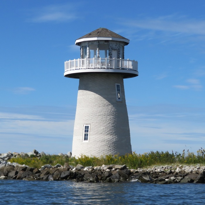
This is considered a faux lighthouse with one source implying that it was probably built around 1987. From another source, I read Bennett Point (date unknown), west side of the entrance to Wye River. This privately-built lighthouse is charted as a landmark but not recognized as an aid to navigation. - from Lighthouses of the United States: Maryland Eastern Shore I paddled up the Wye East River and hugged the shoreline of Shaw Bay. I also explored Lloyd Creek and Gross Creek. Along the way, I saw a lot of stuff. 1 / 5
Dead horseshoe crab.
2 / 5
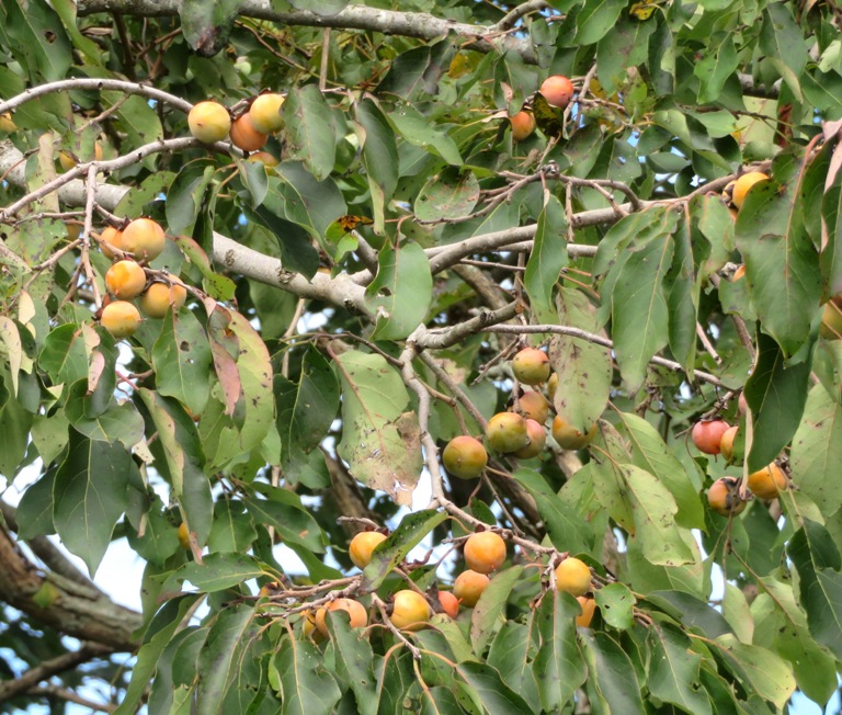
Wild persimmons.
3 / 5
Green heron.
4 / 5
Bald eagle.
5 / 5
Another bald eagle.
I found an osage orange tree holding lots of hedge apples. 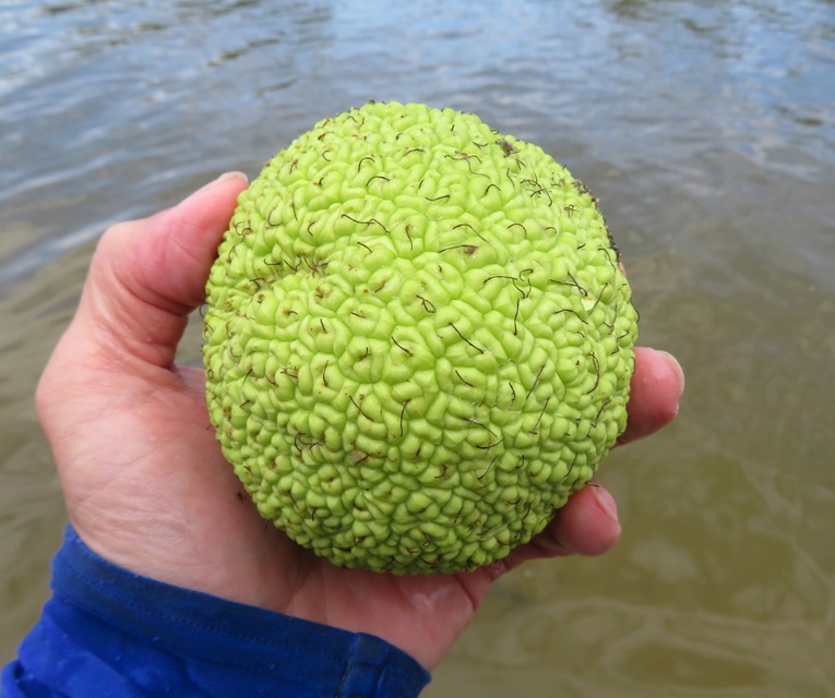
Squirrels and chipmunks love hedge apples; humans do not, but they're not poisonous. Cattle can choke on them. What humans have discovered is that lots of insects really don't like the glossy leaves, the branches, or the bark of this tree. And they particularly don't like the fruit - the hedge apples. It turns out that chemicals in the fruit repel spiders and quite a few different insects, and a good number of folks in the country used to place hedge apples under the bed or in the cellar to keep away spiders (but be sure to put the fruit in open plastic bags, because it softens and rots in less than 6 months). In fact, studies have shown that extracts from the fruit repel some insects just as well as DEET. - from Illinois Extension - Hedge Apples, Spiders, and Mice What about the wood of the tree? The extremely high strength of this wood led to its use for archery bows (in the 19th century, a well-made Osage-orange bow was worth "a horse and a blanket"), and for wheel rims and axle hubs for wagons. It is probably the most naturally decay resistant species in north America, leading to its use as fence posts, insulators and insulator pins on telephone poles, and railroad ties. - from Woodworking Network - The extremely strong Osage Orange tree derives name from the Osage Indians It was also used in the construction of the Schooner Sultana and the Maryland Dove, two Maryland tall ships. Some of my co-workers have never seen hedge apples so I grabbed four to take to work on Monday. It seem like the temperature over much of the last two weeks has been mild. Previous to that, we had a lot of really hot days. But today was cool. It was supposed to get to a sunny high of 72 degrees. I don't know if it every did. Most of the day was overcast. When the sun did come out, it was comfortable but otherwise, I was a little cold. On the SUP, I would have been fine but with water splashing on my arms and legs, I really had to push myself physically to stay warm. After landing at Wye Island, I checked my GPS. I had completed 18 miles. I wanted to get in at least 20 and if I took the shortest path back, I'd probably do 22. But if I continued around the island, I figured I'd come close to 30. It was been a long time since I've gone that far. It seemed like a good opportunity for my annual Saki Challenge. Inspired by Jack LaLanne, I do a physical challenge every year and make each challenge different from previous ones. I was inspired to do this after learning about Jack LaLanne's birthday challenges. A birthday challenge is essentially a goal, generally in the form of physical achievement, to make your birthday more memorable than the last. - from Just What The Hell Is A Birthday Challenge Anyway? I used to try to schedule it on or near my birthday but now I just do one every calendar year. This 30+ mile trip would be it for me in 2022. The distance was just part of the equation. There were other challenges to include navigation, the cold, pushing myself to maintain a good pace, and an unobstructed headwind near the end. It wasn't my most difficult trip but I would definitely put it in the top 10. What was difficult about the navigation? I didn't keep my GPS on my body. It was in a waterproof case behind me, strapped under bungees. Stopping to check it took awhile since that meant I had to land. So most of the time, I was just relying on intuition. On a map, the route looks pretty easy but there is a lot of uncertainly and second-guessing. Sometimes a bend around a point looks like the east end of the island. Other times, the mouth of a creek on the island looks like where I should paddle into to get to Wye Narrows. Unless you've actually done this trip without having to rely much on a GPS, this probably won't mean much. The headwind at the end was only about eight miles per hour but it felt like quite a bit considering I had already paddled 24 miles. After six hours and 35 minutes, I paddled 30.2 miles. My moving average was five miles per hour. I had about 40 minutes of non-moving time where I stopped to check my GPS, eat, drink, and take 69 photos. This was certainly not my most physically challenging Saki Challenge but it was one of the more mentally challenging ones. I know I had a GPS but by forcing myself not to check it so often left me with a feeling self-doubt. But it all worked out and when I was done, I was on top of the world because I had accomplished something difficult. 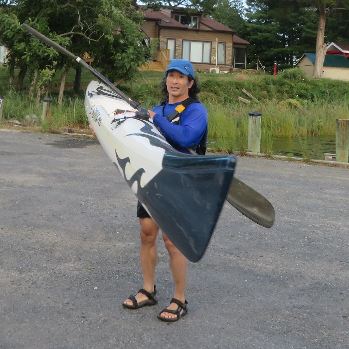
I hadn't started with the goal of paddling so far...it was just a good opportunity. If I were to do it again, I would have worn at least a neoprene top or a farmer john 3mm wetsuit. I would have also put my GPS in a place I could access it more easily. Maybe next year I'll do a Kent Island circumnavigation as my Saki Challenge. I haven't don't it on the S1-A yet. Here's my route. 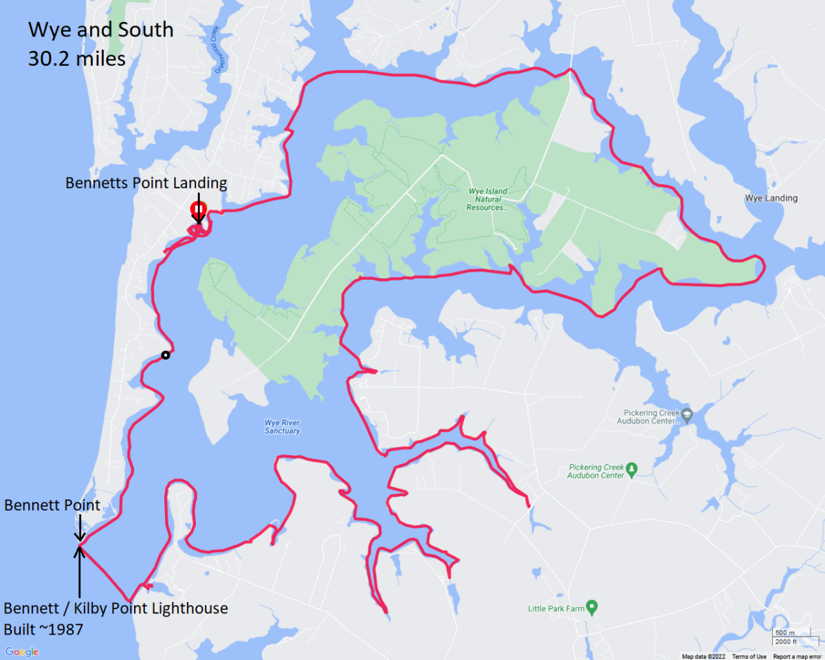
Over the next day and a half, I ate more than I had eaten in years...especially protein. My body was craving it. |
|
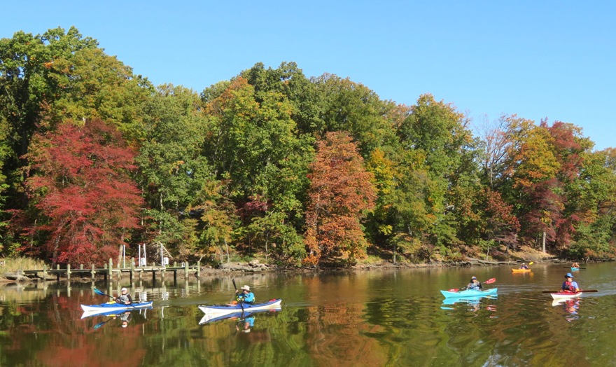
It's been a long time since I paddled on Island Creek or Granny Finley Branch so when Dr. Greg posted this event on the WatersEdge Meetup Group, I was eager to join.
It was a perfect day. Nighttime temperatures have been getting down to freezing but today, it got up to the mid-60s during the day with almost no wind and sunny skies. I drove out to the eastern shore and drove through the heart of Centreville. Folks were getting ready for Centreville Day, the town's fall festival. I met ten other paddlers at the Southeast Creek launch site. We were on the water by 1000. As usual, I was the only person on a SUP...everyone else had a kayak. People asked about Daphne. I said she was with Norma who was visiting her mother. We paddled upstream on Southeast Creek and then explored Island Creek and Granny Finley Branch. Greg led us up both as far as he could without having to portage. We saw several bald eagles, an eagle nest, and a few great blue herons. The osprey have flown south for the winter. I snacked whenever we had a break so when it came time to pull over for lunch, I took a power nap on my SUP. Low tide was around noon and that made it difficult to paddle in many areas. The name of this trip was "Explore Southeast and Island Creeks off the Chester River!" But it could have just as easily been called "Paddle through vibrant fall foliage." I know the eastern shore of Maryland isn't known for bright yellow, orange, and red leaves, but with such clear skies, bright sun, and Mother Nature's colors at their peak, it was hard for me not to appreciate the autumnal change of season. I got in 11.6 miles but with such shallow water, the level of effort felt more like 13.5. Still, it was a fantastic day to be out. Here are my photos: 1 / 7
Southeast Creek.
2 / 7
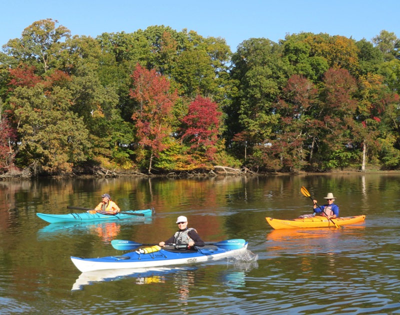
Island Creek.
3 / 7
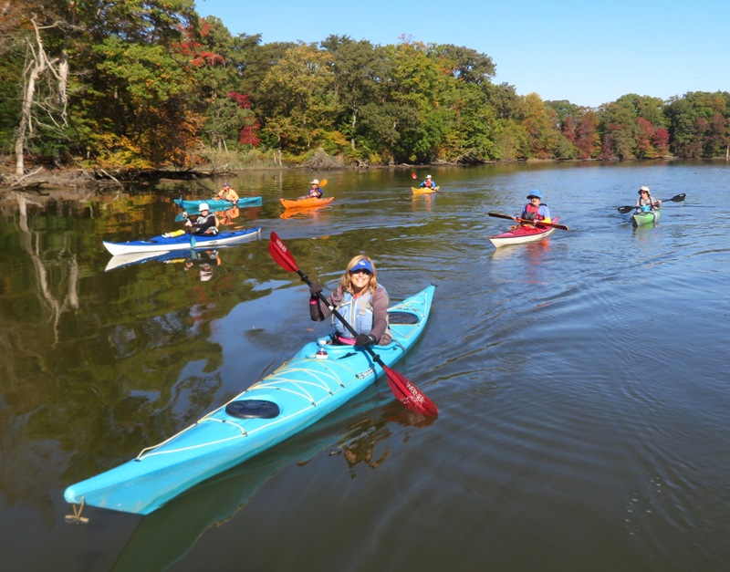
Linda.
4 / 7
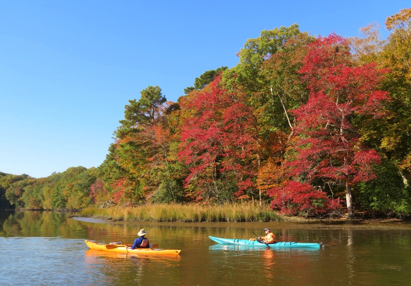
My favorite shot.
5 / 7
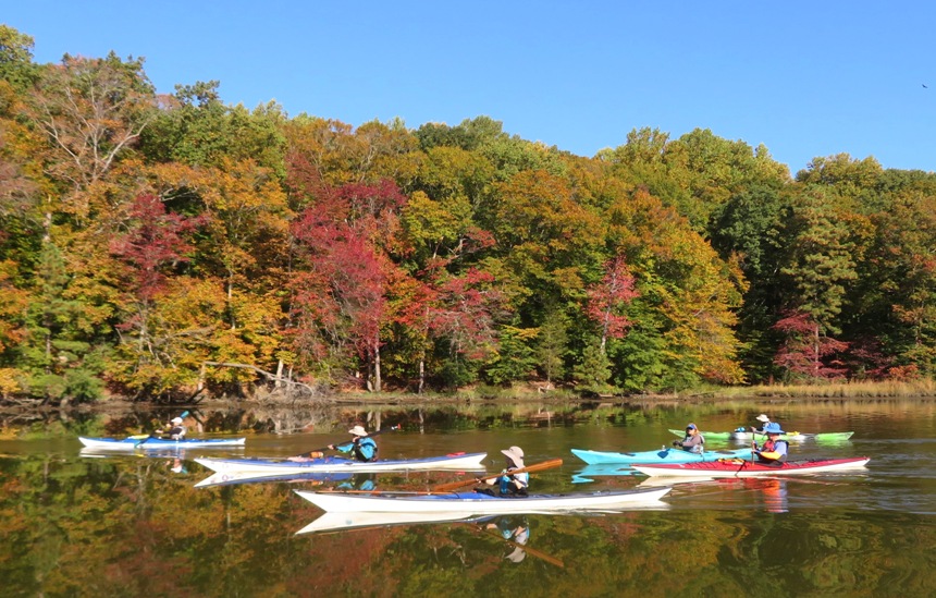
6 out of 11.
6 / 7
More autumn colors.
7 / 7
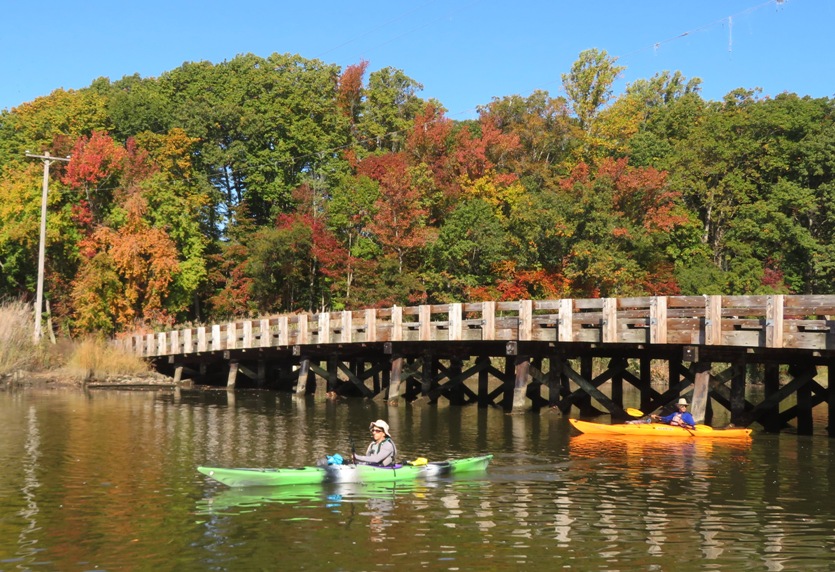
Island Creek Road.
Here are my notes from this trip. Here's my route: 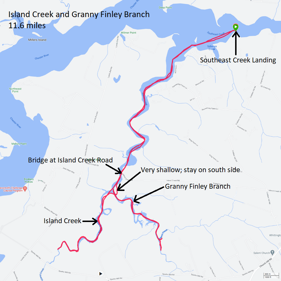
I wore my farmer john wetsuit, neoprene booties, and neoprene shirt. I think I lost the latter at the launch site. Not a big deal. It is about 20 years old and I was thinking of replacing it anyway. I was really glad to get out for the day. I was feeling very zen afterwards. I would have liked to have joined the group for their post-paddling meal but I wanted to finish cleaning the house before Norma and Daphne returned. I was successful. |