|
This page describes my hiking adventures in 2023. |

|
This page describes my hiking adventures in 2023. |
|
Norma, Daphne, and I went for a little hike in Wincopin Park. We walked on the white trail and then crossed under highway 95 to the Huntington Trail.
We found several skunk cabbage plants...harbingers of spring. 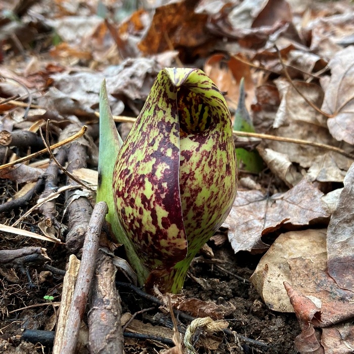
Norma had read about the local gravesite of John Francis Wyman. Wyman served as a Quartermaster Sergeant in the Union Army during the Civil War. He operated a farm in this area, overlooking the Middle Patuxent River. Our goal was to find his grave. It took some bushwhacking but eventually we found it. There were lights and flags around the area so it was obvious someone had been visiting not too long ago. 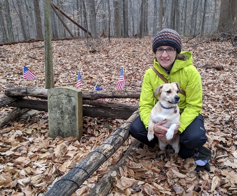
Here is a sign we found near the gravesite. 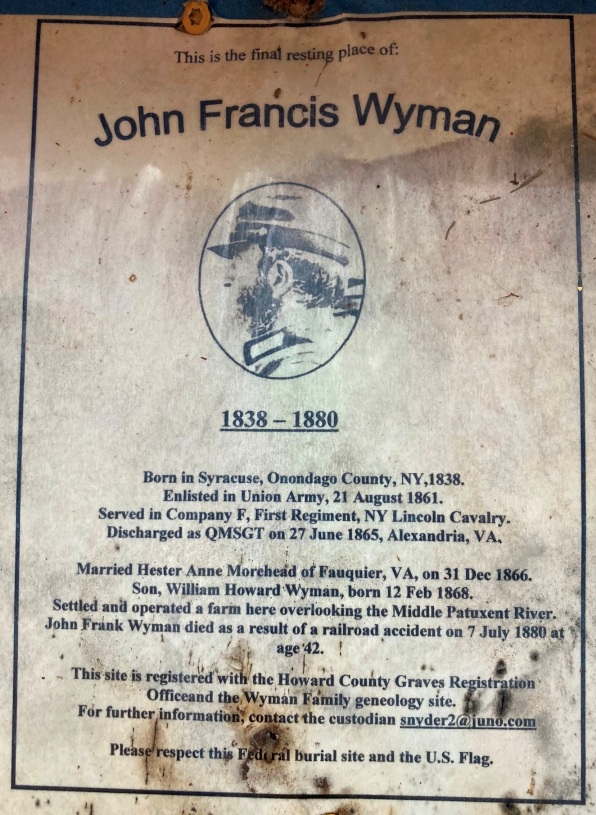
 |
|
Not really a hike...just two short walks. But what I saw was (in my opinion) blog-worthy.
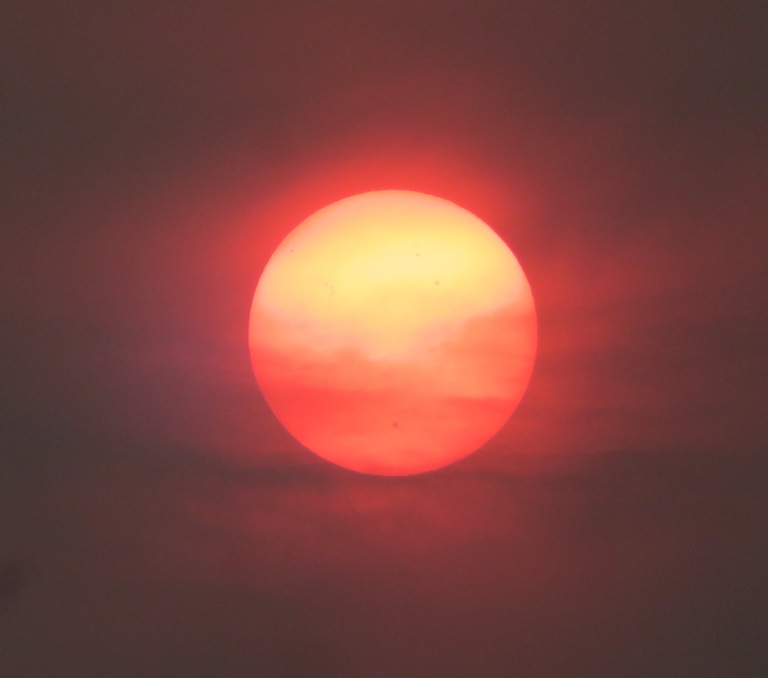
As of Wednesday [June 7, 2023], a majority of Maryland is under an air quality advisory due to smoke wafting in from raging wildfires in Eastern Canada, and state environment officials are warning that Marylanders should limit their exposure outside. - from Maryland Matters - Most of Maryland in 'Code Red' for air quality due to wildfires in Canada This prompted me to get out and take some photos of the sun when it was low in the sky. The last time I saw something like this was September 15, 2020, when Norma and I were paddling on the eastern shore after smoke from California wildfires blew into Maryland. Since it was the afternoon, I needed to find a place where I would have a clear view to the west. I also wanted something interesting in the foreground. I figured the Francis Scott Key Bridge would be a good choice for the latter. So I loaded up my SUP and drove out to Fort Armistead with Daphne. Most of the times I've been there had been early in the morning or in the winter when there weren't a lot of people. But today it was packed. The place had the feel of a 1980s post-apocalypse movie. It seemed a little lawless. I looked at the water and deemed that it was too rough to take the SUP out with Daphne to get photos. From land, I would not get a good view of the sun with the bridge. So I took Daphne for a walk through the ruins with the hope that the wind would die down and make the water calmer. Fort Armistead is a very interesting place. I think it could be a tourist attraction if the government put a ton of money into it. It has lots of concrete structures for big guns and munitions. But today, everything was covered in graffiti and littered with trash. 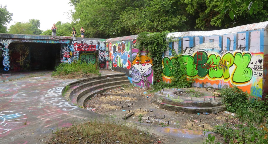
Daphne and I walked by the lower levels where gunpowder was once stored. There are lots of hidden, dark spaces there. Back in the parking lot, folks were revving their engines which caused their poorly tuned cars to make lots of backfire noises. This set Daphne in a panic. I held onto her leash tightly and she pulled me to the car. It wasn't much of a hike and it certainly wasn't an enjoyable one. The wind did not die down so I figured paddleboarding here was not feasible. Looking for another place with a clear view to the west, I drove us to Fort Smallwood Park. Normally, the entrance fee is six dollars but since I could show I am a veteran, they let me in for free. I parked on the west side of the park and then found a nice area where we could watch the sun. I didn't have anything as interesting in the foreground as a bridge but off in the distance, I had a hazy view of the Herbert A. Wagner Generating Station. Fort Smallwood was as peaceful, clean, and quiet as Fort Armistead was not. Daphne and I were very relaxed. Orange sunlight reflected off the Patapsco River behind a great blue heron. 
Here's a shot with the Herbert A. Wagner Generating Station in the hazy background. 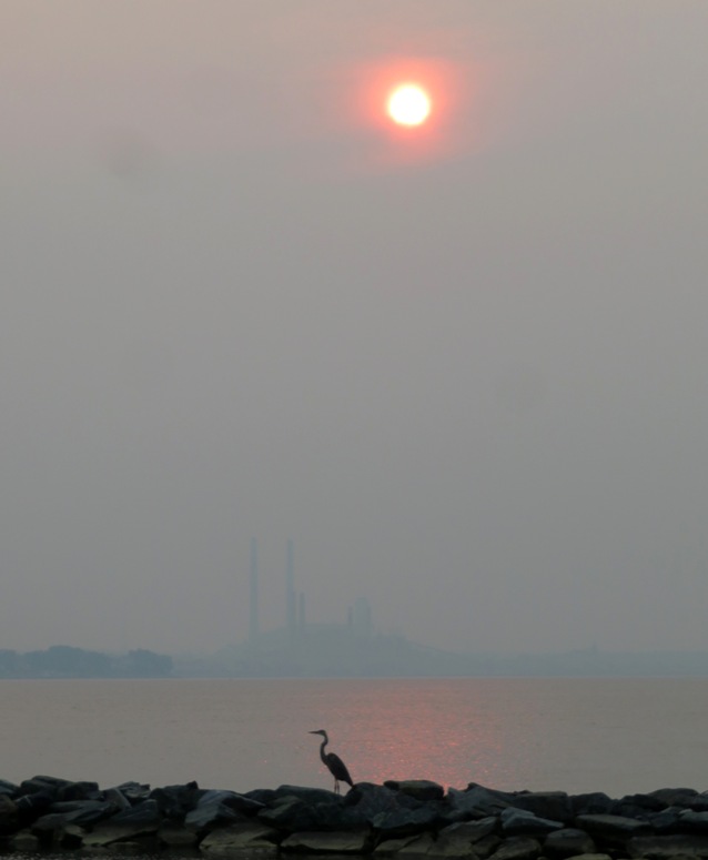
As the sun got low in the sky, it turned red. 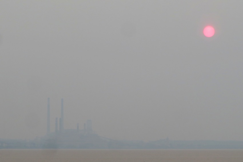
The rest of these pictures have no image enhancement. The sun disappeared about 30 minutes before sunset. During the last moments it was still visible, it looked very red. The park closed at 2030 so we still had some time. I took Daphne for a walk to the boat ramp and then through other parts of the park. It ended up being a good day...but I still would have loved to have gotten a shot of the red sun being the Key Bridge. Maybe next time. |
|
After paddleboarding on Little Elk Creek with Daphne, I drove south on Elk Neck and then took her for a ~three mile walk on the Turkey Point Lighthouse Trail. It was around 1130 and the place was very busy.
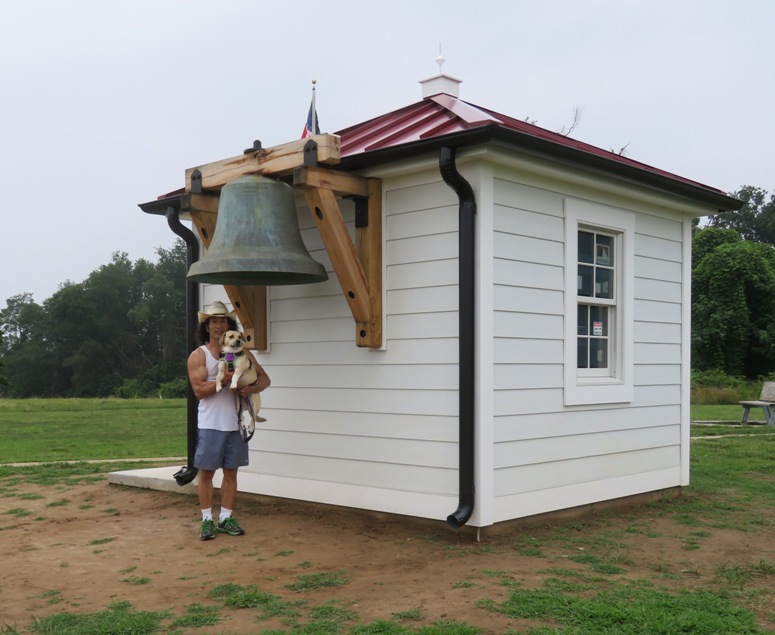
We walked to the southernmost point where we had a crappy view of the Chesapeake Bay because of all the smoke from the Canadian wildfires. The big draw is the Turkey Point Lighthouse. The Turkey Point Lighthouse stands proudly on a 100-foot bluff looking south over the Chesapeake Bay. Built in 1833, the lighthouse pointed the way to safe waters for nearly 175 years. It played a vital part in protecting the lives and livelihoods of many thousands of people. The light was taken out of service in April, 2000. Today, visitors can walk the 40 steps to the top of the lighthouse and experience a moment that started nearly two centuries ago. From the top of the lighthouse - 135 feet above the waters of the Bay - you can see for miles. - from "Sentinel on the Bay" sign at trailhead 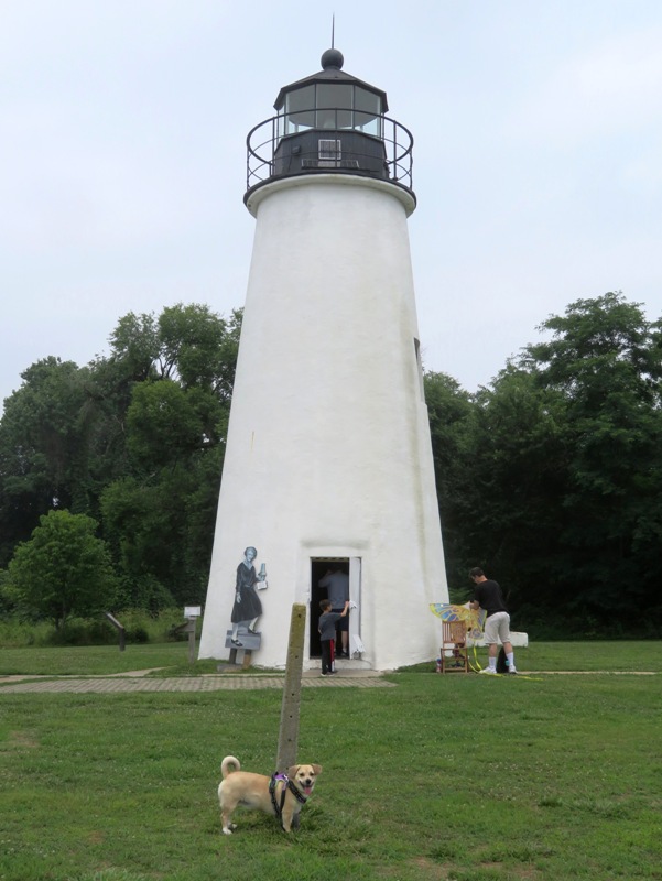
Here is other stuff we saw. When we left, around 1300, there were cars lined up waiting for a parking space. Very popular. |
|
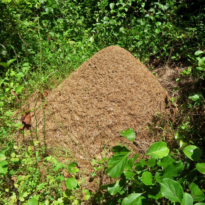
Back on August 19, 2021, I paddled to a place in an area that goes by many names: Douglas Point Recreation Area, Nanjemoy Wildlife Management Area (WMA), and Purse State Park. They are all connected and I've never quite known where one section starts or ends. On that date, I found 150 shark teeth.
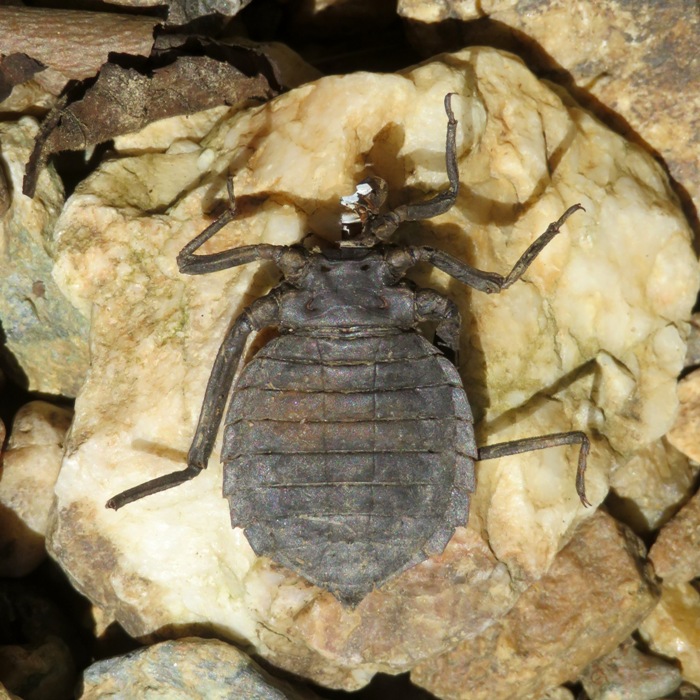
I returned with Daphne to find a land route. It took a couple of tries but I eventually found one. I parked at Douglas Point Tower on the east side of Riverside Road (route 224), just south of the South Trailhead but parking at the latter wouldn't have added much more distance. Then I walked on a slightly overgrown dirt road to my destination. One way from the lot to the water was 0.9 mile. Since we were on the east side of the Potomac River and it was in the morning, we were in the shade on the beach. It was quite comfortable. I tried using my shovel and sifters but found that they were not needed. There were so many shark teeth on the surface that I just needed to walk around and pick them up. Low tide was 1039. I looked for 1.5 hours before that and another hour after. I ended up finding 281 shark teeth along with some other fossils. The shark teeth I collected are from the Aquia formation, dating from the late Paleocene (Selandian). This means they are 59 to 56 million years old. In comparison, most of the teeth I've found on the Chesapeake Bay in Calvert County are 23 to 8 million years old. My observation is that the teeth at Nanjemoy WMA are generally narrower and non-serrated. Many were broken which leads me to believe many of the sharks were hockey players. 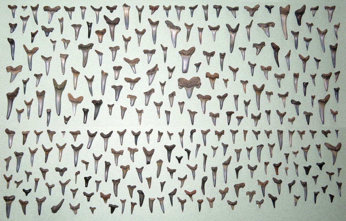
These are my favorite finds. Two of them are not shark teeth. One is a crab claw tip. 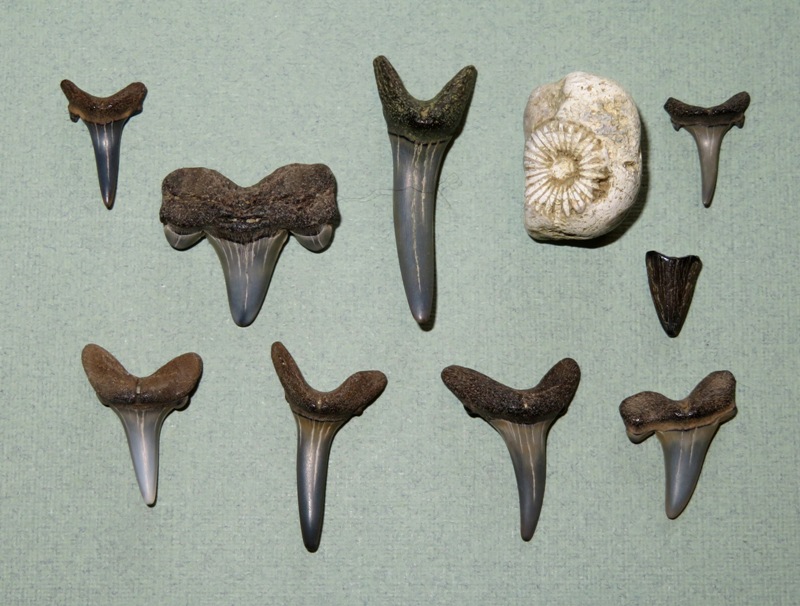
This was my most unusual find. I think it is where a barnacle once resided. 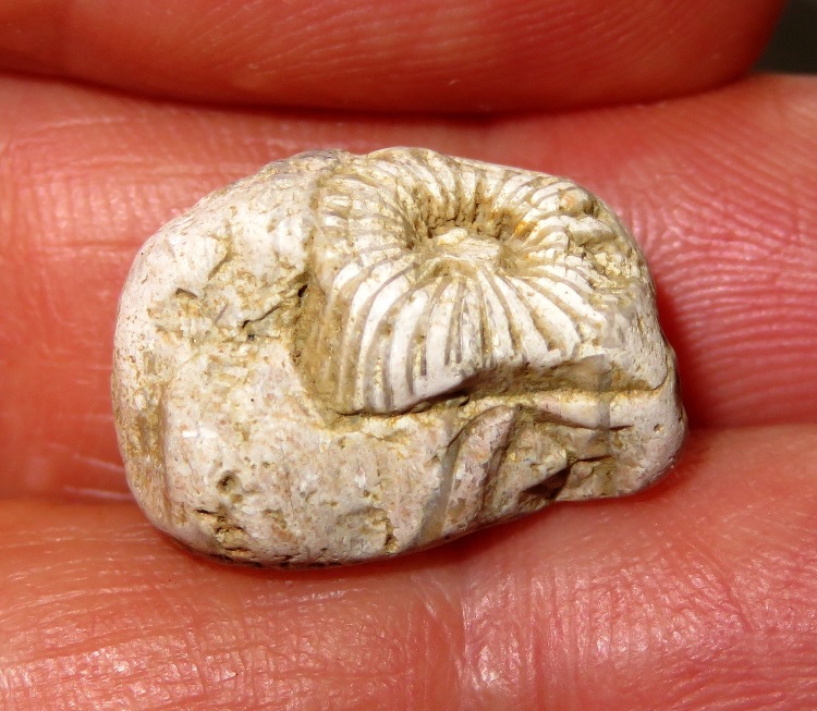
We started heading back. As soon as we left the water, the air temperature shot up. The route back to the road was very buggy and the tall grass harbored ticks. Driving home was terrible. We got caught in the lunch rush hour. What should have taken an hour and 20 minutes took two hours due to slowdowns on the Washington, D.C. beltway. |
|
On July 22, a blogger at work wrote
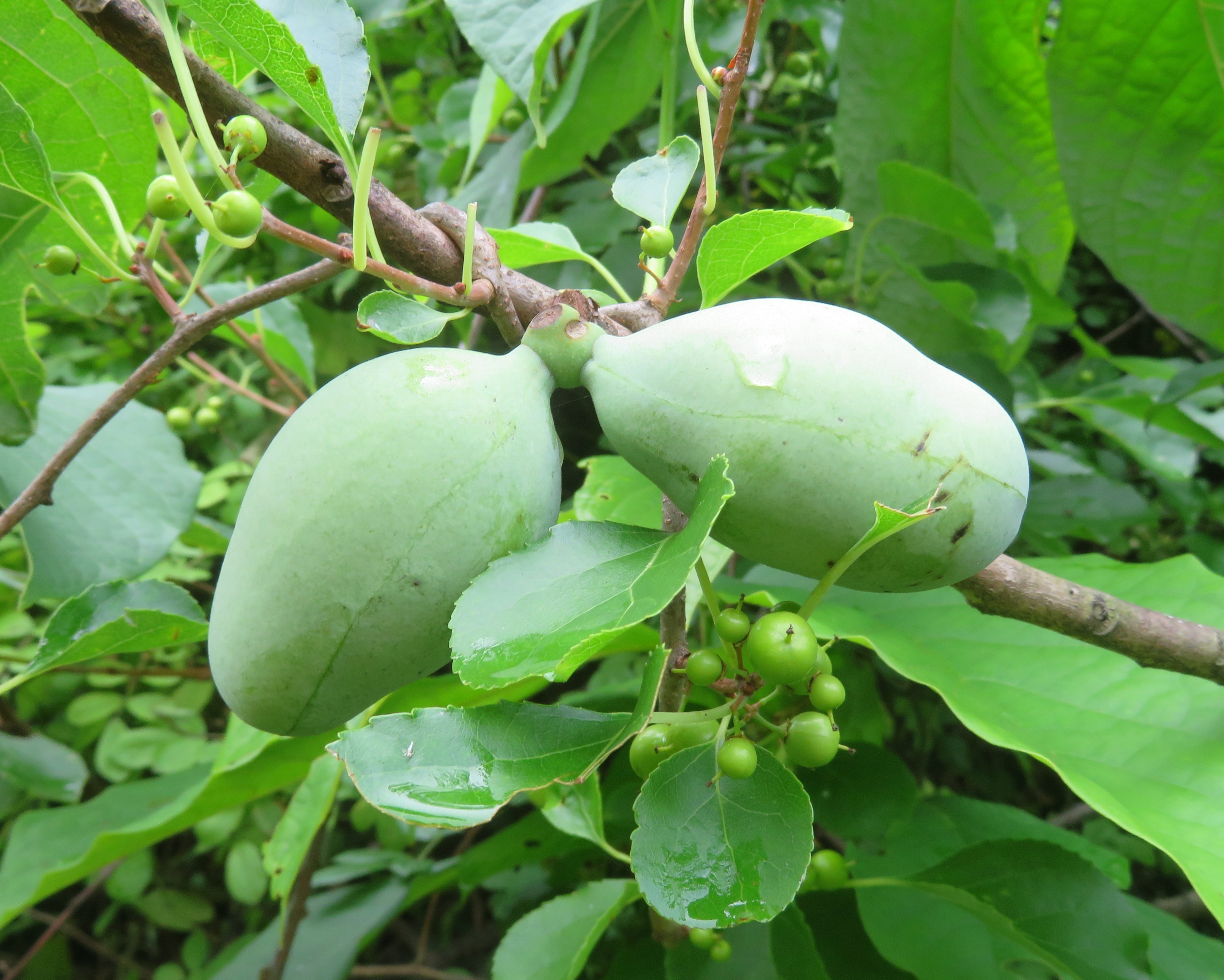
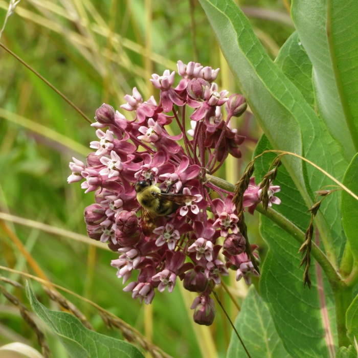
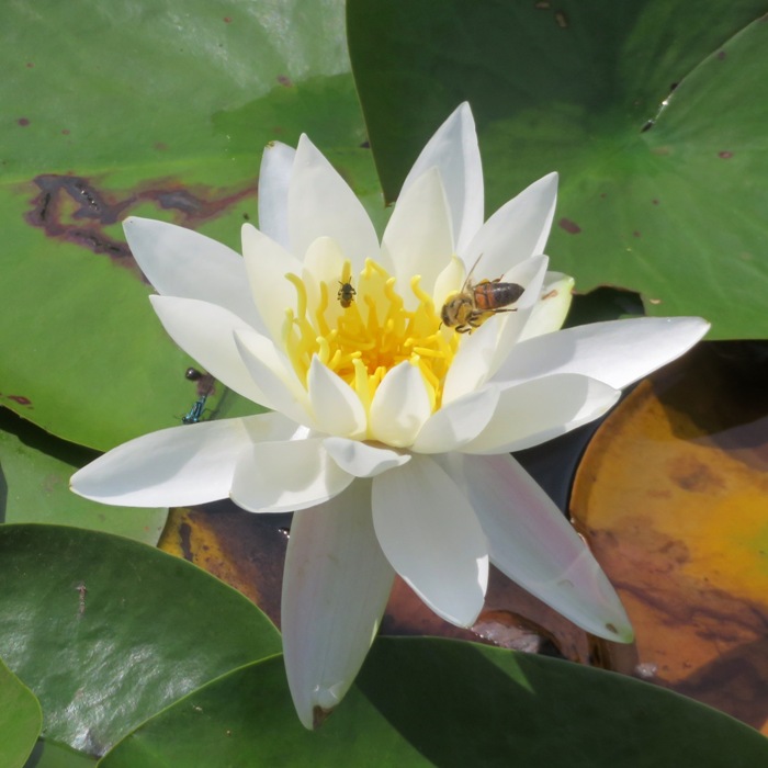
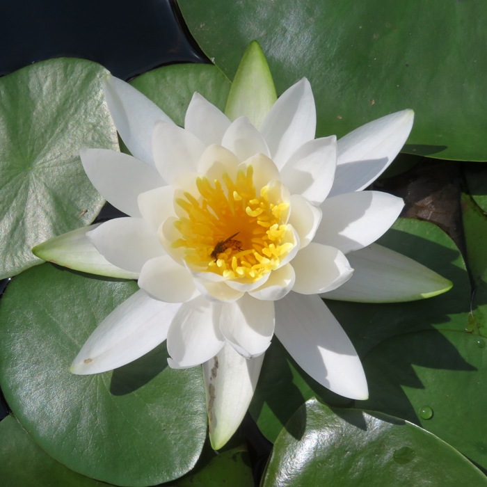
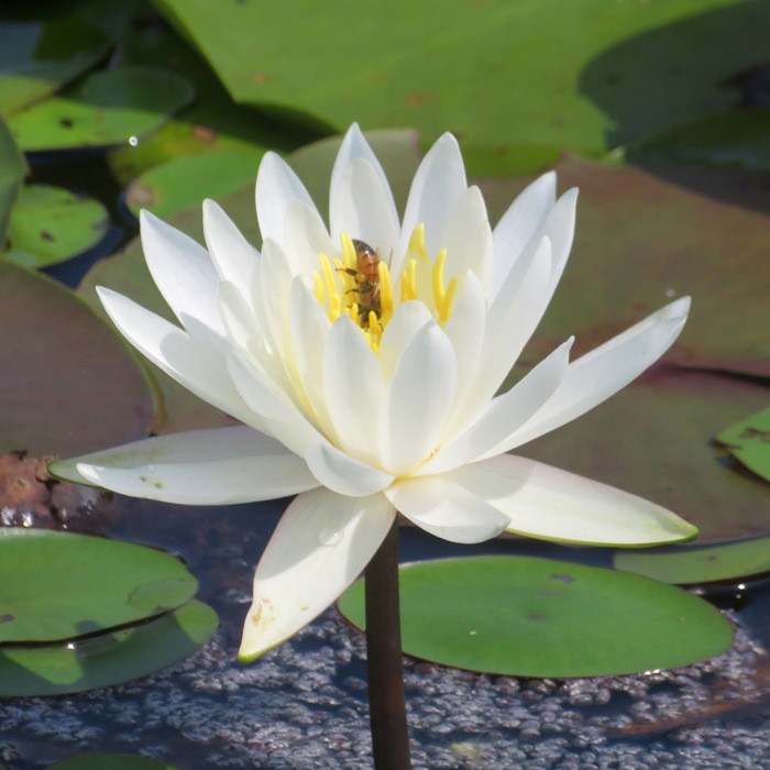
For mushroom forays, choose South Tract. Right now (with all this rain) it's prime chanterelle and black trumpet season, with oysters and lions mane and chickens of the woods also easy grabs. July can be a good month for foraging in our area. Earlier in the month, wineberries were ripe. Chanterelle mushrooms are ready for picking now. Norma suggested we get out to look for mushrooms so I planned a trip out to the South Tract - National Wildlife Visitor Center in the Patuxent Research Refuge. We brought Daphne and spent the day exploring the trails. A sign said we weren't supposed to pick plants (I assume that means mushrooms too). We didn't find any chanterelles except for some really old ones so it didn't make any difference. What we did find were lots of water lilies. Unlike the ones I saw on July 22, 2023 at Kenilworth Aquatic Gardens, these water lilies were growing wild. I much prefer it that way. It is like seeing animals in the wild versus a zoo. There were so many flowers that taking photos of them was too easy. So I went for the ones with pollinators. We saw Goose Pond, Cash Lake, and Lake Redington. Some of these bodies of water were home to acres of water lilies. 
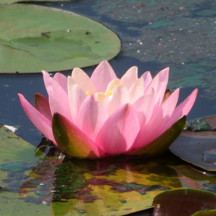
Water lilies weren't the only flowers we saw. We also saw spatterdock. 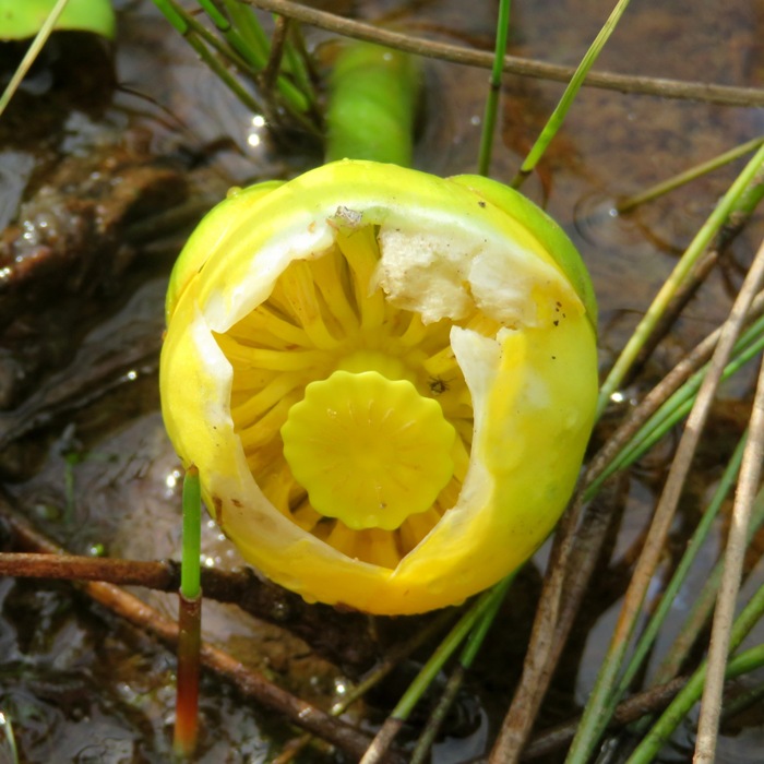
Some Virginia meadow beauties (aka Handsome Harry) were blooming. 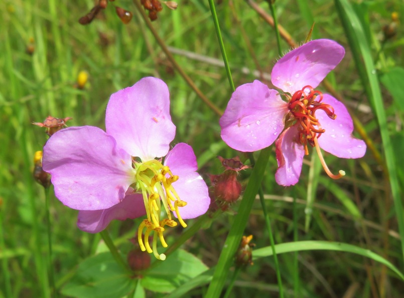
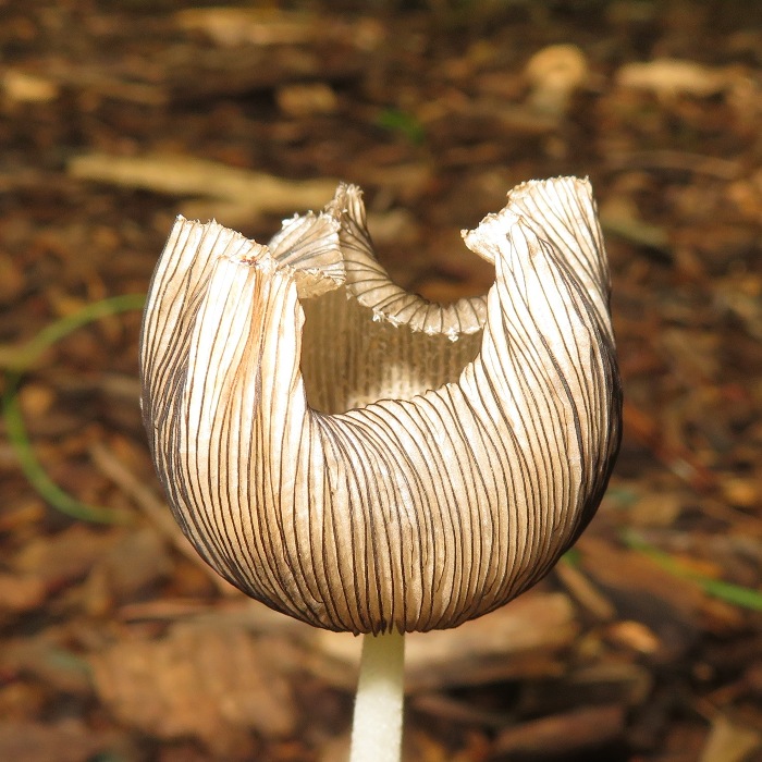
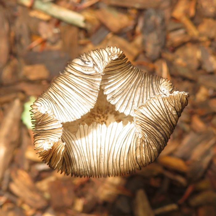
Perhaps the most unusual thing we saw that day was an inky cap mushroom. I found lots of turtle egg shells. Not sure if they all hatched naturally or if something got to them. 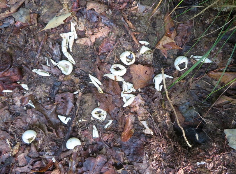
On a bridge, we saw a red-spotted purple butterfly. 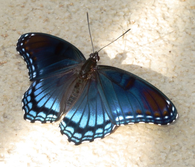
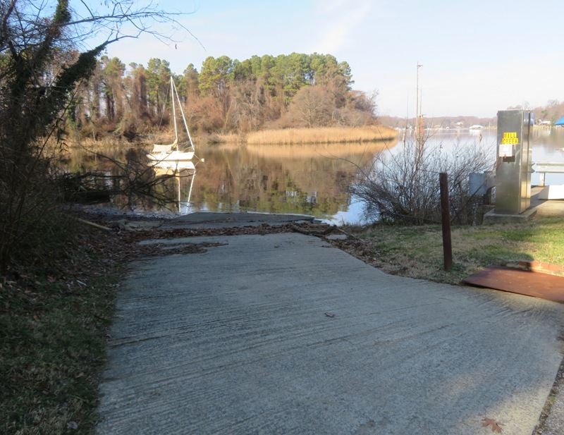
I found a launch site at the northeast side of Cash Lake. 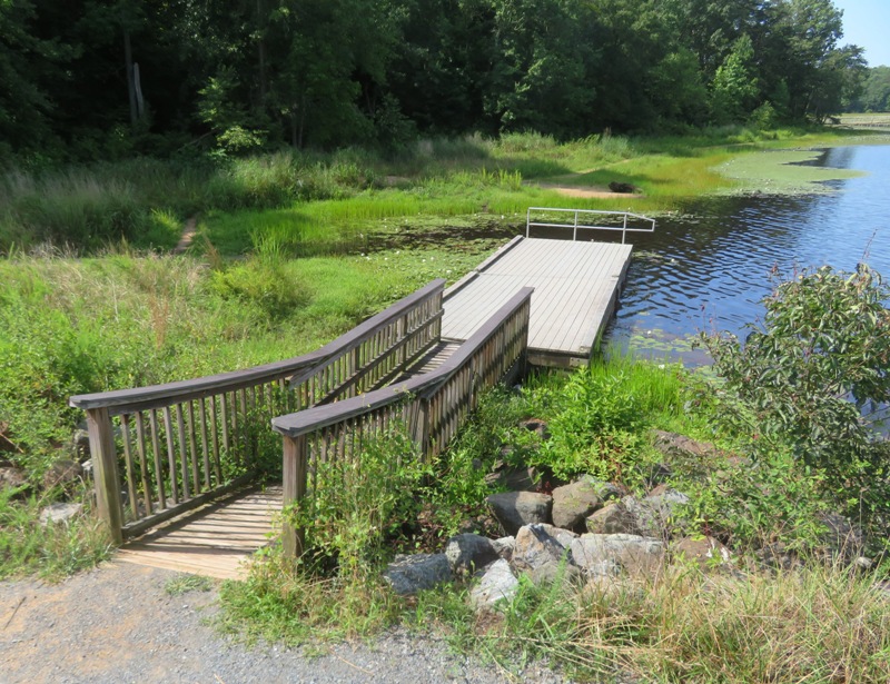
After walking 4.4 miles, we stopped in at the Visitor Center. This is a nice place but it has seen better days. I sense funding has been cut. 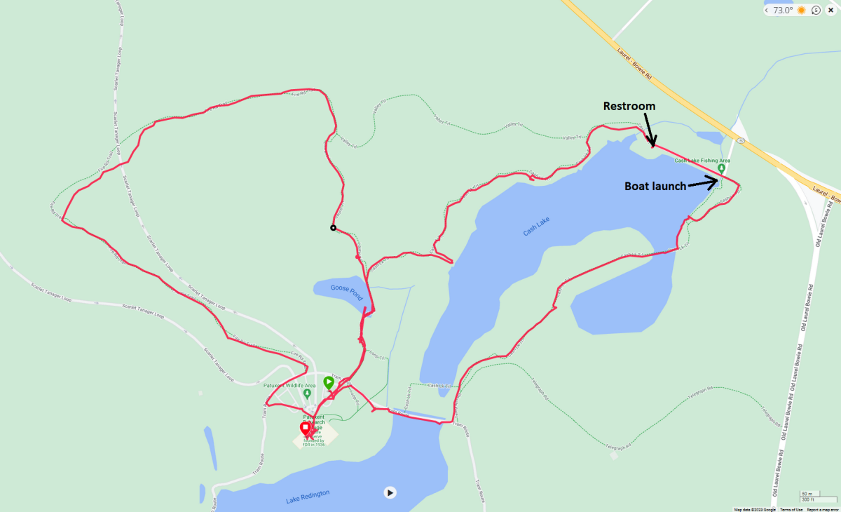
|
|
Norma, Daphne, and I drove out to Little Bennett Trailhead in Little Bennett Regional Park to do a modification of the hike described at AllTrails - Hyattstown Mill, Pine Knob, Kingsley, Beaver Valley, Bennett Ridge.
We walked along Little Bennett Creek. 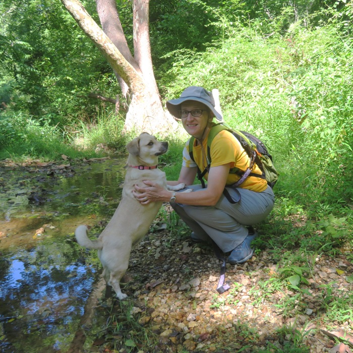
Part of the goal was to do some foraging. We did pick some chanterelle mushrooms but we only found a few. 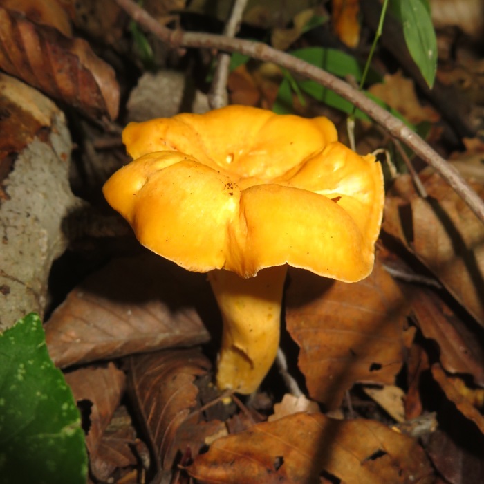
Norma also found what I think is a Meripilus sumstinei mushroom. Yes, it is edible, but no, we did not taste it. 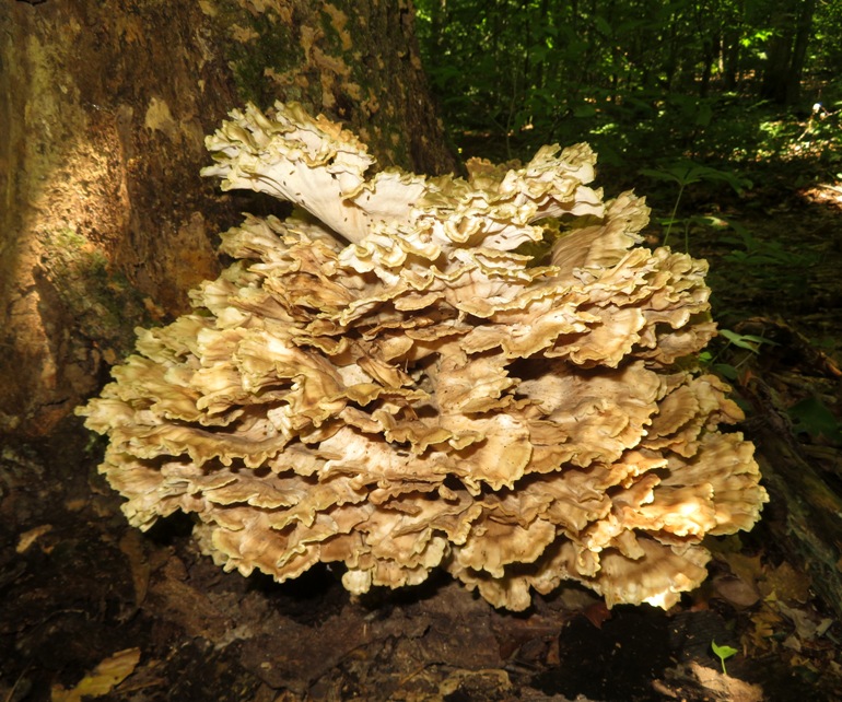
The big find of the day was a garter snake. 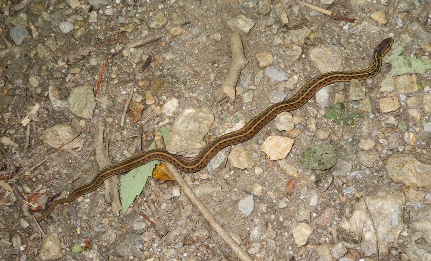
Here's some other stuff we saw. We ended up hiking 8.3 miles. The trails were well maintained, well drained, and shaded. The weather wasn't bad either. But overall, it was a mediocre hike. Not the best scenery and it would have been nice if there was more wildlife. Here is our route. 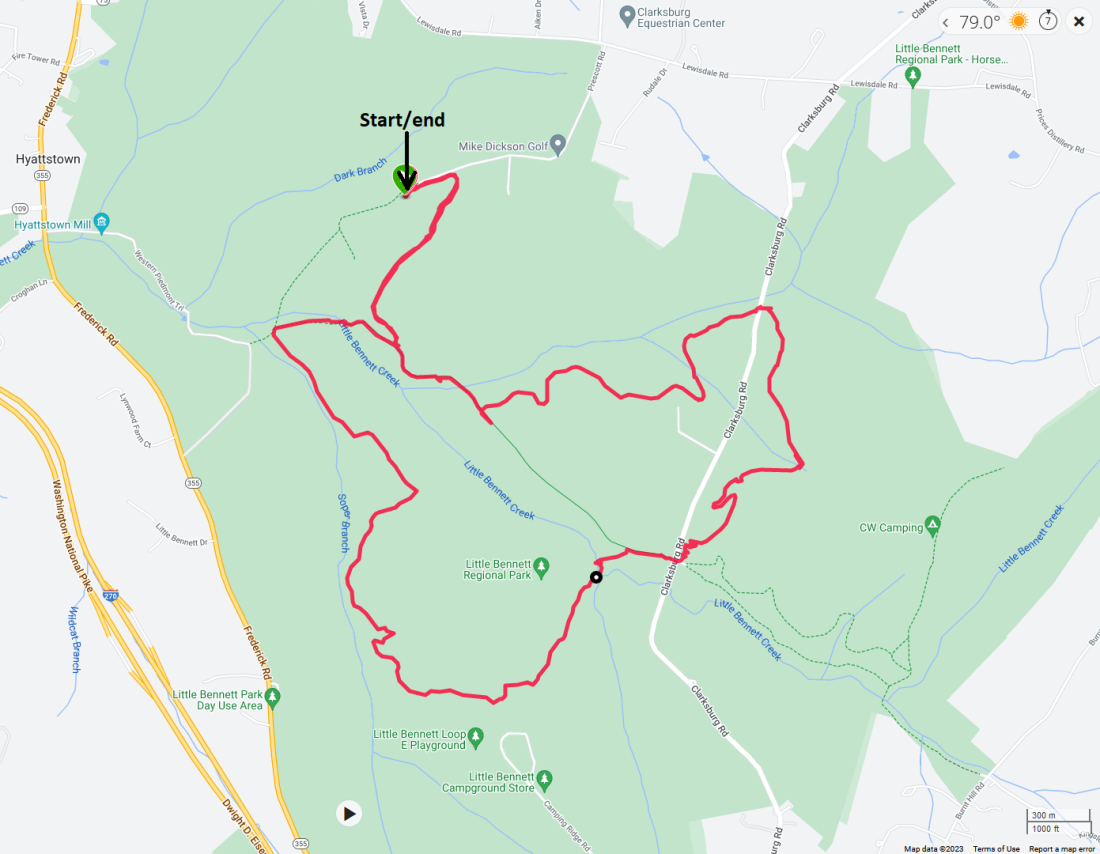
|
|
From August 30 to September 6, 2023, Norma and I traveled to California to visit my mom. The three of us did some great hikes in Mono County, California on the eastern side of the Sierras.
|
|
From October 6-9, 2023, Norma, Daphne, and I spent a few days with her extended family in the Massanutten area of Virginia. We did a few short hikes.
|
|
Norma, Daphne, and I hiked an easy five miles at the Hashawha Environmental Center and Bear Branch Nature Center.
It was sunny and slightly cool...just right for hiking. Here's Norma and Daphne in a small pine forest. These trees were too evenly spaced to be natural. 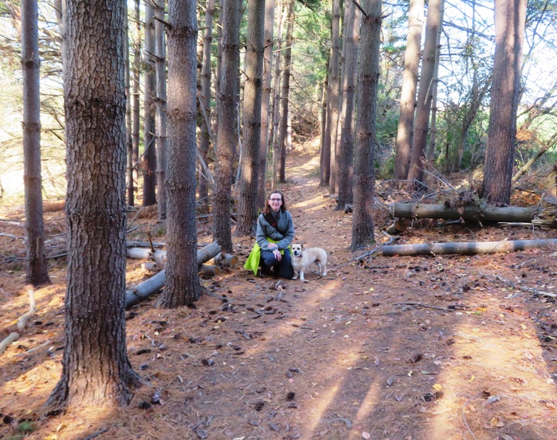
We saw a bald eagle at Raptor Mews. This, along with other birds here have a permanent injury and could not survive in the wild. They are kept for educational purposes. Other birds here include a broad-winged hawk, red tailed hawk, great horned owl, screech owl, barred owl, and kestrel. 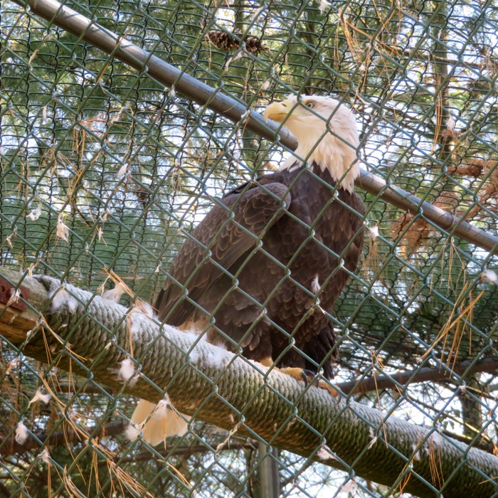
Next, we stopped at the Martin Cabin Homestead where we found a log cabin built in the early 1800's. 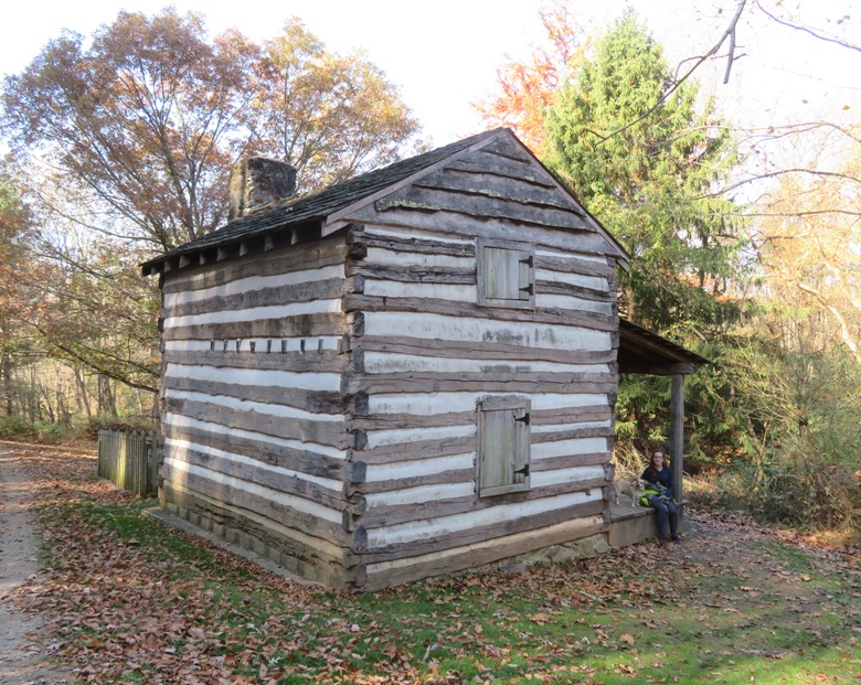
Flowers may be gone but there are still some bright colors if you look for them. I found this American bittersweet. 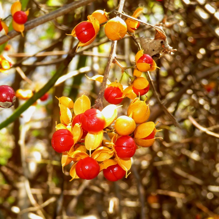
The three of us stopped for lunch at some picnic tables. Mealtime is Daphne's favorite time of day. 
We did a stream crossing across a log. Norma hates doing these. Then we tried to follow the Boulevard Trail on the west side but found it rather overgrown so we turned back. Here is our route. 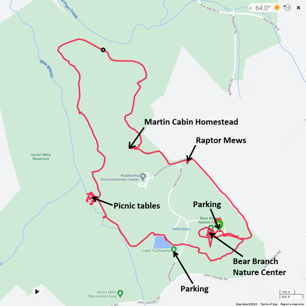
After our hike, we checked out the Bear Branch Nature Center. We were pleased to find that they allowed dogs. It is definitely worth visiting. We spent the rest of the day exploring Historic Westminster. There are some big, beautiful, old buildings. We had dinner at Akira Ramen & Izakaya. Norma loves ramen. |
|
I led some of my co-workers, former co-workers, Norma, Daphne, and Don on a 3.8-mile hike in Wincopin.
For some, this was their first exposure to Wincopin, so I made sure to leave a good impression by pointing out all the historic ruins, which I also describe in Wincopin Neck: My Neck of the Woods. Our first stop was the rock quarry, the remains of the B.F. Pope Stone Company Quarry. Here, we met an older fellow out for a walk. He pointed out a stone structure which he claims was an old blast furnace for the smelting of iron. Smaller ones like this were not as efficient as bigger ones in places like Lonaconing. He pointed out the ashes and said that you can find pieces of pig iron in the area. Our next stop was the stone ruins at the W.T. Manning Company stone crusher site. Below, from left to right are me, Daphne, Unique, Meghan (in front), Elton (in back), Jeanette, and Don. 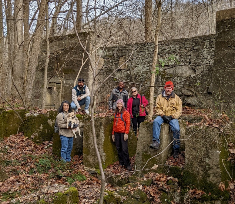
Other things I showed the group were the chainsaw-carved bear, the woody remains of a tulip poplar flower, the vernal pool where the spotted salamanders lay their eggs, and the stone bridge support for the train bridge. It was a great walk and I'm hoping I can convince everyone and more co-workers to join me on outings in the spring/summer. Here is our route. 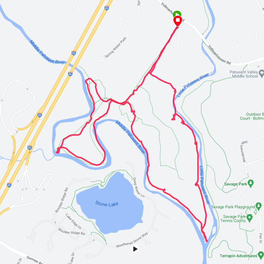
|
|
It was a sunny, fairly warm winter day...the kind where it should be a crime to stay indoors.
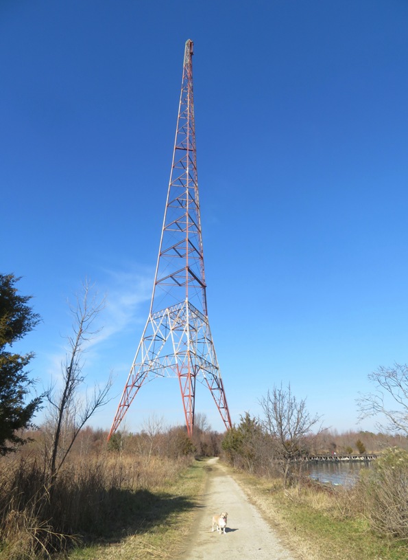
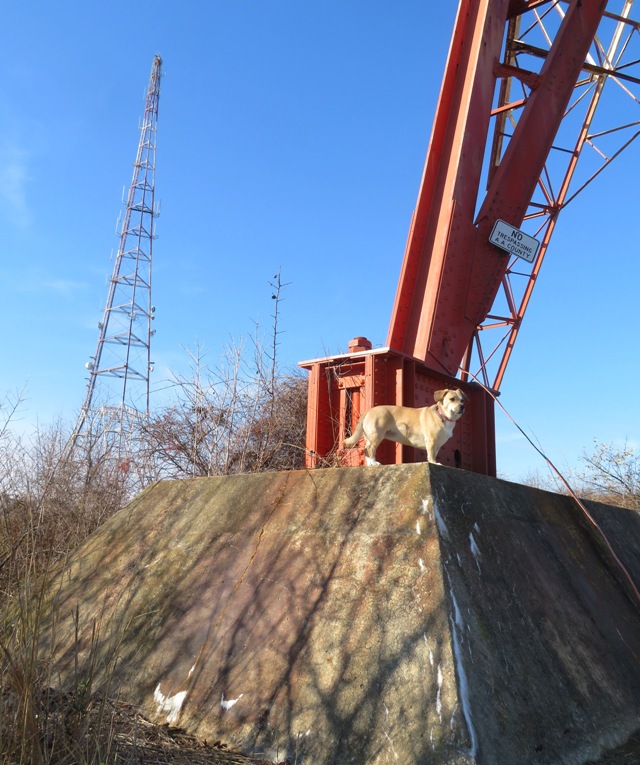
I took Daphne out for a little exploring at Greenbury Point. I parked at the Greenbury Point - Nature Center and we headed south on the Bobwhite Trail. I intended to explore the entire place but somehow ended up missing Poet's Nature Trail, which parallels Carr Creek. I guess I'll have to come back for that. This is a great place for a winter hike. Little tree cover means you'll get lots of sun. There are also lots of lovely water views. Looking across the Severn River, I had a clear view of Historic Annapolis and the Naval Academy. 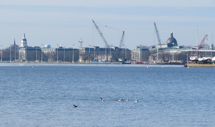
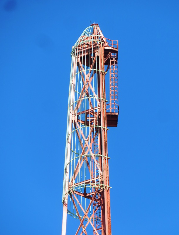
The most prominent features at Greenbury Point are the three radio towers. I've seen these countless times from the water but not so much from land. The trails out here went right up to these ~600-foot-tall landmarks. 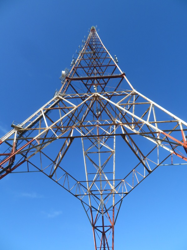
A lot of people were out...especially dog owners. Everyone seemed really friendly. I guess they were in the Christmas spirit. I spoke to one older fellow who told me about the three radio towers which were once used to communicate with submarines. He said that in the 1990s, there more towers and this whole area was inaccessible to almost everyone. ...the facility, which at its height boasted 19 radio towers and both High Frequency and Very Low Frequency transmitters, served as both a communications link between the U.S. and Europe, and between the Navy and the Atlantic Fleet, including the submarine fleet. Naval Radio Transmitting Facility Annapolis closed in 1996... In 1999, 16 of the 19 radio towers were demolished, with the final three being retained for historic purposed and as a navigational landmark on the Chesapeake Bay. - from Annapolis Creative - Naval Communications History in Annapolis Along the rip rap-lined shore, I found some large concrete structures which I assume were used to support some of the old towers that were taken down. 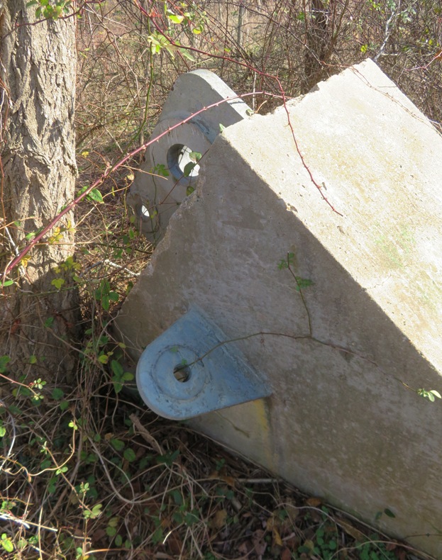
Near the base of some of the towers, I saw some overgrown structures with a large metal wheel looking like it was made to move a belt. 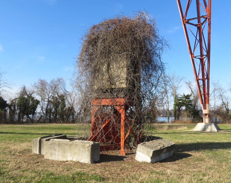
Here are some more views of the towers: Back on the paved roads, we stopped at Commander John L. Dunning, Jr. Memorial Pier at Mill Creek Cove. At many points during our hike, we had nice views of the Chesapeake Bay Bridge. 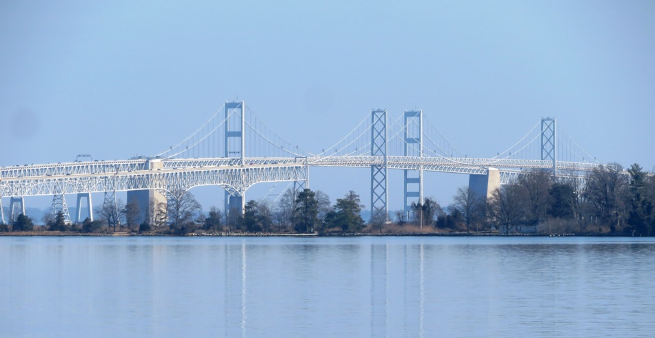
There wasn't much wildlife out but we did manage to spot some bufflehead ducks. 
Daphne and I walked on the Timberdoodle and Pipsissewa trails. I managed to lose the former for a bit. Otherwise, the trails were well maintained and easy to follow. We walked four miles. Here's our route. 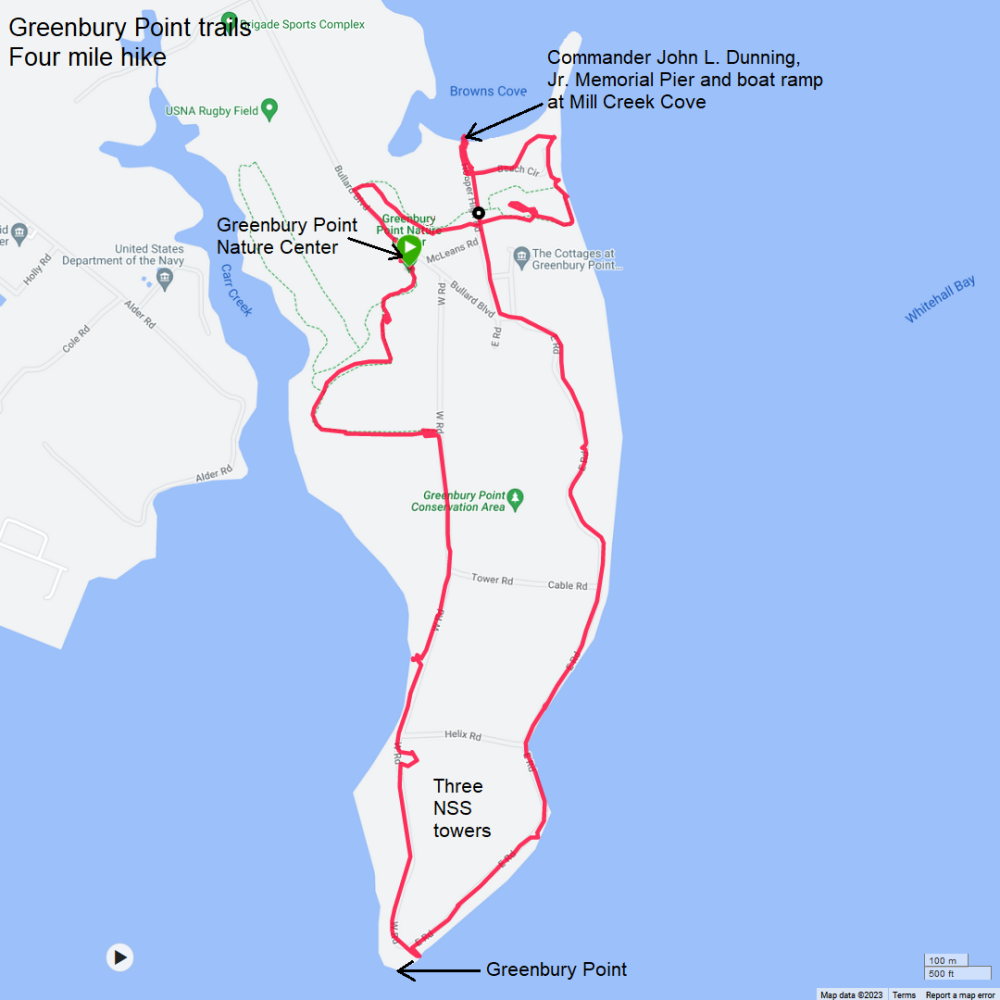
This is a great place for an easy and scenic hike. I'm sure I will return with Norma. |
|
After completing our Greenbury Point hike, Daphne and I still had some time so I drove to Corcoran Environmental Study Area (aka Corcoran Woods). At the Tydings Road, I took a power nap in the car before commencing our second hike.
I saw a barberry plant in the parking lot. 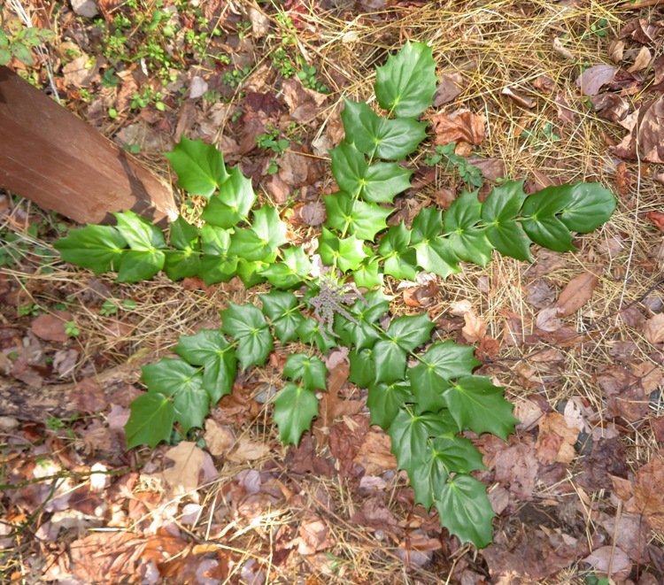
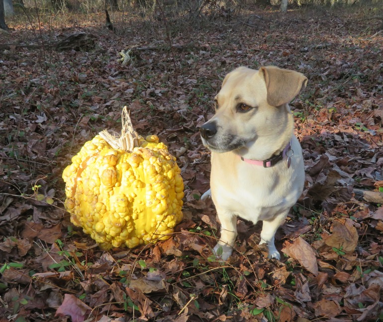
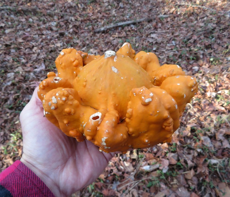
We crossed Tydings Road and stuck to the trail that runs along the perimeter. I found some pumpkins/squashes. I'm guessing people from the neighborhood threw them over the fence. This hike was totally unlike Greenbury Point. Trees blocked the sun and we saw few people. The latter is a good thing but I think a big reason for that is there just wasn't anything interesting here. The place wasn't very well maintained either. A lot of work took place a few years ago to make this place nicer. Invasive vines, shrubs and grasses were taking over this Environmental Study Area, killing trees, degrading habitat, and reducing biodiversity. In the summer of 2015 a large-scale, strategic control of invasives [sic] plants began. Invasives are removed and the area is being reforested. - from sign in Corcoran Environmental Study Area But today, many of the plastic trunk protectors for the saplings were knocked over. Many were crushed and turned into plastic debris. Clearly, people took great efforts to improve the place but then little, if any, maintenance was done after. Lots of briers and some bamboo had taken over. 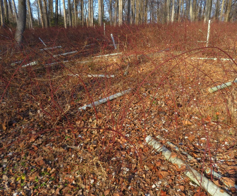
One long stretch of the trail was flooded, despite it not having rained for a few days. 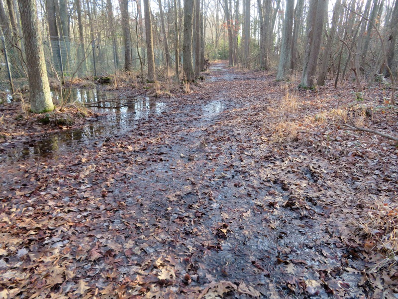
We crossed back over Tydings Road and then continued southeast to the Log Inn Road parking lot. Had we continued southeast, we would have ended up at Sandy Point State Park. Instead, we turned around. I perched Daphne on a cut log for a photo. 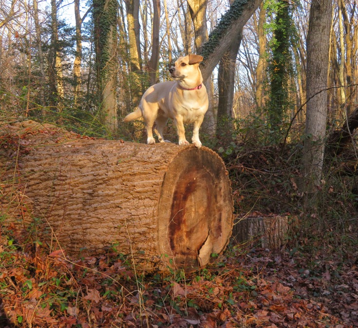
We got in four miles on this less-than-mediocre Christmas Day hike. Oh well, the Greenbury Point hike more than made up for the Corcoran hike. 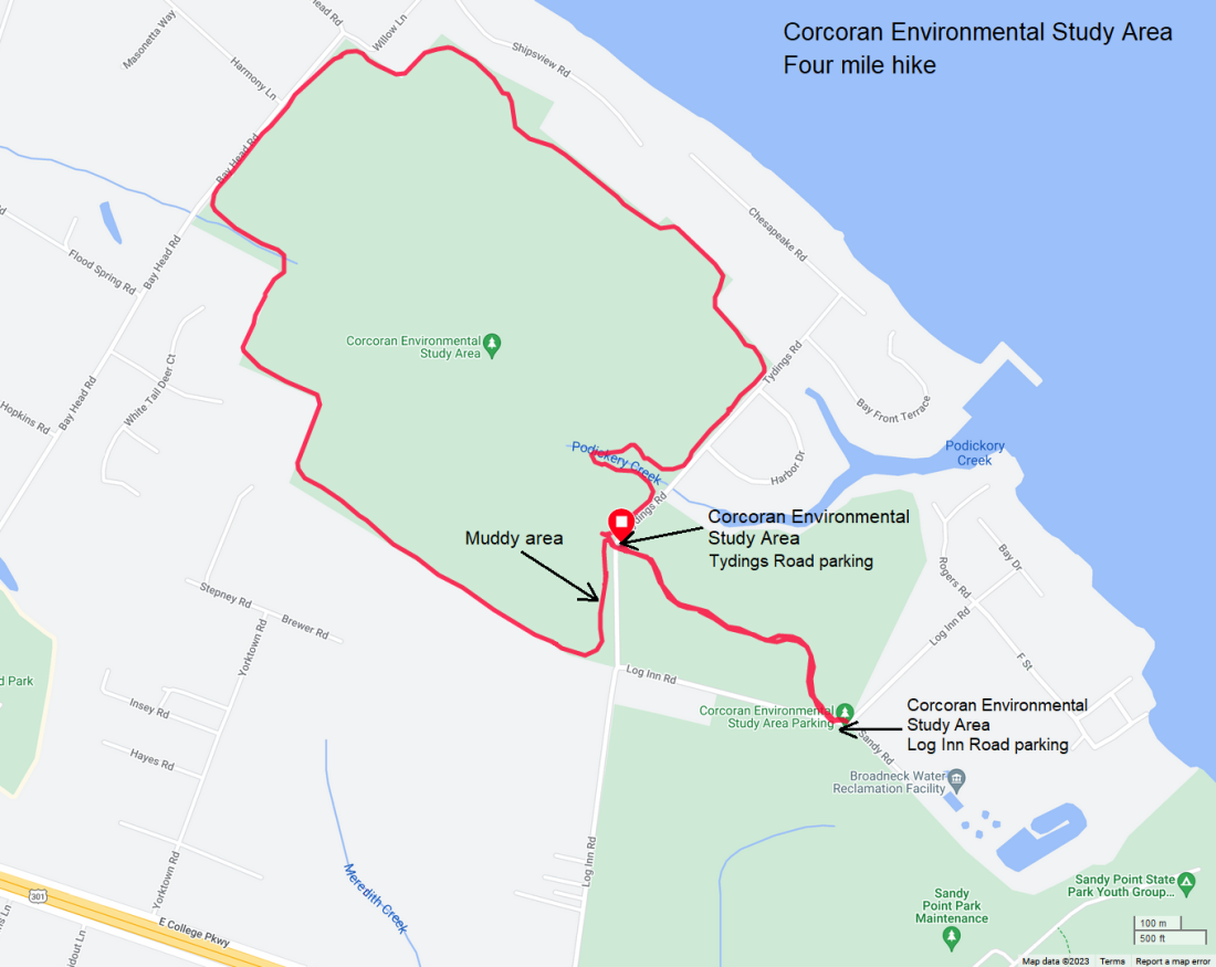
|