|
This page is about a once-in-a-lifetime kayak camping trip that I did at the Apostle Islands in Lake Superior, Wisconsin in 2017 with Norma, Carmen, and Cousin Steve. |

|
This page is about a once-in-a-lifetime kayak camping trip that I did at the Apostle Islands in Lake Superior, Wisconsin in 2017 with Norma, Carmen, and Cousin Steve. |
|
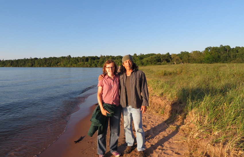
Norma and I typically do a big summer trip. This year was no exception. But what was different is that it marked a milestone birthday for me. So this year's trip was primarily to my liking rather than ours. Naturally, it would have to be kayak-focused.
Back on February 24, 2017, I learned about the Channel Islands off the coast of southern California. These islands are known for spectacular sea caves. After returning home, I did some research and decided that this was the place I wanted to explore via kayak. The problem was that the national park service decided that there would only be one outfitter to offer such overnight trips. I found some other great trips described on-line but after this monopoly was imposed, they were no more. Needless to say, I wasn't too happy about my limited choices. It seemed very un-American. Maybe in a few years, more will be offered and I will revisit this option. I looked at what other sea caves are available. That's when I came across the Apostle Islands in Lake Superior. After reading about it, I was sold. Here are some of the websites I visited to make my decision: I also considered other options: Iceland, Croatia, Belize, Galapagos, Puerto Rico, Alaska, Norway, Glacier National Park, the shipwrecks of Arthur Kill on Staten Island, Glacier National Park, the San Juan Islands, and the coast of Oregon. There were various reasons I didn't go with any of these. Some weren't kayak-focused enough for me. Some weren't as exotic as what I would have liked. Some were beyond the skill level of those I would want to invite. One was beyond my skill level. I ended up going to Arthur Kill as part of a weekend trip on April 14, 2017. I deemed it wasn't significant enough for a long, celebratory trip. After much reading, I ended up deciding to go with an outfitter, rather than organize it myself. The company I chose was Whitecap Kayak. Their reviews at Trip Advisor were especially helpful. But there were several other factors that made me decide to go with them. They were responsive, personable, and honest. They answered all my questions. I said what I was looking for and the owner, Neal, told me what he could offer. I wasn't looking for a cookie-cutter operation. I sent out invitations to all the kayakers that I am Facebook friends with. I also included other people I've kayaked with. With only a couple of very fit exceptions, everyone had some kayaking experience. This was no trip for beginners. In the end, it would just be me, Norma, Carmen (the three of us collectively known as Team SNaCk) and Cousin Steve.  |
|
Ever since the body scanners have been implemented at Baltimore Washington International (BWI) Airport for security screening, I have not been able to pass through without having to get patted down. It is always at least one of my lower legs that triggers something which indicates I might be carrying metal. I wear this as a badge of pride, thinking to myself that my Muay Thai training has significantly increased the bone density in my lower legs to be much greater than the norm. But today, for the first time, I got through the body scanner at BWI without a pat down. I was disappointed.
Norma and I flew in on a direct flight from BWI to Minneapolis/Saint Paul (MSP) on Southwest Airlines. It is a very large airport with two terminals that are not close to each other. At MSP, we met Steve and then got a Hyundai Accent rental car from Sixt. Other airports would have been closer to our final destination but flying into MSP was much cheaper. Next, we drove to the AirBnB house that Carmen reserved for us. She had flown out earlier and was already settled in. It was pretty late once Steve, Norma, and I arrived. |
|
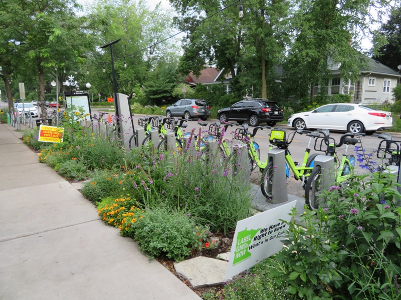
We walked to the Birchwood Café for breakfast. This place epitomizes social awareness. Set up right next to a bicycle share, signs out front and in the window read
Stop the Enbridge Pipeline Expansion, Label GMOs Now - We Have a Right to Know What's in Our Food, Hate has No Business Here, All are Welcome Here, Black Lives Matter, Love Water Not Oil. It was a nice neighborhood. It seemed most of the homes had modest front yards where lawn was not the main focus. Norma mentioned that many of the flowers and shrubs appeared to be native. 
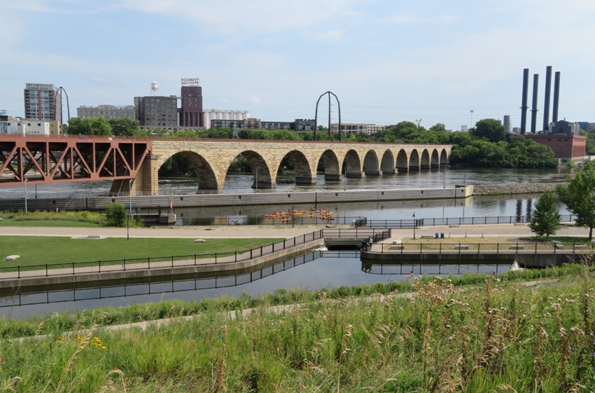
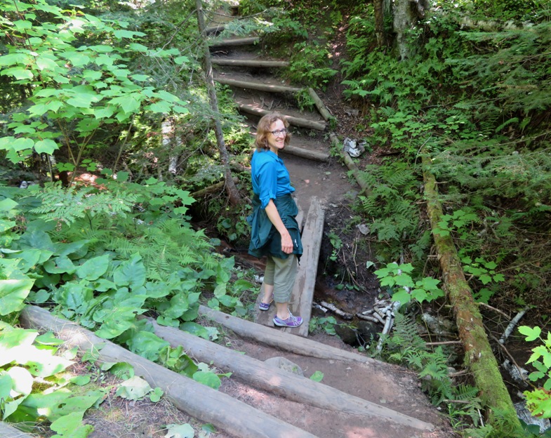
The four of us walked on the West River Parkway and the Winchell Trail along the Mississippi River to the Franklin Bridge. Here, we saw rowers below and the interstate 94 bridge to our northwest. 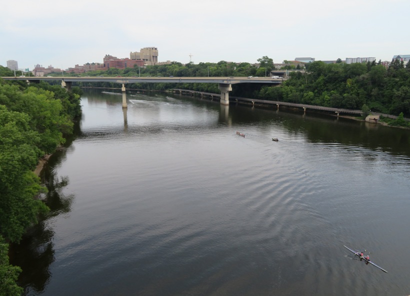
As bicycles rode across the bridge, we saw an electronic sign increment the count for the number of bicycles that passed. After some time we figured out how it works. There is a sensor in the bike path that we were able to activate by passing a metal water bottle over. Overall, the place seemed very bicycle friendly but there was a single impatient driver who angrily honked his horn when the car in front of him stopped to let bicyclists pass. I guess there's one in every crowd. We saw some monarch butterflies. 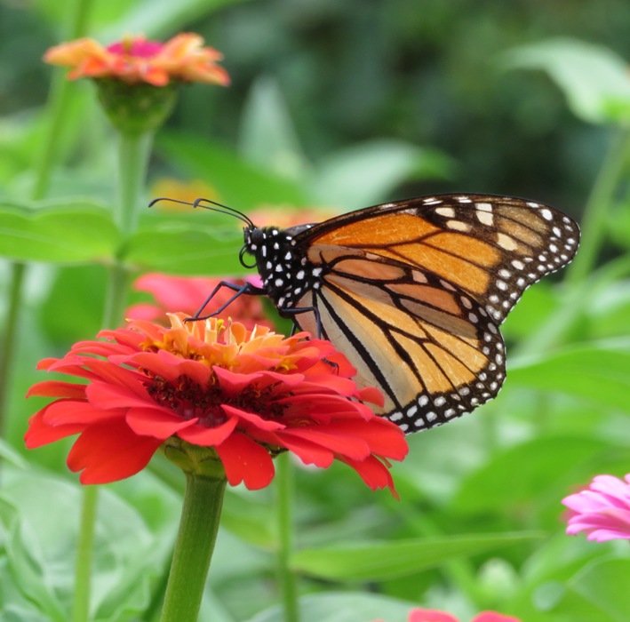
There was some quirky eye thing mounted on multiple bicycles. I'm guessing it was for a parade. 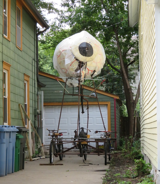
My rental car tire had a slow leak. It was not bad or dangerous but I had to fill it up every few days. It wasn't serious enough to take time out of our vacation to exchange it. I mentioned this upon returning it. |
|
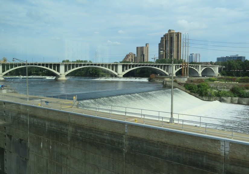
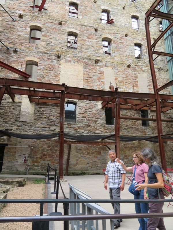
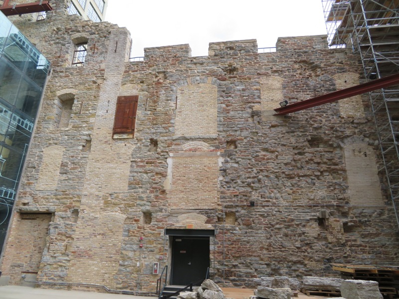
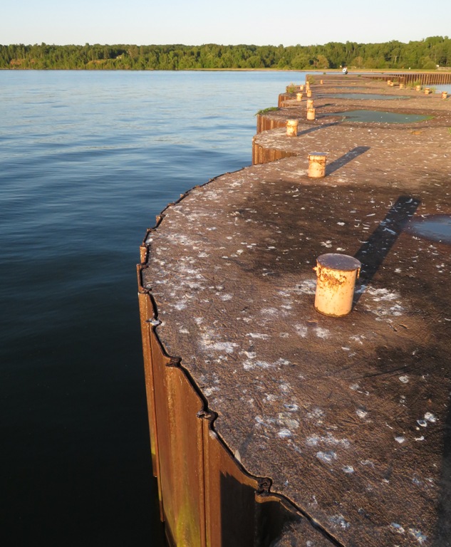
I drove us to the downtown area of Minneapolis. Here, we saw the Upper Saint Anthony Falls Lock and Dam. From the Visitor Center, we had some nice views of the city and the Mississippi River.
A ranger at the Visitor Center told us about the history of the area and how the locks are no longer used, partly because it enables the spread of an invasive carp. In the pic below, Norma holds a weighted model of the carp. It was quite heavy. 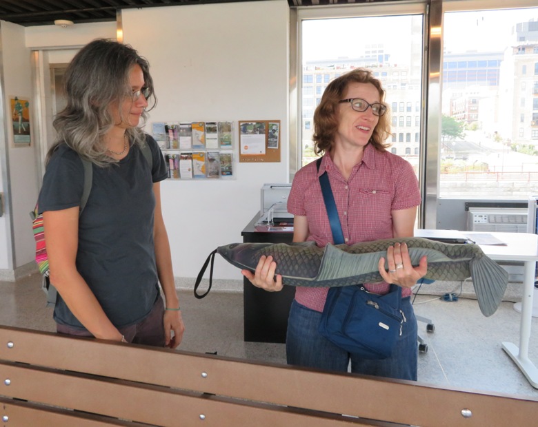
Looking down below into the lock, I saw what might have been an invasive carp. 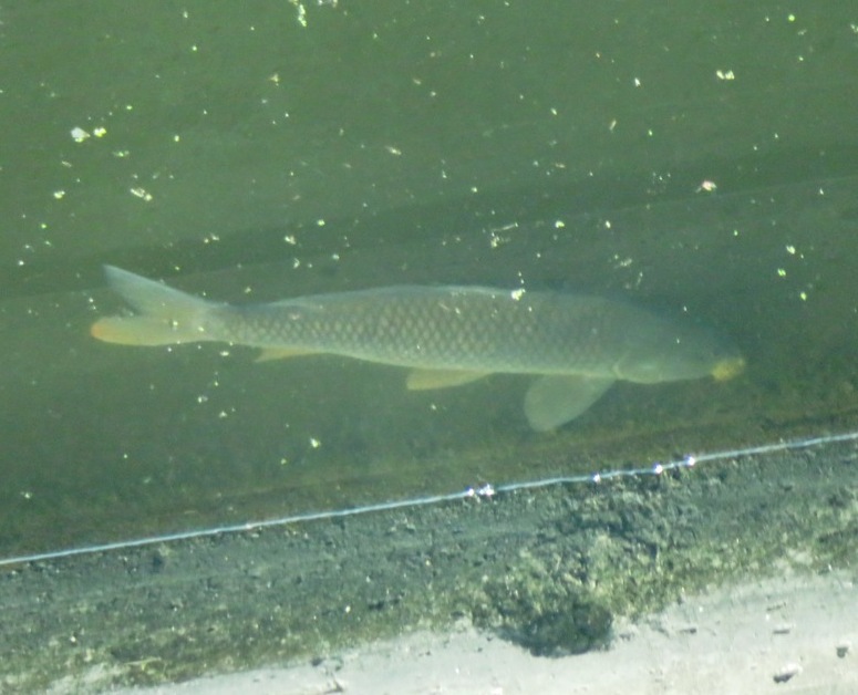
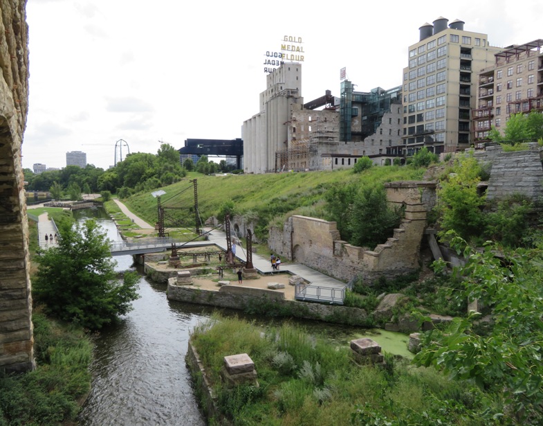
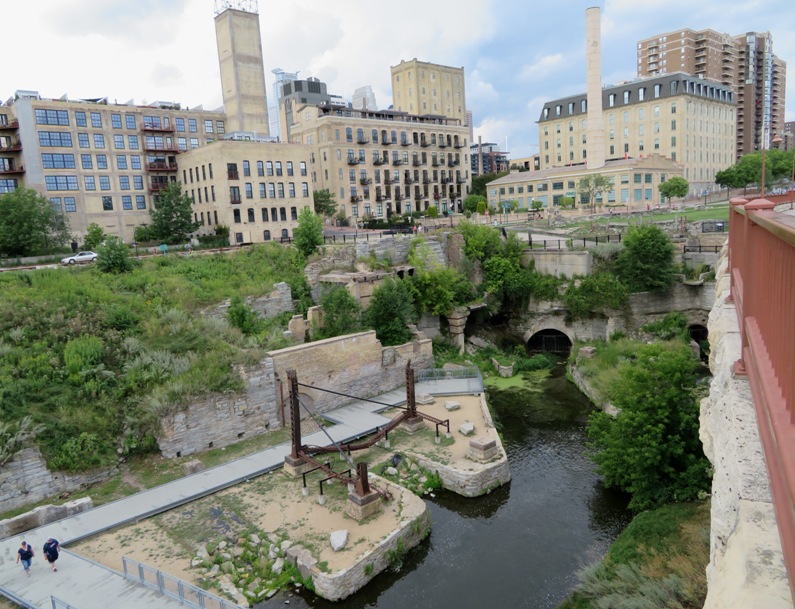
Outside the Visitor Center, we walked by Mill Ruins Park via the Stone Arch Bridge. Mill Ruins Park embraces the flour-milling district that once lined the west bank of the Mississippi River at the heart of Minneapolis. Between 1858 and 1930, the milling district developed along the waterpower canal built here by the Minneapolis Mill Company. During this seventy-year period, Minneapolis became the nation's leading producer of flour, most of it manufactured in the twenty-five mills lining the canal. - from sign at Upper Saint Anthony Falls Lock and Dam Visitor Center We saw a Mississippi riverboat. Right river, wrong state. Perhaps the most famous flour mill in the area is Gold Medal. Check out the sign on top of the building behind Norma and Carmen in the below snapshot. 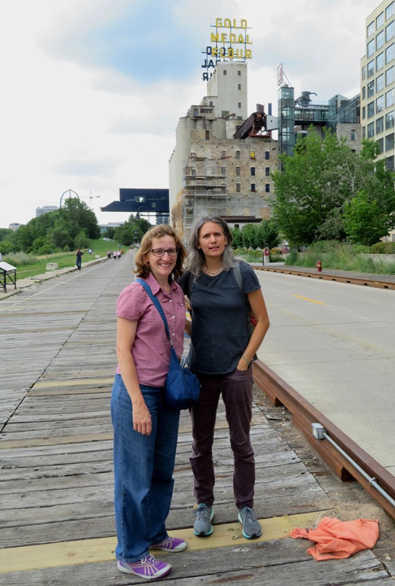
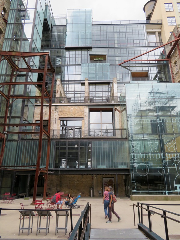
Our next stop was the Mill City Museum. We just toured the outside. When this mill was built in 1879, the water of Saint Anthony Falls powered all its equipment. (Later, steam engines shared the work.) Water from the falls flowed to the mill through a headrace canal before dropping down nearly 50 feet to turn underground turbines - huge horizontal wheels with blades that were rotated by running water. - from information sign at museum |
|
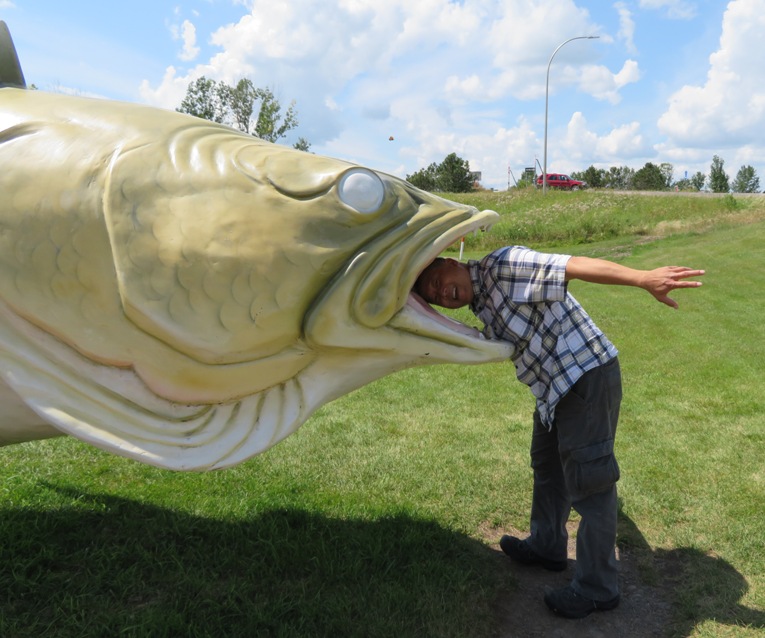
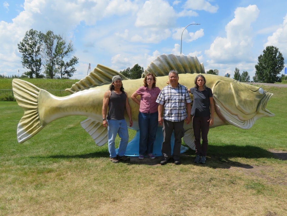
The four of us left the city and started heading north. We stopped in Rush City, Minnesota, the self-proclaimed "Walleye Capital of the World" where they had a statue of what was likely the world's largest walleye. Ever since Team SNaCk stopped to see the world's largest pistachio on May 2, 2016, seeing the world's largest anything has been on Carmen's mind.
We pulled over for lunch at Tobies Restaurant in Hinkley, Minnesota. There I received a call from Ken wishing us well. I was very much hoping he could have joined us but things didn't work out. After crossing over the state line into Wisconsin, we stopped in an industrial town called Superior where we bought groceries at a regional chain called Super One. |
|
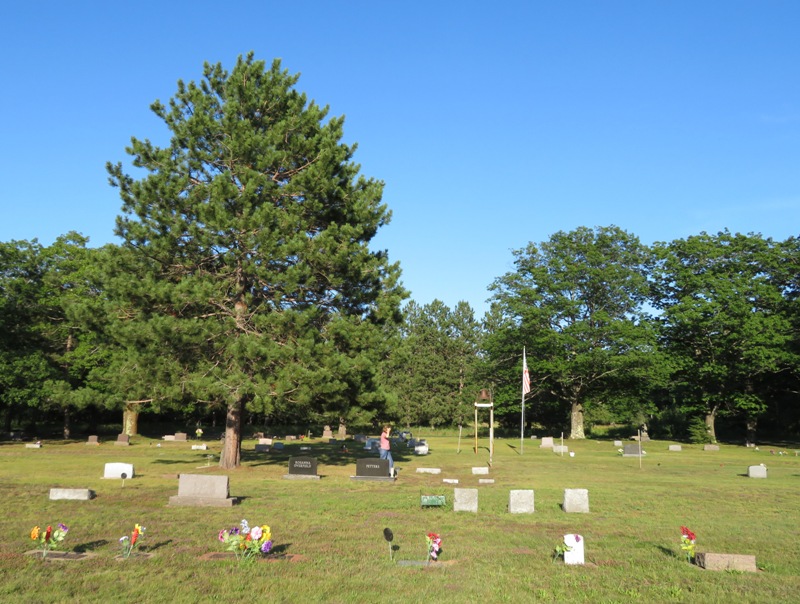
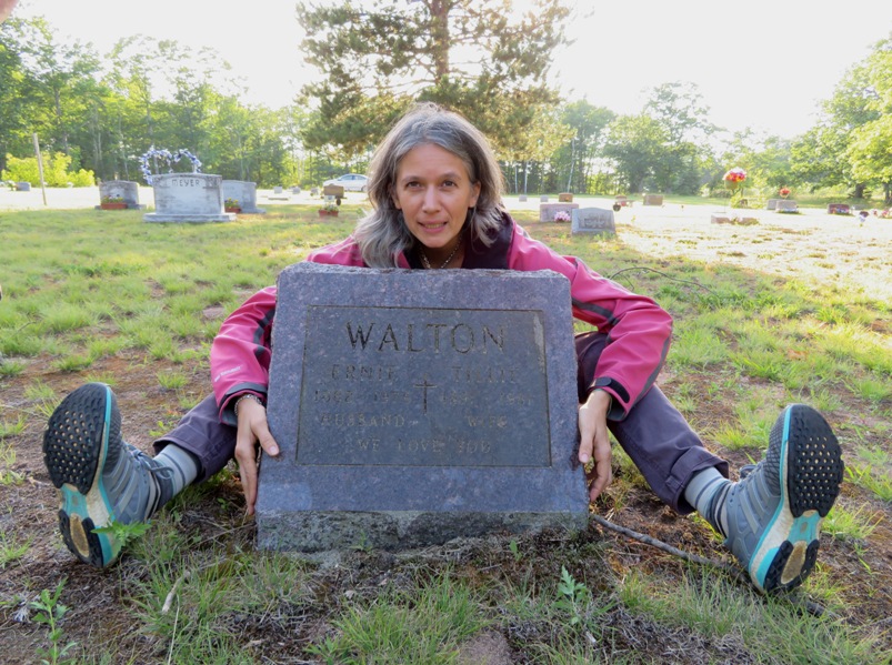
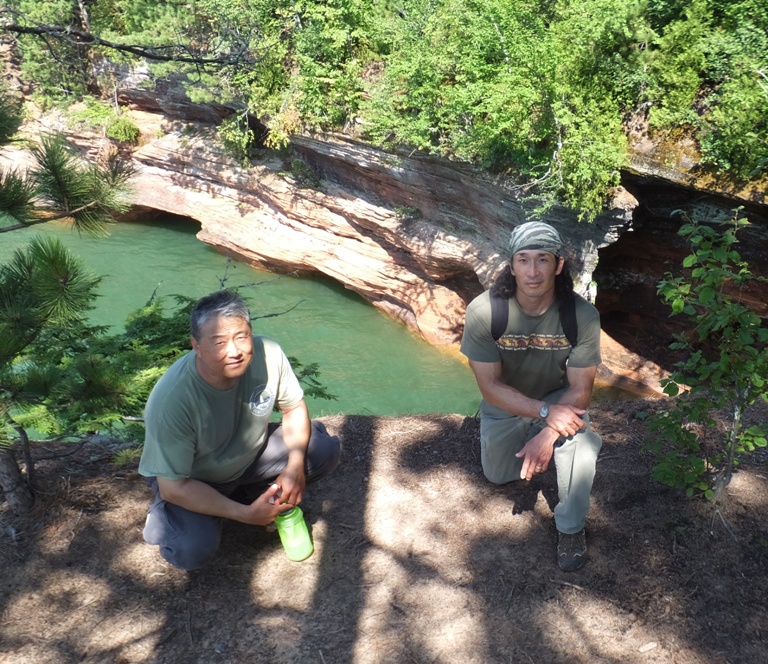
Our next detour was a very small town called Herbster. Here, we visited the community cemetery where Carmen found the headstone of a relative.
We made a quick stop at Bark Bay Slough. It looked very scenic and natural but I didn't want to stick around. It was getting late and the mosquitoes were attacking en masse. 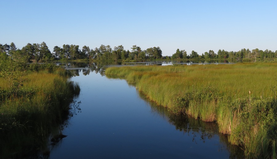
|
|
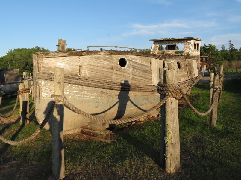
Almost at our destination, we stopped at the delightful town of Cornucopia.
Cornucopia is shaped like the legendary "horn of plenty" it was named for. With no railroad and few roads, early travel to and from Cornucopia was by water. Lake Superior was the highway. Cornucopia's harbor is the community's centerpiece. - from harbor sign in Cornucopia In the town, we saw some old boats and walked on the beach. The four of us walked out on the pier. It was constructed differently than others I'd seen. It looked like steel arcs were set in place with concrete poured inside. We also saw the marina. 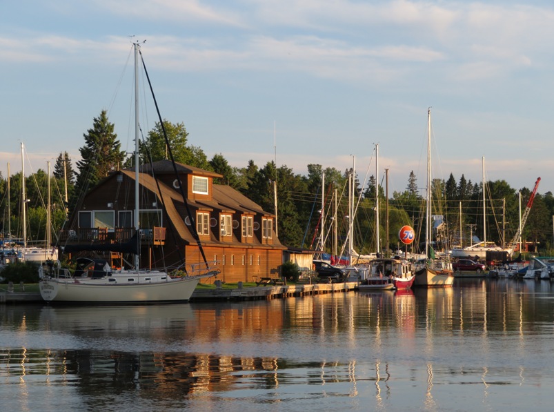
|
|
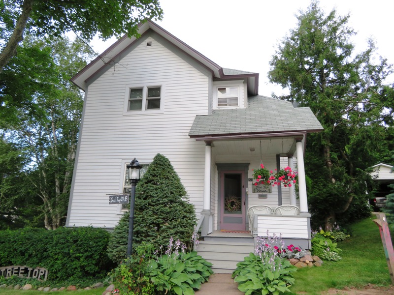
The four of us checked into the Tree Top bed and breakfast house in Bayfield. When Carmen first booked this place, I was hoping it would be an actual tree house but it was not. Bayfield is a charming tourist town along the water. It reminded me of our trips to Maine (July 25 to August 3, 2009 and August 29 to September 3, 2011).
We ate dinner at Ethel's at 250. Norma and I shared the Bayfield Grilled Whitefish Dinner and Crostini with Smoked Trout. I very much liked the trout. |
|
We had a nice meal at the bed and breakfast.
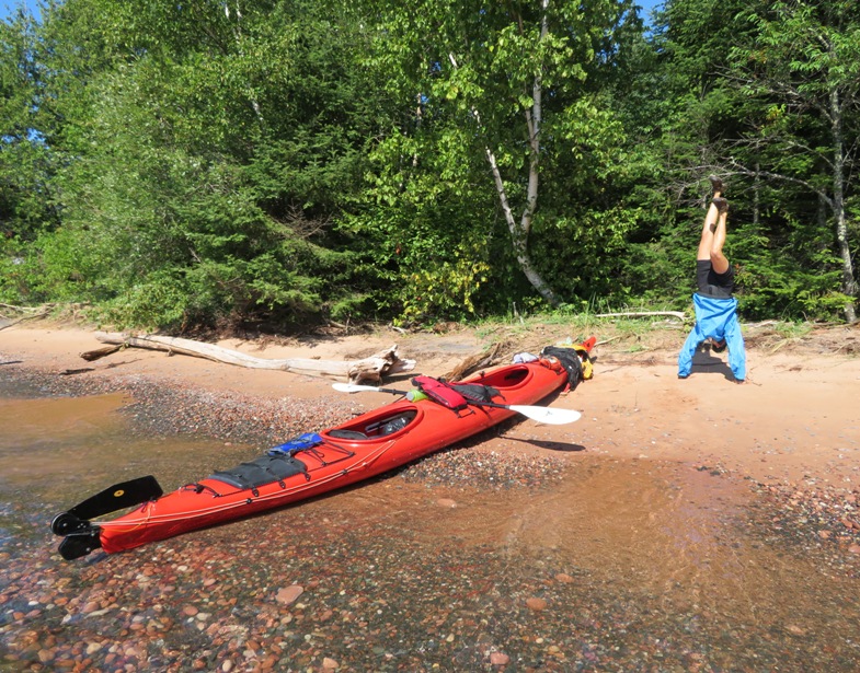
Next, we headed out to Little Sand Bay where we met our guide, Britta, and her assistant, Kiah. They gave us our tents, splash jackets, and shorty wetsuits. We loaded gear and then went over the usual safety stuff like doing a wet exit. 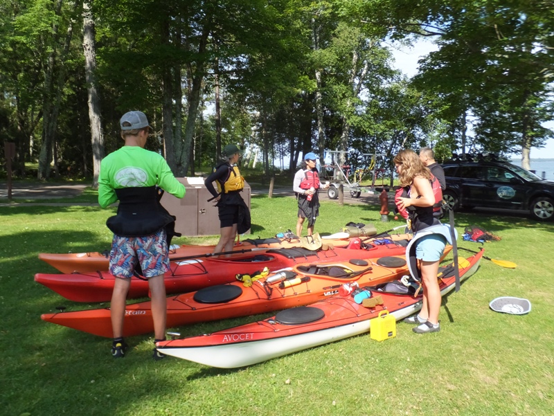
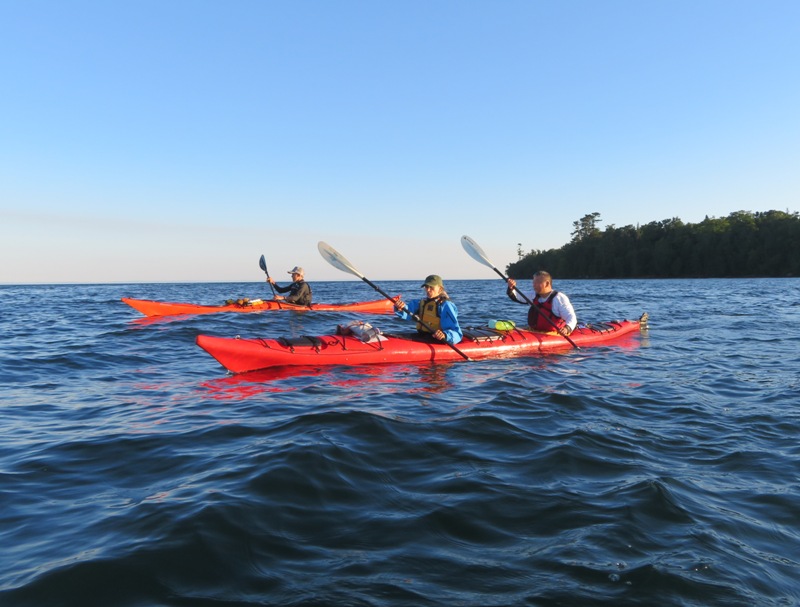
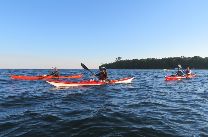
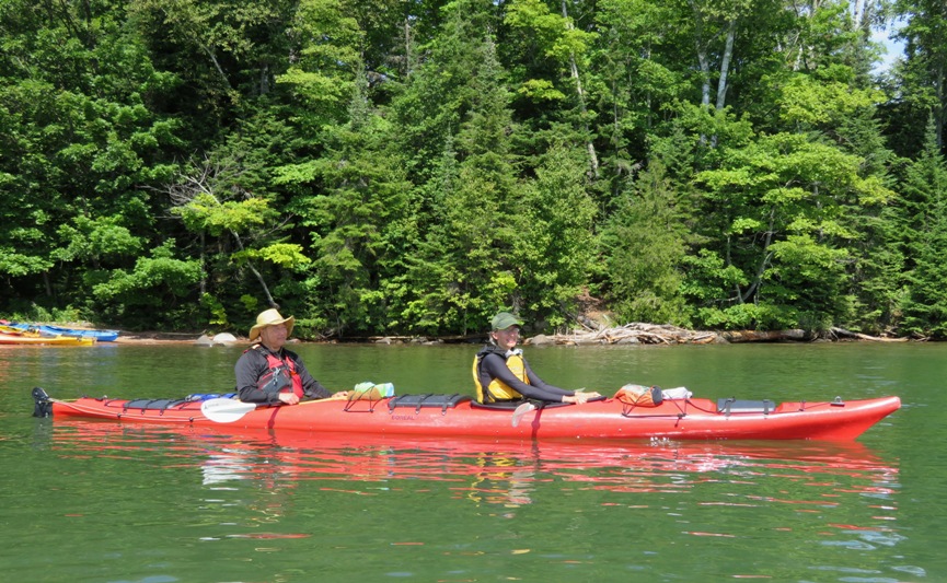
My rental car was left in one of the spaces at Little Sand Bay. Quite a few people leave their vehicles there overnight and there are very few (if any) break-ins. Britta assured us that our plastic Boreal Design Esperanto tandem kayaks were very stable. In fact, she's never led a trip in which one has capsized. These are wide boats with rudders that hold a lot of gear. Steve and Carmen were in one while Norma and I were in another. Britta paddled a fiberglass Valley Avocet while Kiah was in a plastic Valley Etain, both with skegs. |
|
Britta is the daughter of the owner of the company. She is a very skilled kayaker and a competitive cross country skier. A good swimmer, she is also signed up to run a half marathon the day after our trip ends.
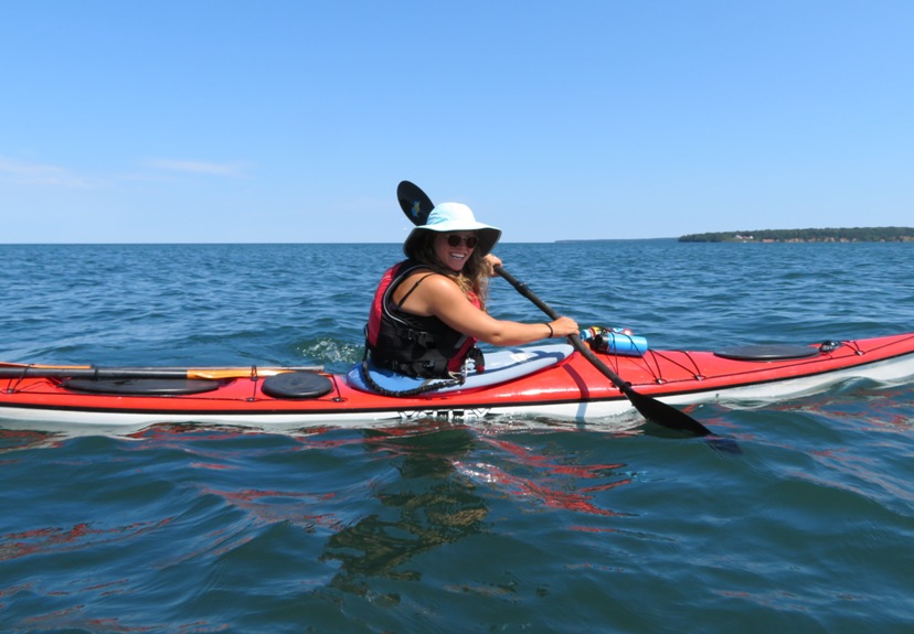
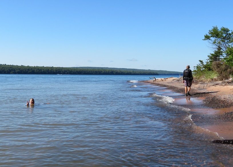
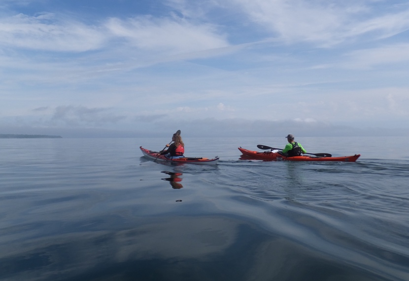
At only 16 years old, Kiah has a lot going for him. He is an experienced assistant guide, is quite mature for his age, and can boast running a five minute eight second mile. After carrying extremely heavy boats to the beach, we were off. The six of us paddled east in clean, cold water. How cold? According to a sign at the park, Any water below 70 degrees Fahrenheit is "cold." Below 70 degrees, the human body cannot generate enough heat to keep warm. Even at its warmest, the average surface temperature of Lake Superior is about 61 degrees. Temperatures below the surface are often much colder. We were glad to be on the water. 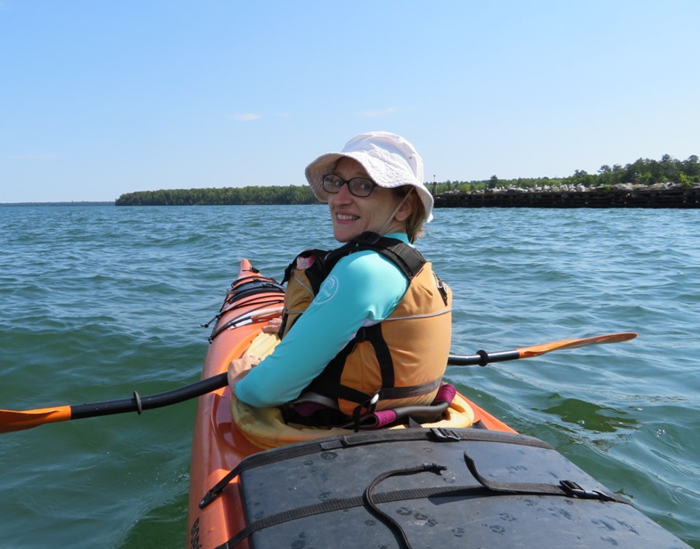
For Norma, Steve, and I, this was our first time in this part of the country. If there was only one Great Lake to kayak in, I think Lake Superior is an ideal choice. This lake I was hoping to see some interesting wildlife but I did not. Britta said the lake has fish but they are deep water fish caught with nets. We saw a boat that must have had some luck that day based on the number of followers it attracted. 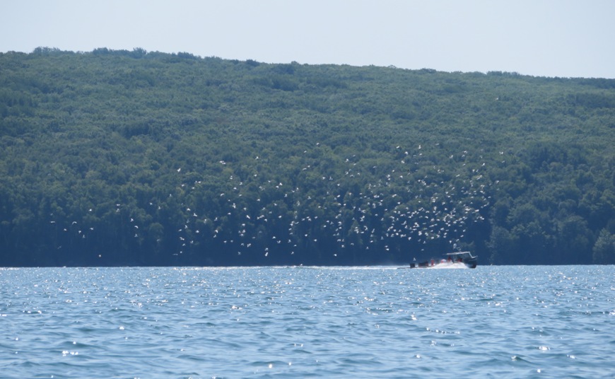
The largest fish I saw were too small to use as bait. We paddled south of Raspberry Island where we saw Raspberry Island Light. 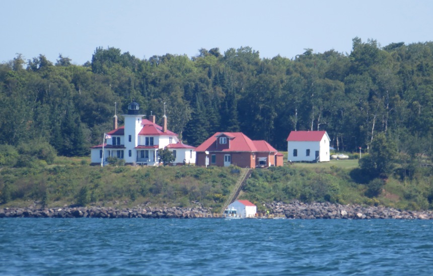
|
|
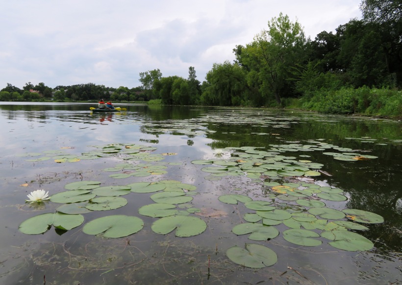
After 7.8 miles, we stopped at Oak Island. It had a nice pier and a pit toilet in an outhouse. We ate lunch, explored the trails a bit, and then took a short nap (at the request of Team SNaCk). Then we loaded up and paddled a very short distance to campsite number two. Our day's total was 8.23 miles.
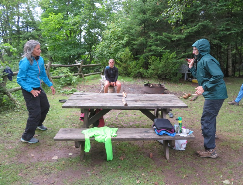
Campsite number two was pretty small. There was a 10'x10' tent area that just barely fit the two tents. Steve and Carmen shared a three person Big Agnes tent. Norma and I shared an older two person Big Agnes tent. Britta set up her tent on higher ground while Kiah slept in a hammock. We weren't close to the outhouse but we had an open air pit toilet. This wasn't ideal but it certainly beat having to carry the toilet in the boat like Norma and I did on our Espiritu Santo Island kayak camping honeymoon, December 30, 2012 to January 5, 2013. I went for a short swim to get rinsed off. The water was cool but tolerable. 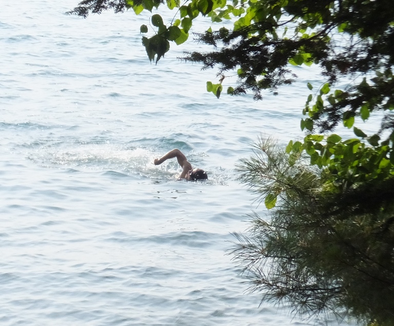
Britta and Kiah did almost all the food preparation and all the cleanup for this trip. While they were getting dinner ready, we explored the trails a little more. I was hoping to see a black bear but did not. I'm sure they were there (at least at one time) because each campsite had a steel bear box for storing food. While we were pretty far from home, things didn't look all that different from Maryland. I could tell Norma and Carmen were getting hungry on the trail. They were ready to munch on some bracket fungi. 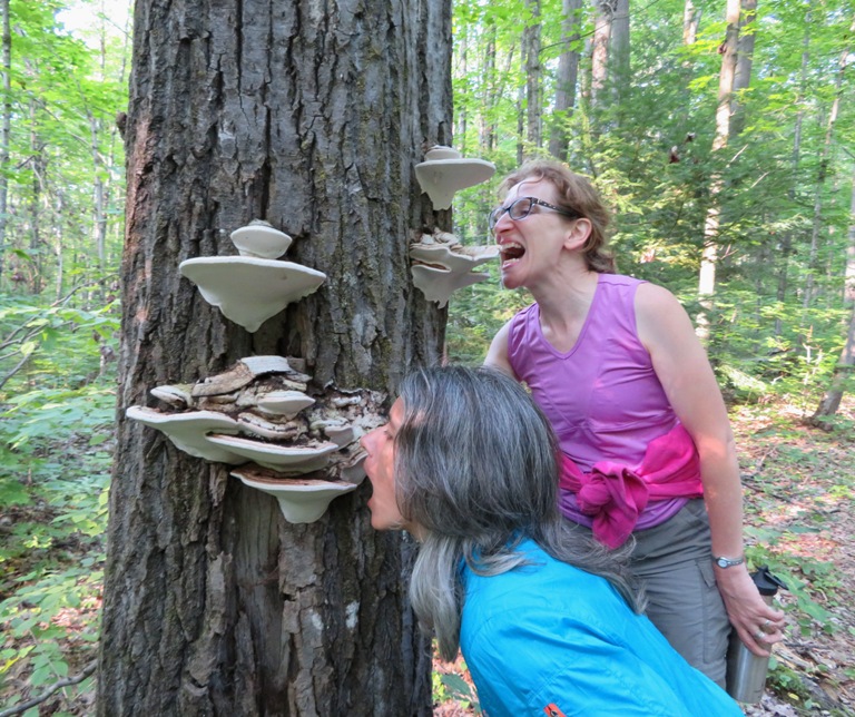
By the time we returned to the campsite, Britta was putting the finishing touches on some whitefish. 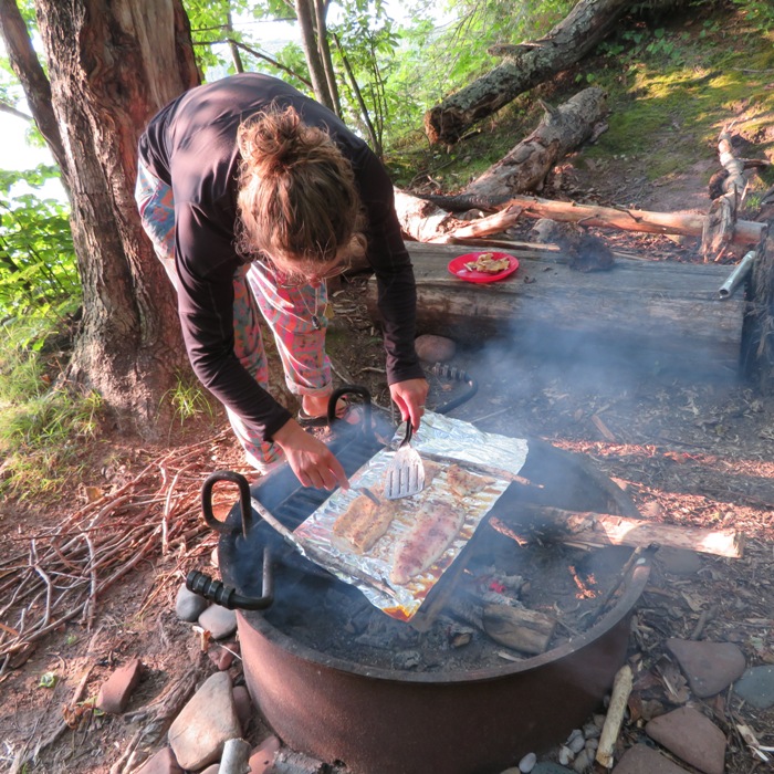
Kiah and I spent some time skipping rocks. For the most part, the rocks in this area are not very spectacular. They look like Sacramento river rocks. But Kiah found a very special one that contained a broken geode. 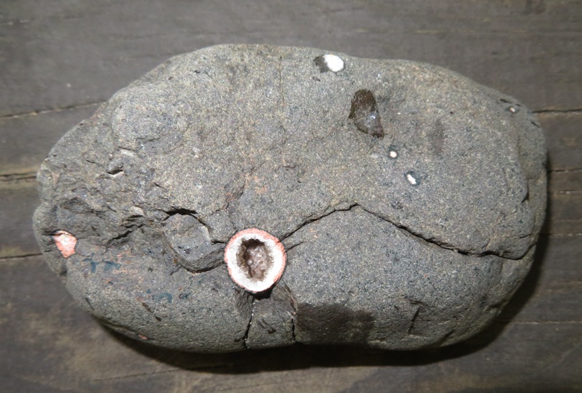
Our campsite was small but it kept us open to the breeze which kept the biting insects away. It also allowed us to enjoy a beautiful sunset and go to sleep to the sound of crashing waves. 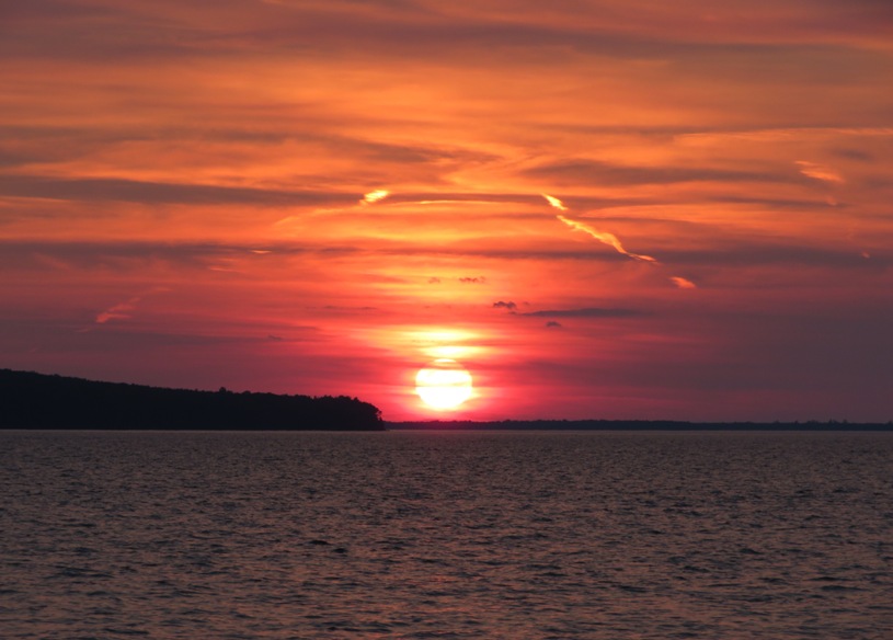
The boats were much higher than the beach so there was no fear of them (or us) being swept out. |
|
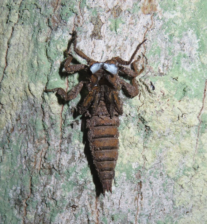
Early in the morning, I found the empty shell of a dragonfly nymph on a tree. Seems like a strange place because it wasn't near the water.
We loaded up our gear and launched, paddling north. 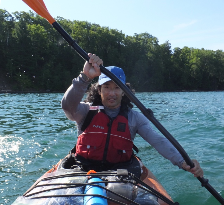
The water wasn't rough but it wasn't smooth either. I'm glad I wasn't on my surf ski or SUP paddling between the islands. 
Carmen worked on teaching Steve the periodic table of elements, which she almost has memorized. She's good at stuff like that. |
|
At mile 13.6 (cumulative), we stopped for a break at Otter Island along with several other people. We saw no otters but someone did at the final island we camped at.
I found a polydrusus green weevil. In the right light, it has a metallic glow. We found several on our adventure. 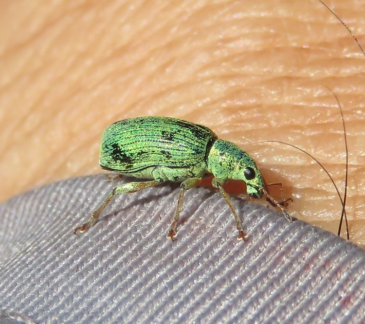
|
|
We resumed our journey and continued north.
Eventually, we landed at Rocky Island for a cumulative mileage of 17.2. We pulled the boats ashore, away from the low beach. Then we carried our camping gear to the campsite. This site was more spacious than the last but had less breeze so it was a bit more buggy. 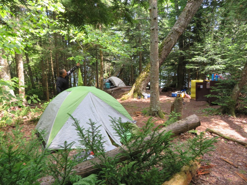
After we got our tents set up, it rained a good bit. So we piled up in Carmen and Steve's tent and played Five Crowns, a card game that Norma brought. It is a simpler version of Gin Rummy with a special deck containing five suits. 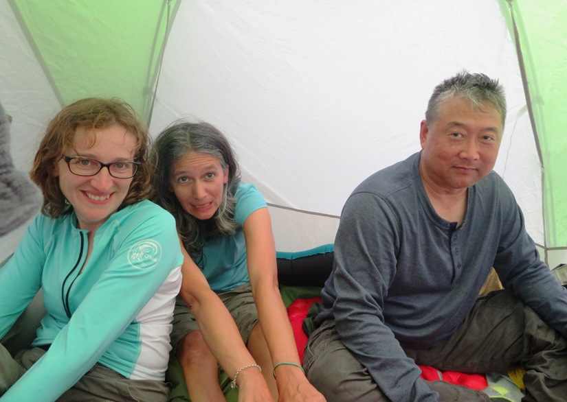
|
|
One thing I would do differently if I did this trip again is not pack so much food. There was some food anxiety amongst us and we bought quite a bit of stuff. But Britta kept us well fed. The food was tasty and nutritious. Having some easily accessible snack bars on the boat is all I recommend packing in terms of food.
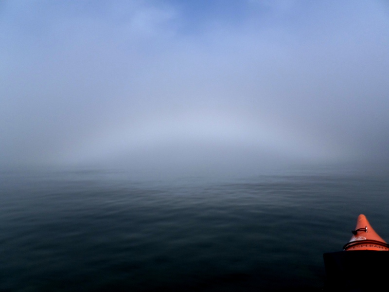
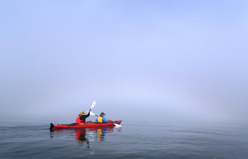
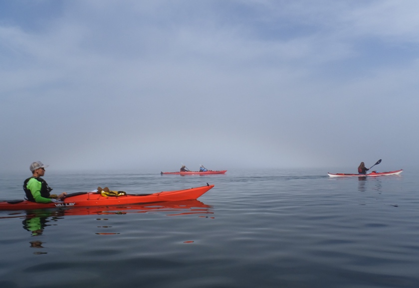
In terms of equipment, Norma and I should have brought more dry bags. I failed to thoroughly review the e-mail from Neal which said they would have a limited number of dry bags to go around. Carmen pointed out my flaw. So we bought trash bags and Ziplock bags on the way over to Little Sand Bay. This was sufficient but not ideal. We were on the water pretty early. Over the last couple of days, I found that the hatches on our tandem kayak are not very watertight. They didn't have neoprene covers under the hard hatch covers like our kayaks in Mexico did. Also, the boats were weighted down quite a bit so they sat low and took on some water when launching or landing as the aft portion of the boat would sometimes be nearly submerged. I found using a trash bag as a replacement for an inner neoprene cover helped keep the hatch dry. The boats never took on enough water to be a safety concern. But having trash bags instead of proper dry bags to keep things dry made me want to keep the hatches as dry as possible. The six of us paddled into a fairly thick fog. 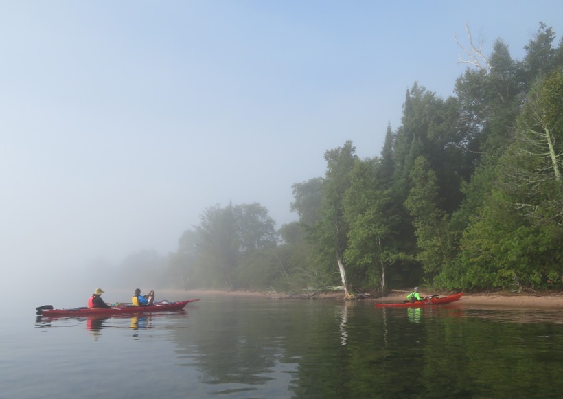
On the first day, I paddled with a straight shaft paddle but then I tried out a bent shaft paddle. Supposedly it is more ergonomic but it just isn't what I'm used to. 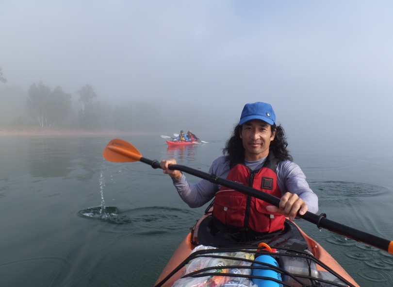
The fog made the horizon indiscernible. At time, we couldn't tell were the fog ended and the water began. 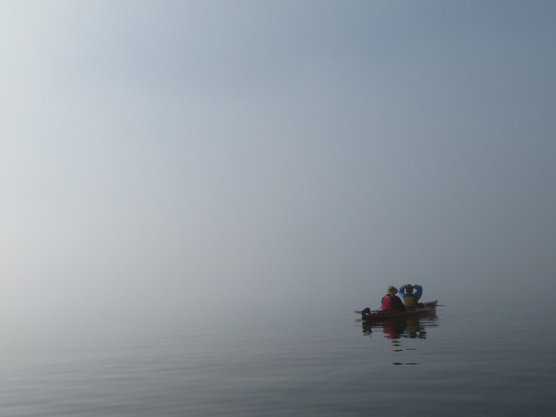
Britta pointed out something I had never seen before. It was a fog bow, also known as a white rainbow. Fog bows are formed when sunlight meets moisture, refracting light from the tiny water droplets suspended in the air. While rainbows mostly appear after rain fall, as sunlight refracts through larger water droplets, fog bows show up when the sun shines on fog, consisting of much smaller water droplets. - from Quartz - The science behind this all-white rainbow This area is not known for its wildlife. We did see some bald eagles but there was certainly no animal life that I would call exotic or interesting (by Maryland standards). We did see some mergansers. 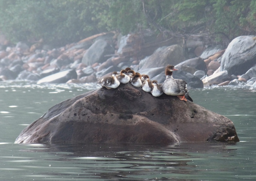
But not seeing interesting wildlife was o.k. I came here to see sea caves, and if we saw wildlife, that would be a bonus. Like our kayak trip in Norway on August 21, 2014, the beauty of this area was the scenery. |
|
As the fog started to lift, the water was like glass.
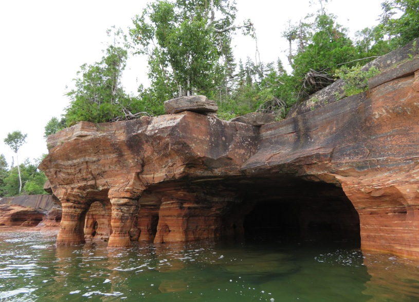
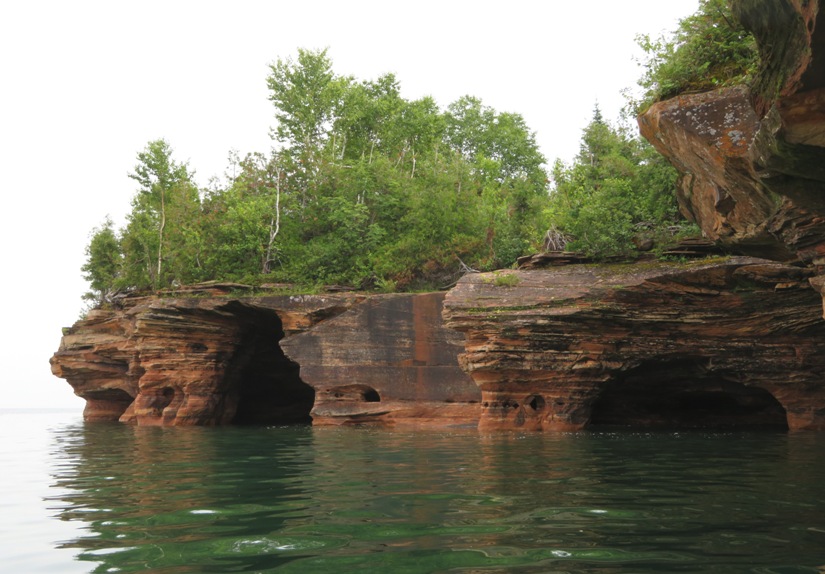
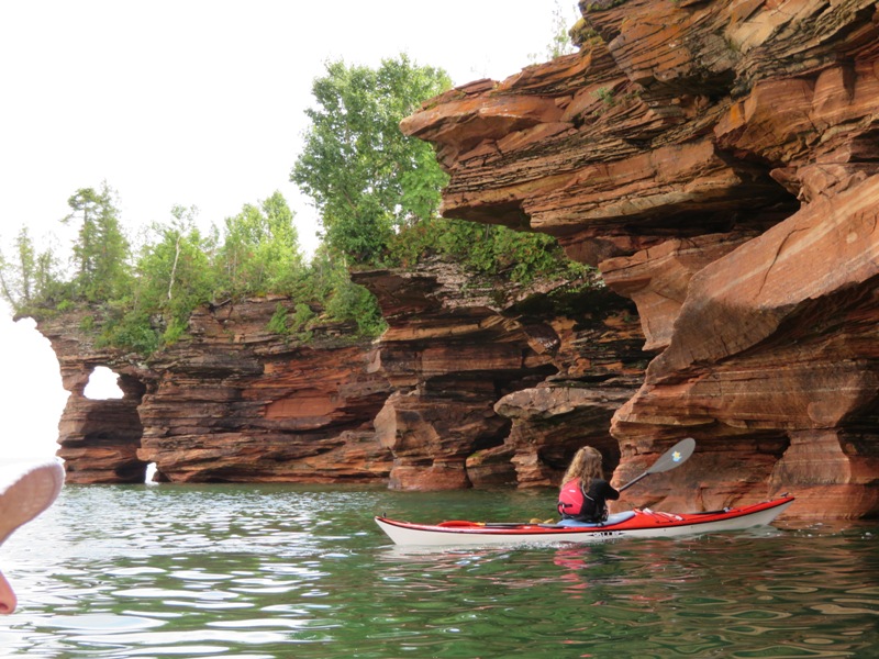
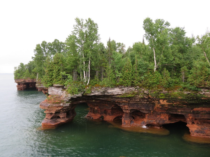
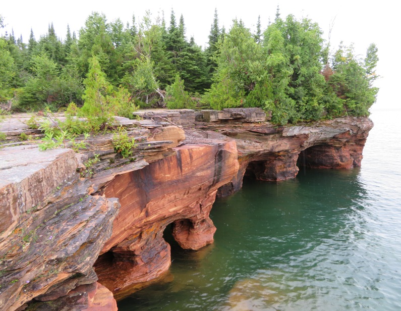
We approached our destination, Devils Island. The politician and author Samuel Fifield wrote in 1899 that, "The Indians in the early days declared it to be the home of Matchimanitou, the "evil spirit," whom Kitchie-Manitouo, the "great spirit," had imprisoned there. Hence its name, Devils Island." Governor Fifield did not specify his source of information for this claim, and some modern Native scholars question the accuracy of this explanation. When surf on the lake is heavy, the waves thunder and boom in the island's extensive sea caves. The rumbling can be heard even well away from the shoreline. Local residents claim that the Ojibwe (Chippewa) interpreted this noise as the sound of evil spirits. - from Wikipedia - Devils Island, Wisconsin 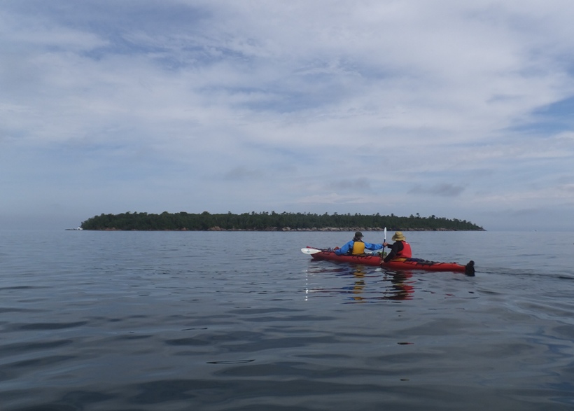
It didn't take much longer before we pulled up to the boat house on the south side of the island. 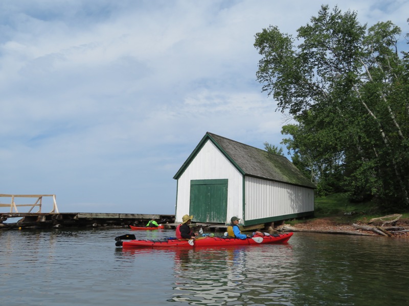
We were greeted by a ranger. 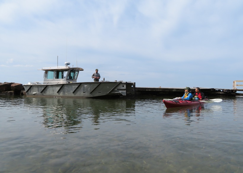
We unloaded our gear and then carried the boats ashore after having kayaked a cumulative total of 21.9 miles. There was only one campsite on the island and Britta snagged it for us by making reservations well in advance. This was the nicest campsite we would stay at on the islands. It had an outhouse, plenty of space, and high ground where we could catch a little breeze to keep the bugs away. I had heard horror stories about how buggy the Apostle Islands can get. So I came prepared with clothes treated with permethrin and plenty of insect repellent containing Deet. But in reality, the biting insects were no worse than at home and certainly not as bad as Assateague Island. Maybe we were just lucky. I'm sure it would have been worse had it been hotter but during the entire duration of our trip, it never got hot. The hottest it got was comfortably warm. There were plenty of times when it was cool enough to wear a light jacket. |
|
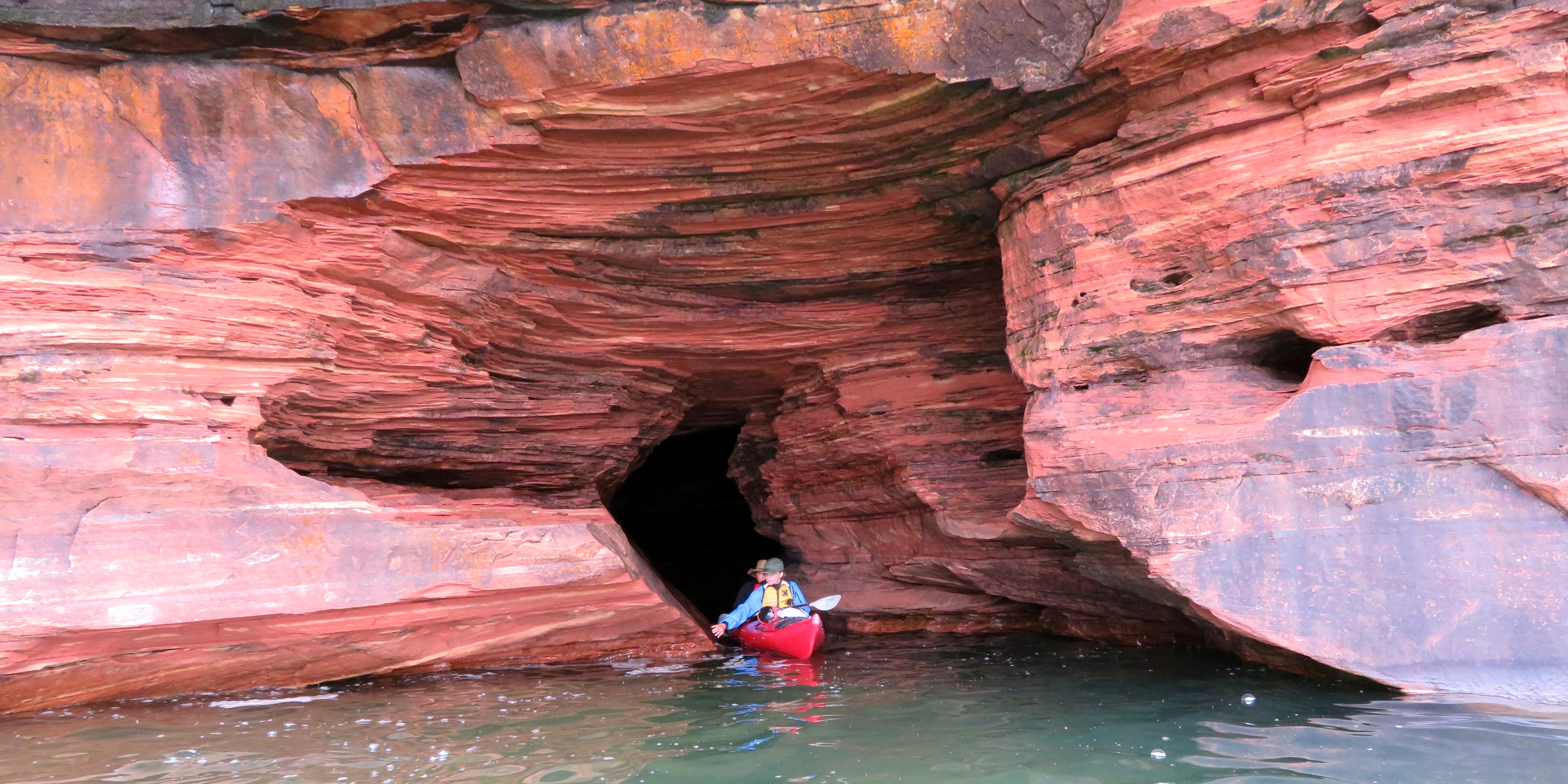
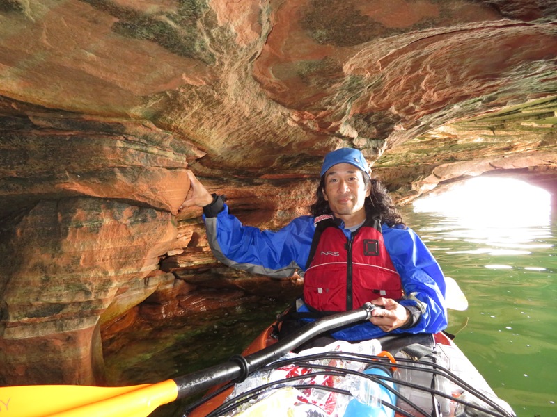
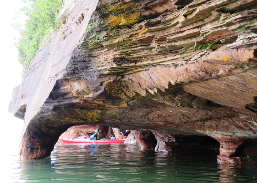
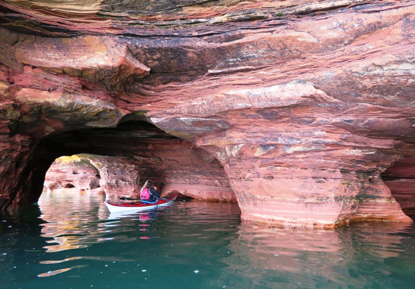
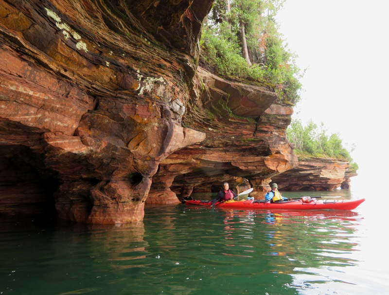
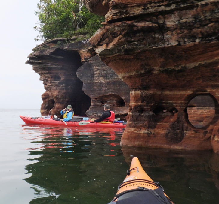
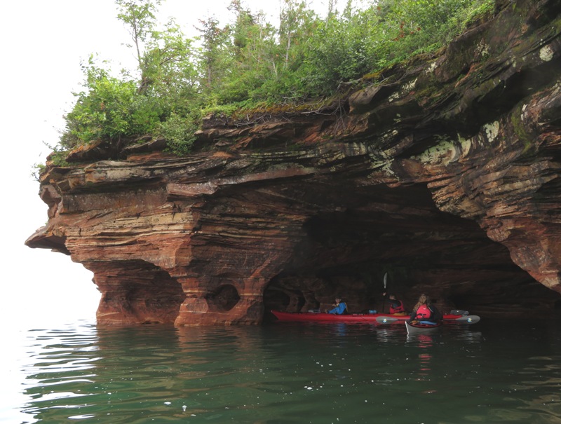
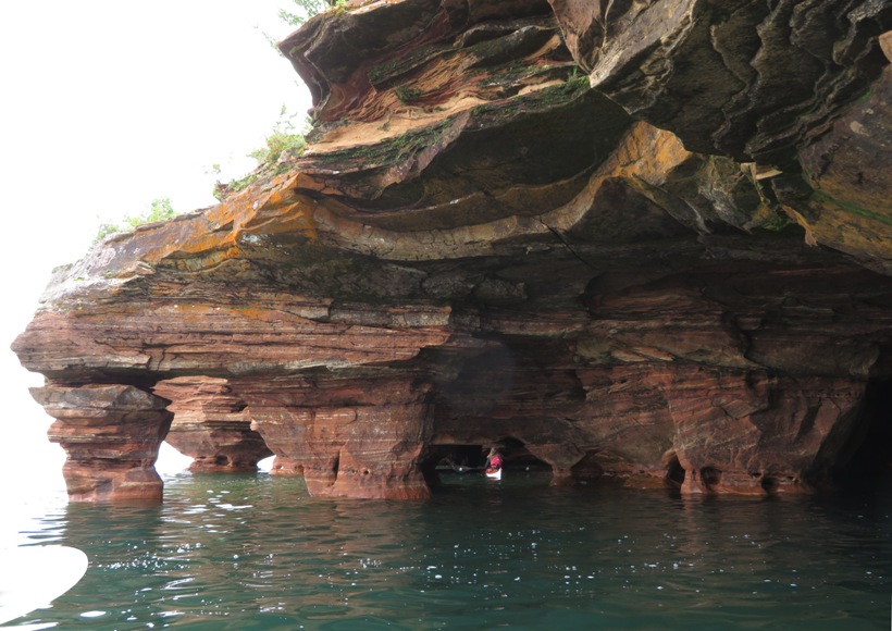
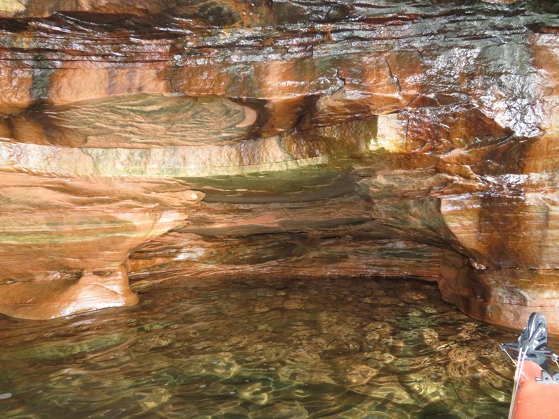
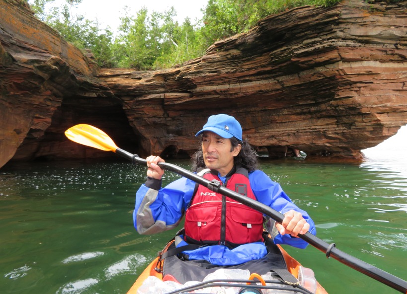
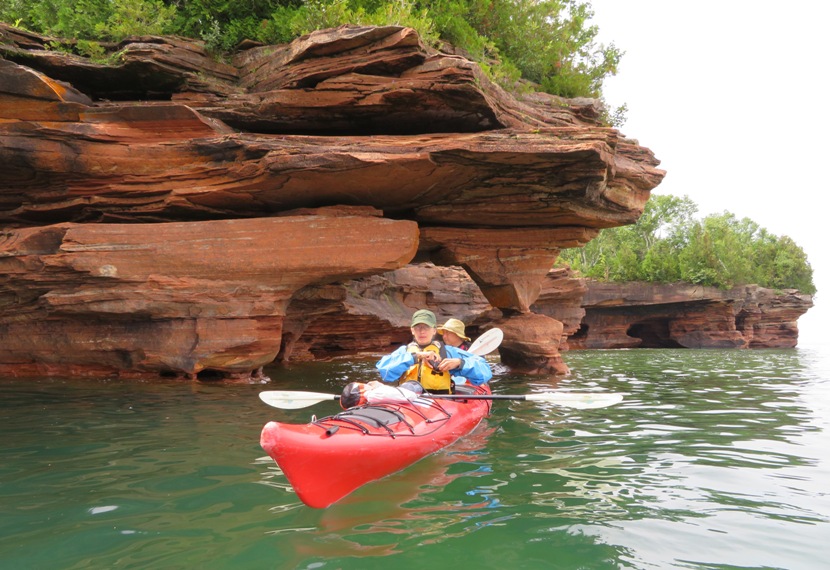
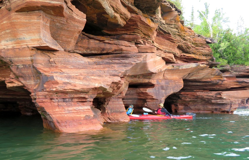
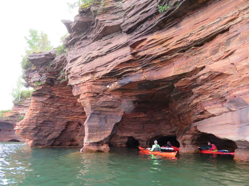
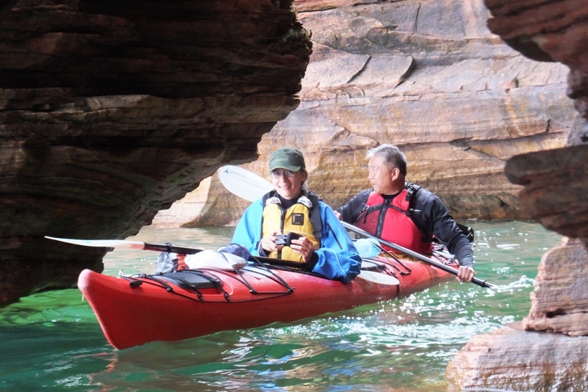
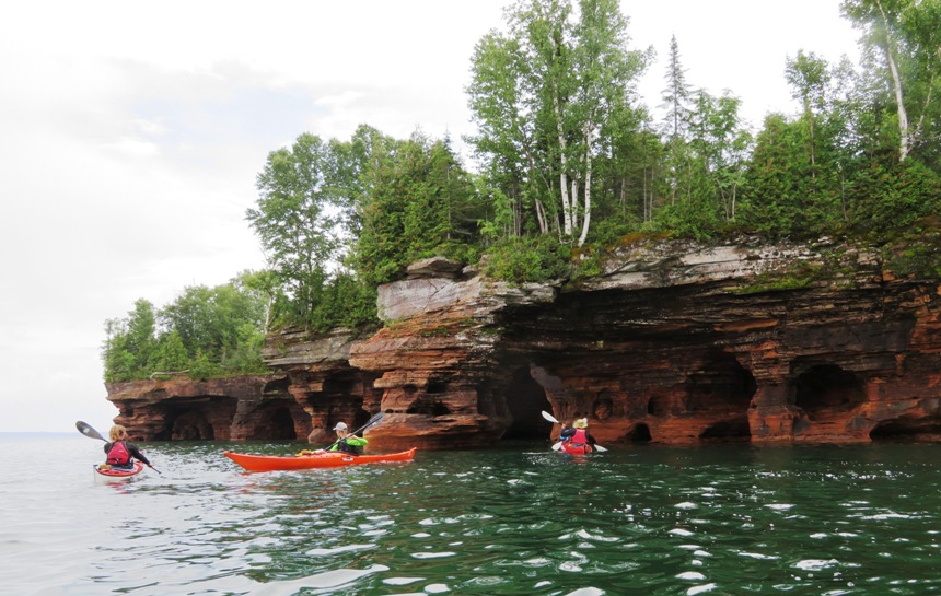
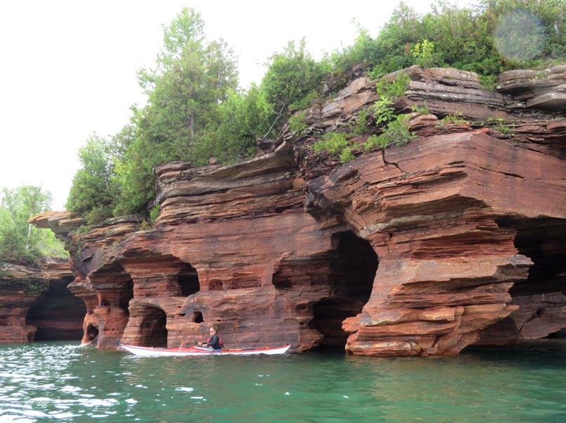
It was now time for the highlight of the trip...the sea caves!
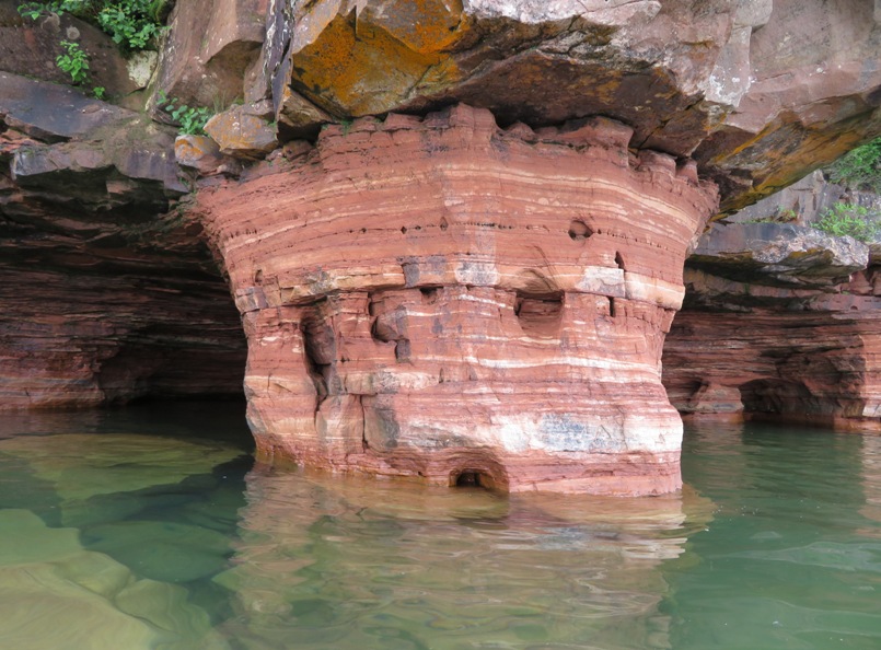
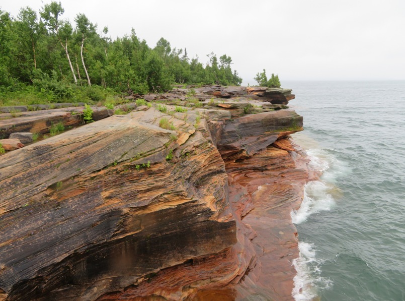
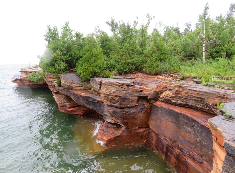
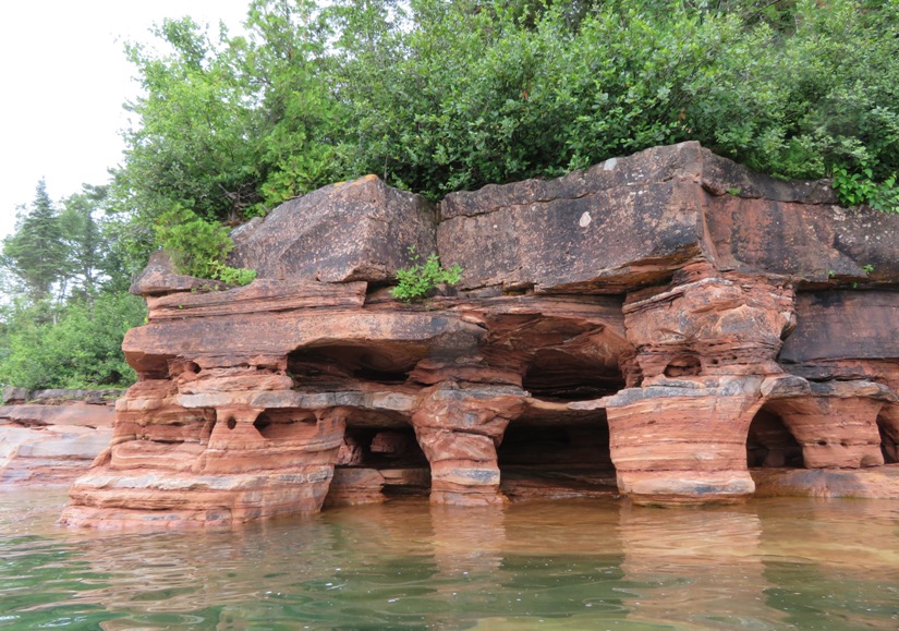
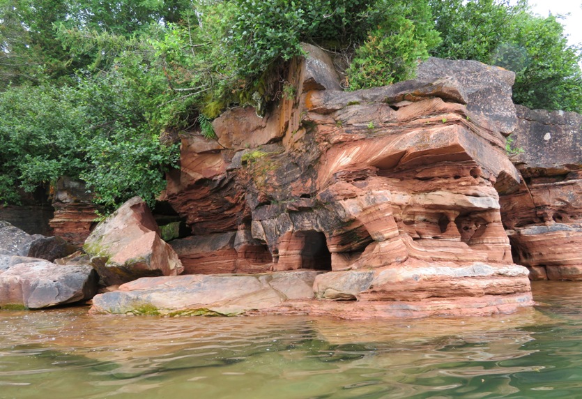
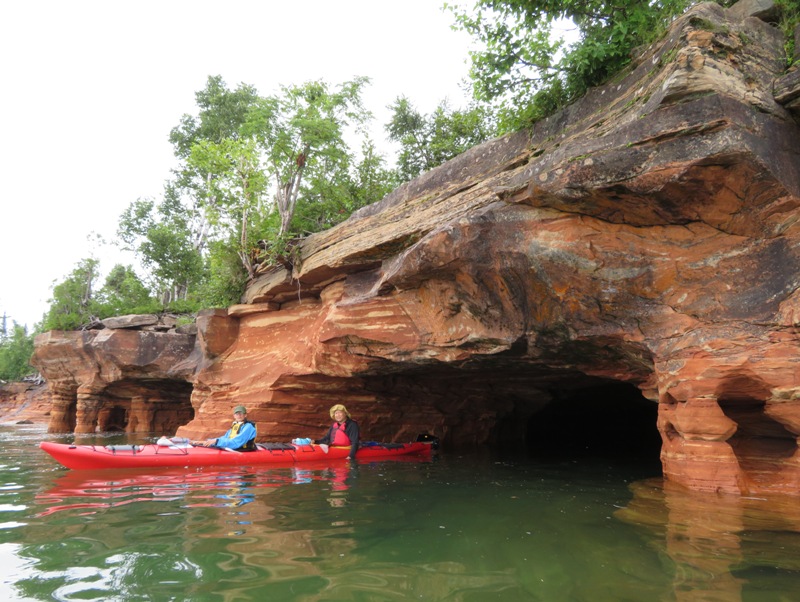
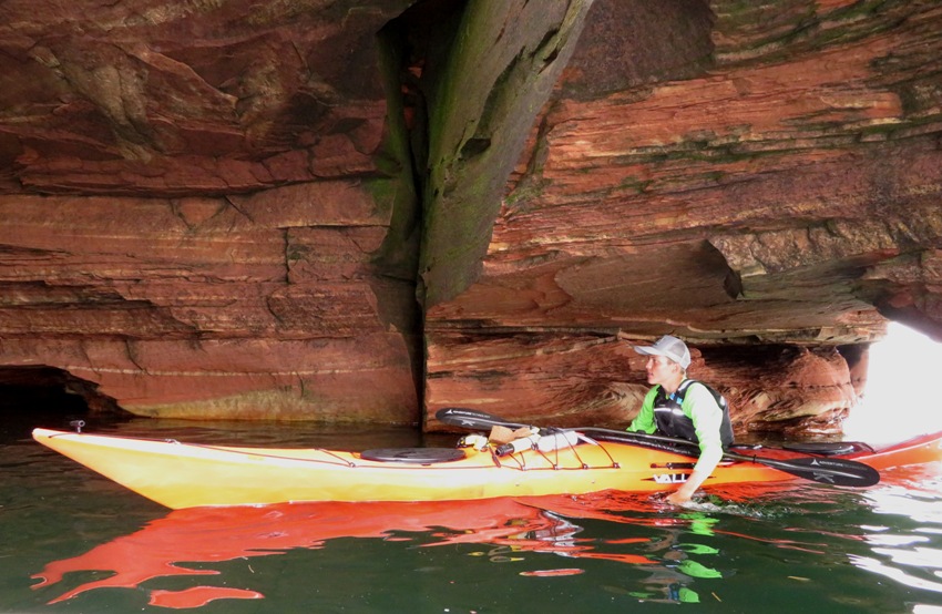
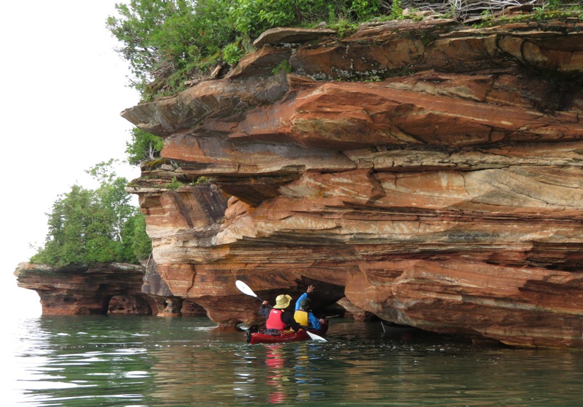
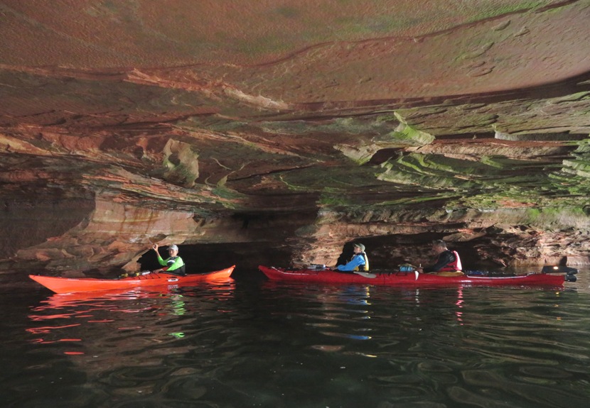
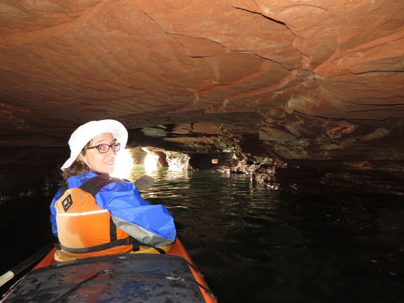
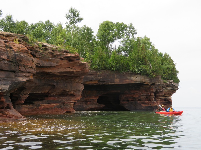
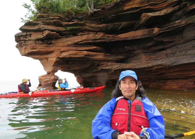
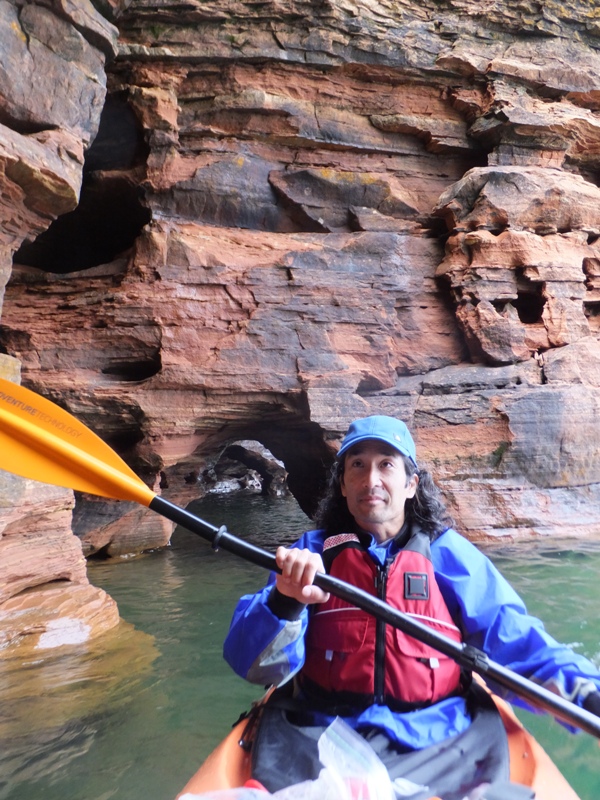
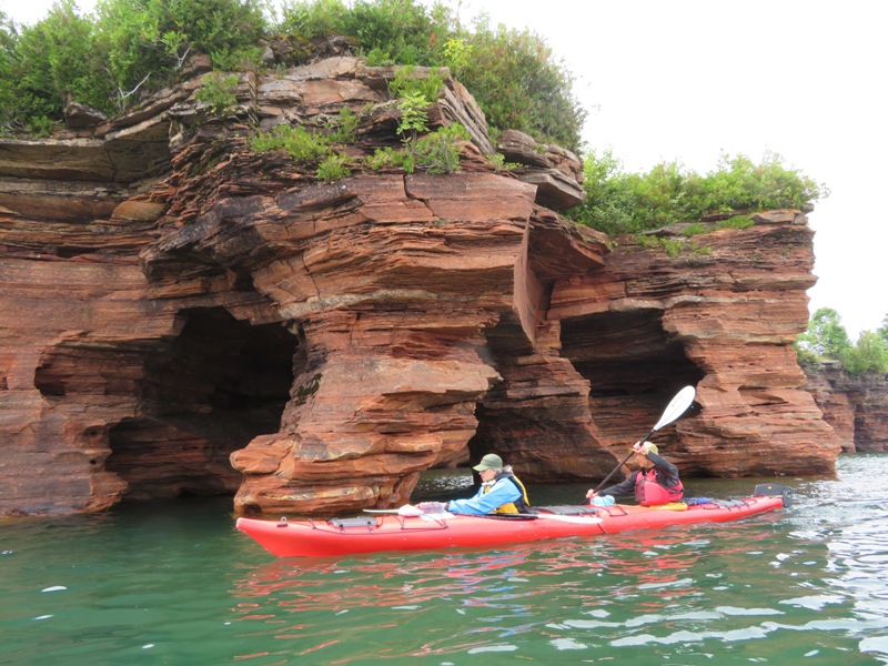
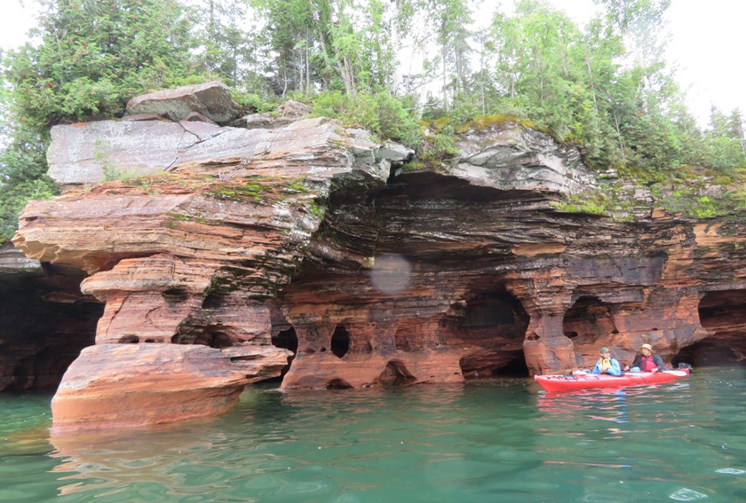
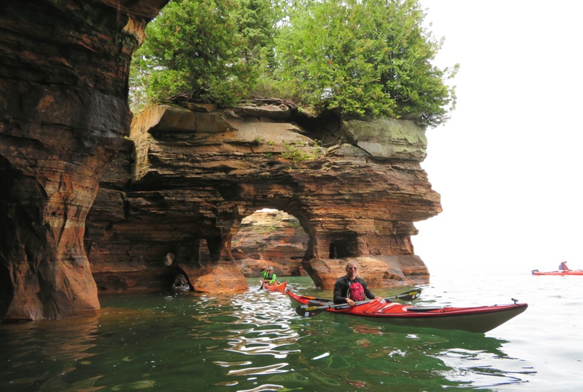
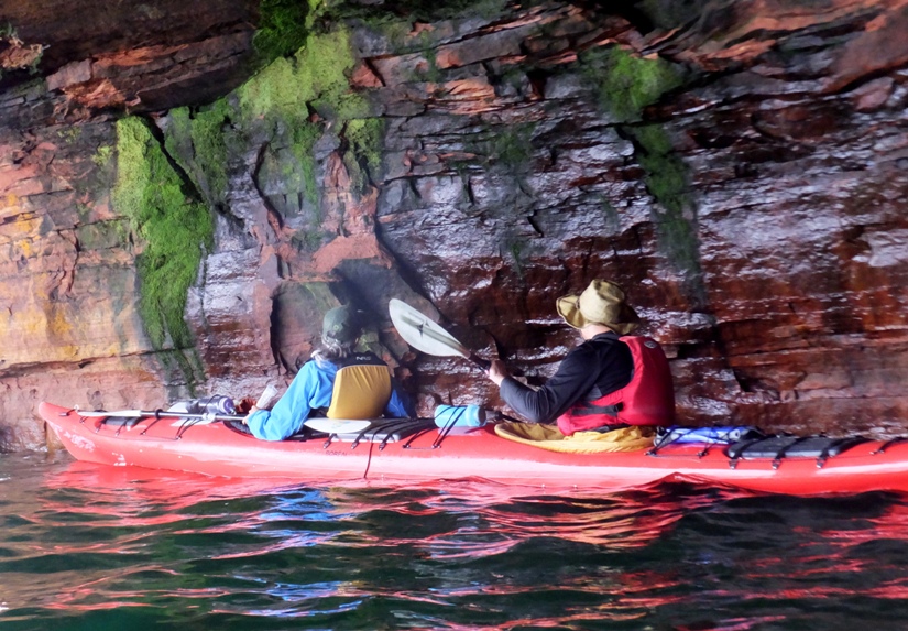
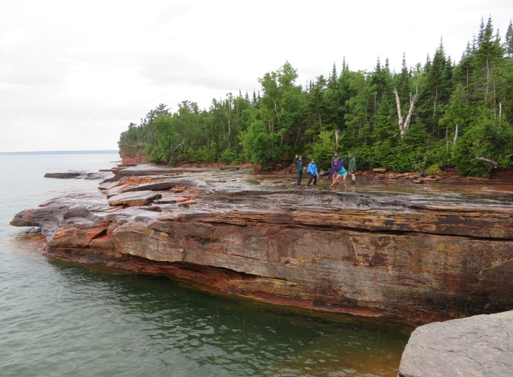
We set out in the afternoon at the warmest part of the day. It was a little colder than what the girls and I would have liked. But this is all relative. To folks up north, this might have been a typical summer day. I guess it was better than the hot, humid August climate of Maryland though somewhere in between would have been ideal. We heard and read stories about how cold it gets in the Apostle Islands during the winter. An ice highway forms which connects the mainland to Madeline Island. One person told us that her ex-husband once drove all the way out to Devils Island which I find incomprehensible! Britta and Kiah led us on a circumnavigation of Devils Island. Norma, Carmen, Steve, and I were in good hands. Britta and Kiah had earned our trust. We started seeing colorful sandstone rock ledges. These then turned into interesting formations and finally caves! The caves started out small. Many weren't big enough to paddle into. Here's one you can paddle into but you can't turn around. 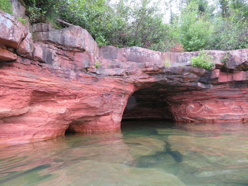
With the boats unloaded, they were much easier to maneuver in and around the caves. 1 / 29

Might be fun to climb.
2 / 29
Lush greenery atop.
3 / 29
Exiting a sea cave.
4 / 29
Greek columns.
5 / 29
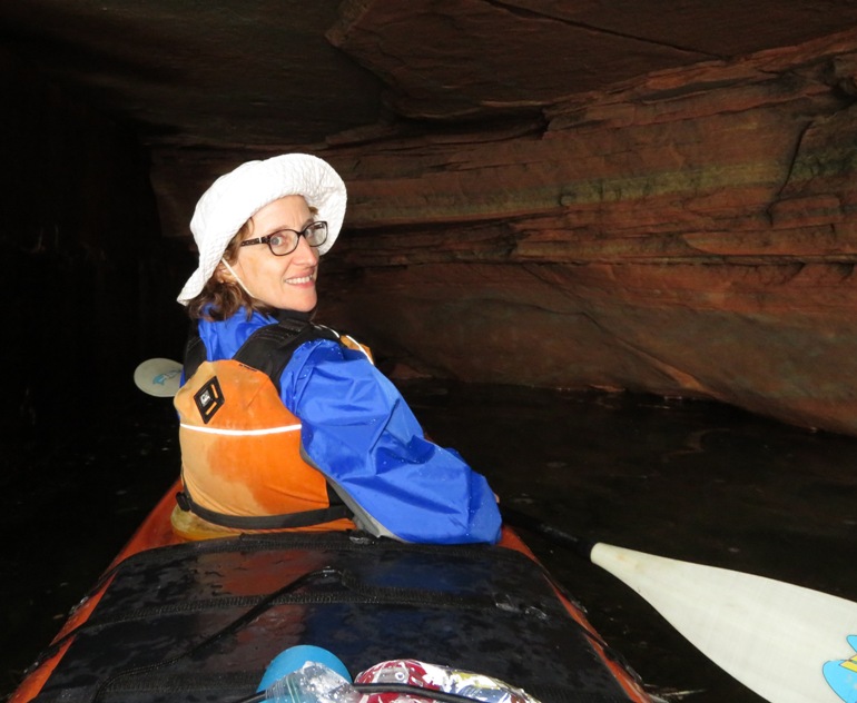
Dark cave.
6 / 29
Kiah.
7 / 29
Reaching for the ceiling.
8 / 29
Proof I was there!
9 / 29
I see Carmen.
10 / 29
Britta.
11 / 29
Steve and Carmen.
12 / 29
A smooth wall.
13 / 29
Room for everyone.
14 / 29
Illuminated ceiling.
15 / 29
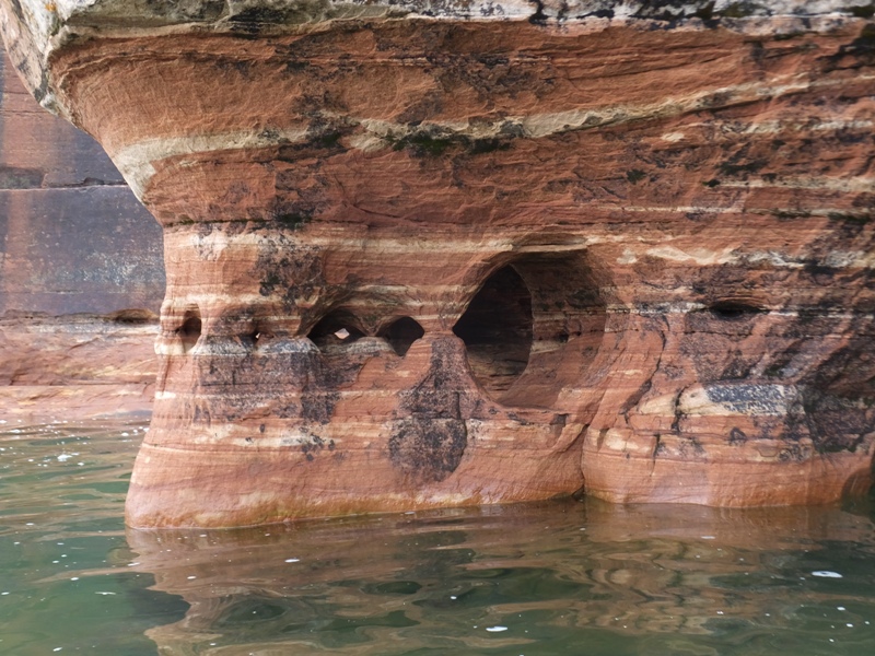
Holey rock.
16 / 29
Carmen taking a pic.
17 / 29
Big cave.
18 / 29
Do you see Britta?
19 / 29
Leaking rock.
20 / 29
Bent shaft paddle.
21 / 29
Britta.
22 / 29
Steve and Carmen.
23 / 29
Feeling Zen.
24 / 29
Layered rocks.
25 / 29
Entering a cave.
26 / 29
All except Norma and me.
27 / 29
Close-up.
28 / 29
High walls.
29 / 29
Zoomed out view.
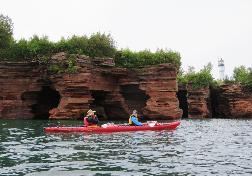
Now we were at the north end of the island. I knew this because we could see Devils Island Light. 1 / 8
Lighthouse on right.
2 / 8
Close-up of lighthouse.
3 / 8
Britta.
4 / 8
Steve paddling, Carmen not.
5 / 8
Lots of holes.
6 / 8
Kiah following Britta.
7 / 8
Wet wall.
8 / 8
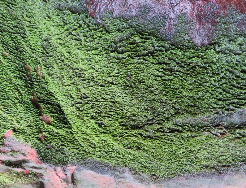
Moss from previous pic.
The water was pretty calm. I can't imagine kayaking so close to the rocks and caves in rough conditions. We were quite fortunate because the weather in Lake Superior can be very unpredictable. By the time we finished, we had completed a cumulative 26.5 miles. |
|
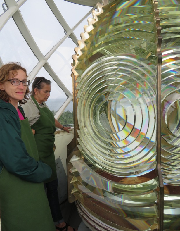
After landing, we took a walk from the south side to the north side of Devils Island to see the lighthouse.
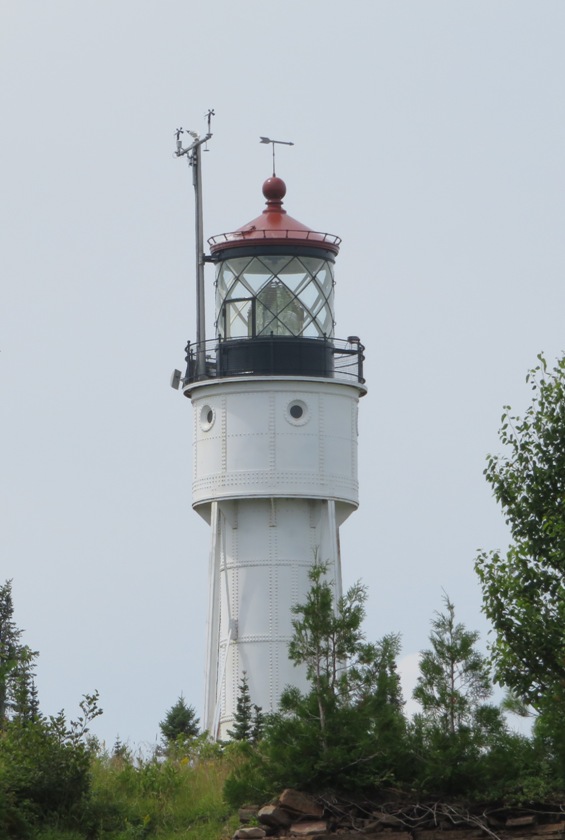
On March 2, 1889, Congress appropriated $15,000 for a lighthouse on Devils Island, the most northern island in the Apostle Island archipelago. When finished, the lighthouse would serve as a coastal light, splitting the gap between the lighthouses on Sand Island and Outer Island. Built of half-inch-thick steel plates, the cylindrical tower stands eighty feet tall and was originally braced at its base by eight latticed buttresses that stood thirteen feet high. - from Lighthouse Friends - Devils Island Lighthouse 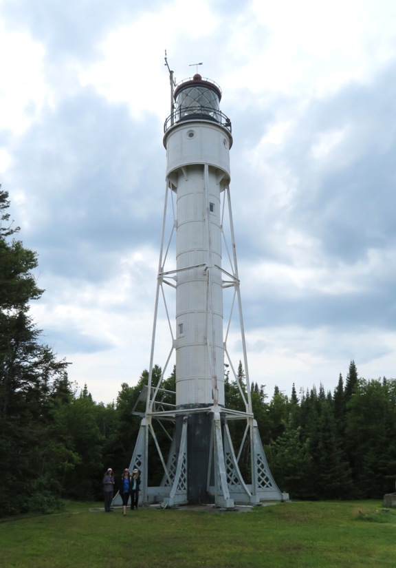
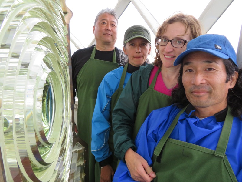
A volunteer greeted us and told us all about the place. After donning clothes to protect the sensitive and delicate glass light, she took us to the top. We had quite the view. 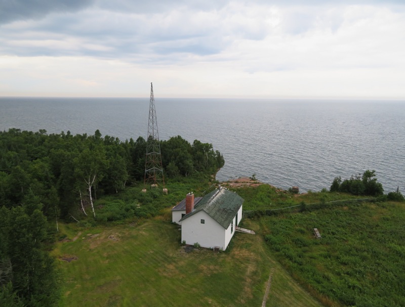
From the top, we could see ominous clouds rolling in as it rained off and on. 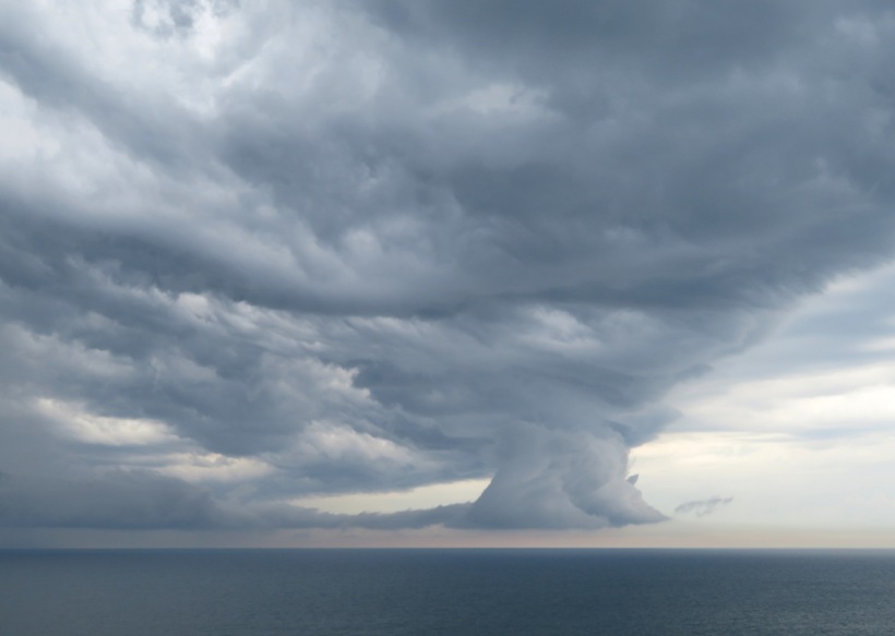
The lens was quite a sight. The third-order Fresnel lens, ordered from Henry-Lepaute of Paris, France, finally arrived at the station on June 22, 1901 and was placed in operation on September 20, 1901. The lens had eight flash panels, and while completing one revolution every eighty seconds, it would alternately produce red and white flashes every ten seconds. - from "Lighthouse Friends - Devils Island Lighthouse" After the lighthouse, we explored the area. We found some wild berries and Indian Pipe. 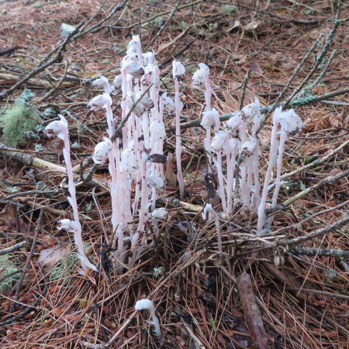
|
|
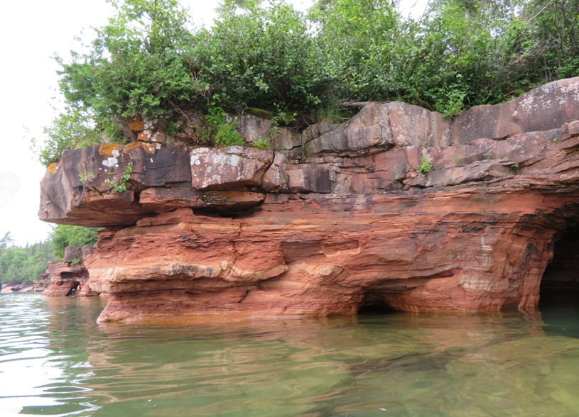
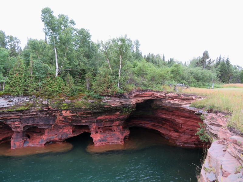
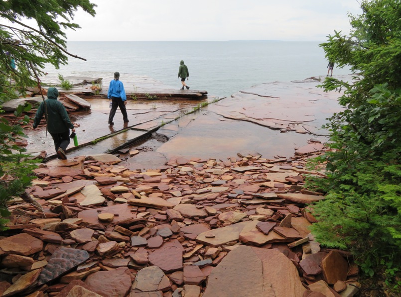
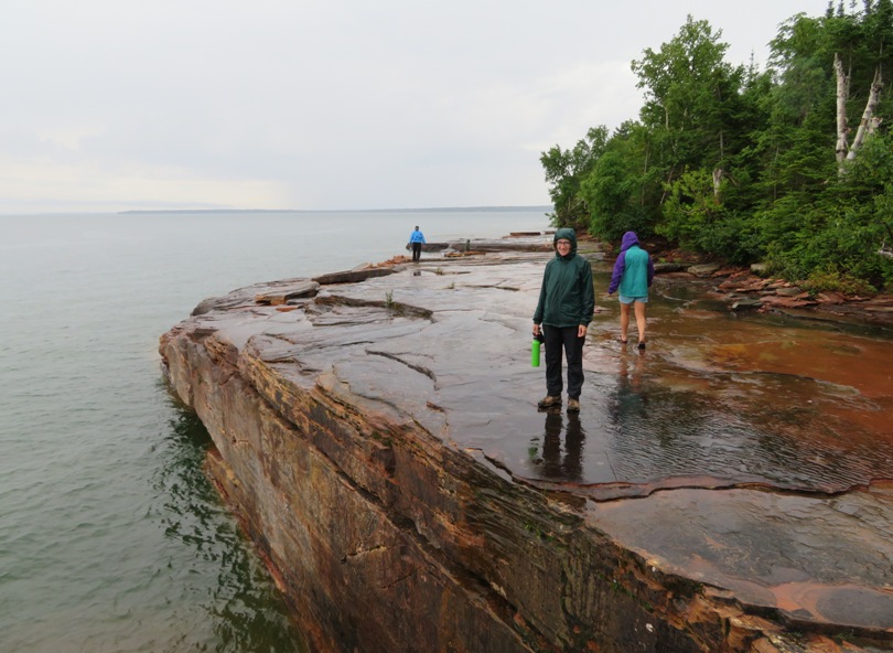
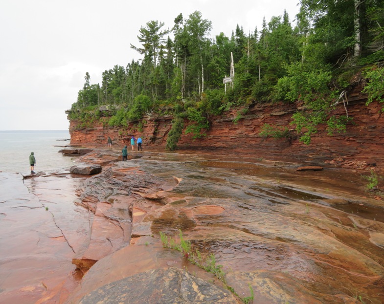
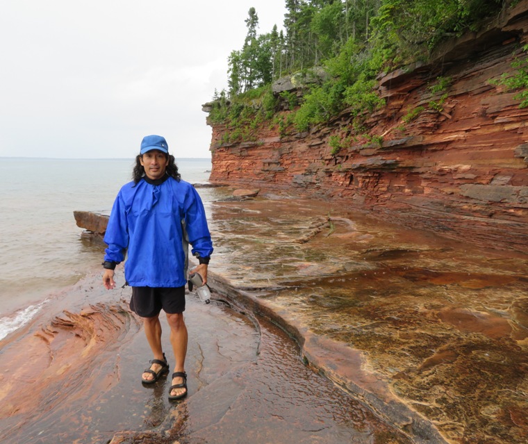
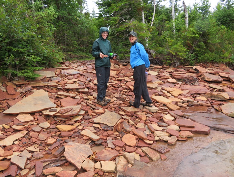
Our group walked to East Landing on the northeast side of the island. Here we saw some of the same sea caves that we paddled into earlier that day. The flat rocks by the water contrasted nicely with the steep perpendicular rock ledges.
1 / 11
Caves below.
2 / 11
More caves.
3 / 11
Flat sandstone rocks.
4 / 11
Norma in the rain.
5 / 11
Big, flat section.
6 / 11
Me at East Landing.
7 / 11
Being silly.
8 / 11
Caves below.
9 / 11
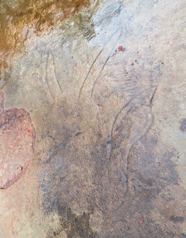
Devil carving.
10 / 11
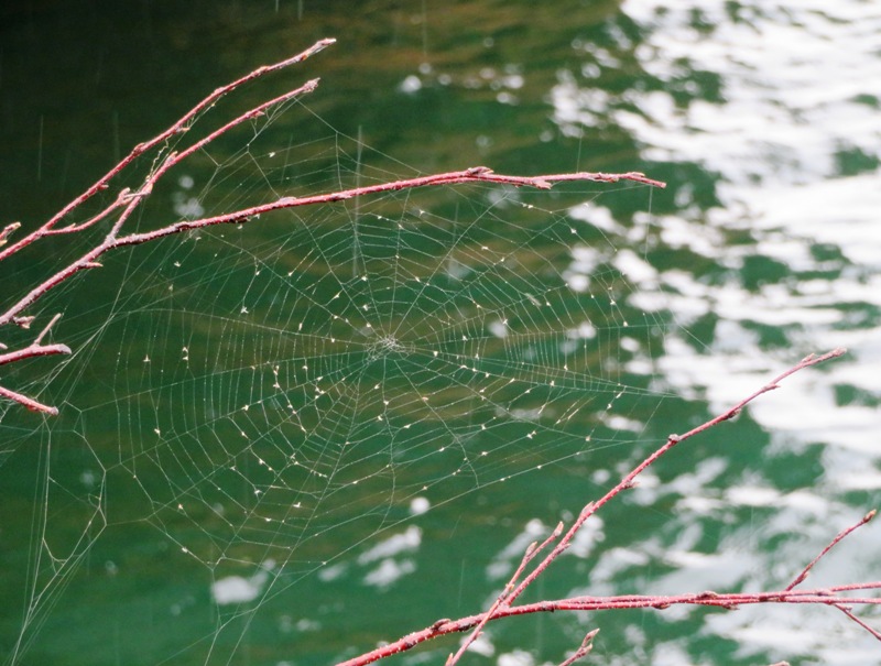
Spider web.
11 / 11
Norma and Carmen.
On the walk back to the campsite, we saw a very red mushroom amongst the moss. 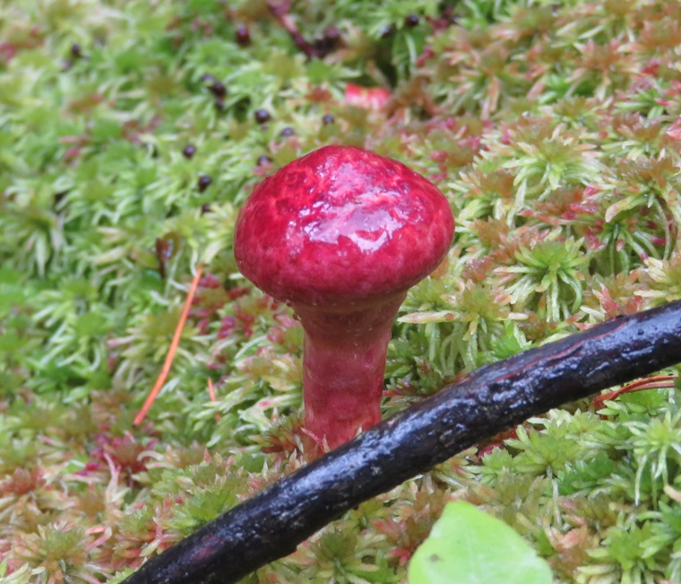
Near our tents, a rabbit watched us. It was much larger than a Maryland rabbit. 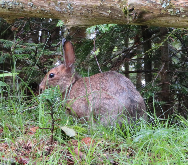
We went to bed a little early...or at least we tried to. The plan was to wake up early, be on the water when it was calm, and then be at our destination before it got too rough. Norma's and my tent leaked at the seams when it rained hard. I didn't sleep well because of that. It needs a treatment of Seam Sealer or to just be retired. It was partially my own fault because had I staked our rain fly down tighter, the inside of our tent might have stayed dry. It wasn't terrible. Loose as the fly was, some parts touched the mesh of the tent. I should know better. |
|
We were up at 0600. But Britta decided that the conditions on the water were worst than she had hoped so she canceled our paddling for the day. From our sheltered position, things looked fine but out beyond the protection of the island, we could see whitecaps. She knew that the wind would pick up and things would only get worse.
Being stuck on Devils Island was not a terrible thing. It had an enclosed toilet (versus the other campsites where the toilet was open air) and good air circulation so the bugs weren't that bad. There were also hiking opportunities to interesting places. While this island didn't have as many trails as some of the others, the trails here were more interesting. During our time there, we found plenty of stuff to keep us entertained. Norma, Carmen, and I walked back to East Landing while Steve remained at the campsite. The moderately calm water from yesterday had now turned hazardous with four foot waves crashing on the rocks. 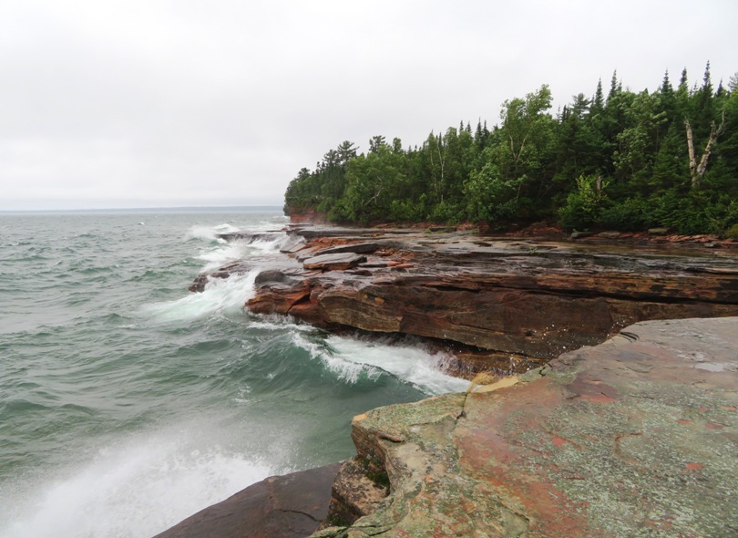
There was no doubt in my mind that Britta made the right decision. Her knowledge of the area and experience with the weather is the main reason I wanted to go with an outfitter rather than try and plan this on my own. The waves made quite a sound which reverberated in the caves. 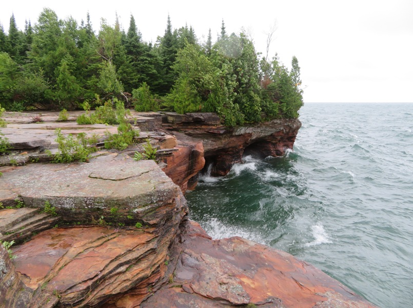
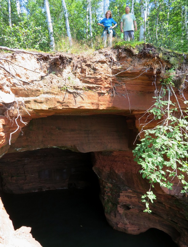
Next, the three of us explored some trails that took us to the west side. Along the way, I found a hole in the trail about 18 inches long by four inches wide. This hole went all the way down to the water even though the trail wasn't all that close to the water. So it led to one of the caves! At the side of one of the trails, we found an old tractor, shown below. No, Norma and Carmen didn't get it running though with their superb acting, one might think so. 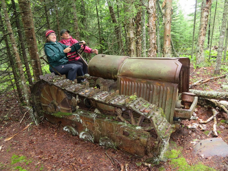
The water at the west side was incredibly calm. That's because the wind was blowing in a way that kept the west side sheltered. Had one camped here and seen this, they might easily think conditions were easy if they didn't check the weather conditions on their VHF radio. 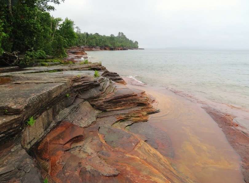
We saw some impressive rock formations and more caves further out. On the fern, bog, and moss-lined trail, we saw more mushrooms. 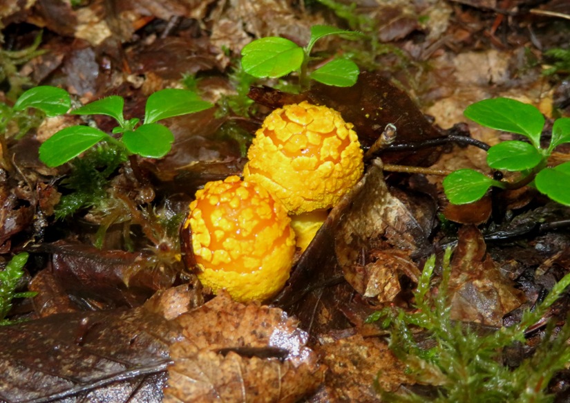
Much of the standing water alongside the trail looked black, as if it were high in tannic acid. I kept looking for frogs and turtles but saw none. The girls and I walked back to the campsite. |
|
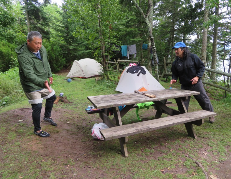
Carmen has a way of keeping us entertained. She brought a rubber ball which we used to turn a picnic table into a Ping Pong table. Instead of paddles, we hit the ball with our hands. So it was "handball table tennis." Carmen had the most victories by far. Of the four of us, she is probably the most naturally athletic.
Amongst Steve, Carmen, and I, we were able to recall how to play Gin Rummy and we taught this to Norma and Kiah, using the same deck of cards as in Five Crowns. I don't remember who won but it wasn't me. But I did manage to win one set of Five Crowns the day prior. Next, we had a rock skipping contest. I think Steve won this though if I had to guess who had the most skips during our trip from a single rock, I would guess Kiah. 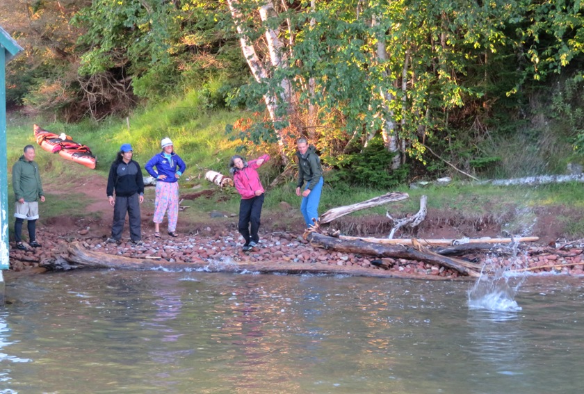
As the sun got low, we headed out to the pier to enjoy the sunset. It had cleared up quite a bit and the water was much calmer but it was far too late to start kayaking to the next island. Pictured below from left to right are Norma, Steve, me, and Carmen. 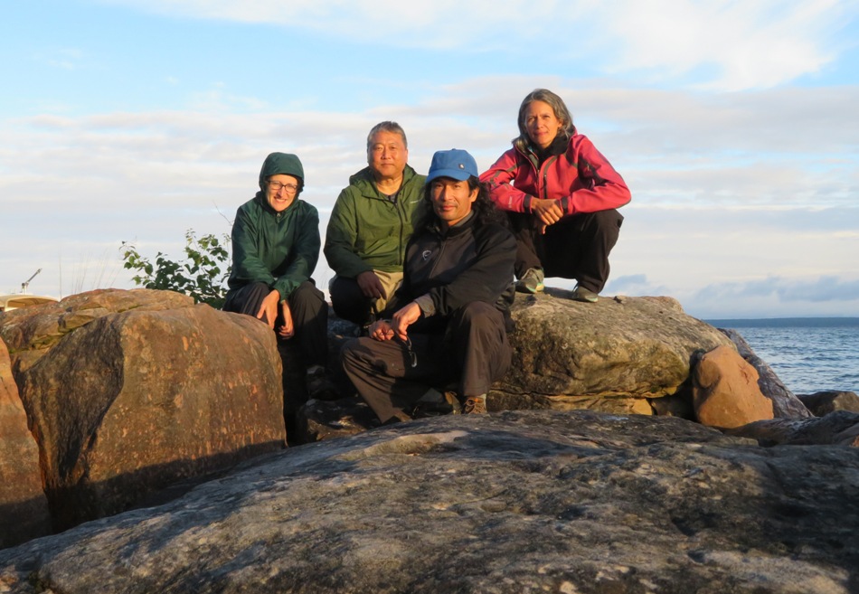
Here's our whole group. In the back from left to right are Kiah, Steve, and Carmen. In the front from left to right are Britta, Norma, and me. 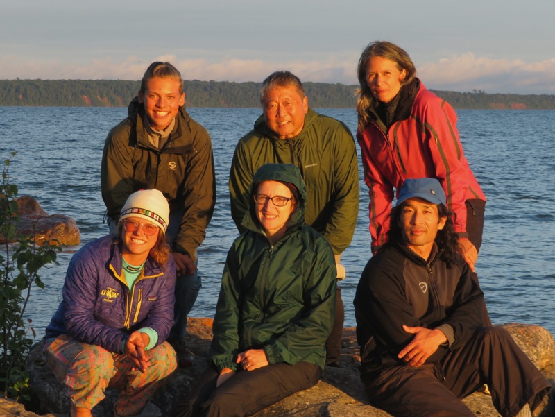
A couple of boats came to rest in the sheltered area for the night. 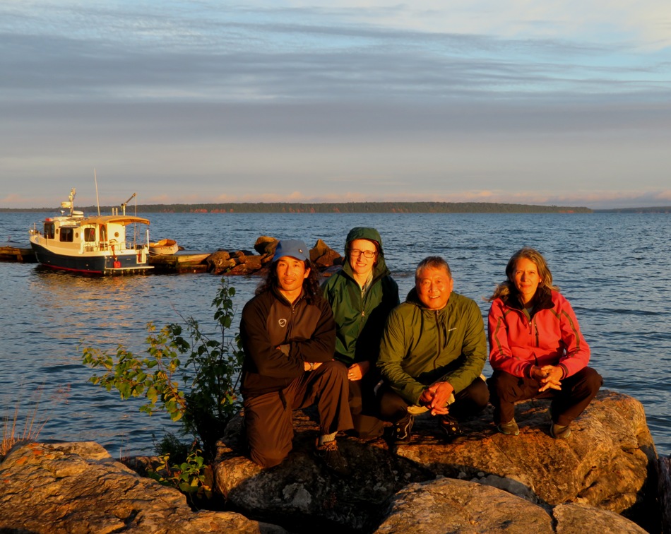
We made silly shadows on the boat house. From left to right are Kiah, Steve, Norma, me, and Carmen. 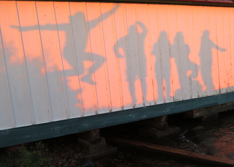
|
|
Having let the storm and wind pass, we were set up for some fair weather kayaking today.
We loaded up the boats while some paper wasps watched. 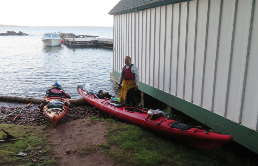
You can actually see the nest in the previous photo above Steve's head. Here's a close-up. 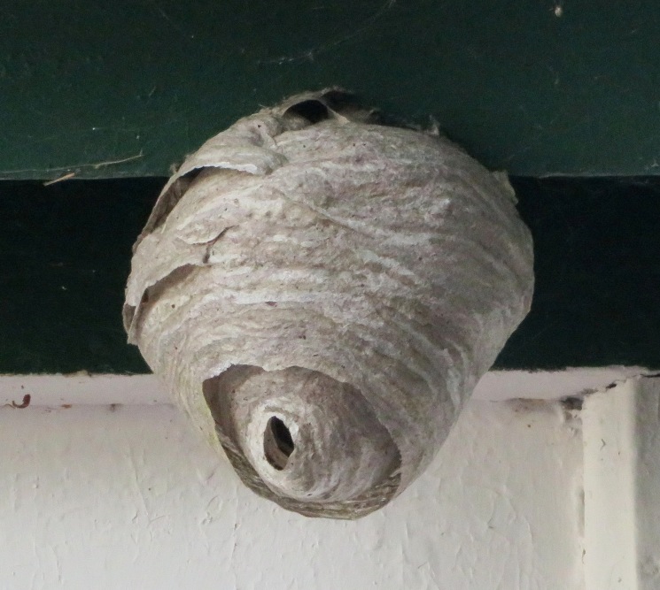
Most of my kayaking is done on sit-on-top kayaks. I realize that there are advantages and disadvantages to each type of kayak but the thing I hate most about cockpit kayaks is getting on the spray skirt. The spray skirt on my boat was no exception and I found myself relying on Kiah quite a bit to get it on in a timely manner. But on our last day, I was finally having some success. We were off. I thought Norma and I made a good kayaking pair. I generally followed her cadence and we kept a good pace as I controlled the rudder. The water wasn't calm or flat but it was compared to yesterday. 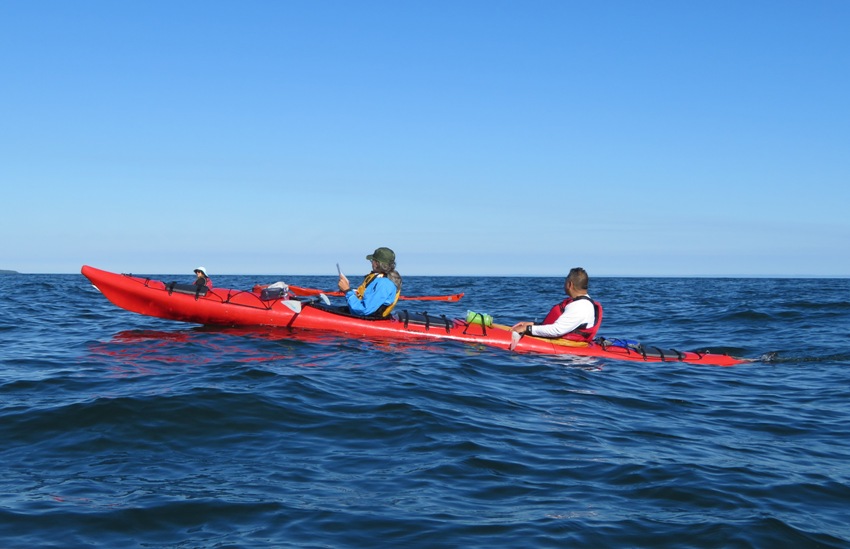
We paddled to and then landed at Bear Island for a short break. 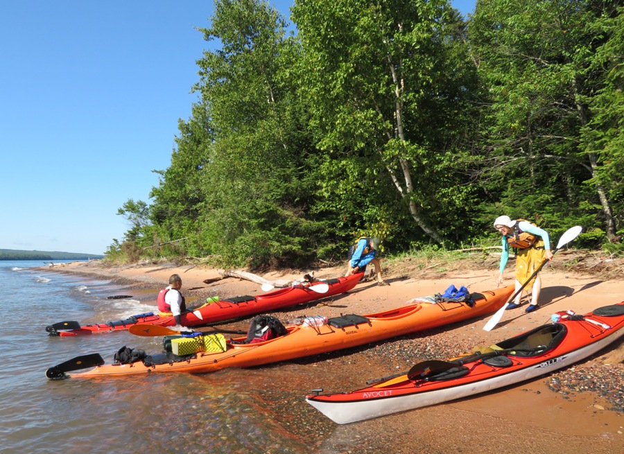
Carmen had energy to spare and Steve was ready for a swim. Britta taught us a good kayak torso exercise that looks like a windmill stretch but another person assists to provide maximum benefit. |
|
Back on the water, Steve provided Carmen with a few "keeping it real" words of negative encouragement that got her paddling much faster.
We finished sometime around midday, I think, landing back at Little Sand Bay. I estimate we paddled a cumulative 36 miles though I'm not totally certain because by the last day, my GPS quit working. It had taken on water, despite being in a soft plastic case. The problem is the case was pretty old and I'm not the best at replacing my gear until it is too late. Could we have done our trip in fewer days? Absolutely. We kayaked from Devils Island back to Little Sand Bay in one day without any difficulty. So I think we could have seen the sea caves at Devils Island and Sand Island in three days easily under ideal conditions. But ideal doesn't mean probable. The weather out there is very iffy. Campsites are not always available when you want them. And there was no way for Britta to know just how competent (or incompetent) our group was. So doing this as three full days and two half days (as we did) is safe. |
|
Britta made us one last meal (peanut butter and jelly) before we loaded up our gear and left the area. But it wasn't farewell quite yet. We followed Britta and Kiah into Bayfield where we stopped at The Candy Shoppe in Bayfield for ice cream. I had the Raspberry Twister which was quite good. There was a sign at The Candy Shoppe which read
Heavier people are harder to kidnap. Stay safe. Eat cake. After our snack, it was time to say good-bye. It wasn't just Britta and Kiah that were departing...Carmen was too. She was flying to Miami to be with her family. I'm glad we got to see the sea caves at Devils Island though I was disappointed that we did not make it to see the ones at Sand Island. I know there are also several along the mainland that are more easily accessible so I called a few outfitters to inquire about trips. What I learned is that at this time of the year, group trips fill up. One can rent kayaks and go out without a guide but they won't rent to anyone. Unless you can prove that you've had self rescue training by showing something like an American Canoe Association (ACA) certification, they will require you to go through their 3.5 hour training. I can understand this since these are cockpit boats and the conditions on the lake can get rough. So in the end, we didn't make it out to see any more caves. But that gives me a reason to return...and maybe seek an ACA certification. |
|
Norma, Steve, and I walked around Bayfield. It is a lovely town with some nice landscaping but at this time of year, it is also very touristy.
We stopped in at the Bayfield visitor center and inquired about lodging. The fellow there was very helpful but there was nothing in town. We asked what the special occasion was and he said "summer." We ended up finding lodging at the Washburn Inn in the town of Washburn and eating dinner someplace nearby whose name I forget. The place had a real "homey" small town feel which I liked. That evening, we drove back to Bayfield and saw two bands at the Lake Superior Big Top Chautauqua. The first was a folksy band called Dead Horses. The lead singer sounds like Edie Brickell of the New Bohemians. I didn't much care for her voice but Norma and Steve liked them. I think Carmen would have too. The second artist was Delbert McClinton. He sounds like Joe Cocker. He had a very good band and some catchy songs but Delbert's voice was terrible and he didn't seem "with it." We didn't stay for the whole show. We sat on the bleachers in the back which wasn't bad. Once I got home, I purchased some of his music online. Yes, I liked it that much. |
|
We packed up and then ate breakfast at Time Out in Washburn.
The weather was great. Britta was signed up to do half marathon today. I wonder how she did. She said she hadn't been training for it but I think she keeps active all year round. The three of us toured the Northern Great Lakes Visitor Center. Here, I learned a lot about the area. I saw a turtle in a pond. 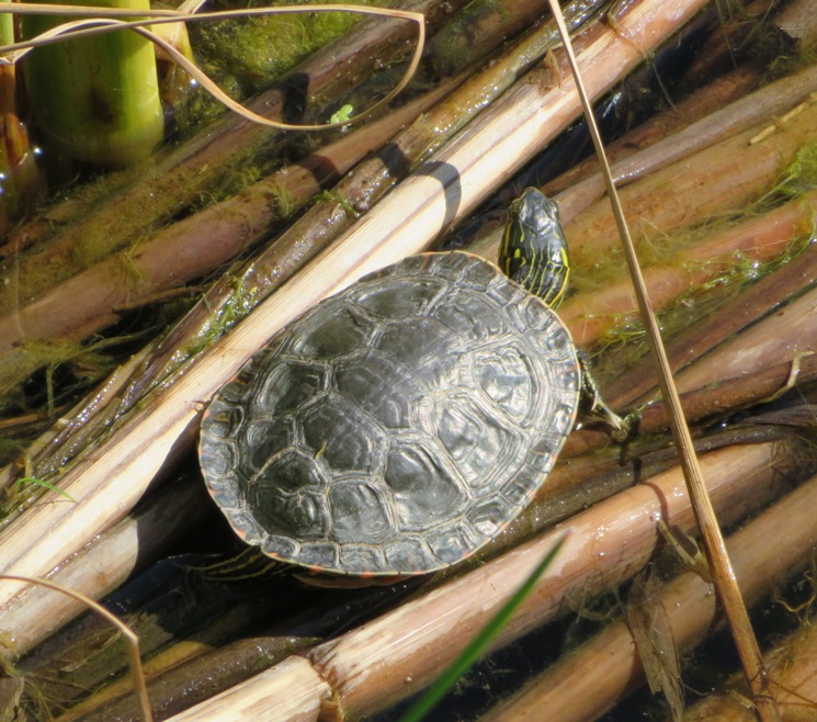
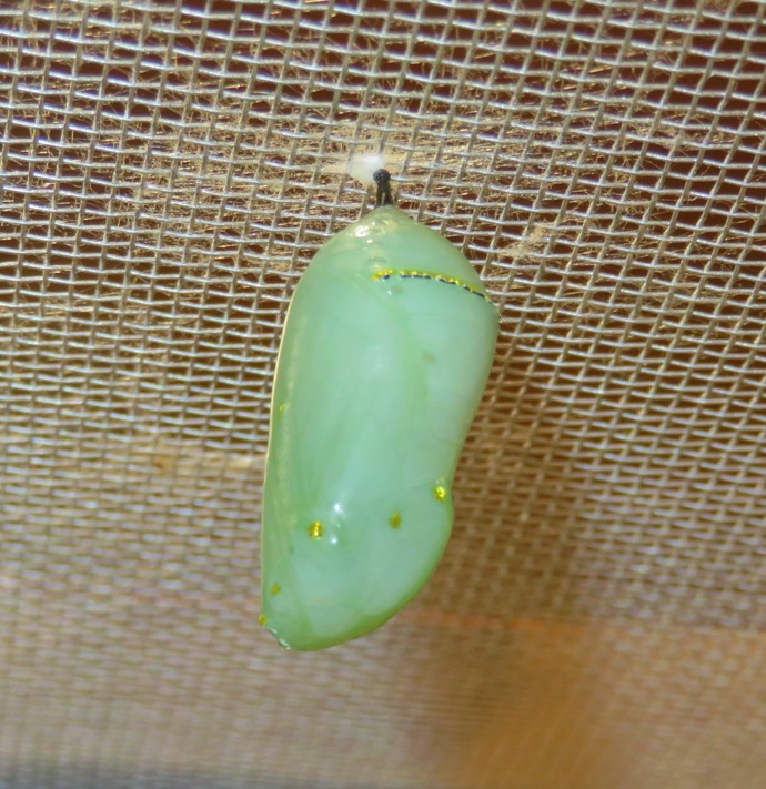
Then Norma and I walked on a trail around the pond. Lots of biting insects followed me. At the side of the trail, we found a small butterfly house. In the snapshot below, you can see this house with the Visitor Center in the background. 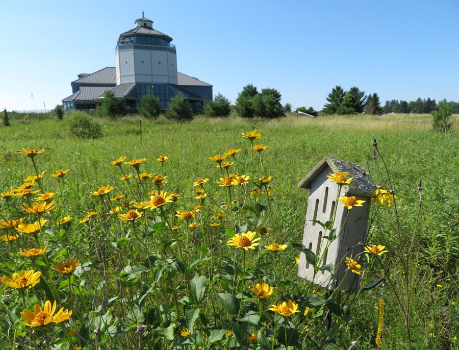
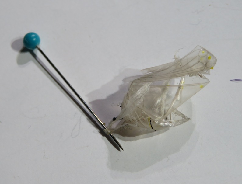
Inside the Visitor Center, we saw a monarch chrysalis and the remains of one where a butterfly emerged. Monarchs migrate north into Wisconsin in May. Wisconsin has several generations, with the last generation migrating to Mexico. Large numbers of these butterflies may be seen at night roosting together during this migration. - from Wisconsin Butterflies - Monarch |
|
Norma, Steve, and I went to the Bayfield Farmer's Market which was tiny. I expected much more since it was tourist season. Steve and I bought fresh apple and pear juice. Then we went to a farm and purchased a couple bags of delicious peaches. Unfortunately, they were not local. But they were sweet enough for us to overlook this fault.
Our next stop was a return to the town of Cornucopia. They were celebrating a town festival called Corny Day, shown below. This takes place at Corny Beach. 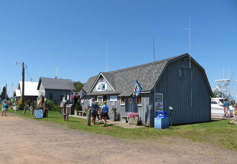
But Cornucopia is known for more than just being corny. They have an abundance of fresh water. See the artesian well below. With an abundance of natural artesian wells, waterfalls, wetlands, and Lake Superior, Cornucopia is water rich. The cold, clear water bubbling from this artesian well has its source in ancient groundwater flowing deep beneath the Bayfield Peninsula. This water is as pure as the glaciers that once covered this land. - from sign at well 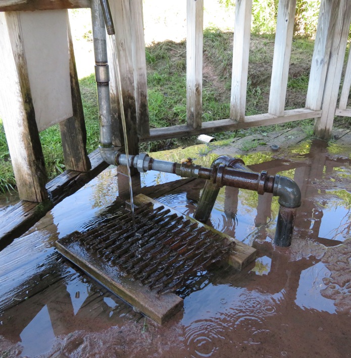
|
|
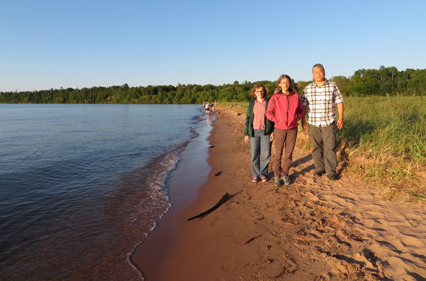
After lunch, we drove to Meyers Beach. The place was packed but somehow, I managed to snag a really good parking spot.
There were numerous kayak outfitters and groups preparing to launch. While none seemed incompetent, they seemed to lack enthusiasm when compared to Britta's positive energy. Norma, Steve, and I hiked on the fern-lined Lakeshore Trail. This took us to the cliffs at the Mawikwe Bay sea caves. 1 / 7
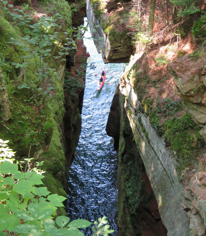
Deep crevasse.
2 / 7
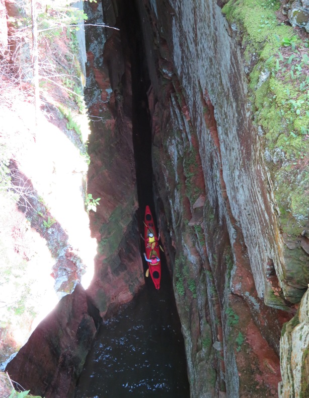
Too narrow for paddles.
3 / 7
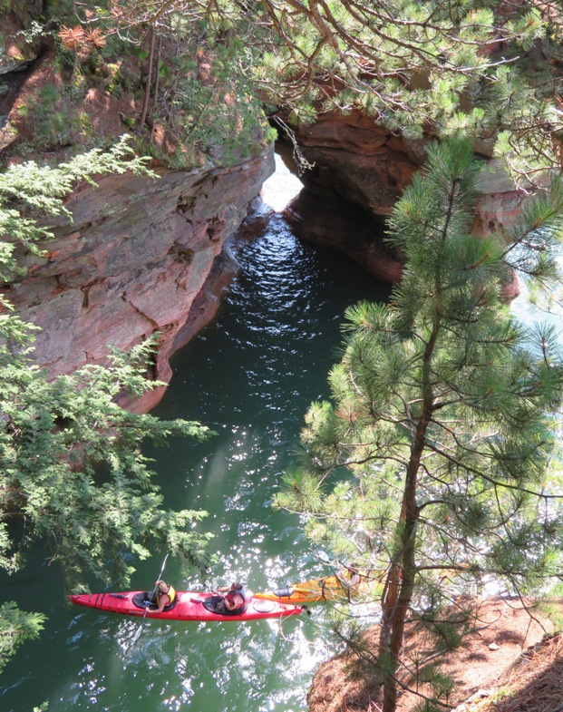
Light at the end.
4 / 7
Steve and I.
5 / 7
Norma and I.
6 / 7
Norma, Steve, and sea cave.
7 / 7
Base of stairs.
The trail was very well maintained. A boardwalk took us over numerous wet areas. I've heard that in the winter, one can walk on ice to the sea caves...then known as ice caves. I saw a two-foot long garter snake. That was the only snake I saw on our trip though Kiah claims he also saw a garter snake at one of the islands we stopped at. I estimate we walked about four miles on this very shaded out-and-back trail. |
|
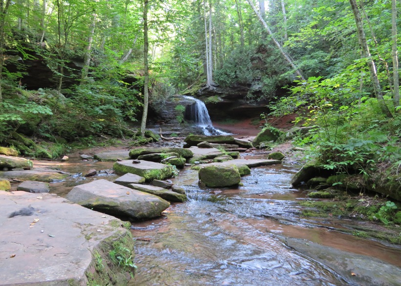
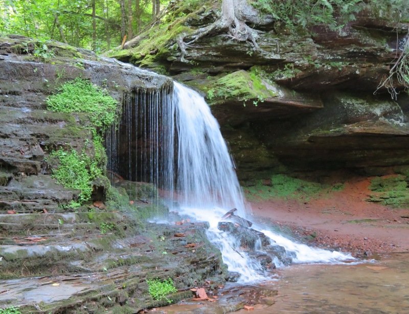
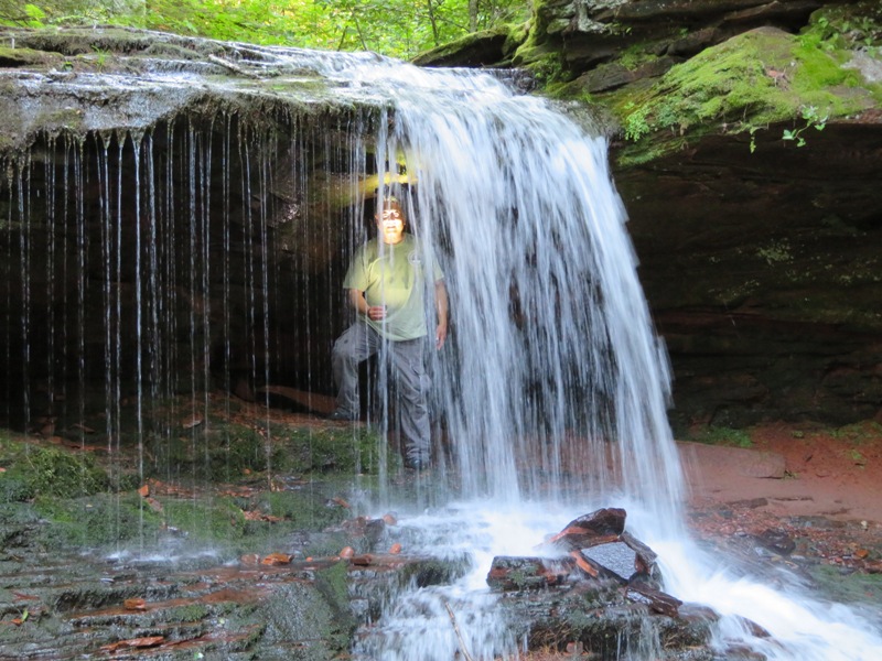
After a short drive, we hiked to Lost Creek Falls and back for an additional three miles.
Back in Cornucopia, we stopped at Ehlers Store where Steve and I devoured tasty ribs while Norma ate a fish taco. Steve commented how folks out here are more trusting. It did indeed seem that way. Instructions at gas stations asked us to pump first and then pay. Here in Cornucopia, they served us at the outside grill and then told us to go pay inside. I was liking this whole small town atmosphere. 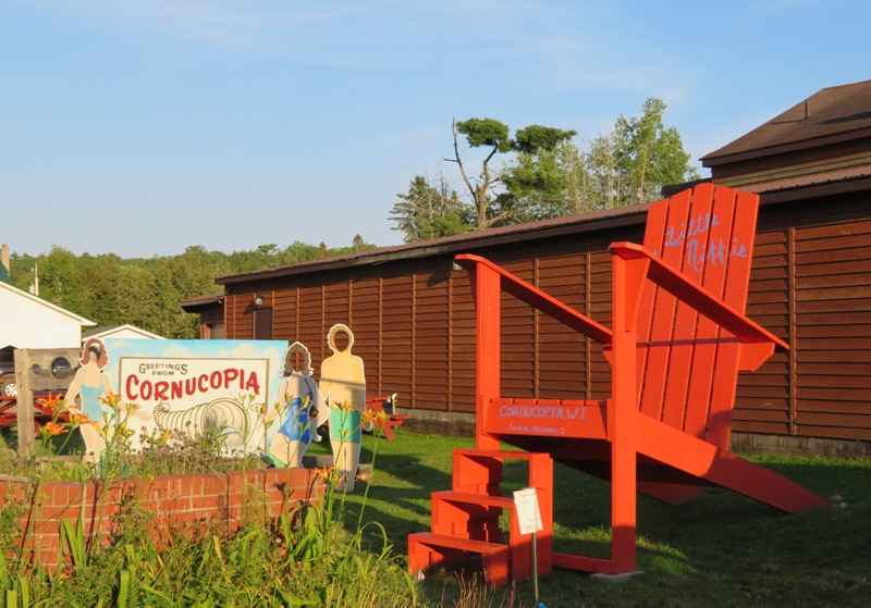
We noticed that a lot of people talk differently in Minnesota and Wisconsin. They sound somewhat Canadian. When the rest of us say the syllable "ow," they say "oo." I found their accent charming and friendly. |
|
Our plan was to find last minute lodging nearby. That wasn't a good strategy. There was a lot going on and everything in the area was booked up. So we started driving back to Minneapolis. Along the way, we stopped at a dark exit off the highway to see the Perseid meteor shower. We each saw a few meteors zip across the dark sky.
Feeling like Jesus' parents, we eventually found an AmericInn motel north of Minneapolis. I think we got their last room. The tub was cracked and drained slowly. But otherwise, the place was nice and their breakfast was good (by motel standards). It beat sleeping in a manger. |
|
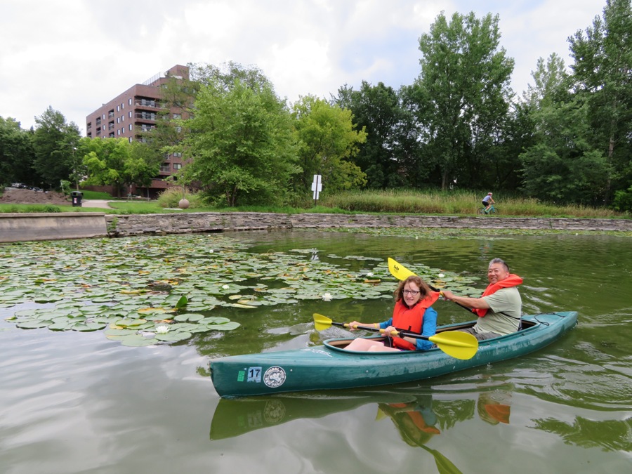
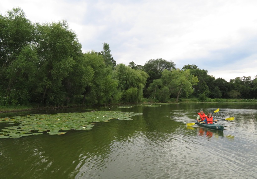
Steve, Norma, and I drove into Minneapolis. We stopped at the northeastern side of Lake Calhoun where we again managed to snag a good parking space in an otherwise congested area. This is the southernmost lake in the Chain of Lakes. This is a popular tourist destination where there are trails and small lakes connected by waterways. This allows one to easily paddle amongst them.
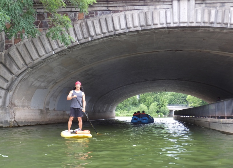
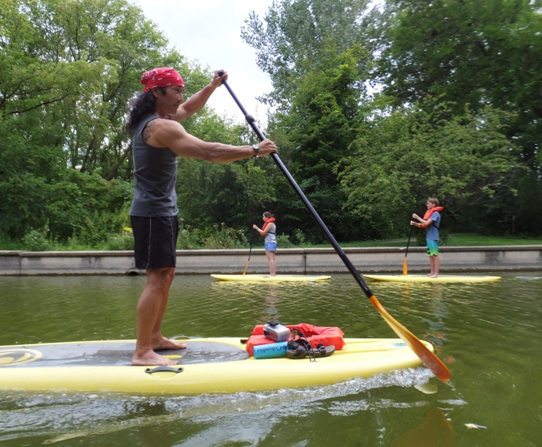
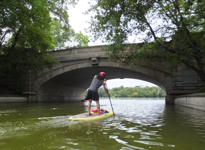
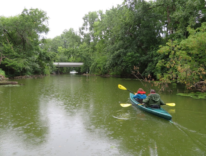
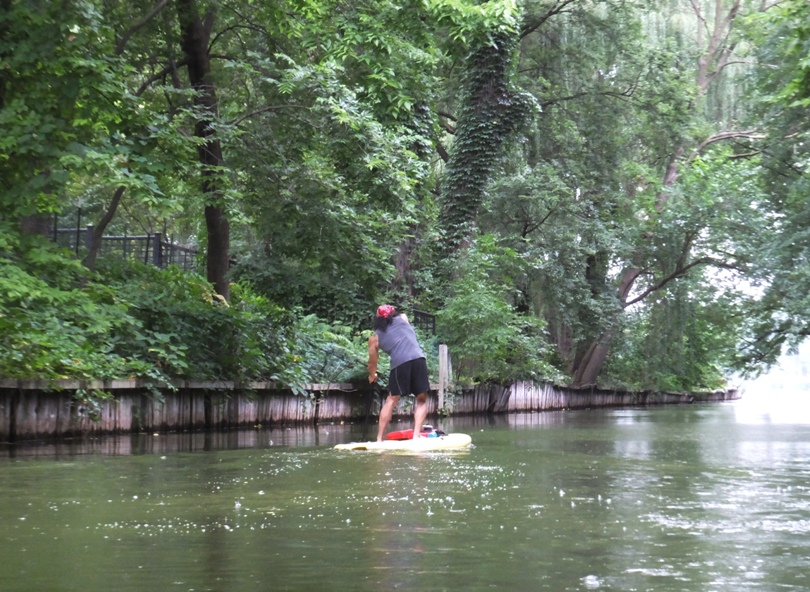
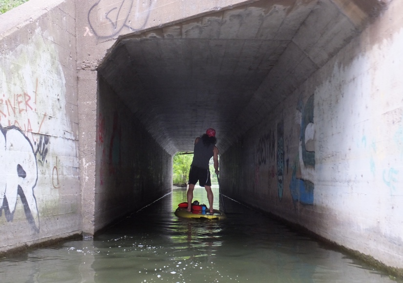
The weather wasn't ideal today for being on the water and tomorrow wouldn't be much better. It was overcast and cool with a chance of rain. There was a kayak and SUP outfitter in the area by the name of Wheel Fun Rentals. They had enough watercraft to supply a small army or a large group of Boy Scouts. Norma and Steve rented an Old Town Otter tandem kayak while I rented an Image Surf SUP. The equipment available for rental was definitely at the low end in terms of quality but it was sufficient. However, I was surprised when I checked my SUP and found that the fin was almost ready to fall off. I tightened the screw as best I could. Norma and I were under the impression that some of the folks that work there were just summer hires. I reckon we paddled about six miles, hitting each of the interesting waterways starting with the Lake of the Isles Lagoon and Canal. 1 / 13
SUP and bridge.
2 / 13
3 / 13
Side view.
4 / 13
Norma and Steve.
5 / 13
Me on SUP.
6 / 13
One of many bridges.
7 / 13
Lake of the Isles.
8 / 13
Working as a team.
9 / 13
Kenilworth Lagoon.
10 / 13
Lots of greenery.
11 / 13
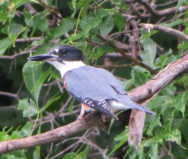
Kingfisher on Cedar Lake.
12 / 13
Under Cedar Lake Trail.
13 / 13
Leaving Brownie Lake.
There were a good number of people out on the water despite the rain. I can't imagine how busy the place must get on a really pretty day. But it is a nice area and it would be a shame if a lot of people didn't make good use of it. We changed into dry clothes and then ate a the Tin Fish Calhoun. I had the Canadian walleye sandwich which was mediocre. Norma ate a pongo fish which we had never heard of. I think it is actually pangas. Norma and I took Steve to the airport and said our farewell to him. Our group was shrinking and our vacation was coming to an end. Very sad. |
|
Norma booked us a room at an AirBnB in Minneapolis. We checked in there and met our host, James. He's a really friendly guy and we chatted for quite awhile.
Norma and I walked to Minnehaha Creek and then Longfellow Gardens. There were a lot of flowers in bloom. Norma spotted a mouse. 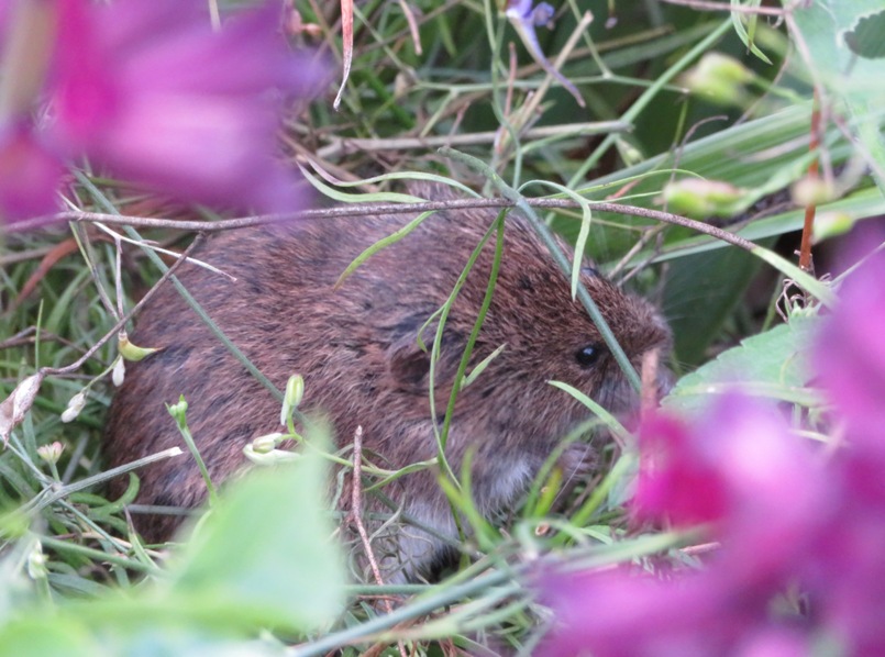
I found some goldenrod soldier beetles perpetuating their species on a purpleicious plant. 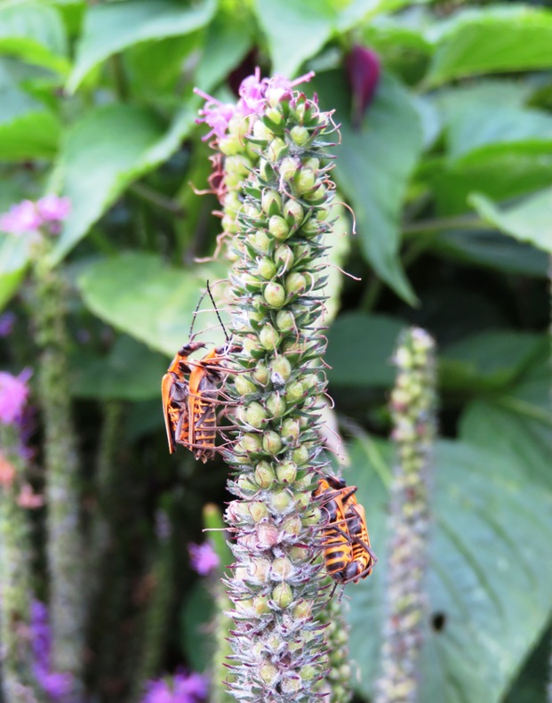
Next, the two of us paid a visit to the 53-foot tall Minnehaha Falls. 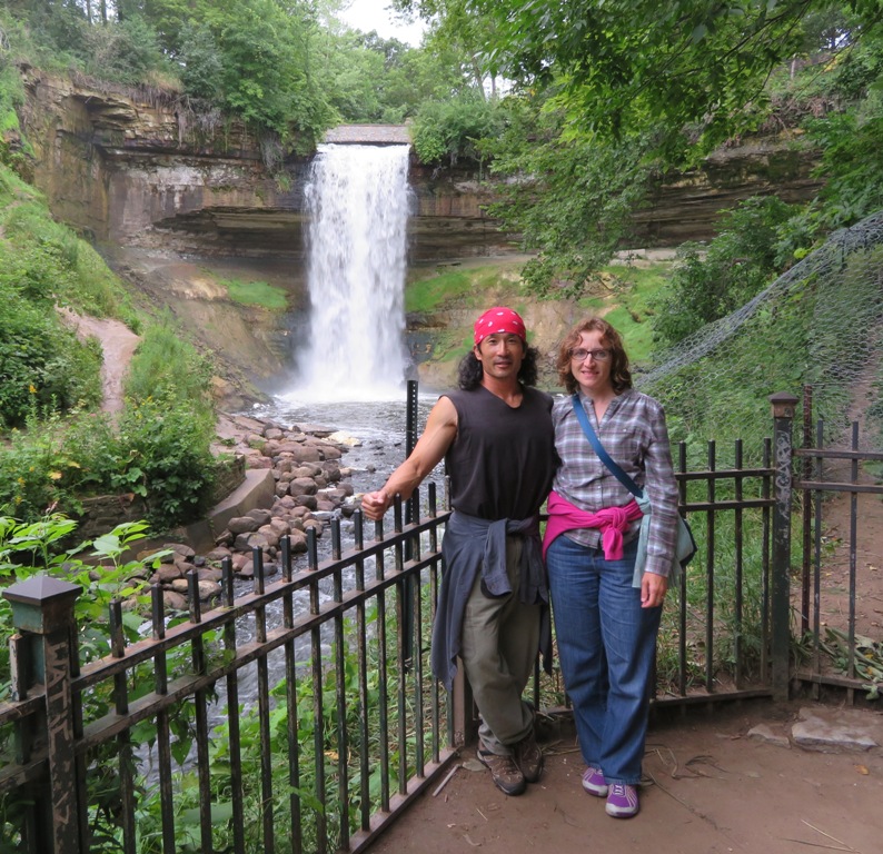
Minnehaha Falls is the same height as the tallest free flowing waterfall in Maryland, Muddy Creek Falls. It started raining again. We walked to Al Vento for dinner. I had the fennel sausage tomato herb goat cheese fresh mozzarella pizza. |
|
On our final day, Norma and I walked on the wooded Winchell Trail in the Mississippi Gorge Regional Park. We walked on a different part of this trail on our first full day of our trip. This is a historic Native American trail that runs along the Mississippi River.
Like yesterday, the day was overcast. I found some interestingly textured worm-eaten wood. 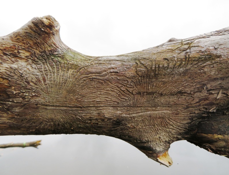
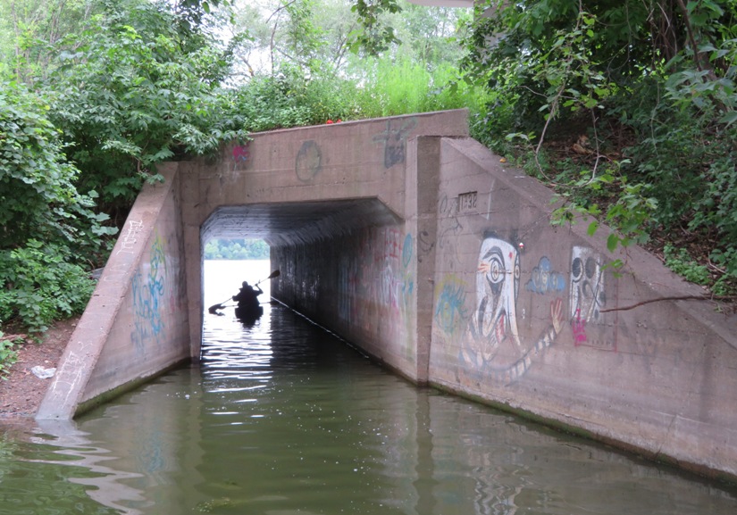
Our trail ran near a huge graffiti-covered drainage pipe. 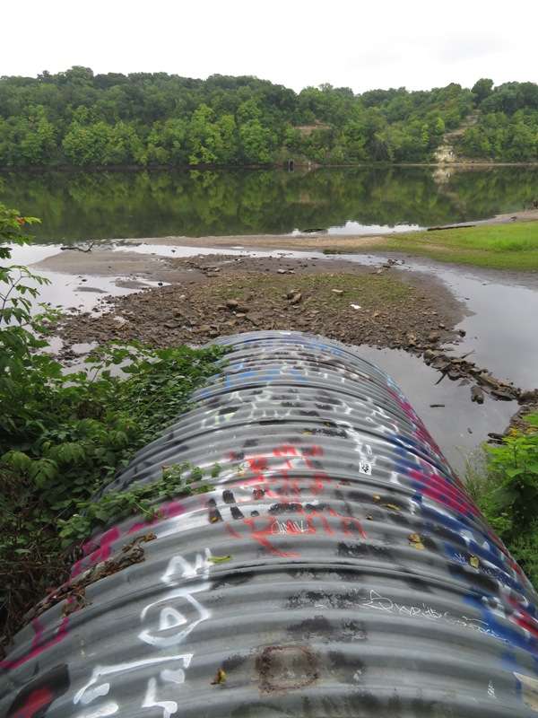
Things were calm, quiet, and melancholy. I think the thought of our vacation ending was sinking in. At the northern end of our walk, we saw the Lake Street-Marshall Bridge. 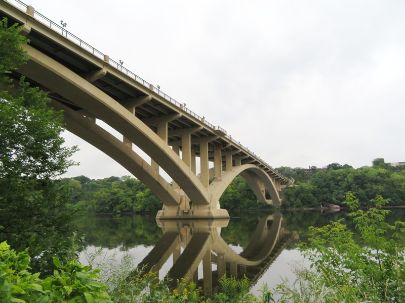
|
|
Next, we drove to Powderhorn Park where we walked around Powderhorn Lake. It was not terribly interesting but we had some time to kill and wanted to stretch our legs before sitting on the plane.
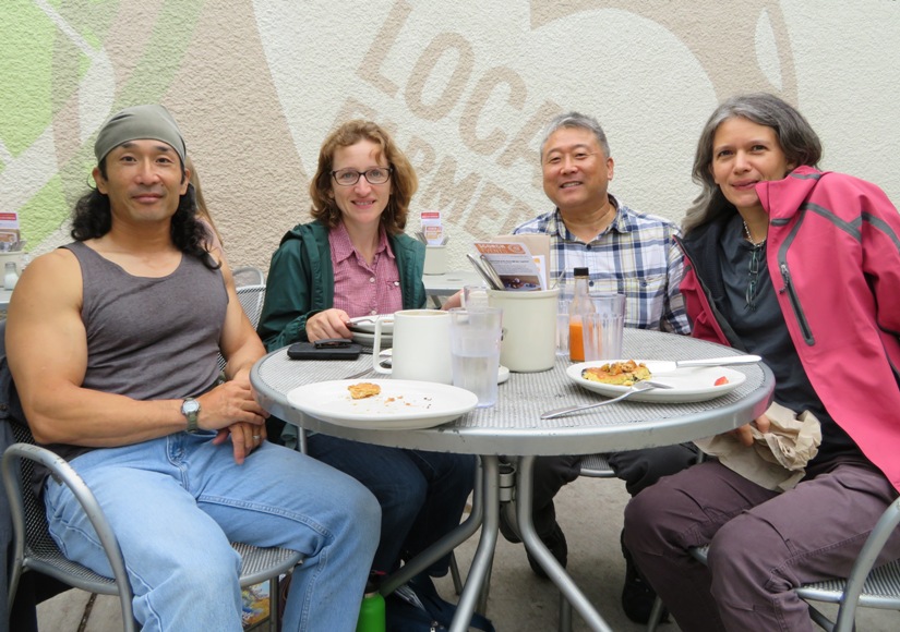
Our last activity of our vacation was to stop in and join some of Norma's friends from long ago for a tasty lunch at their charming house. In the below pic from left to right are Laurel, Mark, Eli, Heather, Norma, and me. 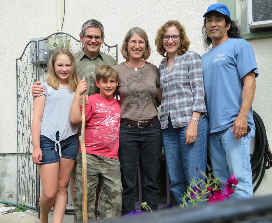
Norma and I returned the rental car and then checked in our luggage. Going through the security checkpoint body scanner, my lower legs had to get patted down. I guess this one is calibrated differently than the one at BWI. So maybe my old Muay Thai training is still having its effect on me. |
|
I enjoyed our trip but I also enjoyed being home. On my next SUP trip on August 20, 2017, I really enjoyed getting out in nature, seeing plenty of wildlife, and enjoying the heat of summer. I'm a Maryland man.
The sea caves at the Apostle Islands are beautiful and I wouldn't mind seeing different ones in that area, perhaps in the winter. The sea caves at the Channel Islands are still on my bucket list too. And then I heard about kayaking the sunken city of Kekova in Turkey. So many kayaking options! Life is good. |