


|
This page is about a weekend of kayaking which I did first with a kayak group, and then with Norma and a co-worker. |
|
This page is about a weekend of kayaking which I did first with a kayak group, and then with Norma and a co-worker. |

|
I generally paddle alone. But occasionally, I get out on the water with others. This was one such weekend.
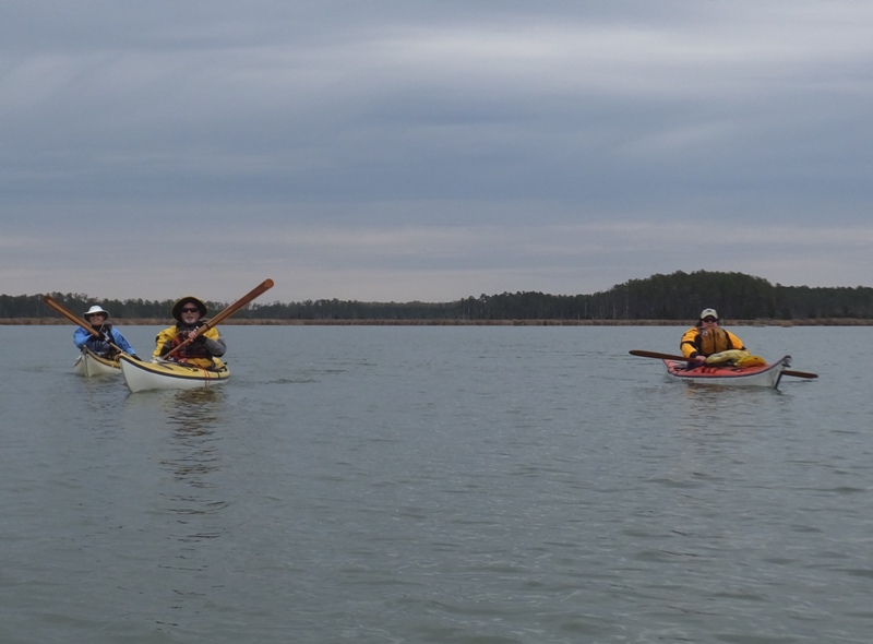
Lisa rented a vacation house for a long weekend on the eastern shore. I was honored to be one of the invitees for this event which she calls Hoopers Troopers. Joining us was Stephen, Hank, Tom, Debbie, Ethel, and Madeline. On the drive out, Lisa called and said to meet them for paddling at Beaver Dam Creek, Smithville Bridge. The last time I paddled around there was June 10, 2007. Back then, I explored the area to the north. Today, we would check out the sections south. I brought both my Yolo Prowler stand up paddleboard (SUP) and my Prijon Catalina. The winds were calm so the weather was good for the SUP but looking at the map, I was expecting shallow water which might pose a problem. The fin on my SUP might prevent me from being able to venture as far as the group so I figured I'd better bring my Prijon. After unloading our gear, we moved our vehicles to the northeast end of the lot to get as far away from the boat ramp as possible. This gave the folks with boat trailers plenty of room. The water was pretty high so we were able to easily launch from the northwest side of the lot. 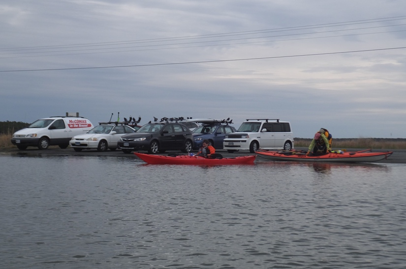
It was cold and dark but at least it wasn't raining. The high temperature forecast for the day was 55. When we launched, it was about 48 degrees. I wore my wetsuit and neoprene top. A few people in our group had dry suits. I saw a few bald eagles and a couple of nests. 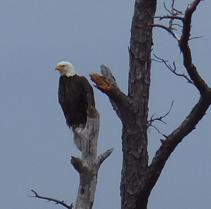
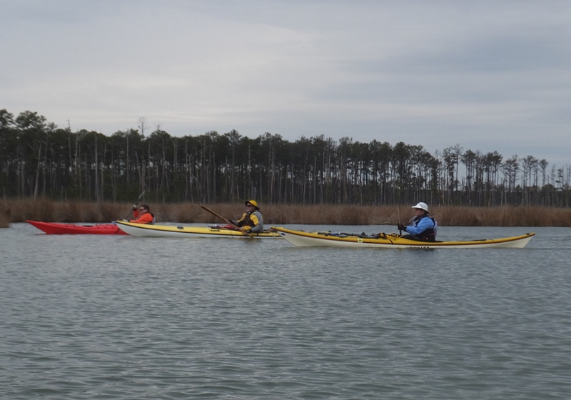
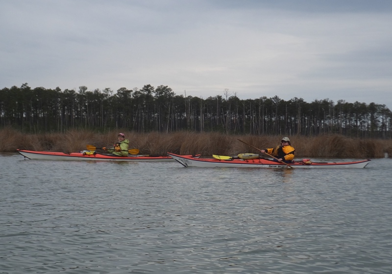
We paddled west on Beaverdam Creek then south on Upper Keene Broad alongside Taylors Island. Things pretty much looked the same; not much change of scenery. Just marsh grasses that had yet to turn green. I took a lot of photos of the group. Most of these were actually brightened up digitally. That's how dark it was. Here's the whole group except me and Stephen. The latter didn't join us for kayaking that day because he wasn't feeling well. 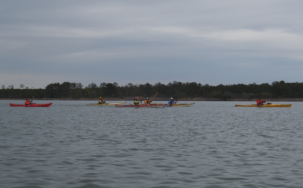
The seven of us continued southwest on Dunnock Island Creek and explored an unnamed tributary along the way. At least that's what my global positioning system (GPS) indicated. We stopped for lunch near a broken boardwalk with a sign that read "Buckwheat Island Road." This was at the southwest terminus of Dunnock Island Creek. At this point, my hands were so cold, I was losing coordination. I donned my splash jacket and after that, I was fine. There wasn't much wildlife out. I saw a single turtle stick its head above the water for a few seconds before going under. We kayaked an easy 9.5 miles before driving to the house.  |
|
The house was called the 1880 House. It was huge. I brought a sleeping bag but there were enough beds so we each had our own. The place was on Upper Hoopers Island.
It rained most of the evening. Our original plan was to eat dinner at Old Salty's Restaurant but we had plenty of leftovers from the previous night. Additionally, Tom and Ethel grilled clams. We spoke about kayaking and I thought that I might want to return to the area and explore Worlds End Creek. There is no access to the creek itself and the closest boat launch to the mouth is a few miles away at Asquith Island. Hank mentioned that he encountered obstacles that would require portage less than halfway up the creek so I should definitely bring my Prijon and a saw. We were all in bed by 2130. |
|
The following morning, water wouldn't drain down the sink or toilets. Tom and Lisa called the landlord. If he showed up to fix things, it wasn't until after I left.
I made breakfast for the group. I used 2.5 dozen eggs laid by my chickens that week along with salami and cheese. I rarely cook, especially for others. So this was a really special event and I rather enjoyed it. |
|
I said my farewells then headed out to my next adventure at Tuckahoe State Park. I went to the takeout and took a GPS reading. Then I quickly scouted the south section of the trail since it had been several years since my last visit. I walked on Tuckahoe Valley Trail but found that it was made extra wide, possibly to accommodate construction vehicles. That section had lost its "natural" feel. Backtracking, I found the Creek-Side Cliff Trail which was in much better shape. I decided we would take that instead during our "hike shuttle." Eventually it would meet up with the Tuckahoe Valley Trail but hopefully by then, we would have by-passed the construction zone.
At the Delaware Owl Chase 2015 event last month, I learned about an event at the park called the Birds of Prey Photo Shoot. Here, folks had the opportunity to see raptors which were obtained (often injured) and would not survive in the wild. So they were kept in captivity by the park staff and used for educational demonstrations. I told my co-worker Elton about it. Norma and I met him here. We saw a screech owl. No, it isn't winking at me. It lost an eye due to an injury. That is why it is here. 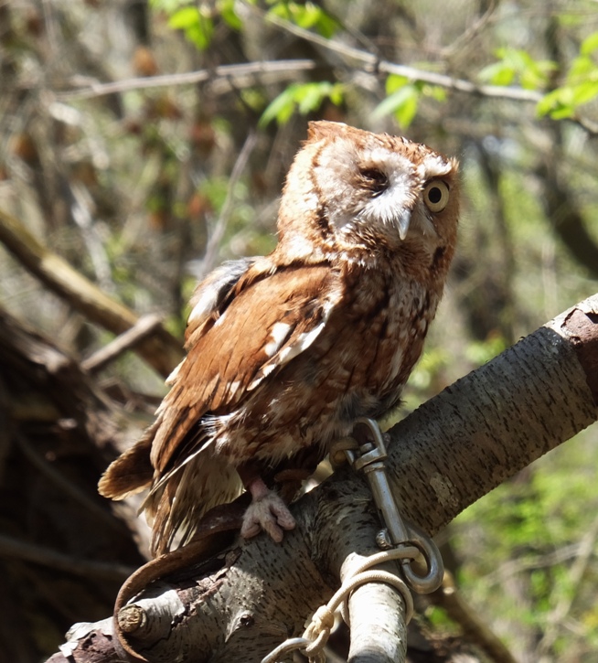
Here's some of the other birds we saw. 1 / 5


Another screech owl.
2 / 5
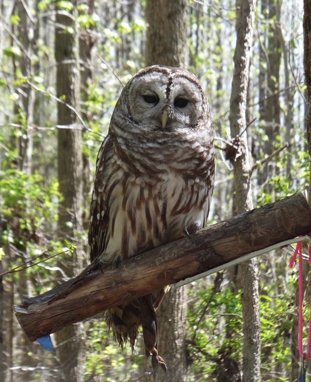
Barred owl.
3 / 5

Barn owl.
4 / 5
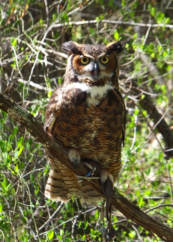
Great horned owl.
5 / 5
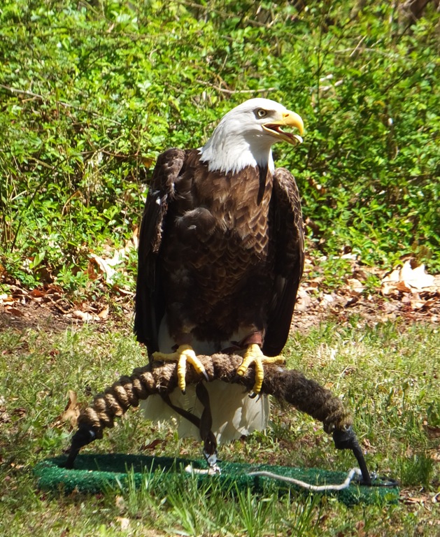
Bald eagle.
We saw a red-shouldered hawk. This breed is the likely culprit that attacked Gwendolyn, my smallest chicken. This particular bird is immature. 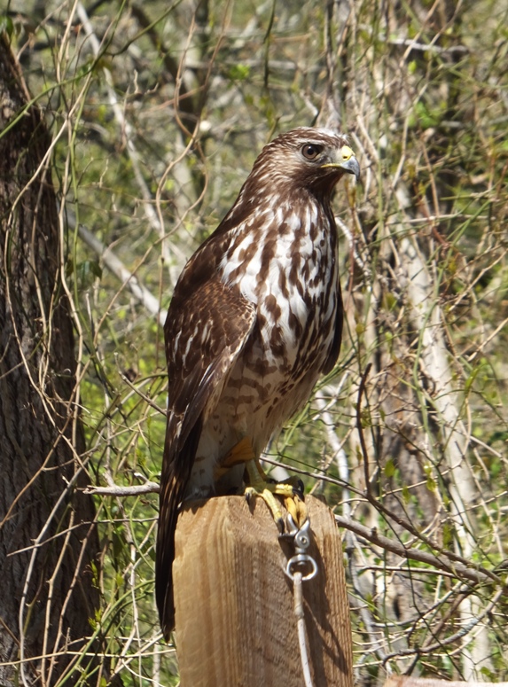
There was a leucistic red-tailed hawk. Leucistic means it is lacking pigment...sort of like Michael Jackson. 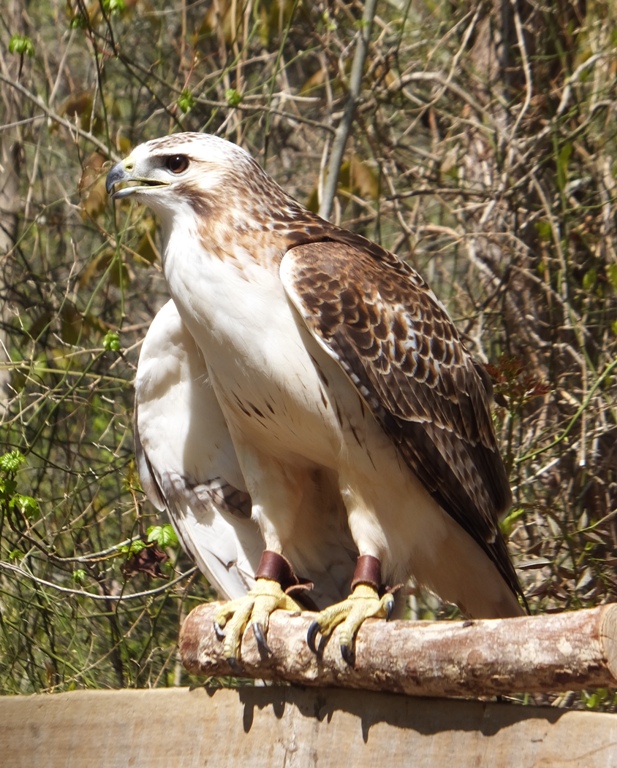
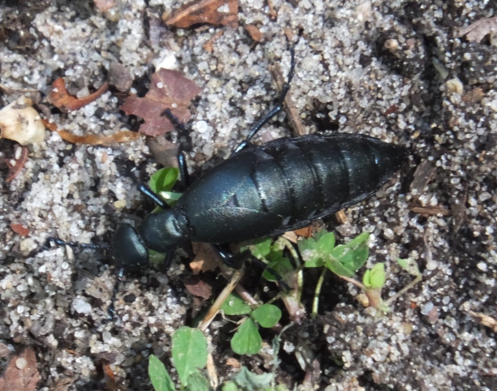
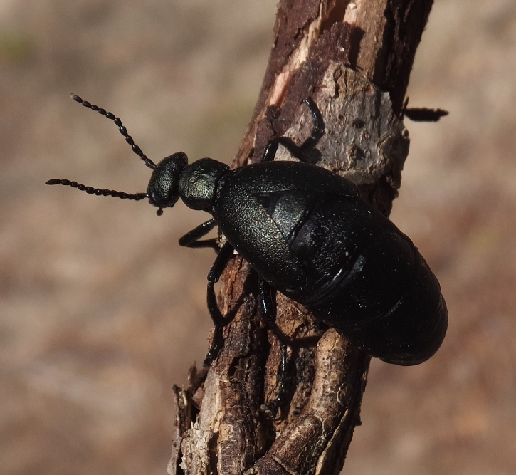
Elton found something very interesting. It was a Short-winged Blister Beetle. When threatened, the Short-winged Blister Beetle feigns death and exudes an orange liquid from its joints. This is known as reflex bleeding and all blister beetles and several other insect families share this defense mechanism. The orange liquid contains high concentrations of the toxin cantharidin which deters many predators. It is know to cause blisters in humans within 24 hours of contact, so handle with care! Blister beetles are toxic and can cause major problems for horse breeders. They are common in alfalfa fields and get baled in hay which is then consumed by horses who get sick and die. Another interesting fact about short-winged blister beetles is that the larvae hatch from eggs as active triungulins that wait on flowers for a bee to clasp onto. The bee then carries it to the hive where it feeds on the nectar for the bee larvae (and may also consume the larvae as well). - from Project Noah - Short-winged Blister Beetle |
|
Norma went to the Adkins Arboretum Native Plant Sale and then met me at the start of the Tuckahoe Creek Water Trail. My co-worker Mike B. also joined us. We were hoping our friend Sara could make it but she was feeling a little under the weather.
By 1300, we were on the water, each of us in single kayaks. I was in my Prijon Catalina again. 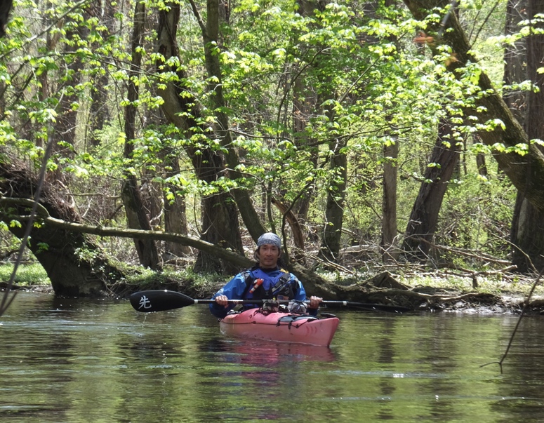
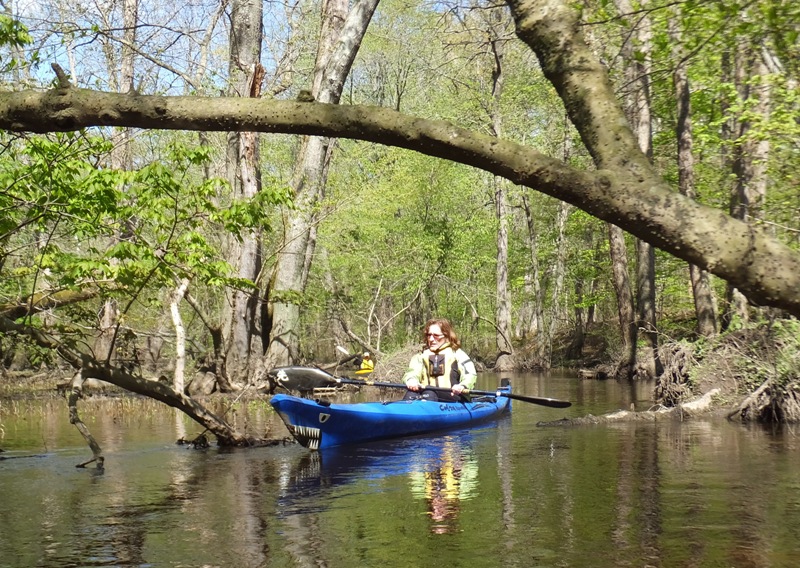
Norma was on the Cobra Expedition. Mike was on his brand new 10-foot long recreational (rec) boat. I figured the 5.2 mile water trail would be ideal for a rec boat. The weather today was much better than yesterday. It was cool but sunny. I wore my wetsuit, neoprene top, and splash jacket. I think the splash jacket was a little too much until I swam after Mike's paddle when he capsized. Following that, I would have been cold without it. While I saw poison ivy growing on some of the trees, it wasn't nearly as bad as the section upstream of Tuckahoe Lake. I am writing this three days after this trip and if I had been exposed to poison ivy, I would be showing symptoms now, which I am not. 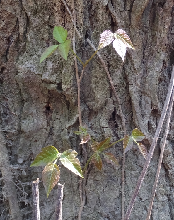
We saw several great blue herons. I saw two snakes in the trees. Both were fairly small black snakes. Here's the second one. 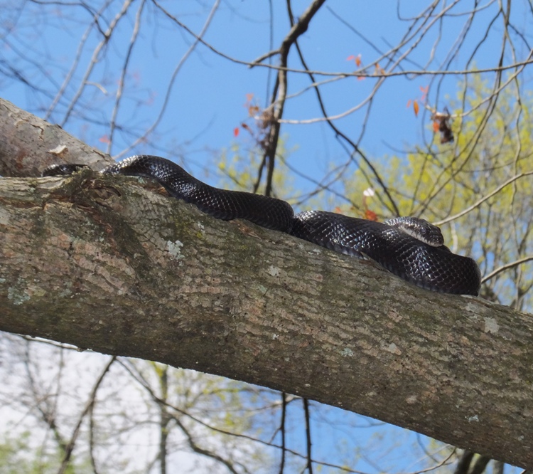
In this pic, Mike observes the snake from his kayak. Can you find it? 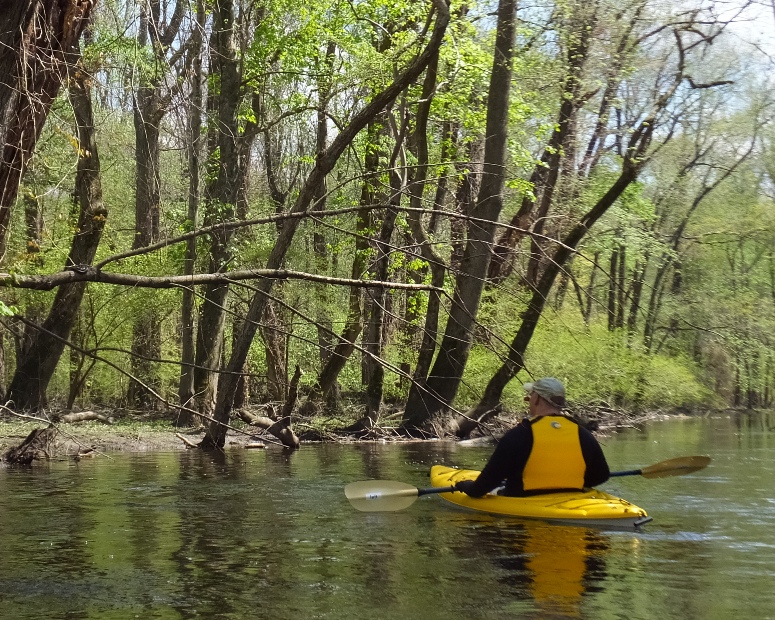
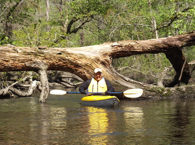
The last time I did this trip was May 1, 2011. Back then it was pretty easy. But today there were significantly more obstacles. In 2011, it was a good trip for a fit beginner but today was not so ideal. Norma's boat was too long to be maneuverable. Mike's boat was very wide and wouldn't fit through narrow openings as well as mine. We did about three portages. I brought my two saws and loppers but didn't have to use them. I took numerous snapshots. 1 / 6

Mike.
2 / 6
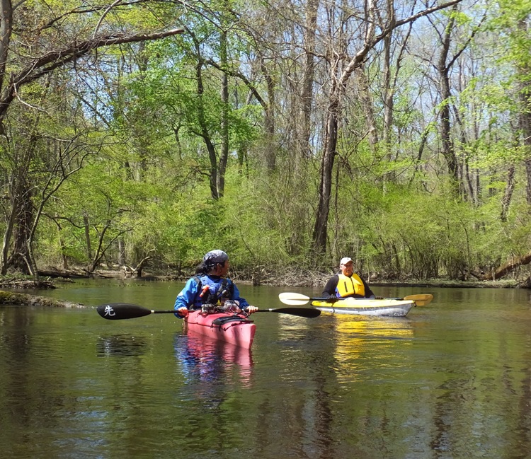
Mike and I.
3 / 6
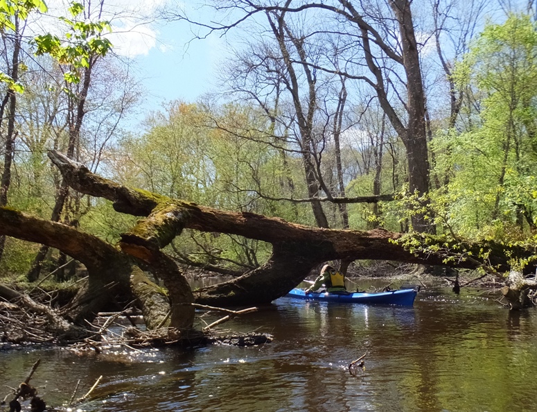
Norma squeezes under log.
4 / 6
Mike emerges from log.
5 / 6
"Shark" boat.
6 / 6
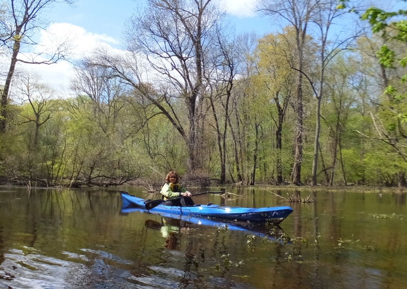
Norma posing.
Here's Mike just downstream of Greiner's Fishing Trail Bridge. 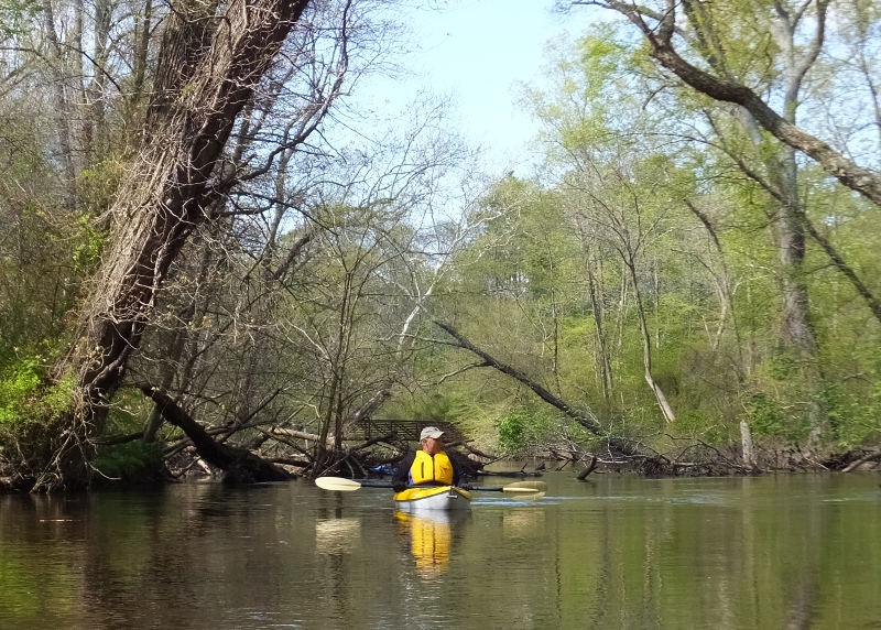
I saw about three turtles. 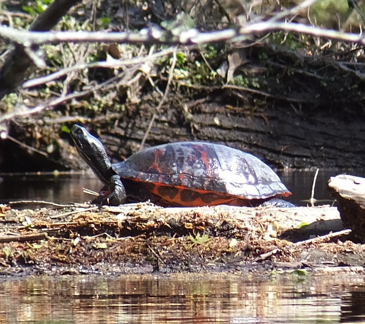
There was a lot of evidence of beaver activity. In the shot below, it looks like this particular beaver was trying to see how close he could come to gnawing at this tree before it fell. The tree was quite tall...maybe over 20 feet. 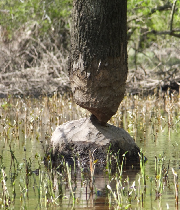
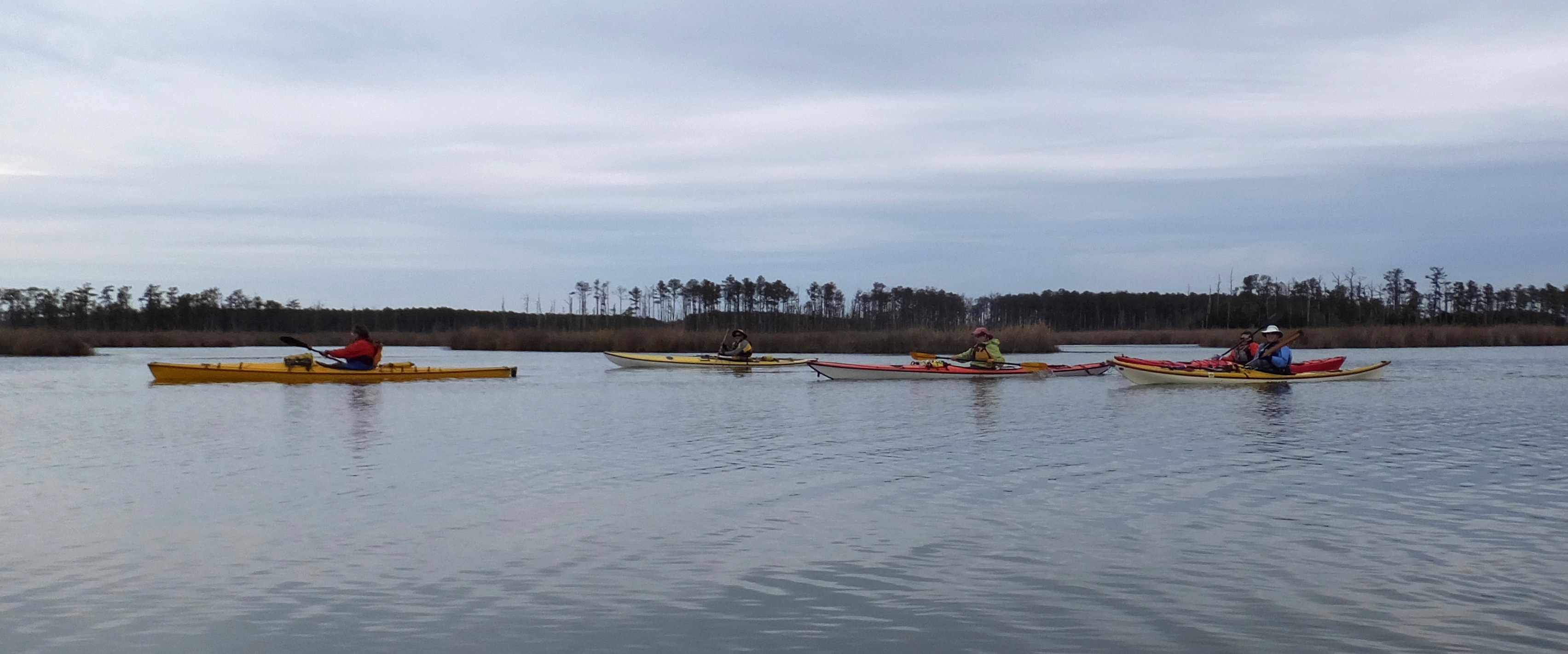
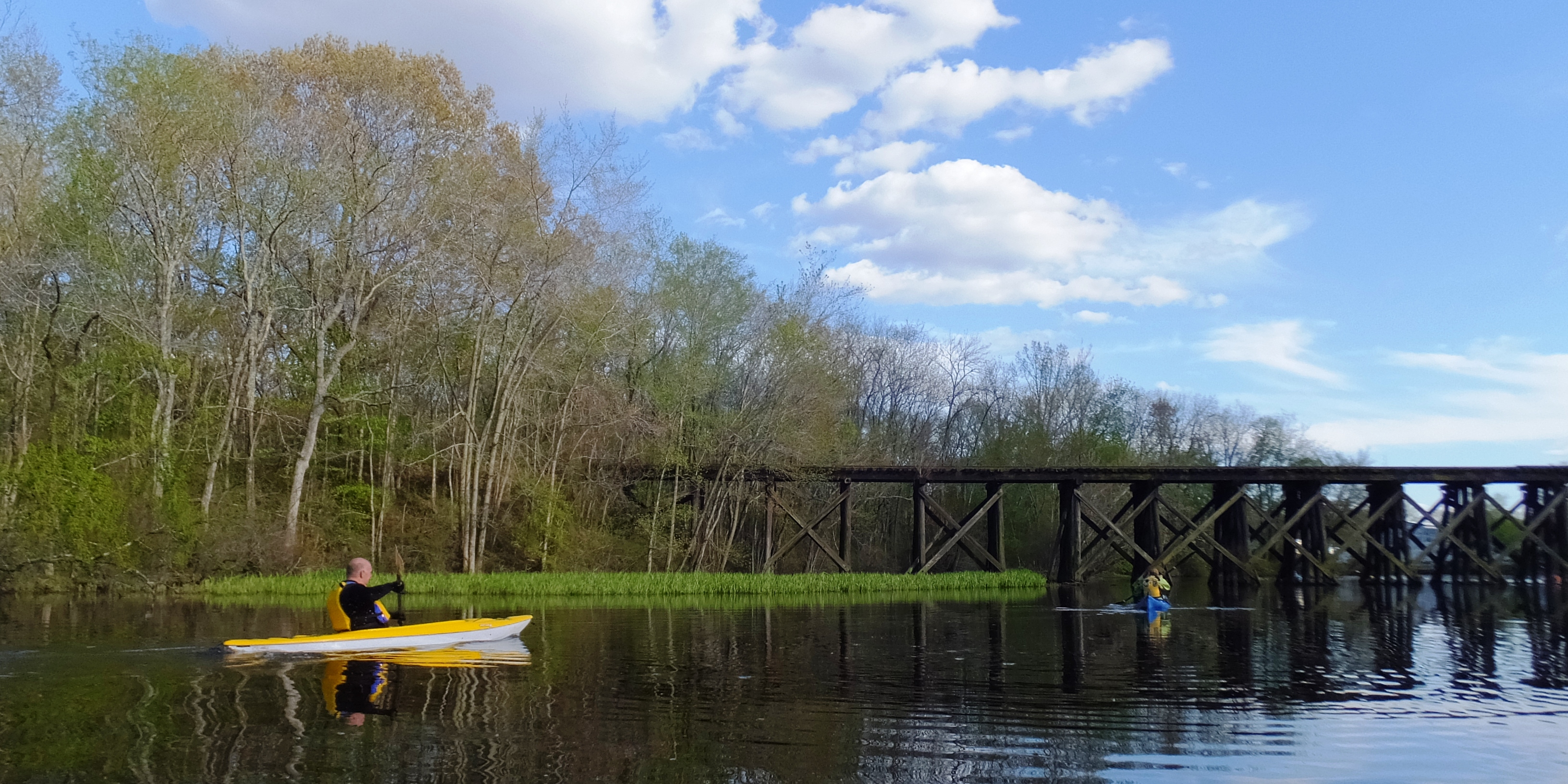
Closer to the takeout, I heard some rustling in the branches then saw a beaver dive into the water. A little later, Norma saw a beaver out the corner of her eye for a split second as it too dove into the water, making a big splash. Starting about 0.8 mile from the takeout, we starting paddling under several bridges, including a couple of railroad bridges. See the cover photo. It took 4.5 hours to complete this trip. This was much longer than I expected but it was actually within the amount of time that the park says one should allow when paddling this water trail. We took the boats out at Hillsboro. I didn't reset my GPS before we started but I think we paddled a little over six miles. |
|
After a quick bite to eat, we locked up the boats, put on some dry clothes, then started walking back to the cars since we only kayaked one way. We walked north on Cemetery Road.
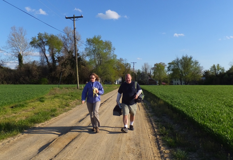
Next we caught the Creek-Side Cliff Trail and then walked most of the remainder on Tuckahoe Valley Trail. As I had hoped, we avoided the construction zone. We had to keep a good pace since it was getting dark. 5.2 miles later, we were back at the cars. Finally, we drove to Hillsboro and then loaded up the boats and gear a little before dark. It was good getting in two days of kayaking on the eastern shore. The two trips were totally different which made for a nice contrast and a memorable weekend. |